Gauteng, S. Africa
While trekking & exploring South Africa in 2023 & 2024, my living base was located in the Gauteng-City region of South Africa. Gauteng includes the cities of Johannesburg, once the world’s most important center of gold production and today South Africa’s financial capital, and Pretoria, the country’s administrative capital. I actually stayed at Pretoria.

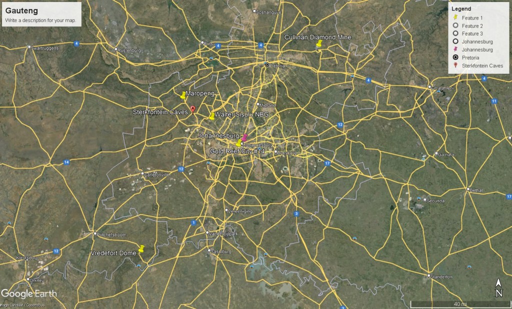
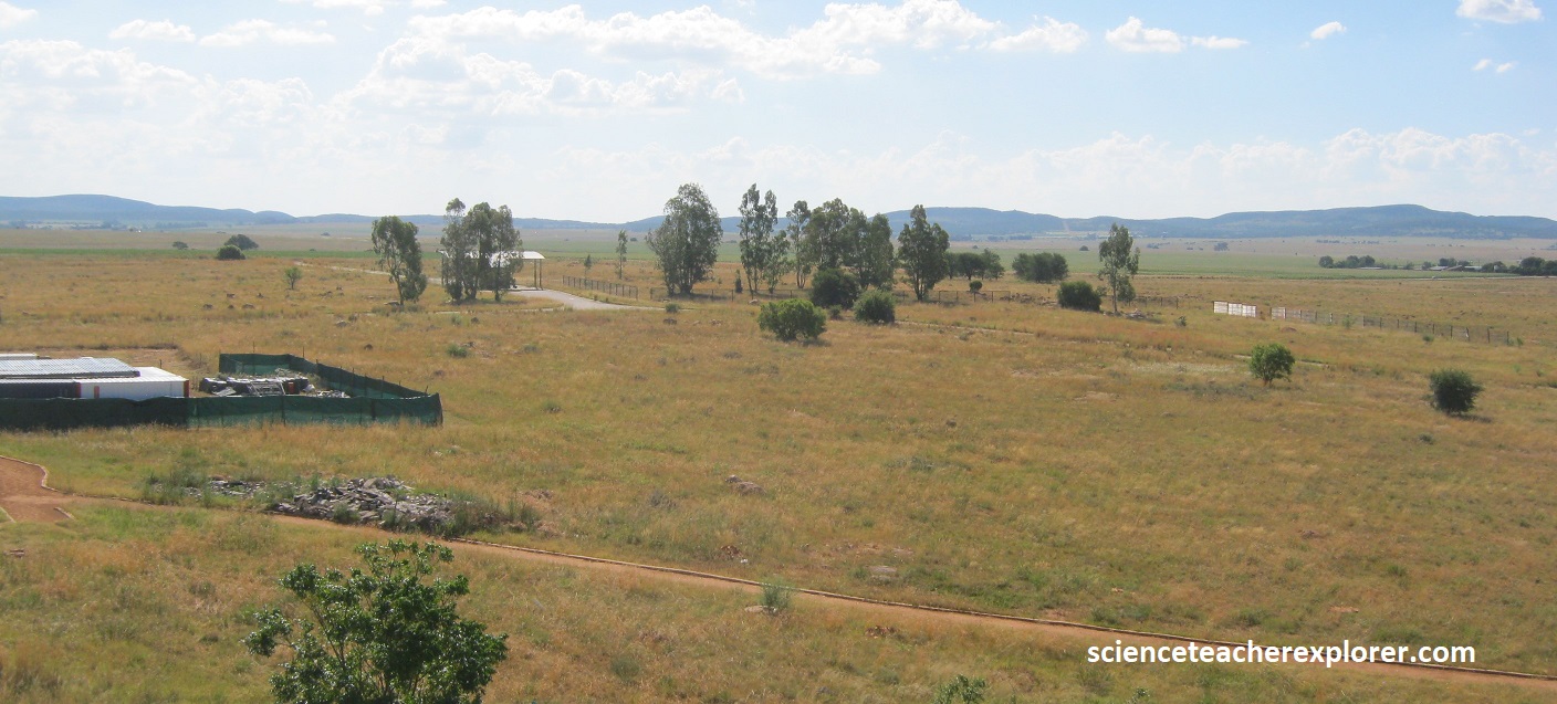
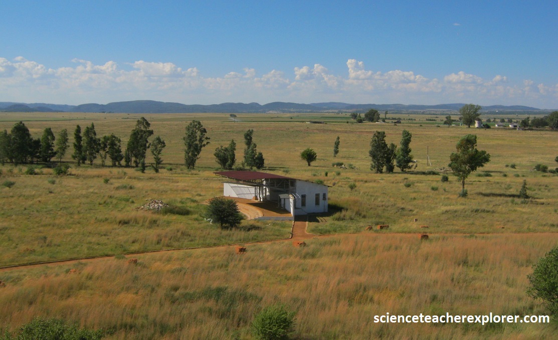
The Gauteng City-Region is an integrated cluster of cities, towns and urban nodes that together make up the economic heartland of South Africa. Pictured below are primary locations that I was interested in exploring in the Gauteng City-Region.
Johannesburg bears all the signs of rapid expansion, with few evocative remnants of the exuberant early years. In 1885, an Australian gold-digger and stone mason name George Harrison was working his way up to the goldfields in Barberton when he met the Struben brothers who had found gold near Roodepoort. They directed him to a widow on the farm Langlaagte (long valley) who they knew was looking for someone to build an extension to her house. Having seen the Struben workings. Harrison soon realized that the farm Langlaagte showed a rich outcrop of the same sort of reef he was looking for. This was the Main Reef, the world’s greatest goldfield.
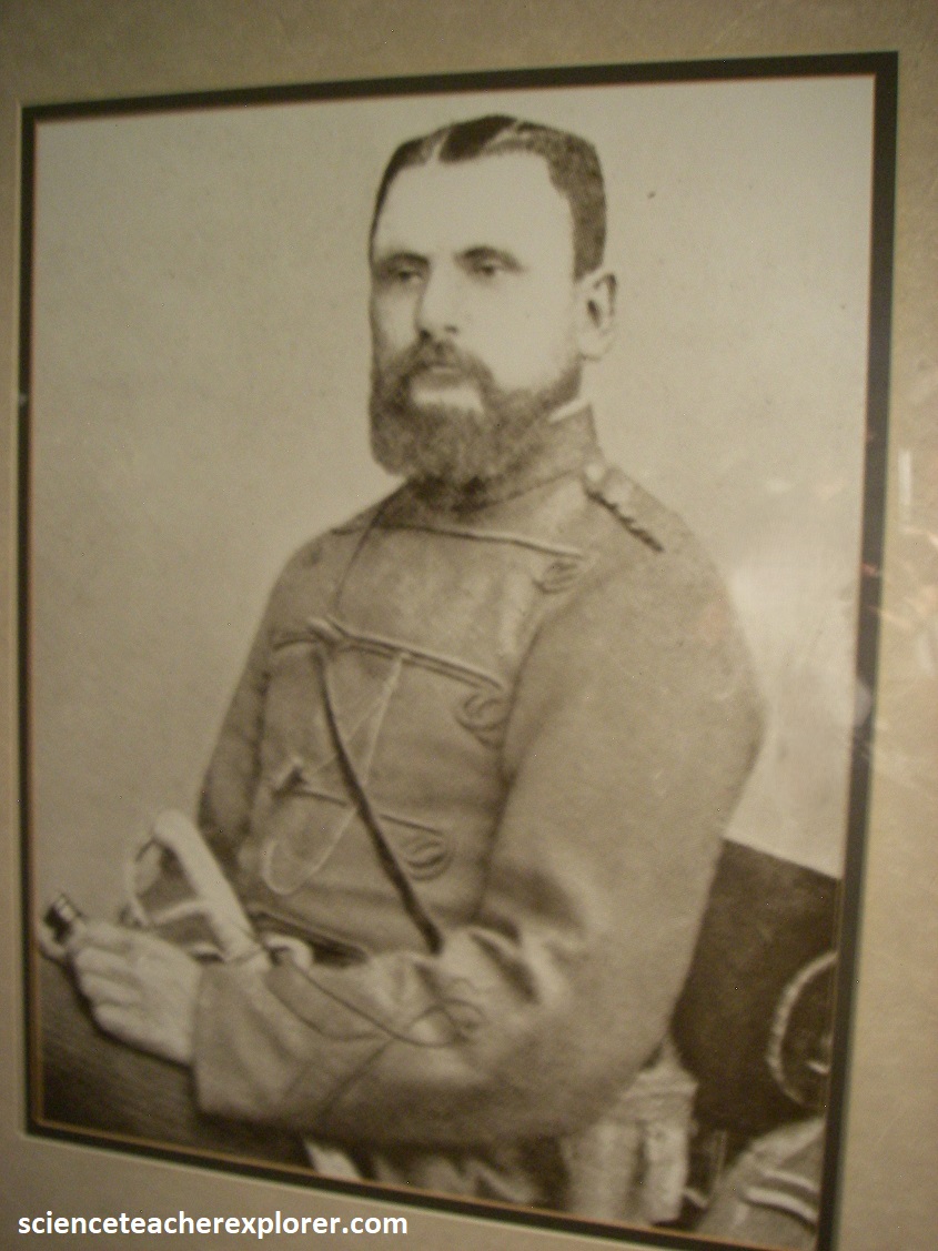
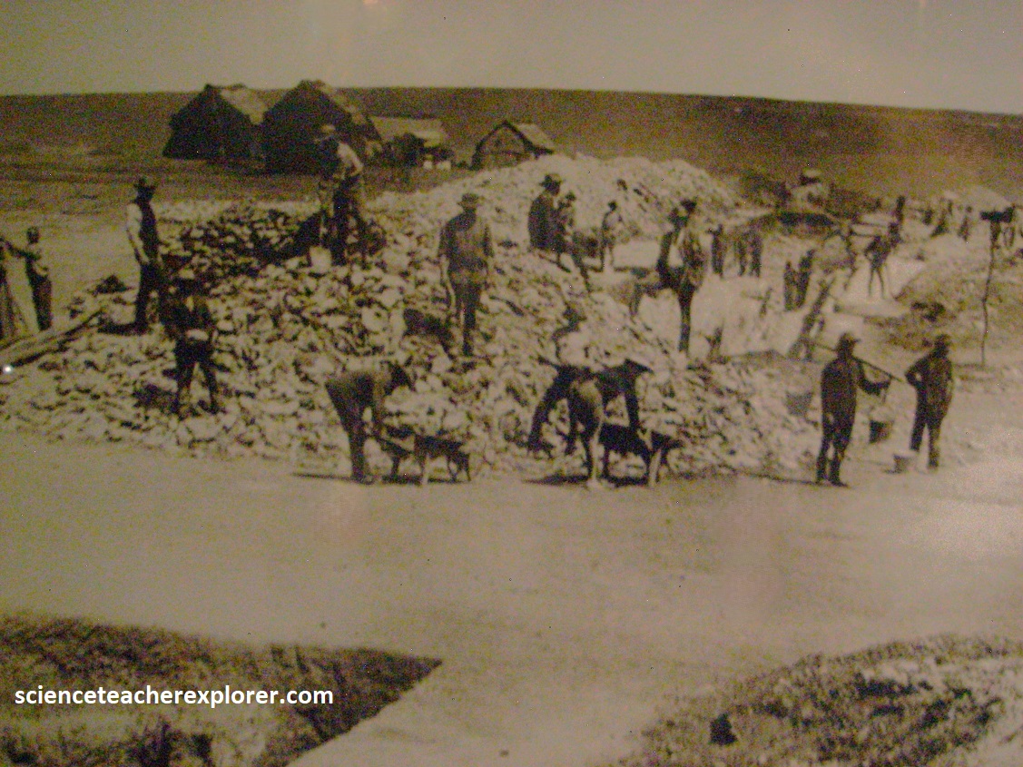
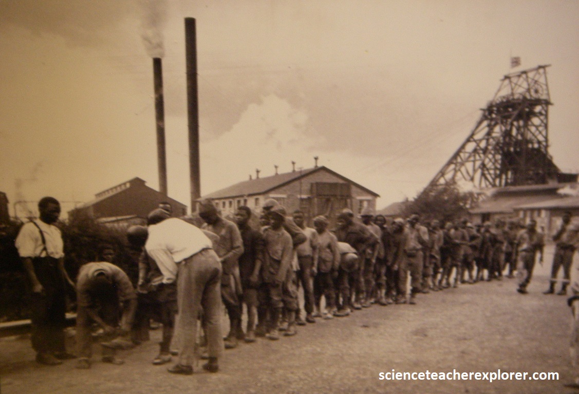
Pictured above, hot on the heels of this discovery came prospectors and diggers from around the country. Pictured above, Ferreira’s Camp was one of three early camps where diggers and fortune seekers coming to Johannesburg settled. Sometimes referred to as the “cradle of Johannesburg”, it is where the first gold diggings started, and where the first diggers initially settled. The city grew around the mining camp in the Ferreirasdorp area, and Johannesburg’s Main Street developed from a rough track where the present Albert Street led off towards Ferreira’s Camp. Pictured above, the suburb is named after Colonel Igantius Fereira, leader of the original group of diggers who settled in this area in 1886.
The nature of the gold-bearing reef required special mining techniques and equipment, and the rapidly rising costs gradually force casual private miners to give way to the wealthy capitalists from the Kimberley diamond fields, (Cecil Rhodes & Charles Rudd). Pictured above, these Randlords had the means to sink the ever-deepening shafts and import mining engineers and specialists i by the 1890s, (called Transvaal burghers). Eventually, a mining boom-town was created into the city of Johannesburg.
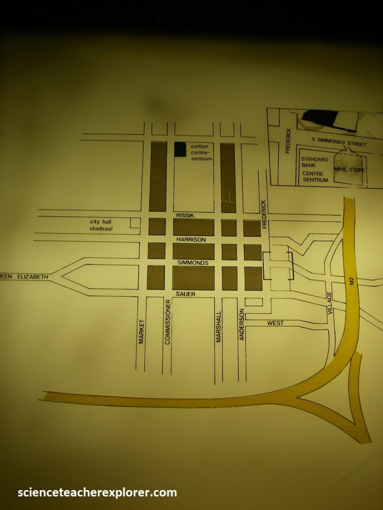
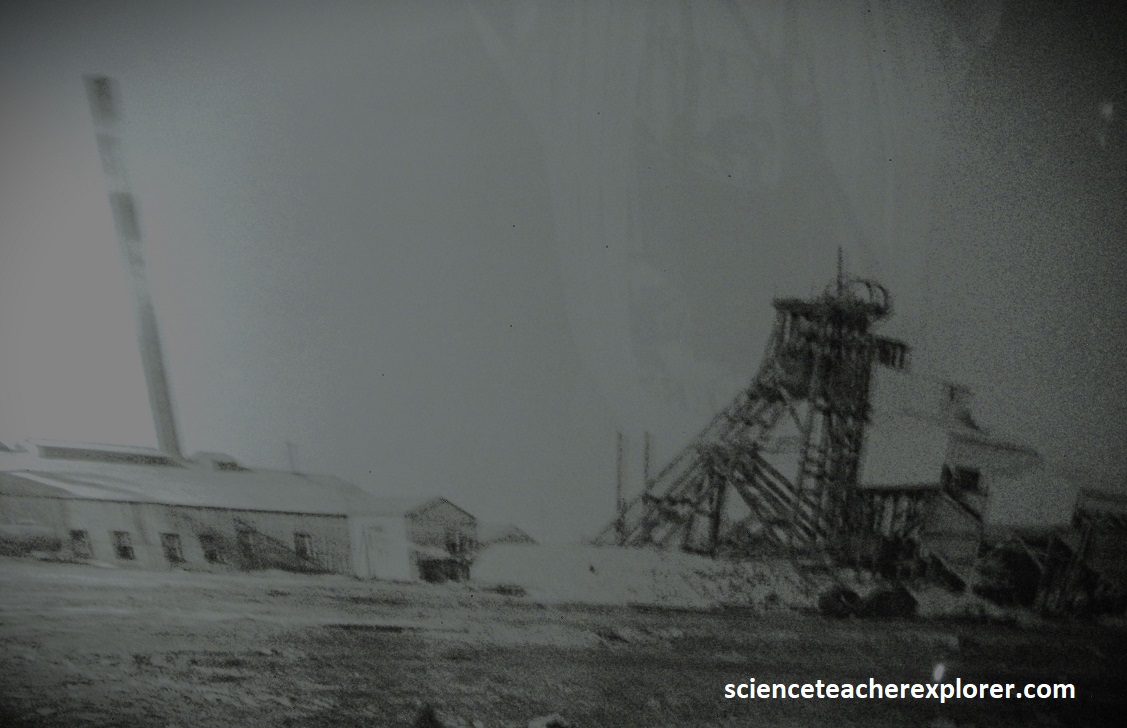
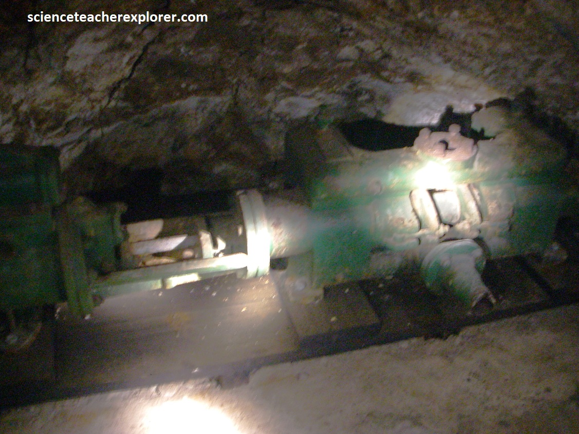
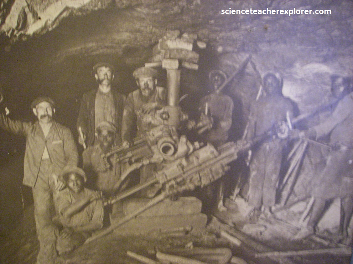
Pictured above, I was able to visit part of the original Ferreira Gold Mine. In 1986, during the excavations for Standard Bank’s new head office at 5 Simmonds Street in central Johannesburg, an old hand-dug tunnel of the Ferreira Gold Mine dating from the 1890s was accidently discovered.
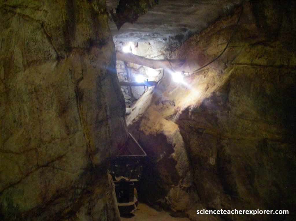
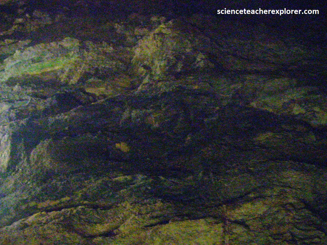
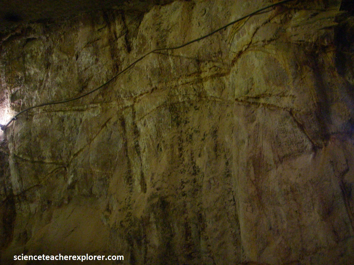
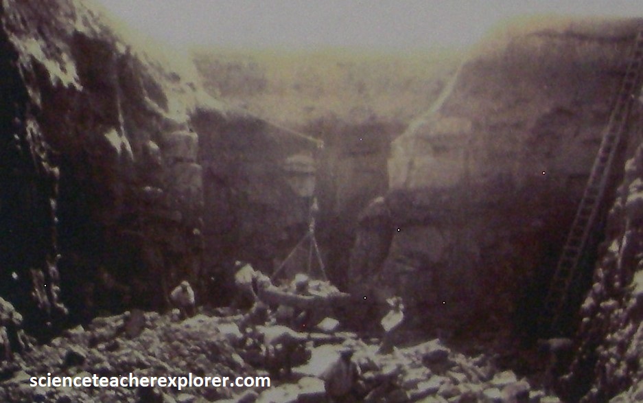
Pictured above & below, is the rock face and entrance to one of the Ferreira Gold Mine Company’s original mine workings, which drops some 1,000m below. The rock face contains traces of the original gold veins leading to the main gold bearing reefs which were extracted. The diggings were started in 1887 and Cornish miners with experience in underground mining were contracted to develop the underground shafts and tunnels below.
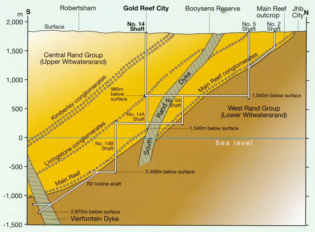
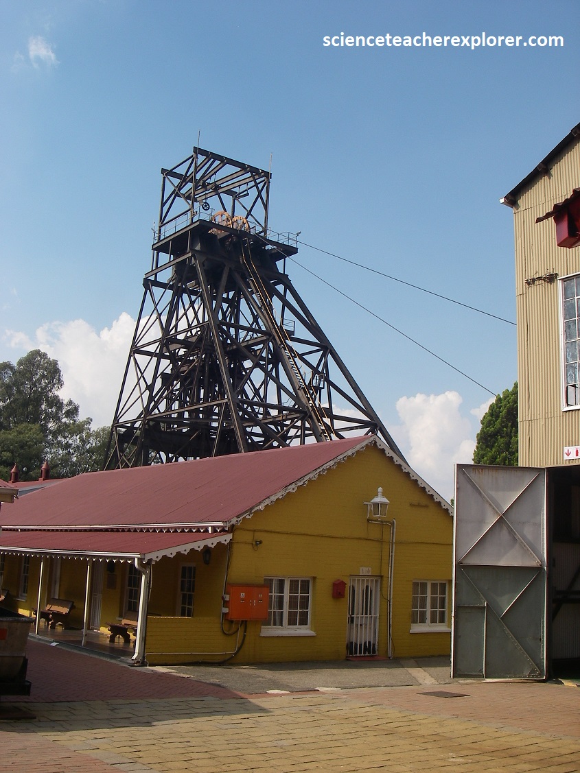
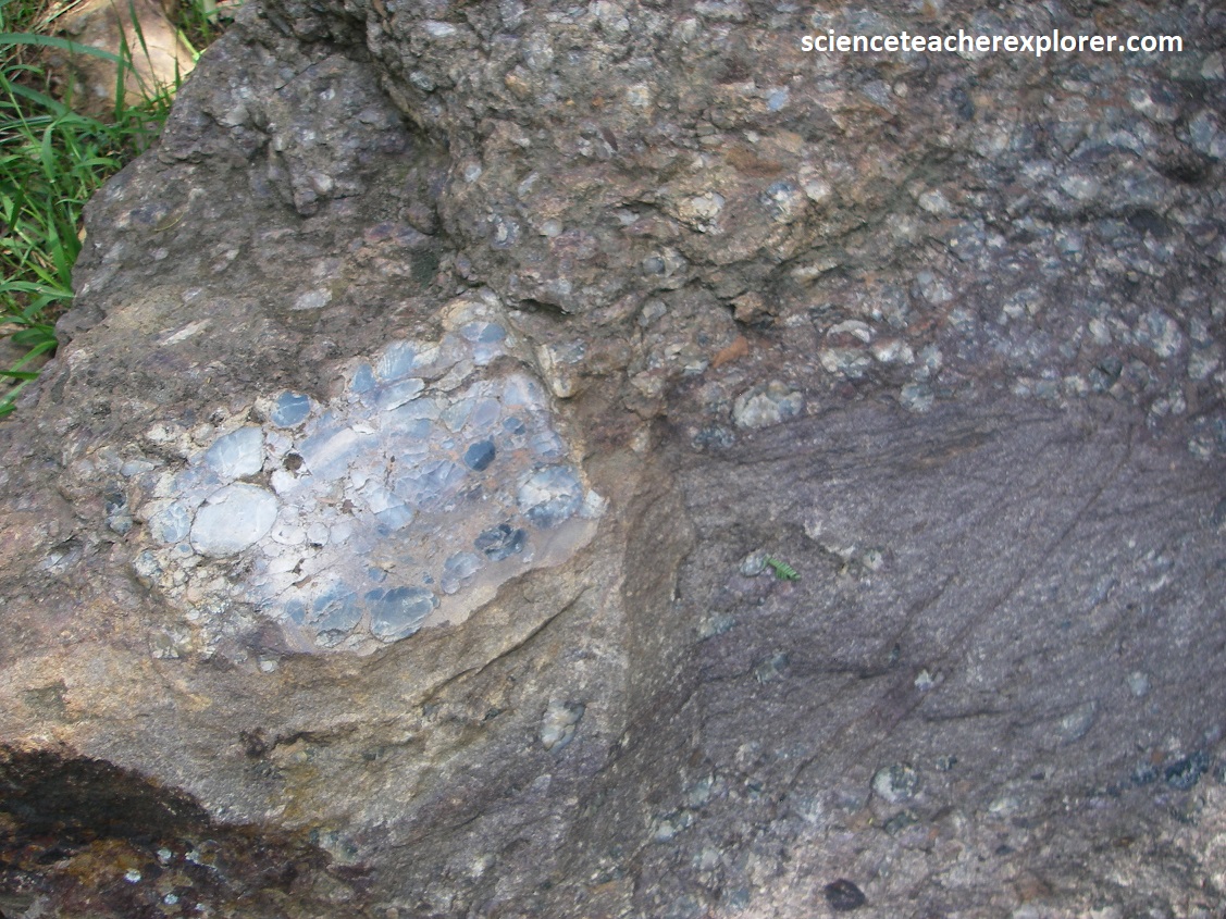
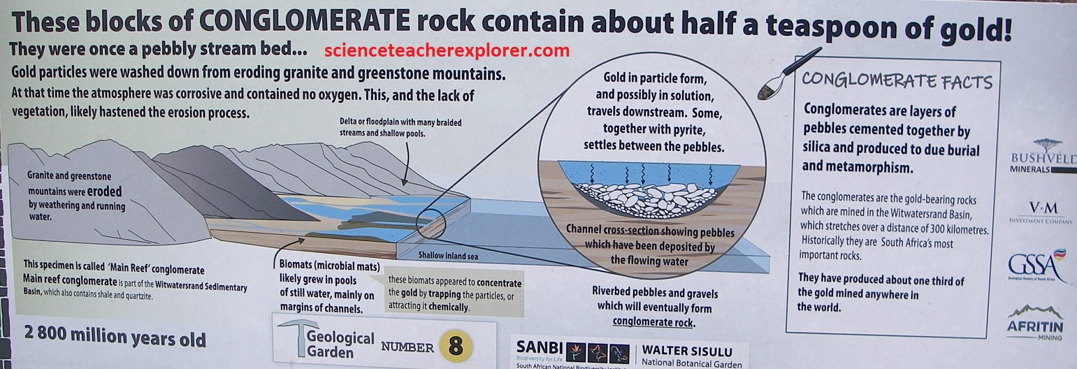
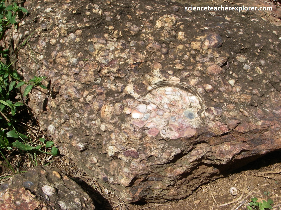
Gold was soon being mined all along the shallow, weathered conglomerate beds or ‘reefs’, as the gold-bearing rock was called. Numerous small gold mines were working between Langlaagte and the new mining town of Johannesburg, and by 1909 the amalgamation of 12 of these operations resulted in the creation of a new company, ‘Crown Mines Limited’. Deep drilling proved that the south-dipping reefs continue far to the south, and underground mining would require deeper shafts. One of those deeper shafts was No. 14 Shaft, completed in 1916 to a final depth of 980m. This No. 14 shaft is now called “Gold Reef City”.
I explored “No. 14-Gold Reef City” in March of 2024. Apparently, Gold Reef City is currently an amusement park and visitors can go under ground to the shallow Kimberly Reefs.
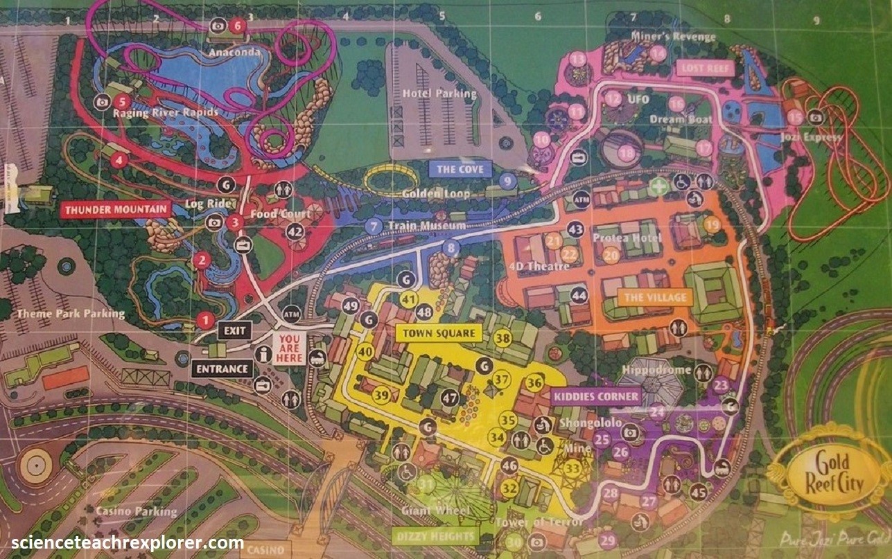
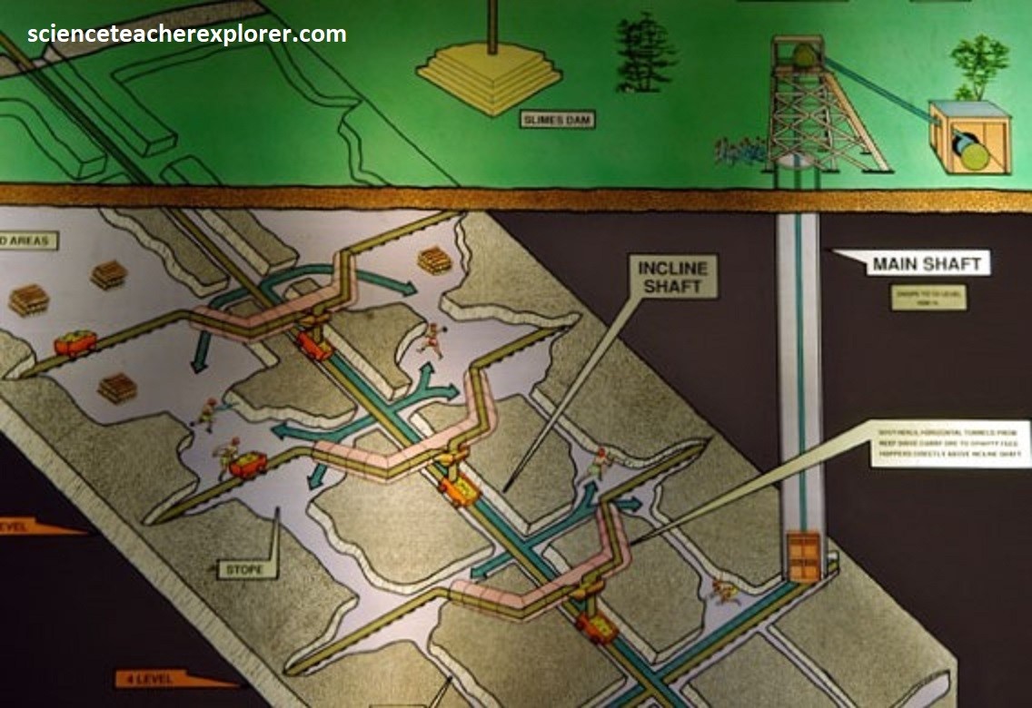
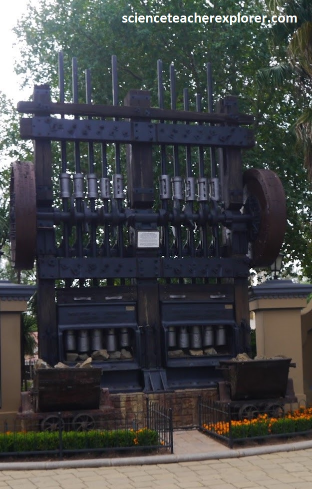
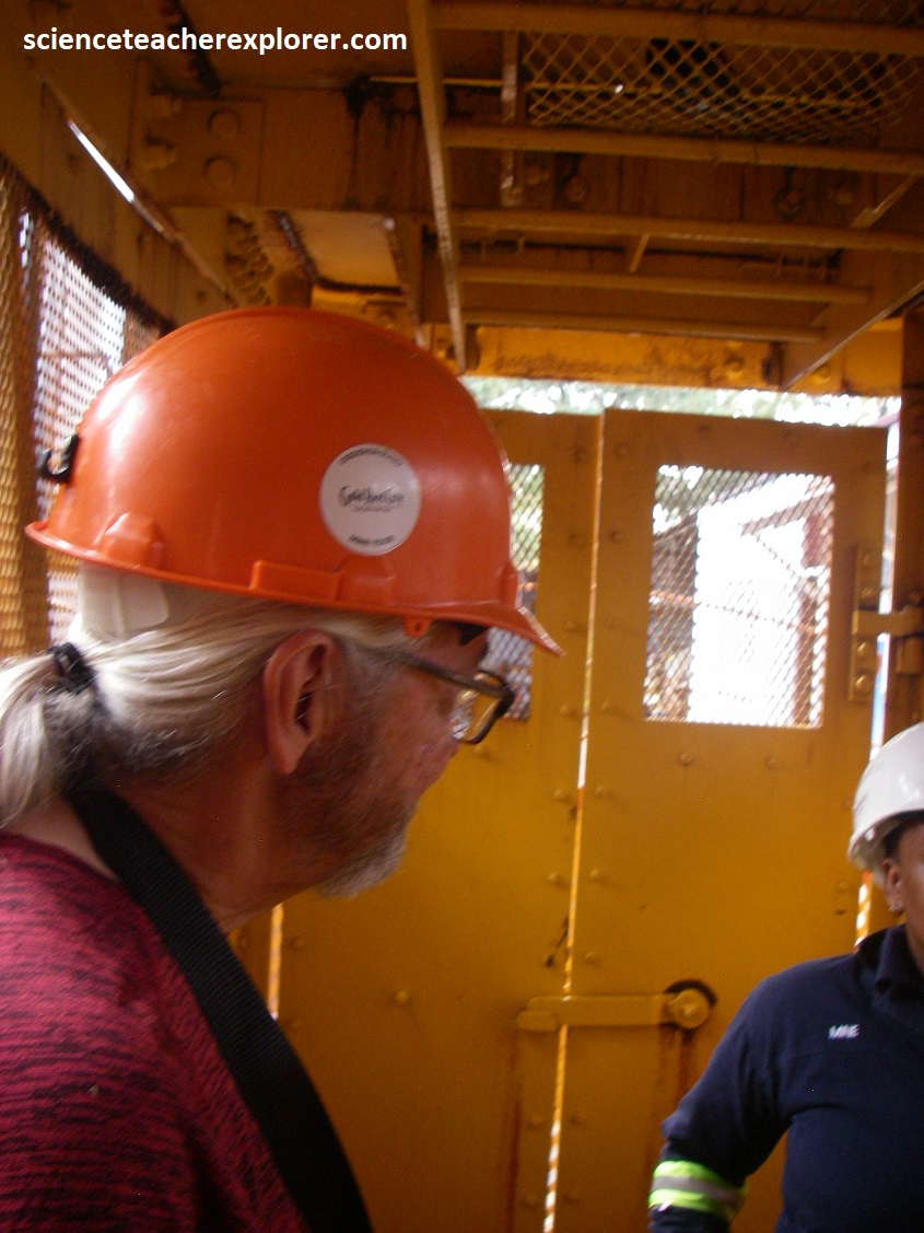
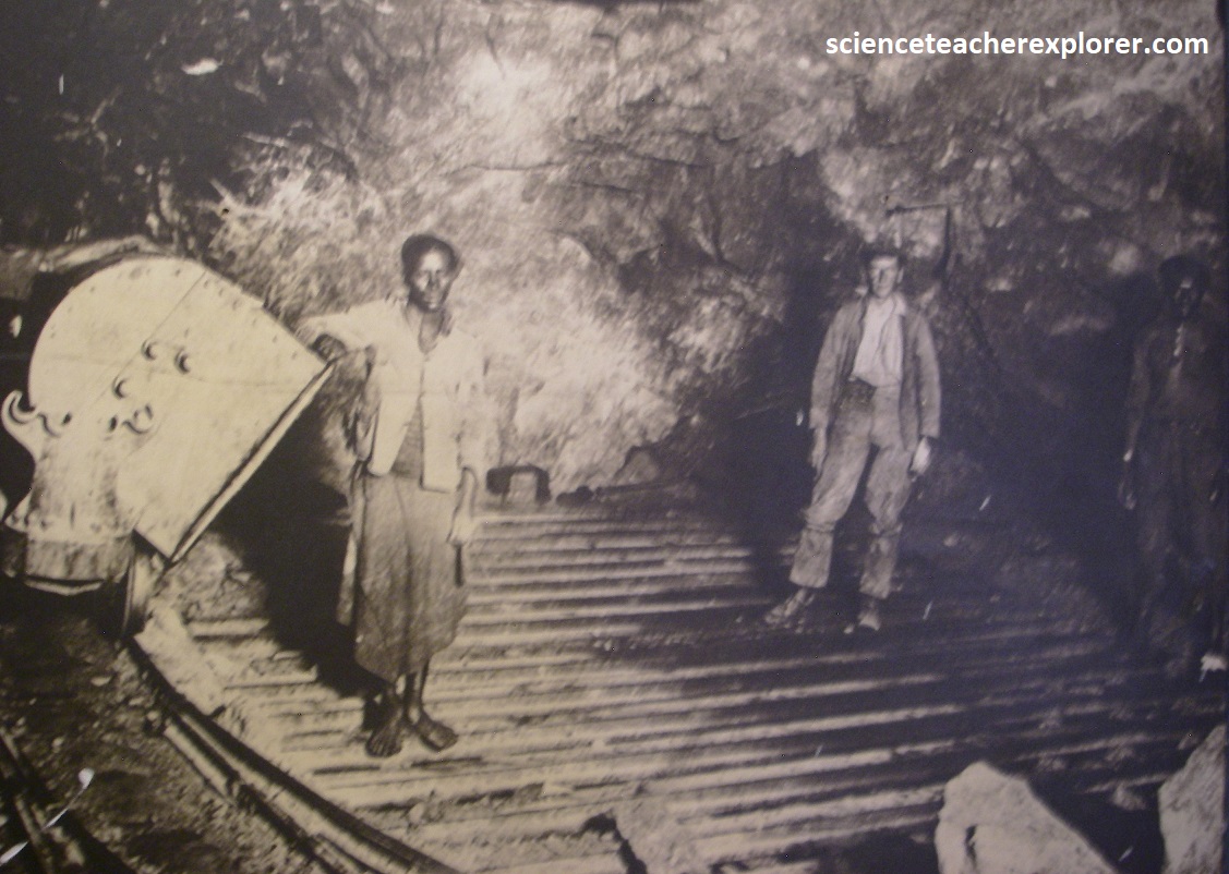
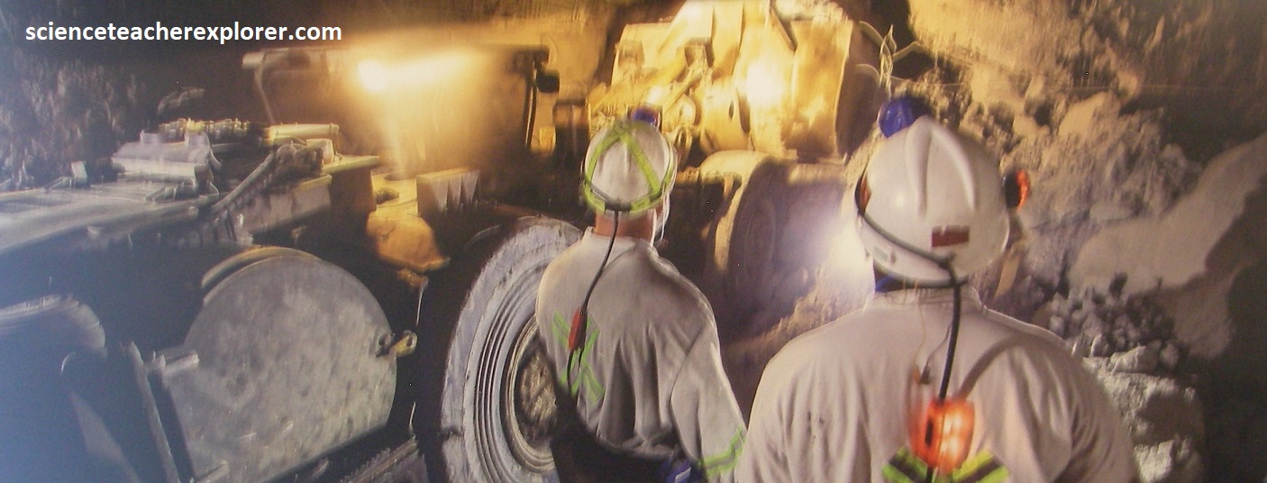
Image above, Gold Reef City’s Heritage Tour offers unique insight into the historical world of Johannesburg’s gold rush, (images taken from interpretive signs on-site and the steam powered, 10-stamp rock-crusher was at the entrance gate). Mine workings continues far below No. 14 Shaft, accessed by later sub-vertical and sub-inclined shafts, as the south-dipping Main-Reef conglomerates were followed to 2,875m below the surface, (below sea-level). Pumping out the groundwater was an expensive & difficult task. Pictured below, Mike Stevens, (trekking buddy) and I take an elevator, (winder), 75m below, before we hit ground water.
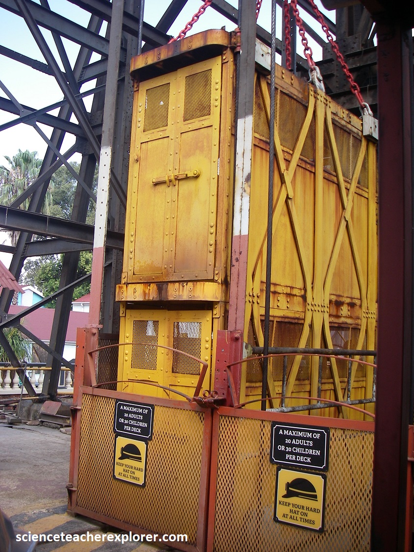
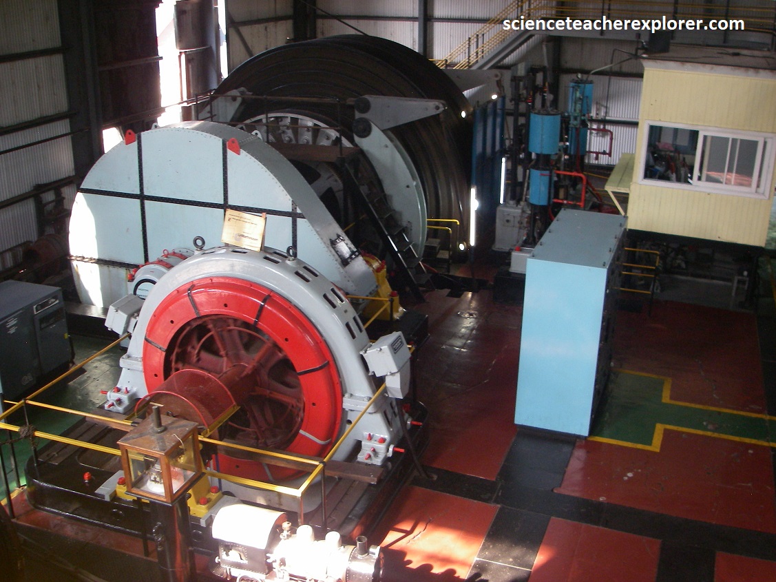
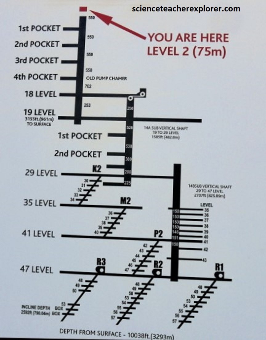
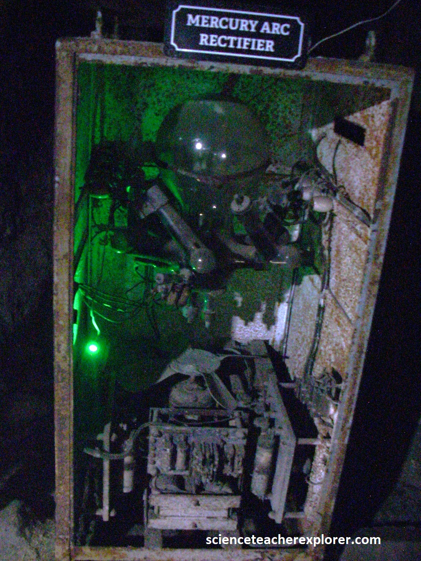
Pictured above, the winder was built in England in 1925. The winder drum is conically shaped with a diameter of 3.2m on the small side and 6.4m on the large part in the middle. The total rope length is 1,134m. The breaking strength is 122 tons. The traveling speed in the shaft was approximately 1.5 m/s. There were two decks that could hold up to 40 persons. The old Mercury Arc Rectifiers were used to convert AC current to DC for driving the electric motor in the elevator & transport cars.
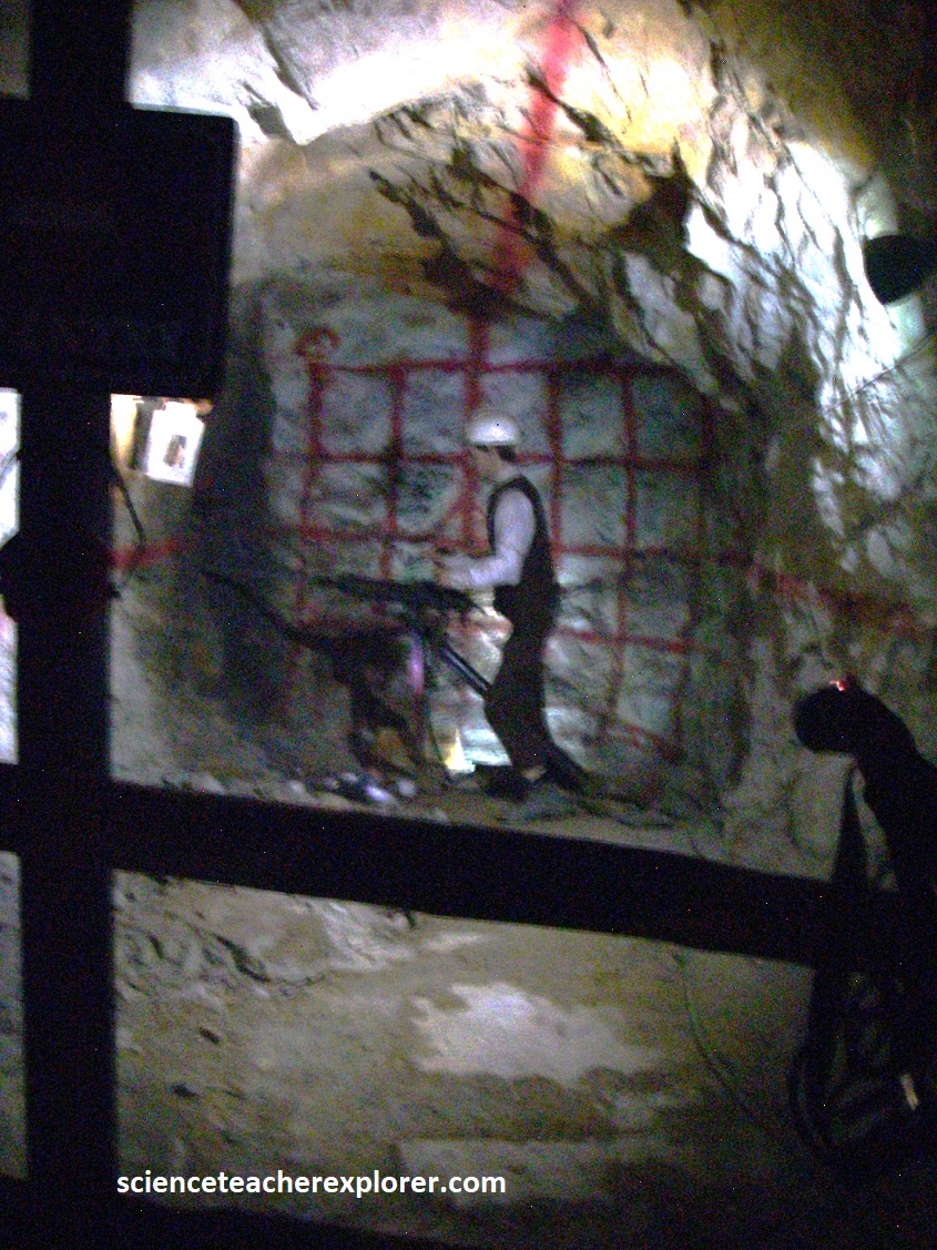
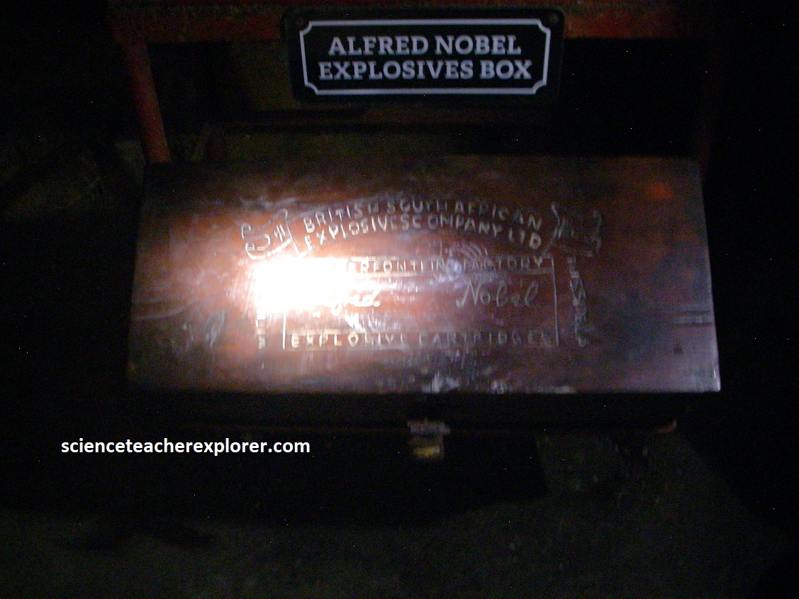
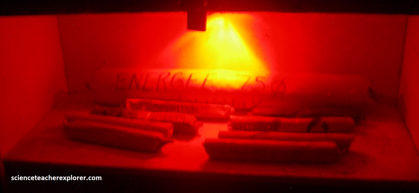
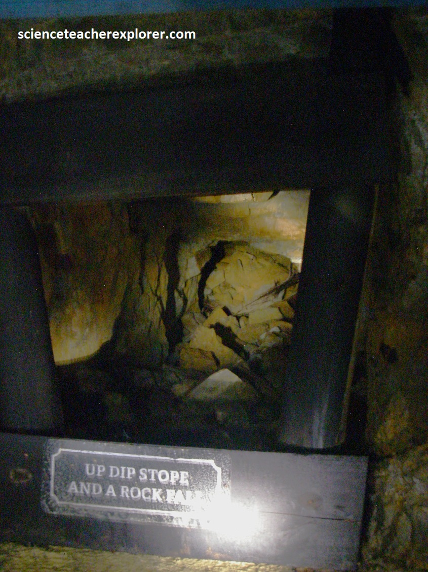
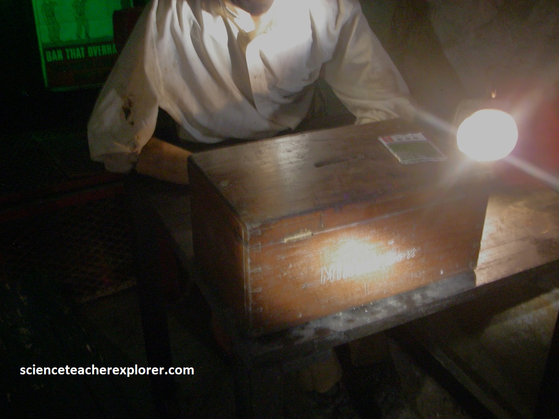
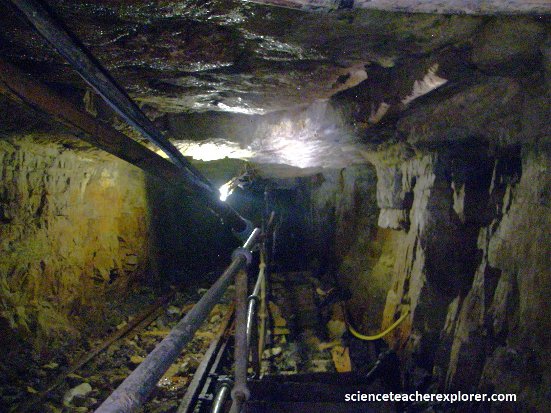
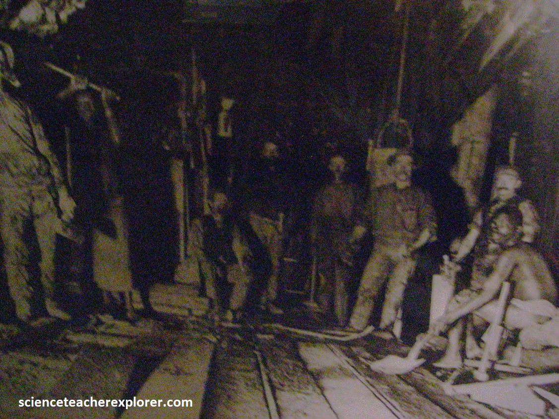
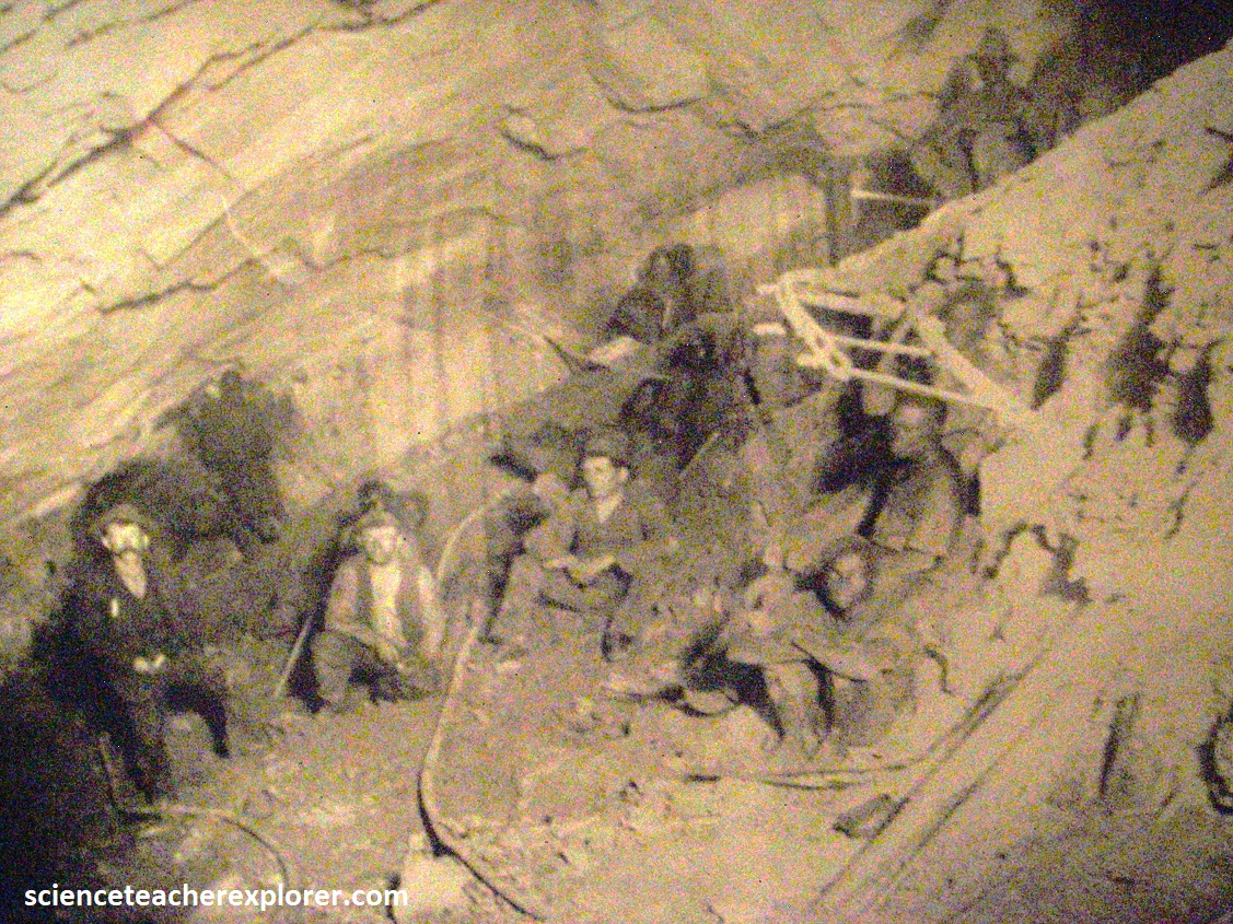
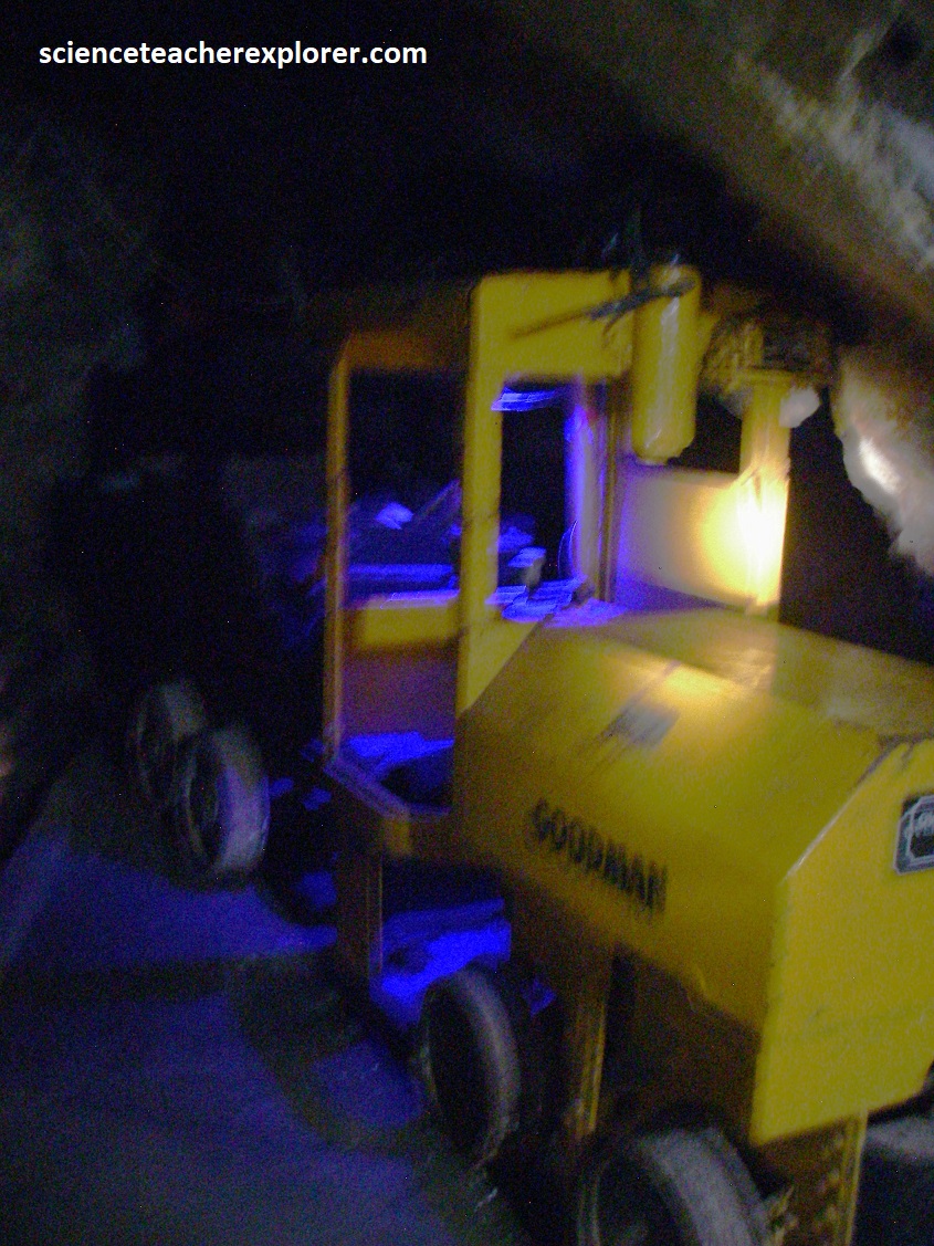
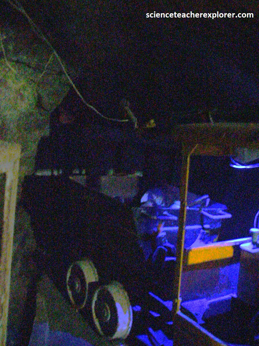
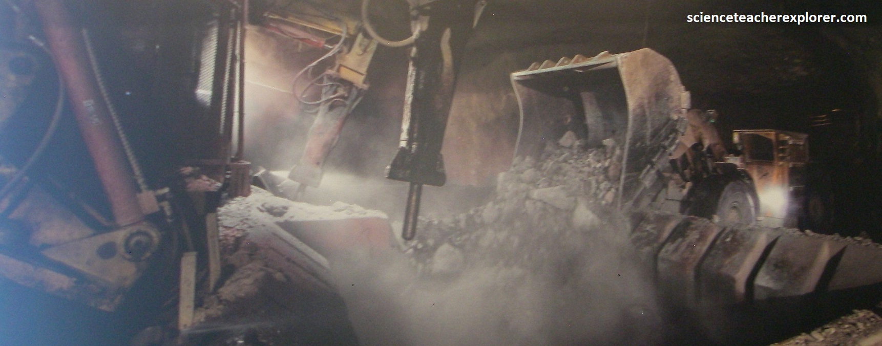
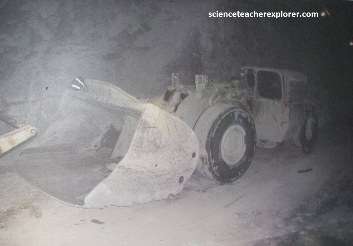
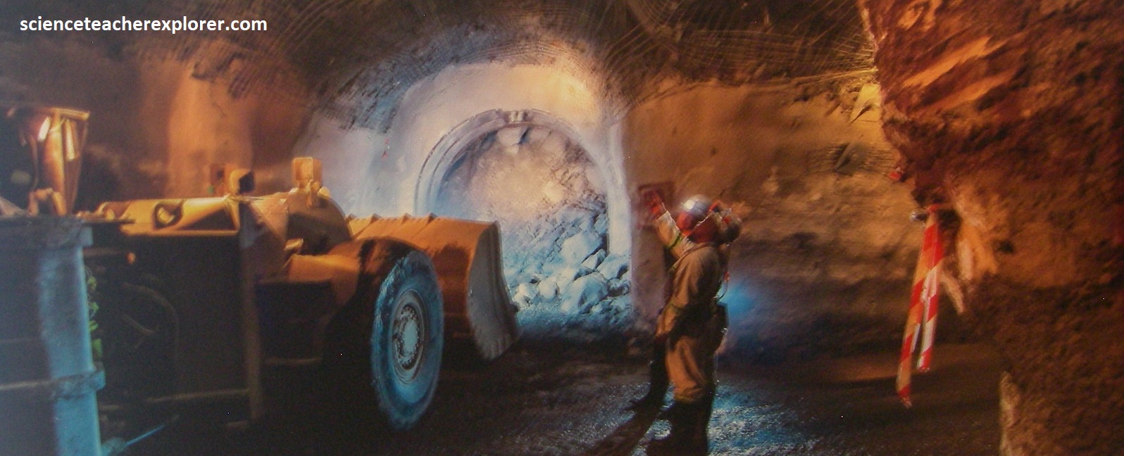
Once in the mine, Mike and I explored down tunnels with a hard hat and torch in hand, so we could experience the tough conditions that gold miners had to endure. The tour-guide stopped for a while to start the short bursts from a miners drill, which gave us an understanding as to why miners would go deaf without ear plugs. We explored the underground mine manager’s office with the miner’s identity box, (helped identify missing miners). Following the coco pan tracks past the red dynamite box, we got a view up a 35 degree slope with little-head room and wooden steps that lead to the surface of the mine in the event of power failure. There is gold remaining in the mine, however the price of gold at the time, caused the mine to close, because it was uneconomical to remove. The lower levels of the mine are now currently flooded – 19th level to the 57th level. Thus, underground gold tours are conducted only up to 5th level. {Pictured below are photos that were taken from interpretive signs on-site}.
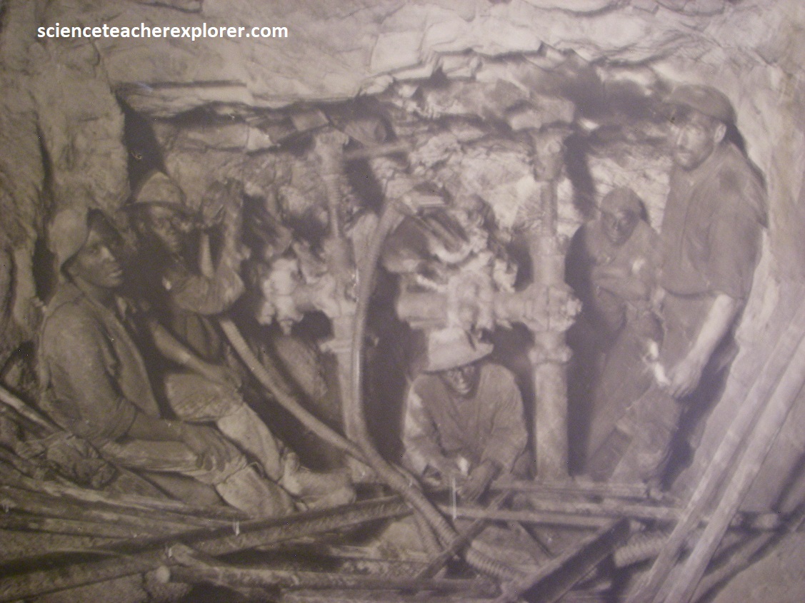
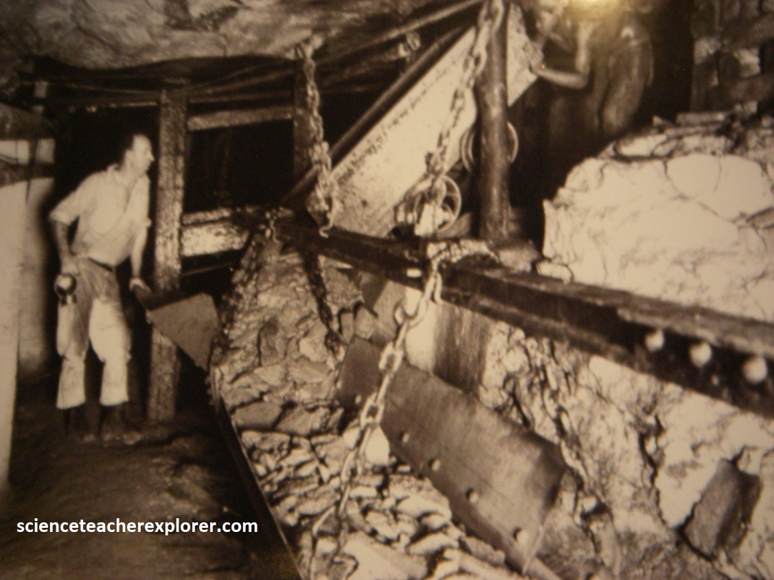
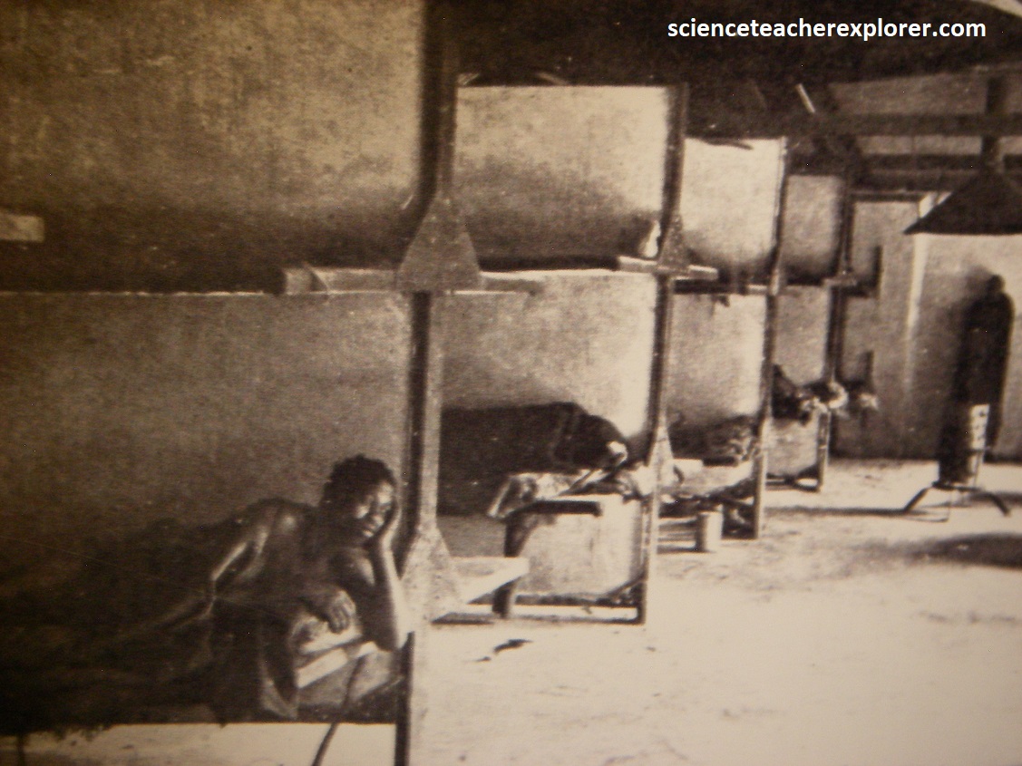
Pictured above, for miners, this was a tough way to earn a living with heat, dampness, darkness and additionally the ear shattering noise of drills. Lighting was by candlelight, thus posing a continued risk of explosion due to the presence of methane gas. Donkeys pulled the gold laden coco pans, staying down the mine for three months before then going blind.
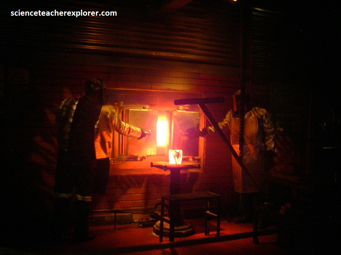
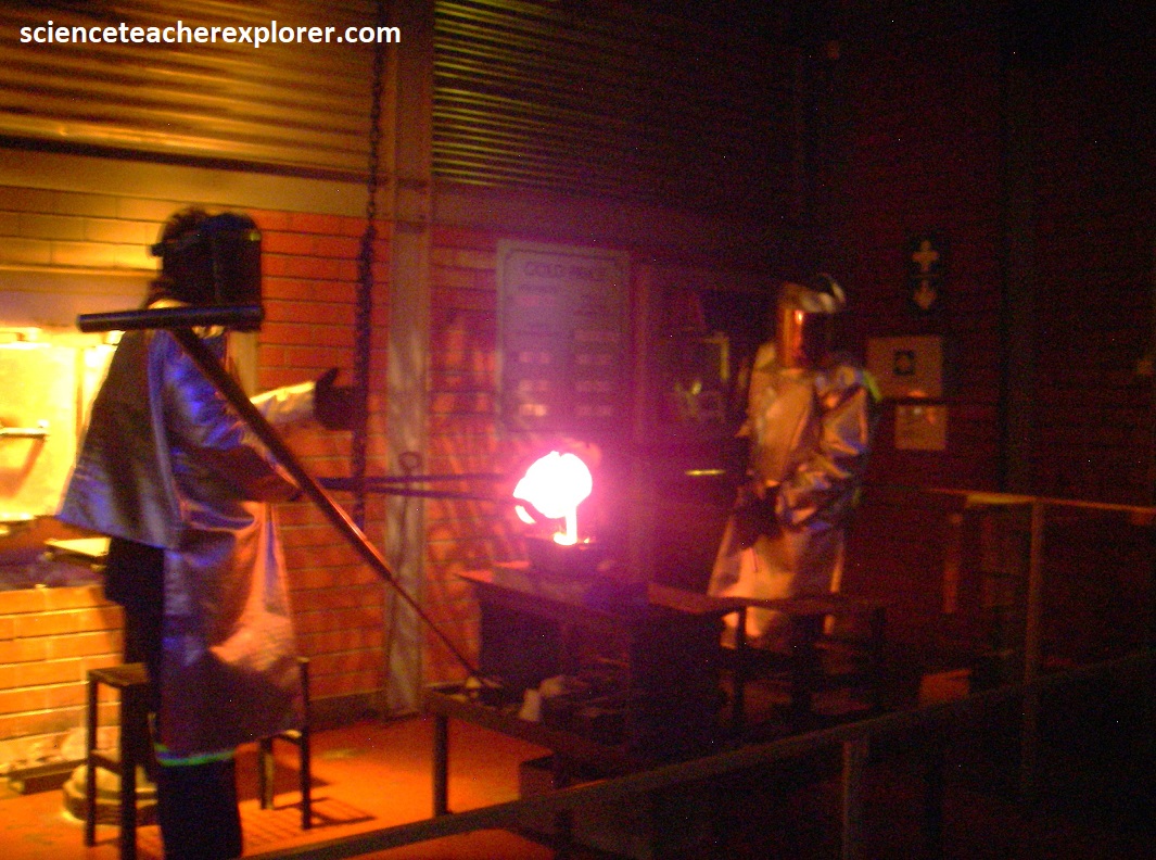
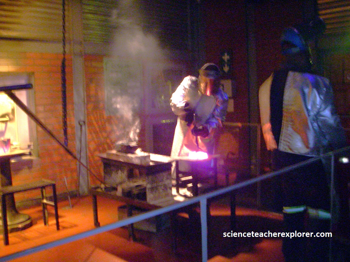
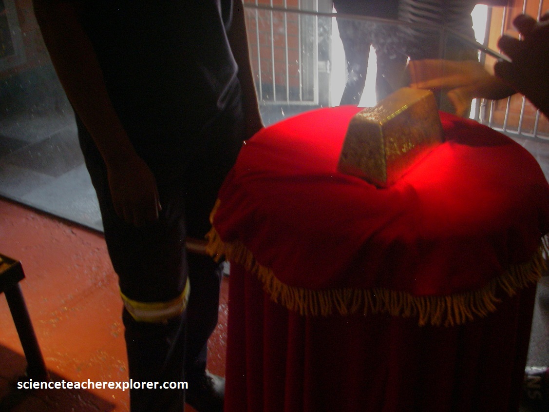
Pictured above, once we made it back on-top, Mike and I visited the “Gold Pour”. There, we witnessed the magnificent glow that emanated from the molten liquid, the scorching heat that radiated, and the hypnotic flow of not-yet-solid gold. Actually, the liquid was copper, but it was still amazing to imagine.
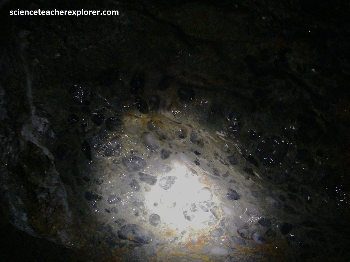
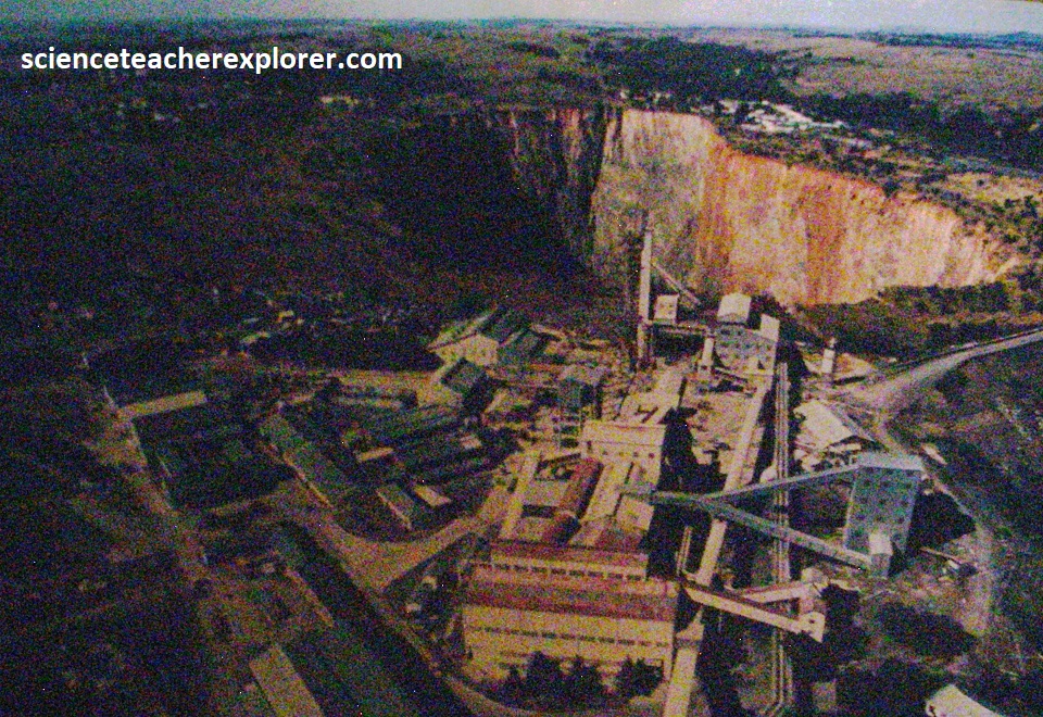
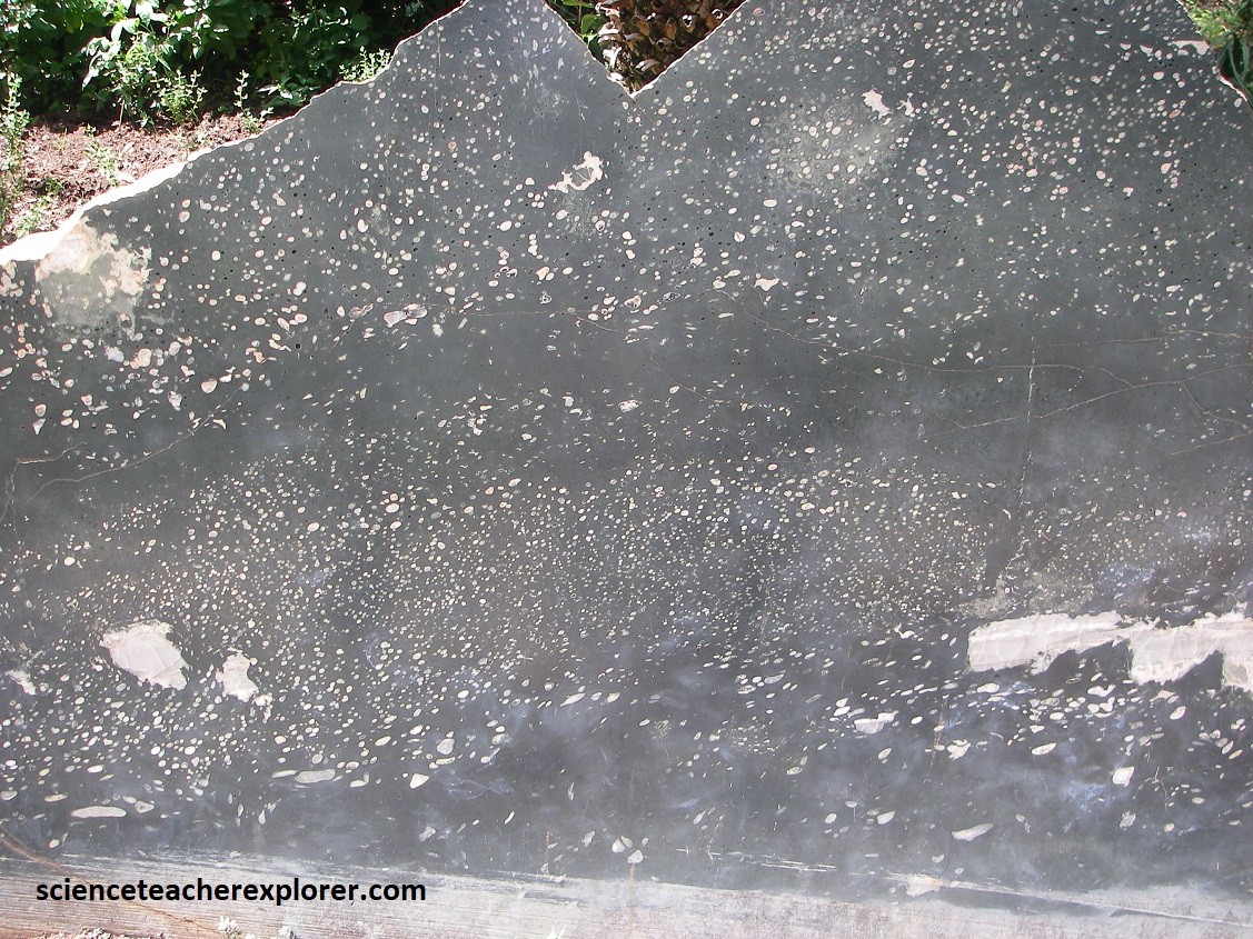
The Gold Reef City and Johannesburg is underlain by the Witwatersrand Supergroup, (an 7,000m thick sequence of predominantly sedimentary rocks ranging 2.9-2.7 billion years old). The sequence is made up of the lower West Rand Group and the upper, gold reef-bearing meta-conglomerate Central Rand Group,(pictured above from underground). The upper group formation were deposited horizontally as sand and pebble beds around the margin of the shallow Witwatersrand Sea, (but they now dip 35 degrees to the south). The dipping of this formation appears to be caused, partly, of the result of the Vredefort meteorite impact to the southwest, (imaged below).

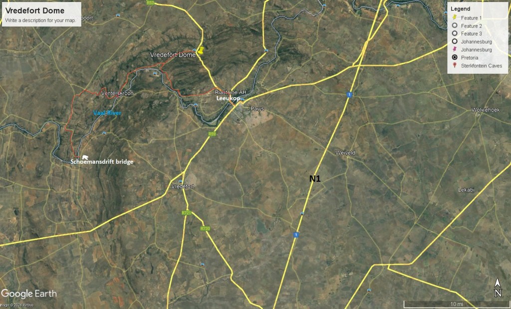
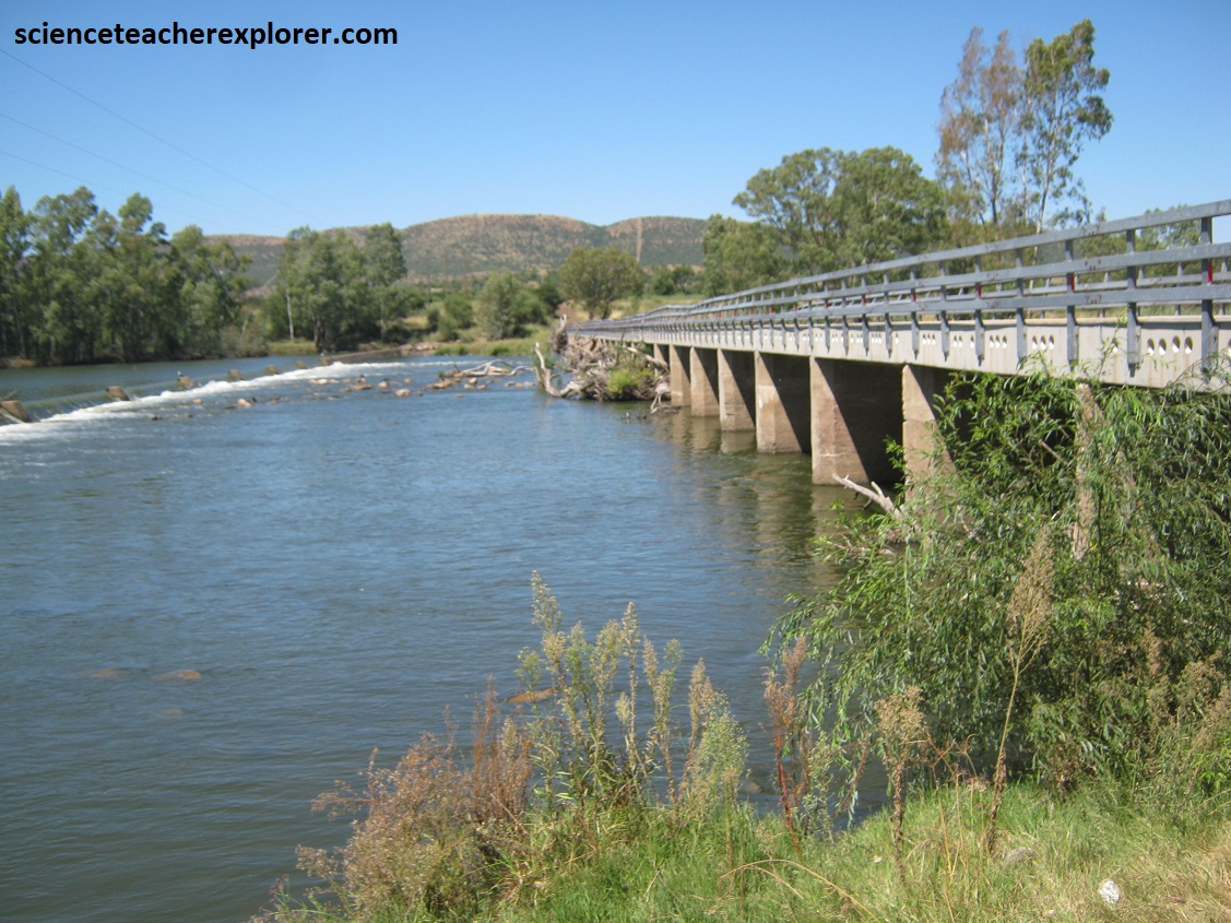
Of course, our next stop was the Vredefort Dome, (imaged above). We approached the dome from the north-west on N12 and Potchefstroom village. From there, we drove south-east, on a graveled road to the Schoemansdrift Bridge, (imaged below).
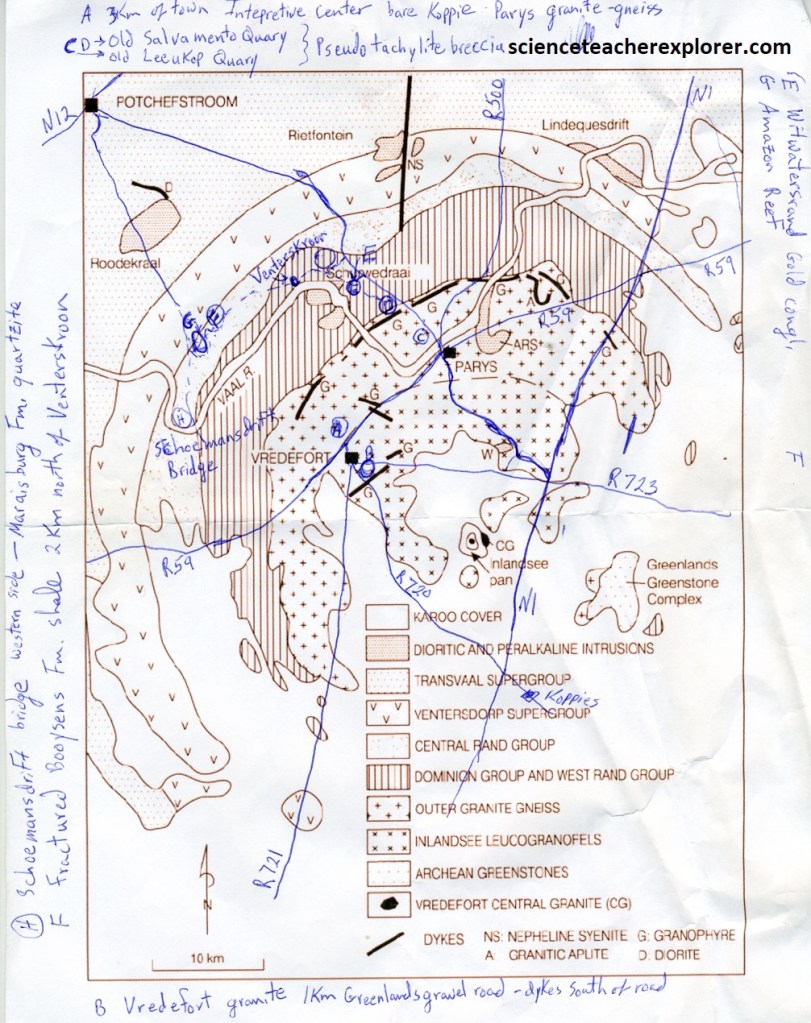
The landscape around the Vredefort Dome is part of the Highfield plateau, and forms the Vredefort Mountain-Land on the Dome’s western and northern sides. Here the crescent-shaped mountains are strongly controlled, (geologically), by up-turned Collar-Zone of Witwatersrand, Ventersdorp and Transvaal strata, through which the south-westward flowing Vaal River had carved a path after passing through 3.2 billion year old Basement Parys granite. On the southern and eastern sides of the Dome, it is a much flatter plain that is covered by significantly younger Karoo strata overlying granite-gneiss and upturned sediments.
The meteorite impact that happened in the Free State made a crater that was about 300km wide, (from Johannesburg to Welkomf). this is the biggest meteorite impact that geologists have yet found on Earth and nearly twice as big as the impact that killed the dinosaurs 65 million years ago. This makes it site of great importance for scientists. It is also the oldest impact crater that has been found on earth. It is mainly for these reasons that it has been made a World Heritage Site.
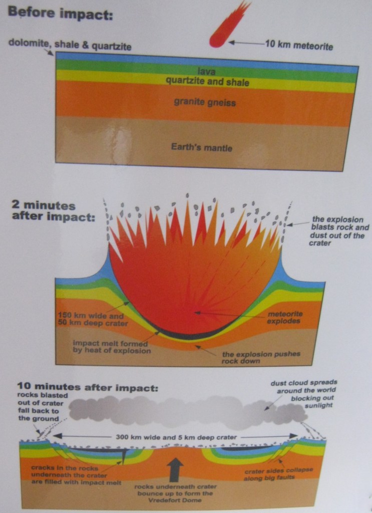
The Meteorite impact happened about 1.023 billion years ago. The only living things on earth were a type of green algae. To make a crater 300km wide, the meteorite must have been about 10km across and traveling at more than 10km/s. The Vredefort Dome is only the central part of the impact crater. It is called a dome because the rock layers were bent into the shape of an upside down bowl 90km across by the impact, (imaged above & below).

Imaged above, the rocks in the Vredefort Dome are exposed in several rings. The oldest rocks that were buried deep within the crust before the impact event are found in the center. These are mostly granite gneisses more than 3.000 billion years old. Parys and Vredefort towns are built on these gneisses that have been mined for their stone in many quarries. The hills of the Vredefort mountainland are made of hard white quartzite rock with the valleys in-between made of softer shale. Some thin layers containing a little gold were once mined from these rocks near Venterskroon. Beyond the hills towards Potchefstroom and Fochville lie softer basaltic rocks that form flatter-land. All these rocks form part of the Vredefort Dome and are steeply dipping, but to the south they are covered by horizontal shale lagers that only formed long after the impact.


Pictured above are the pre-impact Collar Zone of the Witwatersrand, Ventersdorp & Transvaal Formations, that comprise of sedimentary and volcanic rocks. The full sequence is present but thinner, shattered and now steeply dipping or even overturned. These are the same rocks that outcrop along the Witwtersrand, including conglomerates, confirming that they were pushed up by the post-impact rebound in the center.
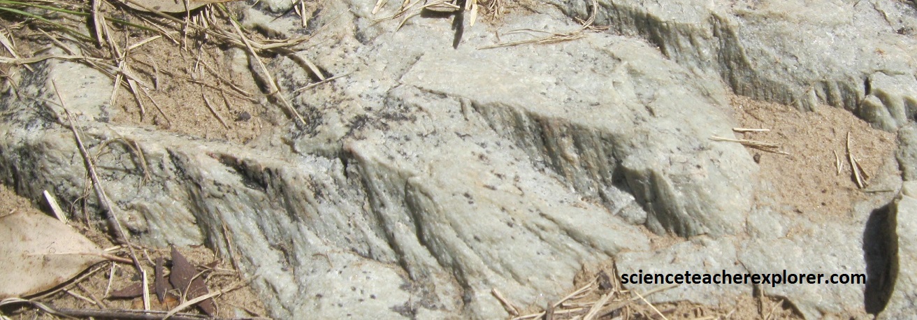
Pictured above on the right are shatter-cone structured in the quartzite, seen at the Schoemansdrift Bridge across the Vaal River west of Parys. These rare, small-scale geological features with fine, radiating, cone-like (or fan-like) striations are found worldwide, and are associated exclusively with meteorite impact structures and with, underground nuclear explosions. Their formation is due to the impact shock wave moving through certain types of rocks.
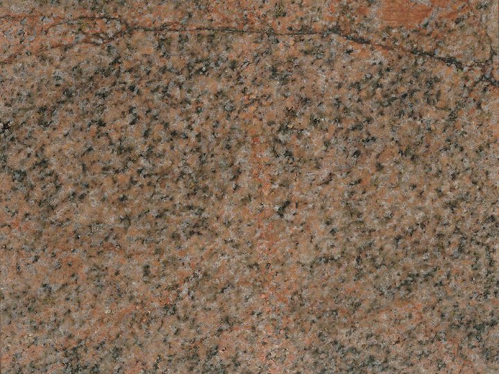
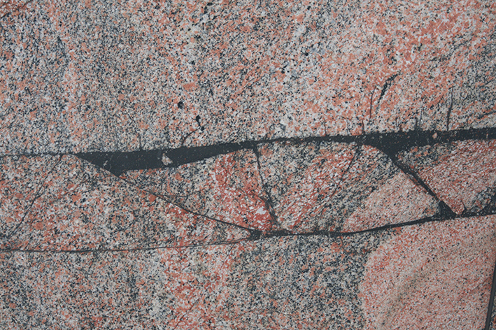
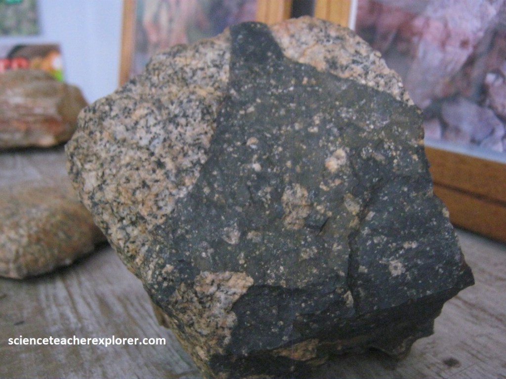
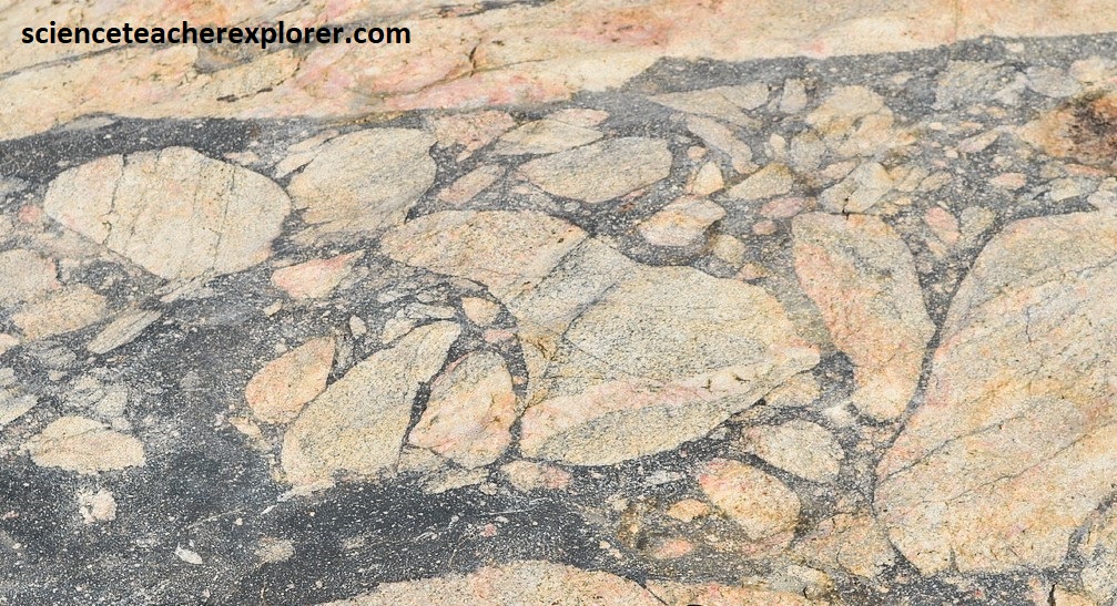
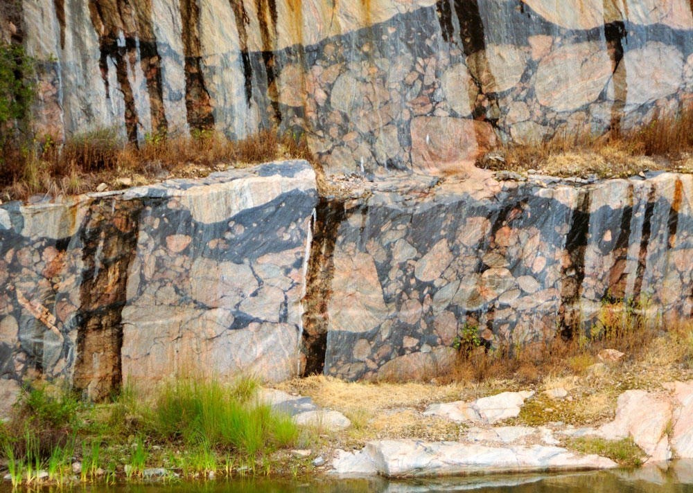
Pictured above is a polished and roughly quarried block of attractively colored Parys granite that is found on the outer zone of the dome that is 3.2 Billion years old. Traded as ‘African Juparana’ and used in various public buildings around Gauteng. Directly below the impact zone, this granite is more of a granite-gneiss, which contains variable proportions of streaky pink to reddish gneissic banding and was also used extensively in the polished-stone industry, (photo below).
Pictured below, Vredefort granophyre are found in a few hard, dark narrow dikes cutting through the granite-gneiss contain abundant small fragments of earlier rock, such as shale and quartzite. Scientific work, has also found traces of ancient meteorite. Pictured below, the rocks represent the original impact melt that penetrated cracks in the floor underneath the original impact crater.
Pictured below, are features of the Vredefort Dome and was best seen in exposures of the quarried Parys granite at Leeukop Quarry. It comprises of irregular veins of black glassy material containing rounded inclusions, (some massive), of the granite-gneiss, and was formed by intense friction or ‘shock-melting’ at the time of impact. The dark material is glass pseudotachylite.
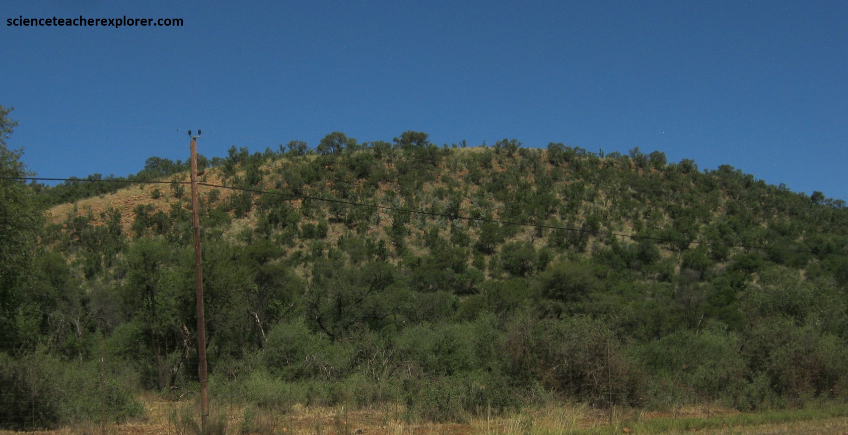
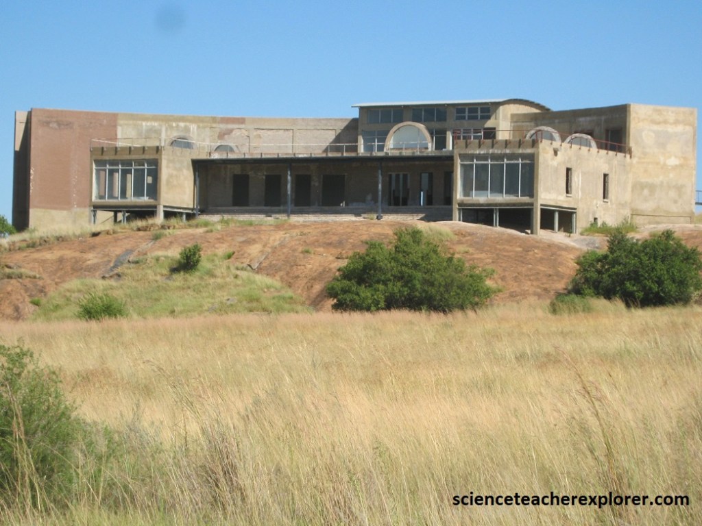
Pictured below, is the abandoned Vredefort Dome Interpretive Center. It is located about 3 km north of the town of Vredefort off the R59. The Center is situated on a bare koppie of Parys granite-gneiss and provides excellent all-round views of the Dome. However, it seems to be abandoned and unfinished from it’s initial construction.
Pictured below is a series of photos, (north, northwest and west), I took from the top-floor of the unfinished Interpretation Center for the Vredefort Dome. These photos show the circular Collar-Zone consisting largely of the Witwaterstand Supergroup strata, which were force up several kilometers by the rebound effect after the impact.

In total, the Vredefort impact event probably lasted less than 10 minutes, although the melted rocks would have taken millions of years to cool down and become solid again. For a time it would have looked like the craters found in the other planets of the solar system. However, over many hundreds of millions of years more, rivers eroded the sides of the crater and most of the cooled melt-rock. This exposed the rocks that once lay underneath the crater. In the up-domed center, (the Vredefort Dome), these rocks still show signs of shattering and melting from the impact.
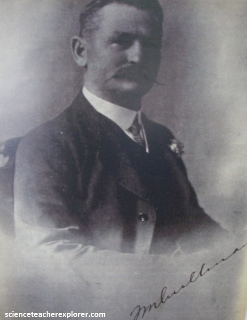
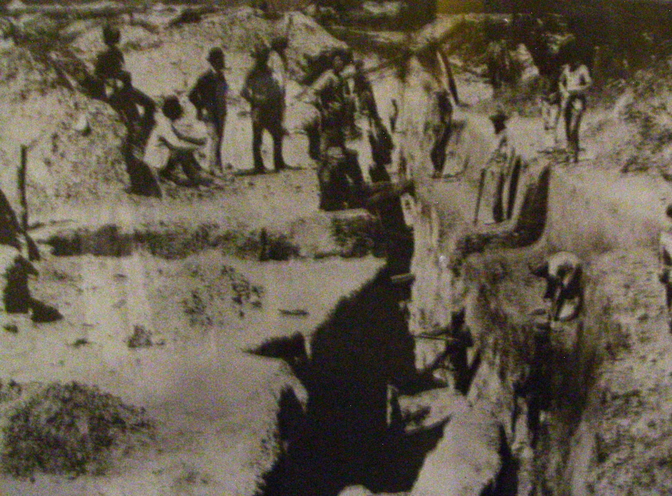
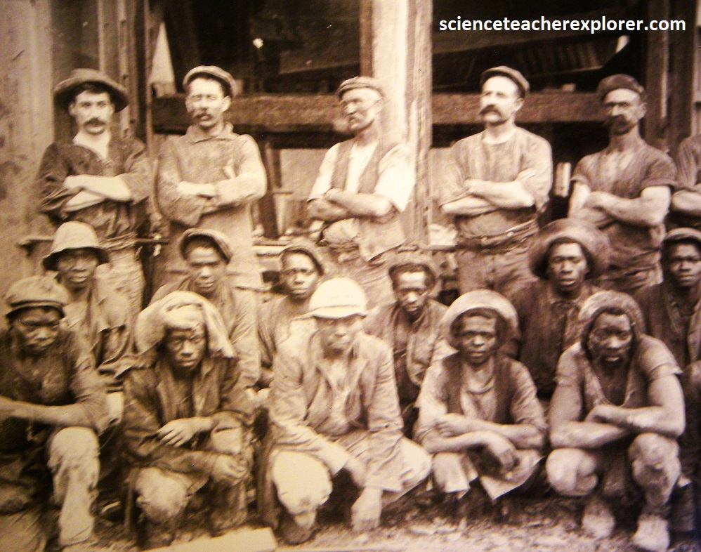
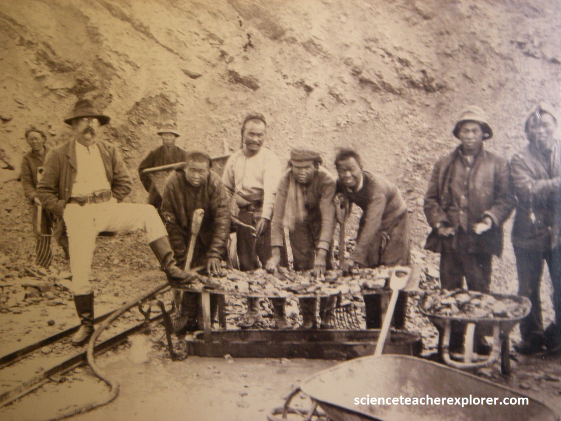
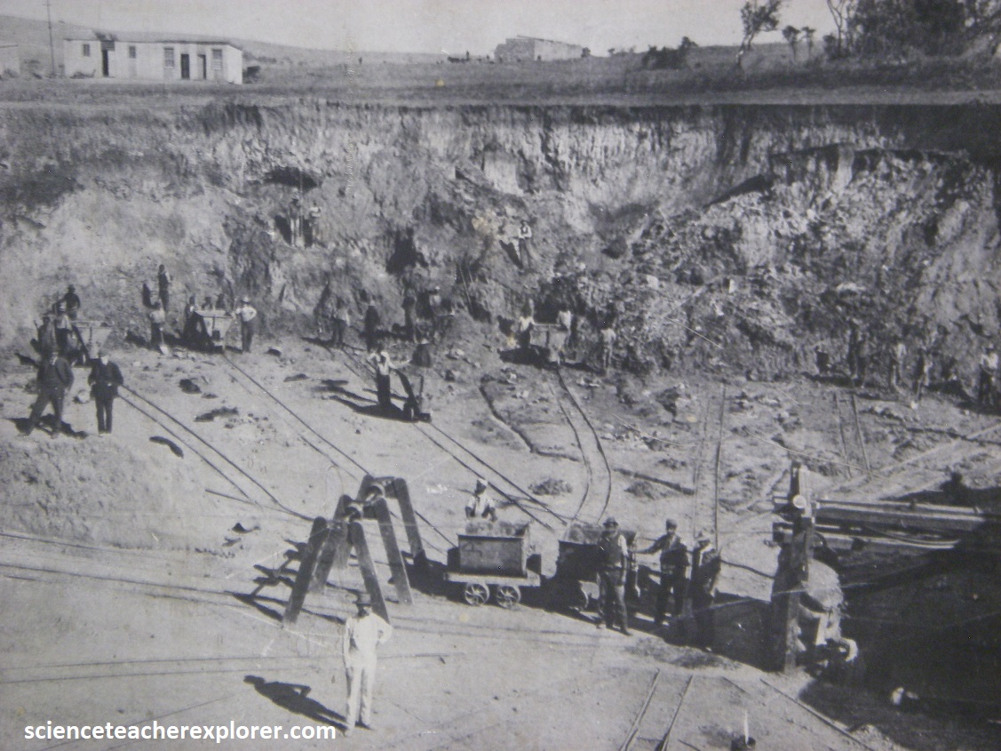
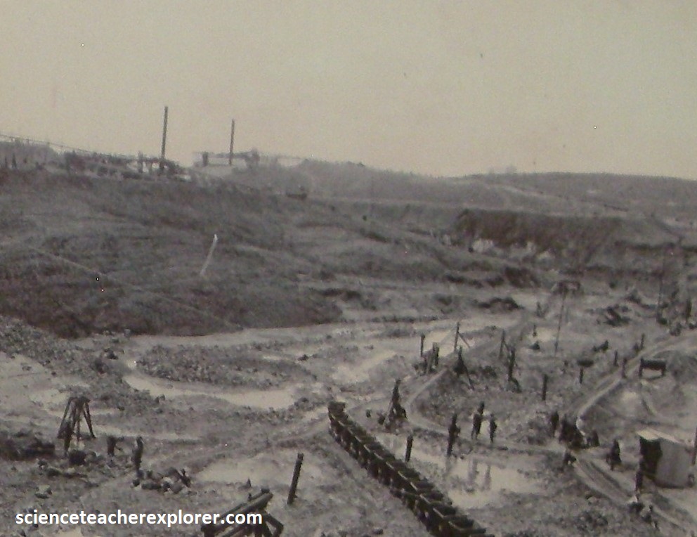
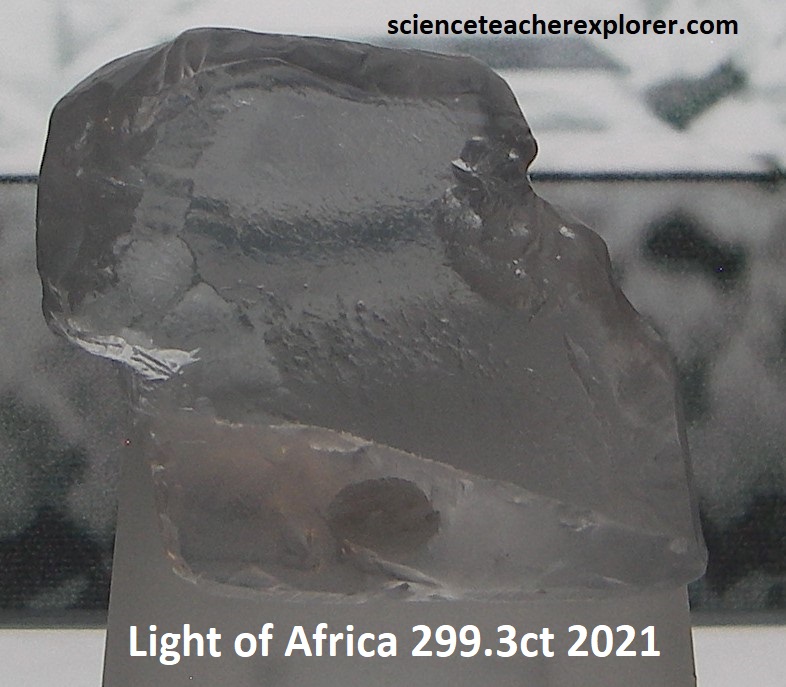
Pictured above, in 1898 Sir Thomas Cullinan was handed a three carat diamond found along a farm fence, 30 km east of Pretoria. He studied the area and came to the conclusion that the diamond was washed down from a nearby hill. Sir Cullinan made an attempt to buy the land from the owner, Joachim Prinsloo, but did not succeed. After Prinsloo’s death, he was able to purchase the land for ₤52,000 from Prinsloo’s daughter. The Cullinan kimberlite was discovered in 1902 and in 1903 open pit mining commenced. The mine was named the Premier mine and it grew into a large open pit using manual labor and basic mechanical equipment, (pictured below). [In 1903 over 100,000 carats of diamonds were recovered with 14,000 miners employed, and which rivaled the De Beer’s combined Kimberly mines]. {The archived photos below were taken of the No. 1 workings of the Premier Mine in 1903 and were taken from an interpretive sign on-site}.
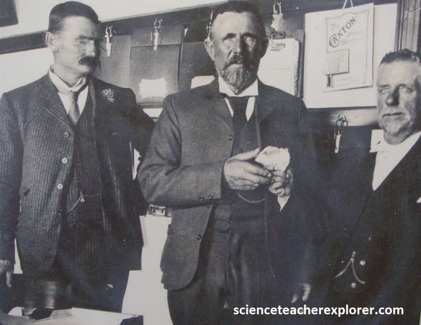
On the 25th of January 1905, a mineworker pointed out a shiny object in the sidewall of the open pit, which was later named the Cullinan diamond. The Cullinan diamond, a 3,106 carats rough diamond and the largest gem diamond ever found, was sold for to the Transvaal Government and presented to King Edward VII as a 66th birthday gift. Pictured below on the left is a replica of the Cullinan Diamond and it’s resulting cuts. On the right is a public-domain historic-photograph, taken in 1905, of Thomas Cullinan, William McHardy (General Manager, holding the rough 3,106ct diamond) and Fred Wells, the finder. Notice the size of the Cullinan stone).
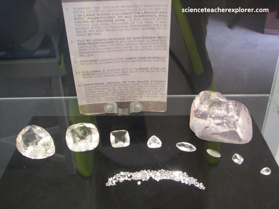
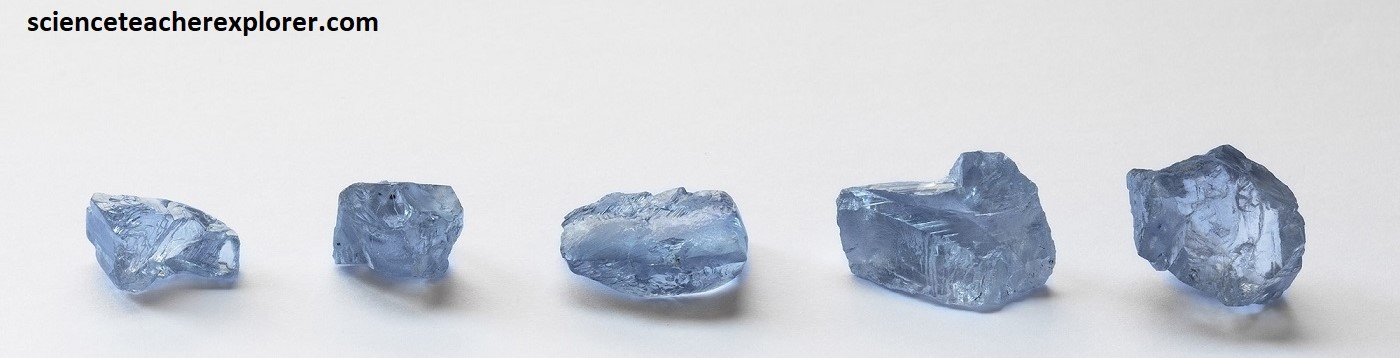
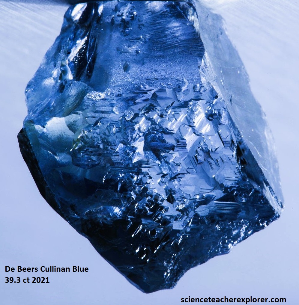
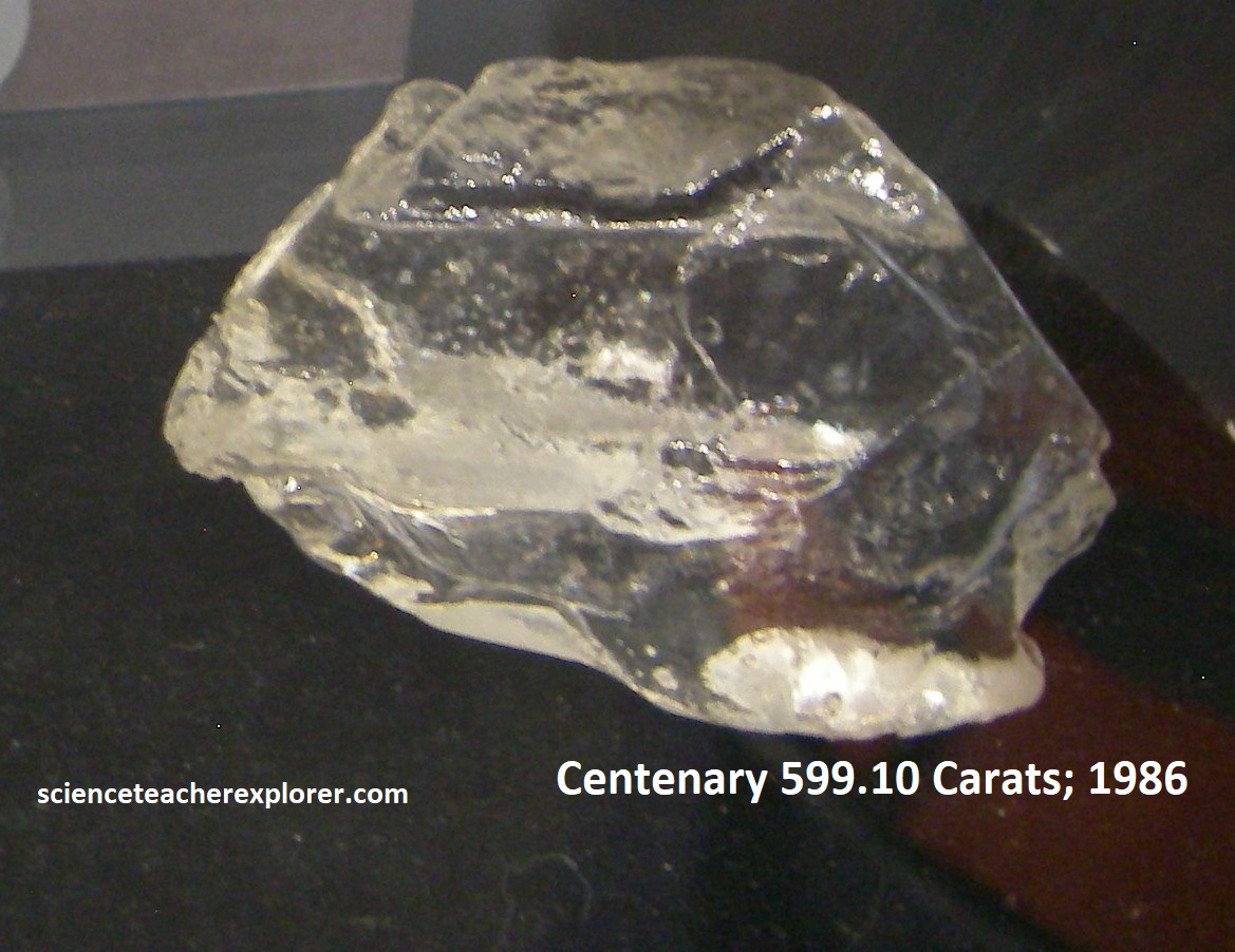
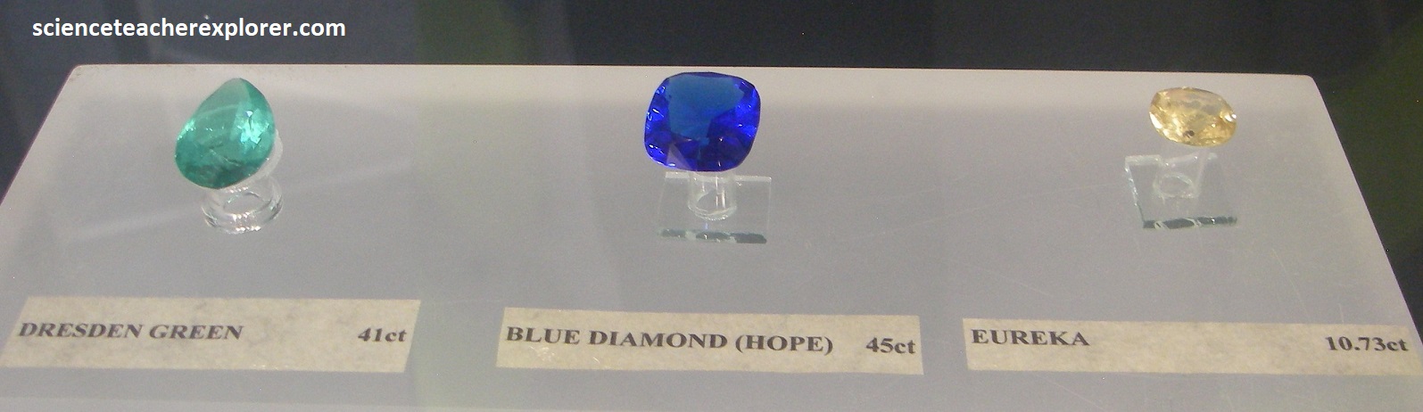
Production at the mine was halted due to WWI from 1914 and reopened in 1916. From 1916-1932, the price of diamonds fell and the mine closed due to the depression and lack of a market for luxury goods. The mine closed again from 1932-1945 and after WWII, a decision was made to re-open the mine. It took 10 months to pump out 4 million liters of water from the 189m deep pit, which had accumulated during that period. After WWII, industrial-grade diamonds amounted to 80% of the mine’s output. Since mining started from the surface in 1903, more than 350 million tons of kimberlite have been mined to produce around 120 million carats (more than 24 tons) of diamonds, and mining continues to this day. As a matter of fact, of all kimberlite pipes worldwide, the Premier kimberlite pipe has produce more than 25% of diamonds over 400ct. Some examples are seen below in their diamond museum:
Diamonds are formed geologically deep within the earth at about 100m beneath the earth’s surface where carbon rich rocks are melted by the heat of the earth’s mantle, and are compressed by the enormous pressure, the heated rock moves upwards and diamonds are formed. Typical of kimberlite pipes, it narrows progressively downwards and at 1,000m below the surface, it splits into two root-like intrusions. Below are an artist depiction of a kimberlite pipes, (taken from interpretive signs on-site).
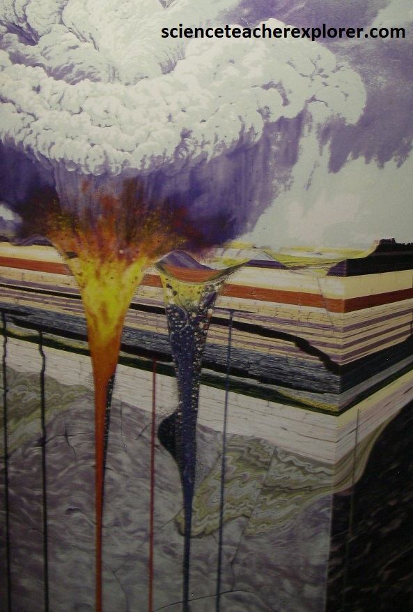
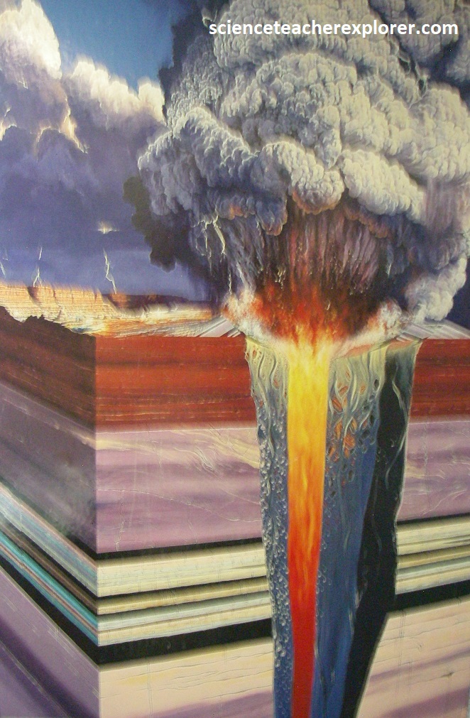
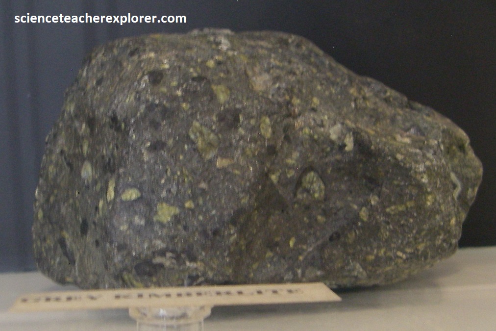
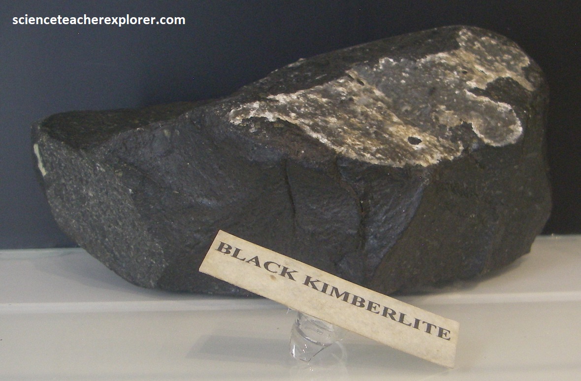
Imaged above, the Premier or Cullinan’s kimberlite pipe, is 1.2 billion years old, (oldest diamond-producing kimberlite in the world). At the surface it intruded through a reddish felsite layer that is correlated with the 2.06 billion year old Rooiberg Group, (part of the Bushveld magmatic event). Originally covering 32ha, it is the largest of a cluster of 11 kimberlite pipes found in the area. It is roughly a kidney-shaped in plan, and it is a multiple intrusion: it contains several varieties of kimberlite, all diamond-bearing, including the Grey, Brown and Black kimberlites, (pictured below from the museum on-site).

The Premier Mine was renamed to Cullinan Diamond Mine in 2003 in celebration of its centenary. The Premier (Transvaal) Diamond Company amalgamated into De Beers Cullinan Mine in 2007. In 2008, Petra Diamonds Cullinan Consortium concluded an agreement with De Beers for the sale of the Cullinan Diamond Mine of 1 billion ZAR. In September 2017, Petra completed the construction and commissioning of a modern, fit-for-purpose processing plant that replaced the previous plant. The new plant was designed to improve the efficiency of the material flow, thereby significantly lowering operation costs.
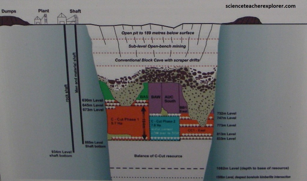
Petra continues to mine the underground resource using mechanized block caving and sub level caving methods. These are massive mining techniques in which sections of the large orebody are undercut by working places, allowing it to progressively collapse under its own weight. the mining system depends largely on the action of gravity and the crushed rock is extracted through the working places, (draw points and extraction tunnels).

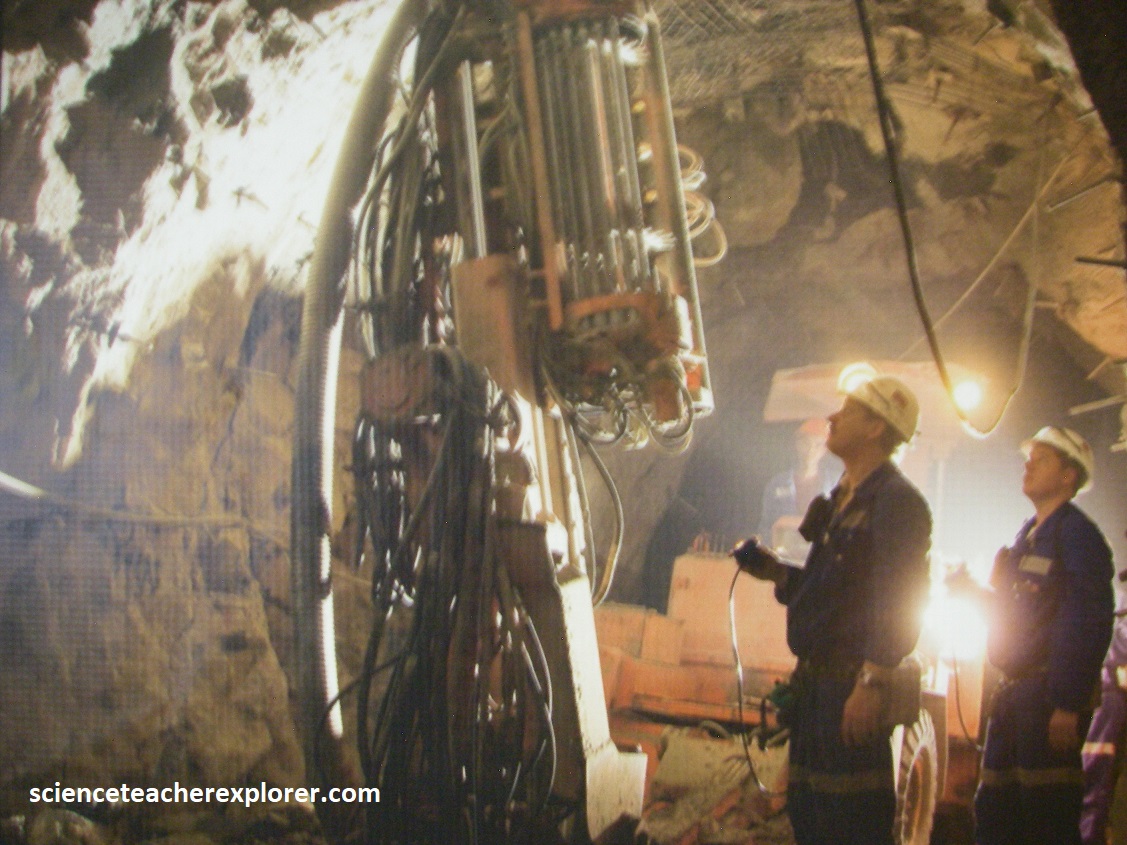
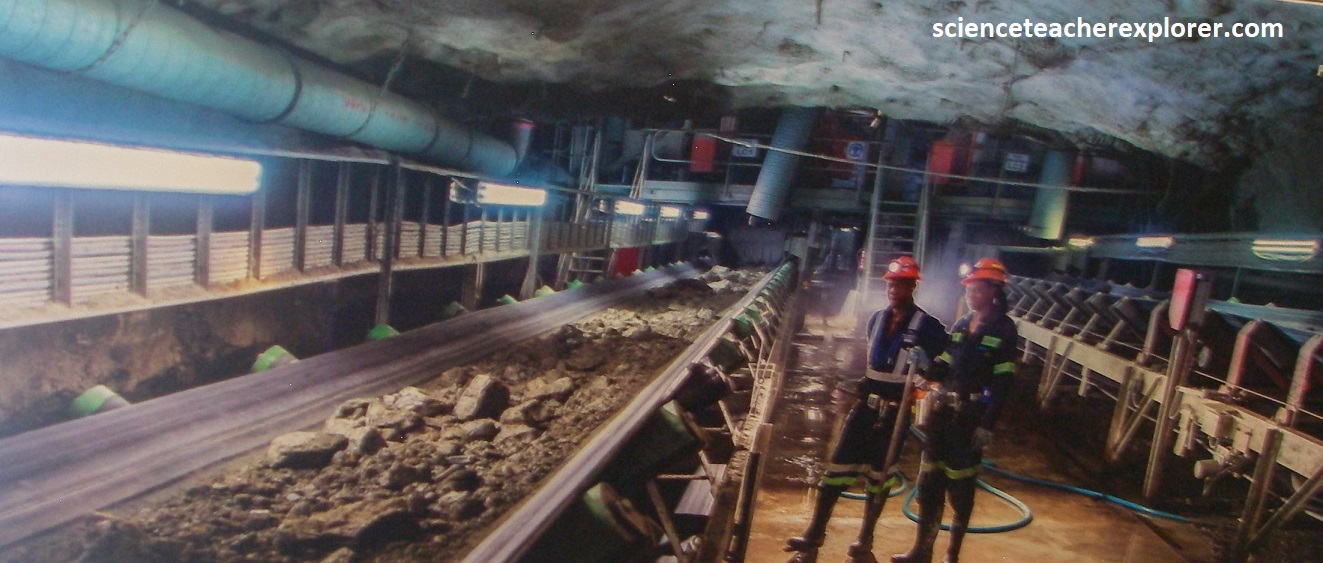
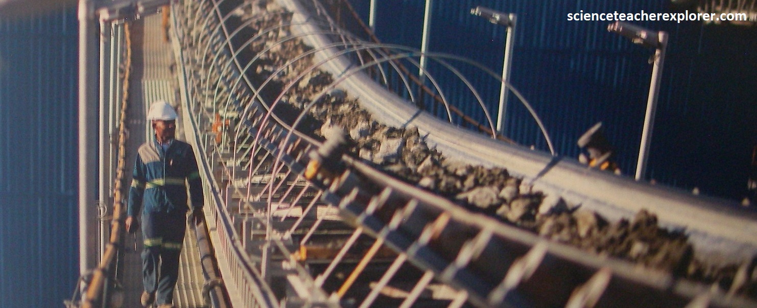
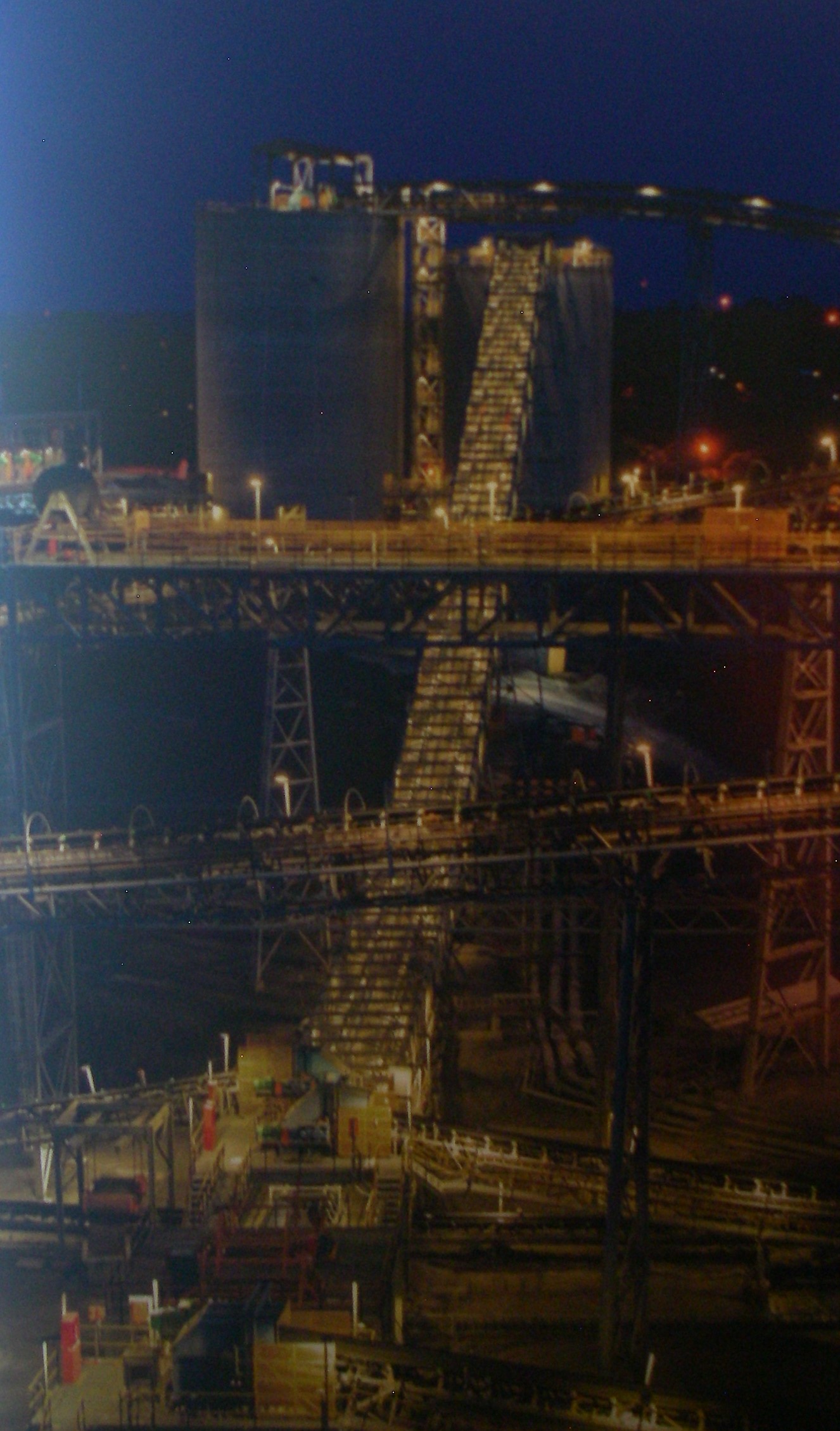
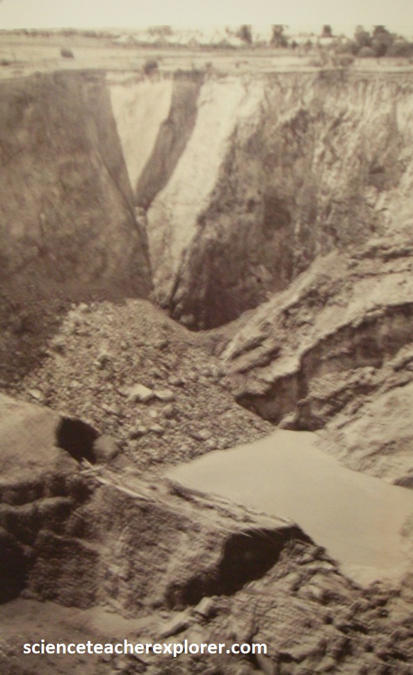
[Pictures above were taken from interpretive signs on-site]. As mentioned, ore is loaded from the draw points underground by load, haul and dump trucks, and hauled along the extraction tunnels. Ore passes where rock breakers facilitate the transfer of the ore to the crusher below the pass. The primary crushers underground reduce the size of the rocks to a suitable size to be transported to the shaft via a series of conveyer belts. Then the crushed rock is transported with conveyor belts to two silos before being tipped into the skips to be hoisted to the surface through No. 1 rock shaft at the rate of approximately 14,000 tonnes/day. On the surface, ore is conveyed to the plant via conveyor belts for processing. In March of 2024, I payed for a mine tour with the ex-mine manager. He showed me the replica diamonds pictured above, the photos of the underground mining facilities the Cullinan Big Hole, (pictured below).

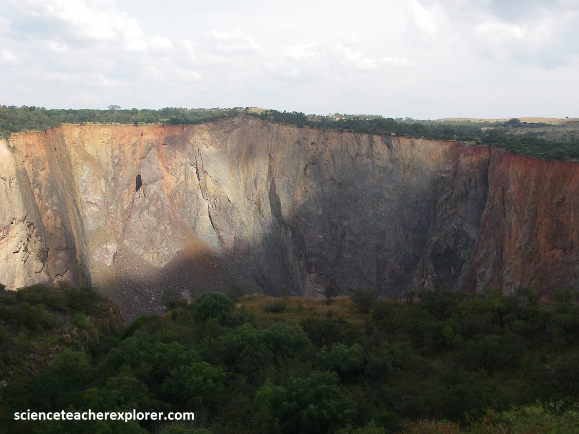

Pictured above, are photos that I took along the edges of the Culliman Diamond Mine Pit. The last, bottom photo, was taken from an interpretive sign on-site, showing an aerial view of the Culliman Mine’s open-pit, the mine headgear and the extensive recovery plant. I toured through most of that.
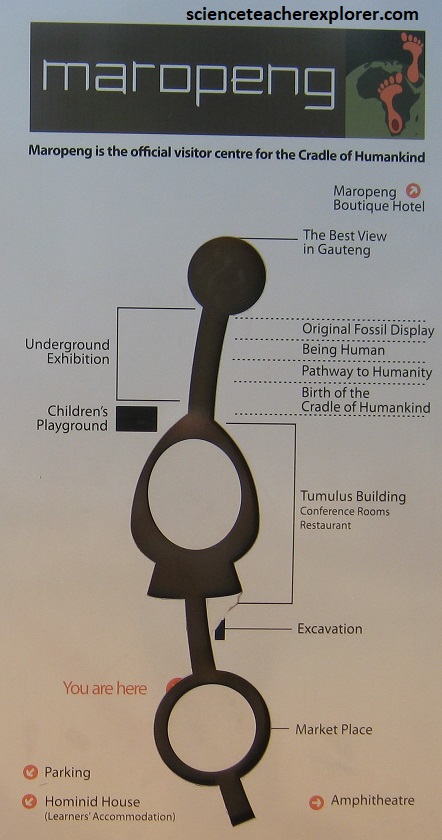
Earlier in 2023, I visited the fascinating museum of Maropeng near Sterkfontein Cave. Maropeng is on the “Cradle of Humankind Site” which is a 180-square-mile site northwest of Johannesburg, home to the oldest hominid fossils ever found.

The Maropeng visitor center is on R400 just off the R563 Hekpoort road.
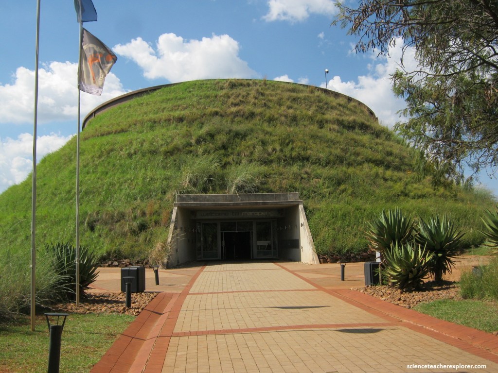
Pictured above, the Maropeng Visitor Center contains a small museum that explores the history of the area. On display are several fossil examples of mankind’s earliest ancestors, as well as hands-on science exhibits, and a collection of photographs and artifacts.

The Sterkfontein Caves are also on this site, and they alone have provided a third of all early hominid fossils ever found. This system of limestone caves became famous with the 1947 discovery of the 2-million-year-old fossil skull dubbed “Mrs. Ples”. After this monumental find, work continued at the site for decades. Then in 1997 “Little Foot,” a hominid skeleton, (Australopithecus Prometheus), aged at about 3.5 million years, was discovered in the caves. In addition to these two “stars,” the caves have also produced over 500 other fossils.
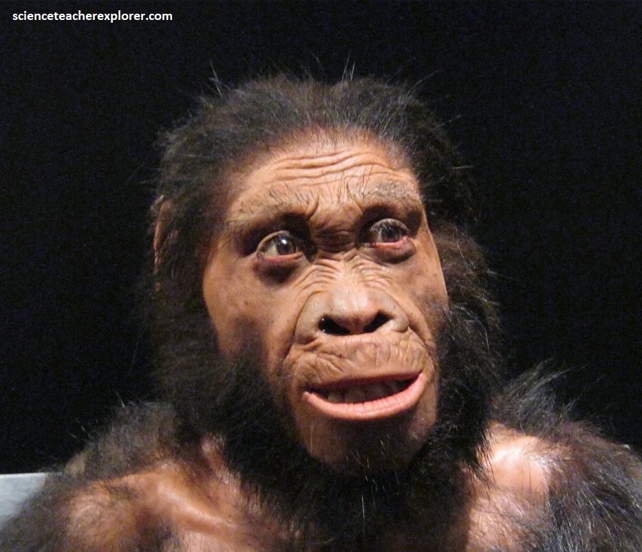
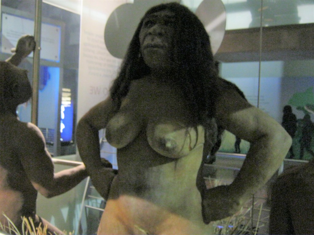
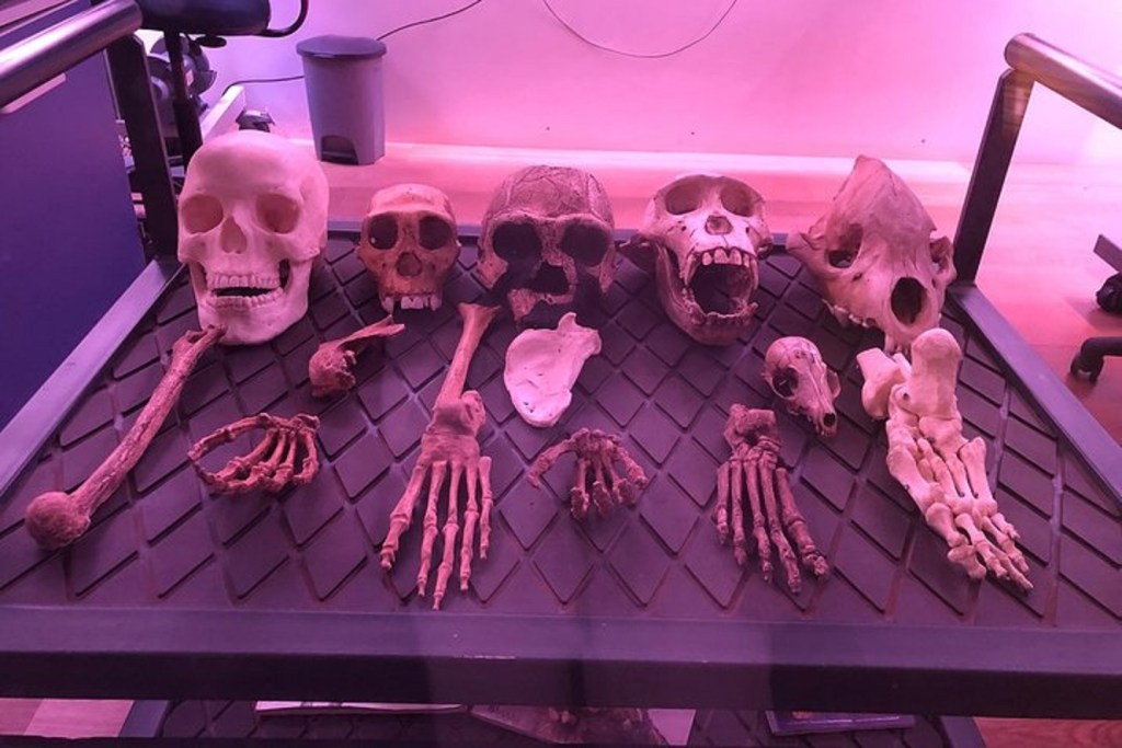
Hominids from the Cradle of Humankind World Heritage Site provide some of the earliest evidence and the deepest roots of human origins. From skull and skeleton found on-site to face and body, the exhibition explores and brings us face to face with these relatives of all of humankind through reconstructions by scientists and artists. The exhibition at Maropeng presents the opportunity to compare face to face the bust reconstructions of Australopithecus sediba and Home naledi by renowned palaeo artist John Gurche.

Pictured above, ‘Neo’ is the nearly complete skull and skeleton of a Homo naledi individual, discovered at Rising Star and announced in 2015. This species lived at the same time as early humans, around 335,000-236,000 years ago. Unlike other members of the genus “Homo”, this species had a small but complex brain and a slightly projecting face.

Pictured above, these images of reconstructions of Homo naledi by Daynes and Gurche show that although the science on which both are based is the same, the way in which the artists interpret the science differ, (but both within the realm of possibility). The process in both instances starts with the hominid skulls as a base, and placing tissue markers before carefully molding clay to form muscles and ultimately skin and facial features.

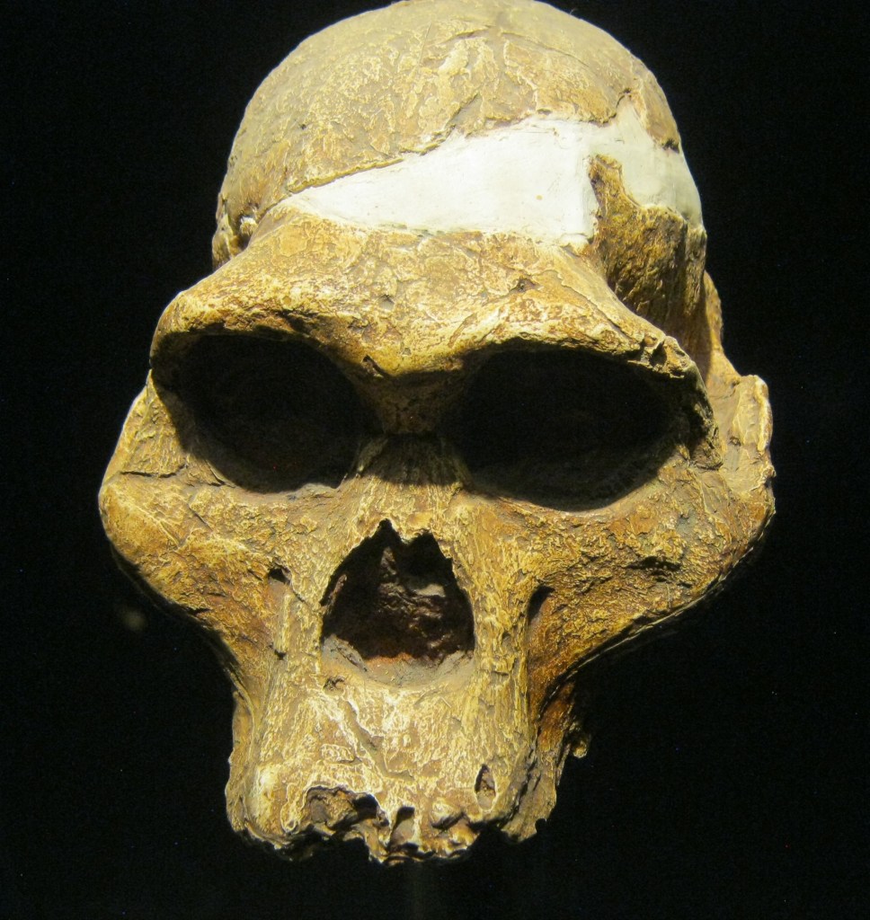
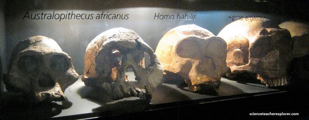
Pictured above, DNH 155 is a male Paranthropus robustus skull discovered at Drimolen in 2018, and lived between 2.04-1.95 million years ago. DNH 155 is one of the best-preserved skulls belonging to this species, which are easily recognized by their large flat faces, extremely large teeth, and a distinct bony ridge or “sagittal crest” on the top of their heads.

Pictured above, the southern African species is known as Paranthropus robustus. Roughly the same size as Australopithecus, it had large jaws, teeth and powerful cheek muscles, all adaptations for grinding tough vegetation such as roots, hard seeds and berries.
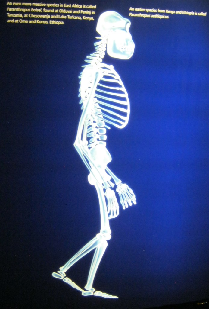
Pictured above, many Paranthropus robustus fossils have been found in the Cradle of Humankind. This species was not a direct human ancestor but a distant cousin; a “broken branch” of our family tree.
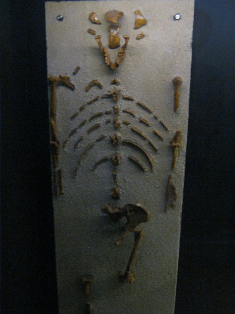
Pictured above, ‘Little Foot’ is the nickname given to the oldest australopith (3.67 million years old), discovered at Sterkfontein in 1994, belonging to the species Australopithecus prometheus. This is the most complete australopith skeleton ever discovered and the full skull is extraordinarily well preserved.

Pictured above, Australopithecus prometheus populated the eastern and southern part of Africa between 4 to 2 million years ago.
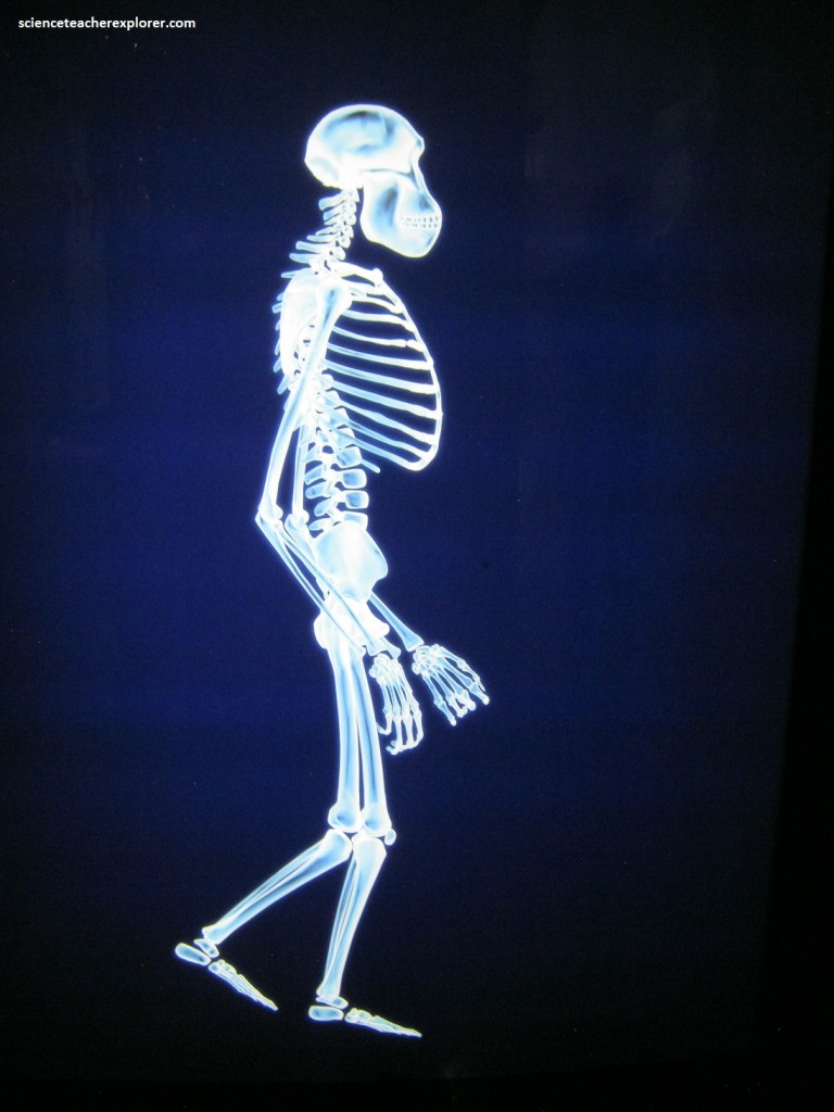
Pictured above, Australopithecus walked upright and had human-like teeth and hands, but also had ape-like features, including a small brain, flattened nose and forward-projecting jaws.
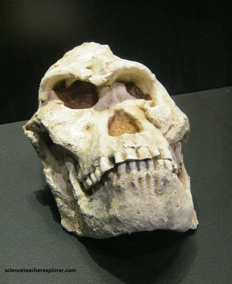
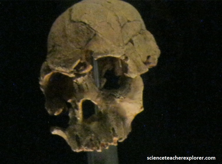
Pictured above, “Mrs. Ples”, an adult Australopithecus africanus and ancient ancestor of humankind, was discovered by palaeontologist Dr. Robert Broom and his assistant, John Robinson, at Sterkfontein in 1947, in an area that had been worked by lime miners. Mrs. Ples is more than 2 million years old and is the best example of an Australopithecus africanus skull ever found.
Pictured above, Mrs. Ples was probably the last of the species, Australopithecus africanus, that lived over 2 million years ago. Her brain was three times smaller than ours.

Pictured above, in 1947, Dr. Robert Broom and John Robinson were blasting breccia with dynamite at the Sterkfontein Caves, when they discovered the skull of Mrs. Ples. Broom suggested that the skull of Mrs. Ples represented a female, based on the small size of the sockets for the canine teeth. Mrs. Ples was clearly on the road to humanity. This hominid could walk upright, but had a small brain, similar is size to that of a modern chimpanzee.
Pictured above, many palaeo-anthropologists believe that one of the many species of Australopithecus may be the immediate ancestor of the genus “Homo” to which we, Homo sapiens, belong. Some however consider that “Homo” had an ancestor separate from Australopithecus (e.g. Kenyanthropus). At about 2.1 million years old, Mrs. Ples is one of the youngest known fossils representing Australopithecus africanus. Not long after that, Australopithecus africanus became extinct.
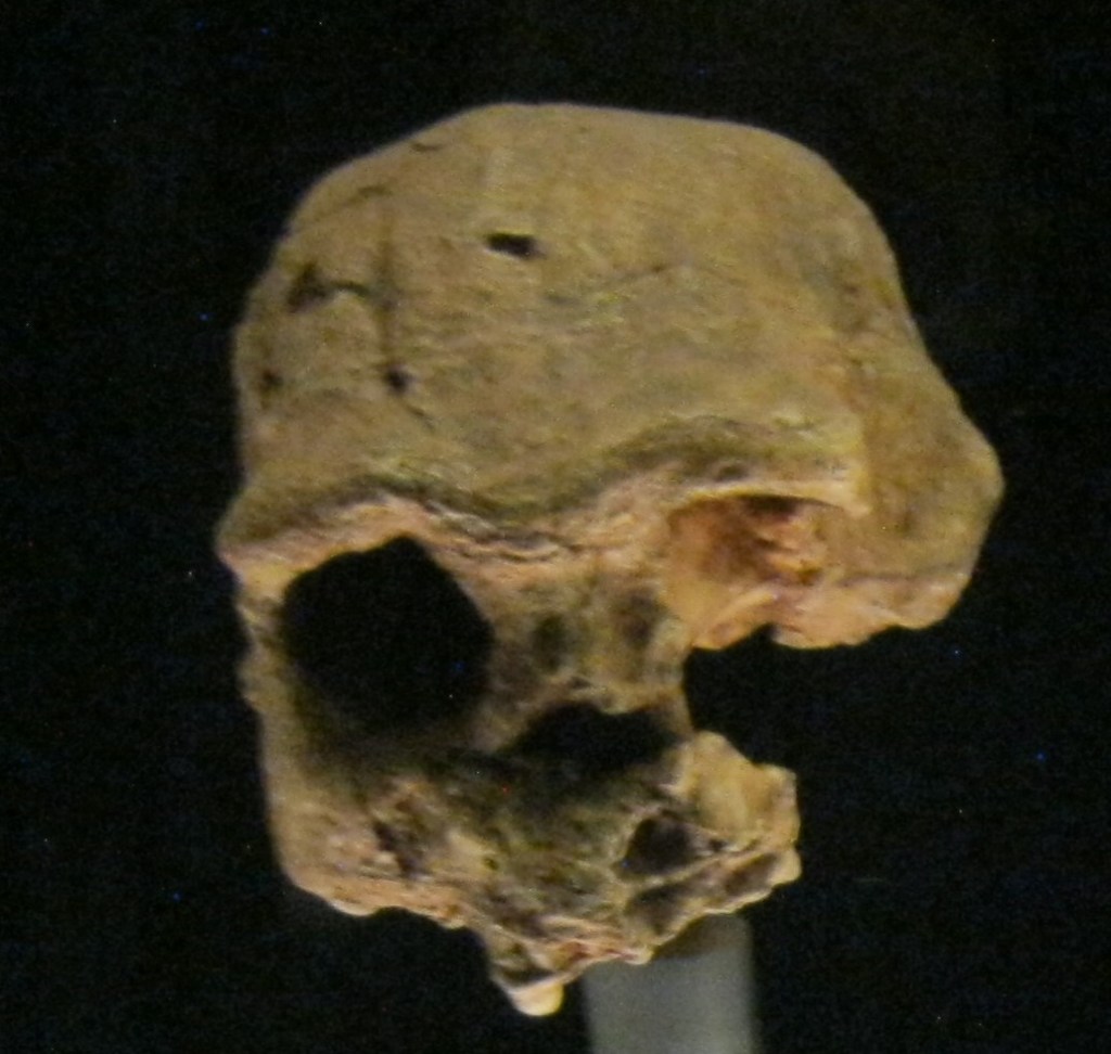
Pictured above, the first Homo habilis fossil was discovered at Olduvai Gorge in Tanzania in the early 1960s. It consisted of 2 parietal (skull) bones and the lower jaw of a child. Other examples are the 1470 skull for East Lake Turkana in Kenya, and the OH65 maxilla (upper jaw) from Olduvai Gorge in Tanzania.
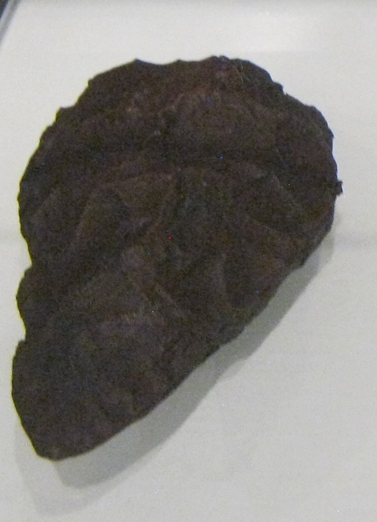
The earliest species of the genus Homo named so far, Homo habilis (“Handy Man”), appeared about 2 million years ago in Africa. Homo habilis had smaller teeth and a larger brain than Australopithecus, and was probably the first hominid to make stone tools, including pebble choppers and sharp flakes of stone. Their faces were more slender and their teeth smaller than their contemporary in South Africa, (which mostly ate tough vegetation). It was probably the development and use of tools that would cause the Homo lineage from extinction, as it was able to adapt to changes in the Earth’s climate at the onset of the Pleistocene, which was marked by a cycle of ice ages beginning about 1.8 million years ago. All together, Homo habilis lived for more than half a million years.

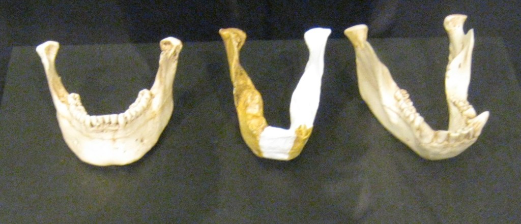
Pictured above, the successor to Homo habilis in the fossil record is Homo ergaster, sometimes known as early Homo erectus from Africa, which lived between about 2-1.4 million years ago and had a brain capacity of about 2/3 rds of the size of that of modern humans. The first discovery of Homo ergaster was made by Tranvall Museum palaeo-anthropologists Dr. Robert Broom and Professor John Robinson at Swartkrans in the Cradle of Humankind in 1949, when they found a lower jaw SK 15 and a cranium SK847, which were only to be recognized as a “Homo” 20 years later by Professor Ron Clarke. Homo ergaster was about as tall as modern humans and always walked upright, but still had a few ape-like features, including a low forehead with prominent brow ridges, a slightly thickened jaw and no discernible chin.
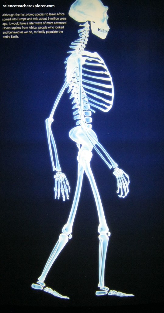
Pictured above, palaeo-anthropologists believe Homo ergaster was the first human ancestor to have made Acheulean stone tools, such as hand-axes and cleavers. This was an improvement on the earlier Oldowan technology. Tools, combined with the ability to control fire, allowed Homo ergaster to leave Africa for colder, northern climates. The use of fire allowed for cooking, which expanded the range and quality of foods available to Homo ergaster. It also provided warmth, and a means to ward off predators. It is probable that the migrated north from Africa and entered into Europe and Asia. From there they evolved into, what is believed to be Homo erectus.
Pictured above, Homo erectus most prominent features were its low, angular braincase with massive brow ridges, and large brain, which comes close to modern human brain sizes. Most palaeo-anthropologists now believe that Homo erectus evolved in Asia about 1.6 million years ago, and used its relatively advanced mental capabilities to spread into Europe and back into Africa.
In 1891, Eugene Dubons found a fossilized 700,000 year old Homo erectus skullcap at Trinil on the Solo River, Java, Indonesia, and named it Pithecanthropus erectus. Later dubbed “Java Man”, this is the type of specimen for Homo erectus. Since then, dozens of Homo erectus fossils have been recovered from Java.
In the 1930s, about 40 Homo erectus fossils were excavated at Zhoukoudian, China. Originally classified as Sinanthropus pekinensis, and known more popularly as “Peking Man”. These fossils date from about 530,000-230,000 years ago, and are less robust than the previously mentioned Java specimens.
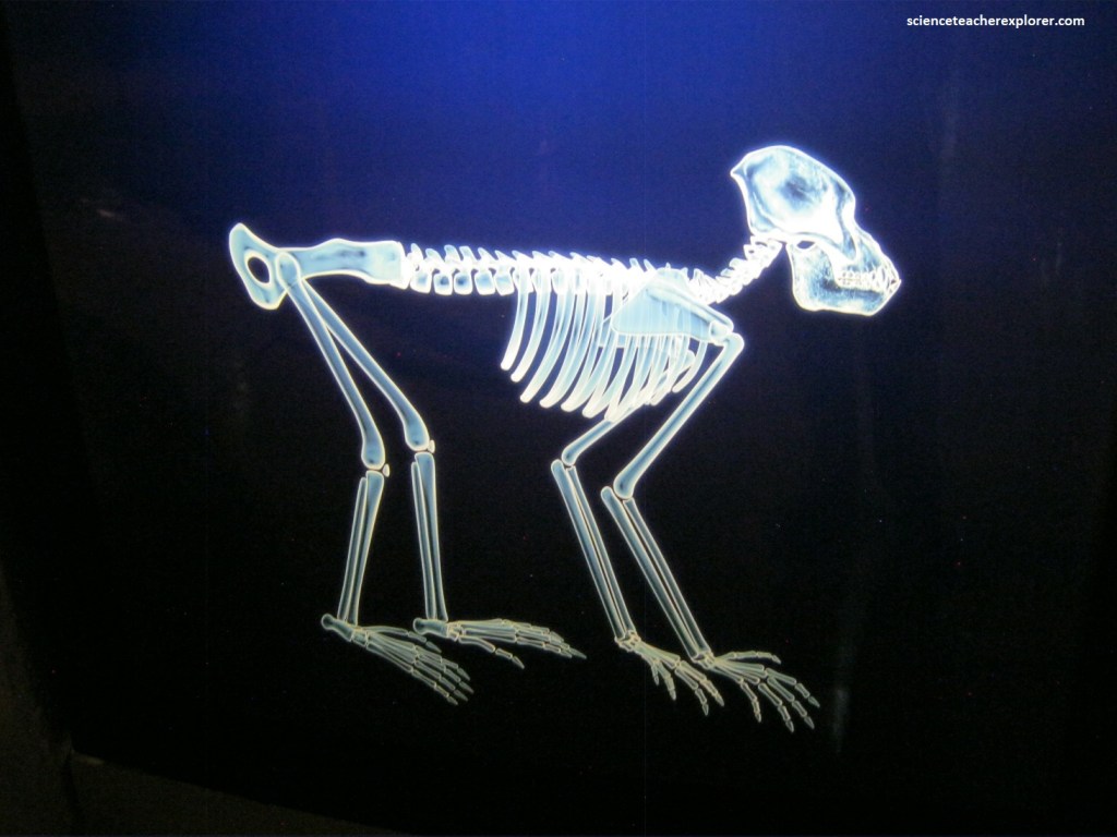
Pictured above, is an example of a Miocene ape. Proconsul africanus was one of the many Miocene apes, but not the one that gave rise to humans. Some researchers believe that there was a common ancestor between modern-day apes and humans. This has not yet been found. It is probable that modern apes and humans evolved from separate but closely related ancestral species rather than a common species. So, out of the late Miocene world, with the global climate beginning to cool, came the great apes, (the ancestors of gorillas, orangutans, chimpanzees, bonobos and our own ancestors, the hominids).
The Cradle of Humankind World Heritage Site was declared a Cultural World Heritage Site by the United Nations Educational and Scientific Council (UNESCO). This site has yielded significant fossils of hominins dating back to more than 3.5 million years before present.
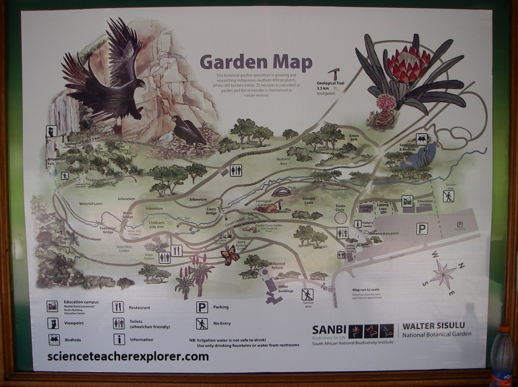
In March of 2024, Mike and I trekked over to the Walter Sisulu National Botanical Garden. Image above, the garden was located at the end of Malcolm Road. We arrived by taking R28/N14 from Pretoria, and turned off at the Pinehaven Intersection.
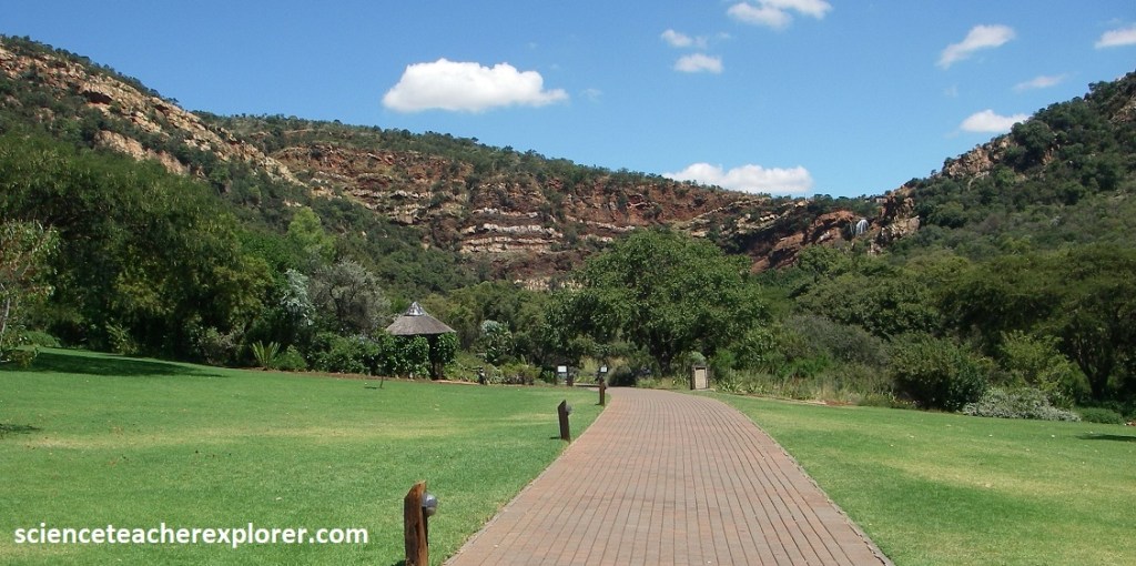
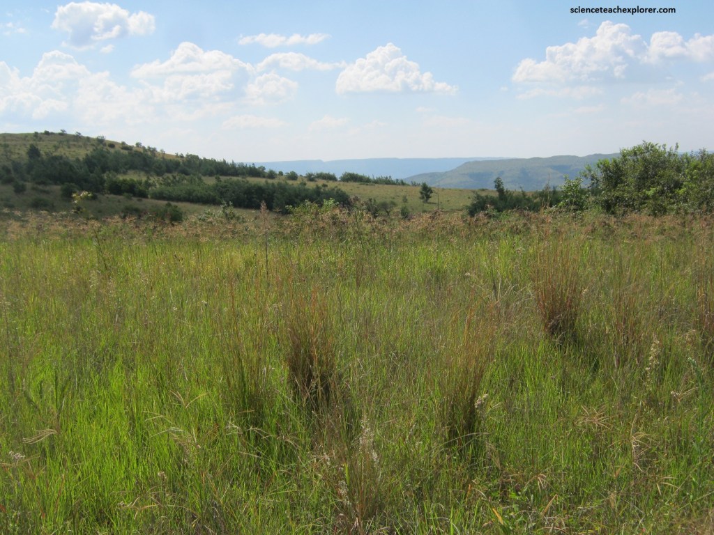
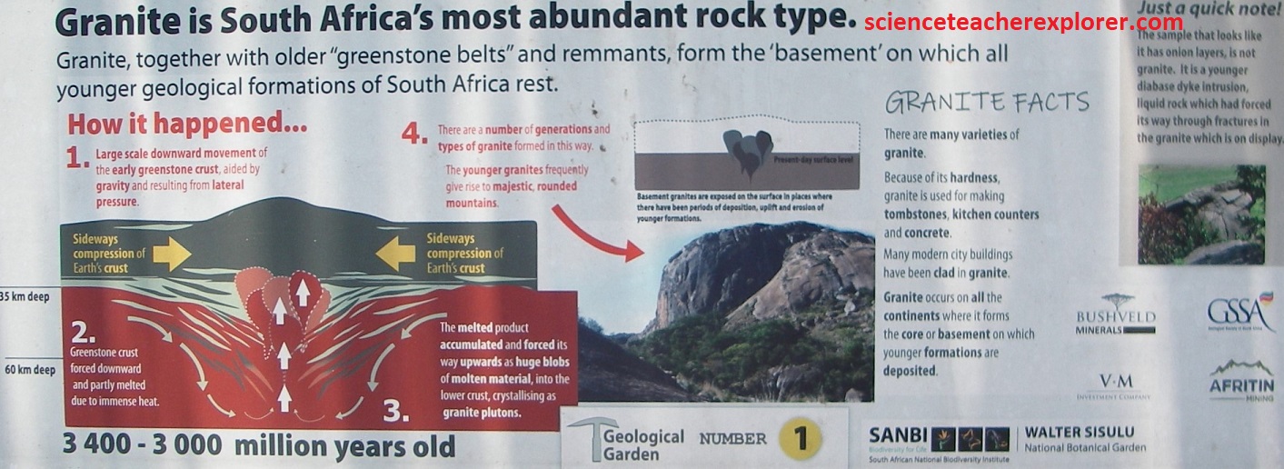
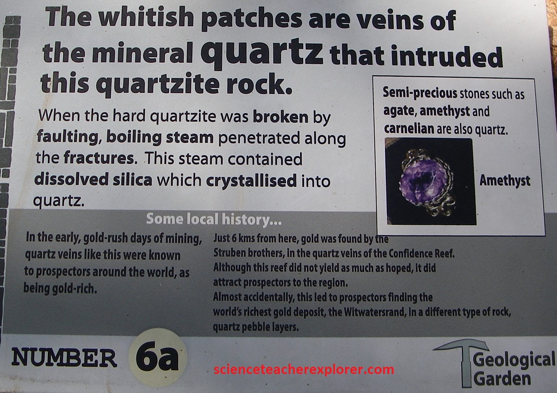
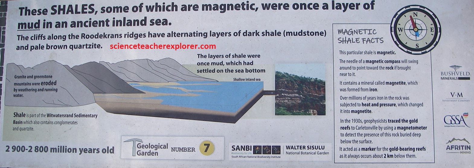
The Walter Sisulu National Botanical Garden is an ideal outdoor classroom for environmental and geological education, consisting of both landscaped indigenous gardens and wild unspoiled rocky Highveld grassland. Initially, the garden was called the Witwatersrand National Botanical Garden in 1986. The name ‘Witwatersrand’ was given to the area by the early Boer settlers, probably because of the whitish quartzite ridges that were the source of numerous streams, hence the ‘white ridge of waters’.
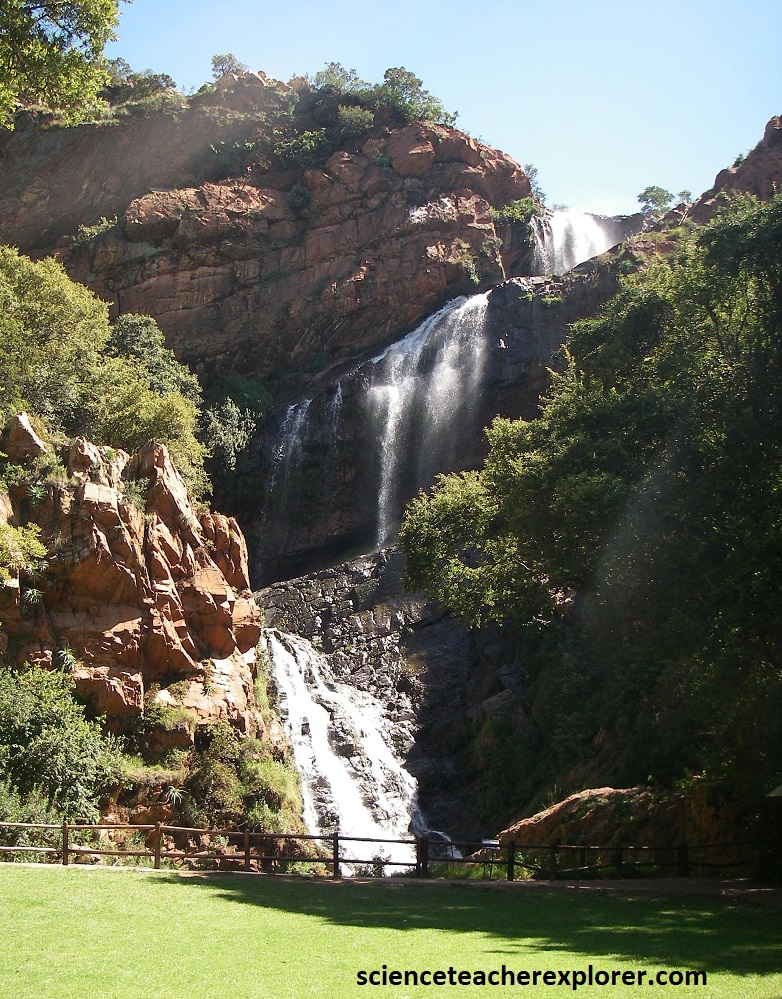
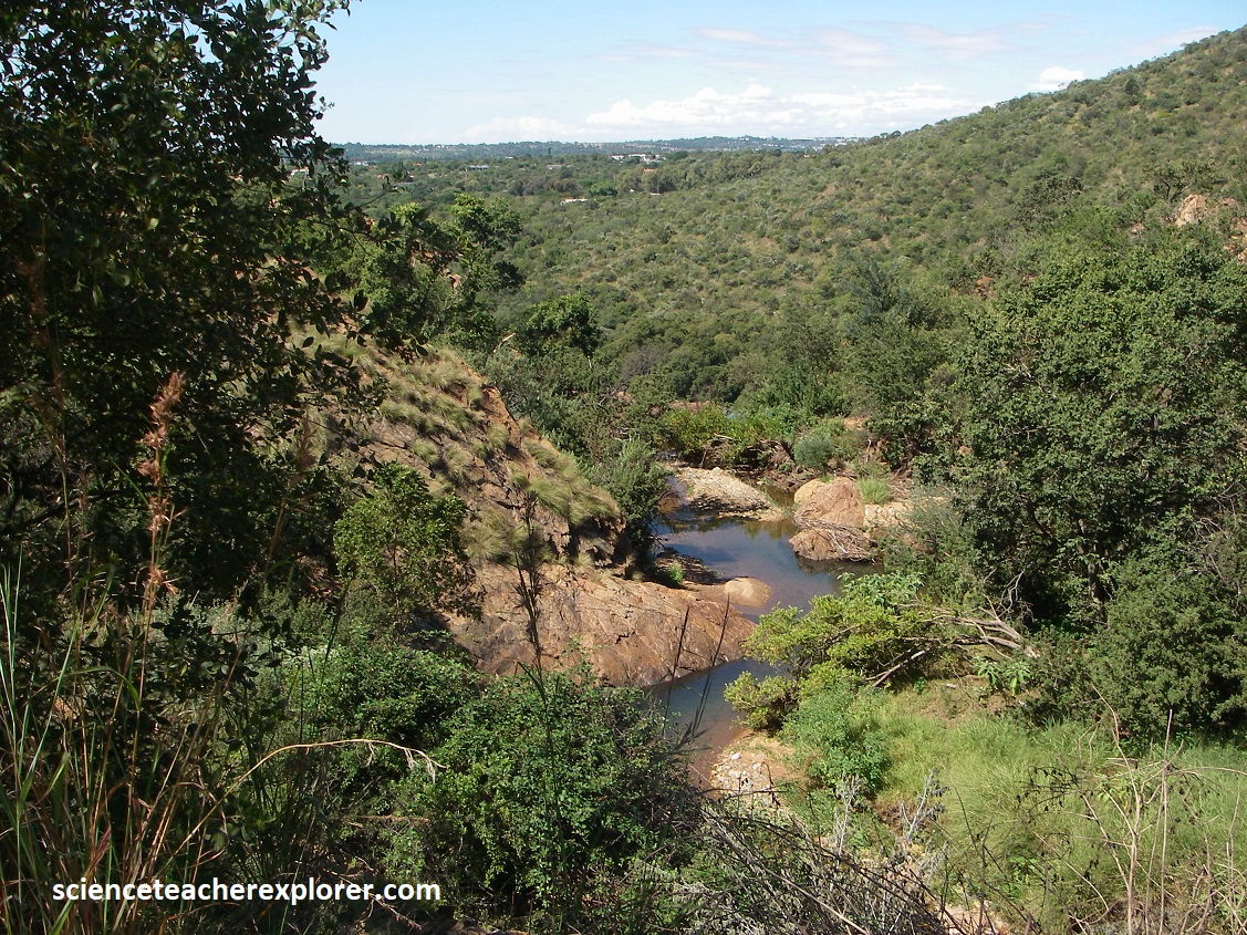
Pictured above, Wipoortjie Falls is at the headwaters of the Crocodile River, and is the iconic centerpiece of the botanical garden. This treasured conservation area is a microcosm of the natural environment that once existed along the pristine ridges and valleys of the Witwatersrand.
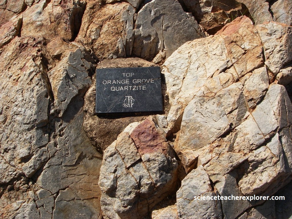
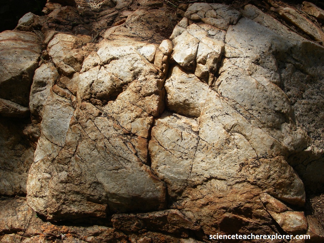
Pictured above, the cliff face on the northwestern side of Walter Sisulu National Botanical Garden is composed of quartzite of the Orange Grove Formation at the base of the Witwatersrand Supergroup, (a thick succession of ancient sedimentary rocks that contains the largest known deposits of gold in the world. The quartzite represents hardened sand beds that were laid down in an ancient shallow sea that covered this area years ago. Ripple marks, formed by wave action in sand on the floor of the ancient sea can be seen on the surfaces of the lower quartzite cliff face to the left of the waterfall, immediately above the pool.
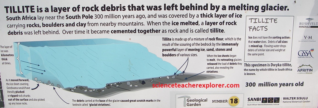
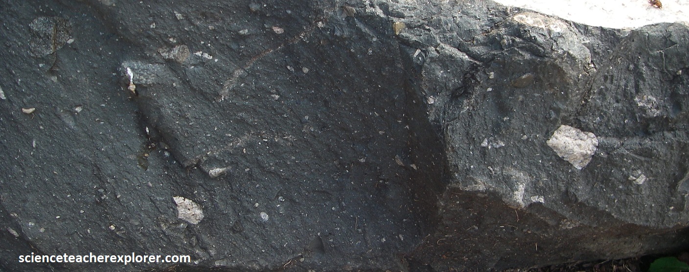
[Picture below is of an interpretive sign from the Geological Display Garden depicting the Quartzite Formation of the Witwatersrand Supergroup]:
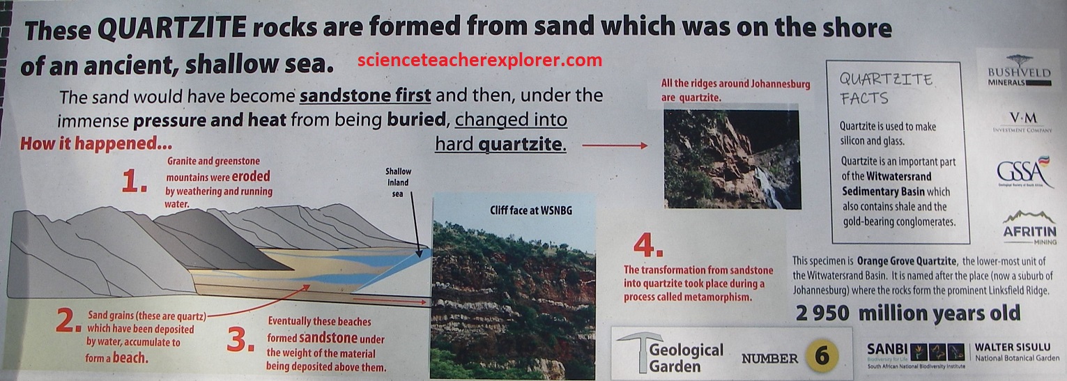
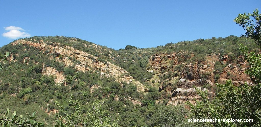
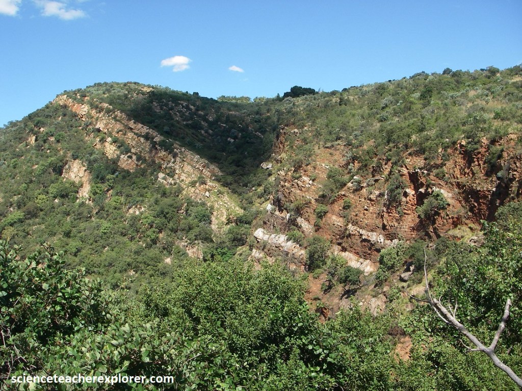
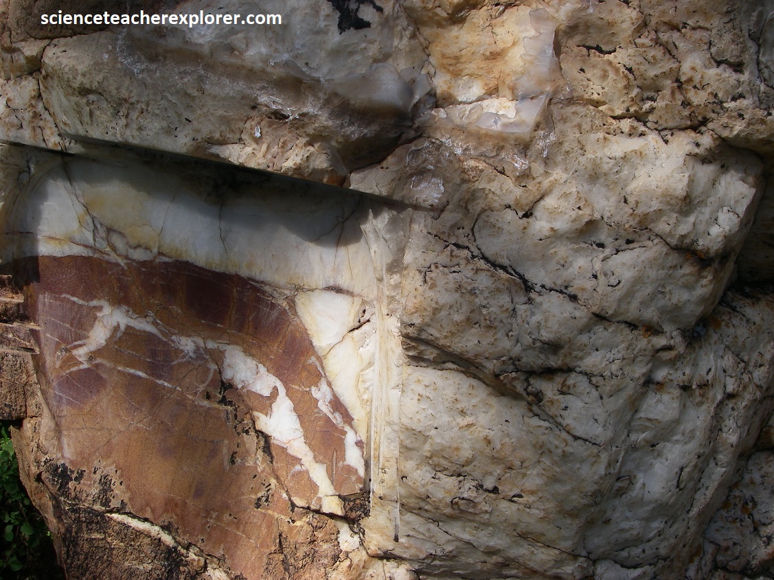
Pictured below, looking across at the exposed rock face, I could clearly see distinct layers of white quartzite and red shale beds in the lower part of the Witwatersrand Supergroup.
Pictured above, the white quartzite beds represent hardened sands that were deposited close inshore of an ancient shallow sea than covered this area some 2.95 billion years ago. In contrast, the shale beds represent muds that were deposited is deeper water offshore in this ancient sea. After deposition the beds were tilted and faulted by earth movement.

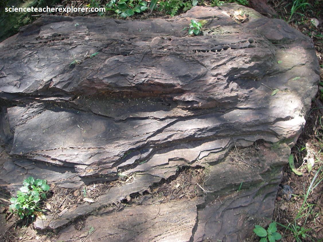
Pictured above and image below, the thickly overgrown gully on the other side of the valley is the trace of a fault. Notice how the layers of rock are displaced upwards on the left side of the fault relative to those on the right side.
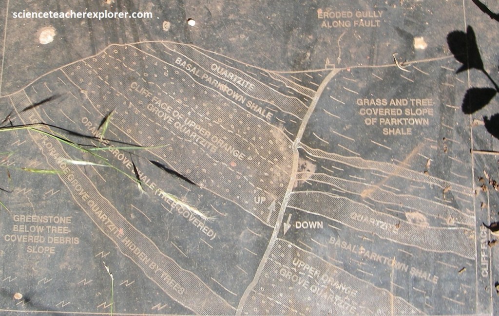
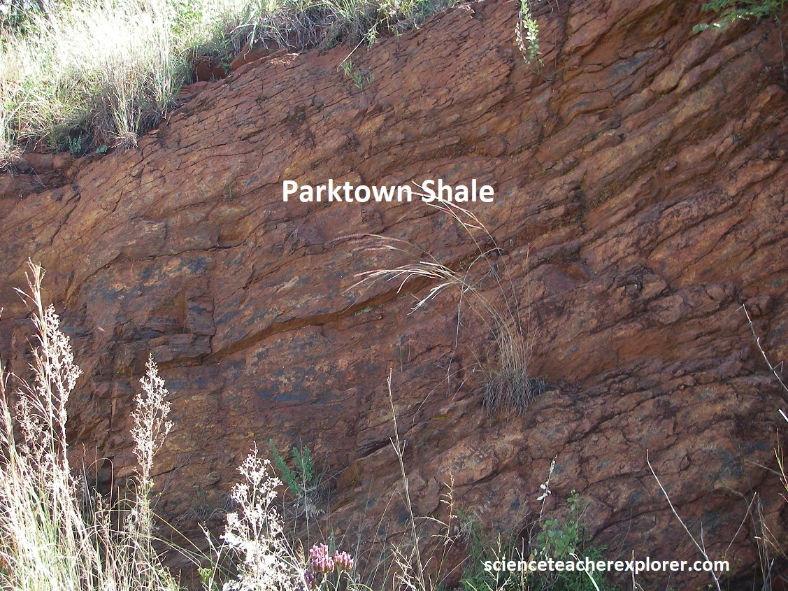
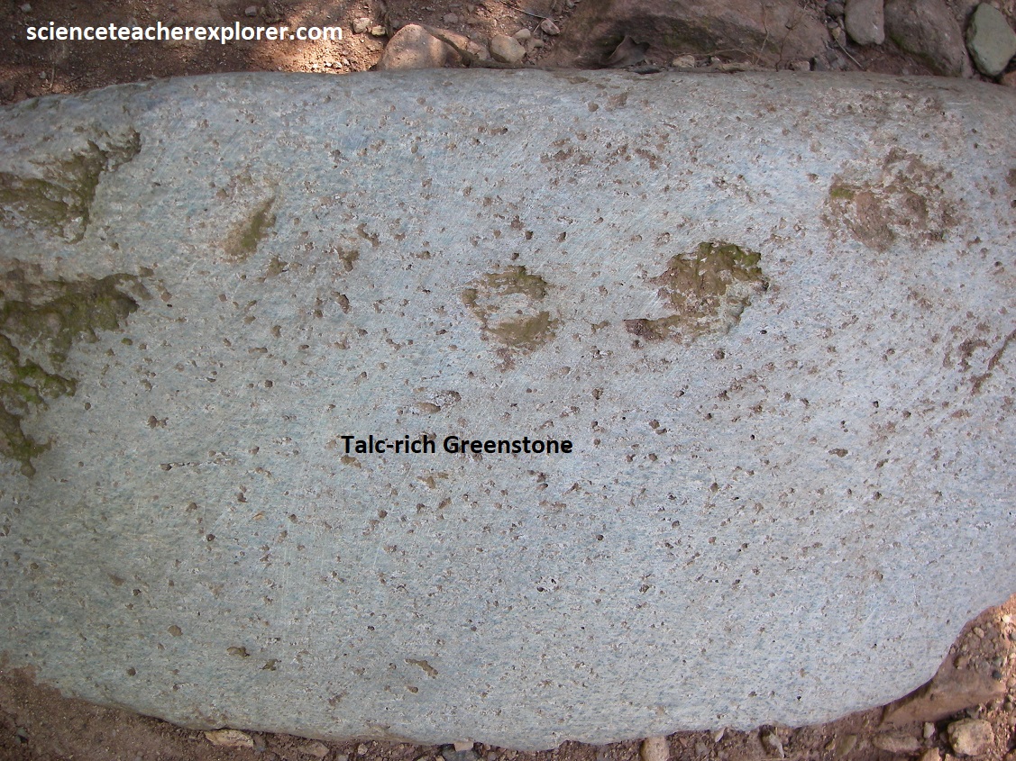
Pictured above, is the view above Witpoortjie Falls and Ridge of the Crocodile River in the northwest. Pictured top right is the iron-rich Parktown shale that lies above the quartzite near to top of the ridge, and also includes thin beds of quartzites. It weathers to a reddish-brown but is dark and slate-like when fresh, and was deposited in deeper, quieter water. Pictured bottom right is the greenstone, (a Archaeanage Roodekrans Complex ) that represents the ultramafic rocks that are some of the oldest rocks in South Africa at 2.95 billion years old. It can be seen as soft, slippery grey-colored talc schist outcrops beneath the quartzite close to the start of the steep trail to the top of the waterfall, (image below from an interpretive sign on-site).
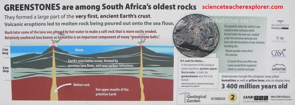
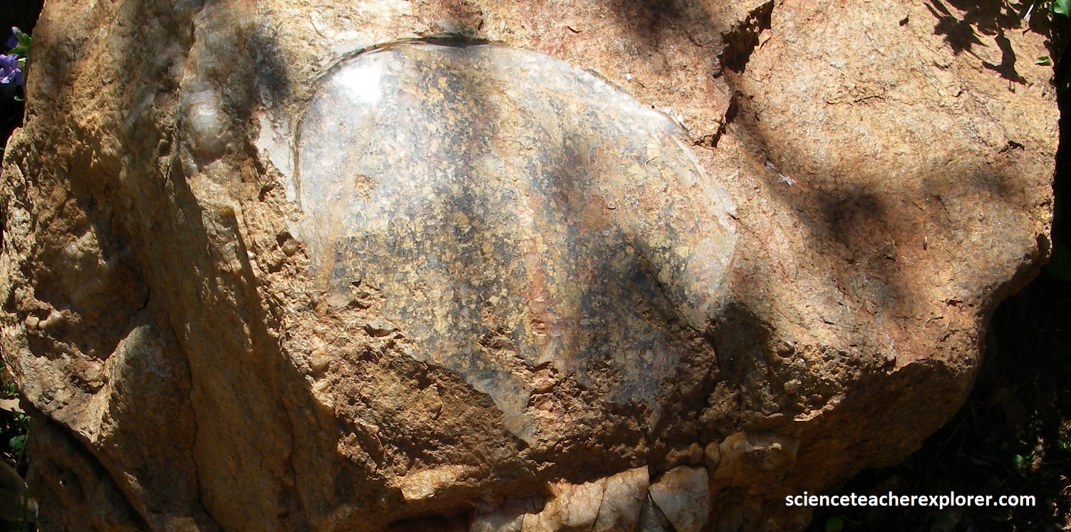
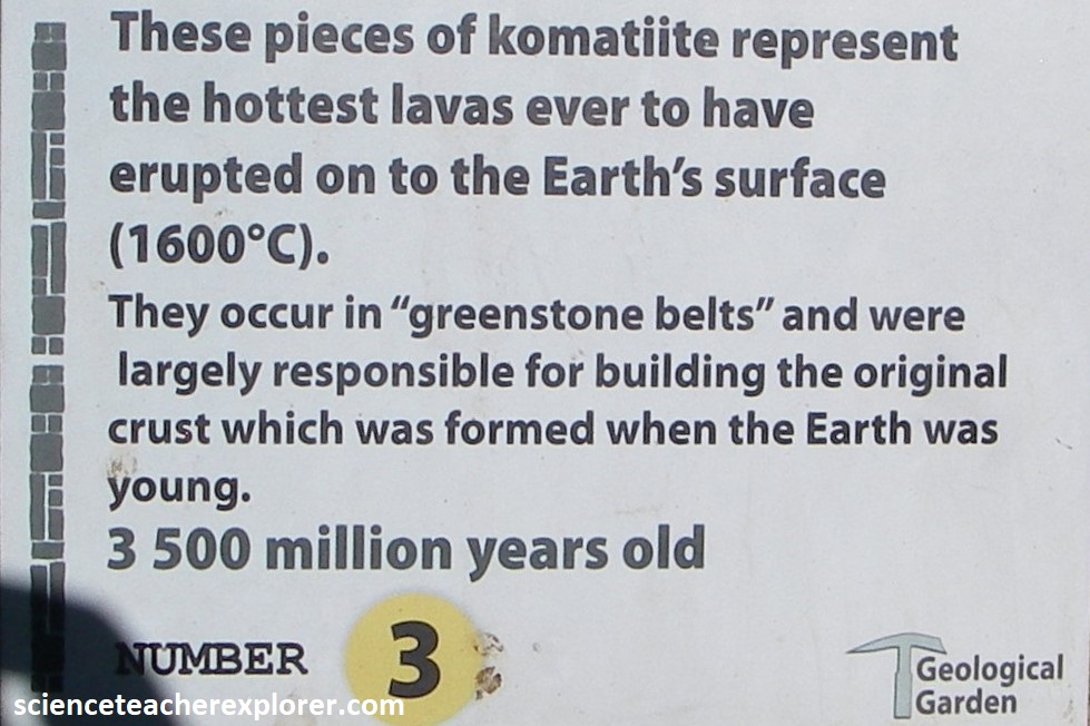
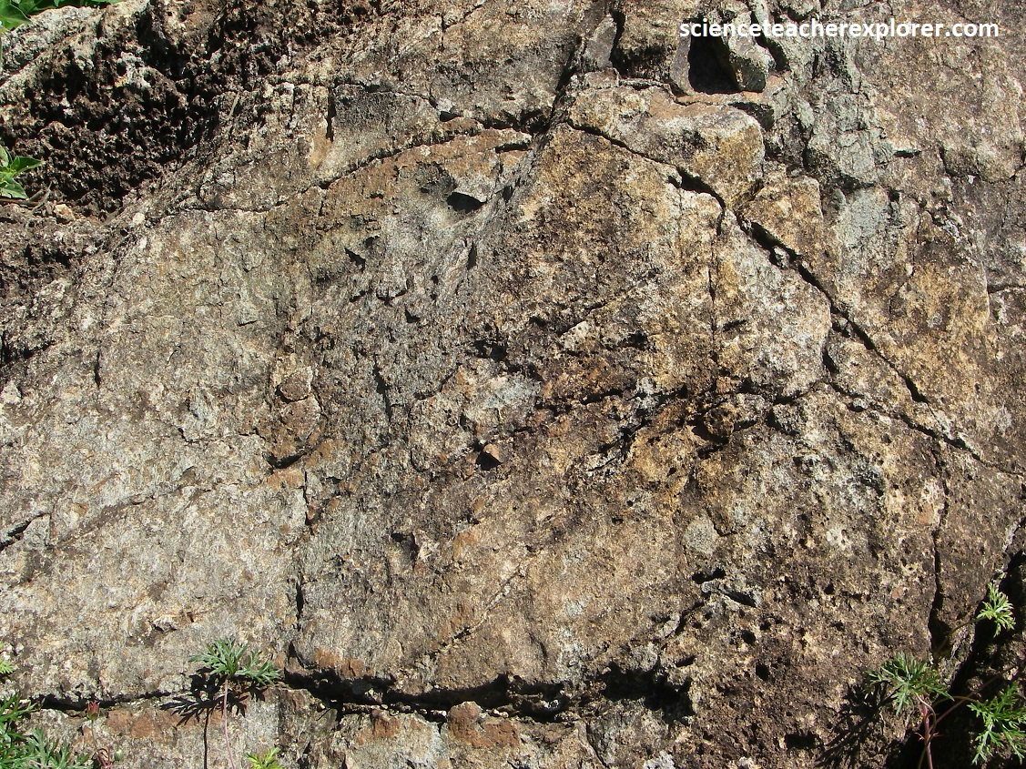
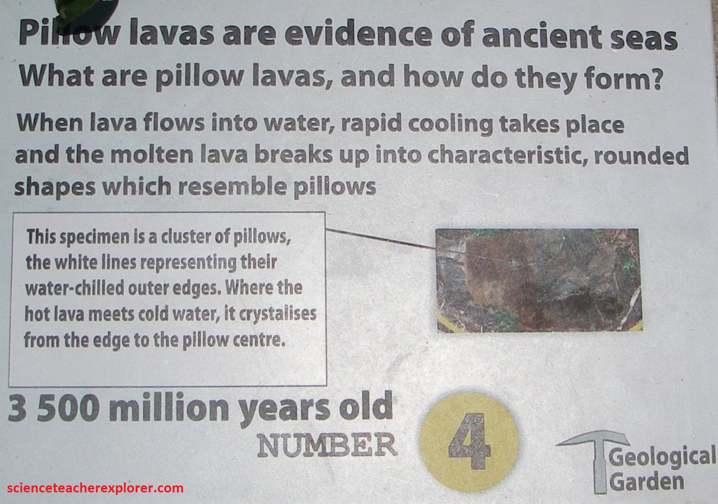
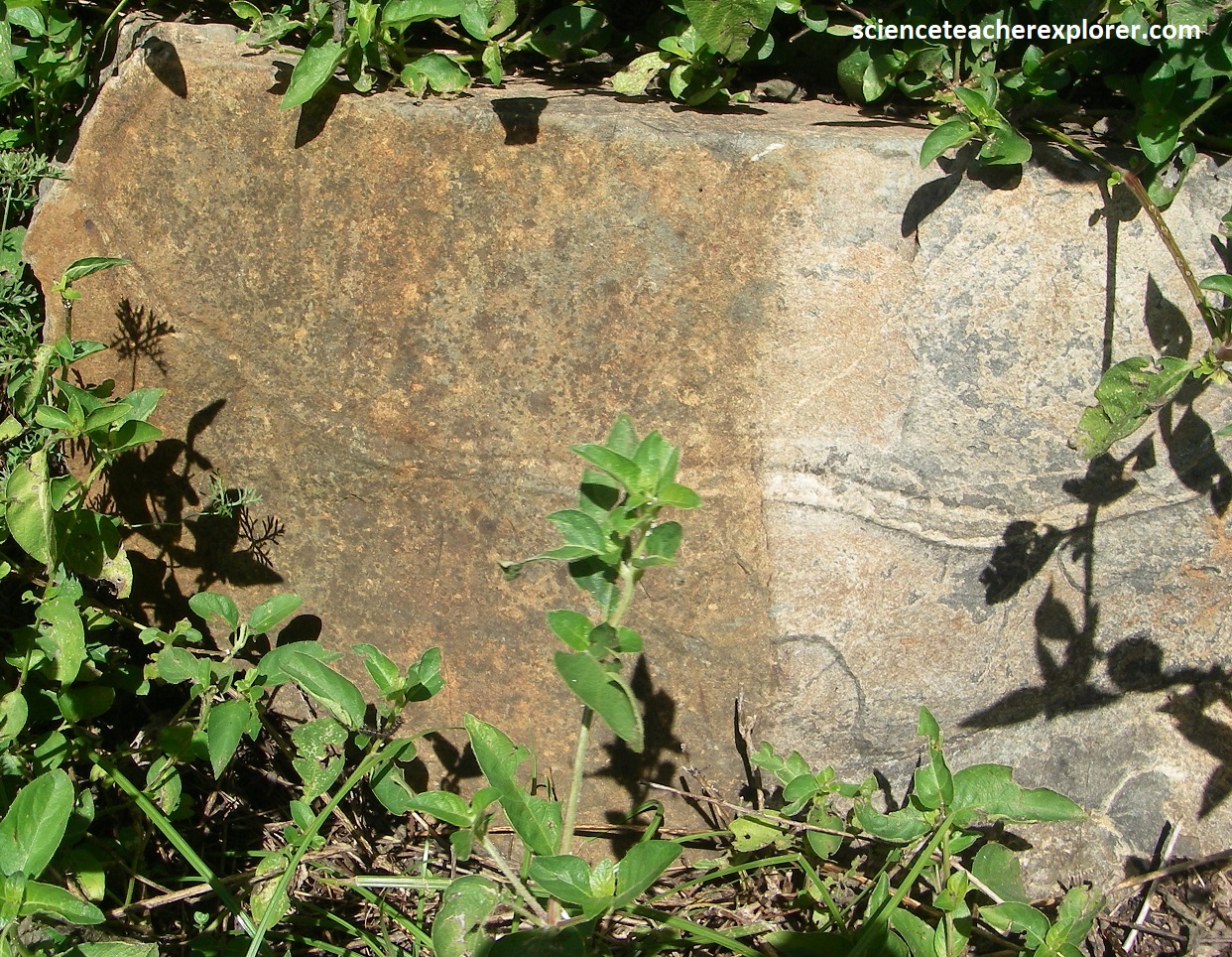
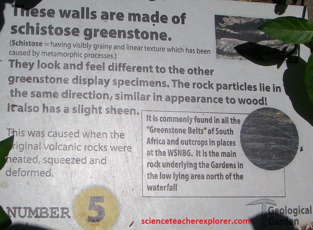
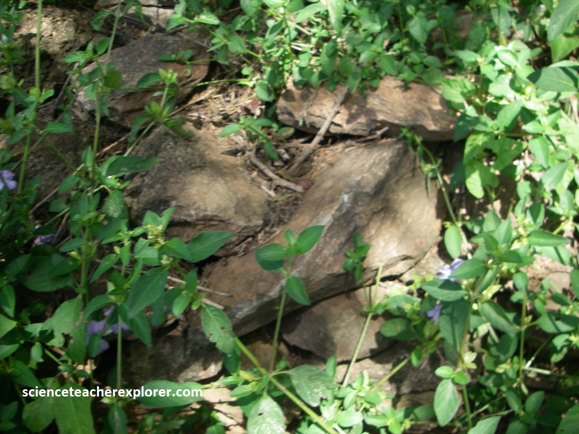
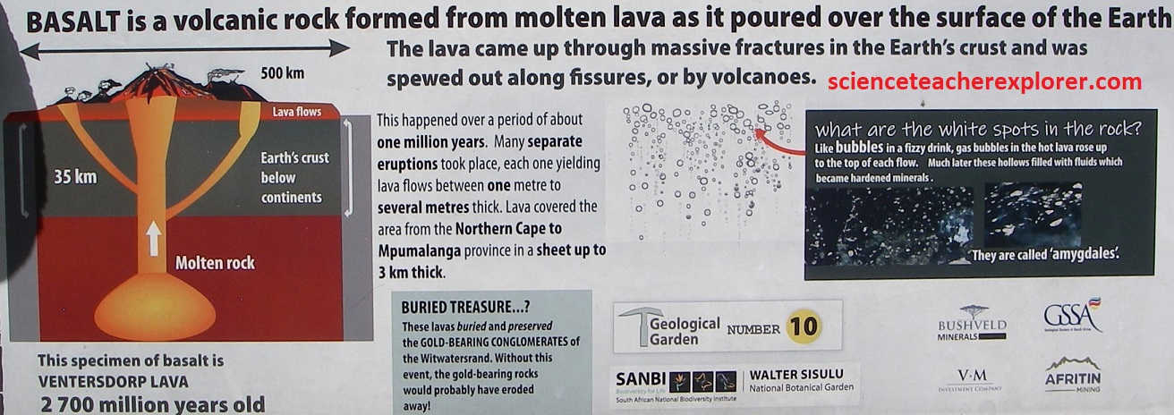
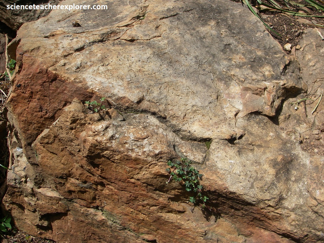
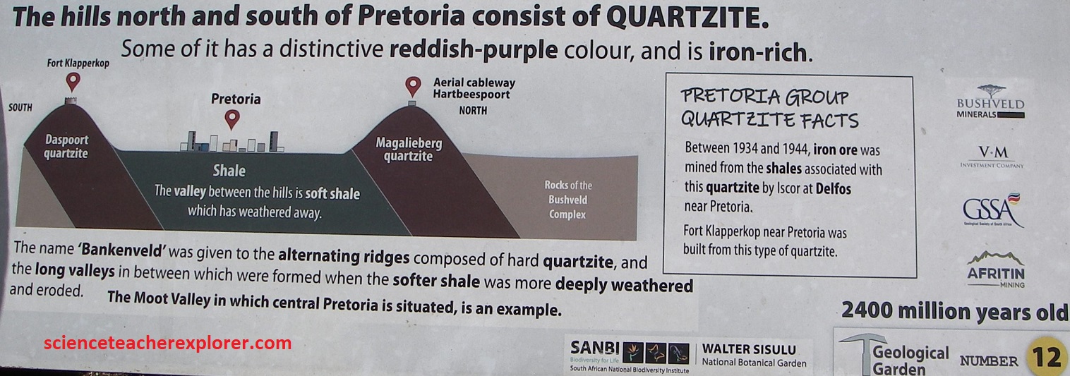
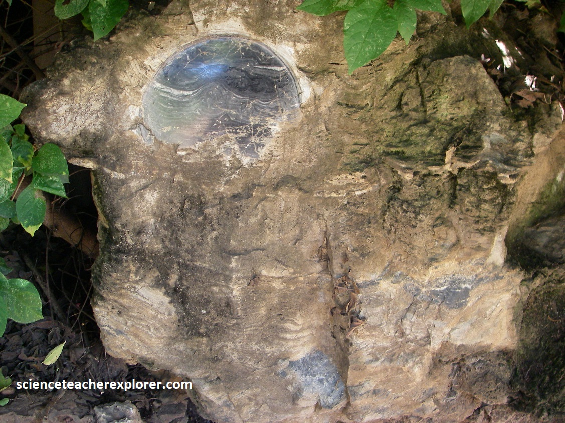
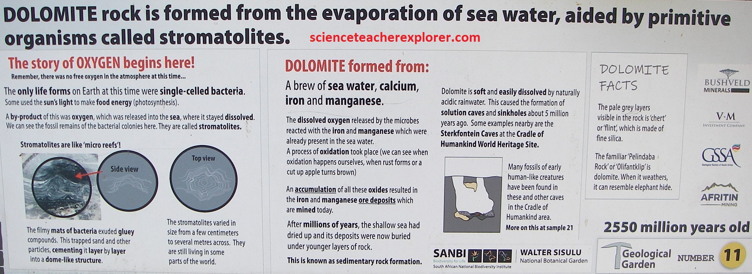
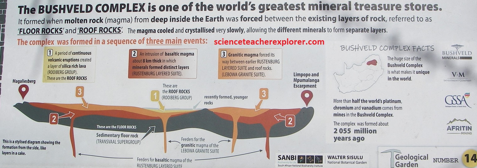
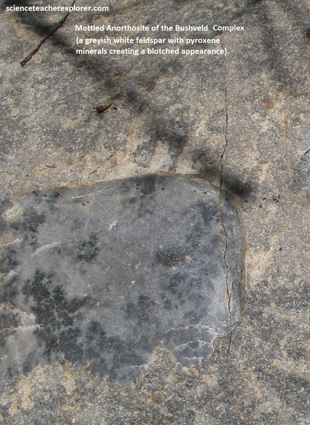
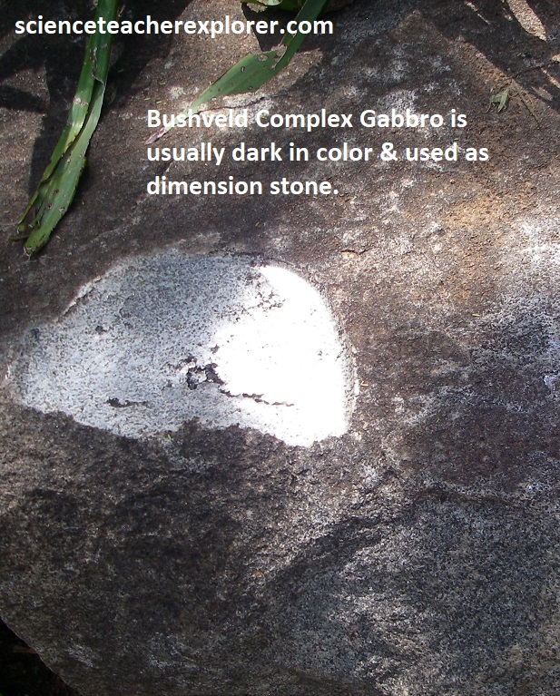
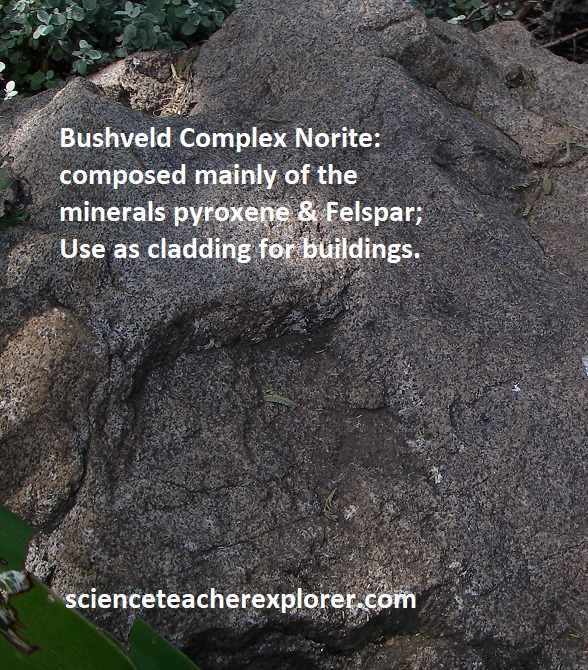
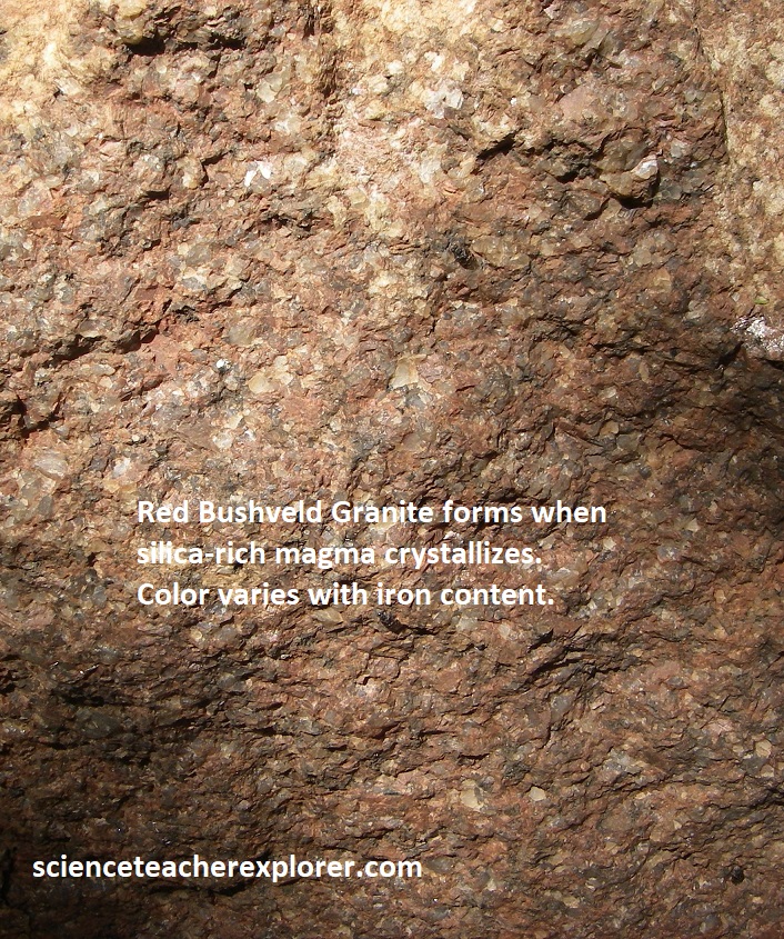
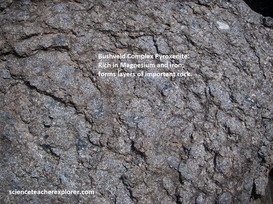
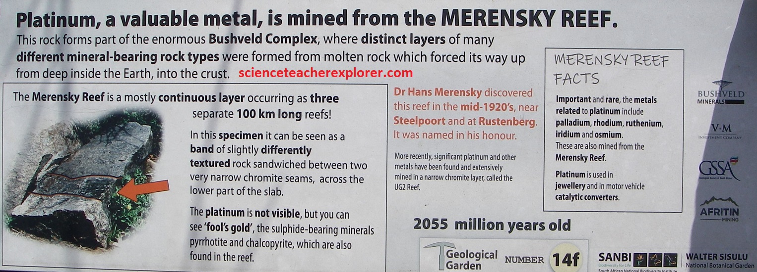
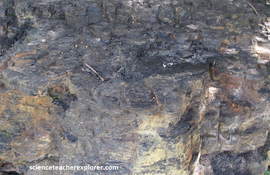
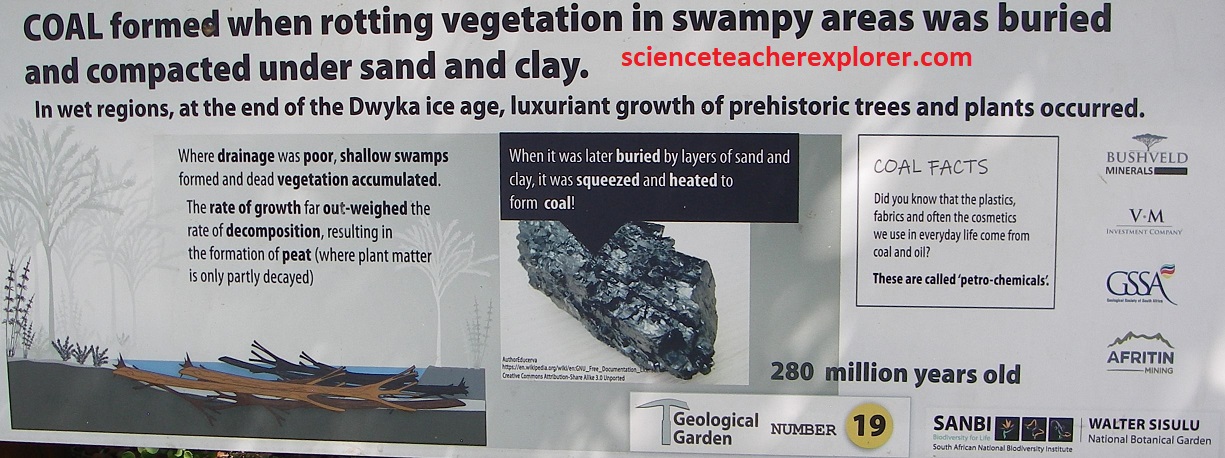
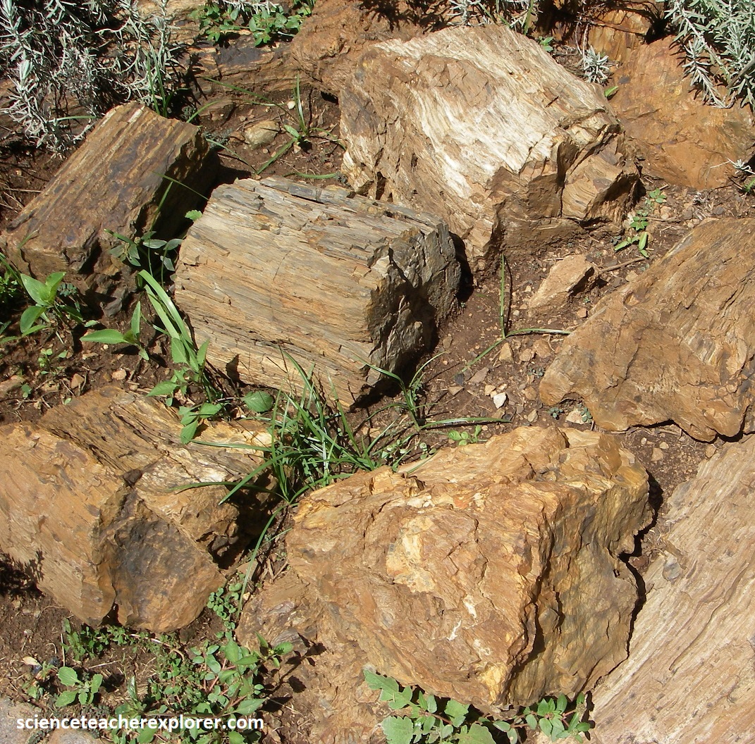
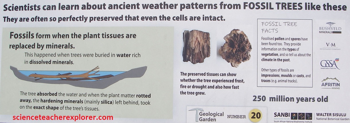
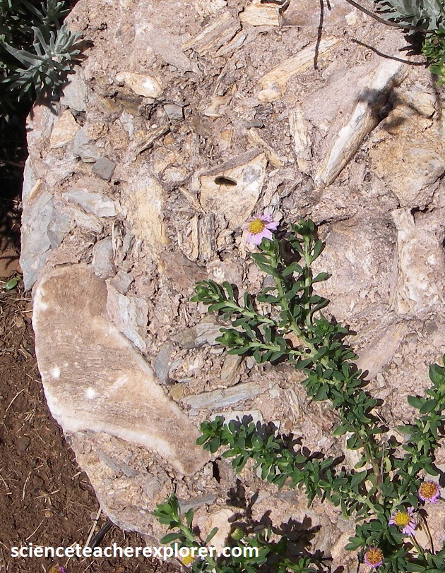
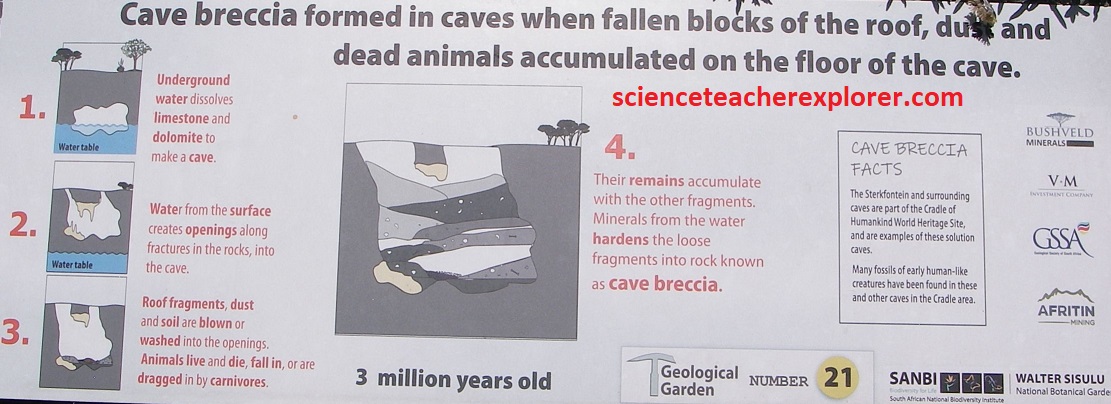
[Pictured below are additional interpretive signs & rocks found along the Geological Display Garden that is cleverly laid out along a meandering geological time-line from oldest to youngest, starting at 3.5 billion year old greenstone and ending at a 3.5 million year old, bone-bearing cave breccia that forms 14 of South Africa’s most important geological formations]:


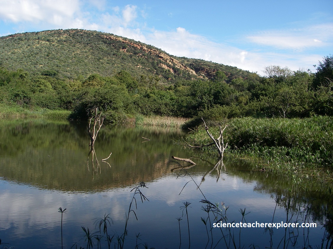
Pictured below is a beautiful pond that we trekked to at the Walter Sisulu Botanical Garden in Gauteng, South Africa 2024 with the Giant African Pied Kingfisher roosting in a tree: