Namib Desert, NA 2025
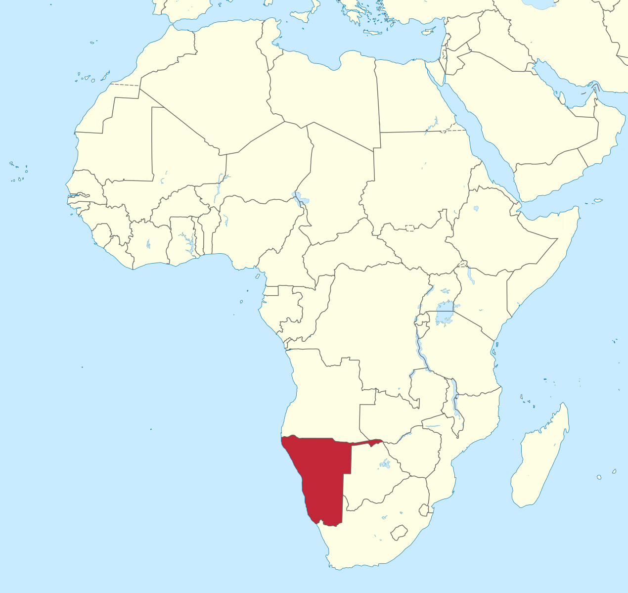
In June of 2025, I had the opportunity to explore the Namib Desert of Namibia. It actually stretches south from southern Angola to the Orange River in South Africa.
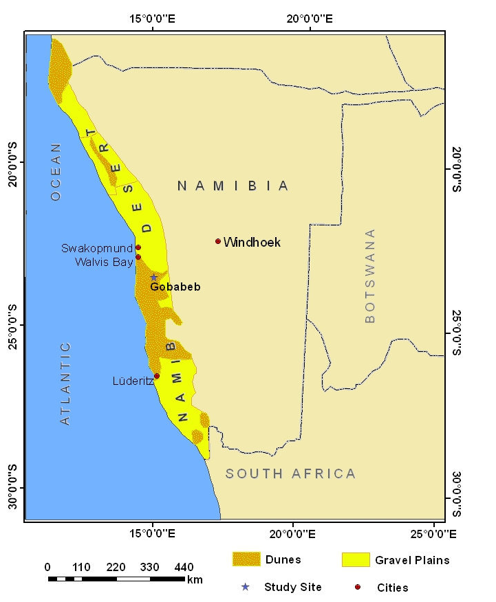
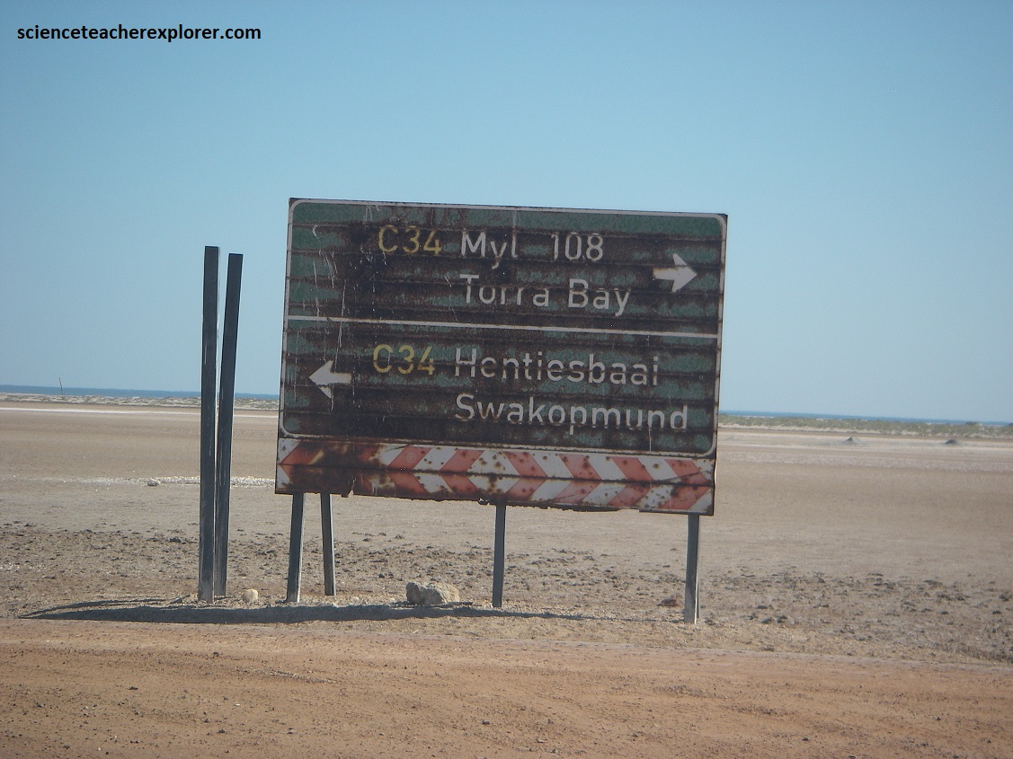
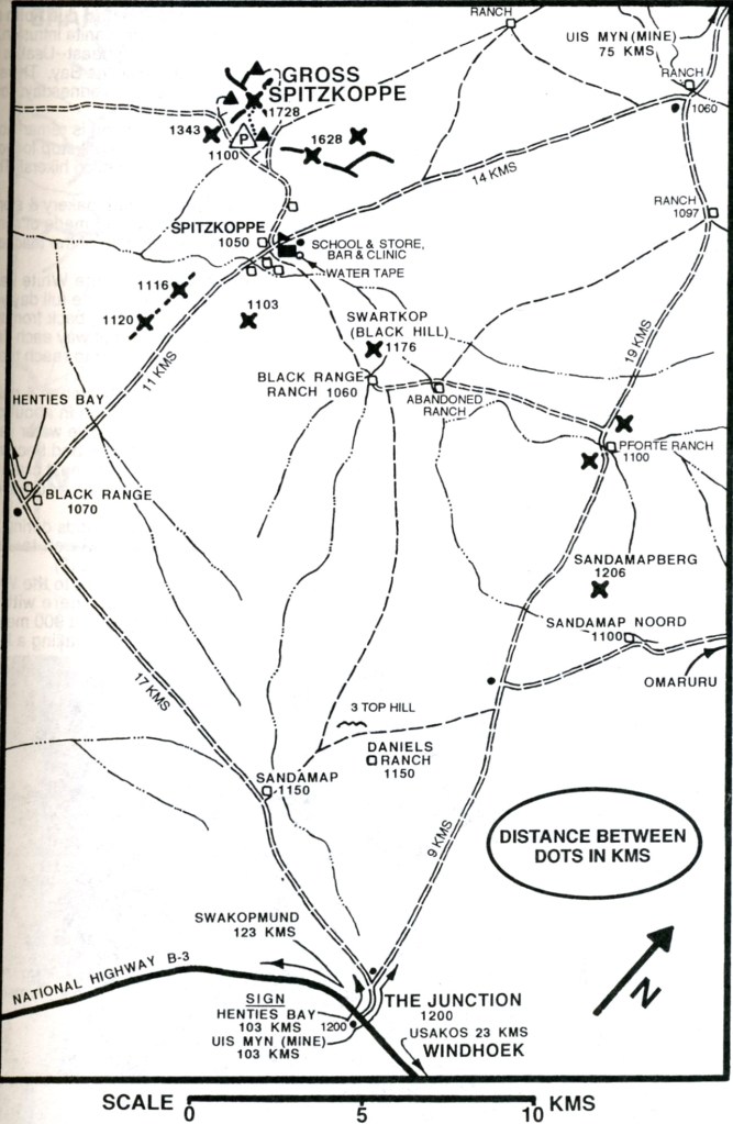
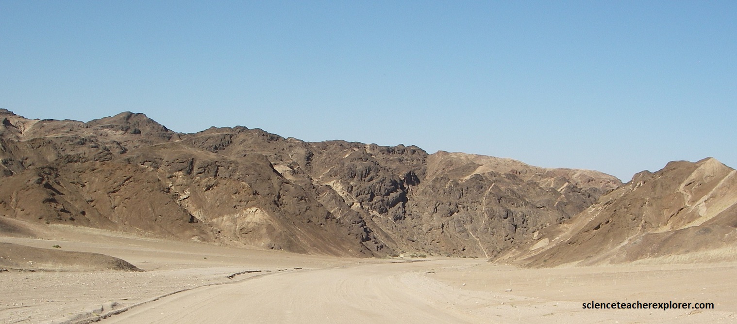
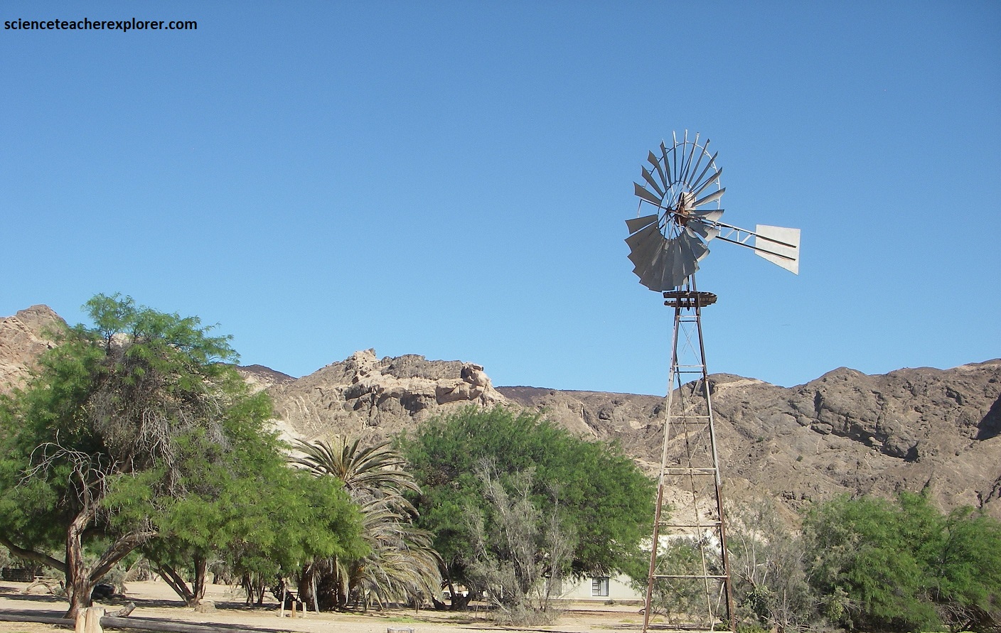
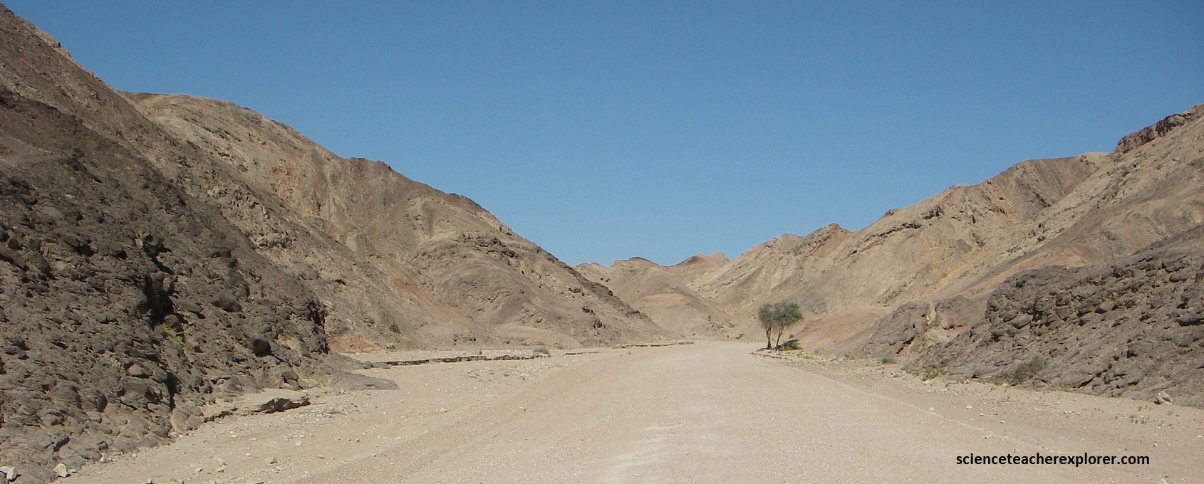
I entered the Namib Desert region on the graveled road of D2303. I had just came from village called Uis and drove west on D2303, that cut south & southwest of the giant batholith/mountain called Brandberg. I was set to intersect with the tarred road, C34, at the Namibian Coast, within the Namib Desert, (pictured below at the top of the map).
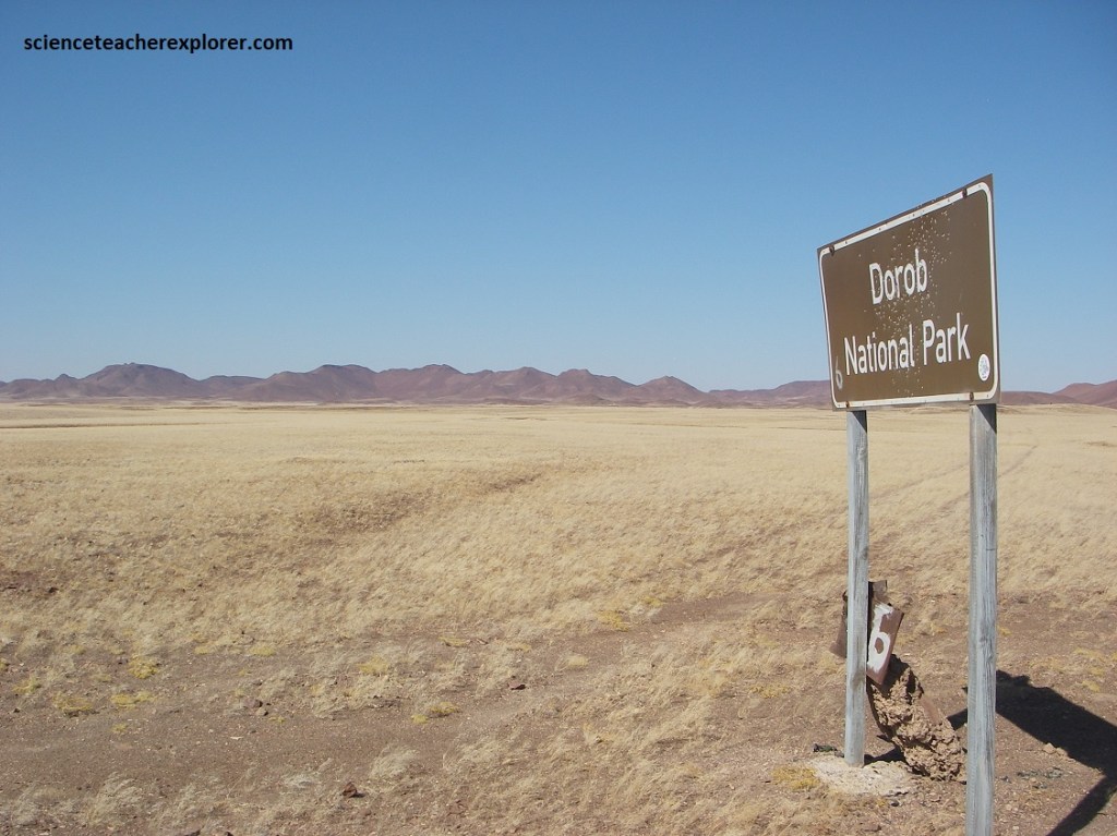
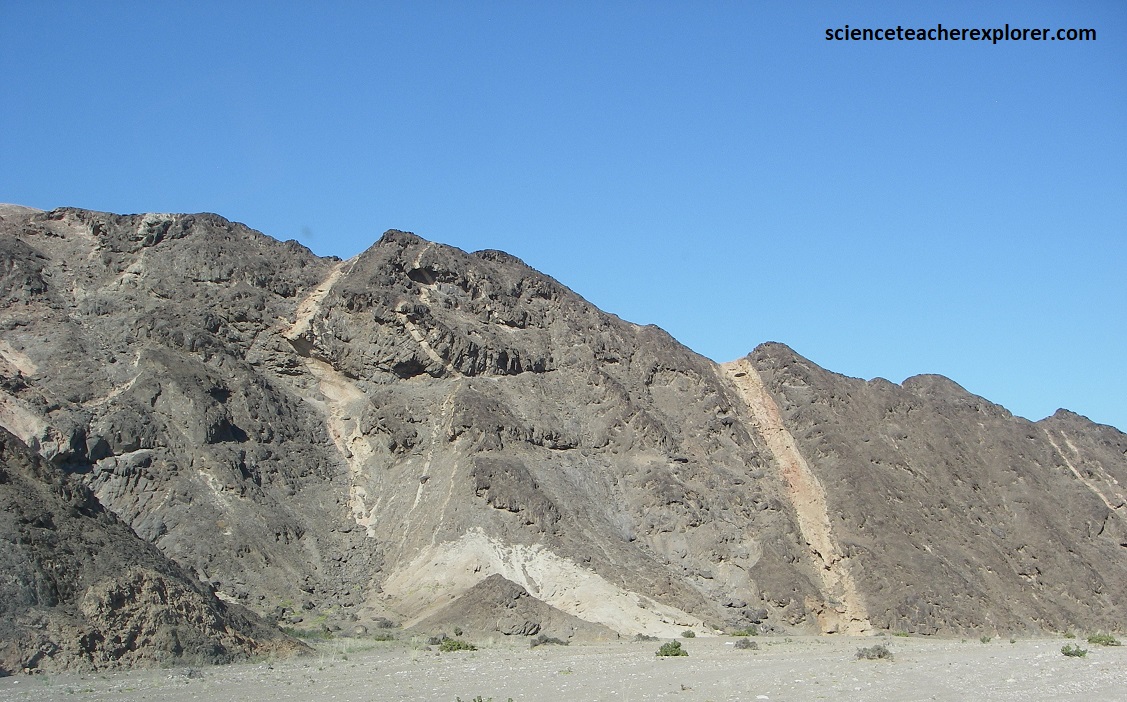
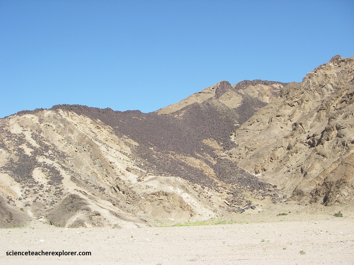
Before reaching the D2303/C34 intersection, I noticed that we had crossed the “Dorab National Park” boundary. Pictured below are the remnants of Messum Crater. Messum is a volcanic feature that forms part of the Goboboseb Mountains to the north-east. It dates from the Etendeka period and was the source of many of the intrusive and quartz-like extrusive rocks found in the area today. Messum Crater is composed of both intrusive and extrusive rocks and was formed between 132 and 135 million years old at the beginnings of the separation of Gondwanaland & the formation of the Atlantic Ocean. It has the approximate diameter of 18 km.
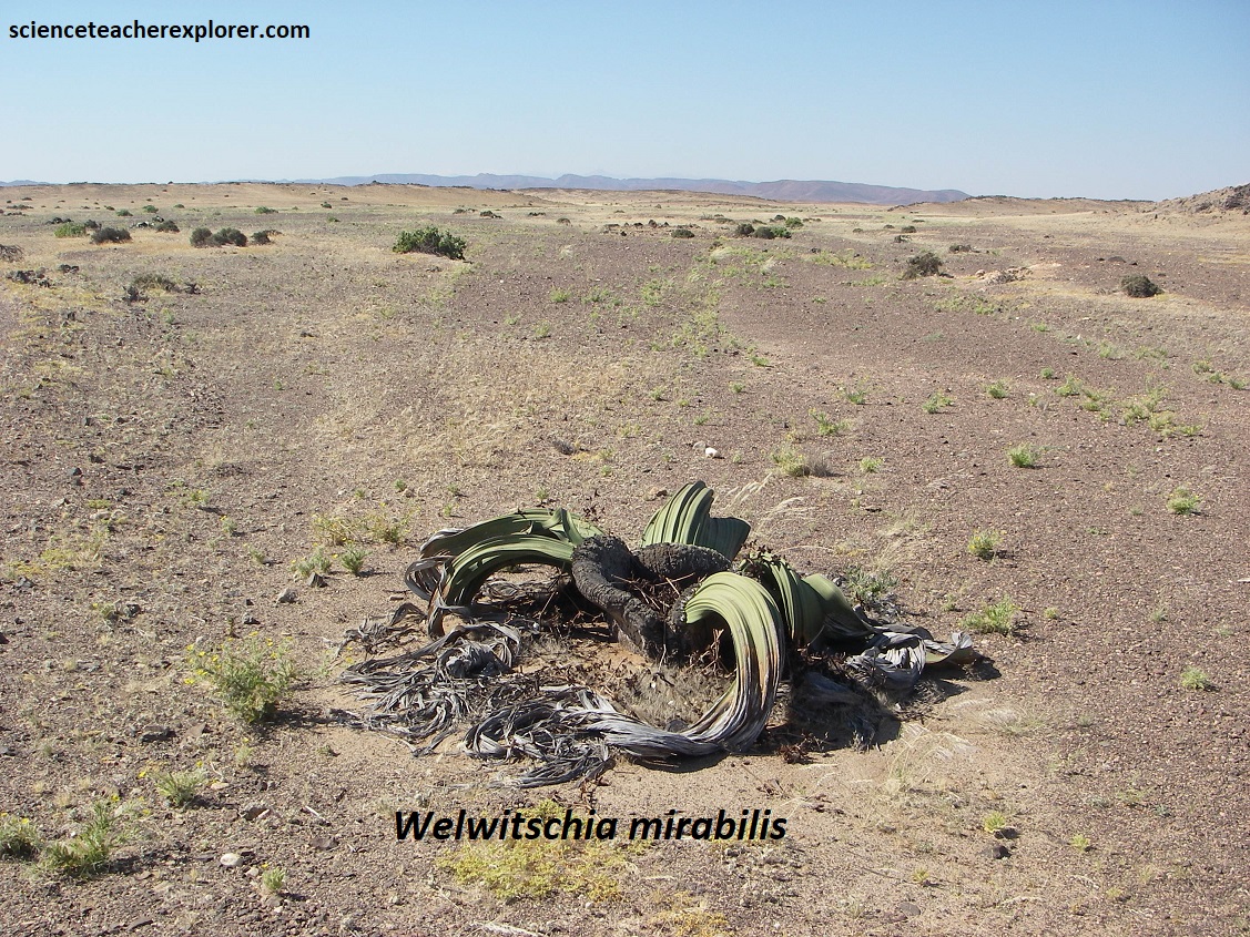
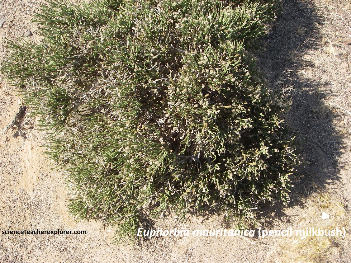
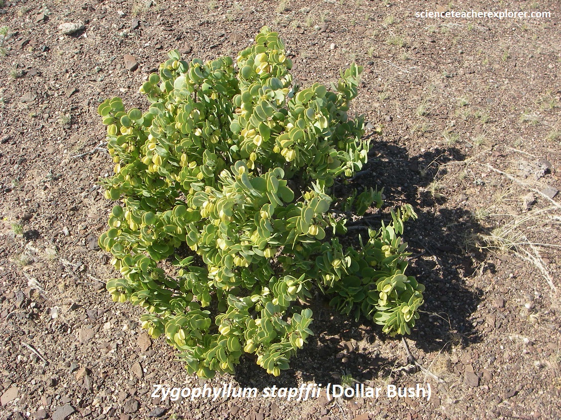
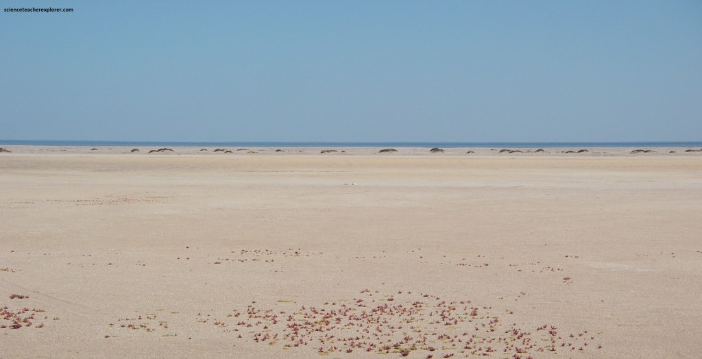
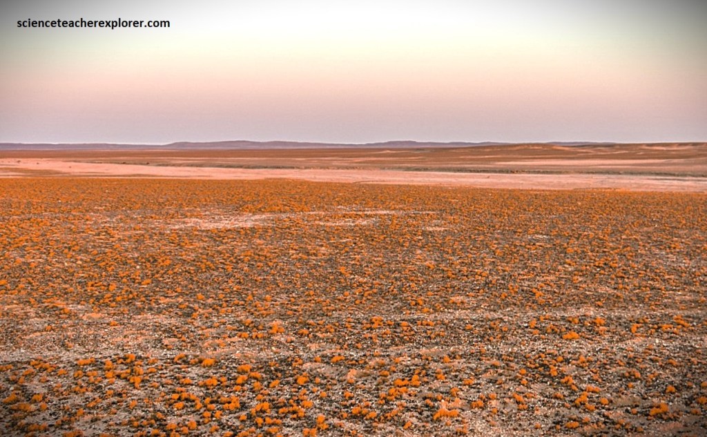
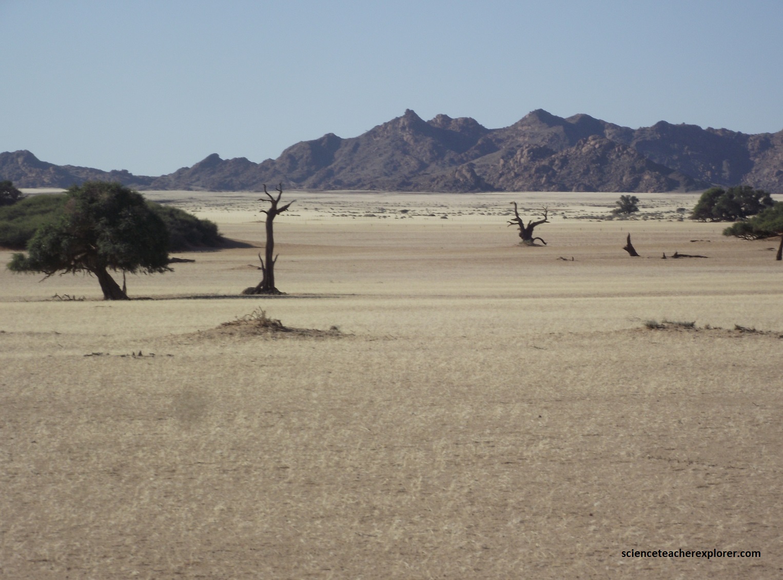
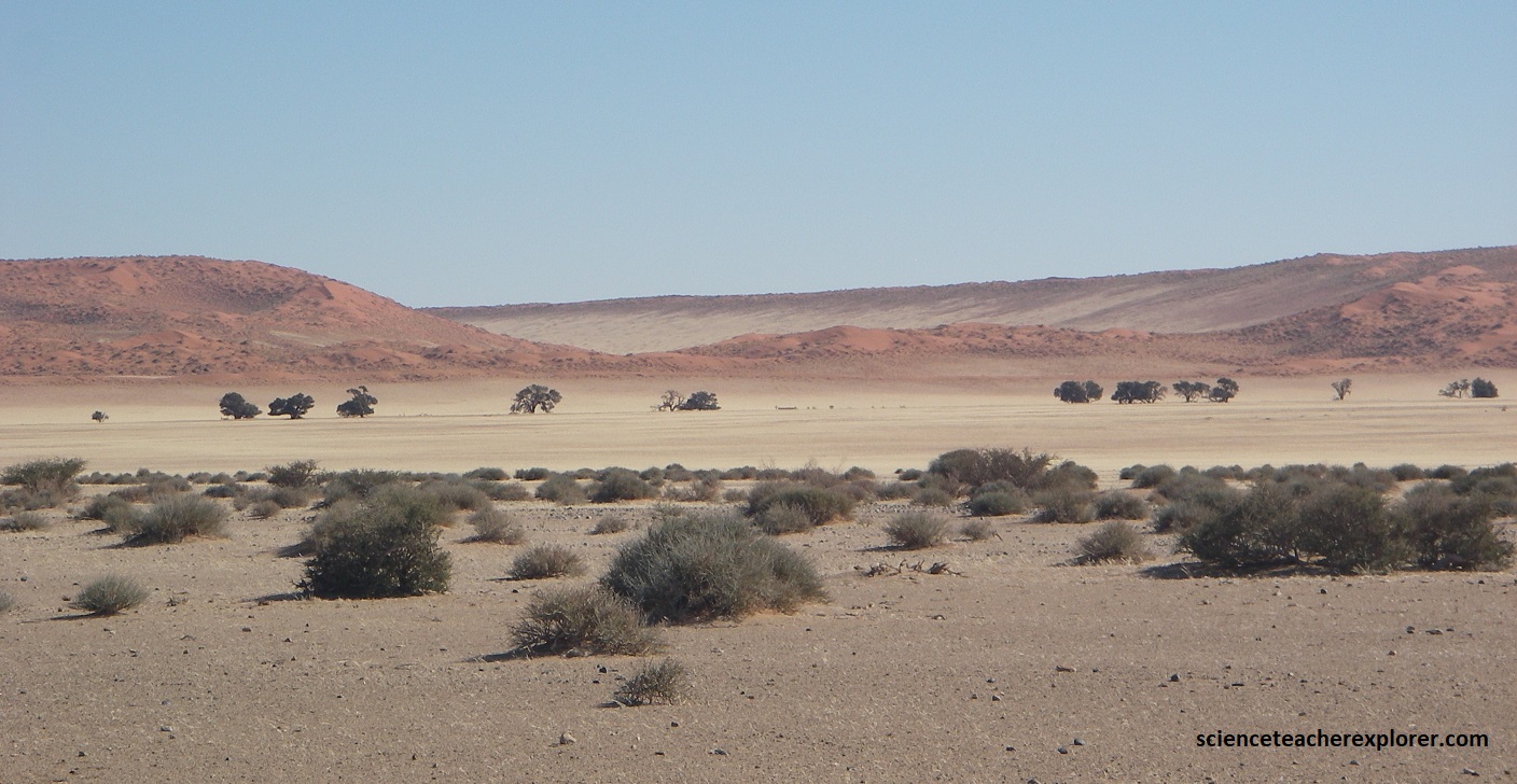
As I approached the D2303/C34 intersection, (Mile 108), I noticed the strange endemic plants were all over the ground next to the road within the Namib Desert. Most were succulents that were specialized to store water and save it for later. This allows them to grow in hot, dry areas and survive for long periods without rain. Pictured below, many of these plants have developed large swollen stems in which they store water. Others, such as aloes and plakkies store water in their fleshy leaves. Note that the animals like to eat the juicy leaves of succulents. However, the spines and poisonous milky sap of some plants protect them, (picture below).
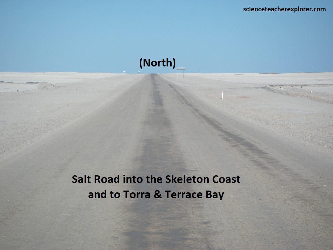
At the intersection of D2303/C34, I turned left, (south), towards the sand dunes of the Namib Desert. However, north on C34 was infamous ‘Skeleton Coast’, (pictured below).
The Skeleton Coast is a long shoreline sandwiched between the Atlantic Ocean and the Namib Desert. It is bathed by the cold Benguela Current that sweeps icy water from the Antarctic northward along southern Africa’s west coast. Offshore winds cause upwellings of nutrients from the deep sea, providing a wealth of food for unexpected numbers of animals. Fur seals and seabirds breed here, next to waters crammed with shoals of anchovies, sardines, and mullet.
Pictured above, it is the extraordinary number of wrecks for which the Skeleton Coast is famous. It is strewn with ocean liners, galleons, and clipper ships, victims of tumultuous seas, thick fogs, and jagged reefs.
Ever since the Portuguese seafarer Diogo Cau sailed down the Namibian coast in 1486, this stretch of coastline got the reputation of being treacherous. Remains of ships from over 400 years ago to modern day letter the beaches of the northern Skeleton Coast. An anonymous “help” message on a piece of slate dated 1860, found beside 12 headless skeletons in 1943, is just one of many mysteries that haunt this shoreline.
Between 1900 and 2023, more than 65 vessels were lost in the 700km stretch of coast between Swakopmund and the Kunene River and at least 63 seafarers lost their lives. Two-thirds of the wrecks occurred between 1965 and 1978, all of them were fishing boats. However, the popular name arose when a Swiss pilot, on a flight from Cape Town to London, crashed here and a journalist suggested his bones would be somewhere on the “skeleton coast.” The pilot was never found but the name stuck.
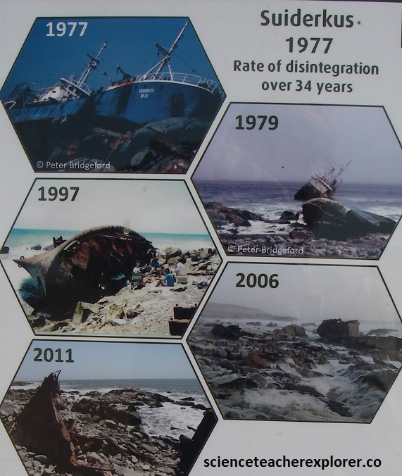
Why are there so few visible shipwrecks now? This is because the lifespan of a shipwreck is usually less than 30 years. Wooden craft break apart soon after the wrecking. Steel-hulled vessels rust away quickly and break apart. Pieces are swept away by the strong current and buried under sand. Some wrecks have been salvaged for scrap, (pictured below).
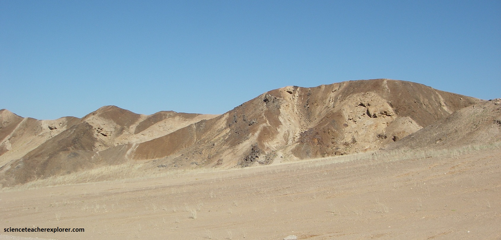
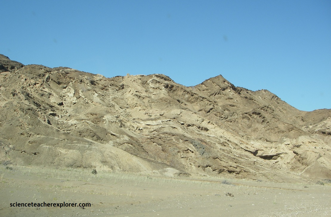
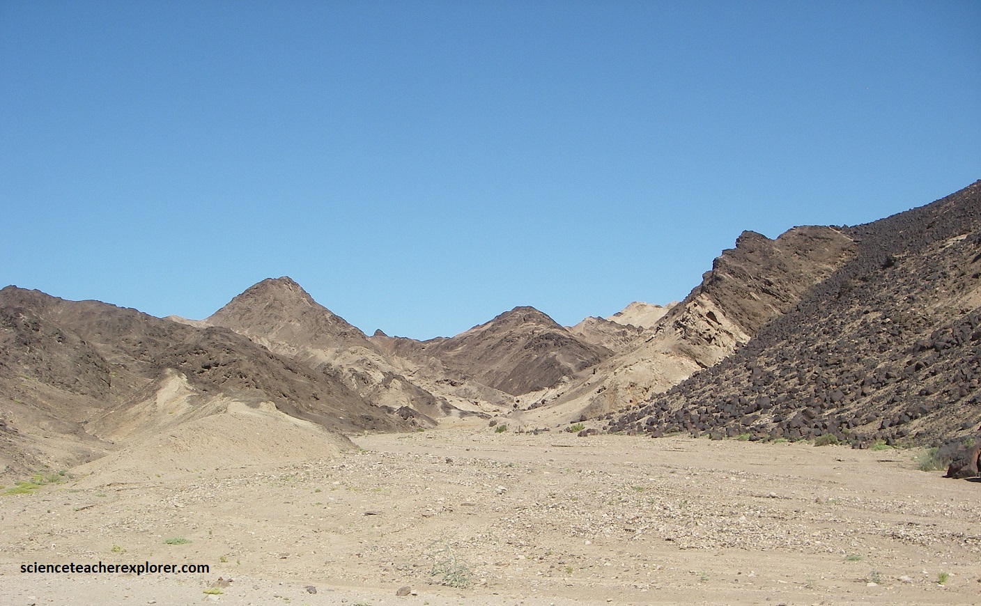
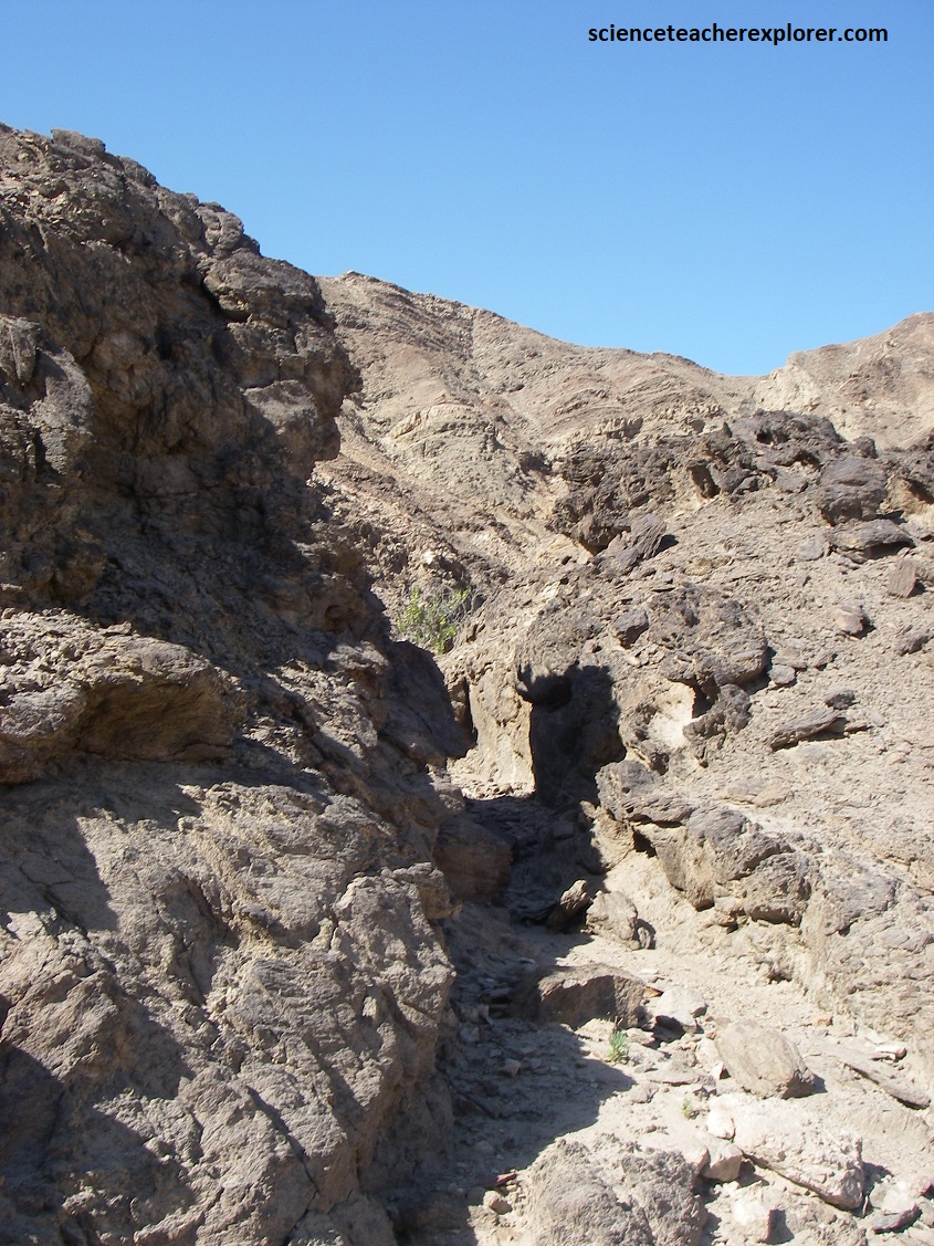
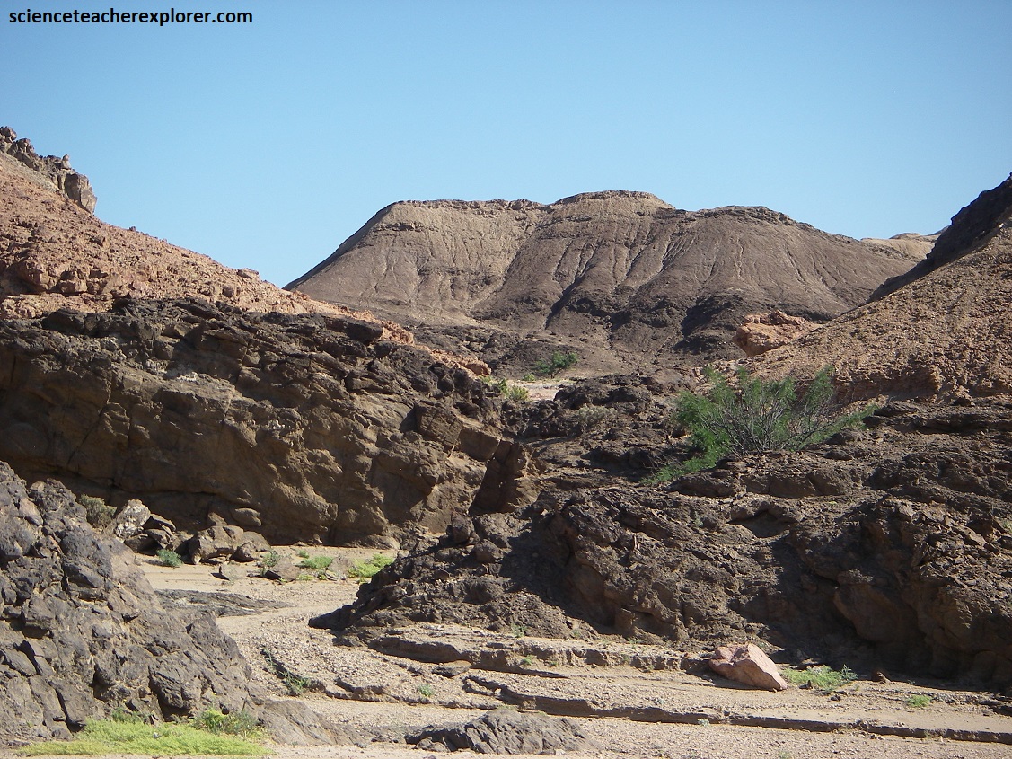
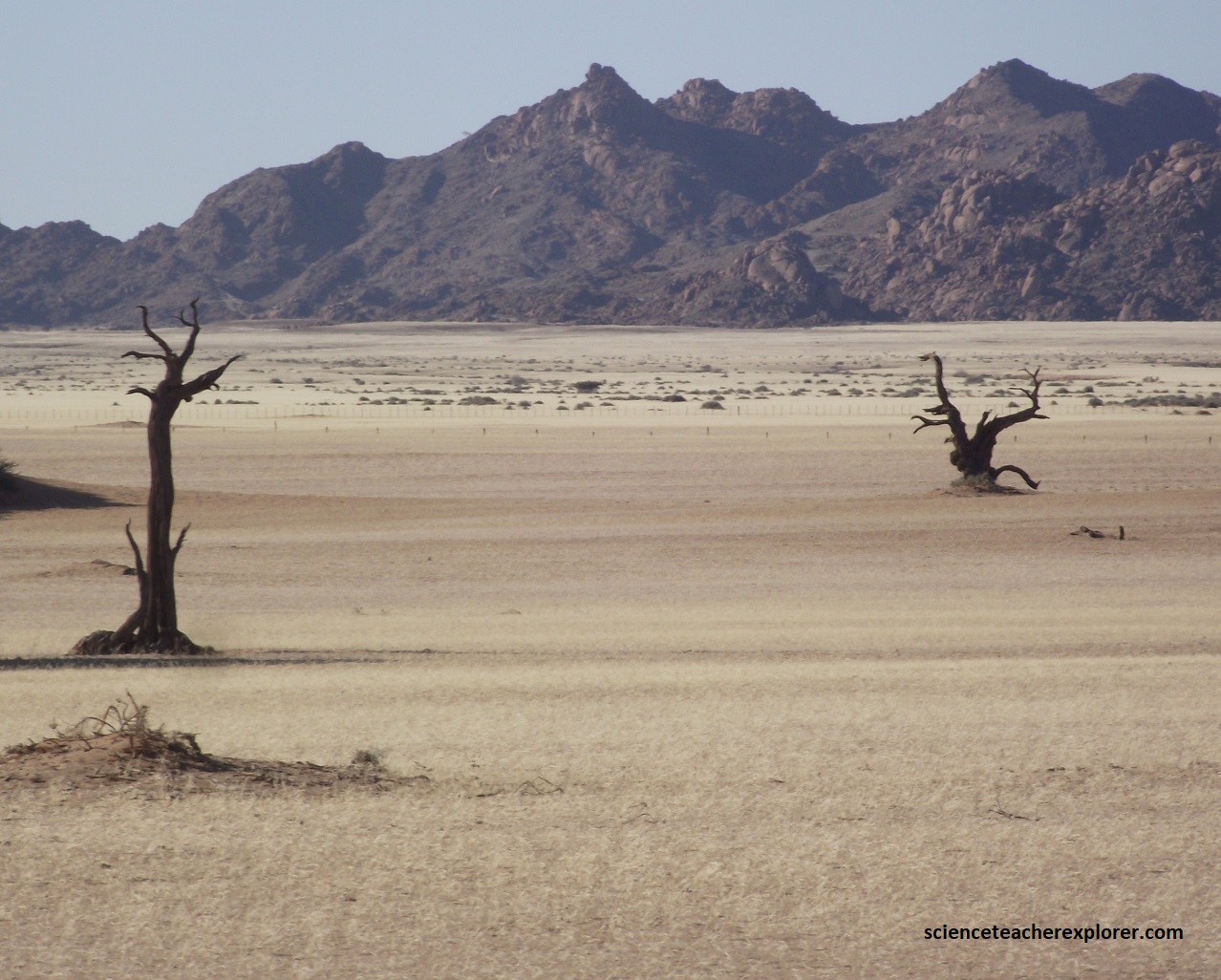
As I drove south on C34, I passed the D2343 road on the left (east), that cuts through the Messum Crater, (pictured below).
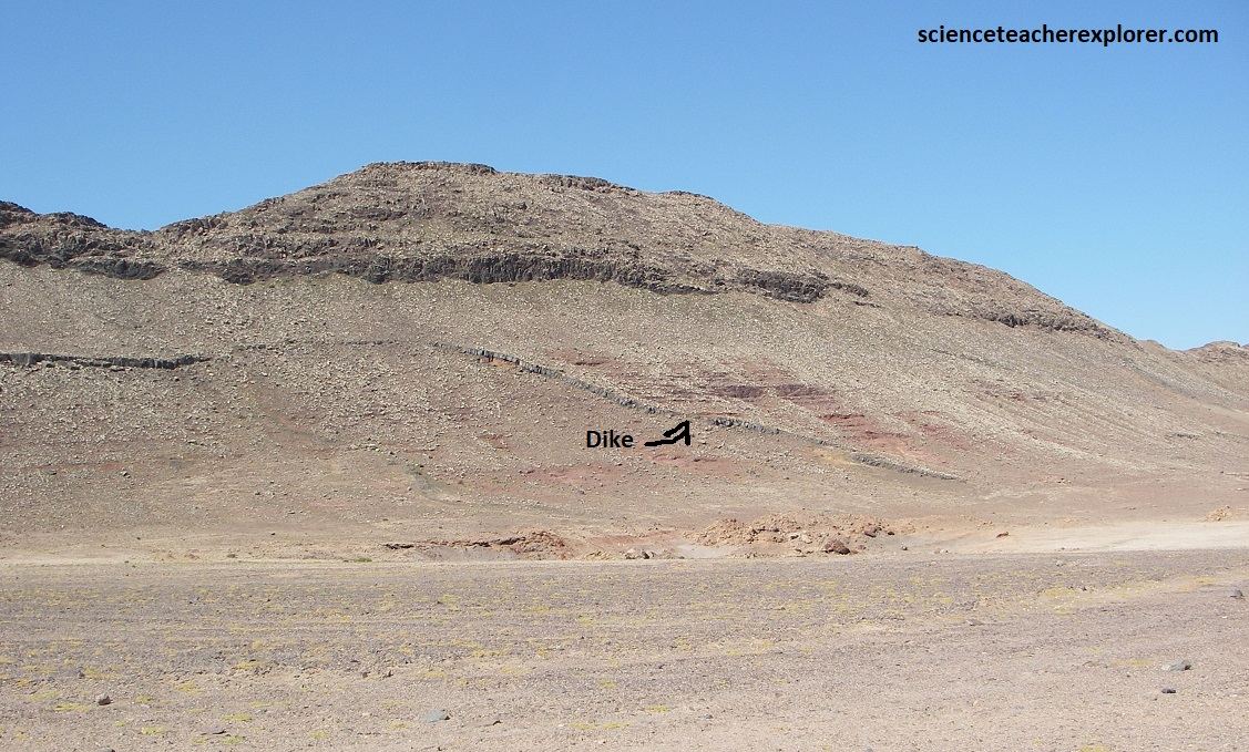
The Messum Crater is a deeply eroded throat of an extinct volcano. Actually, the 25km diameter Brandberg massif is a huge mass of granite magma that solidified in the throuat of the Messum volcano. The outer cone of the ancient volcano, (which was at least 2km high), has long since eroded away. The final basalt magmas solidified in the fissures through which they were erupting to form a the black dolerite dikes & ridges that criss-cross the flat coastal Namib plains. The Brandberg, the Messum Crater, (pictured above), and the rugged, flat-topped Etendeka Mountains are all iconic features of the Namib-Desert landscape. They are also all connected through one of the greatest volcanic events ever recorded in the history of the earth. The formation of the Etendeka, (Parana Lava Plateau; the earth’s largest known volcanic province).
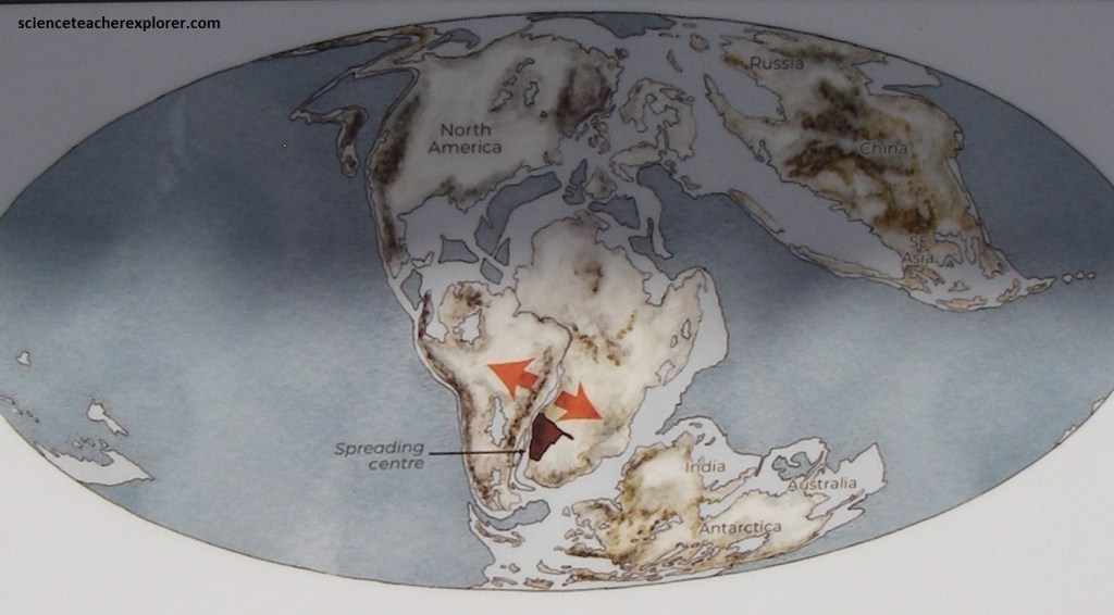
Gondwanaland began to break apart in the mid-Jurassic era (about 167 million years ago), when East Gondwanaland, (comprising Antarctica, Australia, India and Madagascar), began to separate from Africa. Africa about 130 million years ago, creating space for a new ocean, the Atlantic, to form. By 110 million years ago, Africa was established as the separate continent we know today.
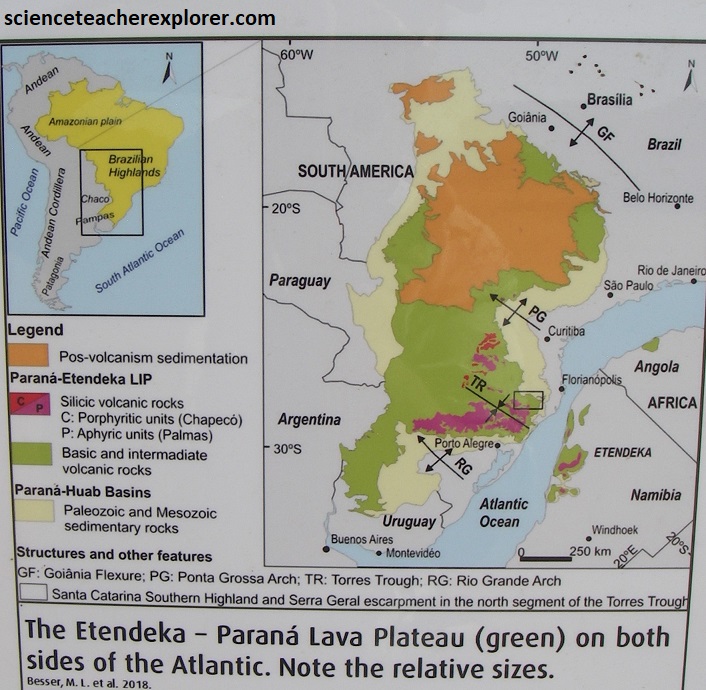
Approximately 130-135 million years ago, more than the 1.3 million km3 of lava flooded the earth’s surface from the Etendeka, (Parana Lava Plateau), 90% of which is found in Brazil, and 10% in Namibia, (pictured above). Basalt lavas rose from a depth of 30-40km and erupted via an extensive network of crustal fractures as voluminous fissure eruptions. Quartz latites erupted from Messum and similar volcanos in South America. Quartz latite rheoignimbrites were deposited as far as 700 m from their sources and, together with the basalt, built up a volcanic deposit, (1000m thick over a period of some one million years. These were the biggest pyroclastic ash flow eruptions in the global geological record. The Etendeka-Parana volcanic event was characterized by alternating eruptions of basalt and pyroclastic deposits rather than any single cataclysmic event. This was the immediat precursor to the initial breaking apart of Africa and South America at about 129 million years ago as the Gondwanaland supercontinent drifted apart.
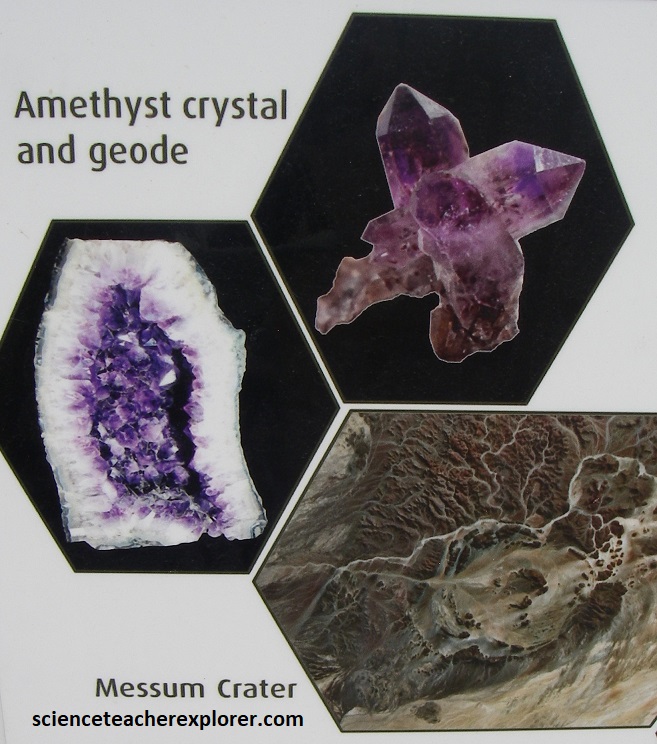
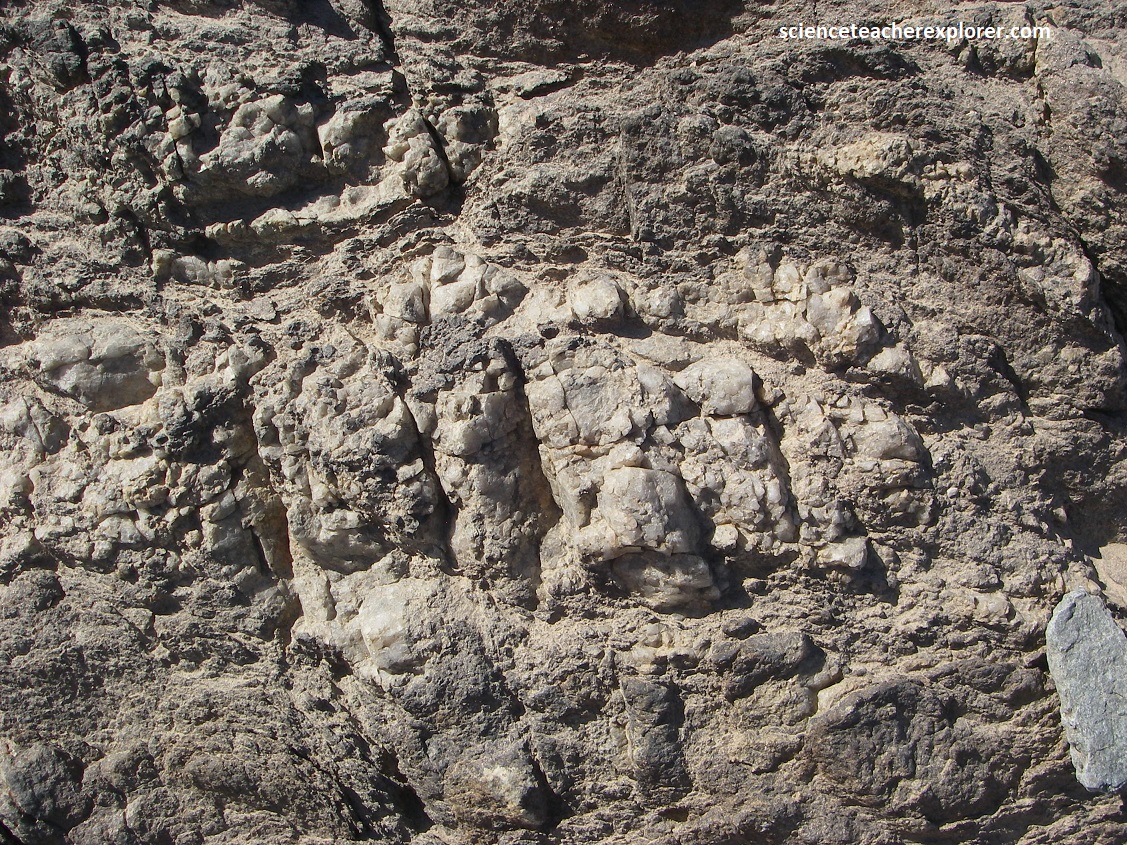
The newly formed continental edge was rapidly eroded by rivers forming the landscape we see today. The flat-topped Etendeka Mountains are the remnants of the lava plateau. The harder and more erosion resistant Quartz Latites form the characteristic thick flat tops and cliffs of the mountains above the ‘softer’ basalt slopes. Gas cavities in the Sarusas Quartz Latite are the source of the world-famous amethyst geodes.
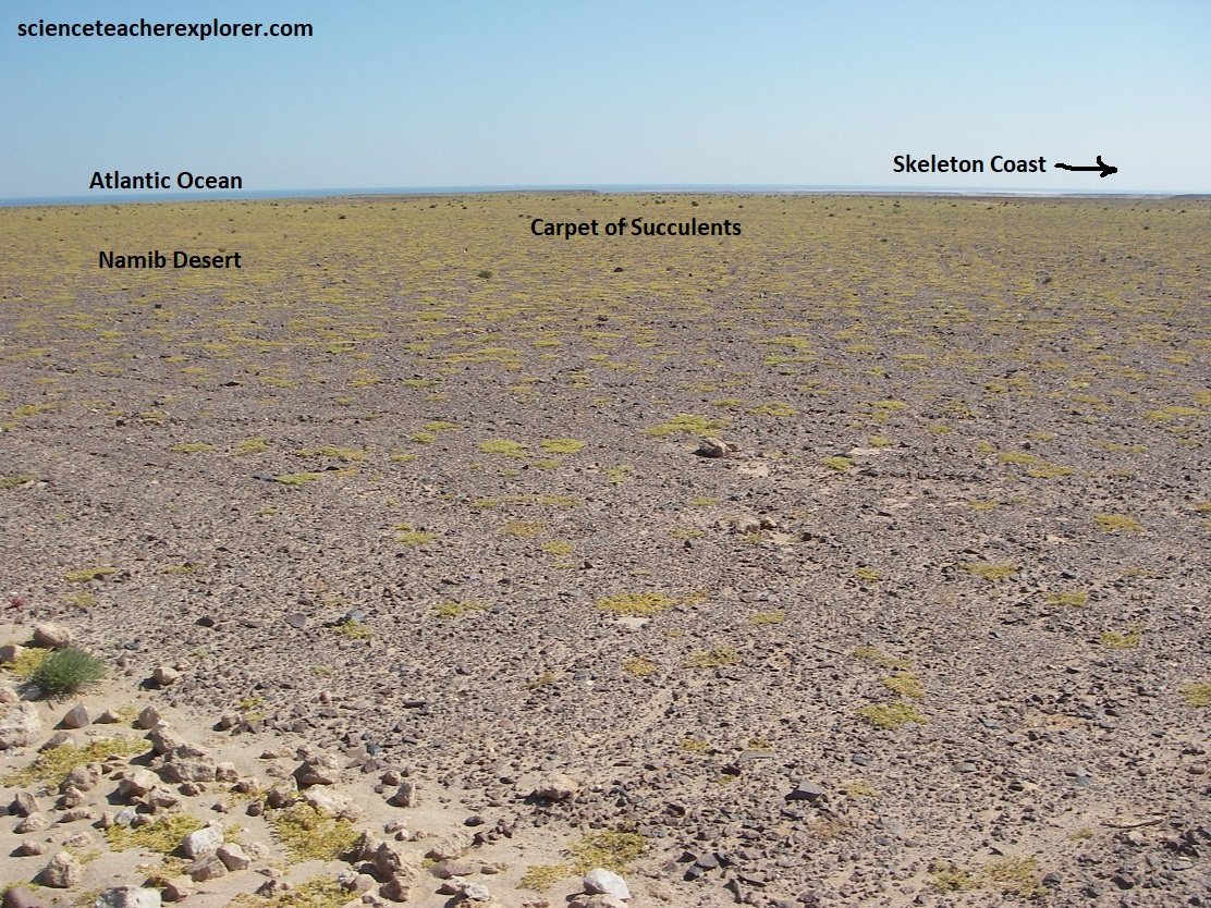
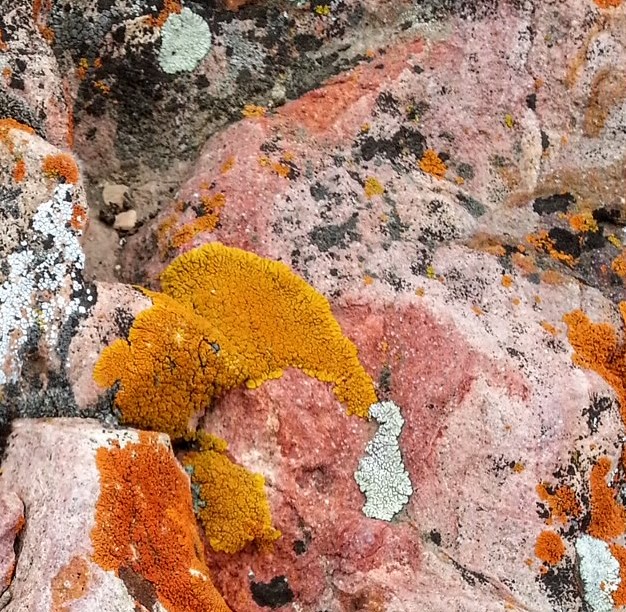
Pictured above, lichens cling to the stones all along the coast of Namibia, sustained by the moisture of the mist belt that envelops the area most of the days of the year. The lichens are the most visible organisms of biological organisms of biological soil crusts. They grow on soil, gravel and rocks, while soil crusts live within or immediately on top of the uppermost millimeters of soil. The presence and activity of these life forms binds the soil particales together and the ensuing living crust covers the ground as a continuous layer. In many parts of the Namib Desert biological soil crusts form the only ‘vegetation cover” largely due to their extreme resistance to drought. Crusts are very important to stabilize the soil, and improve it’s fertility by taking up nitrogen and carbon dioxide from the air. Pictured above, there are numerous large lichen fields within the fog zone of the Central Namib due to almost ideal environmental condition. The presence of biological soil crusts in this area is due to the combination of fog and south-westerly winds that carry moisture and nutrients from the se up to 50km inland.
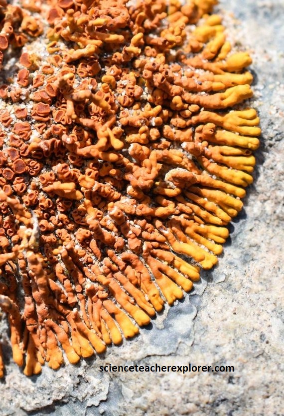
The Namib Desert Lichen are actually not a single creature at all, but a composite organism made up of fungi and algae. The fungus helps absorb food from its surroundings while the algae produce food through photosynthesis. This symbiotic relationship allows lichens to survive for long periods in unlikely places. lichens grow very slowly, adding only few millimeters to their length or diameter in a year.
Approximately 80 species of lichen are found in the Namib and 20 of these species are endemic to Namibia, that is, they only grow here. The highly diverse biological communities of the Namib Desert can be considered unique on a global scale.
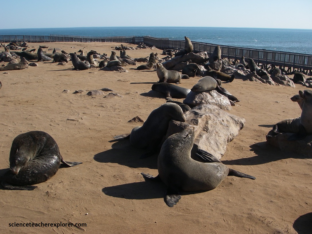
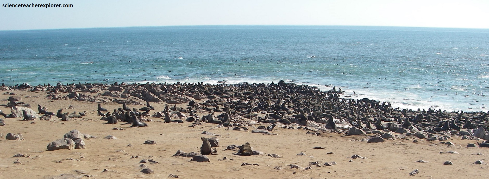
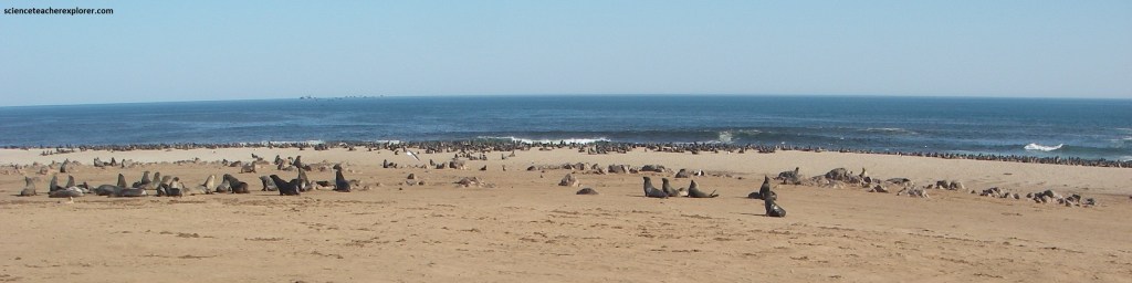
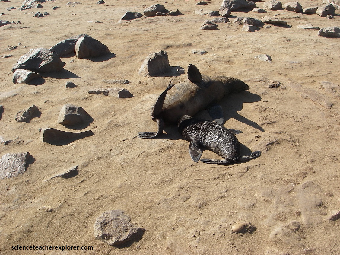
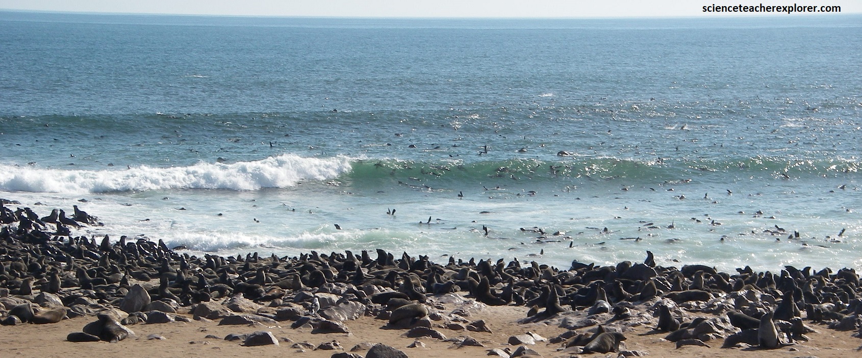
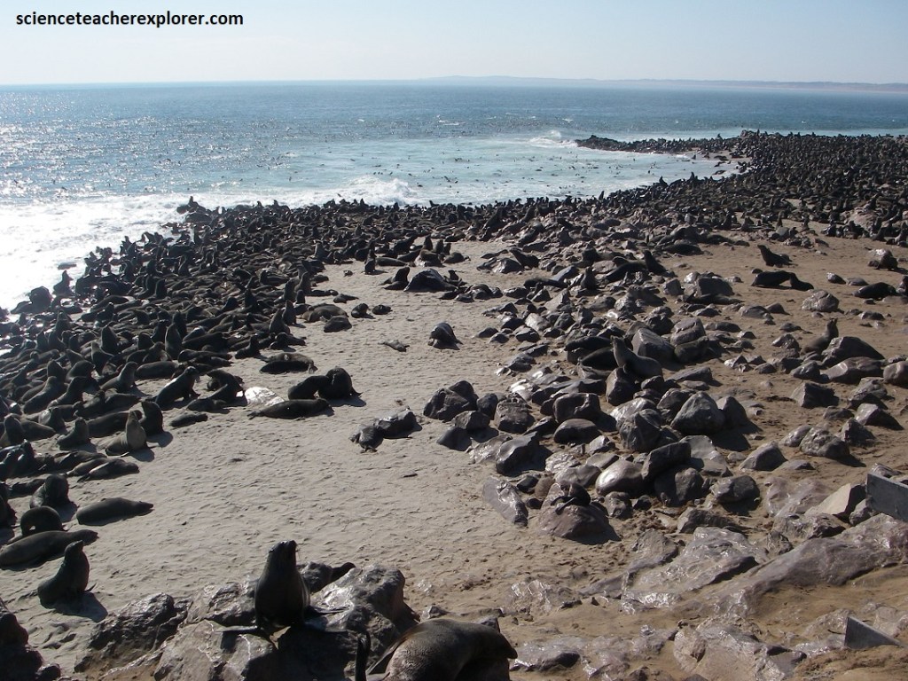
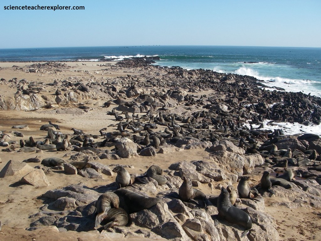
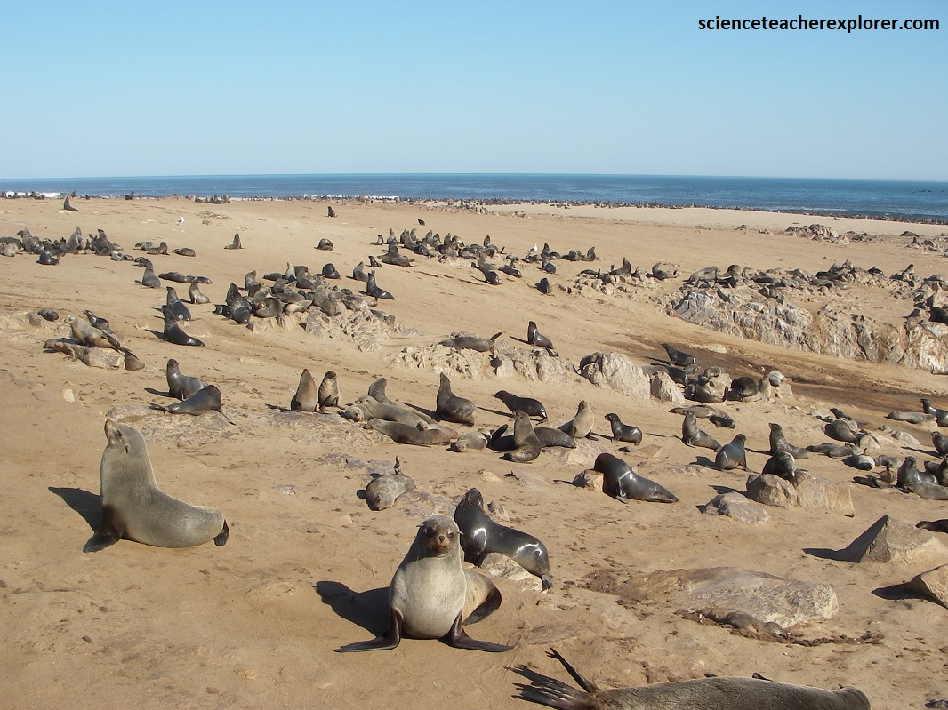
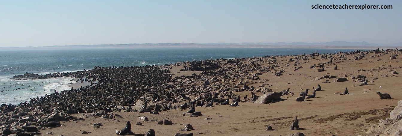
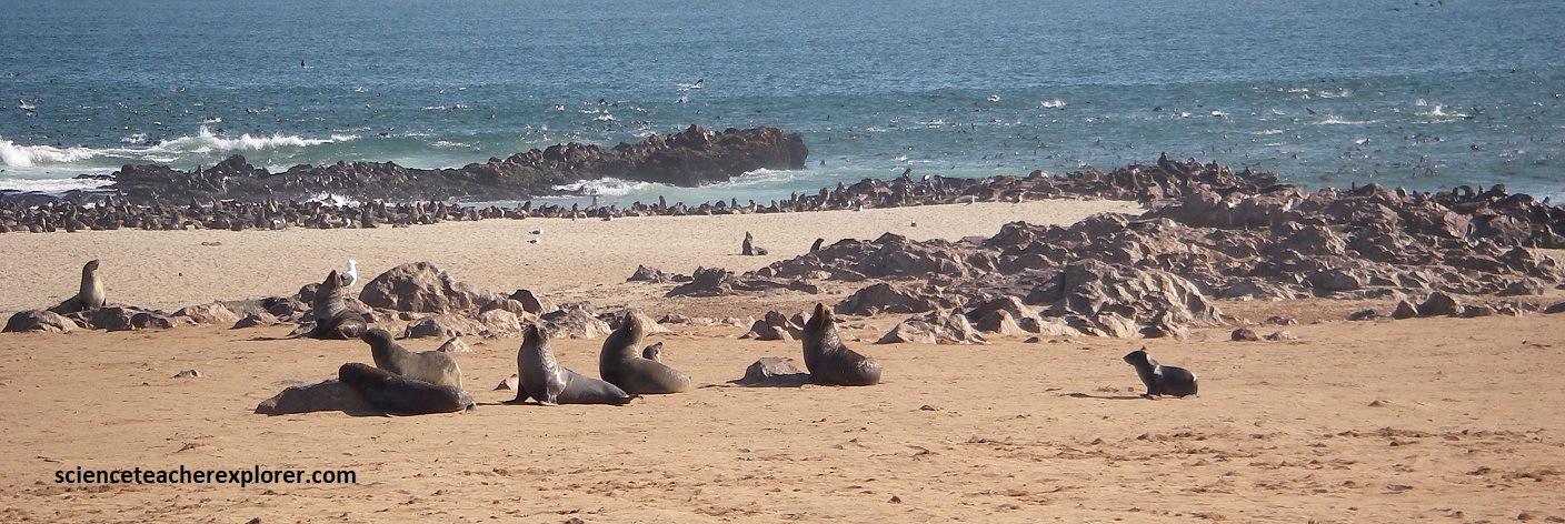
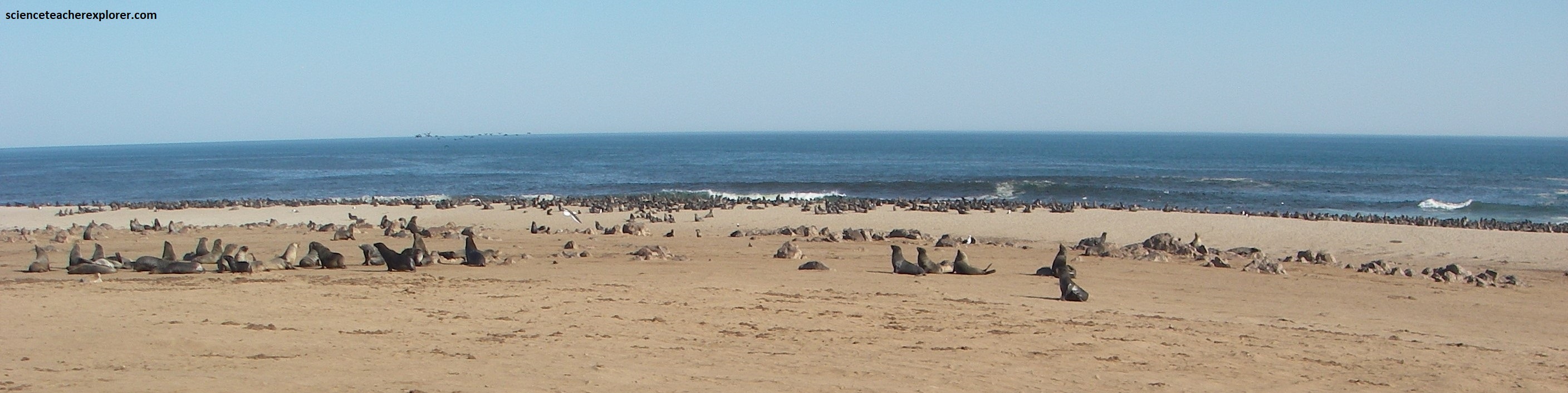
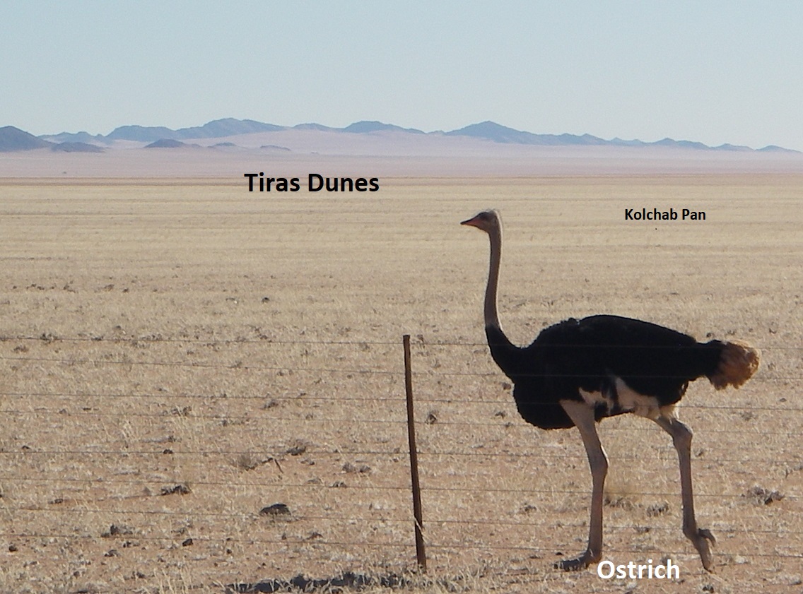
Driving further south on C34, for a few kilometers, I came across the Cape Cross. At Cape Cross, about 100,000 Cape fur seals haul out onto the shore each year to breed. They represent about 1/5th of the world’s total population of this species, (pictured below).
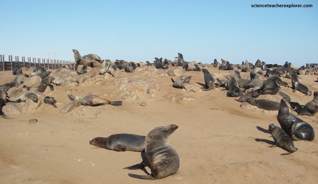
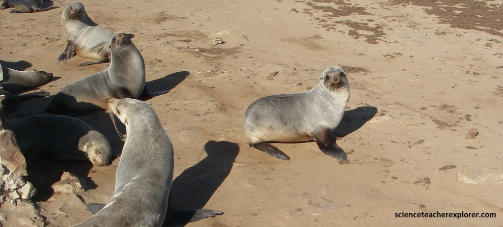
Why are they called Fur Seals? They have a double layered fur with longer flat guard hairs protecting the shorter water repellant under coat fur, (up to 57,000 hairs/cm2). This thick fur is what gave them their name and that is why their pelts were so sought after. On land, fur seals are susceptible to overheating so they will seek shade, expose their flippers to the breeze and need access to the sea to cool down. [Note: the Cape Fur Seal is the only resident seal in Namibia. It is related to sea lions and is not a true seal. Unlike true seals it has ears and can walk on its hind flippers. There are 9 different Fur Seals around the world].
Bull males come ashore to breed in mid-October. While ashore they expend a lot of energy establishing and defending their territories against other males, herding cows and doing boundary displays. During this period they live on their blubber reserves entirely.
When defending their territories, chest to chest combats take place during which a bull attempts to push it’s opponent off-balance. This is accompanied by snorting and bites aimed at the opponent. The smaller bulls will adopt a submissive posture facing the larger bulls with lowered head and open mouth and backing away, which cause large bulls to lose interest. If a bull is pushed into another bull’s territory that bull will join in the fight. Wounds in the tail and pelvic regions are common but these heal quickly.
Young males, non-breeding males and injured males are typically found on the fringe of a breeding colony. Males weight up to 200-350kg, or 5X more than females, and can dive to 400m for 10 minutes or more.
Females come ashore a few weeks after the bulls and give birth to a single pup. Five to six days after giving birth, they come into oestrus and mate. Females establish territories within a male’s territory, and thus form harems which consist of 7-60 more females. After mating, these disperse. Implantation of the fertilized egg, and thus the start of embryonic growth, is delayed by 4 months to ensure that the next pup will be born at the correct time the following year, In synchrony with other females and the breeding cycle of males. Females become sexually mature at 3 years of age.
Females, or cows, also engage in fights in which bulls often intervene. Mothers are very protective of their pups. Adult females weigh 40-80km, and can stay under water for 7 minutes.
Most births occur during December and January. Newborn pups suckle within an hour after birth and grow rapidly due to the high fat content of the milk. A mother will stay with here pup for the first week, but thereafter forages at sea for several days to replenish her milk supply. Mothers locate their pups by bellowing and the pups answer by bleating. Females can also trace pups by scent.
While females are out foraging the pups will congregate on playgrounds and eventually move out to shallow pools. When they are 3-4 months old, they start to venture out to sea in search of food. By the time they are 7 months old they may stay at sea for 3-4days. They are weaned between the age of 8-10 months of age. When this happens the young ones gather in groups.
On the beach the pups are vulnerable to attack by jackals, lions and brown hyenas, and when they reach the sea, sharks and kill whales are yet another threat. Additional threats include: 1) Entanglement of discarded fishing gear, plastics and other garbage. 2) Bio-toxin poisoning after algal blooms. 3) Accidental capture and entanglement in trawl nets and long lines. {Note the historical photos of the guano operations below were taken from a interpretive sign on-site}.
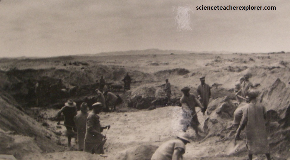
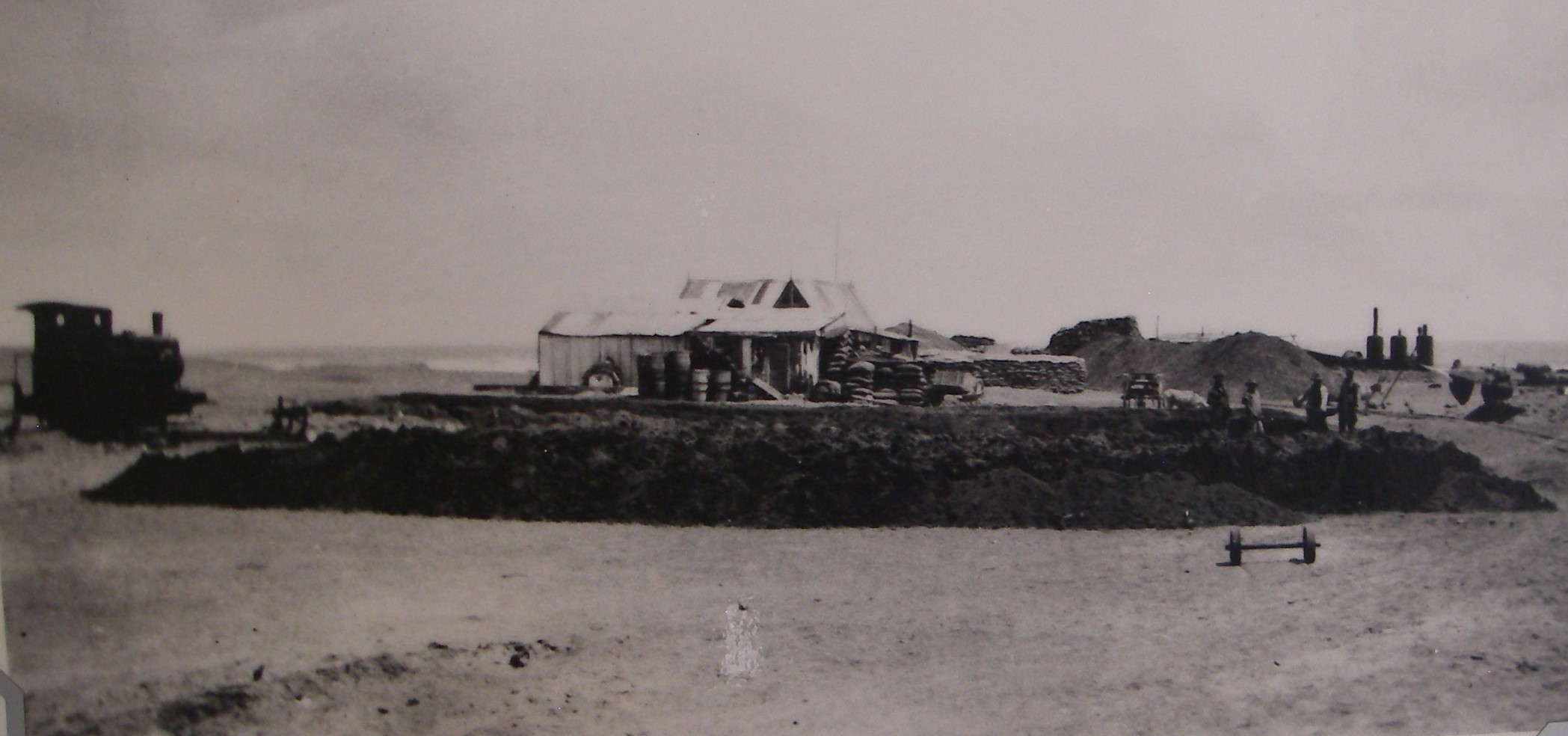
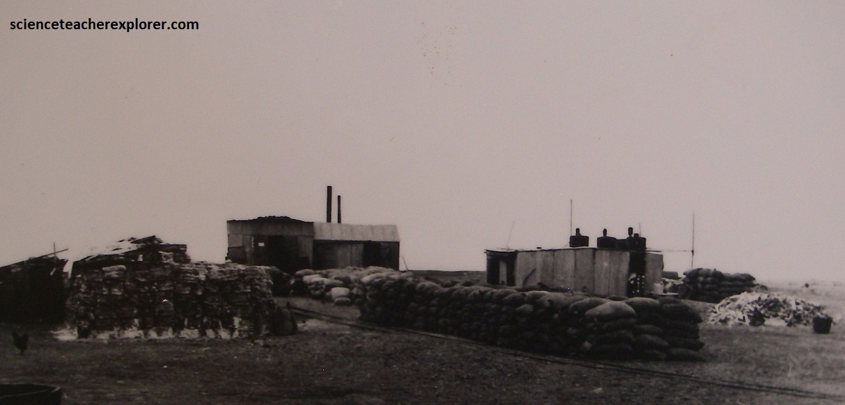
Pictured above, in 1895 a man by the name of Walter Matthews travelled over the desert, northwards from Swakopmund on an expedition to look for fur seals. On discovering a healthy population of seals congregating at Cape Cross, he also noticed that the rocks were caked in layers of guano (bird droppings), which was highly valued as a fertilizer in Europe, so much so that it was dubbed ‘white gold’, {Note: Dried excrement from fish-eating seabirds are extremely rich in nitrogen, phosphorus, and potassium; making it a premium natural fertilizer}. Matthews returned excitedly to Swakopmund with the news, and with the help of a wealthy uncle, he established the Damaraland Guano Company. He was granted a concession to look for guano deposits and to harvest the seals in the area. Just a year later, the bleak coastline had transformed into a bustling operation. There were a hundred workers mining the guano and collecting seal pelts, and a cluster of buildings, which included a post office, police station, train station, customs office and condensation plant.
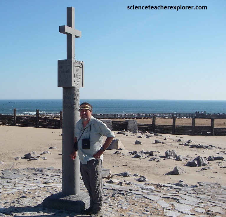
In 1485, the Portuguese captain and navigator Diego Cao landed here at Cape Cross and was the first European to set foot this far south in Africa. He is buried at a nearby outcrop called Serra Parda. A stone cross to commemorate the landing was erected on a headland at the time but it was unfortunately stolen in the 19th century. I’m standing next to the replica that was later created and erected in 1974, (pictured above).
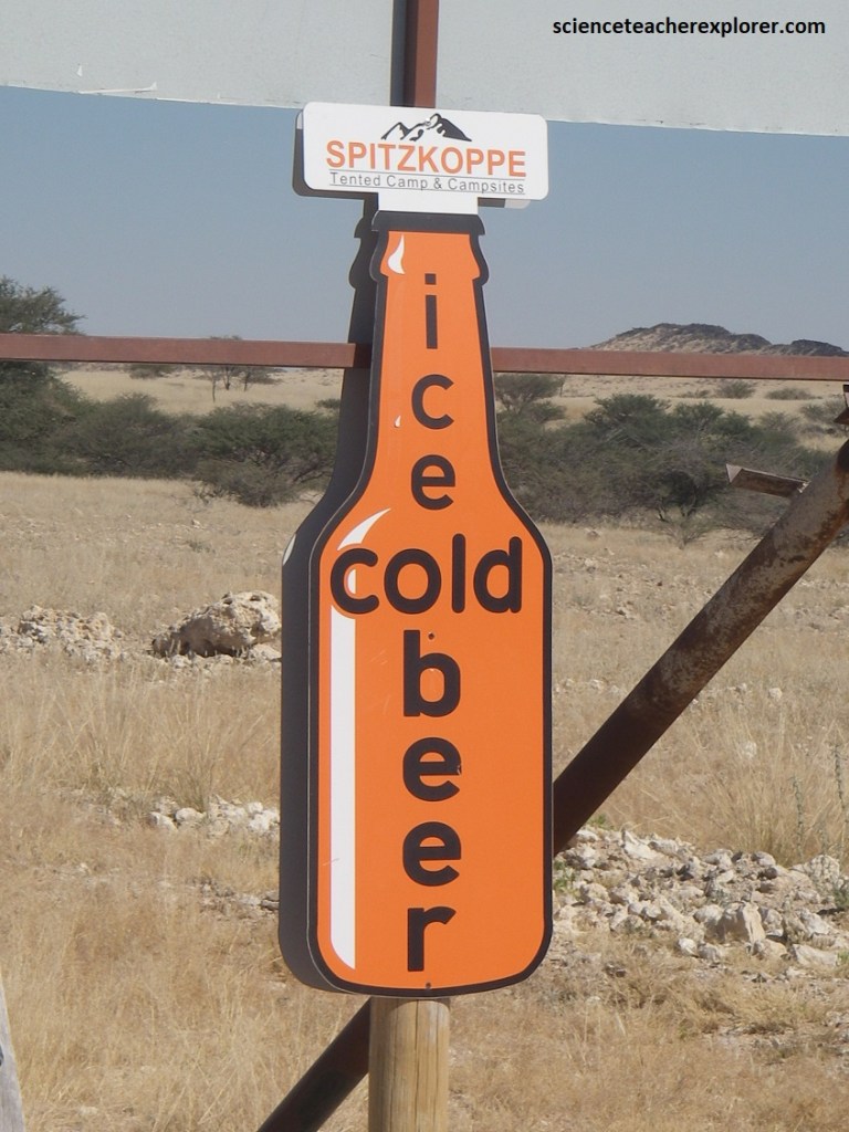
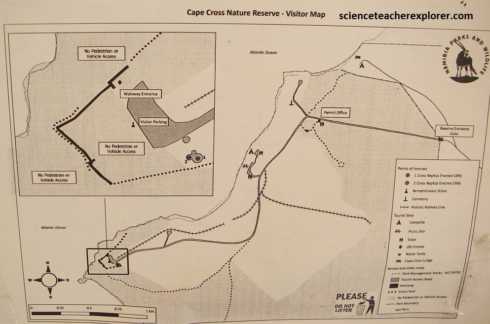
From Cape Cross Seal Reserve, I drove another 60km to Henties Bay and turned left (east) onto the graveled road D1918. I drove another 108km to Grosse and Kleine Spitzkoppe Bornhardts. [Note: A bornhardt, or inselberg, is a geomorphological feature consisting of a prominent, isolated residual dome (or a group of domes) rising abruptly, up to a few hundred meters high, in the midst of a flat plain].
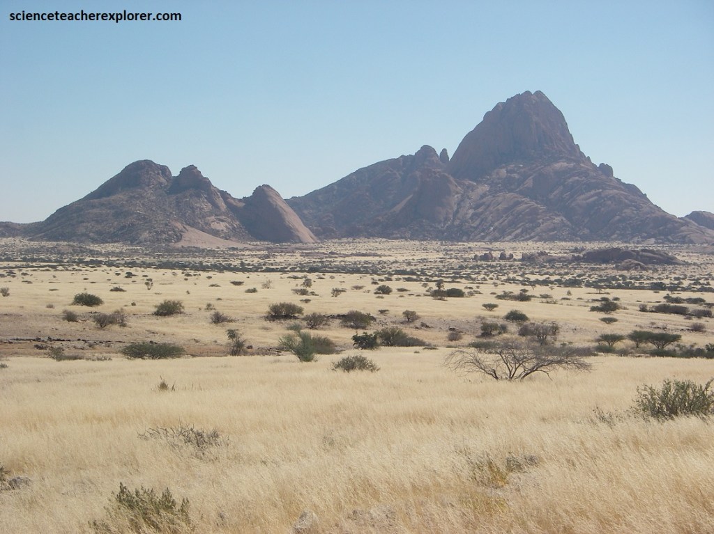
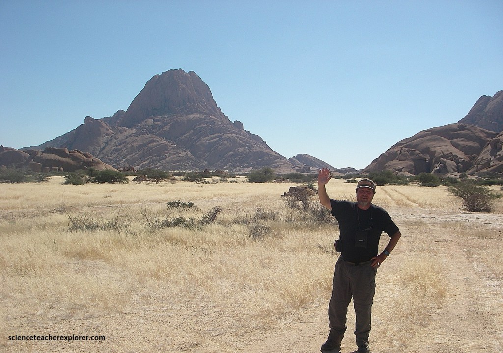
The Grosse Spitzkoppe is a huge, 30km2 inselberg, rising like a rocky island some 670m above the sandy floor of the Namib-Desert plains. Impressive in size and shape, it stands, together with the nearby Pontok Mountains and the Klein Spitzkoppe, as a landmark and the area, as well as of the Namib Desert itself. The Grosse Spitzkoppe is also known as the ‘Matterhorn of Africa’.
Pictured above, the Spitzkoope bornhardts belong to the Damaraland Intrusive Complex in Namibia. They are part of the Parana-Etendeka Large Igneous Province, (mentioned above), which is one of the largest volcanic/plutonic complexes known on Earth, (an intrusive complex that was formed during the Gondwana break-up, 137-124 million years ago, when the South Atlantic opened up.
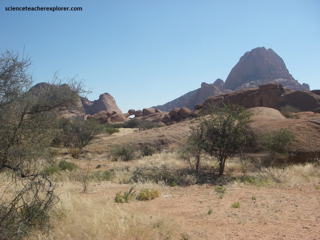
The sculpting of this natural bridge, viewed from under the famous arch of the Grosse Spitzkoppe, shows the immense power of desert winds that have blown here for thousands of years. Paired with extreme thermal shocks, the scouring action of wind and wind-blown sand has loosened the granite particles, sculpting the rock, polishing the surface, and even perforating the granite walls and forming the so-called hollowed bridge.
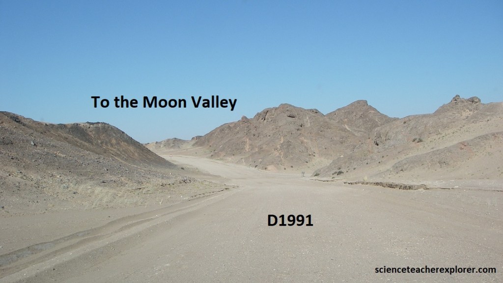
Returning to the tarred road C34 @ Henties Baai (Bay), I continued driving south another 70km to Swakopmund and stayed the night. The next morning, I drove northeast on Hwy. B2 for 30km, and turned right (south) on graveled road D1991 to explore the ‘Moon Landscape’ 10 km away, (pictured above).
Pictured above, the ‘Moon Landscape’ or ‘Moon Valley’ in the Swakop River Valley area of the Namib Desert within the Dorob N.P., is an eerie landscape weathered by coastal fog and wind into bizare rock formations. It mainly consists of granites, marbles and mica schists of the Damara Sequence, into which the Swakop River has cut its way. These Damara Granites, which rose between 460-500 million years ago, mark the end phase of a mountain building episode with the collision of the Congo & Kalahari Cratons. Today this formerly high mountain chain has been levelled down to granites interspersed with the basement of the mountain roots by erosion processes that lasted millions of years.
Here, within the ‘Moon Landscape’, this mountain chain has eroded into a badland topography by the Swakop River. It is characterized by a jumble of poorly vegetated, deeply incised small valleys, sharp gullies and low ridges.
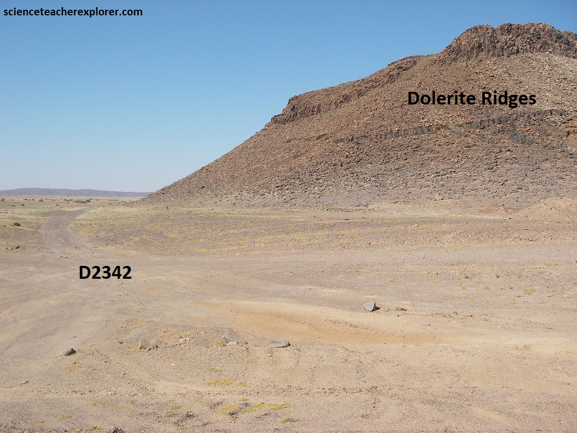
Pictured above, the Swakop River is one of the longest and broadest of Namibia’s ephemeral watercourses. In the north, the eroded landscape consists of red lavas and yellow sandstone, whereas farther south the pale desert floor has contrasting dark ridges. These dark ridges were formed by lava welling up through cracks in the rocks and then cooling into hard ridges that weathered proud of the surrounding granite.
While granite is very resistant against chemical weathering under humid conditions, it disintegrates rather quickly by the frequent heat variations typical of the Namib Desert with the moisture content in the upper rock layers caused by fog. Additionally, the Swakop River and its tributaries then succeed in eroding the loosened grains, cutting more deeply into the surfaces. Also the wind that blow almost constantly contribute to an intense modeling of the badlands landscape and transportation of the fine debris.
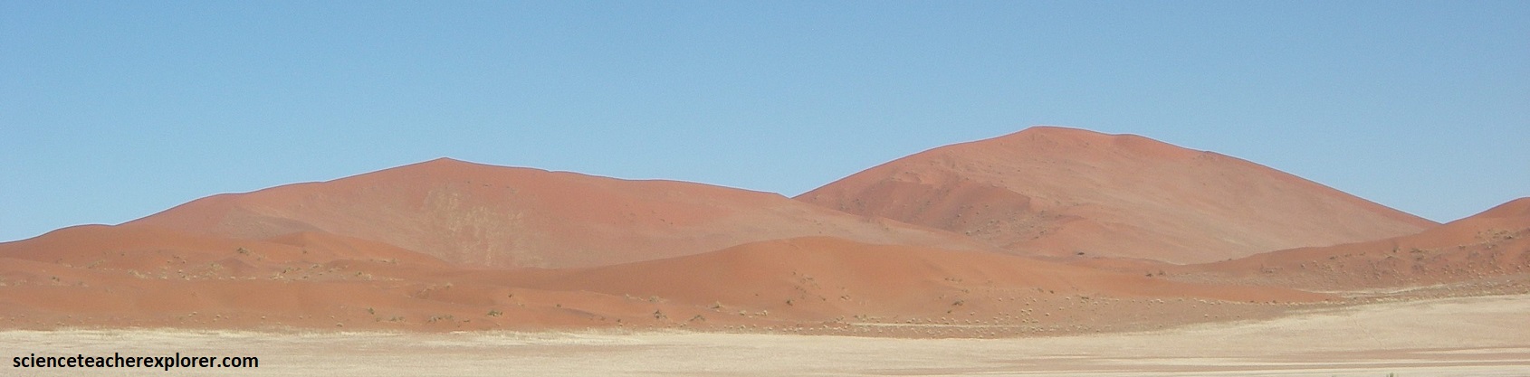
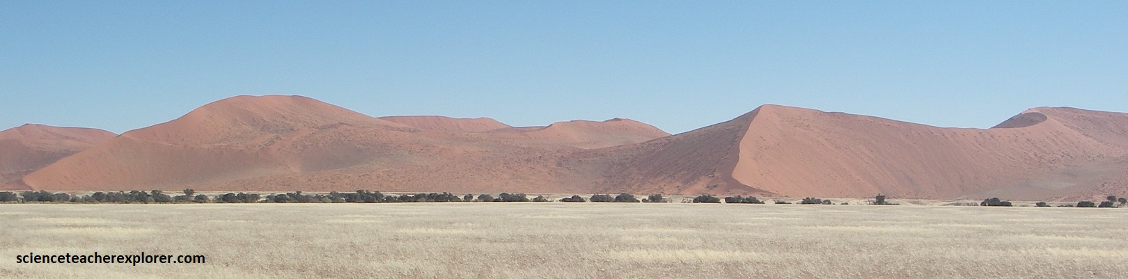
In the northern Namib Desert, the bedrock has been carved by rivers into steep-sided gorges, while the south is covered with sand, yellow-grey at the coast and brick red inland. Parallel lines of sand dunes, running northwest to southeast, have individual dunes 32km long and up to 244m high.
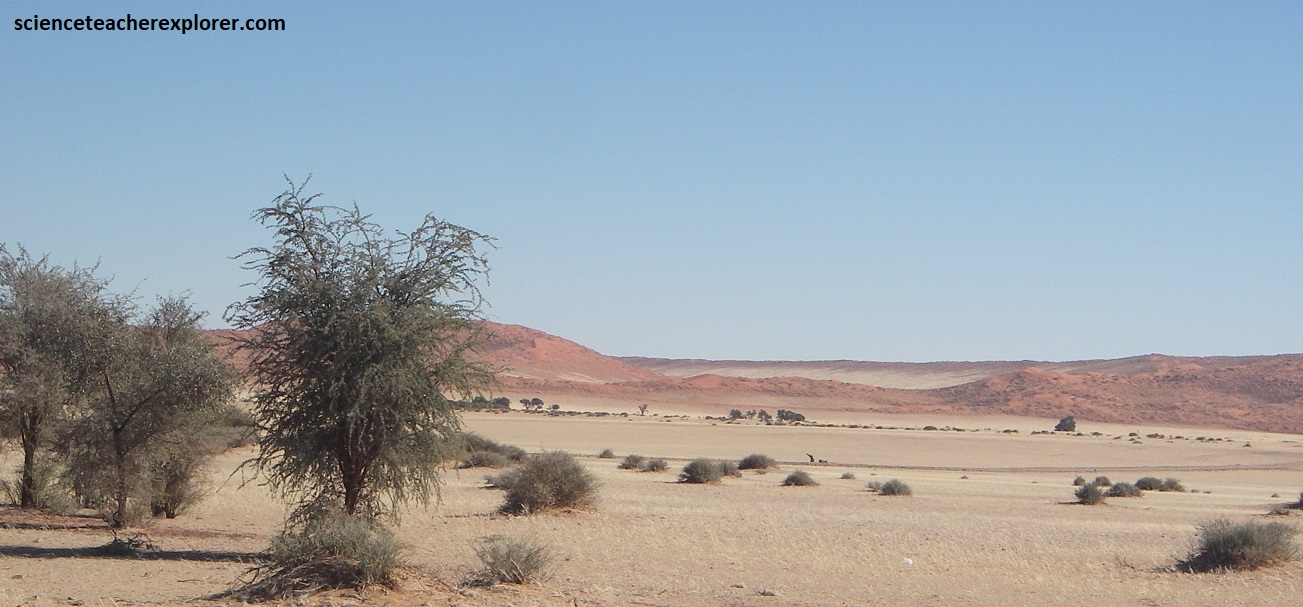
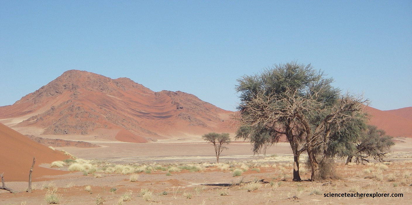
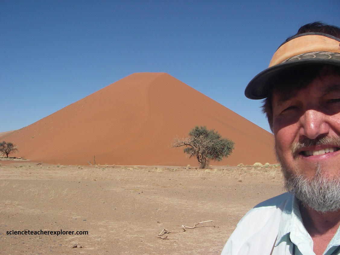
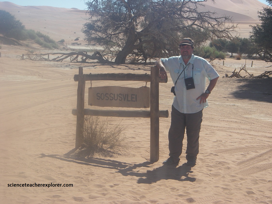
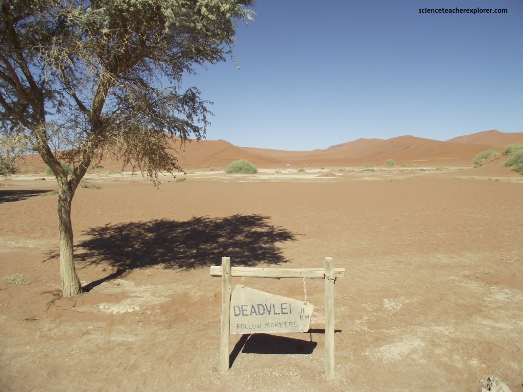
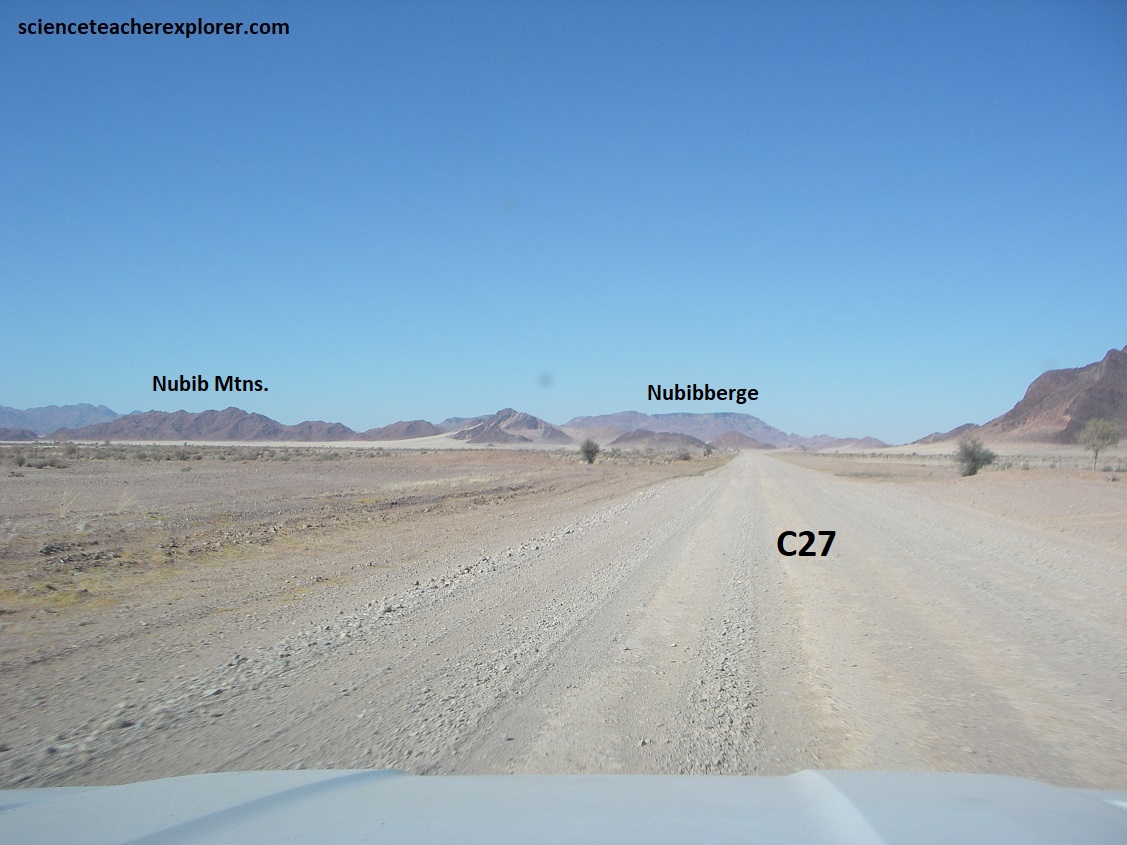
To explore the sandy portion of the Namib Desert, I drove from Swakopmund, south on highway B2 to Walvis Bay. Then, I continued driving west on the graveled road C14, through Gaub & Kuiseb Passes, to the small village of Solitaire. From Solitaire, I drove another 83km south to Sesriem Canyon, (picture above). This is where I stayed for a couple of nights to explore and trek the famous Sossusvlei & Dead Vlei.
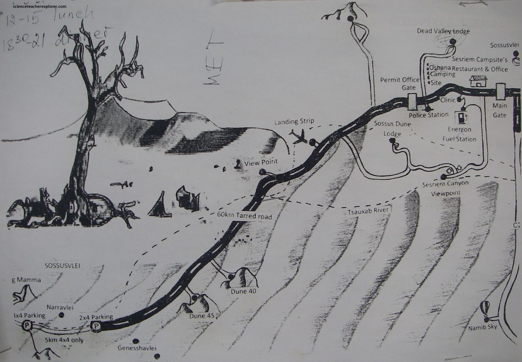
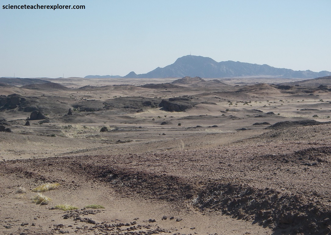
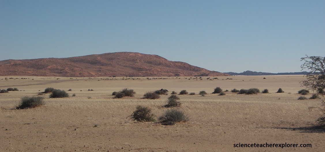
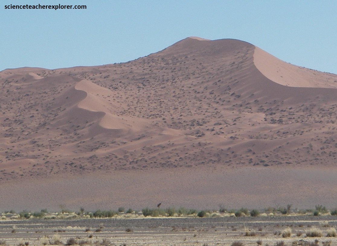
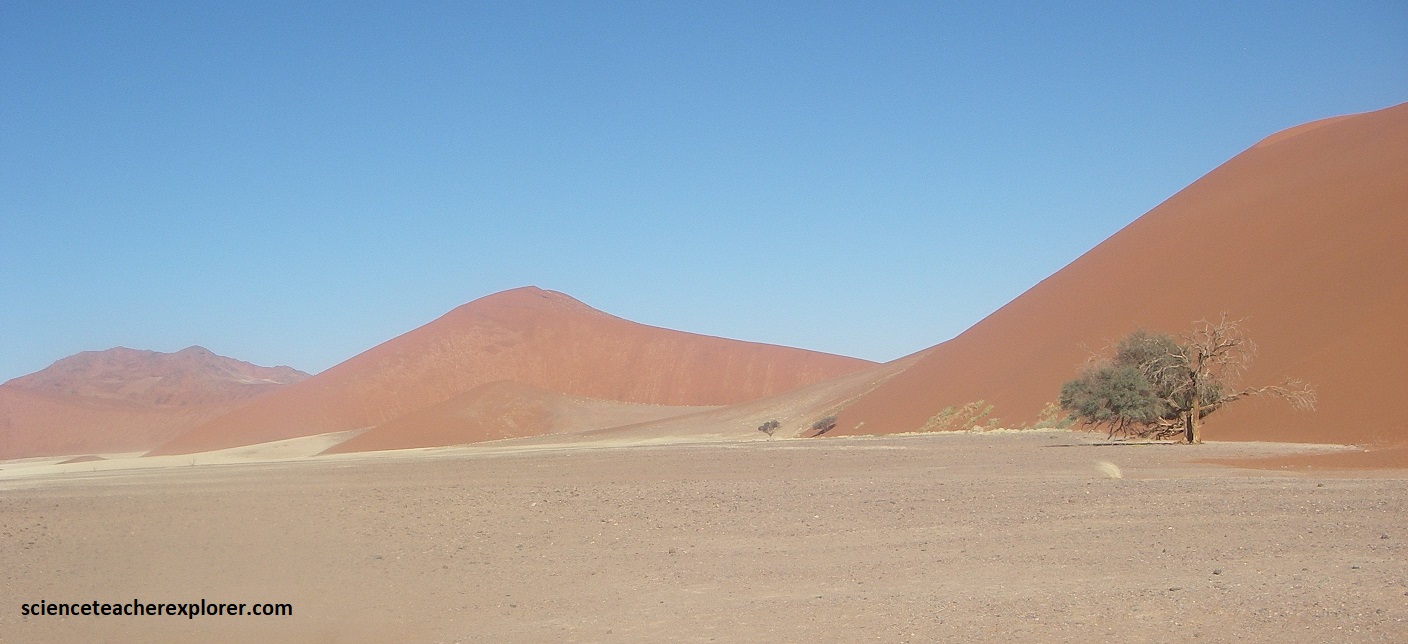
In the 100km wide region, south of the port of Walvis Bay, lie some of the highest mobile dunes in the world towering over 300m. With no permanent surface water, and very little vegetation, this is an inhospitable region, (pictured below is the head of Sesriem Canyon).
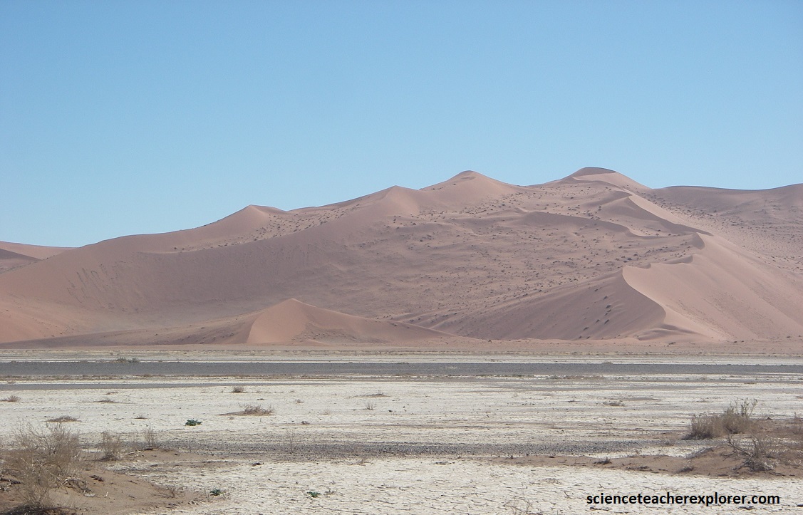
The bed of the normally dry Tsauchab River forms one of the few viable entry points. Before entering the Namib desert, the Tsauchab forms the 2km long Sesriem Canyon, (pictured below is behind the landing strip at Sesriem).
Below the present dune field, lies the Tsondab Sandstone which are about 20 million years old. Pictured above, these sandstones also represents petrified dunes of an ancient Namib. These reddish-purple, fossilized dunes are exposed under the present dune sands at the Sesriem Canyon.
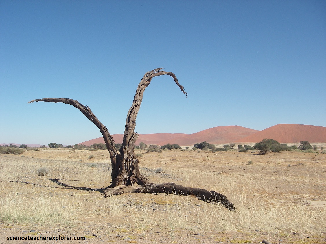
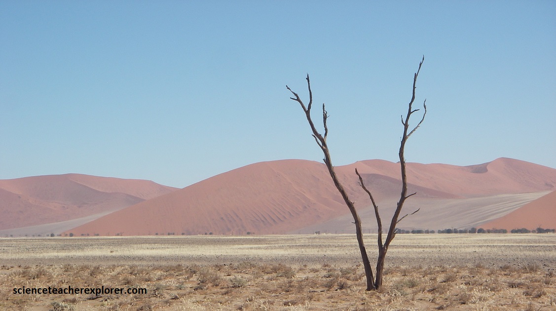
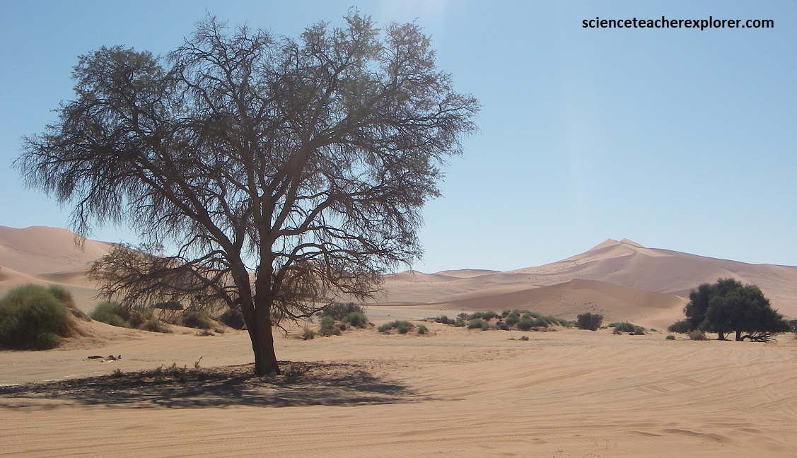
Pictured above, farther west the riverbed runs for about 50km deep into the heart of the Namib Desert. It is flanked by spectacular dunes. The line of camelthorn trees, which I could see along the broad valley of the Tsauchab River on my way to Sossusvlei, shows evidence of the subsurface flowing water occurrences of the Tsauchab. The many dead trees prove, that in more recent times, lots of water coursed in the subsurface, and has now dried up. The reason for this is not only the poor rainy seasons, but also that people have caused a general drop of the groundwater level in the area of the entire Namib Desert by ever increasing extraction.
Along the drive to Sossusvlei, I noticed black deposits on the dune sands, (pictured above). These ‘shades’ are formed from the heavy minerals of black magnetite (Fe2O3). The red color on the Sossusvlei dunes is caused by iron oxide, which cover the sand grains as a thin coating. The rusting of iron shows that the sand grains must have been under atmospheric conditions (oxygen supply) since their formation. So the sand was not carried from the sea but mainly blown by the forces of the wind and the source could be from the underlying red Tsondab Sandstone.
Occasional inselbergs, which rise from the dune fields near the Sosusvlei show that under both the dunes of the Sossusvlei and the Tsondab Sandstone Formation are hidden the Precambrian basement of the Sinclair Sequence, (pictured above).
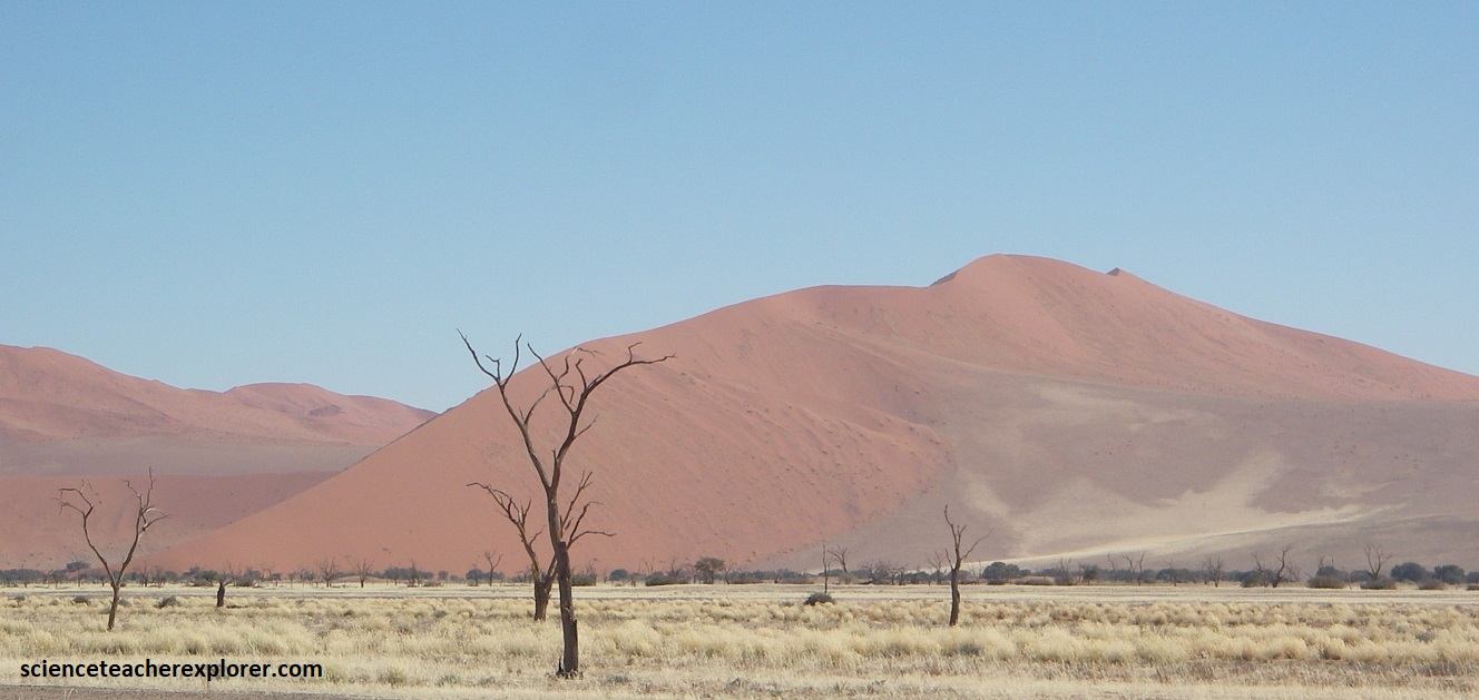
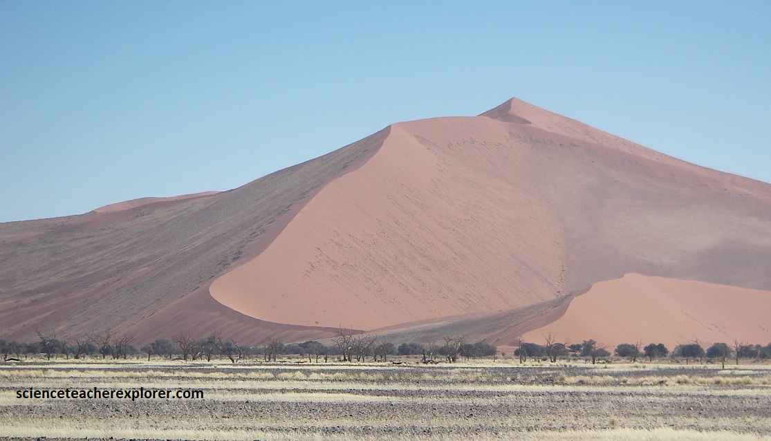
Pictured above, the giant red dune of the Namib Desert, (called Big Daddy), looms 325m above the surrounding sands of Sossusvlei. An icon of Namibia, it is likely on e of the tallest and most photographed dunes in the world.
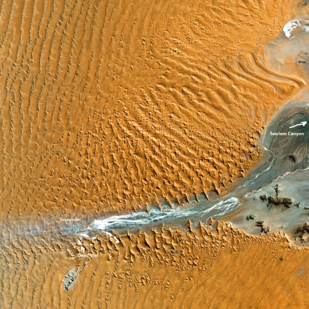
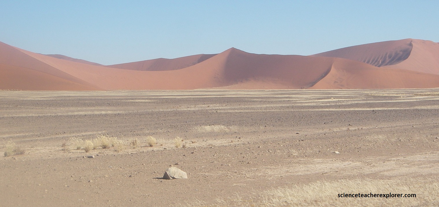
Pictured above, the dunes at Sossusvlei are classified as star dunes. These are formed by winds of equal strength blowing from different directions. Sossusvlei is situated on the interior delta of the ephemeral Tsauchab River. The is where in years of exceptional rainfall, (which may happen only a few times ever century), the river reaches Sosusvlei and, after flowing through the dunes, disappears in the sand, (like an end lake). By so doing, the river leaves behind layers of grey clay sediments as well as saltpans amid the red sand dunes called a ‘vleis’.
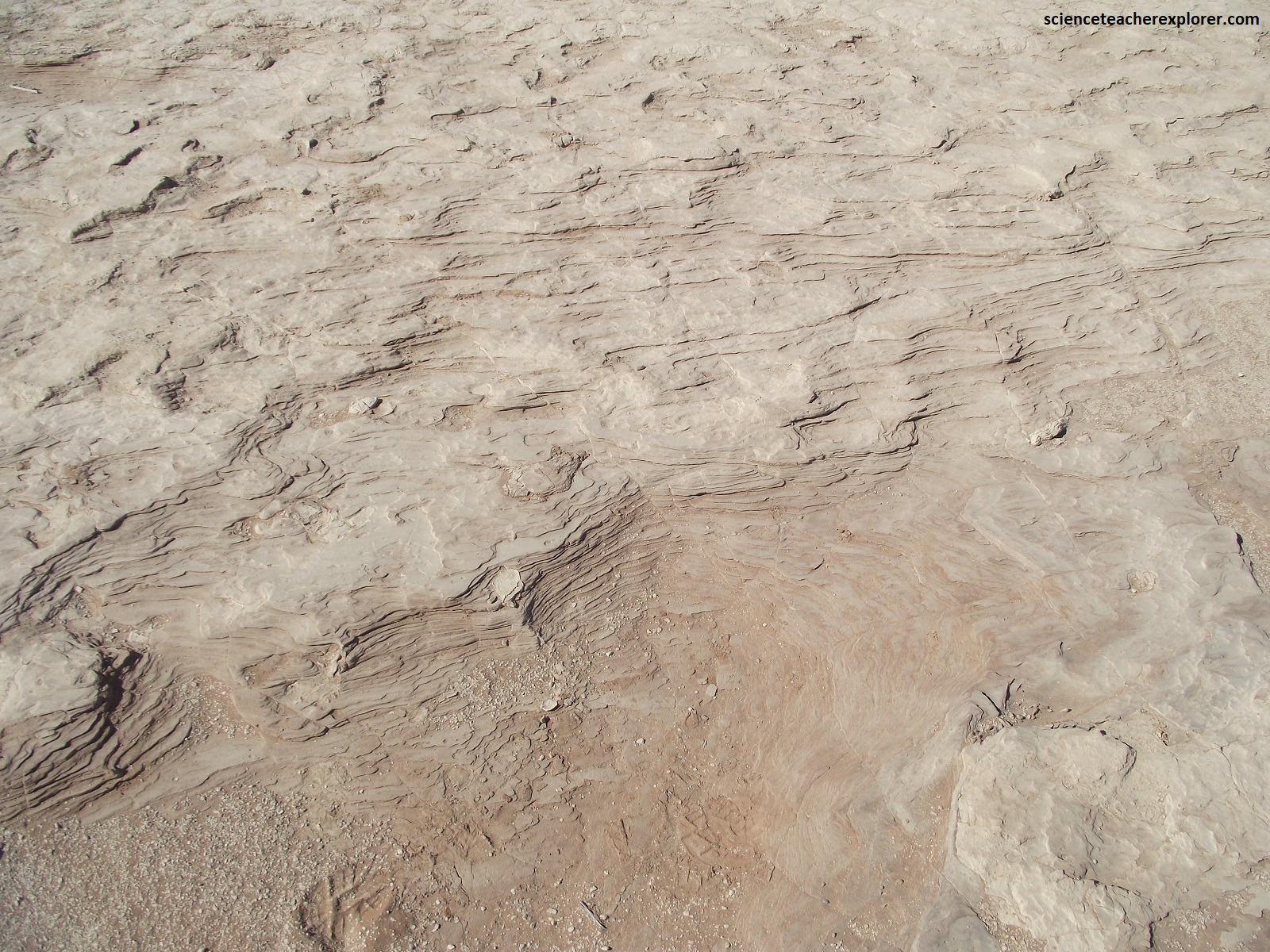
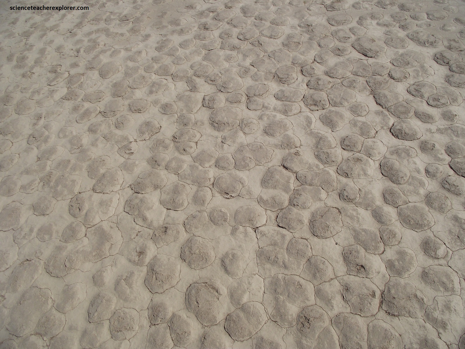
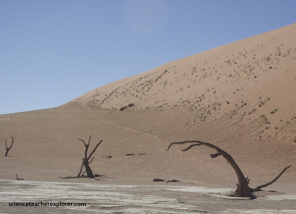
The vleis are separated from each other by small dune chains. This separation of the Sossusvlei shows evidence that the Tsauchab is only rarely able to break through the pile up dune barriers during the rare wet seasons and thus it is split up. Over time, some pans or vleis have become so isolated by the dunes that not further water can reach them, neither from the river, nor from the drying aquifer, (pictured below).
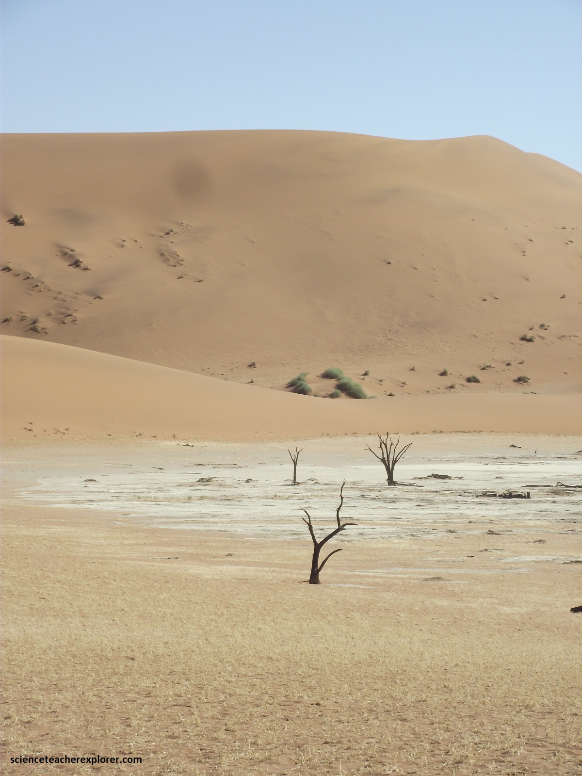

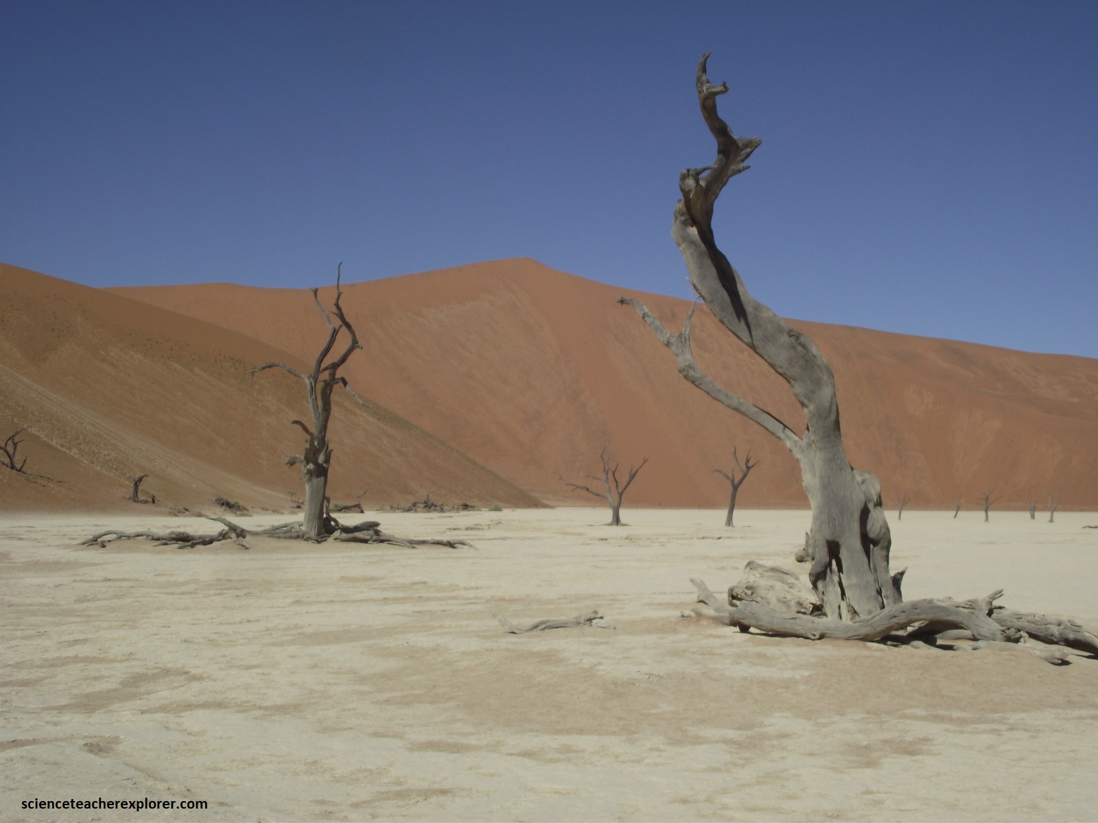
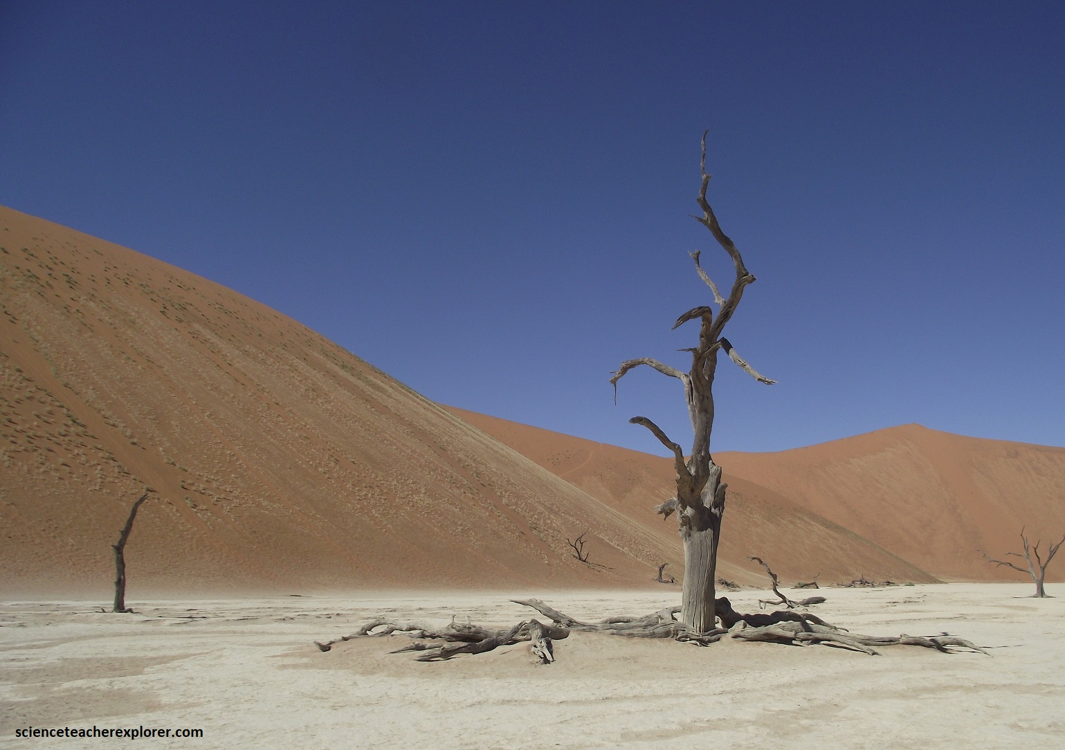
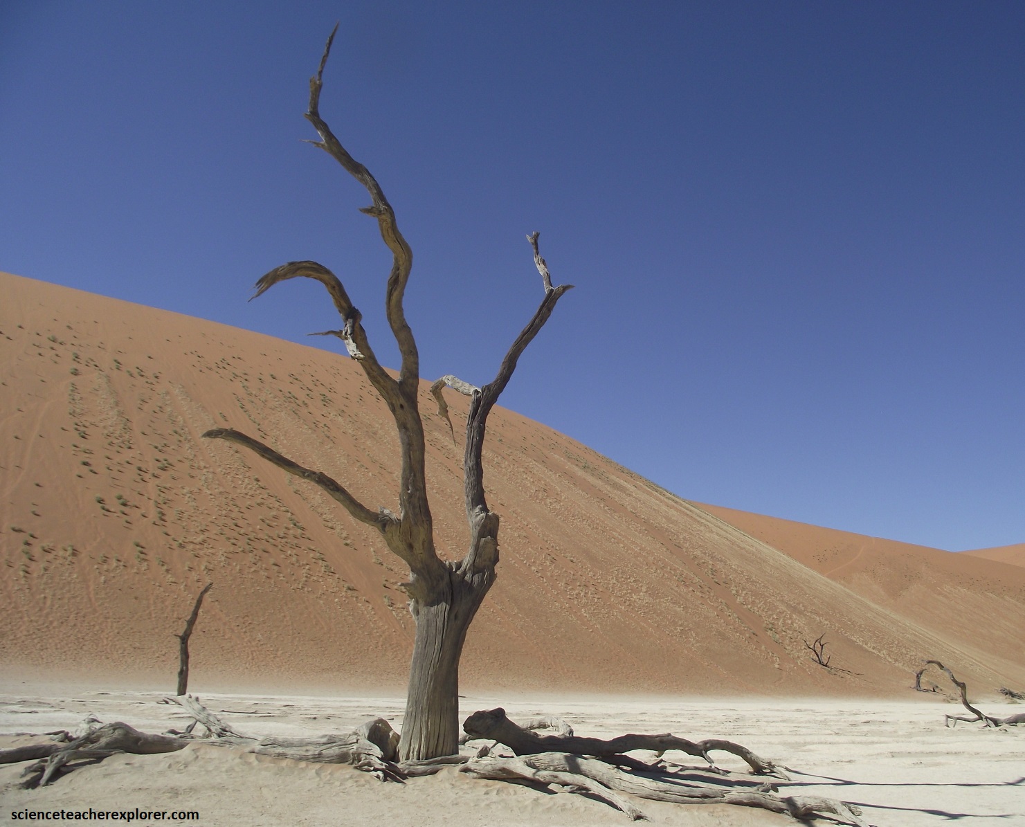
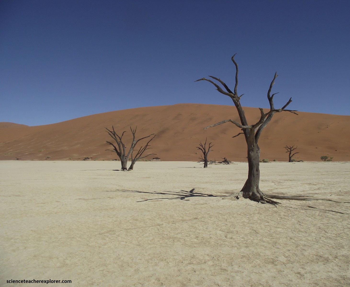
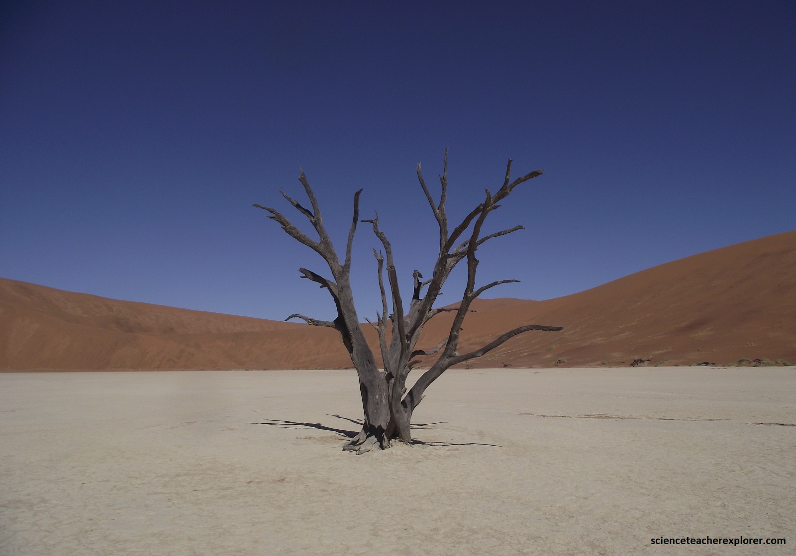
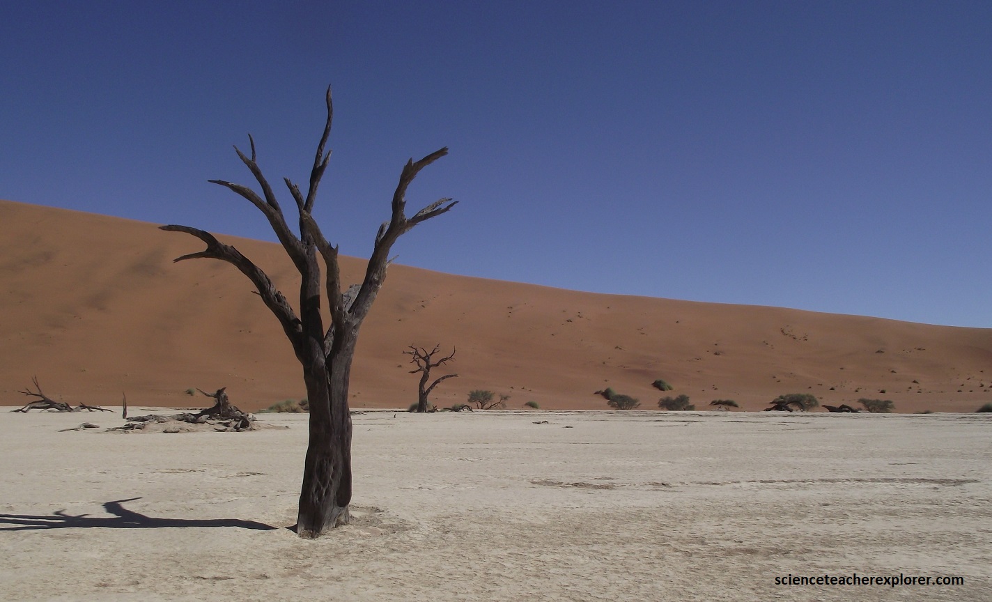
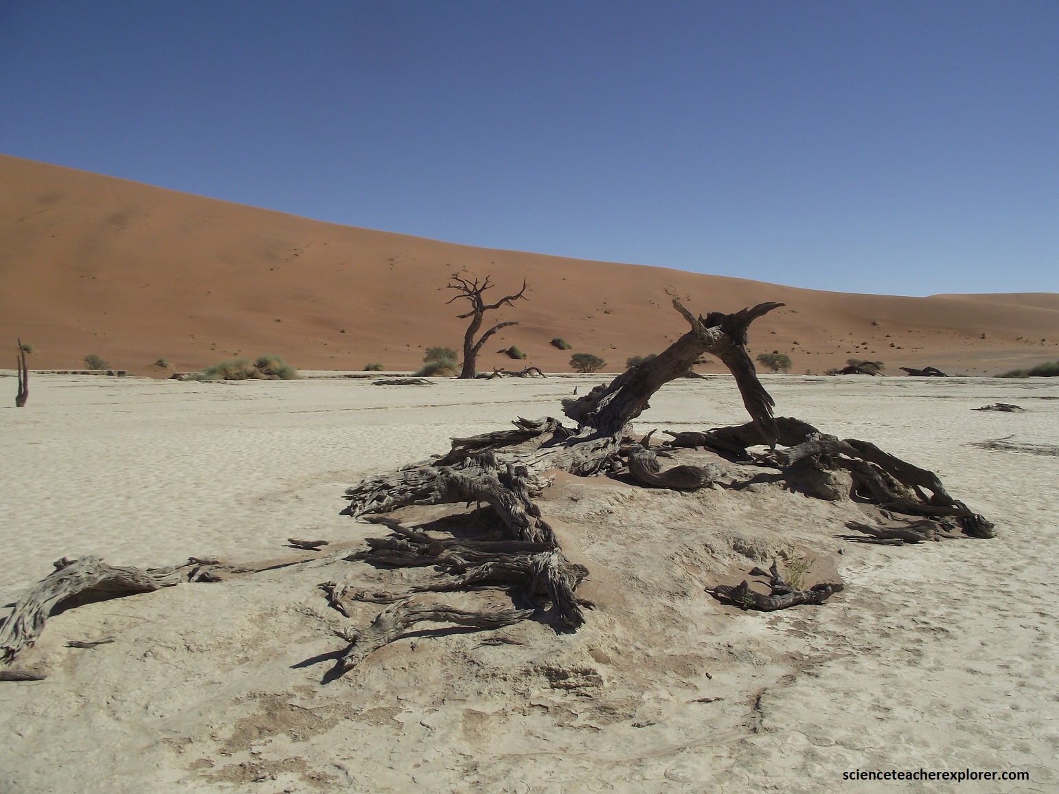
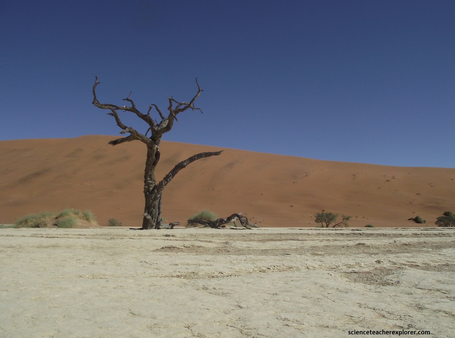
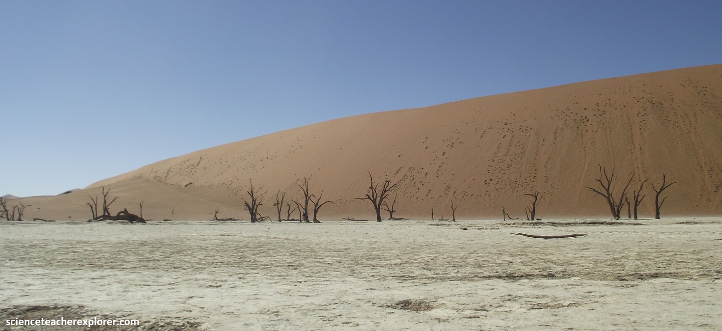
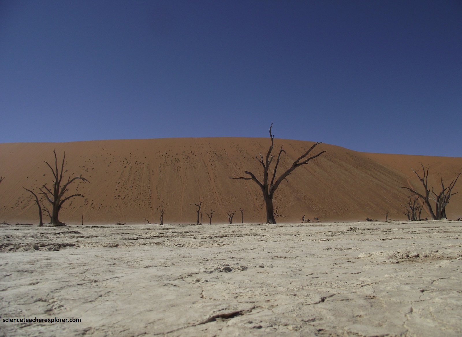
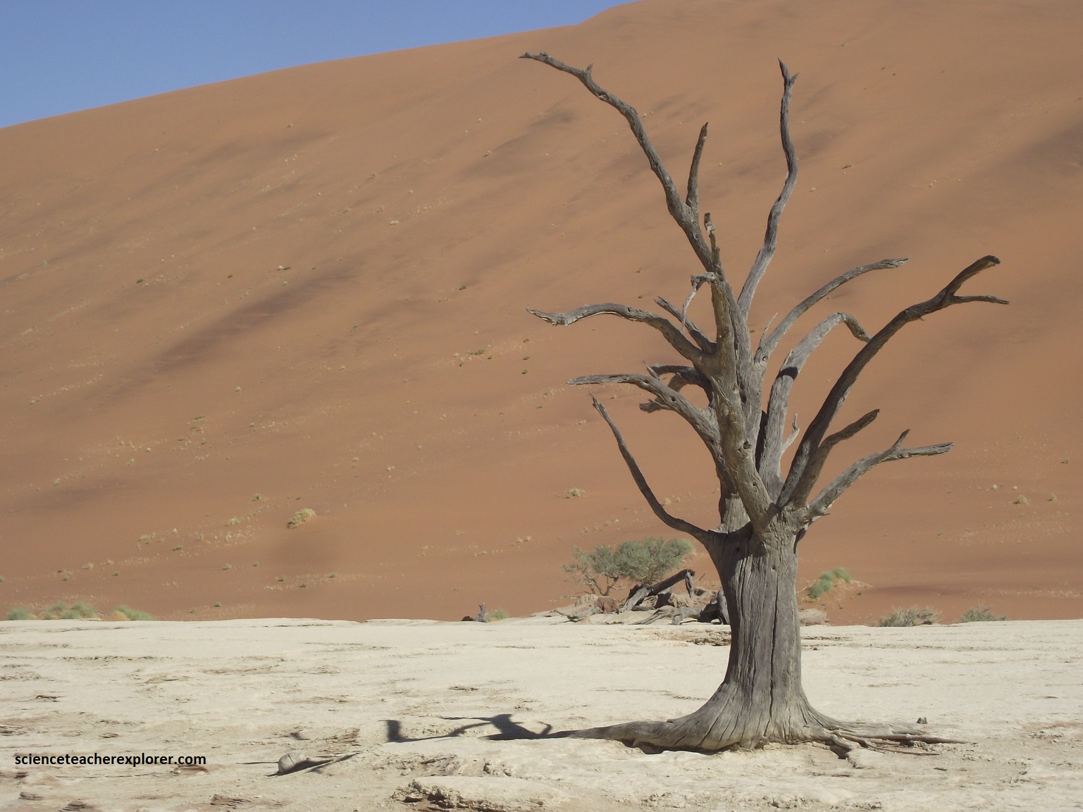
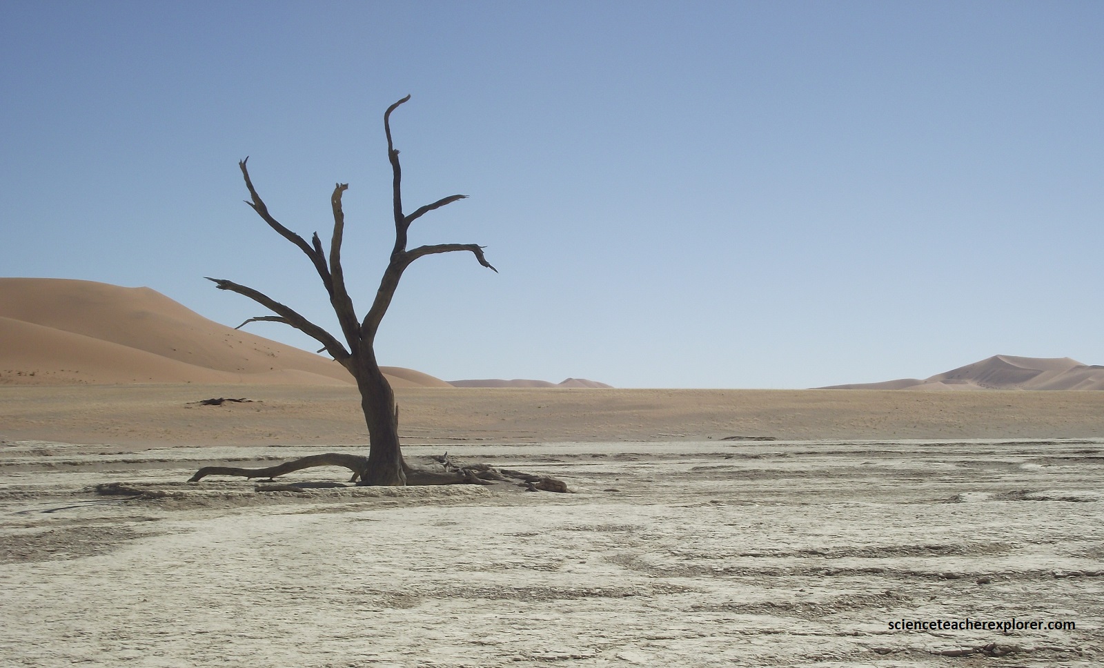
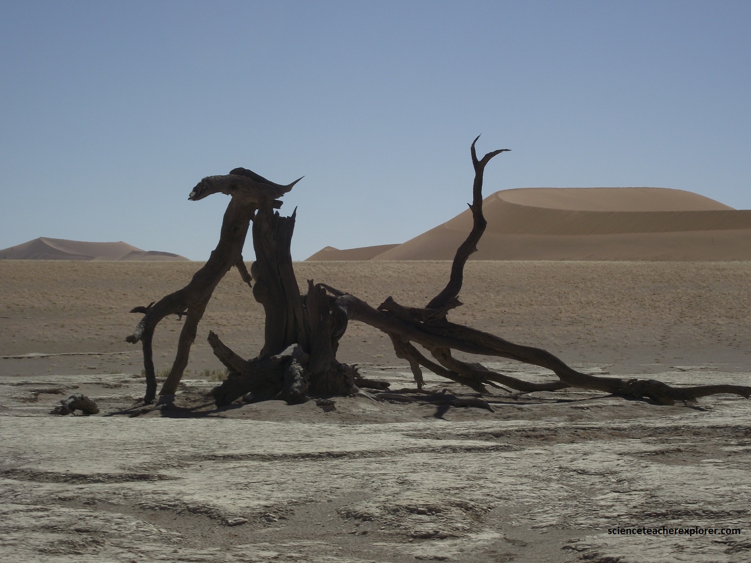
A resulting phenomenon is the white clay pan of Deadvlei, (pictured below).
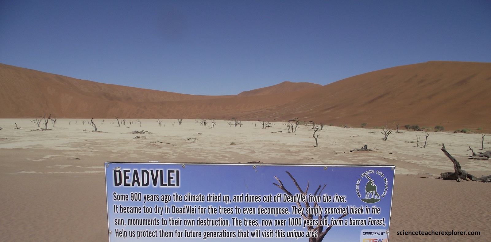
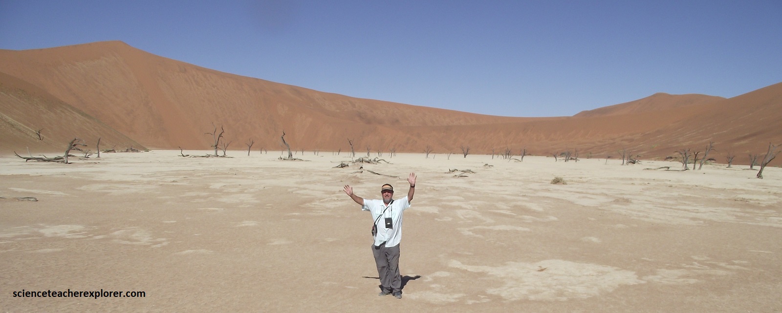
Originally bathed in water from the flooding Tsauchab River, the area was populated by camel thorn trees. As the erratic movement of the dunes diverted the ephemeral river in other directions, the Deadvlei area became totally deprived of water some 900 year ago. The trees quickly died and dried under the scorching sun, but have not decomposed as a result of the dryness of the climate. Their black skeletons have remained standing ever since.
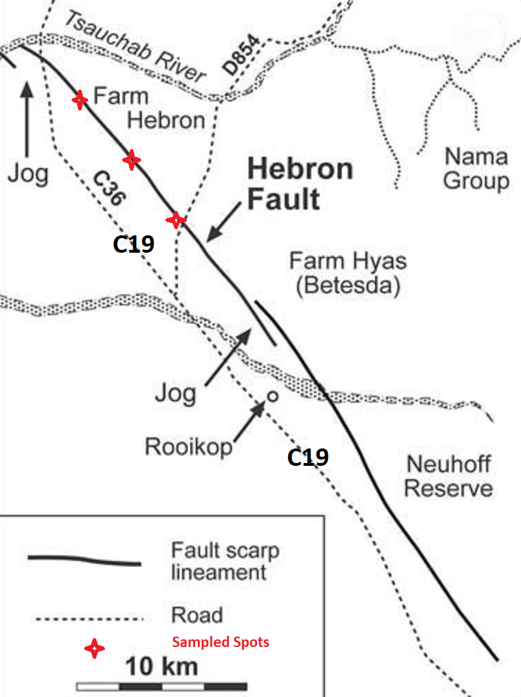
Just east of Sesriem Canyon, on C19, I noticed a recent geological fault scarp, that seemed to parallel the road. Later, I found that the locals called it the Hebron Fault. Pictured below, I followed the Hebron Fault for about 60km. I noticed that many of the local human communities, pop-up along this fault-scarp, (which to appear as a ‘Normal-Fault’ from my brief assessment). {Note: Normal faults are caused by tensional (extensional) forces that cause the rock above the inclined fault plane (hanging wall) to move downward relative to the rock below the fault (footwall)}.
The movement along a fault plane, like the Hebron Fault, shatters and breaks the adjacent rocks, creating a “damage zone” with increased porosity and permeability. This allows groundwater & geothermal-water to percolate deep into and out of the Earth. In the desert regions, this is a very valuable resource & location.
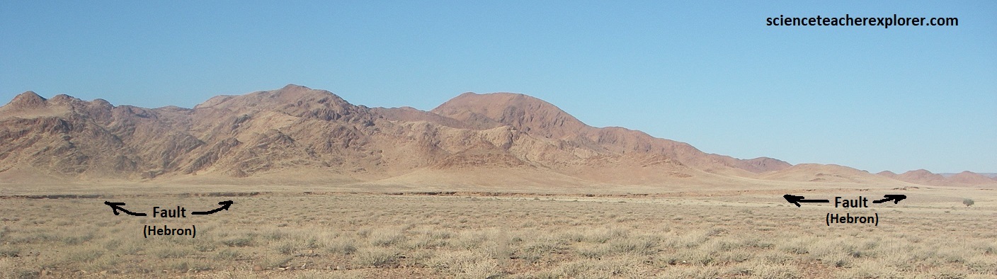
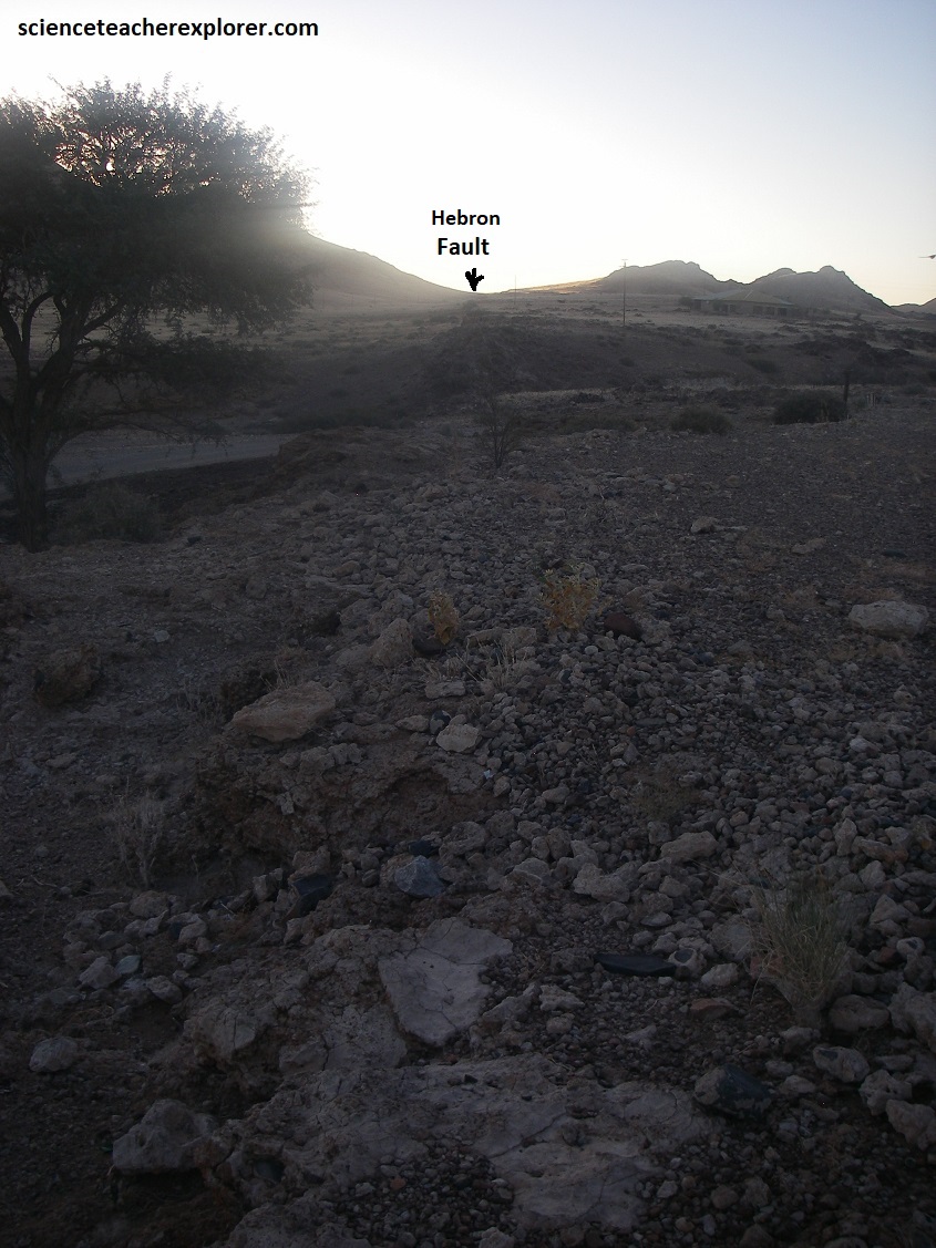
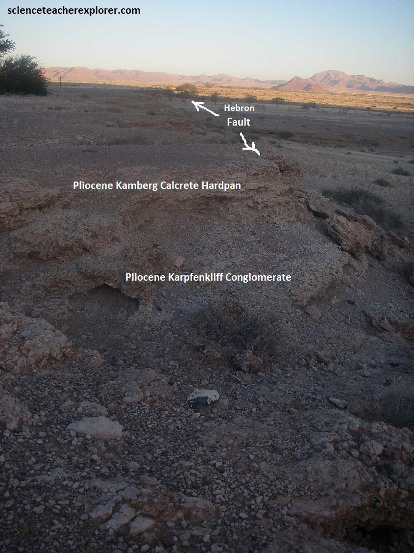
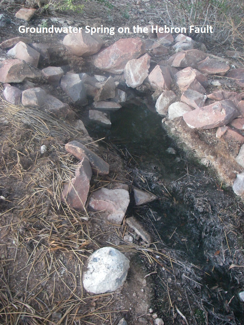
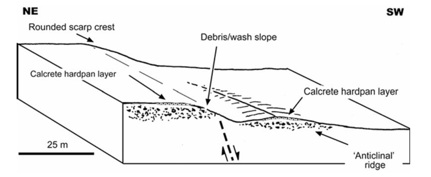
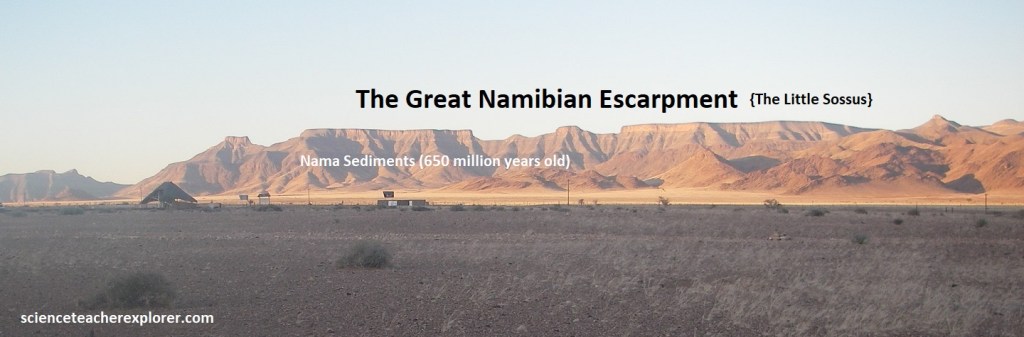
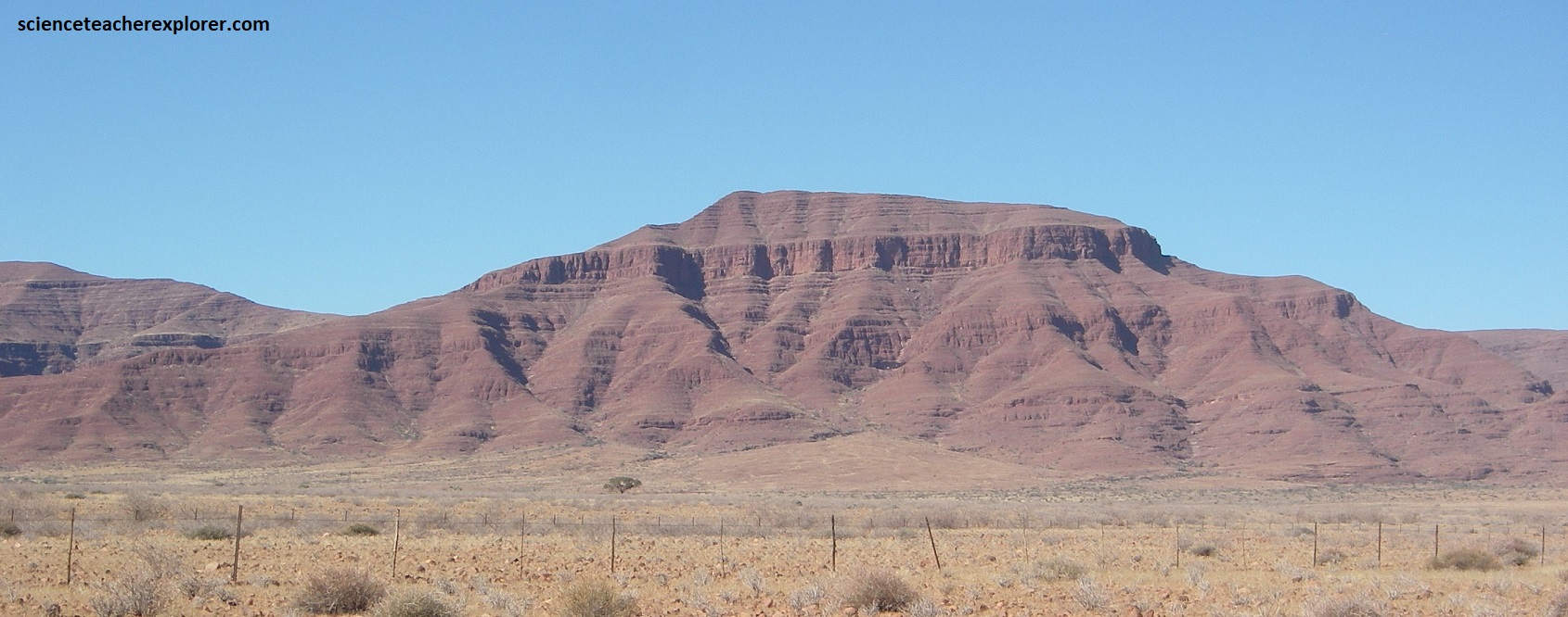
Pictured above, the Hebron Fault scarp varies in height from ,1m to almost 10m, developed principally in otherwise relatively featureless, Pliocene calcrete, cemented-conglomerates and an overlying thinly laminated hardpan layer. Pictured below, the horizontal layers of non-deformed Nama (aged about 650 million years) sediments form classic tabletop horizontal mountains above the Hebron Fault on the Great Namibian Escarpment. The locals call these mountains the ‘Little Sossus’.
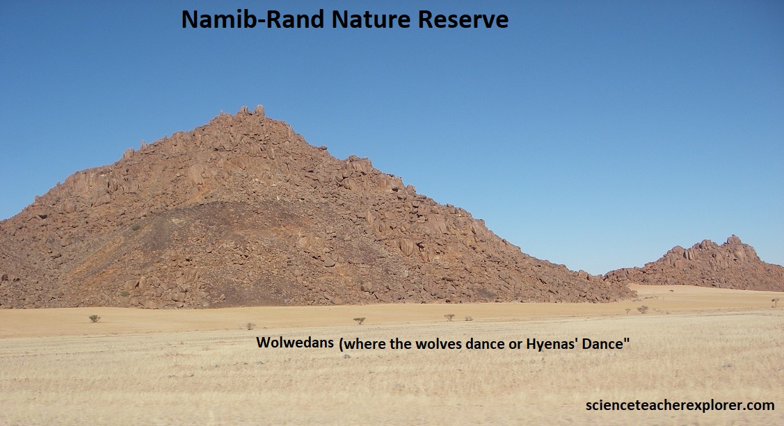
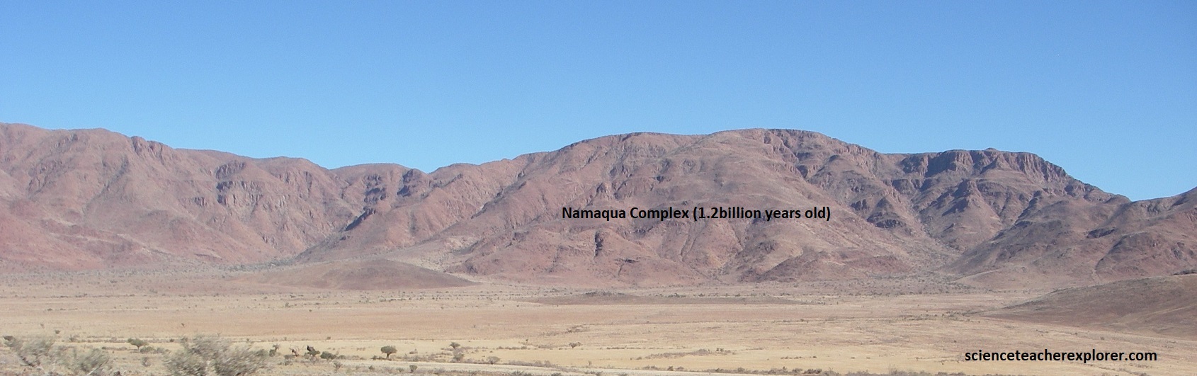
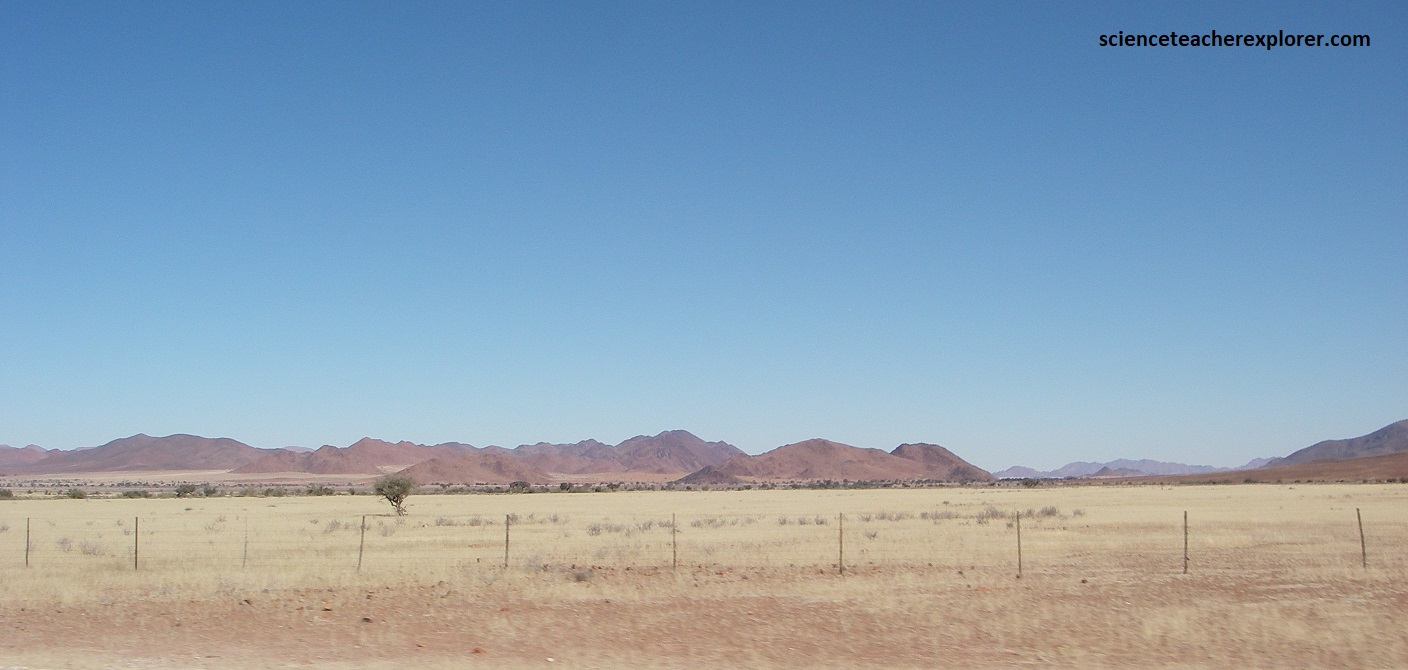
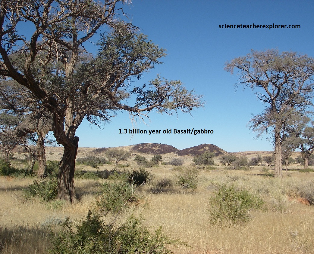
From the Sesriem Canyon area, I continued driving south on the graveled road of C27. This road passed through the NamibRand Nature Reserve. The view along this road was spectacular. Weathering features in the exposed rock areas were plentiful to see, and are largely due to the high variation in temperatures during the day. The geology of NamibRand Nature Reserve featured a diverse desert landscape, like red dunes, gravel plains, mountains (inselbergs), and sandy plains, underlain by ancient rocks such as the 1.2 billion year old granites, (Namaqua Complex) and the black volcanic lavas (Sinclair Barby Volcanics) with younger Nama sediments, (265 million years old), forming flat-topped hills, (pictured below).
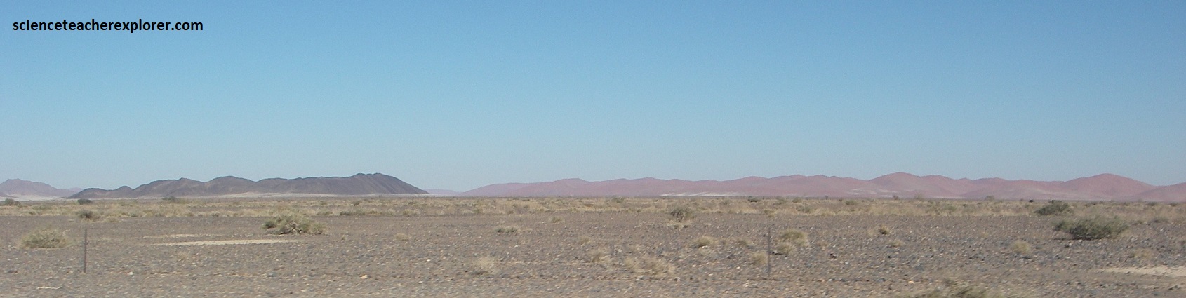
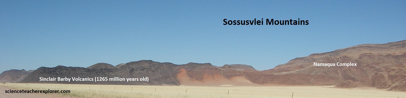
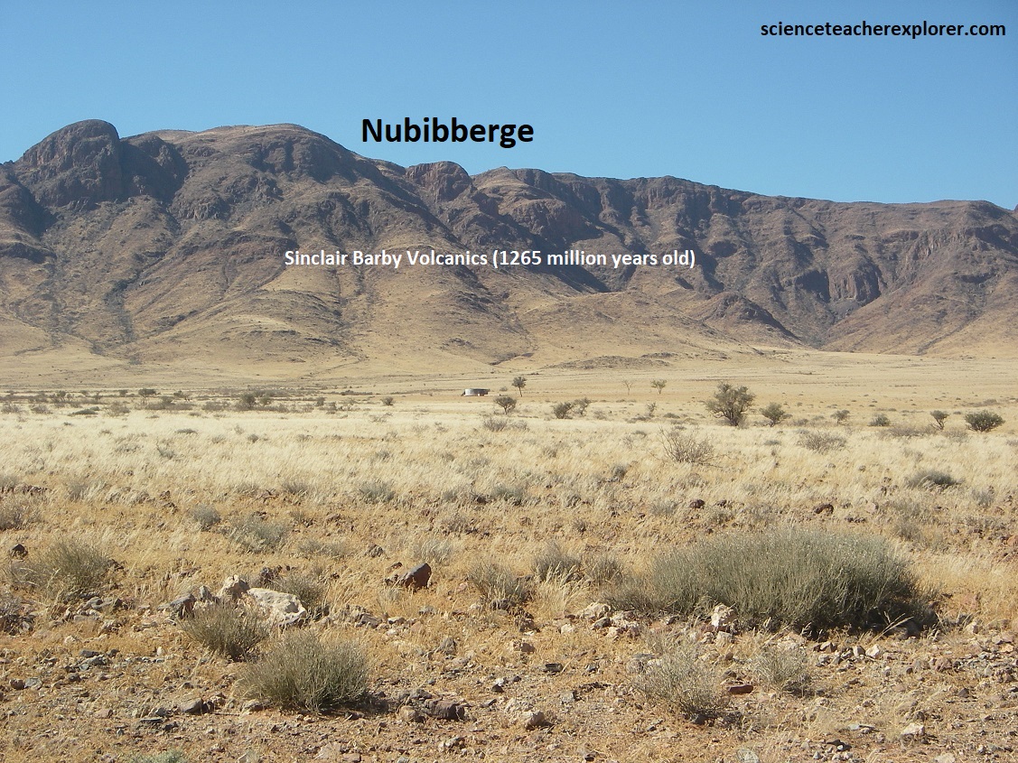
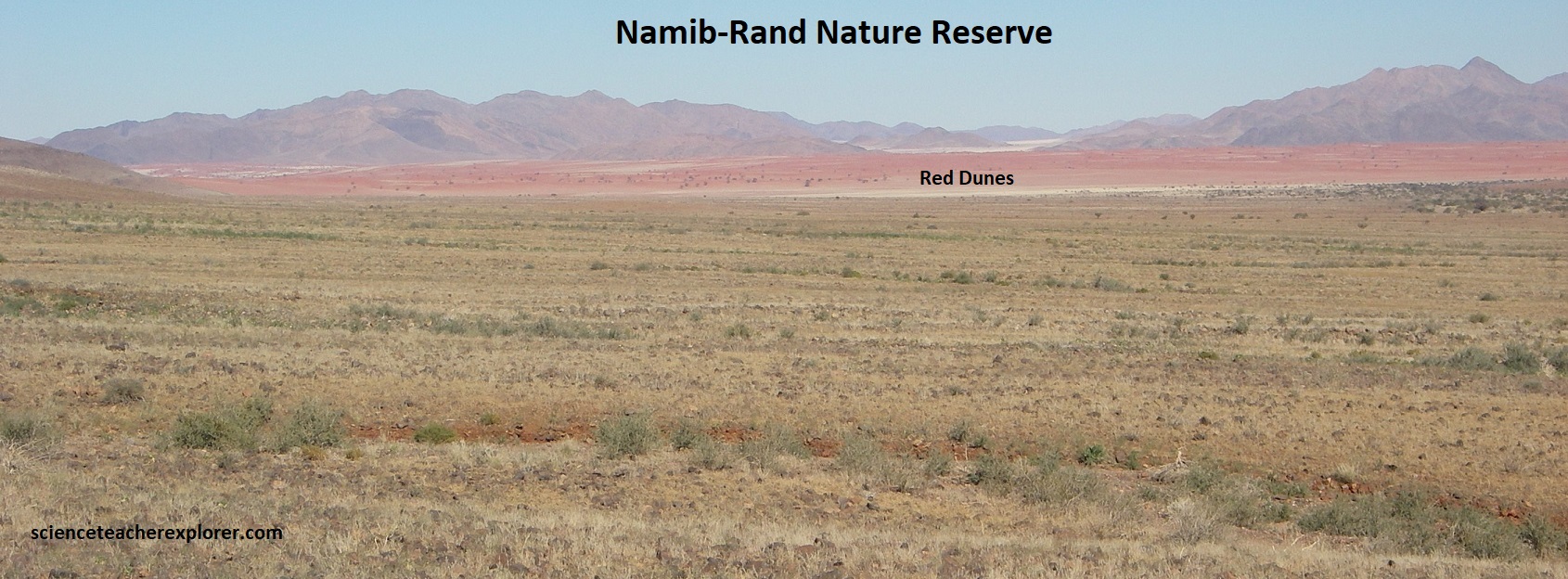
The 1.26 billion year old “Sinclair Barby Volcanics” are acid (silica rich) and basic (silica poor) rocks inter-bedded with sediment that have been highly deformed deep within the crust and are now exposed by erosion. Weathering features in the exposed rock areas are plentiful to see, and are largely due to the high variation in temperatures during the day. The ‘Namib Sand Sea’ was still characterized by a twisting line of south to north dunes caused by a funnel effect of the strong south winds between the high mountains. Large north-south trending mountains, with isolated inselberg hills were interspersed with flat gravel covered plains and in the west the sand dunes of the Namib Desert.
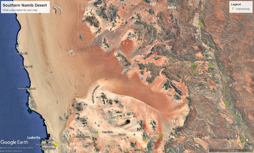
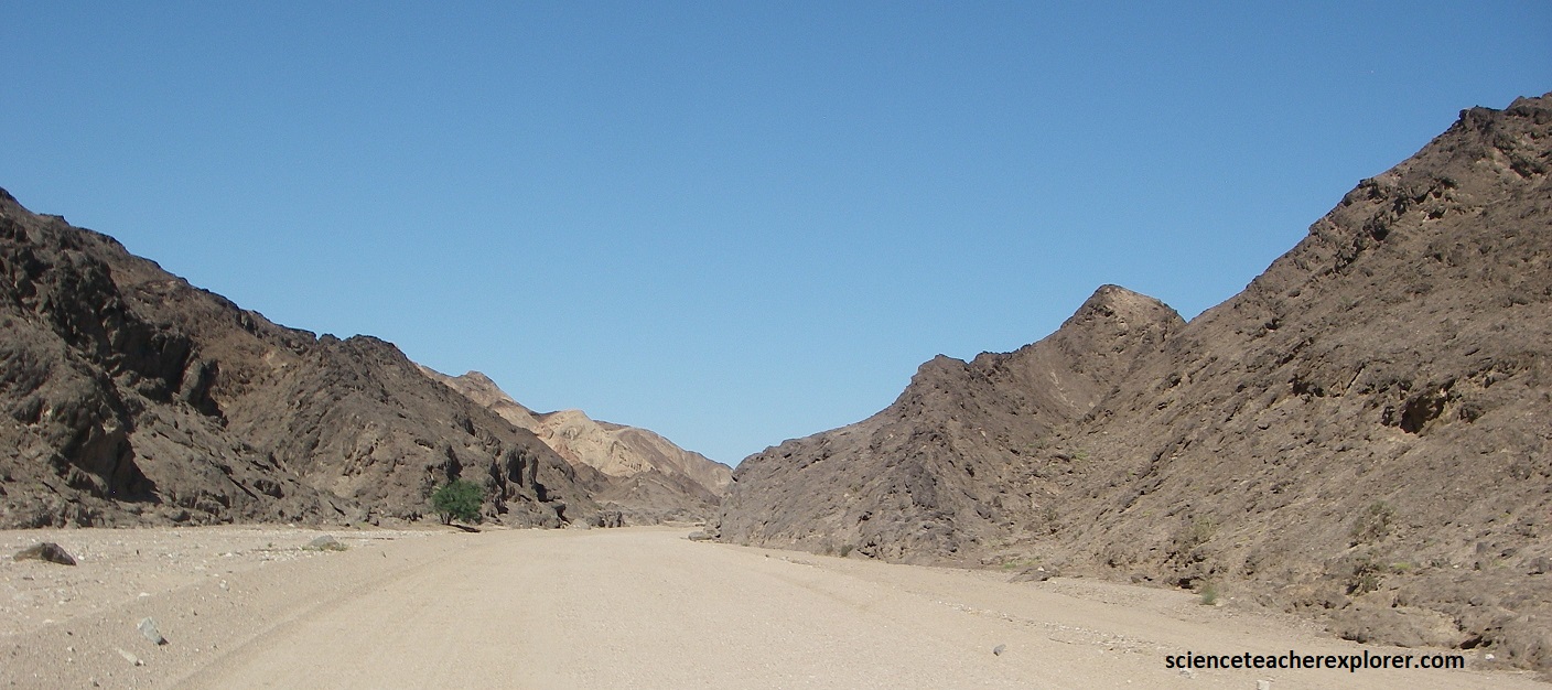
I continued driving south on the C27, graveled road, past Betta & the Sinclair Mine. The Sinclair Mine was a historic, multi-mineral deposit in the Kara Region (near Helmeringhausen) known for copper, but also containing valuable lithium, cesium, tantalum and gold, with a complex past of small-scale mining since the late 1800s. Once I finally arrived at Helmeringhausen and got fuel, I continued driving southwest on C13, (also a graveled road and pictured below).
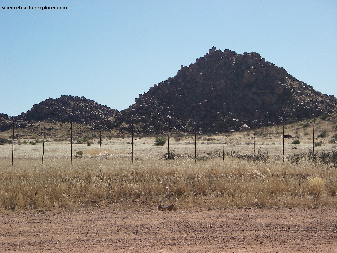
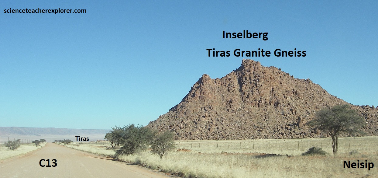
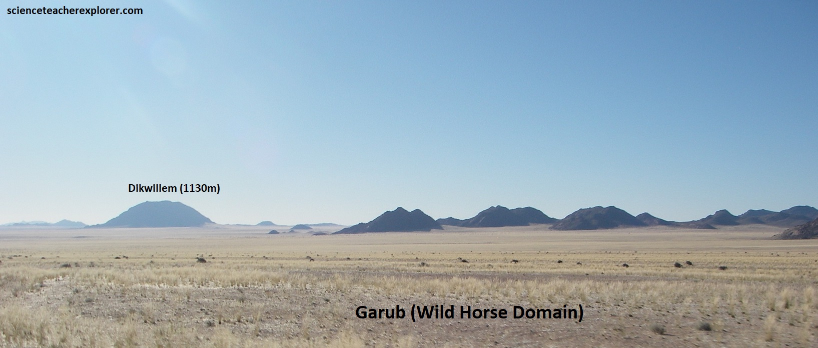
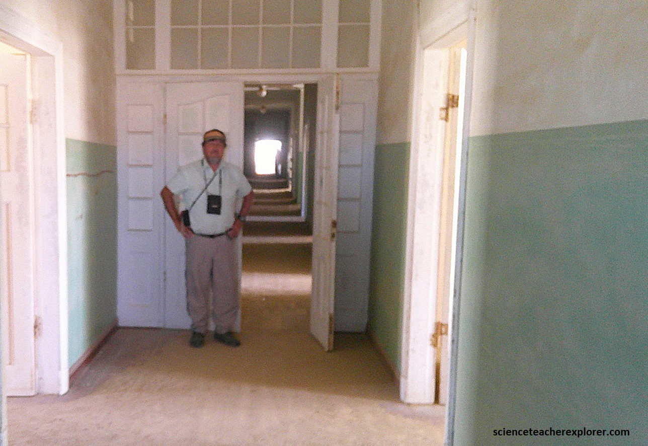
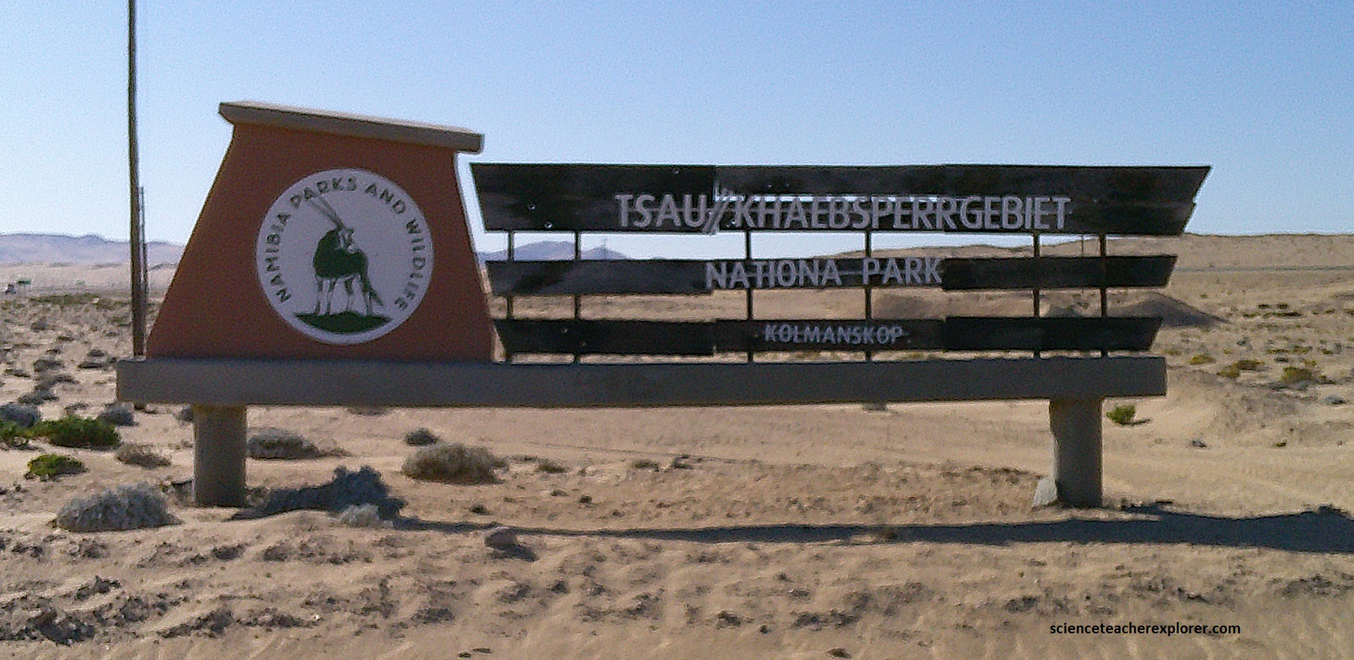
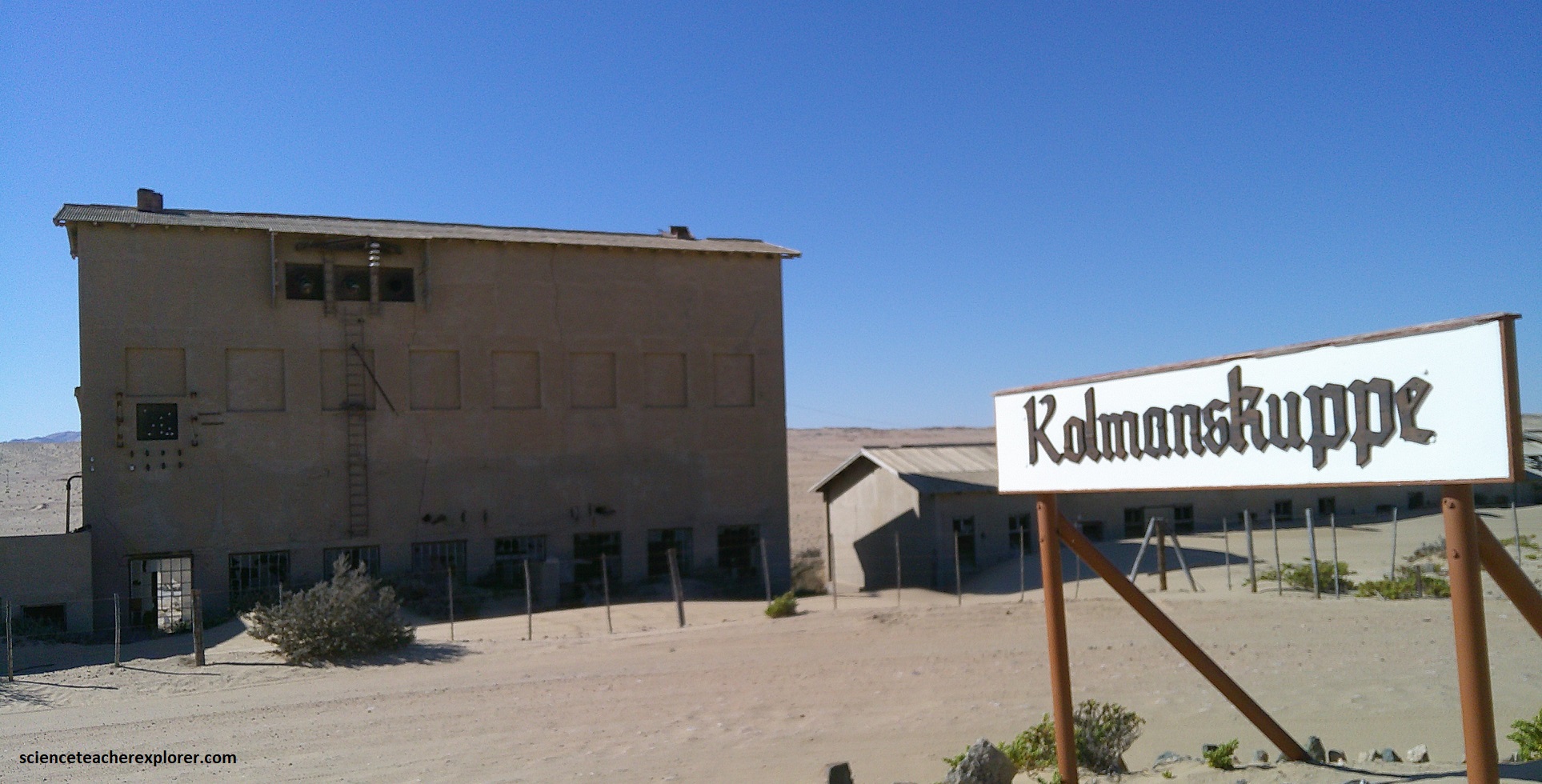
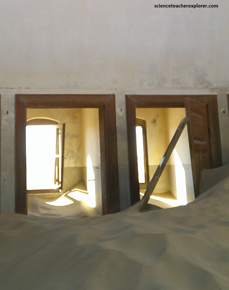
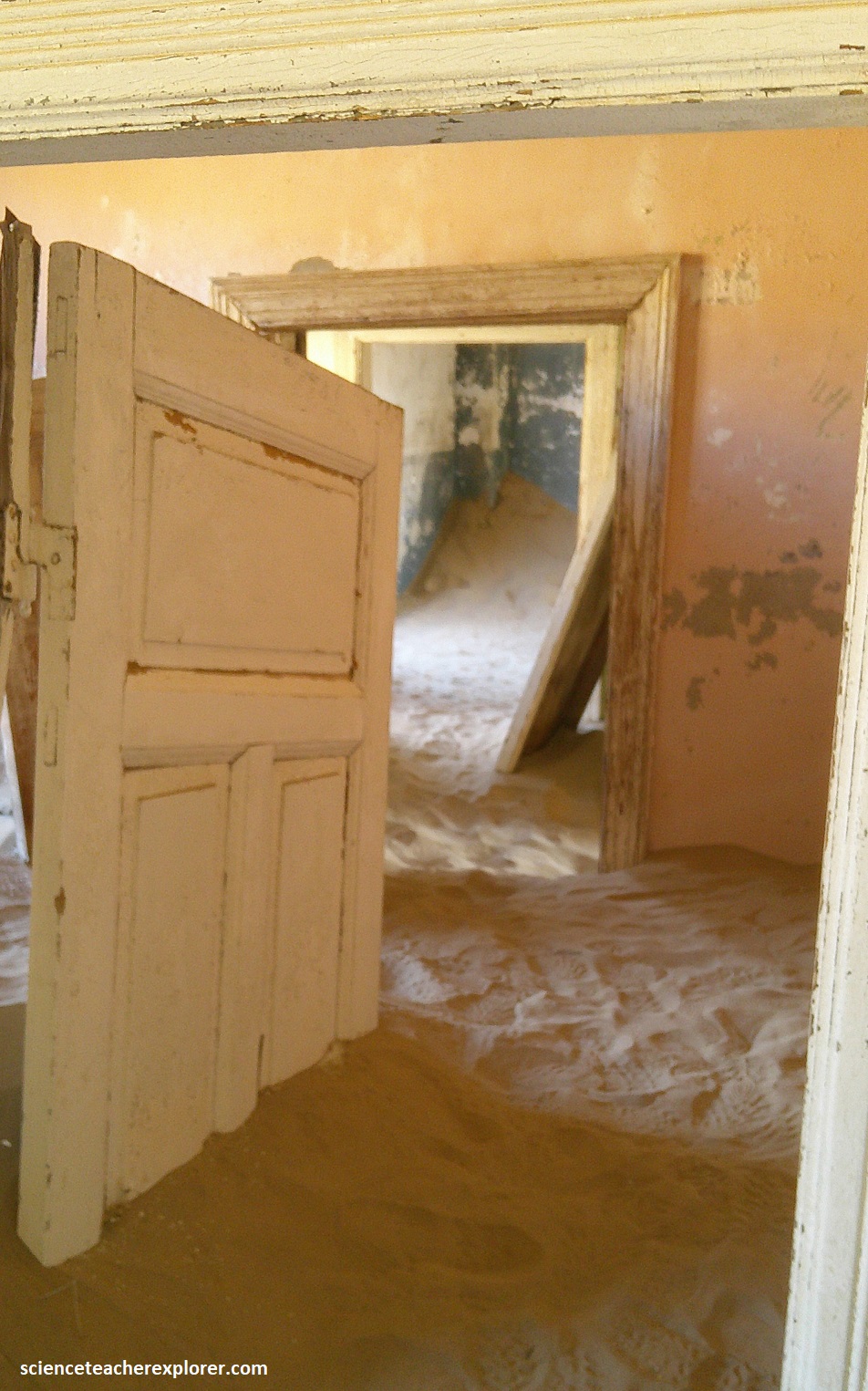
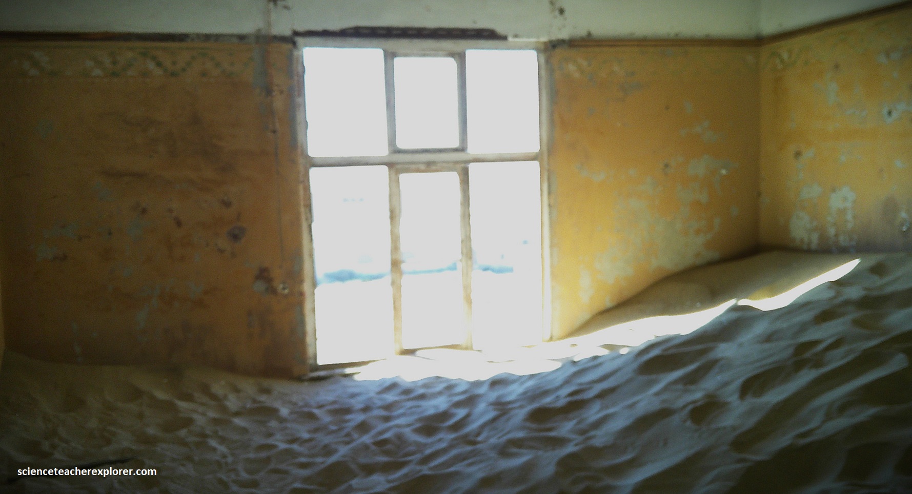
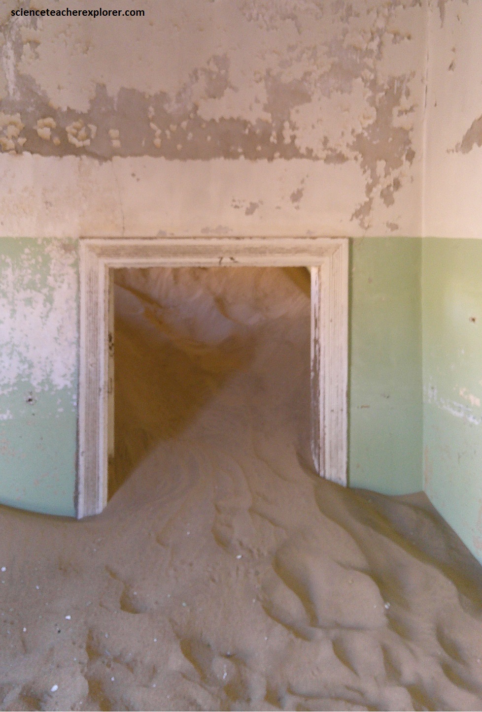
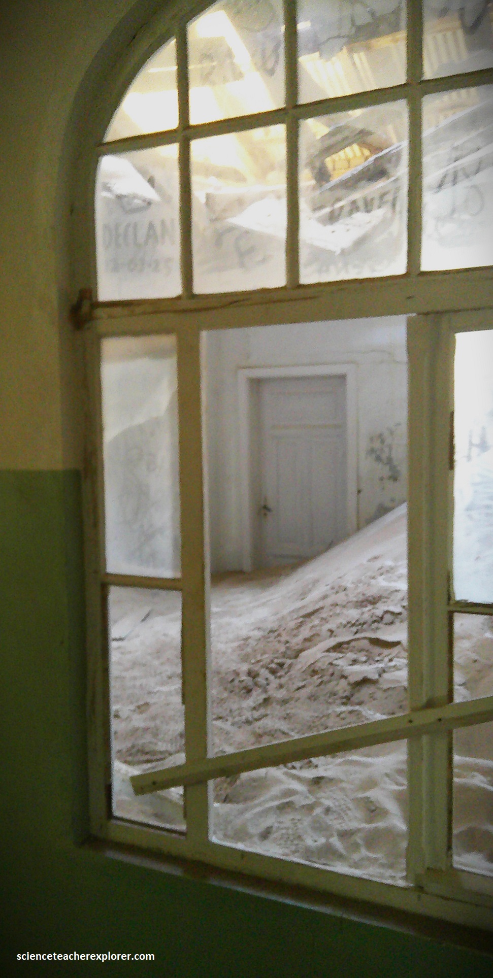
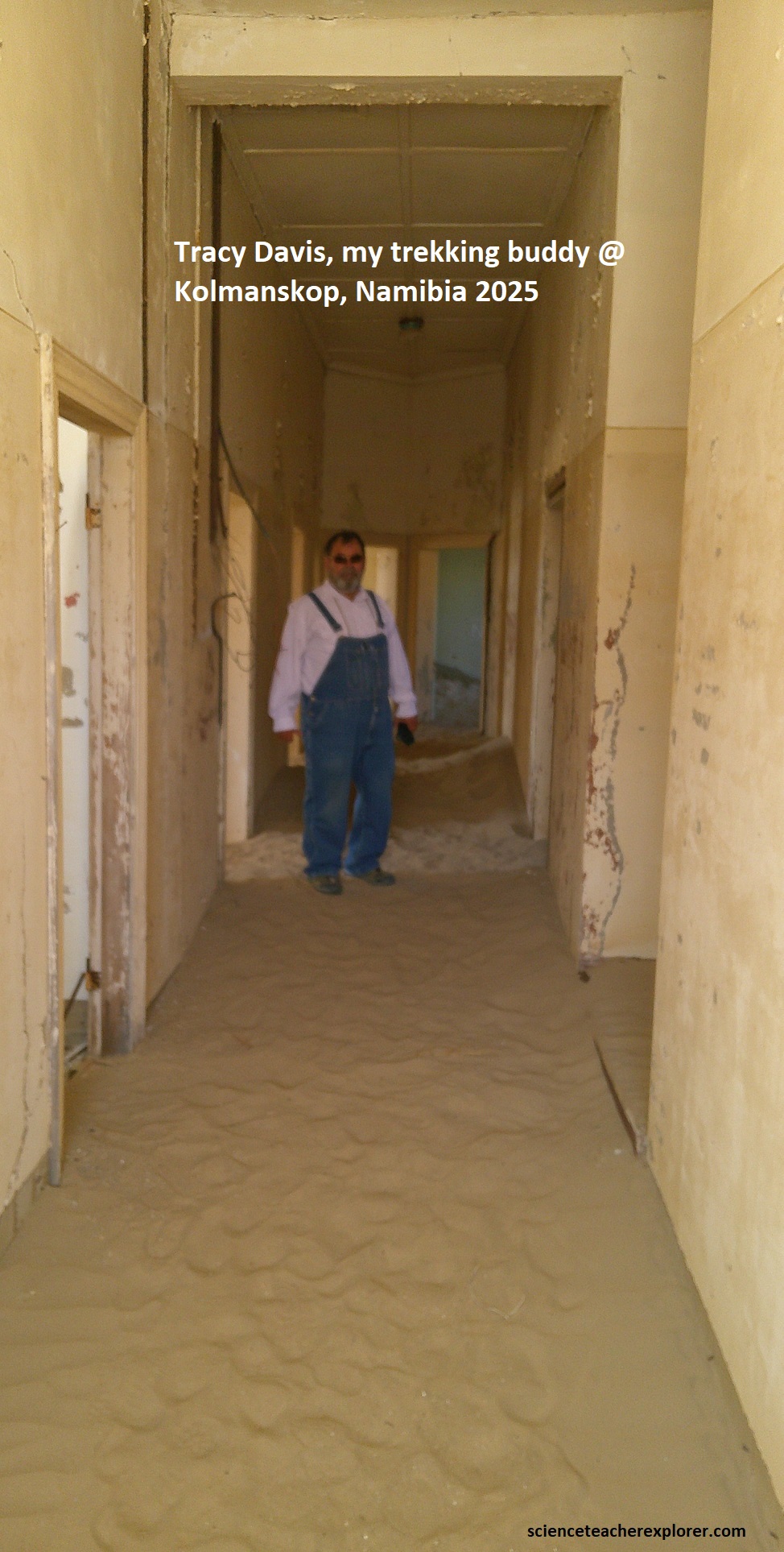
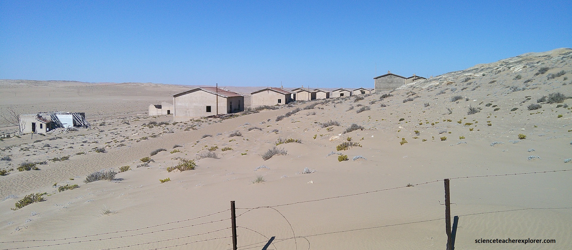
The Tirasberg mountains along C13, are primarily composed of ancient granite outcrops and associated with metamorphosed marine sedimentary layers, specifically shales and sandstones of the Nama Group, (551-538 million years ago). However, the core of the Tirasberg consists of massive granite intrusions, which are ancient magma chambers that cooled underground over a billion years ago. Subsequent erosion has exposed these hard, erosion-resistant igneous rocks as isolated peaks (inselbergs) and large boulder piles that dominate the landscape, (pictured above). The distinct geology visible along the C13 road features a striking contrast between the dark, crystalline red granite and the surrounding desert sands in the valleys. The graveled C13 ended near the ‘Aus’ village at the B4 highway intersection. There I turned right, west, to cross the southern ‘Namib Desert’ to Luderitz, Namibia on the coast. My primary goal here was to explore and trek the nearby infamous ghost-town of Kolmanskop, (imaged below).
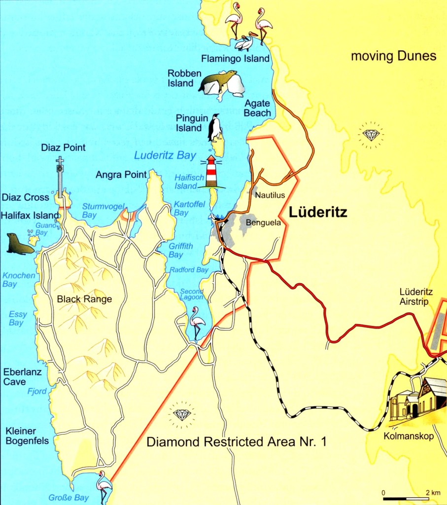
The Luderitz bay was first known to Europeans when Bartolomeu Dias encountered it in 1487. He named the bay Angra Pequena, (Small Bay) and erected a stone cross on the southern peninsula. In the 18th century, Dutch adventurers and scientists explored the area in search of minerals, but did not have much success. Further exploration expeditions followed in the early 19th century, during which the vast wildlife in the ocean was discovered. Profitable enterprises were set up, including whaling, seal hunting, fishing and guano harvesting. Luderitz thus began its life as a trading post throughout the 19th century.
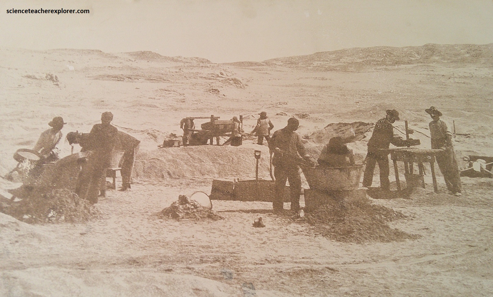
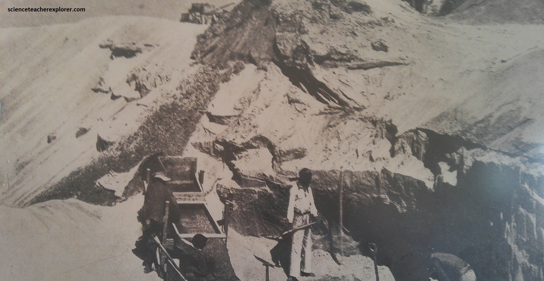
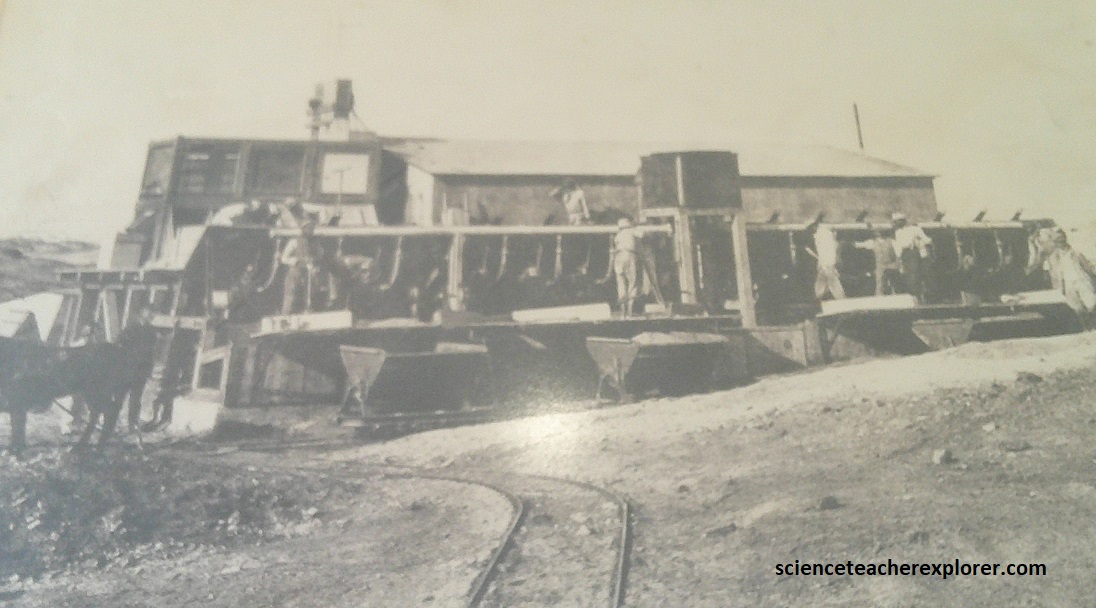
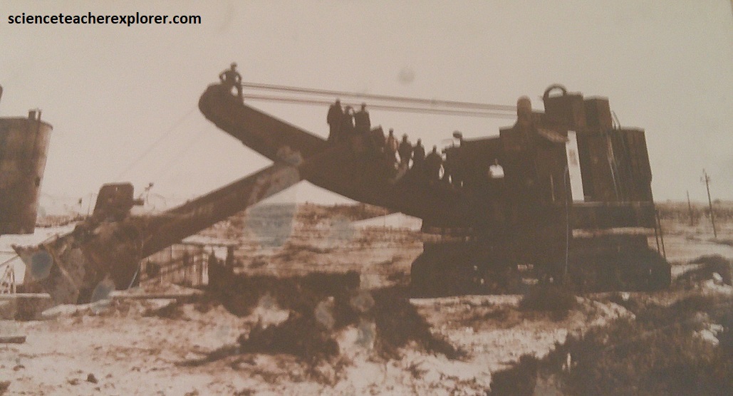
However, in April of 1908, a crystalline specimen was discovered by worker Zecharias Lewala as he was shovelling drift sand off the railway line at Kolmanskop. Workers had been asked by August Stauch, (a recently arrived German romantic convinced that sand in this area held natural treasures), to look out for diamonds. Lewala picked up a glittering stone and handed it to Stauch, who headed immediately for Swakopmund where he could have the shiny stone analyzed at a minerals laboratory. A visiting European gem expert confirmed that the stone was a diamond. Back in Luderitz, Stauch founded the Colonial Mining Company to explore the ground for which he had submitted a hasty claim.
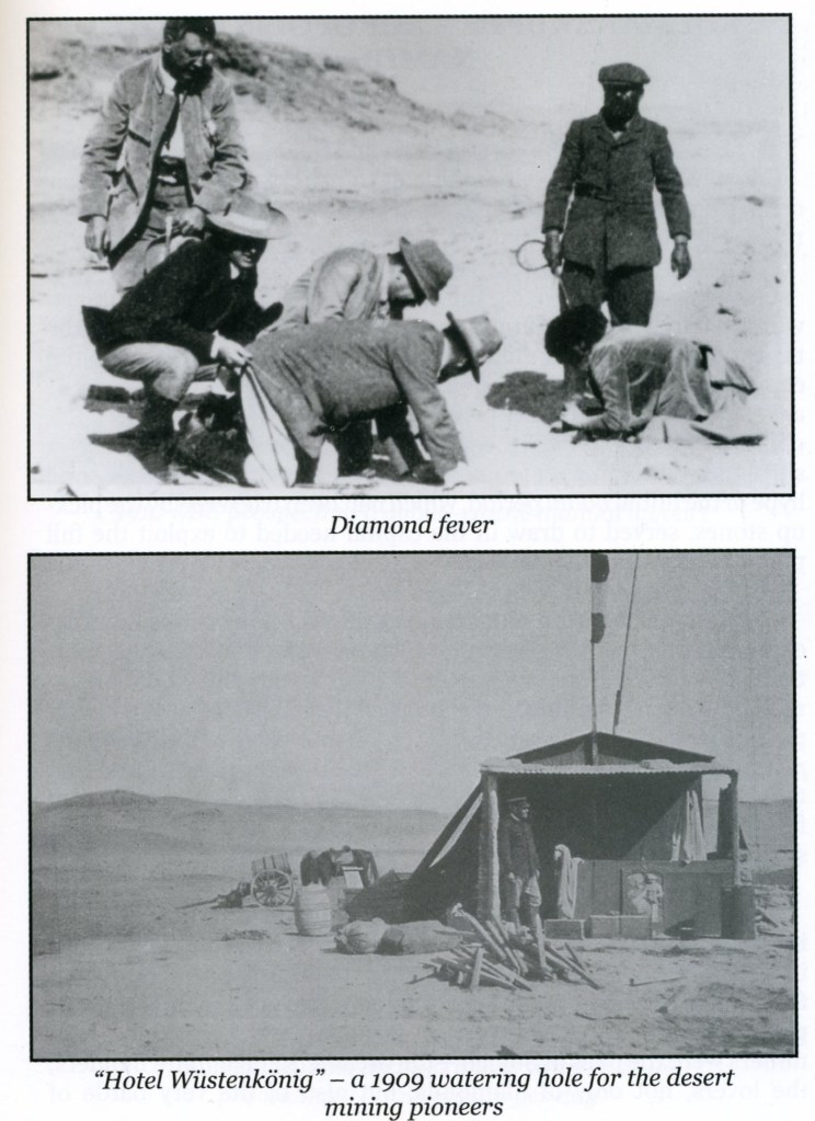
As the story went out that diamonds could be harvested by the scoop, a diamond rush ensued. By now a boom town, Kolmanskop welcomed the newly installed mine management and workers’ families, together with the usual crowd of fortune hunters coming from far and wide. Not only were the stones of the utmost quality, (the grade higher here than any other deposit before or since), but they were extremely easy to recover. In just a few years, Kolmanskop became one of the wealthiest towns in the world. {Image below were taken from an Interpretive Sign on-site}
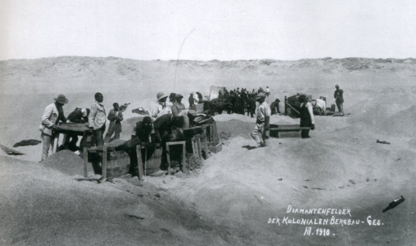
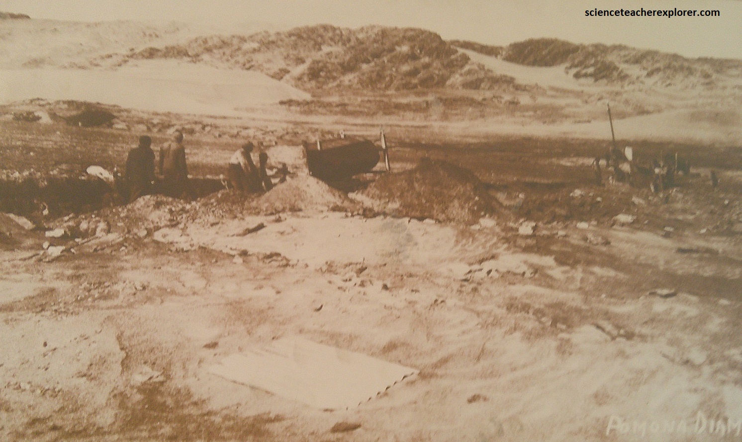
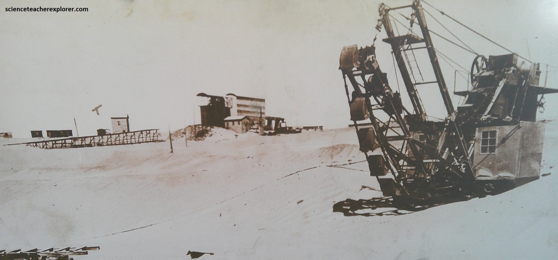
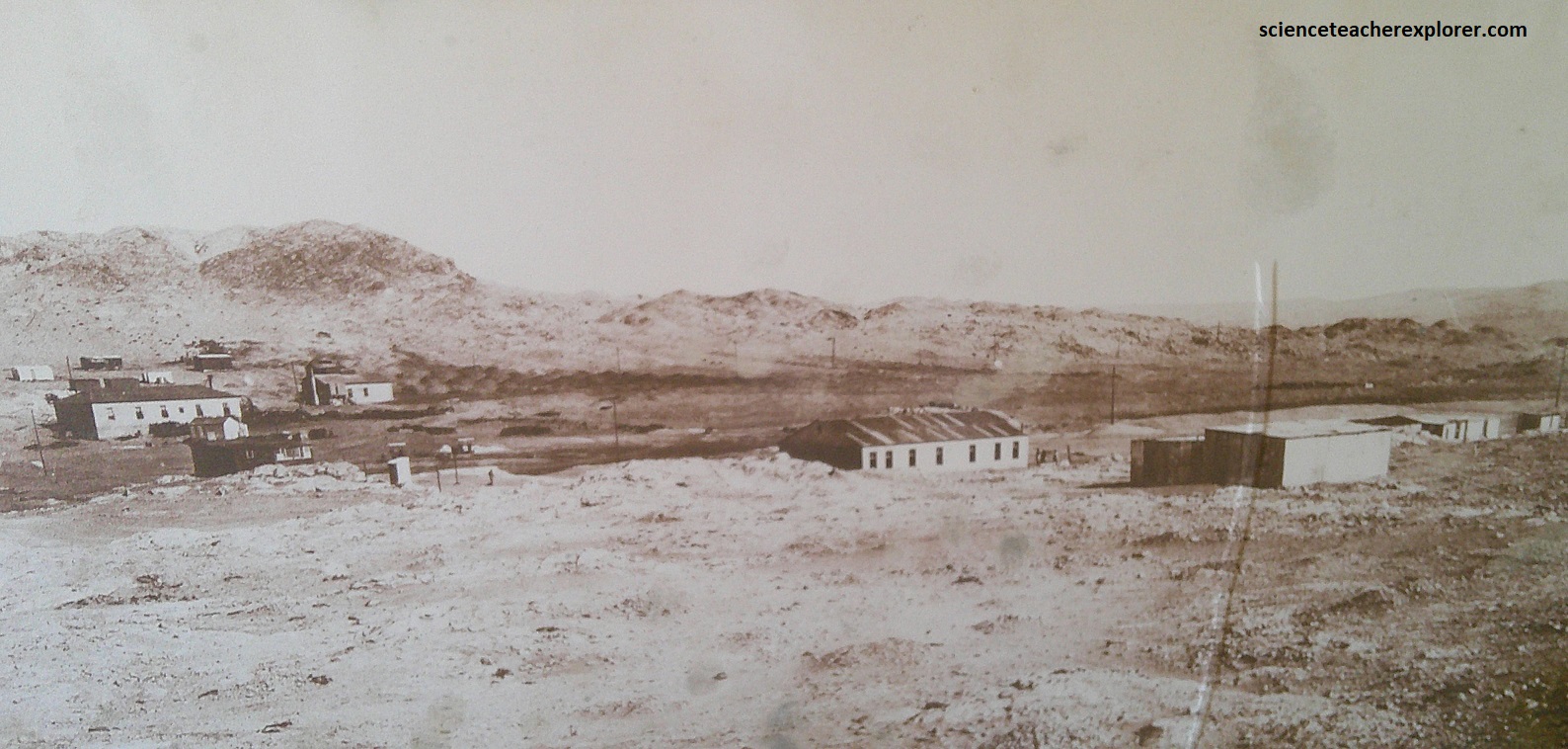
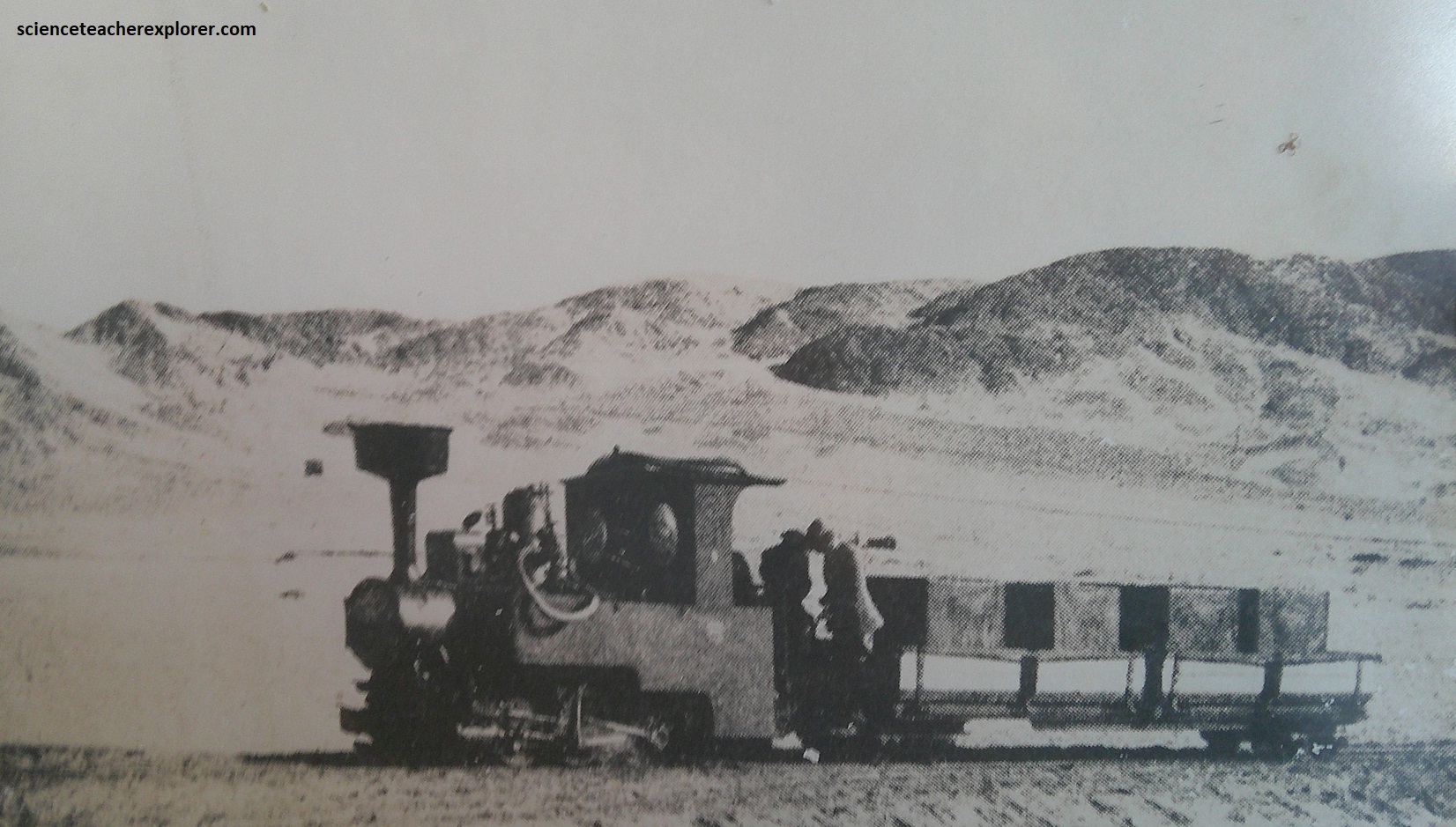
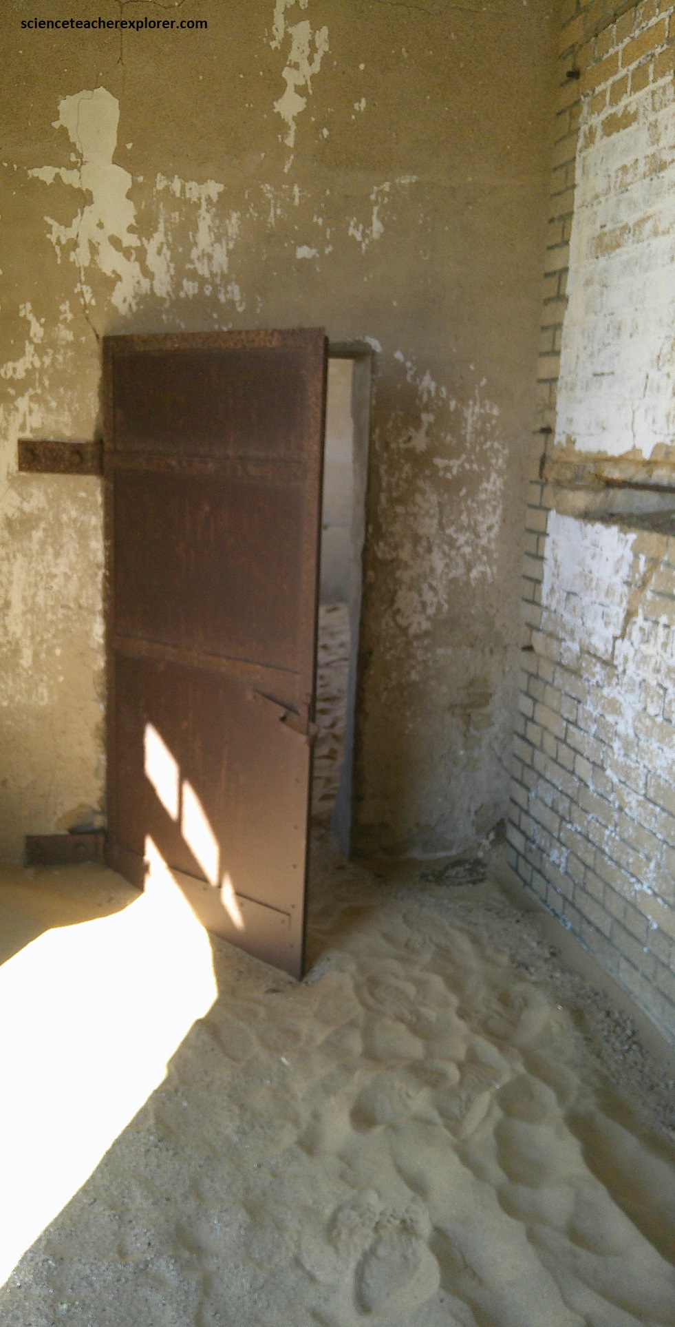
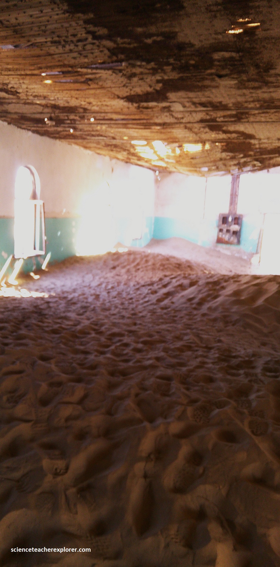
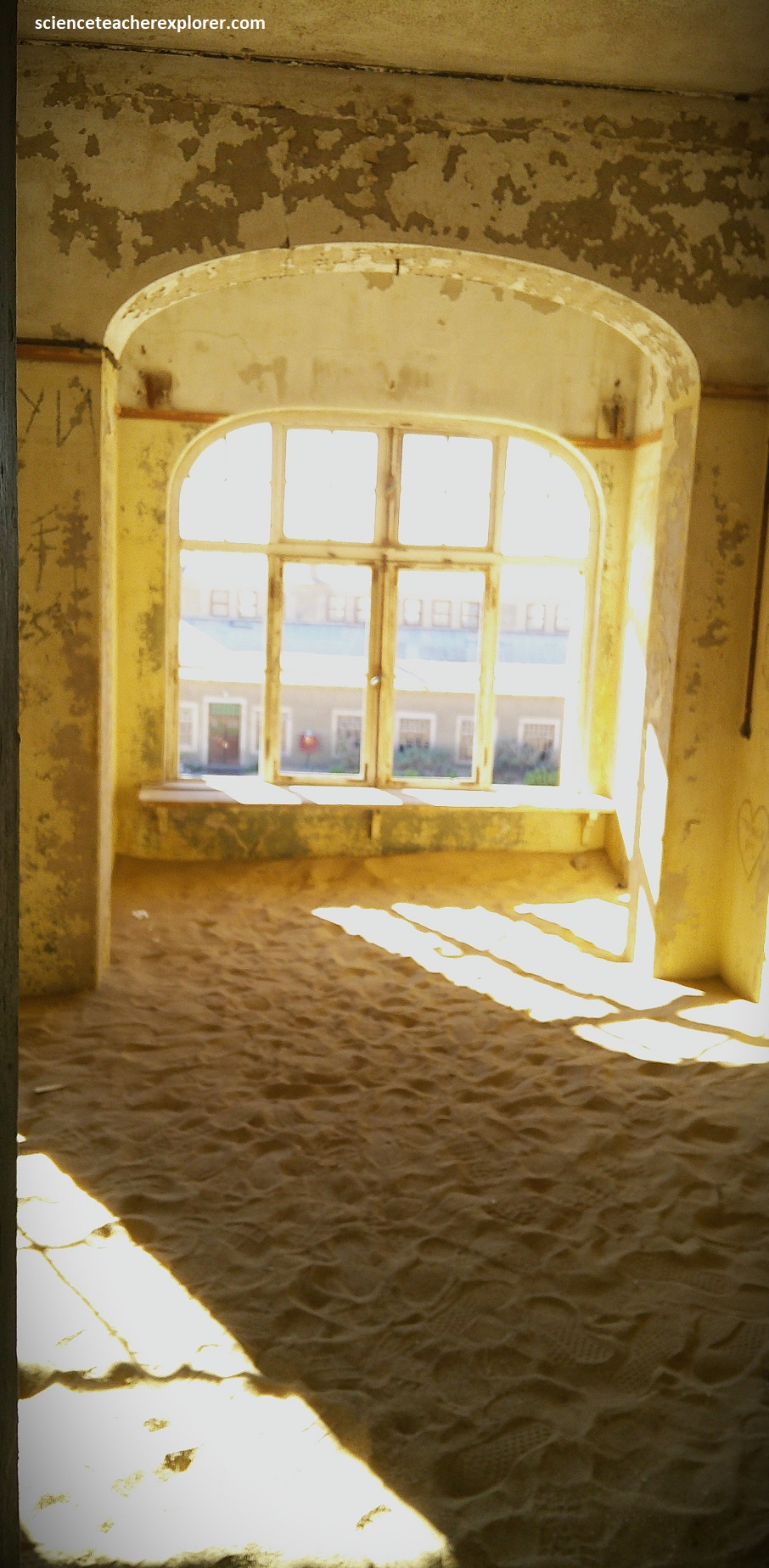
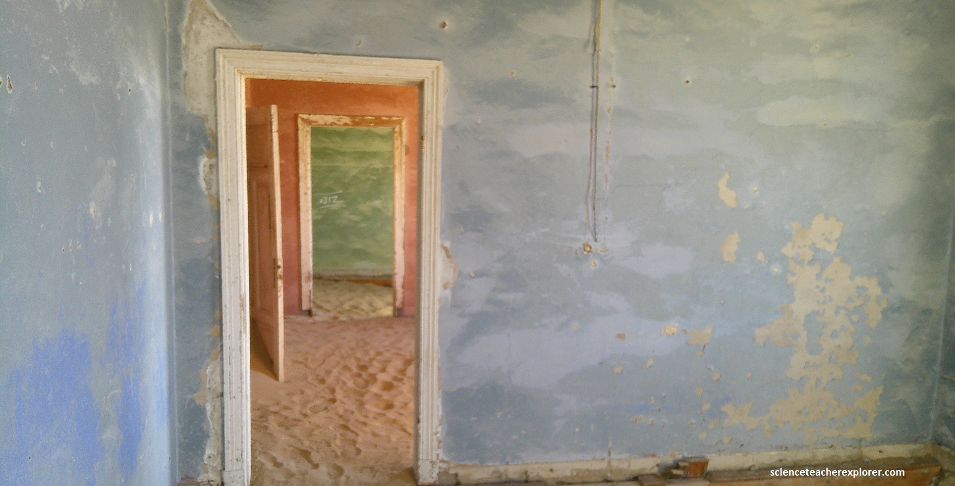
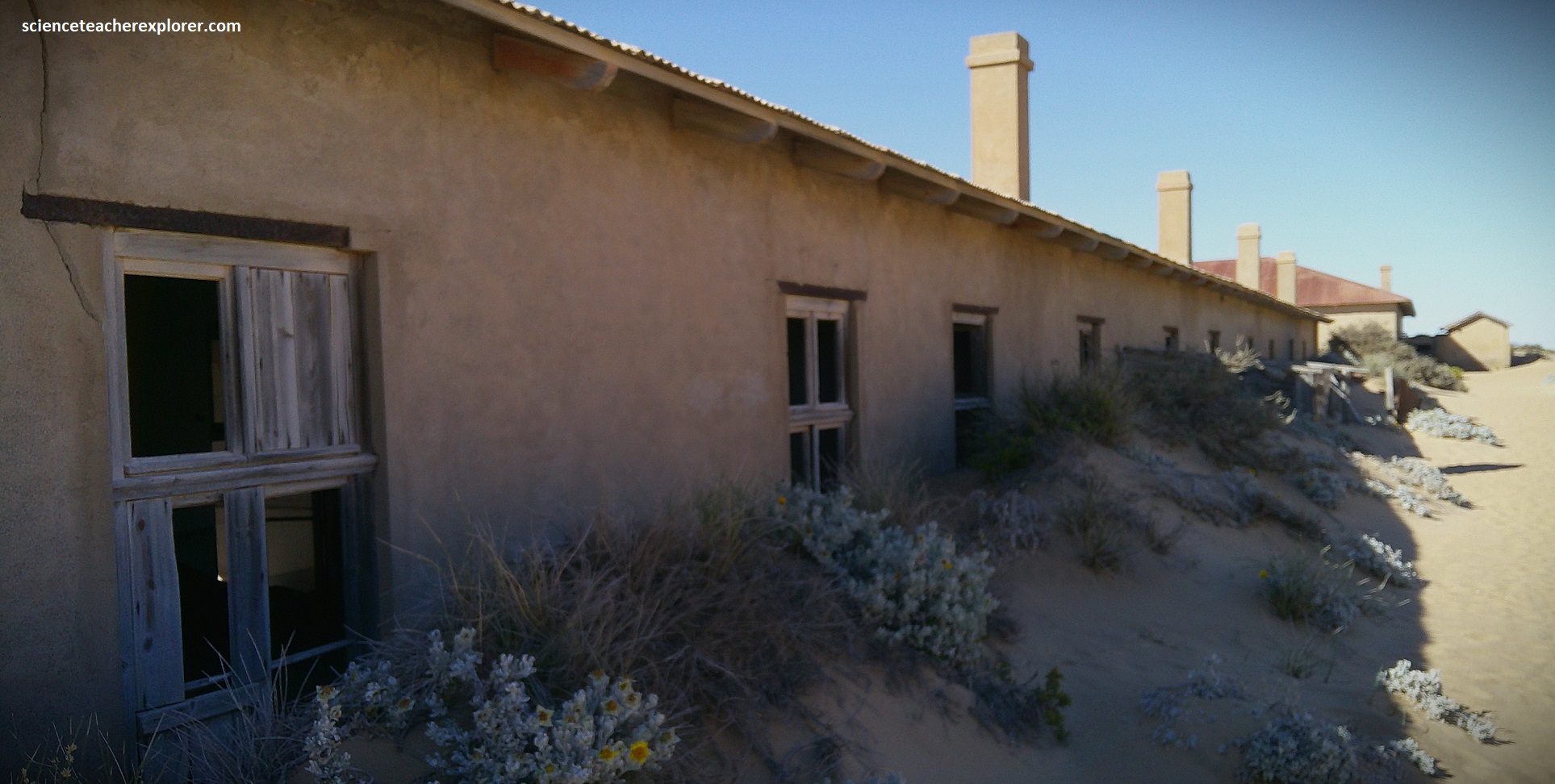
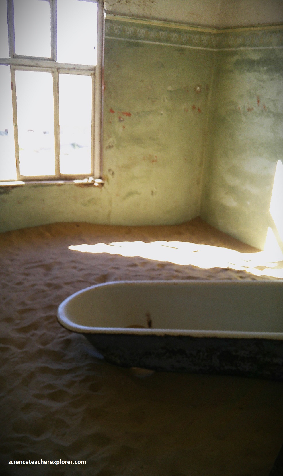
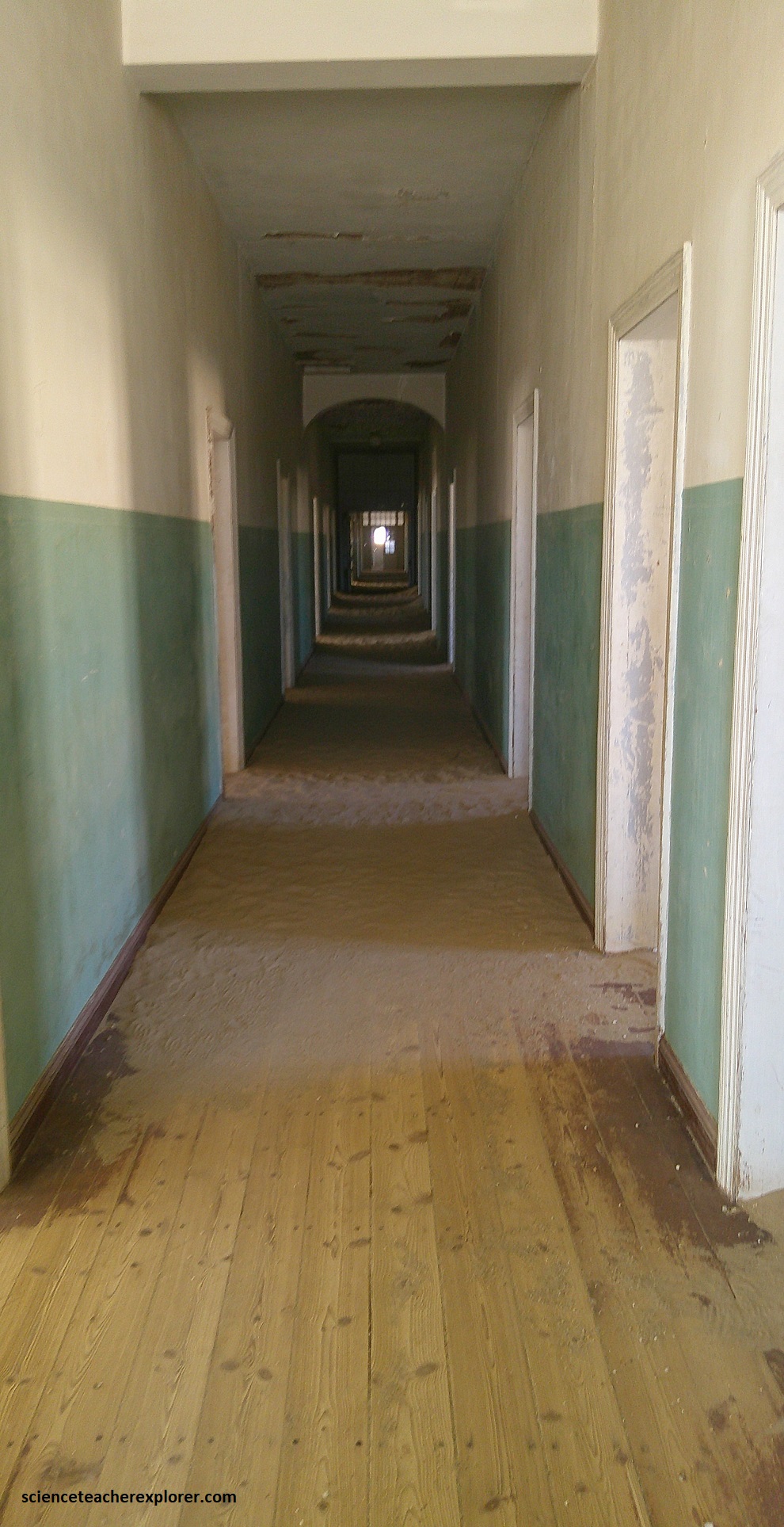
Pictured above, between 1908 & 1914, some 5 million carats were extracted from the area, amounting to roughly 1,000 kg. But World War I and new mineral discoveries further south put a sudden end to the wealth of Kolmanskop. Today it’s an eerie ghost town, swept by the desert sand and strong winds. Some houses & buildings are still standing, (pictured below).
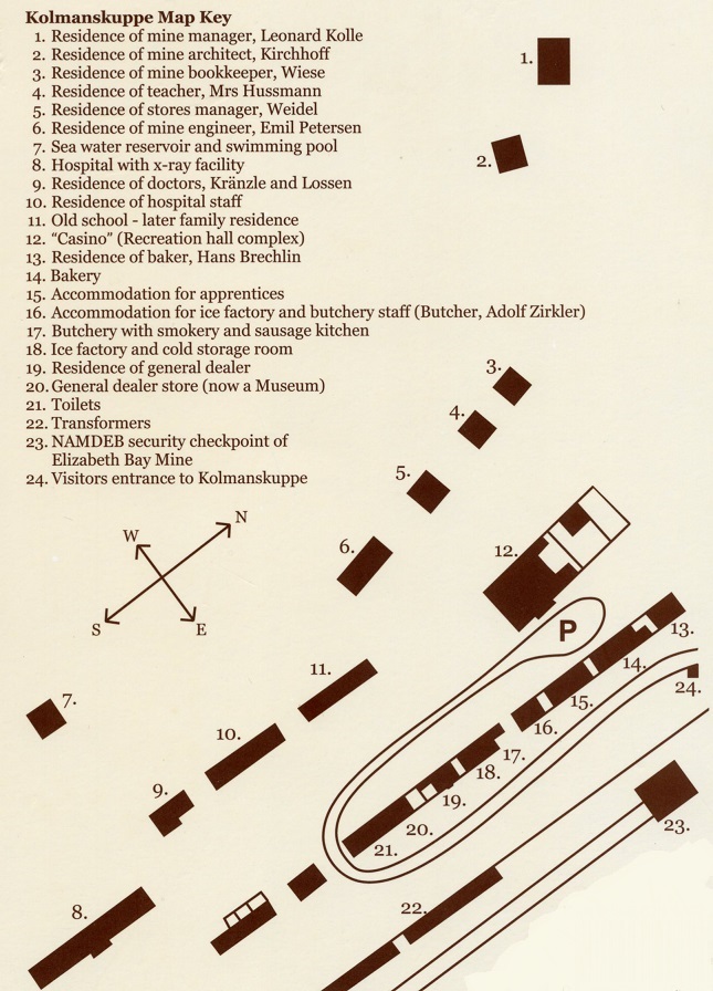
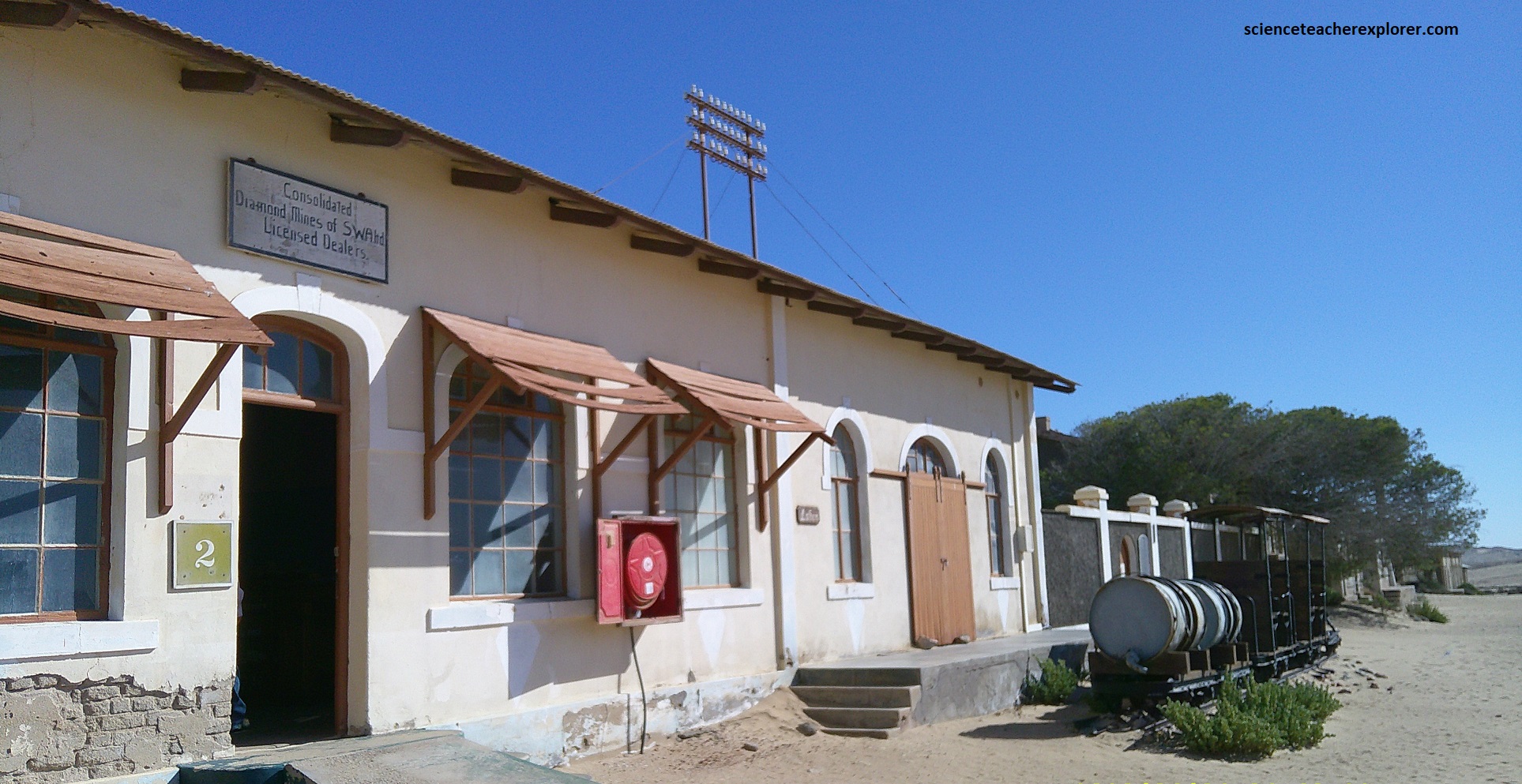
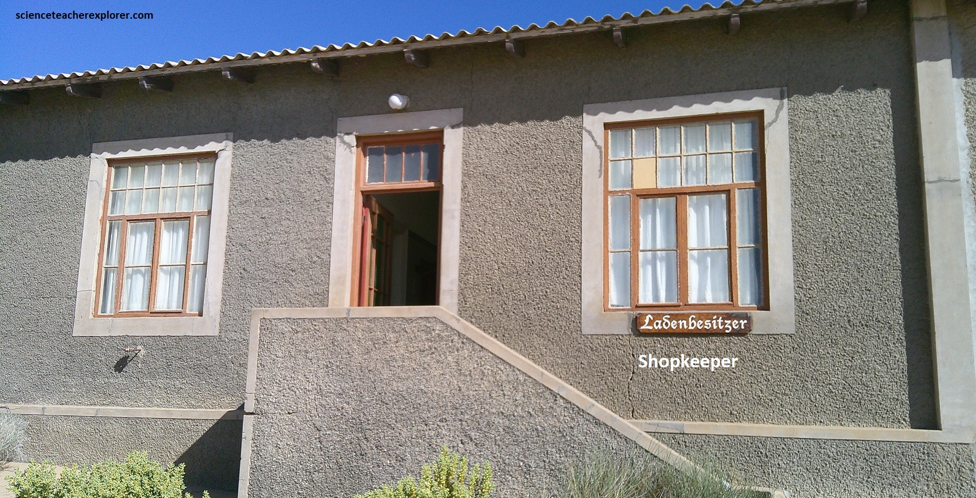
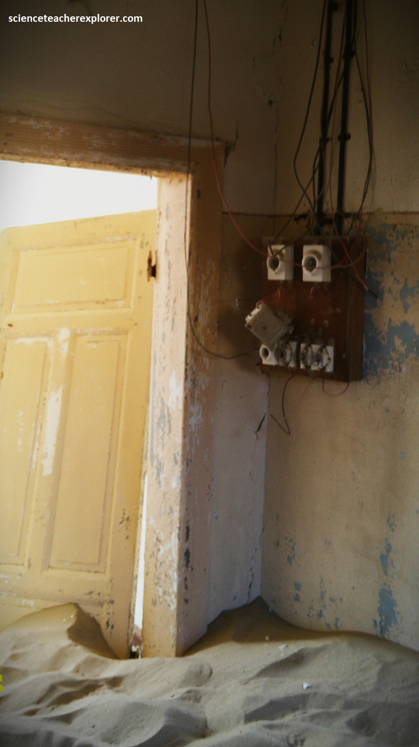
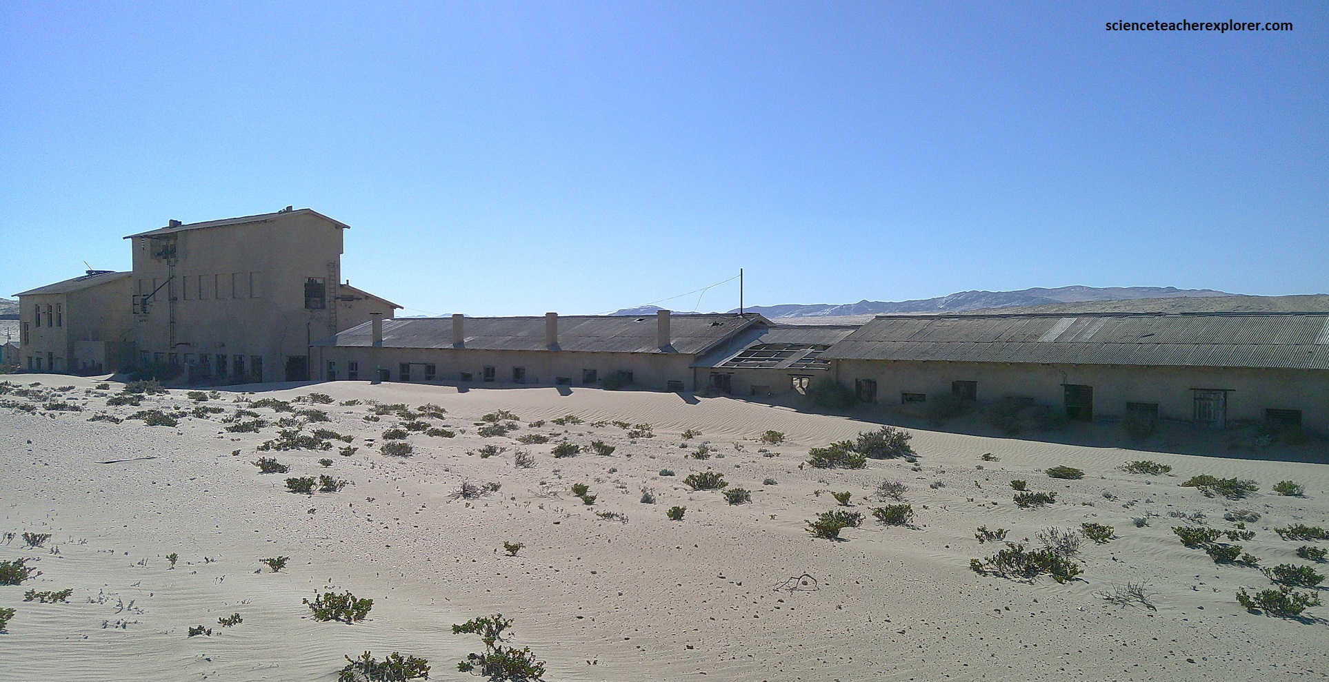
The first building I explored was now serving as the museum, but was used as the general dealer store where absolutely everything from cheese to riding breeches could be purchased. To the right thereof was a storeroom and next to it the shopkeeper’s house. This house, refurbished and fitted out with original furniture of the time, (pictured below).
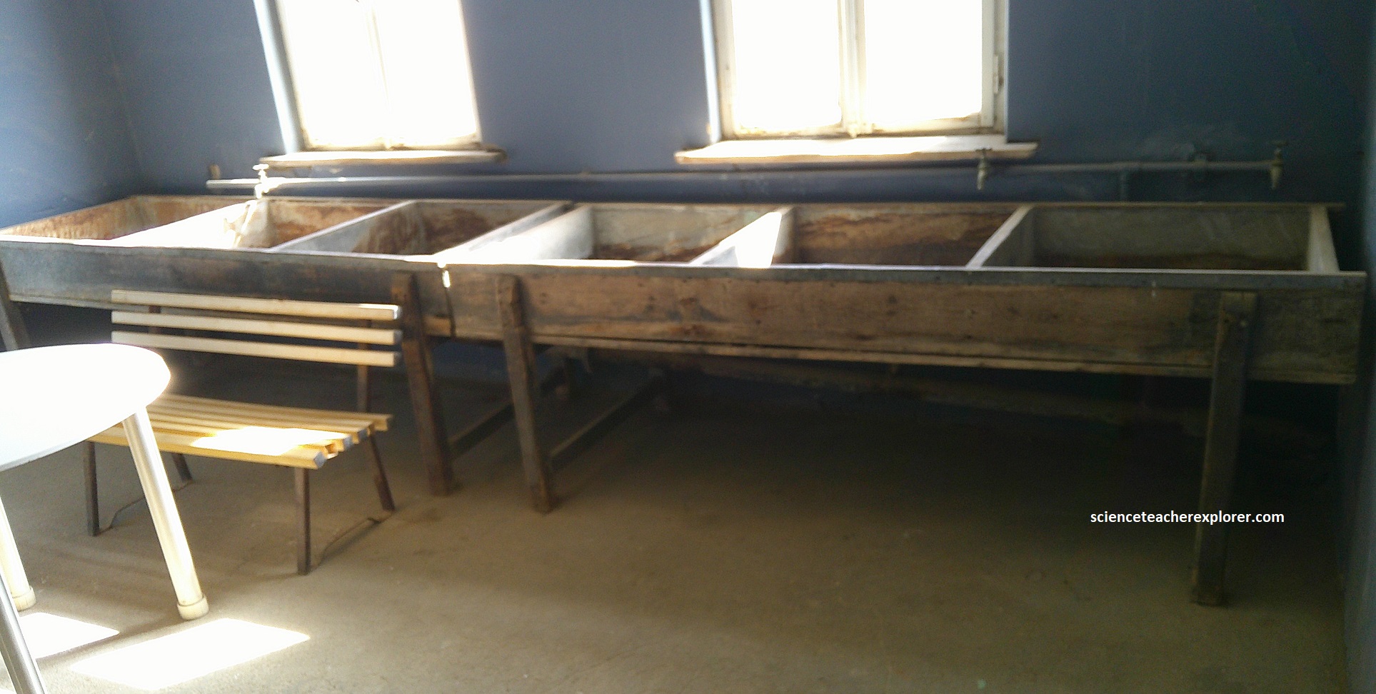
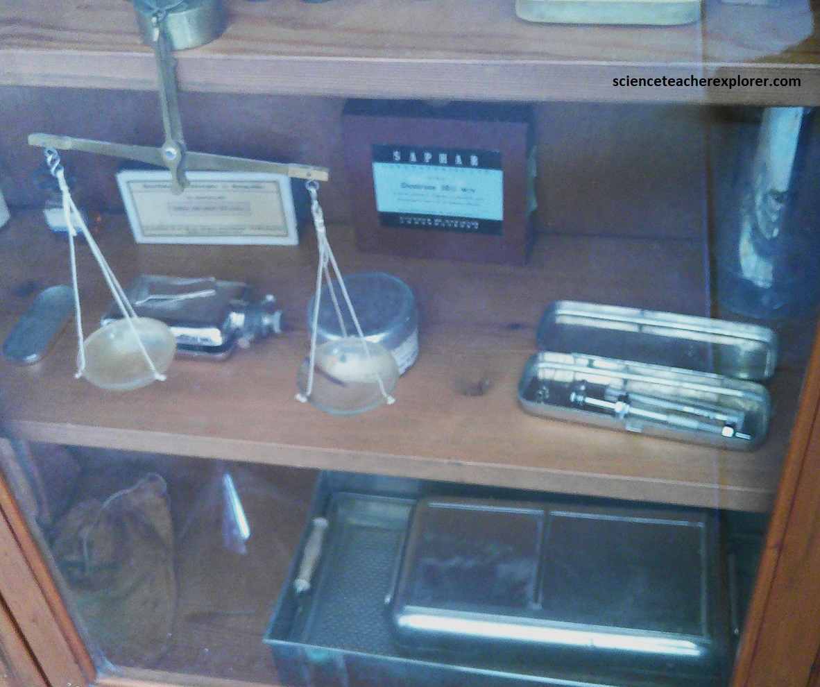
The next building housed the ice factory and the butchery. Here a CO2 electrical refrigeration unit supercooled a saline solution into which a 1 meter long, tapered fresh water containers were hung to form a giant ice tray. All the households had insulated cool boxes for which half a block (about 10kg) of free ice was provided daily. Soda water was also produced and sold at cost price, (pictured below).
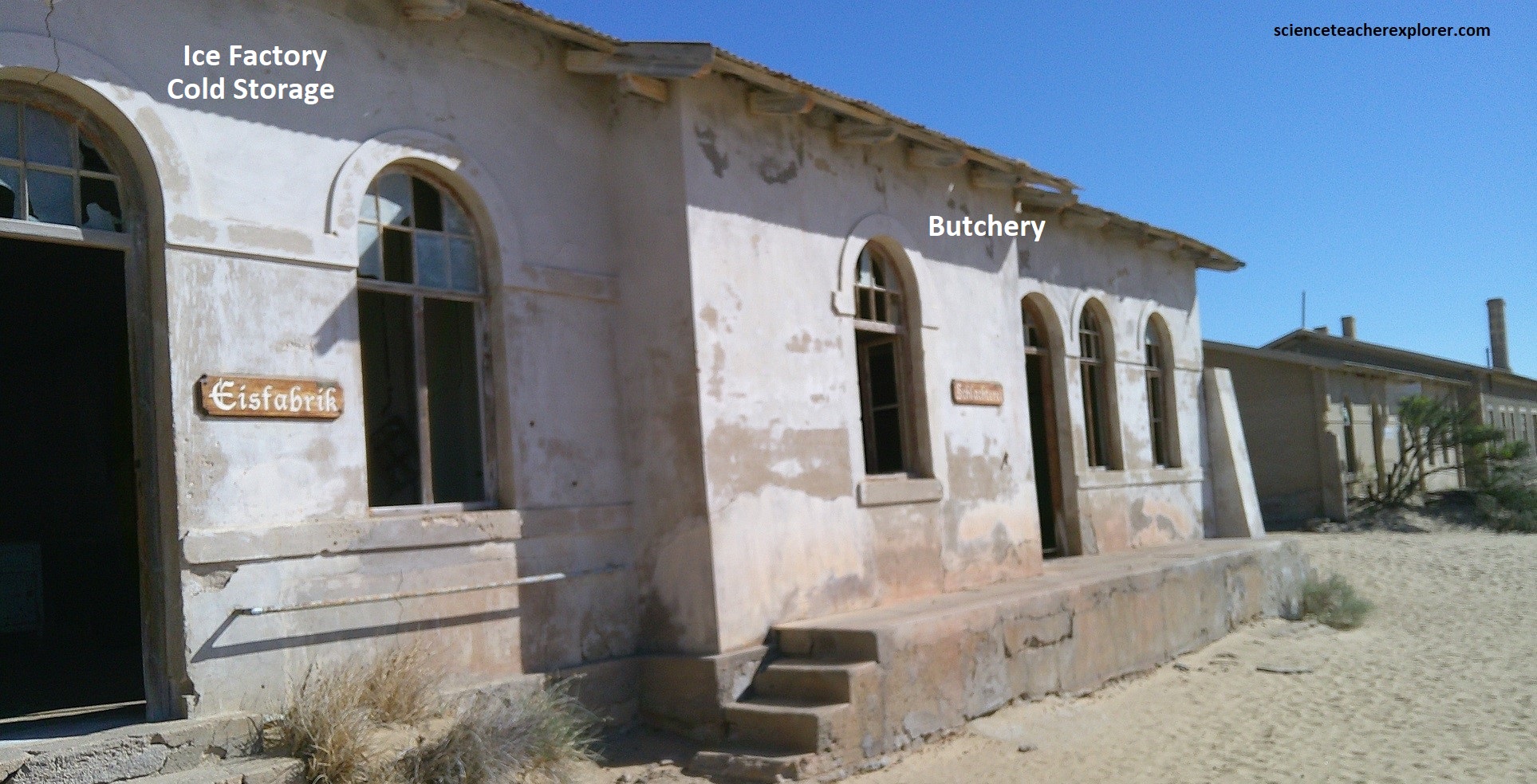
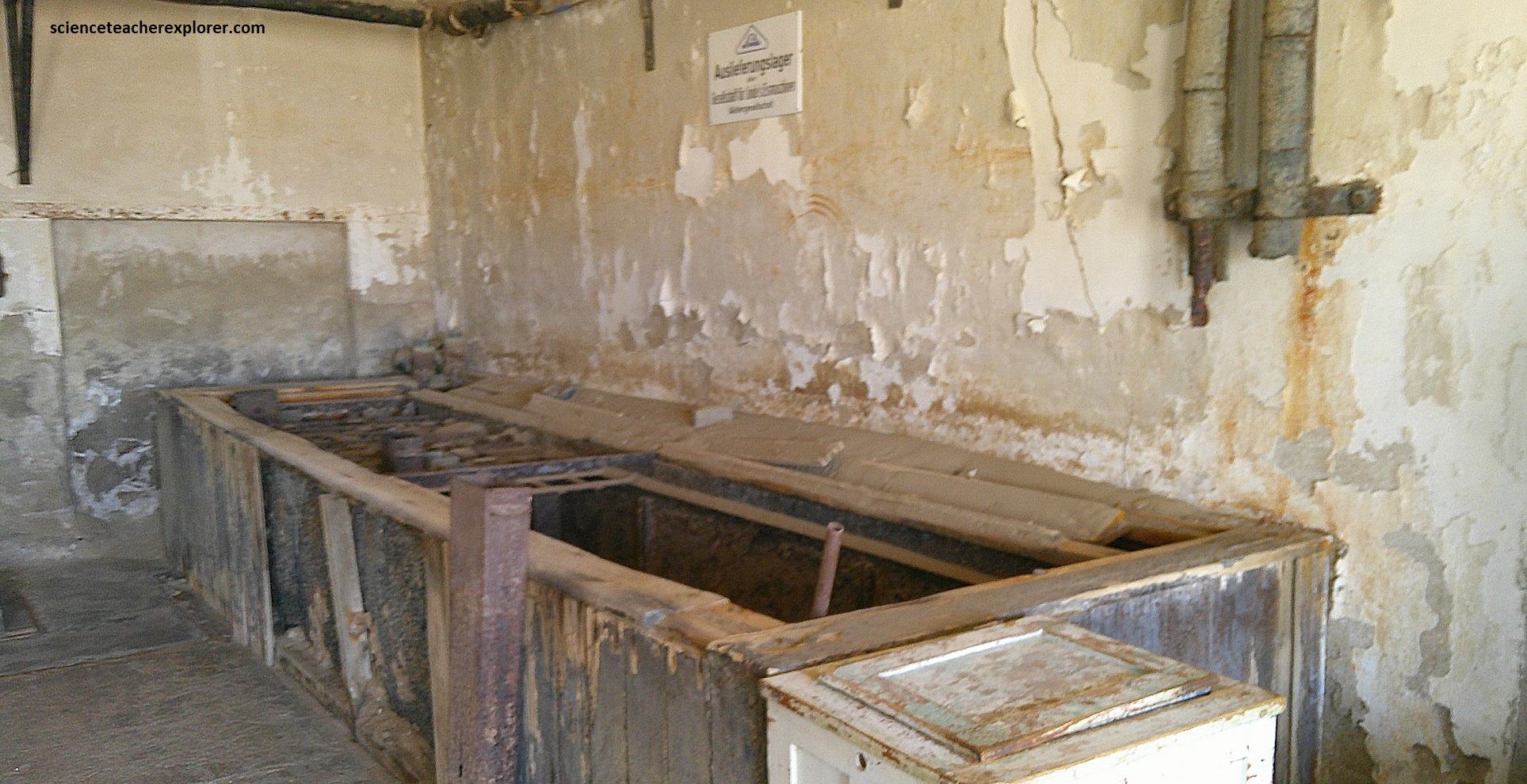
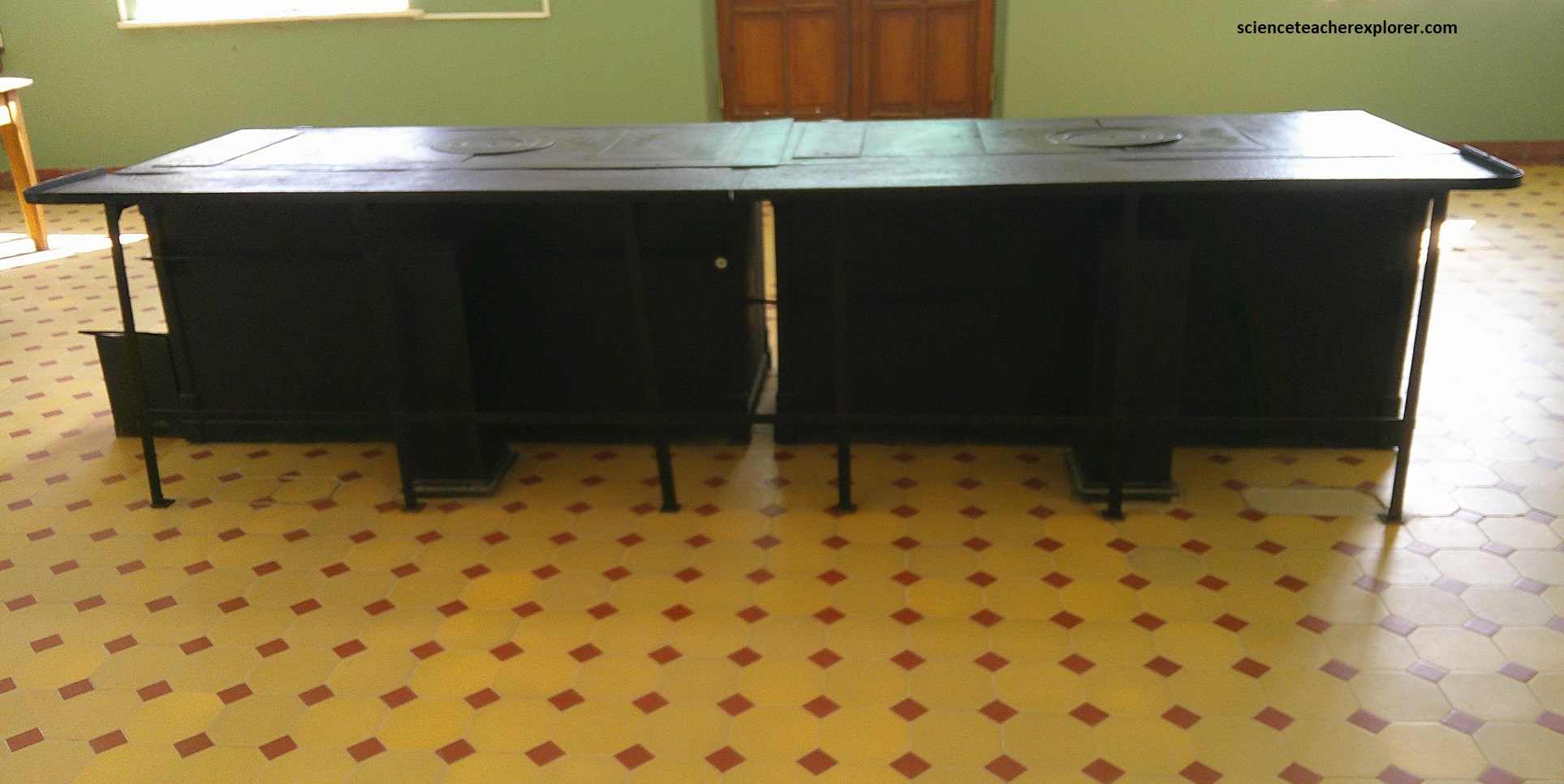
As a secondary function the freezing cold saline solution was piped next door into the radiators of the huge cold storage room of the butchery to cool it down like a central heating system in reverse. Due to the high cost of fodder and water the stock being shipped in by rail from the interior was immediately processed in a slaughterhouse about 1 km east of Kilmanskop. From there the carcasses were transferred to the cold storage facilities adjacent to the butchery, which, besides extensive meat smoking facilities, also boasted a special sausage-making kitchen. Its two enormous mixing vats can still be viewed, (pictured above).
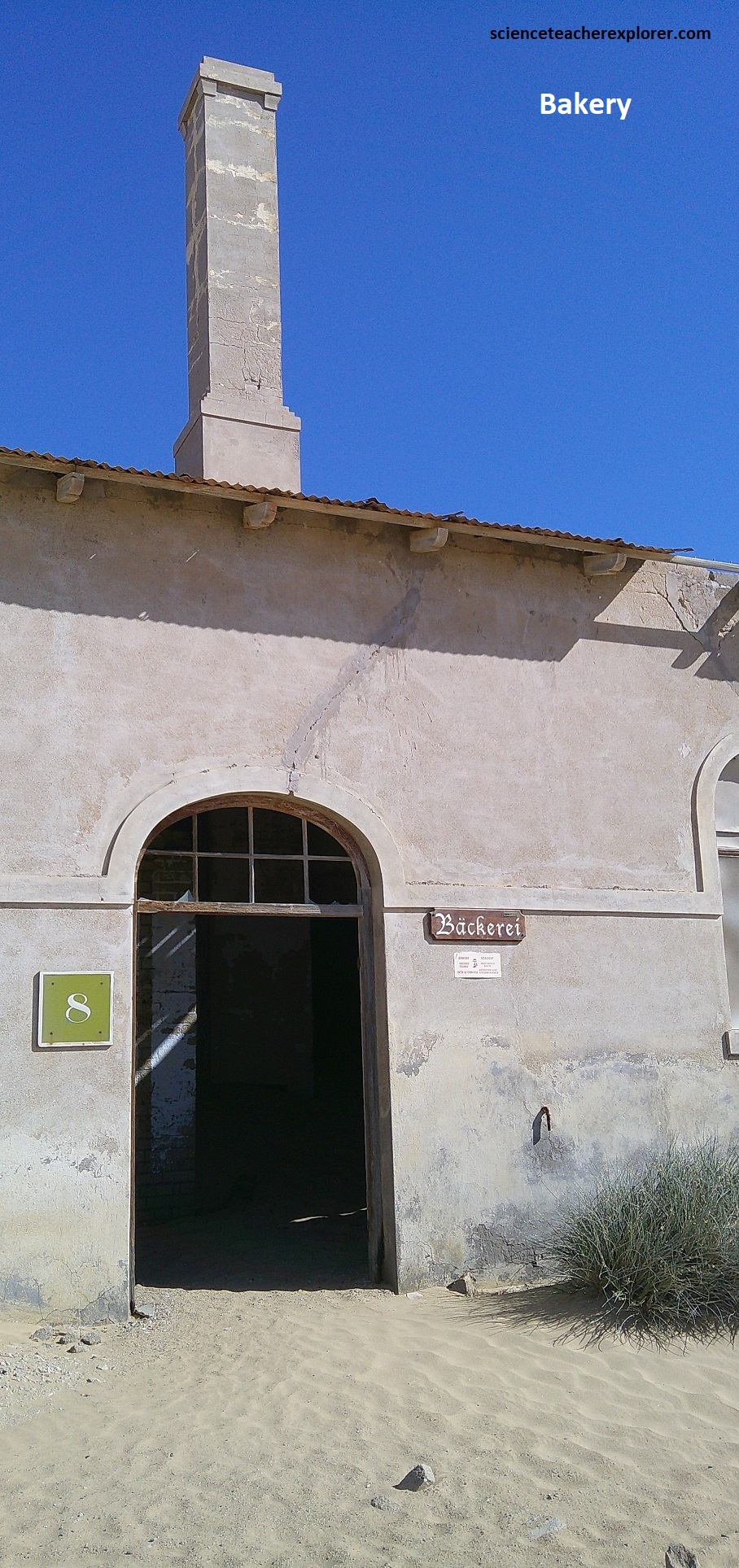
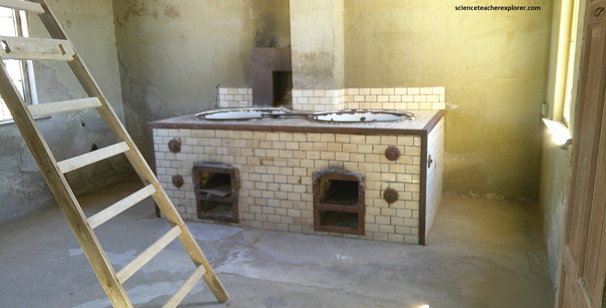
At the end of the row, on the other side of the apprentice’s quarters, was a highly sophisticated bakery with steam-heated ovens. It was completely automated so that no direct human labor was involved from the moment the baking mix was poured into the dough machine to when the completed bread came out at the other end. {Note the historical photo below was taken from “Desert Diamonds”, Noli 2023).
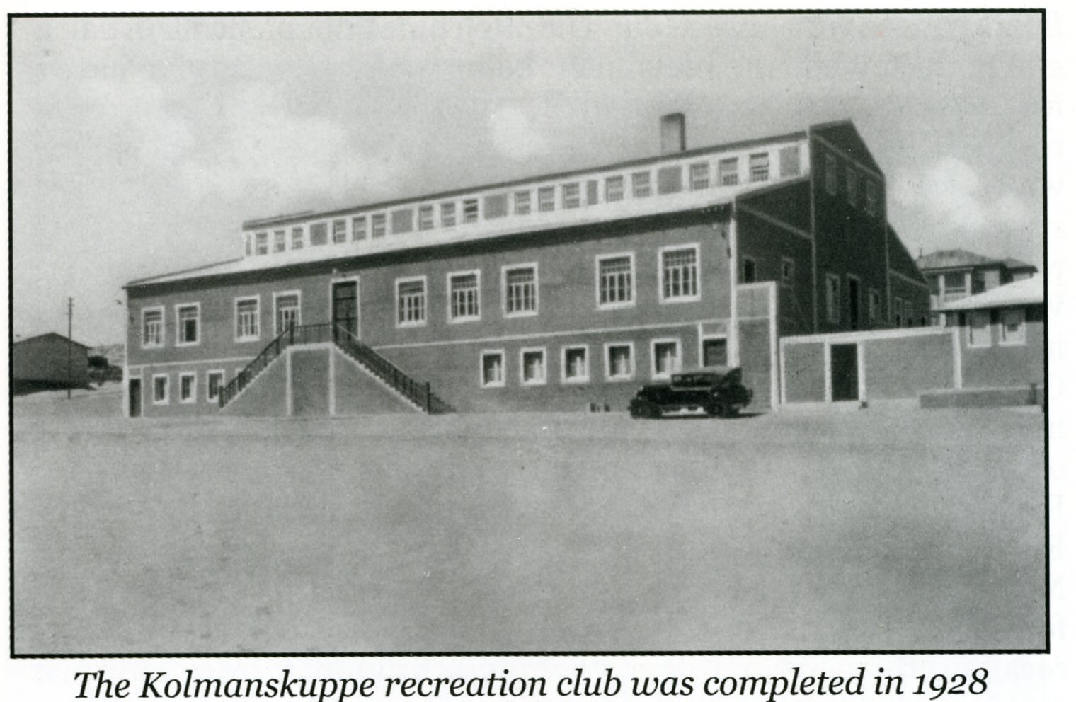
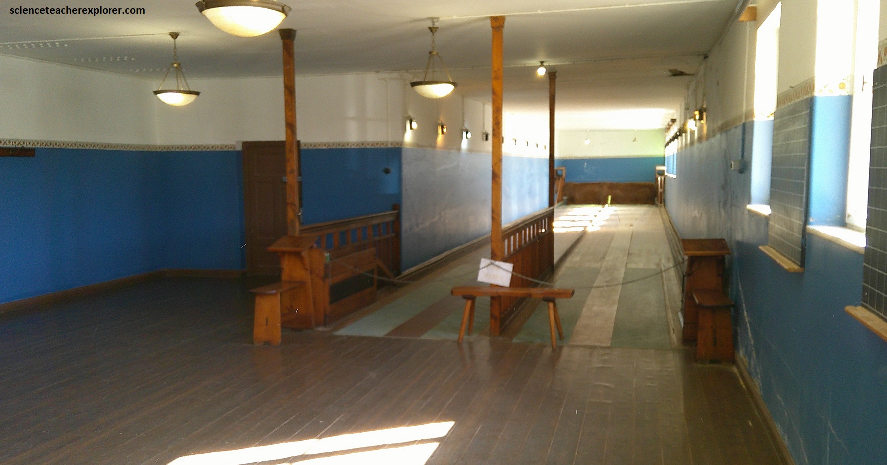
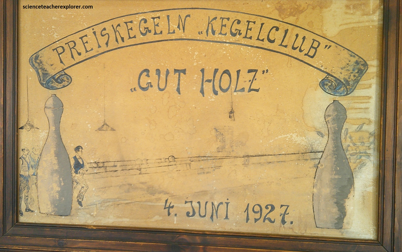
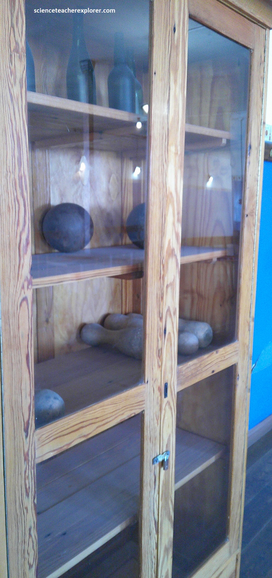
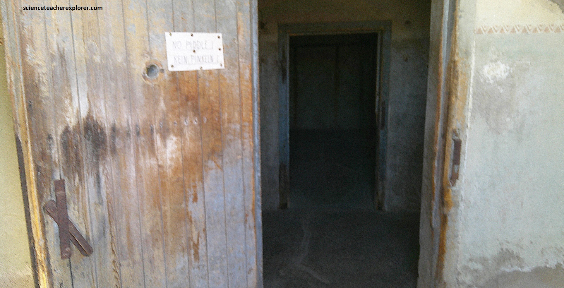
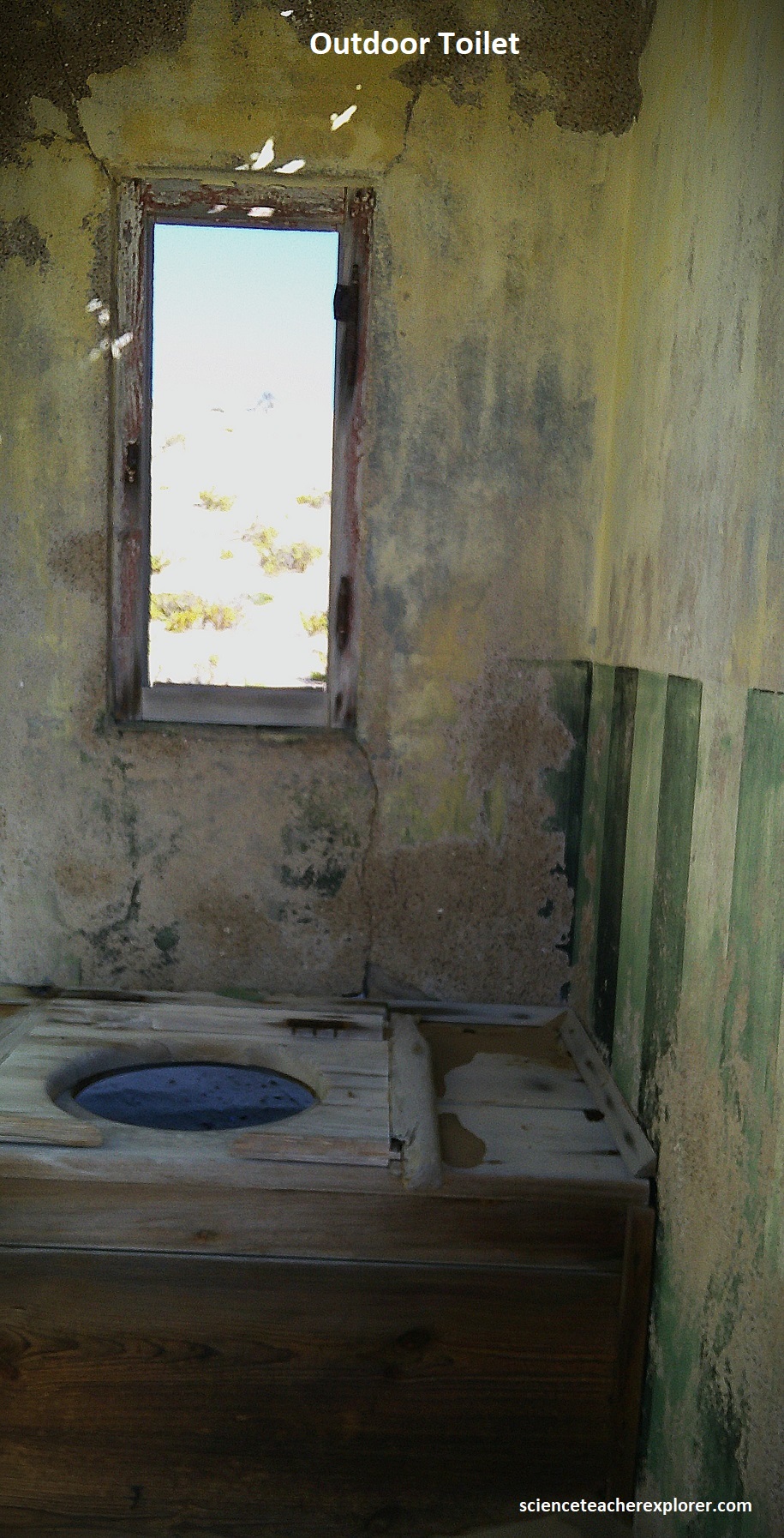
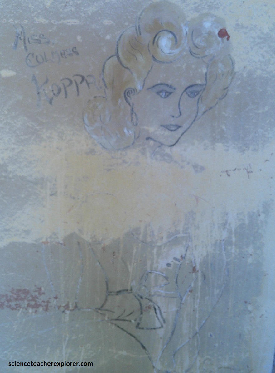
Behind the bakery, the imposing recreation club still stood fast against the onslaught of time, (built in 1927). It basically served as a one stop entertainment mall and refuge from the desert for all the expats. Pictured above, a vast central hall, which was acoustically perfect and fitted out with a stage and a balcony, served as theater, cinema, gym hall and ballroom. Flanking it clockwise from the front entrance were the VIP dining room, a lounge with access to the stage, a library, a club room, the main dining room, the kitchen complex with scullery and store room, and finally a big bar with direct access to the outside toilets. The nine-pin bowling alley in the cellar was still fully functional when I visited in 2025, (pictured above).
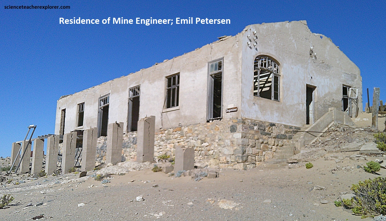
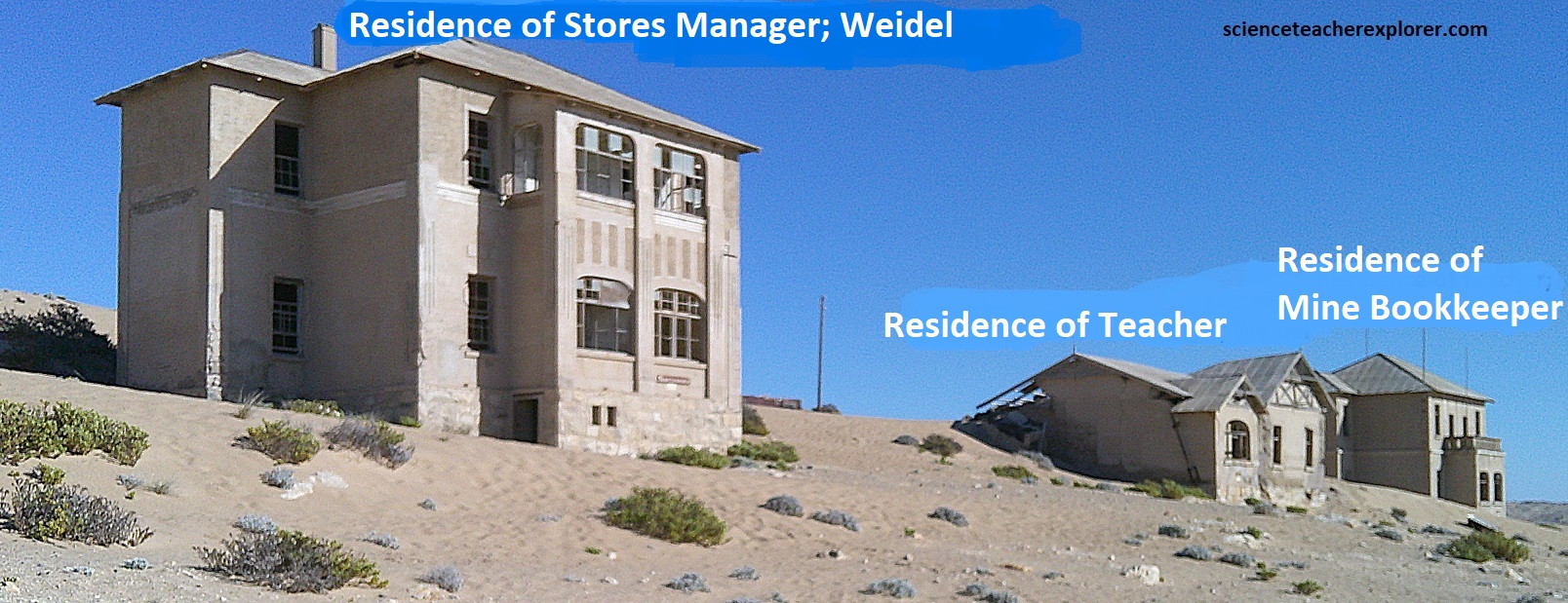
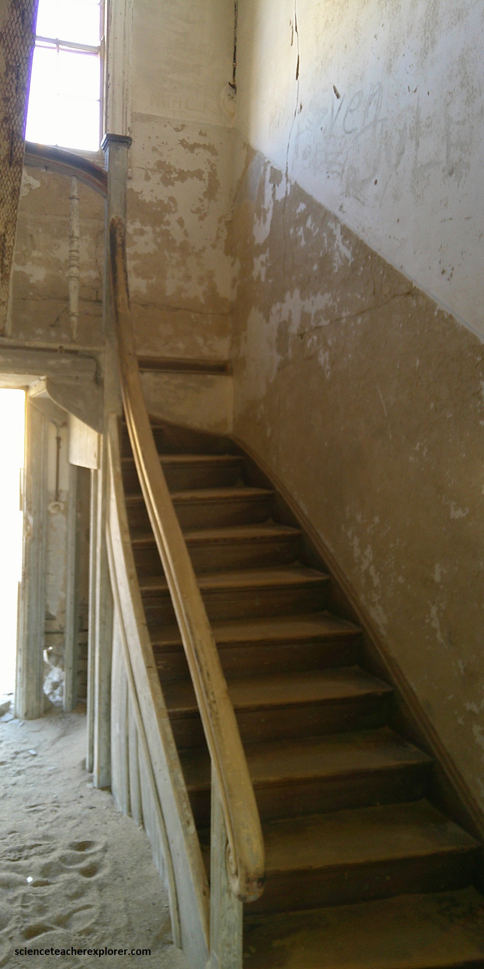
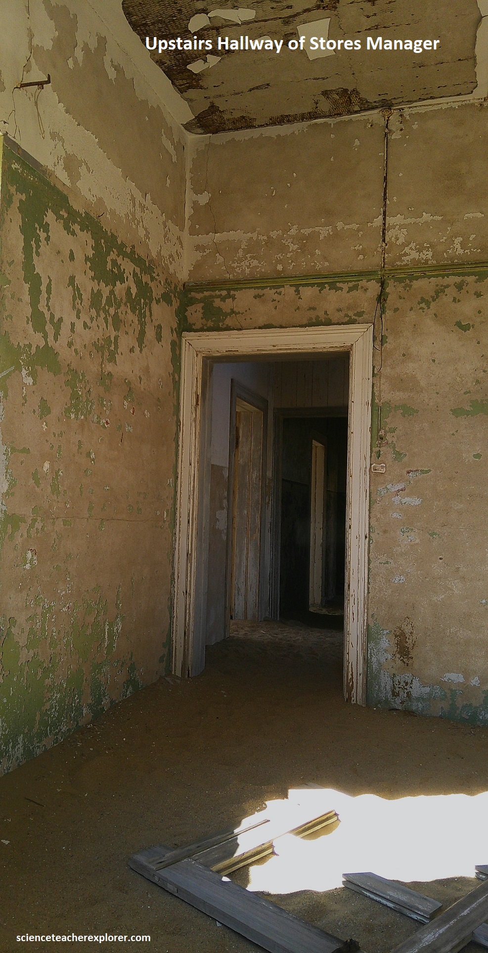
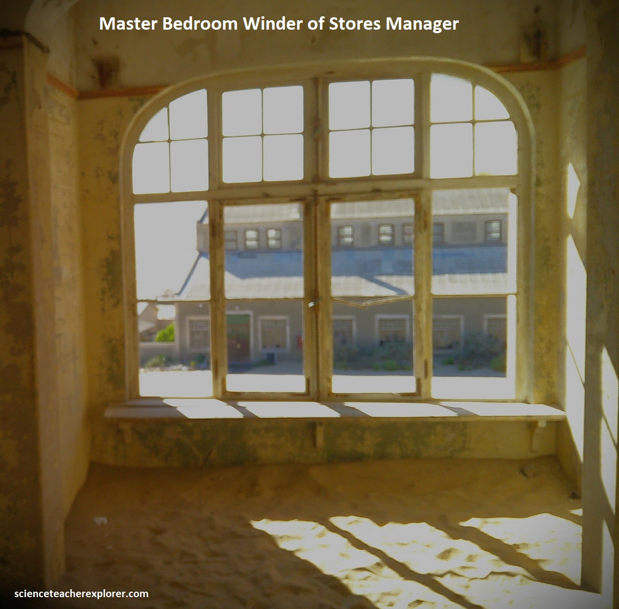
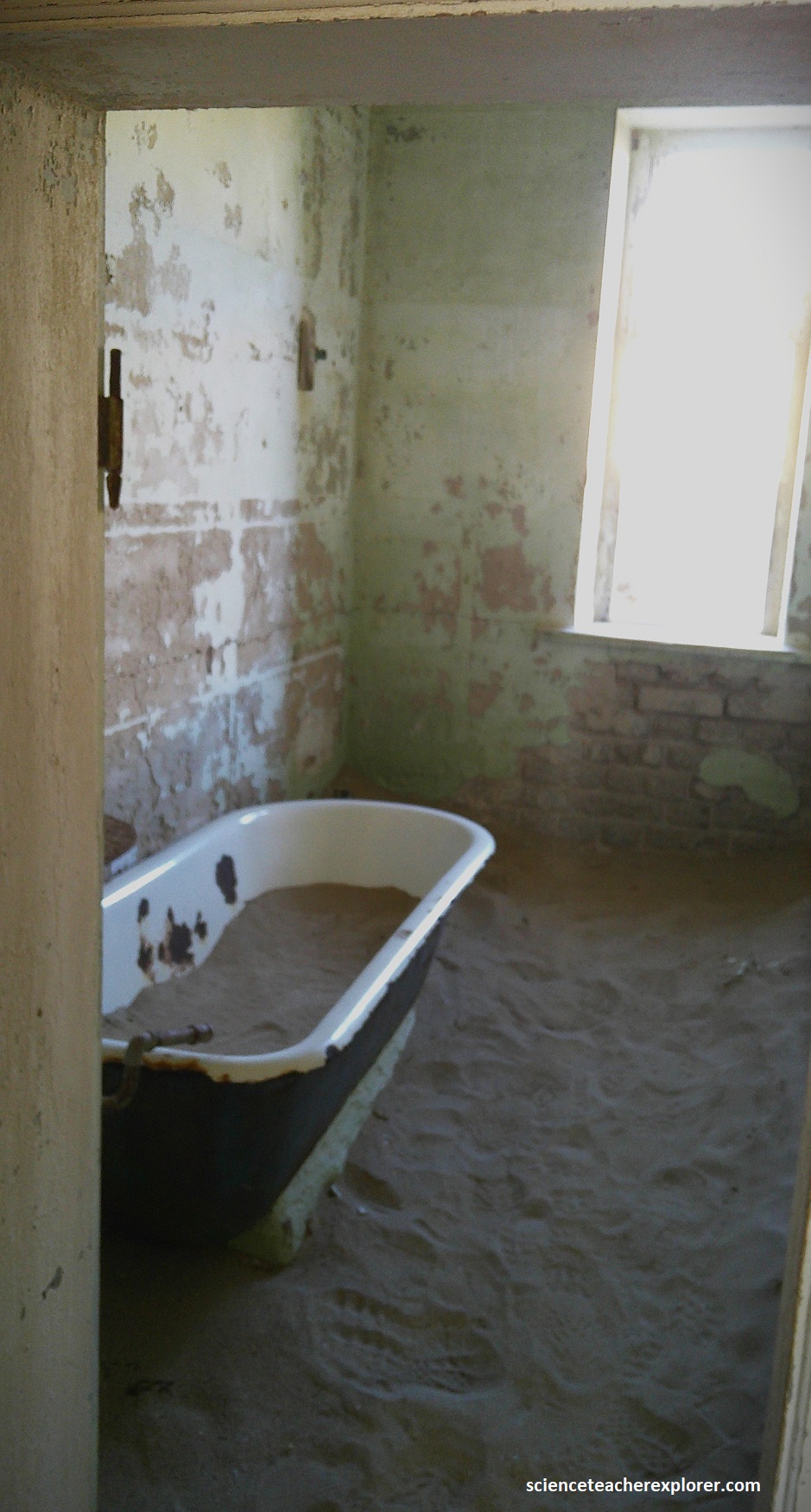
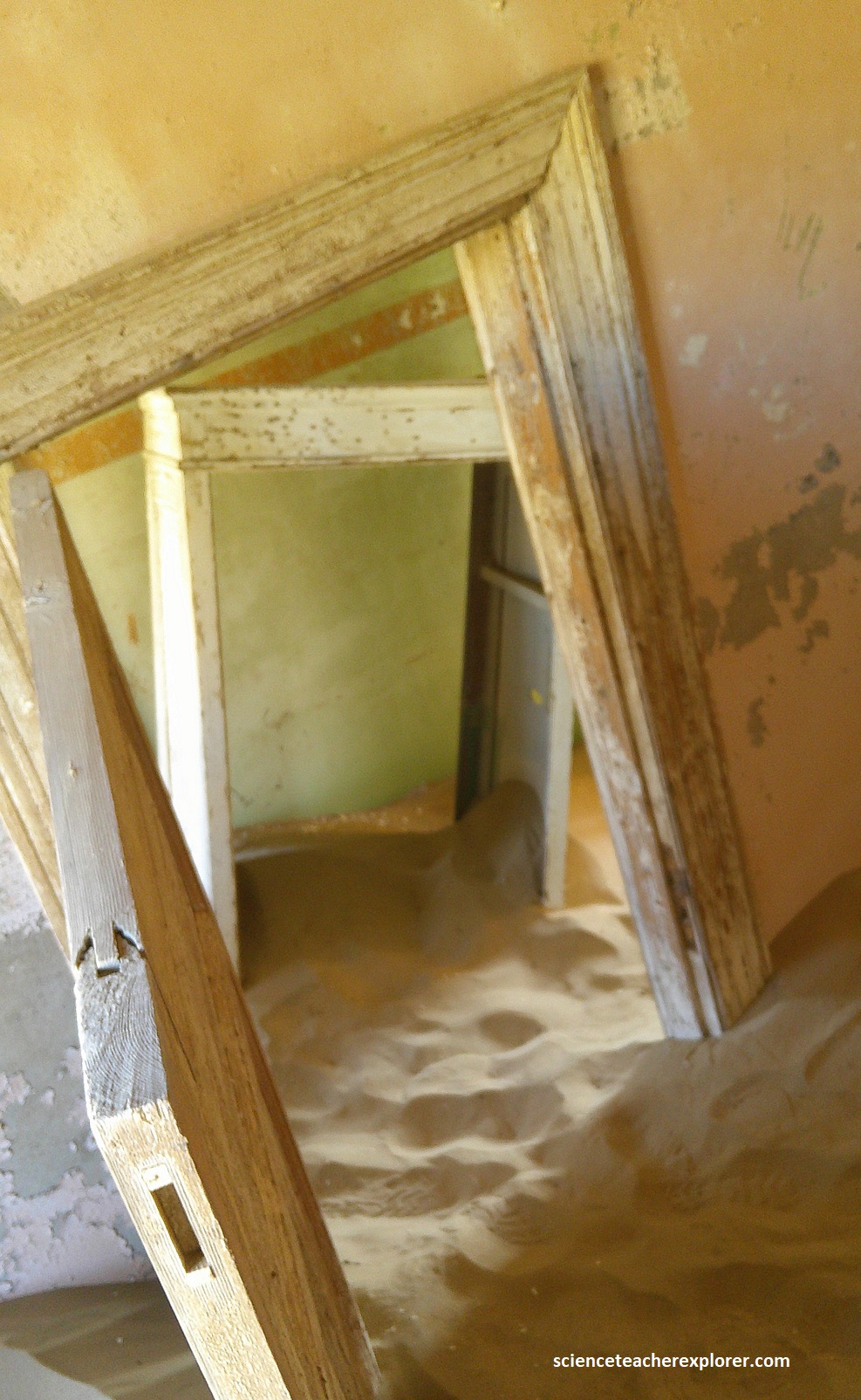
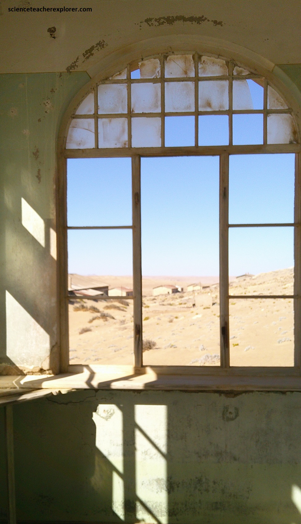
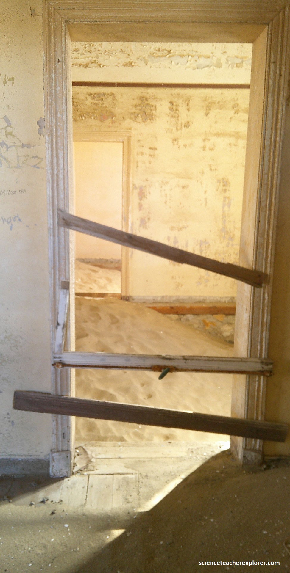
Pictured above, a row of impressive managerial villas was strung along the slopes of the hill behind the recreation club. On the far lift I found the roofless residence of the mine engineer, Petersen. Pillars that once supported an enclosed balcony now reaches up from the sand like teeth gaping from the lower jaw of a half buried skull. And to the right is the teutonically squared off double story house of the stores manger Weidel, (of which I explored thoroughly). Pictured above, the next house, once that of the teacher Hussmann, is half swallowed up by a dune with its roof in a precarious state. Strangely the same destructive dune has chosen to wash gently around the next house, the domicile of bookkeeper Wiese.
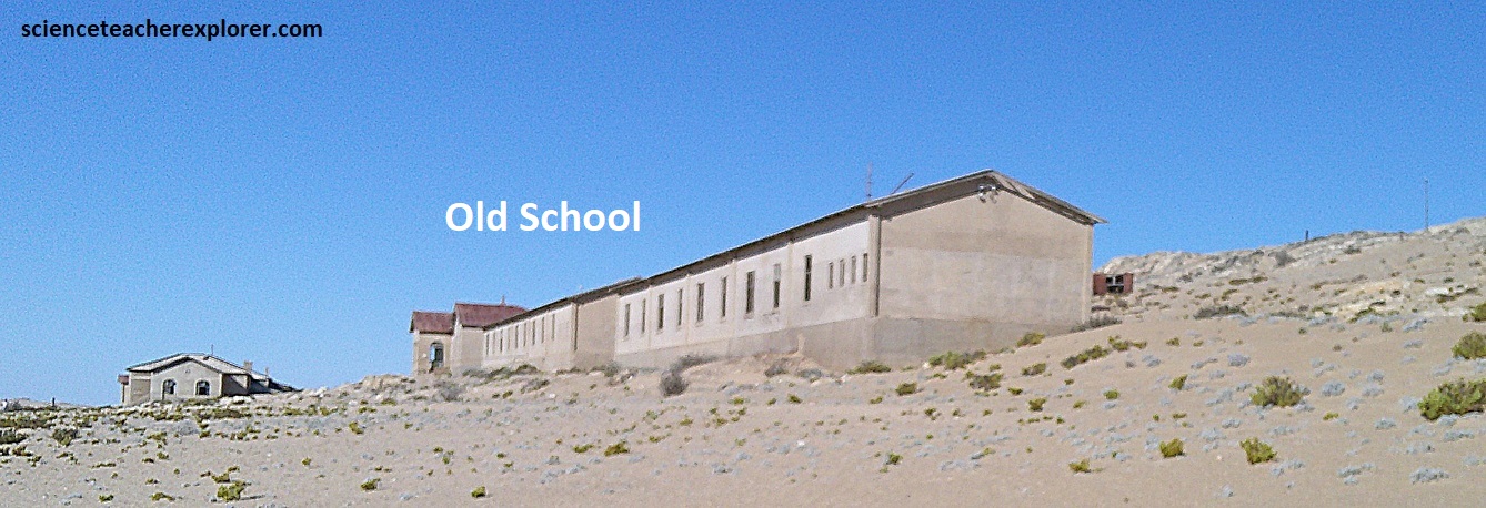
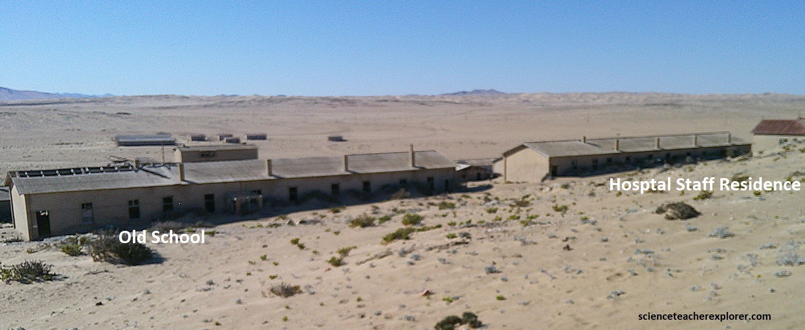
Kolmanskop also had a school that listed a total of 44 children in 1928, (pictured above), next to the residence hall of the hospital staff.
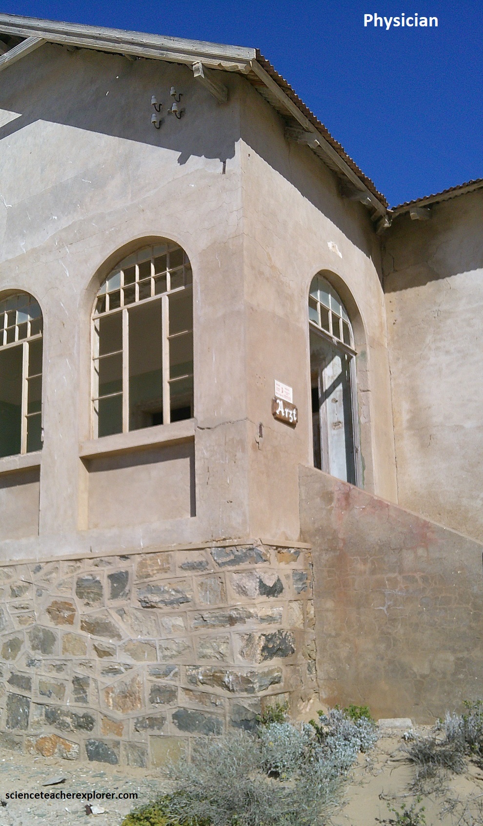
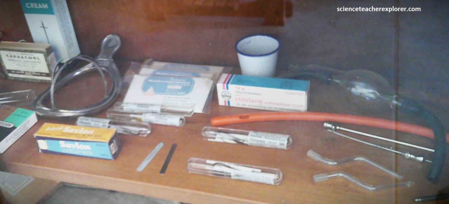
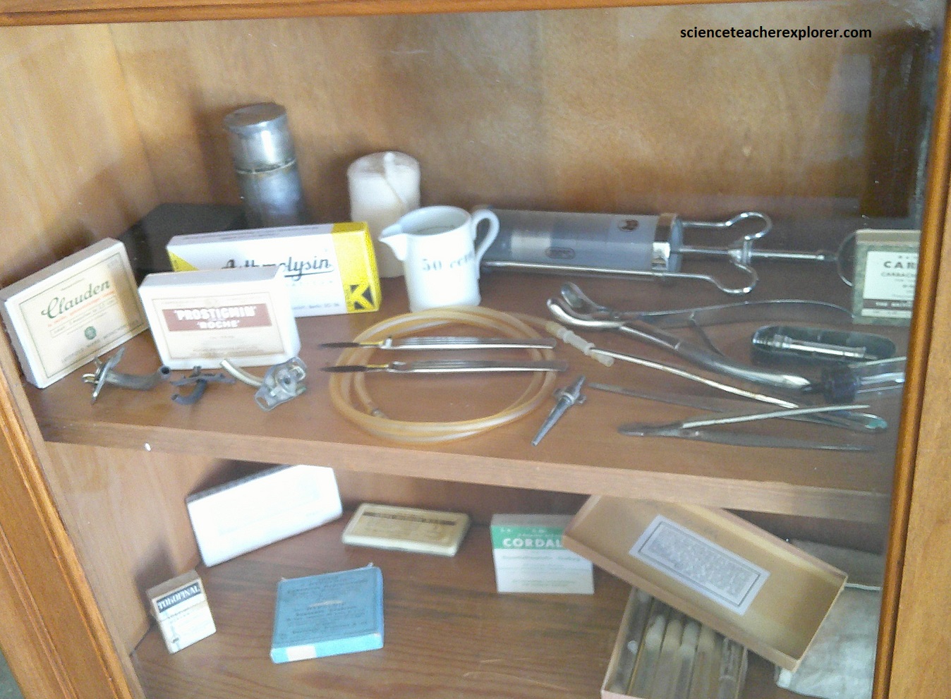
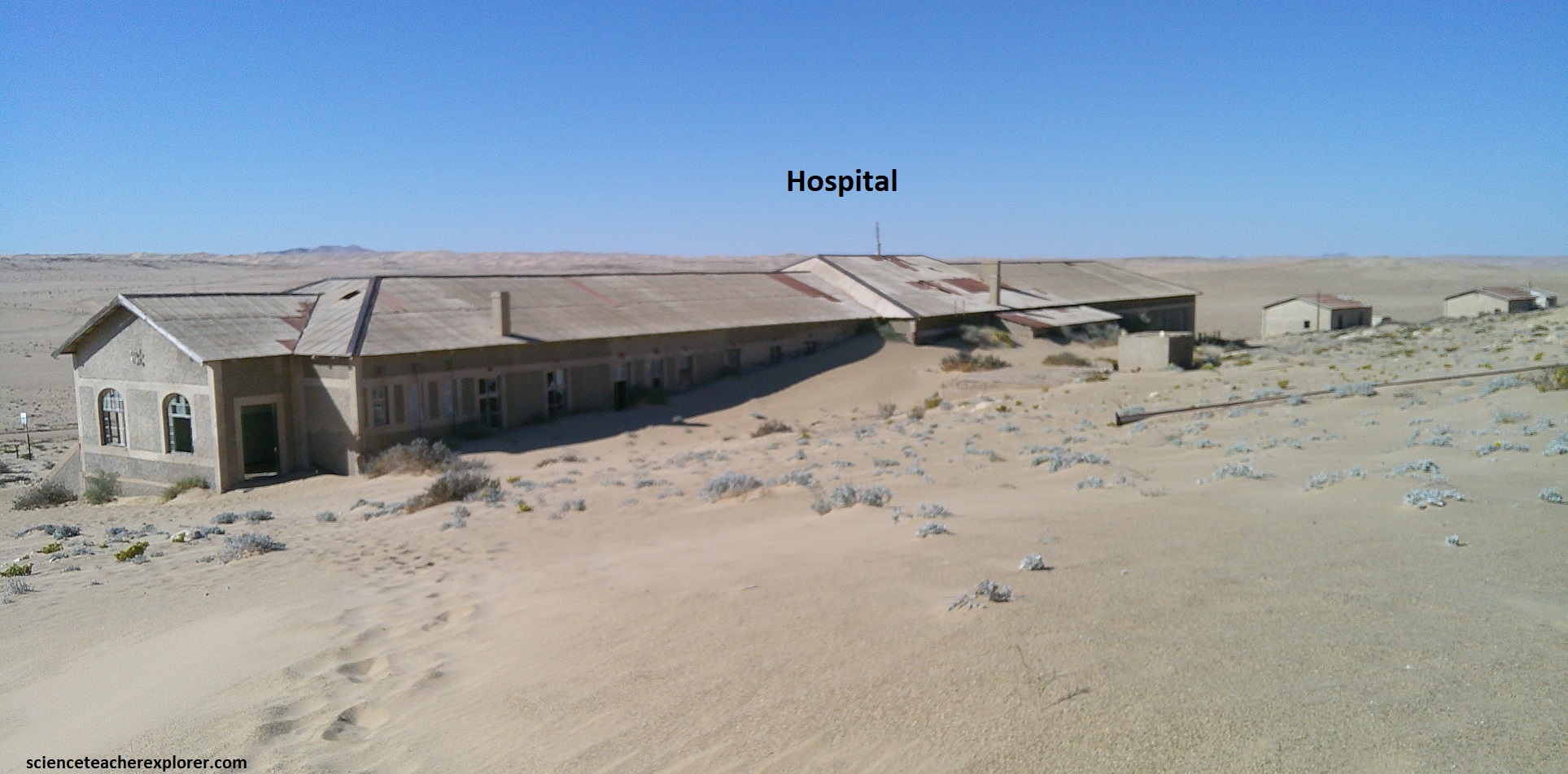
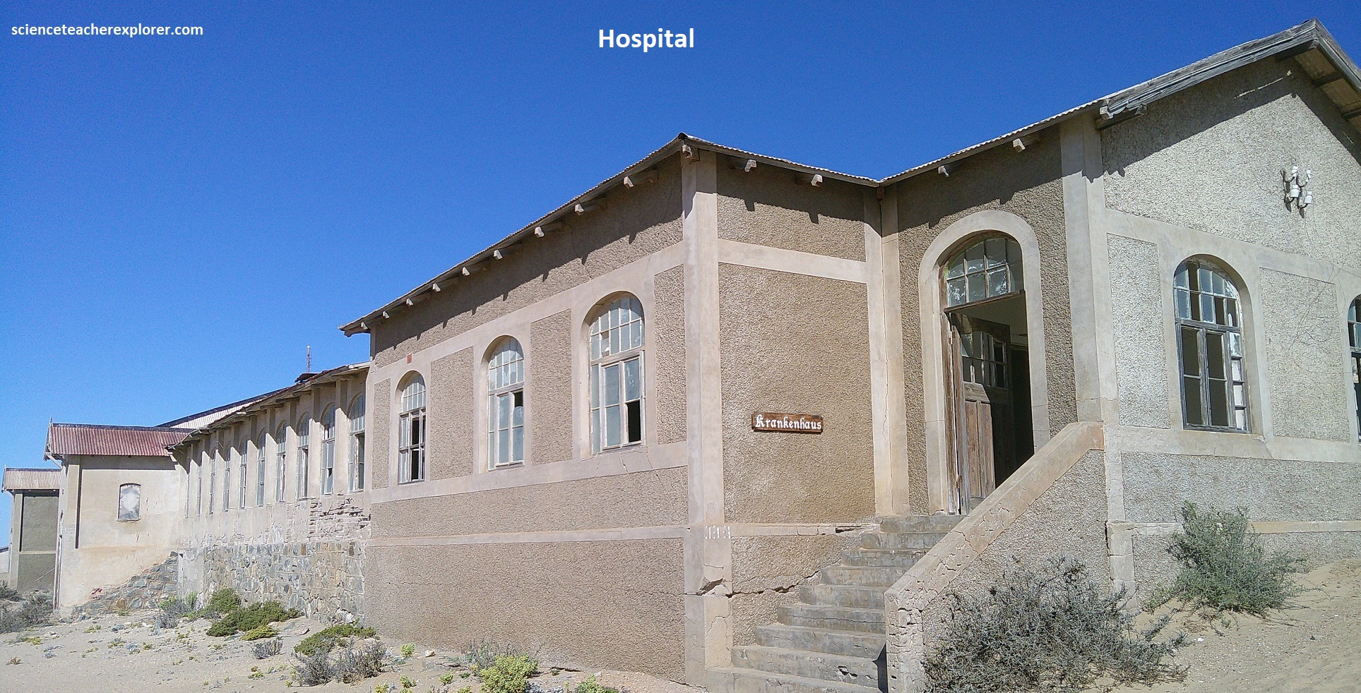
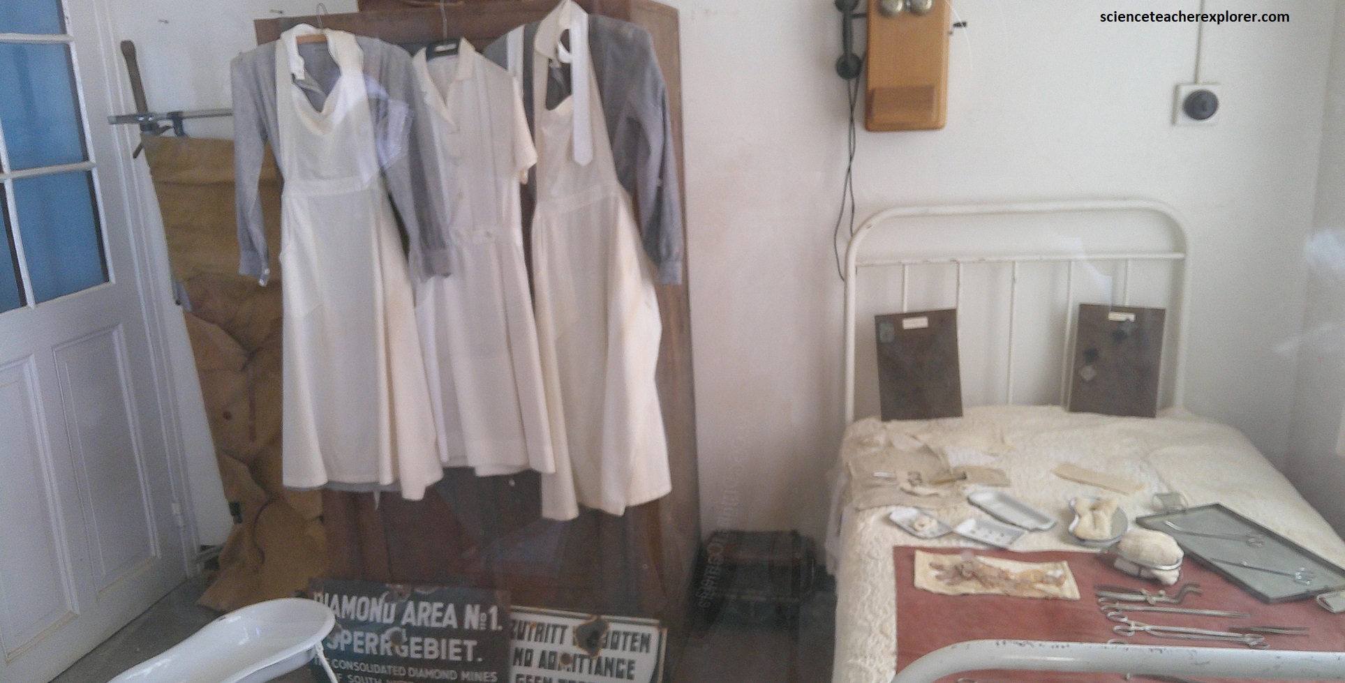
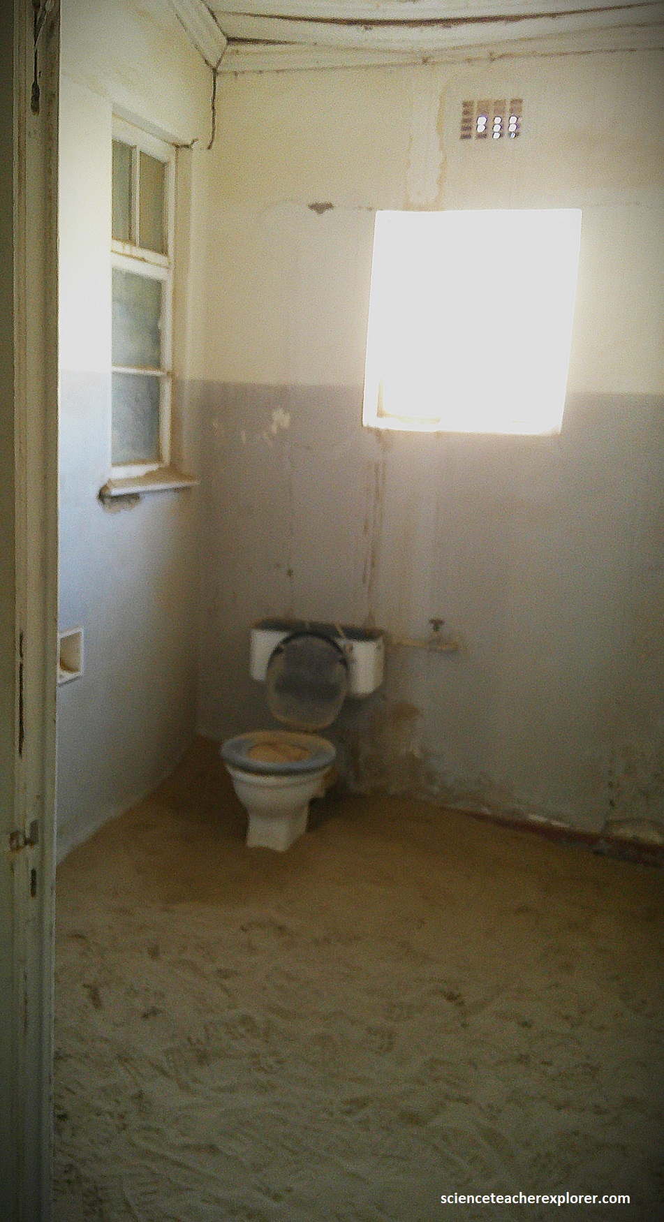
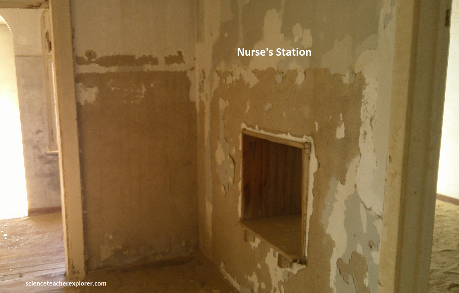
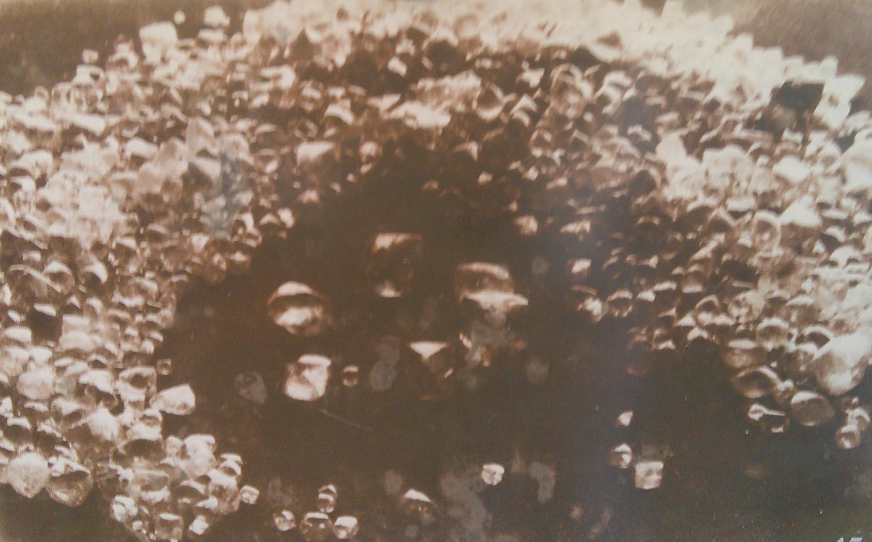
Pictured above, the hospital had an operating theater fitted out with one of the first X-Ray plants in Africa and had two doctors on it’s staff. One of them was famous for always sharing a bottle of champagne with recovered patients who had been rally ill. The 800 Ovambo laborers were accommodated in bunkhouse south of Kolmanskop; had their own, hospital with bathing, delousing, steam cleaning and steam disinfection facilities.
Very high temperatures and pressures are required for the formation of natural diamonds, (conditions that occur in limited zones of the Earth’s mantle, about 150km below the surface, where temperatures are at least 1,0500C. Diamonds formed and stored in these ‘diamond stability zones’ are delivered to the Earth’s surface during deep-source volcanic eruptions, where pieces of the mantle are torn away and carried rapidly to the surface. These eruptions produce the kimberlite and lamproite pipes that are sought after by diamond prospectors. [Kimberlite pipes are found only in Archaean-aged cratons, (areas of rock that are at least 2.5 billion years old). Numerous kimberlite pipes have since been found on the Kaapvaal Craton, which extends through parts of South Africa, Botswana and Zimbabwe]. Weathering causes the kimberlite to release it’s diamonds, and then are carried away by rain and rivers, where they are deposited into topographic traps such as river beds or sedimentary zones of streams and coastlines. Over the past 90 million years, most of the drainage basins covering the Kaapvaal Craton have flowed from east to west and emptied into the Atlantic Ocean. Initially, the diamonds would have been concentrated in small tidal channels of river deltas, (the Orange River), and on nearby beaches. They would later be widely redistributed along Namibias coastline, (here at Kolmanskop). Namibia’s southwestern coast, (the Namib Desert), hosts one of the world’s largest gem diamond deposits. Well over 100 million carats of gem-quality diamonds have been extracted here since the initial discovery of diamonds at Kolmanskop in 1908.