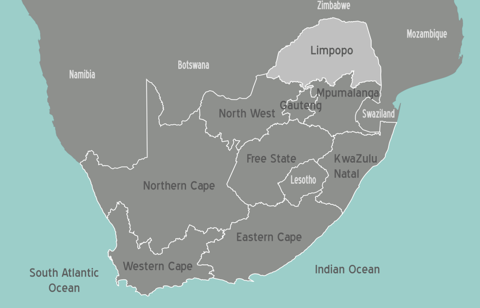
Limpopo, S. Africa
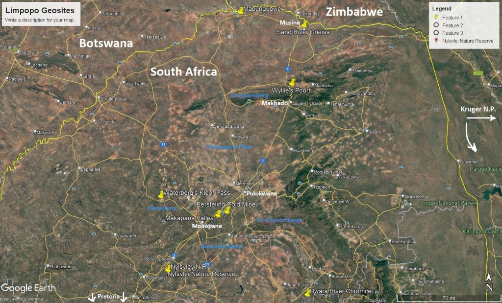
Limpopo is a province of South Africa. I had decided to trek the different Geosites of this province in 2023 & 2025. It is found in the northeastern part of South Africa & I had decided to approach the region from South Africa’s main highway of N1 from Pretoria. Limpopo is a region of considerable geological antiquity and variety, of diverse landscapes. These include the Limpopo Lowveld in the north, the elongated massif of the Soutpansberg, the Mining areas of the Waterberg Plateau in the west , and the outback of the Bushveld Basin .
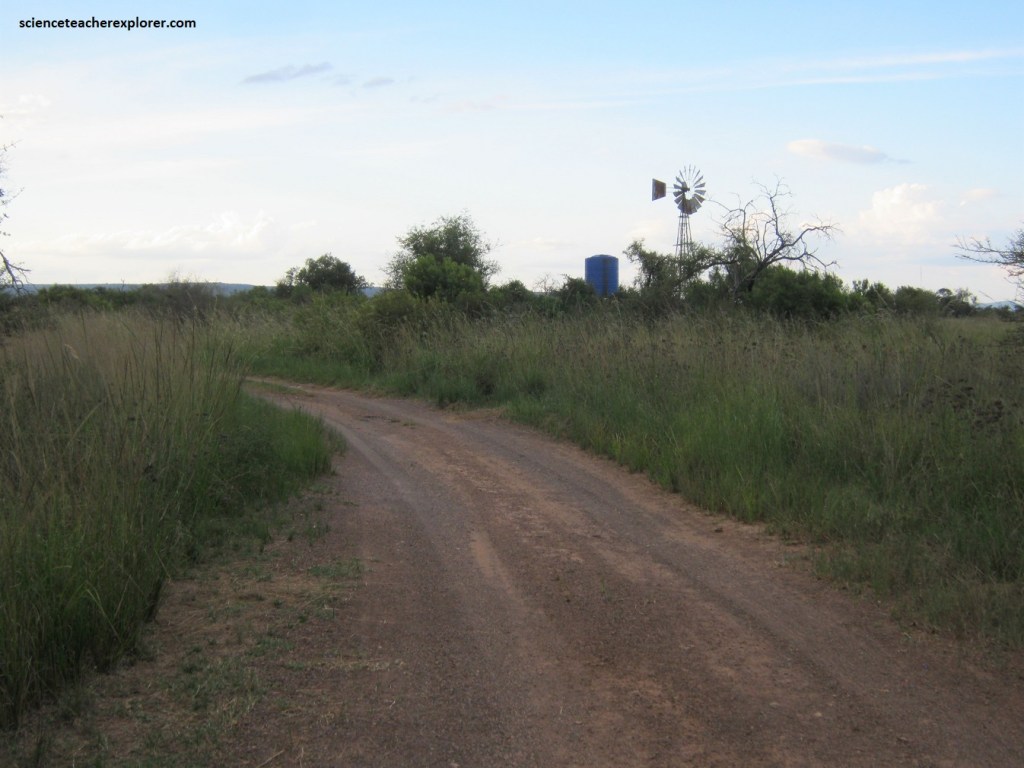
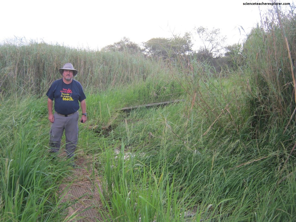
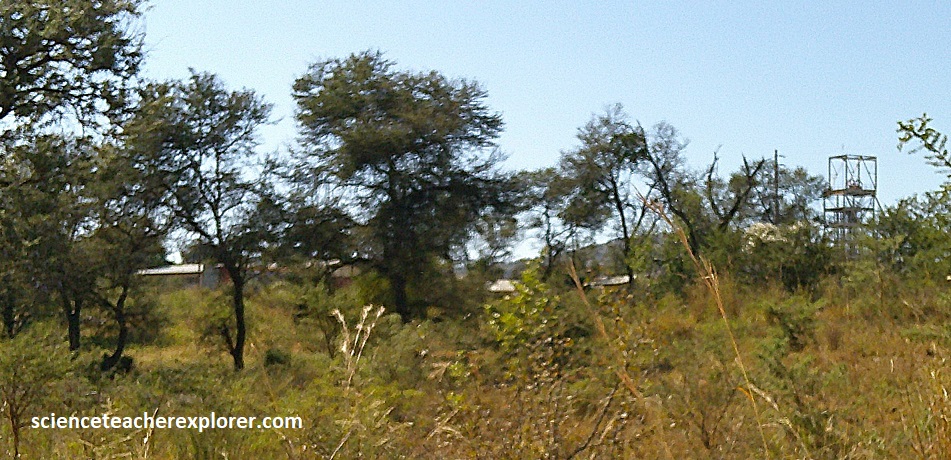
As mentioned, I started my trek of Limpopo in 2023, by exploring a national reserve called “Nylsvley” in the southern portion of Limpopo, (imaged below).
While trekking in South Africa during March of 2023, I spent a day in the Nylsvley Nature Reserve. Nylsvley is located about 170 km north northeast of Pretoria, South Africa.
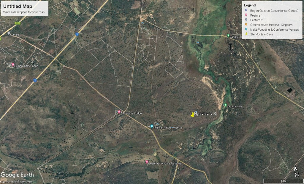
To get to the Nylsvley Game Reserve from Pretoria, South Africa, you take the N1 North towards Polokwane (Pietersburg). Take the Mookgophong off-ramp. Keep going left, some 3 km later you reach the R101 to Modimolle. Travel south (with the mountains on your right) until you pick up the Nylsvley / Boekenhout sign. Turn at the Boekenhout station sign. About 7 km down this gravel road it crosses a railway line, the entrance to Nylsvley is one km further, on the left.
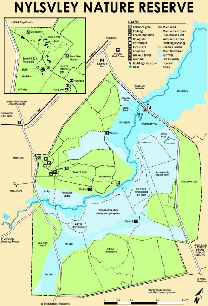
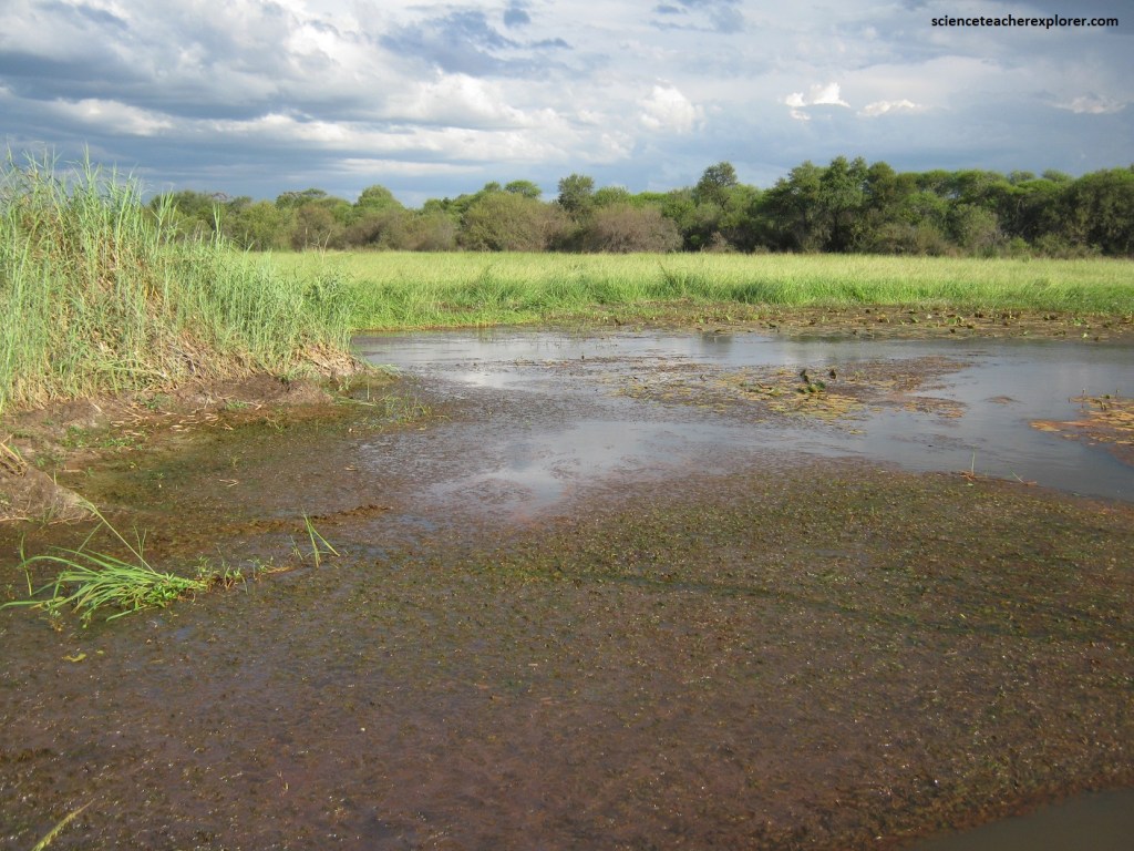
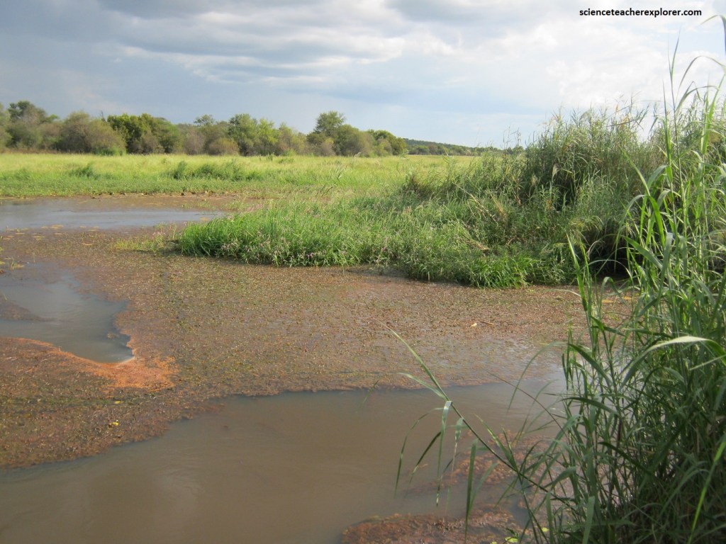
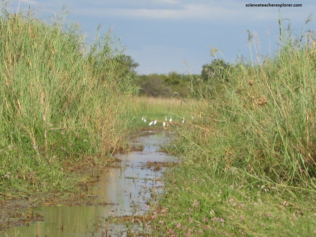
The Nylsvley Nature Reserve is situated in the upper reaches of the Nyl River near the town of Mookgophong (Naboomspruit) in the Limpopo Province, and includes part of the largest floodplain in South Africa.
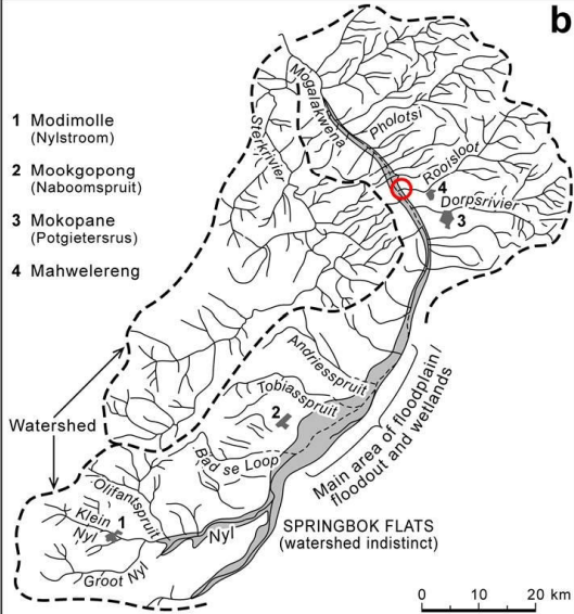
The Nyl River rises in the hills of the Waterberg and flows trough a relatively flat-floored valley between steep hills. Heavy summer storms flood the valley causing the river’s waters to spread out over a wide area, producing vast marshes. These form a 16,000 hectare grass floodplain. Of this area 3,100 hectares are now protected by the Nylsvley Nature Reserve, which is open to visitors.
The Nyl River floodplain stretches from south-west to north-east across the western edge of the Springbok Flats, lying alongside the eastern foothills of the Waterberg plateau, (this plateau is the source-area for the floodplain’s water). There are about a dozen streams and rivers that bring water from the Waterberg onto the floodplain; the largest of these are the Klein Nyl, the Groot Nyl and the Olifantsspruit, (imaged above).
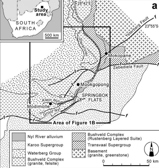
The immediate area around the Nyl/Mogalakwena River lies within a down-warped basin composed of rocks from the Pretoria Group and the Rooiberg felsites of the Bushveld Complex, in addition to the Waterberg Group in the extreme west.
The source area for the Groot Nyl and Klein Nyl Rivers is in the Waterberg Plateau and Formation. The Nyl River originates at the confluence of the Groot Nyl and Klein Nyl Rivers and flows roughly north-eastward across the Karoo sandstones and basalts of the Springbok Flats, which features extensive floodplains and a broad channel due to the very gentle gradients. Further downstream (northwards) the channel disappears to be replaced by a flood-out (a low-gradient, unchannelled floodplain) ~ 7 km wide which merges with the floodplains and forms the Nyl River floodplain wetland. The Nylsvley Nature Reserve is located in this region.
The Nyl River floodplain wetland is located in a semi-arid climate. The present annual rainfall in the area varies between 250–1100 mm with a mean annual rainfall of 630 mm and an annual potential evaporation of 2400 mm which produces a net water deficit on the floodplain. Water flows through the flood-out primarily as sheet-flow during the rainy season, which deposits thin clay layers that effectively seal the floodplain surface, preventing groundwater recharge and prolonging inundation.
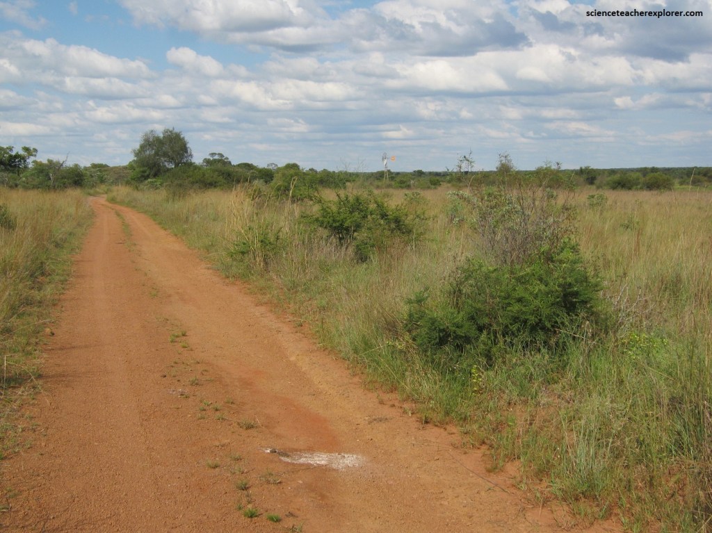
The areas fringing the floodplain in the Nylsvley Nature Reserve consists of a mosaic of Acacia savanna and broad-leaved woodlands. On the north-western side of the reserve one gets a real bushveld feeling with all the Acacia and Sheperd Trees.
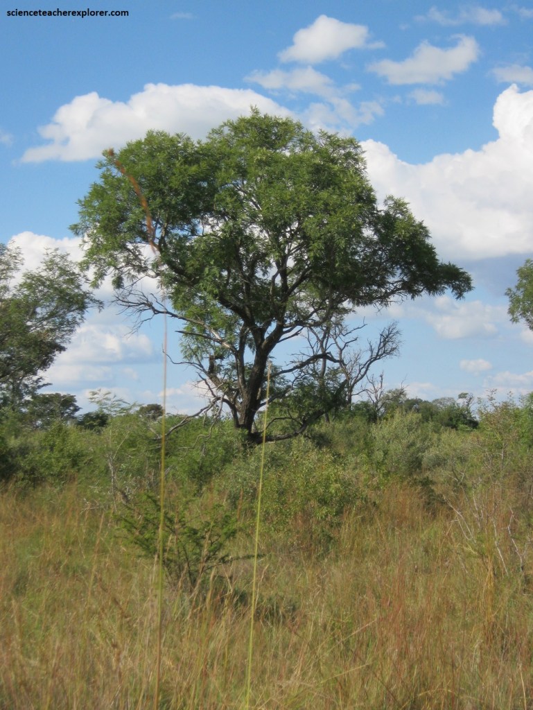
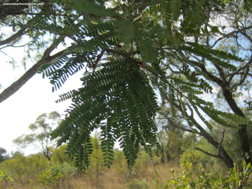
Pictured above and below, the Sweet thorn tree is one of the most common trees in the greater part of South Africa. It has therefore adapted to large fluctuations in temperature and moisture. This species varies considerably in growth form. In the Limpopo, it is a long, slender tree. The bark is smooth and black that is longitudinally fissured. The leaves are dark green and bipinnately compounded, (pictured below).
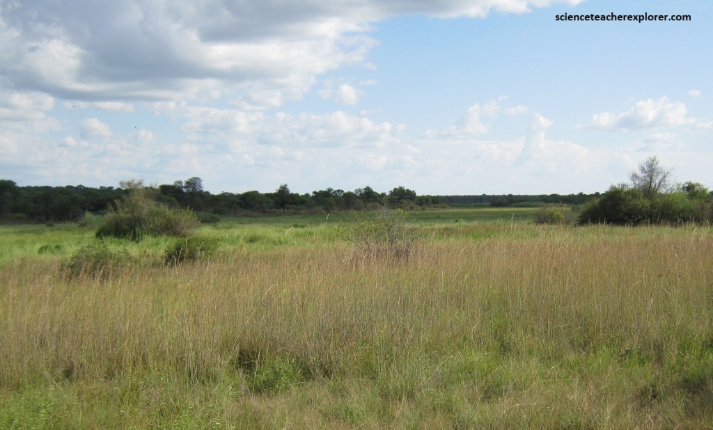
Vegetation comprises broad-leaved woodlands, thornveld, grassland and of course the floodplains, and over 600 species of plant have been recorded in the reserve.
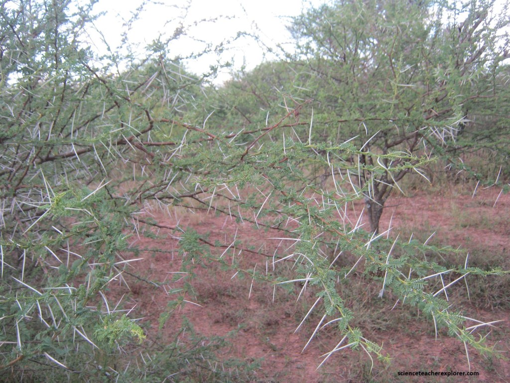
Pictured above, the Umbrella thorn Acacia tortilis is deciduous and usually not more than 10 m high. A well-known, conspicuous umbrella-shaped crown is only fully developed in old specimens, young tree, (like this one), have roundish or flat-topped crowns. The stem is usually fairly short and the main branches are bare. The very sharp spines of this plant are unique, some are short, blackish and hooked, while this one is long, white and straight. The leaves are bipinnately compound and probably the smallest among the thorn trees.
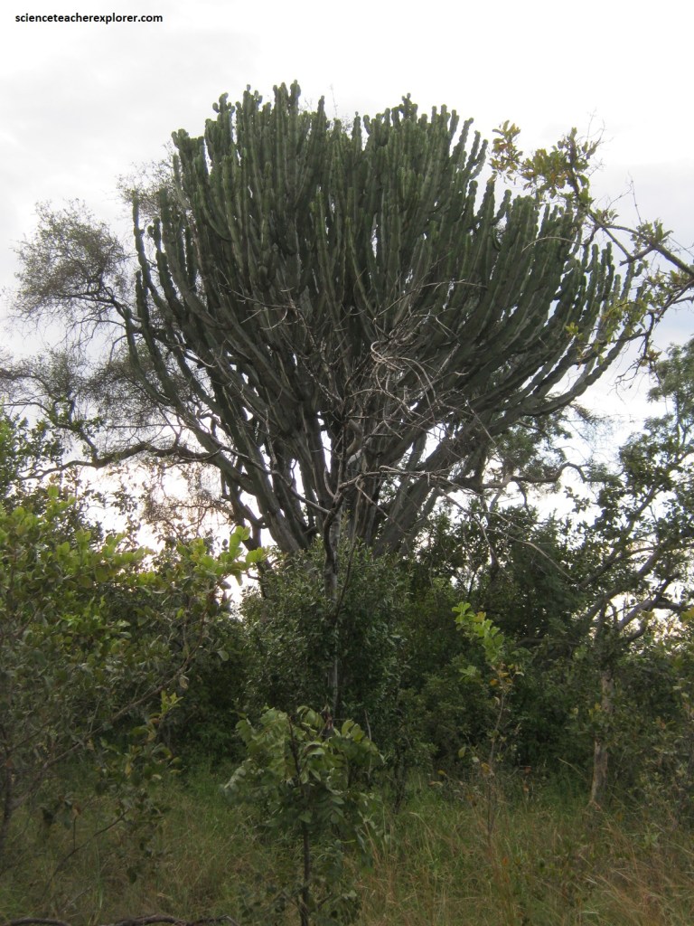
Picture above, Napoon or Euphorbia ingens means large, massive or enormous aptly describing the tree, which can reach roughly 12 m. Its stem is short and the massive crown is very dense. The bark was dark grey, slight rough and dented. Branches were four-sided with four ridges. They branch freely and are conspicuously articulated with about 100 mm in diameter between opposite ridges.
During the rainy season when the marshes are flooded, Nylsvley attracts an incredible variety and number of water-birds. Over 100 species have been recorded on the river and 58 of them breed here.
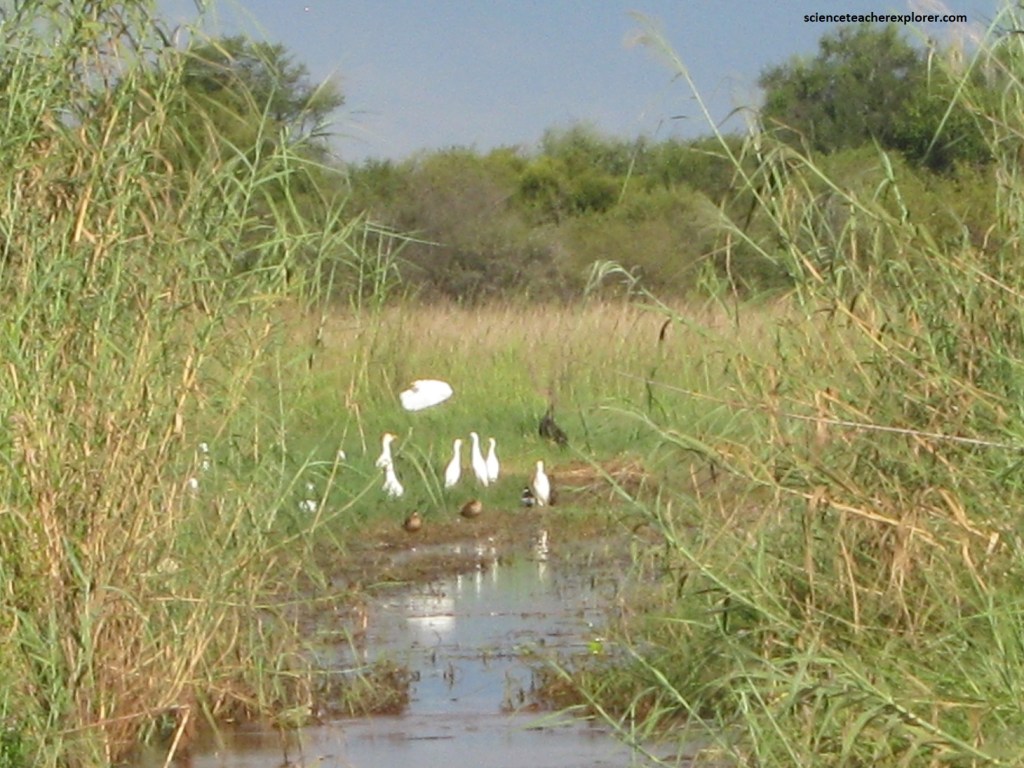
Nylsvley Nature Reserve has the greatest number of waterbird species breeding in one area in South Africa, such as the Squacco Heron, (pictured below).
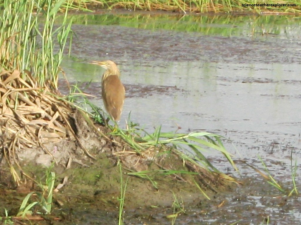
Pictured above, the Squacco Heron Ardeola ralloides is a very shy, light brown heron with dark stripes on the neck. The yellowish bill turn blue and the legs reddish during courtship. The white wings are conspicuous in flight. Forages in shallow water with enough shelter.
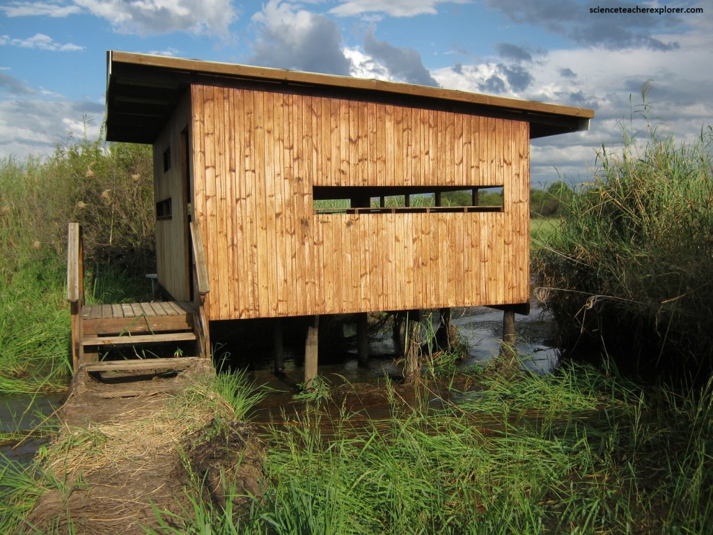
Pictured above, all of the bird hides except one (Dabchick) were burnt down during a fire in September 2013. However, the central “Lookout Tower” has been built since then and it provides the best view points for game as well as waterbirds. The Jacana bird hide offers excellent views of the floodplains.
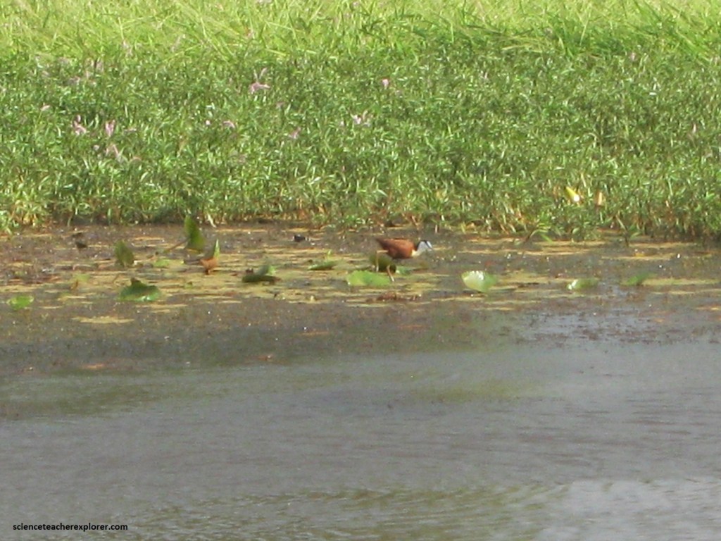
Pictured above, The African Jacana, (Actophilnis africanus) has the characteristic of long toes to enable them to walk on floating vegetation. This white neck and black nape contrasts with the rufous body. The male incubates the eggs and raises the chicks.
While the primary focus at Nylsvley goes to the birdlife, the reserve is also home to thousands of invertebrate species, including 55 kinds of dragonflies and 194 kinds of butterflies. Additionally, there are 13 kinds of fish, 23 kinds of amphibians, 58 reptile species (including many venomous snakes), and 77 species of mammals (among which sizable populations of the rare Roan-Antelope and the Tsesebe).
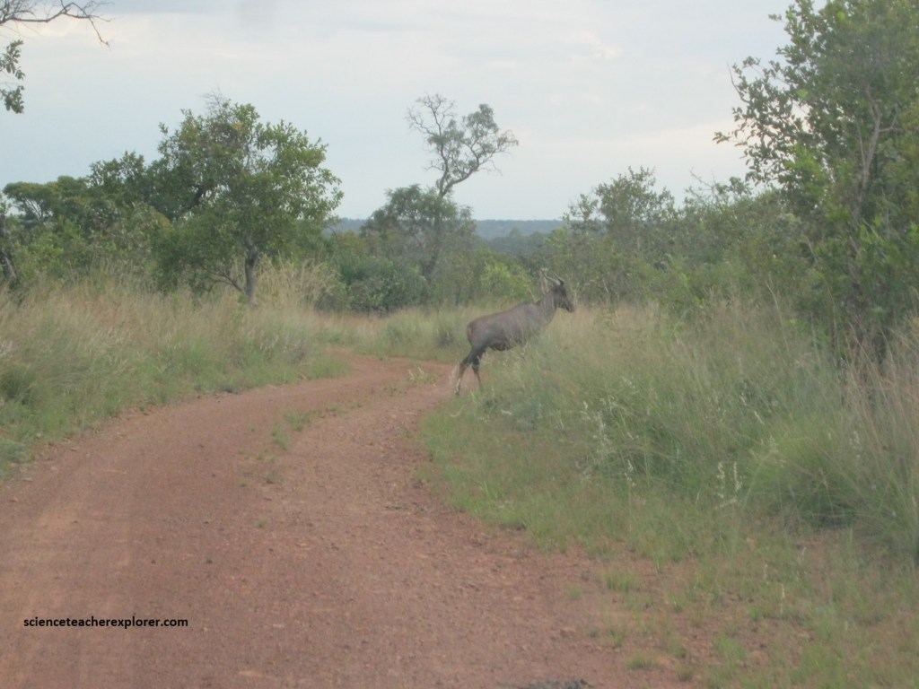
Pictured above, the Tsessebe, (Damalliscus lunatus) is dark, bluish-grey with black on the upper legs, shoulders and upper face. Horns are wid apart at the base and have characteristic “V” shape. They are grazers and prefer open areas with medium to tall tasty grass.
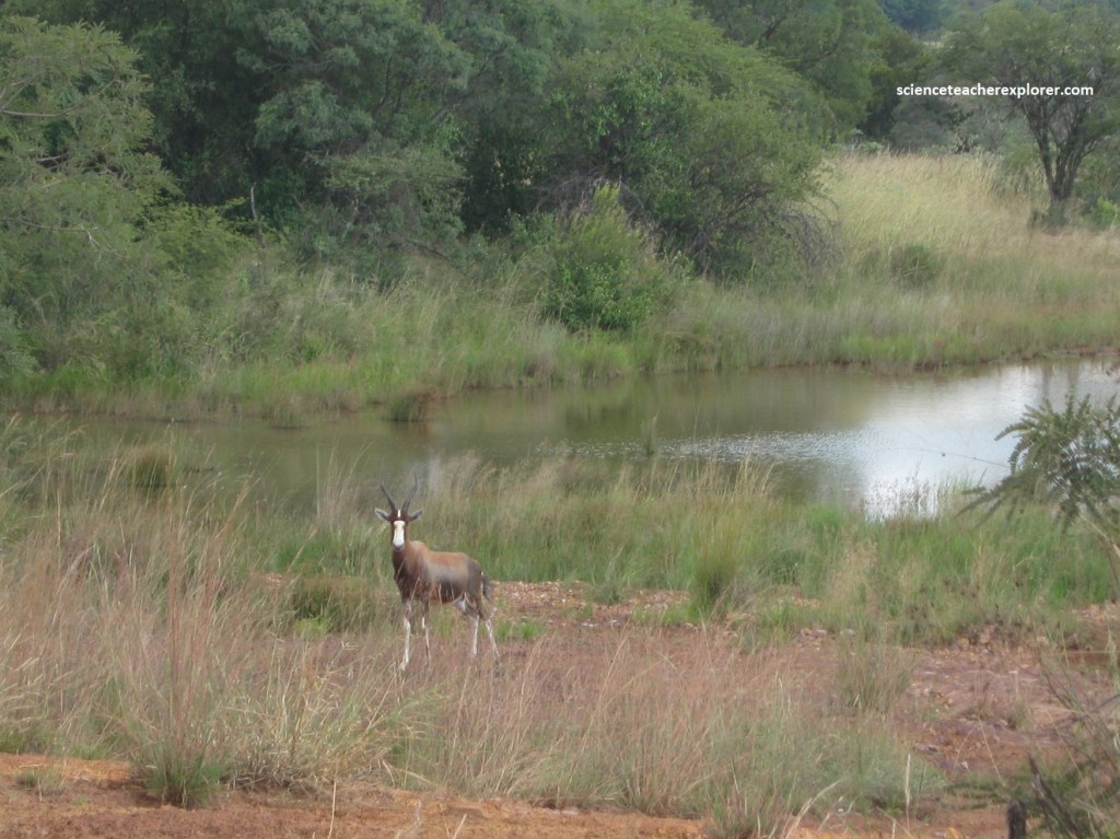
Pictured above, the Blesbok Damaliscus dorcas phillipsi has a distinctive white facial-blaze. Their body color is brown with a lighter-colored saddle on the back, and the rump an even lighter shade. The legs are brown with a white patch behind the top part of the front legs. Lower legs whitish. Their preferred habitat is open grassland with water. They often occupy relatively small territories of 2.5 to 6.0 acres in size. They were once one of the most abundant antelope species of the African plains, but have become scarce since 1893 due to relentless poaching for their skins and meat.
When a group of early explorers, (moving northward through South Africa), chanced upon a north-flowing river, they thought they had reached the headwaters of the Nile. Although this was not the case, the had discovered a feature rich in biological interest, (the Nylsvley River).
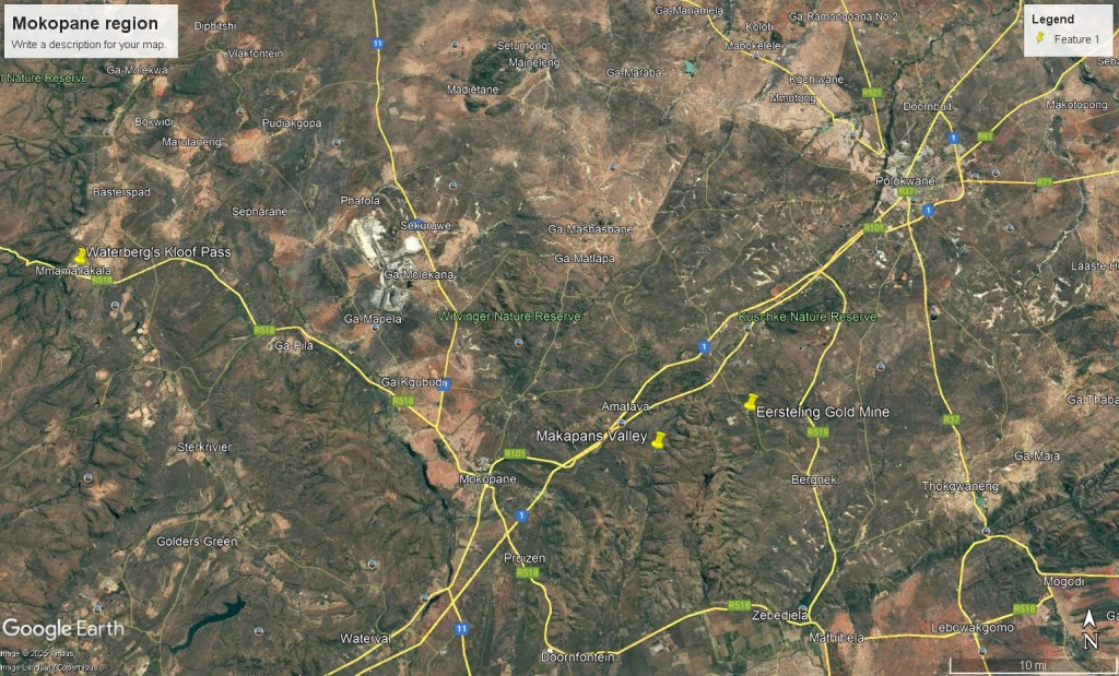
Going north on N1, our next Geosite destination was the region around the Mokopane, (Southwest of Polokwane, South Africa). I was particularly interested in the nearby Makapans Valley, (one of the world’s greatest fossil record area of human evolution).
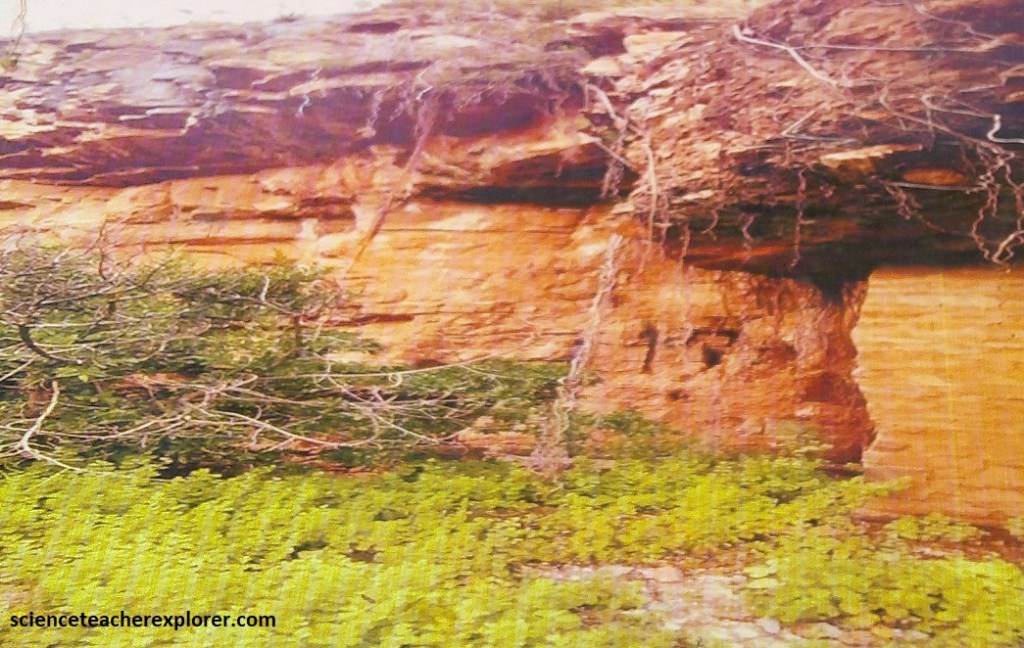
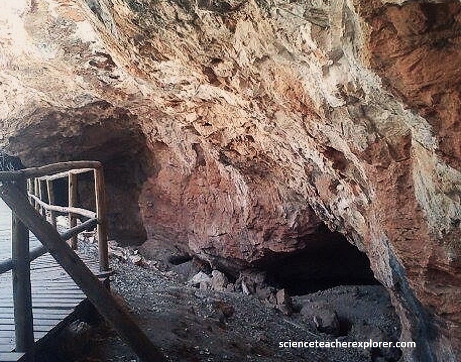
To reach this valley in 2025, we drove about 13km northeast on R101 from the center of Mokopane. There, we turned right onto a signposted gravel road and drove another 7km to the old Limeworks Cave, bypassing the Peppercorn Cave, where we were met by a local guide that took us up into Makapans Valley, (pictured below).
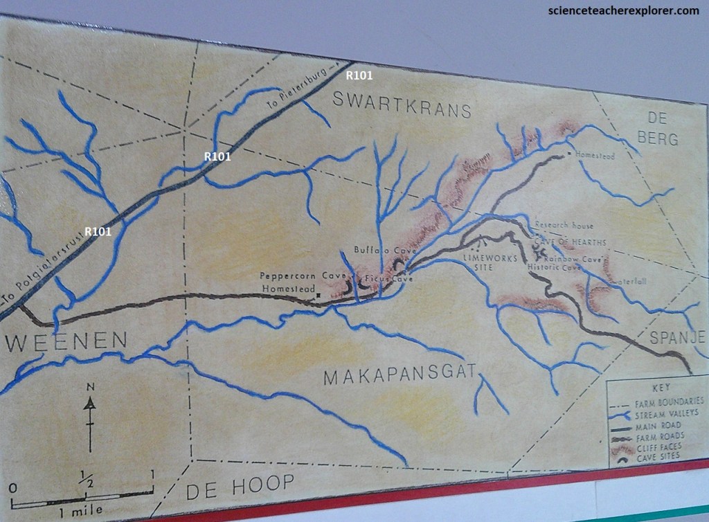
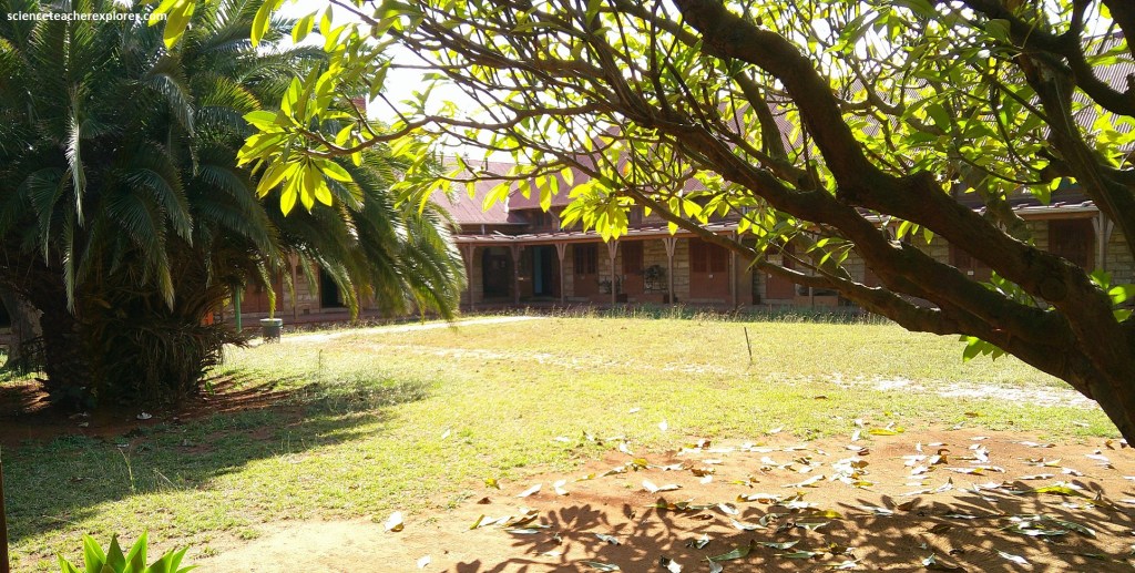
Makapans Valley is the site of numerous caves of scientific and historic interest and an outlying part of the “Cradle-of-Humankind” Heritage Site, (of international scientific importance). Pictured below, I stopped at the Peppercorn Cave Homestead, (on-the-way-out), to study many of the home-made interpretation signs found there and scene below.
The many fossil-rich dolomitic caves in Makapans Valley have a history that goes back to hominid species around 3 million years ago.
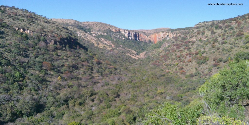
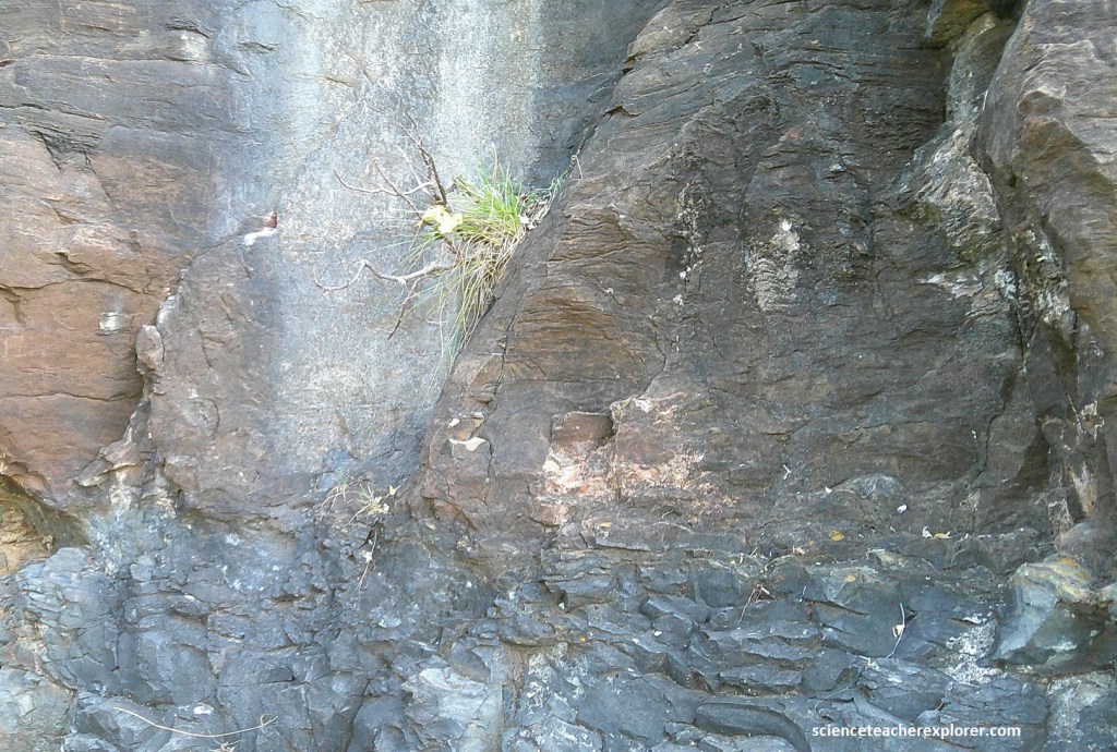
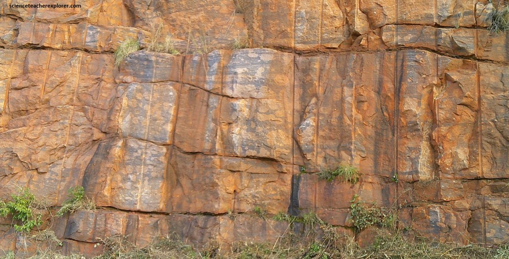
Pictured above, the resistant, cliff-forming formation in the distance is of westward-dipping “Black Reef” quartzite. This thin, hard quartzite formation blankets the landscape of the “Great Eastern Escarpment”. It was deposited on the floor of the inland Transvaal Sea as a clean, pebbly sandstone less than 2.65 billion years ago. It formed a covering that long resisted the underlying softer Basement granite-gneiss. The “Black Reef” formation underlies the thick “Malmani” dolomite sequence in the valley, in which the many caves have formed; [Note: A normal fault separates the two formations at the valley bottom where the fault formed the creek bottom through erosion].
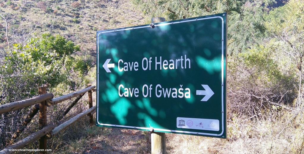
Pictured above, our guide insisted on leading us to the Cave of Gwasha, (or Historic Cave). In 1854 a large number of Kekana Ndebele under Chief Mikopane took refuge here to escape reprisal after being associated with a Voortrekker massacre, (23-28 people were killed at Moordrift and Pruissen from the tension between Kekana Ndebele and the Boers ).
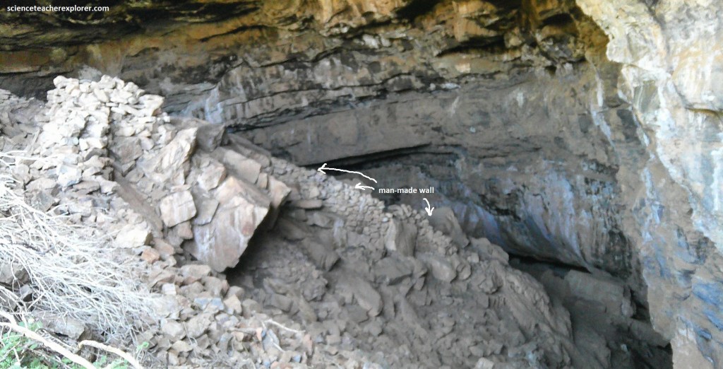
Pictured above, the Kekana retreated into the “Cave of Gwasha”, which they fortified with walls, structures, livestock pens and significant amounts of food and water. However, they were besieged by a large Boer commando and after 30 days many had succumbed to thirst and starvation, and many were killed (approximately 900). It is now listed as a National Monument.
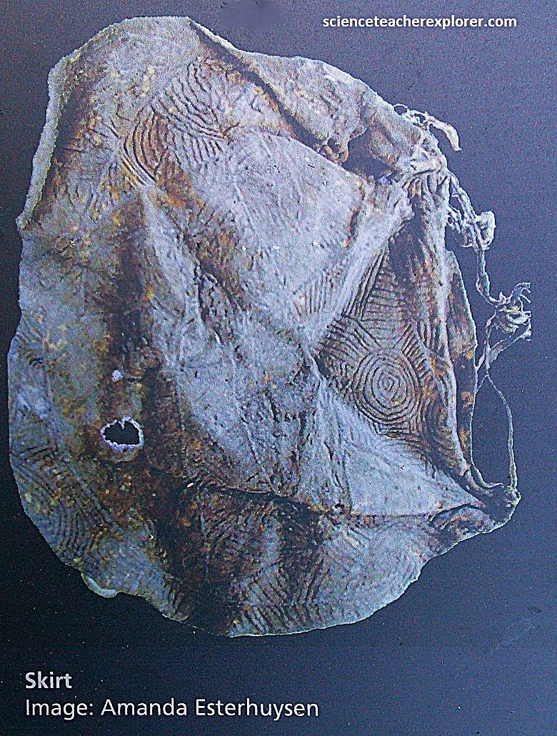
{Picture above are historical items found within the cave, (pictures were taken from an interpretive sign, on-site}.
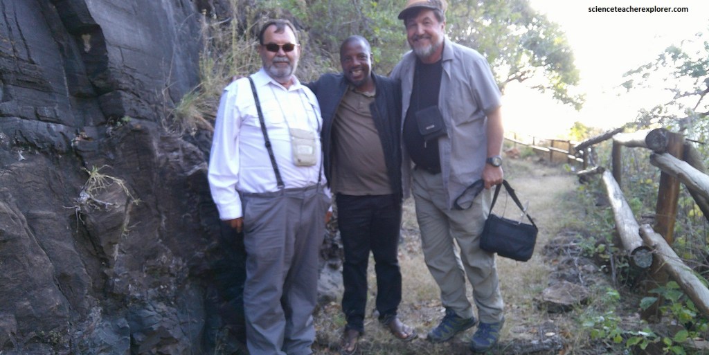
Our guide spent hours explaining the human history of South Africa in the 19th century. This left us little time to explore the other significant caves within the canyon. Our guide was really proud of his legacy from his ancestors, (pictured below with my traveling buddy, Tracy Davis, and myself outside the “Cave of Gwasha”).
Further up the valley is the “Cave of Hearths”, famous for evidence it presents of hominids and Stone Age Man.
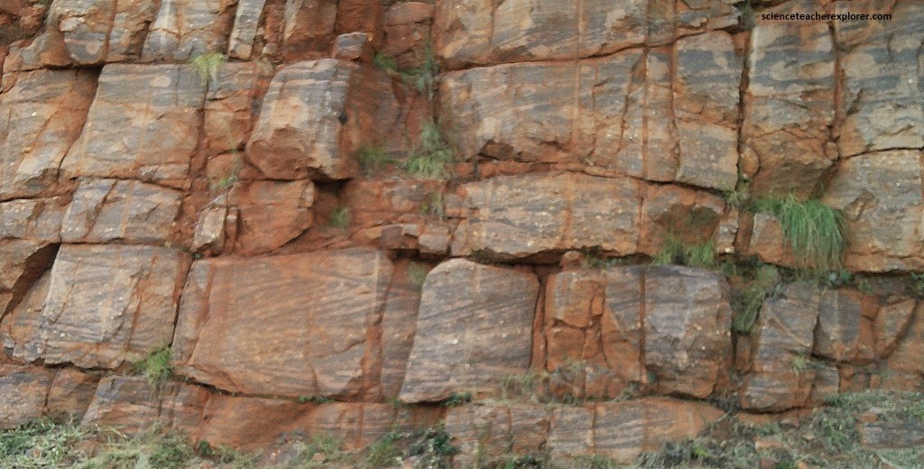
Throughout the Makapans Valley, the rock is dark grey, fine-grained Malmani dolomite. It is largely made of calcium-magnesium carbonate.
The original sediment for the Malmani dolomite was deposited in the shallow Transvaal Sea, around 2.6-2.5 billion years ago. Deposition took place during a geologically quiet period when the dominant life form was blue-green algae, (cyanobacteria), which formed vast marine mat-like algal layers and small domal mat-like algal layers & structures, (pictured below & displayed on-site). Today we see these as fine algal laminations and wavy stromatolite beds. (Note: the algae extracted carbon dioxide from the sea water by mean of photosynthesis, releasing oxygen in the sea water and chemically precipitating the calcium carbonate).
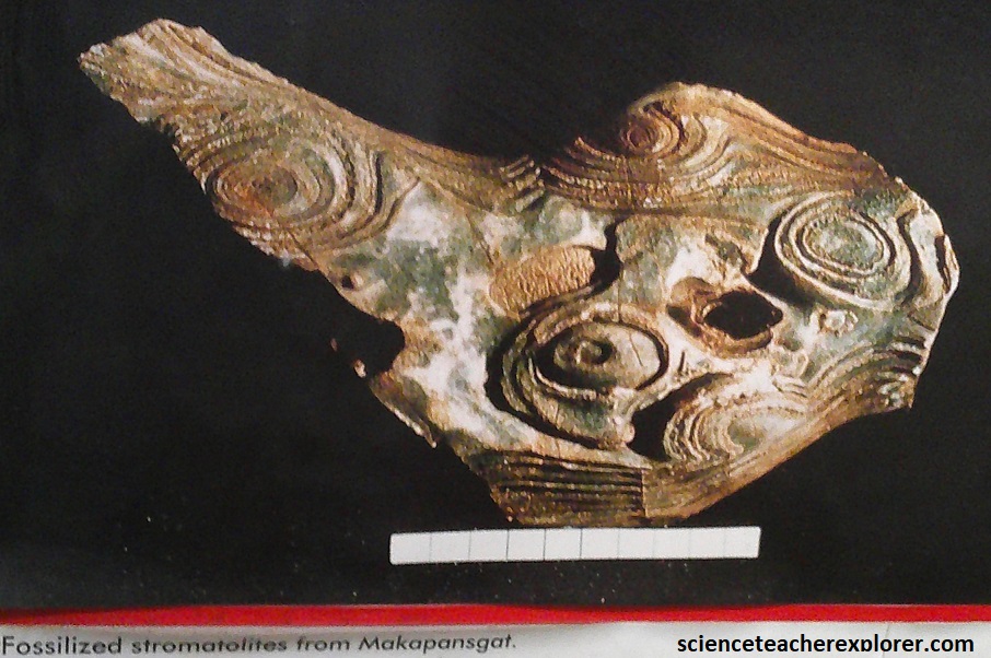
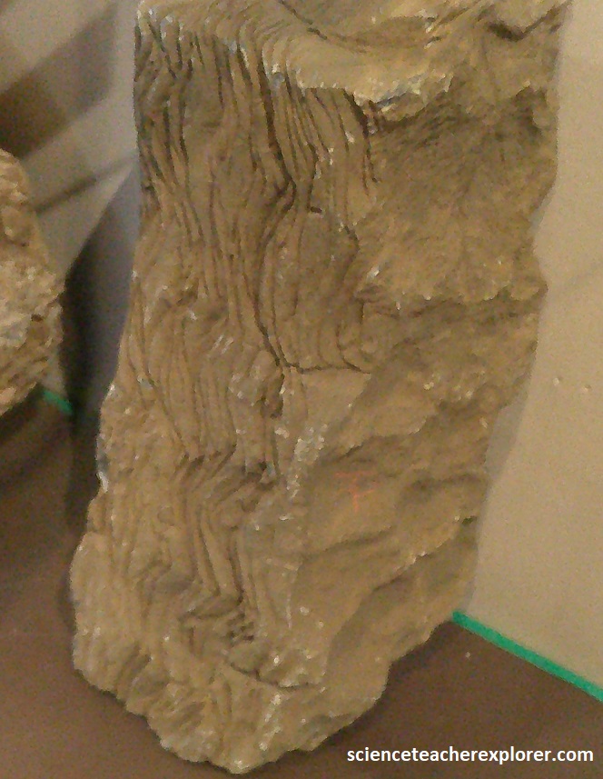
Pictured above are stromatolite structures. They are among the earliest fossils known and are usually found in the dolomite areas, for example at Makapansgat. Here, at Makapansgat, the sheet-like stramatolite mats and other growth forms are common.
Back down the road, “Limeworks Cave” is a treasure-house of fossils. Lime-workers, digging out pure cave limestone to burn for quicklime, removed masses of fossil-bearing cave breccia and discarded it in dumps.
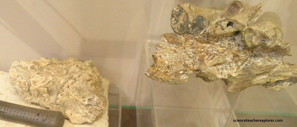
In 1925 a local teacher from Pietersburg, Mr. Wilfred Eitzman, visited the Limeworks and sent fossiliferous breccia to Prof Raymond Dart, (University of the Witwatersrand). This served to focus scientific interest in the valley. Over a period of 45 years, approximately 250,000 bones and bone fragments of fossil animals have been recovered from the Limeworks breccia. {The historical photos and display boards seen below, were taken from an interpretive sign on-site}.


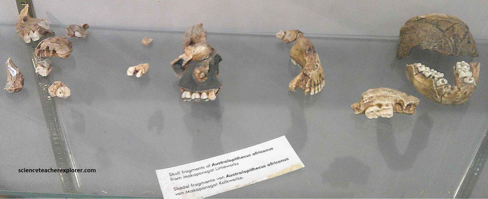
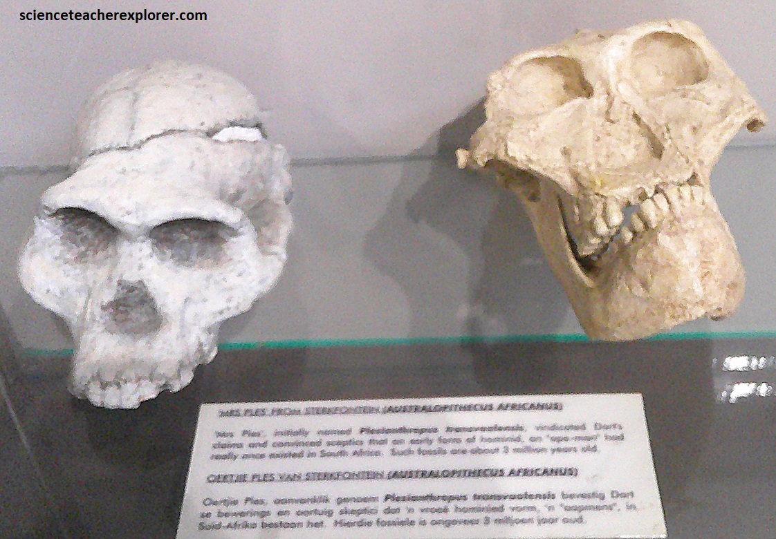
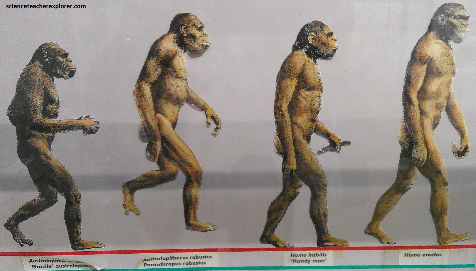
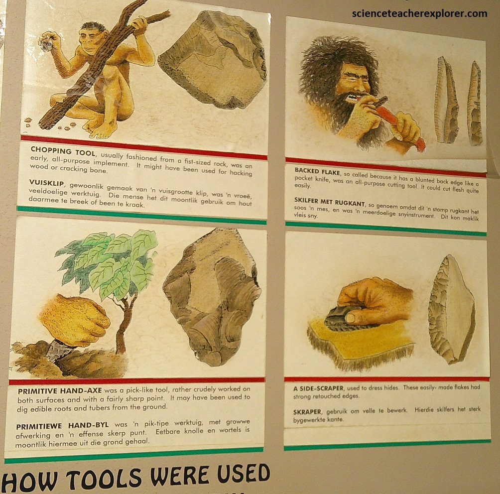
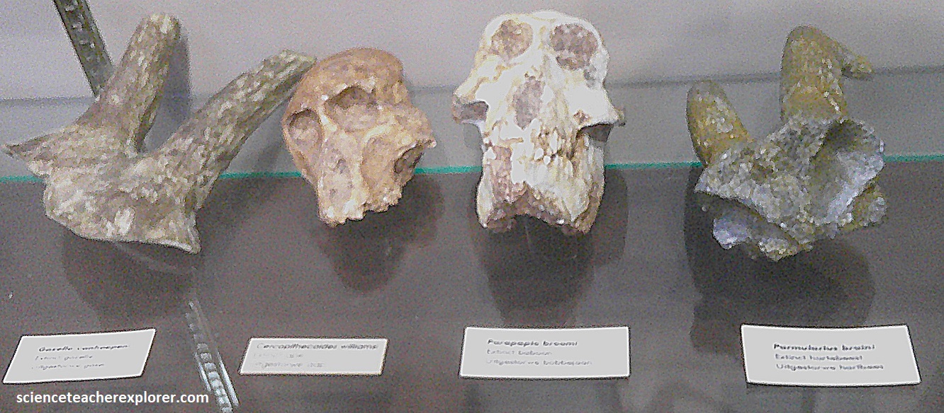
Among the bones discovered were a few hominid fossils. At first these were called Australopithecus prometheus, later renamed Australopithecus africanus. Dart concluded that the ape-man Australopithecus prometheus had manufactured and used implements made from bone, tooth and horn which he named the Osteodontokeratic Culture. Dart’s pioneering study received world-wide attention, and stimulated much research, although the cultural status of the Makapansgat hominid is much debated, (skulls seen below were displayed on-site).
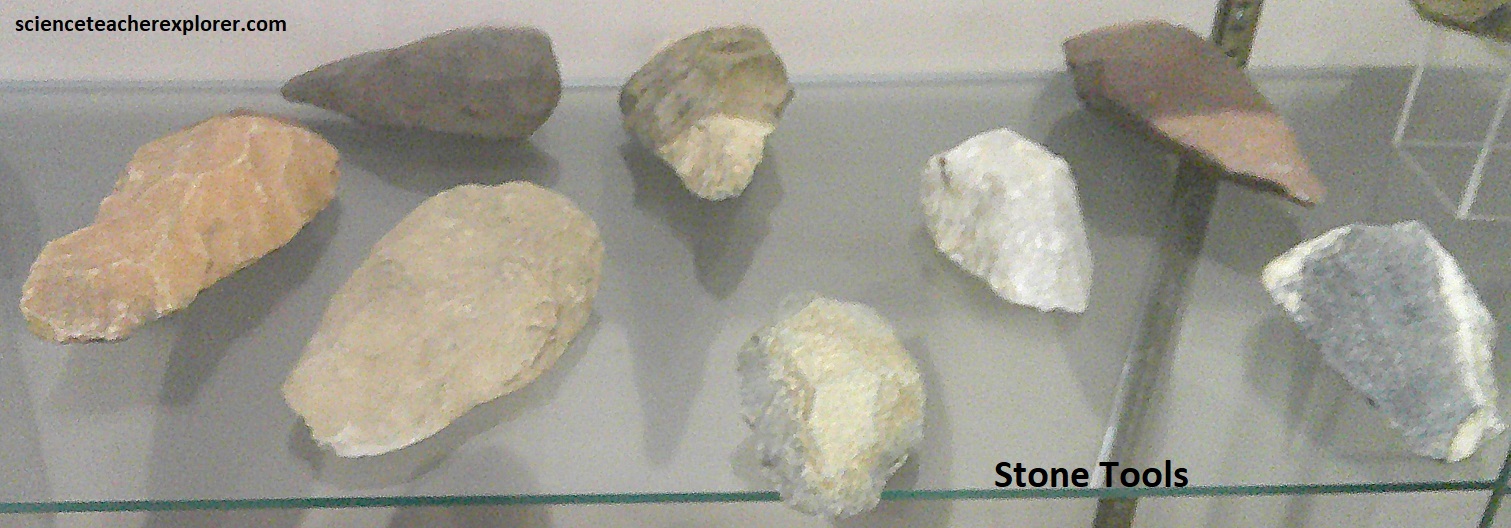
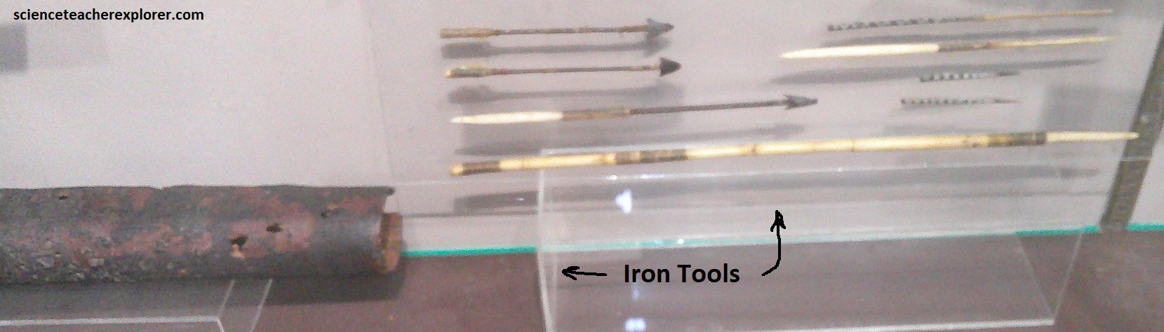
Evidence of habitation extending over many thousands of years was found in the valley in the form of fossil animals (including hominids) bone and stone tools, ancient hearths and iron smelting. {Iron and stone tools that are pictured below were displayed on-site, along with the interpretive sign}.
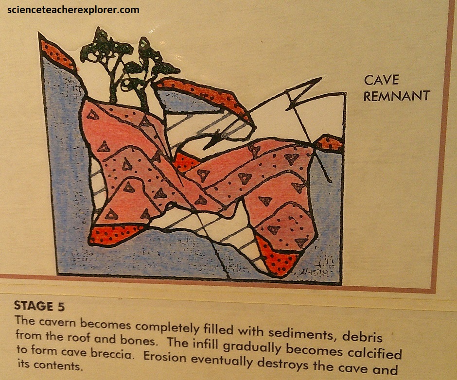
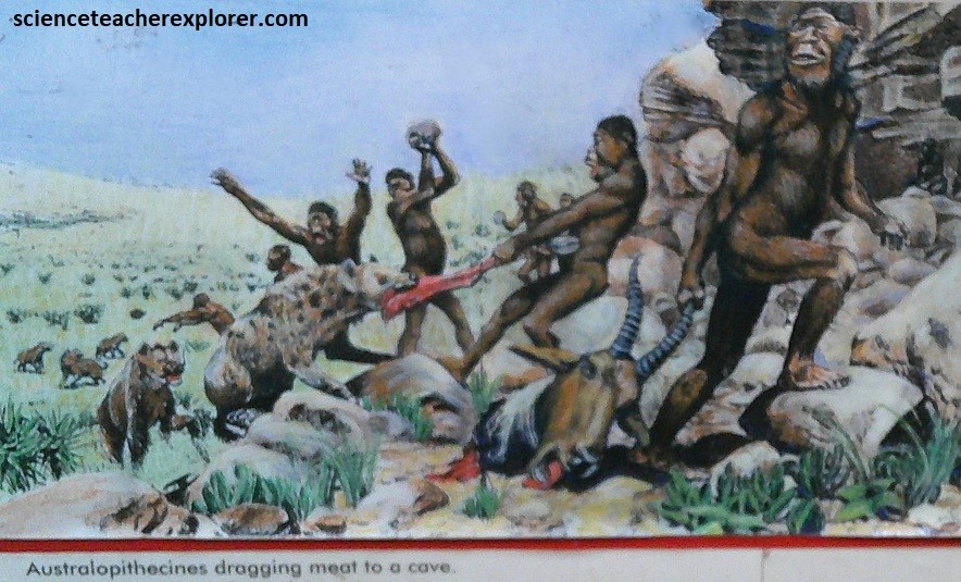
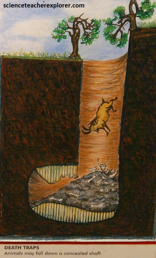
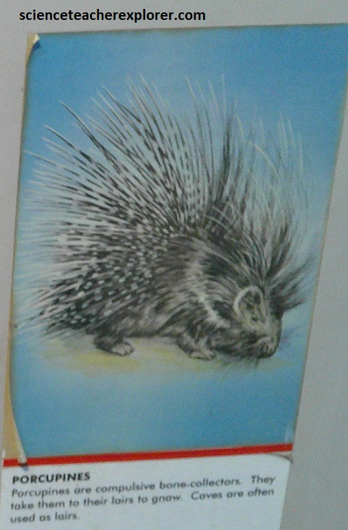
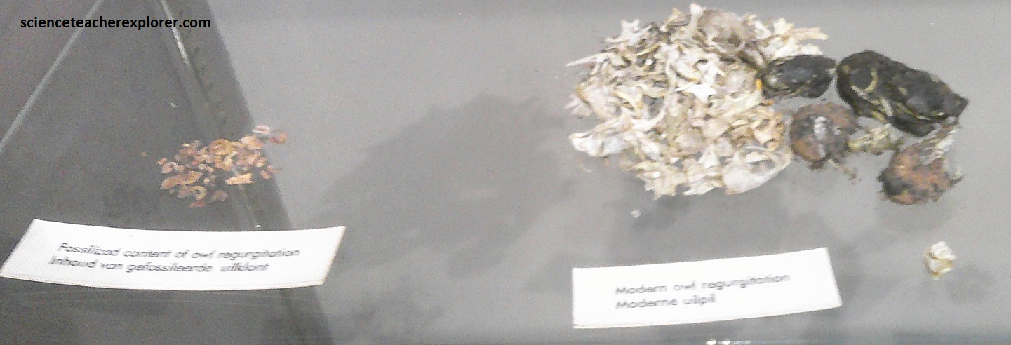
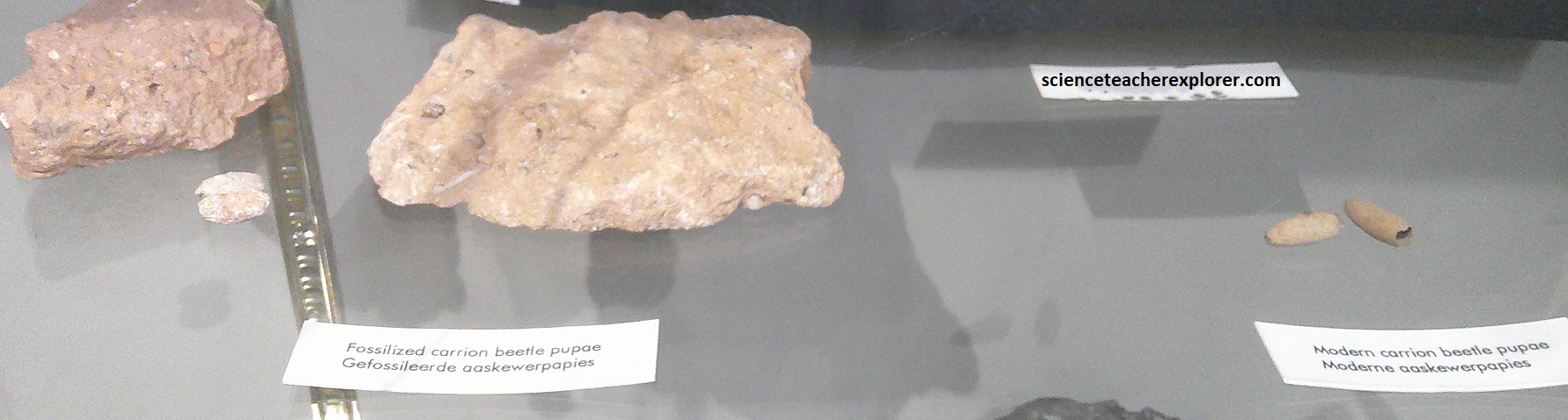
In 1947, more systematic work was carried out at other caves within the valley. However, Cave breccia at “Limeworks Cave” was carefully hand sorted to recover the enormous number of fossil bones that had accumulated in one spot, over millions of years. Below are possible reasons why the accumulation occurred; {the drawings below were taken from a display board on-site}.


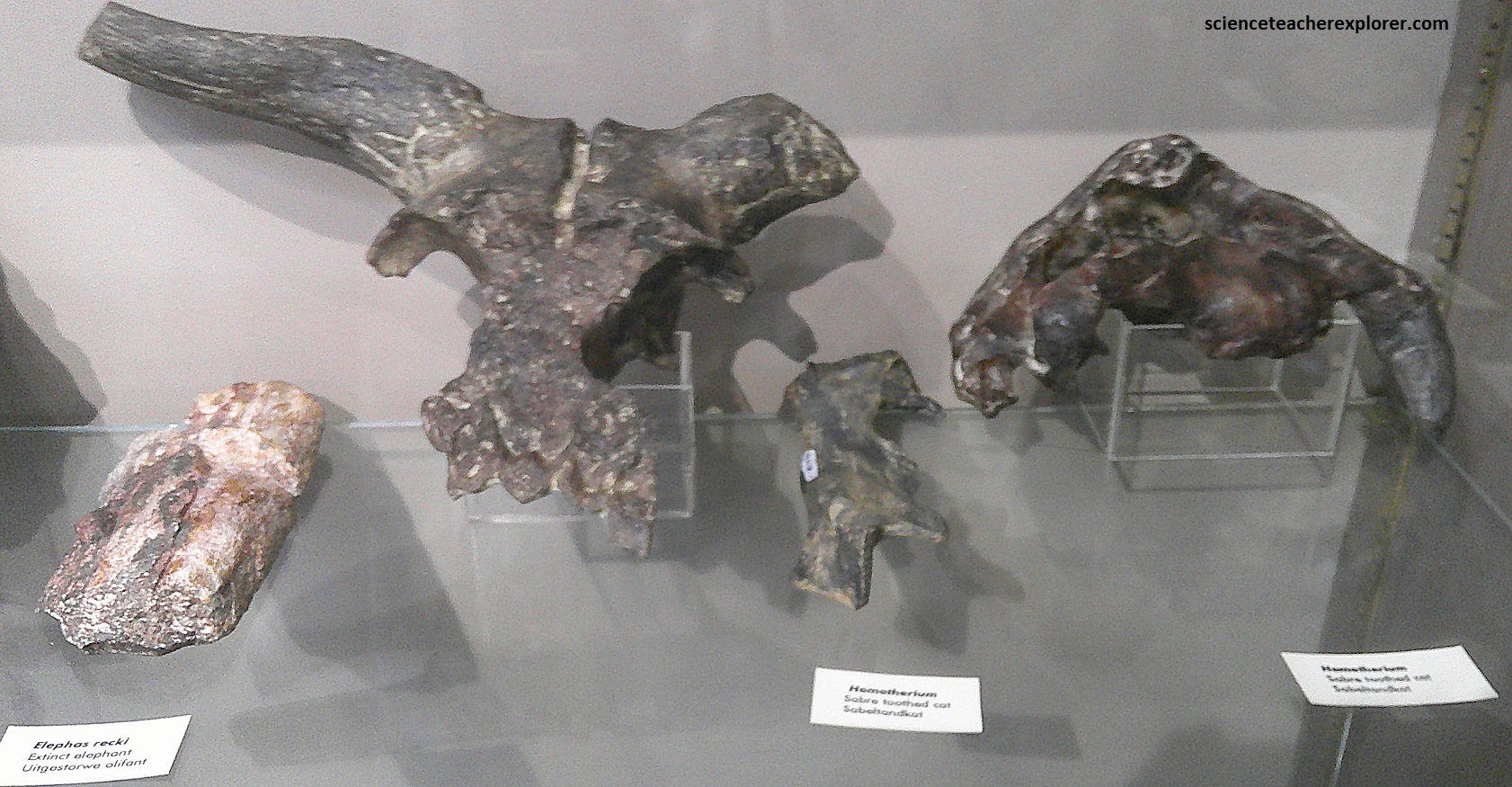
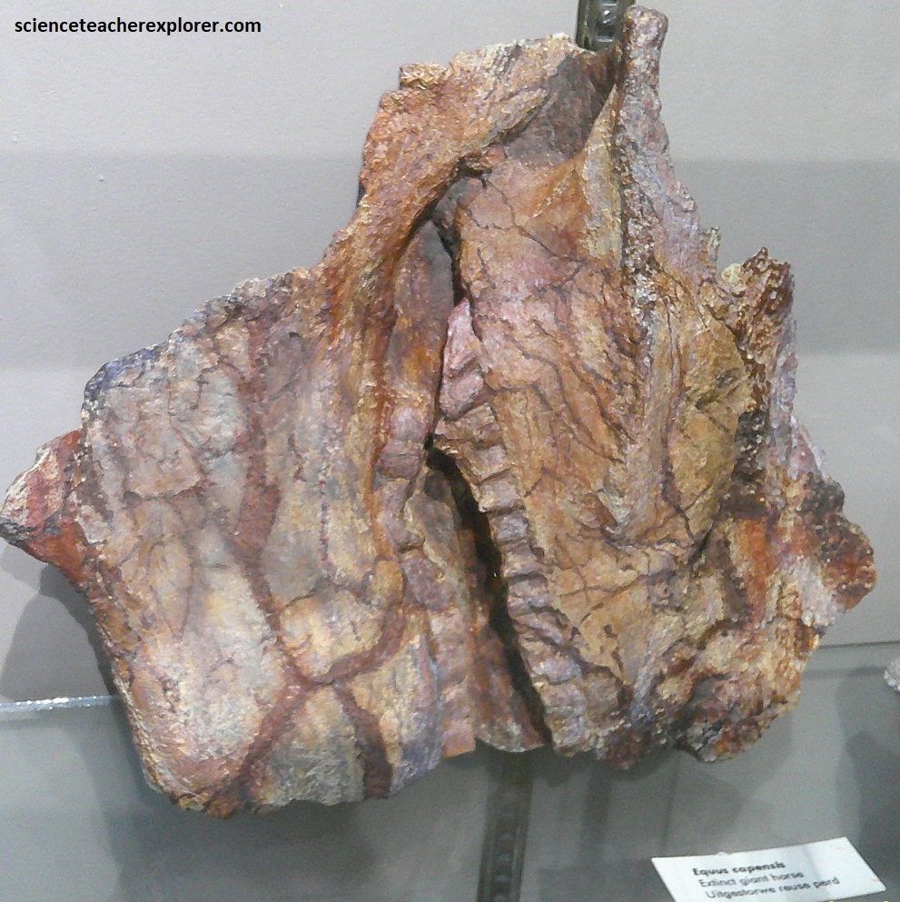
During Pleistocene times Makapans Valley was home to a great diversity of animal life, including insects, owls, giant horses, monkeys, apes, antelopes, and carnivores. In the “Cave of Hearths”, a number of the 3 million-year-old hominid specimens were also found. {The pictured below are bone fossils found within the “Limeworks breccia” & displayed below}
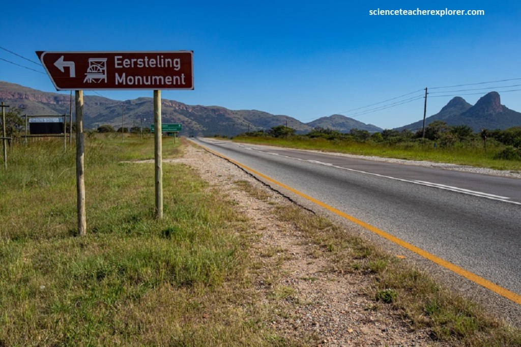
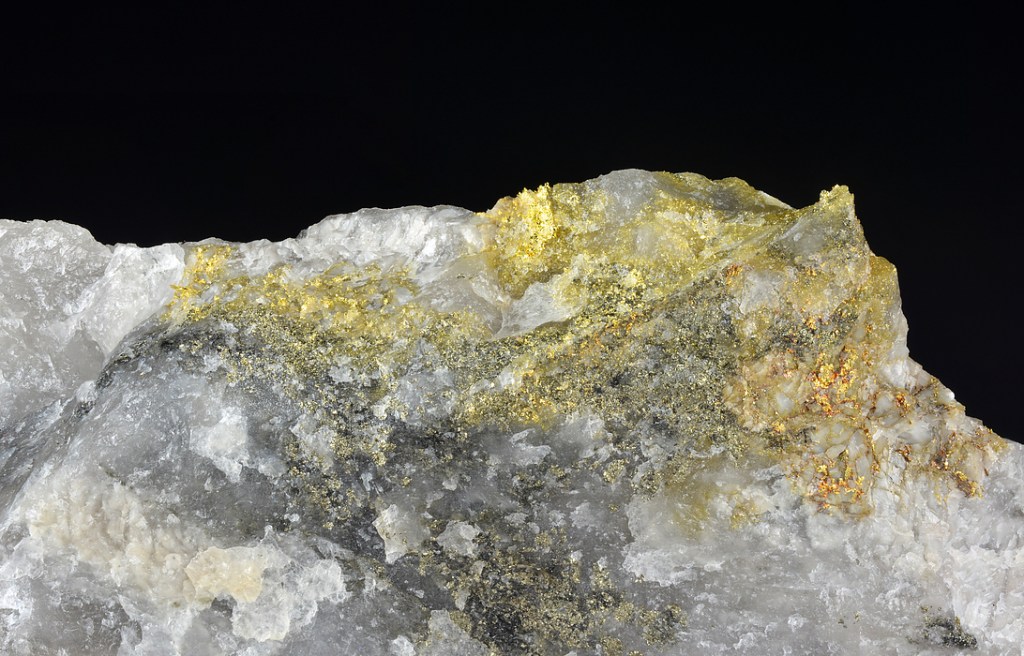
Another 5km up R101, towards Polokwane or northeast of Mokopane; is the Eersteling goldfield. Of course, we turned off at the sign ‘Eersteling Monument’, (pictured below).
In September of 1871, Edward Button appeared before the Volksraad in Pretoria to announce the discovery of a profitable goldfield. In December of that year the Marabastad goldfield was proclaimed, the first in South Africa, and prospectors flooded in. Button called the discovery, ‘The Natalia Reef’.
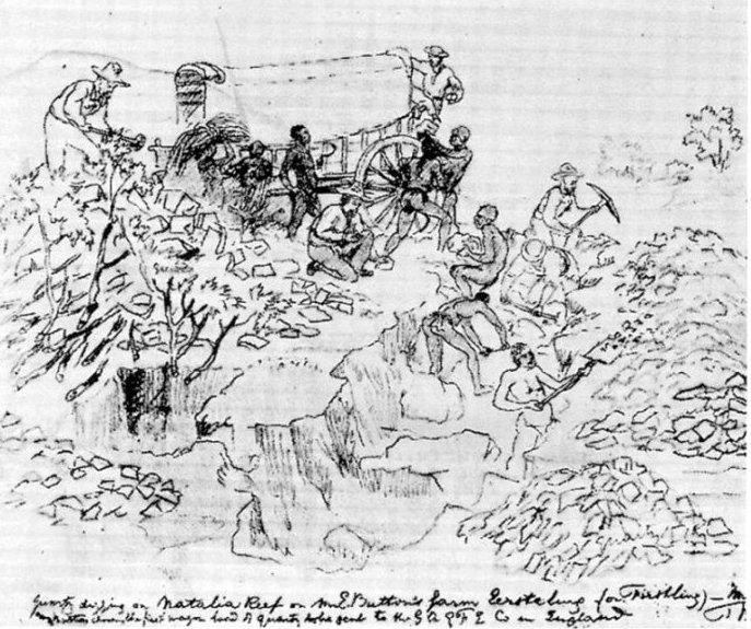
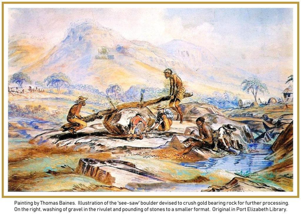
After purchasing the farm, Button soon found rich alluvial gold coming from a deeply weather reef. It was initially recovered by sluicing, but soon the gold was being won by crushing the weathered quartz reef with a primitive see-saw fashion under a large round boulder, devised by William Pigg, one of Button’s mining partners, (imaged below).
Soon, a 12 stamp rock crusher, steam engine and boiler were purchased and shipped to South Africa and brought to Marabastad by ox-wagon, (at great expense). The crusher came into operation only in 1874. From 1906-1937 the Eersteling goldfield is reported to have produced 439kg of reef and alluvial gold, and over the years numerous small workers continued to mine in the area.
This goldfield lies at the southwestern end of the Pietersburg Greenstone Belt in metamorphosed volcanic rocks. The dominant rocks at the old mine site are mafic volcanics (basalt) of the Eesteling Formation, now metamorphosed to a dark fine-grained amphibolite and strongly sheared in places.
As is typical of greenstone belts, the ore occurs mostly in quartz-carbonate-sulfide veins, also called ‘reefs’ that formed when hot, mineral-carrying solutions penetrated into cracks cause by shearing.
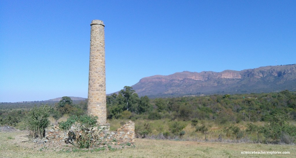
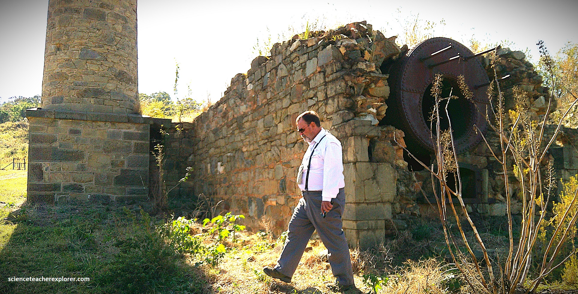
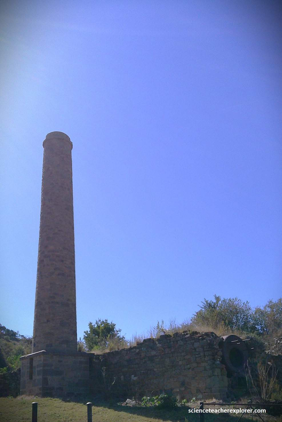
Pictured below, my trekking buddy, (Tracy Davis), and I explored the Eersteling Gold Mine chimney and boiler-house site, extensively.
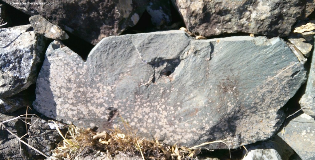
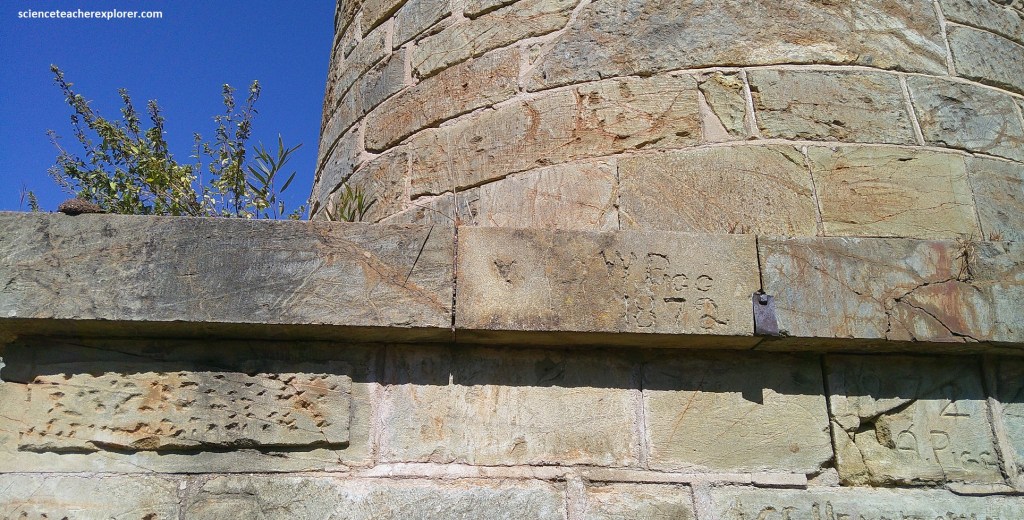
Pictured below, the wall of the chimney bore an assortment of engraved names. On the right is ‘W. Pigg 1872’; William Pigg, who arrived that year, was one of Edward Button’s mining partners.
Driving around on the graveled road nearby, we found an active Mine shaft. It could see the steel headgear of the Franka Shaft, part of the modern-day Eersteling Gold Mine. However, it was guarded with armed security guards, so we didn’t very close, (pictured below). I believe that it opened in 1987.
Our next geo-site destination was the Waterberg’s Kloof Pass. Road access to the high tableland of the Waterberg is limited to 5 natural passes. One of them was on the eastern side, called the Kloof Pass. It was recently built in the 1980s and lies some 50km west of Mokopane on R518. {Kloof means a narrow valley in South Africa}.
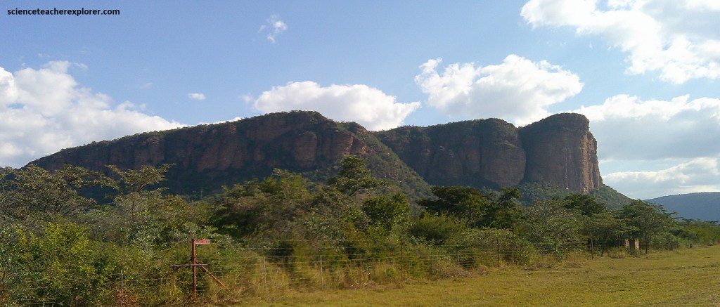
Pictured above, this landscape is part of the prominent Waterberg Mountain Escarpment, which is eroded along the eastern and southern margin of the Waterberg Plateau, and is locally known as the Hanglipberge & Sandriviersberge. The giant cliff-face, picture above, is the 1,760m high Hangclip buttress overlooking the Entabeni Conservancy.
The entire Kloof pass is surrounded by sedimentary ‘Red beds’. Those seen within the Kloof Pass are some of the oldest re beds on Earth, and it is the presence of dark iron oxide that makes these rocks important. Before 2.0 billion years ago, the atmosphere contained no free oxygen but, by at least 1.9 billion years ago, oxygen (derived by photosynthesis from blue-green algae) was gradually becoming available in the air. Therefore, this oxygen began reacting with reduced iron-rich minerals such as magnetite (Fe2O3) & pyrite (FeS2), converting them to rusty iron-rich hydroxides such as limonite and iron-rich clays, which were deposited within the sand, (staining and cementing it). Eventually, these mobile iron hydroxides were able to permeate through the sedimentary rock and form hematite, (Fe3O4) through a process called diagenesis, (the post-depositional physical and chemical changes in the rock).
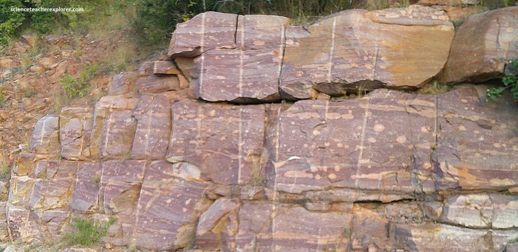
Within the Kloof Pass, numerous freshly exposed faces in R518 provide wonderful views of primary depositional sedimentary structures and secondary diagenetic changes within the sandstones. Their greyish brown to maroon mottled coloration is due to abundant iron oxides, in places further oxidized to rusty pigmentation. Pictured below, the Mogalakwena Formation, less than 1,500m thick, is well displayed on the Kloof Pass, but underlying this is the start of the older Makgabeng Formation.
Pictured above, the Waterberg sandstone is showing the conspicuous, maroon-colored concentrations of fine hematite with paler pinkish pebbly sandstone. The hematite-rich sandstone occurs irregularly, mainly along bedding surfaces.
Pictured above, this exposure shows typical shallow-water, channel-like cross-bedding and scattered quartz pebbles, indicating deposition on a braided, alluvial plain. This reveals that the Mogalakwena Formation consists entirely of maroon to grey-brown, coarse to medium grained, quartz-rich sandstone and occasional thin conglomerate layers and scattered pebbles. These rocks were deposited on extensive flood plains crossed by multiple braided river channels that rapidly transported an abundant supply of sandy sediment from the highlands located to the northeast to a shallow sea in the southwest.
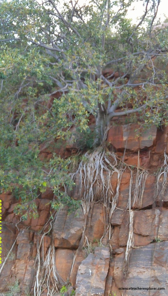
Pictured above, the tenacious roots of the rock fig have established a good hold on exposed Waterberg sandstone along the roadside. The rocks below contain abundant iron oxide in the form of hematite that occurs as coatings around sand grains or as thin layers along bedding planes or cross-beds, and this feature is an important geological marker in Earth’s evolution.
Pictured above, the road cut shows rocks with countless irregular, rounded or elongated bleached patches. These are also called ‘reduction spots’ where the rock has been locally leached. The alteration cross-cuts sedimentary structures and destroys diagenetic hematite, so it is clearly a much later reaction. These common but enigmatic patches are the result of the much later leaching and removal of iron by ground water.
Another location that seems to have similar ‘Red Beds’ is found north of Mokopane on N1. We decided to continue our trek of Limpopo by driving north 169km, (past Polokwane), on N1 to Louis Trichardt, (Makhado).
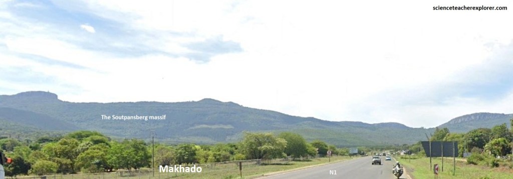
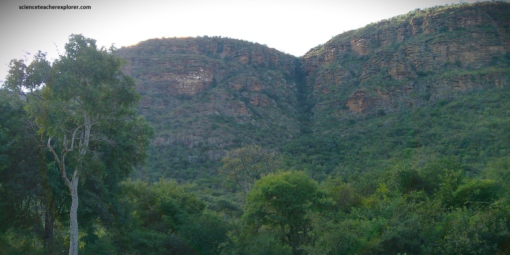
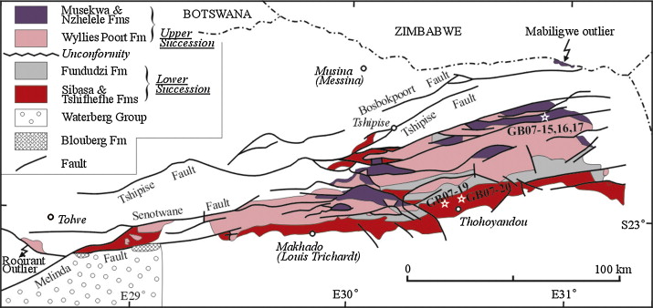
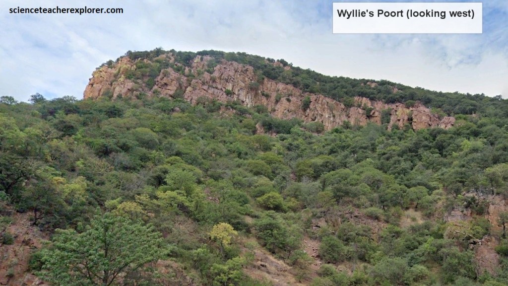
Pictured above, from Makhado, N1 climbs steeply up the southern side of the Soutpansberg mountains before descending to the gorge of Wyllie’s Poort 15km north. The unusual Soutpansberg Mtns. is made up of the Soutpansberg Group, a mixed of sedimentary and volcanic formations approximately 1.9-1.7 billion yrs. old. Much of the Soutpansberg rises over 1,600m above sea level and the highest peak reaches 1,747m. This ancient range lies above the African land surface and is a dissected remnant of the surface that existed before the breakup of Gondwana.
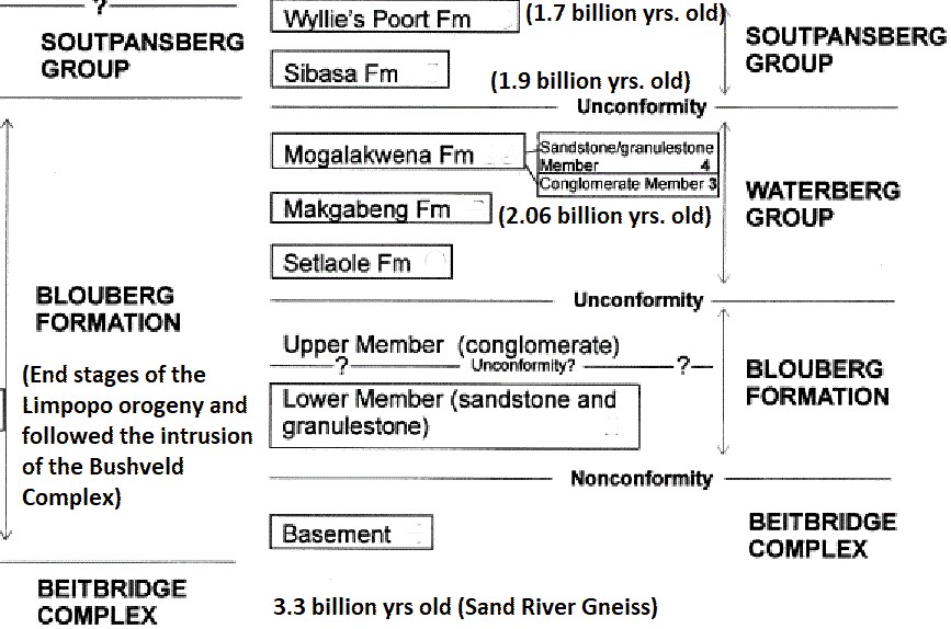
The Soutpansberg massif was formed in a large east-northeast-trending graben structure (a dropped-down block of land bordered by parallel normal faults), that became filled mostly by basaltic volcanics and sandstone, the latter becoming the hard Wyllie’s Poort quartzite. On both its southern and northern sides the Soutpansberg range is bounded by major fault structures against older granitic gneisses of the Limpopo Complex.
Many strike-slip faulting cuts across the range in much the same direction and have resulted in the step-like block-faulting. The cause of this graben landscape is still unknown.
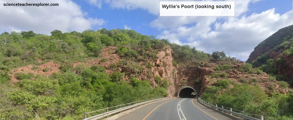
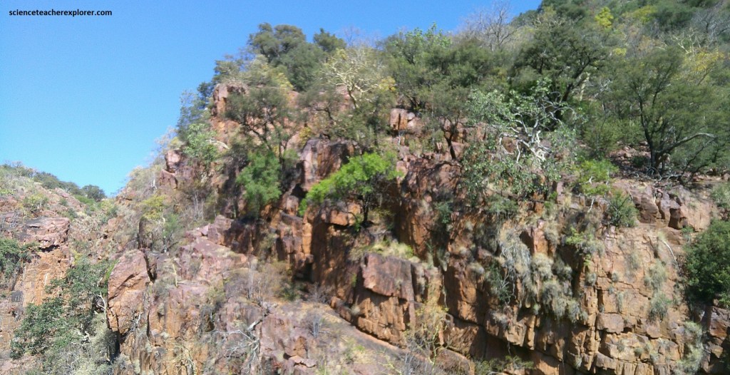
The hard, resistant Wylie’s Poort Formation quartzite, about 1,500m thick, is the dominant geology seen high along the roadside.
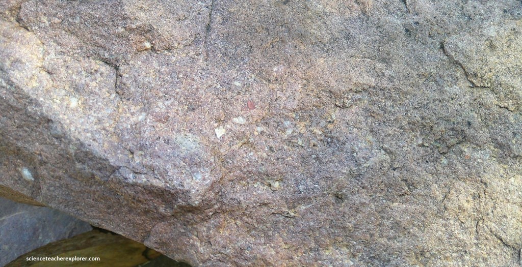
The Wyllies Poort Sandstone is reddish in color due to the pervasive iron minerals, and is geologically known as a ‘Red Bed’. It was originally deposited as a sandstone on a braided alluvial flood plain, but is now a pink quartzite with small layers of pebbles that can be found within the quartzite. A prominent layer of conglomerate layer marks the base of the formation.
Repetition of the dipping formations has resultd in a landscape of steep scarp-slope and more gentle dip-slopes. Picture below, the terrain & bedding are tilted to the north at about 10-25o . Roughly east-west-trending block-faulting has resulted in a step-like repetition of the strata, (mentioned above).
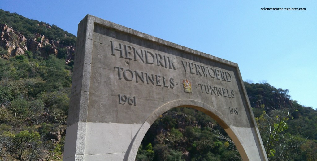
The Poort is named after Lieutenant C.H. Wyllie who surveyed and engineered the original road on 1904. Increasing traffic led to the later construction of a new road higher up, including two tunnels cut through quartzite, 457m and 274m long, opened in 1961 and know as the Hendrik Verwoerd Tunnels.
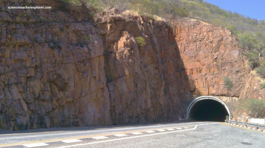
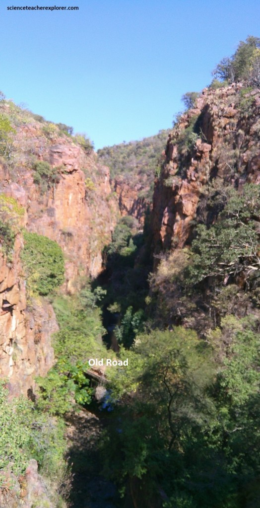
The abandoned and overgrown old road that originally went through the gorge is seen in below, near the entrance to the southern tunnel on the N1 to the west of Wyllie’s Poort.
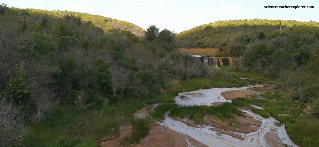
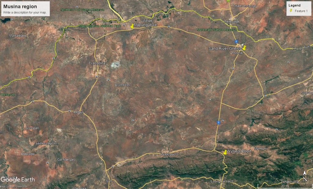
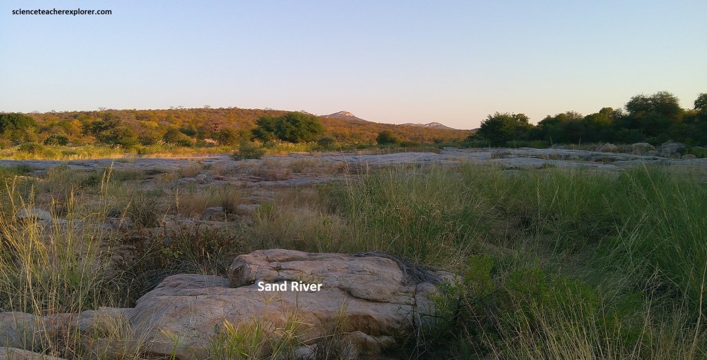
From Wyllie’s Poort, the N1 highway; north to Musina crosses an unspectacular plain before dropping down into the dissected terrain of the Limpopo River Valley. The dry sandy landscape of baobabs & mopane trees, hides the extremely complex “Central Zone of the Limpopo Orogeny Belt”. This is a broad zone of gneisses and metasedimentary rocks characterized by intense structural deformation, strong metamorphism and melting of the original rocks during several major tectonic episodes 3.4-3.2 billion years ago. This “Central Zone” is represented at the Sand River, 4km southeast of Musina, (pictured below). We accessed this site via the Musina Nature Reserve off of N1.
As the Zimbabwe and Kaapvaal Cratons moved closer together, the thin crust between them became compressed, strongly folded and thickened to a depth of more than 30km, forming the Limpopo Orogeny. Deep within the crust these rocks were intensely metamorphosed and partially melted to form a range of granitic magmas that intruded the crust, and eventually became the Sand River gneisses, (pictured below). The process of mountain building, (orogeny), formed an elongated ‘Limpopo’ mountain range, and also welded the cratons together to make what was probably Earth’s first continental mass. Over geological time the mountains were completely eroded so that today nothing is left but their twisted and confusing roots.
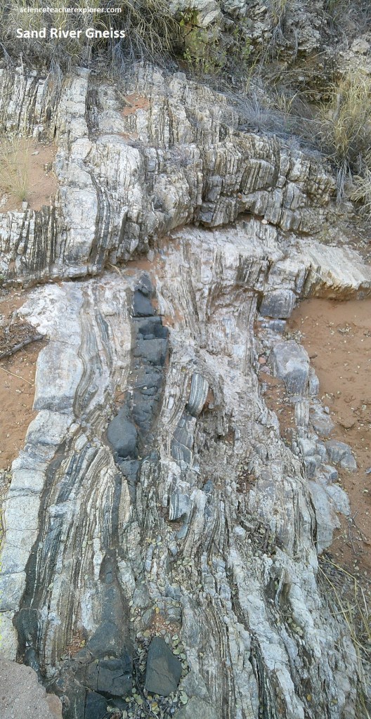
Pictured above, these gneisses are called ‘migmatites’ (consisting of an intimate mixture of at least two other rocks) and show extreme metamorphism and plastic deformation. They are strongly banded, fold in a complex way and show amazing stretching, interlayering and contortion. The dark rocks shown above are thought to represent a much earlier mafic dyke that intruded the gneiss and which has subsequently been intensely deformed.
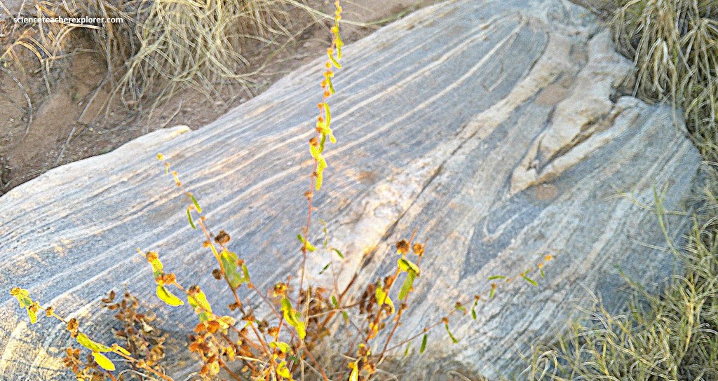
Pictured above, an elliptical and steeply plunging sheath fold within Leucocratic gneiss and darker Grey gneiss, the result of complete detachment of an elongated cylindrical structure during intense deformation. {Note: I found scattered patches of lime-green epidote and pink potassic feldspar that reflects hydrothermal alteration that took place after the intense folding}.
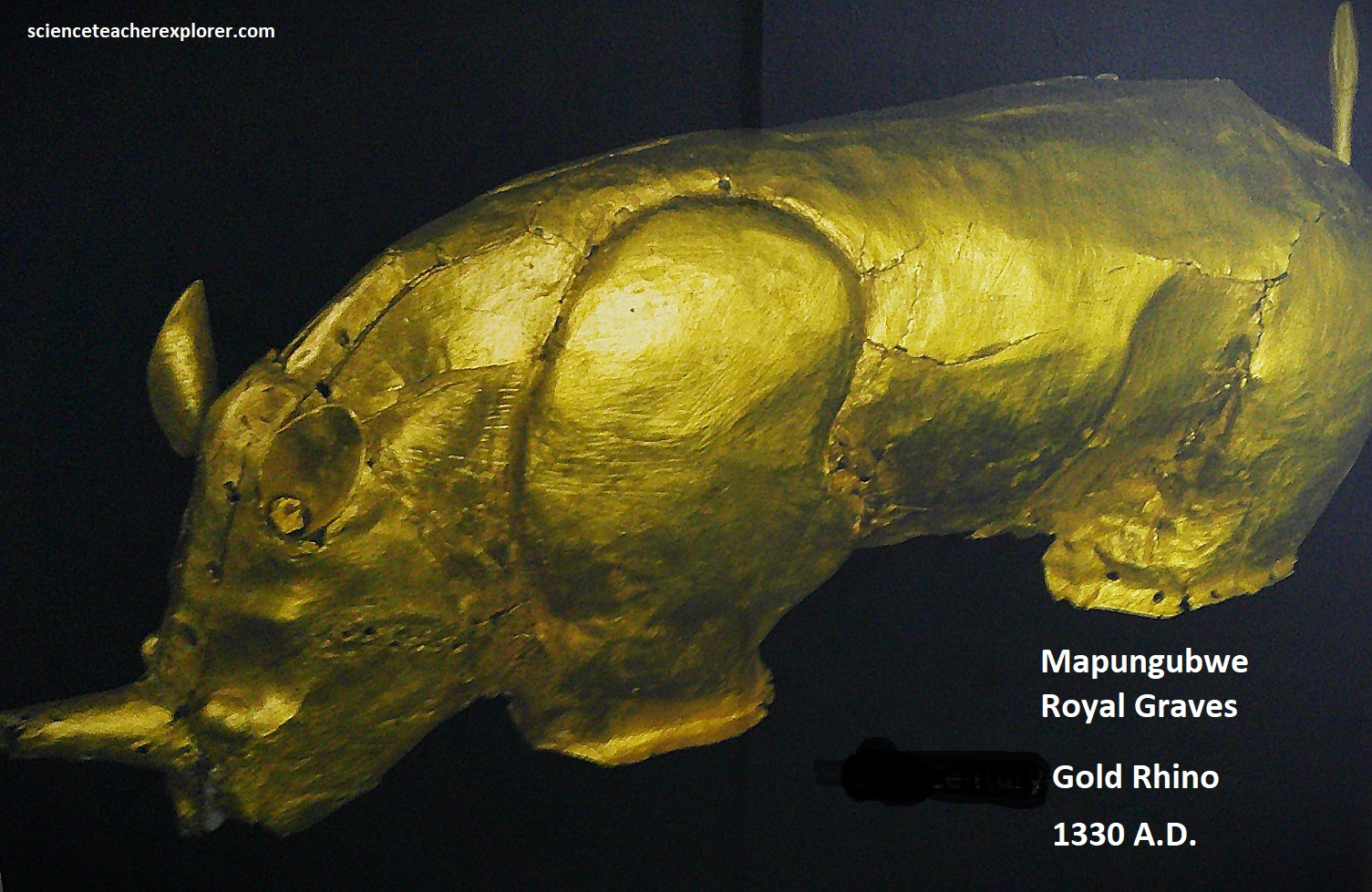
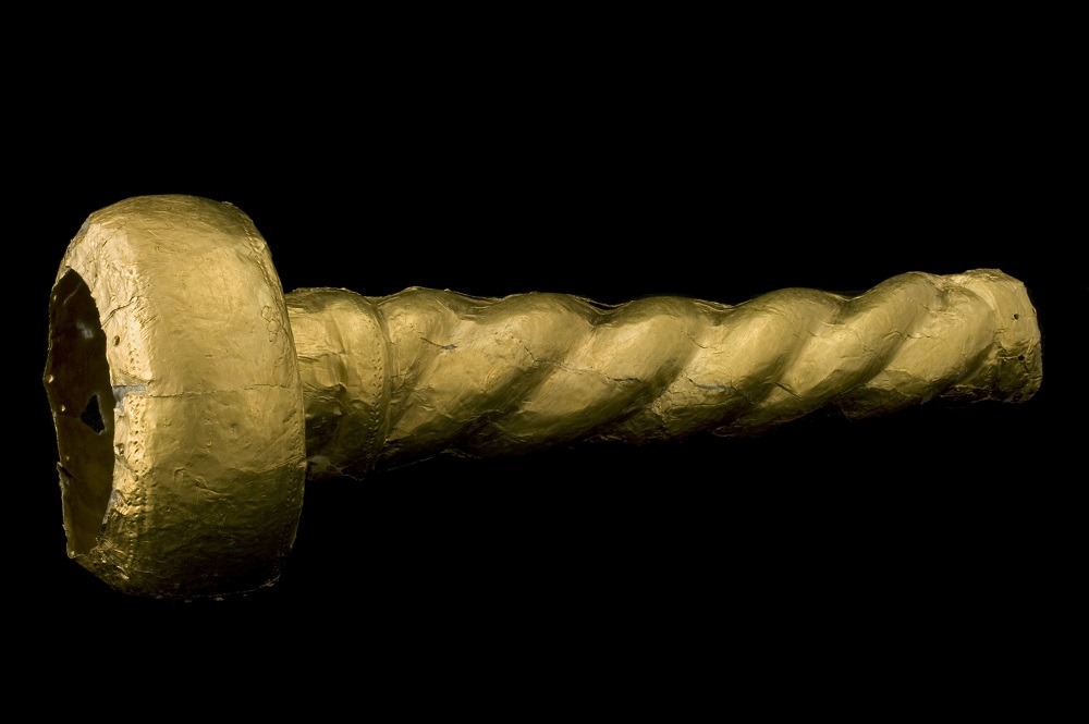
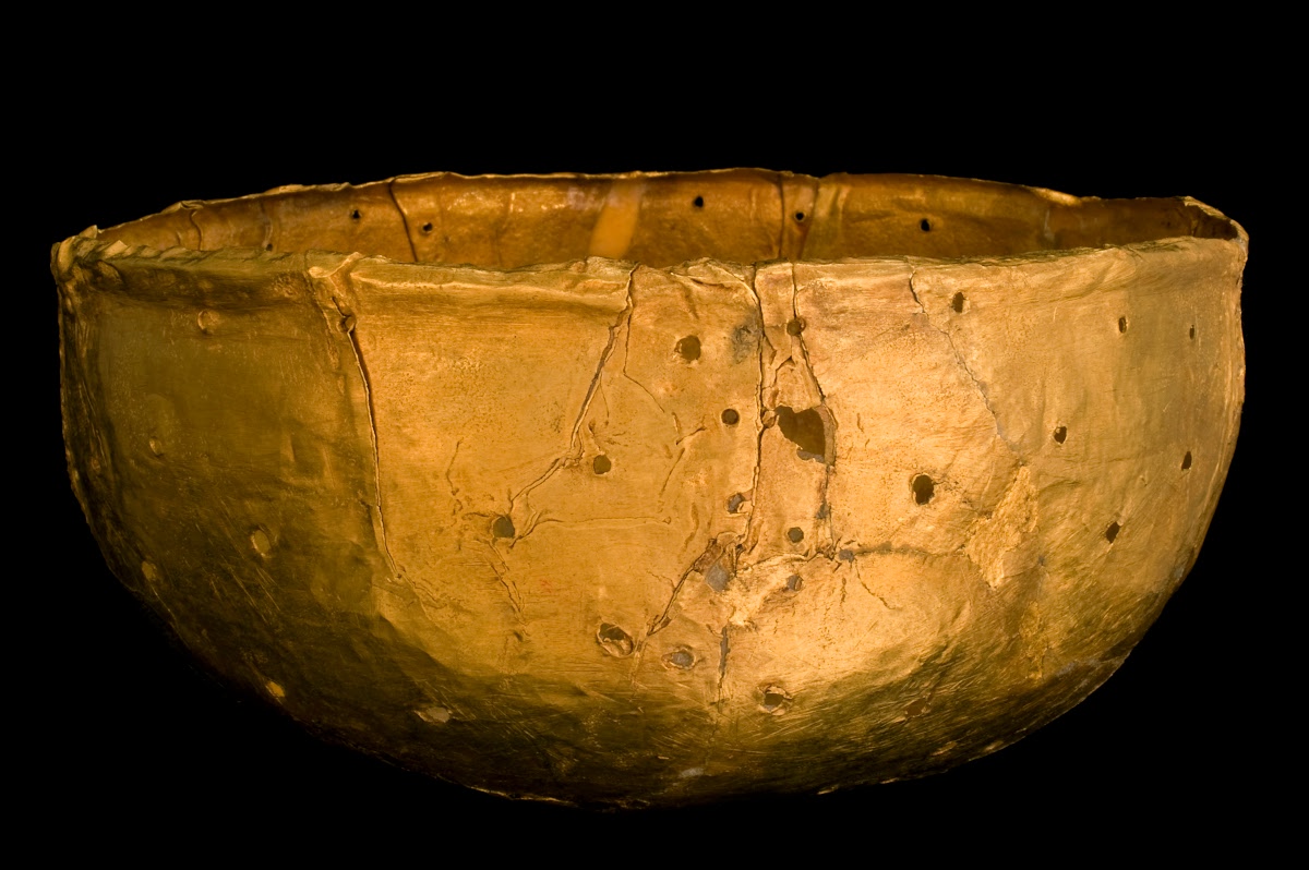
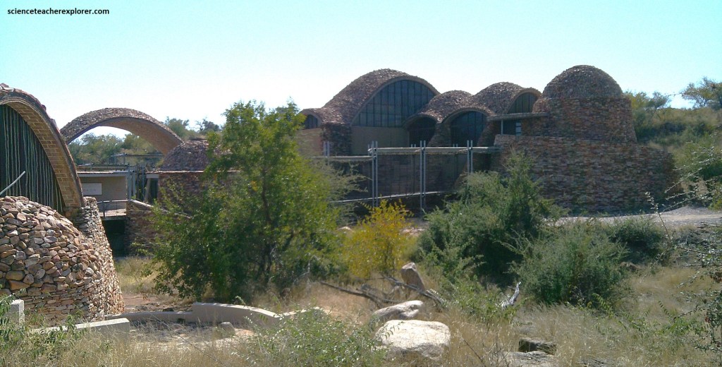
Our last leg of trekking in the Limpopo Province of South Africa was an “Allan Quatermain & the Lost City of Gold” kind of thing. It was in a National Park located in the far north of the Limpopo province, near the confluence of the Limpopo and Shashe Rivers where Botswana, South Africa and Zimbabwe meet. To get there we drove 70km west of Musina on R572. For countless generations, the local people had held the “Mapungubwe Hill” of this location in awe and reverence, and whatever secrets it held remained undisturbed. But there were rumors of a treasure! Then in 1933, a local teacher named Ernst Van Graan, explored the top of “Mapungubwe Hill” and discovered a prehistoric burial site with clay pottery, iron tools, glass & gold beads, a gold plate and human skeleton remains. The University of Pretoria was informed, then the government became involved, followed by intensive and ongoing meticulous archaeological exploration and research. It was declared a World Heritage Site in 2003 as the core of the Greater Mapungubwe Transfrontier Conservation Park. We visited the award-winning Mapungubwe Interpretation Center in 2025, (pictured below).
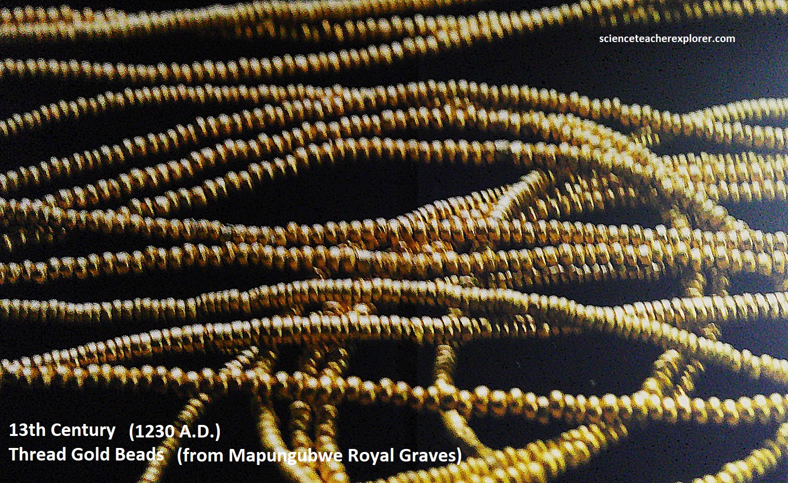
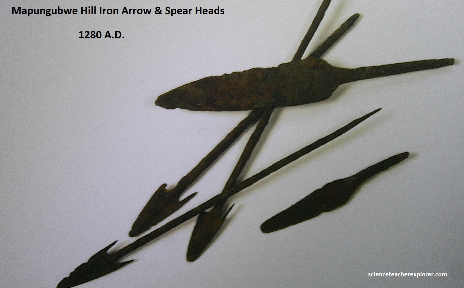
Between 900-1320 A.D., prehistoric Iron Age farming communities moved into the Shashe-Limpopo confluence river basin. Over a period of 400 years, three distinct, but successive socio-cultural developments led to the emergence of southern Africa’s first complex societies that became the Mapungubwe Kingdom. This kingdom trade with other global kingdoms as far as the middle-east, China and India. Archaeological, excavations revealed evidence that the residents were distinct classes of farmers, hunters, metalworkers and long-distance traders. This was southern Africa’s first state civilization—“The Mapungubwe Kingdom”.
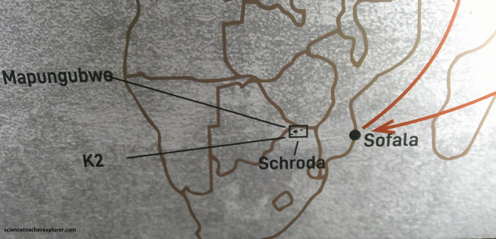
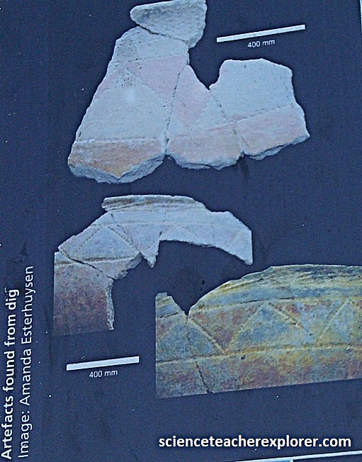
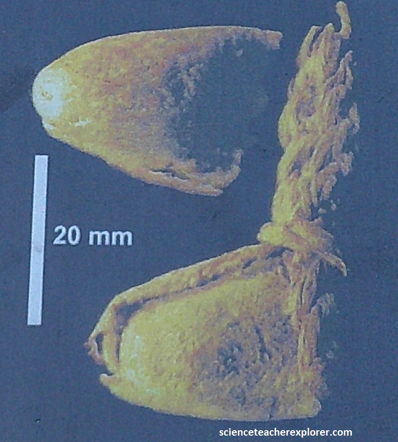
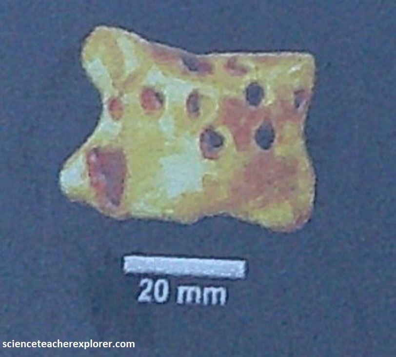
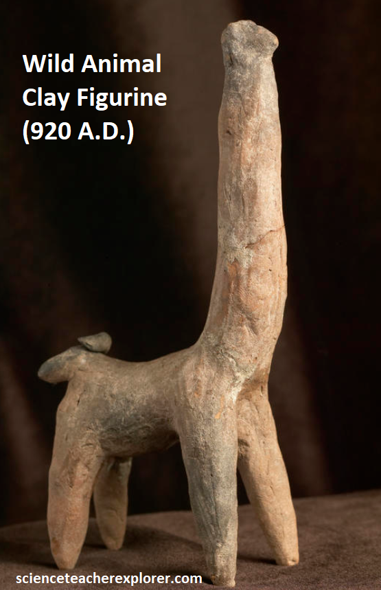
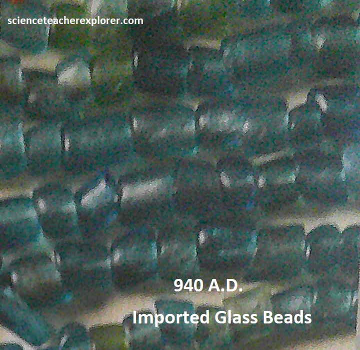
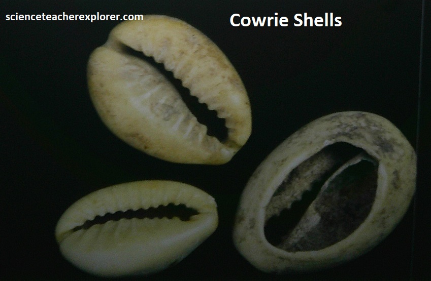
The origins of the southern African civilization from 900-1000 A.D.: For millennia, the vast savannas of the Shashe-Limpopo River Basin, stretching to the Blouberg escarpment, ancestors of the San hunter-gatherers prospered in this region. Attracted by the thriving herds of elephants, Iron-Age African farmers migrated into the Confluence Basin around 900 A.D.. They built their settlements in arable areas along the valleys of Limpopo and other rivers. Over a century, they built the region’s first large human settlement on the slopes of the Schroda Hill high above the Limpopo River valley, with about 500 people living on the plateau. They had specialized iron-workers and entrepreneurs who exported exotic animal skins and ivory through the East African Indian Ocean Coast and imported sild and glass beads, among other luxury products. {Pictured below are items excavated from the area and displayed on-site that are of the 900-1000 A.D. age}.
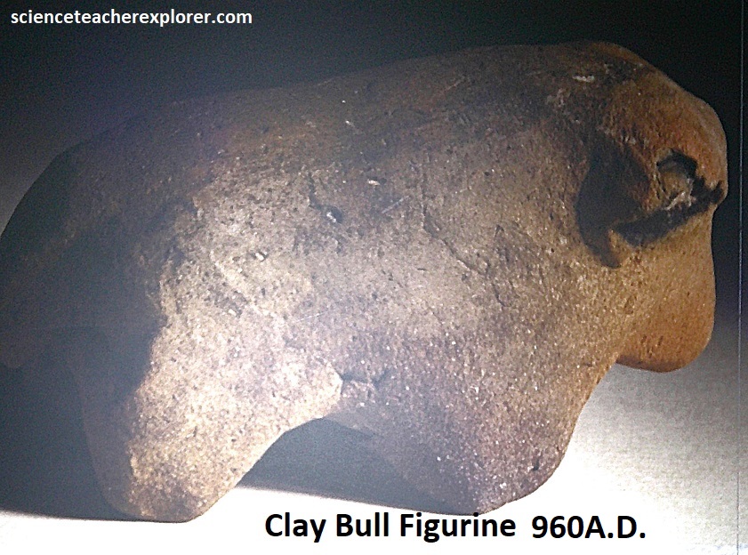

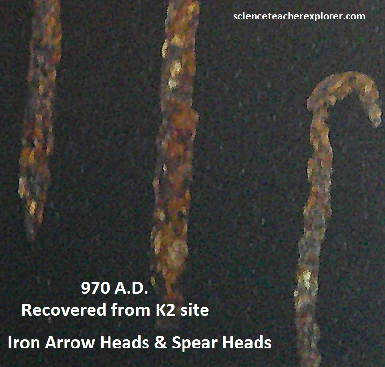
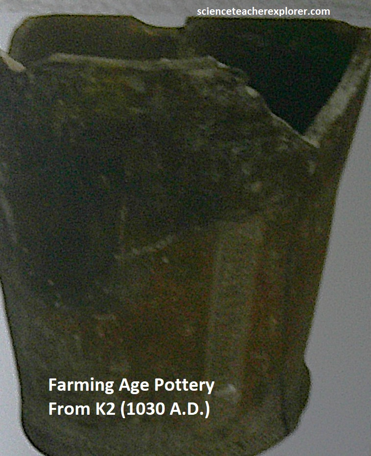
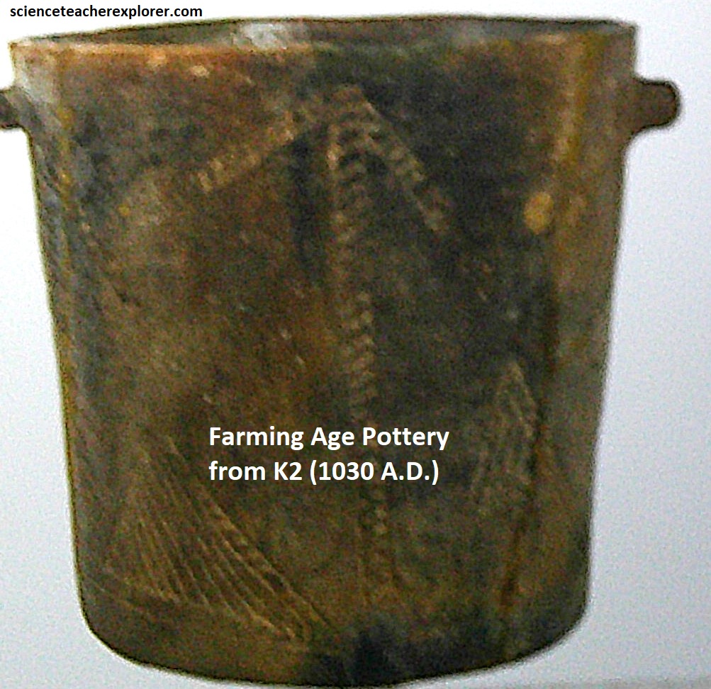
Between 1000 – 1200 A.D., political and economic power shifted from the Schroda site to K2 site, a few kilometers to the west with an estimated population of 7,000 people. They had smaller village settlements along the edges of the Limpopo floodplains. The growth in wealth from long-distance trade enabled the emergence of a class-based society. During this period, evidence shows a settlement hierarchy emerging with residents at the center exhibiting more wealth in cattle and imported luxury goods. {Pictured below are items excavated from the area and displayed on-site that are of the 1000-1200 A.D. age}.
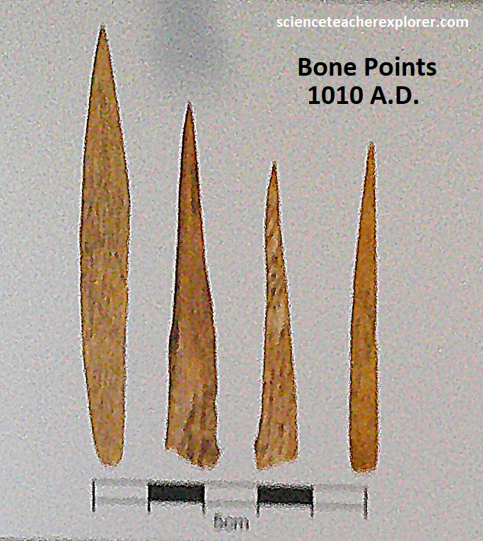
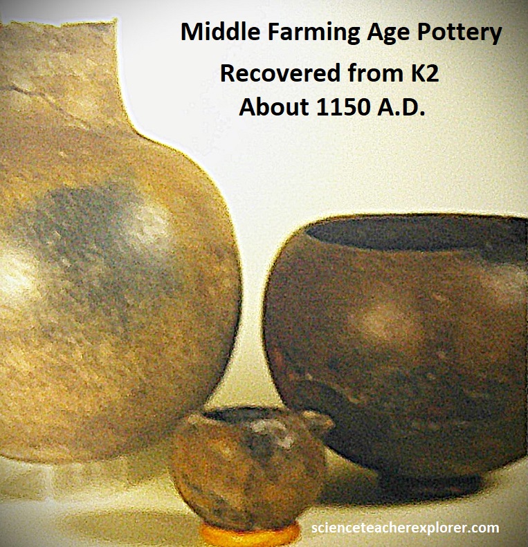
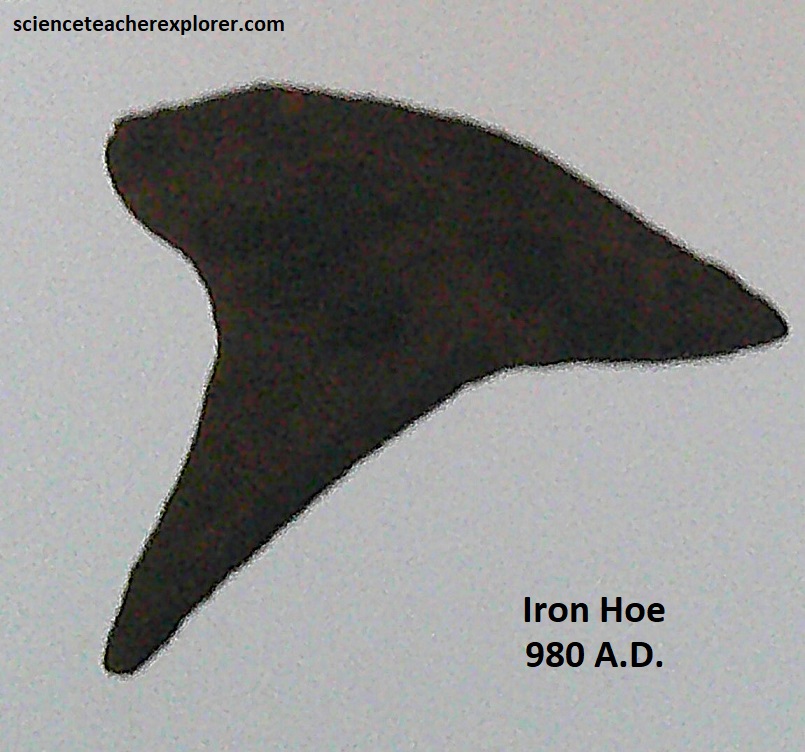
The Peak of the Mapungubwe Civilization–1150-1320 A.D.: From 1150 A.D., as the ruling elite became more powerful and wealthy, they moved out of the valley at K2 to a new settlement on top of the Mapungubwe Hill. With an estimated population of 9,000 people, the king and his entourage lived at the hilltop, while the royal wives and families lived on the slopes. Commoners continued living in outlying villages along the river valleys. By the late 1200s A.D. Mapungubwe had a sophisticated economy based on iron, copper, gold-mining and trade. The bulk of the economy included sectors such as agro food production, ceramic, textile and jewelry manufacturing as well as long-distance trade. {Pictured below are items excavated from the area and displayed on-site that are of the 1200-1350 A.D. age}.


The Shashe-Limpopo Confluence Basin continued to be Periodically occupied by farming and hunting communities after the decline of the Mapungubwe State. From 1200 A.D. the Venda and Sotho-Tswana communities settled in the region until their eviction to make way for white settler farms after the South African War (1899-1902) when forced land removal settlement schemes began. During the 20th century the landscape experience land-use change, starting with the displacement of African communities, the campaign to create nature conservation reserves, commercial crop farming, animal husbandry, large scale mining of copper, diamond, and coal. Conservation efforts led to the proclamation of the Mapungubwe national Park and subsequently declared a UNESCO World Heritage Site of the Mapungubwe Cultural Landscape in 2003.
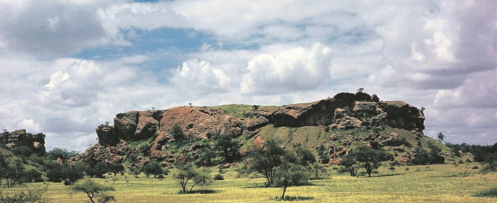
The Mapungubwe N.P. forms part of the outlying Tuli Basin, a narrow east-west sedimentary basin of Karoo age, (320-180 million years old), that comprises a restricted sequence of the Karoo Supergroup. Here, only the eolian Clarens Formation is exposed, consisting of upper Tshipise Member sandstone overlying Red Rocks Member siltstone. Erosion of the sandstone has formed a landscape of numerous small, steep-sided mesas and isolated buttes, (like the Mapungubwe Hill pictured below), separated by wide sandy valleys, eroding towards the Limpopo River.
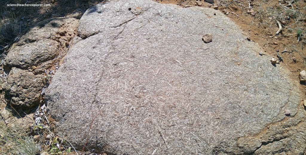
Additionally, molten rock from the mantle has been pushed up through the crust, creating intrusions that influence the region’s topography. Much of it are now now isolated remnants of the dark, fine-grained basalt that caps some the the hilltops. Pictured below is an unusual porphyritic and coarse-grained texture of a dolerite dyke that cuts through sandstone near the Interpretation Center. This is one of a swarm of east-west-trending Karoo dolerite dikes in the region.
Limpopo is a region of considerable geological and cultural antiquity with a variety and diverse landscapes. My trekking there was a spectacular experience and a trip of a lifetime.
