Okavango Delta, BW
In June of 2025, I was trekking (with a childhood friend), across southern Africa when I had the opportunity to explore the Okavango Delta in the far northwest of Botswana.
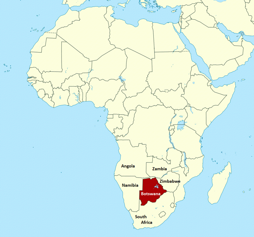
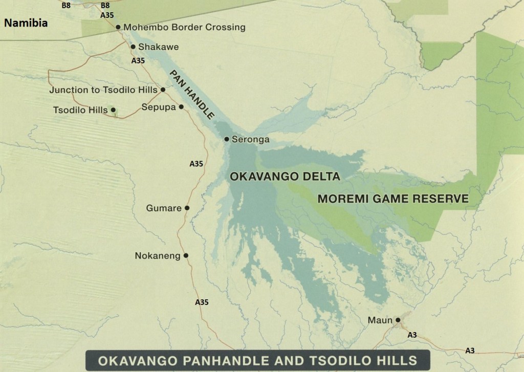
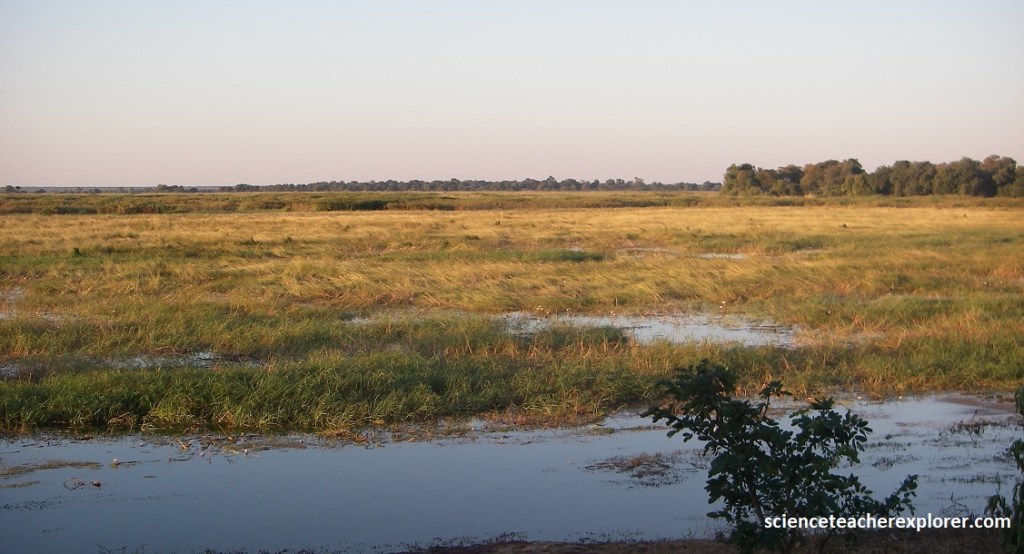
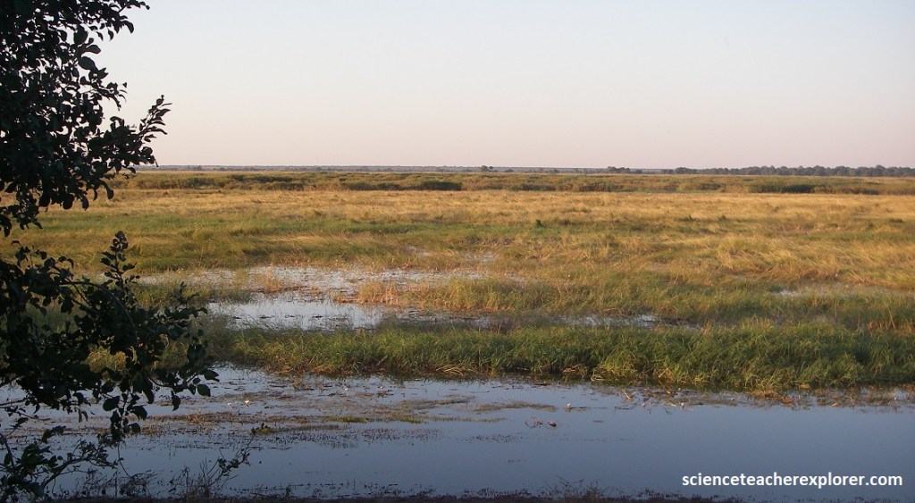
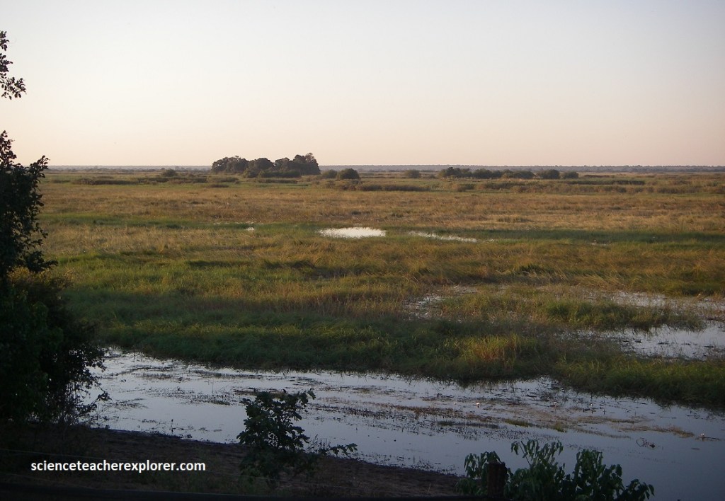
We started trekking in the Panhandle, (by crossing the Mohembo Border Crossing from Namibia) and worked our way towards the “Delta”. The Okavango Panhandle refers to the meandering stretch of the river in the northwest of country, upstream from where the Okavango River abruptly splinters into a myriad of tributaries and channels that form the Okavango Delta, (image below).
The Cabango river rises in the Angola highlands and flows through Namibia, where it is renamed the Kavango river, before entering Botswana. Here it is renamed again as the Okavango river and forms the Okavango Delta; the largest inland delta in the world, (it actually can be seen from space).
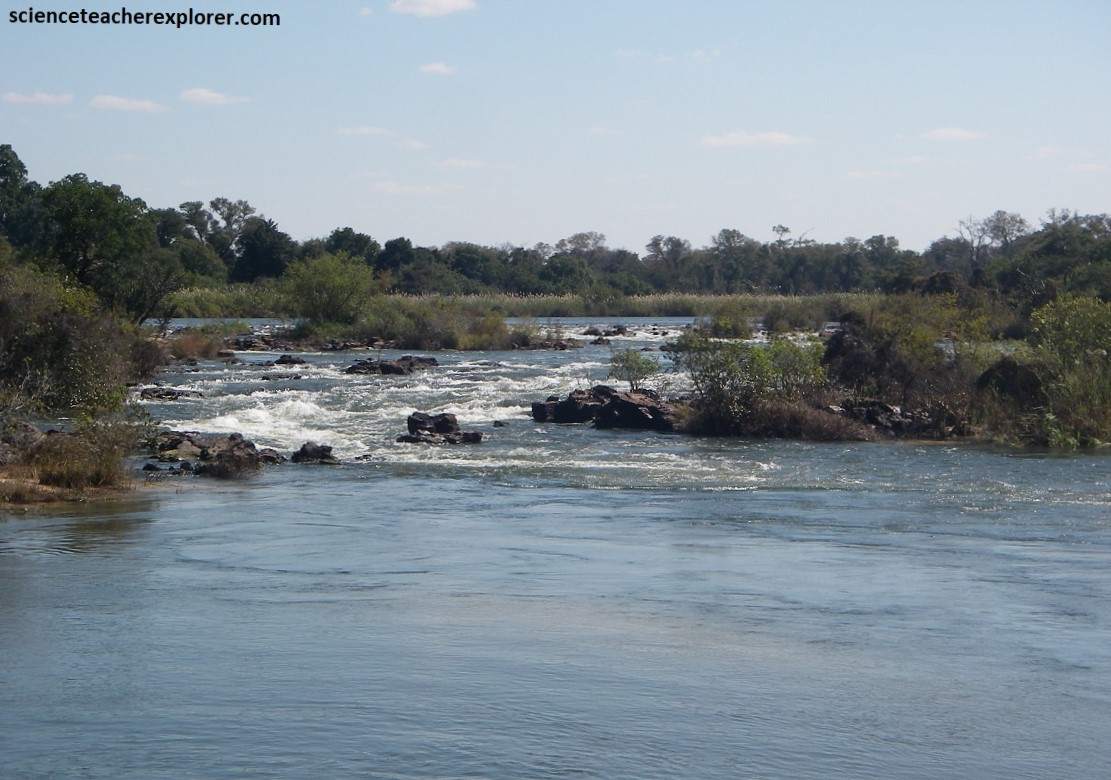
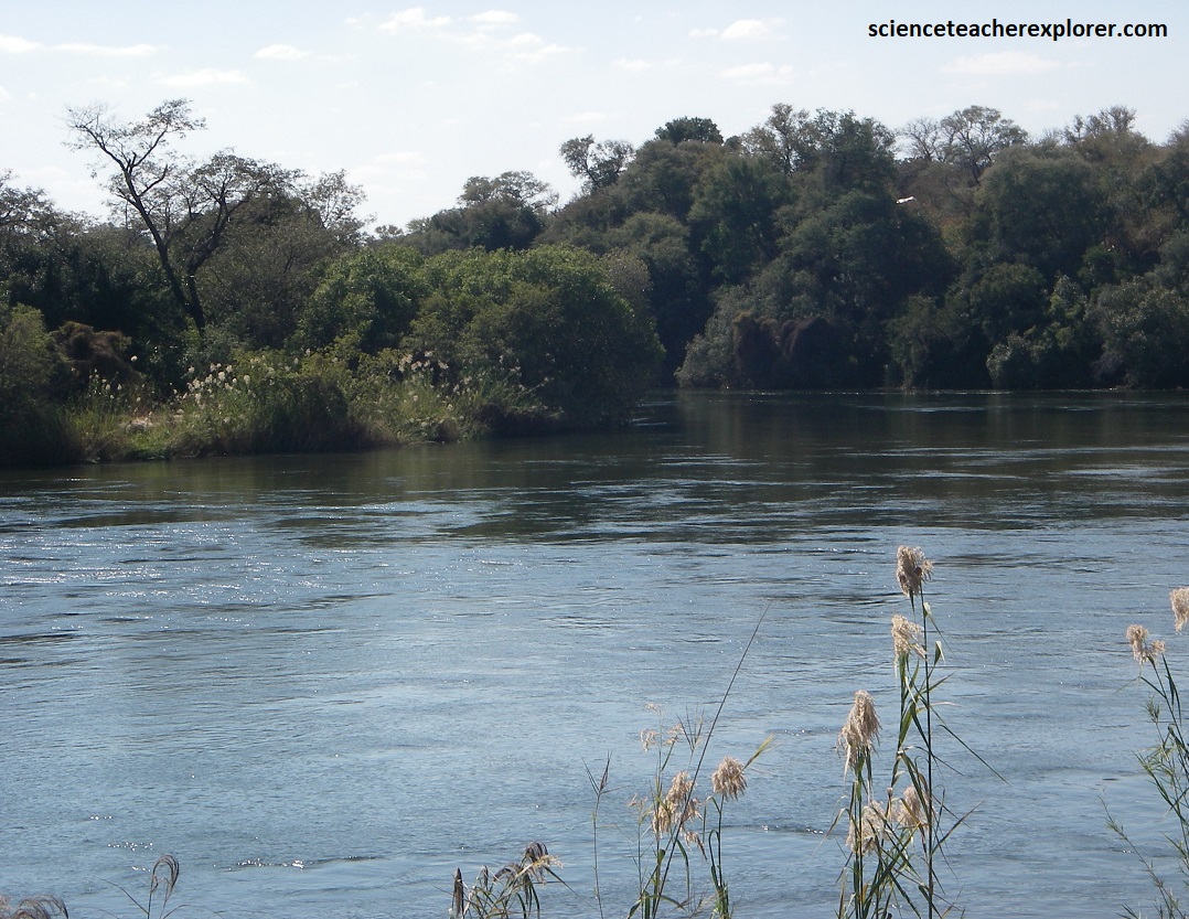
{Images above are of the Popa Falls on the Okavango River in the Pan Handle}
It is known as the “river that never finds the sea,” because instead of flowing into the sea it flows slowly southward, spreading over extensive deposits in Lake Ngami, the Boteti River, and parts of the Makgadikgadi Basin.
Our accommodation was located between Sepupa and Shakawe, Botswana, a short drive from the tar road of A35.
Our accommodation was a bit unnerving because there was a infestation of very large spiders (from 2-15 cm in diameter). Our rooms were full of them. I counted at least 50+ crawling on my ceiling and walls. We were using our towels to jam under & over the outside doors. It was difficult to sleep.
Even though our accommodation was riddled with spiders, the locals that surrounded us were living in mud and grass huts without electricity, (for light) or running water. The amount of poverty here was overwhelming for us from the northwestern hemisphere. However, they were very honest and friendly here.
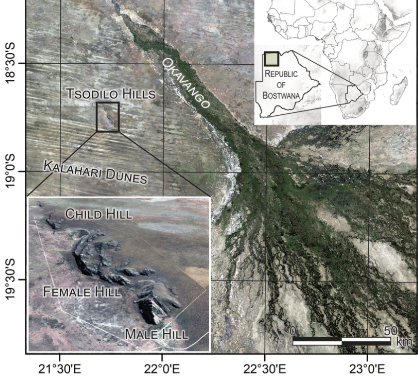
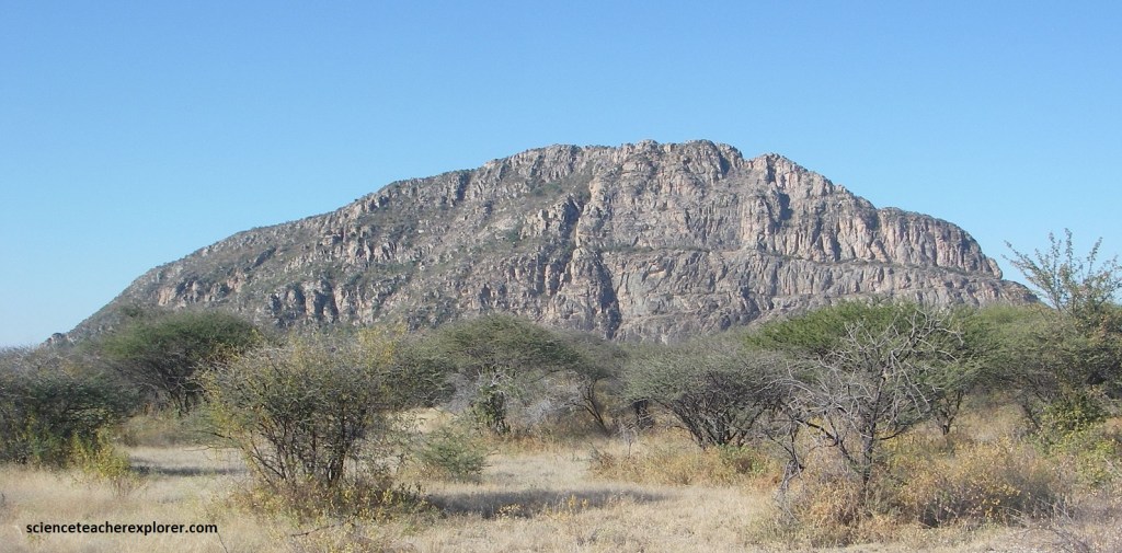
Situated just west of Sepupa, Botswana, the Tsodilo Hill form the country’s first World Heritage Site. We accessed the site on a very bumpy 40km track from A35. The hills rose sharply from the Kalahari bush and towered to a height of 400m over the ironed-flat landscape that stretches almost across the entire country of Botswana.
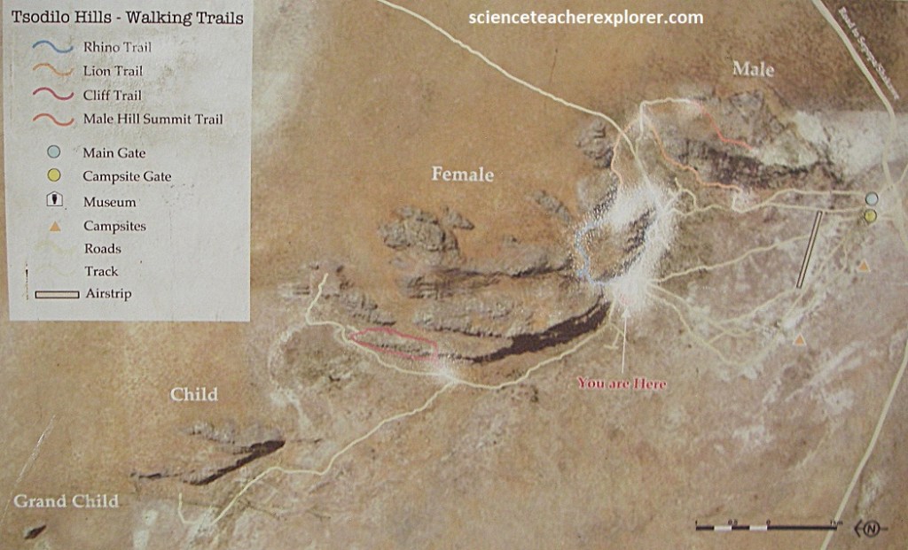
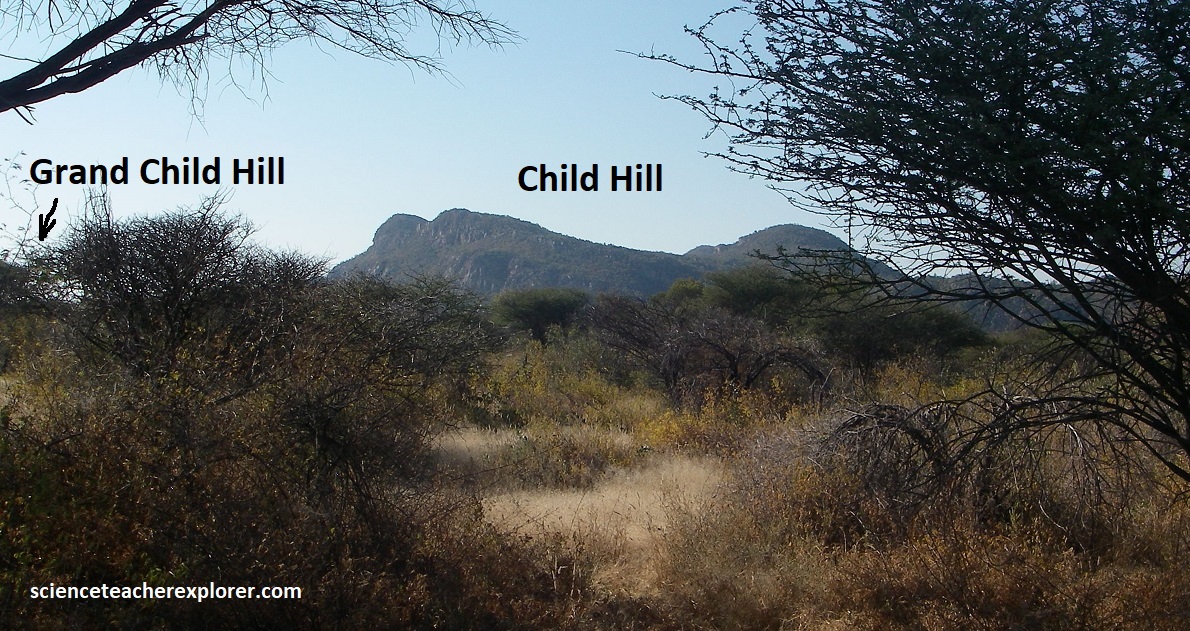
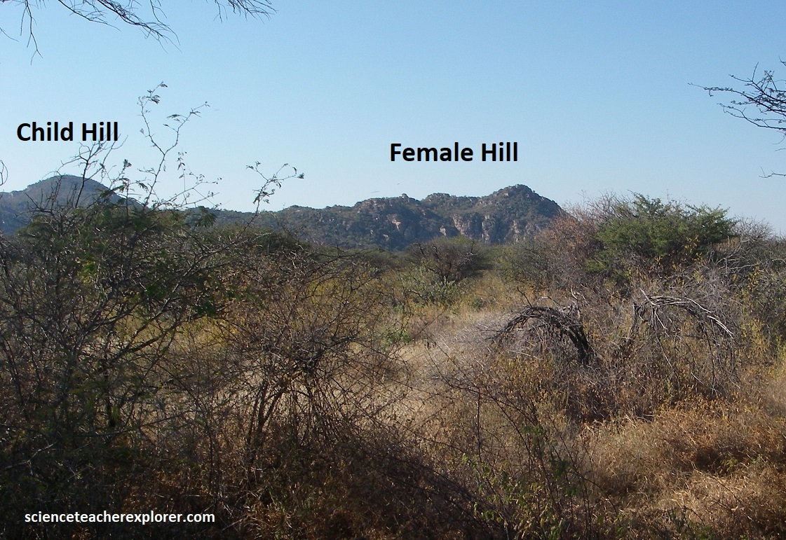
Imaged above, there are four separate hills which according to a legend of the local Kung people, once formed family, and so are now known as Male, Female, Child, and Grandchild, (pictured below from the south).
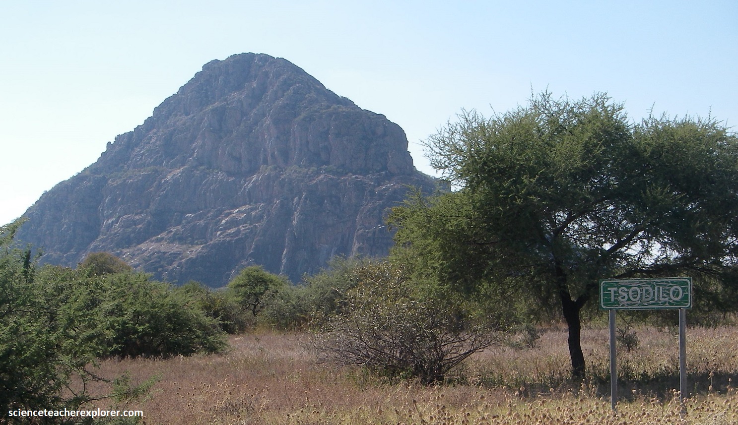
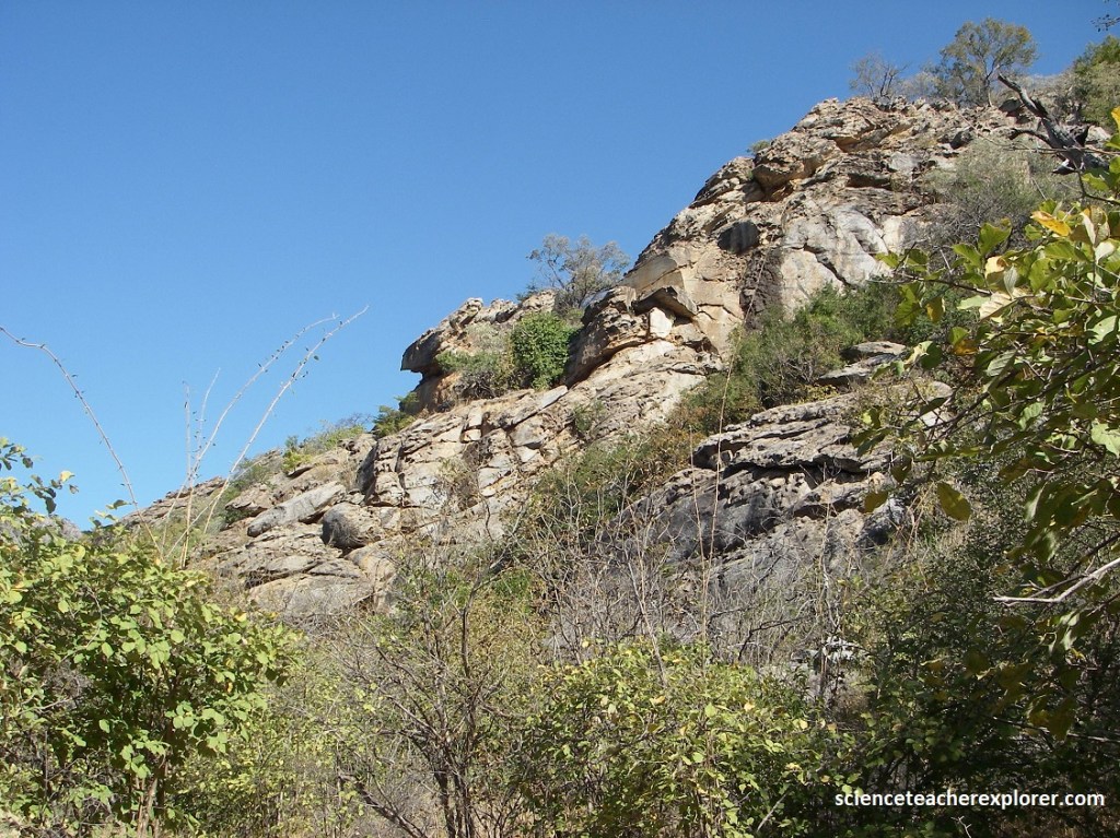
The southernmost hill, Male, is also the highest point in Botswana at just under 1,400m, (pictured below). The habitat seen here is considered a “Woodland Habitat”. It differs from savanna in that the trees are more closely spaced, with crowns almost touching one another. Grass cover is a bit sparser and less palatable to herbivores. Russet Bushwillow and Shepherd’s Tree often occur at the woodland margin. Zambezi Teak occurs on well-drained Kalahari sands. Kiaat and Wild Syringa also occur.
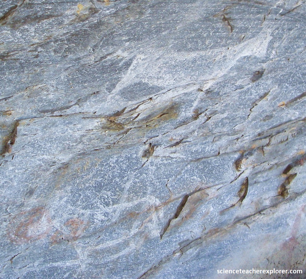
The Tsodilo Hills are a geological formation of metamorphic siliciclastic sedimentary rocks, primarily micaceous quartzites and schists, that were deposited on a marine shelf between 1.9 and 1.1 billion years ago. Then these sediments were later metamorphosed by heat and pressure, creating these inselbergs that rise dramatically form the Kalahari Desert.
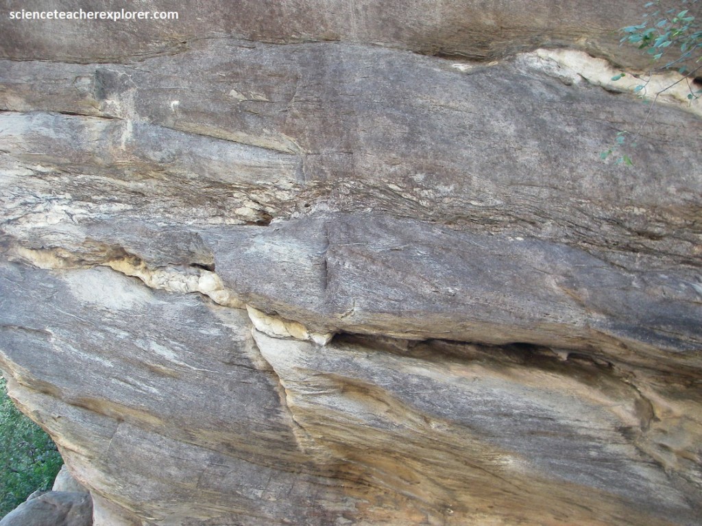
Pictured above, layers of quartzites and conglomerates show sedimentary structures like cross-bedding and tidal bundles, indicating deposition on a marine shelf with alternating currents.
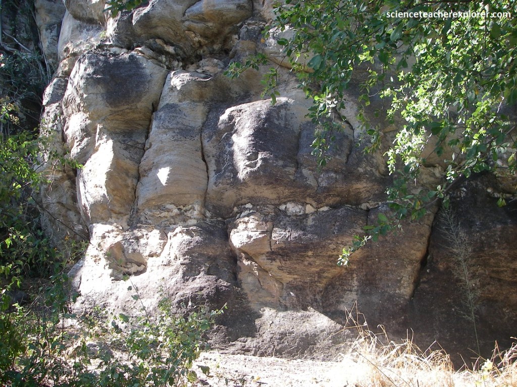
Two major geological erosion cycles have sculpted the area: the Dwyka glaciation, when the hills acted as nunataks (mountains protruding through glaciers), and the post-Karoo formation of the African Surface in the late Cretaceous.
Pictured above, the steep slopes show a stepped morphology, and some cliffs have flared sides, which are geological features that document the modification of the rocks over time. Additionally, a permanent lake existed adjacent to the hills between about 27,000 and 12,000 years ago. {Note in the photos above, the typical tree near the cliffs are Lavender Feverberry & White Syringa.}
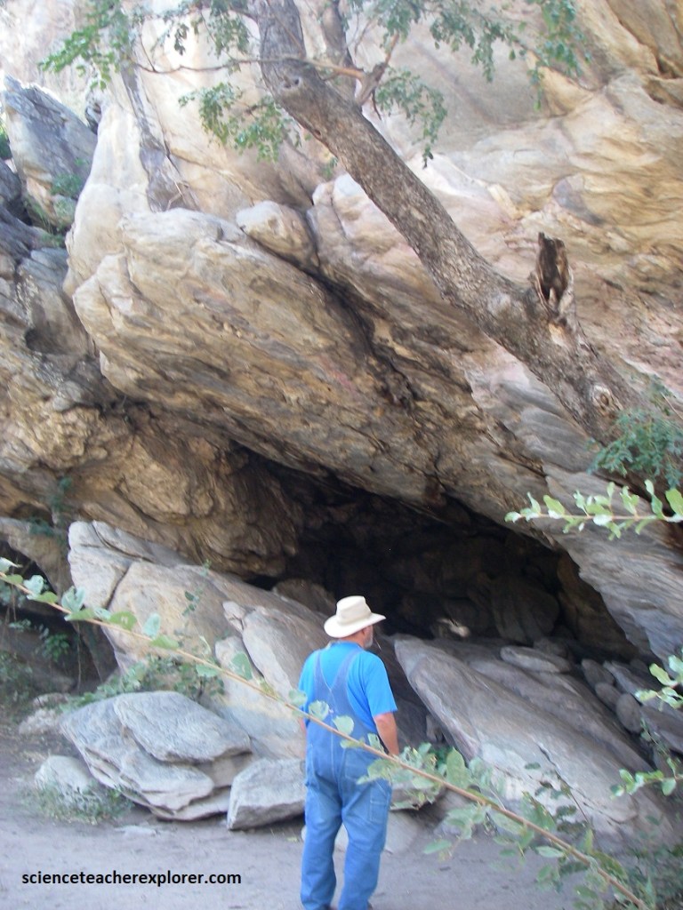
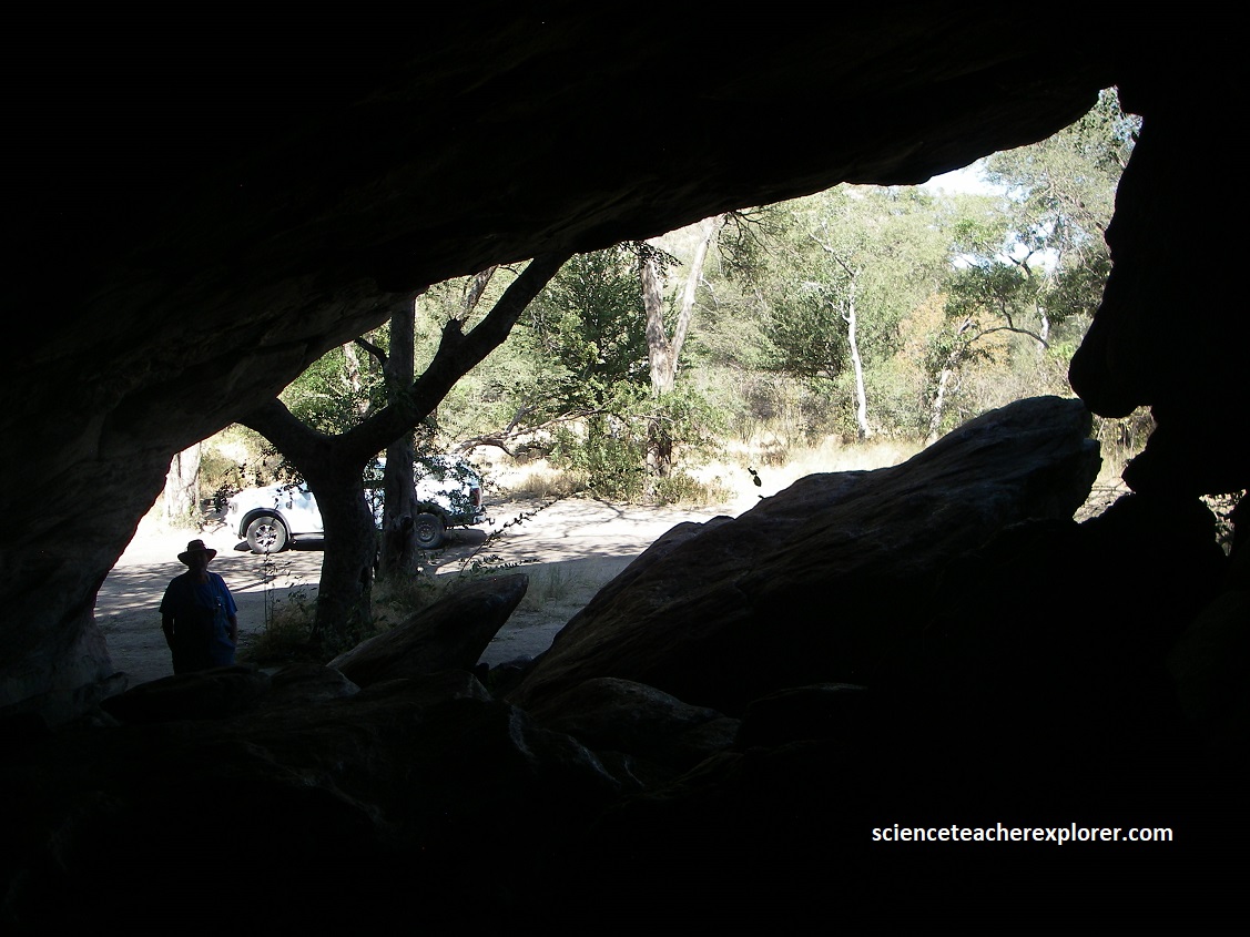
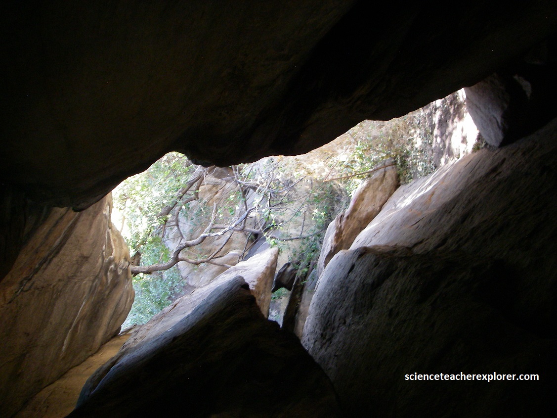
The World Heritage Committee has emphasized the immense symbolic and religious significance the hells hold for the communities that live in the region. In local lore it is said that if you send someone to Tsodilo and the assignment is undertaken unwillingly, the chances are the person will not return. The Tsodilo Hills were first inhavited by the Ju/’hoansi (San) and subsequently by Hambukushu (Bantu) tribes. {Pictures below were taken from inside Makena’s Cave of the “Female Hill” of the Tsodilo Hills, Botswana}.
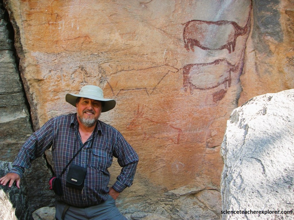
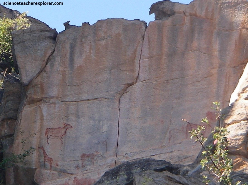
The Tsodilo Hills are particularly famous for their rock art and are said to contain over 400 sites, with upward of 4,500 paintings, mostly dating to the period between 850-1100 B.C.
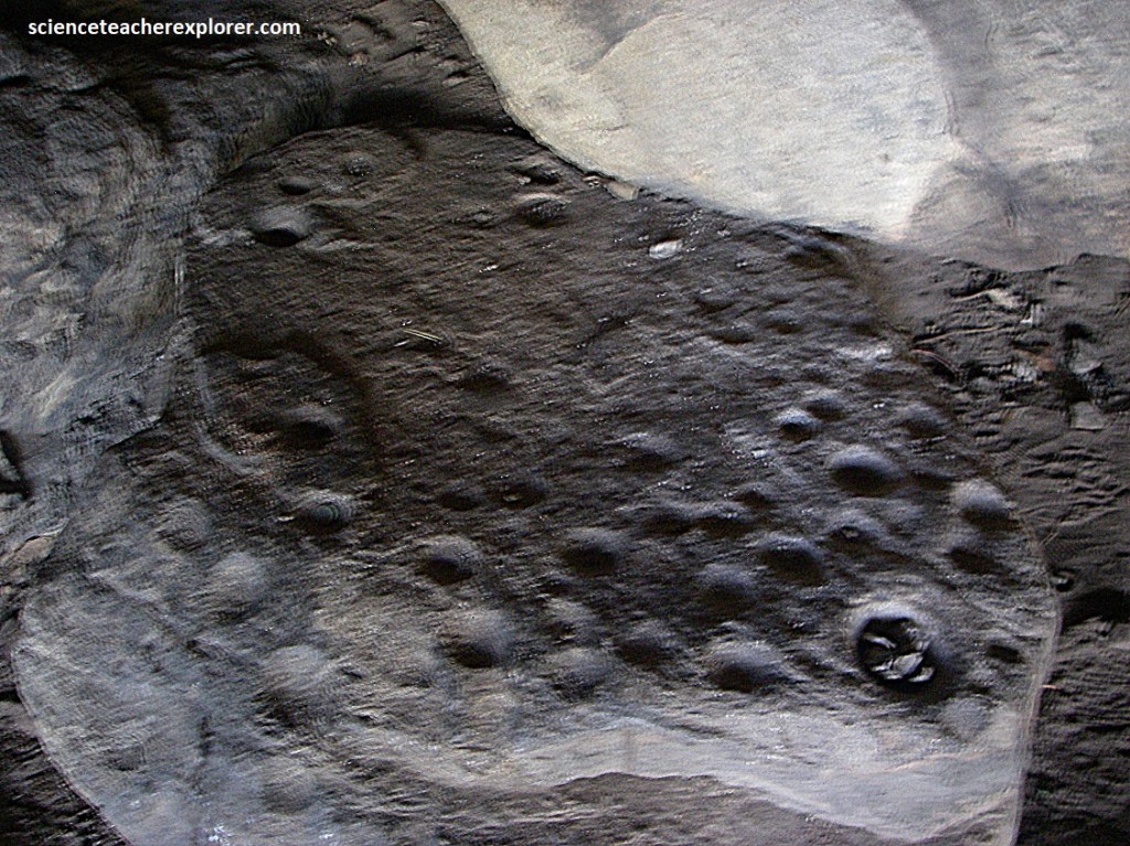
While exploring Makena’s Cave, we found “Rock cupules” that are artificially made depressions on a rock surfaces that resemble the shape of an inverse spherical caps. They were made by direct percussion with hand-held hammer-stones, on this horizontal rock surface. Cupules are widely believed to be the world’s most common motifs. These cupules were between 1.5 and 2 cm in diameter. These seem to occur in random unstructured groupings. Little is definitely known about the purpose or significance of cupules.
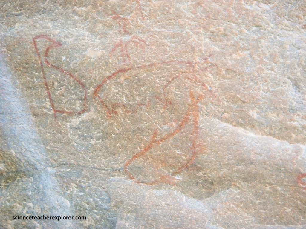
On one of the cliff faces near Makena’s Cave, I found these pictographs that resemble a penguin on the left a seal on the top and a whale on the bottom. The San are a nomadic people and it is believed that the painters must have had links with the Namibian coast, (1000km away), to have been able to draw theses marine creatures.
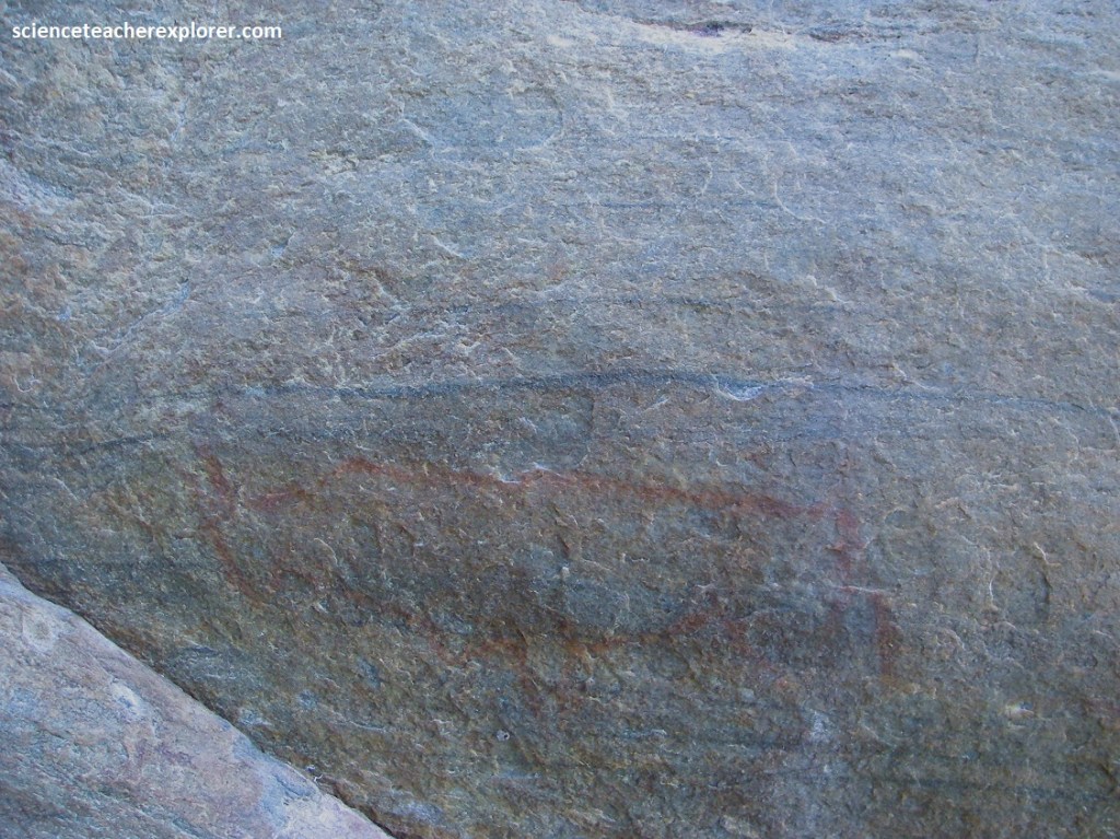
There are two types of rock art at Tsodilo – red and white finger paintings. The red paintings, which make up the majority of the art, were painted by the San people, with some paintings dating back as far as 4,000 years ago.
The red paint was made by mixing calcrete, hematite, charcoal, blood, marrow, animal-fat, tree-sap, egg-white and urine.
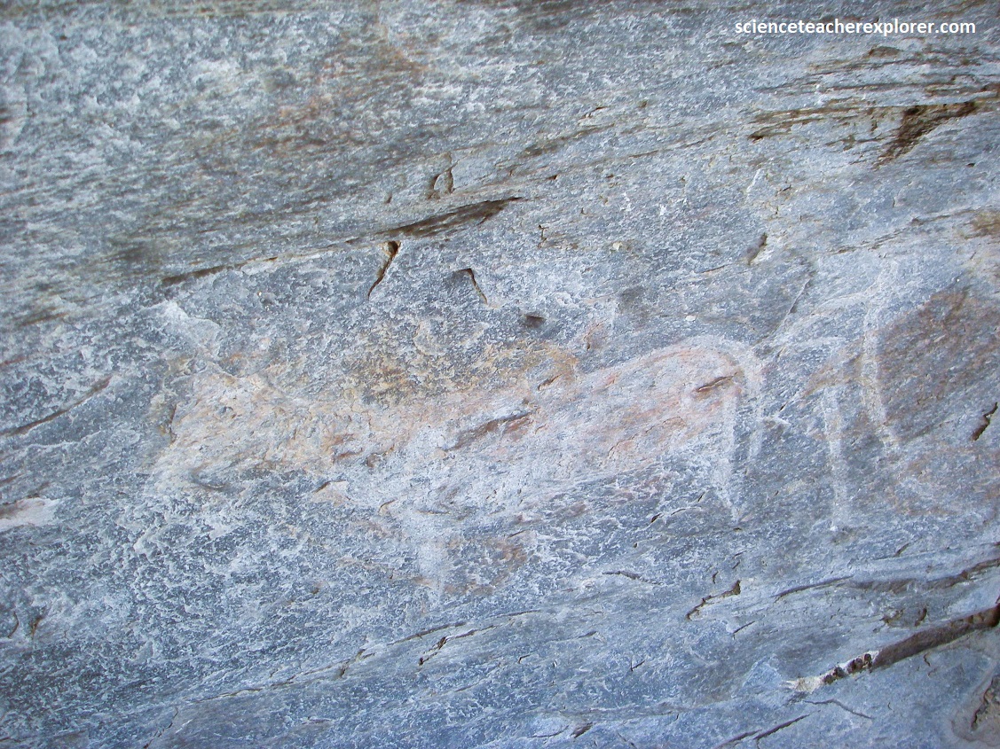
Pictured above, Tsodilo is also home to a series of white paintings created by the Bantu people, which date from as long as 2,000 years ago and feature images depicting animals, both domestic and wild, as well as human like figures.
Rising majestically from where the Kgalagadi sands meet the rich dense vegetation of the Okavango wetlands, Tsodilo Hills fill one with awe and admiration. Tsodilo has been a place of peace, refuge and spiritual fulfillment to different groups of people in the past and today. Some people visit Tsodilo to fetch water from the ancestral well for religious rituals, local hunters use specific spots on the hills to perform hunting rituals. The rock paintings depict animals, humans and geometric designs which were used for specific traditional healing rituals by medicine men. For example; the animals may have been painted because they embody particular powers. These mystical hills have been revered through the ages and are still viewed as sacred today.
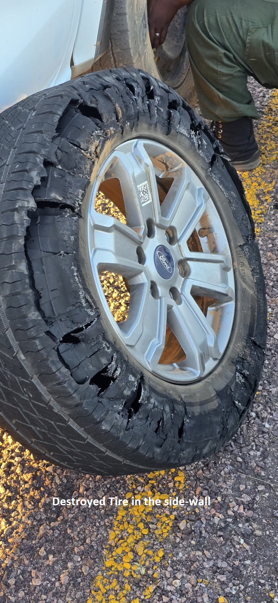
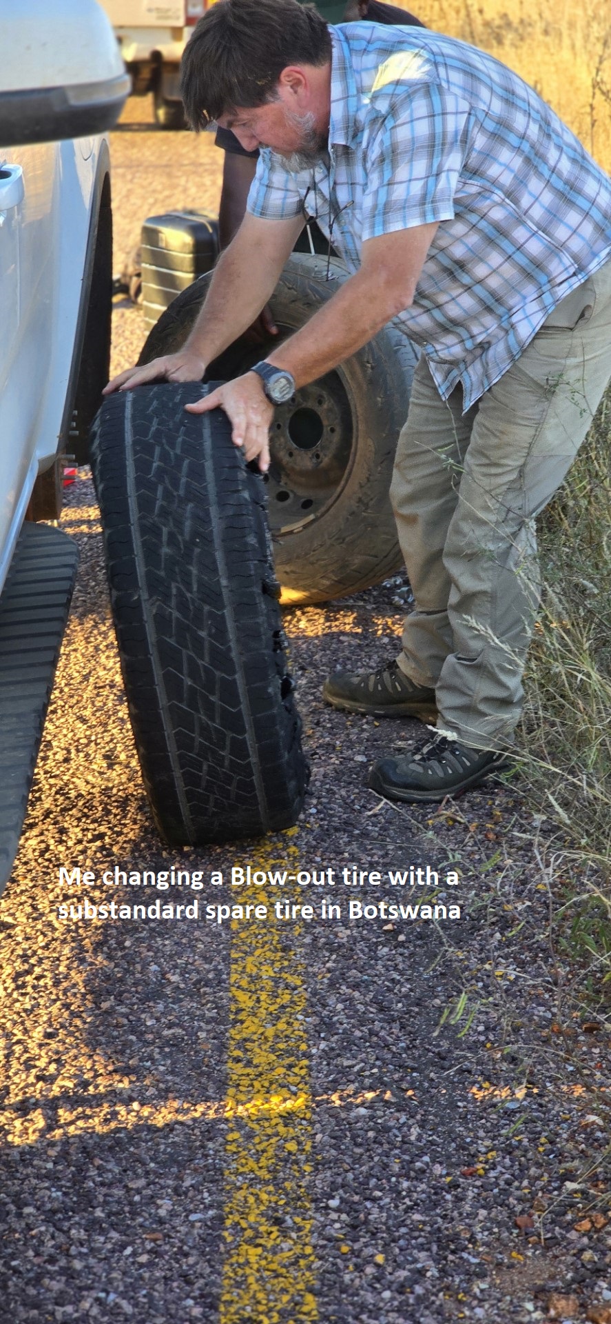
Returning back to Sepupa/Shakawe 40 km away on A35, we received a blown-tire, (pictured above). The dirt road was very rocky. {Maybe we didn’t give the sacred Tsodilo Hills enough respect}. Meanwhile, we continued to explore the Okavango Delta by driving south on A35 & then northeast on A3 to Maun. But first, lets discuss the science of the Okavango Delta.
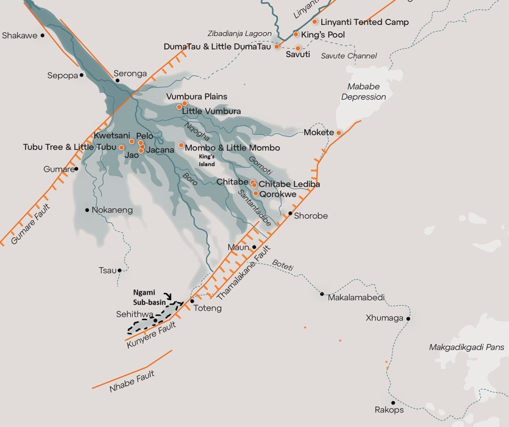
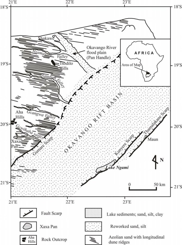
Imaged above, two parallel graben-faults control the direction in which the Kavango River entering the Kalahari Basin, in a geographical-depression called the Panhandle. Entering the Panhandle, the river’s gradient is very low. However, it is constrained from spreading out at this point by the steep river-banks on either side. As mentioned, underneath the sand lies a more fundamental constraint; parallel graben-fault lines in the earth’s crust which run southeast, about 10-15km apart. Thus the river meanders gradually southeast, between them forming a series of wide, sweeping curves and the odd ox-bow lagoon, (but always remaining with the constraints of the banks). The southern extent of these fault-lines lies around the Gumare fault, so south of here the river begins to spread wider to form the main body of the Delta.
Imaged above, as the Okavango flows over the Gumare Fault, (a continuation of the Great Rift Valley of east Africa), the slope of the land breaks the Okavango River into numerous channels, which fan outwards over the Delta. These are eventually blocked by two southern faults, the Kunyere and the Thalamakane, which redirect the Delta’s myriad channels.
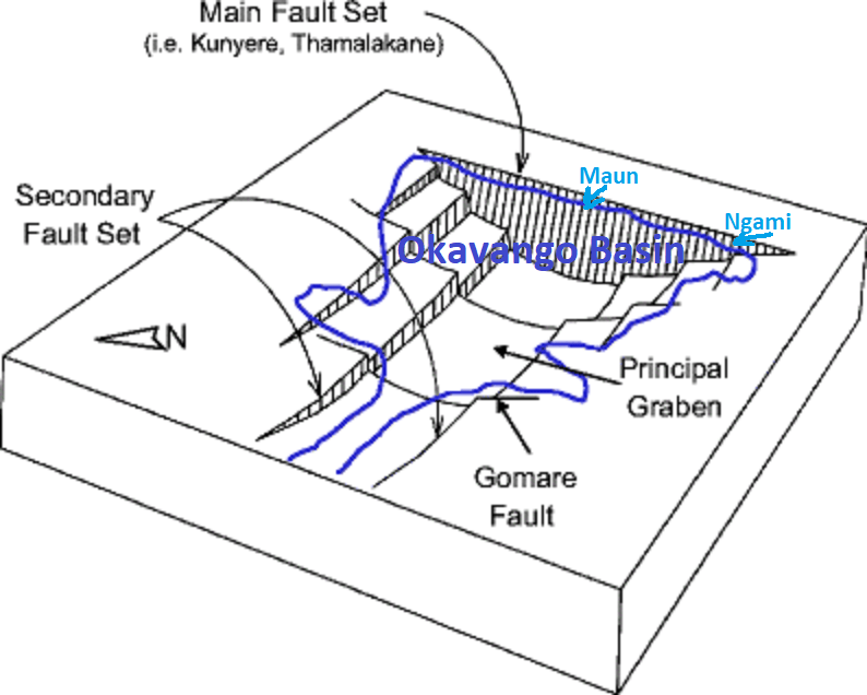
Imaged above, the Thalamakane Fault acts as a 242km-long natural-dam. Here the channels abruptly change direction and join to form one river, the Boteti, which flows eastwards through a break in the fault towards the Makgadikgadi Pan. Additionally, there is a small channel, the Nghabe River, that continues southwest toward Lake Ngami, serving as both inlet and outlet depending on the strength and direction of the annual floods. {The geology of this area is still inherently unstable, as these faults continue to move regularly}.
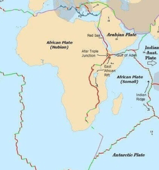
Imaged above, The Okavango Rift Zone is related to the Great Rift Valley in Tanzania; it is considered a southern, youngest, and incipient (early stage) extension of the Great East African Rift System. This geological connection is what causes the unique formation of the Okavango Delta, as fault lines created by the rifting process interrupt the path of the Okavango River, causing it to flood and spread into the surrounding desert instead of flowing to the sea.
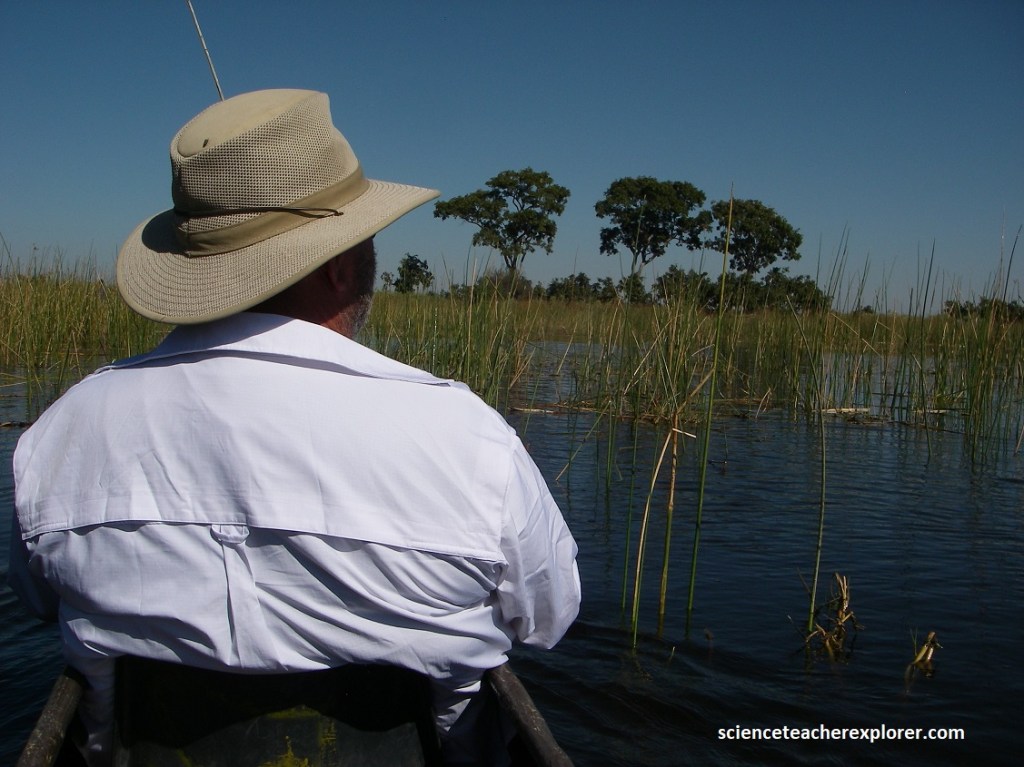
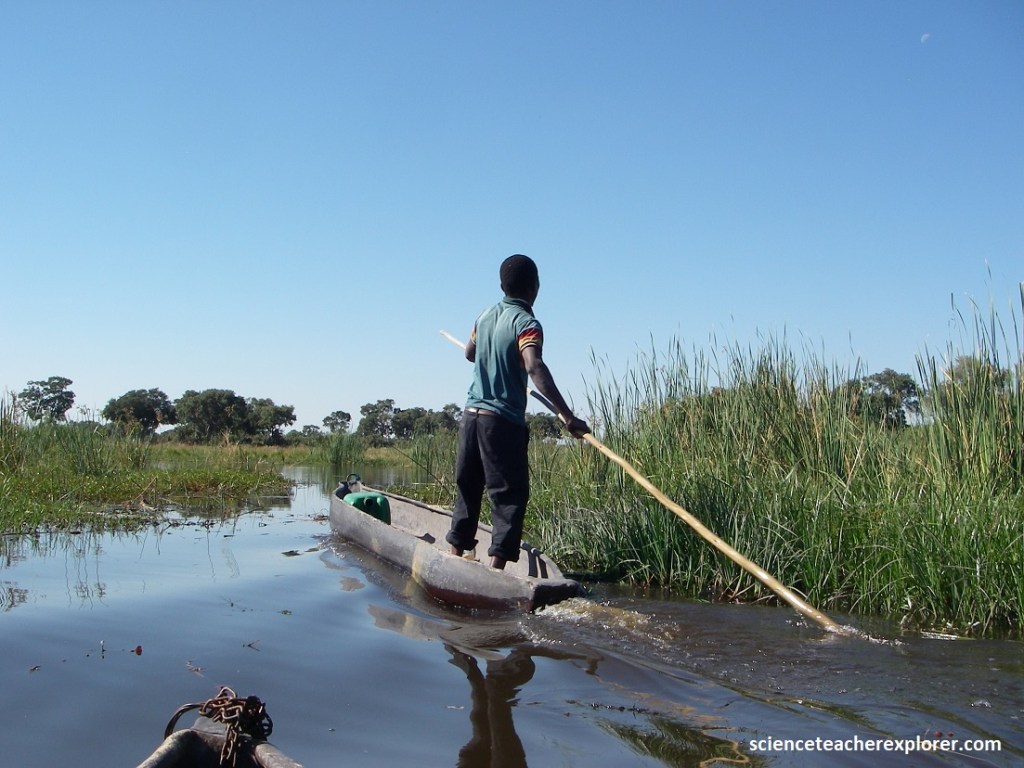
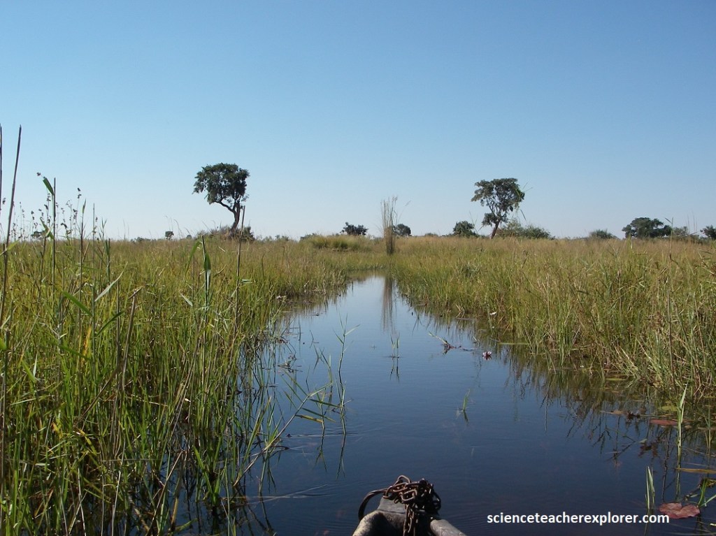
From Muan, Botswana; we continued exploring the Okavango Delta by driving to Morutsha within the Moremi Game Reserve and renting a “Mokoro”. The best way to experience the Delta is silently and by a mokoro. Mokoros are traditional dugout canoes.
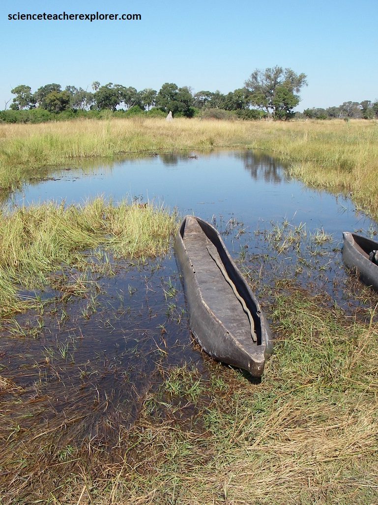
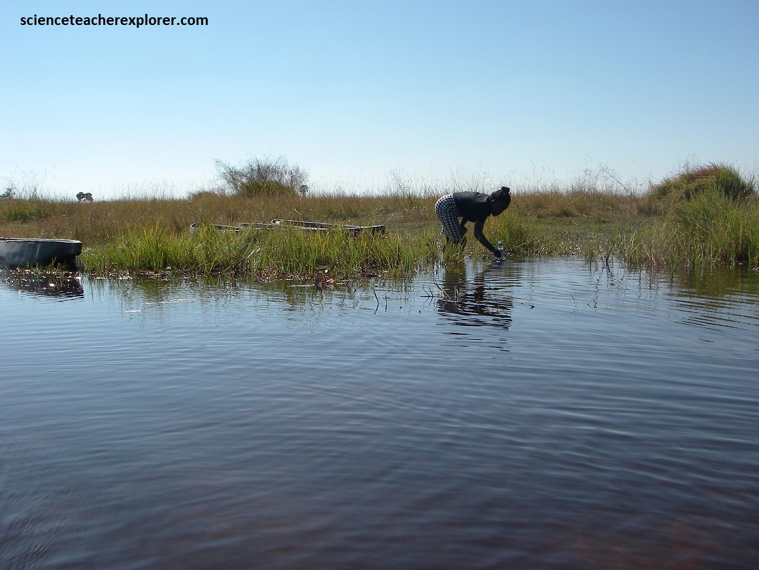
The term “mokoro” refers to a traditional dugout canoe, traditionally made from large hardwood trees, though many are now made from fiberglass. The canoe is propelled by a guide (like the women pictured above) who stands at the back and uses a long pole to push off the riverbed, (sometimes the pole is forked on the end). {Picture below}
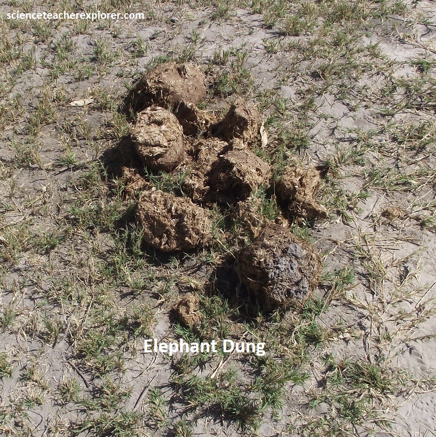
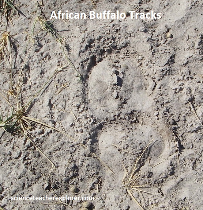
Our mokoros followed the channels made by hippos and elephants whose movements through the Delta create drainage channels.
The pattern of channels is ever-changing as the river deposits silt and channels are blocked by vegetation. However, hippos move through the channels, keeping some open and re-opening others that have been closed. A wealth of small herbaceous plants occur in the Okavango Delta region, pictured below are a few of the aquatic and semi-aquatic plants that I could identify while boating and walking through the Delta. Many of these plants grew in dense, single species communities.
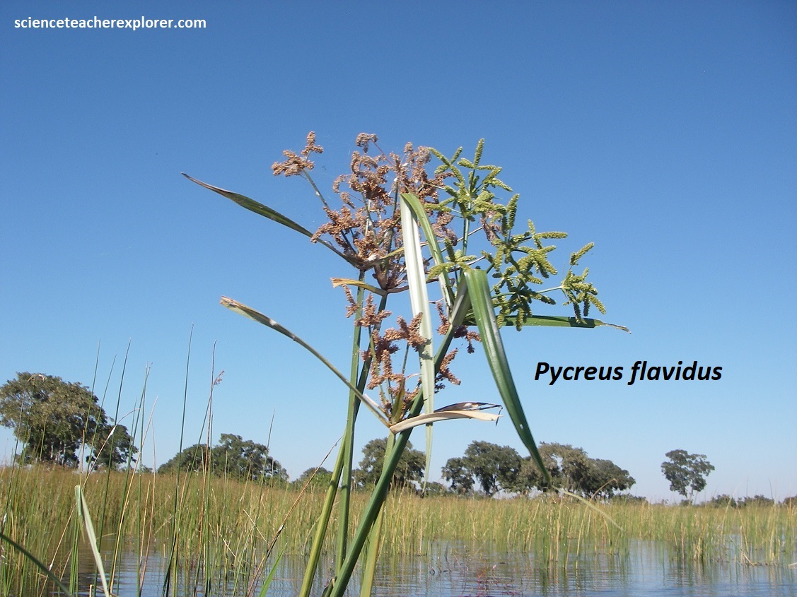
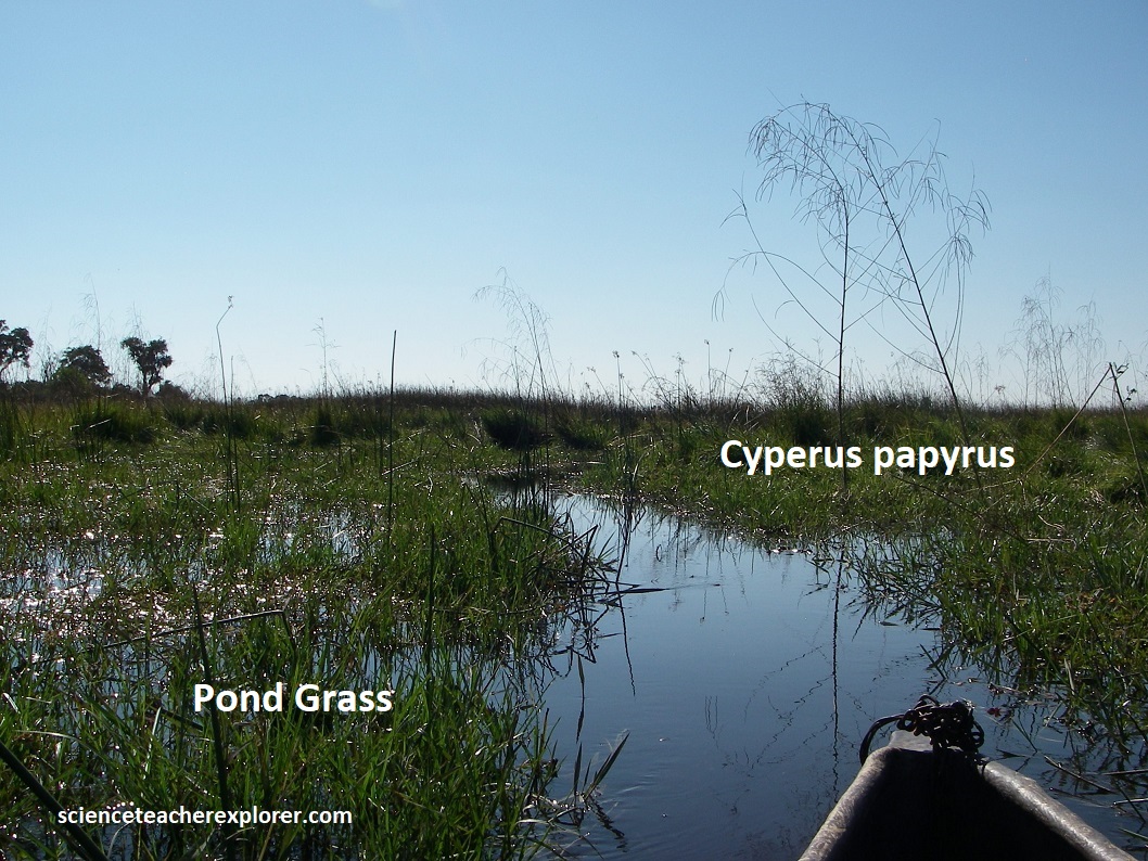
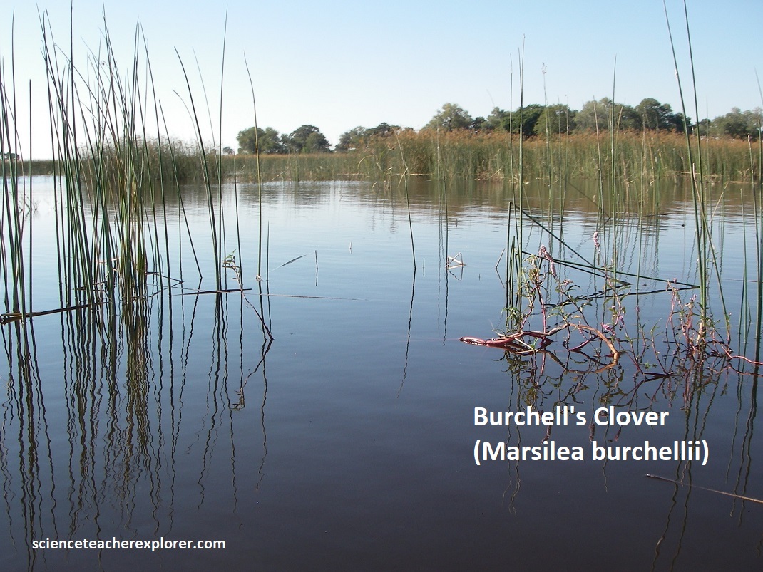
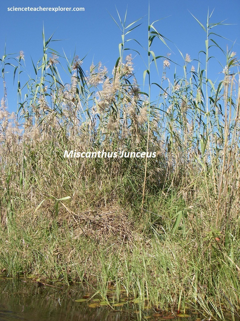
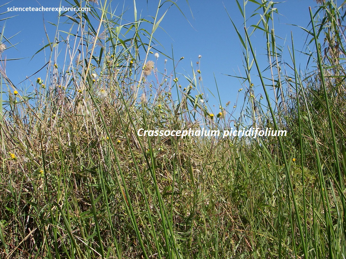
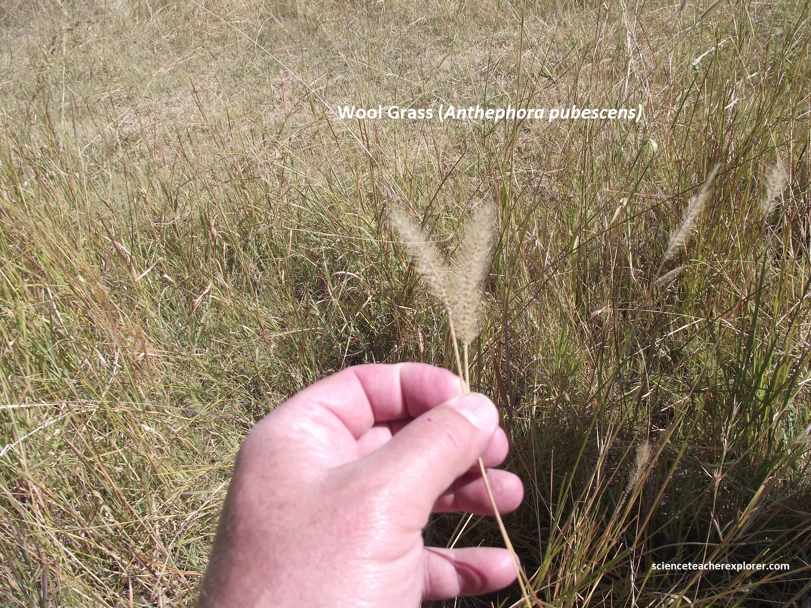
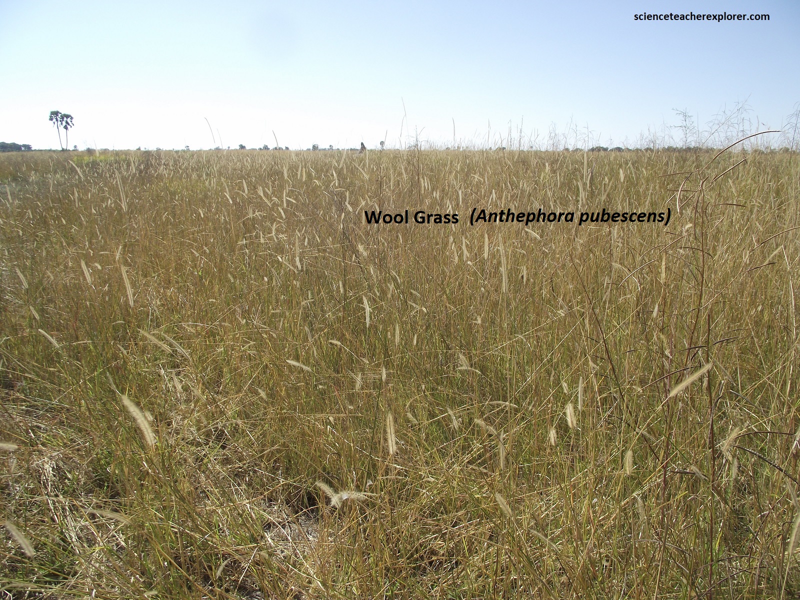
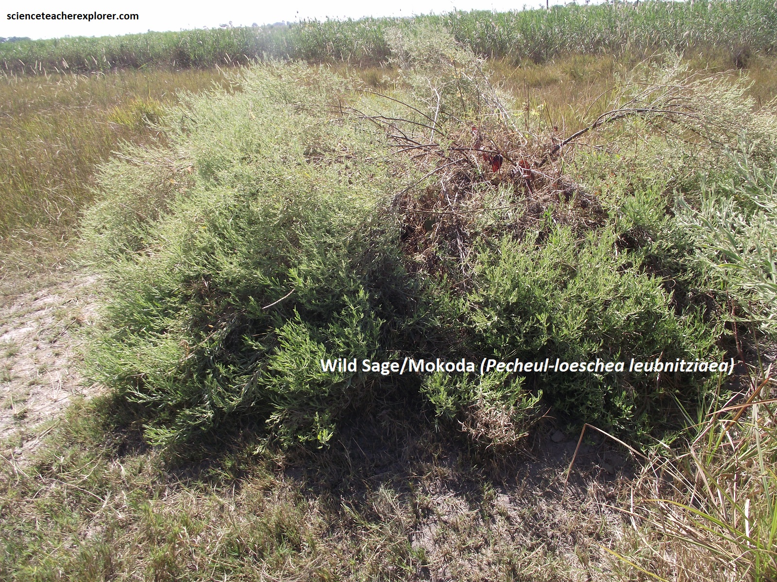
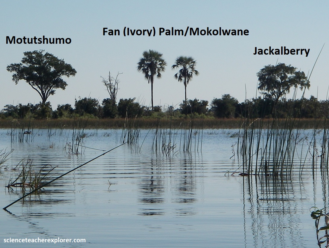
Pictured above, the water and its nutrients enable plants such as papyrus, lilies, clovers, reeds, Pycreus & Miscanthus to thrive. The diversity of trees in the Okavango Delta region was relatively small. Nevertheless, most of the best-known bushveld trees are found here. Magnificent specimens of Umbrellathorn, Sausage Tree, Jackalberry and Sycamore Fig occur in abundance, while tall woodlands of Mopane and Zambezi Teak cover extensive areas. I’ve pictured a few conspicuous or common trees below.
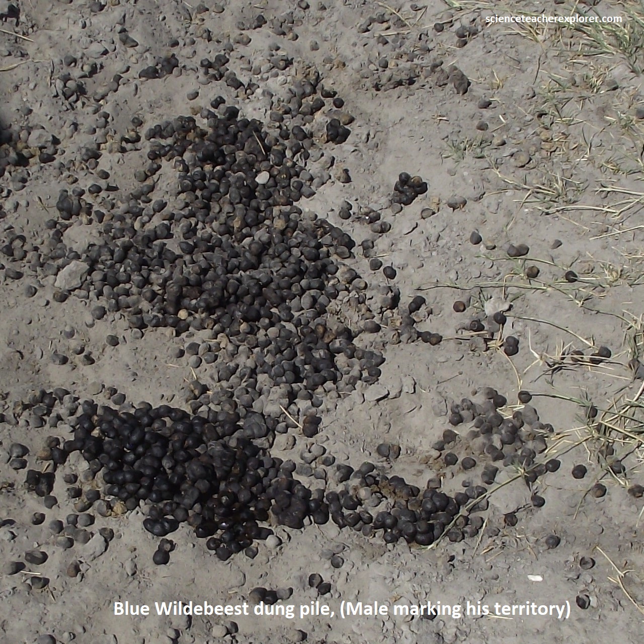
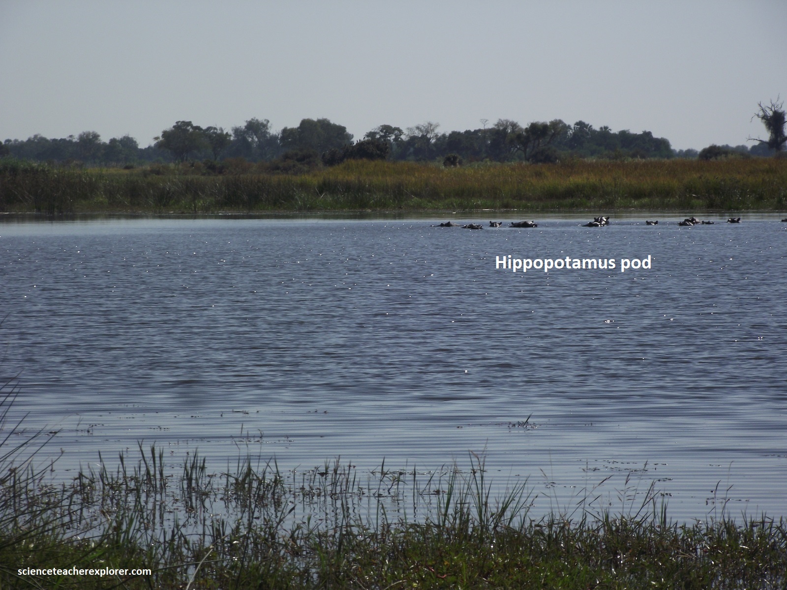
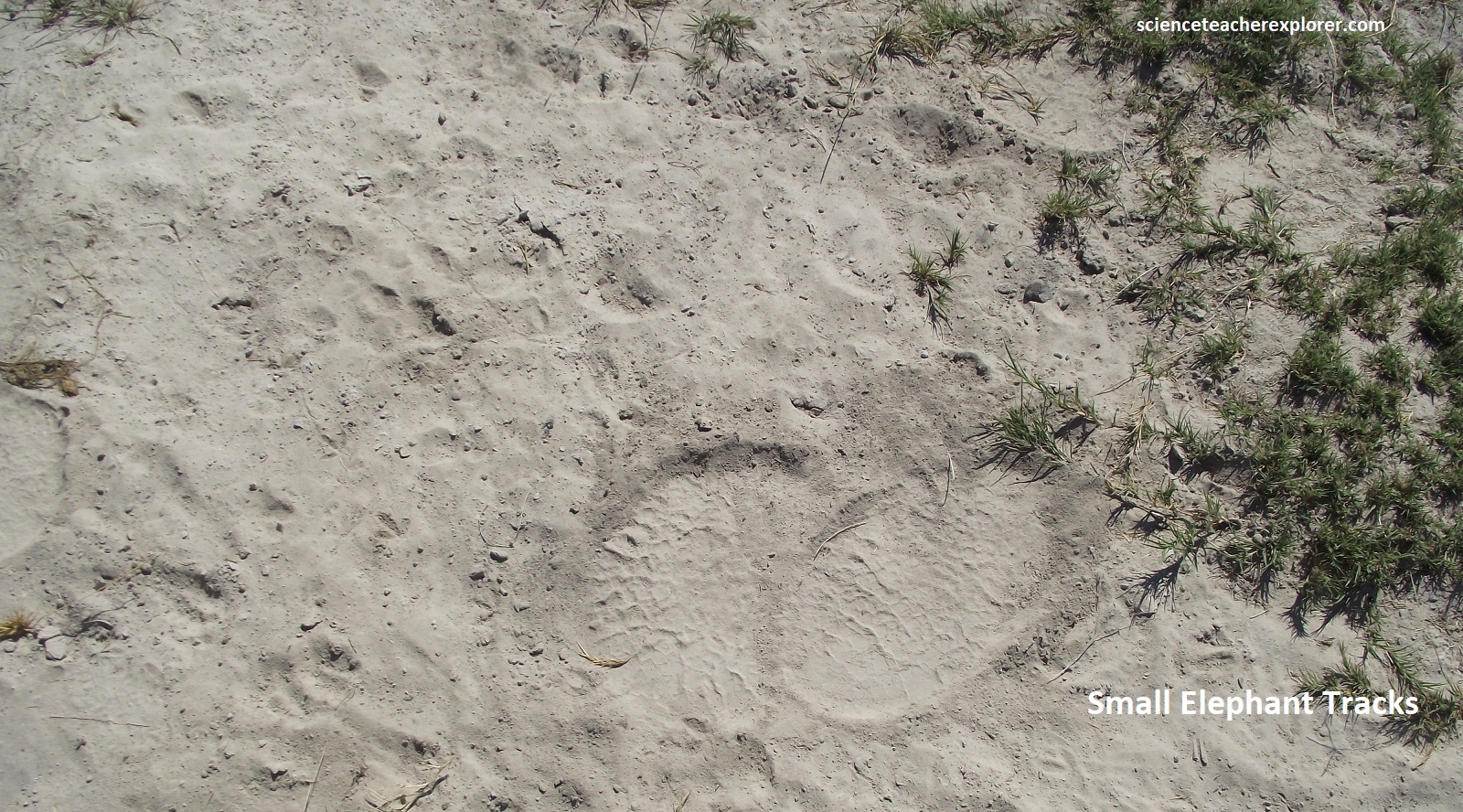
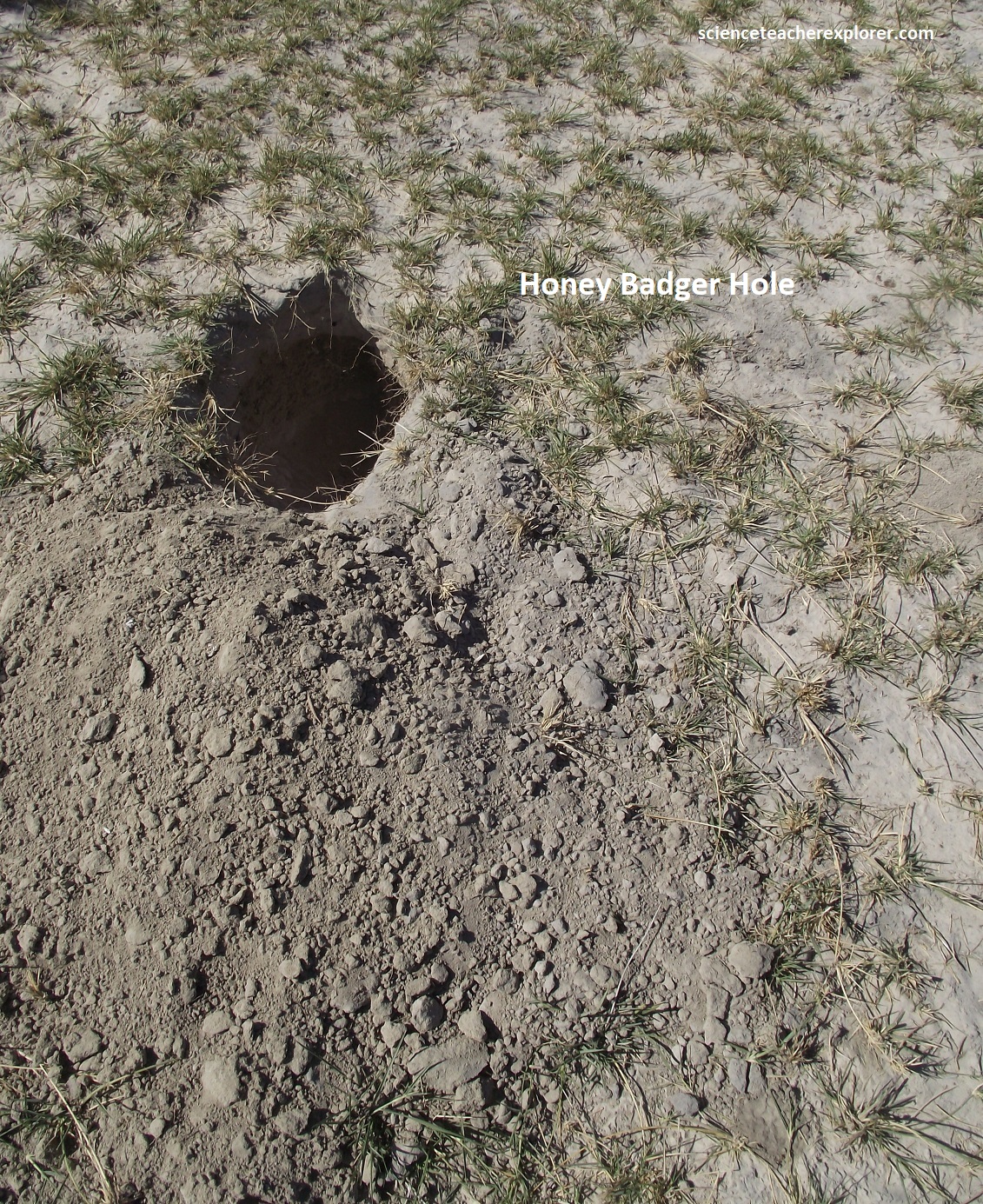
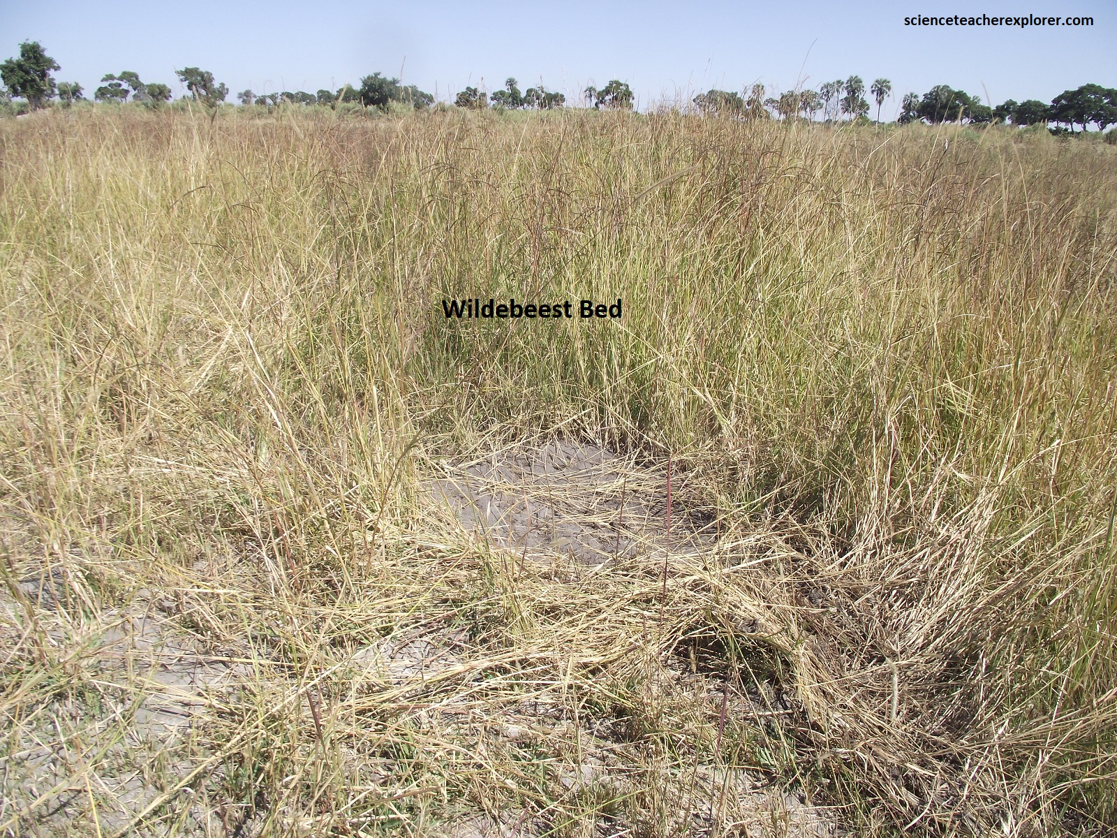
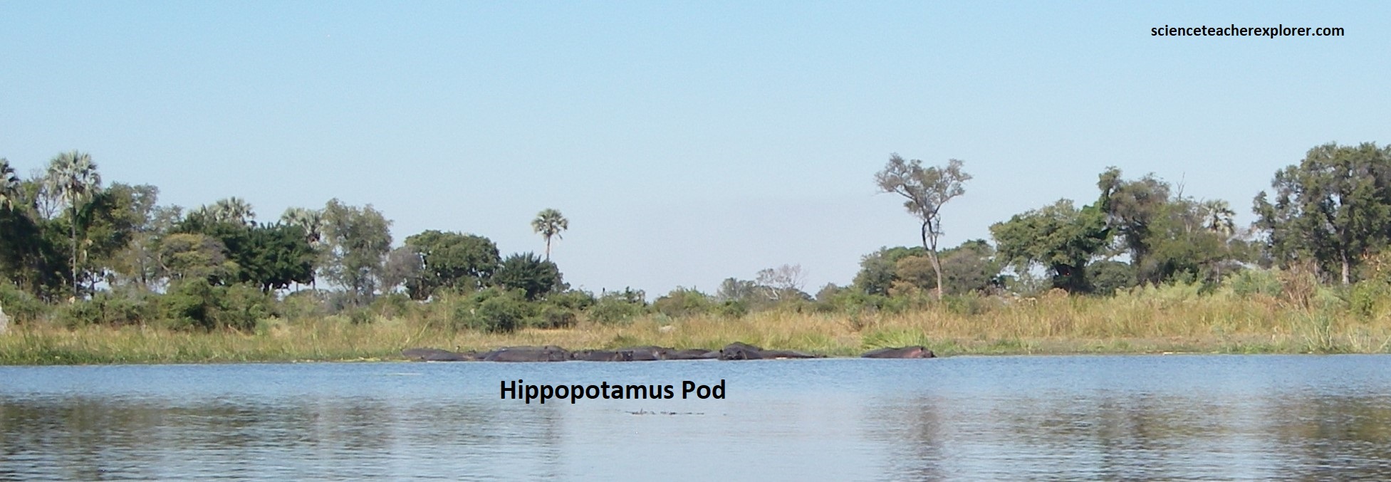
Wildlife-watching on the Okavango Delta was primarily of the winged variety, although we did see some Hippo pods and recent animal traces, (pictured below).
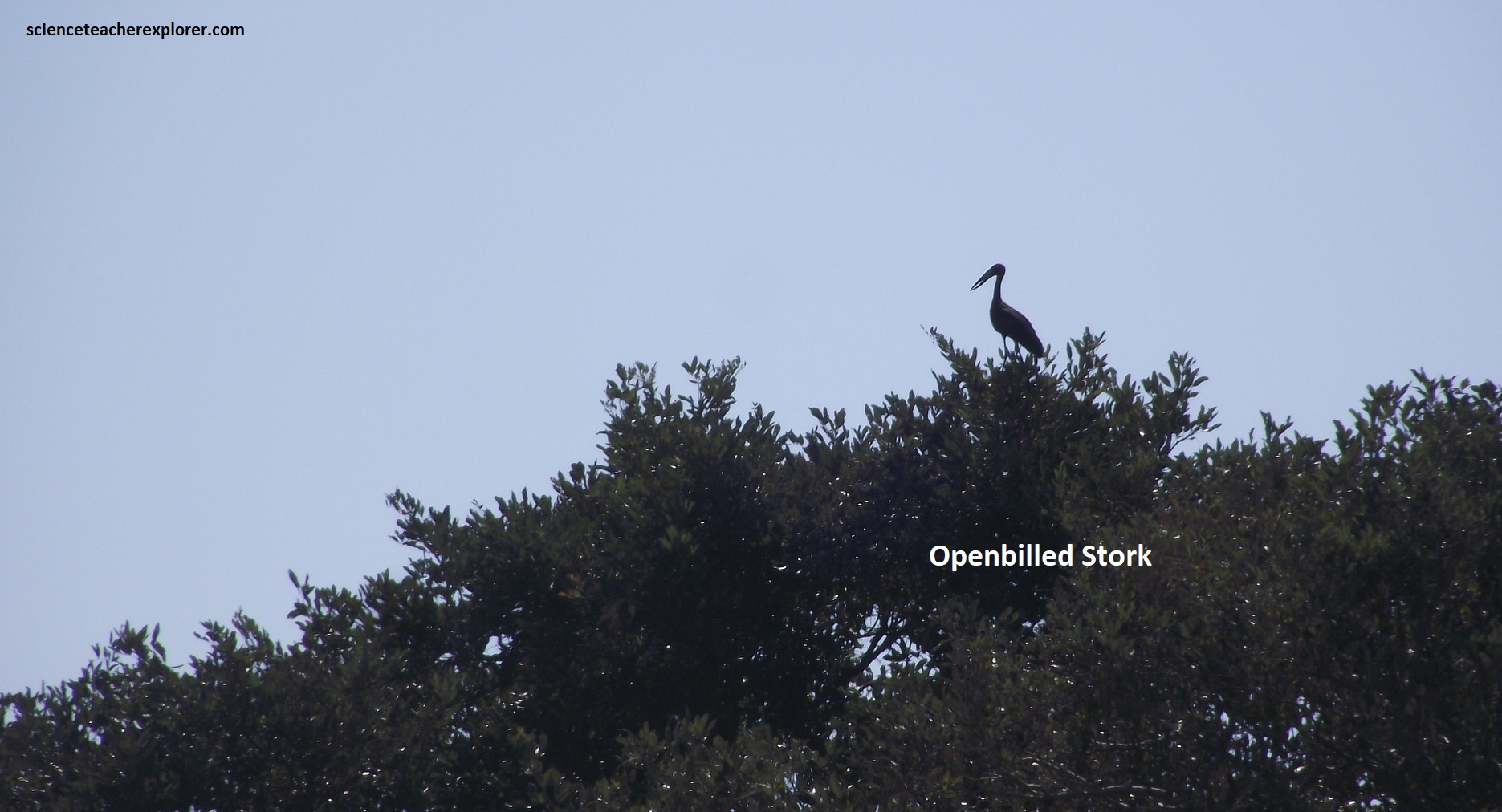
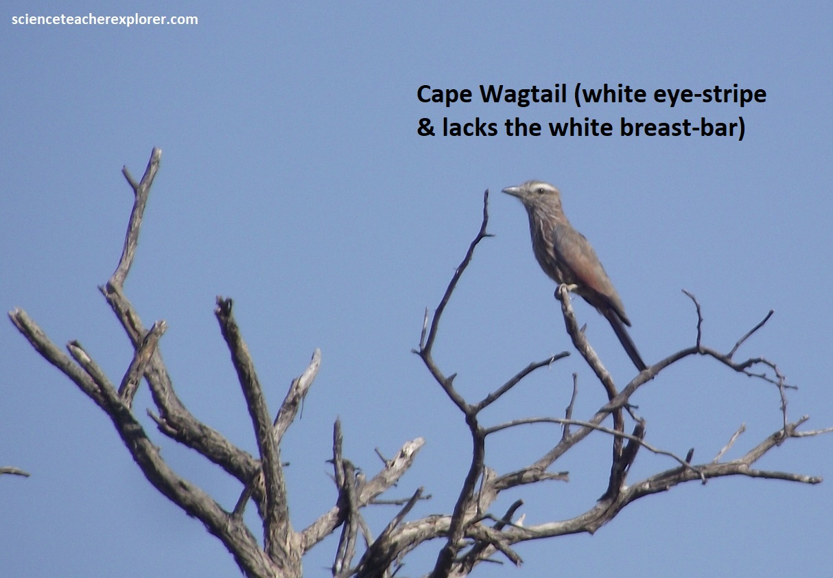
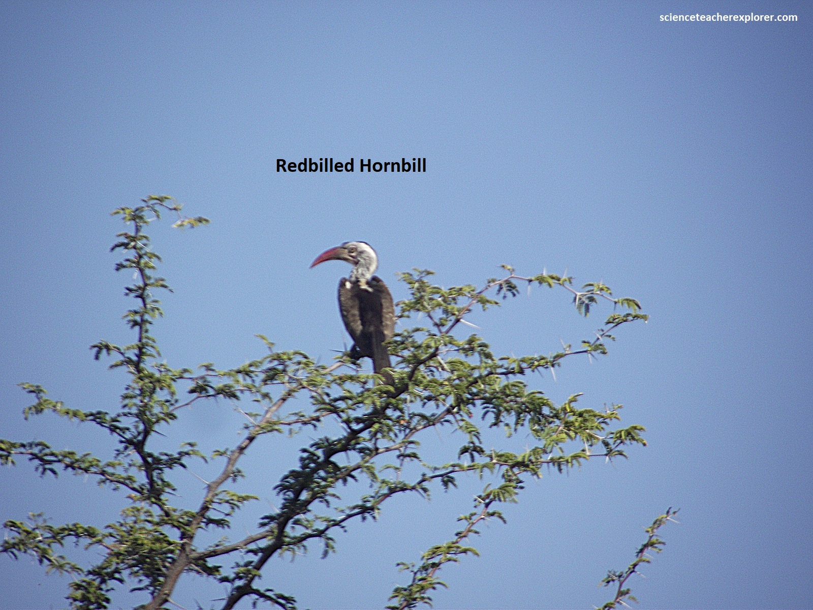
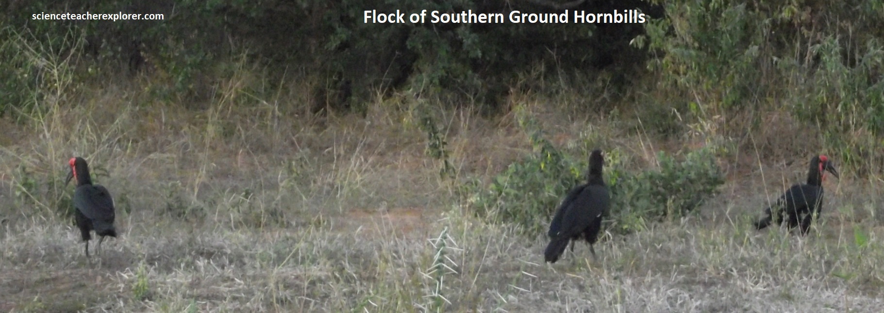
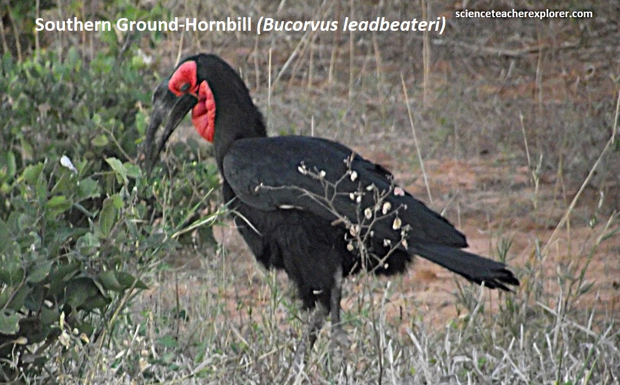
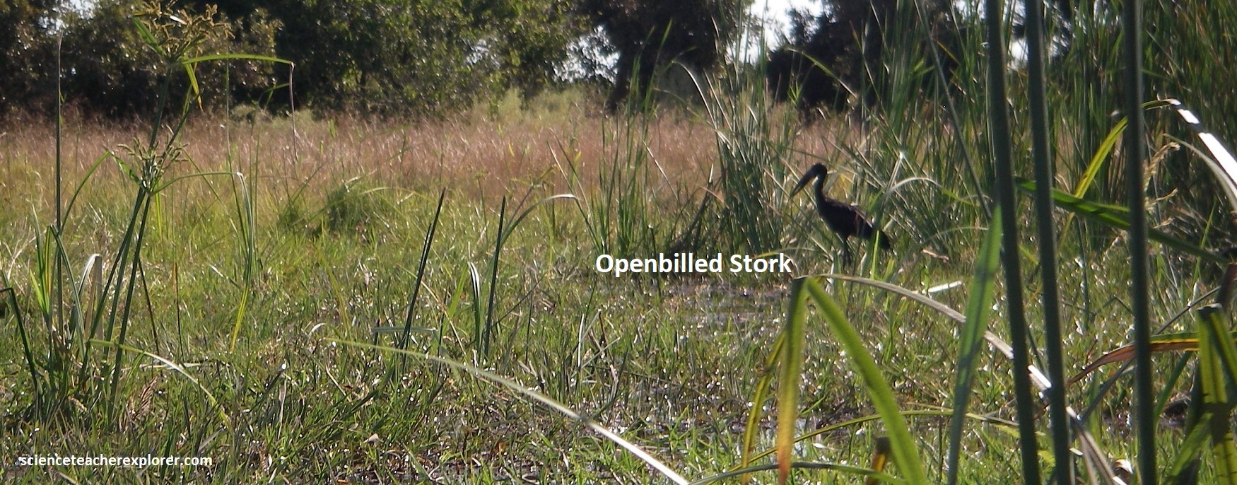
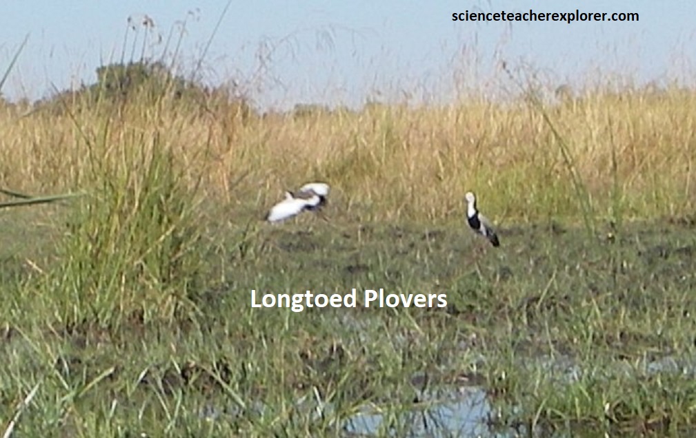
The birdwatching on the Okavango Delta was spectacular, with 350 species recorded in the area. I captured a few notable specialties in the pictures below. (Of course I saw more, but was unable to get respectable pictures of them).
While exploring the Okavango Delta, we were able to vary our mode of transport from mokoros to short walks on one of the many islands. I was able to identify six distinct habitats: (from the permanent waters of rivers, channels and lagoons to the dry woodlands dominated by mopane or teak). With a few exceptions, habitats rarely divide into neat blocks and a great deal of merging and overlap occurred. In such areas, (known as ecotones), species diversity was often at its greatest.
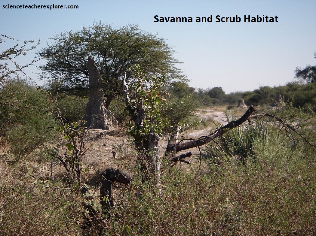
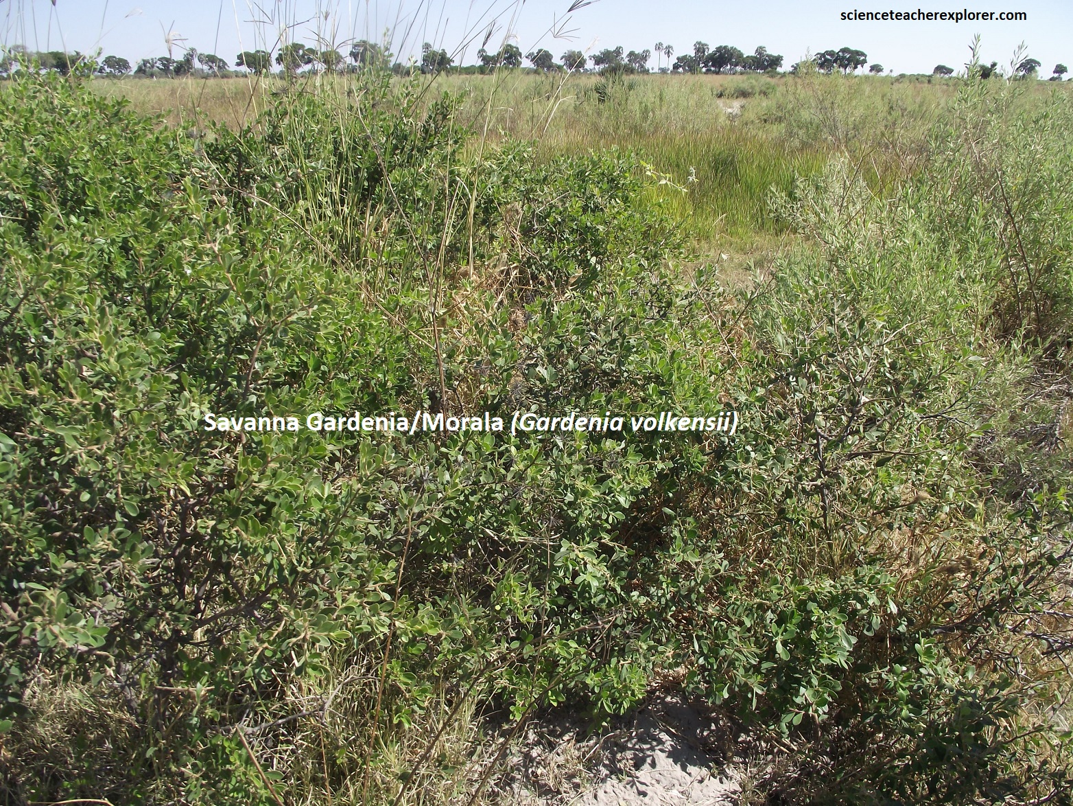
Pictured above, the Savanna was an open, park-like habitat with trees widely spaced and a ground cover of various grass species. In their mature stage, trees were generally fire-resistant but saplings were vulnerable to fire and browsing. Mixes species thickets often occurred on termite mounds protected from fire. This habitat was typical of alluvial soils and different species dominating on compact silt and looser sand. [Note: Knobthorn Savanna dominates on alluvial soils adjacent to floodplains, while Umbrellathorn Savanna dominates on shallower, less well-drained soils]. Mopane Scrub, characterized by low, multi-stemmed plants, is typical of shallow soil underlain with calcrete. This dense habitat, (relatively unfavorable for wildlife), we typical of this area in the eastern parts of the Moremi Game Reserve.
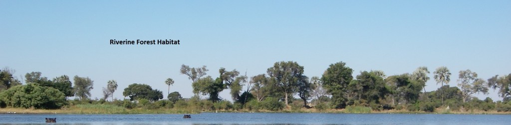
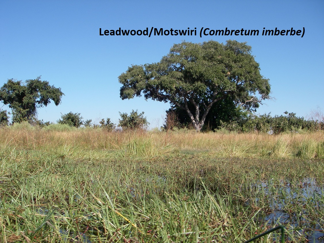
Pictured above, the Riverine forest is typified by tall trees with interlocking crowns and a tangled under-storey dominated by shrubs and creepers. Grasses are sparse or absent. The ready availability of groundwater allows large trees to grow close together, but they must then compete for light and this results in tall trunks and relatively small crowns. [Note: This forest type grows wherever alluvial soils occur alongside water, but are sufficiently raised to prevent waterlogging of the root zone]. The typical trees are Jackelberry, Birdplum, Mangosteen, Sycamore Fig, Sausage Tree, Wild Date Palm, Knobthorn, Rain Tree & Confetti Bush.
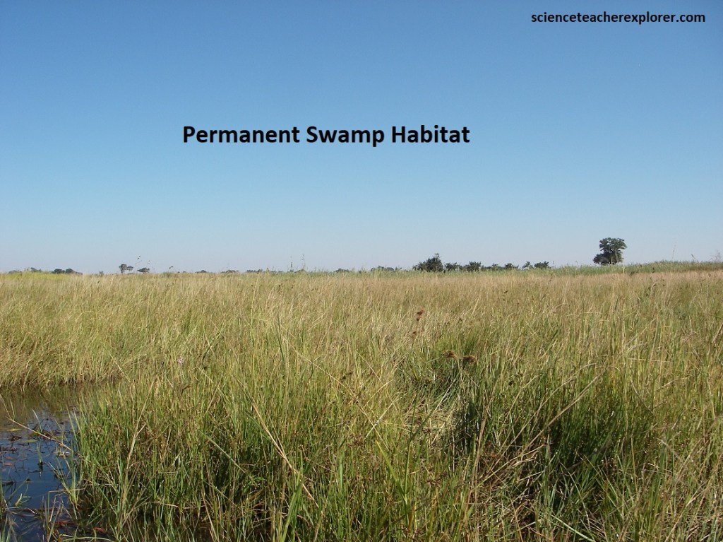
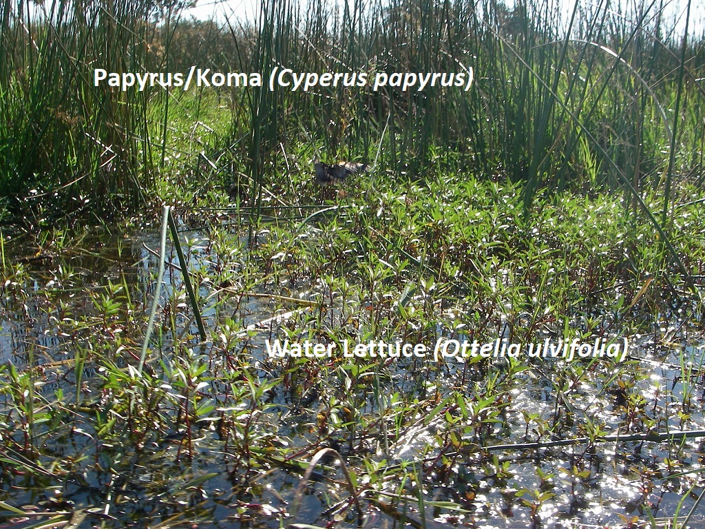
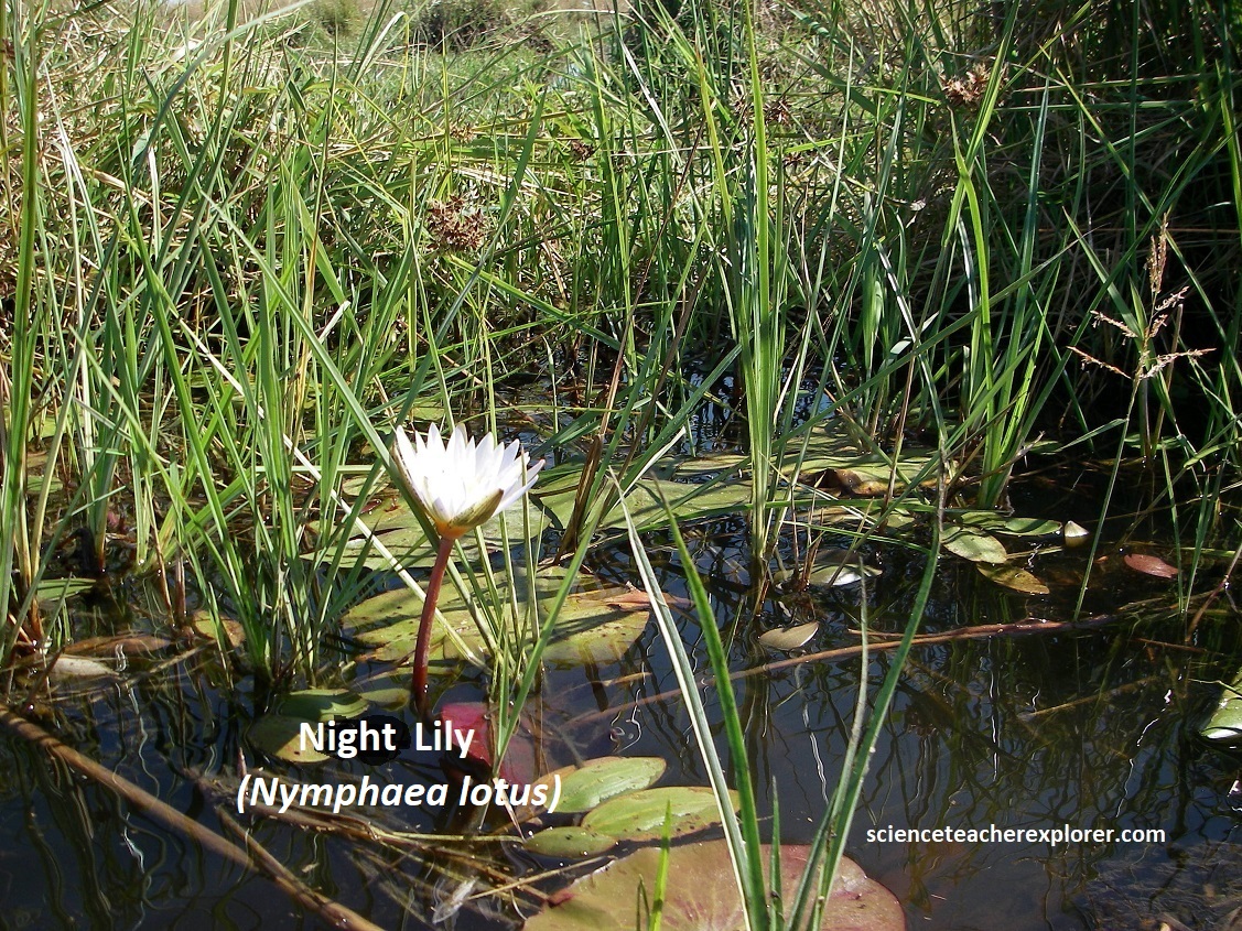
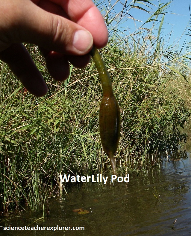
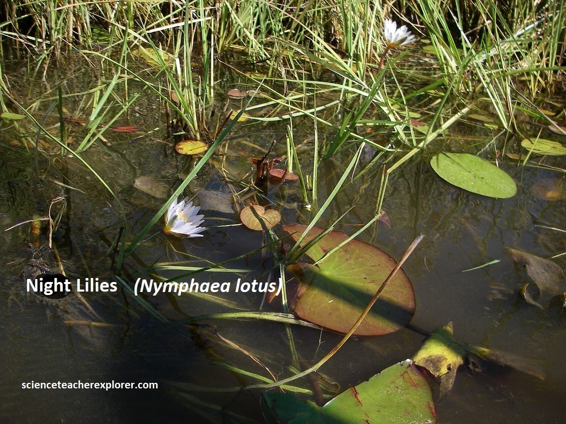
Pictured above, areas permantly inundated with water are characteristic of the upper reaches of the Okavango Delta. Overspill from the Okavango River, from the major channels, has created a swamp dominated by floating-leaved, submerged and emergent plant communities. Beneath this is a substrate varying from fine silt and sand to peat beds. Of the floating-leaved plants, the Night Waterlily and Water-Chestnut seemed to be the most abundant. Communities of these plants were most common in deeper water along channel and lagoon fringes. The most distinctive submerged plants were the Water-Lettuce, which has long, broad trailing leaves. Rooted emergent plants dominate the permanent swamp, (i.e. Papyrus, Common Reed, Bulrush, etc.).
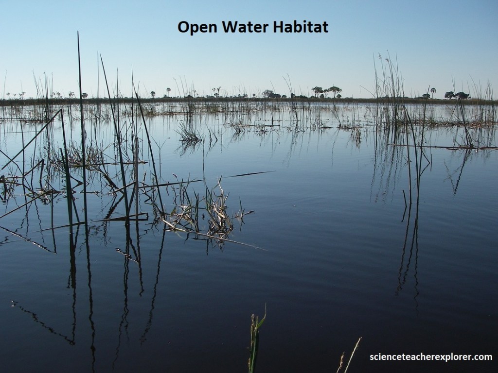
Pictured above; we explored 3 different types of “Open-Watered Habitate”, while in our mokoro. (1) The channels differed from a river in that they are smaller and their flow was largely directed by vegetation such as papyrus or hippos. (2) Lagoons (madiba) are small permanent lakes within the Delta, often where previous river systems meandered or formed ox-bows. Several channels may converge or disperse from lagoons. (3) Pans are seasonal, temporary bodies of water left behind in depressions on floodplains as floodwaters recede, or rain-filled pools in poorly drained clay soils associated with mopane woodland. These are where we seen the hippo pods.
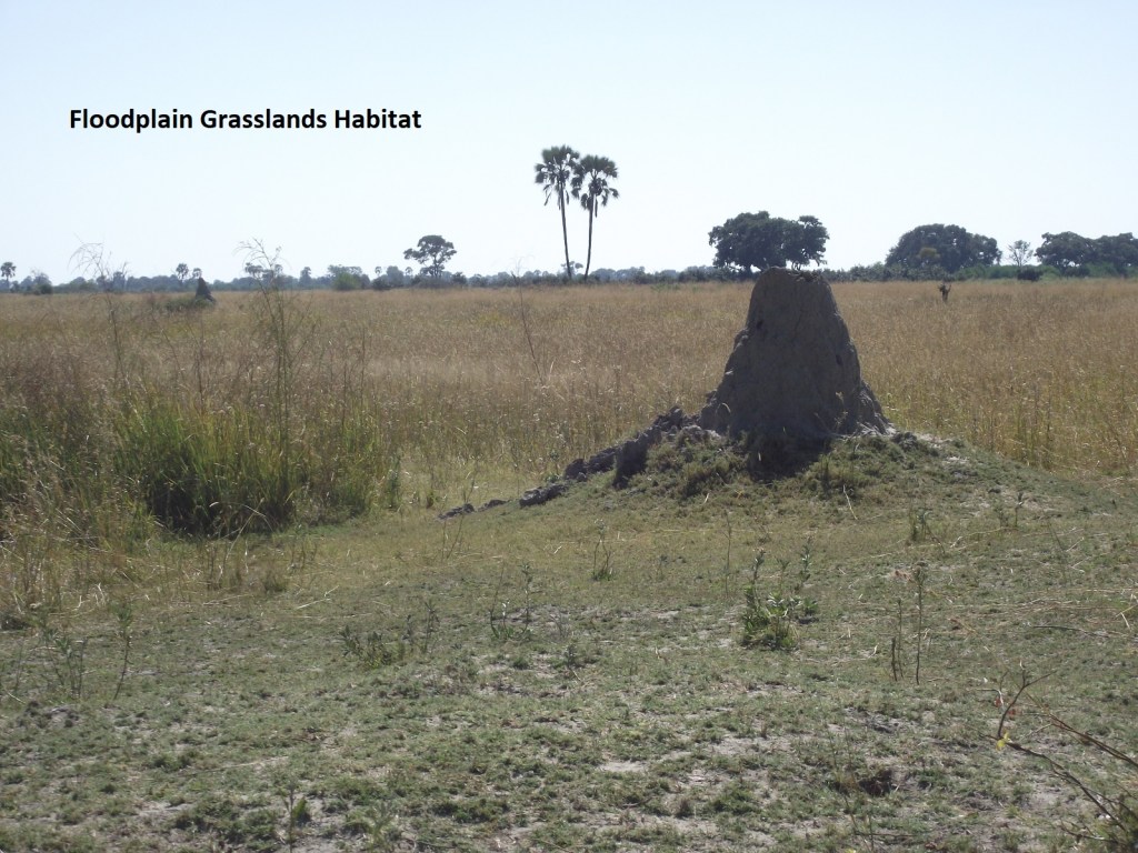
Unlike the permanent swamps, where water levels remain relatively constant, the appearance of the flood-plain changes throughout the year, and from year to year depending upon rainfall in the catchment area. Tufted grass species with Couch grass dominate on raised ground. Termite mounds and islands dot the flood-plains. During winter, (May – July), the floodplain is typically covered in shallow water with the grass cover being swept over and submerged. In the spring and early summer, the floodwaters evaporate and slowly recede, and the exposed grass grows exuberantly. As the grassland dries out, fierce fires often sweep the area, removing tree and shrub saplings in the process. Young woody plants cannot tolerate these interaction between fires and waterlogging, which is why trees are not present there.
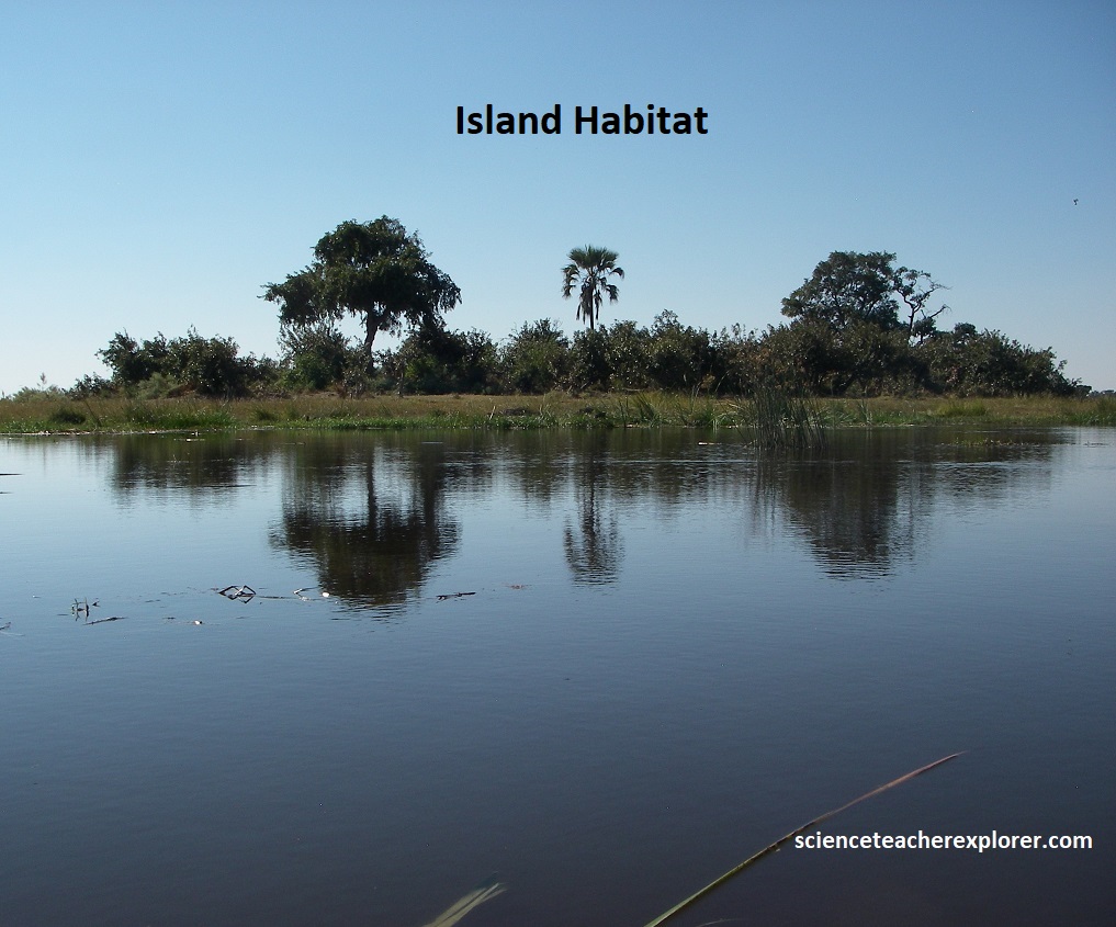
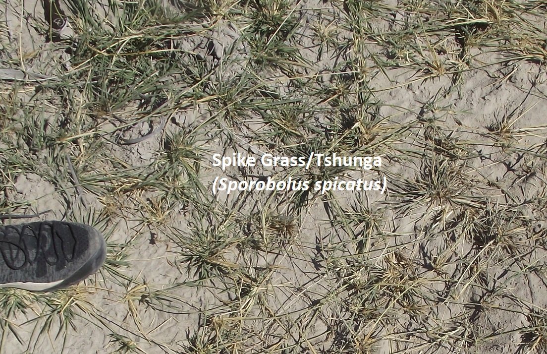
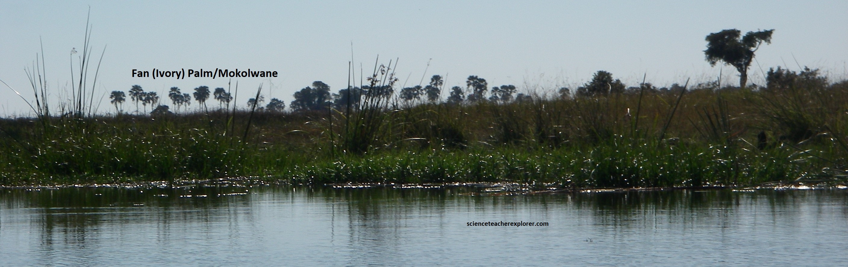
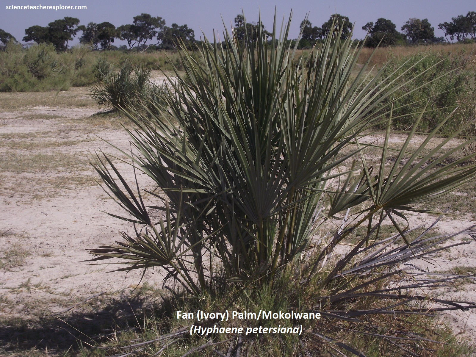
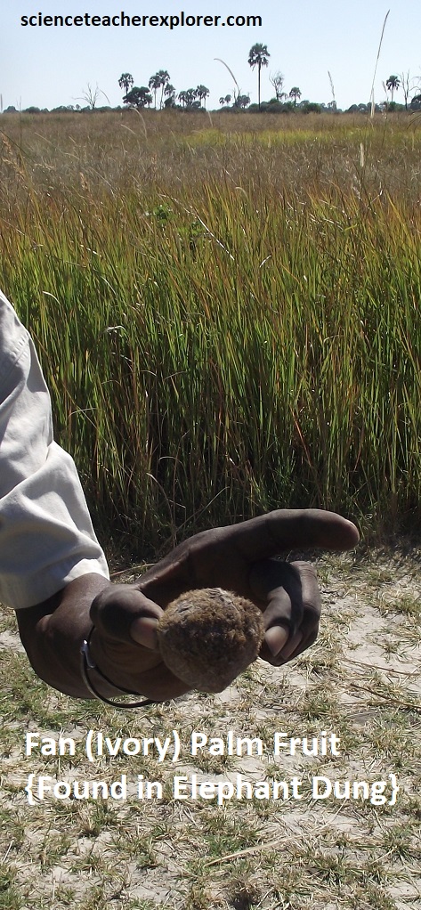
Pictured above, islands of various shape and sized are distributed throughout the Okavango Delta, (in both the permanent and seasonal swamps), and contribute to the appearance of the landscape. By providing a constantly dry environment, these islands add to the diversity of life. In the flatness of the Okavango, any patch of raise ground may be considered an ‘island’ and they range in size. Wild Date Palm dominates the outer fringes while Sycamore Fig, Jackalberry, and Knobthorn are among the trees which form a forest behind. Ivory Palm grows as elegant giants in the island interior, much of which may be covered in Couch Grass or Spike Grass.
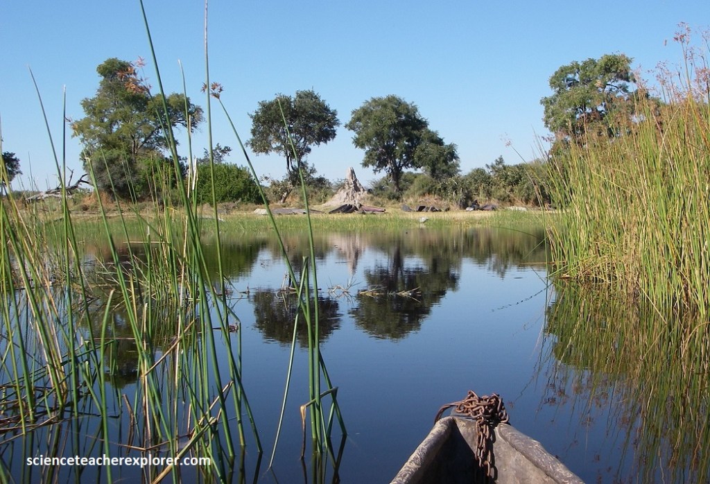
Pictured above, islands are formed in a variety of ways. Smaller, circular islands originate from termite mounds, while sinuous islands are the result of raised channel beds caused by channel abandonment through blockage. Islands expand by a process of chemical precipitation which causes the land surface to rise. Dissolved salts in the groundwater ultimately rise to leave a crust of white ‘trona’ on the surface. The highly alkaline soils associated with this trona are toxic to most plants except with barren interiors.
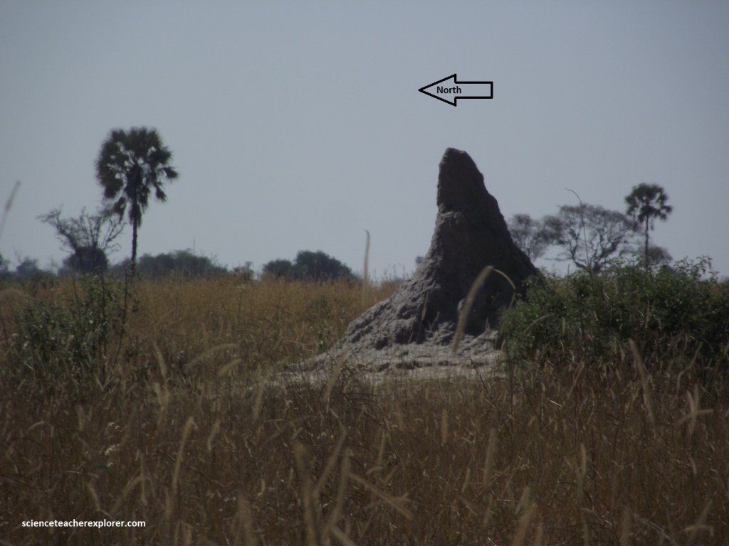
One of the things I learned from our local trekking guide & pole-man, is the interesting facts about termite mounds. Pictured above, fungus-growing termites, which build enclosed mounds without visible ventilation holes, belong to the genera macrotermes. These macrotermes mounds can be up to 6 m high above ground. The tip nearly always leans slightly over, and the termite mounds face North, which can be taken as a reliable direction pointer. Generally speaking, such mounds consist of an outwash pediment, a conical base, and a spire with a tip on top. This outwash pediment is free of vegetation and consists of hard-baked termite mound material. This material was eroded by rain, wind, and sun from the base cone and spine. It is a mix of quartz grains glued together by clay particles and termite saliva. {Note: In the southern hemisphere, the sun rises in the east, moves over the north, and settles in the west. The sun’s position is highest in the north. Therefore, the termite mounds face in this direction}. On the side illuminated by the sun, the metabolic rates of termites will be faster compared to the cooler side. With a higher metabolic rate, the working speed of termites also increases. Therefore, the mound will grow with an increasing tilt.
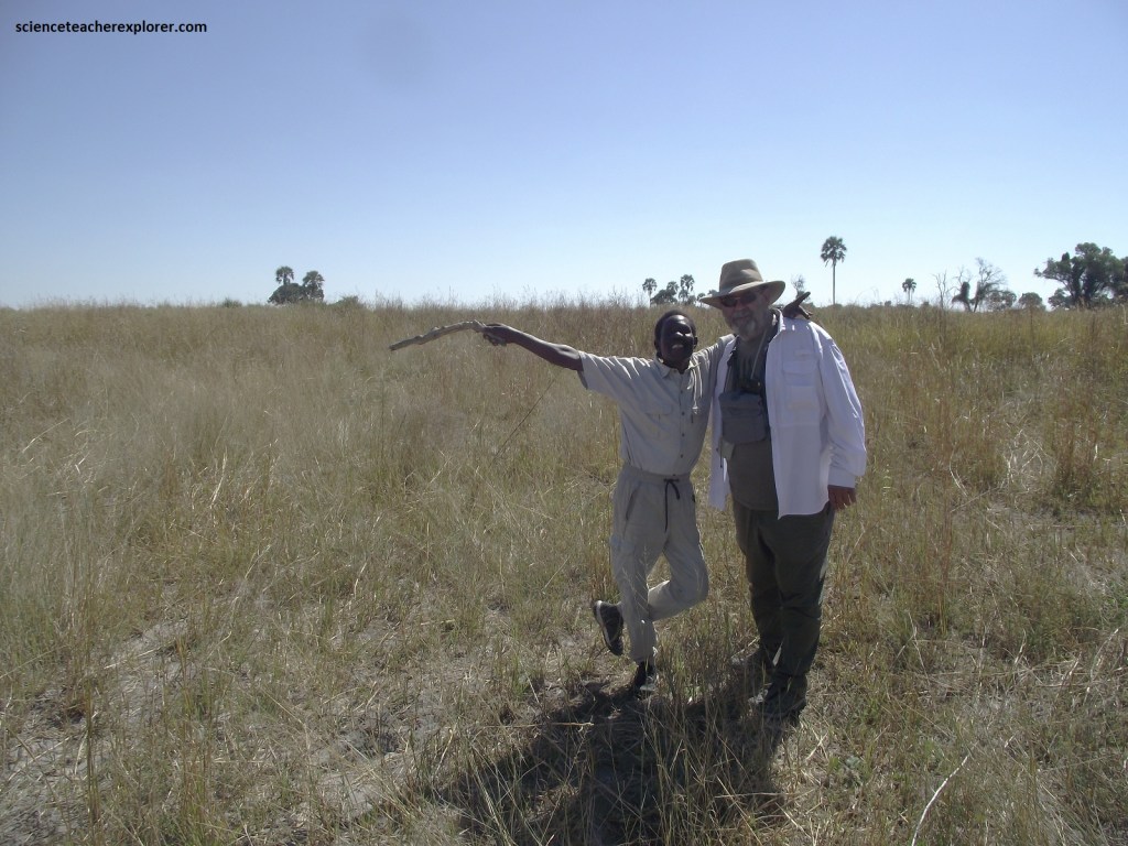
Pictured above, you might notice that we’re not carrying a rifle for protection. I asked our guide, “What if we encounter a pride of lions?” His response was to freeze and not move a muscle. From his experience, you will never be attacked by lions as long you don’t move. At that moment I thought of the infamous Dr. David Livingstone. While setting up his mission station just south at of here in Mabotsa, Botswana, he was mauled by a lion, with the result that he could never able to raise his left arm above the vertical. I wondered if he just froze in his tracks. I’m just saying!! (Luckily somebody had a gun at that time in the 19th century).
