Otavi, Namibia 2025
In June of 2025, I explored and trekked Namibia with a childhood friend of mine named, Tracy Davis.
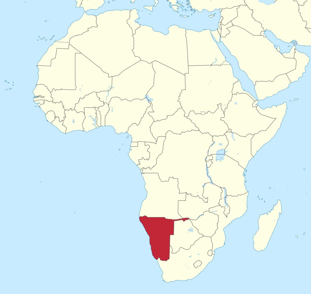
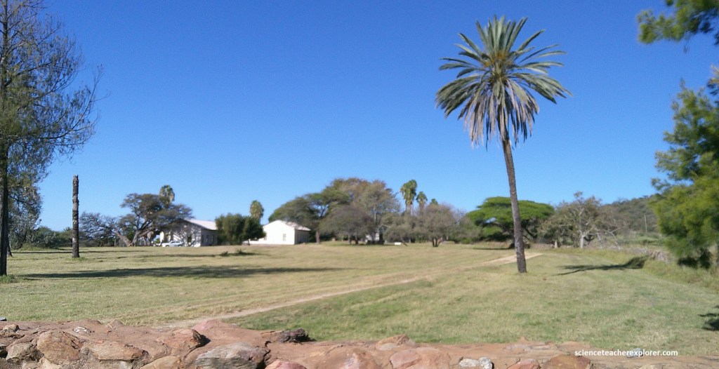
We entered Namibia from the northeast on B8 and drove to Otavi, Namibia. Our mode of transportation was a 4WD Ford Truck, (imaged below).
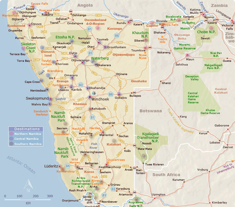
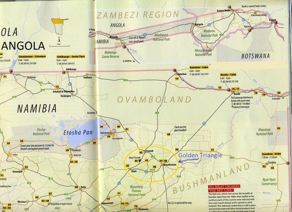
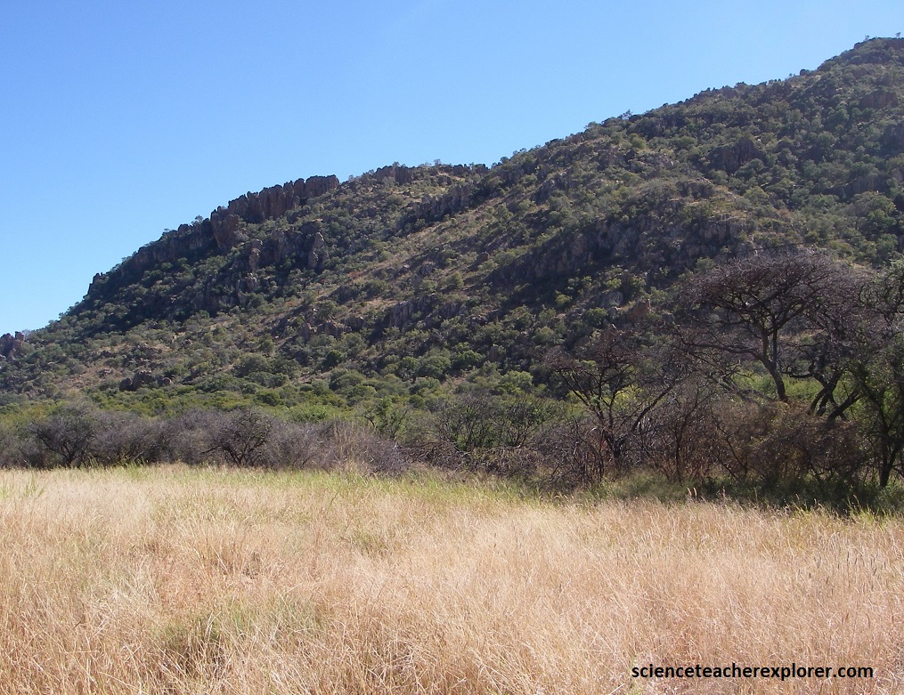
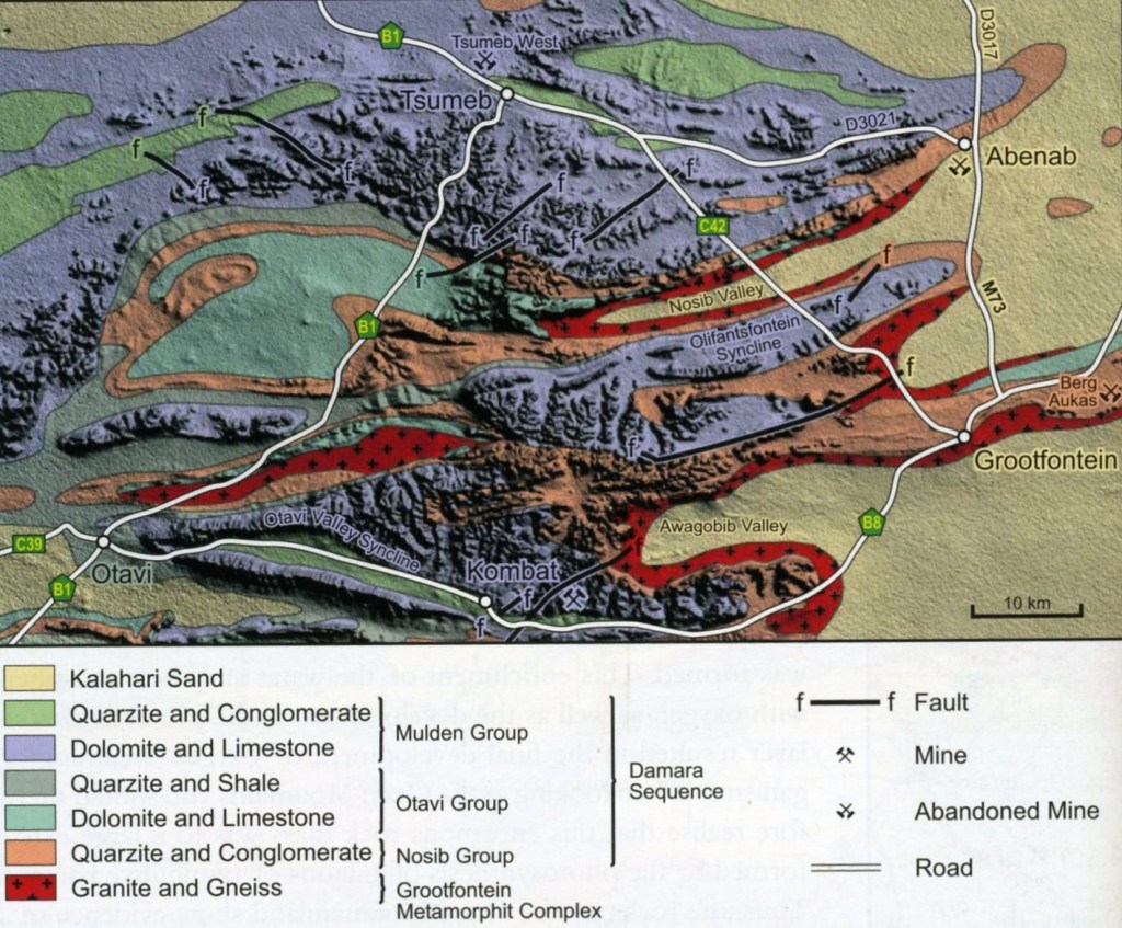
My primary destination to explore and trek was the Otavi Mountainland. It lies between the small towns of Otavi, Tsumeb and Grootfontein, and is considered the ‘Golden Triangle’ with it’s abundant, fresh, clear groundwater.
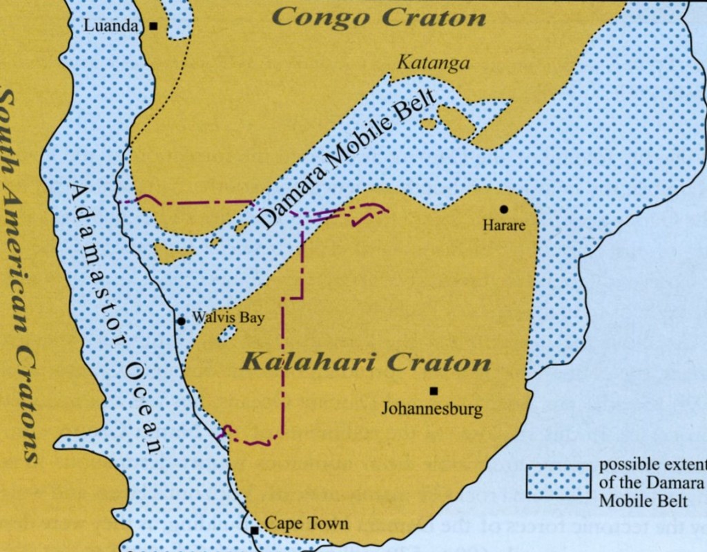
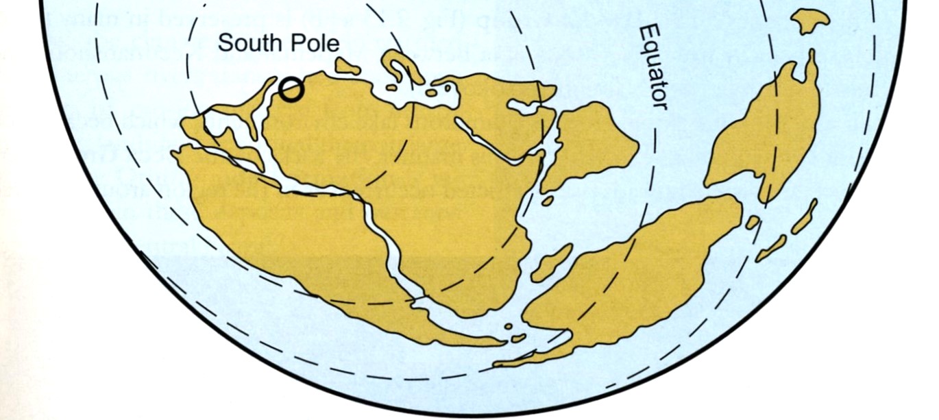
From the beginning of the first mainland formations of Africa, approximately 750 million years ago, only two landmasses, the Kalahari Craton of the East and the Congo Craton in the North, (part of the Rodinia supercontinent) , lay like islands in the huge ancient ocean. [Around 750 million years ago, the supercontinent Rodinia began to break apart, a process that likely contributed to a period of global cooling or even “snowball Earth” events. As Rodinia fractured, new rift valleys formed, and the breakup increased the amount of shallow seas and continental margin, which enhanced the burial of organic carbon. This process removed CO2 from the atmosphere, causing the climate to cool.
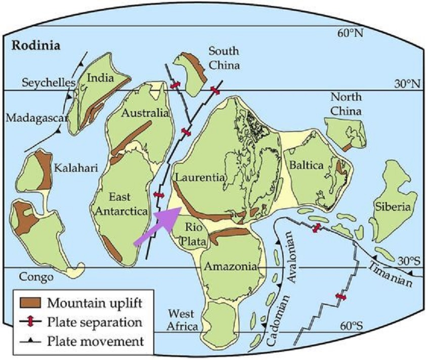
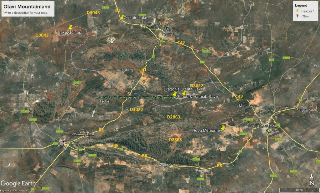
Between the Kalahari Craton & Congo Craton, a branch of the sea extended in a northeasterly direction from Walvis Bay to the ‘copper belt’ in Zambia, (called the Damara Belt and imaged below).
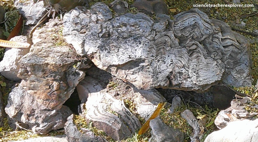
Along the Damara Belt, (which includes the Otavi Mtns.), fine clayey-sandy sediments were deposited in the deep regions of the the internal sea, while on the coastal shelf areas huge calcareous reefs were formed. However, these reefs were formed by the lime-secreting cyano-bacteria called stromatolites. These were of such huge dimensions and thickness that they contributed significantly to the formations of limestone at the end of the Precambrian period.
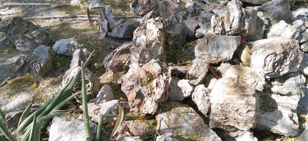
During the times of the formation of the Otavi carbonates, the earth’s atmosphere still consisted of large amounts of life-threatening CO2. However, the cyano-bacteria absorbed this CO2 from sea water and split off the oxygen through their metabolism, resulting in the secretion of the surplus carbon in the form of limestone (CaCO3). The oxygen was released into the atmosphere and ozone was formed. {This resulted in the development of oxygen-breathing organisms}. Thus, the rocks of the Otavi Mountainland show evidence of the fundamental process in the history of life on the earth.
Over several 100 million years of reef-building in the shallow shelf regions of the ancient sea at the southern edge of the Congo Craton, limestone and dolomite rock was created to be a mass of 5,000m thick.
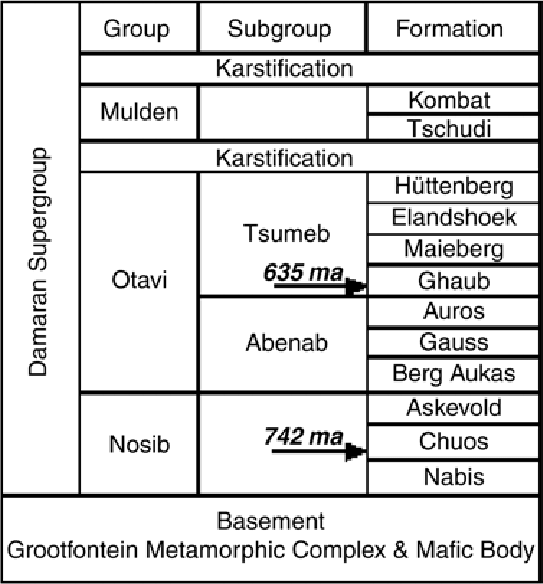
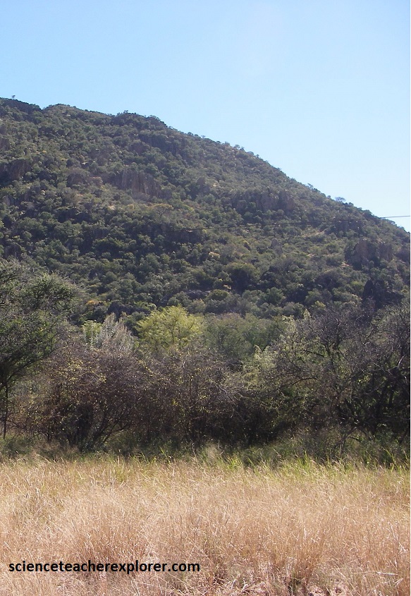
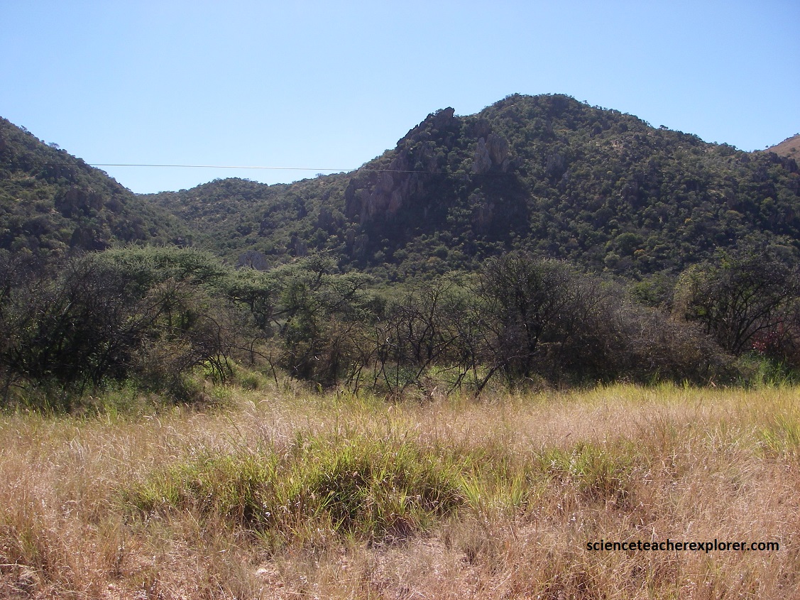
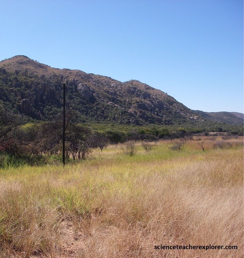
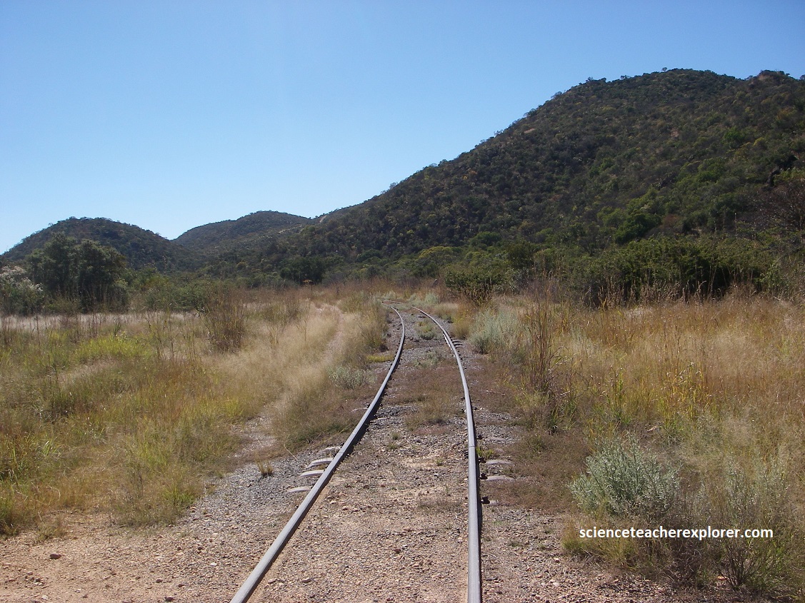
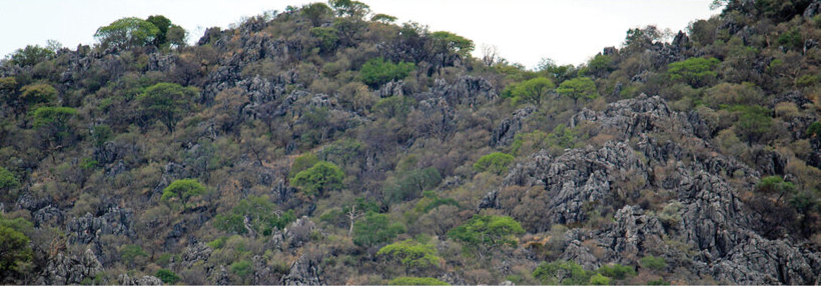
Then, approximately 650 million years ago the Congo and the Kalahari Cratons drifted towards each other, creating a mountain building event, (orogeny). Therefore, some 540 million years ago, the sediments of the small sea, situated between the cratons, were pushed together into a huge folded mountain range, called the Damara Orogeny. The remnants of this carbonate mountain-chain can be seen in the light-colored, heavily overgrown high rock formations within the Otavi Mountainland, (Pictured below on hwy. B1 between Tsumeb & Otavi).
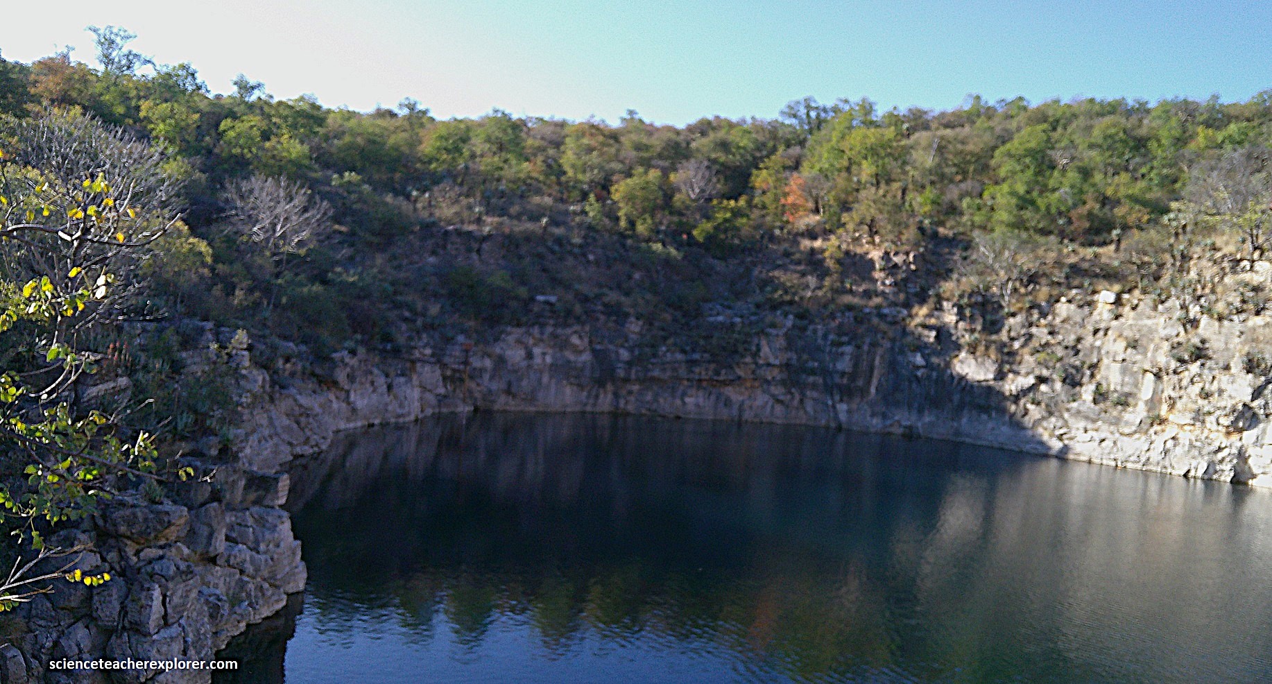
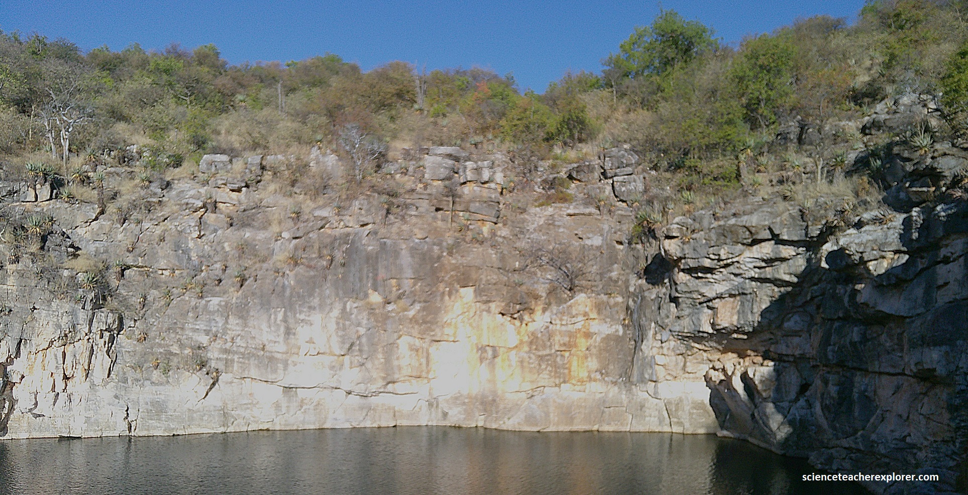
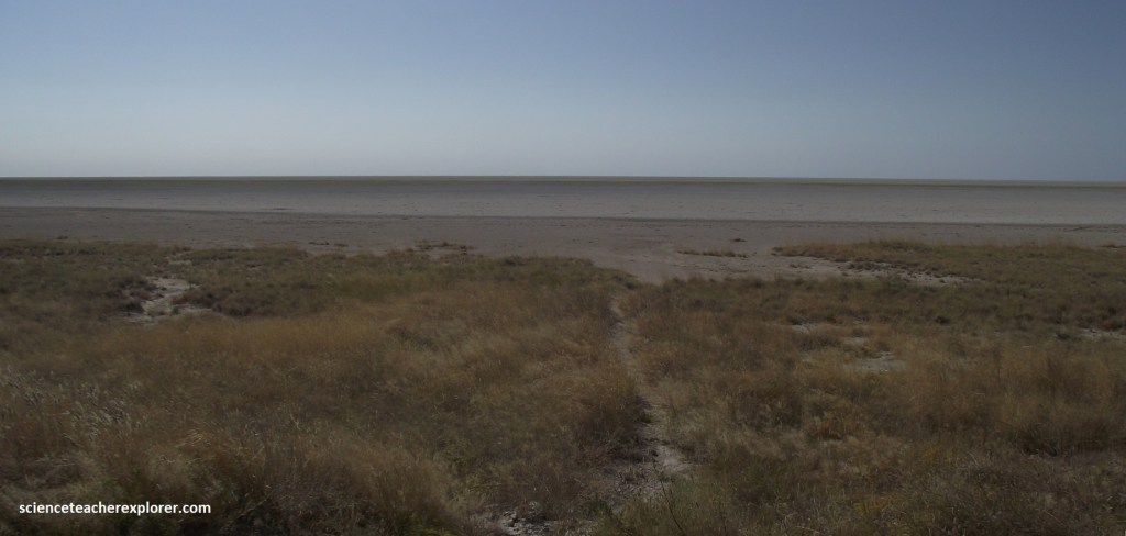
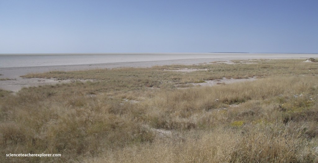
The Otavi Mountainland was then subjected to erosion processes during the subsequent, seemingly endless period of approximately 500 million years. The Otavi Mountainland, mostly composed of the 750 million-year-old limestone, is now only 1,300-1,900m above sea level. However, in this region of 5,000 km2, some of the biggest underground lakes have been discovered quite recently in the limestone and dolomite countryside. Additionally, the Otavi Mountainland boasts two large, fully exposed lakes, Otjikoto and Guinas, formed by a pair of neighboring cenotes, (underground caves). Originally a system of underground caverns and tunnels that became unstable and collapsed, what now remains are circular sinkholes exposed to the open atmosphere.
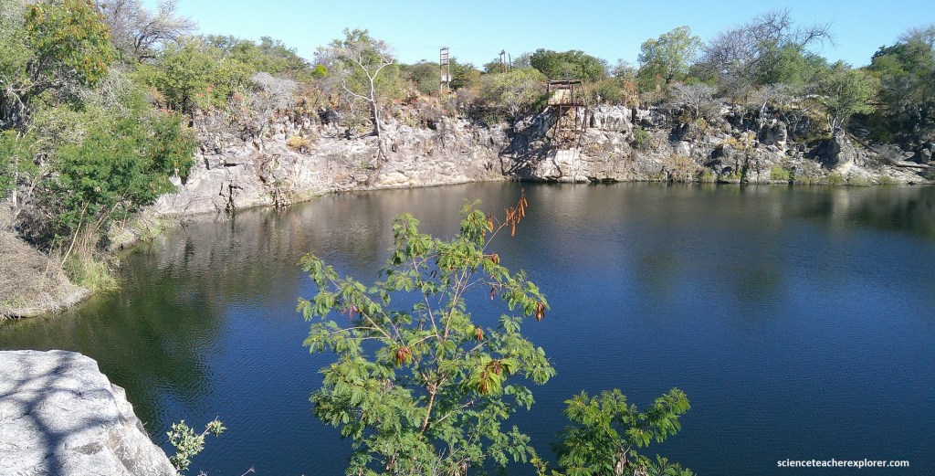
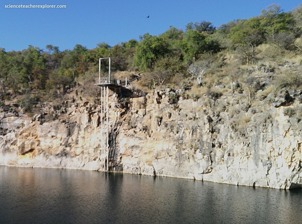
Pictured below, the Otjikoto Lake is probably the most famous permanent lake in Namibia, with emerald green waters surrounded by vertical limestone cliffs. Located 24km northwest of Tsumeb, we accessed it from Highway B1.
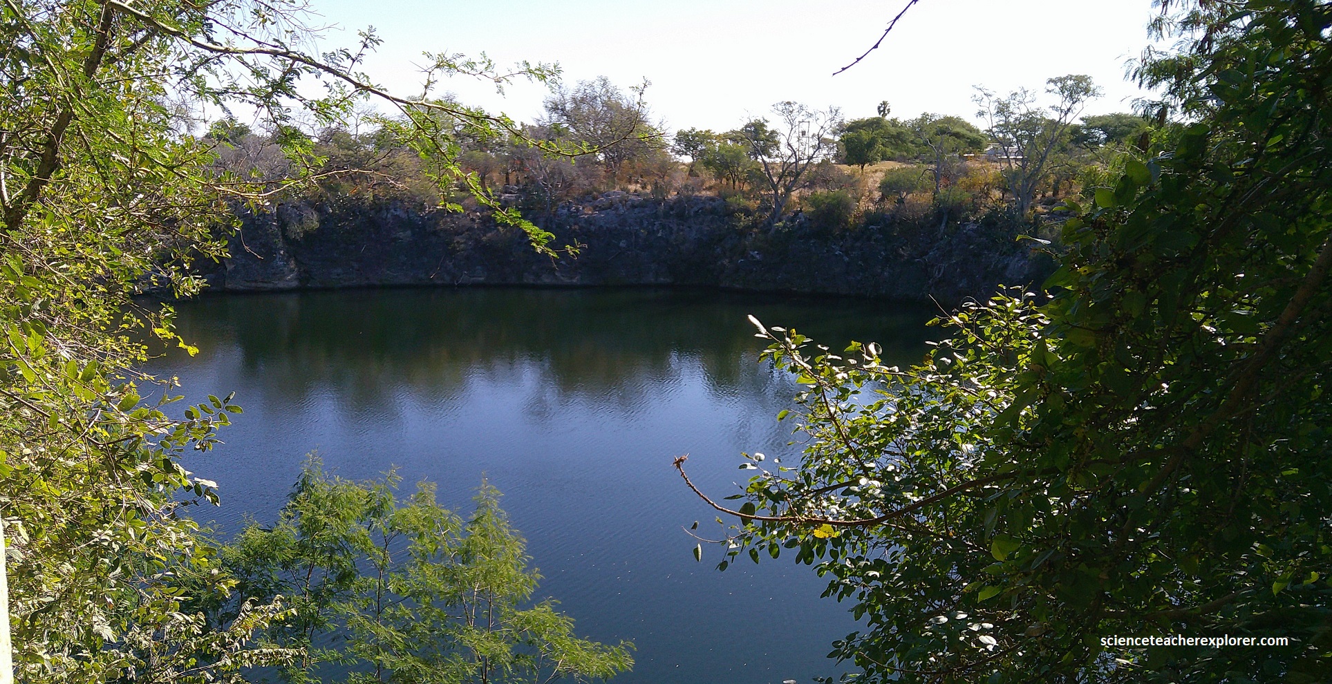
Pictured above, Otjikoto Lake is a perfectly circular lake that has a diameter of 102m with a surface of about 7,850m2. It’s depth is probably greater than 100m, and its volume approximately a million cubic meters of fresh water. It’s temperature remains steady a 220C near the surface and 180C at deeper levels. I couldn’t help notice that is was full of an endemic , mouth-brooding species of fish called Tilapia guinasana.
Pictured above, Otjikoto Lake features an incident that occurred towards the end of WWI. When German troops in the vicinity of Otjikoto were forced to surrender to the forces of the British Union of South Africa in June 1915, instead of conceding their weapons to the enemy, they dumped their artillery, heavy guns and even ammunition wagons into the lake. Much of the dumped war material has now been recovered, although it is rumored that a large safe filled with 6 million gold Deutsche Mark coins is still sitting at the bottom of the lake.
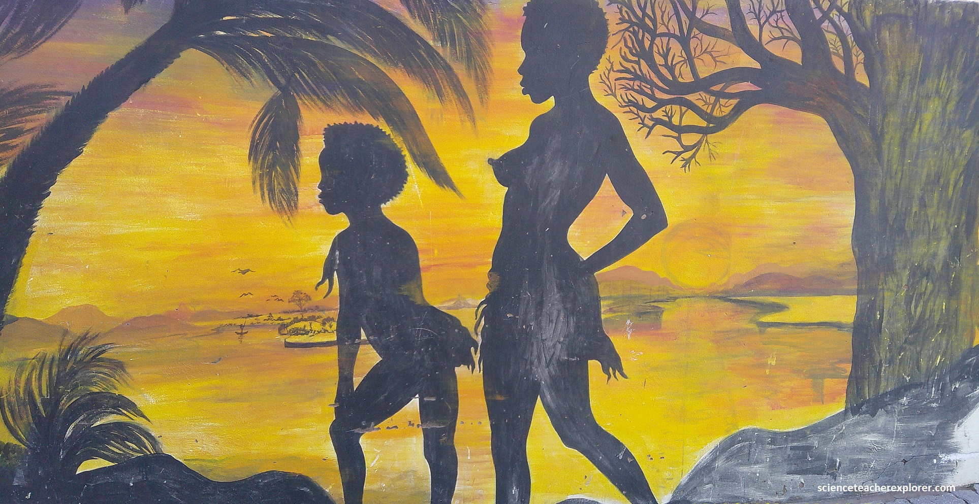
{Pictured above is from a local Herero artist that painted these images on the side of the building there}. When the Herero moved into the Otjikoto Lake area, they namedthe feature Otjikoto. It means “deep hole” in their language. The first Europeans to discover the lake were Briton Francis Galton and Swede Carl Johan Anderson in 1851. Upon spotting the lake, the two explorers immediately jumped in for a swim. The local Herero people could hardly believe what they were witnessing, (that these two white individuals could safely swim back to shore). The local Herero people believed that no-one would survive immersion of the lake’s mysterious waters.
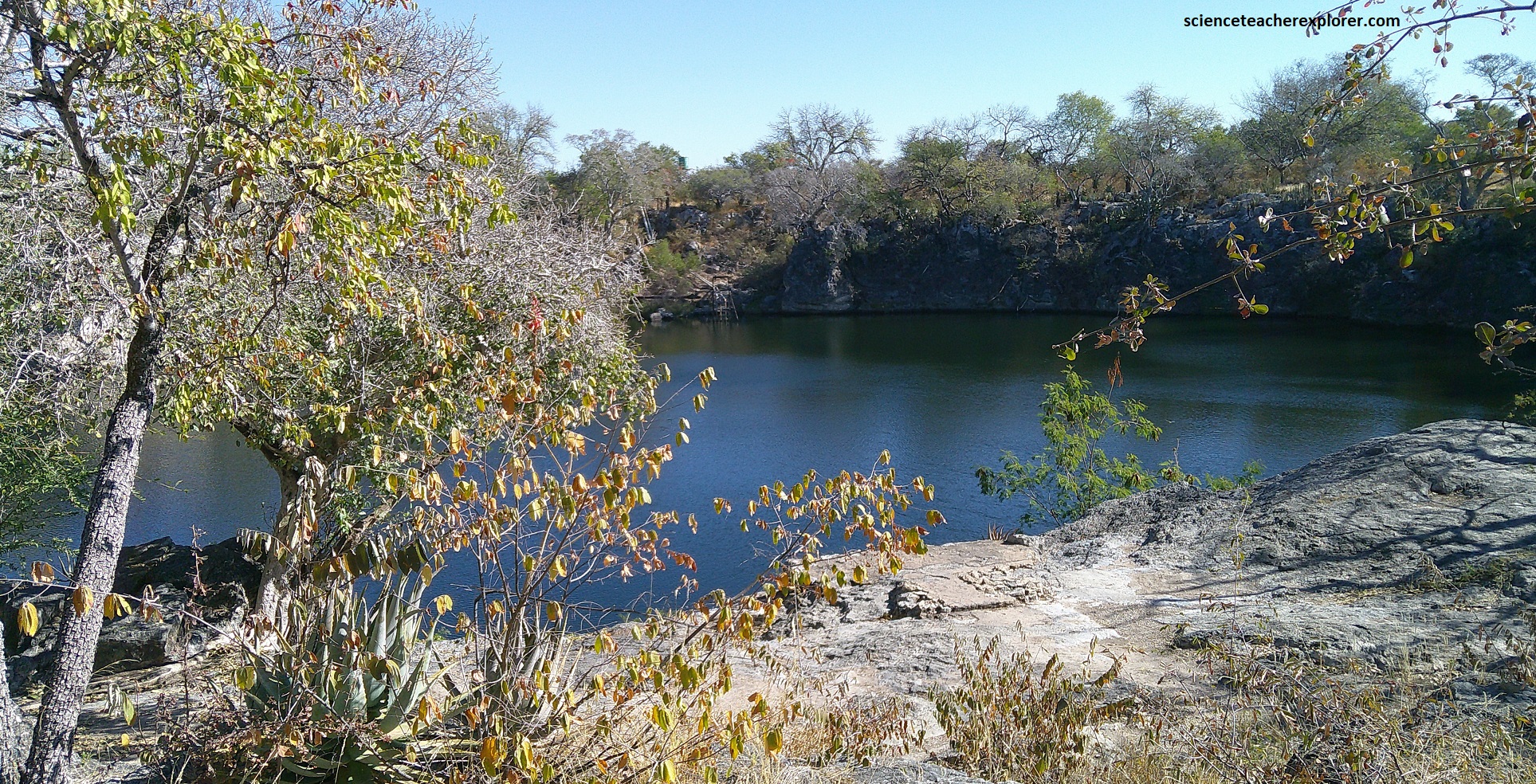
Pictured above, Lake Guinas is situated southwest of it’s sister lake Otjikoto. We drove north, towards Etoscha National Reserve, to the graveled road D3043 and turned left. Round trip from Otjikoto Lake was about 50km. In the Herero language, Guinas means “ugly”.
Pictured above, Lake Guinas had extremely clear waters with an intense cobalt blue color. The lake was elliptical in shape, with a surface area of 118m x 62m. At 130m deep, it contains approximately 600,000 m3 of fresh water. The temperature throughout the body of water is constant all year at 260C. With this temperature and good visibility, Lake Guinas is a world famous dive site. {In 2001, South African Trevor Hutton set a world record here in free-diving at 66m in 2 minutes 11 seconds}.
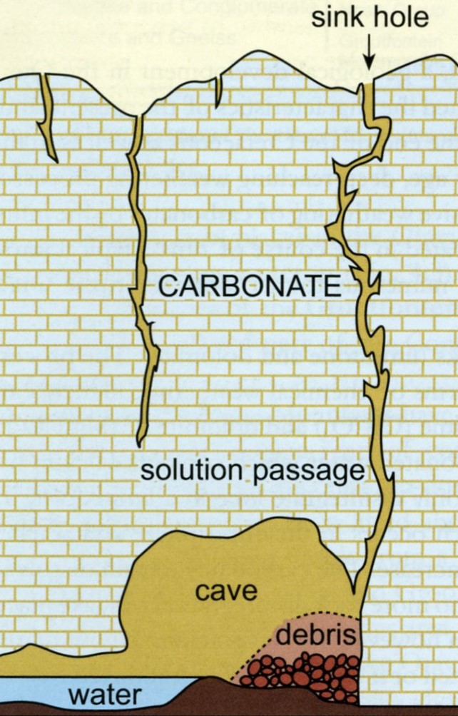
Intensive weathering of carbonates by the influence of water has created in the course of time a typical ‘karst’ landscape, whose geo-sites we explored at numerous localities in the Otavi Mountainland and it’s surroundings. Karst phenomena can occur both on and below ground level. We attempted to explore the underground variety by driving to Ghaub Cave.
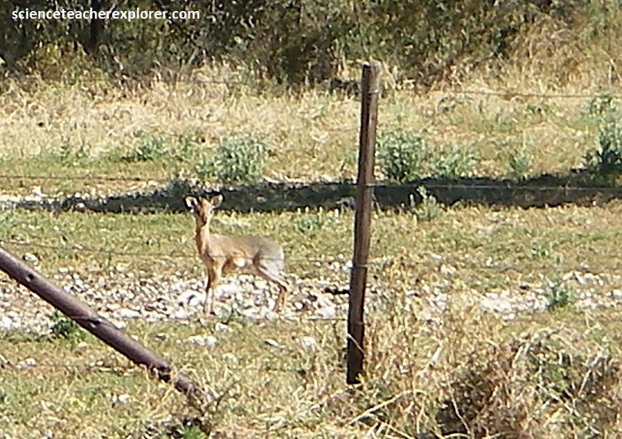
We got to the Ghaub Cave on the D 2863 graveled road, which branched off from the B 8 highway in the small mining town of Kombat. We drove about 30km, when we saw the signpost of ‘National Monument Ghaub Cave’. Along the way, near an active spring, we saw this amazing little animal, pictured above, called the Damara Dik dik, (Madoqua kirki). This extremely rare and protected species is only 38.6 cm high and has a mass of 5.1 kg. Only the rams have horns which can attain a length of 8.0 cm. The Dik dik usually inhabits the dense shrub and thicket, which provide shade and protection from predators. We were very fortunate to see one of these.
Discovered early in the 20th century and proclaimed a national monument in 1967, the Ghaub Cave offered a labyrinth of chambers and corridors. It descends 38m below ground, and visitors can proceed along passages that extend for 2.5km. (Pictures below were provided by the Ghaub Guest Farm).
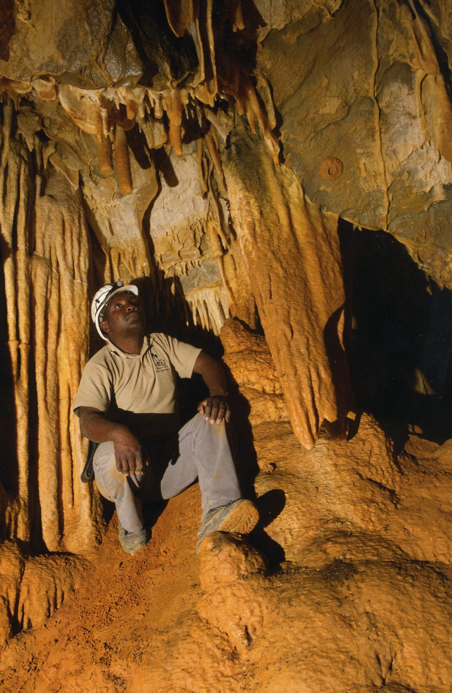
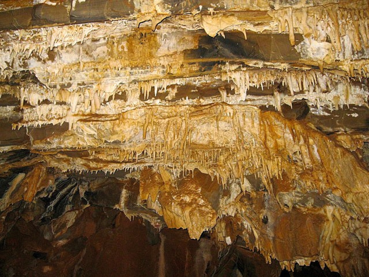
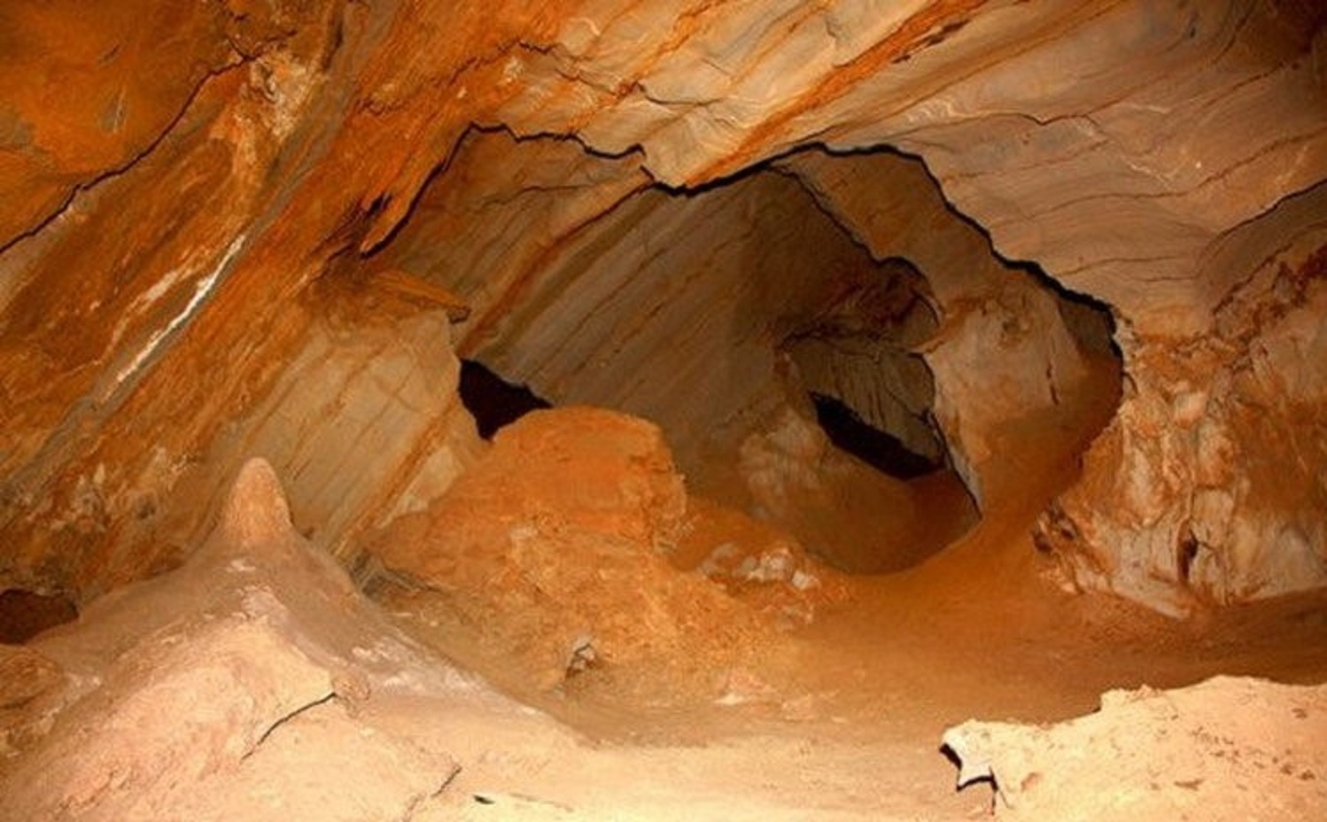
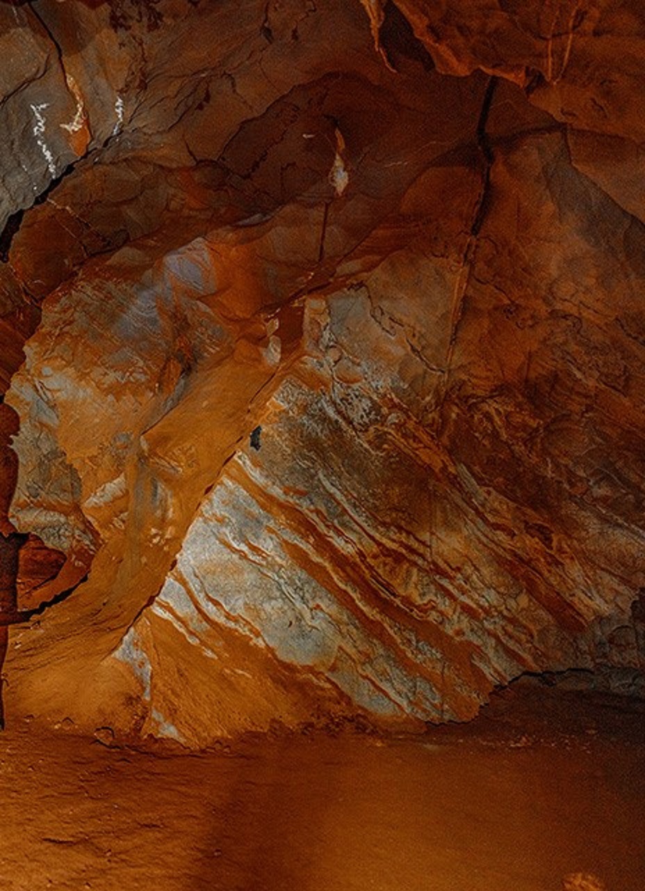
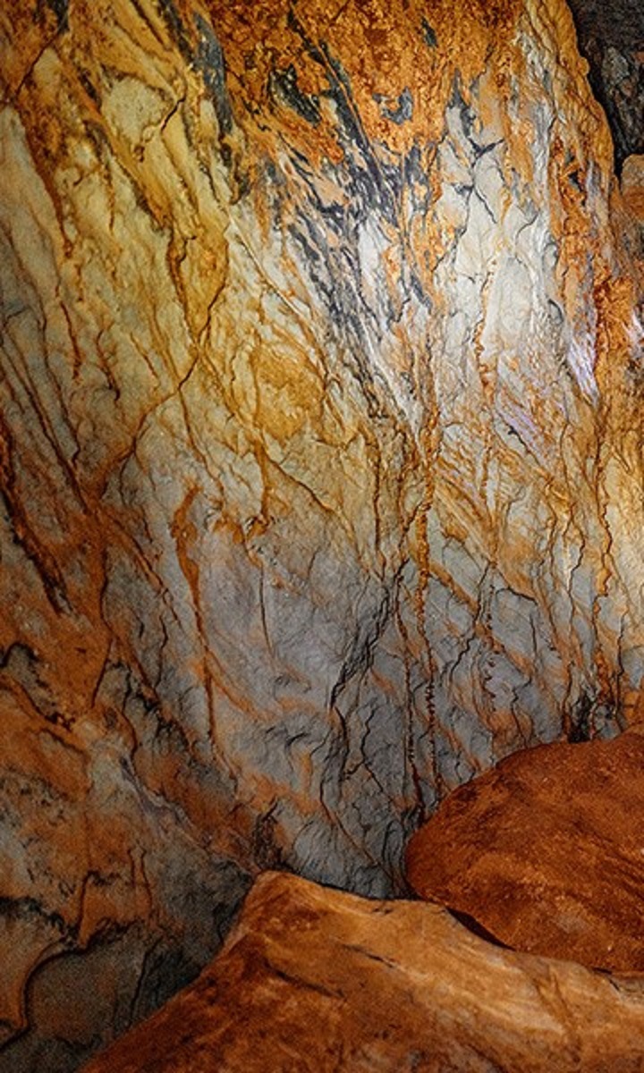
The Ghaub Cave is just about the only such feature open to the public in Namibia. Unfortunately, Tracy and I missed the opportunity to explore it, because we needed reservations and the guide was unable to break away from the Ghaub Guest Farm to show us. He was alone. Therefore, he provided me with the above photos by e-mail to show what we missed. I did take a photo of the Ghaub Guest Farm below:
Actually, the Otavi Mountainland became famous mainly from a mineralogical and mining point of view. The Tsumeb deposit, (under the town of Tsumeb), contains an extraordinary diversity of various ores of lead, copper and zinc. In addition, silver, arsenic, antimony, cadmium, cobalt, germanium, gallium, iron, mercury, molybdenum, nickel, tin and vanadium occur. It is situated in the northern part of the Otavi Mountainland in slightly folded, karstified dolomite rocks of Damaran age.
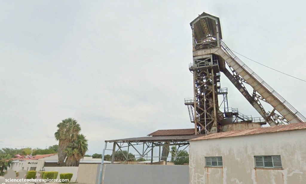
The ore-body forms a steep sub-vertical pipe, with a proven drilled depth of nearly 1,800m. From 1905 to 1990, a total of 24.6 million tonnes of ore were mined from which 1.7 million tonnes of copper, 2.8 million tonnes of lead and 0.9 million tonnes of zinc were produce. The mine was closed in 1996.
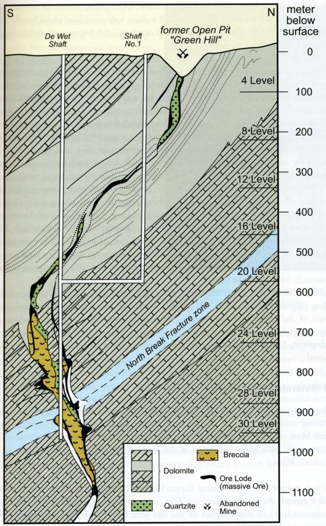
The ore occurrence of Tsumeb is classified as a “hydrothermal deposit” where the acidic magmatic water mixes with the surface sea water and adjusting the pH-levels. This will drop out or precipitate ore minerals, (considered secondary), in an oxidizing zone. In the oxidizing zones of Tsumeb, you’ll find, for example , the intensively blue and green tinged secondary copper minerals of Azurite, Malachite and Dioptase. The limestone acted as a reducing agent and a fault acted as a pipeline for the hydrothermal solutions and surface water, 650 million years ago during a karstification process of the Damara Mountain Building.
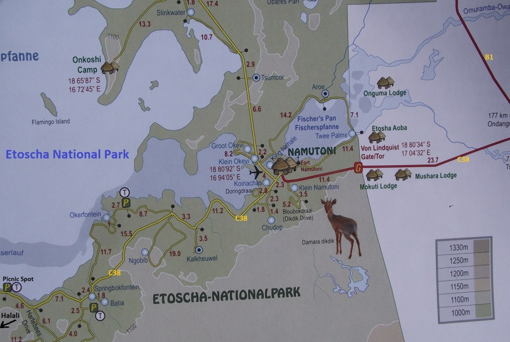
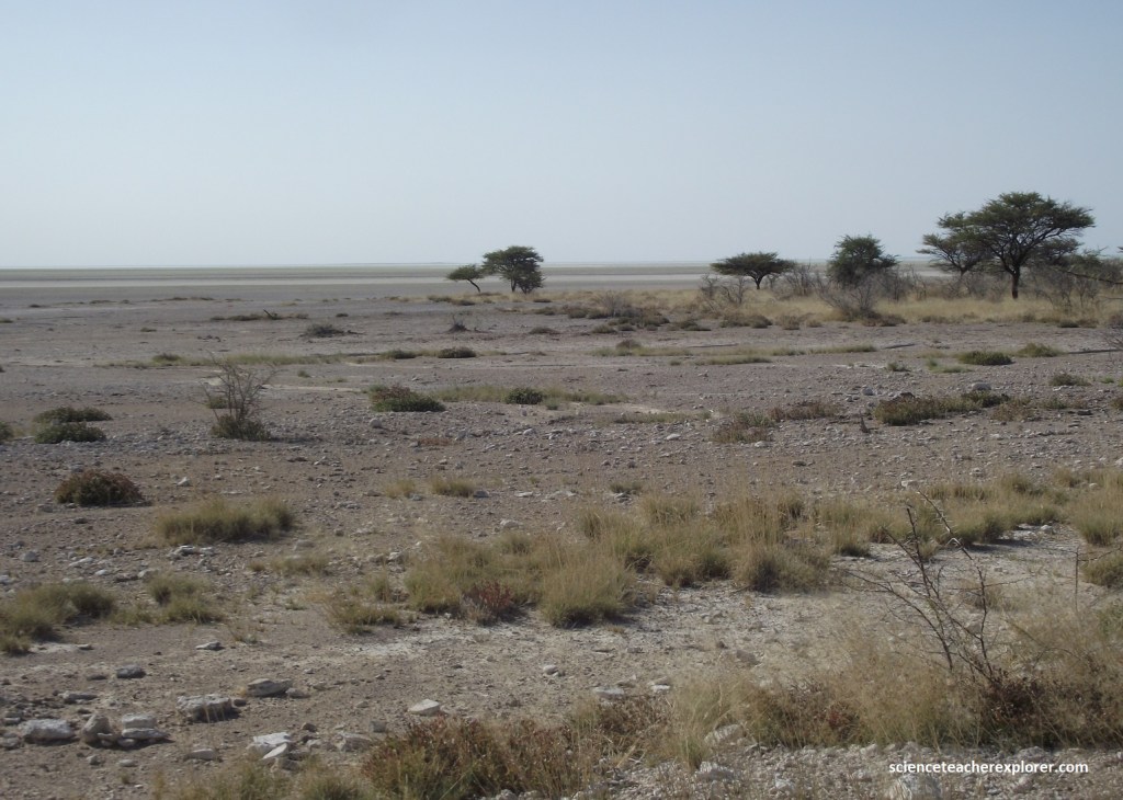
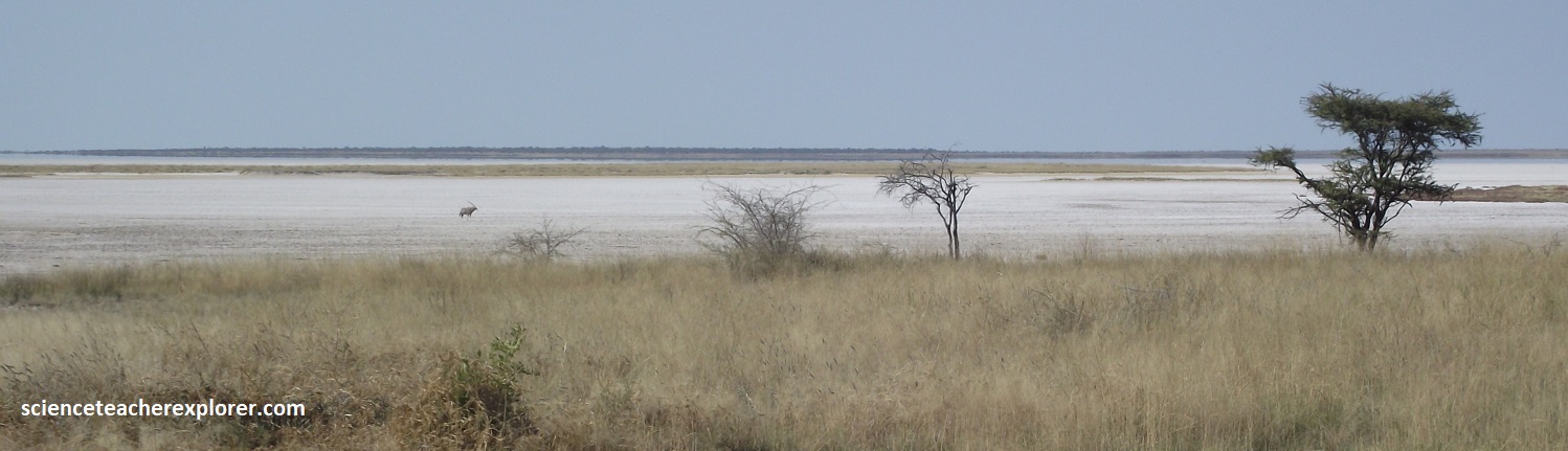
Later, Tracy and I drove north of Otjikoto Lake on highway B1 to road C38. There we turned left to enter and explore the Etoscha National Park. The pan, situated at 1,200m above sea level, constitutes the largest part of the Etoscha National Park and morphologically represents a part of the Ovambo Basin.
As mentioned above, the dolomite and limestone of the Otavi Mountainlands lies directly beneath the southern and western parts of Etoscha National Park. These Otavi-Group carbonates form the underlying rock of the area. Therefore, the Otavi Mountainland rocks from the Damara Orogeny were eroded-down 650 million years ago, to form the foundation upon which the park-basin sits on.
Additionally, the Gondwana ice age was a major geological force that shaped Etoscha National Park’s current landscape. About 300 million years ago, glaciers from the ice age carved features like riverbeds and the landforms that now contribute to Etoscha’s distinctive dry, flat pans. {Note the images below depicts the Gonwana ice ages 300 million years ago. The images were taken from, (“Namibia-Fascination of Geology, A Travel Handbook” Grunert 2013)}.
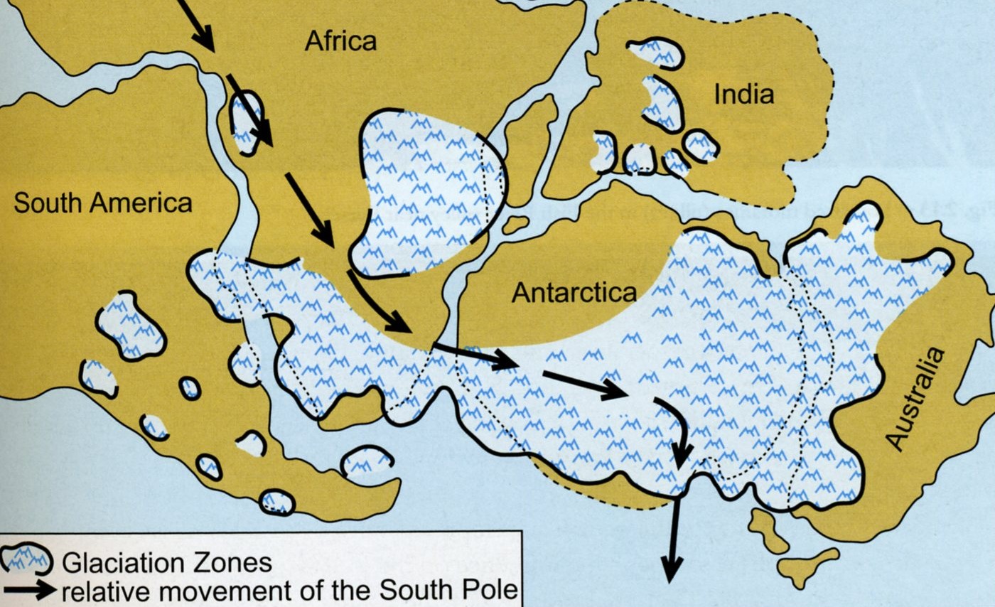
Imaged above, during the Gondwana ice age, which lasted about 20 million years, glaciers formed in the mountains of what is now Angola and flowed south into the area of present-day Etoscha National Park. The immense weight and movement of these glaciers carved the land, contributing to the erosion that would eventually lead to the formation of the Etoscha Pan.
Lastly, geological uplift caused the final phase of the formation of Etoscha National Park. Primarily due to tectonic activity and continental uplift, it diverted the Kunene River by changing its course away from the Ovambo Depression. This tectonic shift blocked the water supply to the vast inland lake that once existed, causing it to slowly dry up and form the Etoscha Pan, which has since been shaped by wind and erosion. {The images below depict the drying up of Etoscha Lake; The images were taken from, (“Namibia-Fascination of Geology, A Travel Handbook” Grunert 2013)}.
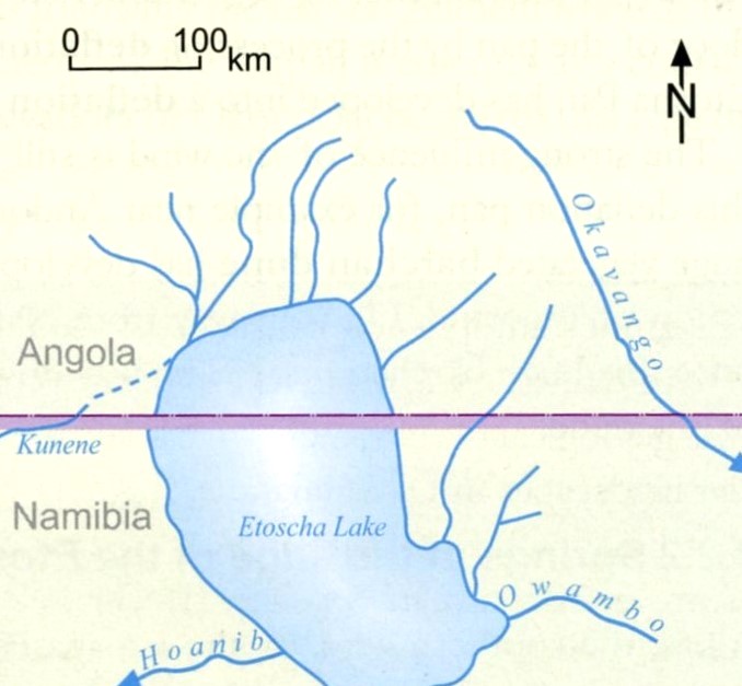
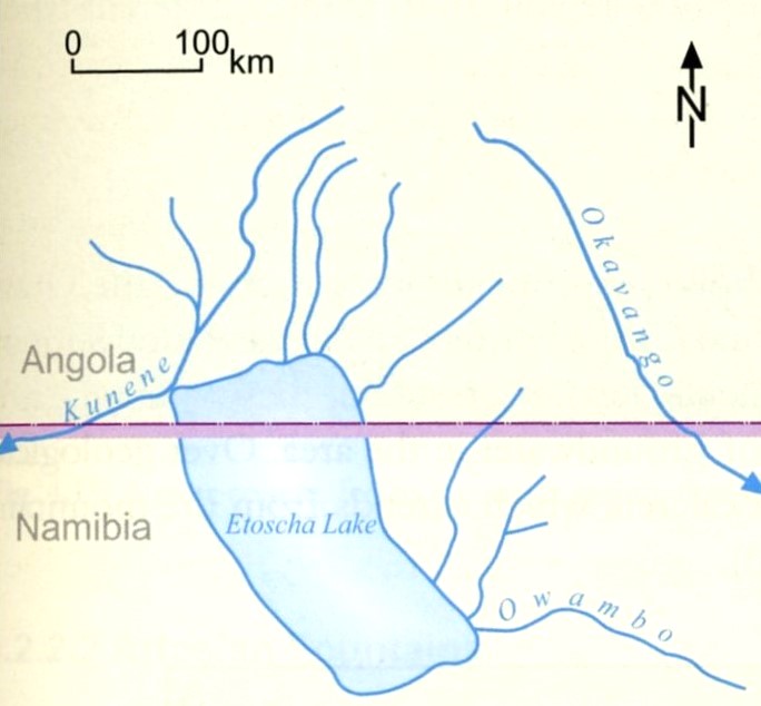
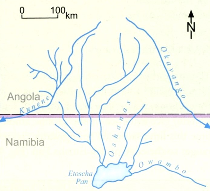
The geological uplift that changed the course of the Kunene, leading to the formation of the Etoscha Pan, started around 12 million years ago and continued to the present.
So to summarize, this continental uplift caused the major Kunene River to shift its path from flowing southeast into the ancient lake to flowing west into the Atlantic Ocean, cutting off the lake’s water supply and causing it to dry up and evaporate over time, leaving behind a saline pan. Wind erosion later deepened the depression and shaped the pan into its current form.
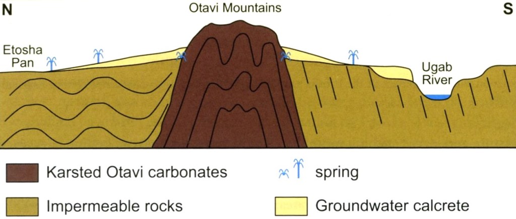
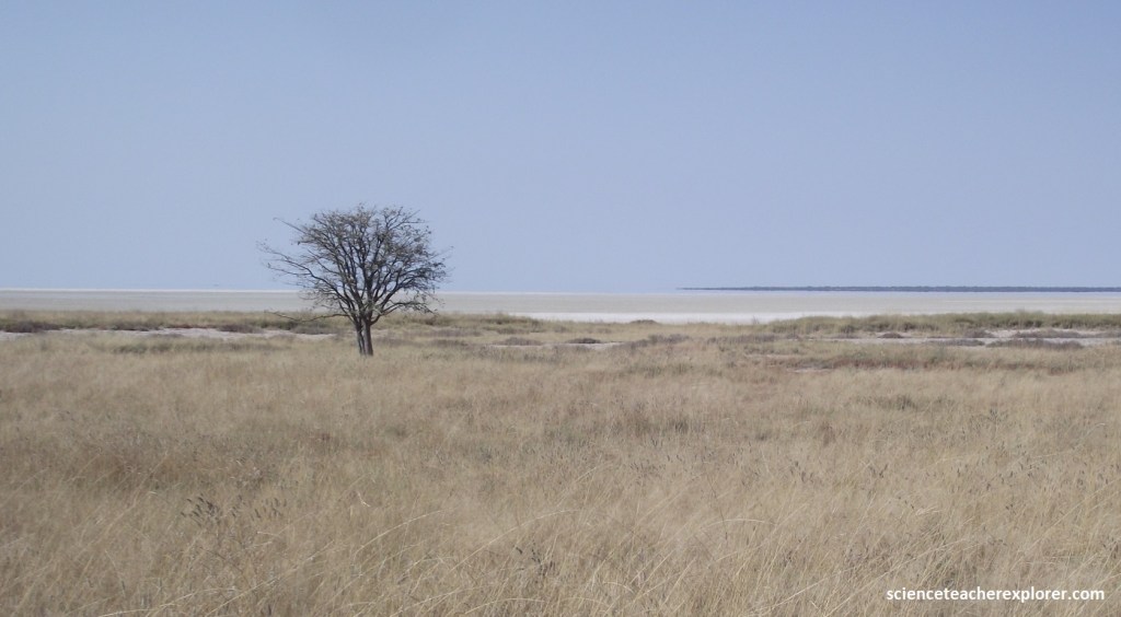
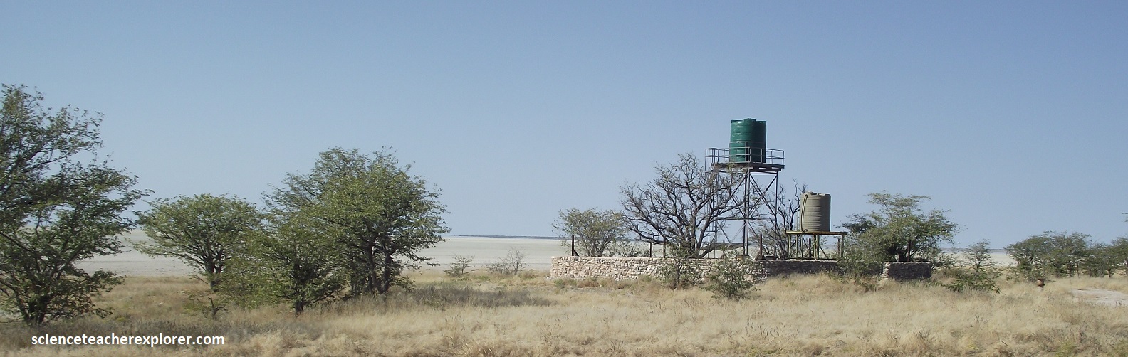
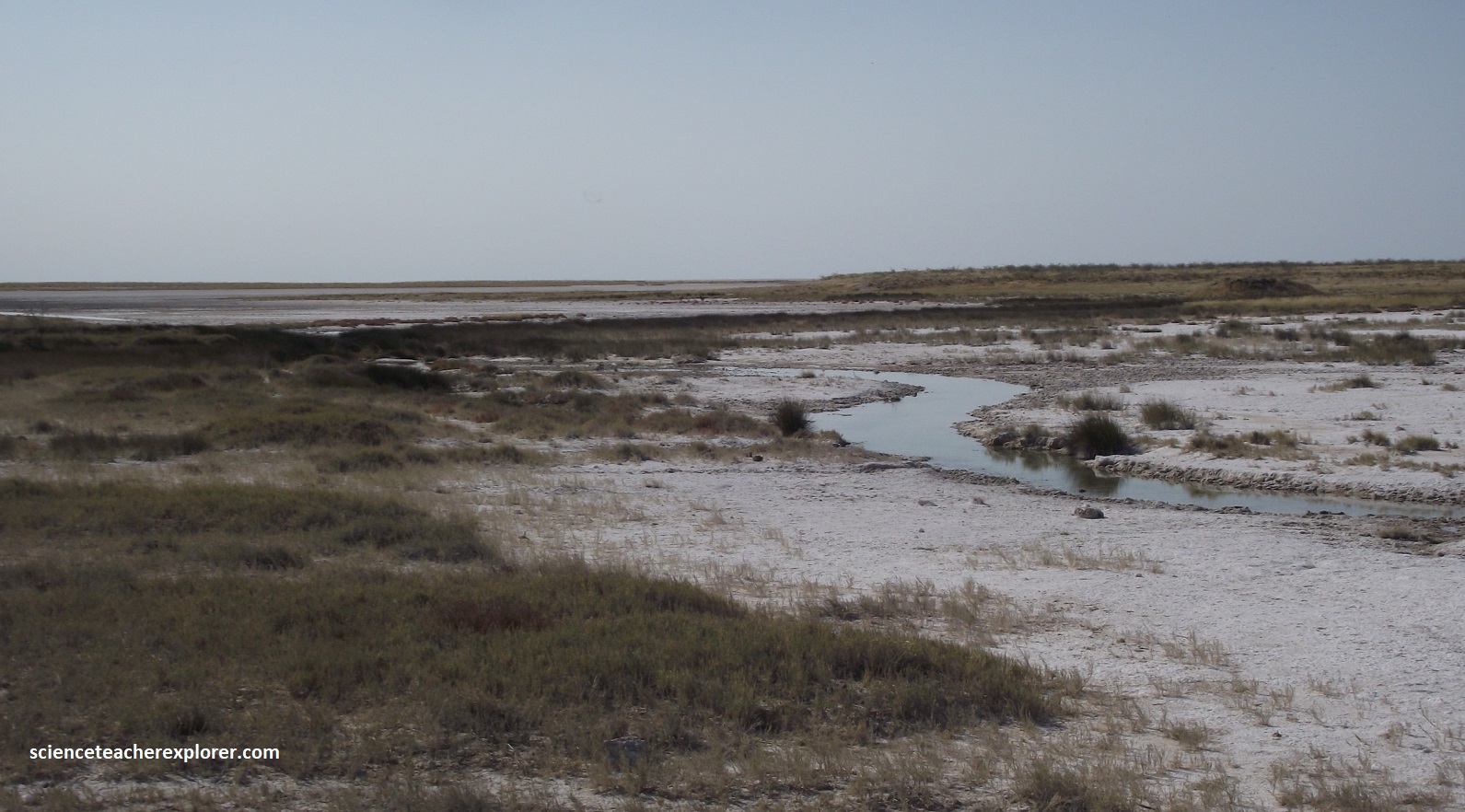
However, the Otavi mountainous region, composed of dolomitic rocks, acts as a source of groundwater that flows north into the central Etoscha Basin, providing the needed springs for wildlife to drink, (picture below).
Yet despite the harsh conditions there are an enormous number of animals living here—herds of wildebeest, zebra, springbok and giraffe, stalked by lions and hyenas. Tens of thousands move into the area each year in what is one of Africa’s greatest migrations. They come from their dry season refuge on the Adonis Plains to the northeast, after rains that start in December reawaken the land with sudden growth of lush grass. Below are pictures of the migrating giraffes within the Etoscha National Park 2025.
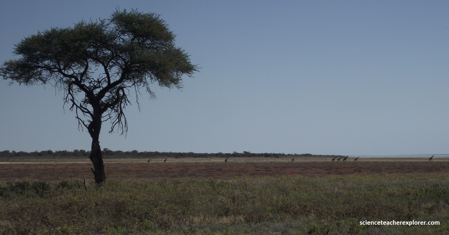
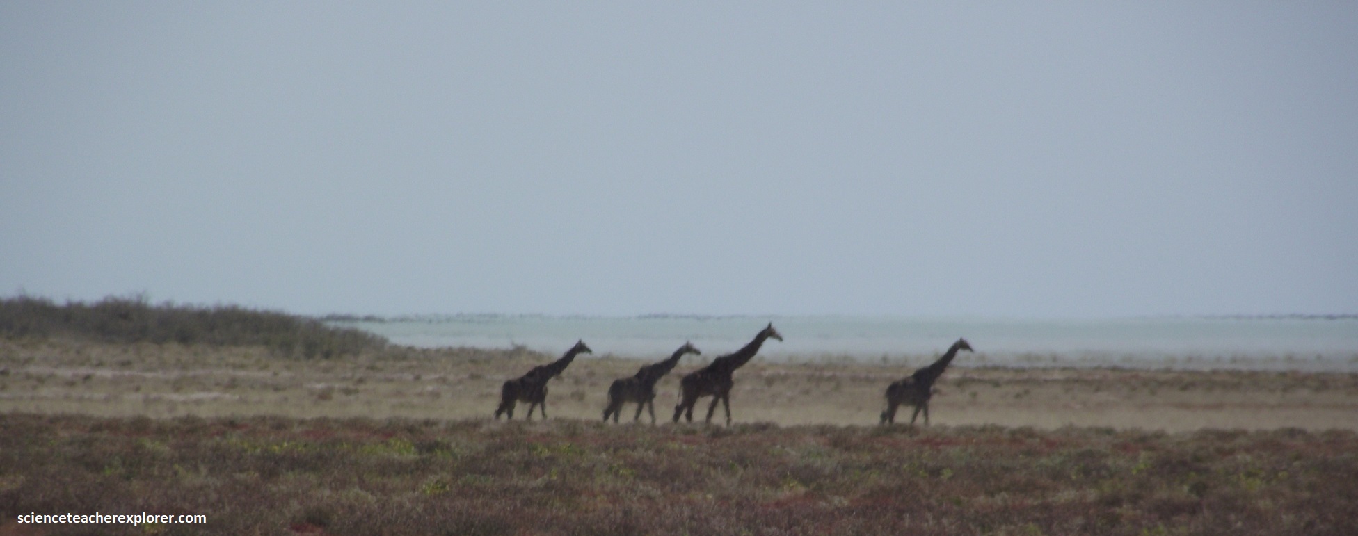
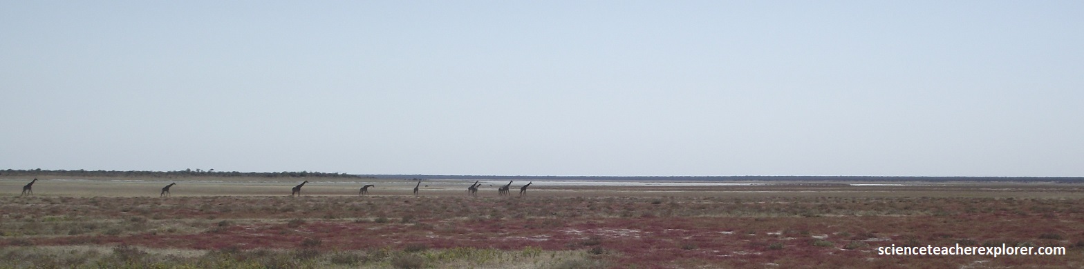
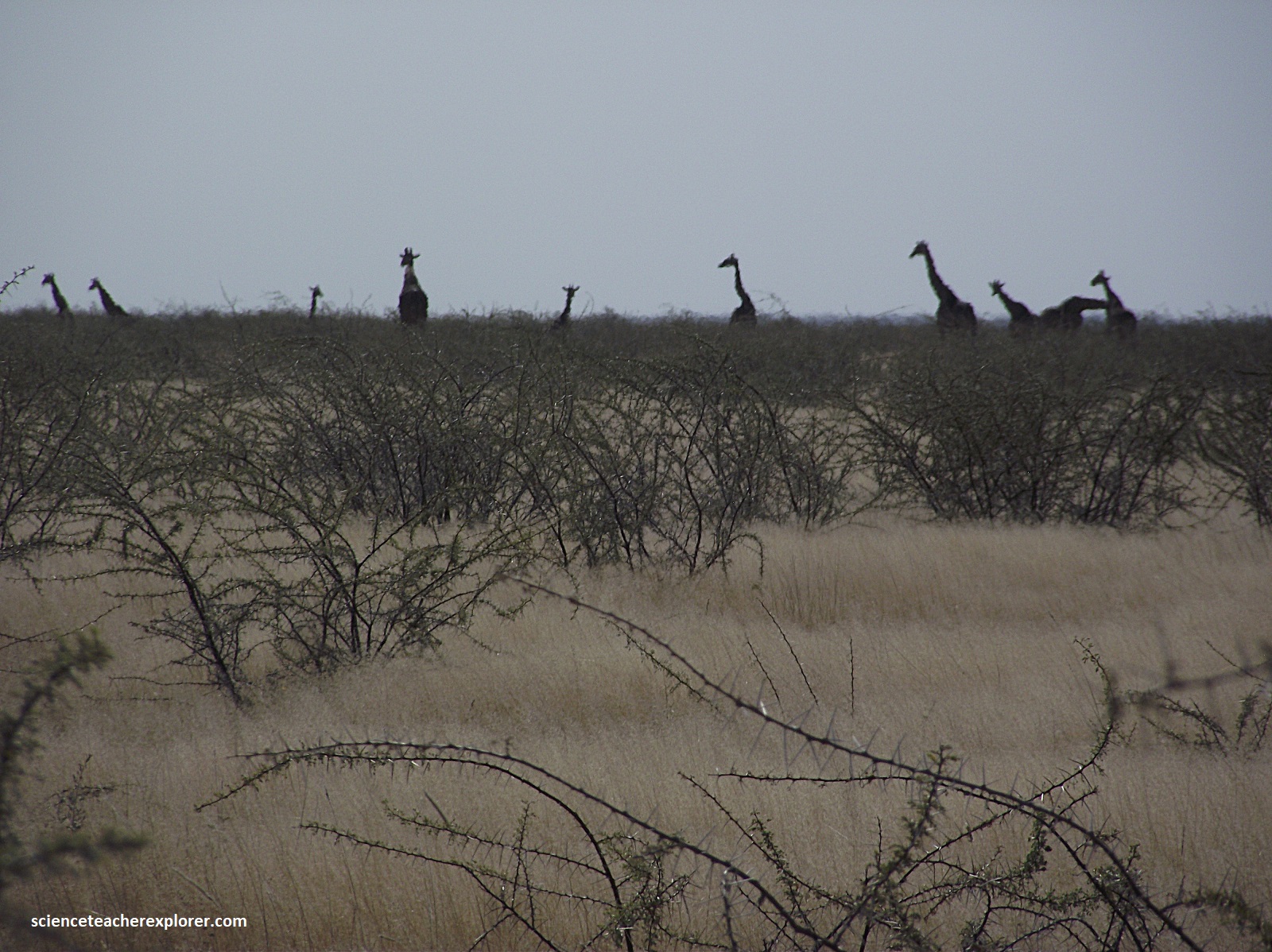
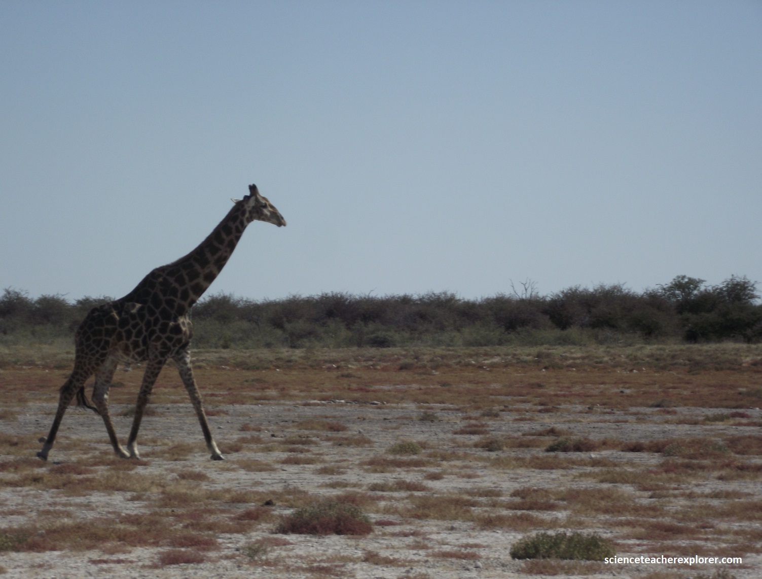
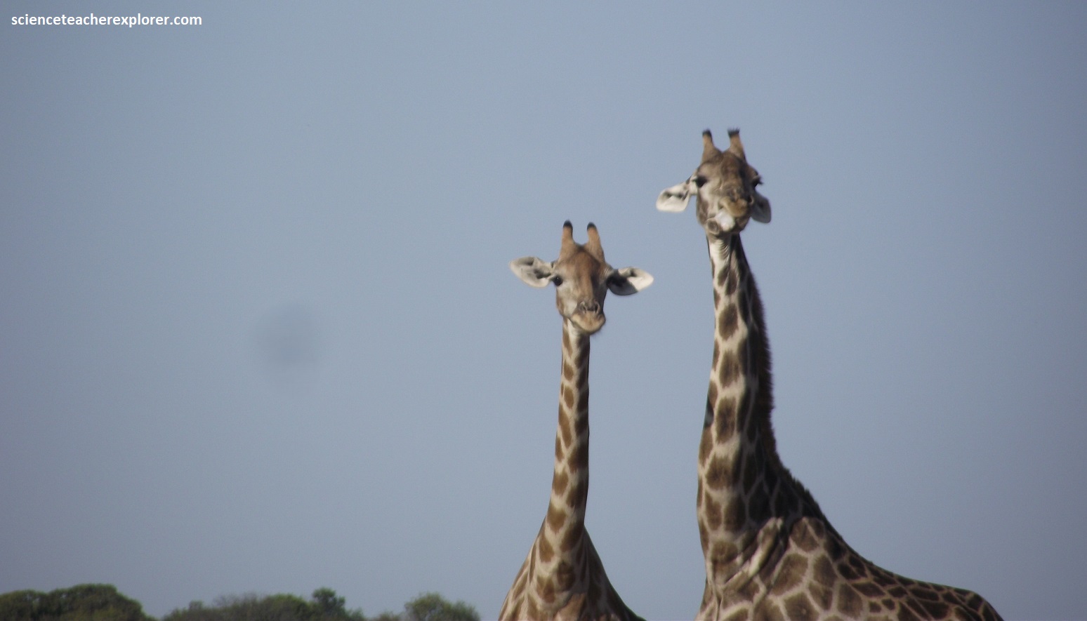
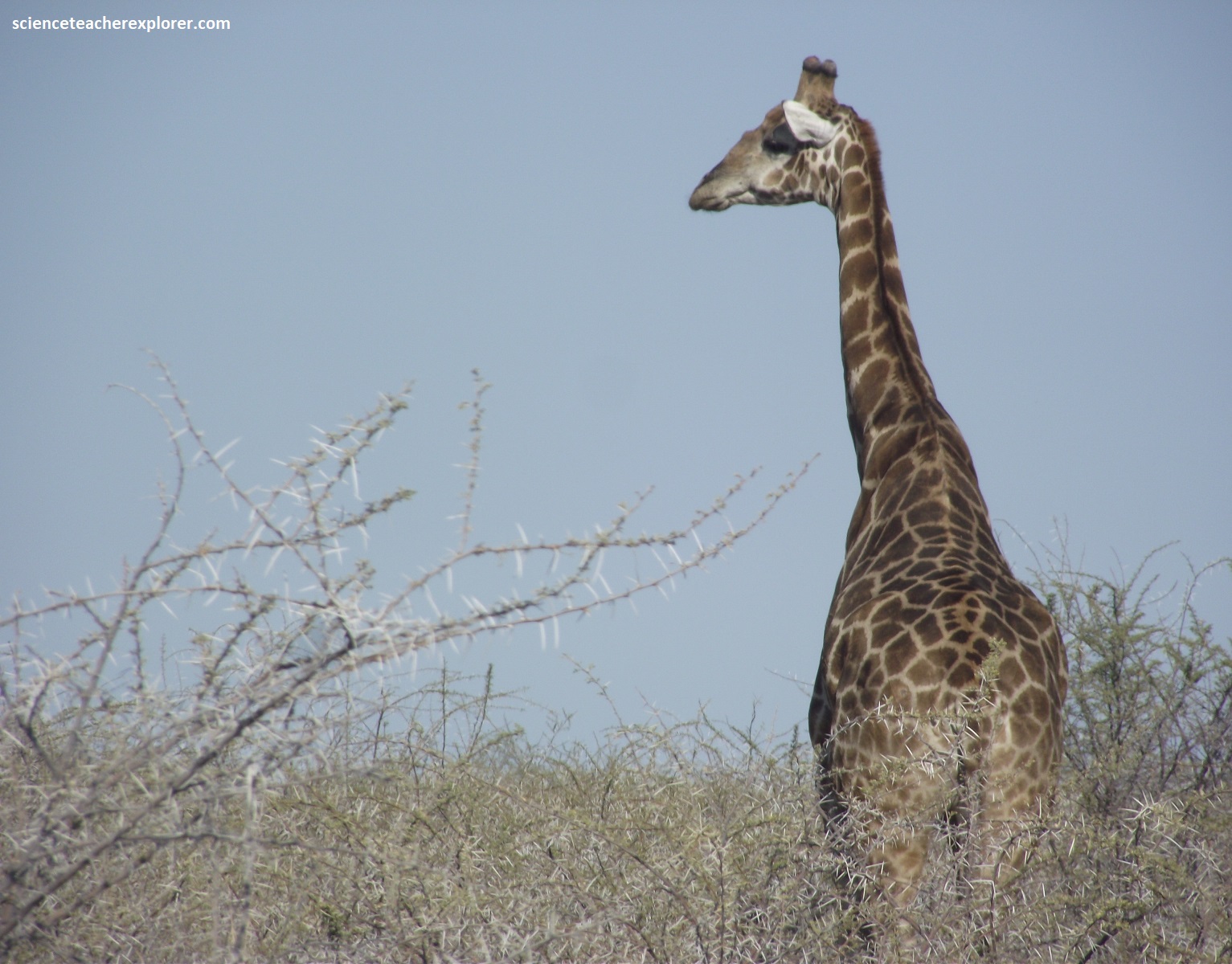
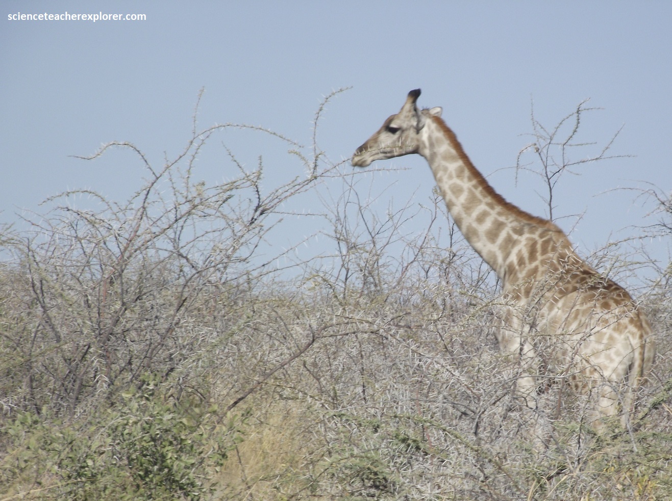
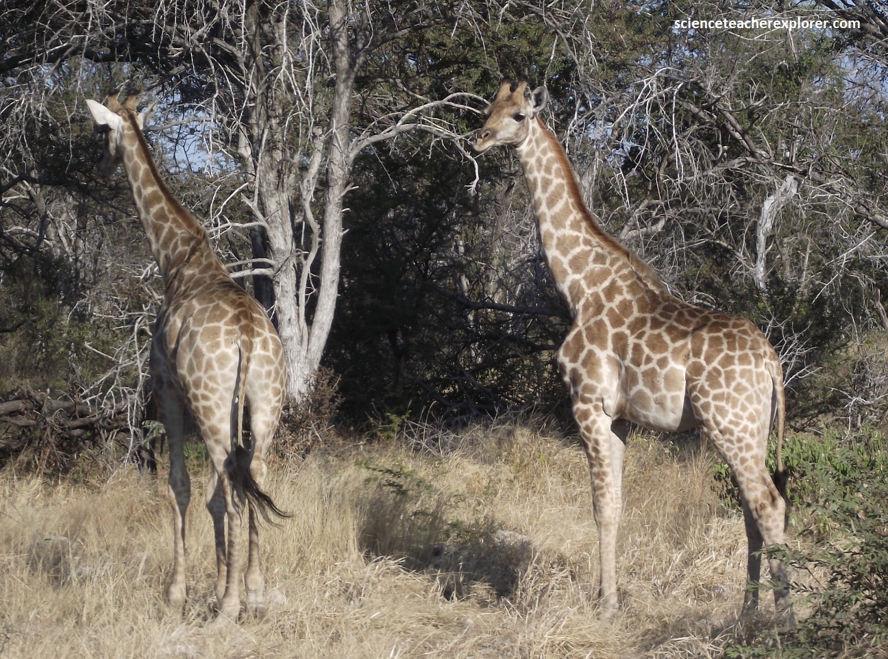
Pictured above, the Angolan giraffe (Giraffa giraffa angolensis) is a subspecies of the Southern Giraffe that is found in northern Namibia. This subspecies has large brown blotches with edges that are either somewhat notched or have angular extensions. The spotting pattern extends throughout the legs but not the upper part of the face. The neck and rump patches tend to be fairly small. The subspecies also has a white ear patch. The male giraffe moves longer than the female giraffe and also it has longer average daily movement (5.64km compared to 1.87km in 180 days during the dry season).
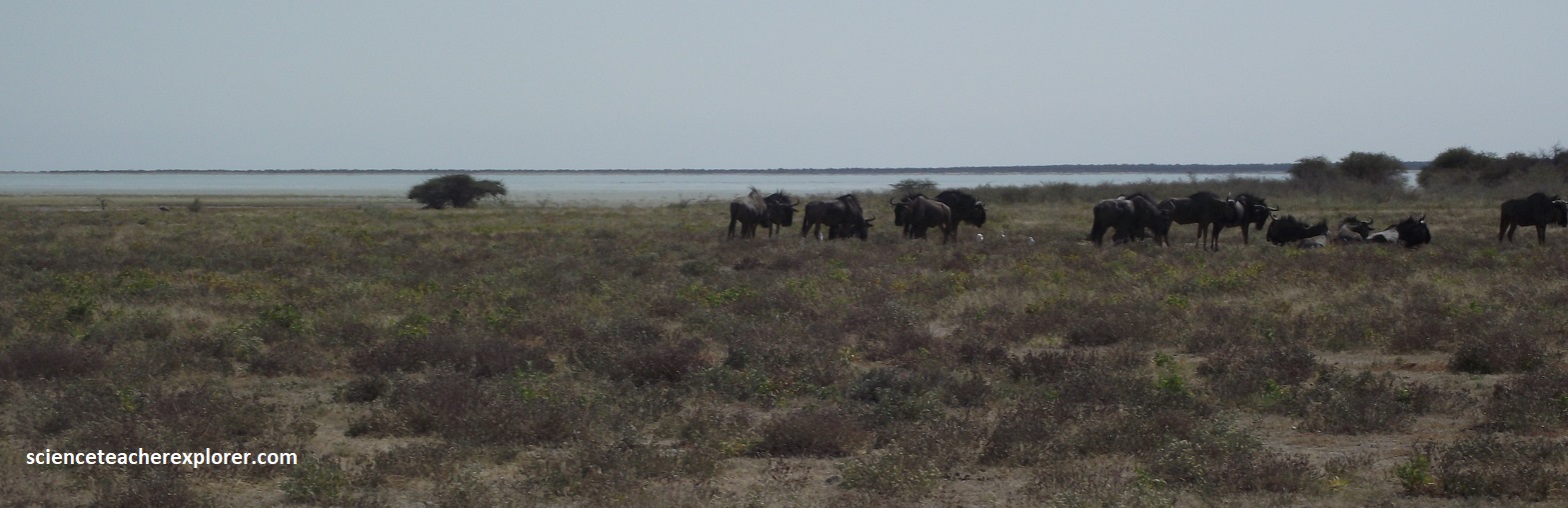
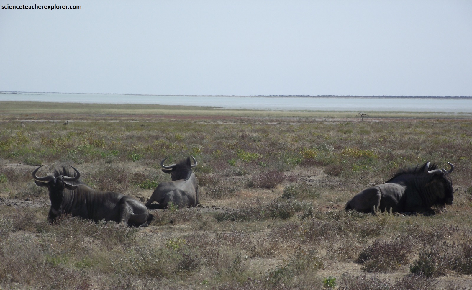
Pictured above, the Blue wildebeest (Connochaetes taurinus) migrate in large herds at Etoscha National Park, Namibia from Ardea. They are characterized by a long black mane and a beard of hair hanging from the throat and neck. Both sexes grow short curved horns.
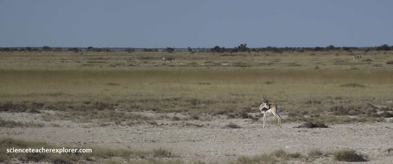
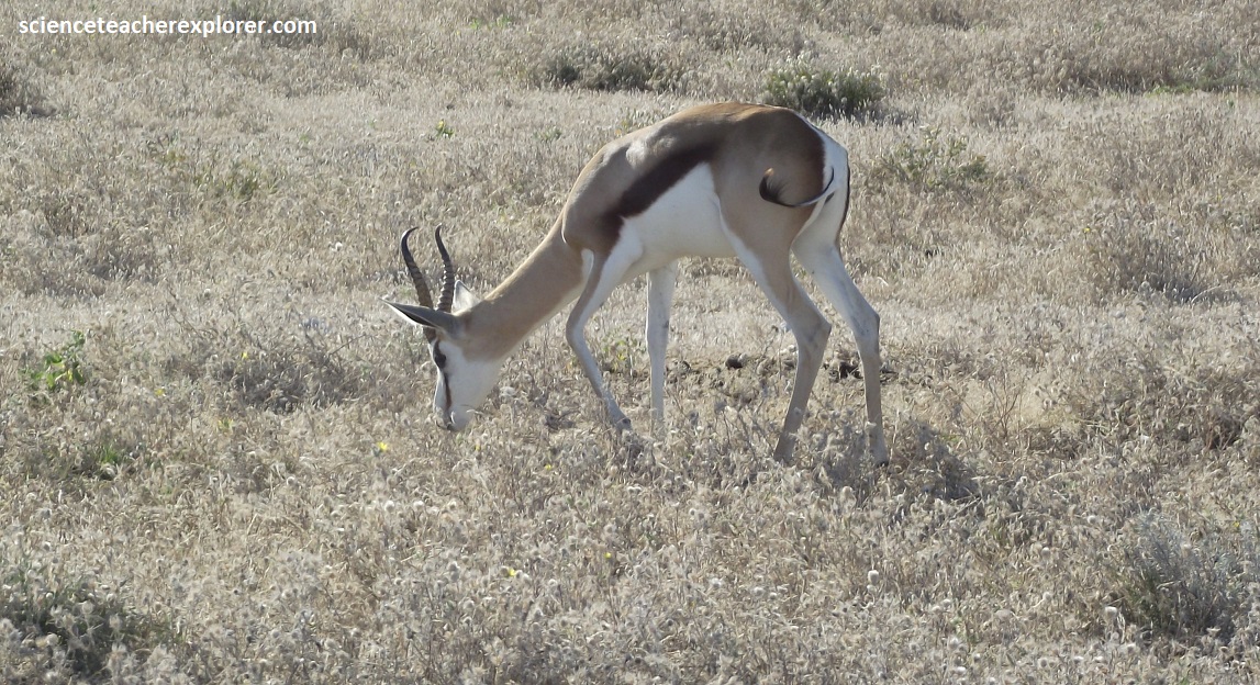
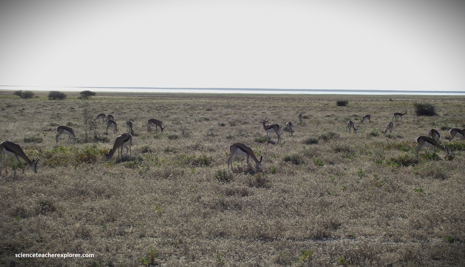
Pictured above, the Springbok (Antidorcas marsupialis) are known for their speed (88 km/hr.) and “pronking” behavior, (high leaps of 2m when excited or alarmed), and can be seen grazing on the plains, especially near waterholes during the dry season. After rains, larger herds gather and migrate to the green pastures. I believe they are among the most common antelope in Etoscha.
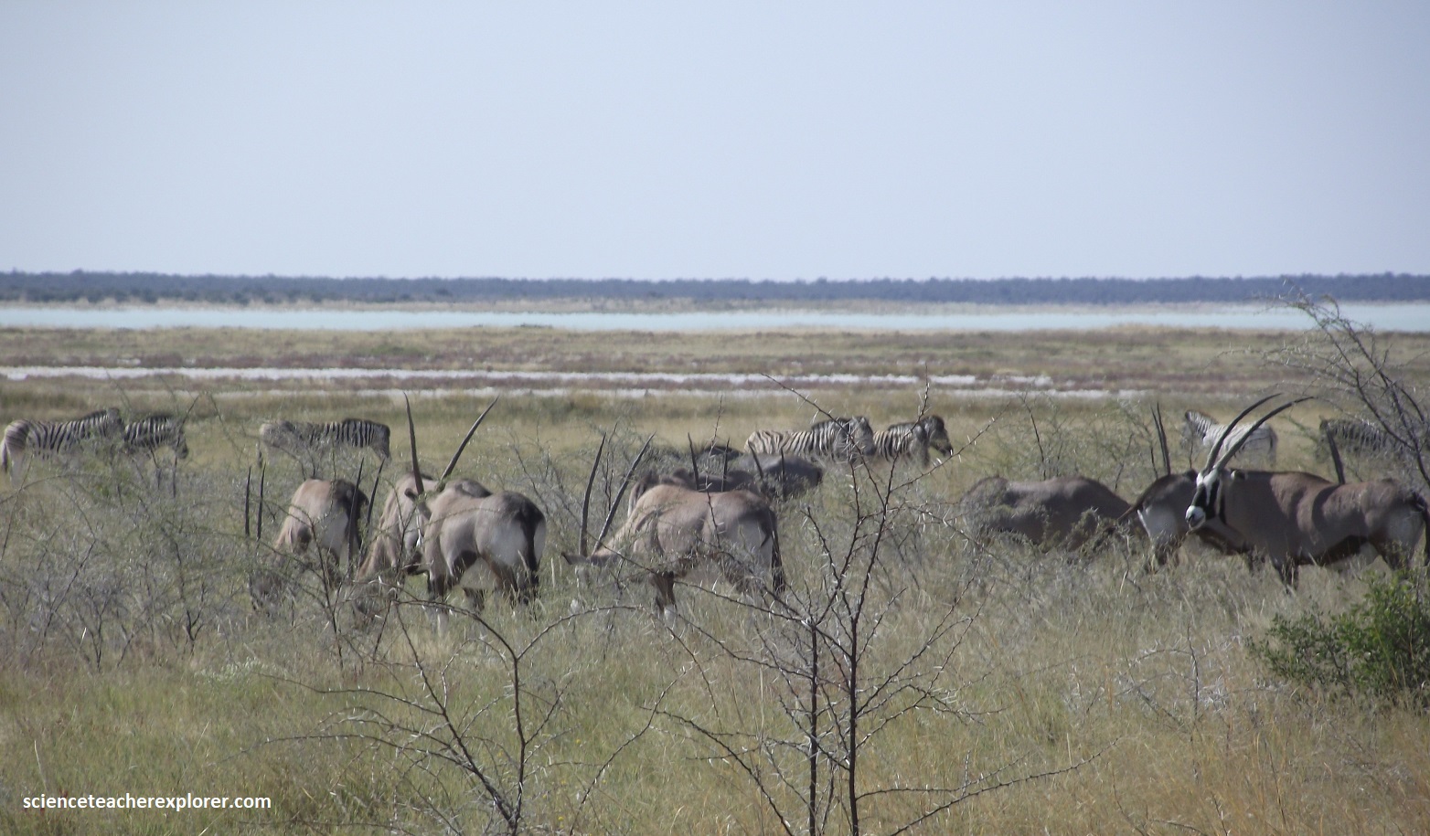
Pictured above, are a mix of Plains zebras (Steppenzebra) and Gembok (Oryx gazella). The Gembok is a large, powerful antelope with striking black and white markings and long, spear-like horns, known for its ability to thrive in the arid, desert-like conditions of Southern Africa, making Etoscha an ideal habitat for it.
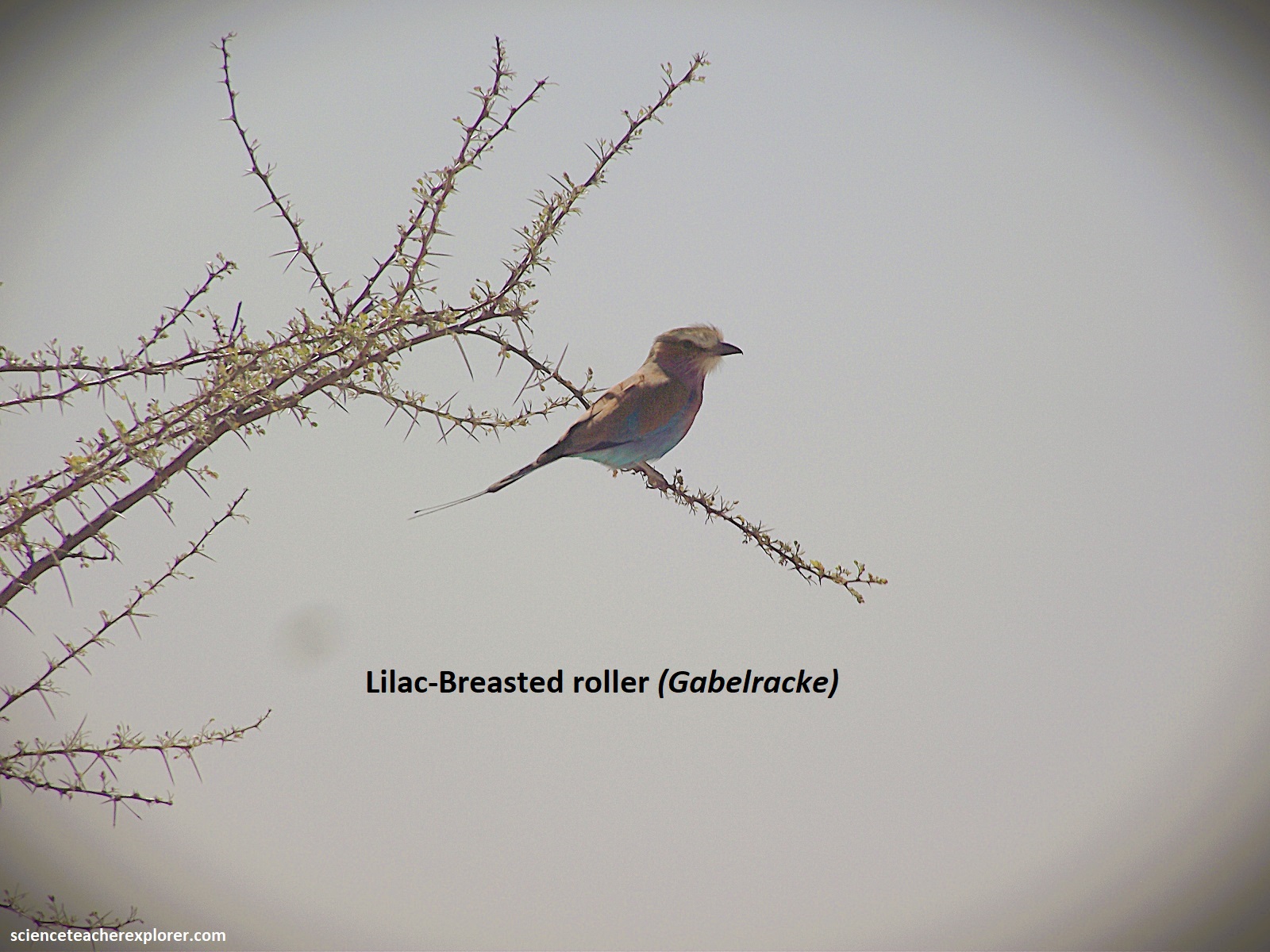
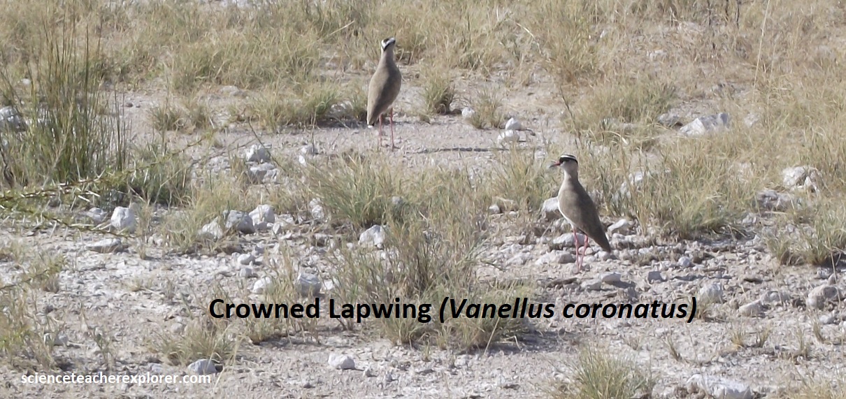
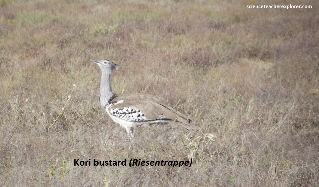
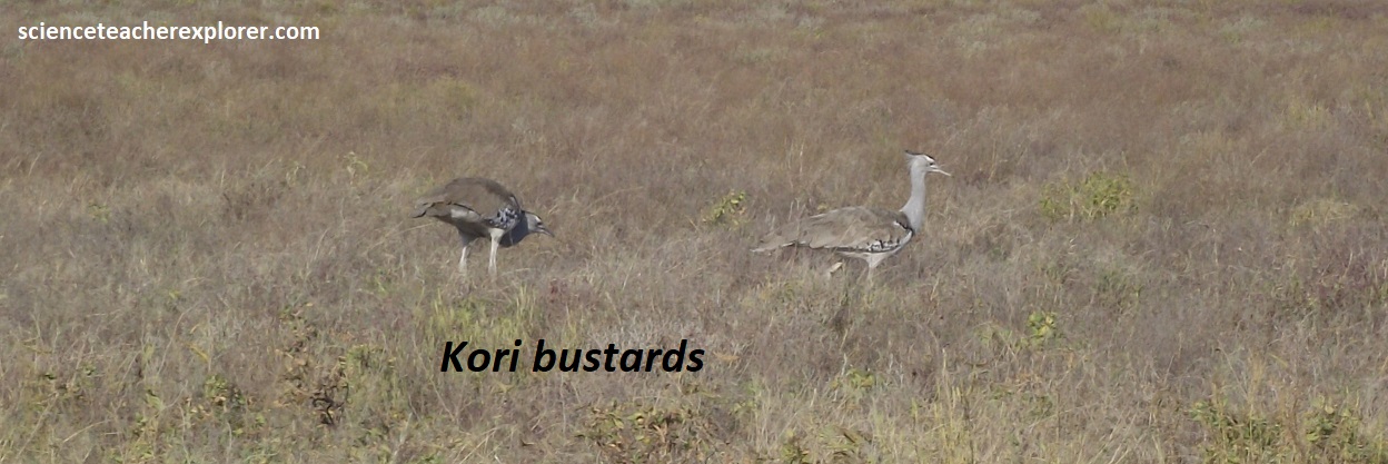
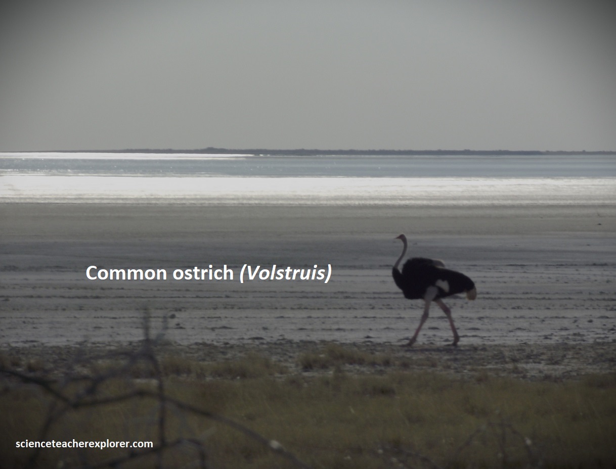
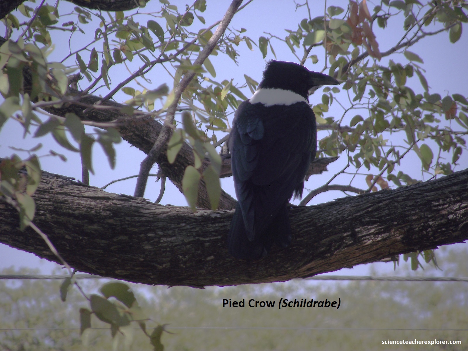
Pictured above, Etoscha is home to 340 bird species, about a third of which are migratory. The avian residents of the park make up an eclectic mix that ranges from ostriches to the colorful lilac-breasted roller and Kori bustard.
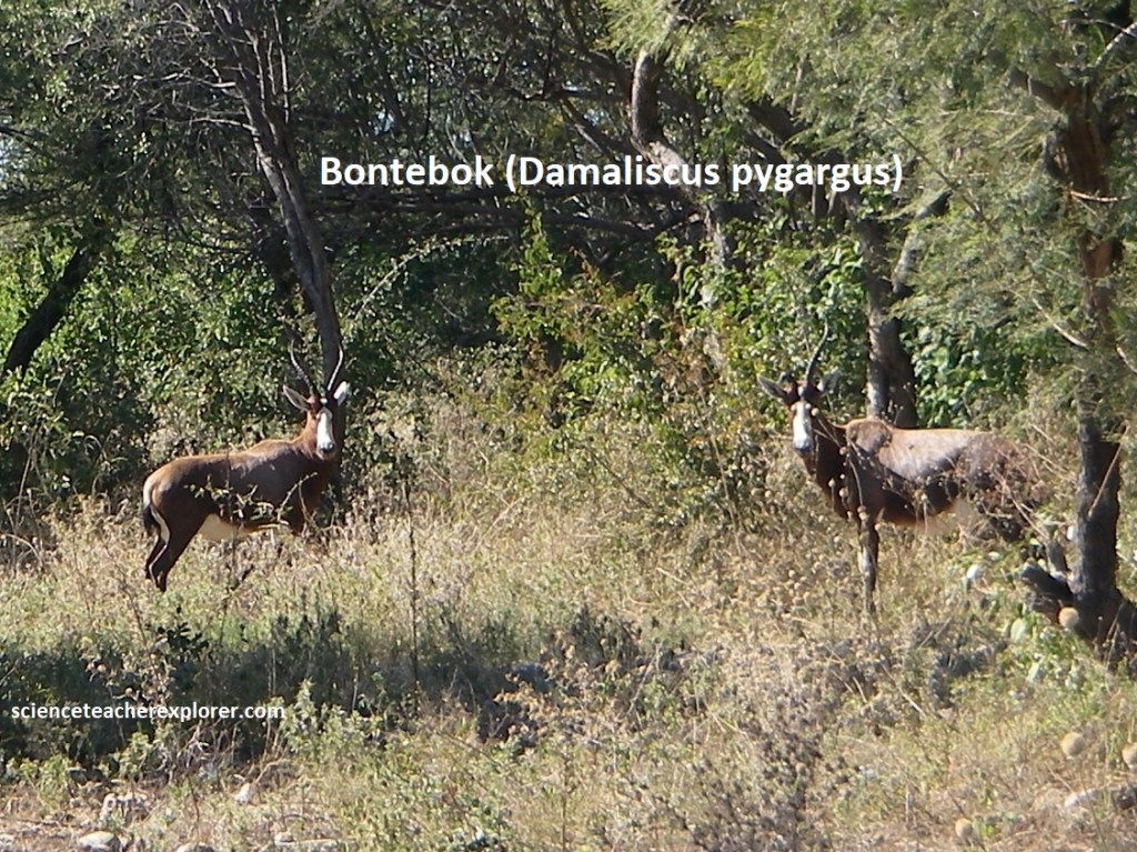
On our way back from Etoscha National Park, we saw these two Bonteboks in the bush near Otavi. Interesting story about these antelopes. The Bontebok were once extensively killed as pests, and by the early 20th century were reduced to a wild population of just 17 individuals. The species was saved from certain extinction when a Dutch farmer named Alexander van der Bijl corralled the remaining individuals into a fence, which they were unable to jump out of. In 1931, this herd of 17 was transferred to the Bontebok National Park, South Africa, which was established for the explicit purpose of conservation of the species. By the time the park was relocated to better suit the needs of the bontebok in 1961, the herd had grown to 61 members. Today, their population is estimated to range from 2,500 to 3,000, all descendants of the original herd of 17 members. Here, we found two in the wilds of Namibia.
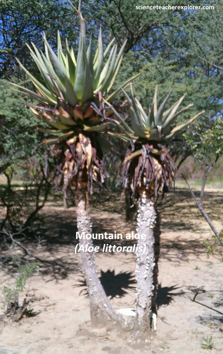
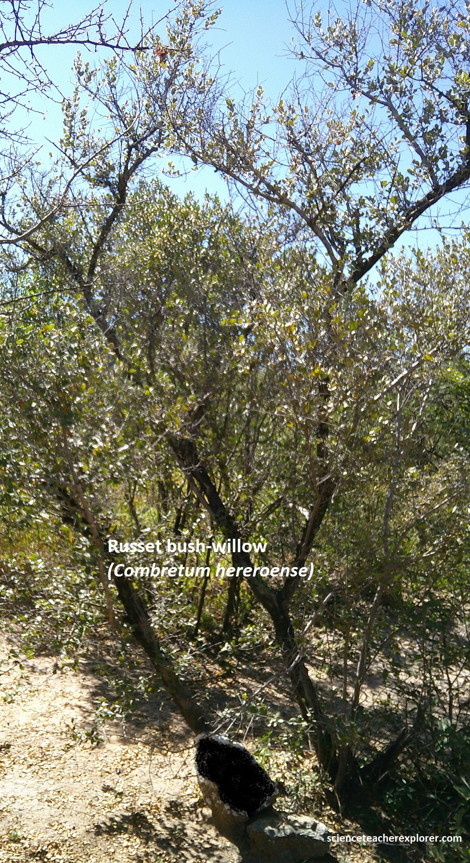
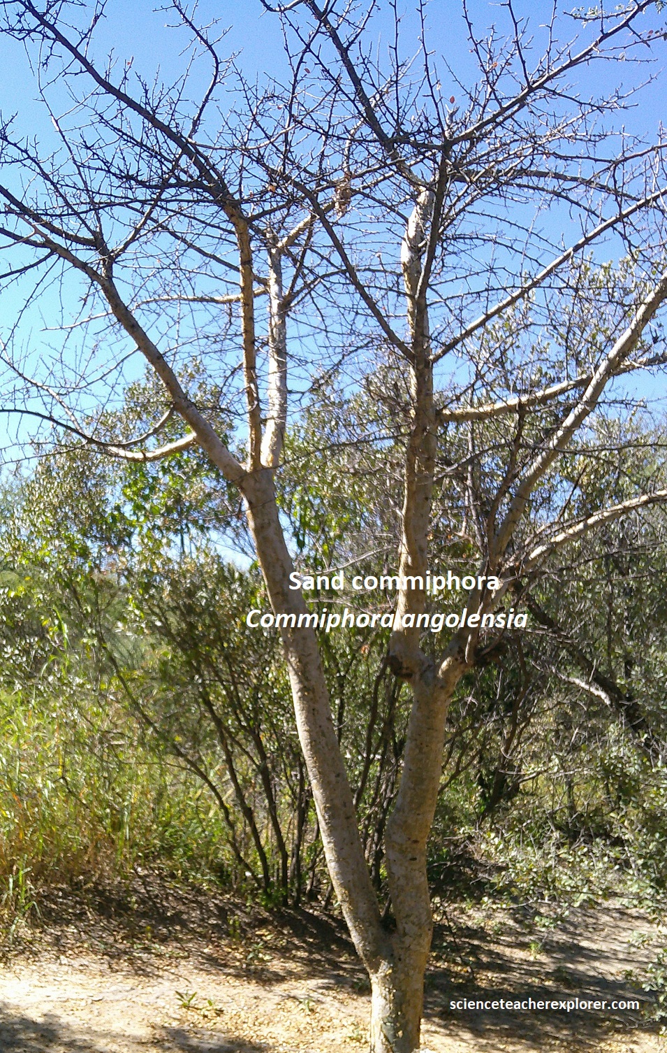
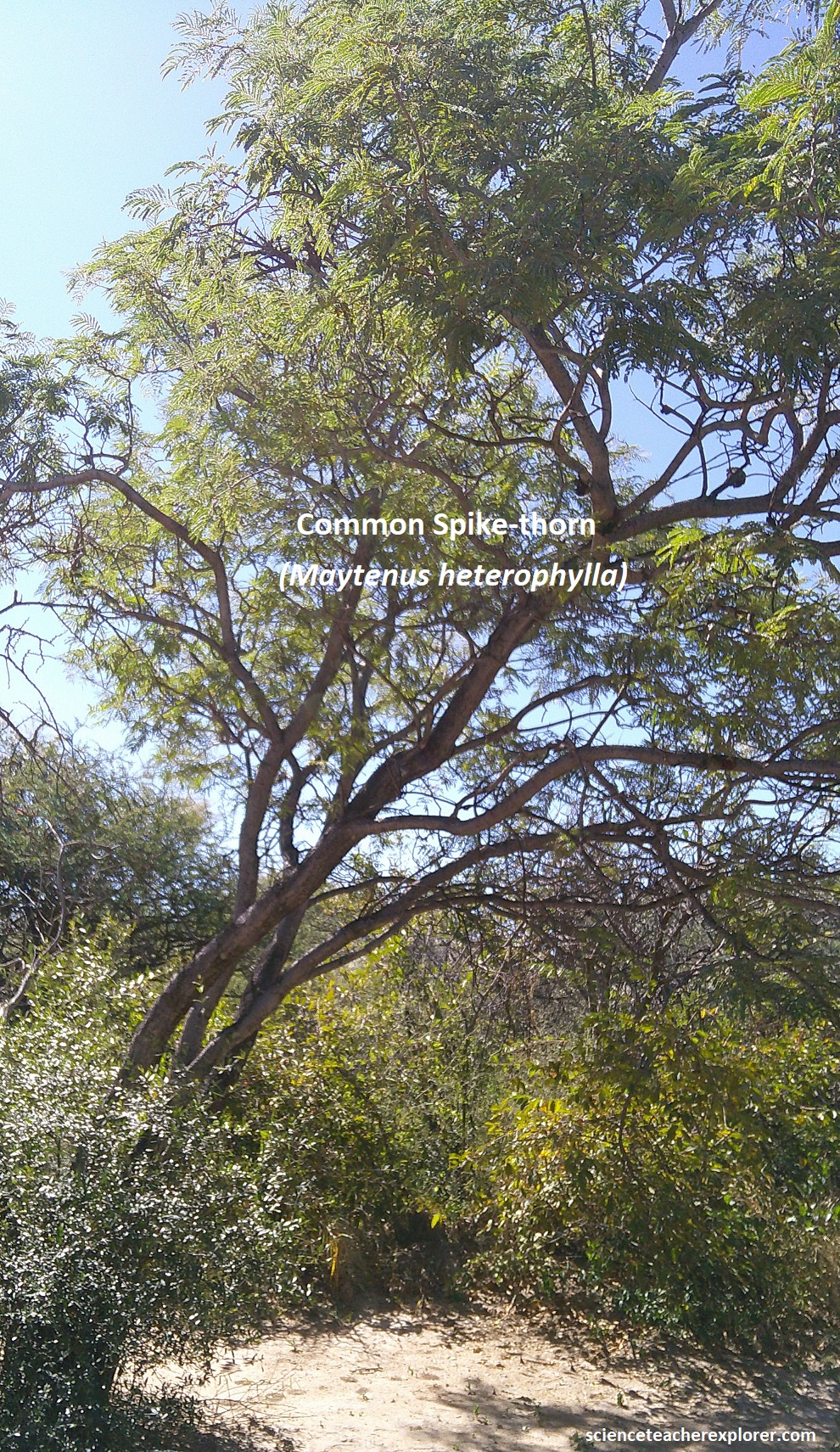
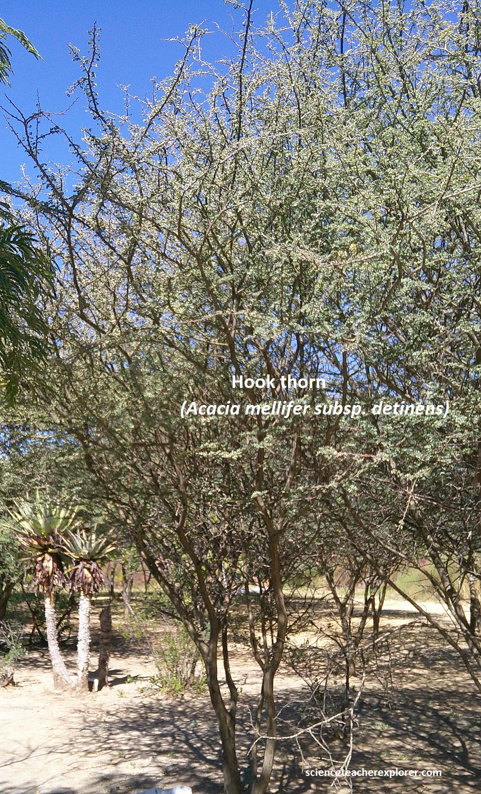
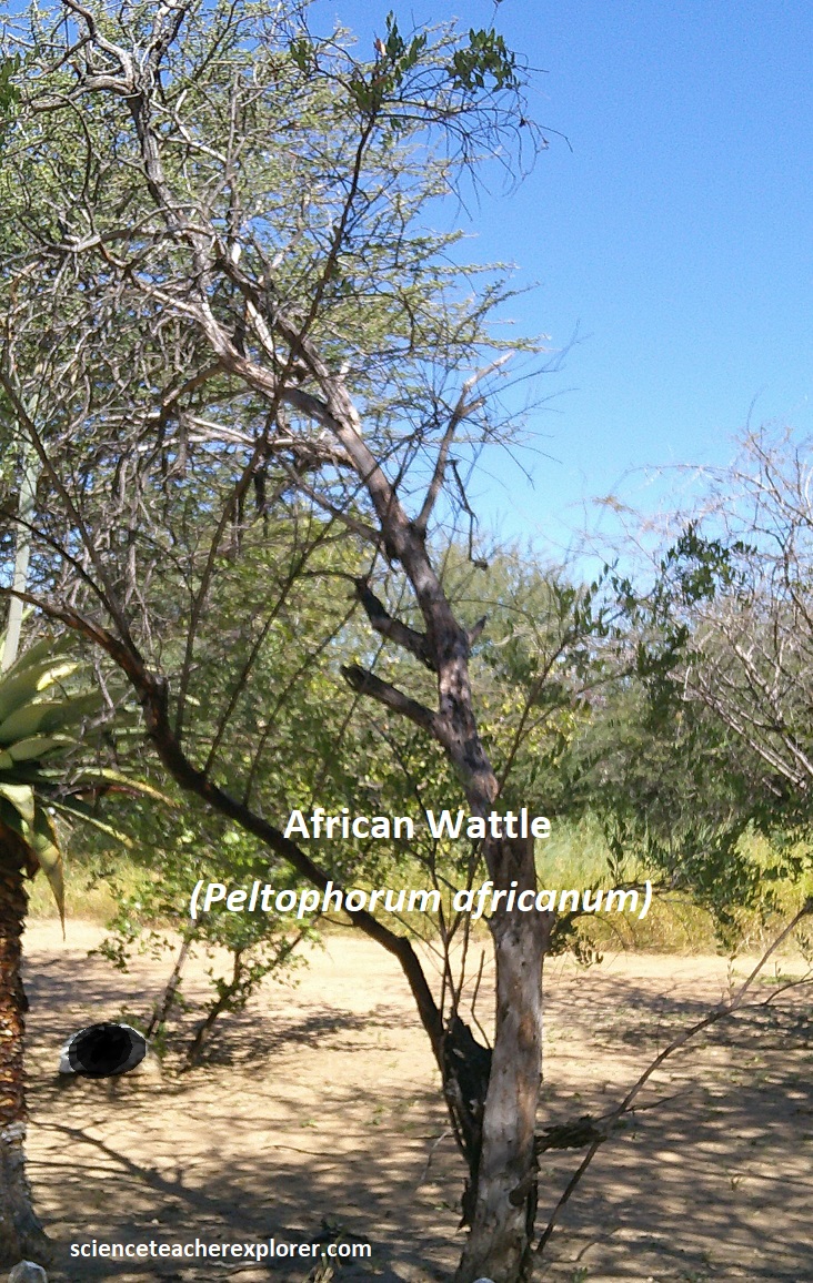
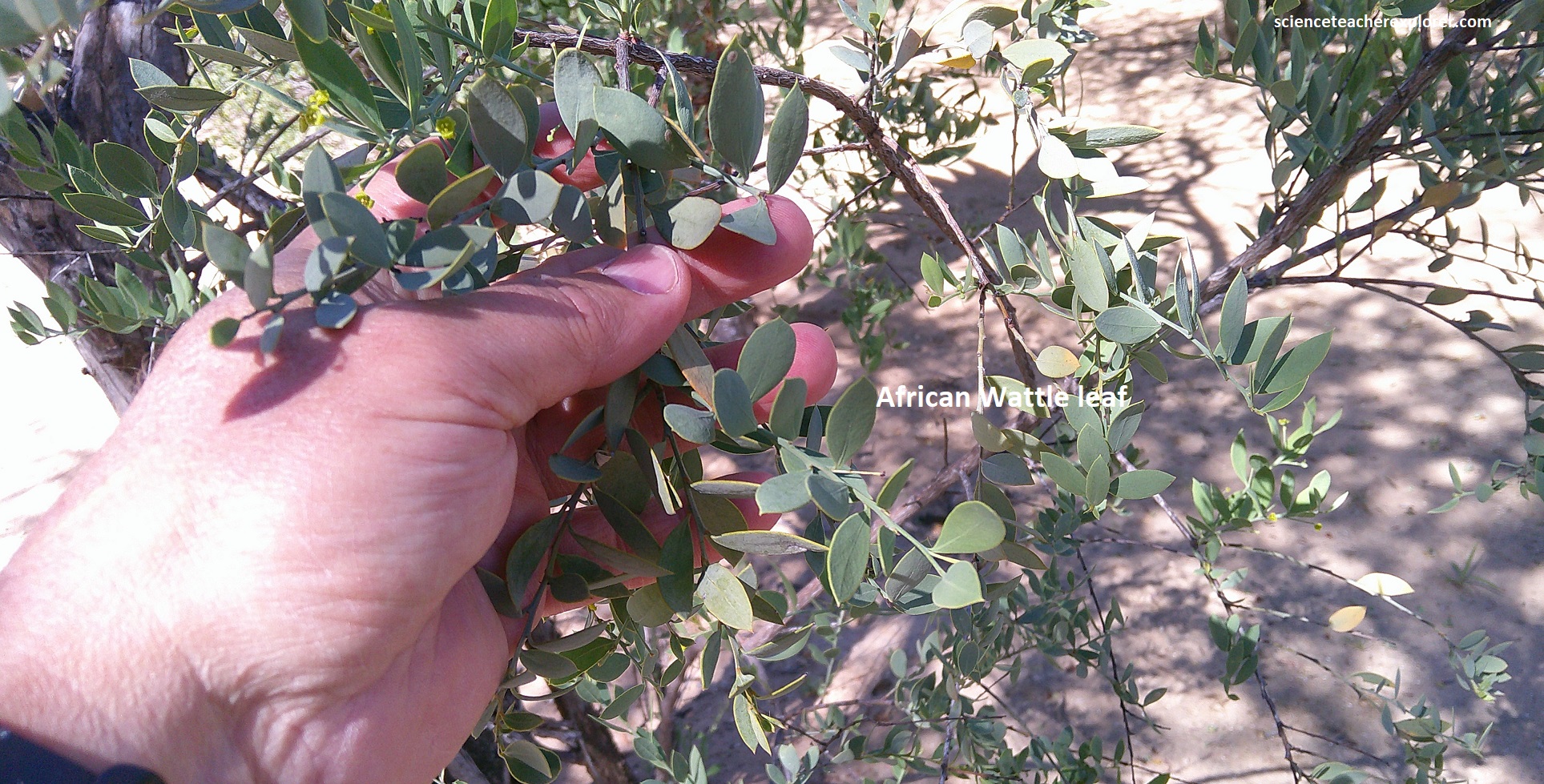
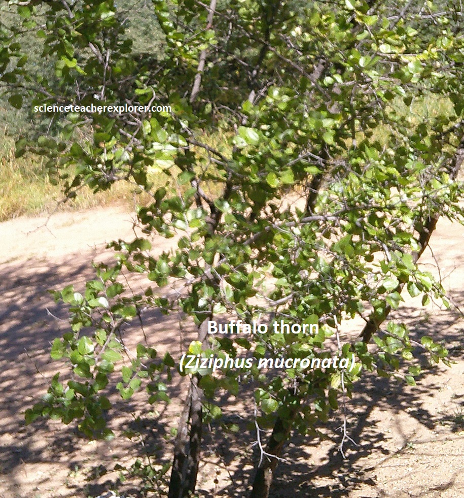
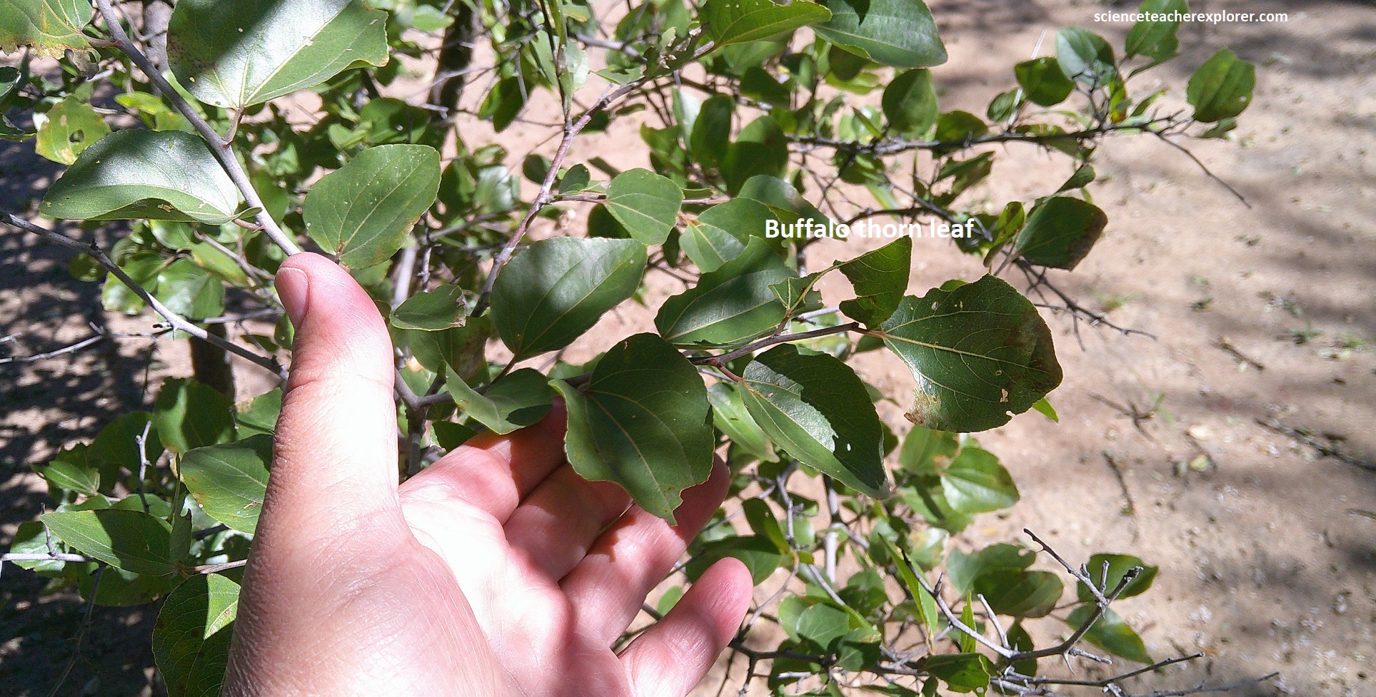
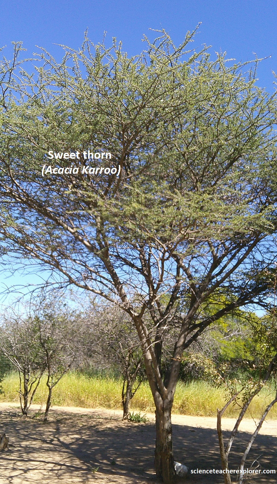
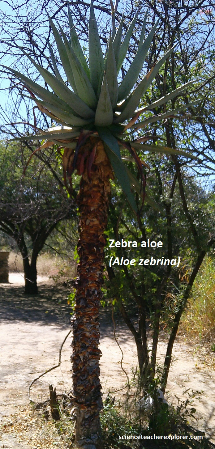
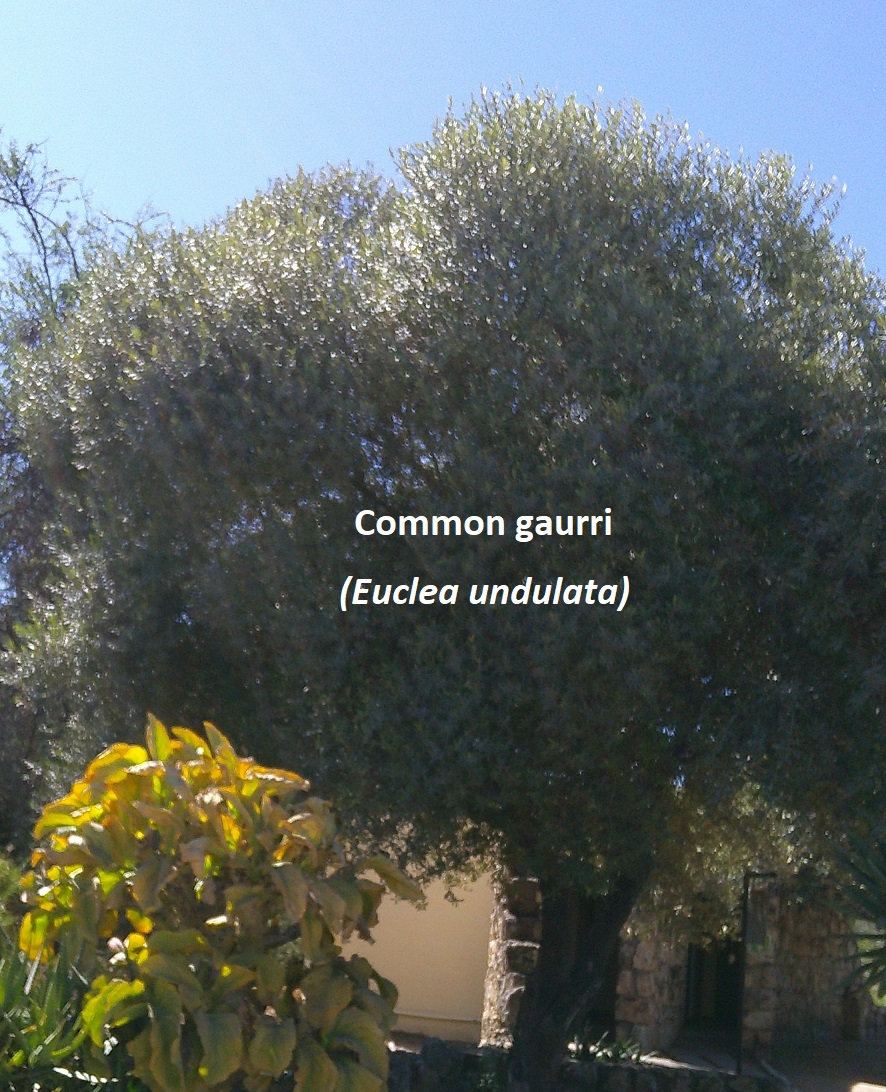
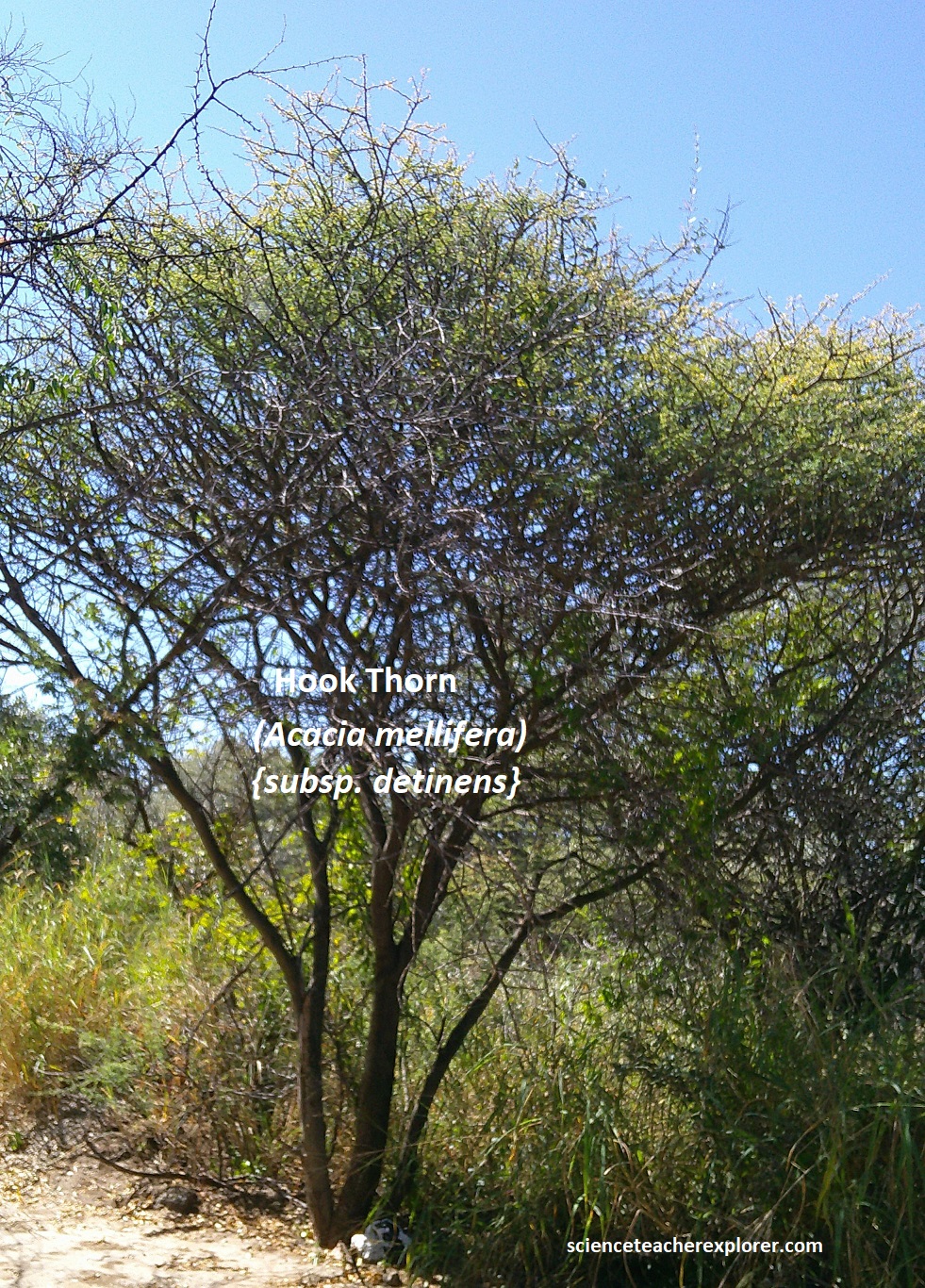
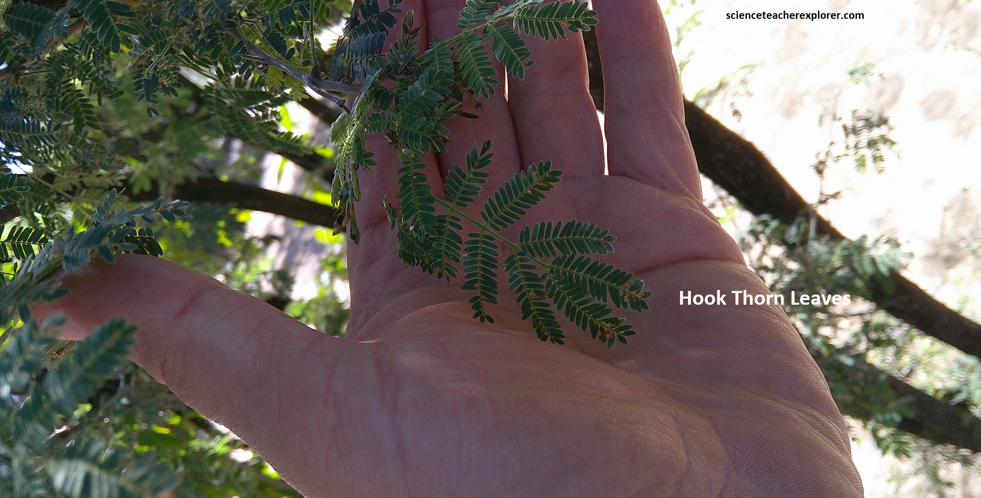
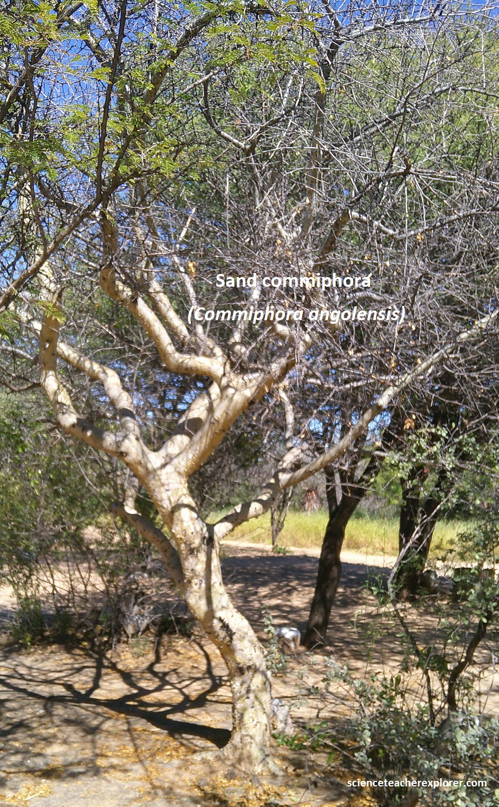
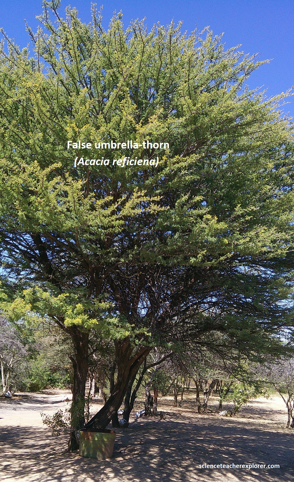
Our last Geo-site destination in the Otavi Mountainland area was the Hoba meteorite. We reached there by driving north on highway C42 from Grootfontein and turning left (east), on graveled road D2859. At the parking lot, we checked in with the National Monument fold and trekked to the meteorite. Along the way, I was able to identify some of the endemic trees on the path, (pictured below).
The Hoba meteorite in Namibia is the largest known meteorite on Earth; no other fragments of this body have been found in the surrounding area, suggesting it travelled through Earth’s atmosphere without ever fragmenting. Weighing about 60 tonnes, this iron meteorite was found hear-near Grootfontein and is thought to have landed some 80,000 years ago. It is composed mostly of iron (82.4%) and nickel (16.4%), with some cobalt and various trace elements such as carbon, sulfur, chromium, copper, zinc, gallium, germanium and iridium, (Pictured below with Tracy Davis standing next to it). Iron meteorites come from the disintegrating cores of asteroids, a belt of bodies in orbit between Mars and Jupiter.
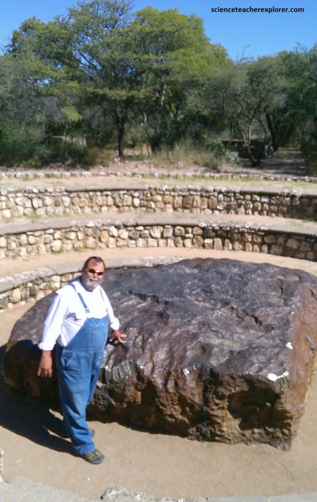
Pictured above, this meteorite was found in 1920 by Jacobus Hermanu Brits while he was ploughing his land. Astonishingly, the impact of the body obviously neither left an impact crater behind nor could changes in the temperature or pressure conditions be observed in the surrounding rocks. Most meteorites hit the earth’s atmosphere at an average speed of about 90,000 km/hr. {Note: With a 10 km/hr speed entering the atmosphere, the meteorite would impact the earth at 40,300 km/hr due to the acceleration of gravity}. Owing to this extremely high speed, the air in front of the celestial body is comreessed so much that frictional heat causes the surface of the meteorite to star to melt and evaporate. The surface of the Hoba meteorite, was actually covered by numerous small cavities caused by melting as it entered the atmosphere.
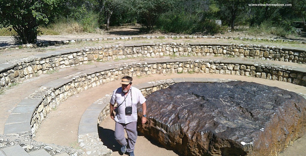
However, the Hoba meteorite has no massive impact crater. This tells me that the Hoba meteorite came from the west at an extremely low angle. With the spin of the earth at 1670 km/hr and the atmosphere quadrupling in thickness from this low angle, this would lessen the impact of the collision. Plus, if the Hoba meteor had a low velocity when it initially entered the atmosphere, this also lower the impact speed on the earth and skip across the surface of the earth. However, this is only my speculation. How could the Hoba Meteorite be here, without a massive crater? Strange!
