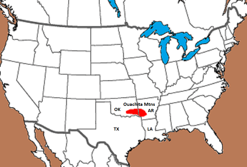
Ouachita Mtns, OK 2024
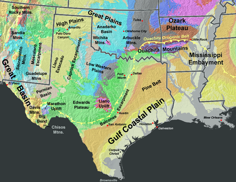
During the summer of 2024, I had the opportunity to drive across and explore the Ouachita Mountains. It’s ridges extend across the Arkansas-Oklahoma border.
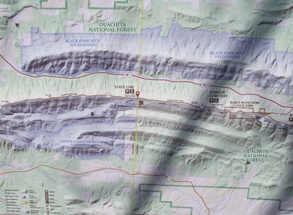
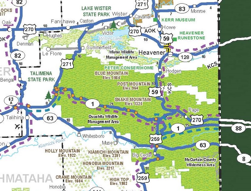
I gained access to the Ouachita Mountains by driving the Talimena Scenic Byway, (AR-88/OK-1), from Mena, Arkansas to US-271 in Oklahoma. Additionally, I trekked the nearby Heavener Runestone Park in Oklahoma.
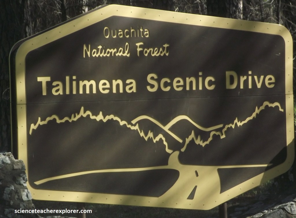
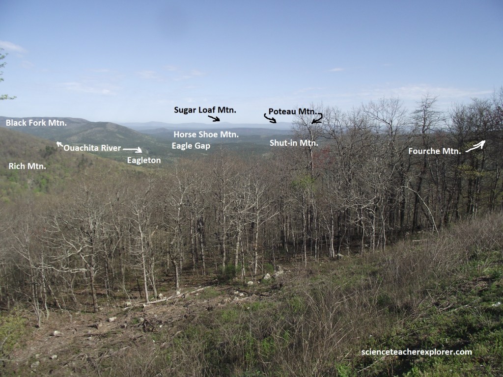
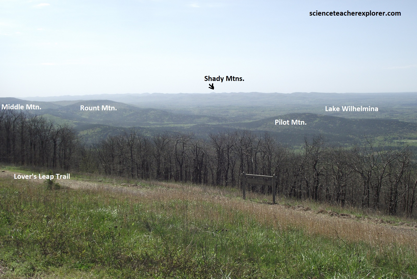
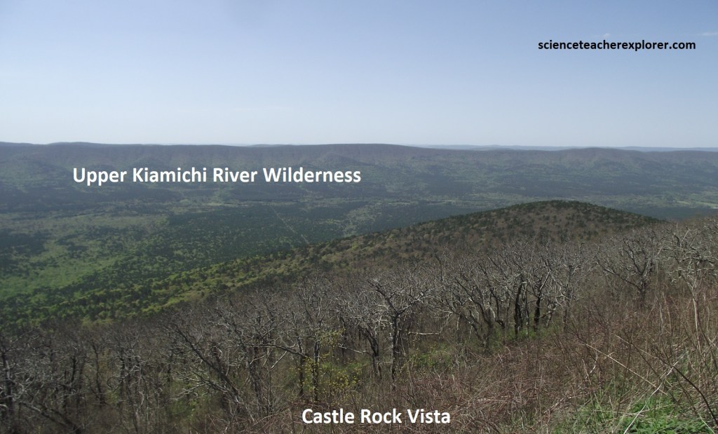
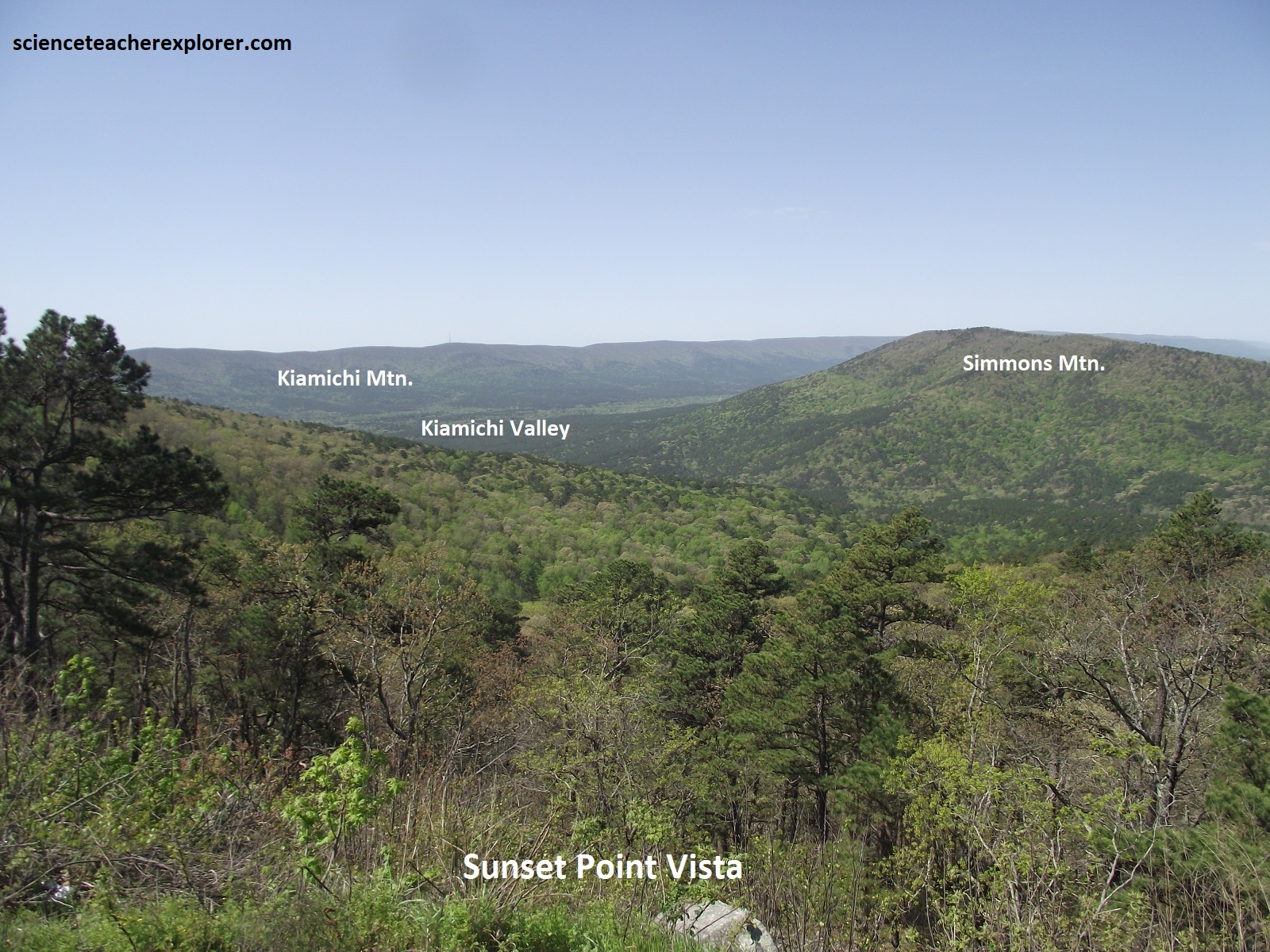
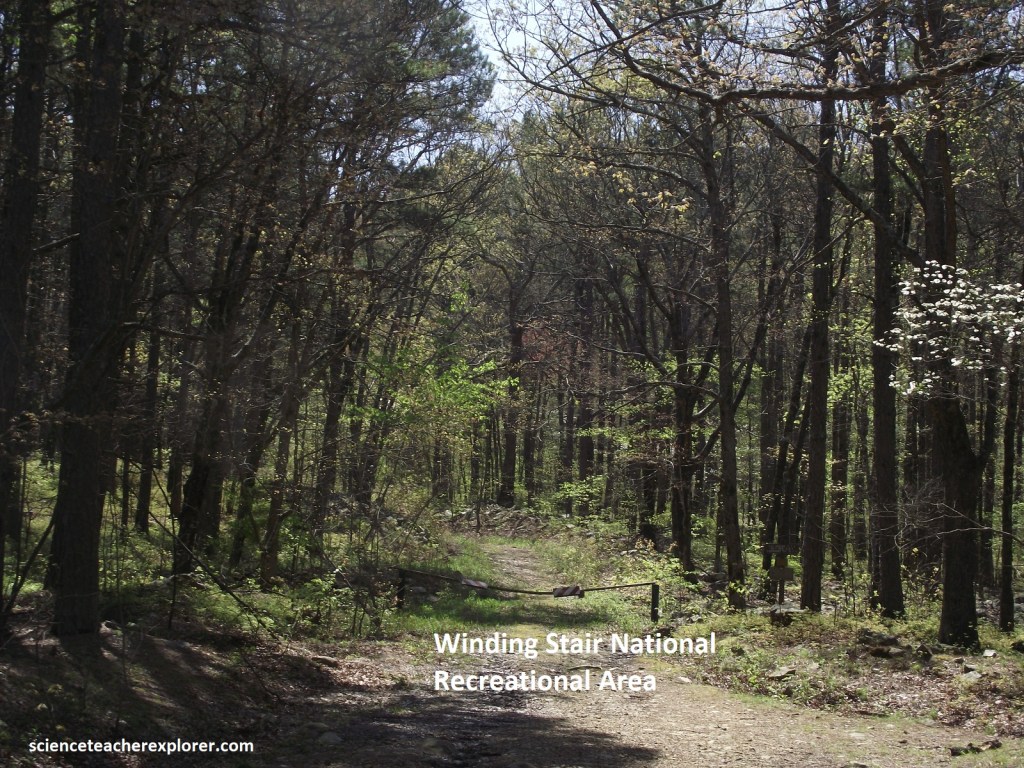
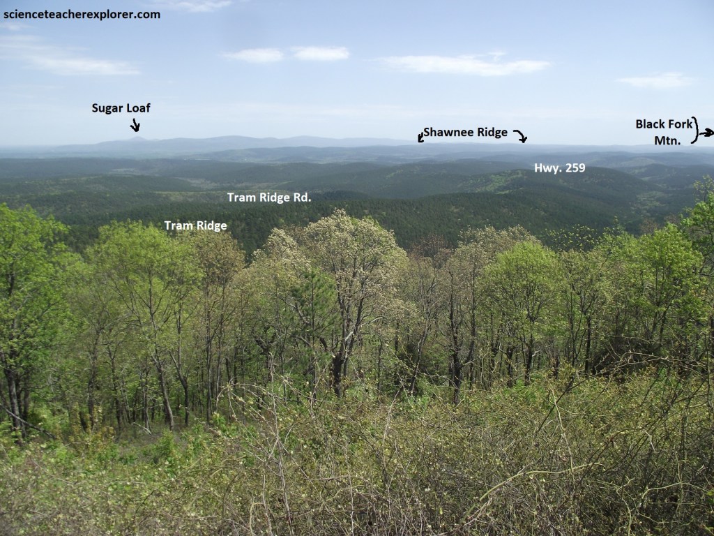
I began my trip on highway AR-88 from Mena, Arkansas. The Talimena Scenic Byway is one of the first highways to be designated a scenic byway by the U.S. Forest Service, (the Oachita National Forest). It provides beautiful view of the surrounding valleys and ridges that make up the Ouachita Mountains, (imaged below).
The name Talimena drive comes from the towns nearest each end of the 87 km drive. On the Oklahoma side is Talihina, Oklahoma and on the Arkansas side is Mena. The Ouachita National Forest dedicated the drive as a scenic byway during a ceremony at the Arkansas-Oklahoma State Line on June 20, 1989. The Talimena Scenic Drive leads visitors along the crest of Rich Mountain and Winding Stair Mountain in the Ouachita ranges of Western Arkansas and Eastern Oklahoma. There are breathtaking views with many vistas. My first vista that I stopped at was Rou)nd Mountain Vista, (pictured below).

Skimming the crests of the hills on the Ouachita Mtn. Range, the Talimena Scenic Byway drive dipped and looped like a roller coaster, often rising to overlooks with views of the steep-slopes, narrow-valleys, and a nearly seamless carpet of trees, (pictured above and below).
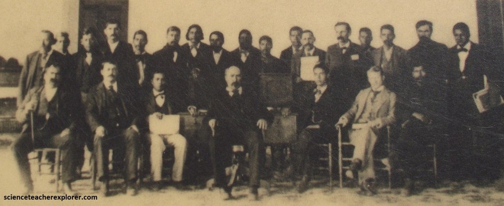
While holding a seminar near Rich Mountain (formerly called Mount Mena), 25 noted scientists, interested in plant life and who make annual field trips to many parts of the world, visited the Ouachita National Forest. It was in their opinion that a square mile in this area had more kinds of wild fruits, timber, flowers, and medicinal plants, ferns, mosses, grasses, weeds, and small plants growing there, than could be found on any similar tract–in a natural wild state–anywhere in the world. They submitted this amazing fact to Ripley’s “Believe It or Not” contest and won first place. They itemized 47 varieties of trees, 27 wild fruits, 17 kinds of medicinal plants, over 100 kinds of flowers, and mosses and ferns, some of which were subtropical.
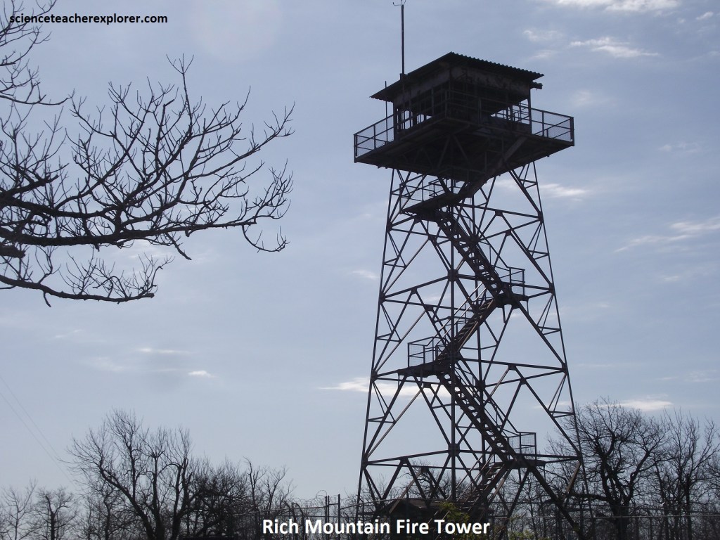
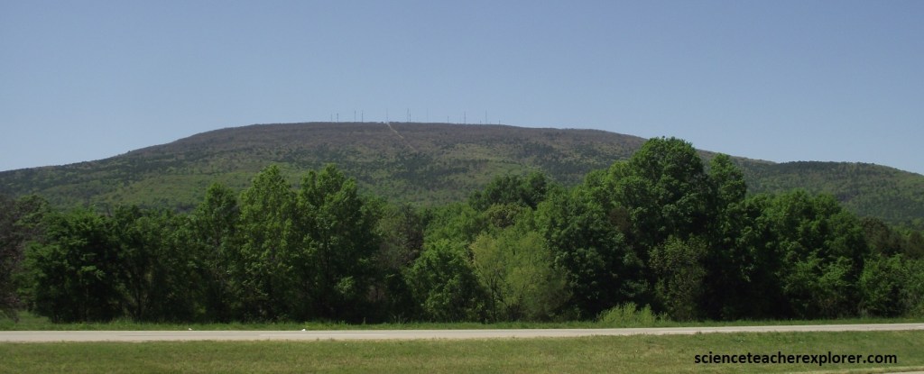
At 894m Rich Mountain is the highest peak in Ouachita National Forest. Taking advantage of this lofty location, the Forest Service erected a tall steel tower here to spot fires. Now that helicopters and other aircraft have taken over that task, the site seems to have become a popular picnic spot.
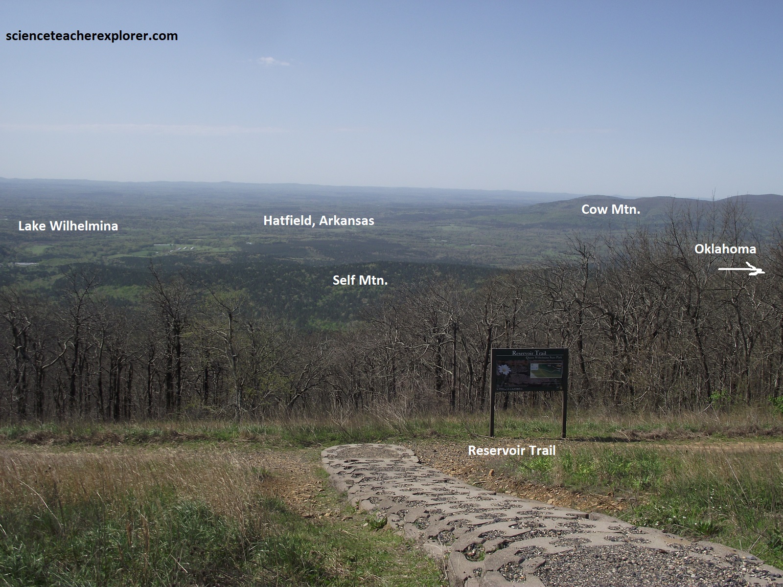
As the Talimena Scenic Byway drive crosses from Arkansas into Oklahoma, the route number changes along with the state (AR-88 becomes OK-1), but the views remain as boundless as ever. A few kilometers before the Oklahoma state line, 640-acre Queen Wilhelmina State Park and its mountaintop lodge come into view. Investors from the Netherlands built the original structure here in 1898 and named it in honor of their young queen, hoping she would be flattered enough to visit. Wilhelmina never came, however, and the hotel closed after only a few years. Today’s modern facility retains the royal title and enjoys the same panoramic vistas that wave its predecessor vistas that gave its predecessor the nickname Castle-in-the-Sky. Pictured below are views of the southern hills below.
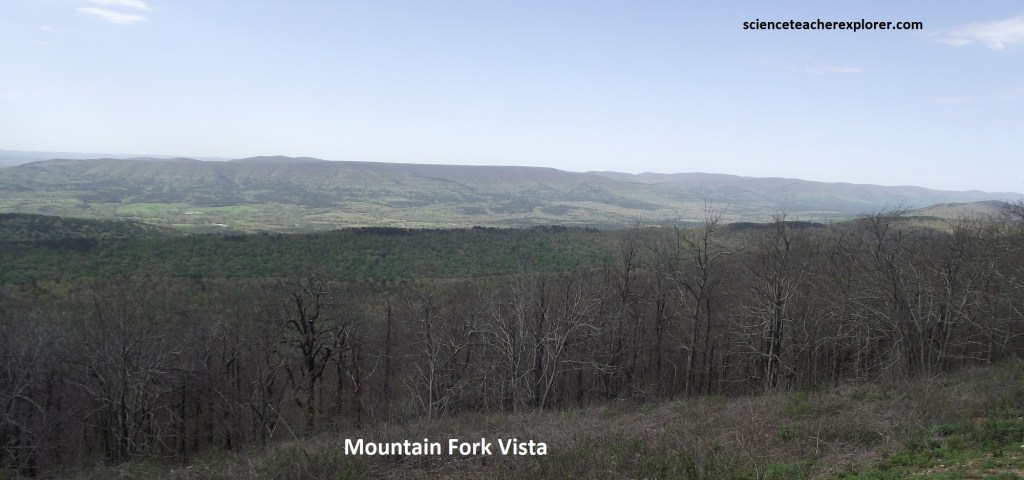
Pictured below is Mountain Fork Vista. It is only a kilometer from the Arkansas/Oklahoma state-line and is the boundary of what once was two separate nations. Before this became the Arkansas and Oklahoma state line, this was the boundary between the United States and the Choctaw Nation. Shortly after the American Revolution, people from the original 13 colonies poured into the rest of the continent. The Choctaws and other native peoples living in the south and east were overwhelmed by white settlers. In 1801, Thomas Jefferson started a push to move native people west. The push turned to shove when Andrew Jackson signed the Indian Removal Act of 1830. In the fall of 1831, the United States government began moving Choctaw people to their new home in Oklahoma. The Choctaws were followed by the rest of the 5 civilized tribes, the Cherokees, the Chickasaws, the Creeks and the Seminoles.
From the time of the first treaty with the Choctaws in 1820, the eastern boundary of the Choctaw Nation in Indian Territory has been disputed. Today, legal battles for the boundary still persist. During the survey of 1877, it was confirmed that the original 1825 Conway Survey located the boundary too far to the west, (favoring Arkansas). Despite this error, the boundary was changed and a trail marker was posted at the present location near the road, preserving the line as a permanent boundary.
Despite more than 153 cm of rain a year, the top of this long mountain ridge that I’m driving along has more in common with a desert than a rainforest. The soil texture, slope, and gravity act like a giant sieve. Rain water disappears almost as quickly as it falls, leaving little moisture near the surface. Wind constantly blowing evaporates moisture clinging to any surface. Plants that live here must be able to protect themselves from its dehydrating effects with special root and leaf structures.
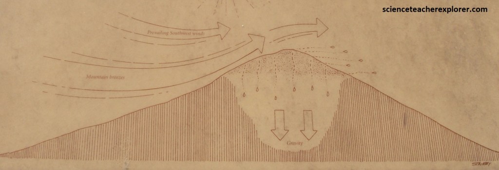
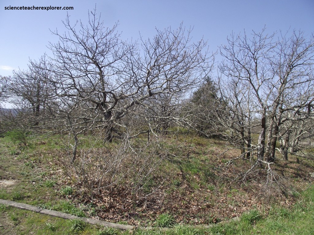
Pictured below, natural force sculpted the trees into a miniature forest. Strong, drying winds and ice storms sheer and prune relentlessly, forcing survivors to stoop and bend to their will. The most common tree, the white oak, (Quercus alba), is not normally a dwarf. Under more favorable growing conditions in the valley below, any one of these dwarfs may grow into 38m giants.
Pictured above, many of the white oaks here are estimated to be 200 years old. Scientists believe that if their age is calculated using root systems instead of trunks, certain individual trees may be even older. This is because white oaks have the ability to stump sprout, (if a fire or wind storm destroys the tree above ground, the root system simply sprouts a new trunk).
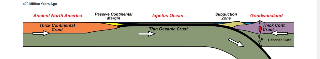
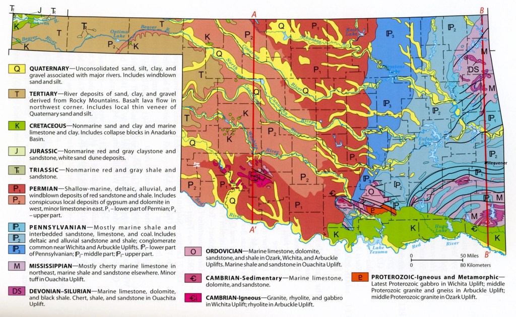
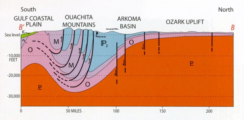
Beginning about 400 million years ago in Middle Mississippian time, the Llanorian Plate, which consisted of South America and Africa, (Gondwanaland), approached the North American Plate from the south and east.

The collision between the plate is called the Ouachita orogeny and produced the Ouachita Mountains in south-eastern Oklahoma.

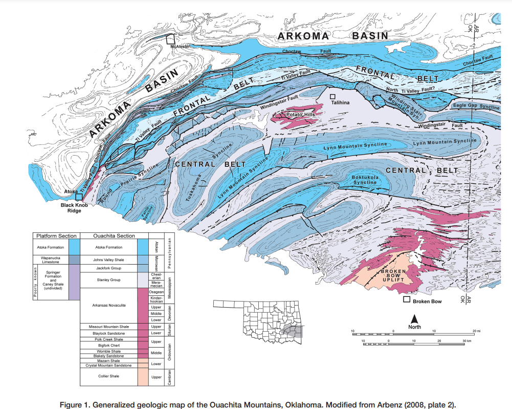
Imaged above, the initial phase of the orogeny was the deepening of an ocean basin, called the Ouachita trough, in what is now northeast Texas. The basin accumulated as much as 330m of Middle and Late Mississippian deep-water deposits, (Stanley Group), whereas most of Oklahoma same-aged units to the north on the continental shelf are only 30m thick, (Caney Shale). Most of the Stanley Group sandstones and shales form turbidites, (a deep-marine) sedimentary deposits characteristic of active tectonic settings.

Imaged above, for the next 30 million years or so, the turbidite-filled Ouachita trough migrated to the north, just ahead of a northward-advancing, but mostly subaqueous, fold-and-thrust mountain range. The formations within this type of mountain range are folded into a complex series of anticlines and synclines separated by relatively high-angle reverse faults that flatten with depth. The folds and thrust faults are the result of compression on a continental scale, and the compression is the result of collision between the two tectonic plates. It is estimated that the compression-caused folds and thrust faults in the Ouachita Mountains represent al least 161 km of crustal shortening with Cambrian to Devonian deposits stacking on-top of each other.
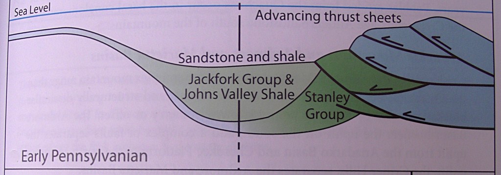
Imaged above, as the trough migrated north into Oklahoma, it caused the Late Mississippian-Early Pennsylvanian continental shelf and slope to migrate north as well, mildly deforming them.
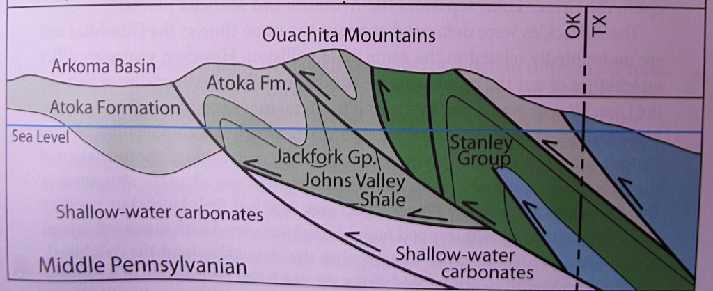
Imaged above, plate collision and its compressional tectonics ceased 308 million years ago at the end of the Middle Pennsylvanian time. Late in its collisional history and continuing through the end of the Pennsylvanian and into the Permian, the Ouachita fold-and-thrust belt was uplifted above the sea level and eroded, (imaged below). {images below were taken from “Earth: An Introduction to Physical Geology” Lutgens and Tarback 2004}
Pictured above, the Pennsylvanian Atoka Formation appears on the ridge-top near Castle Rock Vista. It is a Turbidite sandstone that was deposited in deep ocean basins as fast-moving, turbulent, high-density clouds of sediment eroded off adjacent continental shelves. It was either shaken off the shelves by earthquakes or collapsed off over-steepened shelf areas at the front edge of advancing river deltas. This usually causes graded effect, (grain size getting finer upward through the bed). However, the Atoka Formation here appears to be not graded because the sediment in the source area was fine grained. The plane-parallels laminated beds in the upper part of the sandstone grade into the overlying shale.
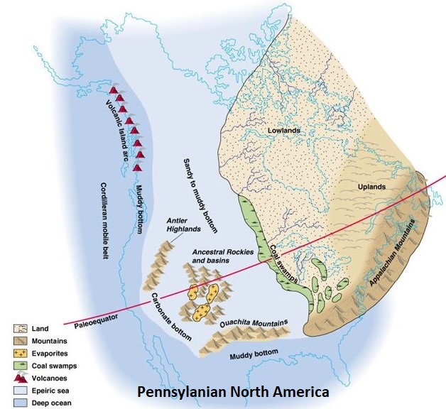
From the newly formed Ouachita Mountains, rivers flowed north and northwest across the filled Arkoma Basin and former Early Pennsylvanian shelf, depositing their loads of gravel and sand before emptying into a shallow sea at deltas in central Oklahoma and the Gulf Coastal Plain, (imaged below).
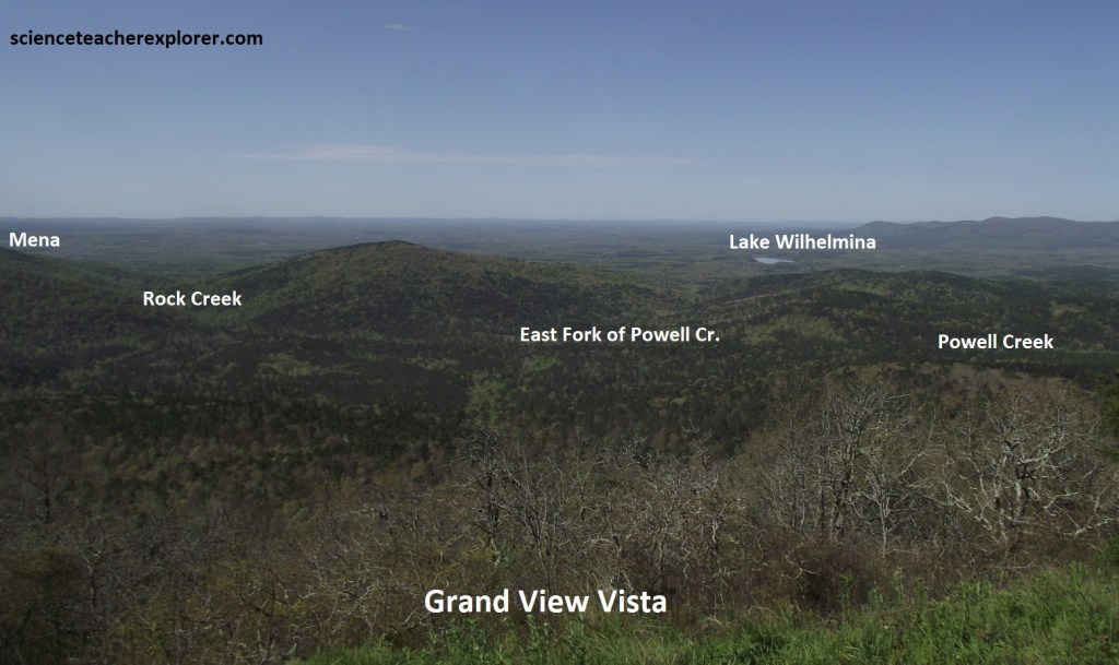
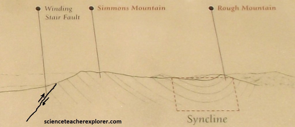
The valley-and-ridge character of the Ouachita Mtns. is caused by interbedded thick, hard sandstones that form the ridges and relatively soft, easily eroded shales that form the valleys. In the Talimena Scenic Byway part of the mountains, the ridges and valleys mostly trend east-west, parallel to the faults that formed the mountains, (pictured below).
In places, and further west, the ridges curve and form large arcs, marking places where the rocks are folded. Westward, the ridges and valleys are oriented northeast-southwest, following a change in direction of the faults and the trend of the entire mountain range, (pictured below).
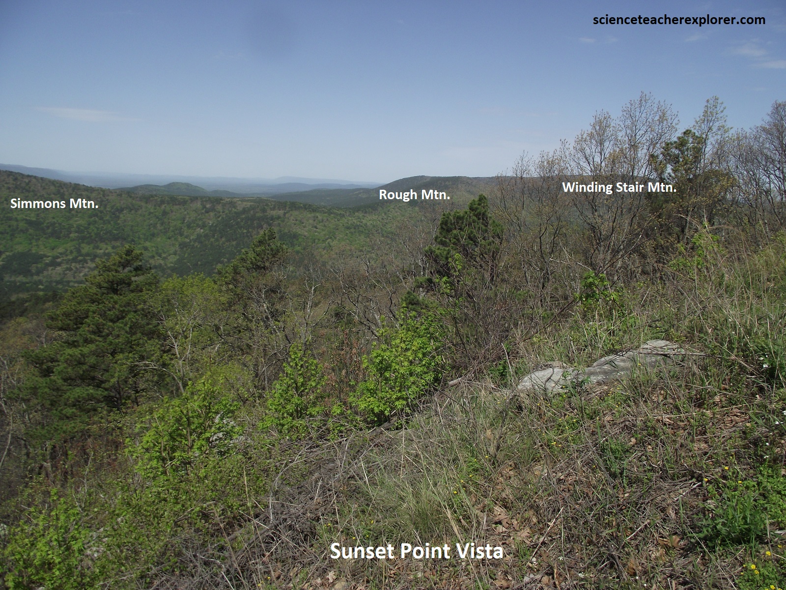
Pictured above, the curved ridge is formed by Simmons and Rough Mountains. The depression between these two peaks is part of a large syncline. Synclines are large folds in the earth formed when the earth’s crust was compressed and bent. The Ouachita Mountains, a “fold-and-thrust” mountain range, were formed when rocks far to the south were shoved hundreds of miles over rocks in the north. As mentioned above, the rocks here were once part of a deep sea floor in Texas.
Sandy soil underlying the Ouachitas favors the growth of pines, making this area one of the country’s leading sources of timber. While shortleaf pine is common, hardwoods, (including oak, maple, and elm), are also present in these parts, providing splashes of red-orange that, in autumn, blaze against the emerald ever-greens. In early spring pink blossom of redbud, white dogwood blooms, and pale yellow buckeye flowers create lacy swirls of color in the woods. {Below are photos I took from the Robert S. Kerr Arboretum}
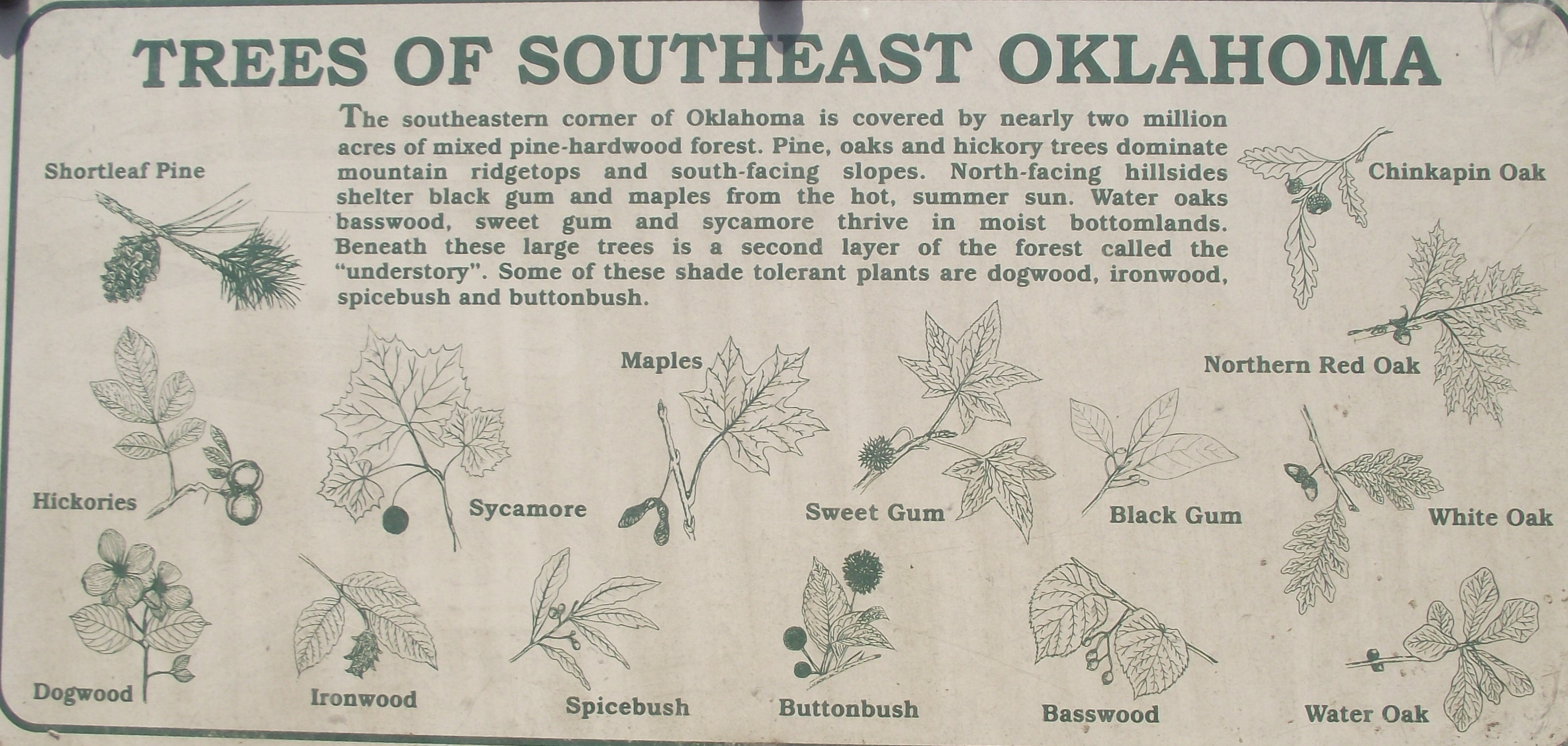
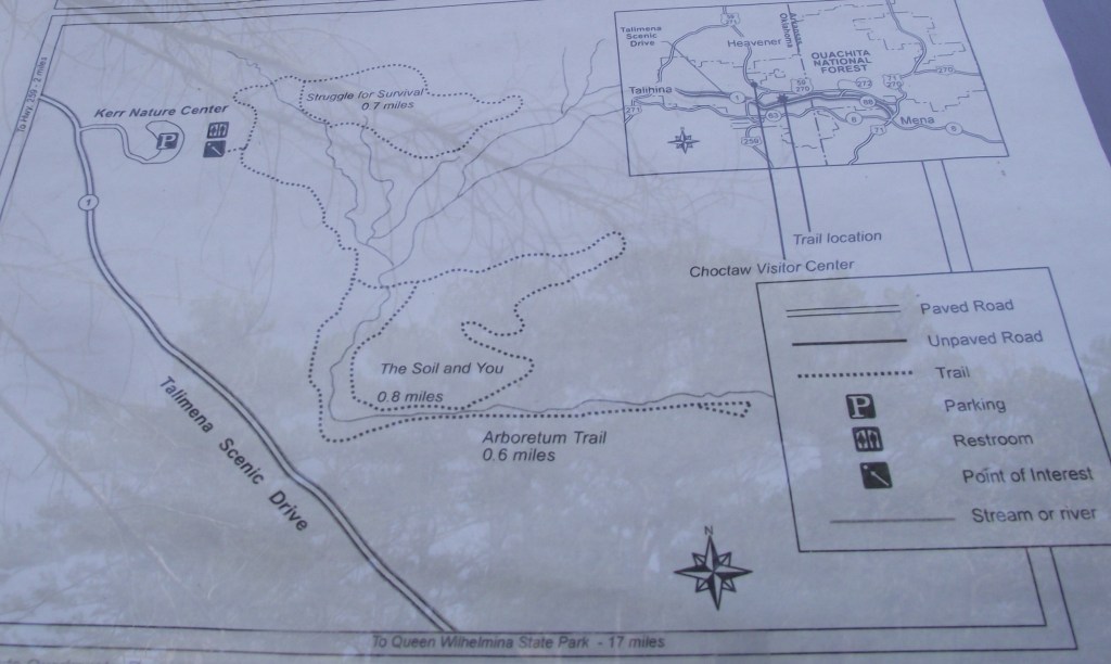
For and informative introduction to the many varieties of trees, shrubs, and flowers that are found in the Ouachita Mountain region, I visited the Robert S. Kerr Arboretum and Nature Center, where 3 unmarked trails focused on soil formation, vegetation, and ecology.
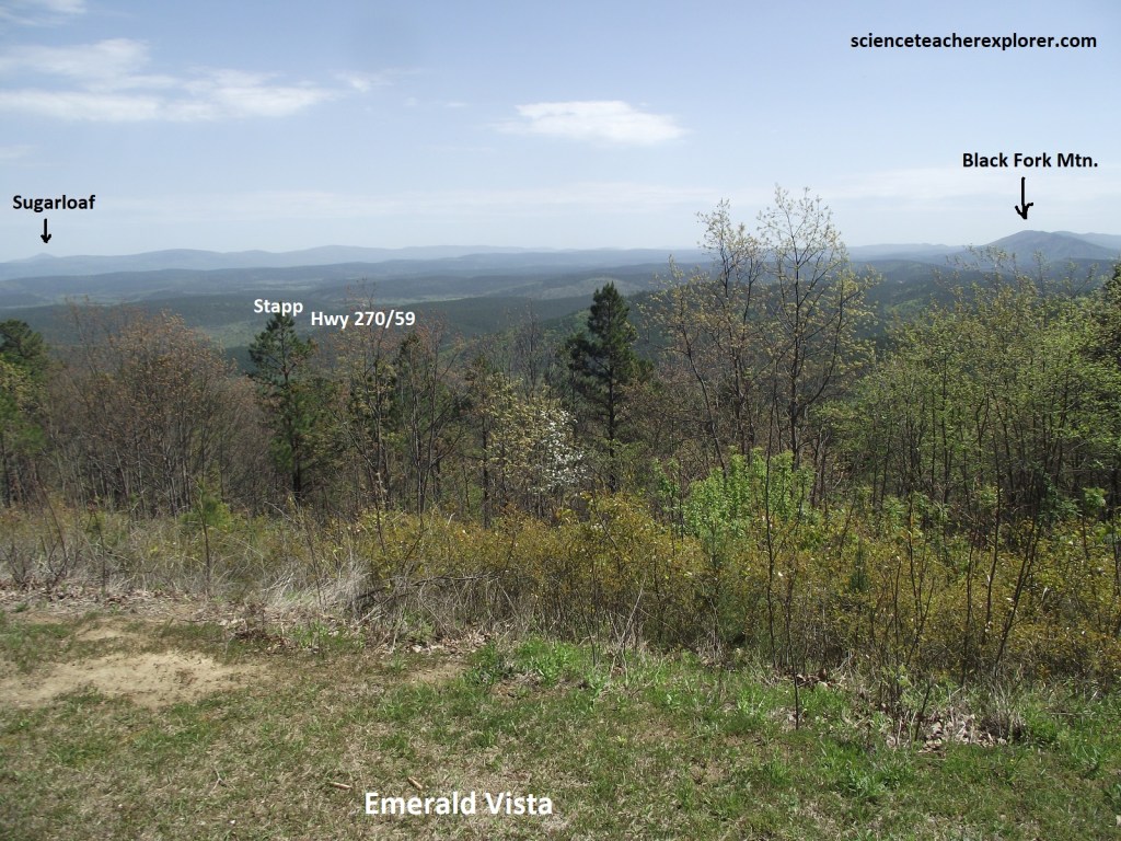
Pictured below, the Buschow Lumber Company operated a mill and railroad in Stapp, Oklahoma in the valley below during the early 1900s. At that time the timber industry was primarily nomadic and the average life of a mill was 20 years. Typically, timber companies rolled in on railroads and created small towns like Stapp. Trees were cut without regard for erosion control, fire protection, or replanting. Once the trees were removed, the timber companies simply packed up and rolled out. Said to be the “ultimate in devastation” the Buschow Lumber Company was typical of many in the industry at the turn of the century. At the same time, some companies were beginning to explore conservation methods and fire prevention programs.
In 1930, government appraisers said this land had “no commercial value”. Described as lightly to severely burned over, there were too few trees left from logging and fires to re-seed the barren acreage. Hoping to cut their losses, the Buschow Lumber Company sold the property to the only bidder, (the U.S. forest Service purchased 48,257 acres for $1.42/acre. Today the U.S. Forest Service manages this area as the Indian Nations Scenic and Wildlife Area. Scenic beauty and wildlife habitat now make these acres priceless to the American public.
Despite the abundance of lovely scenery and lovely scenery and varied attractions, Ouachita National Forest remains a relatively well kept secret. The oldest (establ. in 1907) and largest (1.6 million acres) national forest in the South, Ouachita is home to white-tailed deer, bobcats, foxes, and a host of birds, including hooded warblers, great horned owls, and (in winter) golden eagles. In the 1930s the forest was a candidate for national park status, but political issues over-ruled the region’s unquestionable beauty.
Pictured above, from the last Ice Age until the 1800s, native peoples collected chert from Shawnee Ridge. Found on the surface, this stone material forms sharp edges when broken. Skilled craftsmen could turn the stone into razor sharp tools and weapons. Chips and scraps were left behind as they broke the stones into manageable sizes. Archaeologists call these sites “prehistoric workshops”.
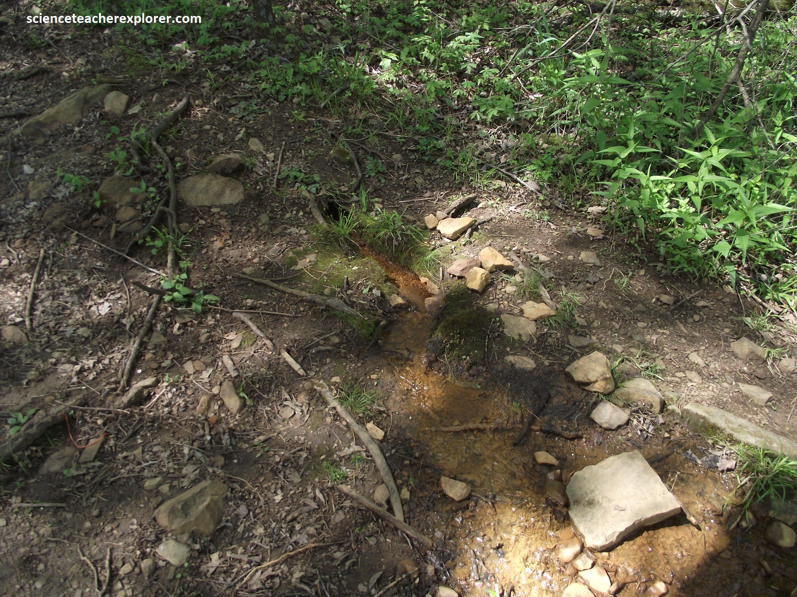
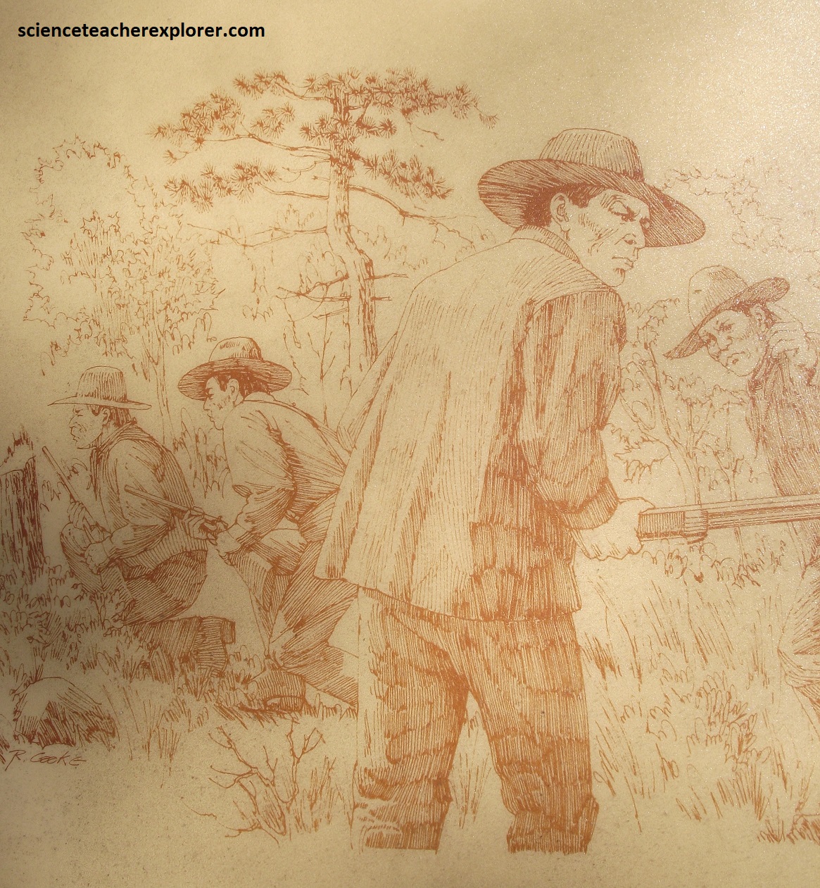
In the late 1800s bands of bold entrepreneurs operated a thriving, (if illegal), business in these parts, smuggling stolen horses across the Ouachitas to Texas. So blatant were their activities that the route became known as Horse-thief Trail; a watering hole where the bandits often camped was even dubbed Horsethief Spring, (pictured above). The Anti-Horse-Thief Association, organized at nearby Heavener, put an end to these shenanigans shortly after the turn of the century. {Images below are taken from interpretive signs at the Horsethief Spring}
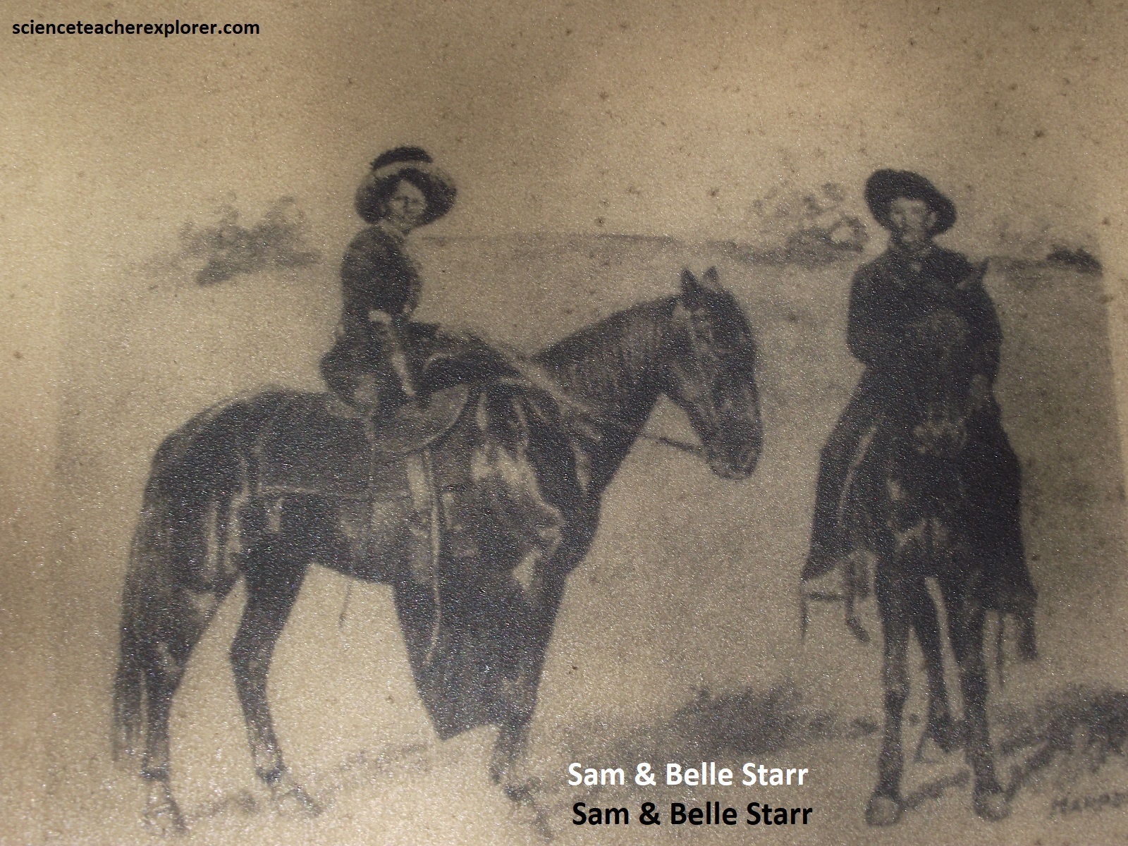


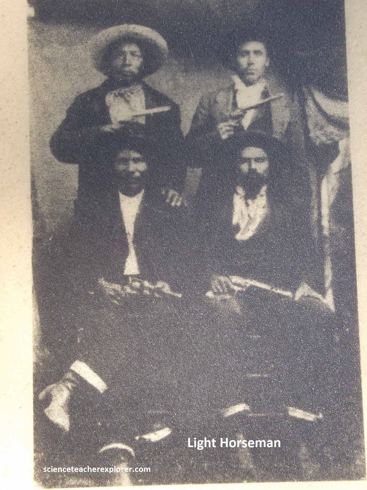
Indian Territory was a criminal’s paradise during the 1800s. The Choctaw Nation did not escape the impact. Seeking refuge where there was “no white man’s law” or extradition, criminals simply crossed the border into Indian Territory. With the border just 25 km to the east, imagine how many scoundrels camped here. When Judge Isaac C. Parker ruled the U.S. Court in Ft. Smith, Arkansas between 1875 and 1896, escaping the law was no longer and option. Known as the “Hanging Judge” Parker and his 200 deputy marshals cleansed the territory of many famous criminals such as the Dalton, the Buck Gang, Sam & Belle Starr, and Cole Younger. Judge Parker tried 13,490 cases and 9,454 resulted in guilty pleas or convictions. Parker sentenced 160 to death for capital crimes, and 88 were publicly hanged from the courtyard’s gallows.
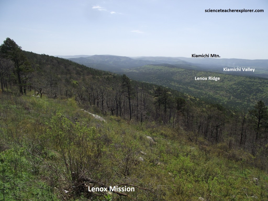
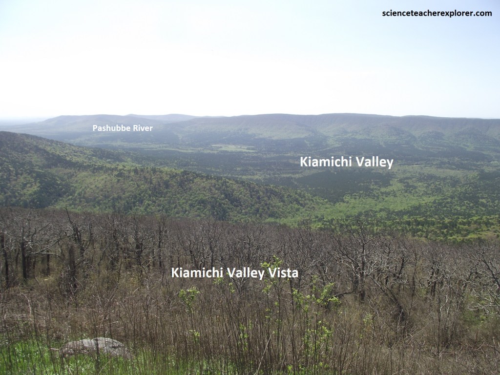
The Choctaw Natives placed a high priority on education. Boarding schools and small neighborhood schools existed as early as 1832 in Indian Territory. Although tribal funds supported the schools, missionaries were often responsible for establishing and maintaining them. Pictured below, missionaries Dr. Simon Hobbs and his wife established the Lenox Mission in the Kiamichi Valley below in 1858. Perhaps feeling homesick, Mrs. Hobbs named the mission after her hometown in Massachusetts. Serving more than one purpose, the mission was a church on Sundays and on weekdays, students of all ages attended the mission school. Like many missionaries, Dr. Hobbs was a medical doctor as well as a minister. When yellow fever struck the community, Dr. Hobbs and his wife were among the victims. The mission closed after their deaths in 1884.
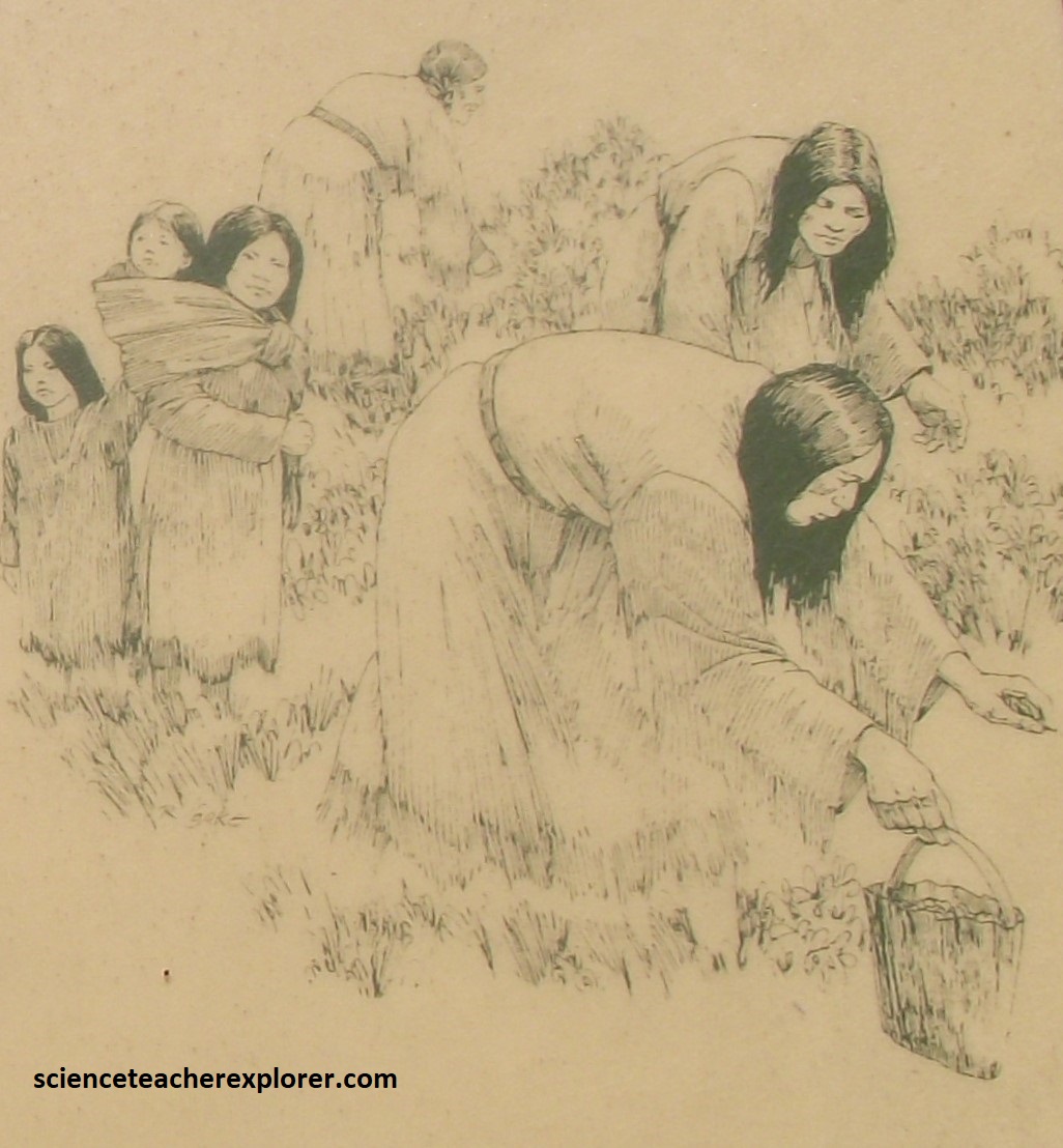
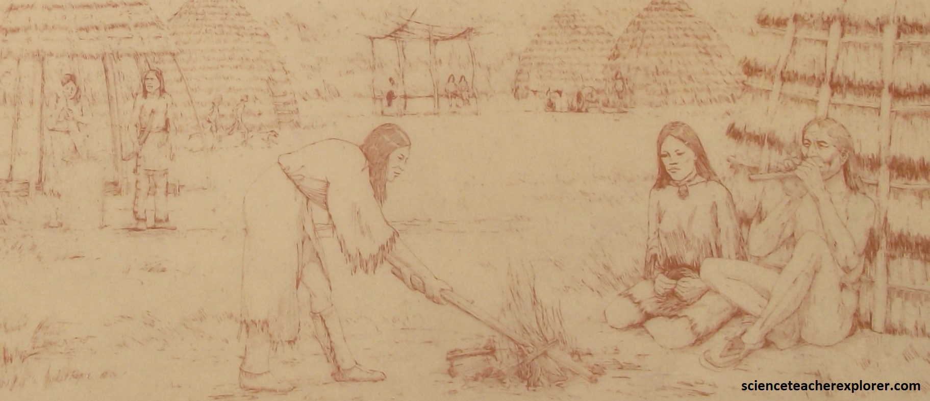
Depressions in the ground, charcoal from cooking fires, middens or “garbage heaps”, stone hoes and pottery fragments are all clues to the prehistoric sites along the Kiamichi River, (pictured above). These clues reveal that people were farming and storing food 1500 years ago. By 500 A.D. small permanent villages of 2-4 acres existed along the Kiamichi River. When people began storing food and farming, they were no longer tied to a nomadic life of following game and searching for wild plants. These people, known as the Caddos, began to build villages. They became accomplished farmers and began early commerce in the form of trade. They traded bows made from the osage orange trees, black tanned doeskins, salt and agricultural products to other tribes great distance away. Today, the Caddos live primarily is western Oklahoma.
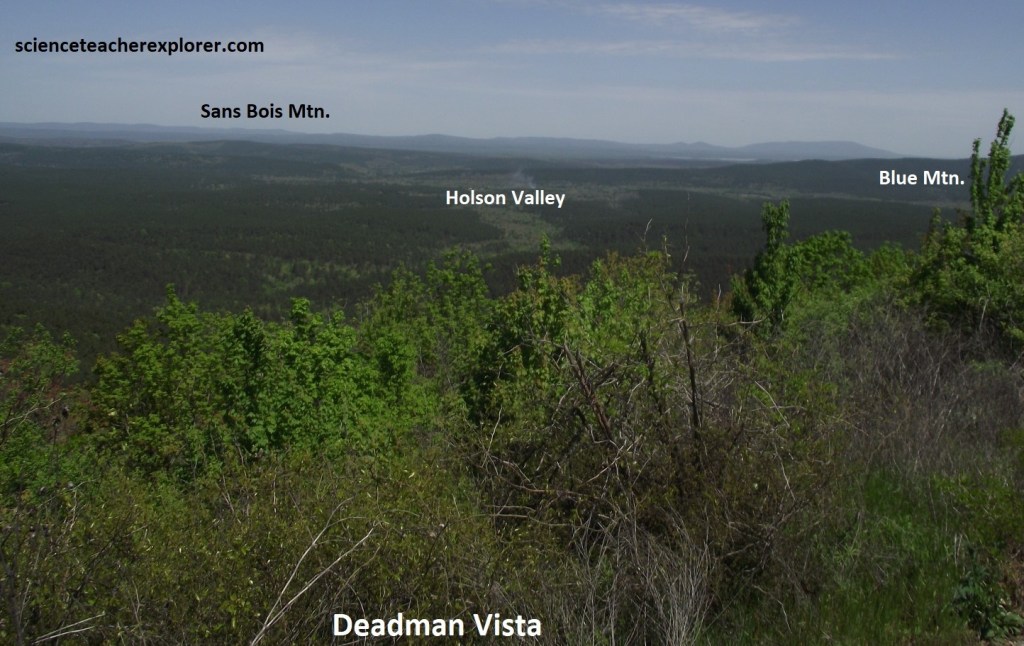
Pictured above, Deadman Vista inherited and intriguing name, the origin of what is a mystery. One legend suggests that many years ago, hors thieves were caught on a nearby trail. With justice swift in those day; the thieves were hung from an oak tree in a gap nearby.
Unlike most mountain ranges, the Ouachita ridgelines run east to west with north and south facing slopes. Two very different habitats are found on north and south facing slopes. South facing slopes receive more sunlight than any other slope. This creates a warm and dry environment. North facing slopes tend to remain in the shade, creating a cool and moist environment. These slopes are the extremes. Slopes facing east and west are more moderate and the difference is less striking. Evergreen, short-leaf pines dominate the south facing slopes while north facing slopes are crowded with hardwood trees like the oak. The difference in vegetation on the two slopes becomes even more striking, as the hardwoods change color in the fall and drop their leaves in winter.
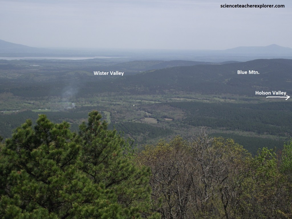
Pictured above, evidence dating back to 1500 B.C., suggests prehistoric people lived in Wister Valley. Sustaining life required daily hunting, and the gathering of wild plants. As their cultures evolved or necessity demanded, they began to cultivate plants such as corn and squash, leading eventually to full-scale farming. Evidence of these people disappears after 700-800 A.D.. In 1719, Bernard LaHarpe, an early explorer, wrote in his journal that this area was abandoned except for an occasional Native American hunting party.
Finishing my drive on the Talimena Scenic Byway and reaching U.S.-271, I turned right, (north) and drove to Wister a few kilometers away. In Wistor, Oklahoma; I am reminded that this was the appointed Choctaw Nation of south eastern Oklahoma. From 1832 to 1907, the Choctaw Nation functioned as a country separate from the United States. The Choctaws established a constitutional government with executive, legislative and judicial branches. A school system and scholarship program provided youngsters and adults opportunity for education. They established successful cotton plantations, farms and businesses in their new home. In 1907, the land within the Choctaw Nation was absorbed into the United States, becoming part of the State of Oklahoma. The Tribe retained its sovereignty and still governs its own affairs.
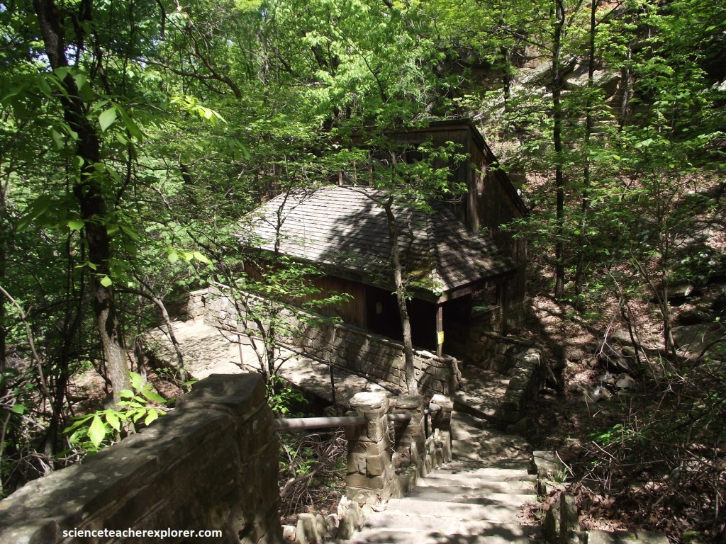
From Wister, I turned right again, (southeast) on U.S.-270 and drove to Heavener {Note that U.S. 59 heads north from Heavener to Poteau 16 km away}. Just east of Heavener is one of Oklahoma’s most scenic, and perhaps most controversial parks. Heavener Runestone Park is on the west flank of Poteau Mountain and the northern flank of the Ouachita Mountain Range, at about 333m elevation, almost 167m above Heavener, between the axes of the Pine Mountain Syncline, (1.6km to the south), and the Heavener Anticline, (1.6km to the north). The view west from the overlook at the end of the road looks along the axis of the gently east-plunging Heavener Anticline, and the vegetation-covered sandstone ridges in the Hartshorne and Atoka Formations that form large “U”s around the mostly cultivated intervening shale valleys.
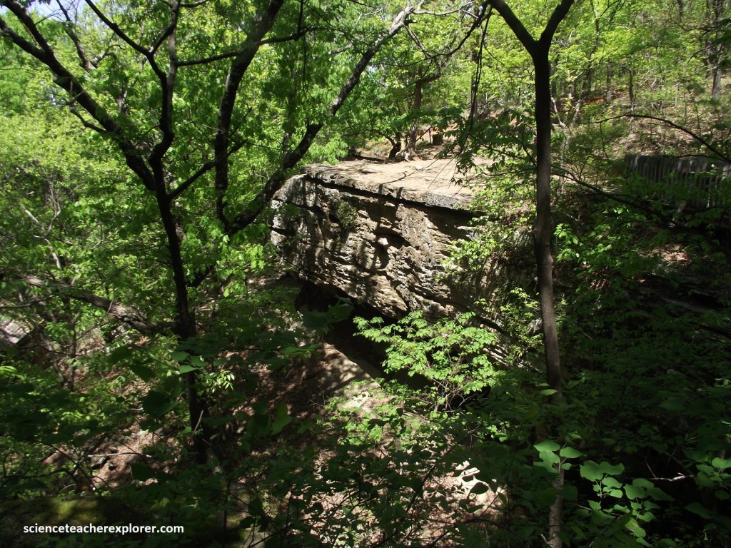
Pictured above, the Heavener Runestone State Park is located within the Pennsylvanian Savanna Formation with excellent exposures of which are along the 1.6 km trail to the runestone below the visitor center.
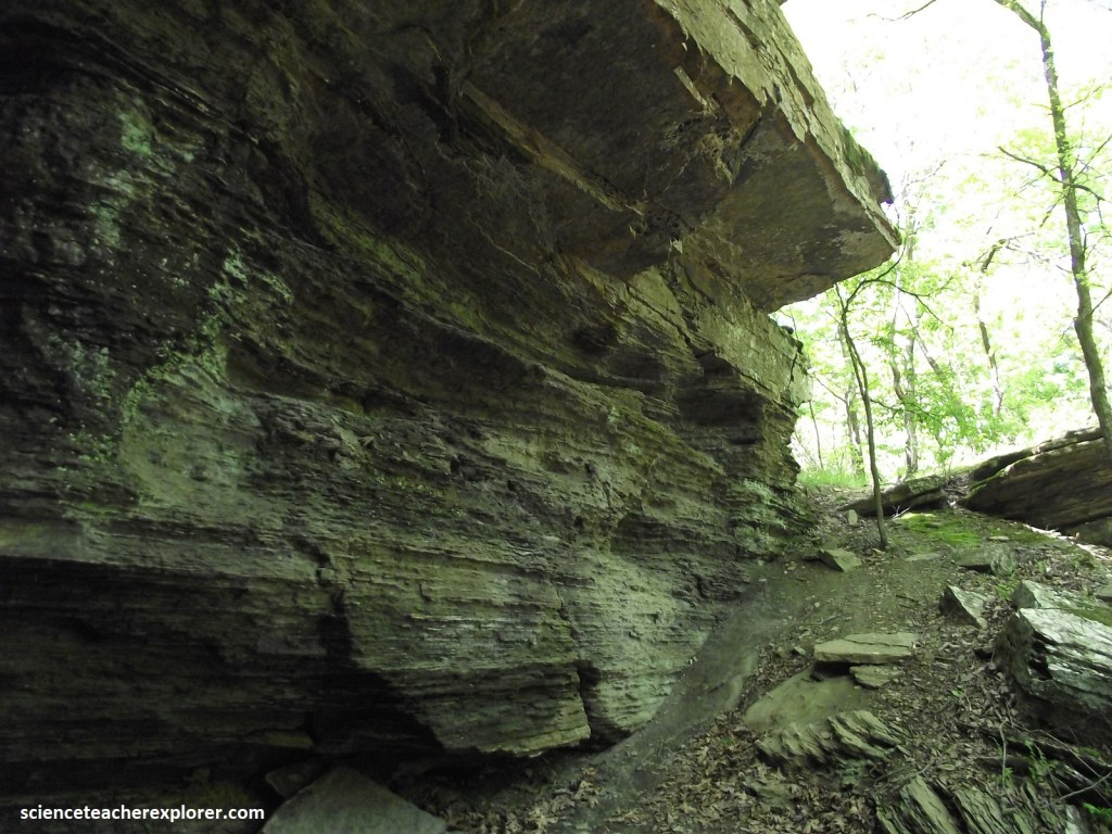
Overall, the outcrop at the waterfall along the trail coarsens and thickens upward, from shale at the bottom up through siltstone to sandstone at the top. Pictured above and below, the lower, more easily eroded shale is being undercut below the harder sandstone of the overhang.
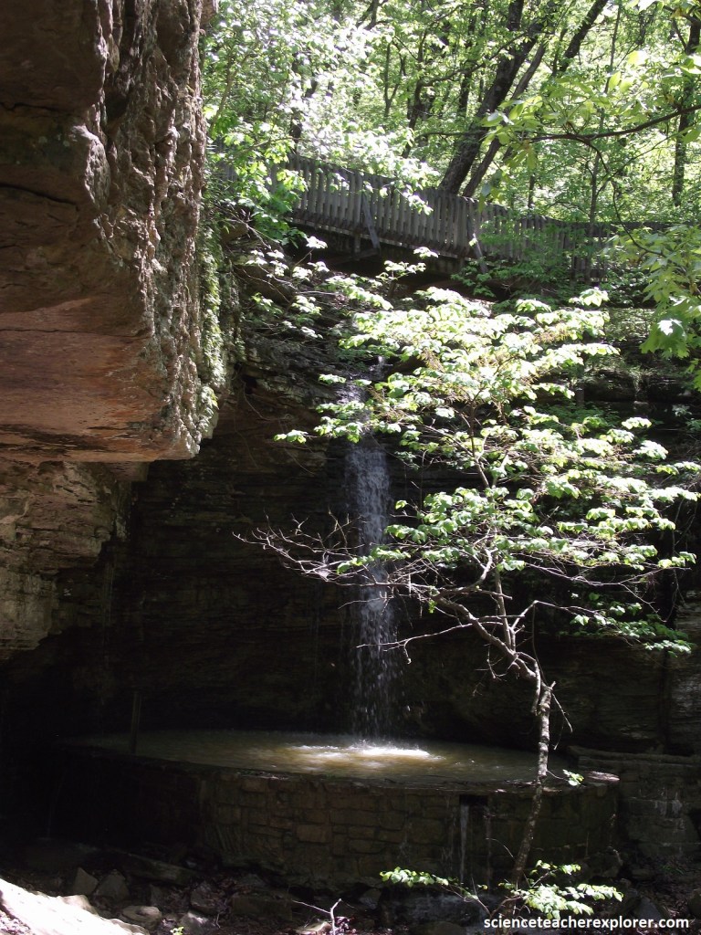
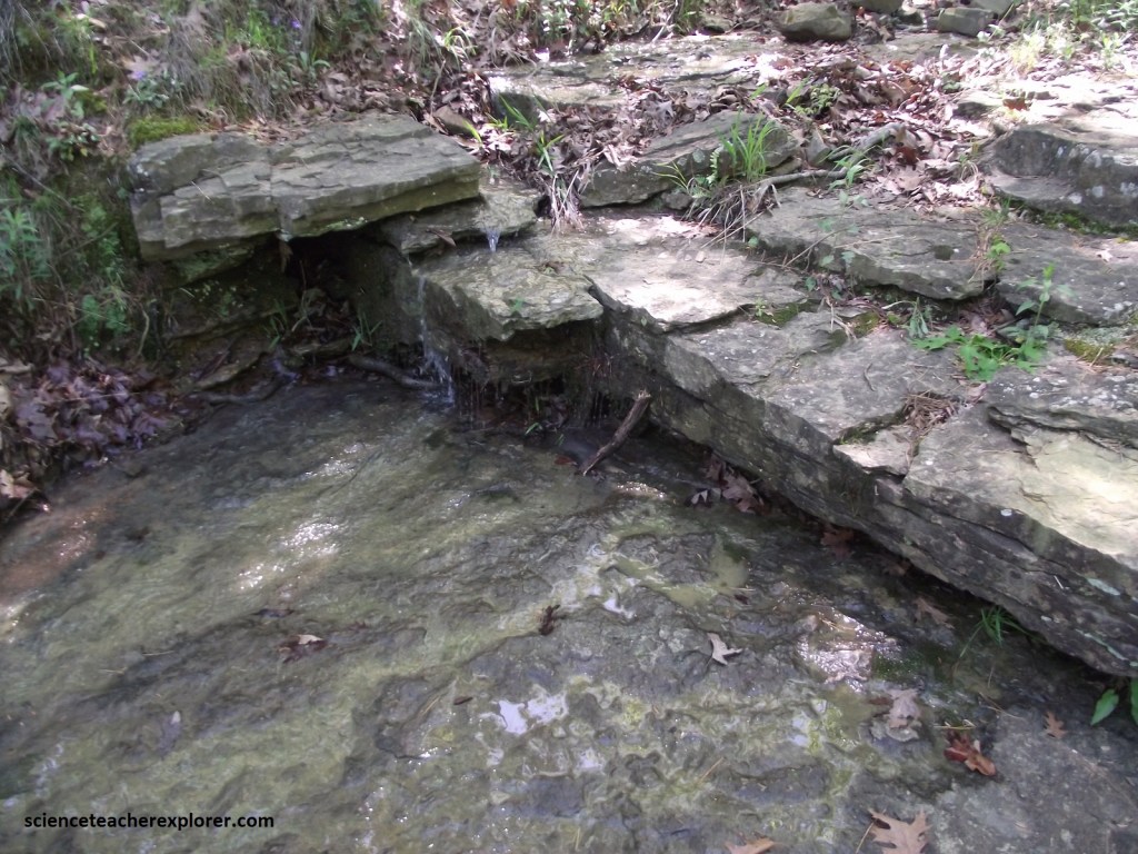
Pictured below, ripple marks caused by ocean waves moving over the san during deposition in a shallow Pennsylvanian-age sea or delta are common in the outcrop at the base of the falls.
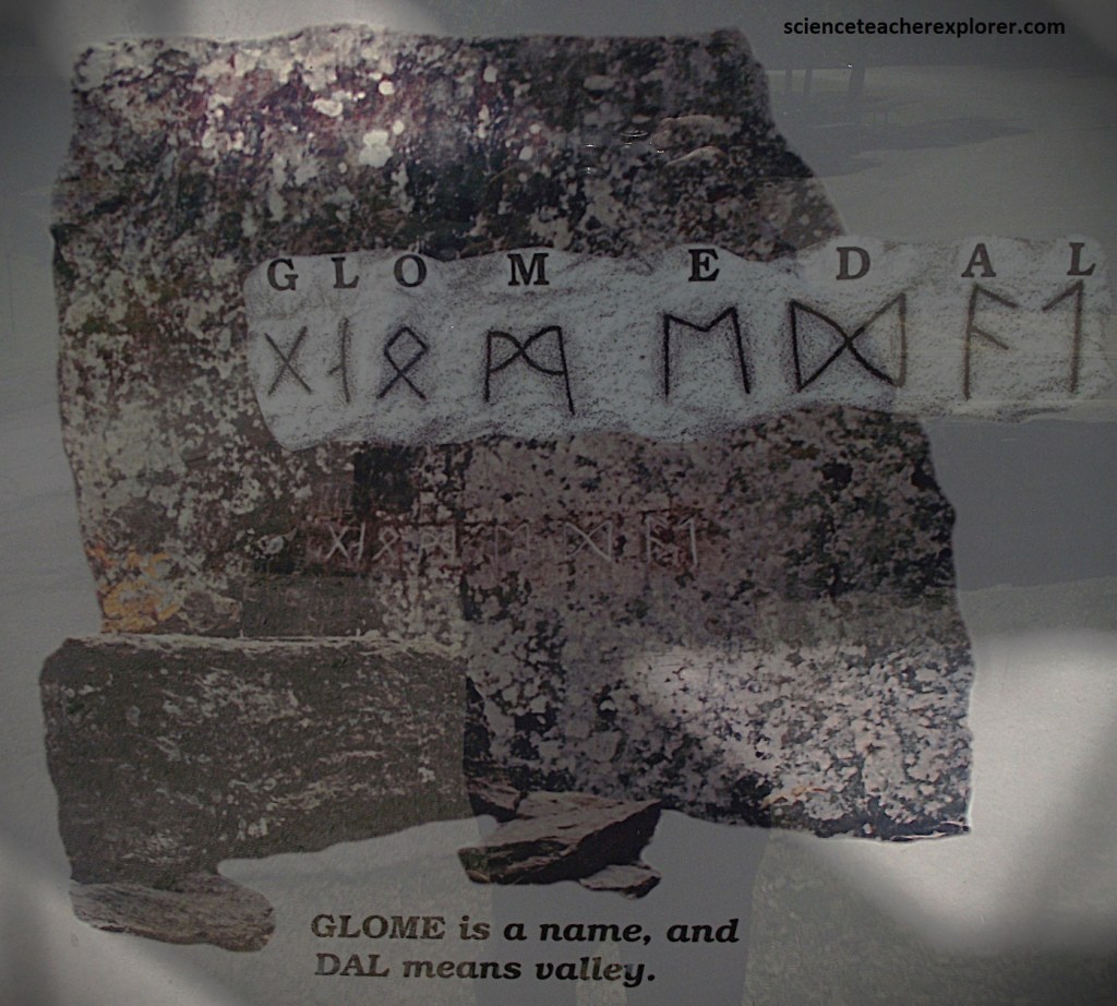
Further down the trail from the waterfall is a 4m by 4m upright stone slab with carving that look like an ancient alphabet, or 8 Nordic-Runes representing a boundary marker for “Glome Valley”. Some believe that the runestones were left by Viking explorers in 1000 A.D. Below is are pictures of the runes within it’s protective structure.
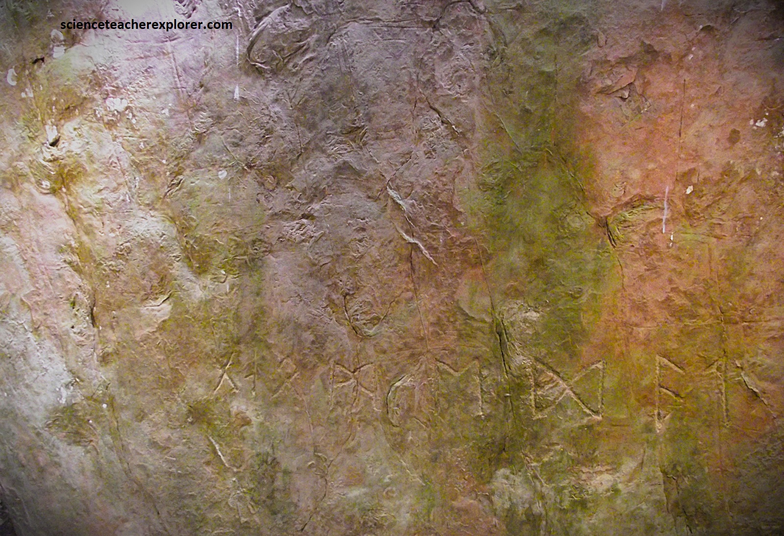
An American engineer and Norse scholar, Richard Nielson, (doctorate from the University of Denmark) did an in-depth study of ancient Scandinavian scripts and grammar. Nielson determined that the Heavener runes are derived from one of these alphabets called “Elder Futhark”. This allowed Nielson to translate the runes into plain text, or words. Nielson believed the Heavener Runestone was a property marker which claimed this site as “Glome’s Valley”.
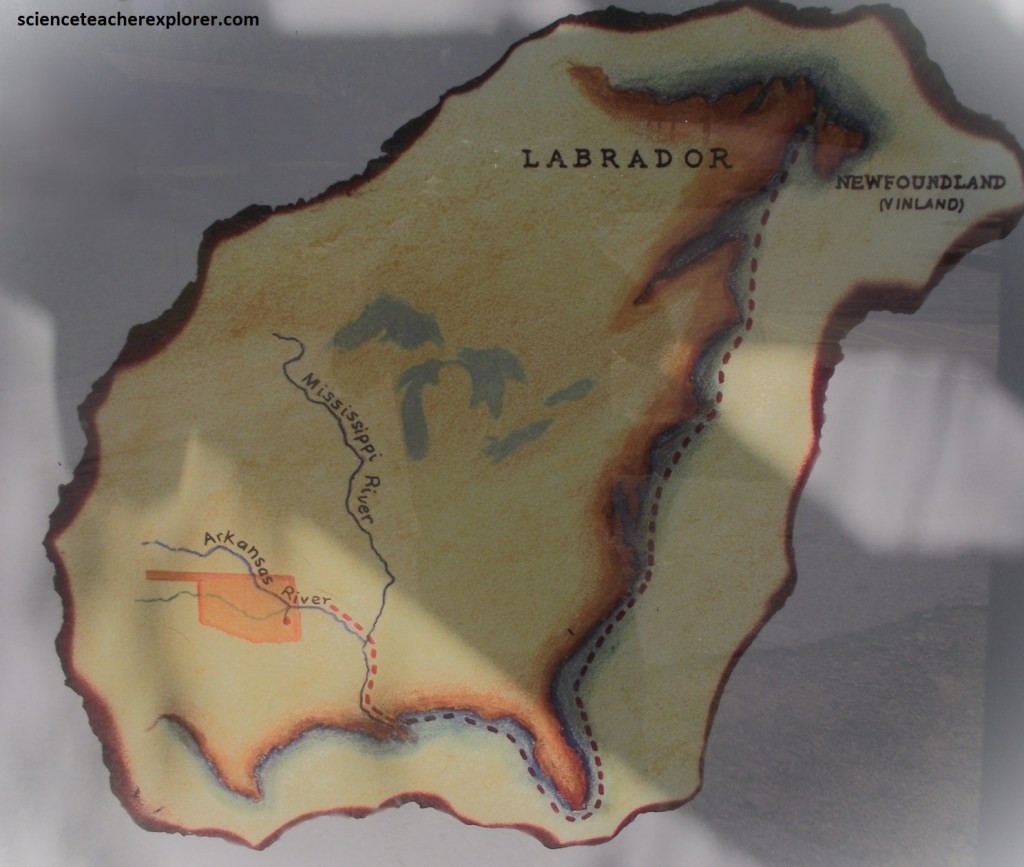
Dr. Nielson believed that Norse explorers rounded the tip of Florida, and entered the Gulf of Mexico and into the Mississippi River. One or more ships may have sailed up the nearby Arkansas river and into the Poteau River. This would have put their entrance into the area about 5 km from the present site of the Heavener Runestone, (imaged below).
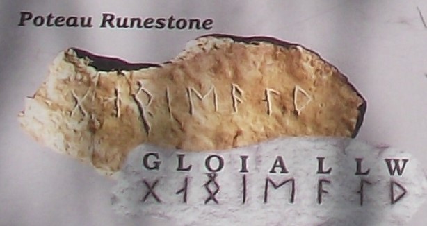
Additionally, it is reported that the Heavener Runestone was seen by a Choctaw Native hunting party in the 1830s. Signed statements have been made by territory residents who saw the stone as early as 1874. Four other runestones have been found in the Poteau and Heavener, Oklahoma area. A fifth runestone was found near Shawnee, Oklahoma. Using the Elder Futhark alphabet, Dr. Nielson translated the Poteau Runestone as G-L-O-I A-L-L-W meaning “Magic or Protection to Gloi”. Gloi is believed to be a nickname for Glome. Dr. Nielson translated the Shawnee Runeston as the Scandinavian name MEDOK. The Poteau and the Shawnee Runestones are exhibited at the Kerr Museum in Poteau, Oklahoma. { The images of Dr. Nielson, the Poteau Runestone and the Shawnee Runestone below were taken from an interpretive sign, on-site}.


Skeptics suggest that the runes were carved during the early European exploration of the Arkansas River valley in the early 1700s. Most archaeologists favor a still younger age for the carvings, possibly the late 1800s when many Europeans, (some well-educated), lived in Heavener.
{I find it interesting that the Shawnee Runestone “MEDOK”, seems to support the popular 18th & 19th century legend of “Madoc the Welsh Explorer”. Madoc the Voyager, also known as Madog ab Owain Gwynedd, was a Welsh prince who, according to legend, set sail from Wales in the 12th century and landed in North America, long before the arrival of Christopher Columbus. Some versions of the legend suggested that Madoc and his men intermarried with the Mandan Natives, and that their descendants went on to play a significant role in the development of North America. This legend might have influenced the explorations of Lewis and Clark or England’s claim to North America.}
Pictured above, the hilly 1.6 km nature trail meanders through the 50-acre park. Hickory, dogwood, redbud, oak, cedar, and pine trees proved cover for racoons, beavers, armadillos and deer, as well as hawks, blue jays, quail, and brown thrashers.