Pahvant, UT 2023
In the late summer of 2023, I decided to prepare for the annular Solar Eclipse on October 14th, 2023. I wanted to stay close to my home-town, but pick a spot the had minimal cloud cover and far from the mountains in the east. The eclipse would start in the morning. Pictured below, is the pathway for the eclipse and it’s cloud cover estimation, that was provided by NASA.
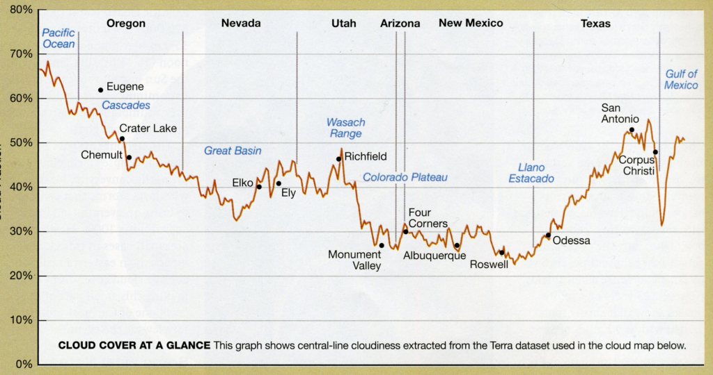
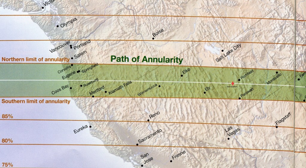
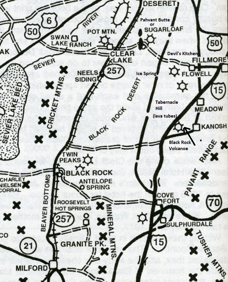
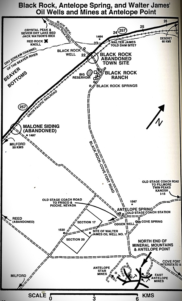
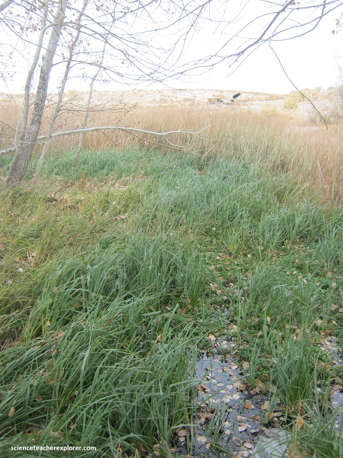
I noticed that the middle of the eclipse path would travel over the Pahvant Range and across the “Black Rock Desert of the Pahvant Valley in Utah. This gave me an opportunity to explore the area before and after the eclipse. I started on SR 257, north of Milford at the “Black Rock” ghost town site, (imaged below).
The “Black Rock Ghost-town” was a little town in south central Utah. It was situated along the Union Pacific Railway line about 32 km north of Milford, (towards Delta). The ruins I found are pictured below from Oct. 2023.
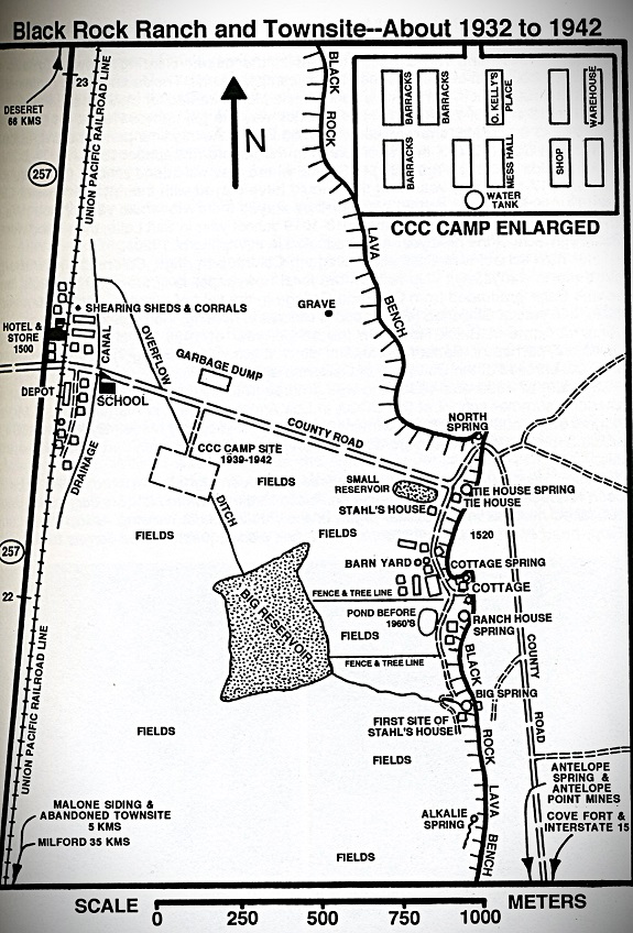
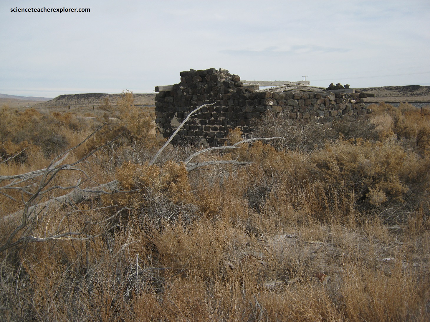
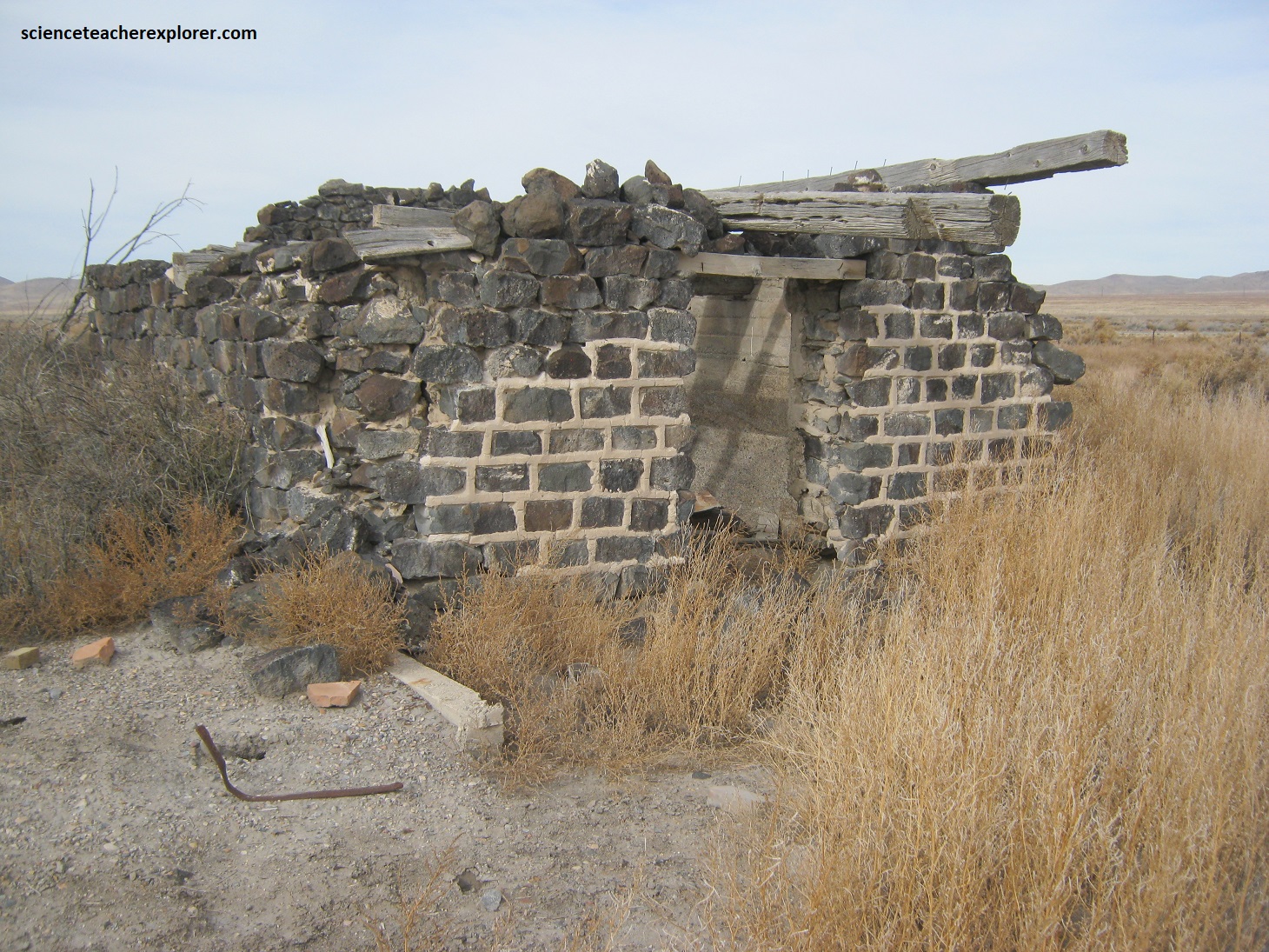
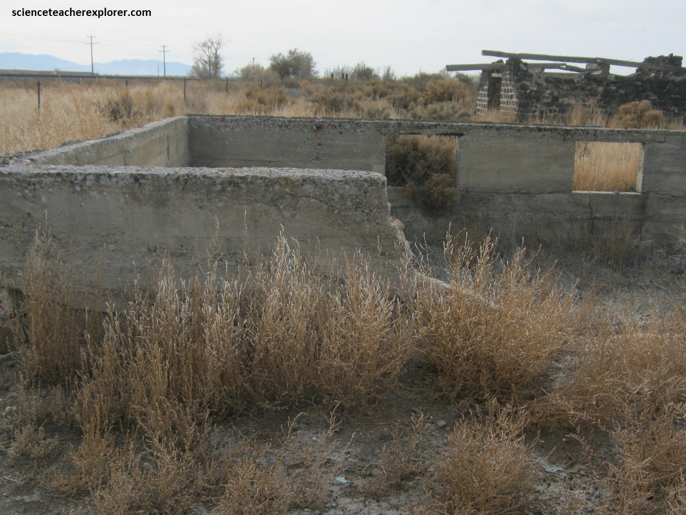
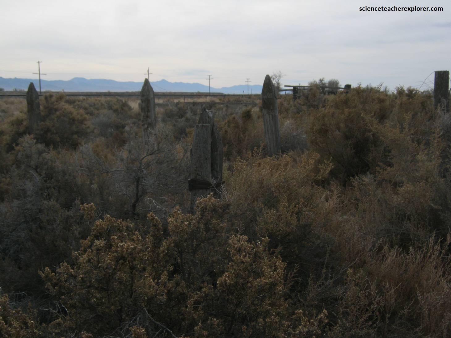
Life began in the late winter of 1880, when railway crews working south first built a rail-way grade through what would later be a town. Tracks were put down a month or so later. Soon after the arrival of the tracks, the decision was made to make this site the arrival and/or departure point for residence of the Fillmore area. As the area roads and vehicular travel improved, beginning in the twentieth century, its relative importance waned. A post office operated at Black Rock from 1891 to 1959. The population decreased from 70 to 20 by the 1950s.
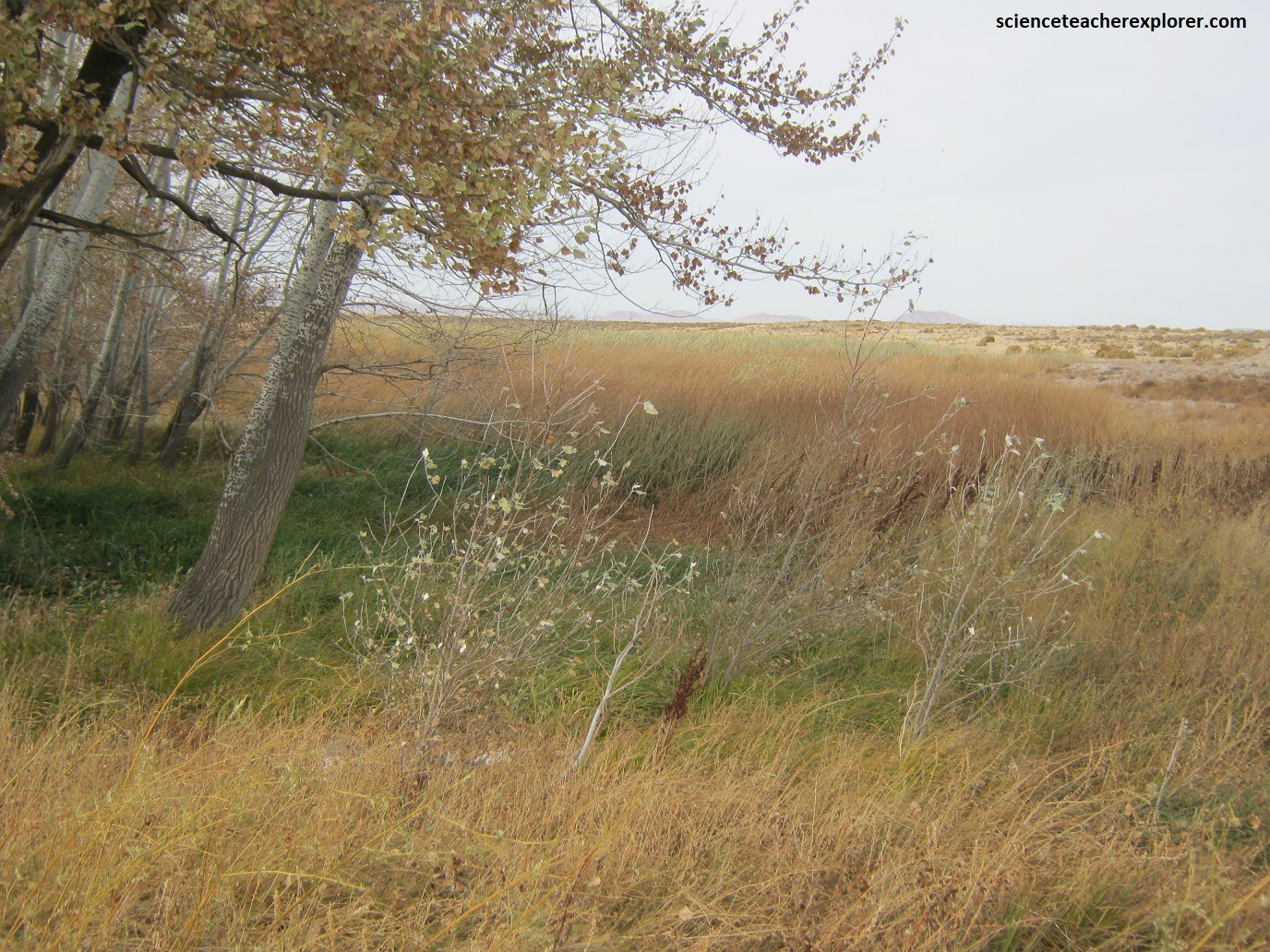
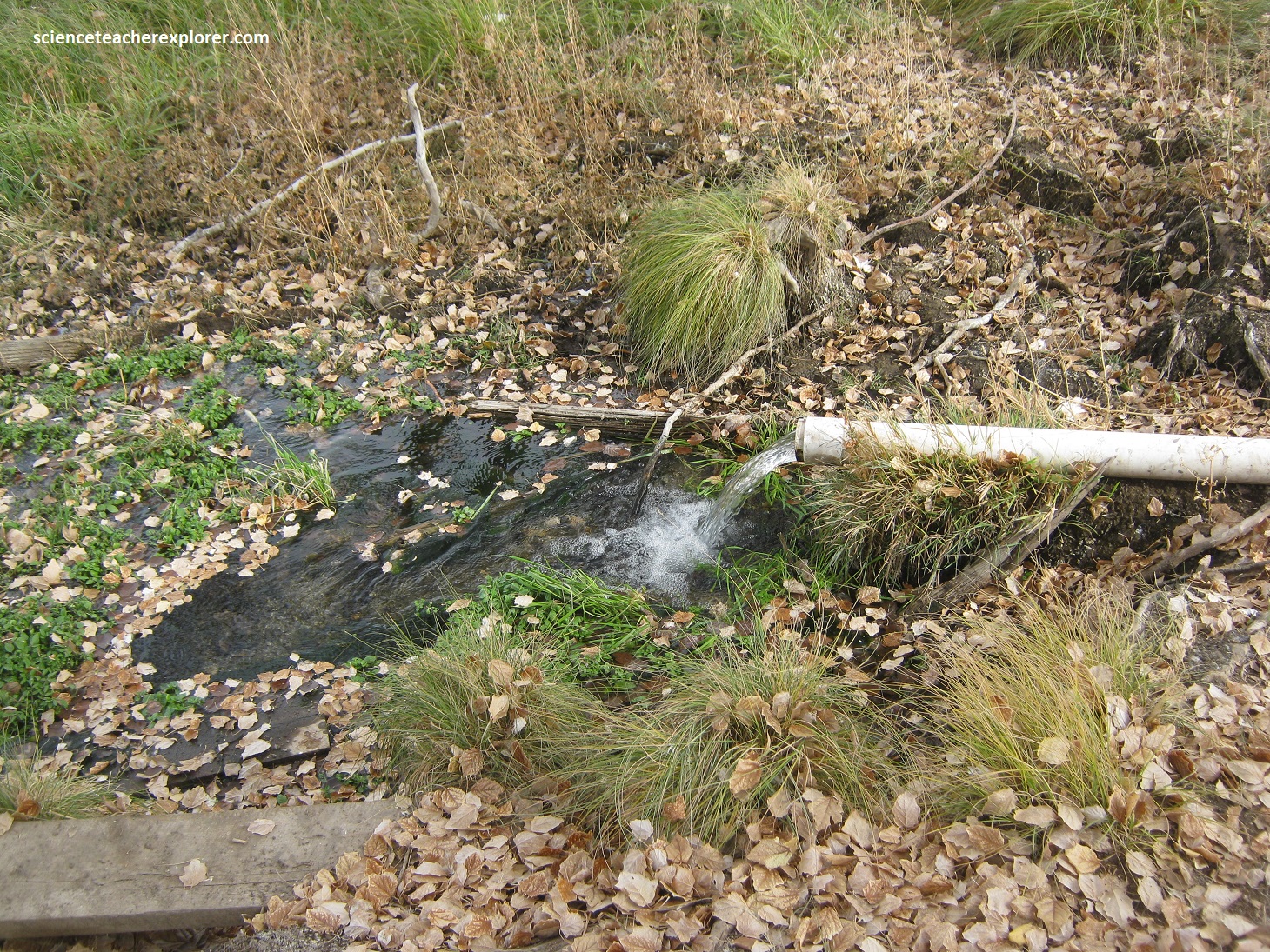
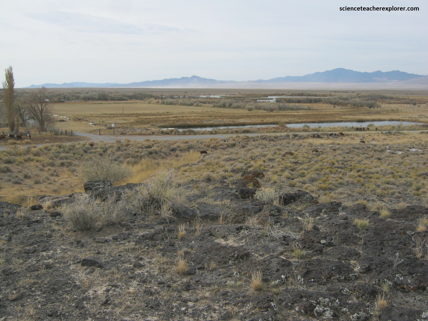
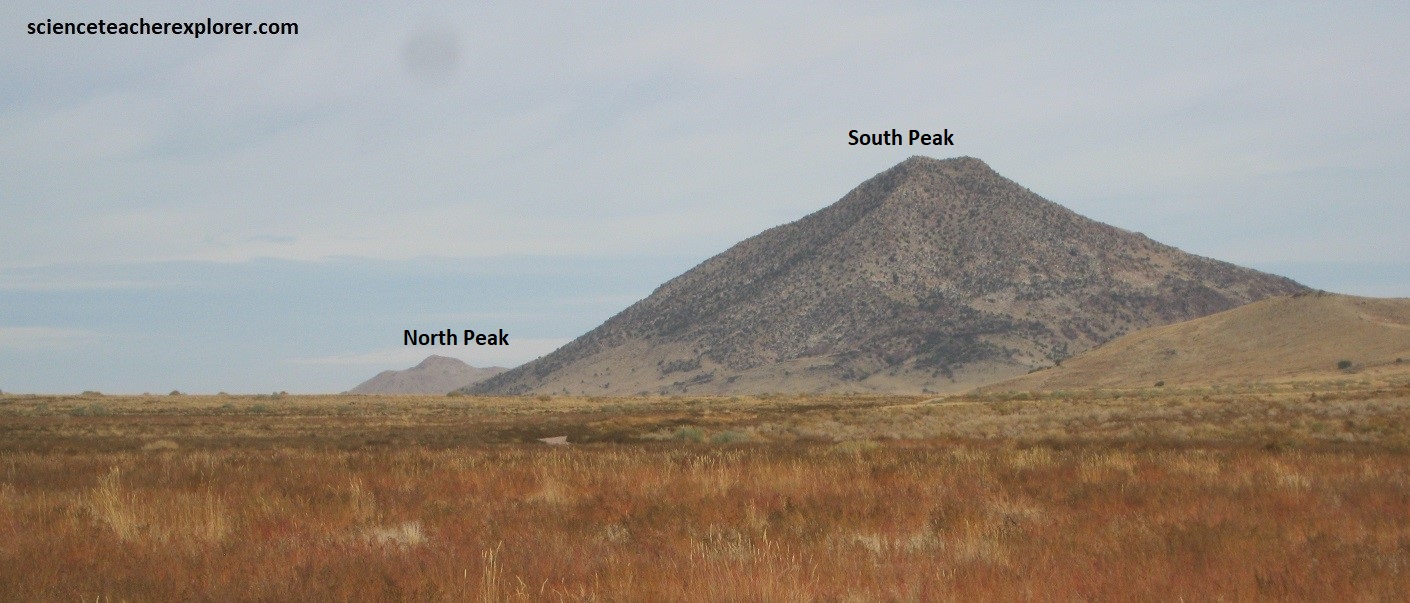
Further east, I stopped and explored “Antelope Spring”, (pictured above in Oct. 2023). It lies on the northern end of the Mineral Mountains of the Basin and Range Province. To the south, the Mineral Mountains exposed a large, mostly gray, alkalic, high-silica, composite Oligocene-Miocene (25 to 17 Million yrs. ago) granite, monzonite, and syenite batholith, (the largest exposed batholith in Utah). This batholith was strongly rotated to the east (40°–85°) in the middle to late Miocene, so that the east side of the mountain is closer to the paleo-top of the batholith. The strata, in this area, were of structurally complex Lower Cambrian quartzites thrusted over the Middle (?) Cambrian carbonates. From Antelope Spring, I headed northeast, towards Twin Peaks, (pictured below, photos taken in Oct. 2023).
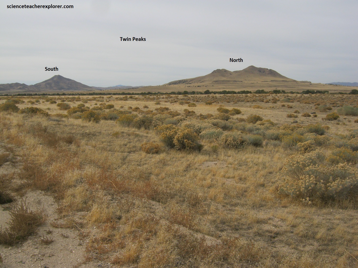
My research indicated that the Twin Peaks subfield represented a rhyolitic caldera with associated eruptions. These early eruptions (2.7 million yrs ago) formed an arcuate-shaped field of rhyolitic lava-domes that were then followed by the eruption of an ash-flow tuff that produced about 100 m of ground subsidence over an 120 km2 area. That caldera was filled with a lake and associated sediments, which formed a thick limestone deposit. Eruptions of both the basalt flows and rhyolitic lava-domes filled the rest of the caldera, culminating in the formation of the Burnt Mountain cinder-cone, that had lava flows that occurred 2.1 million yrs. ago.
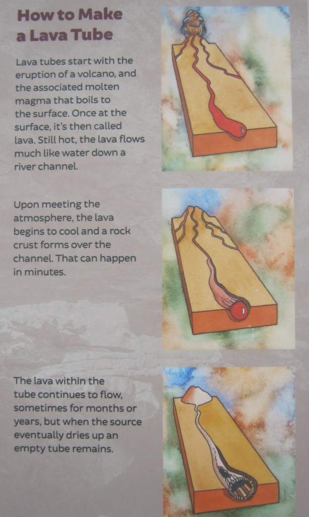
Black Rock Desert is part of a Pleistocene-Holocene volcanic-field that has been an active tectonic area for approximately 2.7 million years. Within the past 1.5 million years, local volcanism has produced both rhyolitic and basaltic cones from near 24 vents from which lava escapes through geologic faulting. Black Rock Desert is distinct from most other young volcanic fields in Utah in that it contains not only basalt and andesite, but also dacite and rhyolite. Eruptions are dominantly monogenetic, but some are more complex. Black Rock Desert is host to a variety of volcano types, including cinder cones, shield volcanoes, lava domes, maars (explosion craters), and a caldera. Lava tubes are preserved in some of the younger volcanoes.
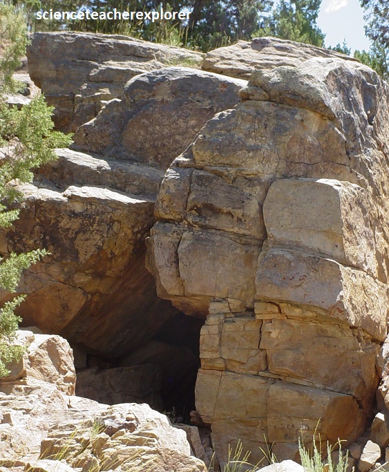
After driving by Twin Peaks, I continued on to Hole-in-the-Rock. Native people long ago selected this place to leave etchings on the rocks, (photos taken in Oct. 2023).
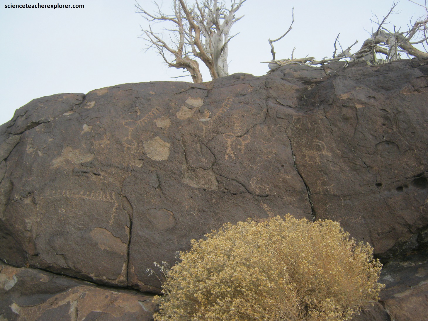
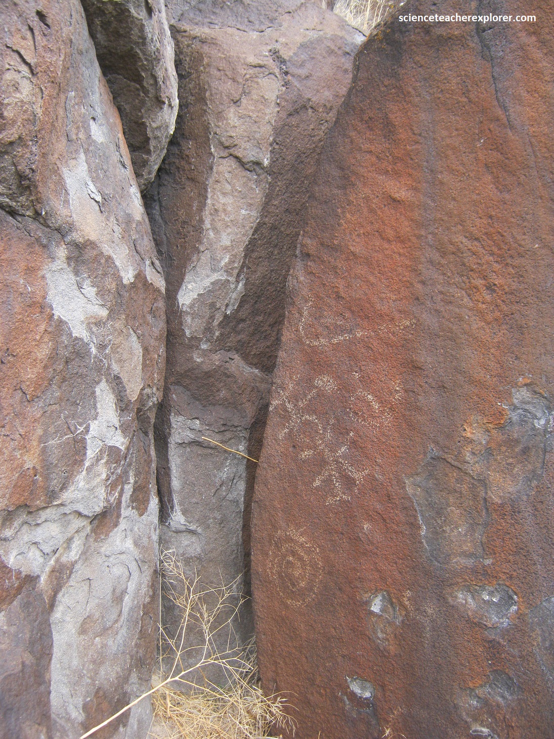
Geometric shapes, (circles, hashmarks, and wavy lines), are common. It’s a style archaeologists call Great Basin Curvilinear and it could be thousands of years old. Other images in different styles were made by people many centuries later.
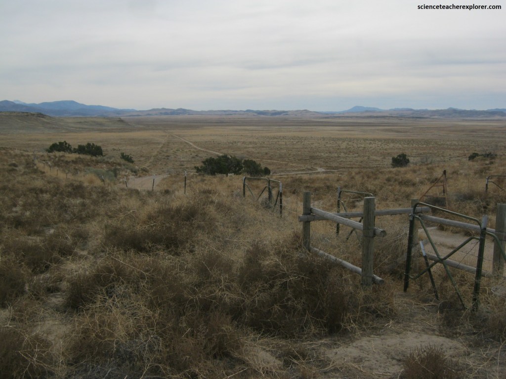
Picture above, from Hole-in-the-Rock, looking southwest across the valley, you see the lingering effects of the Milford Flat fire. On a July afternoon in 2007, a lightning strike ignited the blaze that spread with incredible speed.
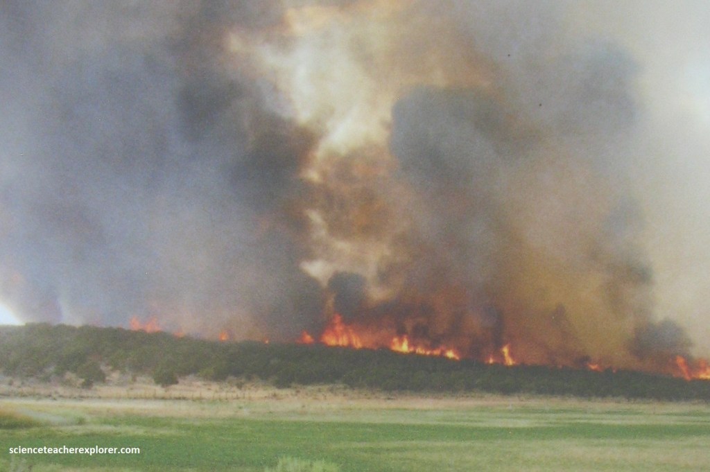
Smoke and flames caused traffic accidents on I-15, and people had to be evacuated. By the middle of July, the fire was finally contained. It burned about 360,000 acres, the largest wildfire in Utah’s history.
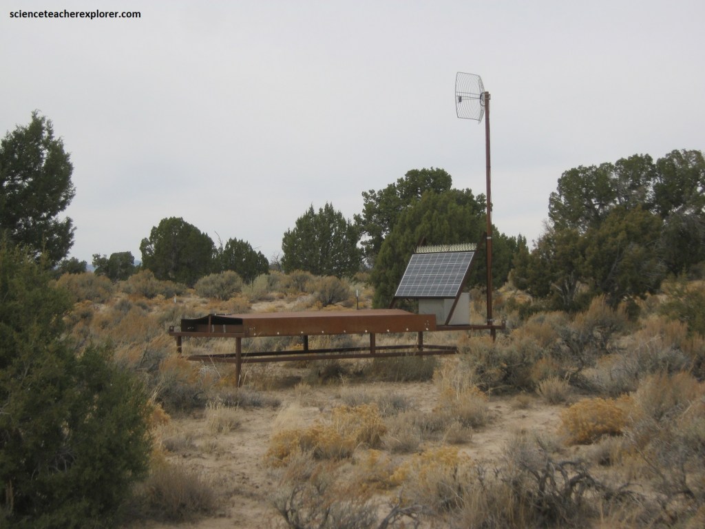
Pictured above, the Telescope Array (TA) is the largest cosmic ray detector in the northern hemisphere, located just to the west of Delta, UT. It detects cosmic-ray-induced extensive air showers for cosmic rays with energies above about 1 EeV (a sixth of a Joule). In 1991, they detected the highest-energy cosmic ray ever observed. Later dubbed the “Oh-My-God particle”, the cosmic ray’s energy shocked astrophysicists.
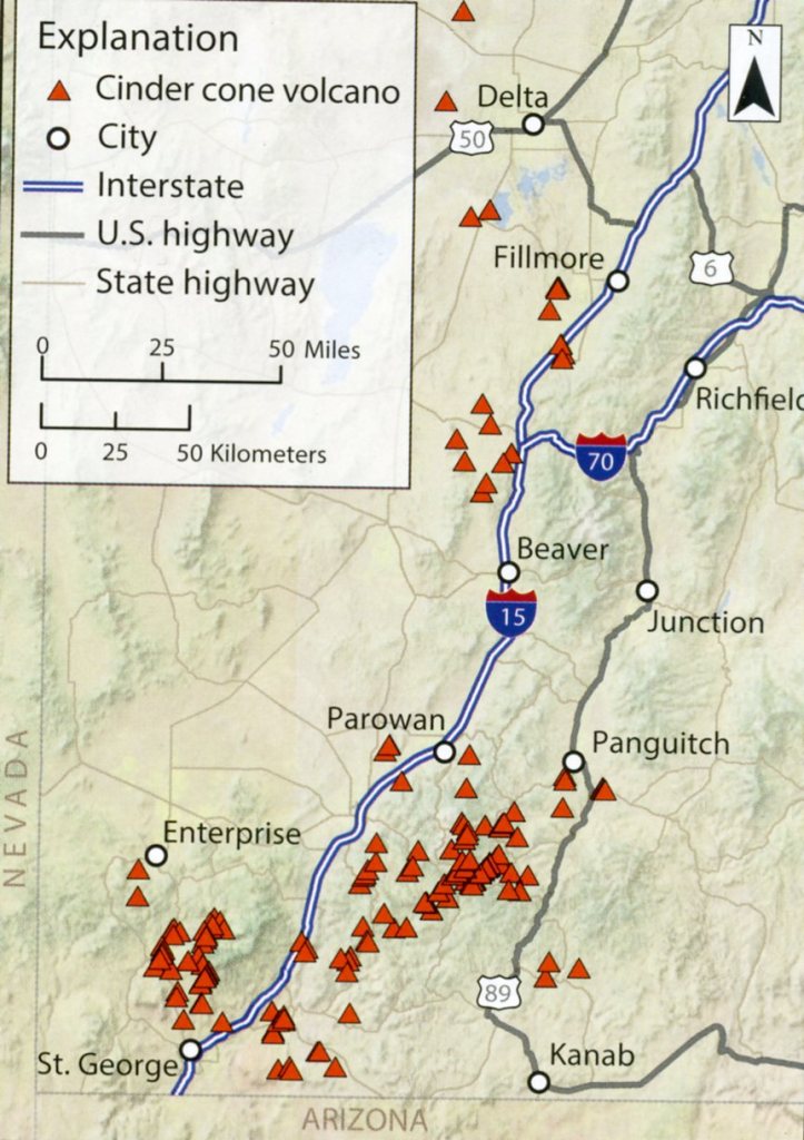
Utah claims more than 150 cinder cone volcanoes, found throughout the southwestern quadrant of the state. Their presence and prevalence stems from the dynamic and complex forces of plate tectonics and geologic events set in motion 150 million of years ago. Imaged below, an ancient oceanic plate called the Farallon plate was forced under the western side of the continental North American plate during subduction. Imaged below, the more-buoyant-than-normal Farallon plate, with a little extra push-back from the North American plate, caused the leveling out of the Farallon plate and faster-than-normal advancement far eastward underneath the crust in Utah. This also caused uplift of mountain ranges similar to the Uintas.
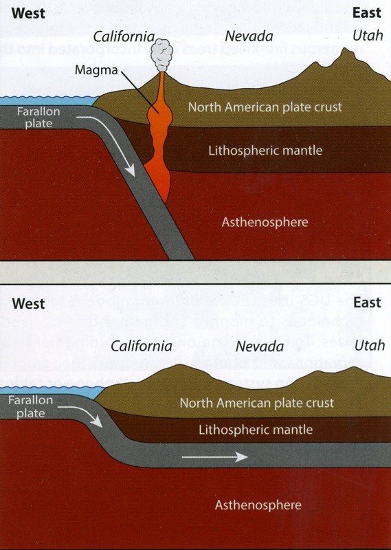
Imaged below, the Farallon plate could not remain flat and its trajectory steepened downward again, and even rolled back toward itself. As subduction slowed, a section of the Farallon plate broke off and sank deeper down into the planet’s interior. The sinking of the detached section and the initial rollback motion facilitated the migration and flow of hot material upward from the asthenosphere, which in turn helped to melt the lower lithospheric mantle of the over-riding North American plate. This magma rose through the crust of the North American plate towards the Earth’s surface and caused enormous volcanic activity throughout Utah.
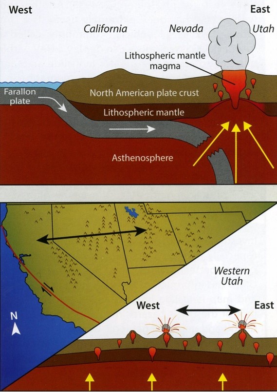
Imaged above, the bulk of the Farallon plate was subducted by about 17 million years ago, and is still in contact with the Pacific plate. However, unlike the subducted Farallon plate, the Pacific plate laterally grinds past the North American plate at a transform boundary, (San Andreas Fault). This oblique tectonic motion coupled with the previous long period of heating and softening is stretching, elevating and thinning the continental crust across the Basin and Range Province from western Utah to eastern California. In turn, this stretching and thinning facilitated a transition from enormous explosive volcanoes, (Tushar Mountains), to the many small cinder cones found across southeast Utah and the Black Rock Desert. The magma that feed these cinder cones are mainly composed of the upwelling asthenosphere and is therefore less viscous & basaltic in composition.
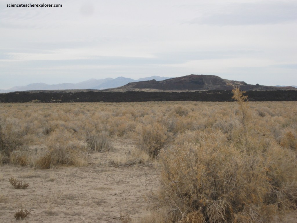
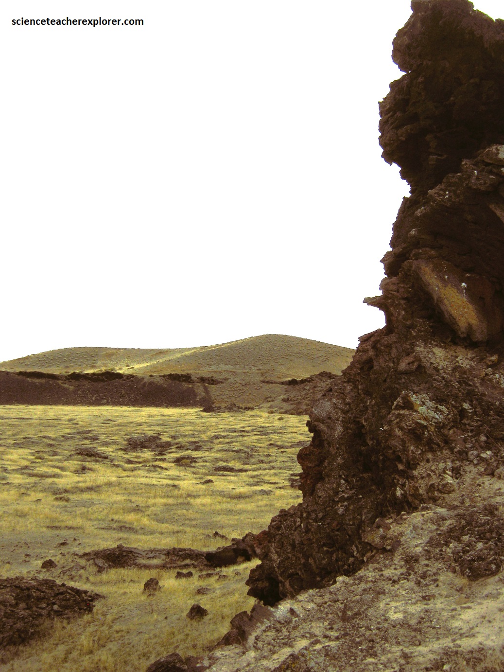
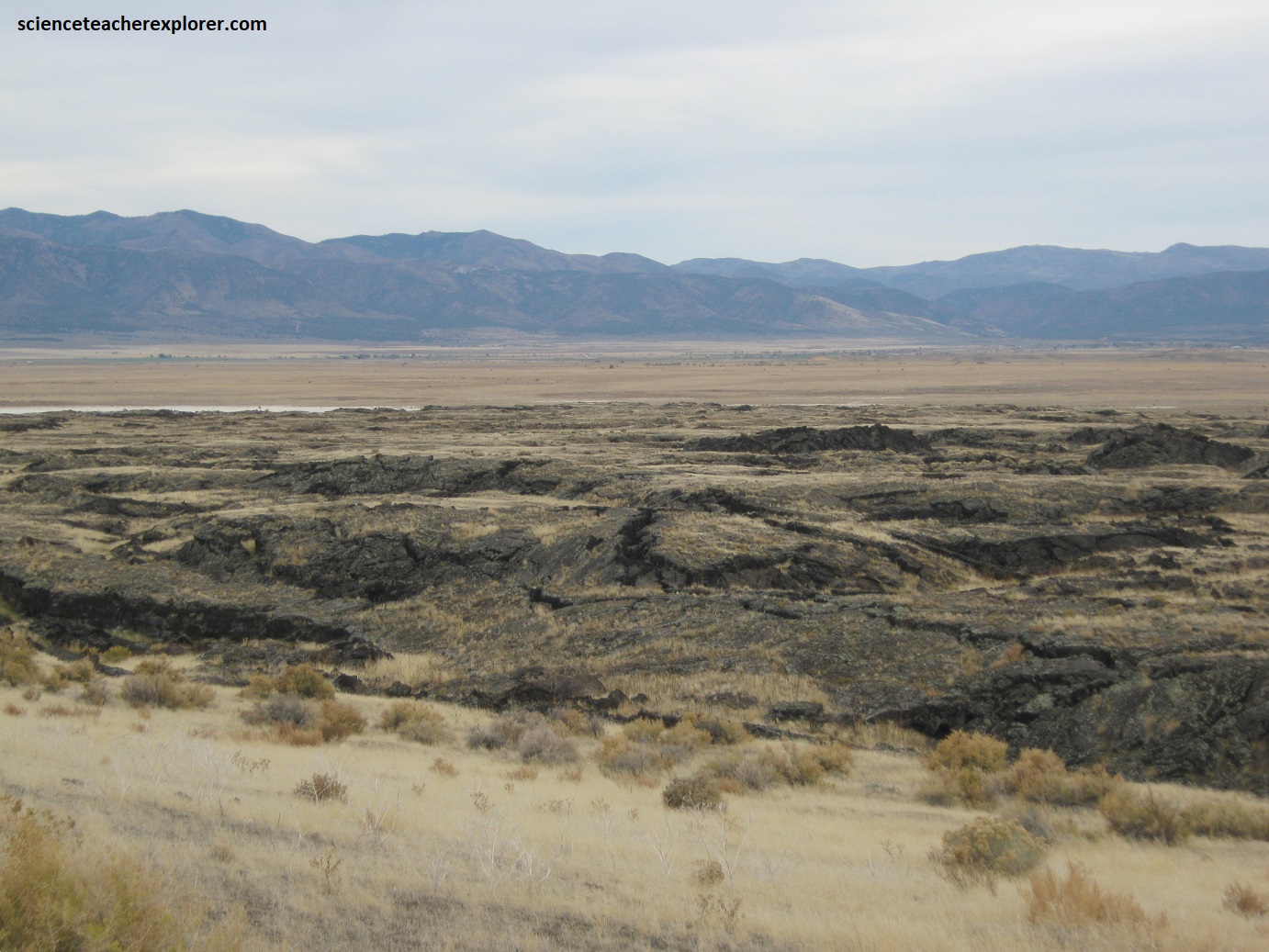
Coming in from the northwest on Lava Tubes Road, I explored and trekked the Pahvant Valley lava-tubes, which extend for hundreds of meters. They formed as the surface of lava streams cooled, solidified, and crested over, (pictured below are the Lava Tubes near Tabernacle Hill during Oct. 2023; note the collapsed roofs forming skylights).
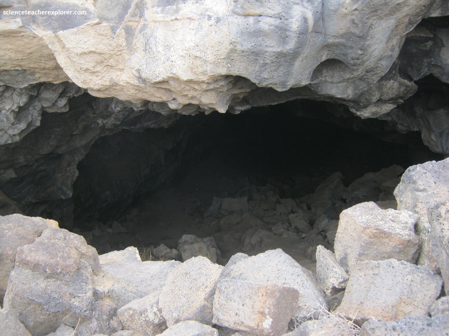
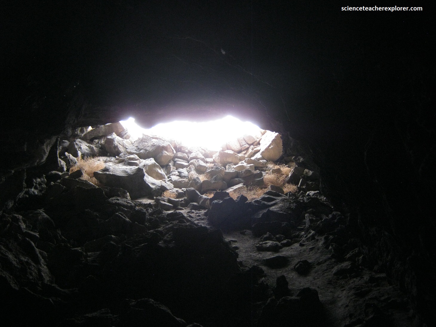
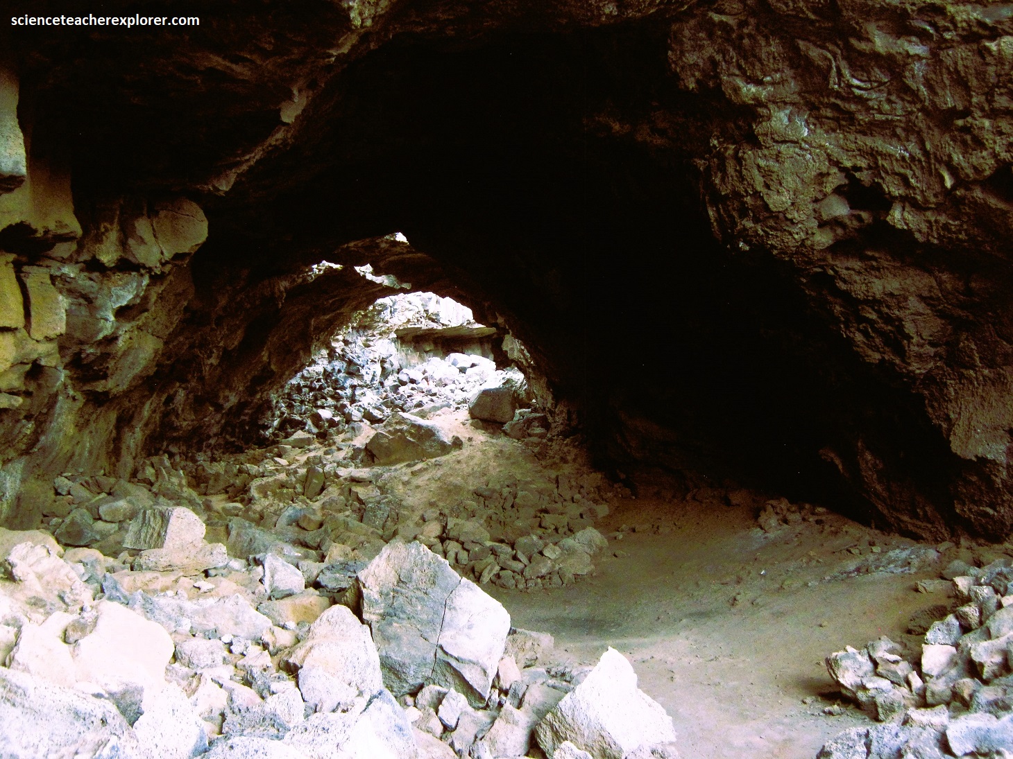
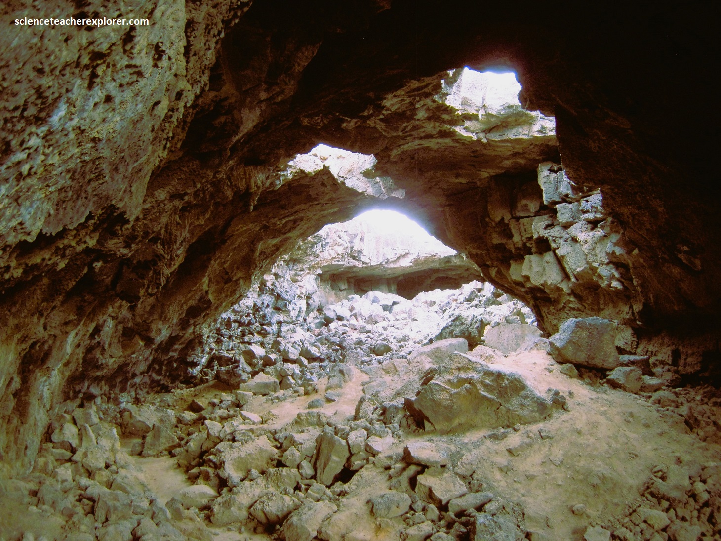
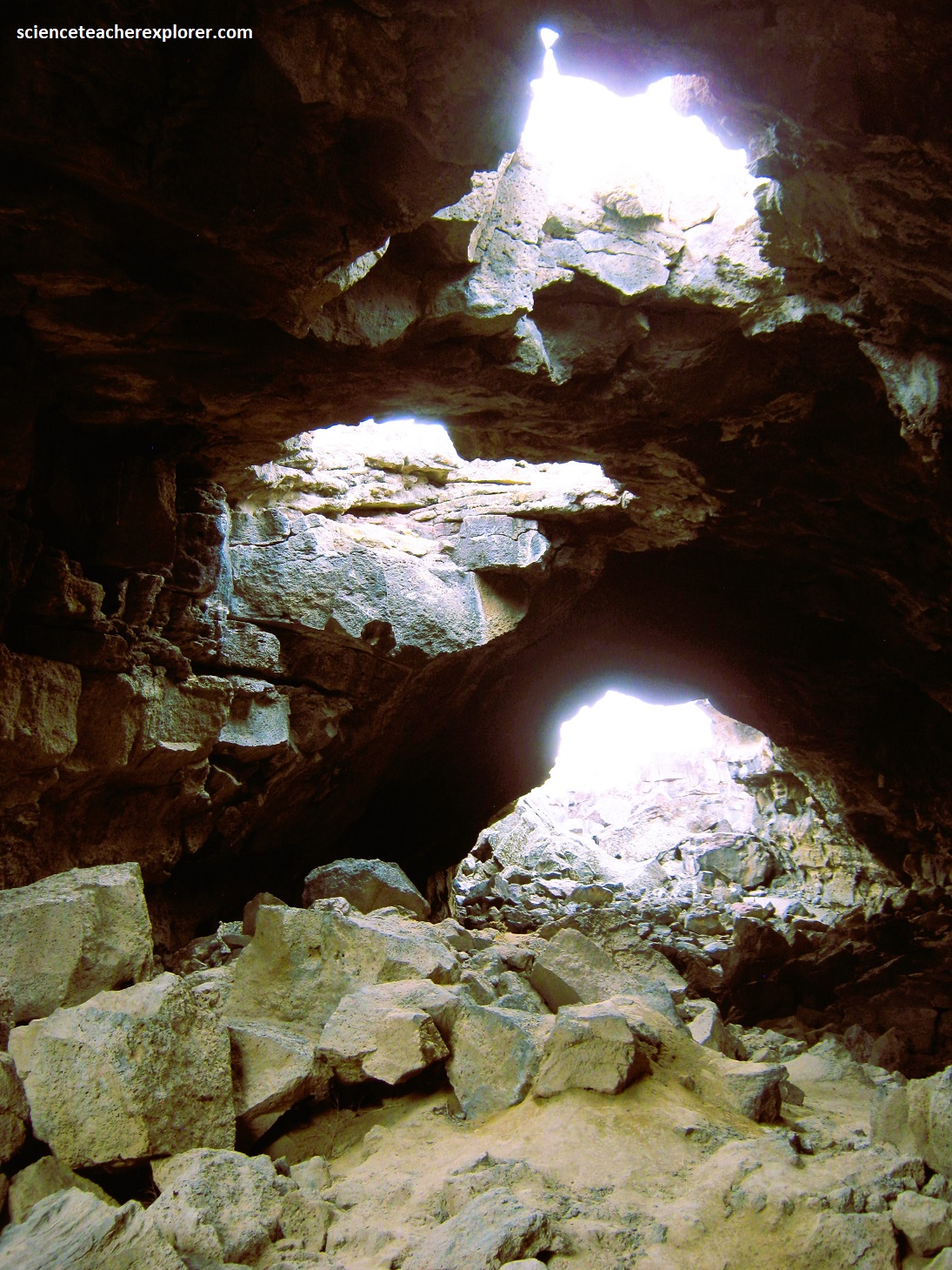
The subterranean lava vacated the tubes as the supply of lava diminished, leaving behind these empty conduits, (as seen below). Creatures like Big Brown Bats appreciate the cool shelter for home.
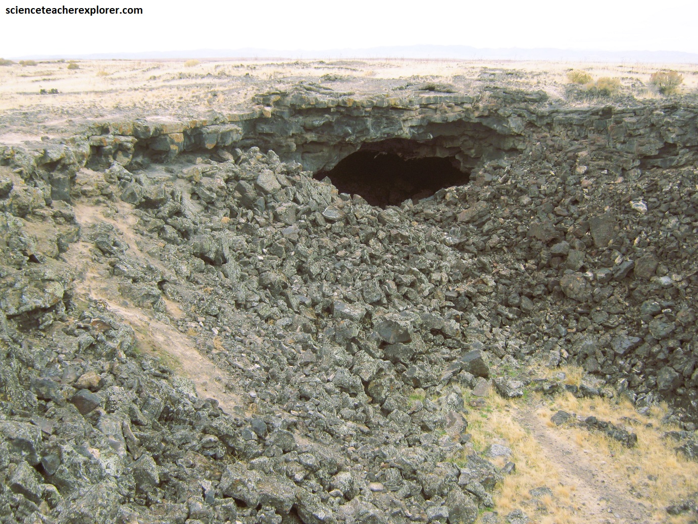
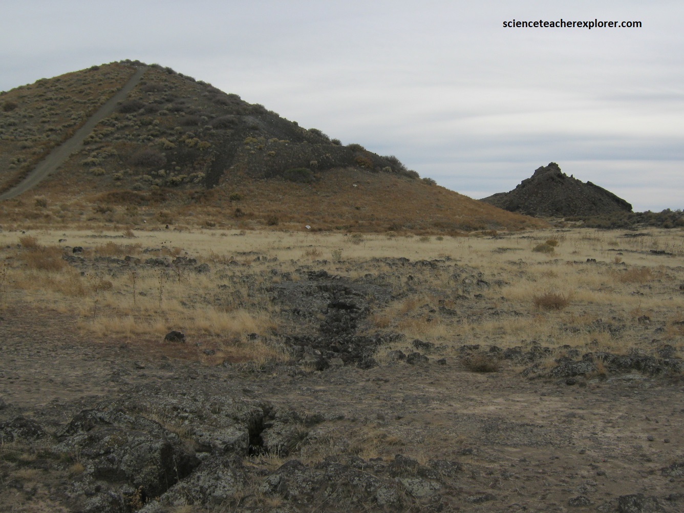
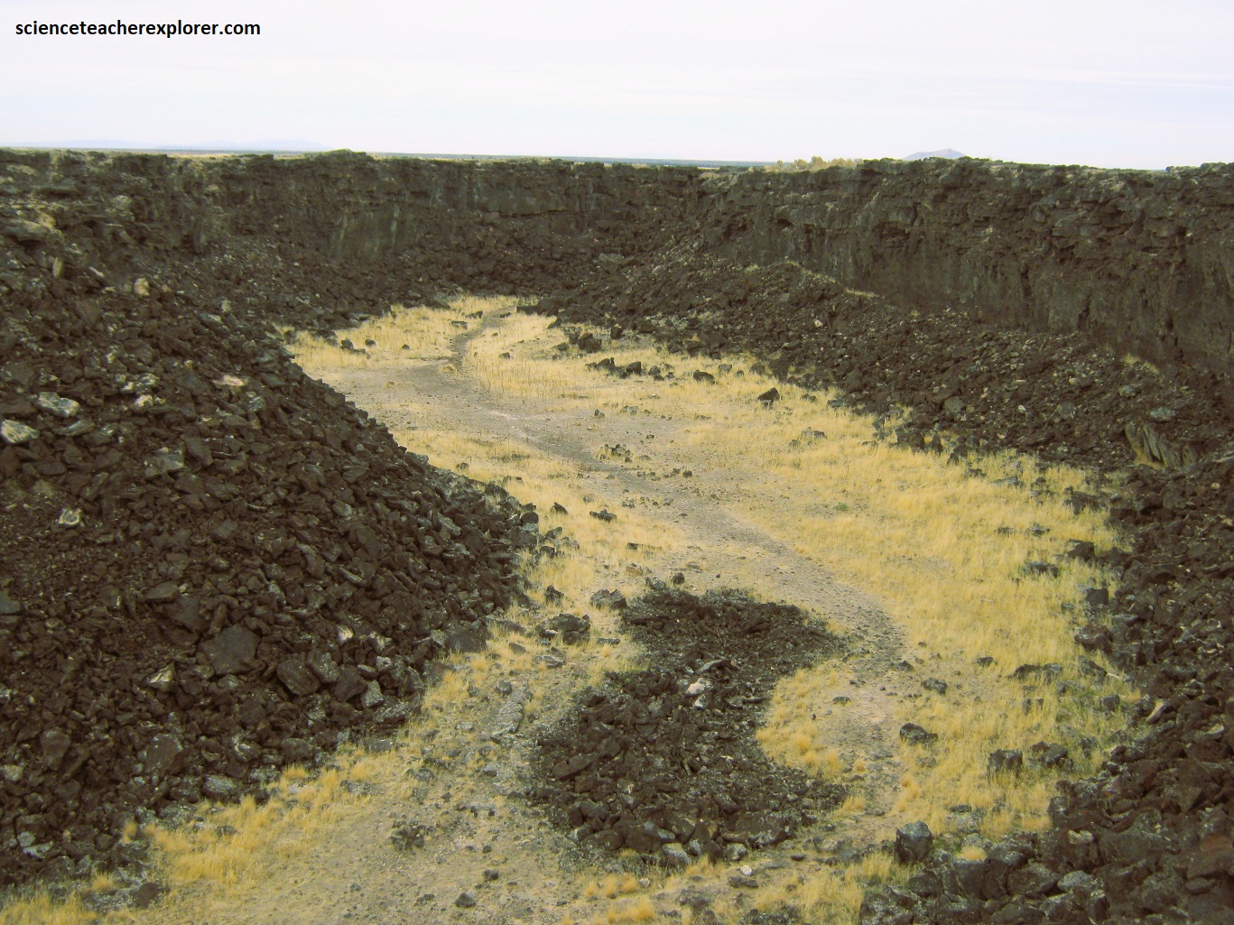
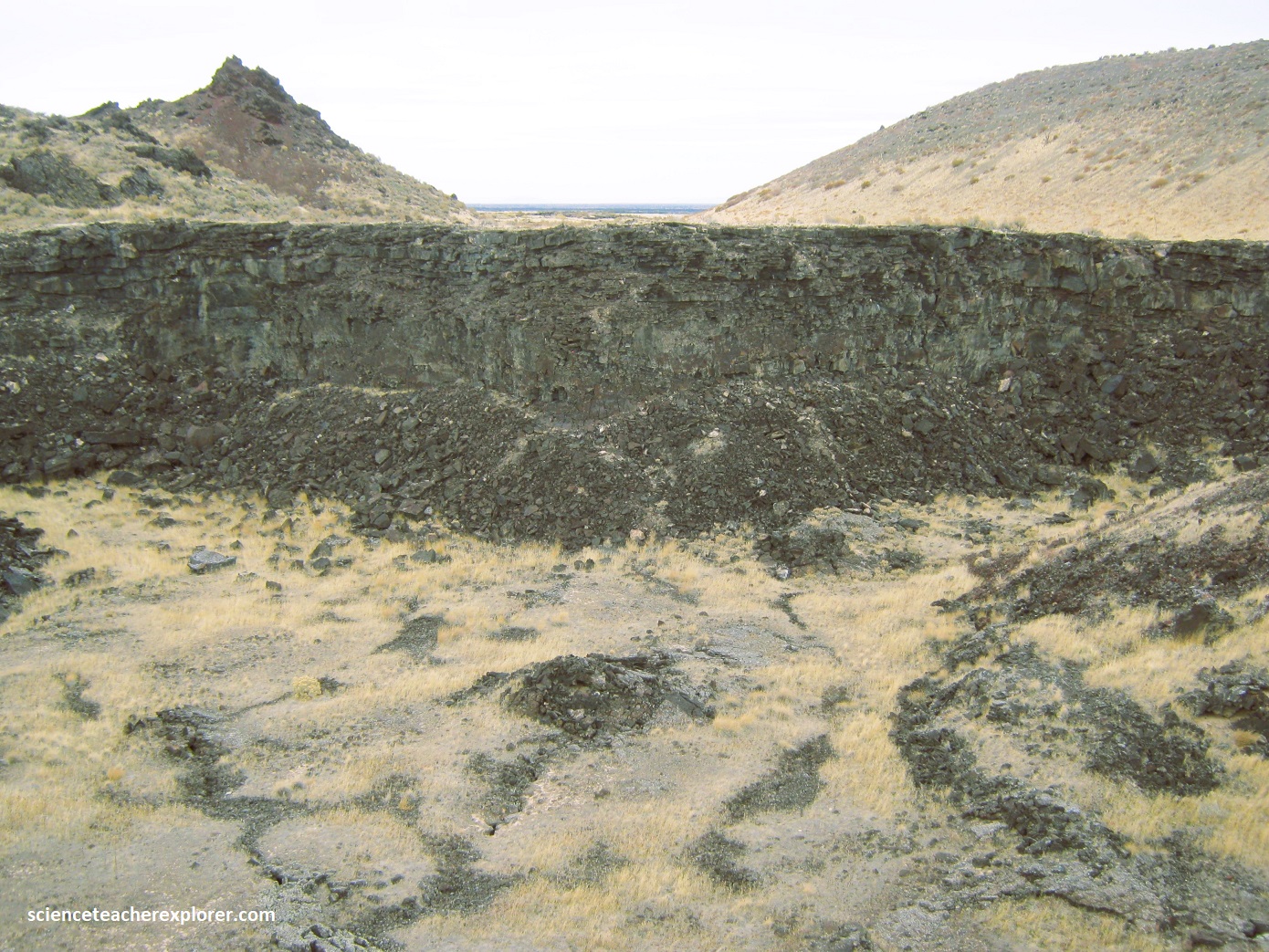
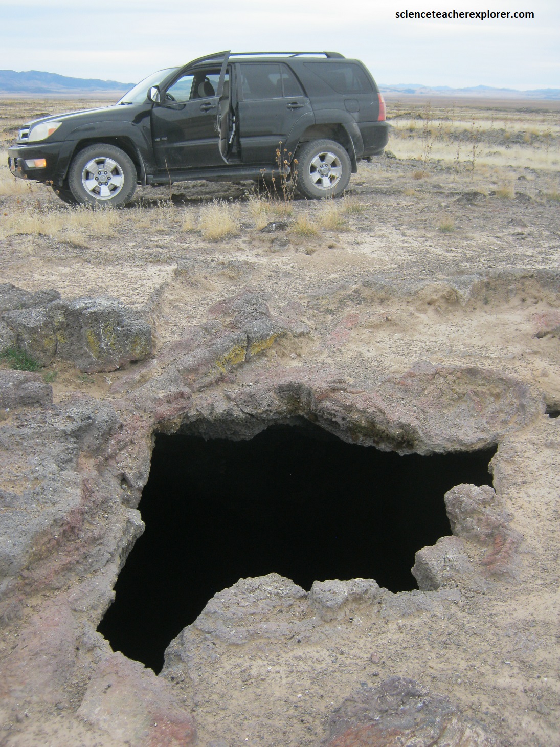
The central tuff ring, from which Tabernacle Hill gets its name, is a type of volcanic cone made of ash and grittier fragments (lapilli) created by explosive eruptions caused by the interaction of basaltic magma and shallow water. Only 2/3 of Tabernacle Hill’s original 1,000 m diameter cone remains; the northwest side had been obliterated by eruptions. The central caldera with the tuff ring is surfaced with pressure ridges and domes, which are elliptical mounds that commonly split lengthwise along their crest as molten lava pushes upward on the solidified crust of the flow. Picture below are photos take in Oct. 2023 of Tabernacle Hill. (Notice the extremely deep hole found near my vehicle, south of the Tabernacle Hill crater).
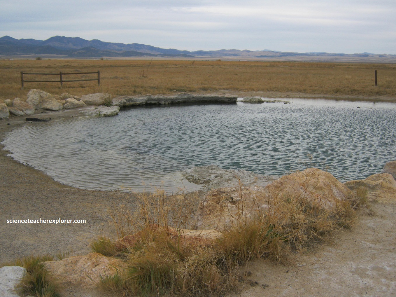
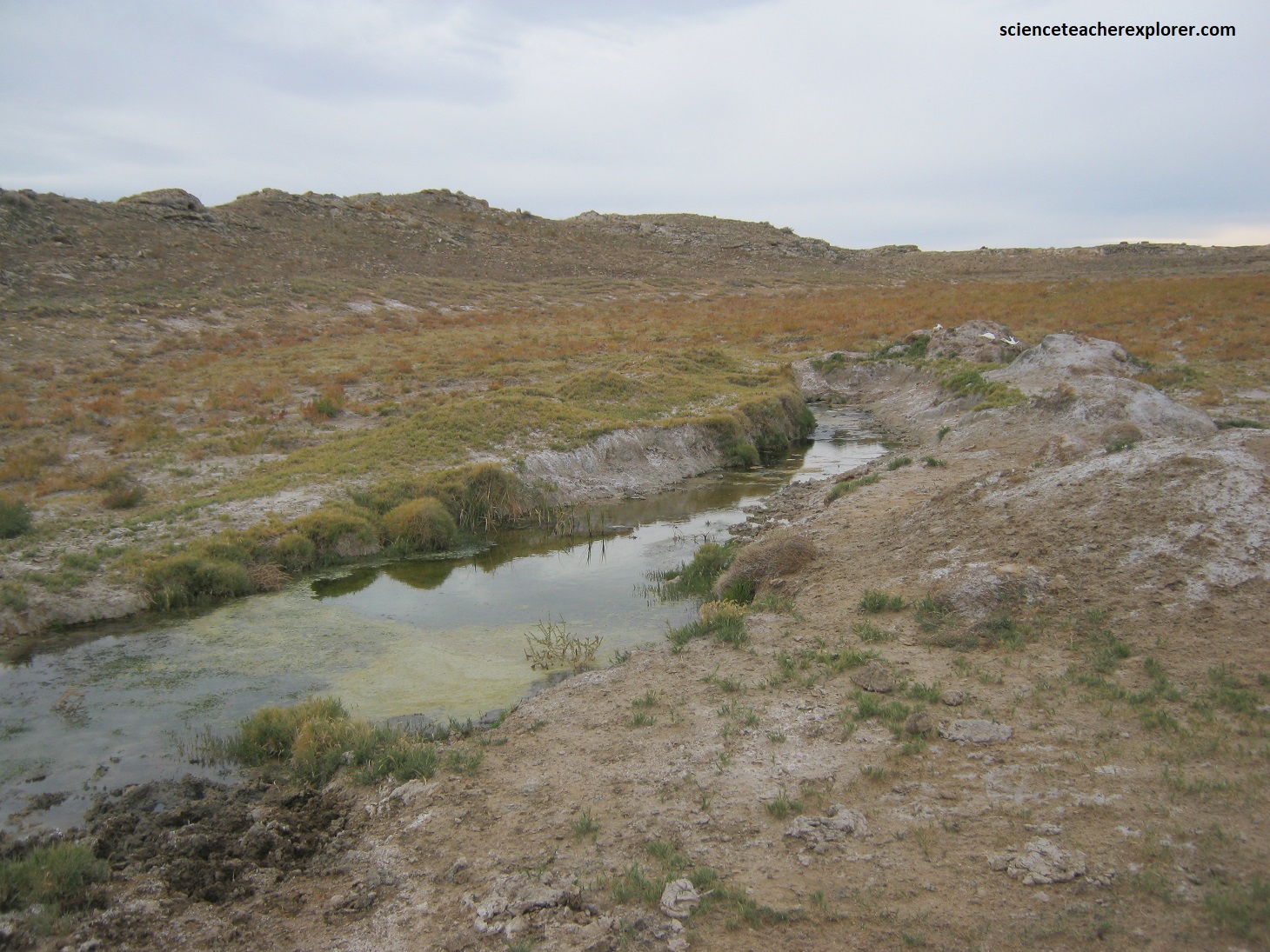
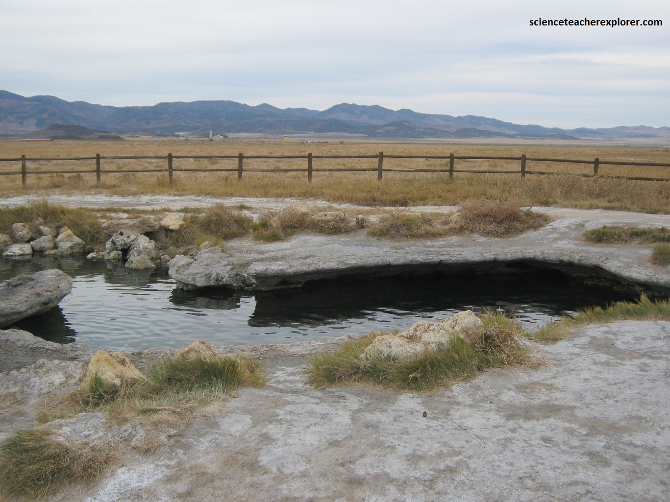
My next stop is southeast of Tabernacle Hill, called Meadow Hot-Springs. Meadow Hot-Springs features 3 different pools that all vary in temperature. The closest pool is the warmest and deepest spring on the property at 102 degrees and nearly 9m deep. This smaller but deep pool has become a popular destination for scuba divers and free-divers from around the country. Pictured below are photos taken in Oct. 2023 of the 3 different hot-springs. The nearby travertine deposits come from the volcanic activity, which heats the springs around Tivoli. Generally, the development of travertine involves rapid precipitation of calcium carbonate.
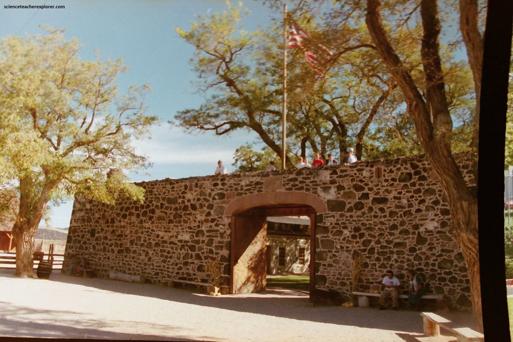
From here, I went south on I-15 to visit Cove Fort. Cove is located about halfway between Fillmore and Beaver. It provided a way-station for people traveling the Mormon Road. It is square, 30 m on each side. The walls are constructed of black basalt and dark limestone, both quarried from the nearby mountains. The walls are 6 m high and 1.2 m thick at the base, tapering to 0.75 m thick at the top. The fort has two sets of large wooden doors at the east and west ends, originally filled with sand to stop arrows and bullets, and contains 12 interior rooms (6 on the north wall and 6 on the south wall.)
From Cove Fort, I drove east on I-70 to explore and visit the Fremont Indian State Park in Clear Creek Canyon and on the southern edge of the Pahvant Range, (pictured below). Fremont Indian State Park & Museum interprets archaeological remains of the Fremont culture. The site was developed during the construction of I-70, and thousands of artifacts had been excavated from the ancient village there and put on permanent display at the museum on site. The Fremont Indians were agriculturalists who lived from about 400 to 1300 A.D. in north and central Utah and adjacent parts of Colorado, Idaho, and Nevada. The Fremont are thought to have come from hunter-gatherers who previously lived at this location and were influenced by the Ancestral Puebloans who introduced corn and pottery, making year-round settlements possible.
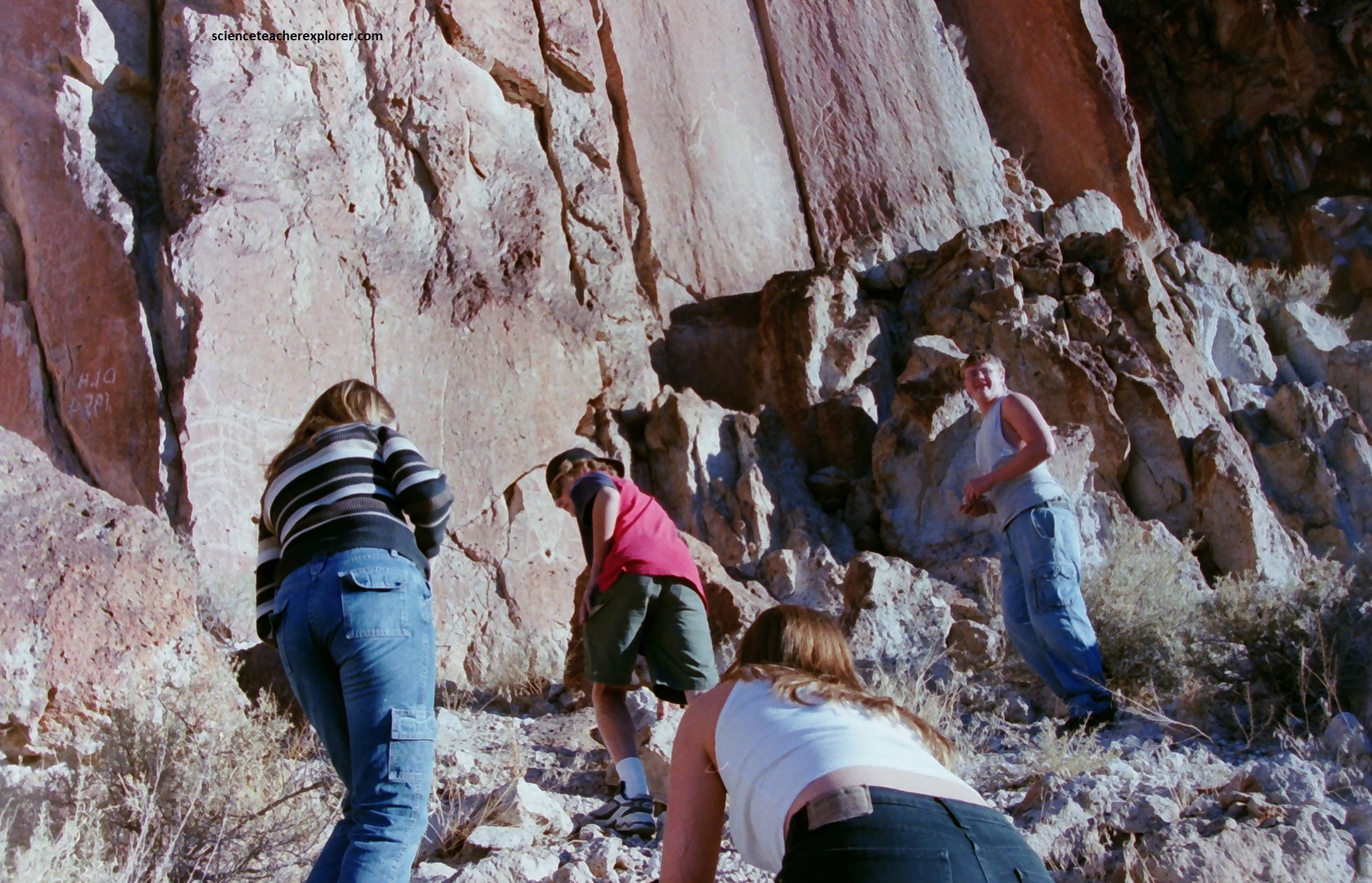
Pictured above are a group of my students in 2005, climbing to the ledge-face at the Fremont Indian State Park to see a series of pictographs. The photo on the right was taken by my friend and asst. advisor at the time: Marc Curtis
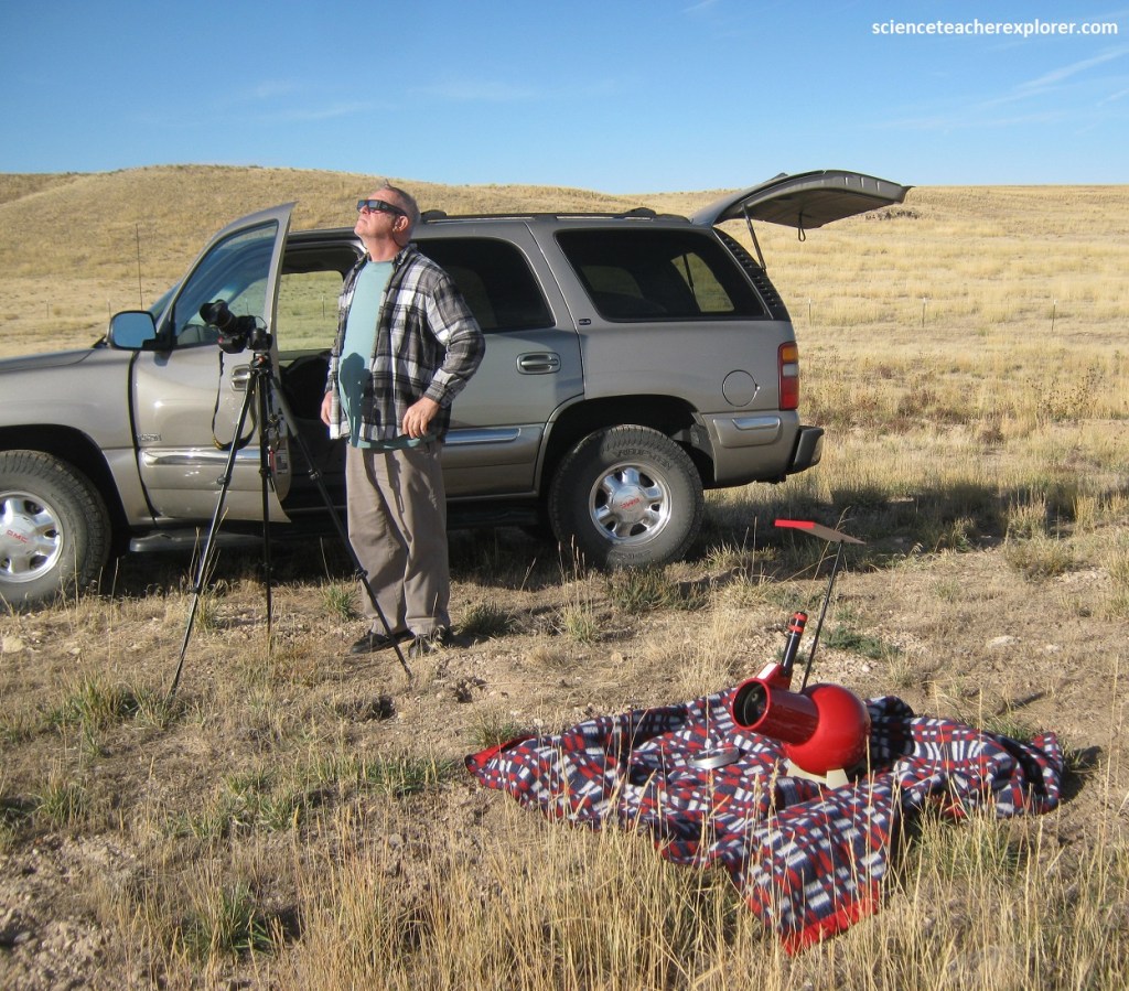
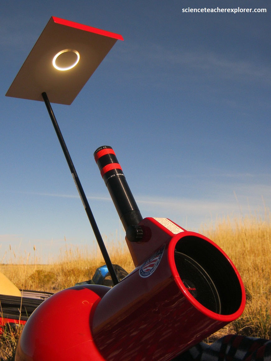
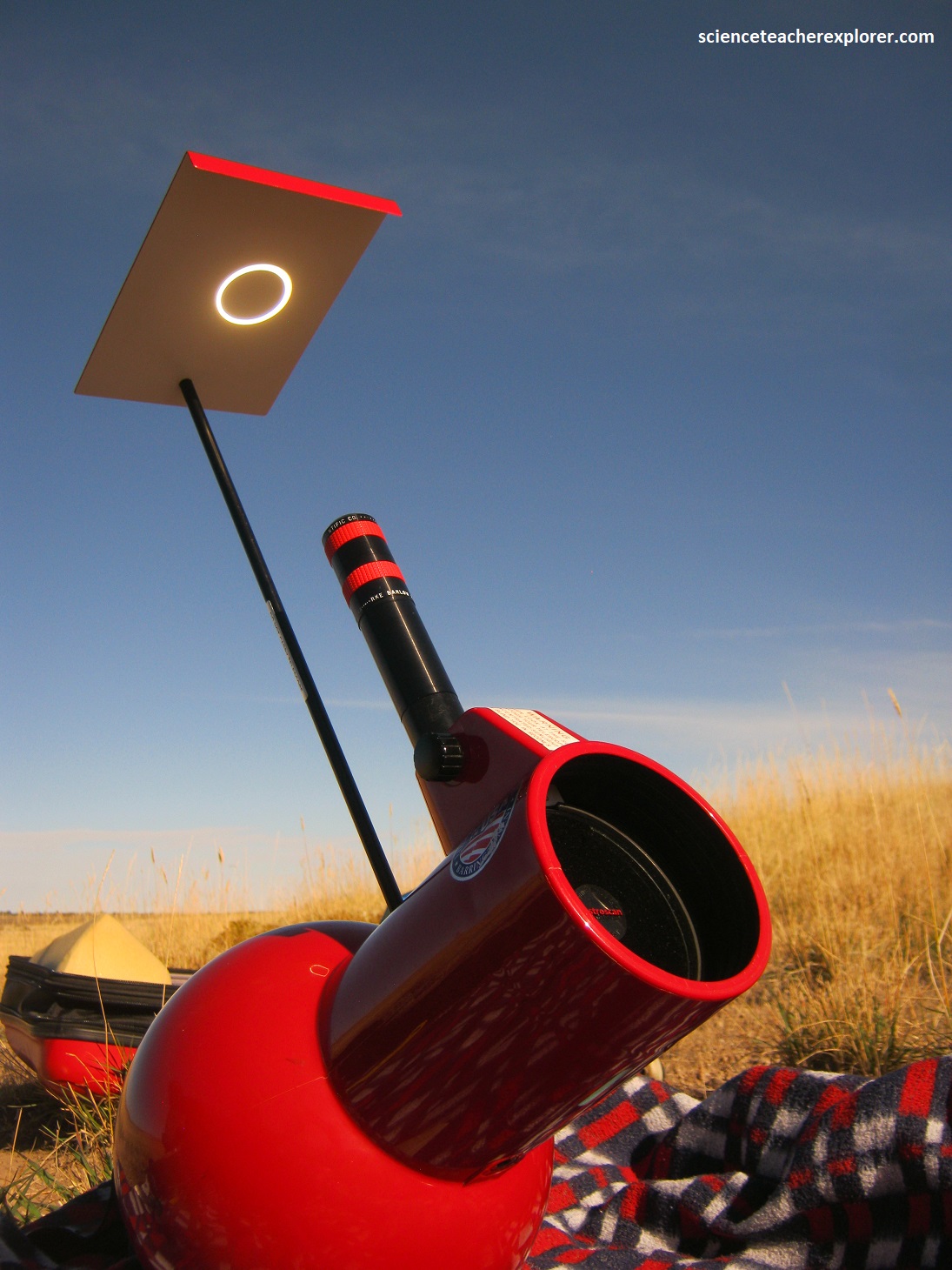
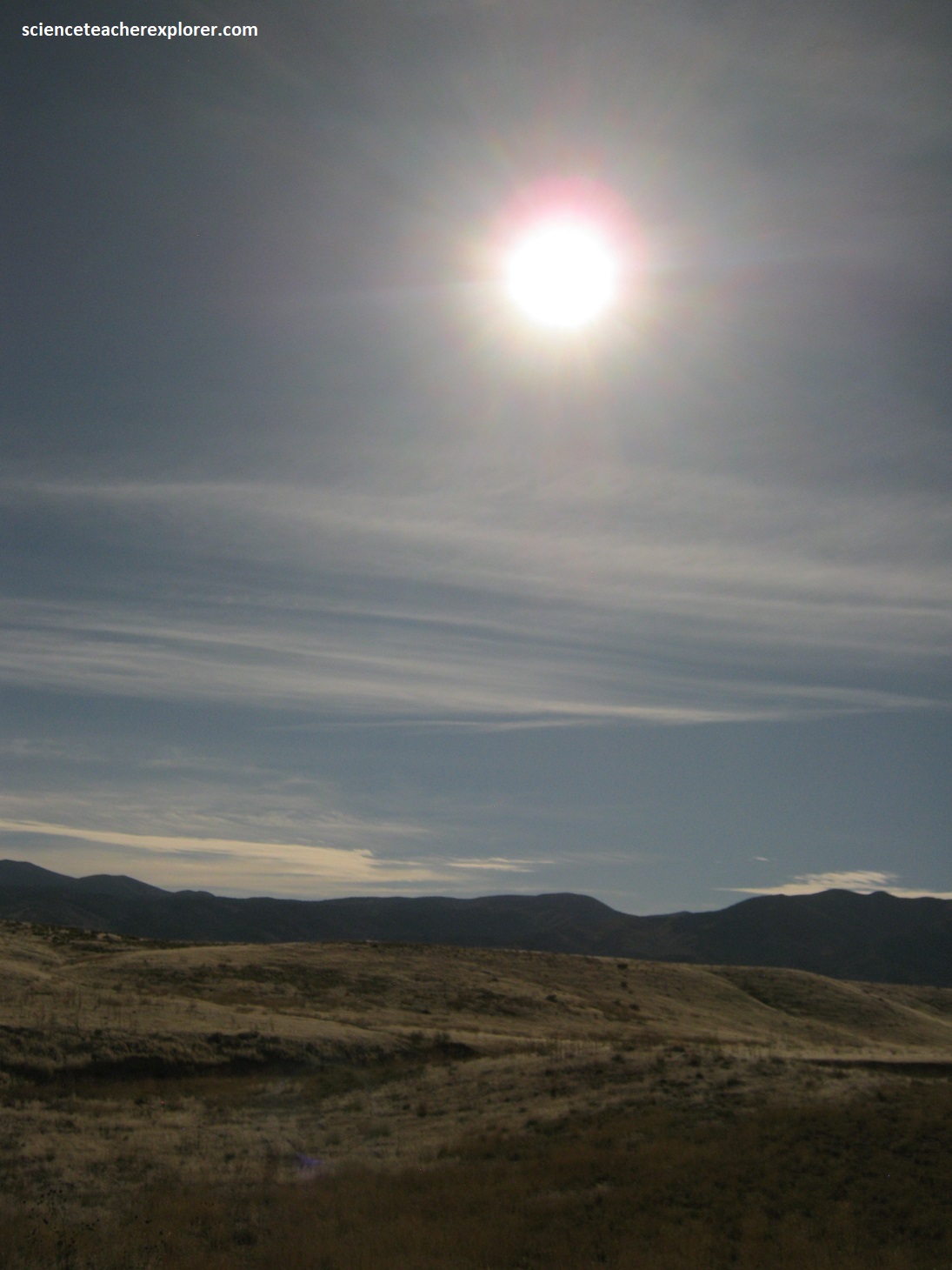
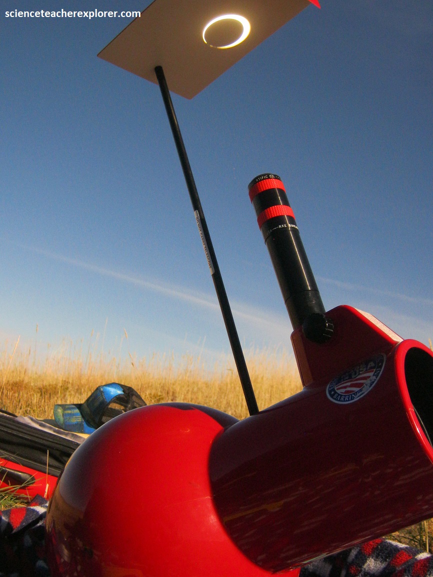
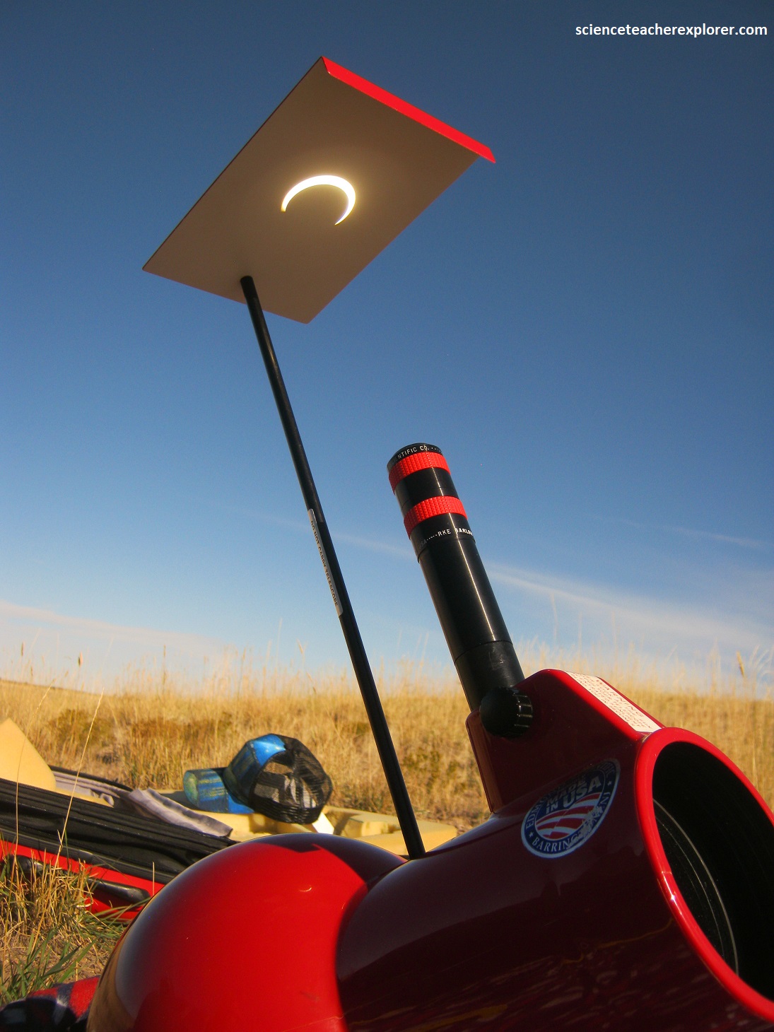
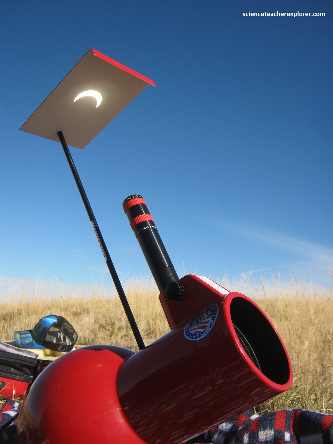
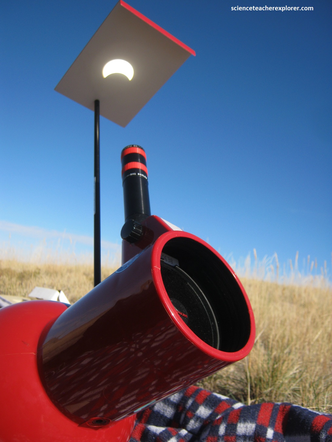
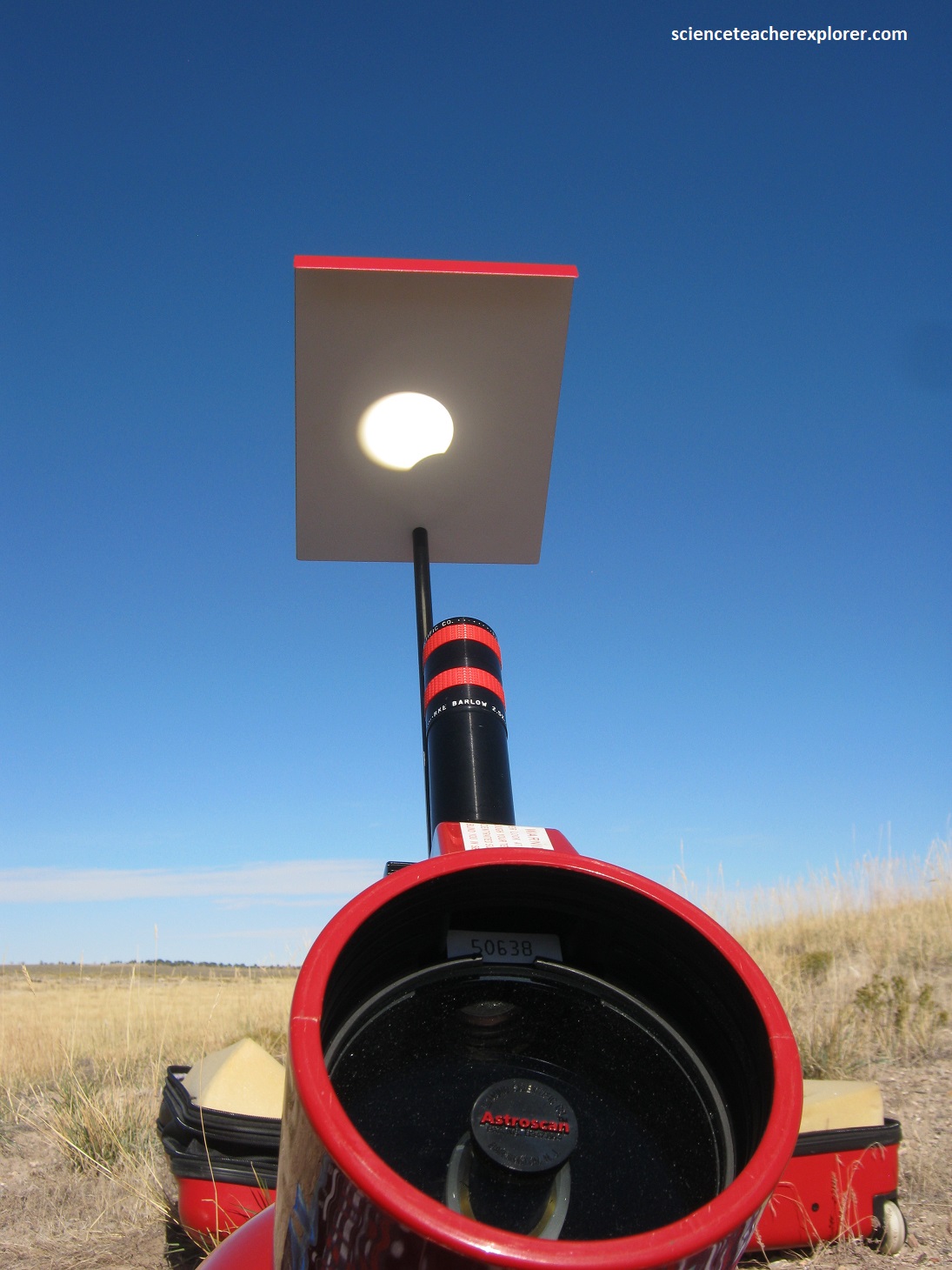
Our destination is just west of I-15 on the six-mile road that heads south of Kanosh, Utah. We plan to be ready at 9 AM. A solar eclipse occurs when the Moon passes between Earth and the Sun, thereby totally or partly obscuring the image of the Sun for a viewer on Earth. An annular solar eclipse does not completely cover the Sun’s disk. Instead, it covers most of the Sun, leaving its outer edge visible as a bright ring or “annulus” around the darkened Moon, (pictured below).
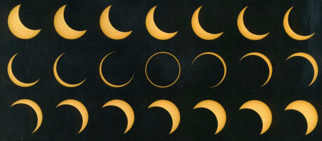
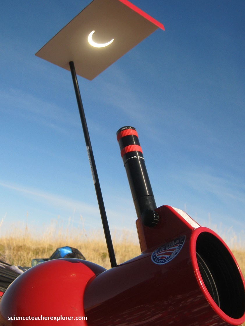
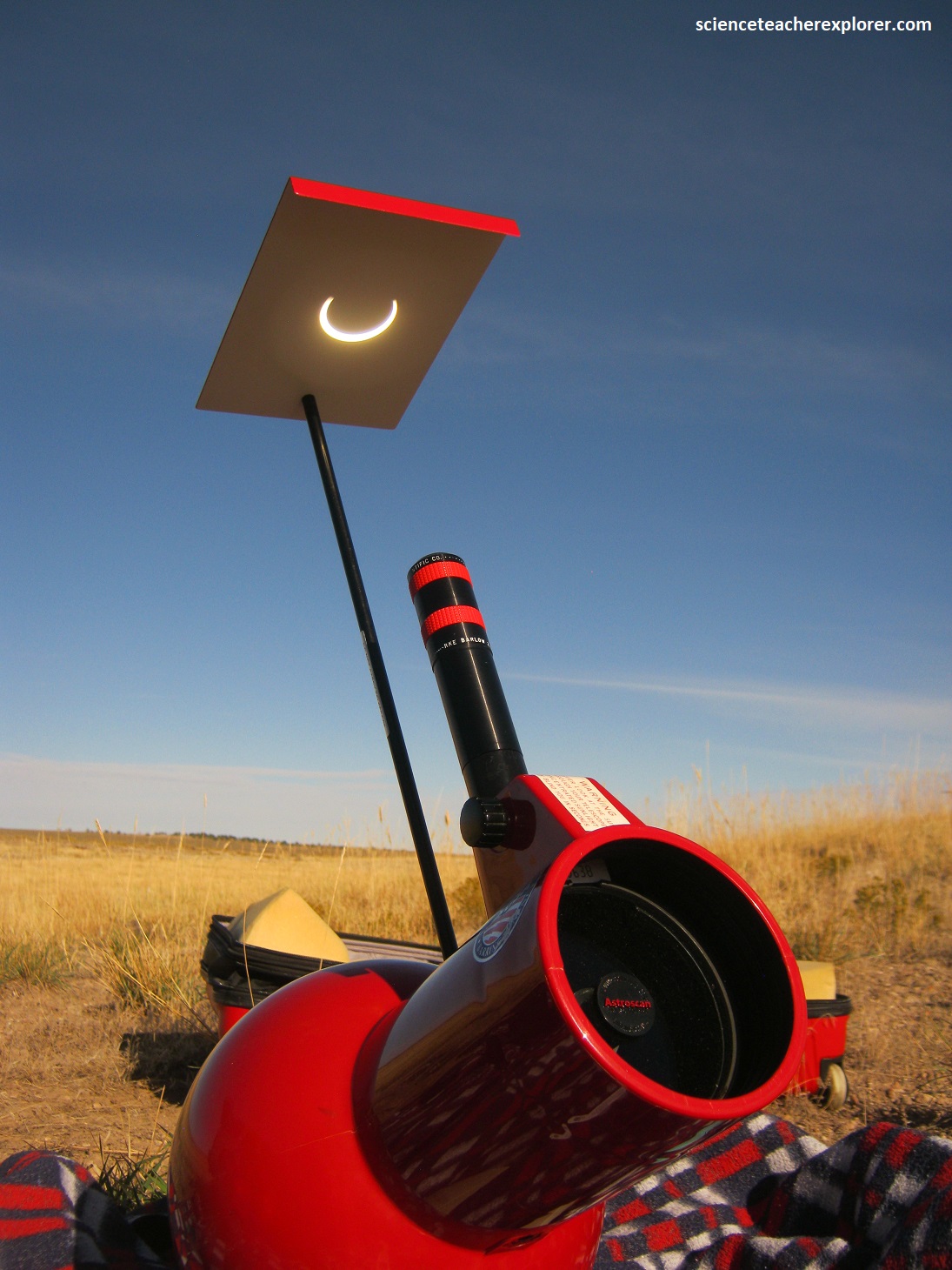
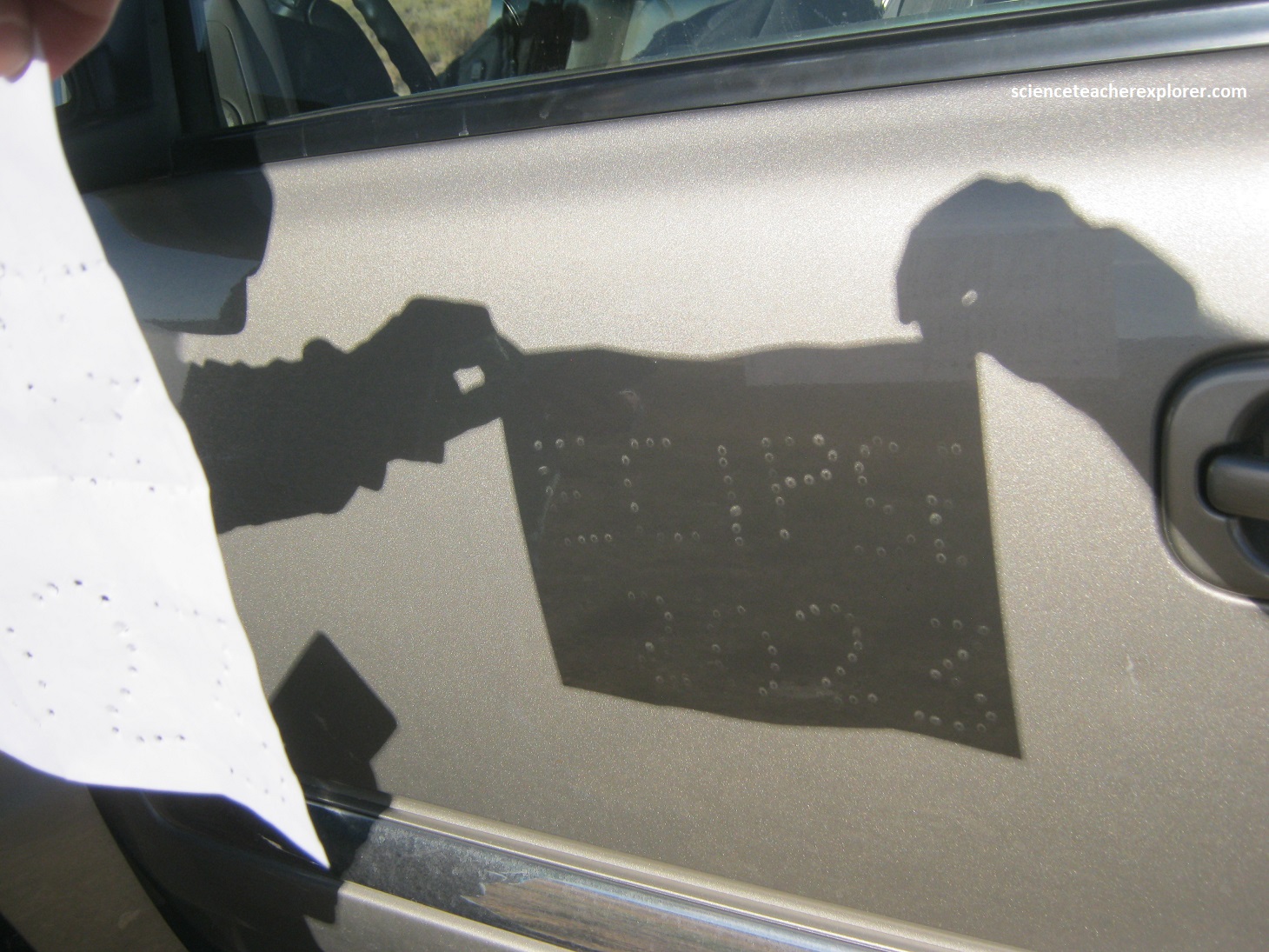
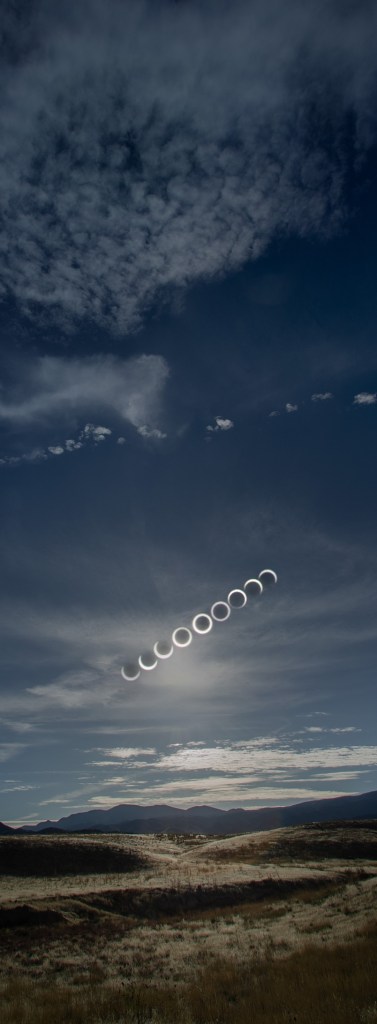
Pictured below is a series of photos I took of my reflector, “Newtonian” telescope during the Oct. 14th, 2023 annular eclipse in the Black Rock Desert of Utah.
Marc Curtis’s summary photo is included below. If you would like a professional copy of it: contact him at: Marccurtis59@gmail.com
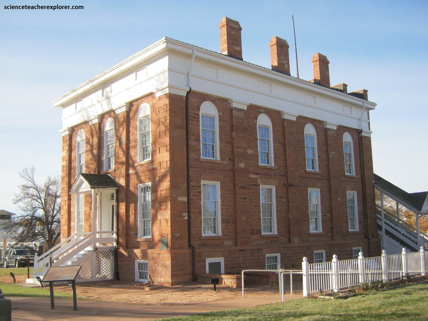
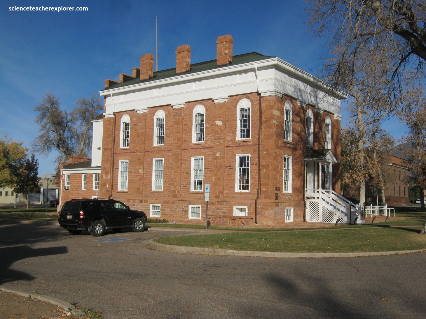
After the eclipse, I decided to visit Utah’s first Capital, Fillmore. On September 8, 1851, Governor Brigham Young placed his cane on the north East corner of this block and designated this geographical centered location as Utah’s capital. The large open space, water and building materials were favorable for settlement. In a political move the Governor named the town Fillmore and the county Millard after President Millard Fillmore. (Photos taken in Oct. 2023).
Also located on the Fillmore-Capital grounds, is a historical interpretive sign about the history of the native “Utes”. First described by Spanish explorers by Spanish explorers as the “YUTA” Indians, the ancestors of the Ute people are thought to have migrated from the desert of southeastern California over 700 years ago. With the arrival of the Mormon pioneers in 1847, relations between the Utes and the newcomers were at first peaceable and friendly. The pioneers described the “Utes” as hunters & wanderers. They had seasonal camps all over central and southern Utah including those near Spanish Fork, Payson, Nephi, Manti, Fish Lake, Meadow, Kanosh and Parowan. Imaged below, on occasion the Utes ventured as far as the plains of Colorado in search of buffalo meat and hides. Marriage was polygamous. Women were expected to raise their children, butcher and process wild game and plants, provide meals, and to move the camp. The role of the man, in contrast, was that of hunter and warrior.
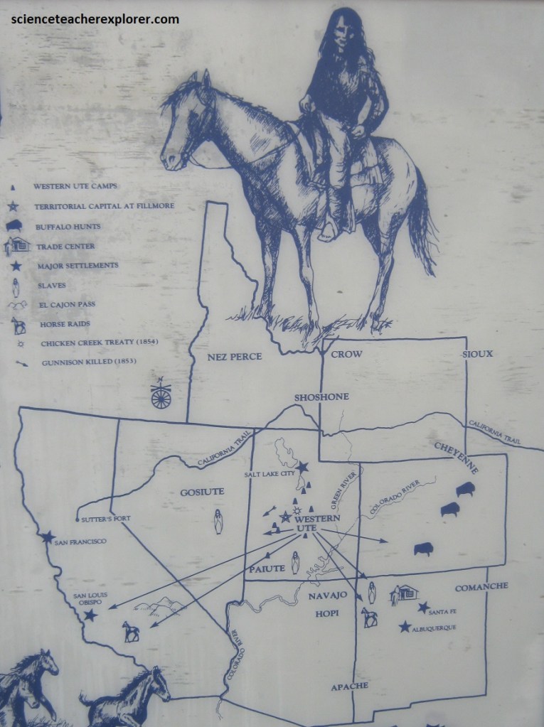
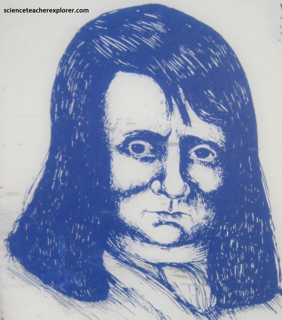
Images below, the greatest warrior and chief during the early pioneer period was a tall, handsome man name Walkara, the “Hawk of the Mountains”. Born somewhere between 1808 & 1815 on the Spanish Fork River, Walkara rose to power when he assumed the role of war chief in his father’s band, the Timpanahgos Utes. The Hawk quickly increase his prominence as a leader by his skill and prowess as a “procurer” of horse flesh. Raiding as far away as the coast of California near San Luis Obispo, Walkara terrorized western ranches for over a quarter of a century until his death in 1855. The largest number of horses stolen on any one raid was 3,000 with several raids netting at least 1,000 head. Horses could b sold at a mountain rendervous for as much as $50/animal or traded to other tribes for native children who were then exchanged for ammunition, blankets, pots and pans, and trinkets at the at the Santa Fe slave market.
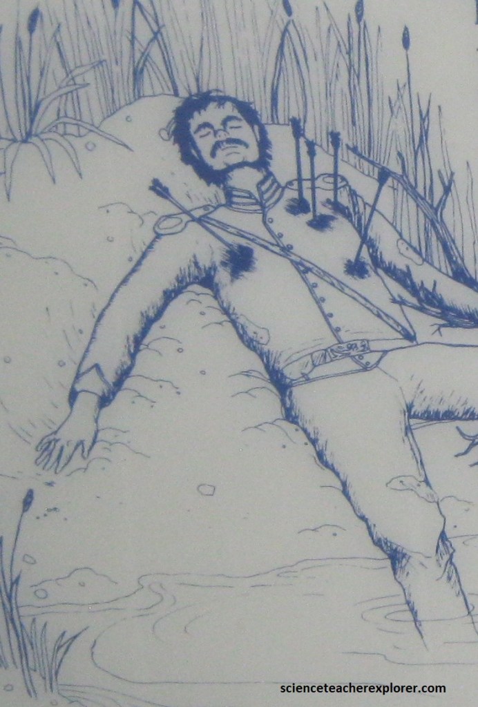
By 1853, relations between the pioneers and the Utes were strained to the limits. In July of the year, 3 braves from Chief Walkara’s camp on Hobble Creek appeared at the cabin door of James Ivie near Springville, Utah to trade fresh fish for flour. An argument followed, and Ivie killed on of the Braves in a hand-to-hand fight with a broken rifle stock. Walkara upset with this incident and the Mormons’ recent policy opposing his lucrative slave trade, grasped the situation and unleashed a hit-and-run reign of terror that plagued the settlements in Utah, Juab, Sanpete, Millard and Iron counties for the better part of the next year. Additionally, in the fall of 1853, a wagon train of Missourians, (the Francher Party) en-route to California, came into trouble with the Pahvant Utes, when the father of the Pahvant war chief Mosnoquap was mortal wounded. In retaliation, Mosnoquap ambushed a U.S. Army survey team in bivouac near Sevier Lake some 56 km northwest of Fillmore. Captain John W. Gunnison and 8 of his men died as the Pahvants attacked with a barrage of arrows and bullets as the morning sun rose on the army camp.
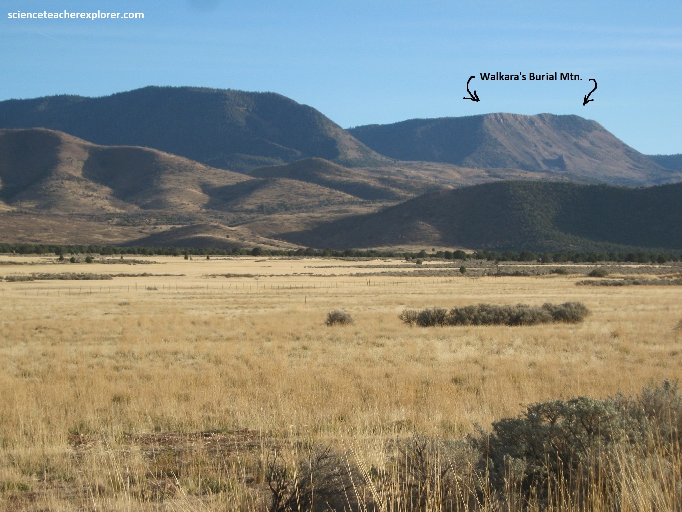
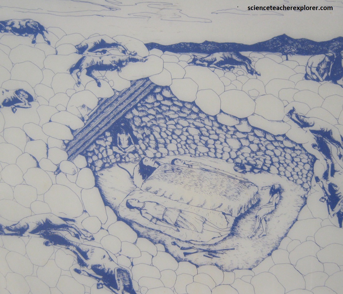
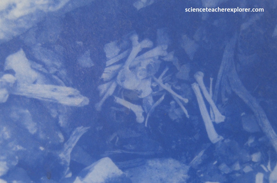
0n January 29th, 1855, chief Walkara died from pneumonia. Carrying out the wishes of his dead brother, Arapene slashed the throuats of Walkara’s two wives so that their spirits might walk with that of the Hawk. The cielf was placed on his favorite blue blanket, and the still-bloody bodies of his two wives were laid on either side. A young Paiute girl was also killed and put into the grave while another Paiute child, (a small boy), was staked alive in the pit to ward off wild animals. Before the tomb was sealed, an ornate saddle with brocaded cherubim, a Book of Mormon (he was recently converted), rifles, bows, steel-tipped arrows, Spanish ornaments, and food were placed with the dead chief. With the sealing of the 3 m diameter tomb, 14 of Walkara’s favorite horses were led to the grave and killed. Imaged below are an artist’s depiction of the burial site, the archeological excavation of the site and it’s location above Meadow.
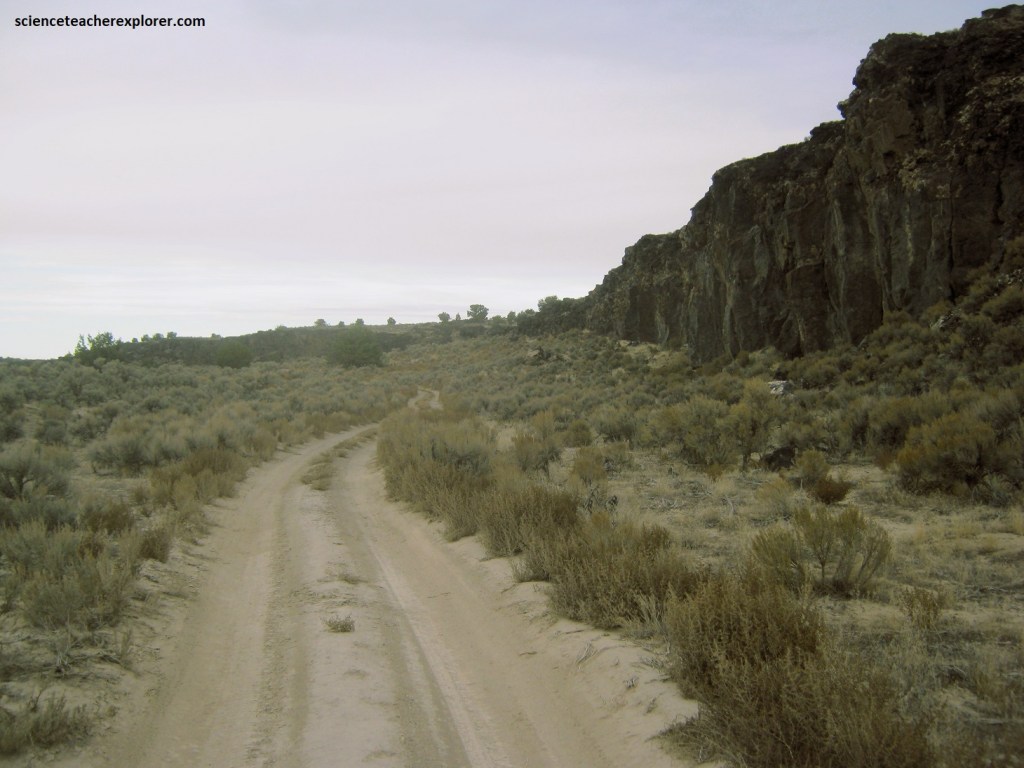
After leaving Fillmore, I drove out to Pahvant Butte byway of the graveled Clear Lake Road. Along the way, I was able to take a small detour to the “Devils Kitchen”, (named for the hollow sound associated with its lava flow on horse’s hoofs). Pictured below, the Devils Kitchen fault forms a prominent escarpment for most of its length from the Ice Springs flows toward Pahvant Butte. The fault scarp is up to 20 m high and exposes columnar basalt, characterized by vertically jointed columns, typically hexagonal and about 1 m across, that form from the cooling and contracting of thick lava. Numerous boulders along the fault scarp have petroglyphs etched into the dark patina.
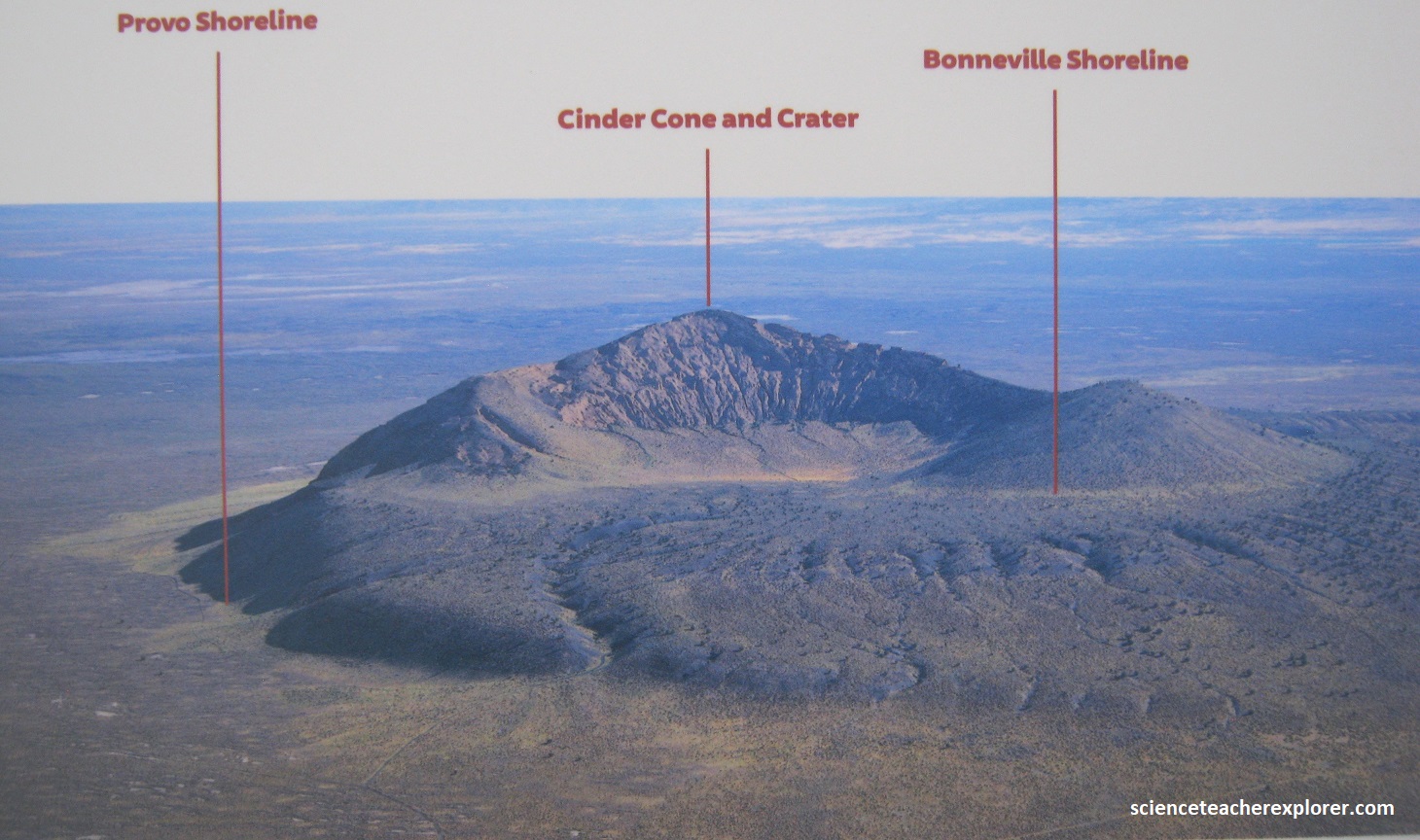
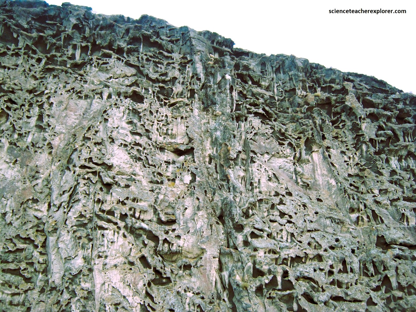
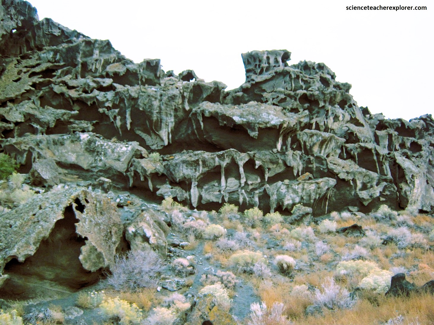
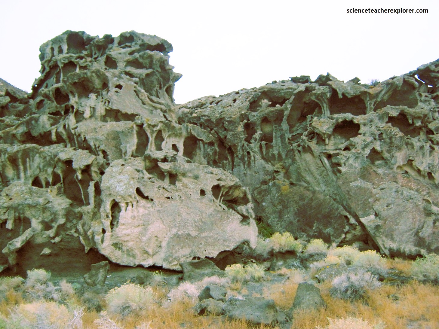
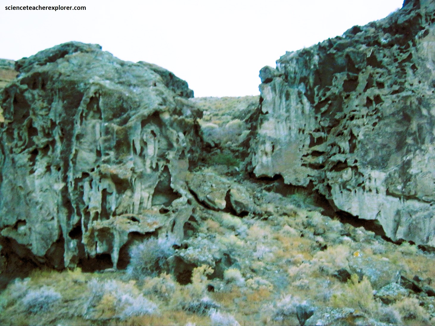
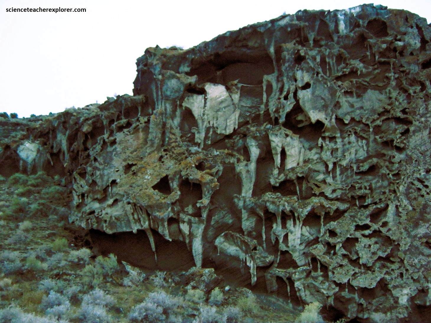
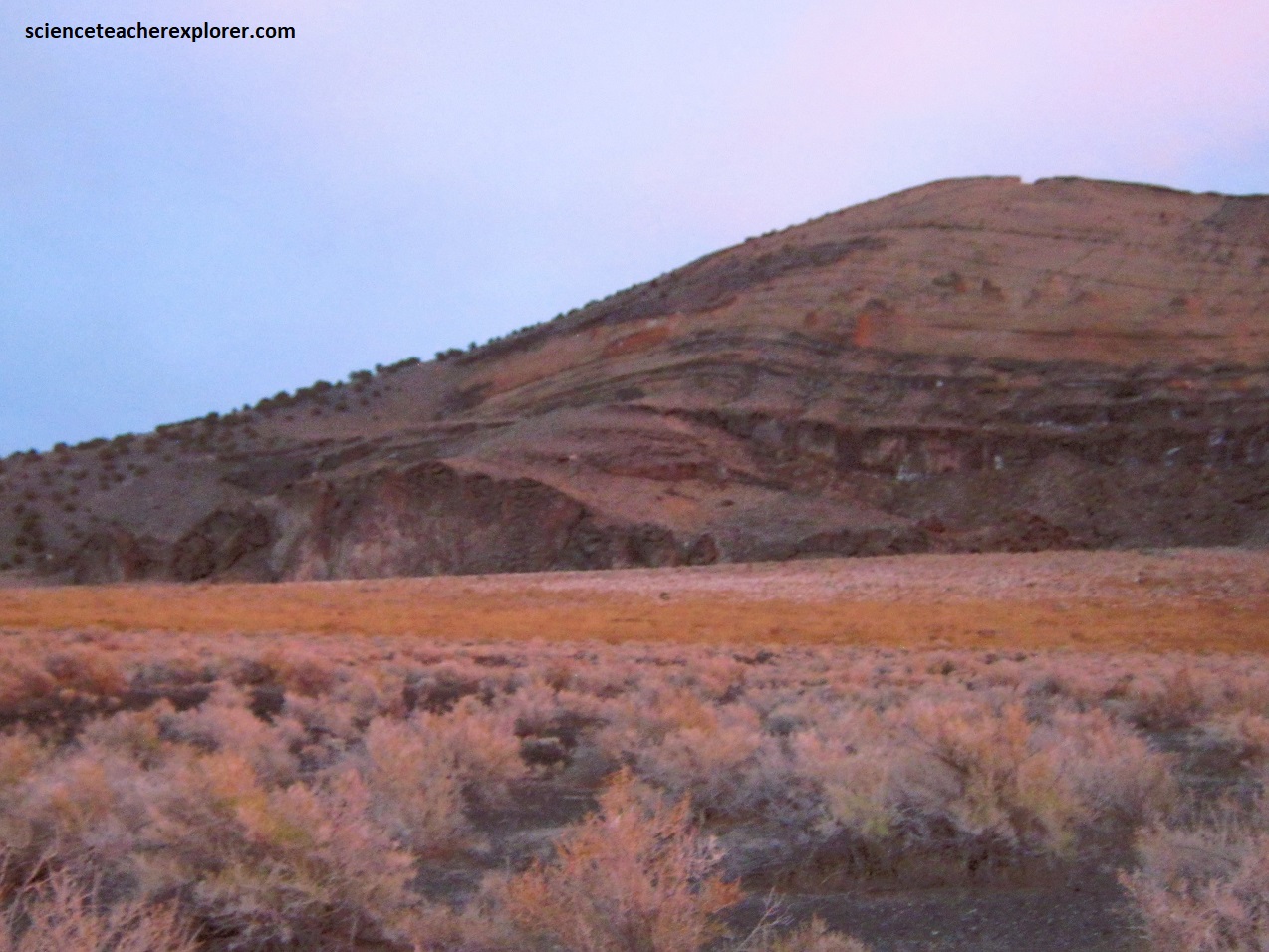
Picture below, Pahvant Butte, (also known as “Sugarloaf” by the locals), is a major landmark in the northern Black Rock Desert. A volcanic island in Ice Age Lake Bonneville, (15,500 yrs. ago), that emerged from beneath the lake surface, Pahvant Butte has a wave-cut shoreline terrace surrounding most of the tuff cone that rises almost 130 m above this ancient beach level. The upper part of the cone consists of palagonite, (a yellowish-colored rock created from the contact of basalt lava flows with water). Today, the highest point on Pahvant Butte is 1,670 m above sea level. The entire volcano is about 225 m above the ground surface and 3 km in diameter. (The photos below were taken in Oct. 2023 and the images taken from interpretive signs on-site).
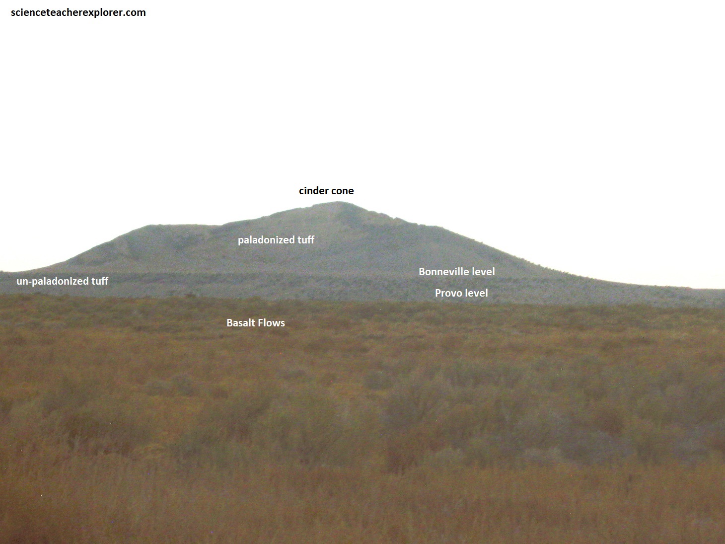
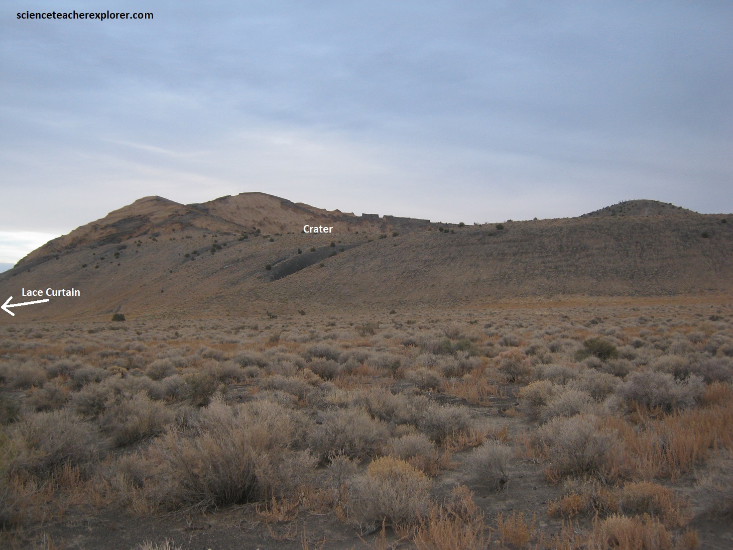
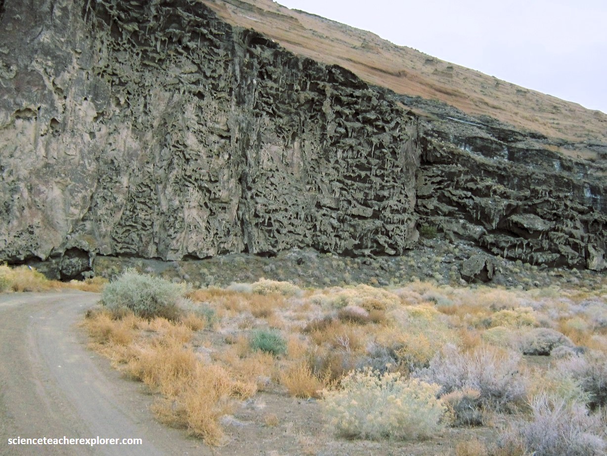
Pictured below, the northwest side of Pahvant Butte is draped in the peculiar cavity-filled “lace curtain” rock that resembles dripped wax. Waves from Lake Bonneville carved a shelf around most of the volcano except for this north face where intense storm waves cut a vertical cliff into the cone. The cut exposes this intricate lacey pattern caused by the partial cementing of the tuff by minerals in ground water. Pahvant Butte has white, partially cemented tuff at the Lace Curtain, unaltered black tuff below the Bonneville-level beach, ad altered yellow-brown tuff above the Bonneville beach.

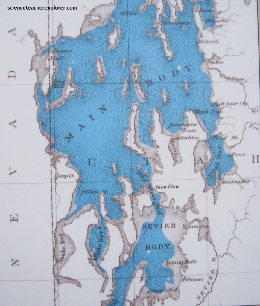
Lake Bonneville existed from about 32,000-14,000 yrs. ago, when climate was wetter and colder at the end of the last ice age. Melting glaciers, rivers, and precipitation fed Lake Bonneville, but the water was held in a closed depression with no outlet to the sea. Fish swam in it, waterfowl flocked to it, and Pleistocene bears, camels, musk oxen, and mammoths plied its shores. Lake Bonneville reached the height of Red Rock Pass in Idaho about 16,800 yrs. ago, and it began to drain north into the Snake River basin. Rapid downcutting and a flood around 14,000 years ago dropped the lake level by almost 125 m to the Provo level. The Provo-level beach is evident near the elevation of the 30,000 to 128,000 yrs. old basalt flows that make up the base of Pahvant Butte. After the flood, and with climate warming and drying, Lake Bonneville was reduced to what’s left today., (the Great Salt Lake and the Sevier Lake).
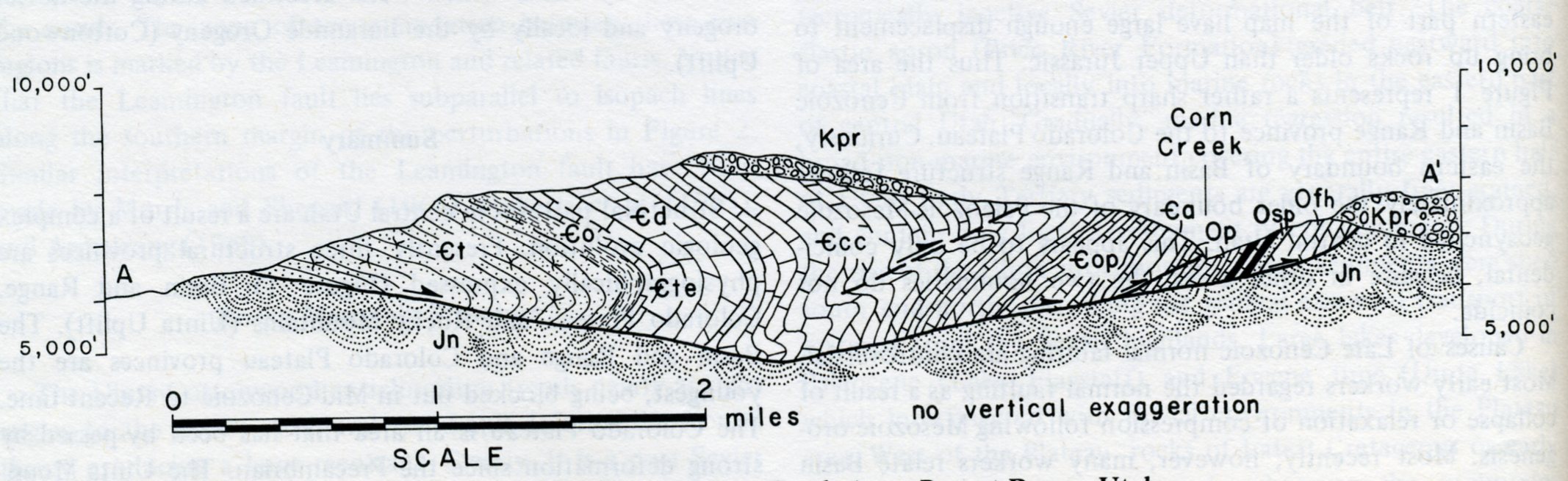
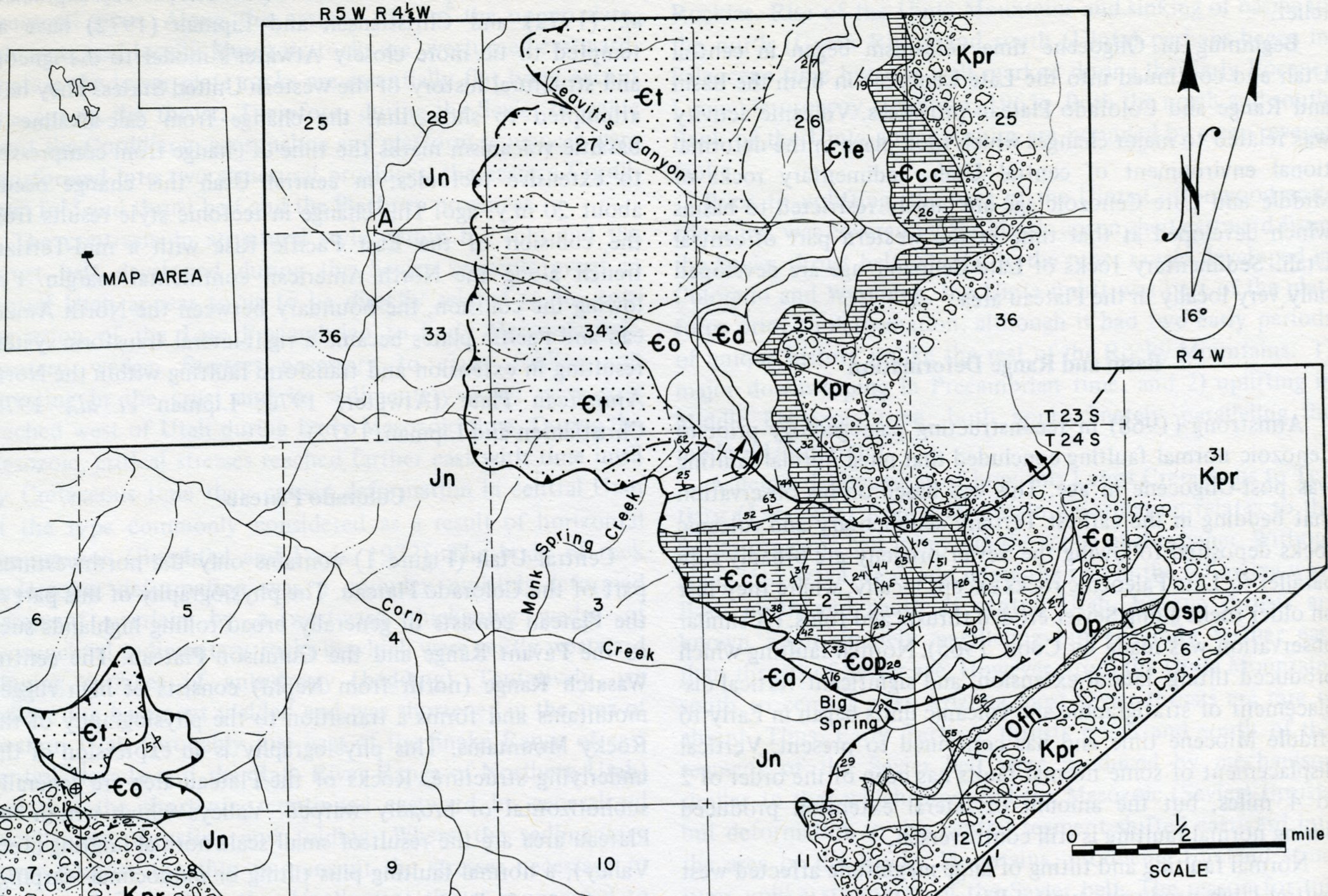
From Pahvant Butte, I drove back to Fillmore to continue east exploring the Pahvant Range. In the Pahvant Range, the Cambrian Tintic Quartzite has been thrust over the Jurassic Navajo Sandstone. Eastward overturned structures in the upper plate rocks indicates and eastward direction of transport. The east dip on the thrust is probably the result of Tertiary eastward tilting of the Pahvant Range. (Images below were taken from “Structural Development of Central Utah” Burchfiel & Hickcox of Utah Geol. Assoc. Publ. #2 1972)
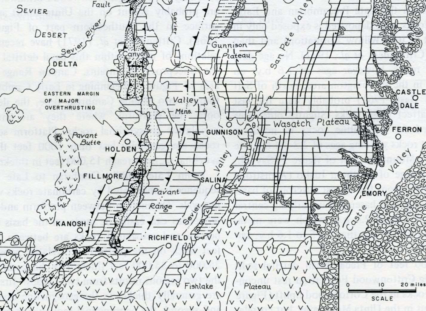
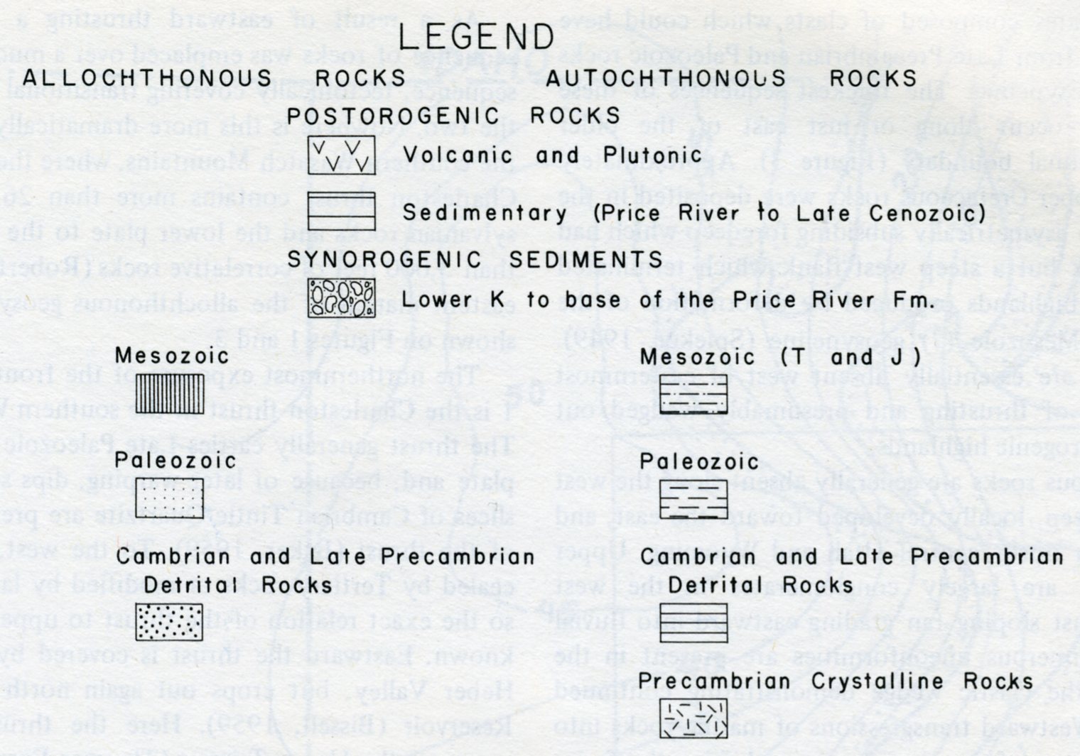
Near the south end of the Pahvant Range, the upper plate contains a large recumbent anticline with brings rocks as young as Upper Ordovician in an overturned position against the thrust, (imaged below). The eastern limit of the thrust is covered by post-orogenic clastic rocks, but by geometrically reconstructing the east part of the upper plate, the original eastern extent of the Pahvant thrust probably lies 8-11 km east of the Cretaceous overlap. Farther north, control on the eastern limit of thrusting is lost, but it lies west of the Mesozoic rocks of the Gunnison Plateau and is probably covered by the Quarternary fill of Juab Valley. (Images below are of the Pahvant Range east of Kanosh, Utah in Corn Creek; they were taken from “Structural Development of Central Utah” Burchfiel & Hickcox of Utah Geol. Assoc. Publ. #2 1972).
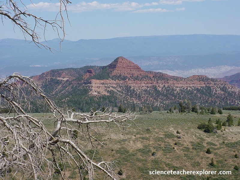
Pictured below, Beehive Peak is a unique Navajo Sandstone and White Limestone base, triangular pyramid in the eastern portion of the Pahvant Mountain Range.
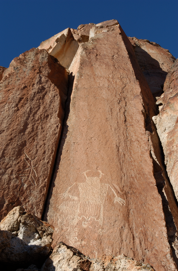
One last interesting site in the Pahvant Range above Fillmore, Utah. The Mysterious Hieroglyphs. The University of Utah had me research and take photos of these etchings. I do not believe they are of Native American origin and there was a local myth that they were created during the Book of Mormon time period. I don’t believe they are old enough for that. However, two young men were killed here, while digging for Book of Mormon Treasure below them.
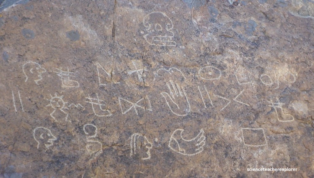
I found similar glyphs in Ogden, Manti, Nephi and Cedar City. I believe they were created by the local pioneers.
