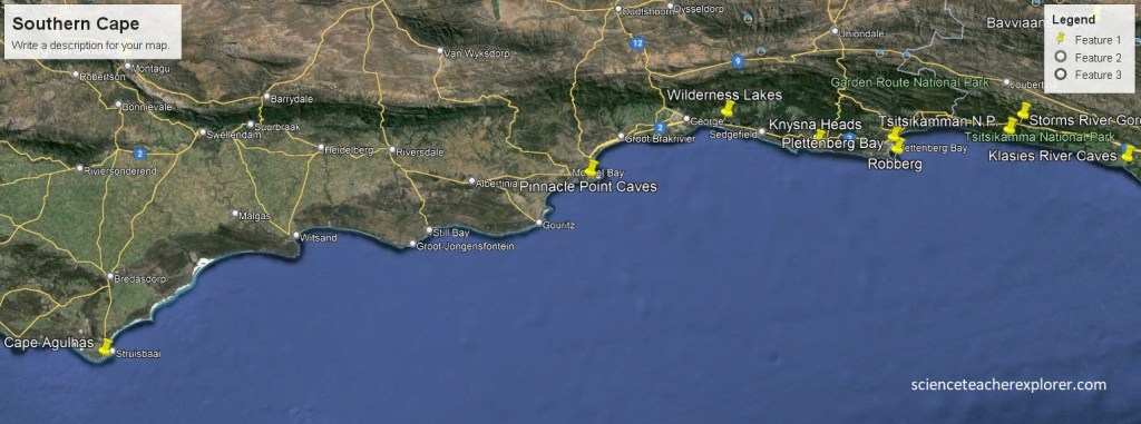
Southern Cape, 2024
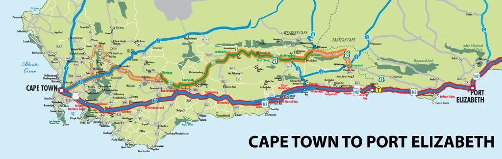
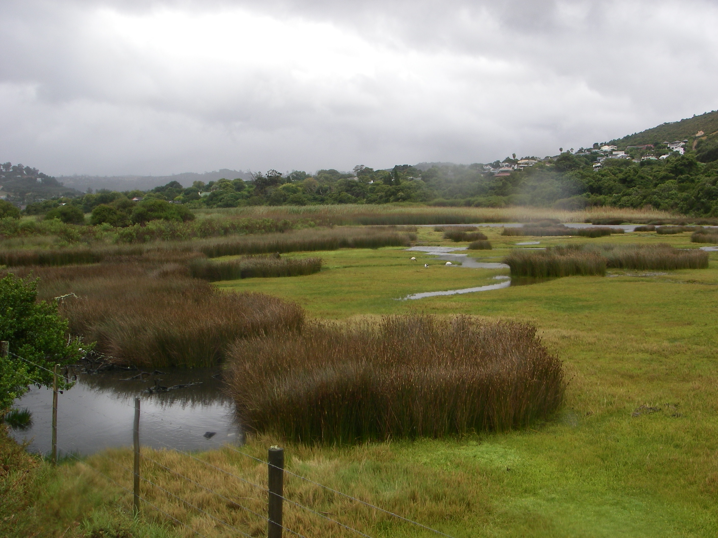
Halfway along South Africa’s southern coast, (between the cities of Cape Town and Port Elizabeth), the ocean coast and the mountain range narrows the coastal plain to a mere 5 km in places. The rapid 1,000 m rise from the ocean to the peaks, together with the prevailing winds off the warm currents of the Indian Ocean, have created a region on the southern cape of rare beauty. I trekked and explored this region with my traveling buddy, Mike Stevens, in February of 2024.
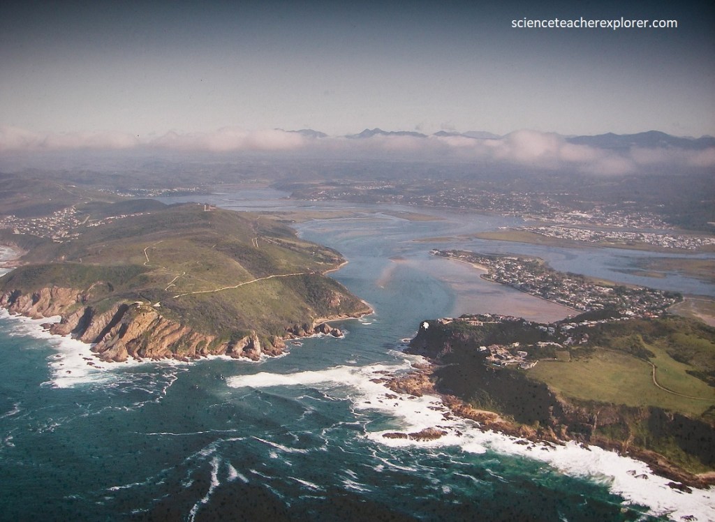
Pictured below, we started our exploration at the Klasies River Caves and worked our way to Cape Agulhas, (the southern tip of Africa). I called this region, the Southern-Cape of Africa. Others commonly defined this region as the Garden-Route due to its outstanding beauty.
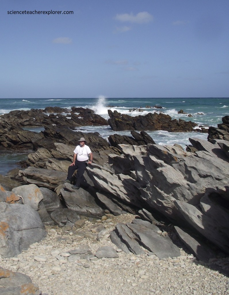
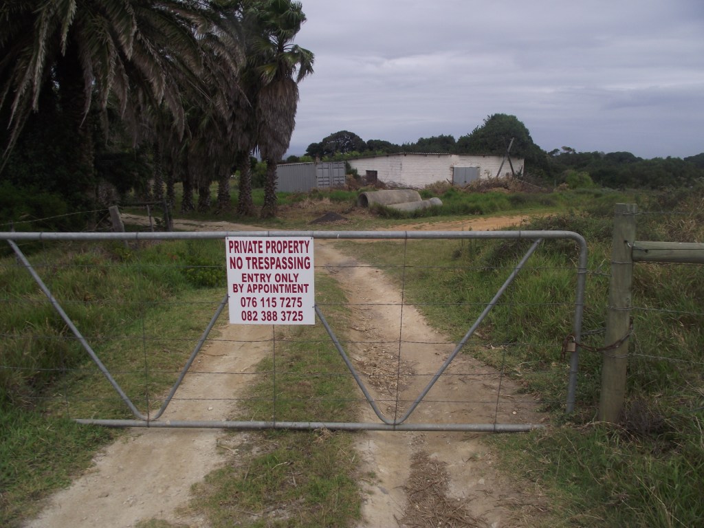
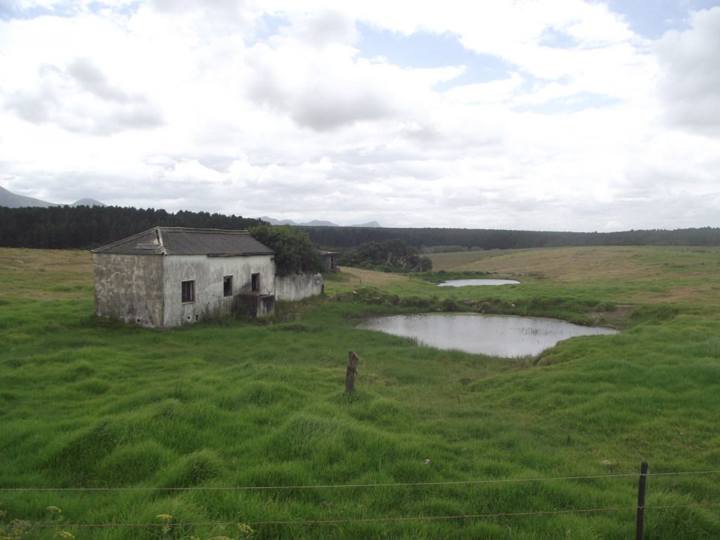
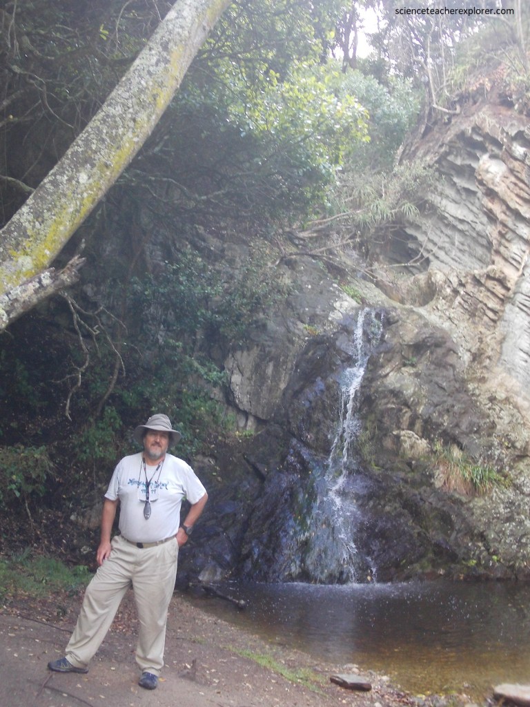
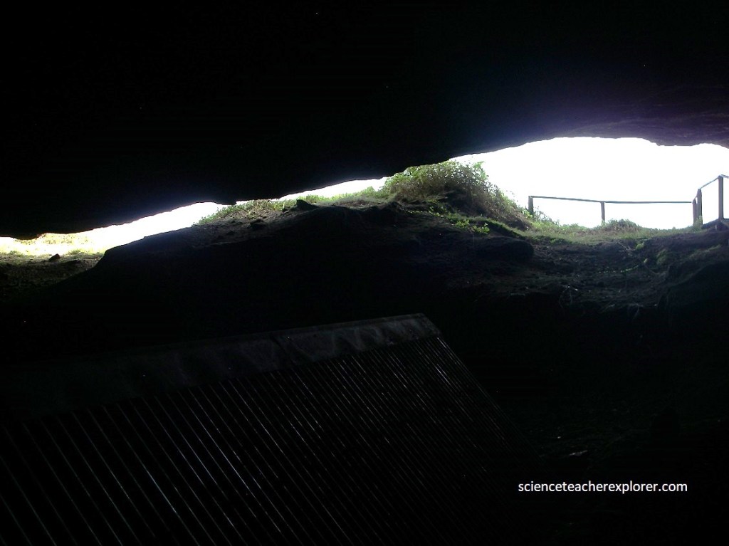
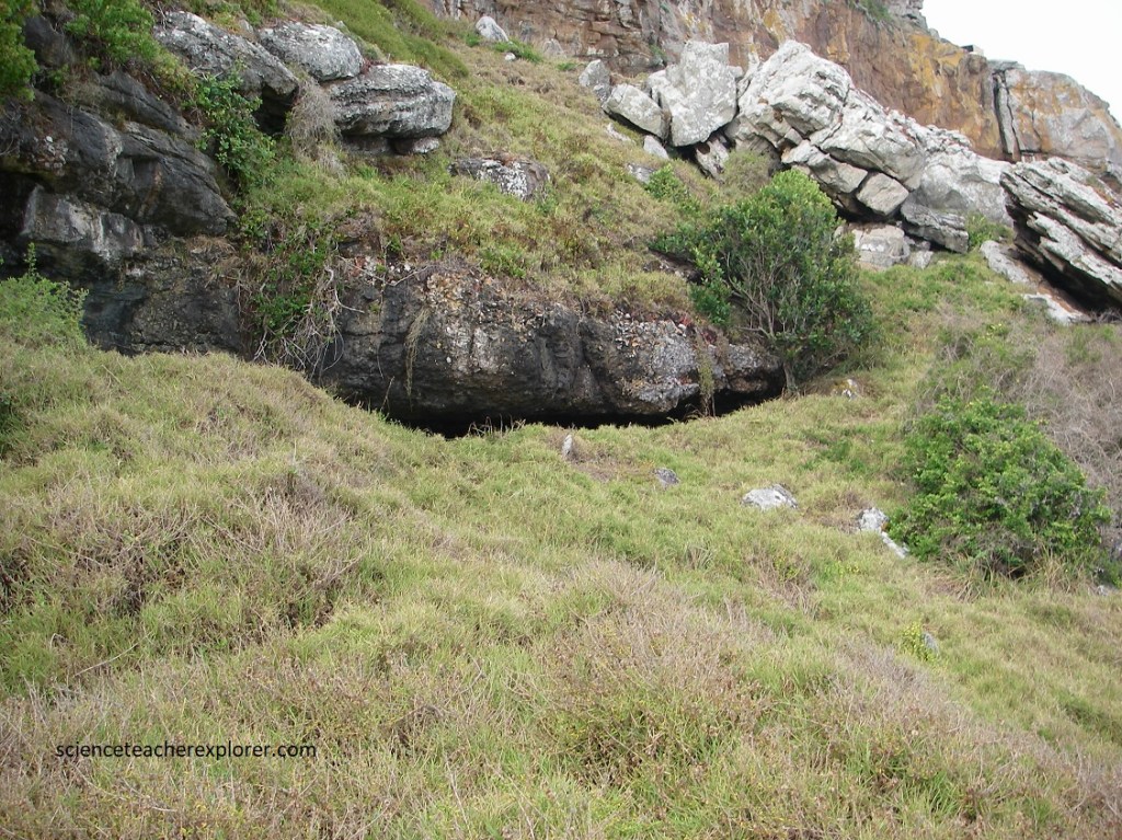
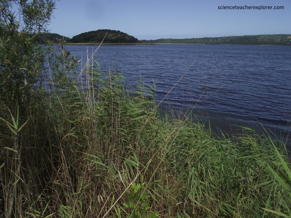
Our first destination, the Klasies River Caves was a site that consisted of 3 main caves and 2 shelters located within a cliff on the Southern-Cape. The site provided evidence for developments in stone tool technology, evolution of modern human anatomy and behavior, and changes in paleoecology and climate in Southern Africa based on evidence from plant remains, (125,000 – 55,000 years ago). However, we were not successful at visiting the site, without permission, (pictured below). Apparently, they didn’t want tourists, exploring this site.
From nearly 40 human fossil bones and bone-fragments, Archeologists that Klasies Cave site provided evidence of the behavior of Homo sapiens at our very earliest moments of existence, and a slightly uncomfortable peek into our distant past.
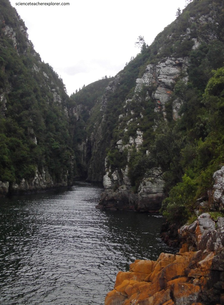
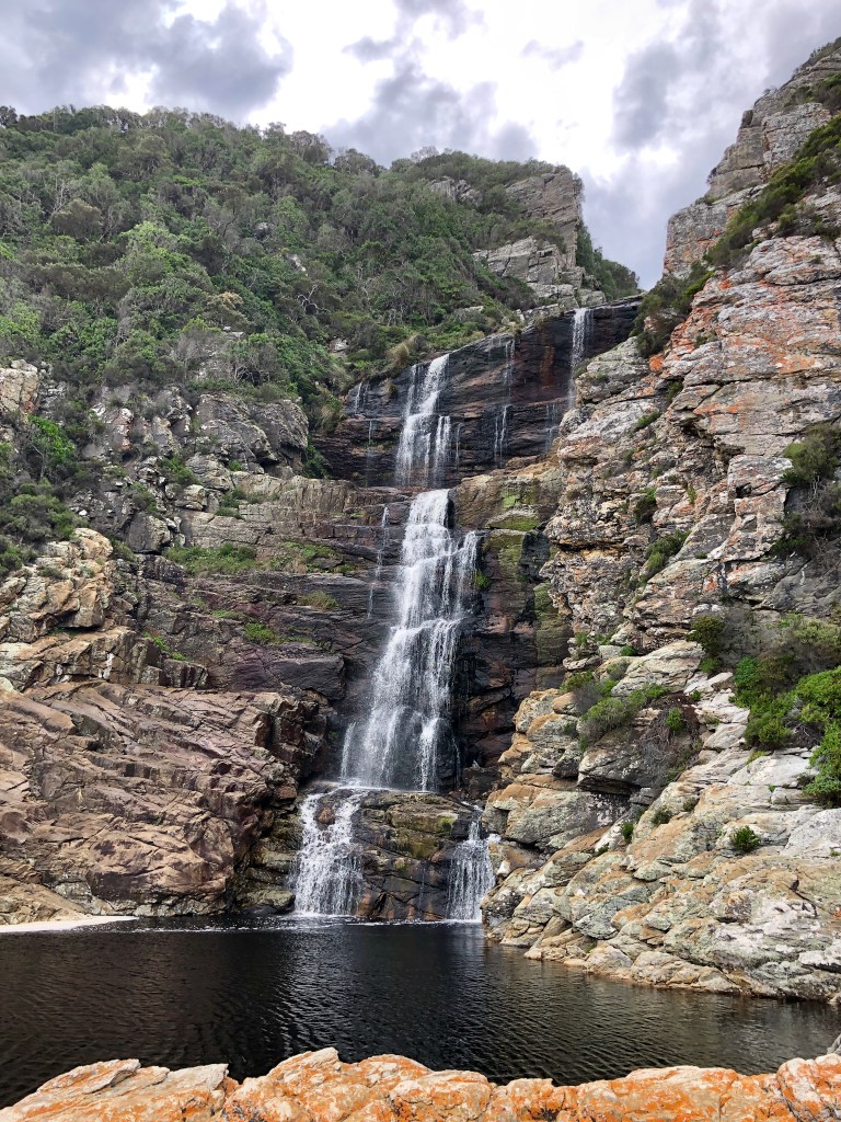
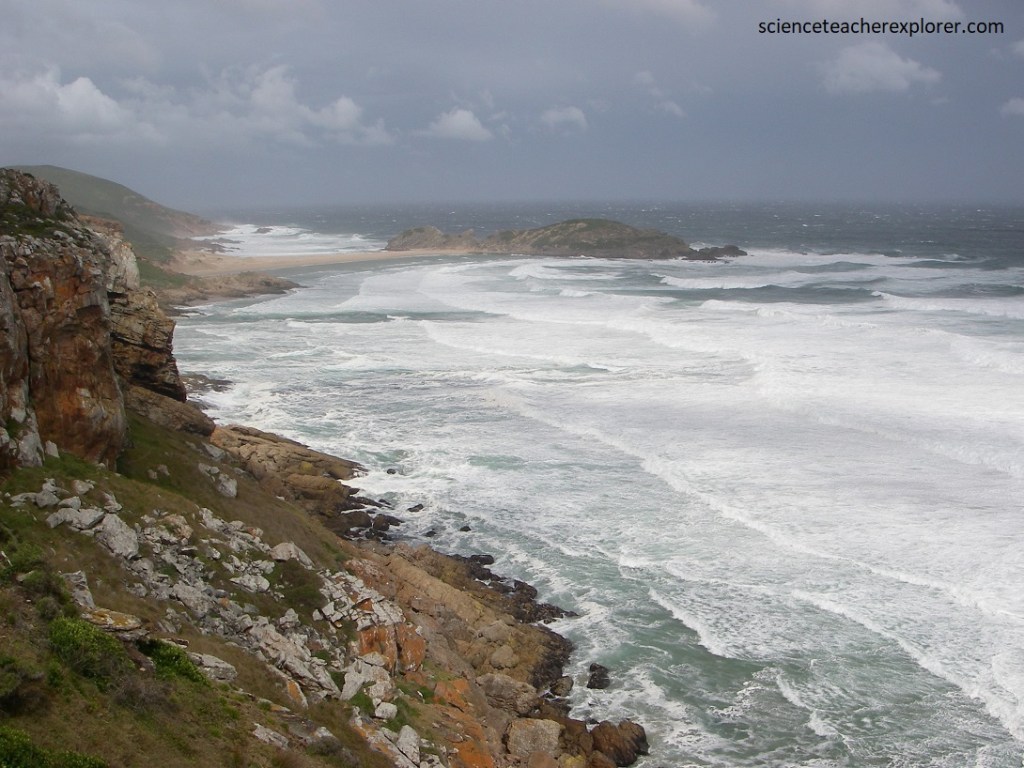
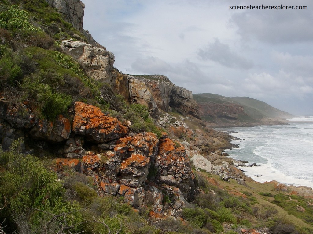
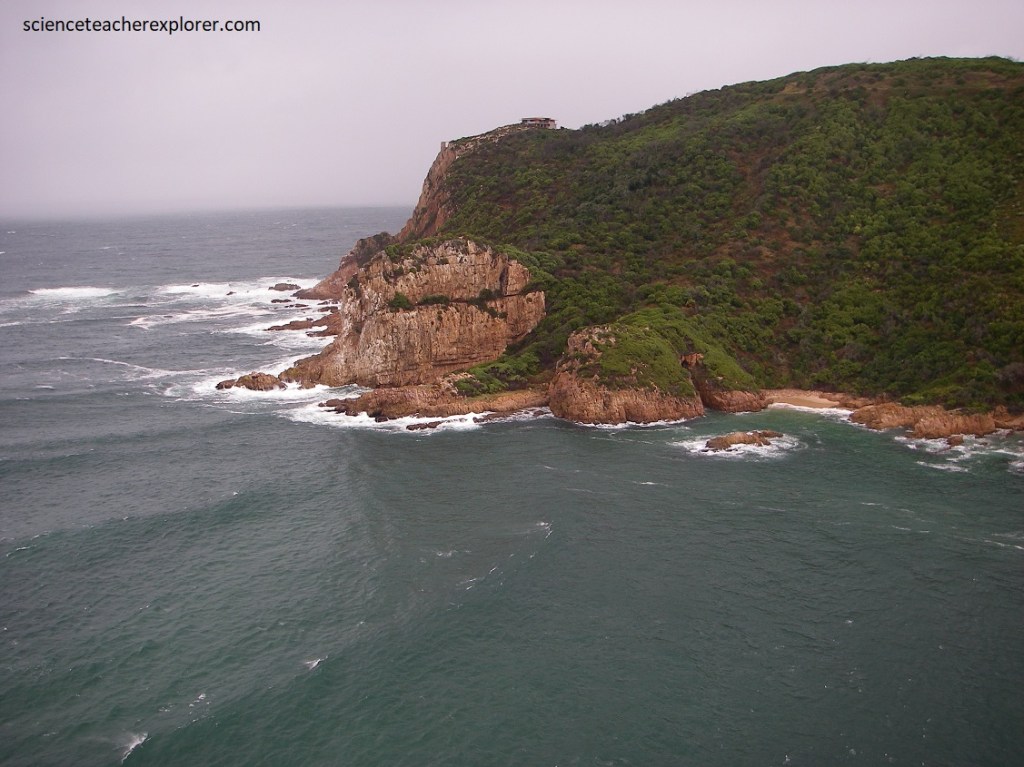
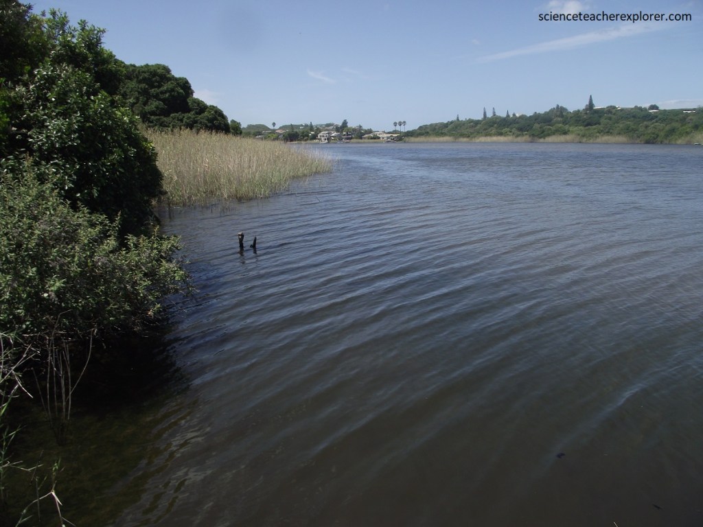
We continued onto our next destination, called the Storms River Gorge. A remarkable feature of much of the Southern Cape’s coastal landscape is the elevated plain that lies between the ocean and the mountains. In the Storms River area it is up to 7 km wide and is know as the Aberdeen Plain. It slopes very gently towards the ocean and ends in awesome coastal cliffs, and is dramatically and deeply incised in places by short coastal rivers.
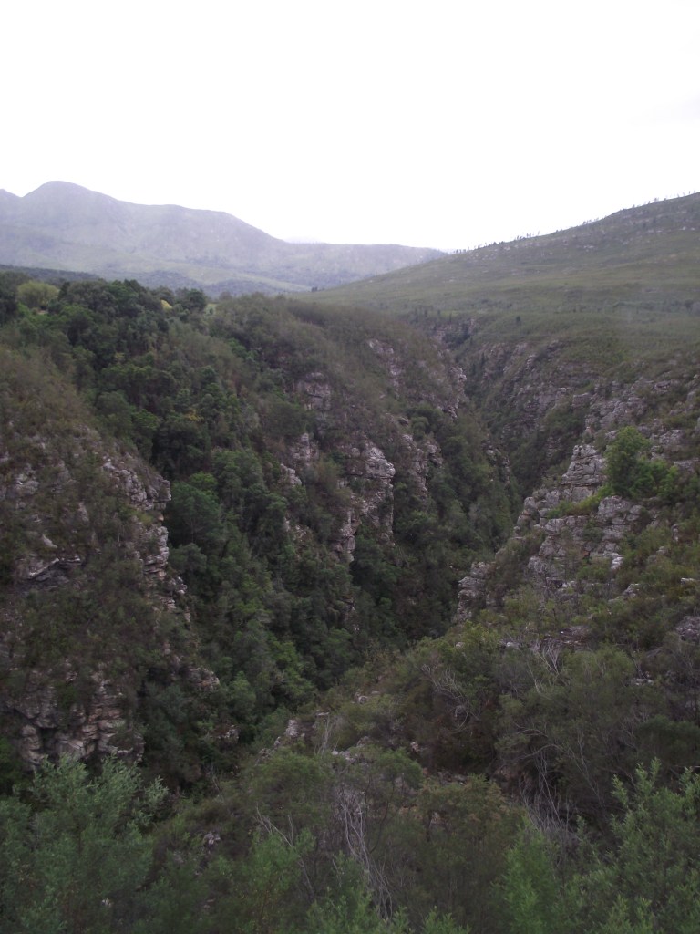
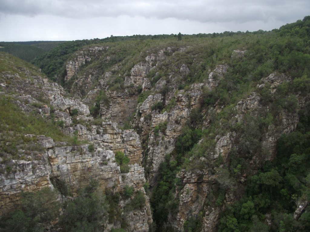
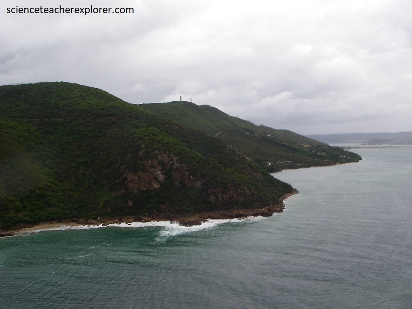
The region south of the Tsitsikamma Mountains is well known for its rugged coastline, indigenous coastal forest and the famous 50 km long Otter Trail. Pictured above, the incredible Storms River Gorge, (one of several deeply incised valleys that cuts through the coastal plain), heads toward the ocean nearby.
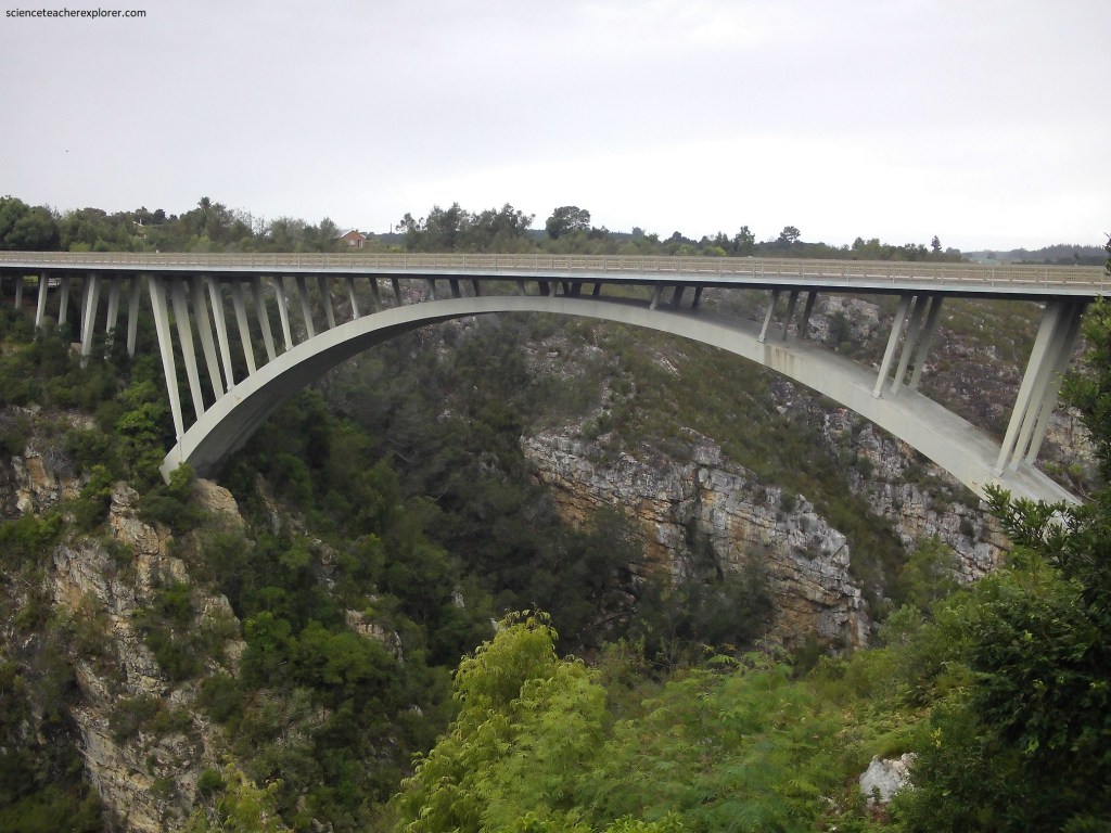
East of Plettenberg Bay the N2 highway crosses a remarkably flat plain that is cut at intervals by deep river gorges, now spanned by modern, high-level bridges. The old road was cut through almost impenetrable forests and followed steep winding pass through the Grootrivier, Bloukrans, and Storms river valleys. Pictured below, the Paul Sauer Bridge, which opened in 1956, spans some 100 m across the Storms River Gorge. It is firmly anchored in Table Mountain Group quartzite and was constructed in a cantilever style from both sides.
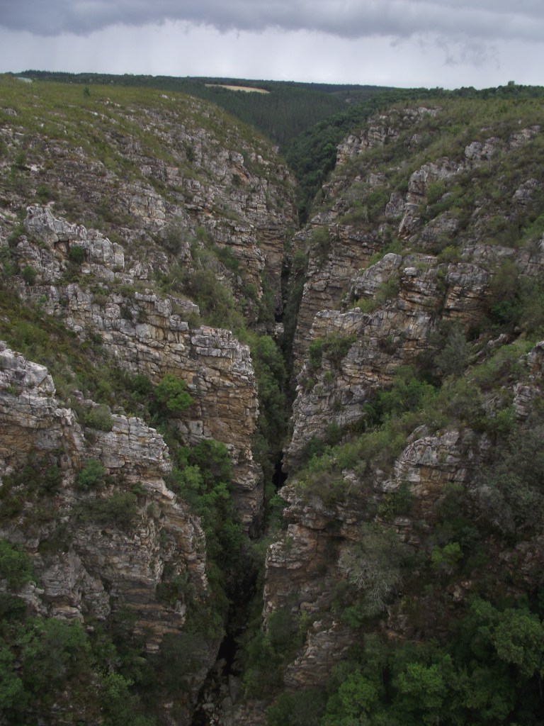
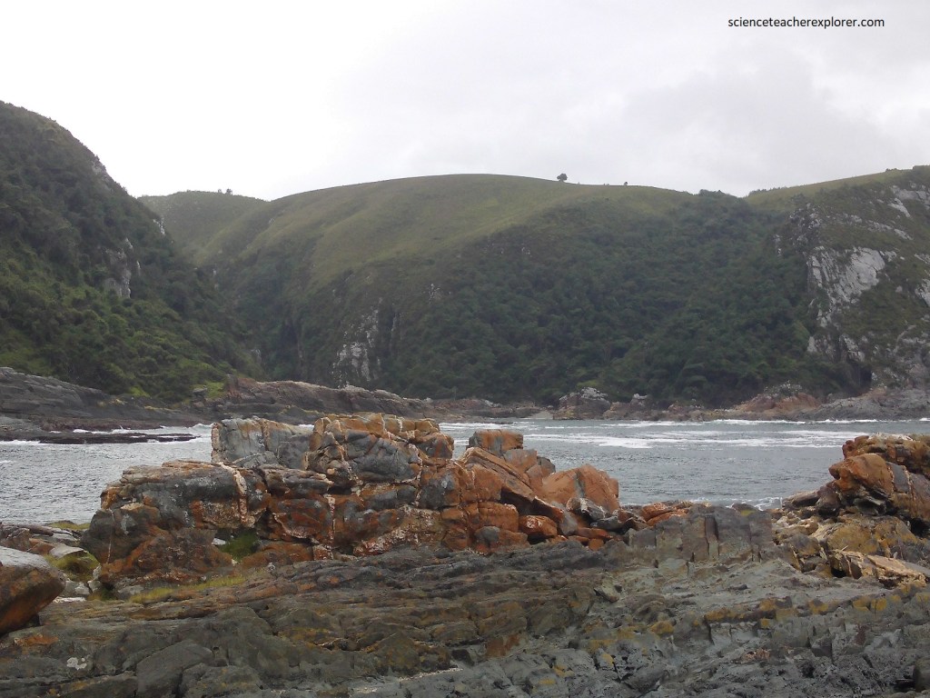
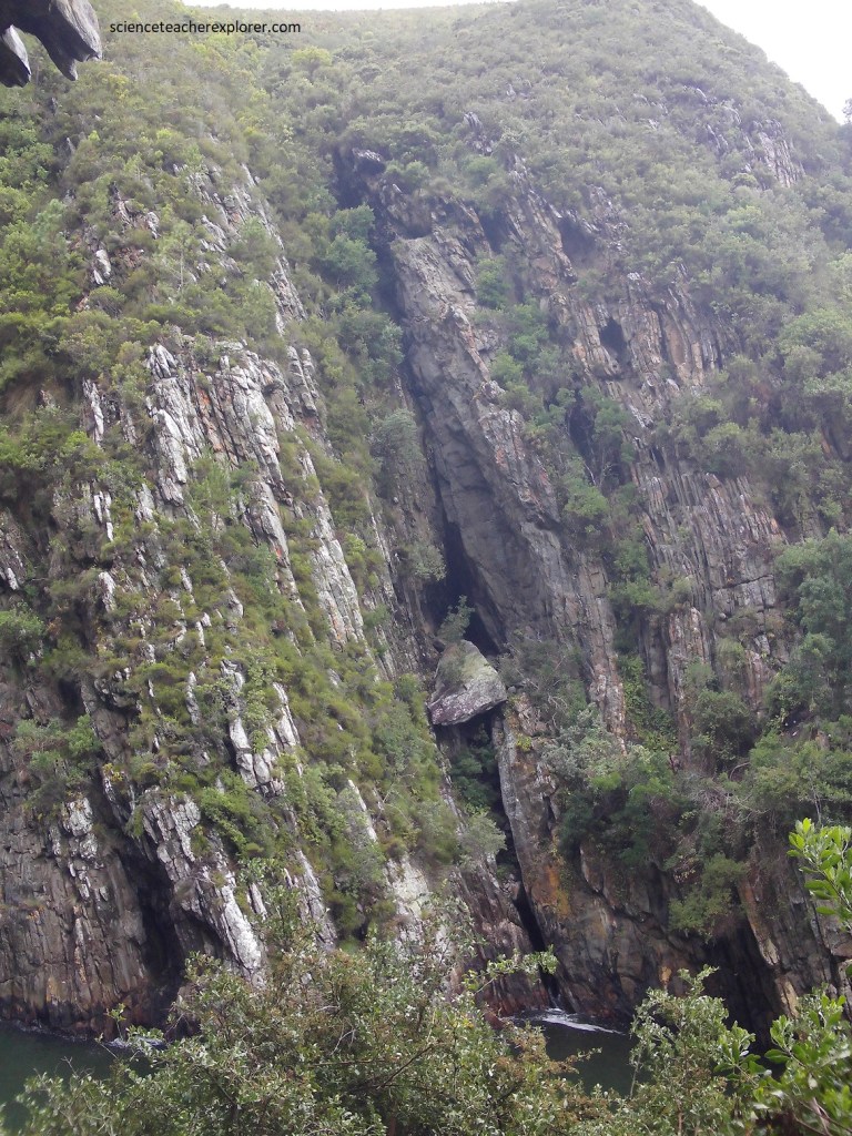
Pictured below, Storms River Gorge, as one looks south, is about 120 m deep and less than 10 m wide, seen from the bridge on the N2. Notice the flat coastal plain in the background.
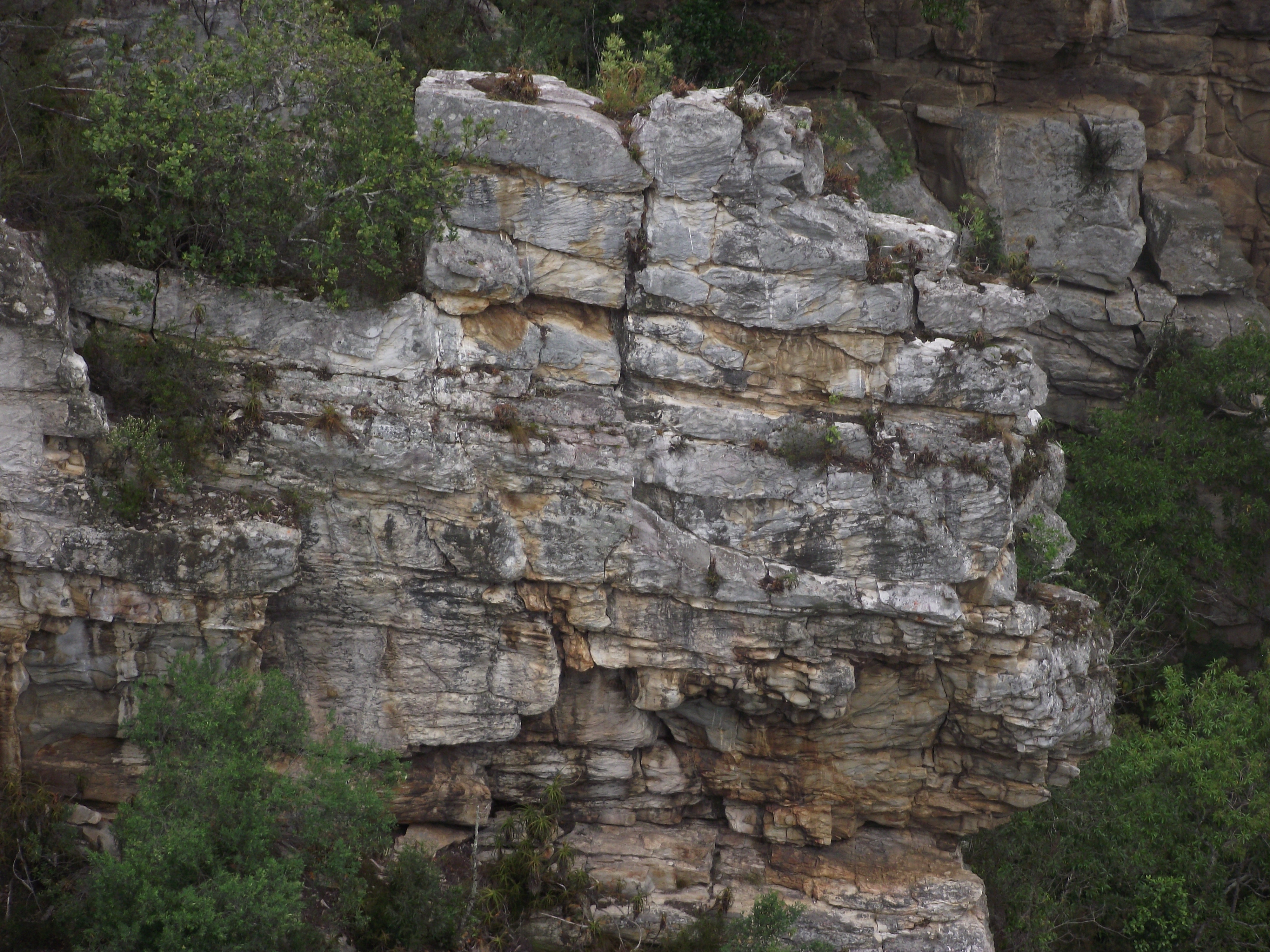
Pictured below, all the quartzite-formations north of the bridge are all of the Table Mountain Group, as well as the shale-rich Bokkeveld Group.
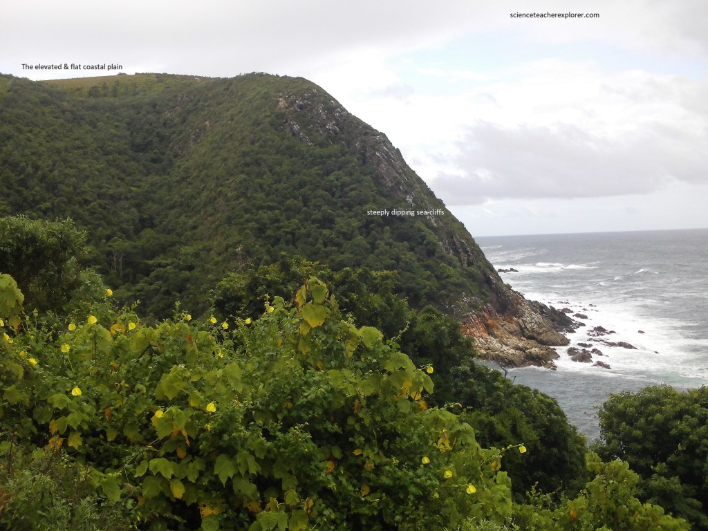
Pictured below, the narrow, elevated, remarkably flat coastal plain, backed by the rugged Tsitsikamma Mountains, tilts gently towards the ocean. Now uplifted to an average elevation of over 200 m, it originated as a wave-cut platform that formed at sea-level.
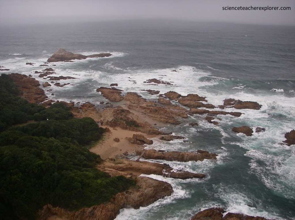
Pictured below, the Storms River Mouth the north-south-oriented river gorge is impressively straight over a distance of about 3 km, and almost impossibly narrow. It cuts the structural grain at about 900 and follows a narrow zone of fracturing that weakened the rocks and allowed the youthful Storms River to cut down effectively through hard quartzite, keeping pace with uplift of the coastal plain.
Pictured above, the elevated coastal plain is mostly underlain by strongly folded formations of the Table Mountain Group (exposed along the rugged coastline), part of the Cape Supergroup. These rocks were compressed and deformed during the formation of the Cape Fold Belt, resulting in a more or less east-west structural group.
Pictured above, the mouth of the Storms River is on the left. The high ground in the distance is the now-elevated coastal plain, terminating in steep sea cliffs. Steeply dipping Table Mountain quartzite and siltstone are in the foreground.
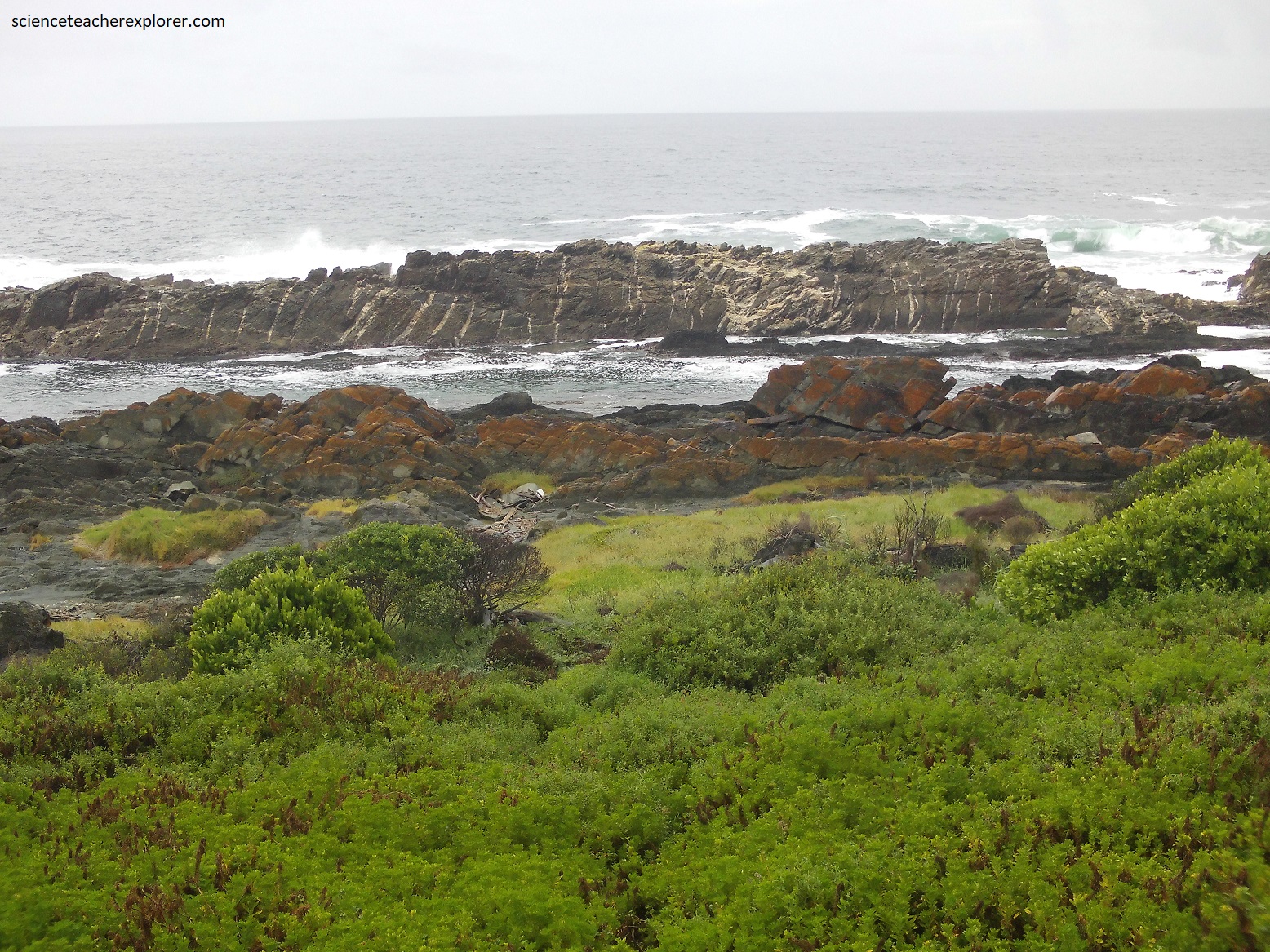
As mentioned above, at the rocky Tsitsikamma coast, the cliffs drop vertically into the ocean from a gently sloping plain about 200 m above sea-level.
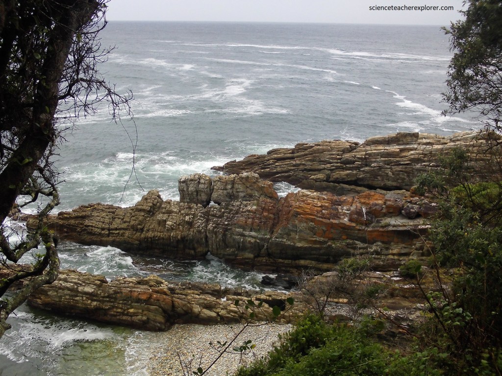
Pictured above, the steeply dipped rocks formations plunge below the waves to depths of over 30 m in places.
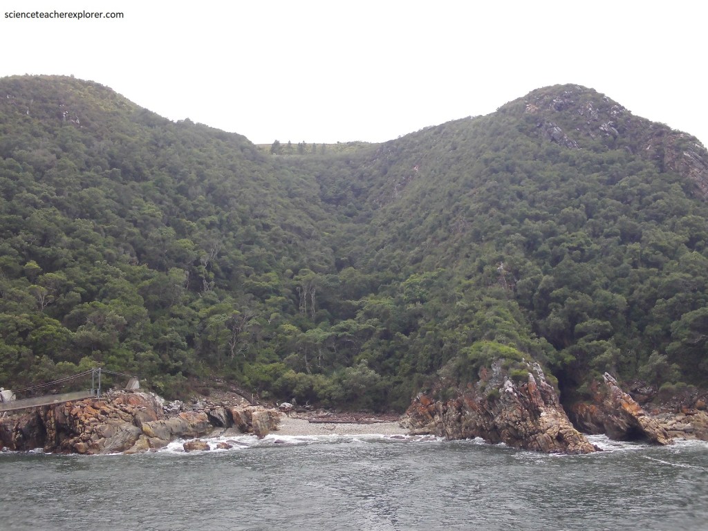
Pictured above, the action of water, both from the ocean and rivers has created a spectacular landscape.
Pictured above, as the base of the cliffs the waves have eroded a new ledge, known as a wave-cut platform, while slicing into the coast are steep-sided ravines, carve out by swift flowing river, such as the Storms.
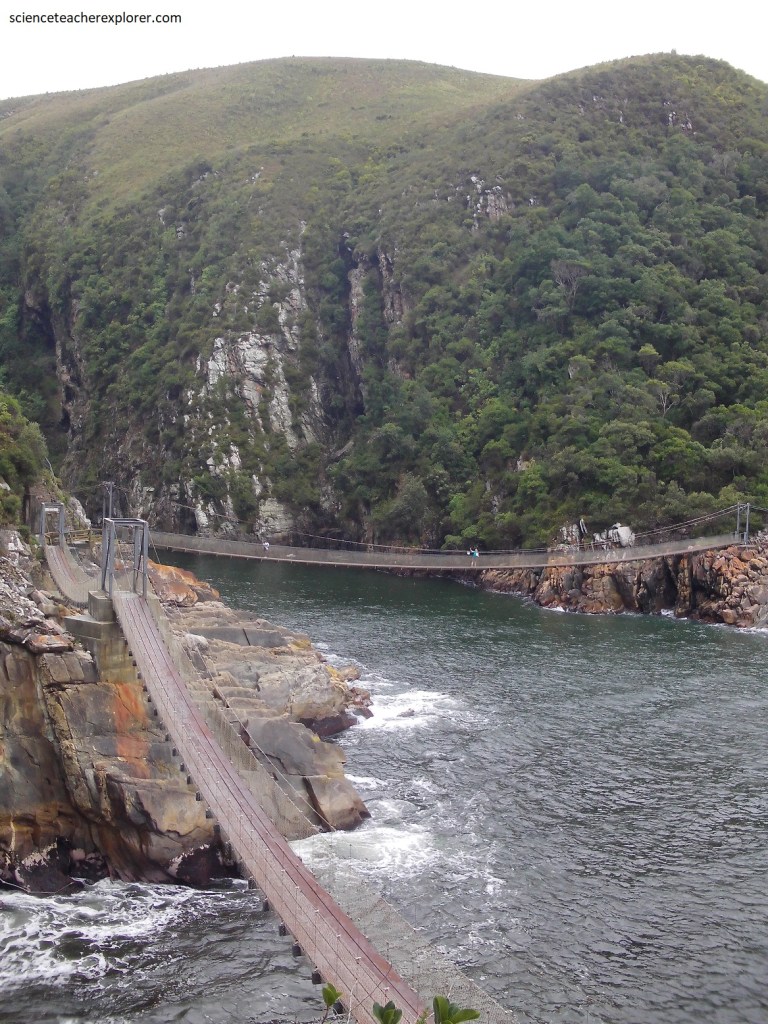
Pictured above, 3 suspension bridges have been installed over the Storms River Gorge Mouth. The main suspension bridge over the gorge is 77 long and 7 m above the water. It was built in 1969. The steeply south-dipping quartzite strata can be seen very clearly.
Pictured above, the ocean has invaded the river mouth of Storms Gorge. This funnel-shaped canyon is called a Schietklip, and it causes huge waves.
Pictured above, a bush-covered cleft in the hillside adjacent to the suspension bridge marks the positions of the Cederberg shale unit separating the Peninsula and Nardouw quartzites.
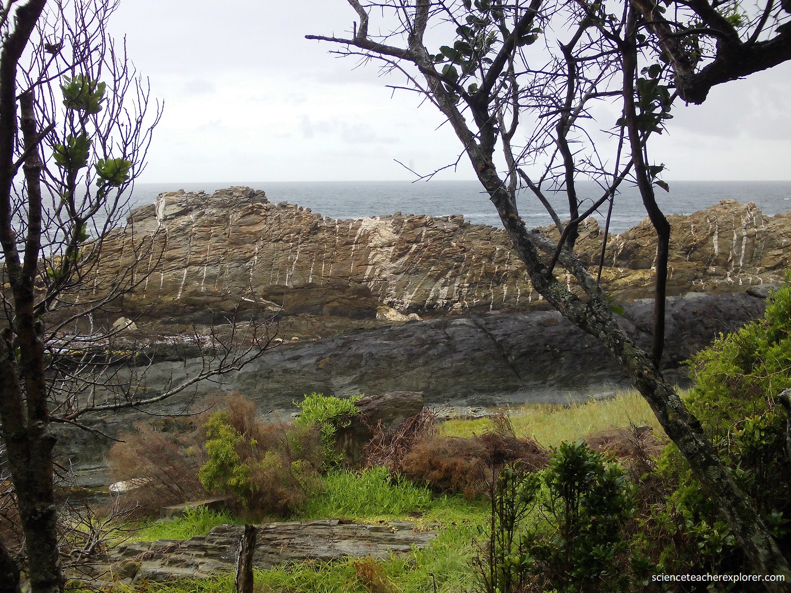
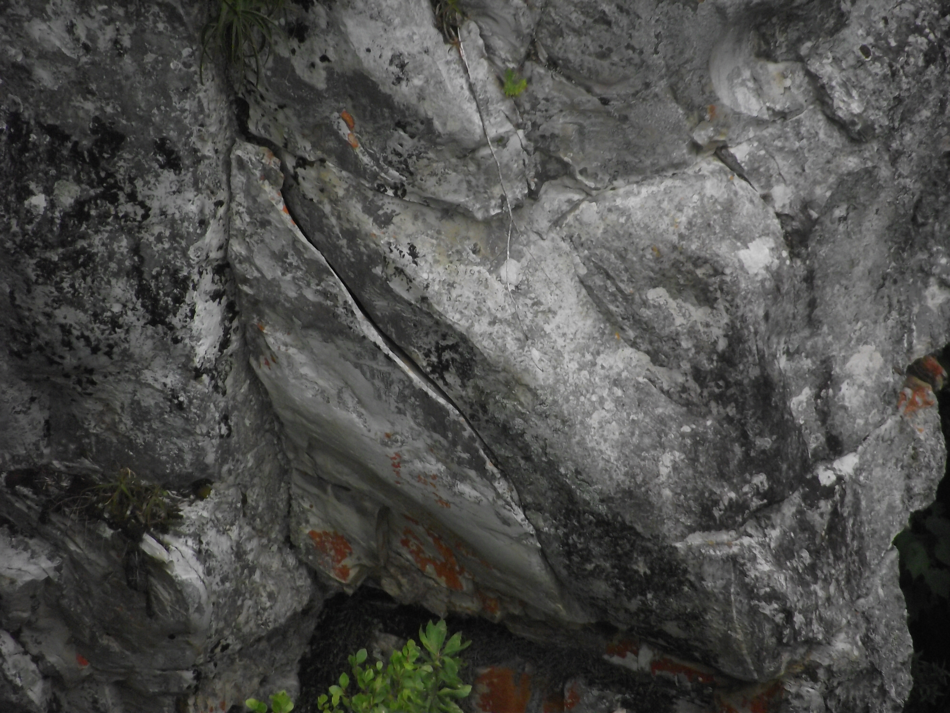
Pictured above, in places along the sea front rocks there are irregular white quartz veins that cut across or run parallel to the strata; there are rumors of gold occurring here along the start of the Otter Trail.
Pictured above, there were numerous white Quartz and brown carbonate veins in quartzite and phyllite, some of which contained pyrite & traces of gold.
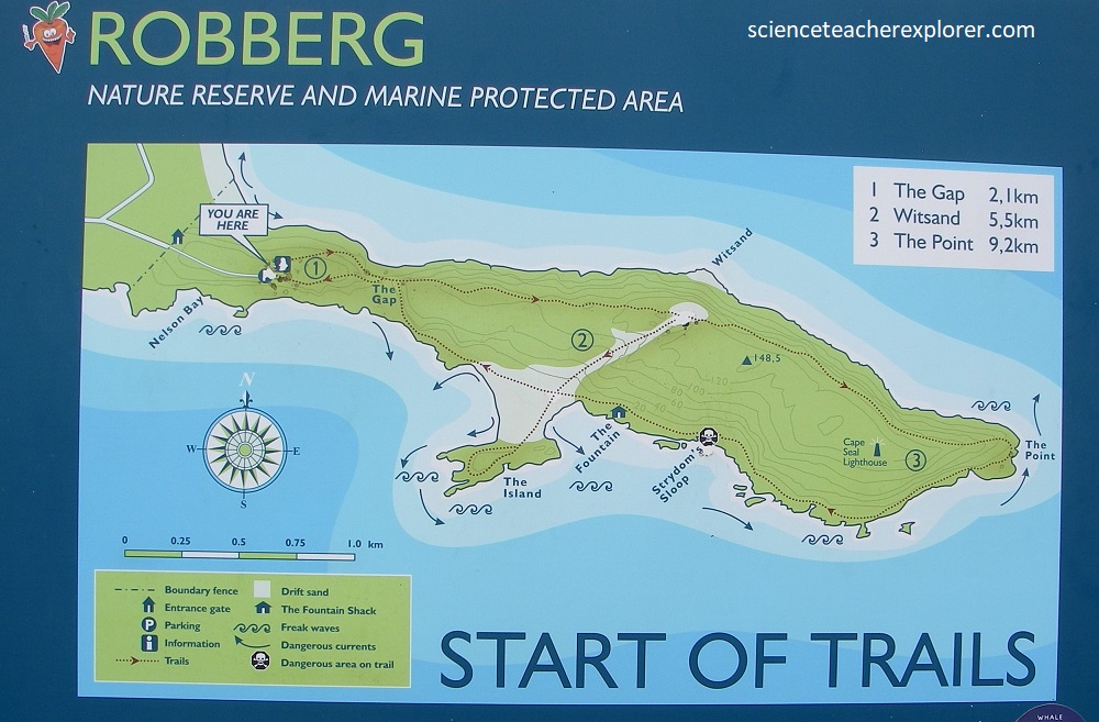
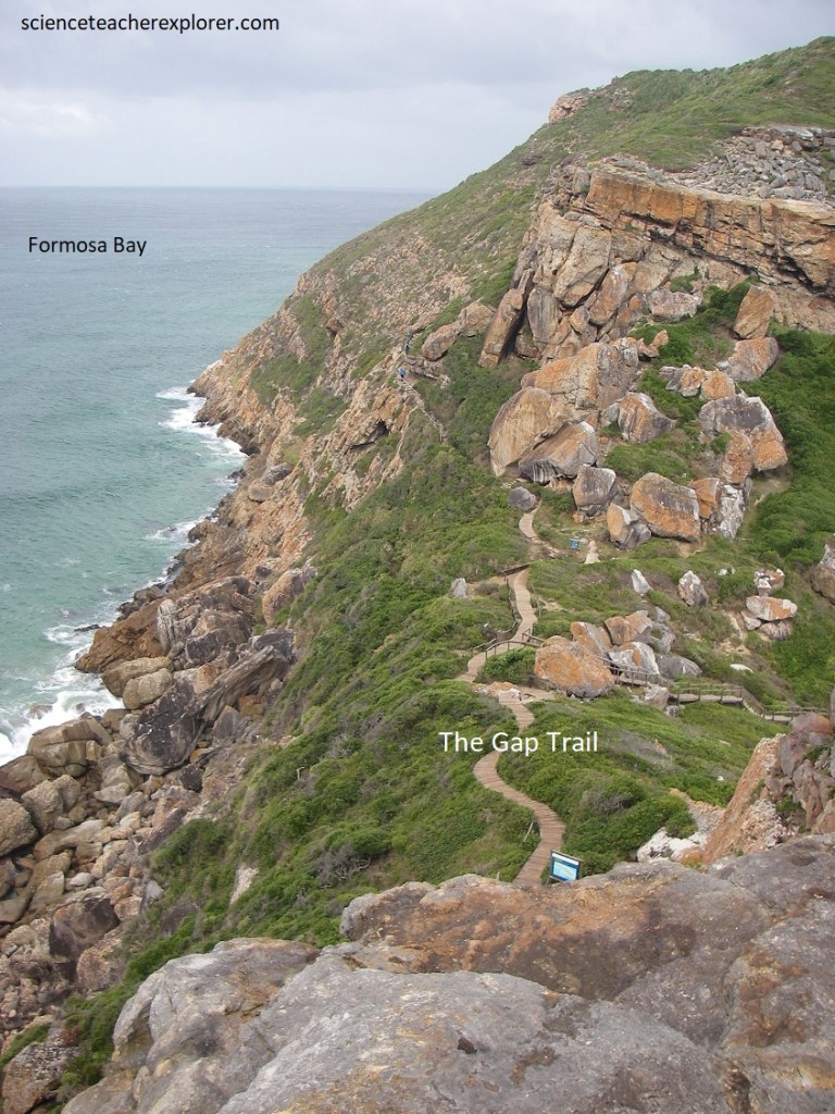
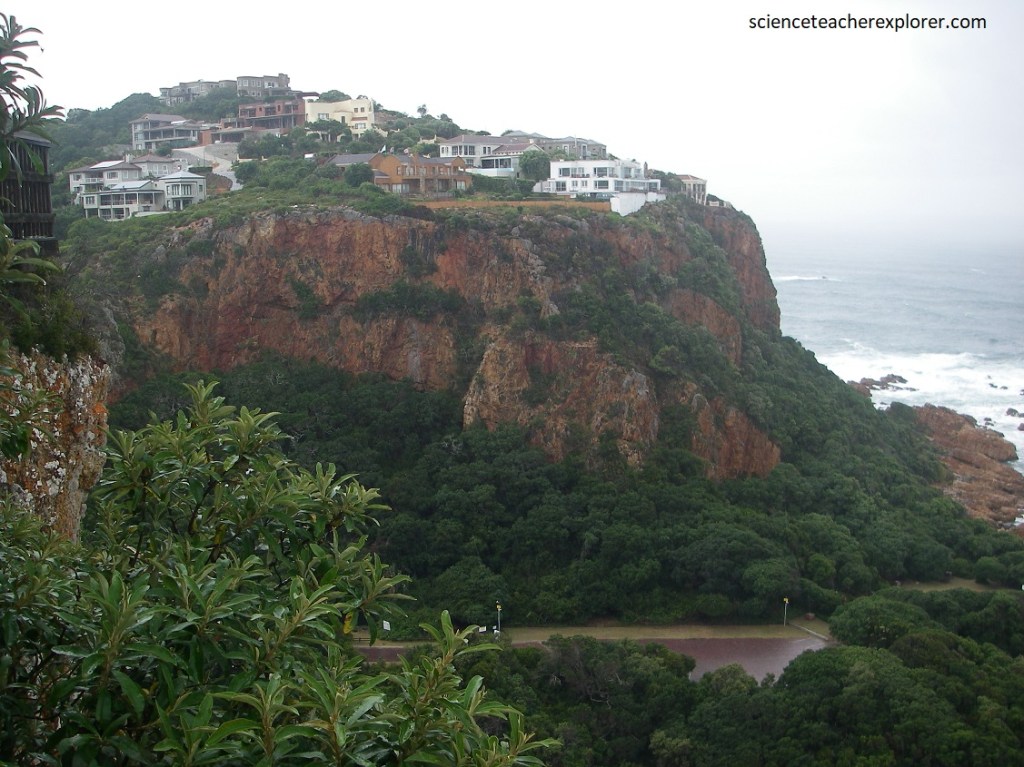
Peninsulas are comparatively rare on the southern African coast, but driving 68 km west of the Storms River Gorge on N2, the Robberg Peninsula forms. Robberg Nature Reserve lies some 5 km to the south of Plettenberg Bay town.
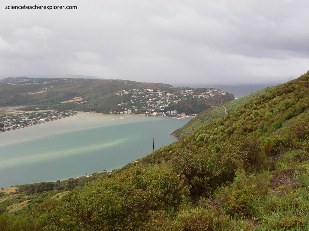
Plettenberg Bay is a striking horseshoe-shaped by lying on the Southern Cape coast, formed by the Robberg Peninsula, a long promontory curving south and southeast.
The early Portuguese explorers were so taken with the area that they named it “Bahia Formosa, (beautiful bay), and with its long beaches, dramatic peninsula, lagoons, and indigenous forests, it is still worthy of this title today.
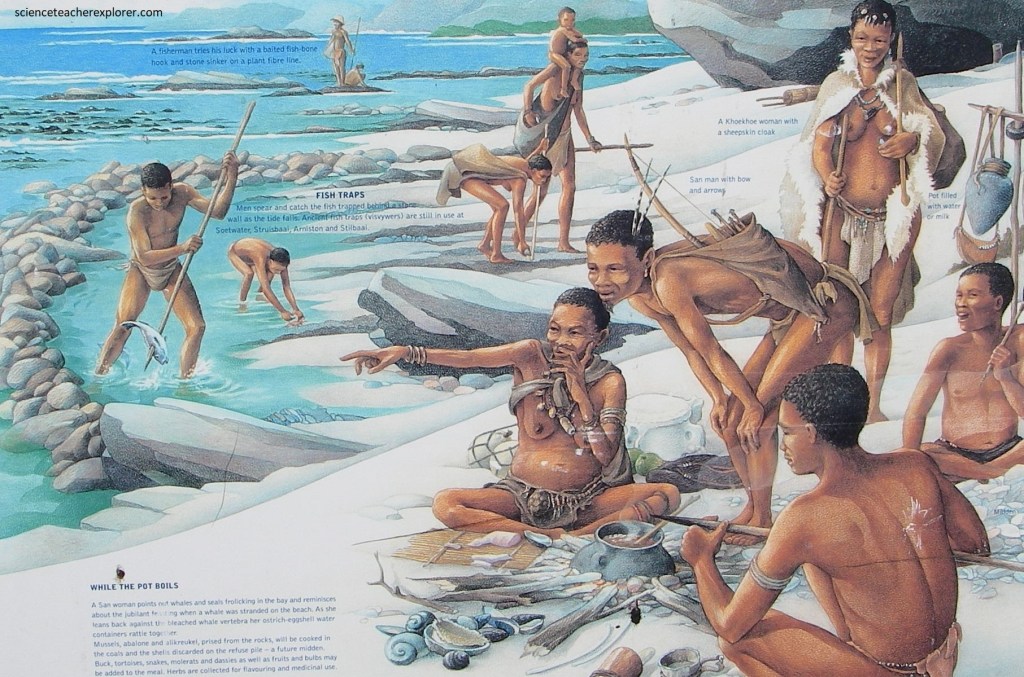
Robberg, meaning ‘mountain of seals’ was the name given to the rocky headland by early Dutch mariners. These first white settlers arrived at Formosa Bay in the 1760s; at that time the Khoikhoi people lived along the coast, the probable descendants of ‘Strandloper’ people who had lived there for many thousands of years, (imaged below).
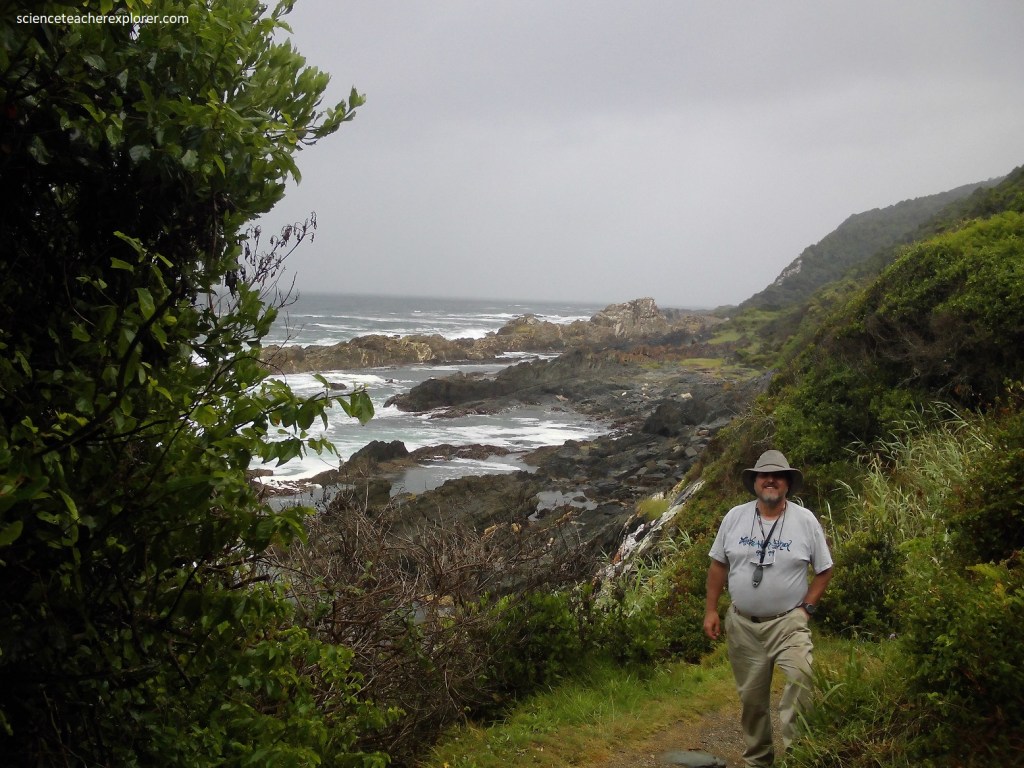
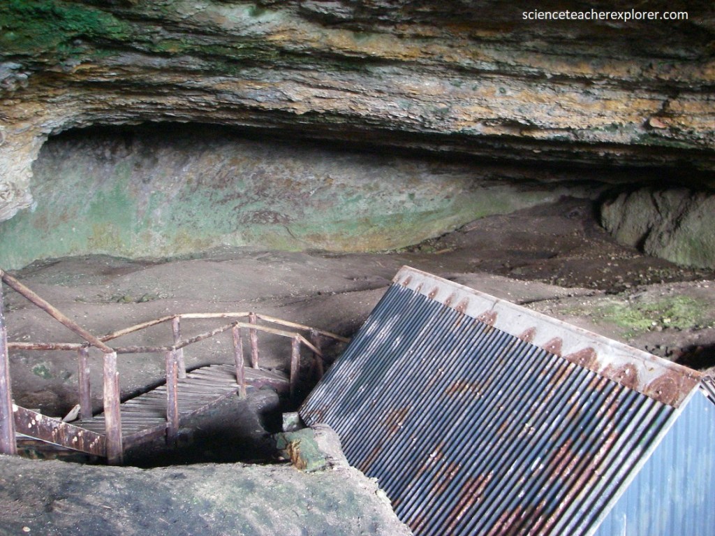
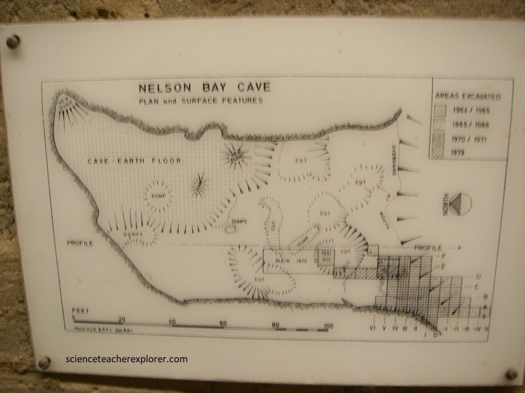
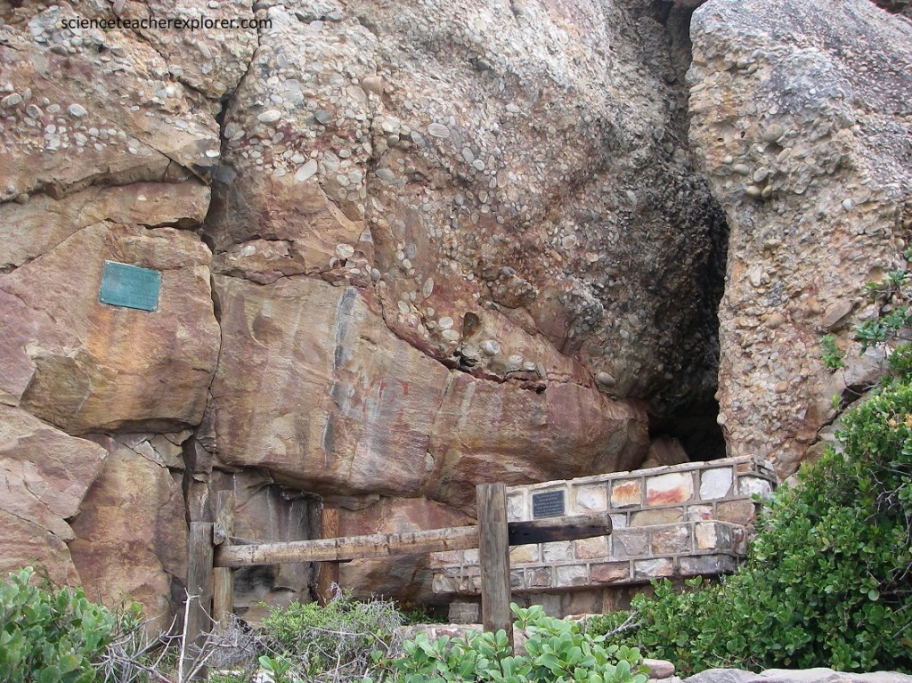
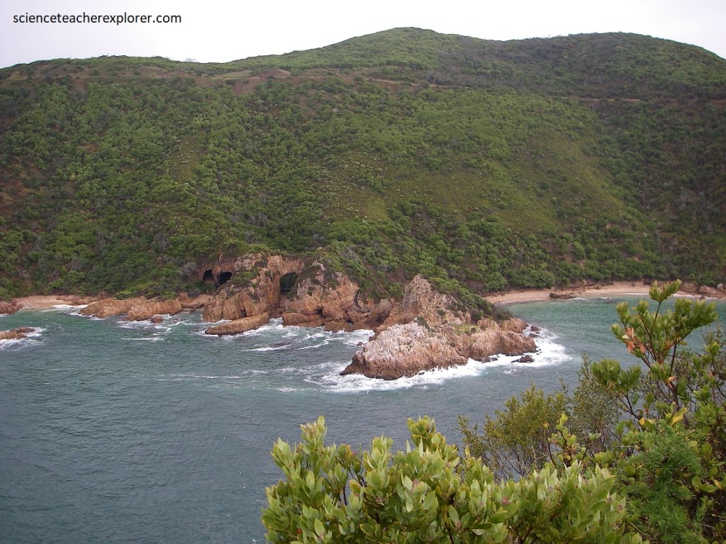
Mike and I trekked down the steep slope of the south side of Robberg Peninsula. This brought us to the famous archaeologically excavated Nelson Bay Cave, which was formed in angular quartzite breccia of the Robberg Formation by erosion from the ocean, (pictured below). It was occupied by early humans as far back as 120,000 years ago.
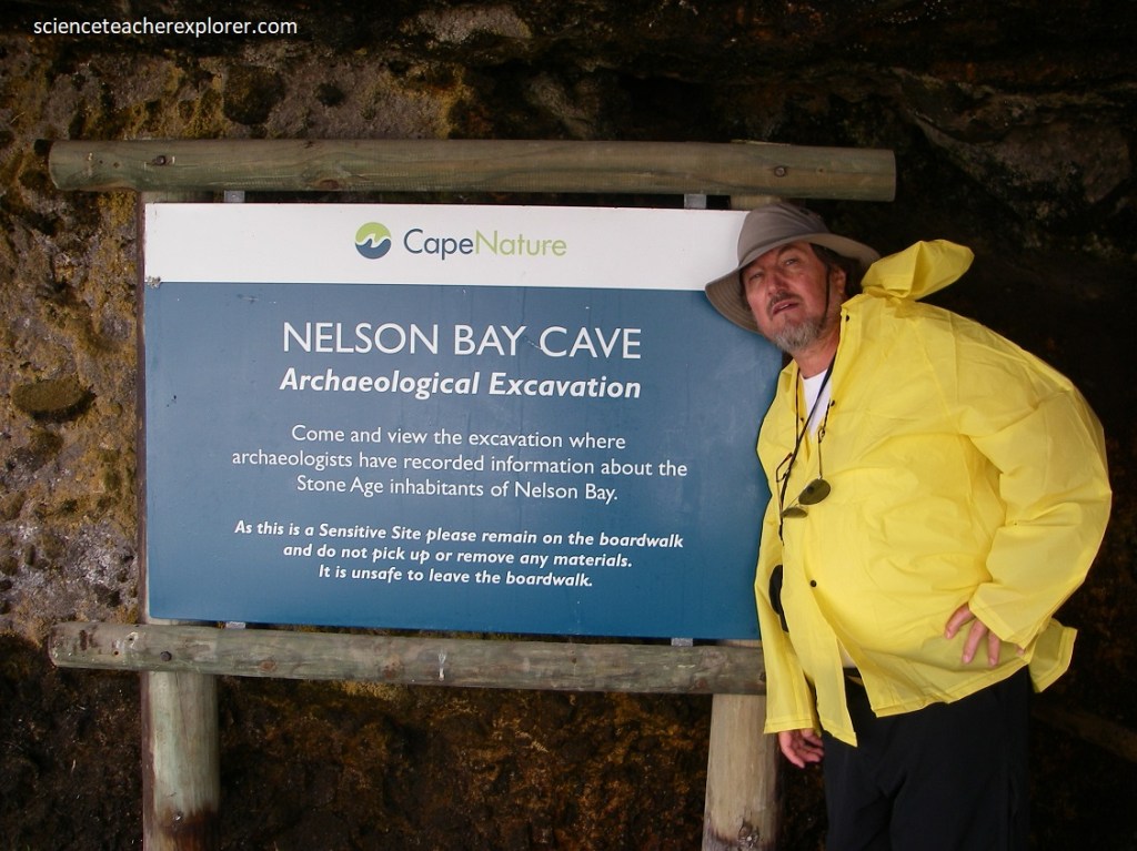
Pictured below, the interpretive facility Nelson Bay Cave tells the a fascinating story of early human occupation from 120,000 years ago, and later by San hunter-gatherers and Khoikhoi people.
The deposits the archaeologist removed from the Nelson Bay Cave were built up slowly by the rubbish left behind by the cave inhabitants.
The history of people along the southern cape can be pieced together from evidence as varied as fossil footprints, stone tools, shells, bones and building. From midden (refuse heaps), we can learn what people ate by examining old shells, the ashes of ancient cooking fires, and the bones of seals, seabirds, fish, buck and other animals. Shards of pottery and ornaments such as shell pendants and ostrich-shell beads give a glimpse into their ancient lives. Some coastal artefacts date back over one million years.
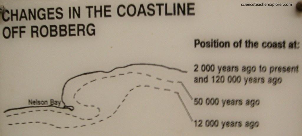
Imaged above, the archaeological record revealed in Nelson’s Bay Cave gives a glimpse of receding shorelines, followed by rising sea levels, as the last ice age firstly accumulated the waters in the polar ice caps, later releasing them to come flooding back. When global temperatures were cooler, ice sheets built up in the Arctic and the Antarctic. Because so much water was frozen in the ice, global sea levels dropped. The map above shows the position of the coastline south of Nelson Bay at different times in the past.
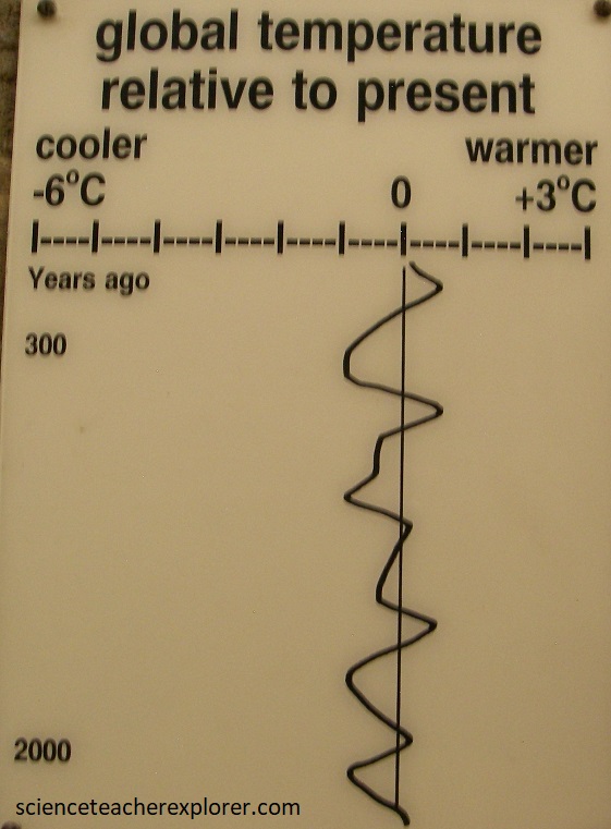
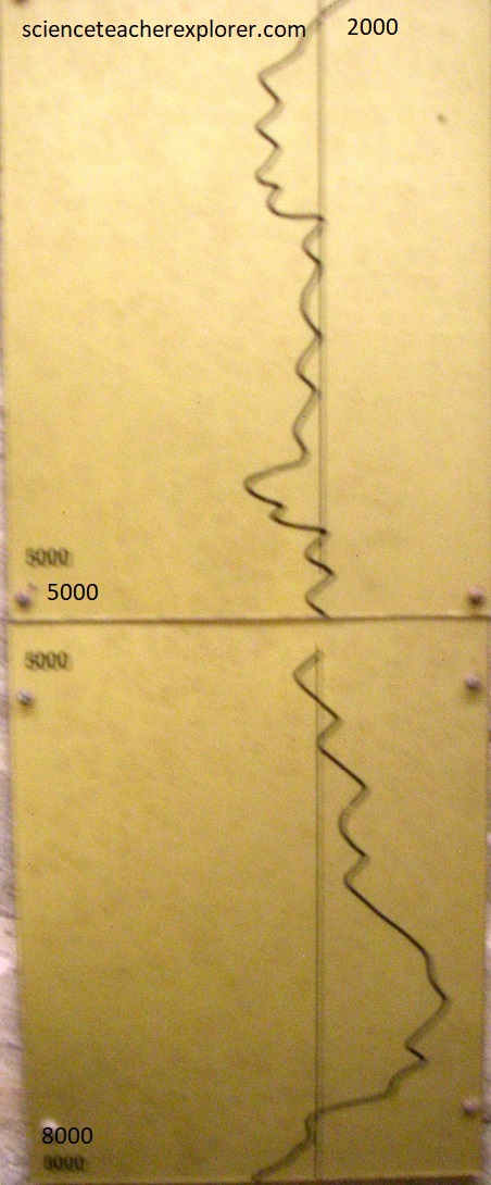
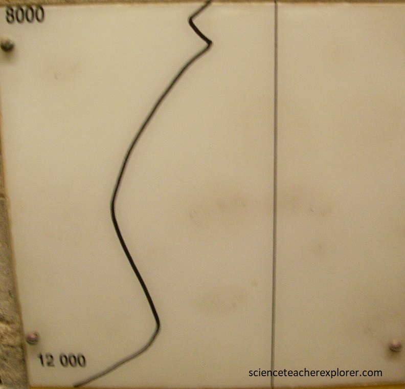
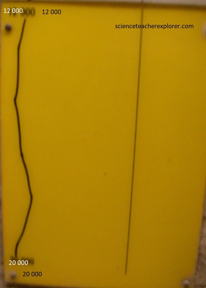
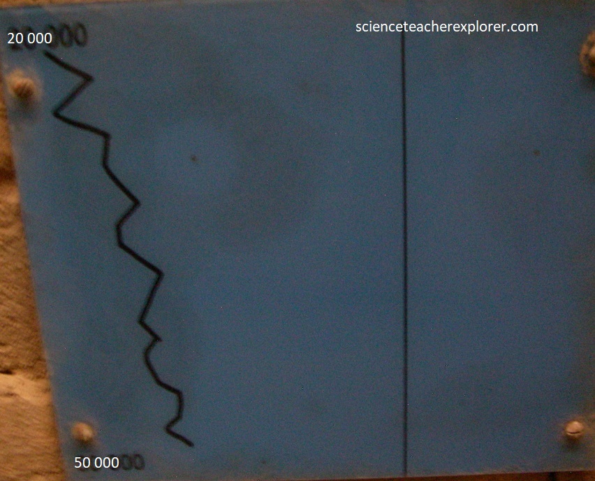
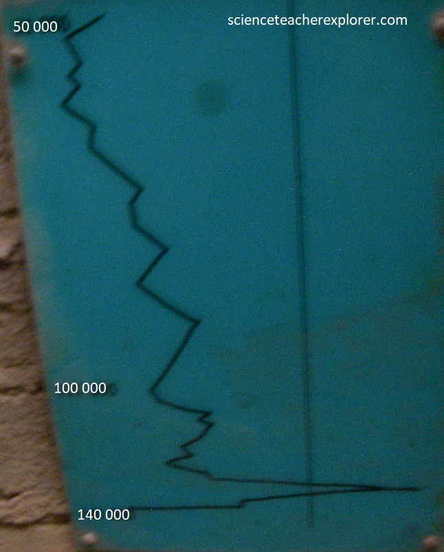
Imaged above from an interpretive sign on-site, Global temperatures have changed considerably over the time period when Nelson Bay Cave was occupied by Stone Age people. This curve is the result of the analysis of hundreds of cores taken from sediments on the ocean floor in many parts of the world. It records the amount of global ice and therefore temperature changes over the past 125,000 years.
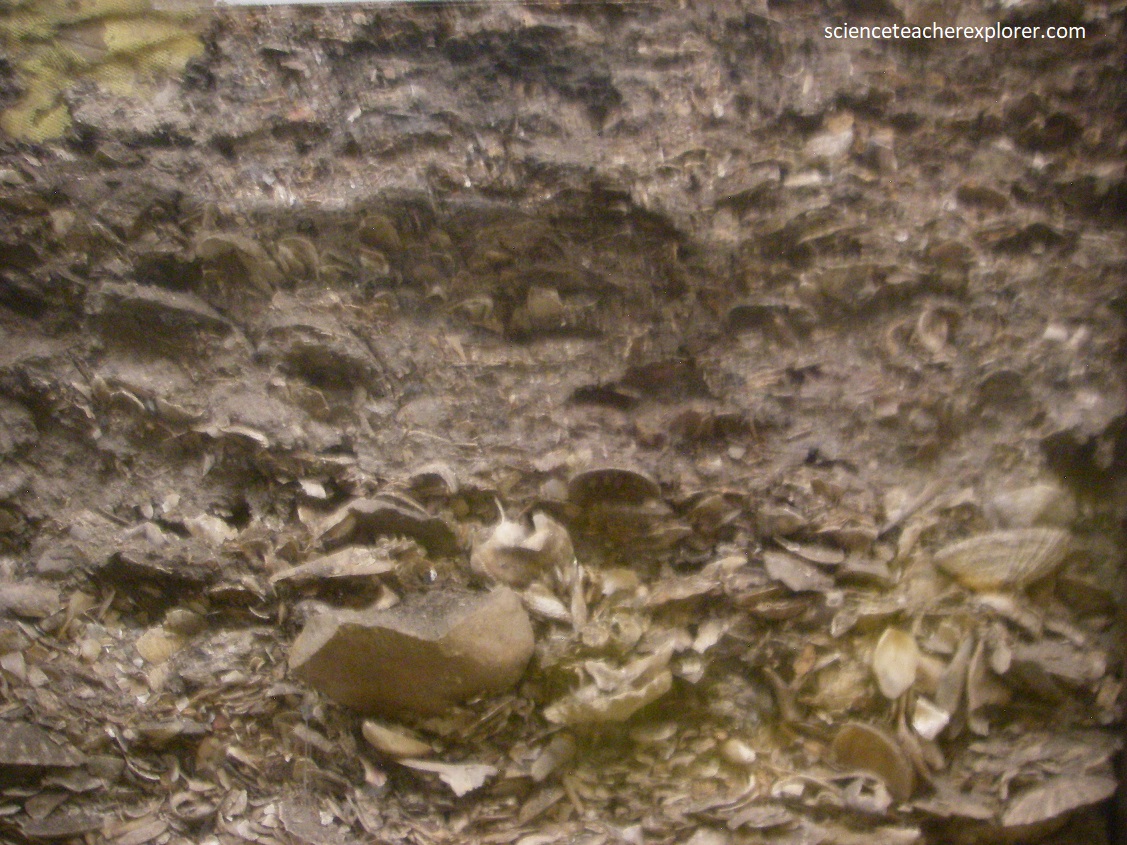
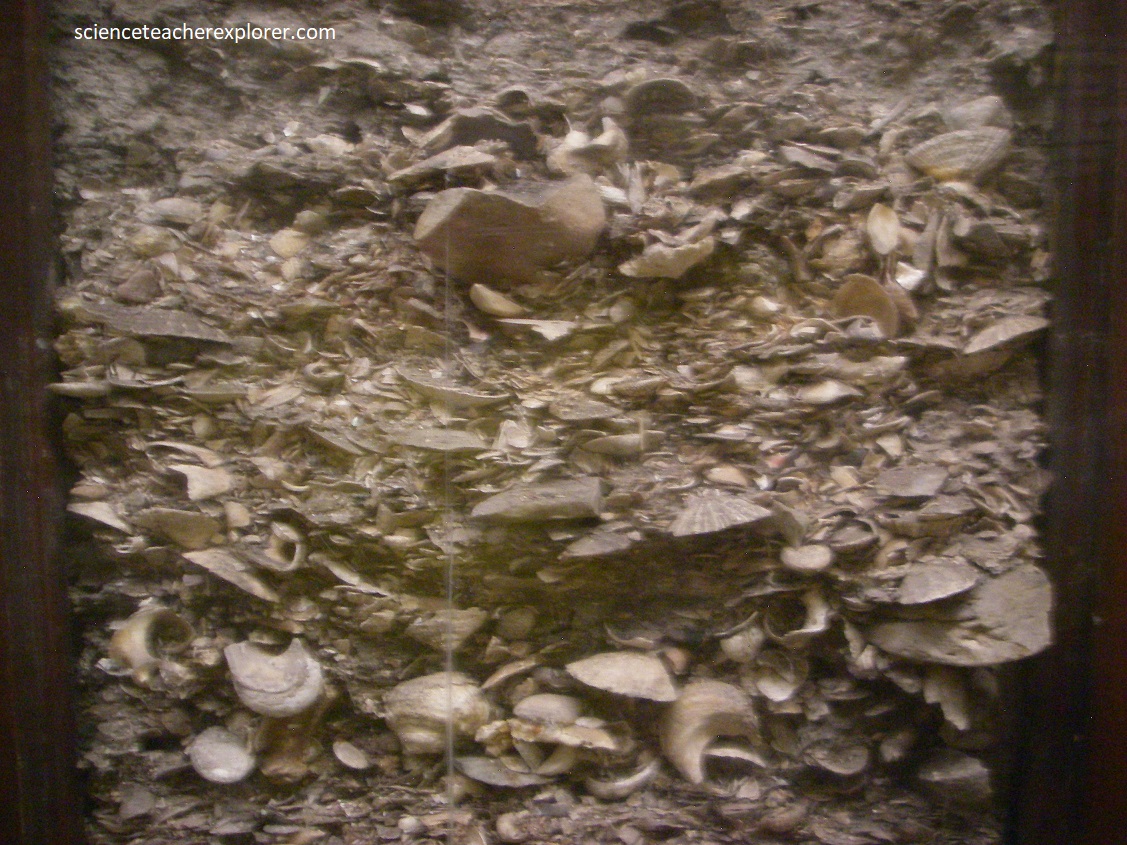
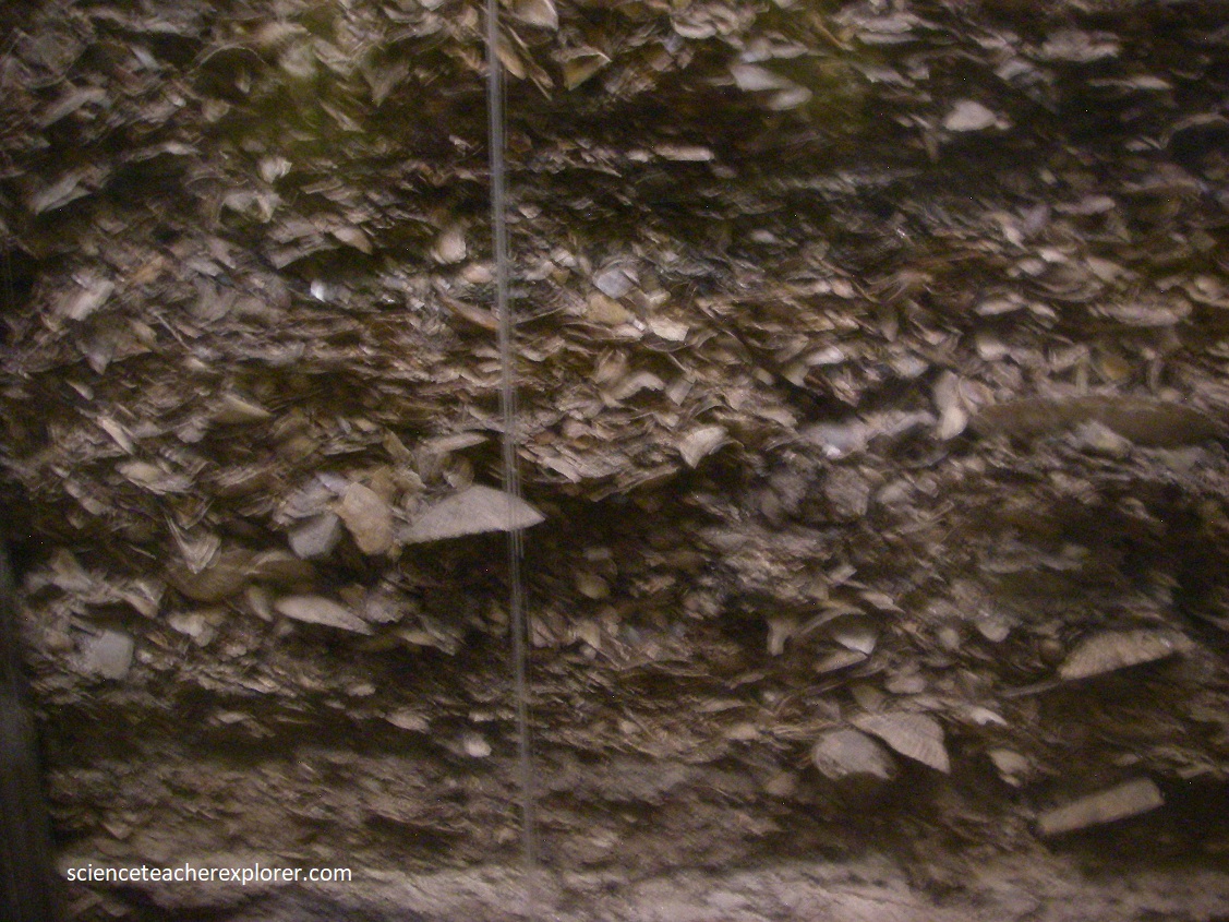
Pictured above from behind a glass panel from on-site, are consecutive sections through the deposits, We could see the layers of shells, bones and stone tools left here at different times in the past.
Found in these layers were of the following; LAYER 1 (Later Stone Age Khoikhoi pastoralists and San hunter-gatherers 300-2000 years ago): black musselcracker, strepie, mullet, yellowtail, galjoen, white stumpnose, red roman, elf, white steenbras, lipfish, red steenbras, brown mussels, perlemoen, white mussels, limpets, whelks, seal, dolphin, blue antelope, mongoose Cape buffalo, bushpig, bushbuck, dassie porcupine sheep, mountain reedbuck, grysbok, blue duiker, tanged stone-points & polished bone points. LAYER 2 (Later Stone Age San hunter-gatherers 2000-8000 years ago): Black musselcracker, elf, dassie, rod roman, kabeljou, white musselcracker, rock cod, yellowtail, silverfish, white steenbras, brown mussels, black mussel, limpets chiton, perlemoen, pencil bait, white mussels, periwinkles, alikreukel, whelks, venus ear, slipper limpet, dolphin, seal, dassie, blue antelope, mountain reedbuck, hippo, porcupine, bushpig, waalribbok, grysbok, bushbuck, Cape buffalo, mountain reedbuck, grey duiker, mongoose, micro-lithis stone tools, stone sinkers, polished bone points, decorated bone tubes, bone rings, ostrich eggshell pendants, ostrich eggshell beads, shell pendants, painted stones & human remains. LAYER 3 (Later Stone Age ancestors of San hunter-gatherers 8,000-12,000 years ago): hottentot, silverfish, red roman, dassie, black mussel, white steenbras, white musselcracker, yellowtail, elf, klip-fish, brown mussels, perlemoen, white mussels, limpets, alikreukel, periwinkles, whelks, chiton, dolphin, seal, mountain reedbuck, bushpig, oribi, southern reedbuck, klipspringer, bushbuck, roan, grysbok, vaalribbok, eland, wharthog, porcupine, dassie, mongoose, blue antelope Cape buffalo, hippo, medium and large scrapers, & polished bone tools. LAYER 4 (Later Stone Age ancestors of San hunter-gatherers 12,000-20,000 years ago): Extinct giant buffalo, warthog, extinct giant hartebeest, ostrich, wildebeest, extinct springbok, mongoose, southern reedbuck, eland, klipspringer, quagga, dassie, porcupine, bushpig, bontebok, roan, bladelets and cores, large and small scrapers. LAYER 5 ( not occupied 20,000-50,000 years ago). LAYER 6 (Middle Stone Age ancestors of San hunter-gatherers 50,000-120,000 years ago): Triangular stone points and stone segments.
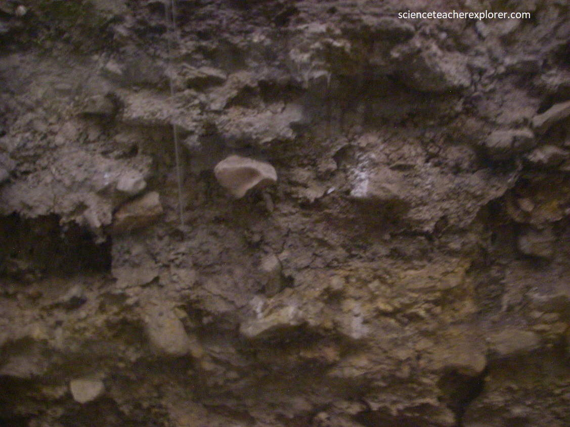
Pictured above and below, the Nelson Bay Cave is a large overhang formed by wave erosion at the unconformity between quartzite and breccia.
Robberg Peninsula provides a small but interesting geological window into the development of a sedimentary basin as the new southern African coastline was being formed, following the break-up of Gondwanaland. It is almost 4 km long and up to 750 m wide, and rises to 148 m above the sea level. It is being actively eroded by the ocean and wind because of its exposed coastal position.
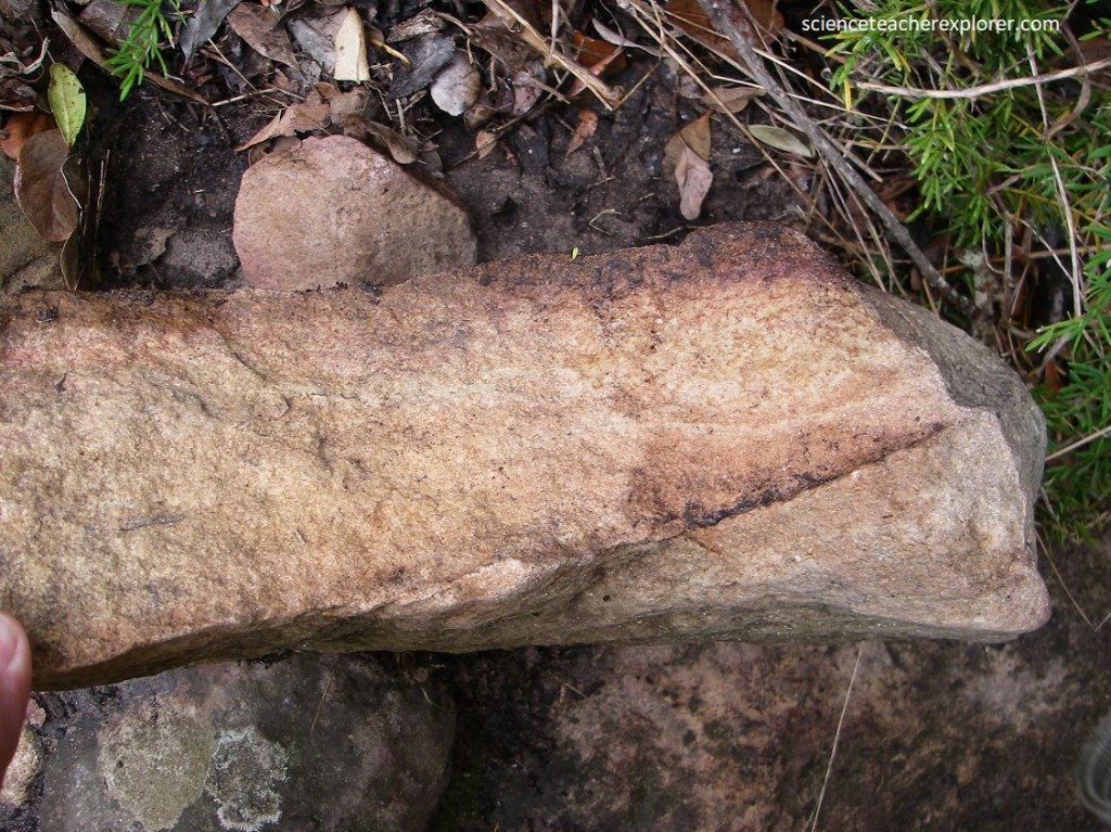
As seen below, three distinct geological formations of different ages make up Robberg Peninsula: (1) Table Mountain Group: The quartzite formed hard south-dipping beds that are well exposed close to sea-level, and makes the rigid basement rock. (2) Robberg Formation: Comprises of various sandstones, conglomerates and scree breccia. It is up to 80 m thick and was deposited around 120 million years ago. (3) Quaternary dune rock: consists of windblown beach sandstone that is well exposed. Up to 30 m thick, it is mostly restricted to the highest part of Robberg Peninsula.
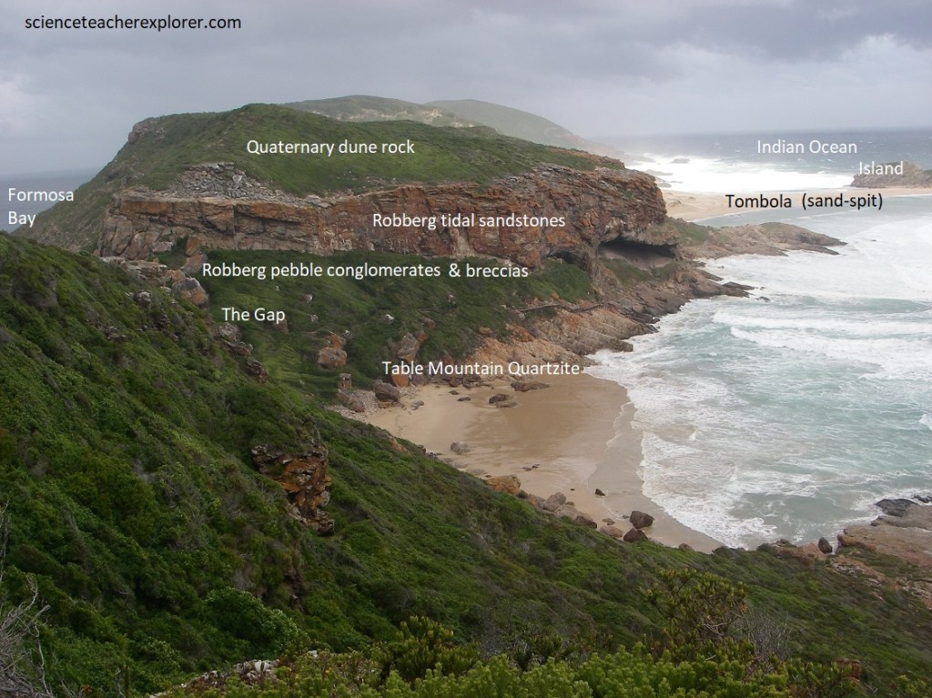
Pictured above, Robberg Peninsula narrows down to less than 200 m at a fracture zone called the “Gap”, which is more than 20 m above sea level, and where it could be breached in the distant future.
Before the Robberg sediments were deposited there was a rugged, scarp-like ridge made of hard, south-dipping Table Mountain quartzite, (pictured above).
Pictured above, strong coastal erosion of the Table Mountain quartzite ridge, (mentioned above), first formed deposits of unsorted rock debris (scree) that accumulated close to its source area. The scree hardened to form a lower breccia of angular quartzite fragments cemented within a fine-grained matrix.
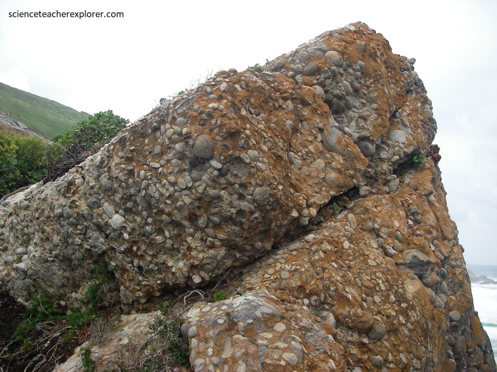
Pictured above, active regional faulting caused the basin to subside below sea level and strong wave action produced pebbly beach deposits that are now preserved as layers of well-rounded quartzite pebble-conglomerate.
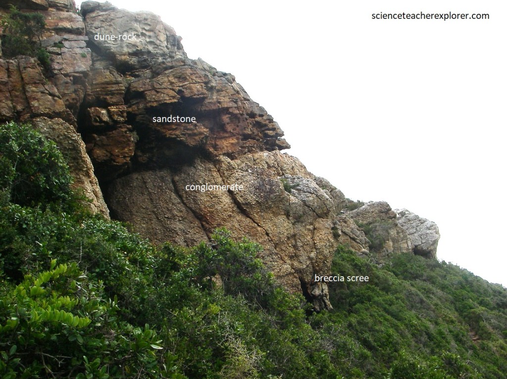
Pictured above, renewed subsidence once again led to the sea flooding in, but in more subdued conditions, and thus added a complex sequence of tidal and channel sands on top of the conglomerates, and formed the upper sandstone layer.
Later, during the Cenozoic, renewed erosion and uplift produced a regional land surface that survives near the top of Robberg, upon which windblown sand dunes were later formed, to become cemented eolian sandstone.
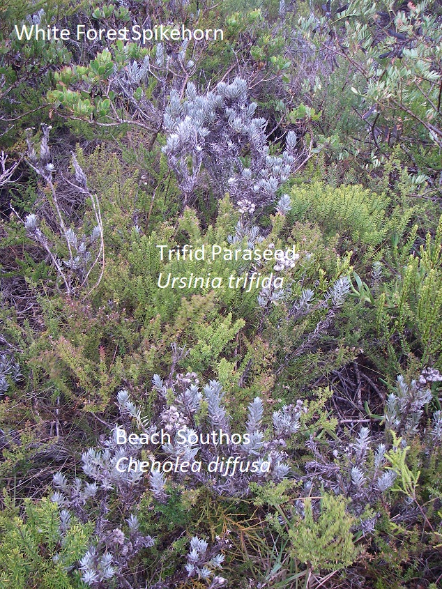
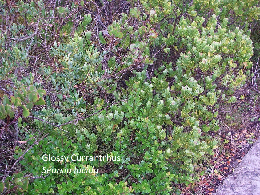
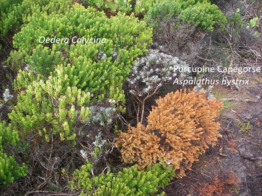
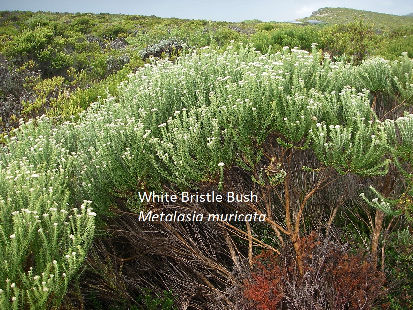
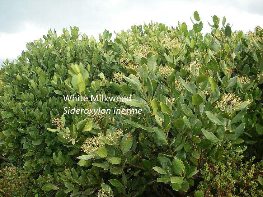
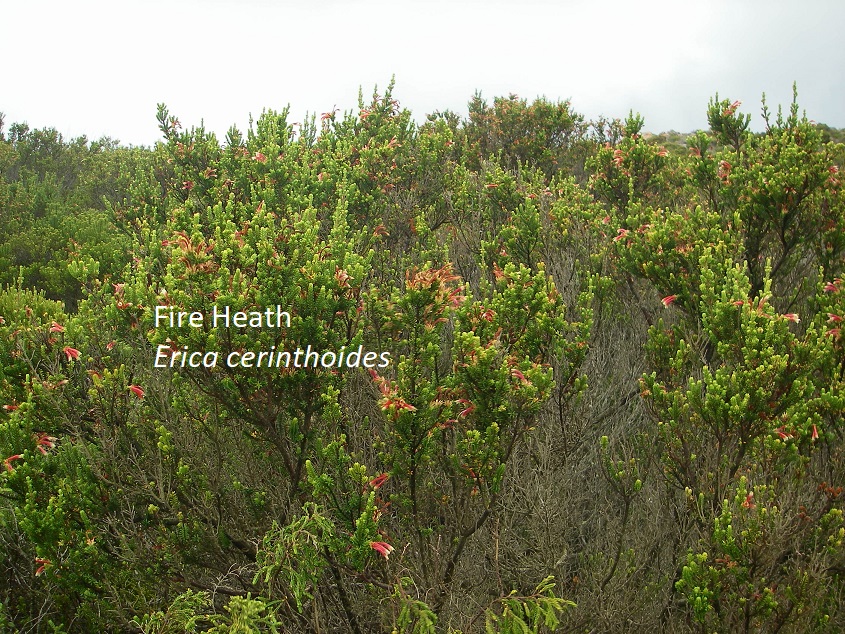
While trekking around Robberg Peninsula, I was able to identify the following plants:

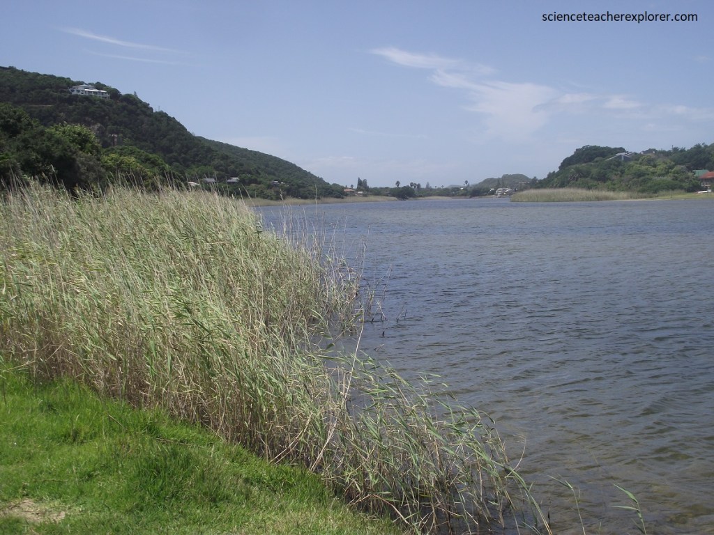
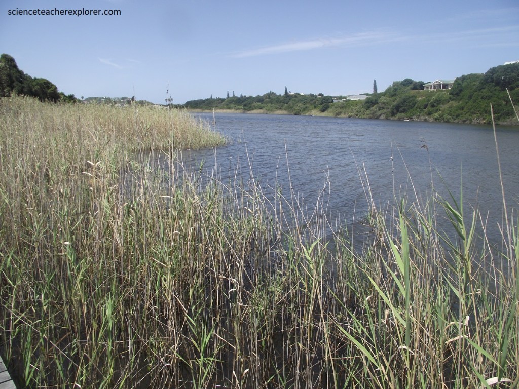
33 km westward on N2 from Plettenberg Bay is Knysna. Pictured below, the tide enters Knysna’s estuary by surging through a narrow channel flanked by two spectacular headlands.
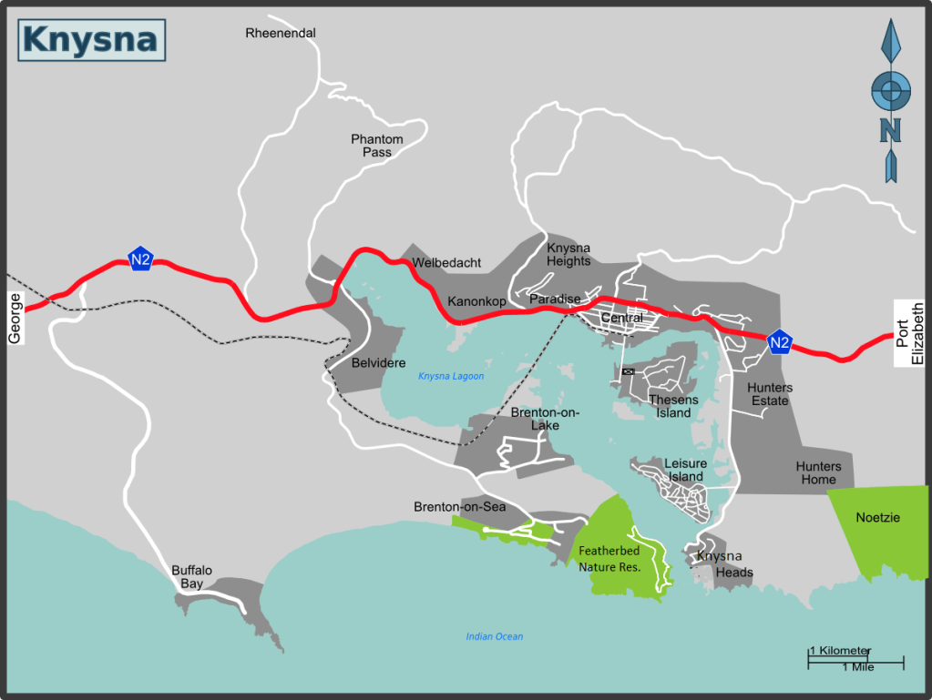
In 1818, the first British ship sailed safely through the rocky Knysna Heads into what became a useful harbor. However, the entrance channel to less than 200m and , with the strong currents, it has always been a treacherous passage in which ships foundered and lives been lost, (pictured below).
Pictured above, the headlands are composed of strongly jointed, south-dipping strata of Table Mountain Group quartzite. these quartzites are the same rocks that make up the Robberg Peninsula & the Tsitsikamma sea-cliffs.
Pictured above, the Heads are remnants of the extensive coastal plain that is present throughout the Southern Cape, and originally part of a wave-cut platform that was later elevated more then 200 m above sea level. On their northern side of the Heads, is the wide and shallow estuary of the Knysna River, often referred to as a lagoon. At one time the headlands flanked a narrow river gorge, and the river eroded a deep cleft through layer of hard quartzite when the ocean was at a lower level, (similar to the head of Storms River Gorge). However, the gorge has since been flooded by the ocean.
Pictured above, the upper part of the Western Head is covered by much younger dune & eolian sandstone rock.
Pictured above, at the Western Head the quartzite strata dip shallowly to the south but are intensely cut by joints and fractures, which reflect a wide north-south-trending zone of geological weakness, probably fault related.
Pictured above, these rocks very clearly show the intensity of the north-south fracturing and weakness, probably fault related, which allowed easier erosion by a coastal river gorge between “The Heads”, geologically similar to Storms River Gorge, but larger.
Pictured above, beds of hard, well-jointed Peninsula Formation quartzite of the Table Mountain Group dip at around 200 to the south and are well exposed in the cliffs near sea level. Again, (highly jointed quartzite), where there is very strong set of vertical joints in the quartzite that allows it to break up more easily; in places it has shattered to form zones of brecciation and consequent weakness.
Pictured above, north of the quartzite ridge is Knysna estuary & wetlands, underlain by sediments of the Enon Formation of the Uitenhage Group. I was able to pull off some nice wildlife photos.
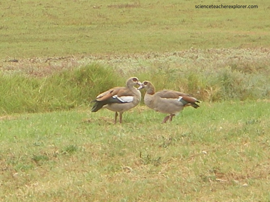
Pictured above, Egyptian Geese Alopochen aegyptiaca, where the dark brown patches around the eyes and on the center of the chest are characteristic. The legs and feet were red.
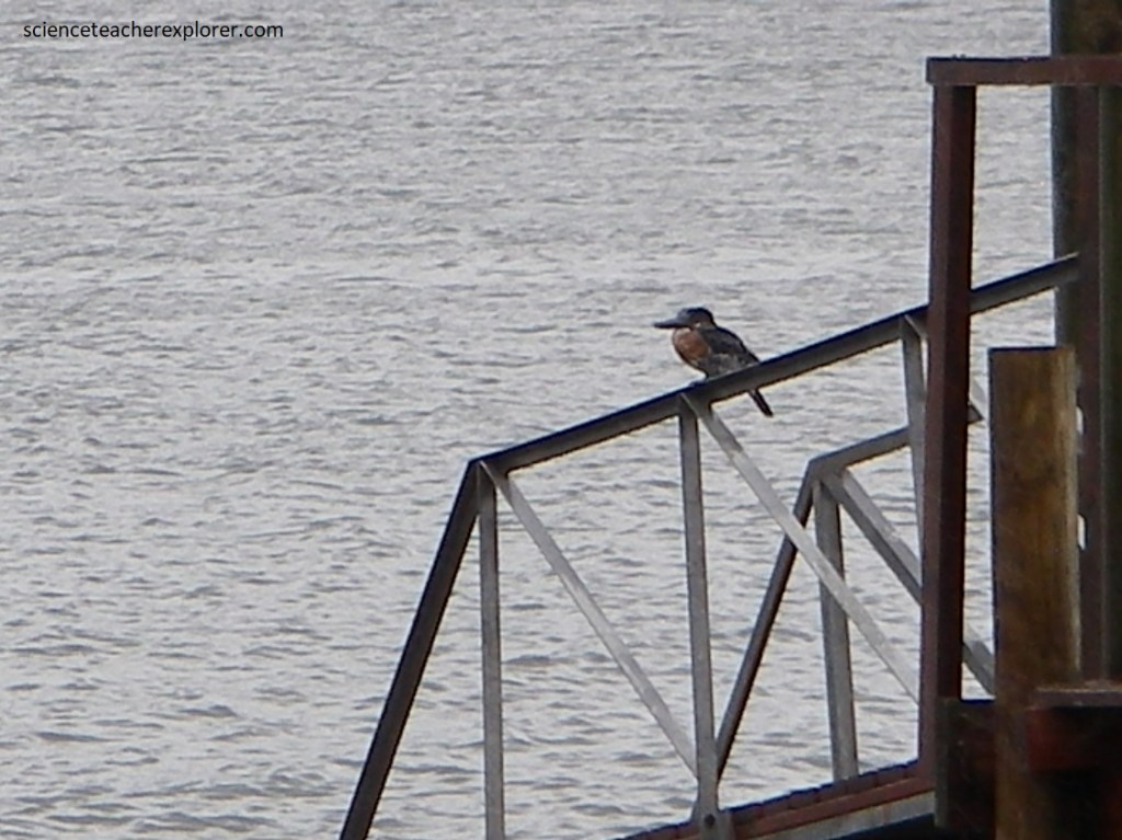
Pictured above, Malachite Kingfisher Alcedo cristata is a very small kingfisher with a red bill and orange under-parts. The upper-parts were bright blue and a greenish-blue barred crown.
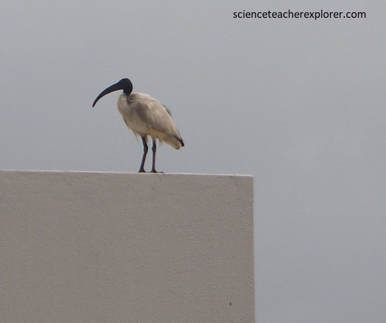
Pictured above, Sacred Ibis Threskiornis aethiopica is mostly white with a black head and neck and some black plumes in the tail. It has a long, slender, down-curved, black bill.
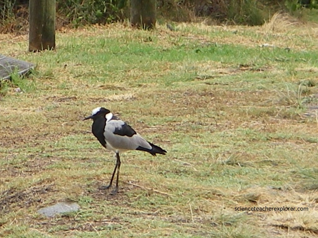
Pictured above, Blacksmith Lapwing Vanellus armatus had the black white and grey patterns that were characteristic. This one had call sounds that sounded like a blacksmith’s hammer striking an anvil.
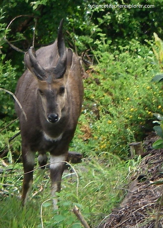
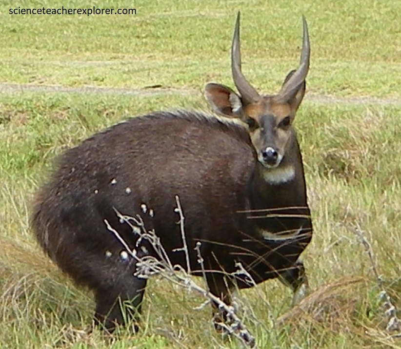
Pictured above, Bushbucks Tragelaphus scriptus were found on the Western Knysna Head within the “Featherbed Nature Reserve”. They were a medium-sized, reddish-brown animal with white spots on the body, white patches at the base of the neck and against the legs. They both seemed very solitary.
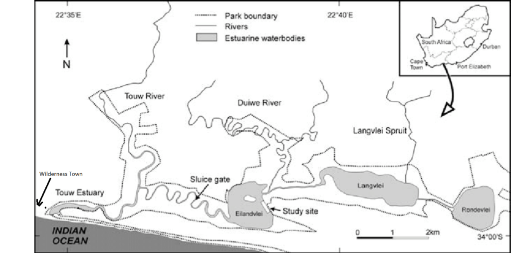
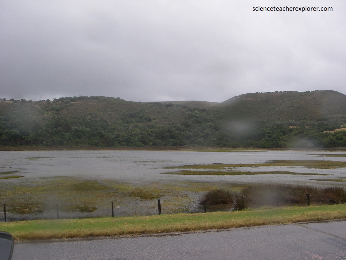
Imaged above, our next location to explore on the Southern Cape was the Wilderness Lakes, 47km west of Knysna on highway N2.
Pictured above, Wilderness Lakes are shallow lagoons, (sometimes called estuarine lakes), rather that true lakes, and were formed by the infilling of the estuary by sediment, either deposited by the river or by wind-blown sand. Eilandvlei Lake was formed as a submerged lowlands between sand dunes. It was then flooded by the rising levels of the Indian ocean, which was not connected to any river system at that time.
The Wilderness Lakes lie parallel to the coast, occupying and area 1.6 km wide and 15 km long.
Pictured above, The Touw Estuary formed the lagoons in the west of the Wilderness Lake area. These lakes are now separated from the Indian ocean by sand dunes that have been stabilized by the plants growing on them.
Pictured above, when the channels flood, however, they break through the coastal sands at the former river mouth and enter the ocean. In particular, Langvlei Lake was formed when a submerged river valley was flooded by rising sea levels due to the melting of the ice caps and glaciers; 6000 years ago.
For a short time both the river, channels and lakes are slightly tidal, as seawater flows into the lake at high tide. This allows fish into the lakes to spawn in both Eilandvlei & Landvei Lakes.
Pictured below, only one lake (Groenvlei) is totally isolated by the wind-blown sand, with neither a river flowing into it nor an outlet to the sea. It was formed by wind erosion which hollowed out an area of land into a large basin and was subsequently filled with water.
The formation of sand dunes along the Wilderness coastline by the constant rising and falling of the sea levels over the ages has played a big part in the formation of the lakes system. The first sand dune formed in the area north of the Langvlei Lake some 300,000 years ago and is about 2 km inland from the sea. Every time the sea level rose a new dune was formed and there are now a number of large dunes lining the coastline.

Pictured above, Rondevlei Lake has been declared a bird sanctuary. It has a number of bird hides built amongst the reeds that grow on its banks where people can sit quietly and watch the water birds do their thing. It would very interesting to get up close to some of the thousands of birds that live on and visit these lakes each year. There are at least 72 bird species and the monthly average for birds using the lakes is about 10800 birds. Below are a few examples we saw.
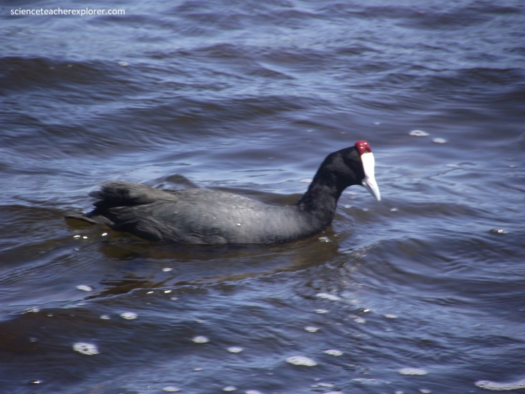
Pictured above, Red-knobbed Coot Fulica cristata was a fairly large black bird with a white bill and frontal shield. Above the shield are 2 red knobs. I understand that these become enlarged and brighter when the bird is breeding. I did notice the eyes were red also.
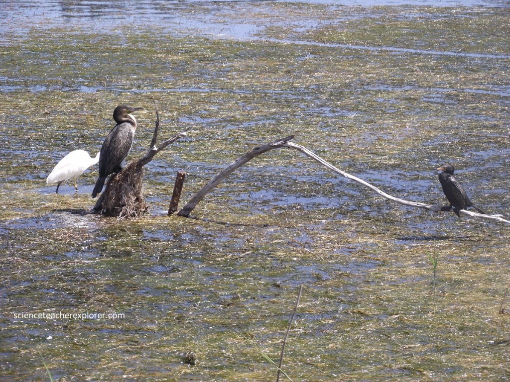
Pictured above, the White-breast Cormorant Phalacrocorax carbo is the largest of the cormorants in southern Africa. The white front extends from the chin to the breast. The Reed Cormorant Phalacrocorax africanus is noticeably smaller, slimmer and totally black. It is the smallest Cormorant in the southern Cape. They have a longer tail than the Cape Cormorant. I’ll ignore the Little Egret for now, since it darted behind the White-breast Cormorant.
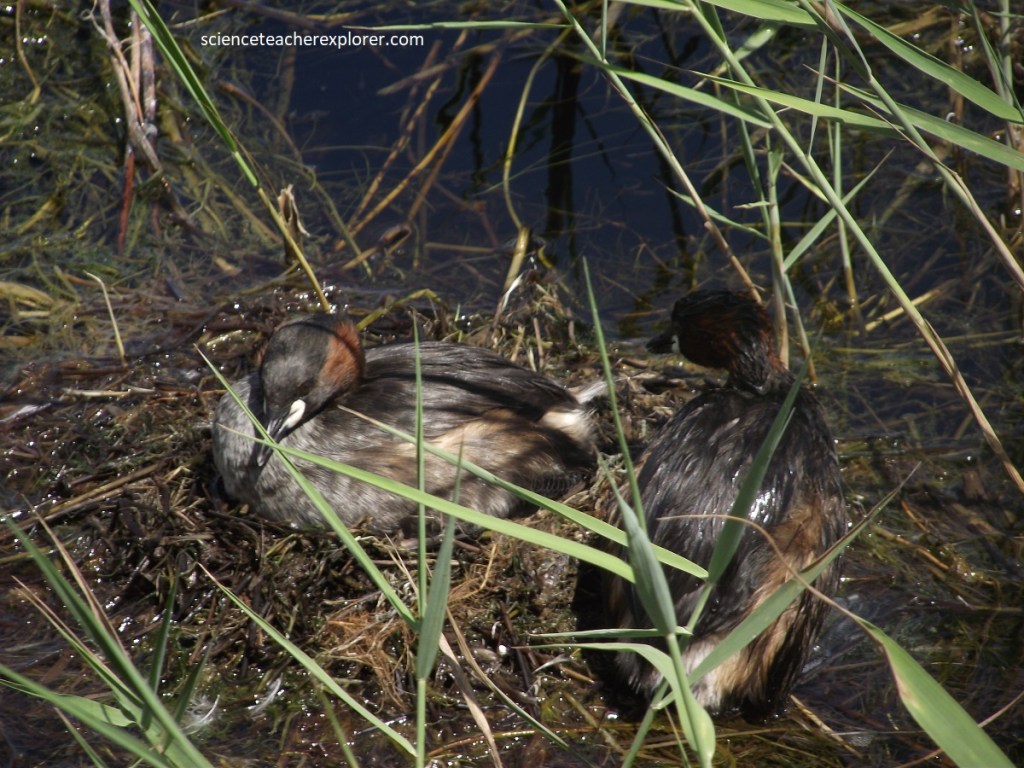
Pictured above, the Little Grebe Tachybaptus ruficollis is the smallest of the grebes and the commonest. They are small enough to be overlooked, especially as they spend much time under water. These were brightly colored and the rufous neck & chest contrasts with the black crown and nape.
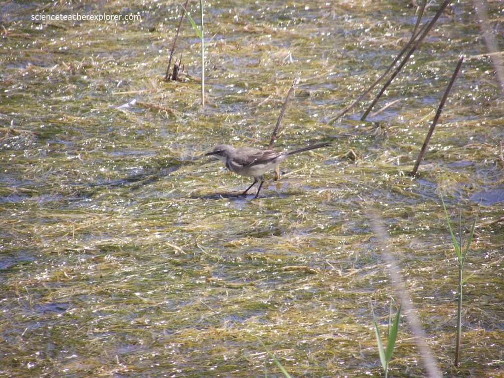
Pictured above, a Senegal Lapwing Vanellus lugubris skirting along the wet grass. It had a narrow black breast band that separated the greyish breast from the white belly. I could barely make out a small white patch on the fore-head. I wasn’t quite sure on this one. What confused me, was the long tail. Alot like the African Pipit with black legs.
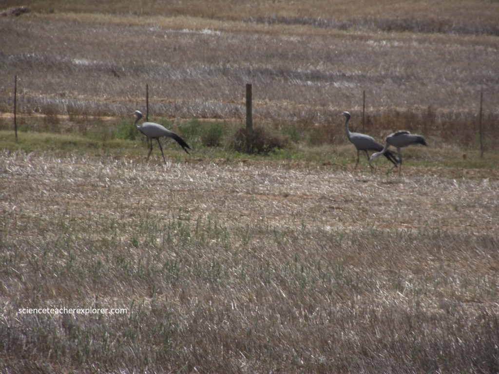
Imaged above, our last destination for exploration of the Southern Cape was Cape Agulhas. It was 340 km via. highways N2 and R319. Picture below, we caught a flock of Blue Cranes Anthropoide paradisea in the fields on R319. These are actually South Africa’s national bird. These beautiful birds were pale blue-gray in color that became darker on the upper head, neck and nape. From the crown to the lores, the plumage was distinctly lighter, sometimes whitish. The long wingtip feathers trailed to the ground. They seemed to have a relatively large head and a proportionately thin neck.
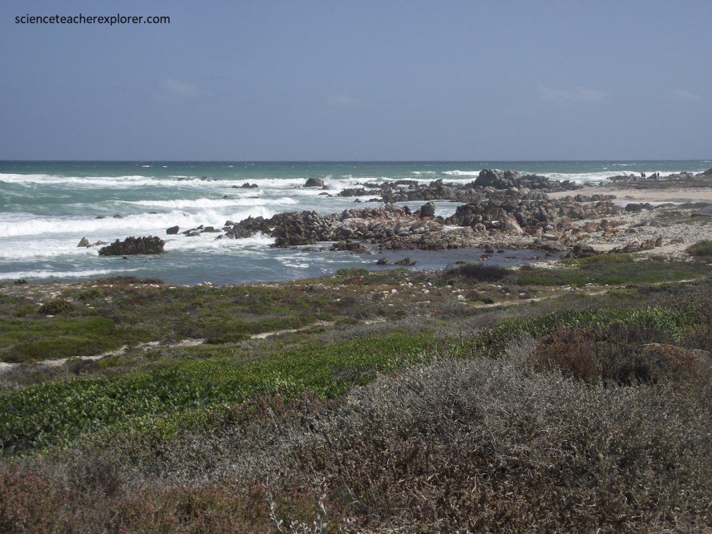
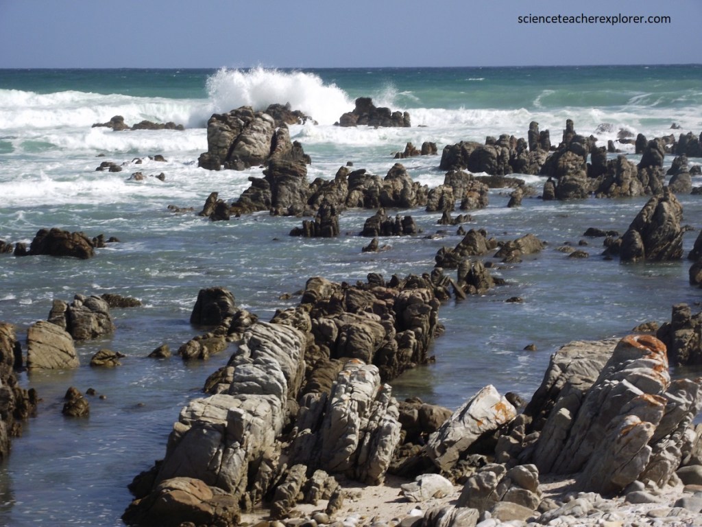
At Agulhas, the sandstone, which formed such dramatic cliffs further up the coast, had become a low rock platform that extends its long spurs into the surf.
“Agulhas is the Portuguese word for “needles”, (it is likely that the cape was named after these rocky outcrops. All of these rocks are of the Table Mountain Group quartzite.
The vast Agulhas Bank, which stretches out unseen beneath the waves, has important consequences for the region. Partly because of it, the warm Agulhas Current is forced southward here and loses itself in a maze of swirls and eddies. The awkward currents, tides, and winds that result have led to there being more shipwrecks along the Agulhas coast than on any other open coastline in southern Africa. Early Portuguese navigators found this a strange and dangerous place. As a matter of fact, the sea off Cape Agulhas is notorious for winter storms and mammoth rogue waves, which can range up to 30 m high and can sink even large ships. Over the past few hundred years it has been believed that around 150 ships have sunk around Agulhas.
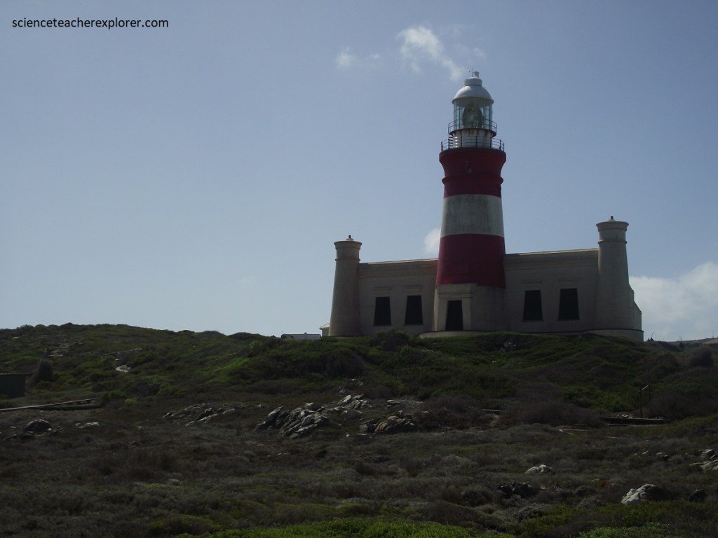
Pictured above, after many disastrous shipwrecks and numerous fatalities in the vicinity of the most southerly point on the continent, the first lighthouse on the African coast was built and funded by the British Government in 1848.
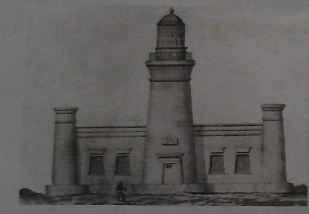
Influenced by Egyptian Revival architecture, the Cape Agulhas Lighthouse is a masterpiece of design. Its distinctive Egyptian Pharos style, with its tapering tower and central lantern room, was built in style of the Lighthouse of Alexandria. Standing tall at 27 meters, the Cape Agulhas lighthouse still makes for an imposing figure along the southernmost shoreline, having faithfully guided ships through the treacherous two oceans waters for over 170 years. The pictures below were taken within the lighthouse, after Mike and I climbed up to the top.
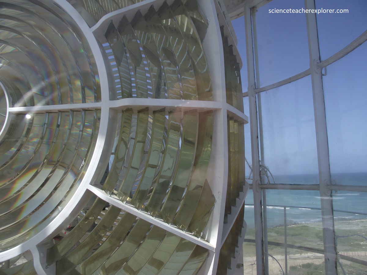
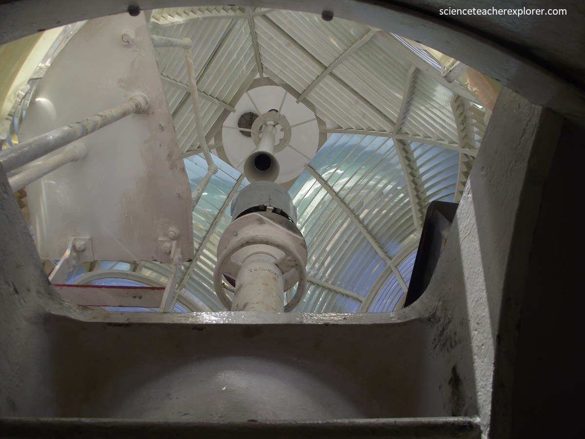
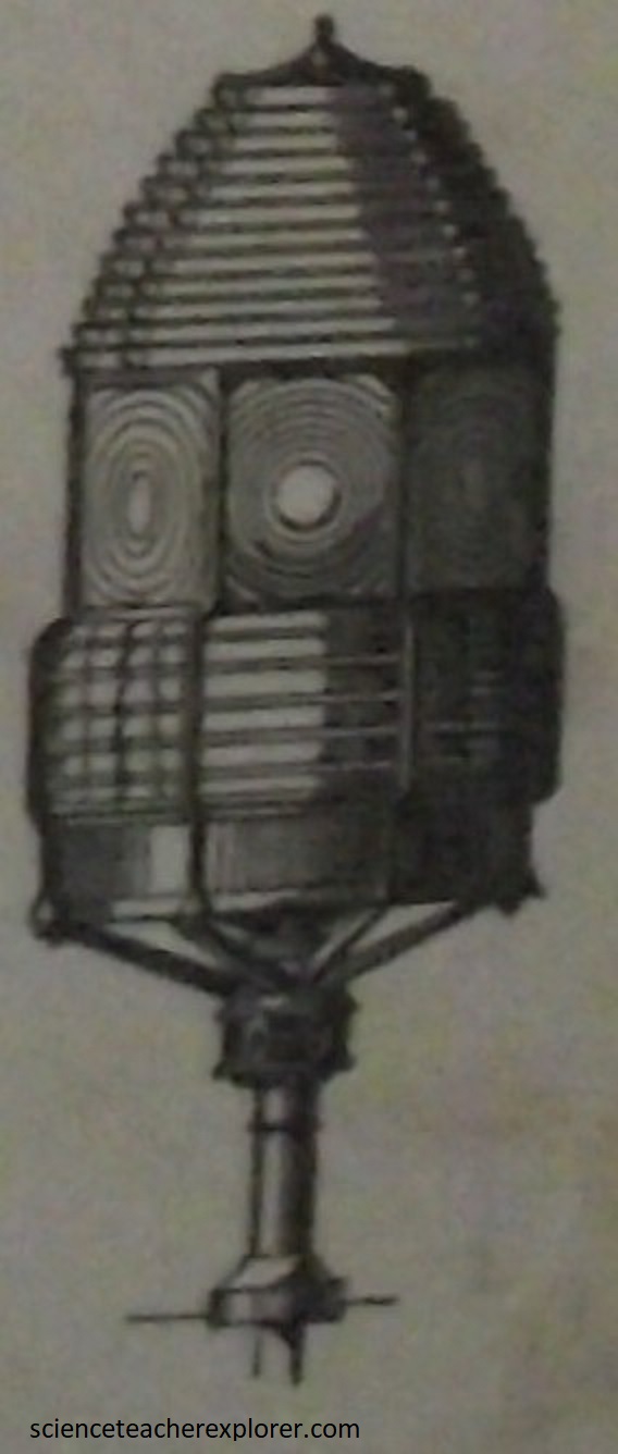
The most important development in Lighthouse engineering was the Fresnel lens, invented by the French physicist Augustin-Jean Fresnel in 1822 and which was made of ground and polished glass. These lenses provide highly concentrated beams and are produced as fixed, drum lenses, (this was a beehive shape), and rotating lenses. The glass lens design pioneered by Fresnel remains a principle element of the modern aid to navigation light. The Agulhas Lighthouse was of the “Dioptric” design. This meant that the prisms directing the light rays were refracted into a concentrated horizontal beam.
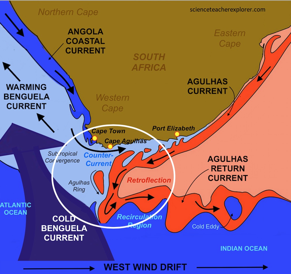
Cape Agulhas has one other important point of interest: modern hydrographers have determined at this is where the Atlantic and Indian oceans meet and is the southern most point in Africa. Here, the warm Agulhas Current that flows south along the east coast of Africa retroflects back into the Indian Ocean, (imaged above). While retroflecting, it pinches off large ocean eddies (Agulhas rings) that drift into the South Atlantic Ocean and take enormous amounts of heat and salt into the neighboring ocean. This mechanism constitutes one of the key elements in the global conveyor belt circulation of heat and salt.
Additionally, the naturally strong winds of the westerlies at the 40 degree Latitudes of the southern hemisphere, and the cold Antarctic Circumpolar Current flowing in the same direction, come up against the warmer Agulhas Current in the region of the this cape. These conflicting currents of water of different densities, and the west winds blowing against the Agulhas Current, can create extremely hazardous wave conditions; these are further exacerbated by the shallow waters of the Agulhas Bank, (a broad, shallow part of the continental shelf which juts 250 km south from the cape, after which it falls steeply away to the abyssal plain).