Shenandoah N.P., VA
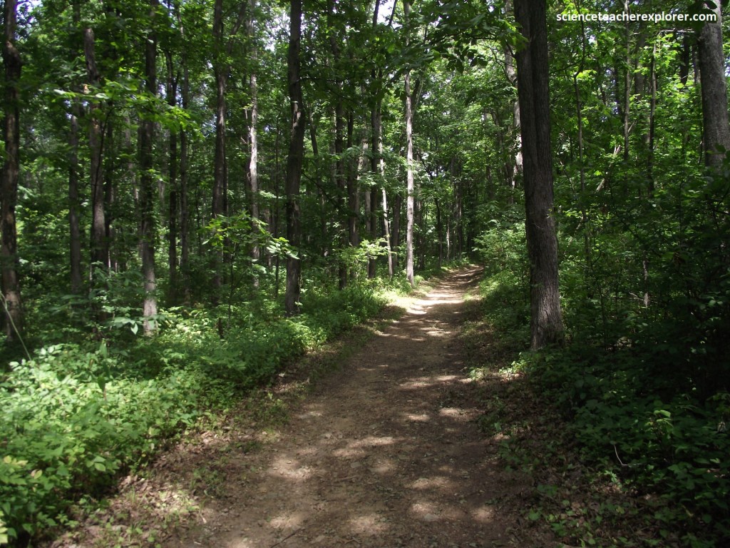
In the late summer of 2024, Becky (my wife) and I spent a little more than a week in Virginia. While driving to our destination on the coast, we had the opportunity to explore Skyline Drive in the Shenandoah National Park.
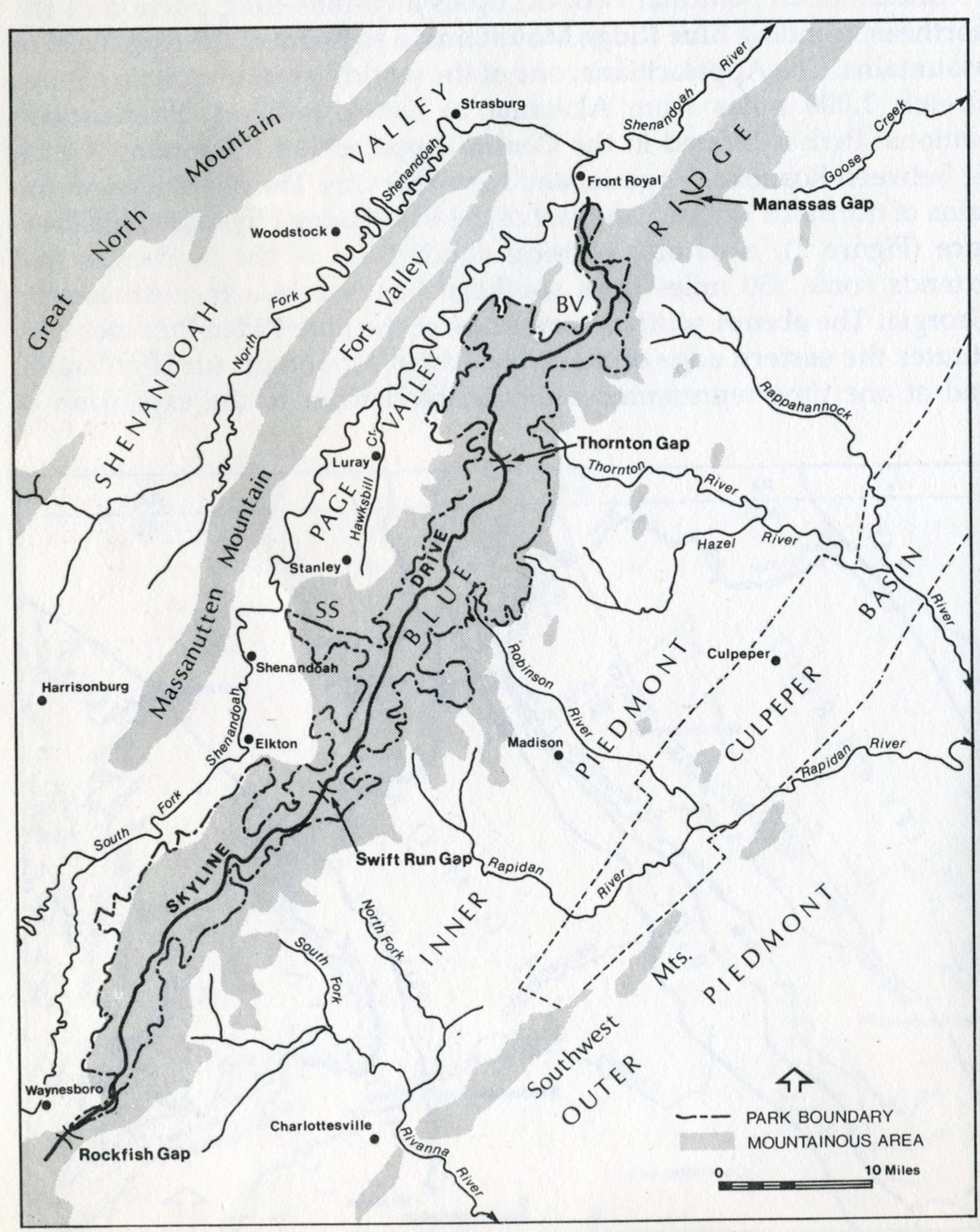
We began our exploratory drive just south of the city of Front Royal at the intersection with US340. Front Royal was near the confluence of the North and South Forks of the Shenandoah River and near the Chester and Manassas gaps.
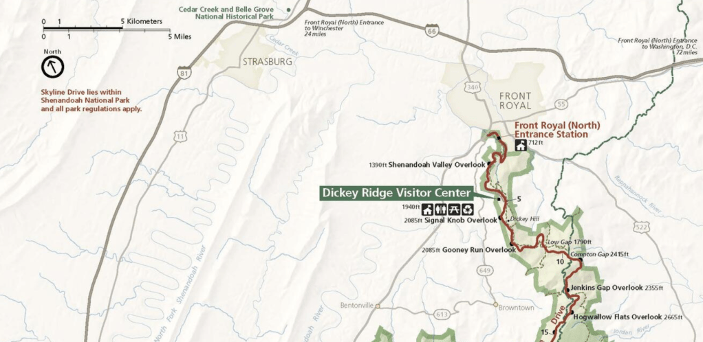
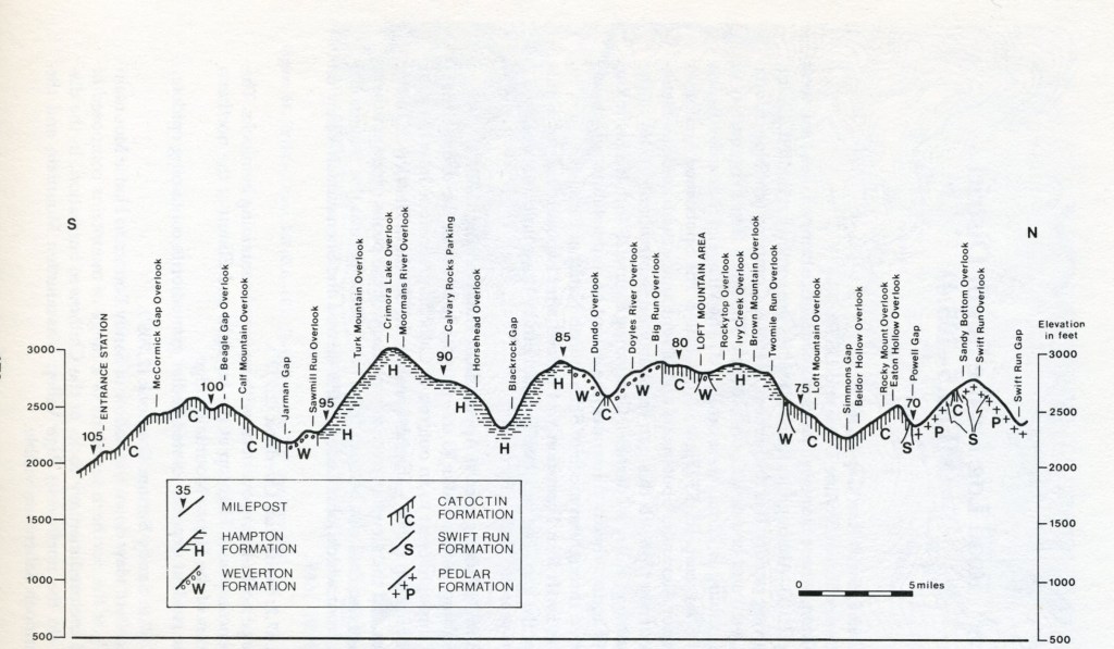
Our plan was to hit most of the Overlooks on our drive from the northern gate (Front Royal) to the southern gate near I-64 in one day. Our hope was to have nice clear day for this endeavor.
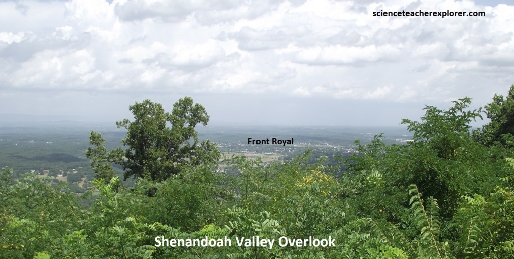
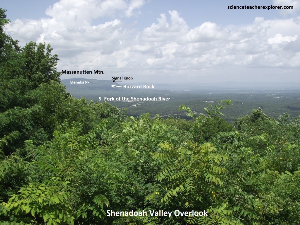
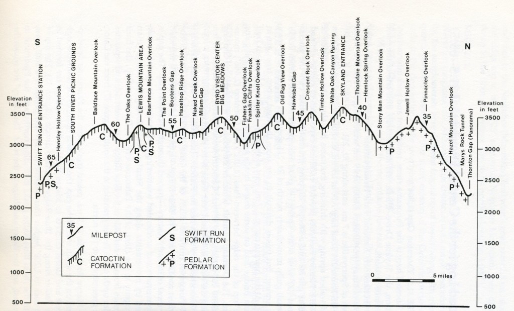
Our first overlook was the Shenandoah Valley Overlook, (pictured above and below). This is an impressive view of Front Royal. Bordering the South Fork of the Shenandoah, are several large industrial waste ponds of the huge Avtex Plant, (one of the world’s largest synthetic fiber facilities). Skyline Drive & the Shenandoah National Park occupies a 113km portion of the northeast trending Blue Ridge Mountains, a segment of the Appalachian Mountains. The Blue Ridge Mountains of northern Virginia are part of the Blue ridge Physiographic Province, (imaged below).
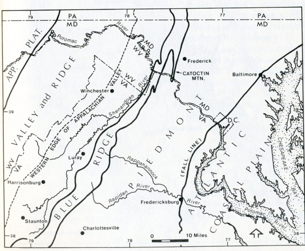
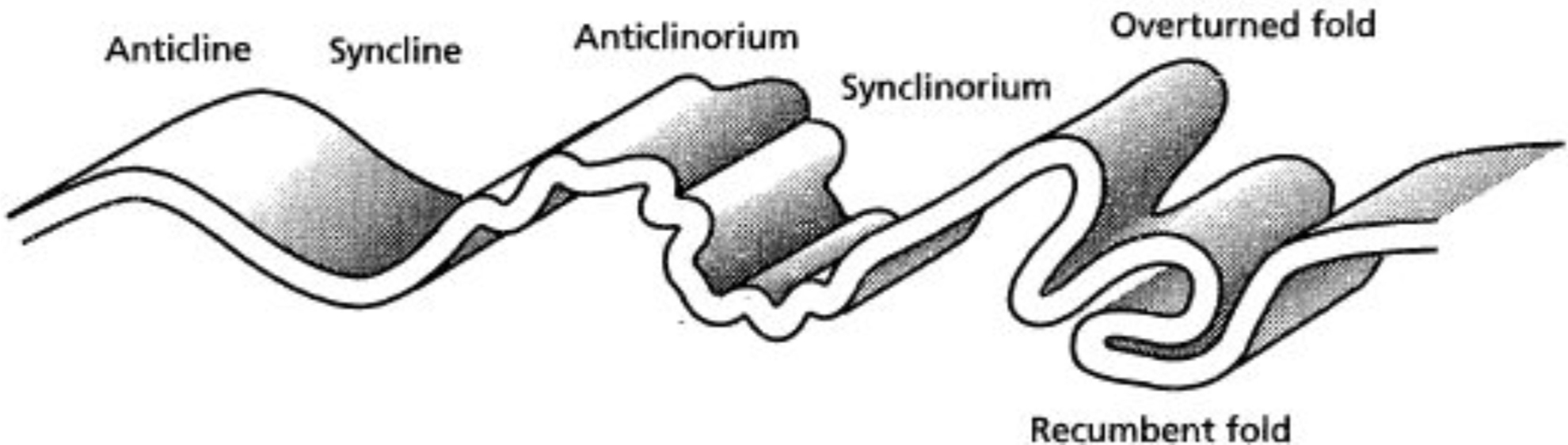
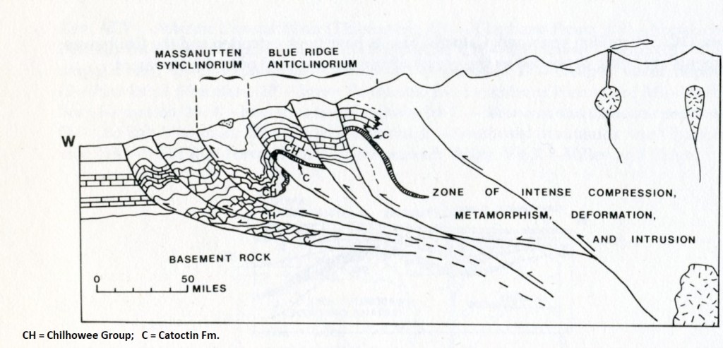
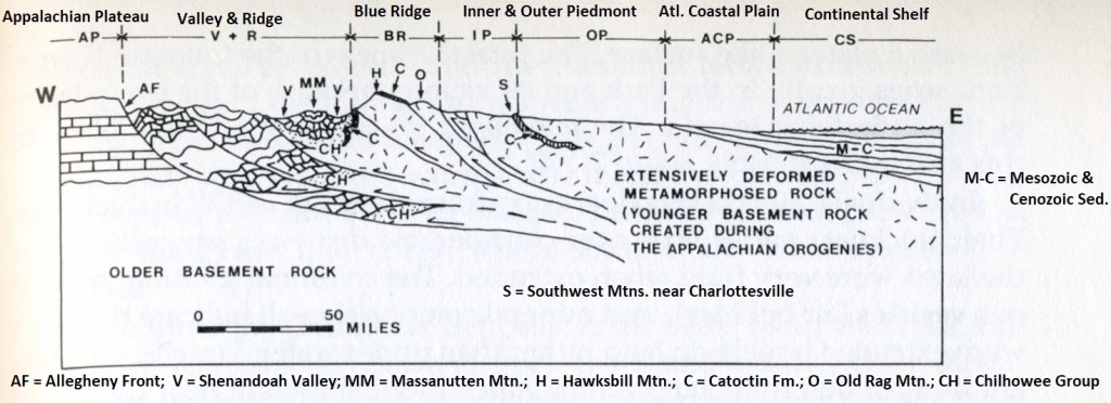
The mountains of Shenandoah are formed by resistant rocks located along the western side of a large, complex up-warped in the earth’s crust called the Blue Ridge Anticlinorium. This anticlinorium encompasses the entire Blue Ridge and Inner Piedmont area called the “Foothill Zone”. {Images below are from “Shenandoah National Park: An Interpretive Guide” Conners 1988). The two major fold of this area are the Blue Ridge Anticlinorium and the adjacent Massanutten Synclinorium, which has Massanutten Mountain occupying it’s central portion. The east limb of the Blue Ridge Anticlinorium dips very gently to the southeast and the west limb is nearly vertical, (imaged below). Note that both of these huge folds have numerous subsidiary folds associated with them.
Pictured below at the Shenandoah Valley Overlook, Page Valley is the name for the valley of the South Fork of the Shenandoah River between the Blue Ridge and Massanutten Mountain. The high point near it’s northern end is Meneka Peak (about 800m elevation). This is often mistakenly identified as Signal Knob, an impressive promontory at the northwestern extremity of Massanutten Mountain 2km north of Meneka Peak.
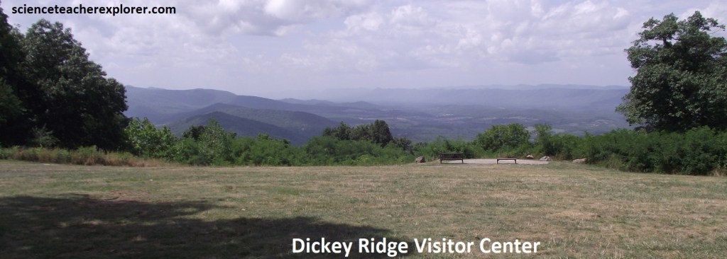
From the Shenandoah Valley Overlook, the next 12km southward, Skyline Drive continues its ascent along Dickey Ridge, (a long northward-extending spur of the main Blue Ridge).
The Dickey Ridge Visitor Center and Picnic Area was occupied by a cornfield until a dining hall was constructed and opened in 1938. In 1958, it was converted into the present visitor center. The lawn behind the center provides a fine view west of the meandering South fork of the Shenandoah, (pictured below).
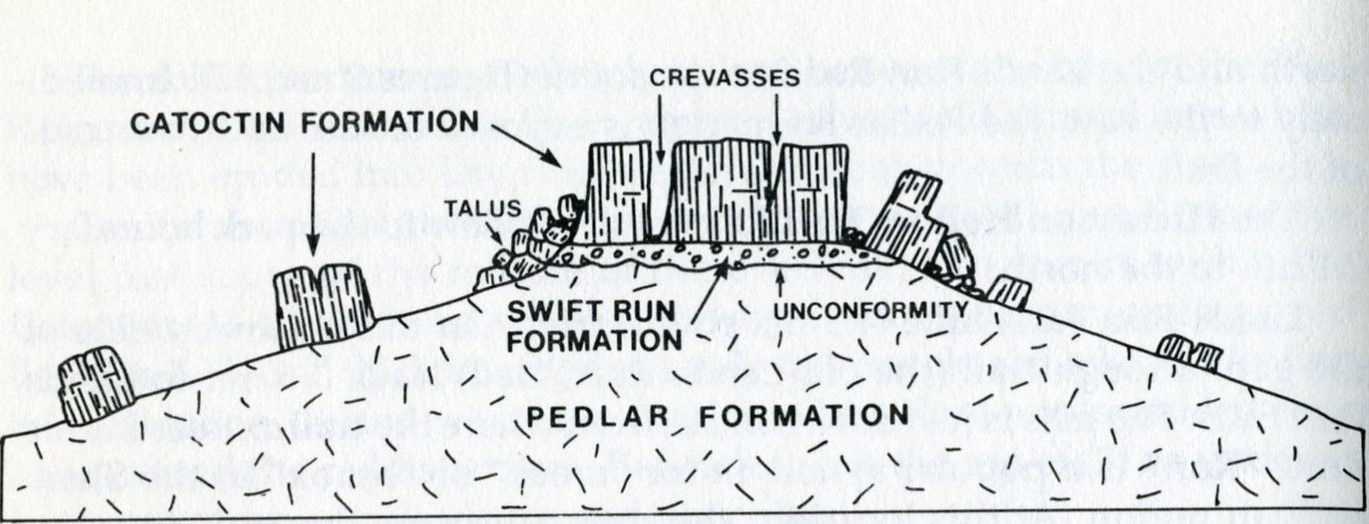
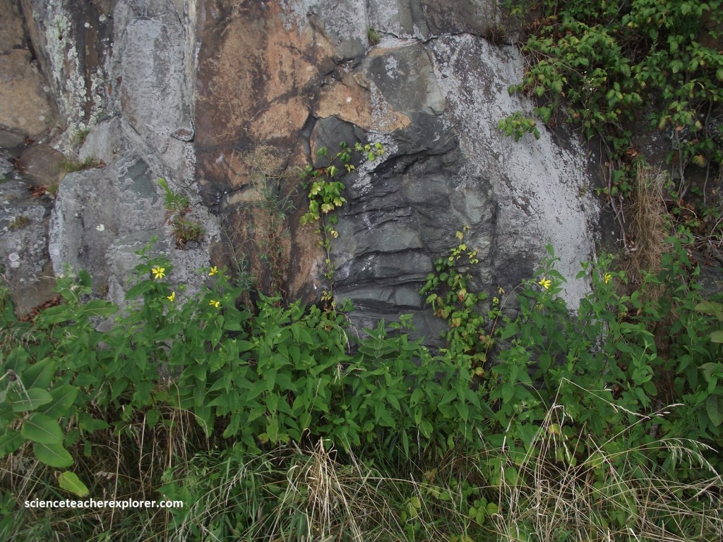
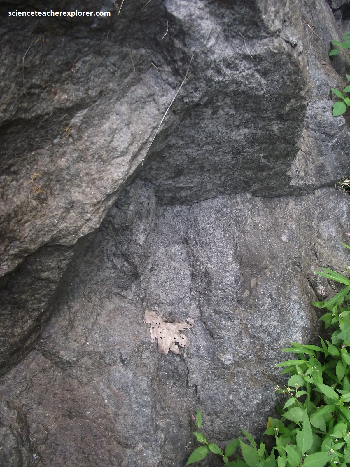
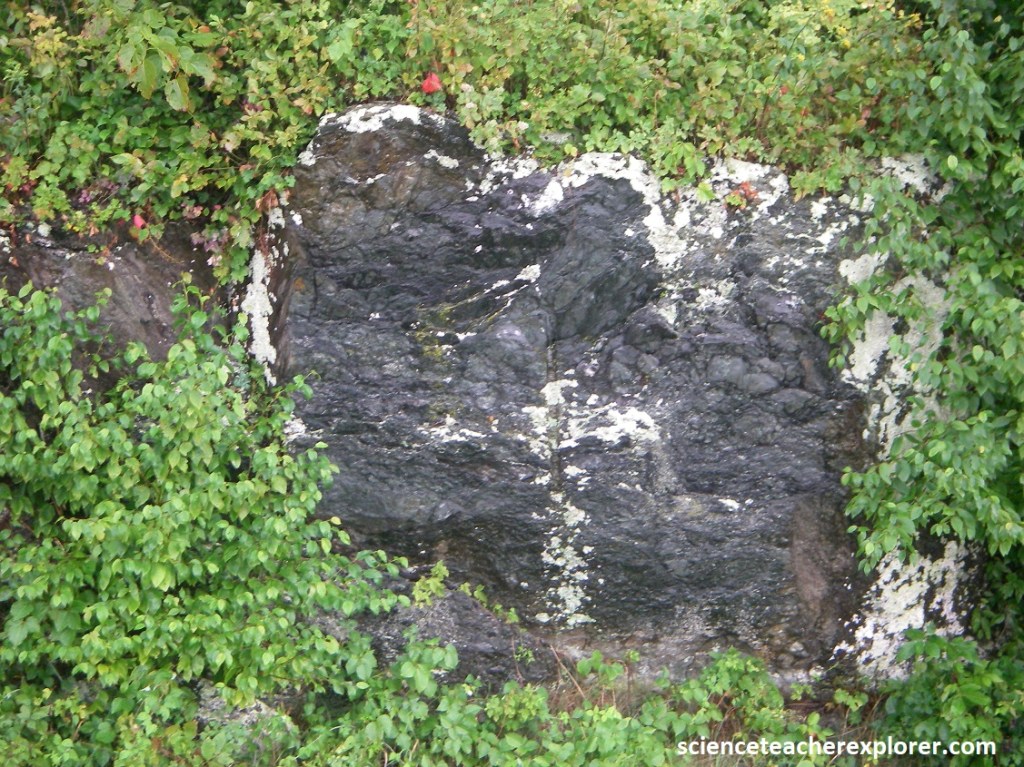
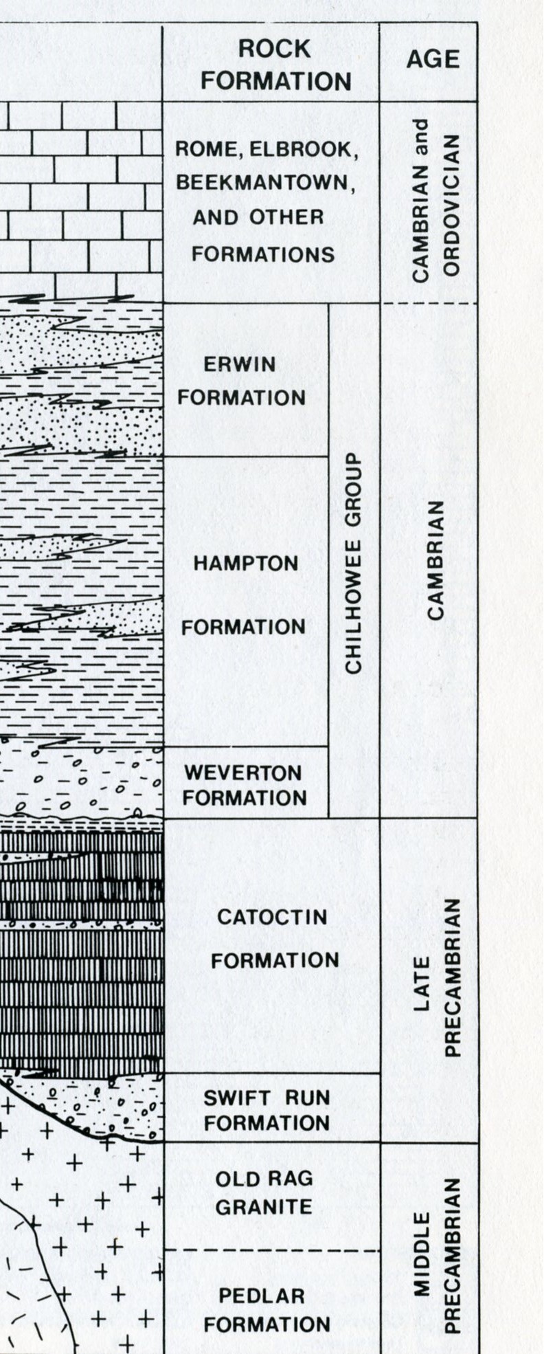
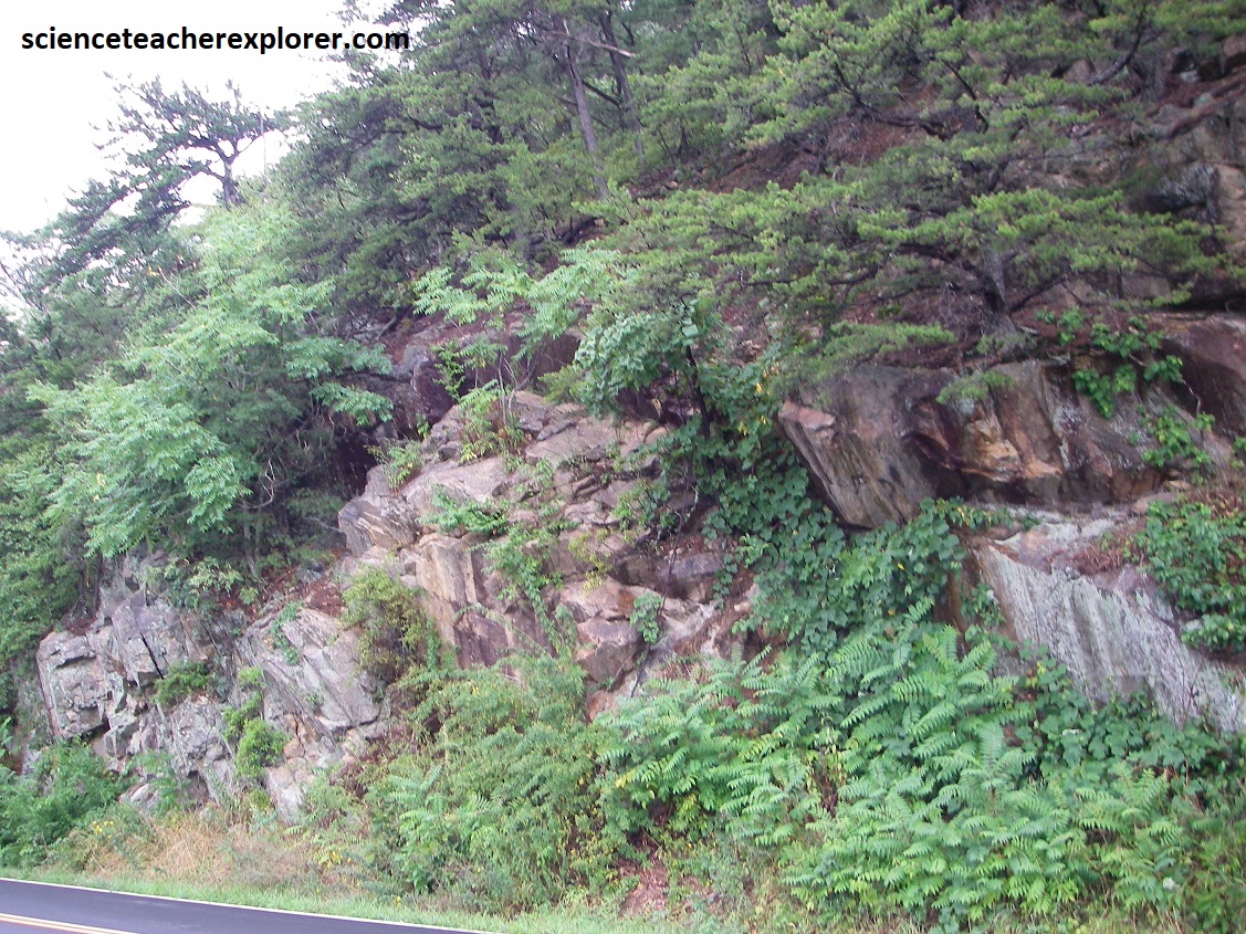
The surrounding rocks in the area, (for this part of the Skyline Drive), are from the Catoctin Formation. The 560 million year old, (late Pre-Cambrian), Catoctin Formation consists of metamorphosed lava flows (greenstone) and associated rocks (volcanic breccia, phyllite and slate). These resistant greenstones support the loftiest peaks and high plateau-like areas in the Shenandoah National Park.
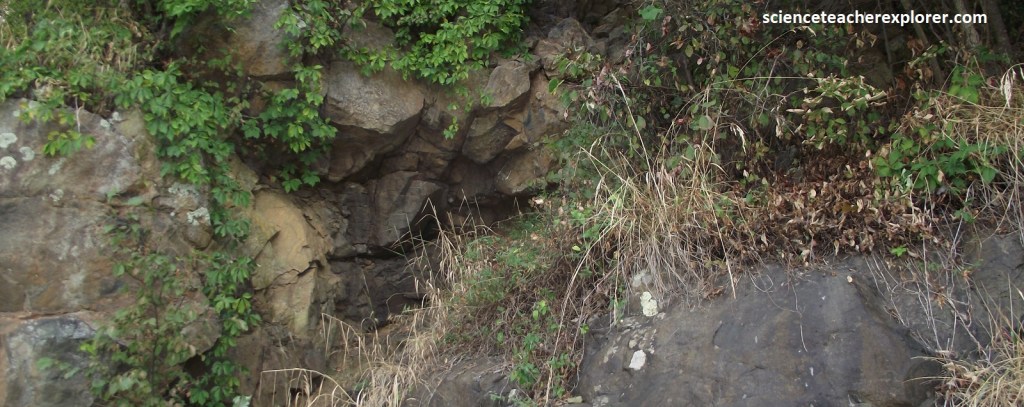
Pictured above, is a Catoctin greenstone roadcut. Two minerals, epidote and chlorite, both formed during metamorphism of the basaltic lava flows making up the 560 million year old Catoctin Formation, giving the greenstone it’s distinctive color and name.
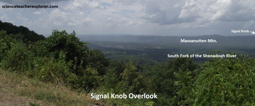
Pictured above, Signal Knob Overlook provides an excellent view westward across Page Valley to the double ridges of the northern end of Massanutten Mountain. The meanders of the South Fork of the Shenandoah seen here are entrenched 50-67m below the level of the rolling floor of Page Valley. The width of the meander belt ranges from under 2km to about 5km, and the river has a gradient of about 1m/km. Here, it is noticed that the South Fork migrates away from the Blue Ridge toward the base of Massanutten Mountain. The rolling terrain immediately below, between the base of the Blue Ridge and the Shenandoah River, consists of very old alluvial fans which have been eroded into low ridges extending out towards the river.
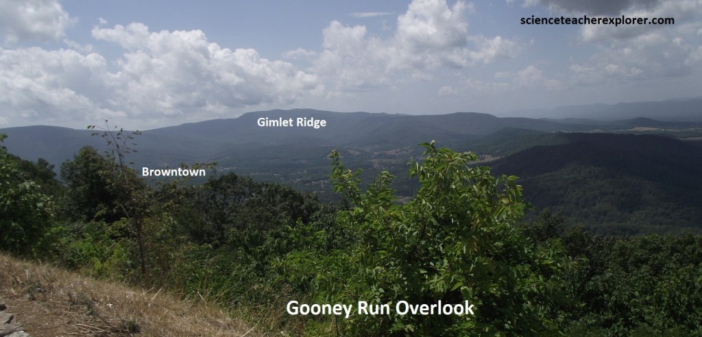
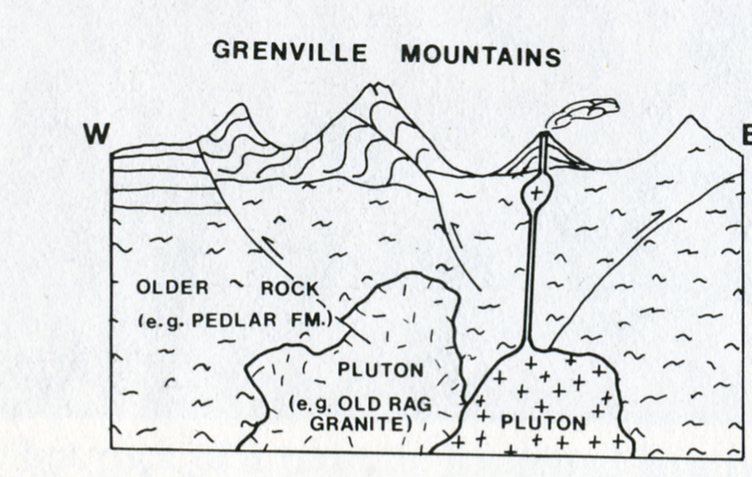
Pictured above, Browntown Valley lies to the southwest. The core of the Blue Ridge Anticlinorium consists of very old granitic rocks. The Middle Pre-Cambrian Pedlar Formation originated either as part of the ancient north American continent, (Laurentia), which occurs as the Canadian Shield, or as sediments that were deposited along the margin of Laurentia. The intense metamorphism which altered these rocks occurred during the Grenville Orogeny, (imaged below). Note that the contact between the Catoctin and underlying Pedlar Formations lies just below the parking area at the Gooney Run Overlook.
Another kilometer down the road, is the Gooney Manor Overlook. A panorama to the south shows Browntown valley, a broad expanse of privately owned land drained by north-flowing Gooney Creek and encircled by the Blue Ridge to the east and south and by Gimlet Ridge to the southwest. Browntown, a small village in the center of the valley, lies 3.7km, southwest of the overlook.
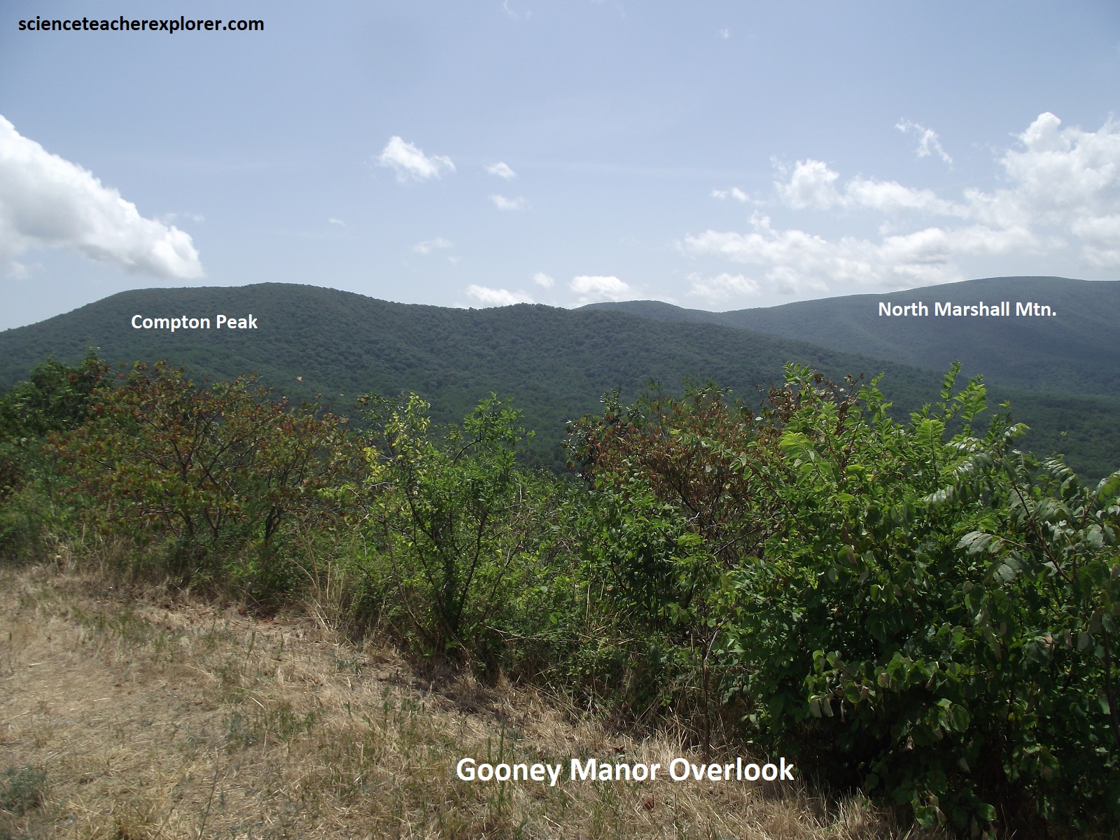
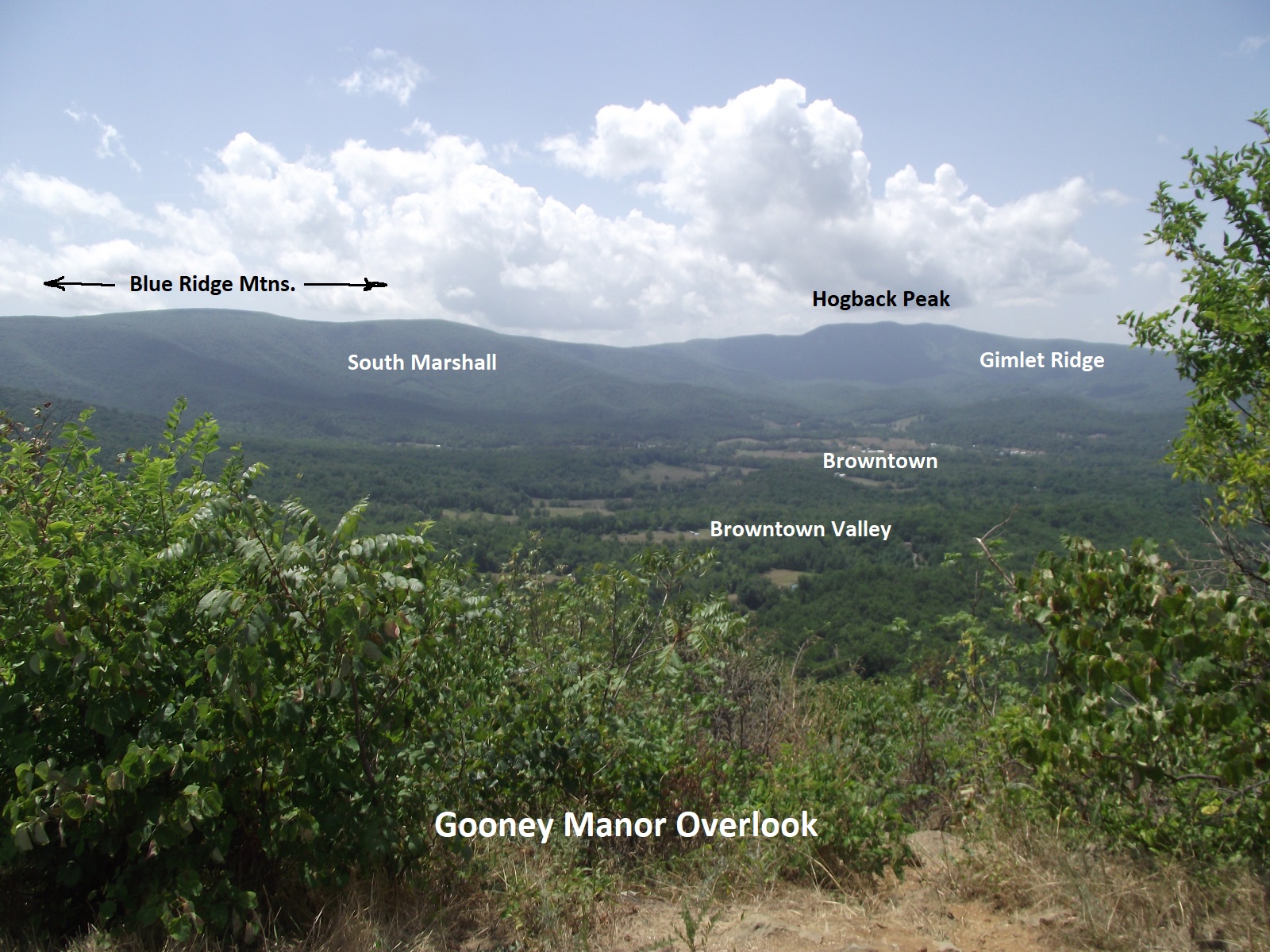
Pictured above, the Gooney Manor Overlook and the upper parts of the higher mountains, (except the Hogback Pk.), are supported by the Catoctin Formation, (600 million years old). The remainder of the nearby terrain seen from here is underlain by the granitic Pedlar formation (1.1 billion years old).
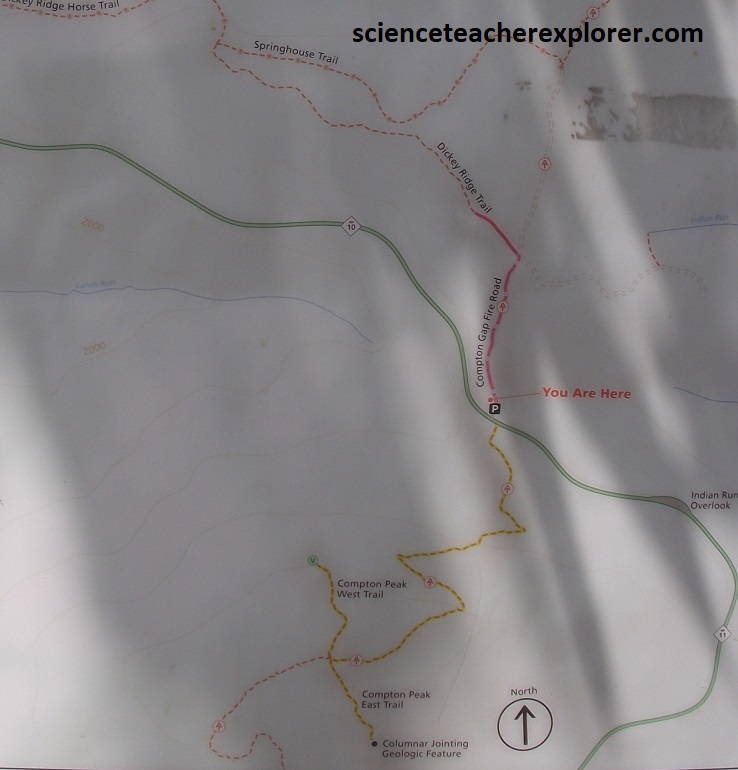
About 4km down the road, Becky and I parked at Compton Gap to trek some trails to Fort Windham Rocks (north) and Compton Peak (south). {Part of the Appalachian Trail}.
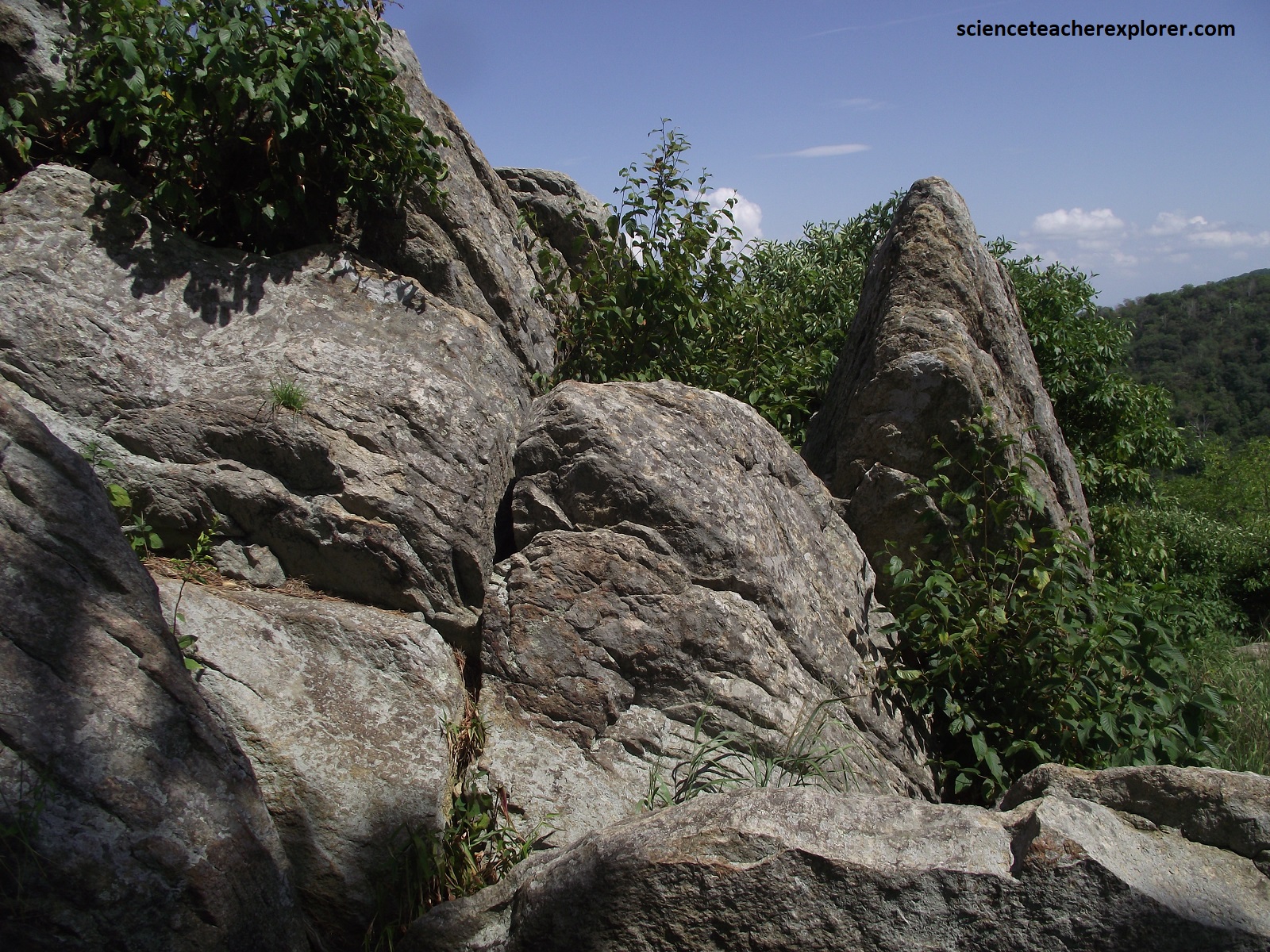
The Fort Windham Rocks are a large ‘tor’ composed of isolated erosional remnant of Catoctin greenstone surrounded by Pedlar granitics atop Carson Mountain. {The graphical image below is taken from the “Shenandoah National Park: An Interpretive Guide” Conners 1988; the photo is of part of the Fort Windham Rocks in 2024}.
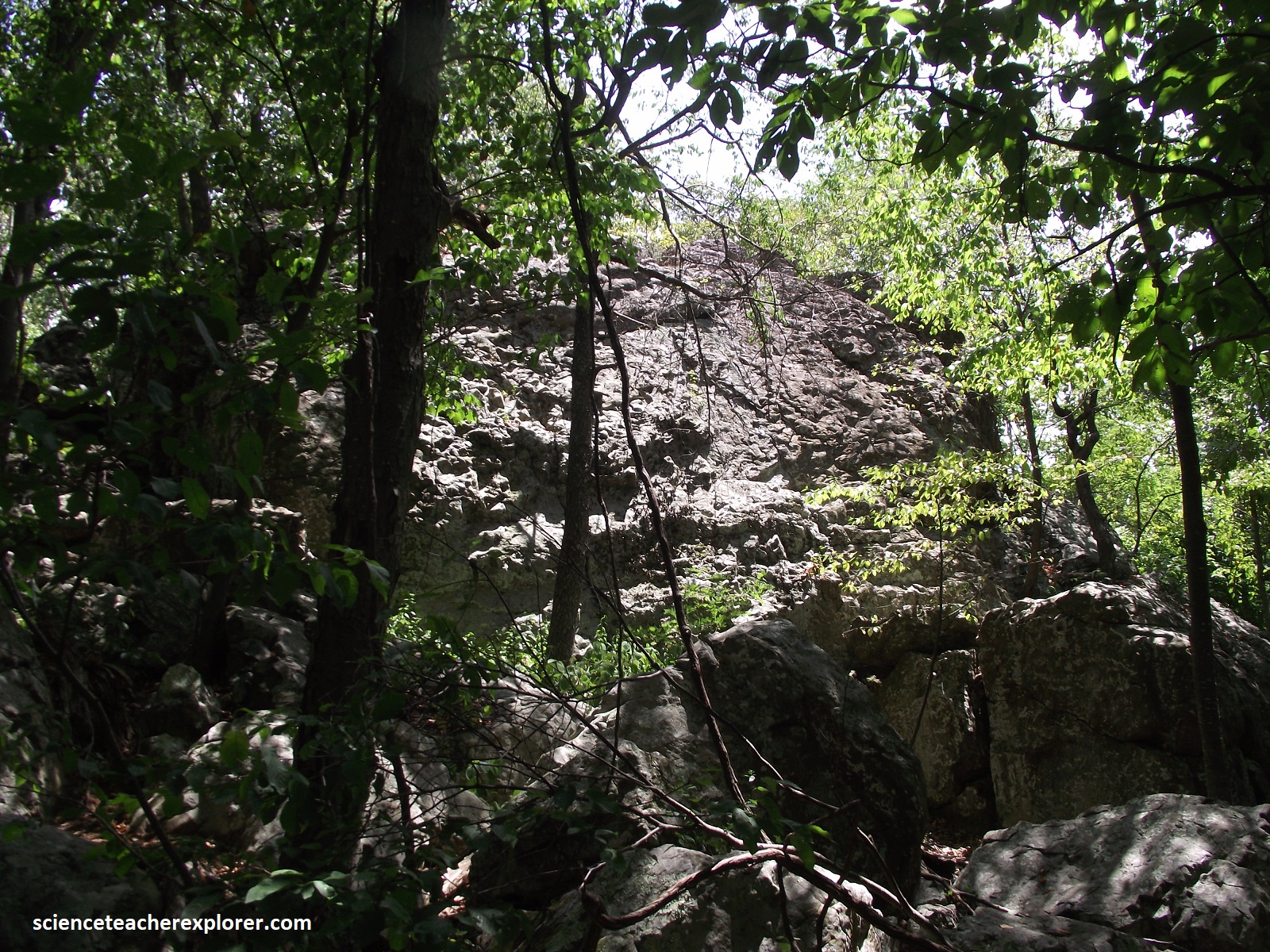
Pictured above, the Fort Windham Rocks ‘tor’, (which has vertical sides up to 13m in height and is split by deep vertical cliffs), lies in the forest about 30m to the right of the trail. The surrounding slopes were littered with large greenstone blocks which were wedged from the ‘tor’ and then migrated downslope during the harsh Pleistocene climates more than 10,000 year ago.
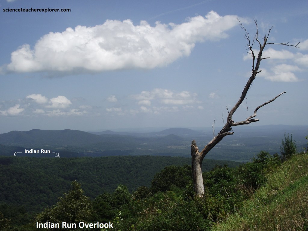
Once back in the car, we drove another 0.6km to the Indian Run Overlook, (pictured above). This provided our first view east into the 113km wide Piedmont Province, (foothills). Pictured below, the north end of the roadcut exposed some good columnar jointing in the Catoctin Formation.
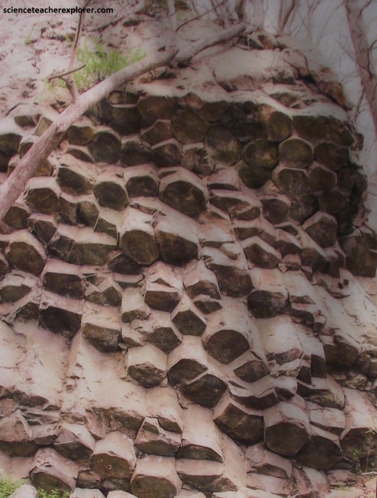
Pictured above, the columns have four to six side and tend to fan upwards, probably away from a high temperature area with the once-molten rock. Becky and I drove on through Jenkin’s Gap to Hogwallow Flats Overlook, (4.8km).
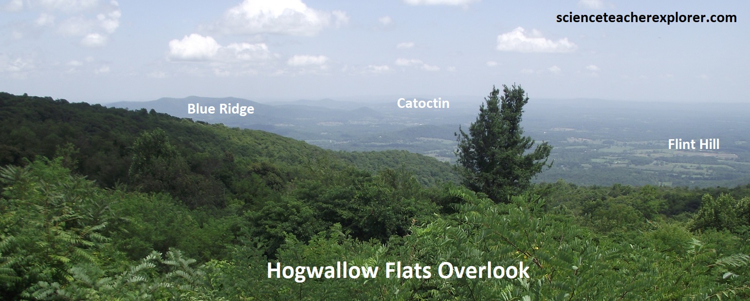
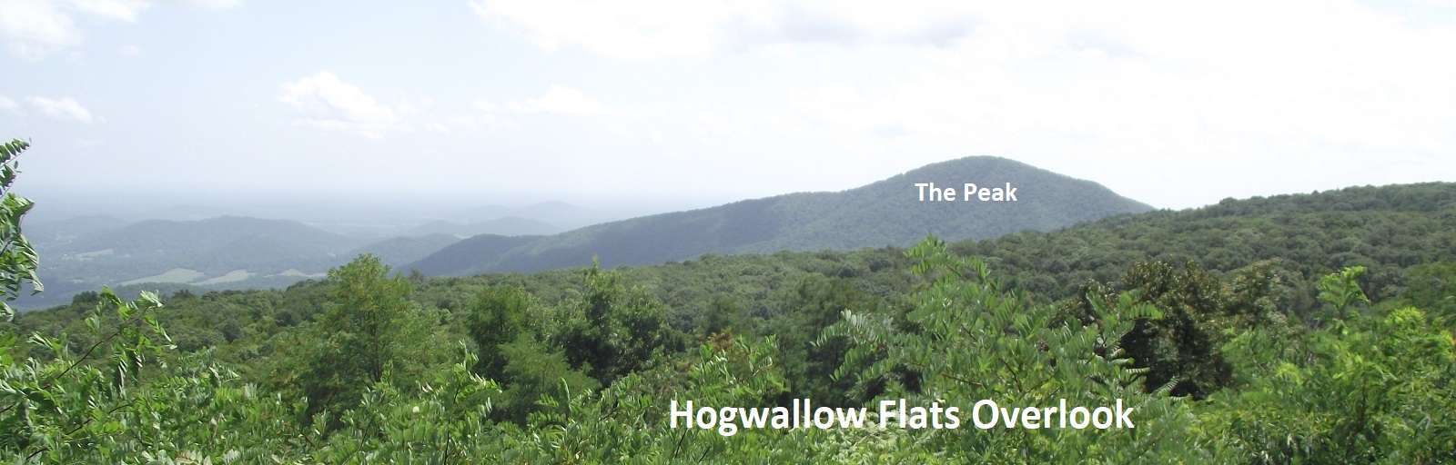
Pictured above, the Hogwallow Flats Overlook shows the Inner Piedmont terrain. Low ridges of Catoctin are visible 32km to the east at the far side of the Blue ridge Anticlinorium. The hills for the Inner Piedmont in the core of the huge crustal upwarp are supported by more massive plutonic and metamorphic rocks of the Pre-Cambrian basement. The Peak, composed entirely of the Pedlar Formation, is visible to the south. The small village to the southeast is Flint Hill, a very rural community of Rappahannock County, Virginia.
For the next 5.3km, Becky and I drove along a flat stratigraphic bench supported by a 600 million year old Catoctin lava Flow.
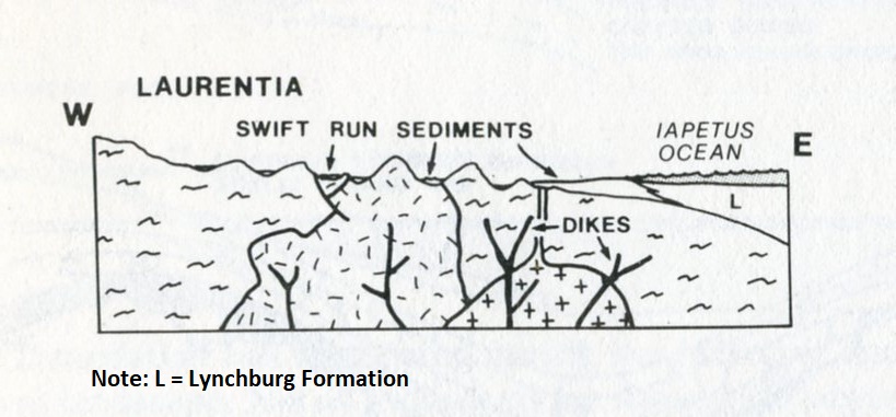
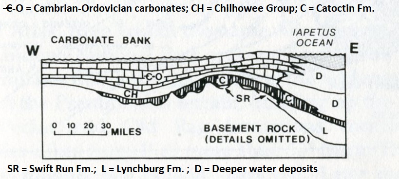
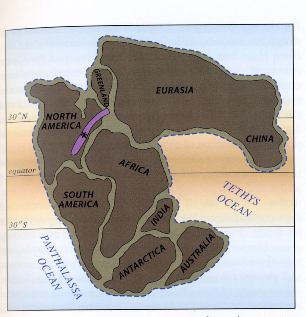
Imaged above, at 620 million years ago, the Grenville Mountains eroded down. The Iapetus Ocean had opened up to the east due to the separation of Laurentia from Gondwanaland with a rift. The Swift Run formation was deposited in the Shenandoah area with the Lynchburg Formation to the east. Additionally, igneous dikes intruded from below.
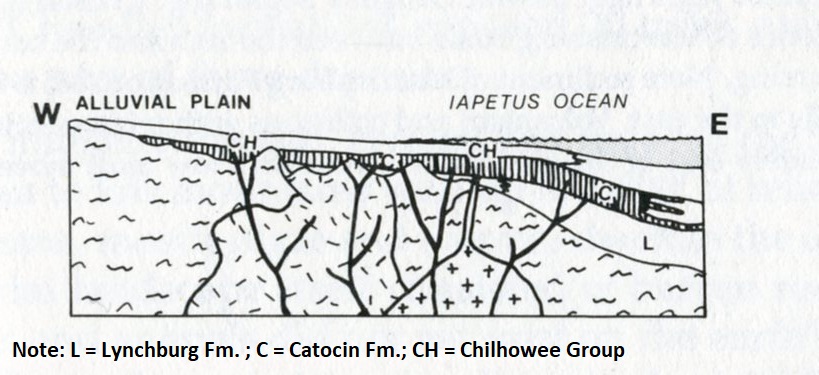
Imaged above, at 560 million years ago (during the Cambrian), Catoctin basalts had been extruded during the late Pre-Cambrian and the Chilhowee sediments were being deposited during the Cambrian as the ocean advanced westward onto the continent.
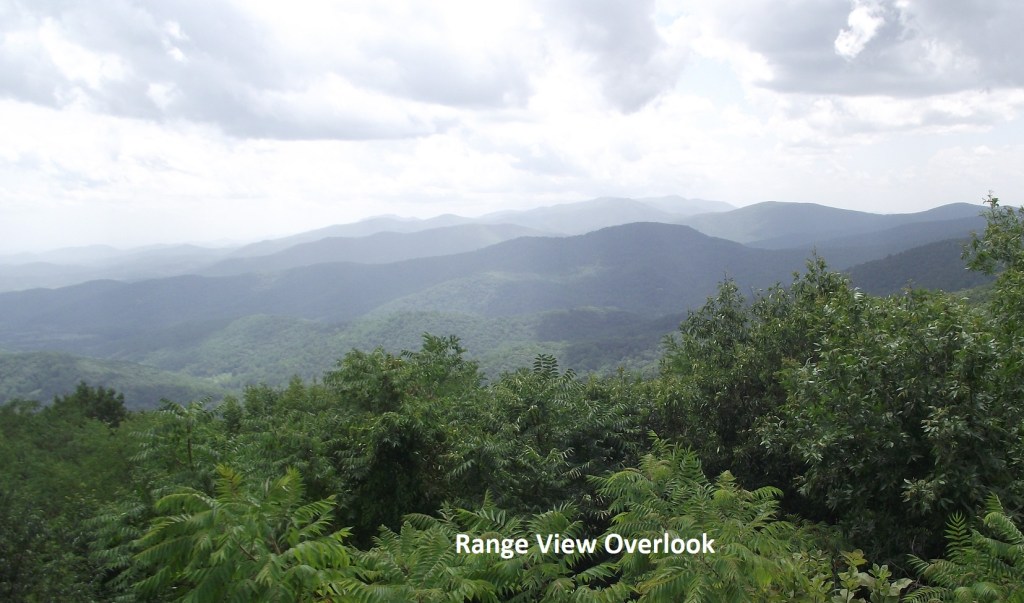
Pictured above, the Range View Overlook is one of the finest viewpoints in the Shenandoah N.P., including a rare panorama southward along the Blue Ridge. One can see and compare the Valley and Ridge terrain to the west with its large linear ridges and rich agricultural valley lands, with the Piedmont to the east, with its more random land use patterns, low hills and more widely scattered, less fertile farmlands.
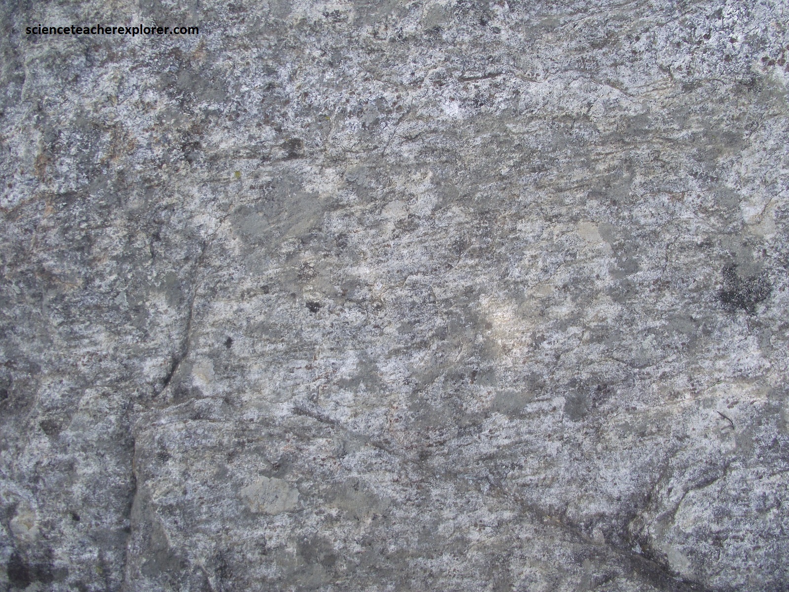
Pictured above, Becky and I drove past a road-cut that showed an attractive outcrop of Cactoctin meta-basalts with fresh surfaces. Their fresh, un-weathered surfaces provided excellent example of greenstone with veins of bright green epidote and white quartz.
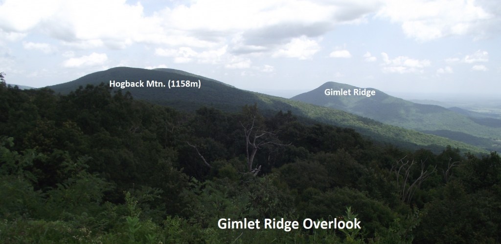
Pictured above, the Gimlet Ridge Overlook encompasses Hogback Mountain at the left (with the radio towers on top), and Browntown Valley with Dickey Ridge to its north and Gimlet Ridge to the south.
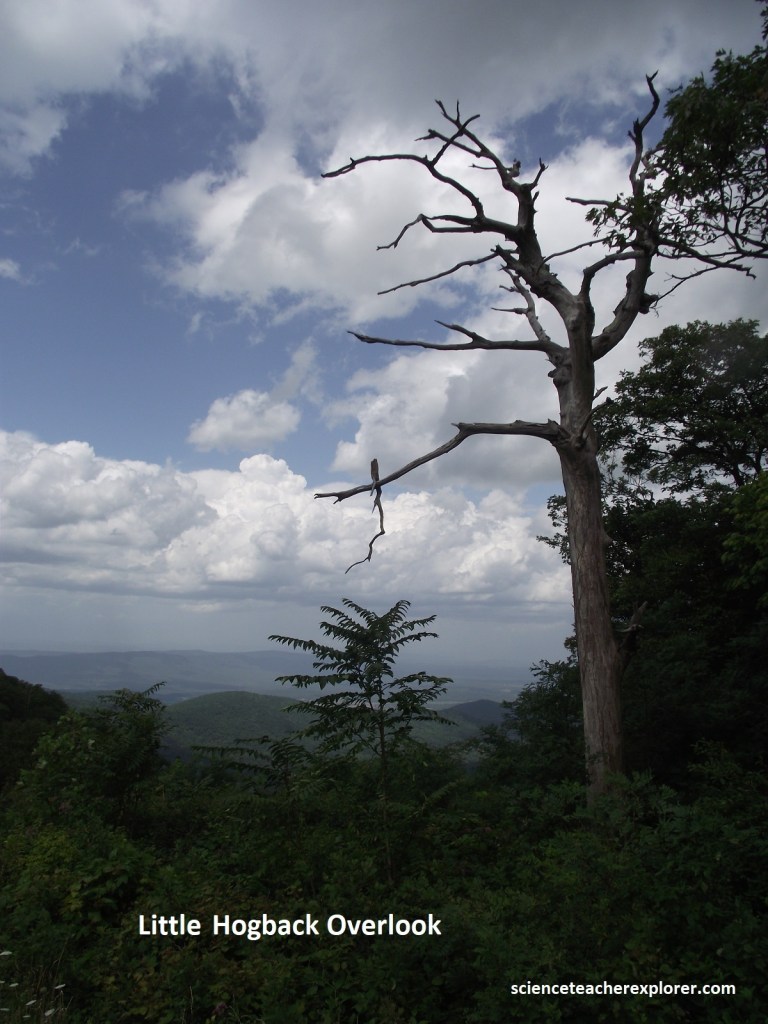
Pictured above, the Little Hogback Overlook shows a mountainside that drops into Browntown Valley that descends 667m in 2.2km. This is the site of the unconformable contact, (representing a time interval of 500 million years), between the Catoctin and Pedlar Formations. We’ll be viewing Pedlar rocks, for the next 2.6km on our way along the Skyline Drive.
Pictured above, the coarse-grained and gneissic textures of the 1.1 billion year old Pedlar, along with the types of minerals present, indicate that this formation was formed at high temperatures and pressures will below the earth’s surface. In addition to gneiss, the Pedlar contains massive non-foliated granitic rocks, suggesting that the temperatures to which it was subjected may have been hot enough to approach the melting point, thus explaining it’s igneous rock-like texture.
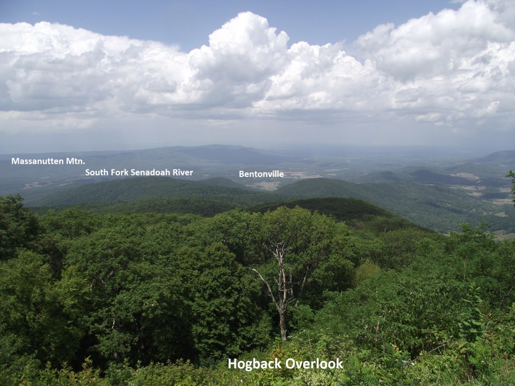
Pictured above, Hogback Overlook is the longest overlook in the Shenandoah N.P., and provides sweeping vies to the north along the west side of the Blue Ridge, and west across Page Valley at Massanutten Mountain. Note that Catoctin greenstones are more resistant than the Pedlar granitic rocks. And yet Hogback Mountain, highest in the Northern District, is made of Pedlar. Apparently, Hogback Mountain was a high point in the ancient landscape with the Catoctin lavas buried, and has only recently been uncovered or stripped from these overlying Catoctin.
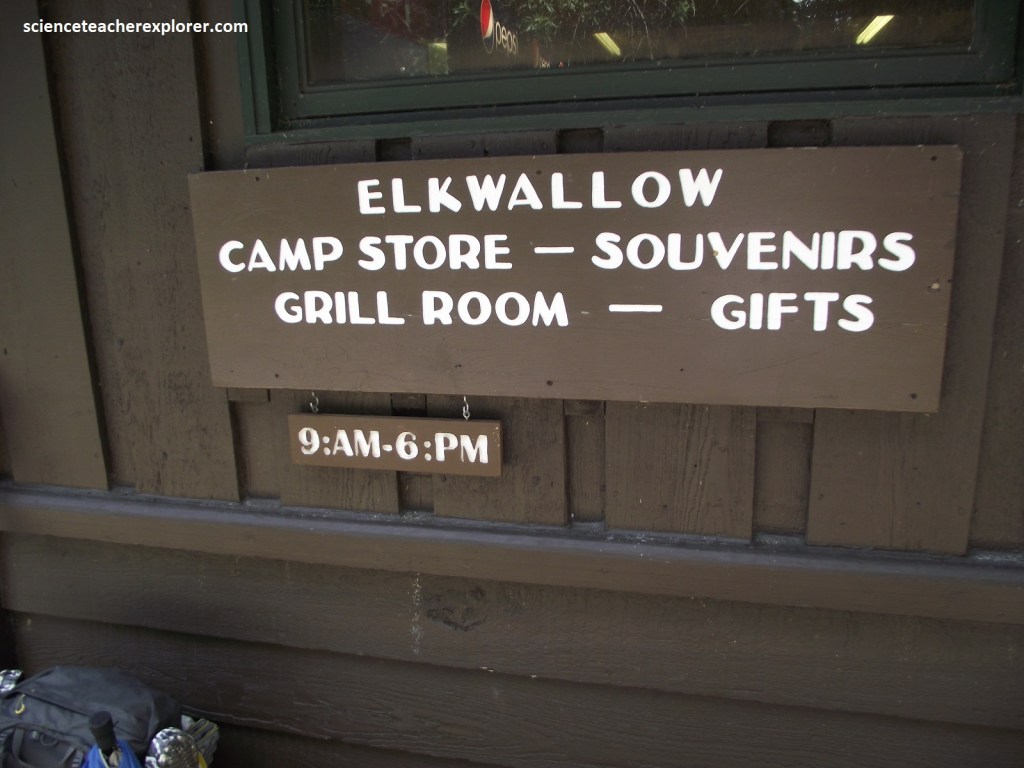
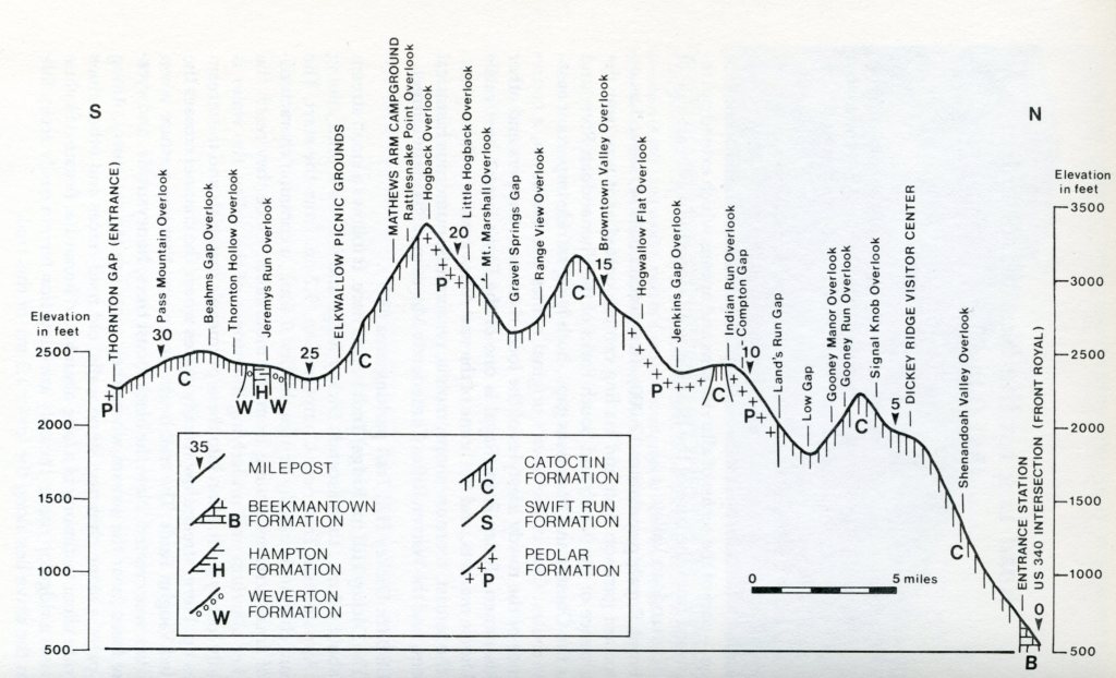
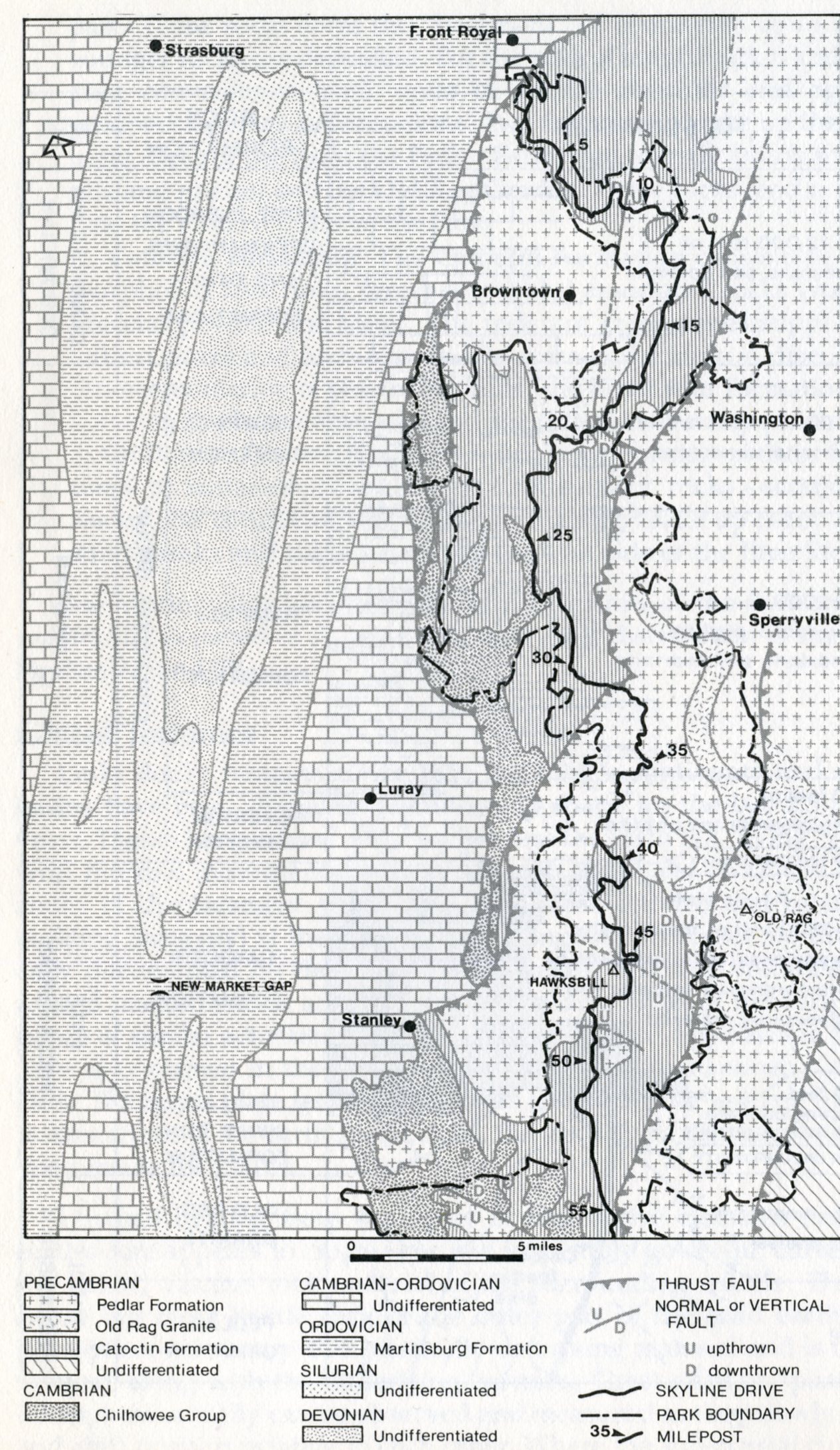
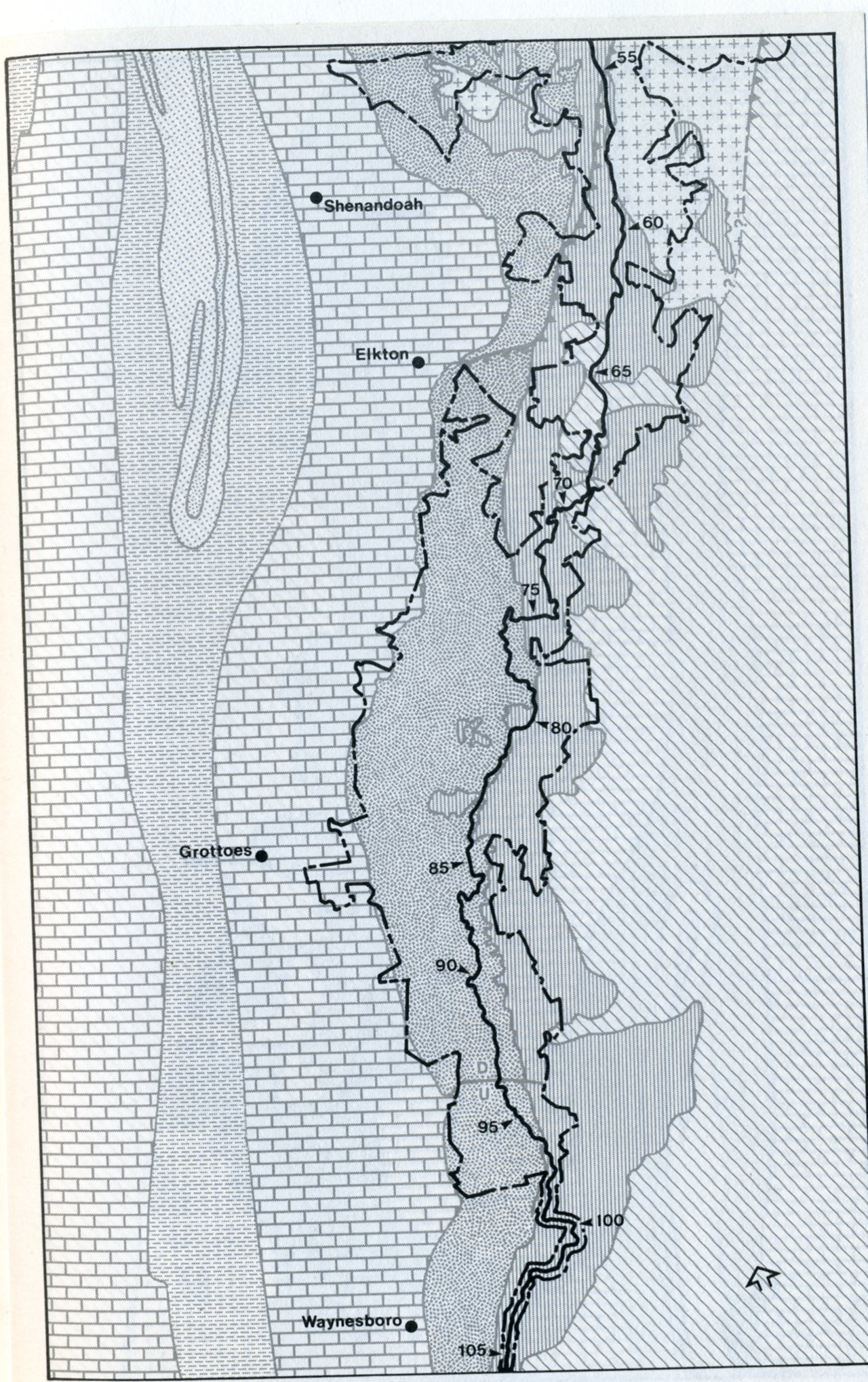
Becky and I continue 4.8km to the Elkwallow Wayside for snacks at the store. On the way down from Hogback Mountain to the Wayside, we crossed back into the Catoctin rocks and a fault zone. The terrain around the Elkwallow Wayside Picnic area, seems to have flattened out. Much of this is due to the erosive nature of the contrasting structure and rock types that are separated here by a section of a normal faulting and the Stanley Thrust Fault seen in the geological maps of Shenandoah National Park, (north half is on the left and the south half is on the right. [Note that Elkwallow Wayside is just south of Browntown on the left]. (Images below were taken from “Shenandoah National Park: An Interpretive Guide” Conners 1988).
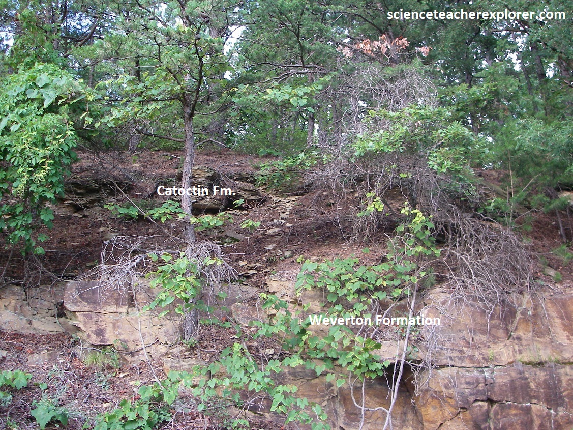
As Becky and I continue driving south from Elkwallow Wayside on the Skyline Drive, we cross another contact between Catoctin greenstone and the overlying Cambrian Weverton Formation, (containing purple-tinted slates here). The Weverton Formation is part of the Chilhowee Group mentioned above.
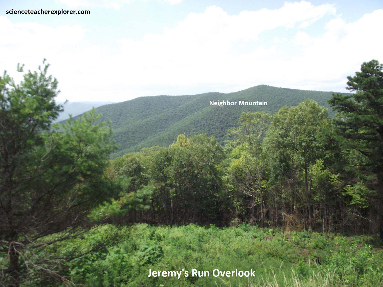
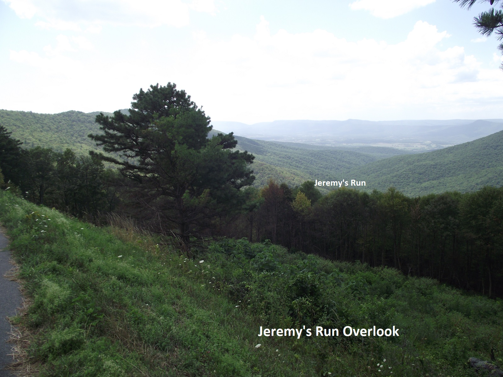
Pictured above, a magnificent overview of Jeremy’s Run. The upstream part of the canyon to the north is centered over a gentle anticlinal flexure, and the parallel ridges on each side (the Blue Ridge crest and Knob Mountain across the canyon) follow synclines. These folds occur along the gentle southeastern limb of the larger anticlinorium mentioned above. Chilhowee strata cap both ridges and the Catoctin composes most of the Jeremy Run Canyon. As seen above, beyond Jeremy’s Run V-shaped canyon are parts of Page Valley and Massanutten Mountain. At the left is Neighbor Mountain.
Imaged above, at 460 million years ago in the Cambrian, shallow tropical seas had covered the wide continental shelf and a thick blanket of carbonates were being deposited as the area slowly subsided.
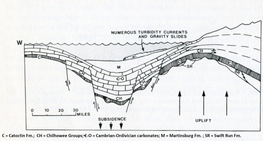
Imaged above, at 420 million years ago, was the beginnings of the Taconic Orogeny. Crustal uplift (Taconic Arch) to the east and subsidence of Martinsburg Basin between the arch and the continental mainland to the west was occurring. Note that the sediment of the Martinsburg Formation was now being derived from the new lands to the east. Volcanism and collisions with microcontinents were probably occurring immediately east of the area.
Imaged above, at 250 million years ago, was the Alleghenian Orogeny. The image above shows the western part of the young Appalachian Mountain chain on the Pangean supercontinent. Africa had joined North America east of the area shown.
Imaged above; presently denudation had dominated during the Mesozoic and Cenozoic eras, producing the present landscape near the Shenandoah National Park.
Picture above, at the Thornton Hollow Overlook, we get a wide panorama eastward look at the mountains just east of the main Blue Ridge, separated from it by the Stanley Fault, and the Piedmont below. In the area, bedrock east of the fault is up-thrusted Pedlar; and on the west is Catoctin.
Becky and I continued driving south along Skyline Drive, where we passed a junction with US211 at Thornton Gap. US211 was one of the earliest roads to cross the Blue Ridge as early as 1746. The gap is a consequence of accelerated weathering and erosion along rocks weakened by movements along the Stanley Fault during the Alleghenian Orogeny at the close of the Paleozoic era. At Thornton Gap, the fault crosses from the east side of the Blue Ridge to the west side and separates older up-thrusted Pedlar granitics to the south from the Catoctin greenstones to the north. In about 1.1km we came across Marys Rock Tunnel. {Note the historical image below is taken from an interpretive sign on-site}.
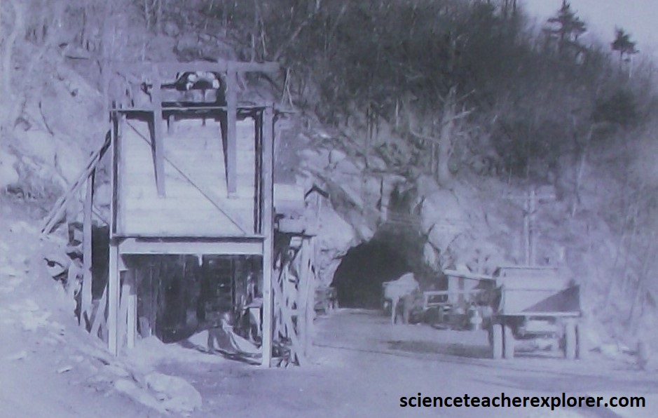
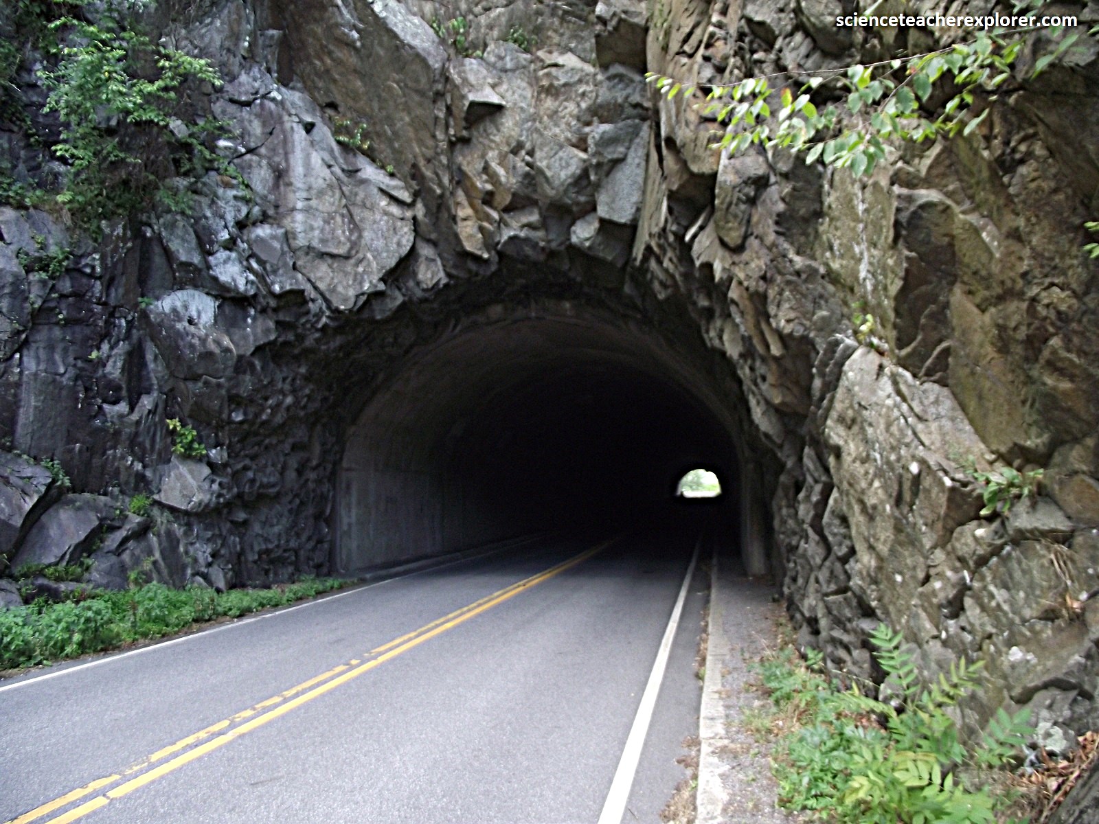
In 1932, when road engineers encountered Marys Rock, (a 1167m granodiorite gneiss peak of the Pedlar Formation), they realized building a shelf into its steep slope would create a huge, ugly scar on the mountainside, so rather that go around they went through. Using an average of 500kg of dynamite daily, workers blasted through 200m of solid granodiorite gneiss in 5m increments. After 3 months, daylight streamed through the tunnel, and within a week, cars streamed through as well.
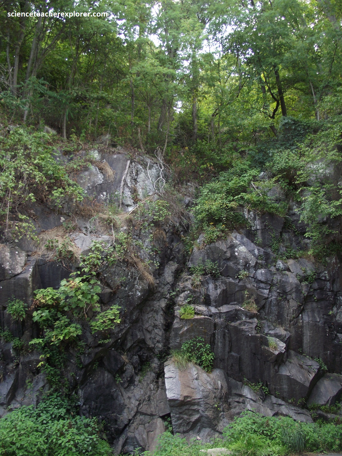
Pictured above on the left, two sets of joints intersecting at nearly right angles are well displayed at the southern end of Marys Tunnel. Here, the Pedlar hosts several dozen Catoctin feeder dikes in this region of the Park. The Roadcuts here show good gneiss with 5-8cm lenses of feldspar, quartz and garnet, (pictured above on the right). About a kilometer down the road, we got a look at the surrounding mountains to the east at Buck Hollow Overlook, (pictured below).
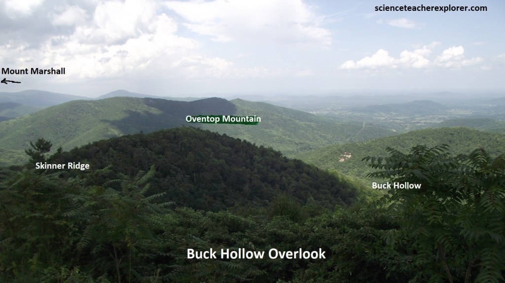
Pictured above, Buck Hollow Overlook gives us a view to the northeast over Pass and Oventop mountains at Hogback and Mount Marshall in the distance.
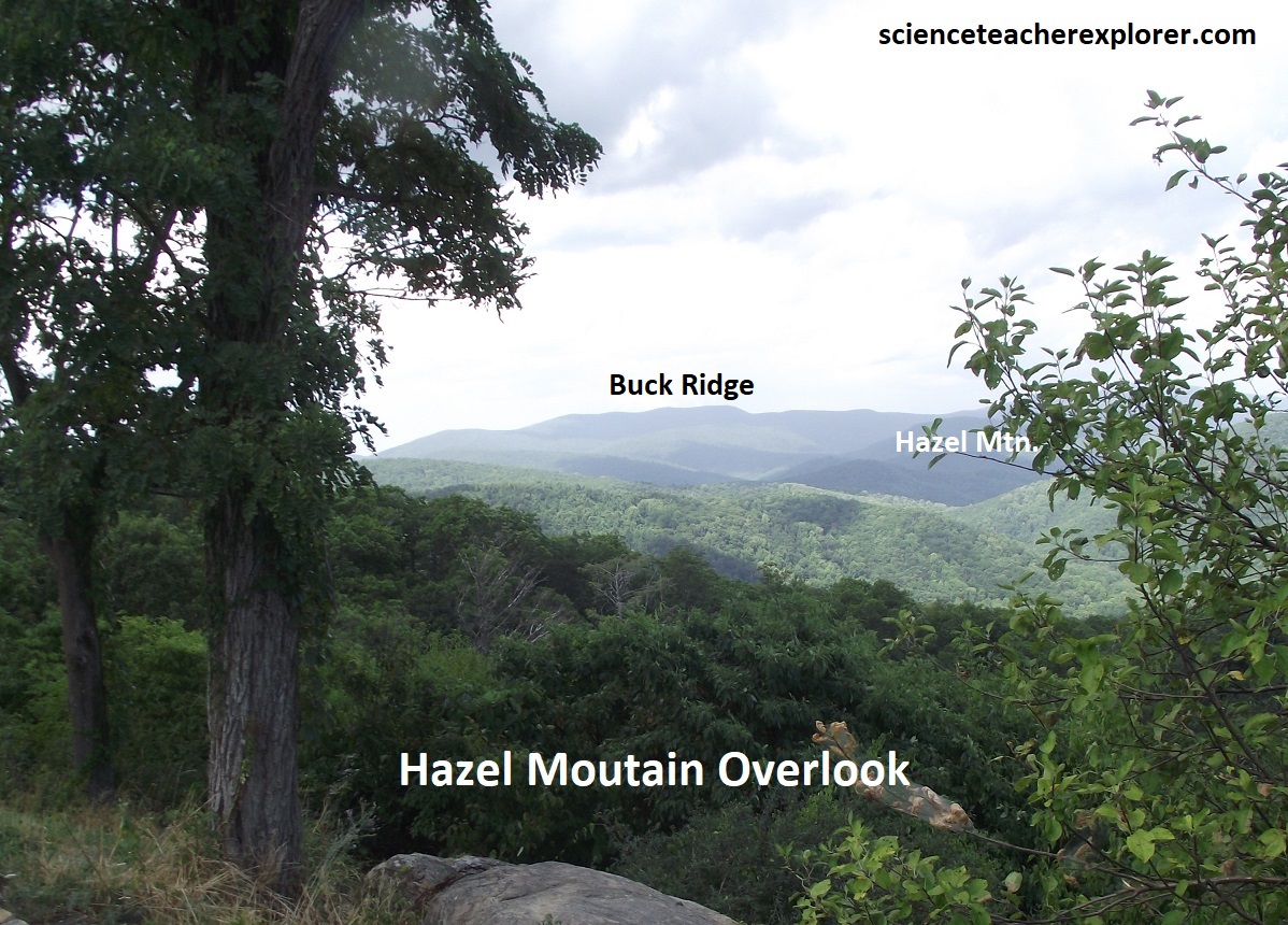
Pictured above, Hazel Mountain Overlook views east from a group of granitic boulders across the upper part of Buck Hollow to Buck Ridge and beyond.
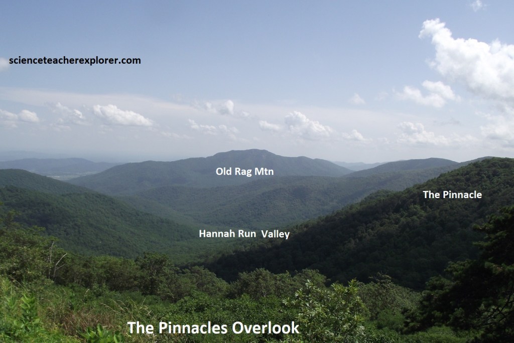
Pictured above, Pinnacles Overlook views down Hannah Run valley at Old Rag Mountain (1090m elev.), 4.8km to the south. Pinnacle Ridge lies along the right side of Hannah Run and the summit of The Pinnacle (1243m elev.) is about 0.8km northwest of the overlook.
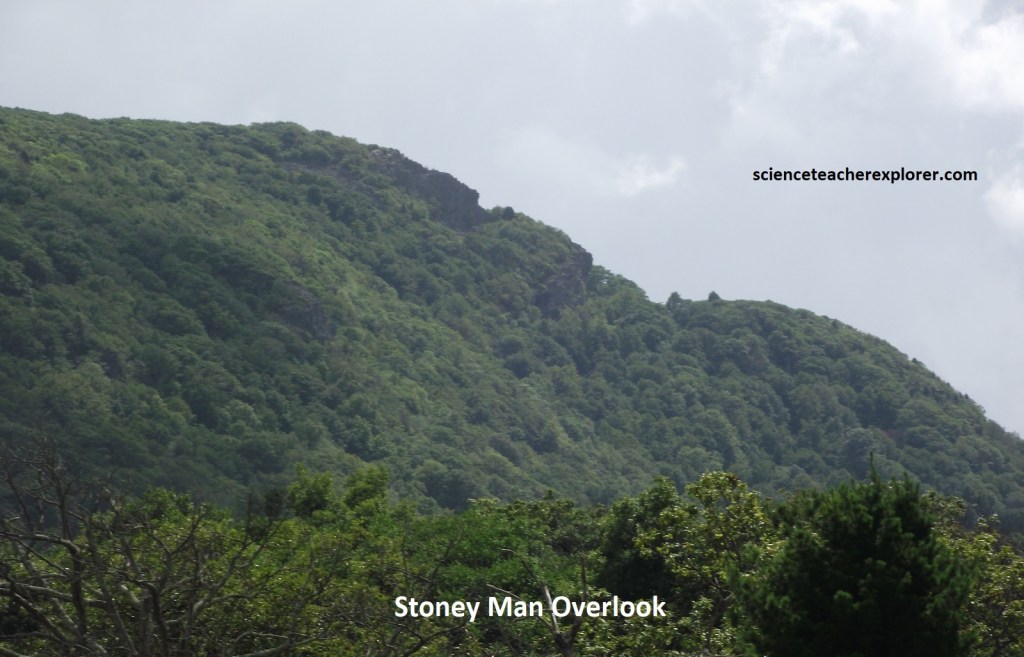
Pictured above, Stony Man, the old man in the mountain, is a Shenandoah National Park icon. It only takes a little imagination to see the profile of a man’s face in the mountain from the above overlook. Stony Man’s facade is Catoctin greenstone, (a metamorphosed ancient volcanic rock).
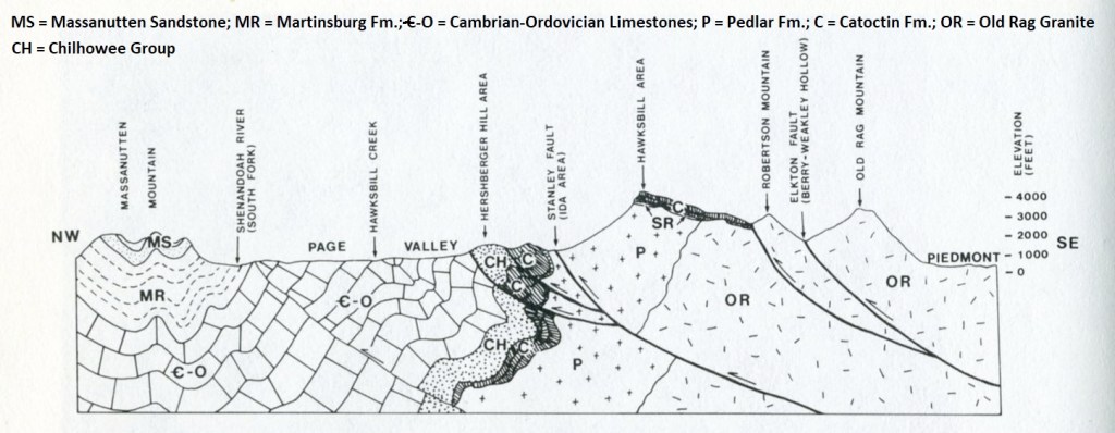
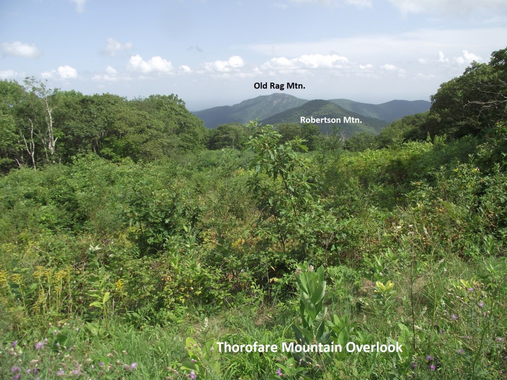
Pictured below, Thorofare Mountain Overlook provides an excellent view southeast towards Old Rag Mountain. Imaged above, is a geological cross-section from Old Rag Mtn. to Massanutten Mtn. with the rocks included. Old Rag Mountain (1089m elev.) is 5.6km away and separated from the main Blue Ridge by the shear zone along the Elkton Fault. Between the overlook and Old Rag is the sharp apex of Robertson Mountain, which is also composed of Old Rage Granite, (Pre-Cambrian). A smaller fault lies in the gap at the near side of Robertson Mtn. and marks the contact between the Catoctin greenstone and the granite, (imaged above).
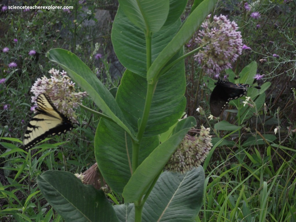
Milkweed’s abundance in Shenandoah is key to the survival of the stunning Monarch, Viceroy & Eastern Tiger butterflies. Milkweed is these butterflies host plant, providing shelter for its eggs, food for its caterpillar, and protection for the chrysalis. Here at the Thorofare Mountain Overlook, I found these two butterflies on one Milkweed, the Papilio troilus (Eastern Tiger) on the left and the Limenitis archippus (Viceroy) on the right.
Our next stop was the Skyline Resort. This is the highest elevation on Skyline Drive, (1227m elev.). This was a great place to get lunch and a bathroom.
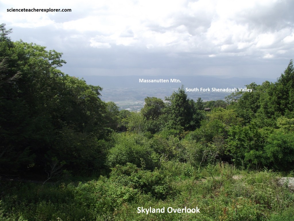
From the Skyland Overlook is a grand view view over central Page Valley and environs with the sandstone ridges of Massanutten Mountain to the northwest. The surrounding forest there features a number of cold-climate plants including red spruce and balsam fir, many attractive ferns, gnarled tress deformed by ice storms, and American chestnut saplings. After our small bread we continued driving south on Skyline Drive. In 1.5km, we again stopped at Timber Hollow Overlook, (pictured below).
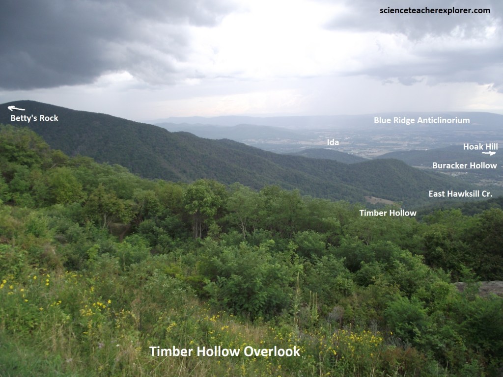
Pictured above, Timber Hollow Overlook gave us a view over the hollow of East Hawksbill Creek, the upper part of which is called Timber Hollow; the lower part, Buracker Hollow. At the mouth of the hollows, resting on alluvium deposited by East Hawksbill Creek, is the small hamlet if Ida. Ida sits in a northeast-trending valley eroded along the trace of the Stanley Fault. Pedlar granitics underlie underlie the terrain between the overlook and the fault. West of the fault are low hills composed of tightly folded and faulted Chilhowee and Catoctin rocks lying along the overturned northwestern limb of the Blue Ridge Anticlinorium.
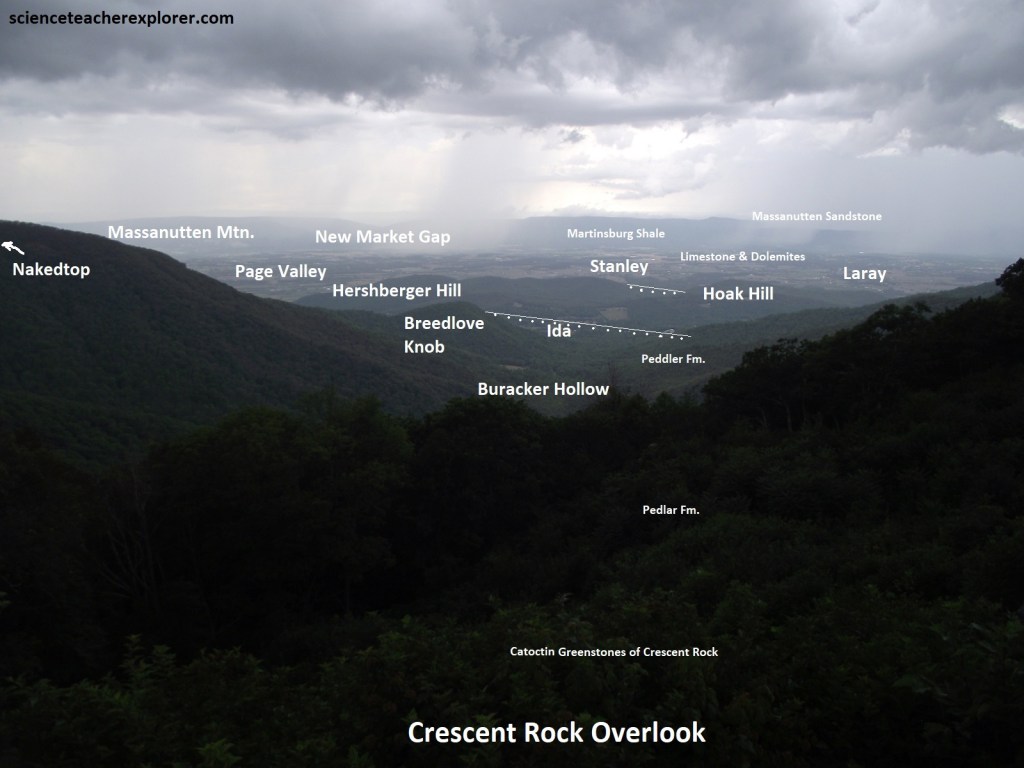
Pictured above, the Crescent Rock Overlook views northwest along Baracker Hollow with the imposing north side of Hawkesbill Mountain, (1350m elev.) looming above to the left. The geology of this area is pictured above. In the rainstorm, we continued onto the Spitler Knoll Overlook where I got a great view of the Franklin Cliffs, (pictured below).
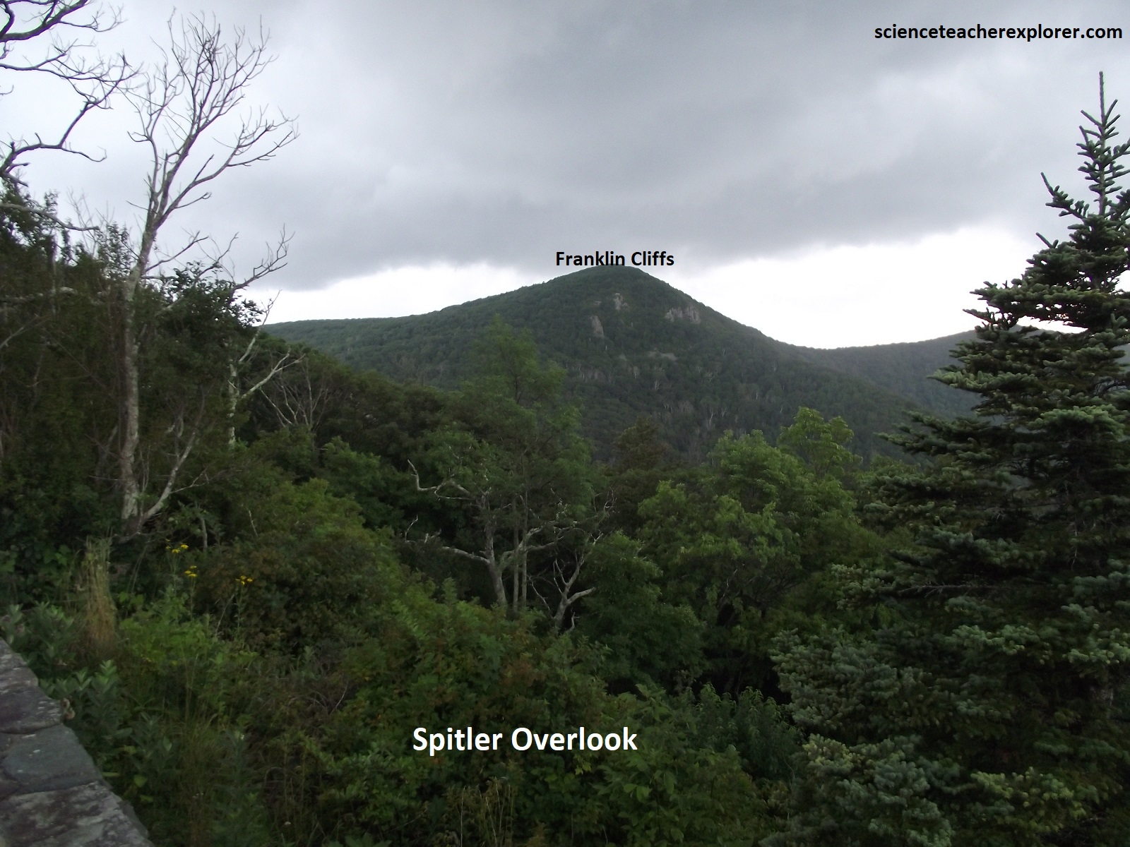
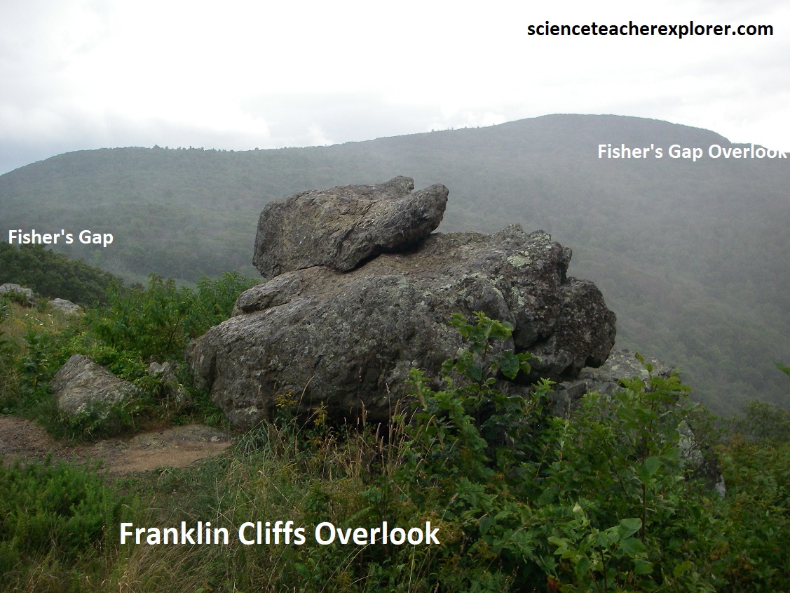
Pictured above on the right, we drove another 1.5km to the Franklin Cliffs Overlook. The Franklin Cliffs are composed of 3 metamorphosed basalt lava flows of the Pedlar Formation. The cliffs themselves form in the more resistant parts of the flows with interflow breccias and sheared zones tending to form the intervening slopes and benches. The boulder in the above right picture is an example of volcanic breccia. A slope of coarse forested talus is visible at the foot of the cliffs. The forest cover and the extensive weathering of the talus blocks strongly suggest that the talus slope is largely inactive today. {The historical Big Meadows image below is taken from “Shenandoah National Park: An Interpretive Guide” Conners 1988).
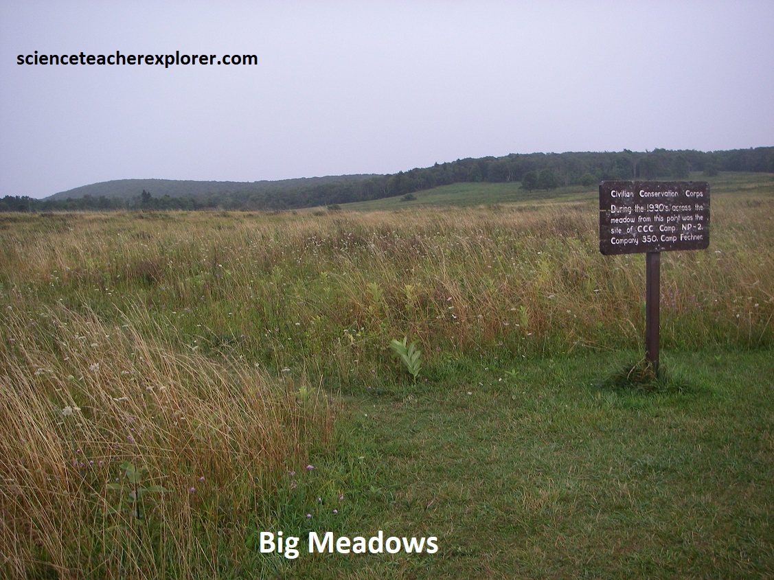
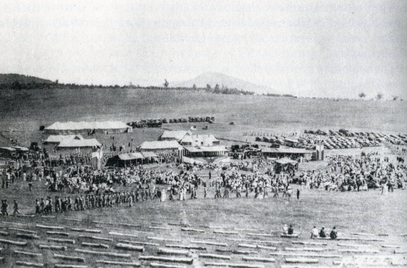
Pictured above, Big Meadows is the only large treeless area in the Shenandoah National Park, and lies at about 1167m elevation atop a plateau-like upland approximately 2.6km2 area. Big Meadows is underlain by some 600m of gently dipping Catoctin lava flows and contains 2 shallow marshes that are both drained by the Hogcamp Branch. Poorly drained soils and the relatively cold, harsh environment may have discouraged tree growth, allowing sedges and grasses to maintain small meadows here in the natural state. The historical photo seen above is the gala dedication of Shenandoah National Park, (which featured President Franklin D. Roosevelt in 1936), was held here at Big Meadows. Big Meadows supports over 270 species of vascular plants.
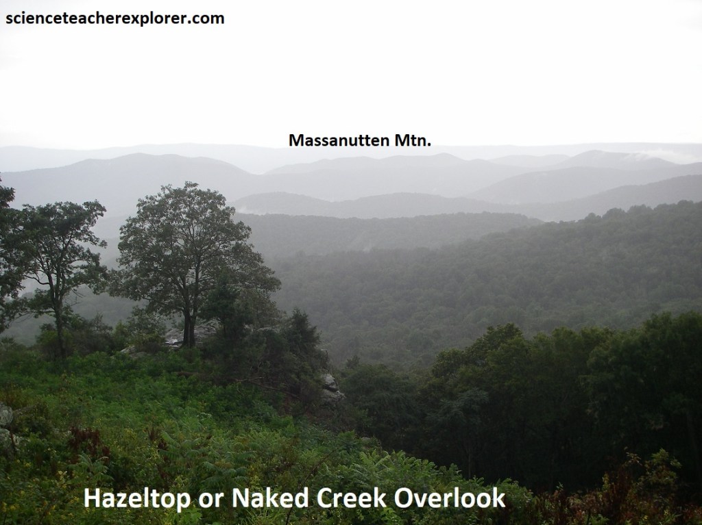
After leaving Big Meadows, Becky and I continue driving south on Skyline Drive for another 3.5km to Naked Creek Overlook. Pictured above, we get a view across Long Ridge at the mountains beyond. This broad panorama west shows many peaks and ridges west of the Blue Ridge. According to the geological map, Long Ridge is capped with the Weverton Formation, (a conglomerate from the Cambrian Chilhowee Group).
Below us is the valley of the East Branch of Naked Creek toward Elkton, (18km away). This valley is formed in the Catoctin Formation and contains a few waterfalls, (from the map). We didn’t didn’t trek to them due to the rain.
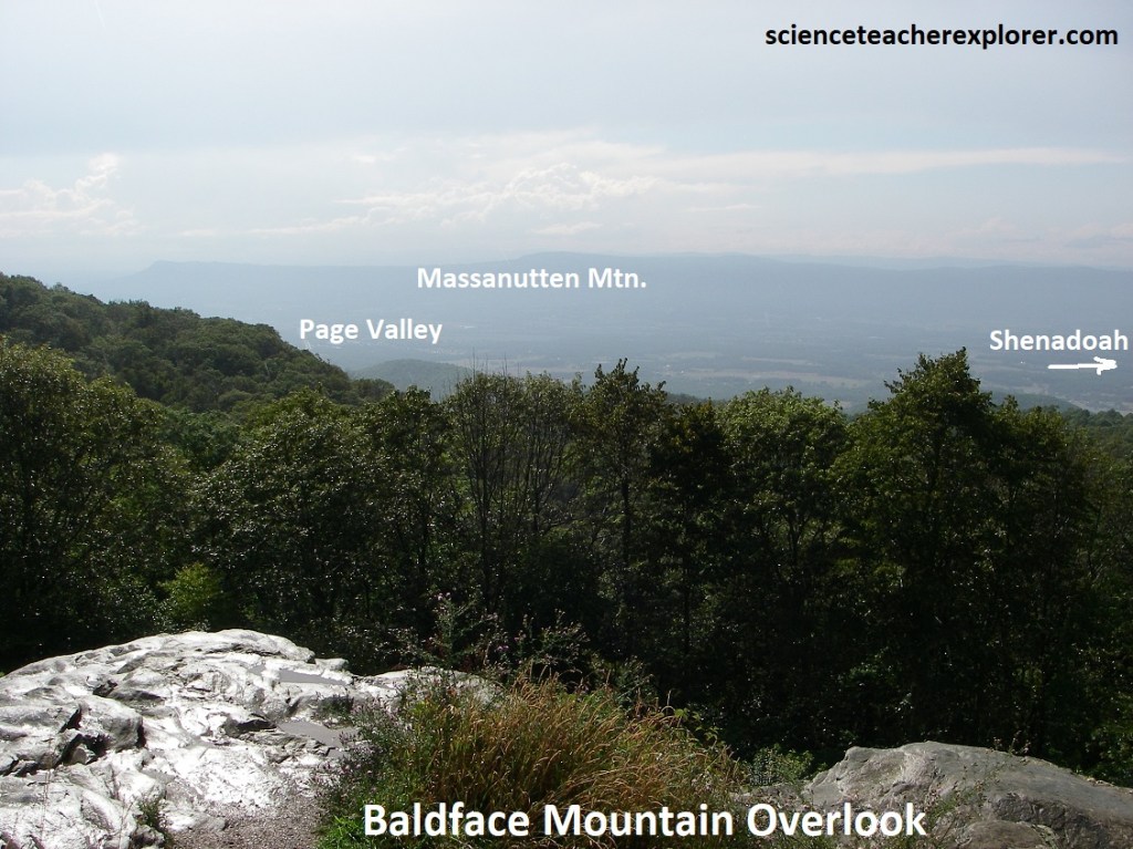
We continued driving south, skipping Bootens Gap, (where we crossed the Elkton Fault), The Point Overlook, and the Oaks Overlook, {It was raining pretty hard}. We also drove past Bearfence Mountain and Lewis Mountain. In about 12km the rain ceased and we were able to stop at the Baldface Mountain Overlook, (pictured above). This gave us an excellent view at the south end of Page Valley and the southern part of Massanutten Mountain. Elkton is seen on the left, (10km due west) and the town of Shenandoah was seen on the right, (14km northwest of us).
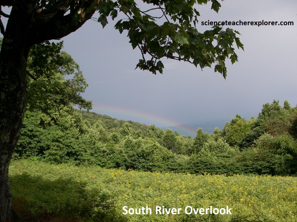
Down the road, we stopped to get a picture of a rainbow from the South River Overlook, (pictured above). Note that the Sun is behind us at 420 from the horizontal, while we look into a rainstorm. We also notice a change in vegetation: dogwood, grapevine, black cherry, persimmon, black locust, Virginia pine, pitch pine, red oak, yellow poplar, ash trees, sugar maple, black birch, hickories, wild hydrangea, bluets, Indian pipes, basswood, hemlock, yellow birch, hornbeam, black gum trees, butternut. & maidenhair.
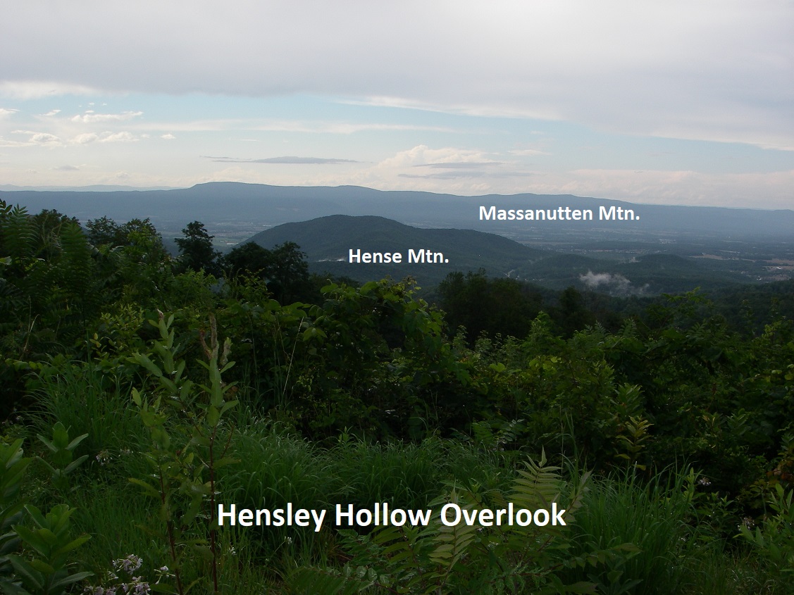

5km down the road, we stopped at the Hensley Hollow Overlook. This gave us a northwestern view over Hensley Hollow with Elkton to the left and Massanutten Mountain in the distance. Immediately south of Elkton is Hanse Mountain, (northern most of a lengthy range of mountains composed of the Cambrian Chilhowee rocks.
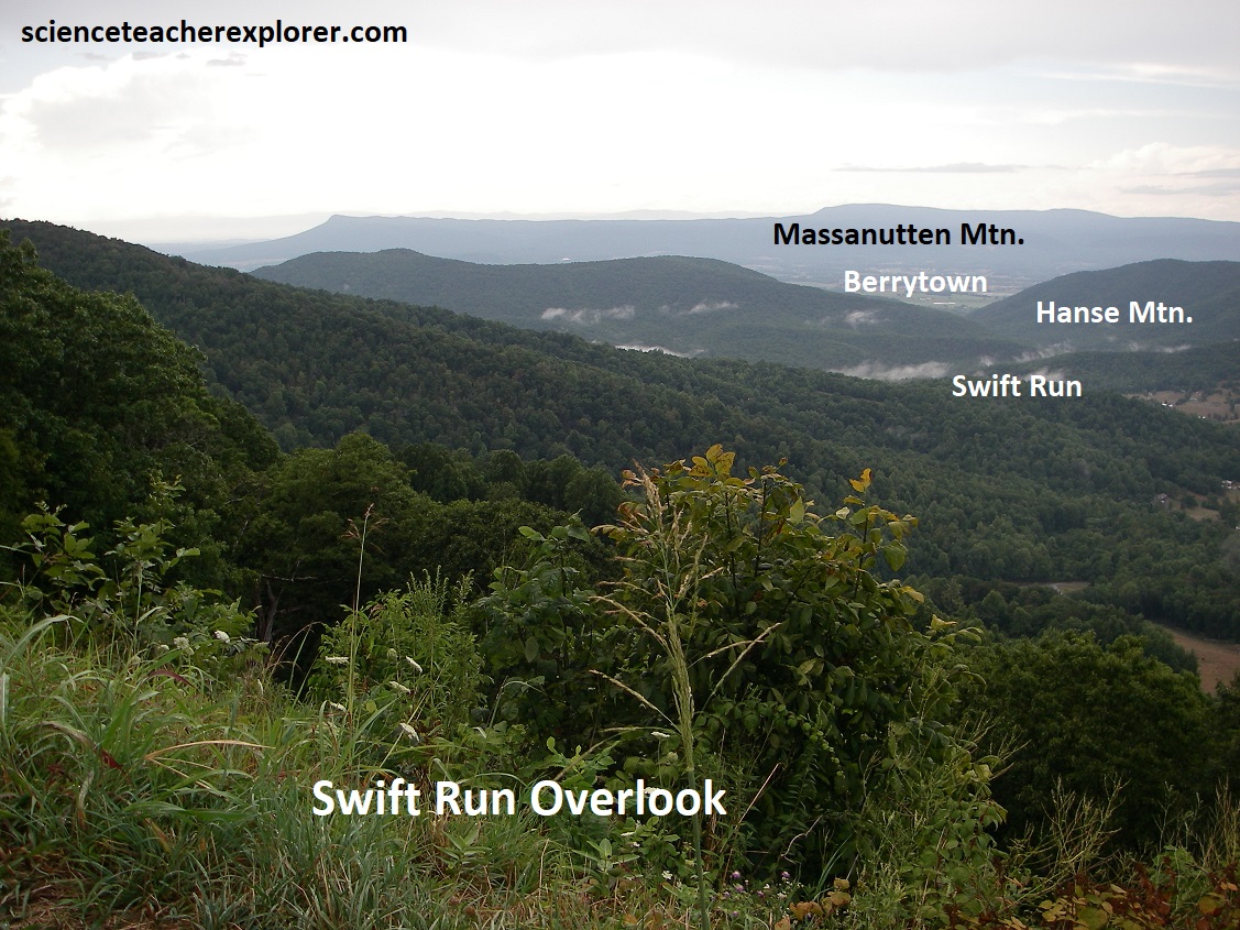
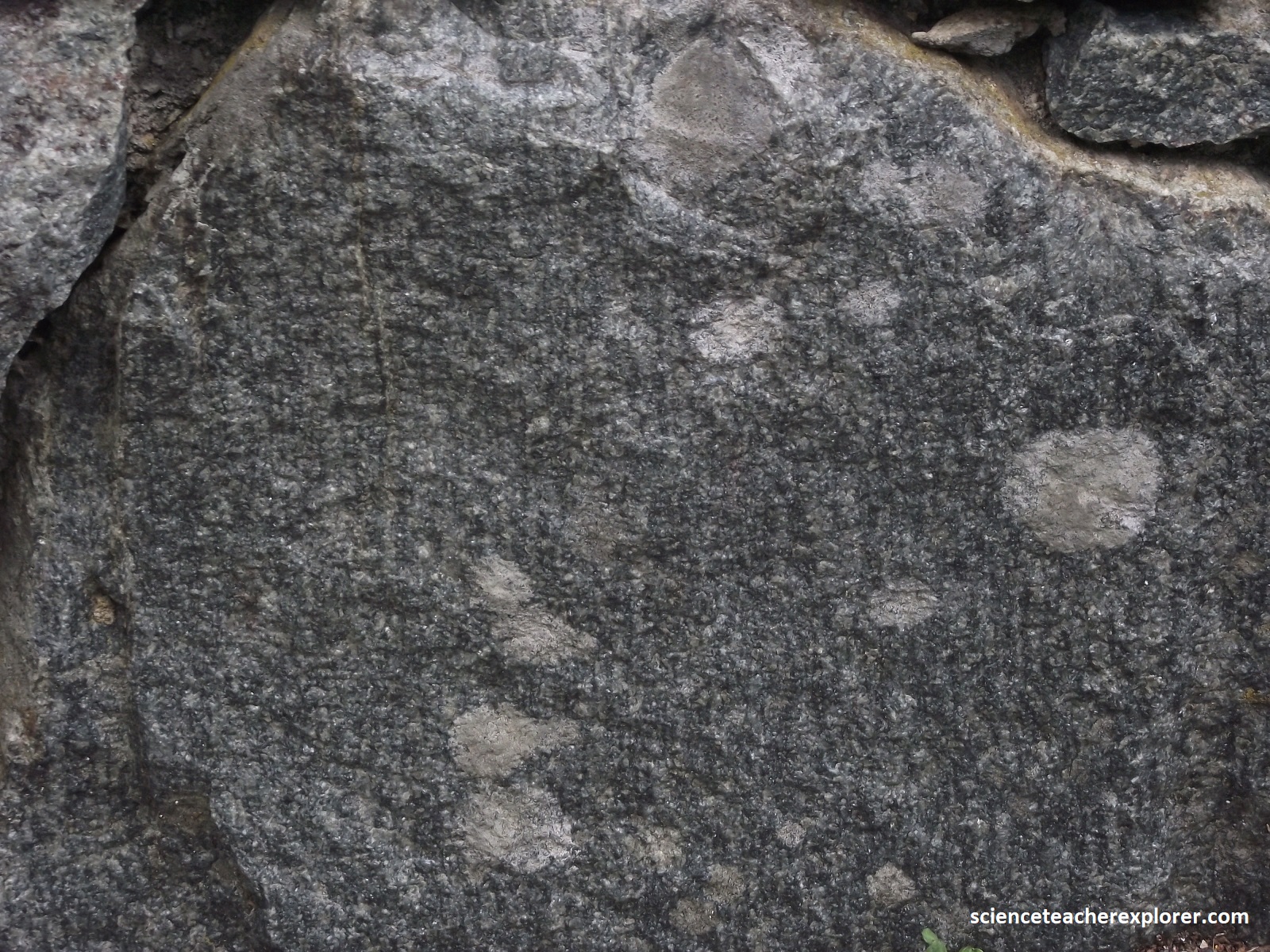
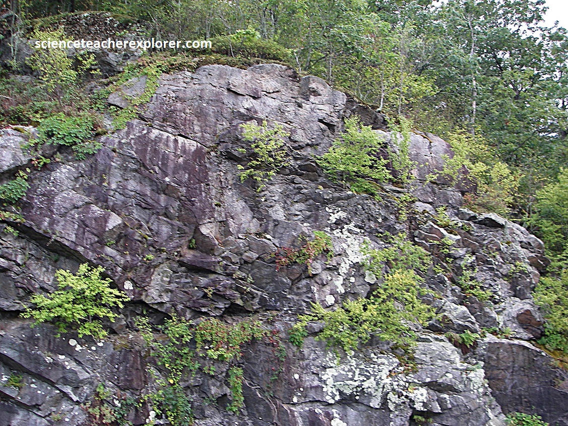
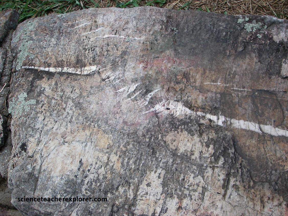
Becky and I continued driving south along the Skyline Drive, when we crossed the US33 junction at the Swift Run Gap. US33 runs west to east from Harrisonburg through Elkton to Stanardsville. Driving up from the canyon bottom floor (2.7km) to the south, gave us a better view of the gap from the Swift Run Overlook, (pictured above). The gap itself is underlain by the granitic rock of the 1.1 billion year-old Pedlar Formation. Roadcuts along the way exposes the jointed Pedlar granodiorite containing epidote, (pictured below).
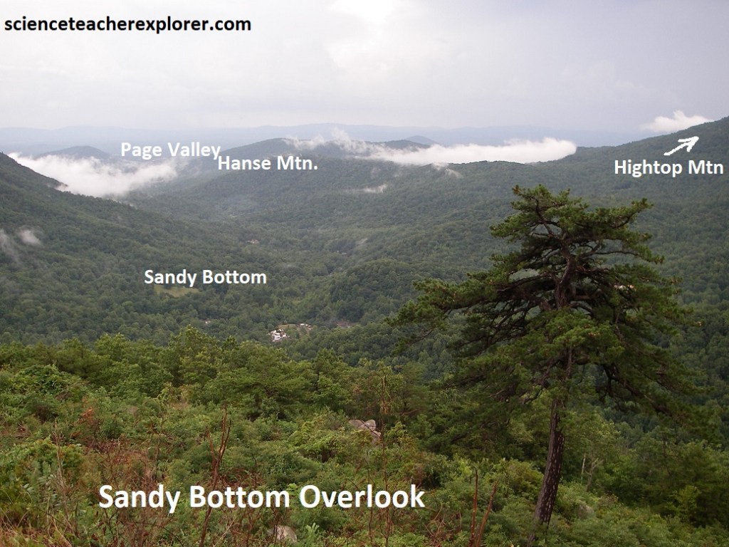
Our next view along the drive is Sandy Bottom Overlook. This gave us an excellent view down the hollow of Sandy Bottom to Hanse Mountain. In the distance (to the northwest) Page Valley and Massanutten Mountain are visible. The large valley below is drained by an additional Hawksbill Creek. The small village of Sandy Bottom lies in the tributary hollow 430m below the overlook.
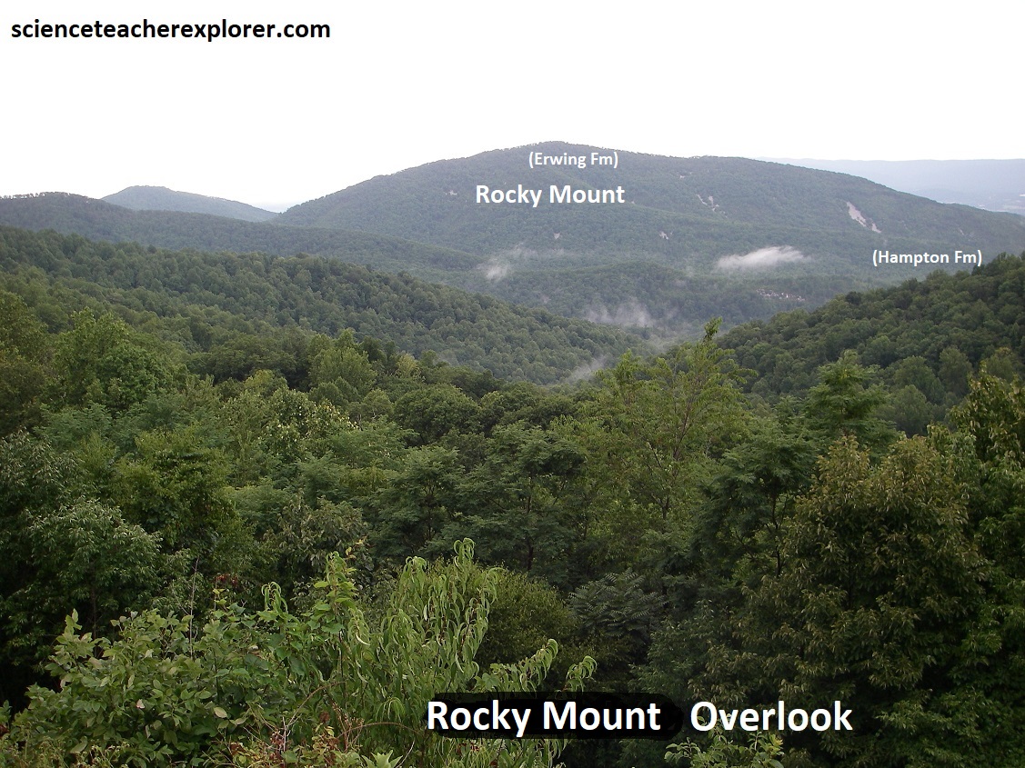
Passing a couple of gaps, (Smith Roach & Powell), and the Bacon Hollow Overlook, we came upon the Rocky Mount Overlook, (pictured below). Rocky Mount lies directly ahead. It is capped by the Erwin Formation whose quartzites form the scree and talus slopes seen along it’s slopes. A closer look at the hard, resistant quartzite, are seen about the overlook on the guard rocks and walls. {(Image of the stratigraphical column below is taken from “Shenandoah National Park: An Interpretive Guide” Conners 1988).
The sequence of geological formations composing the local terrain is representative of outcrop patterns along the side of an eroded upfold along the northwestern limb of the huge Blue Ridge Anticlinorium. Imaged above, the formations get progressively older eastward toward the central part of the anticlinal structure. We’ll also see the same progression from older to younger as we progress from here & drive south on Skyline Drive.
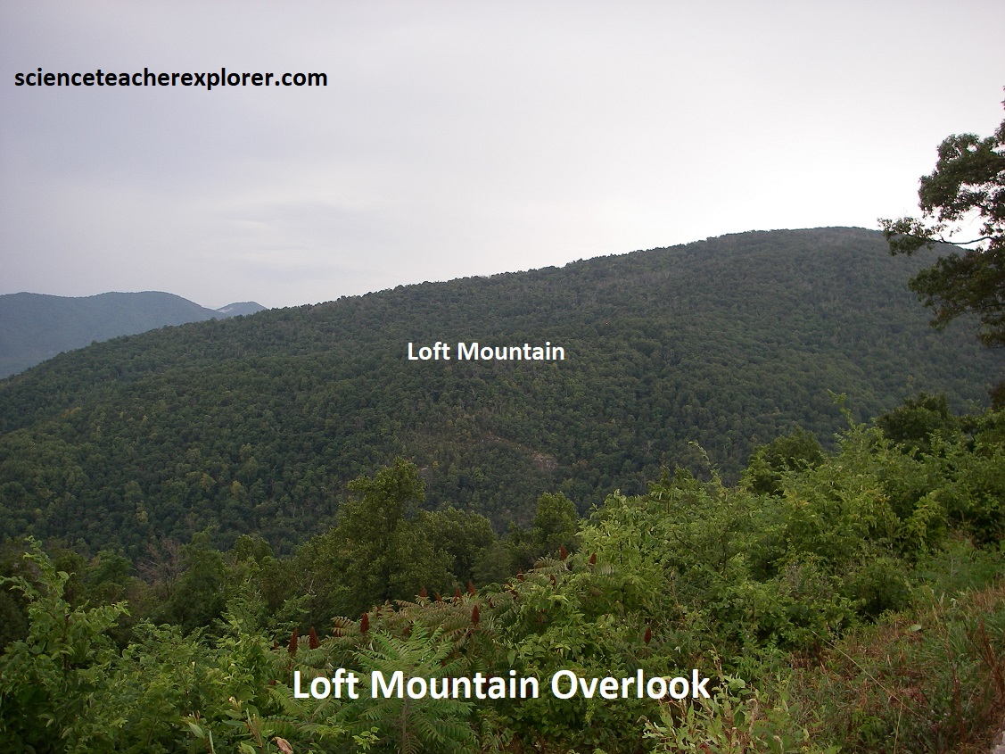
By-passing Beldor Hollow Overlook & Simmons Gap, we stopped at Loft Mountain Overlook, (pictured above). The view east gave us a view of Loft Mountain & Flattop Mountain in the distance (out of view). Both are capped by the Catoctin lava beds. Pictured above-right, the Catoctin greenstone exhibits colors ranging from gray to green to purple with mineral-filled vesicles & fractures filled with quartz, epidote and serpentinite.
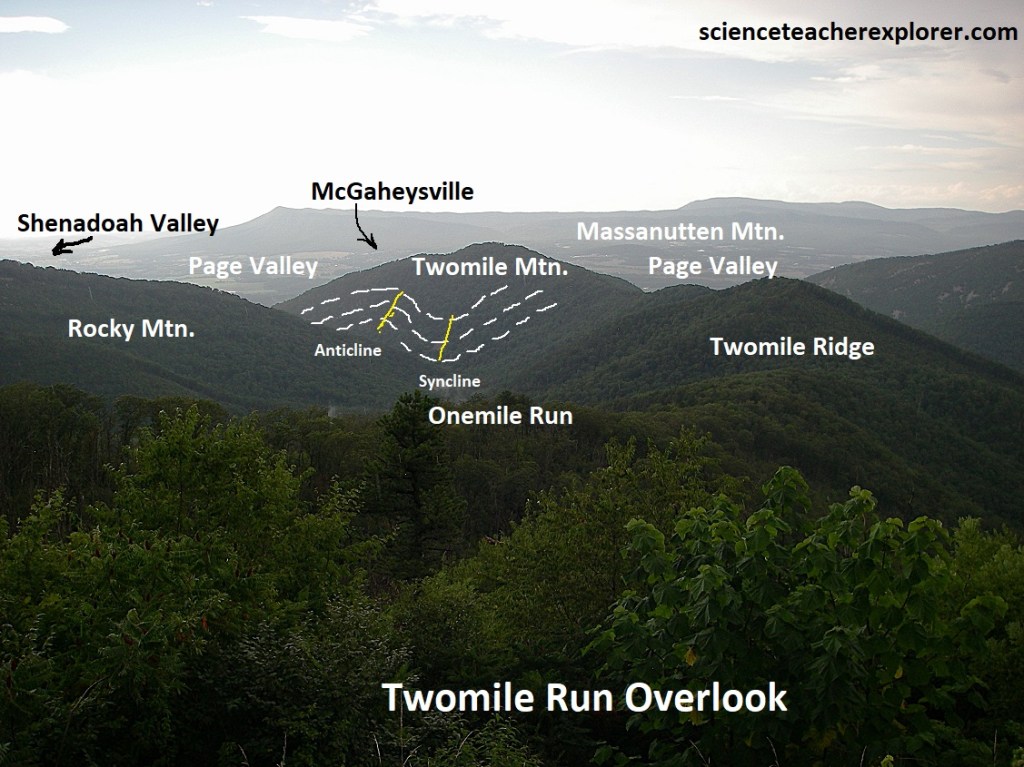
At Twomile Run Overlook, the view northwest across peaks of Erwin and Hampton Formations at the south end of Massanutten Mountain looming up out of the broad Shenandoah Valley. The canyon trending northwest from the overlook toward the south end of Massanutten is Onemile Run. Twomile Mountain at the foot of Onemile Run contains and excellent example of folding but is not visible with the vegetation. Rocky Mount is the prominent peak directly north of the overlook.
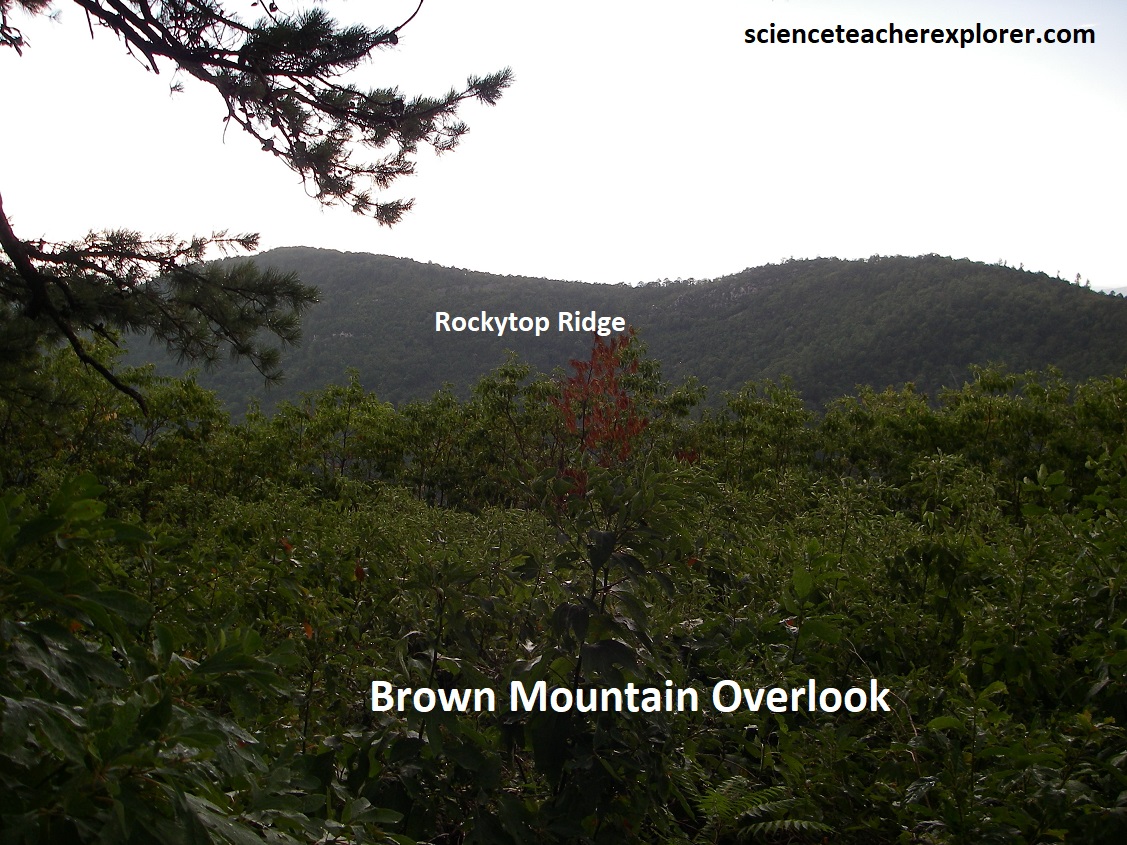
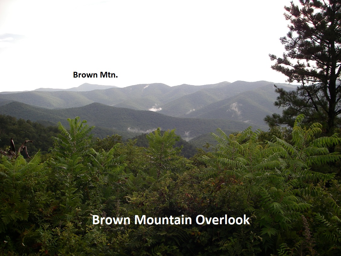
Our next view looks down the valley of Rock Mountain Run below the Rockytop Ridge, (pictured above). The large mountain immediately north-west of the valley is Rocky Mountain & Brown Mountain, which is part of the same ridge and is hidden behind it. All these “rocky” names are inspired by the very hard, resistant quartzite beds in the Chilhowee strata which form the prominent cliffs, scree slopes, block fields, and jagged rock formations which abound in this region.
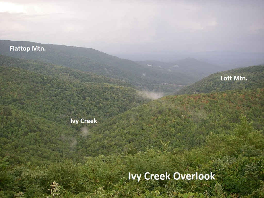
In the next 1.5km, we stopped at the Ivy Creek Overlook to view east down Ivy Creek valley with Flattop Mountain to the left and Loft Mountain to the right.
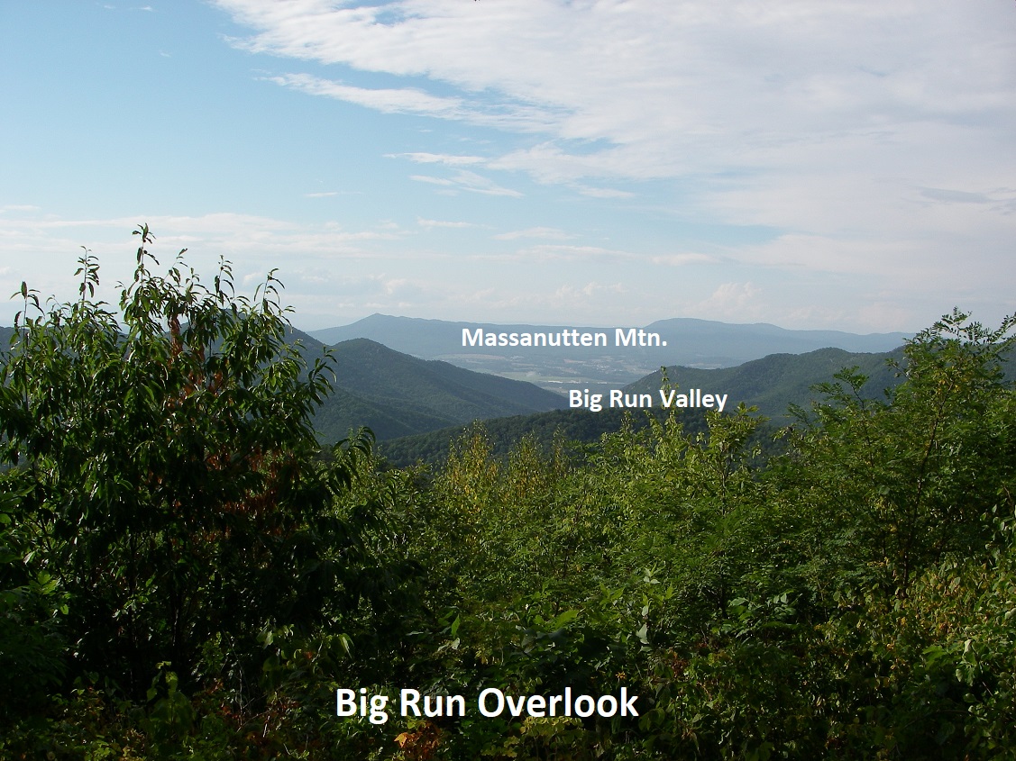
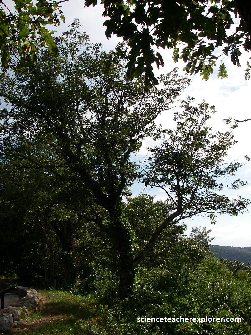
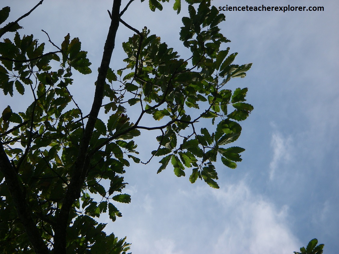
Becky and I drove another 6km south southward, passing Rockytop Overlook & Loft Mountain Junction when we approached the Big Run Overlook with a large wide view framed by trees. We stopped! The main view was northwest along Big Run at the Big Run portal, where the narrow gap through at the lower end of the valley shows Massanutten Mountain in the distance. However, the large trees were “Old Chestnuts”. Pictured above, “Old Chestnuts” are extremely rare in the U.S. and non-existent in Shenandoah N.P.. Since the early 1900s, when a deadly blight first entered this country on imported Asiatic chestnut trees, once-impressive American chestnut trees have died en masse. Magnificent shade trees often growing to 33m, American chestnuts were once common in the Appalachians. Before the blight’s arrival, the chestnut provided food for livestock and wildlife, and the tannin-rich wood and bark were used by locals for lumber, tanning, and charcoal production. Note that in Big Run Valley the “Old Chestnut” is seen occasionally.
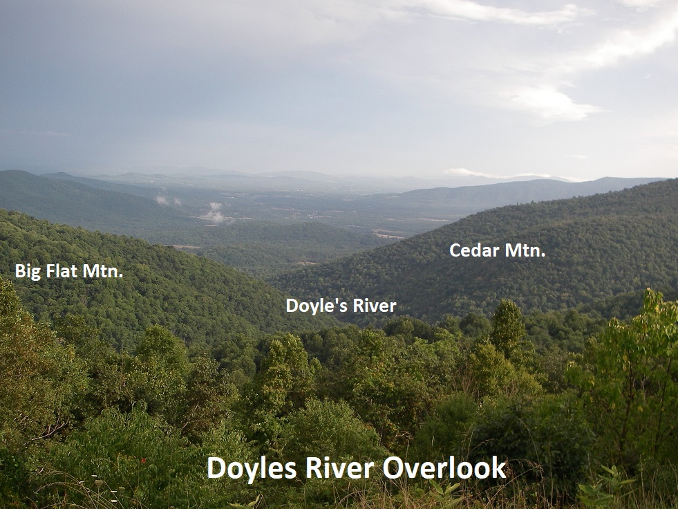
Pictured above, the Doyles River Overlook view southeast down Doyles River valley. Big Flat Mountain is at the far left and Cedar Mountain is to the right. The Weverton Formation of the Cambrian, underlies this overlook and is well exposed nearby. The deep forested canyons and adjacent mountains below are formed from Catoctin greenstones, and the Pedlar Granite comprises the lower terrain beyond.
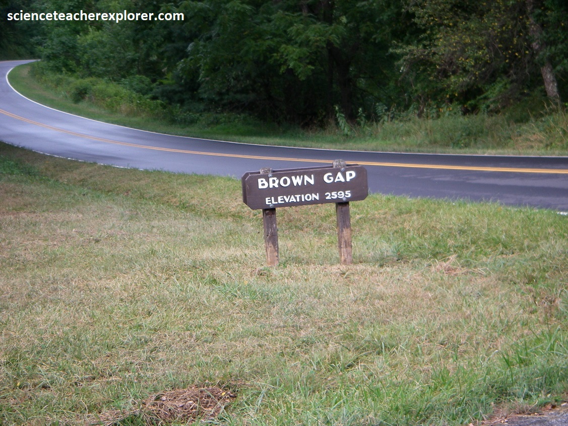
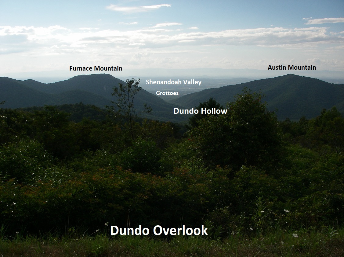
The next 2 km, we passed through Browns Gap. This gap is a famous turnpike over the Blue Ridge, connecting Shenandoah Valley to markets in the Richmond area, created in 1806. However, Stonewall Jackson marched his army through the gap in 1862 during the Civil War. Then in 1864, General Jubal Early and his troops established a position in the gap and defended it from Sheridan’s attacks for 2 days while awaiting reinforcements. The nearby Dundo Overlook views northwest down Dundo Hollow. Near the mouth of the hollow, Furnace Mountain rises to the left and Austin Mountain to the right. Both are capped by Erwin quartzites with southwest dipping ledges. Furnace Mountain was named for the Mount Vernon Furnace, built at its base in 1848 for the reduction of iron ore. Beyond the Dundo Hollow mouth is Shenandoah Valley sitting on limestones that are famous for its Caves. {e.g. Grand Caverns}.
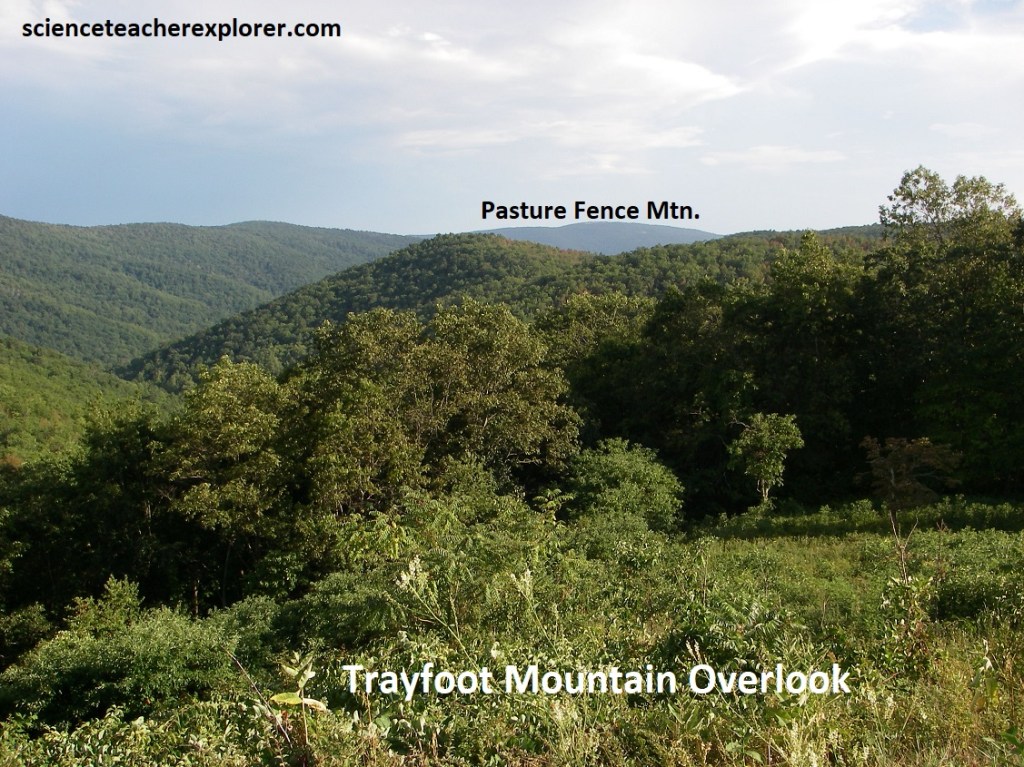
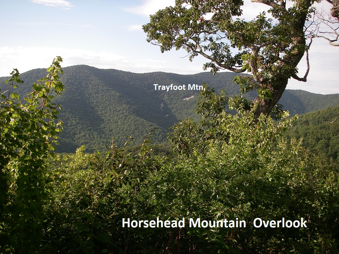
As the Skyline winds around for the next 5km, we made a brief stop at the Trayfoot Mountain Overlook, (pictured above). This gave us a broad view south along the Blue Ridge crest. To the southeast is the long, massive ridge of Pasture Fence Mountain, (pictured above). Trayfoot Mountain was of us and not pictured above.
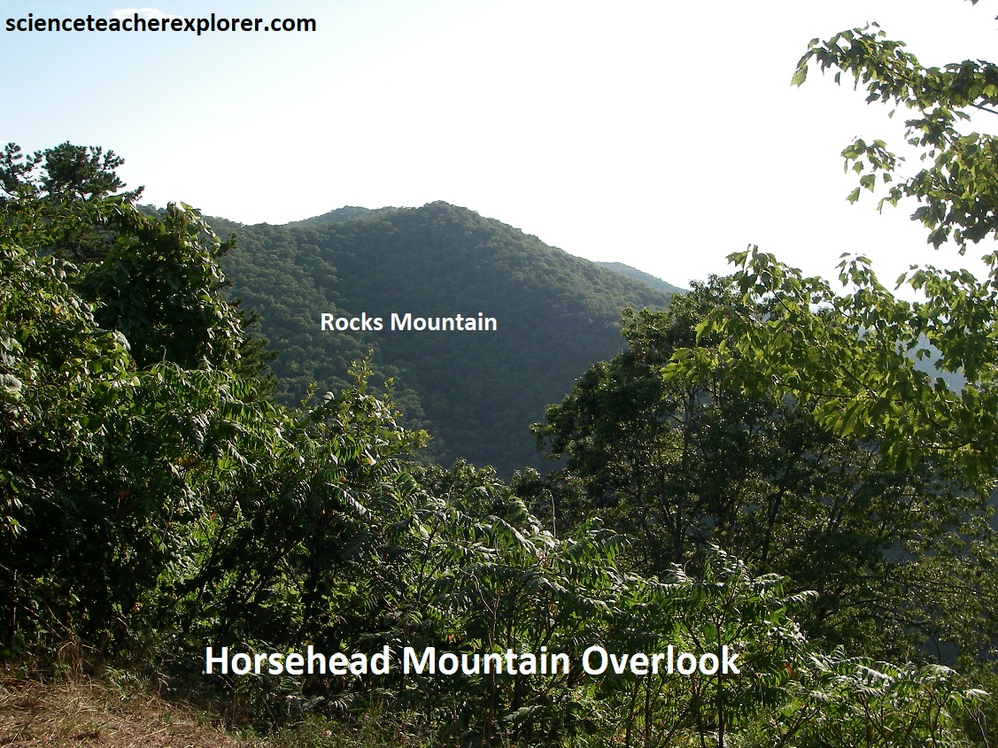
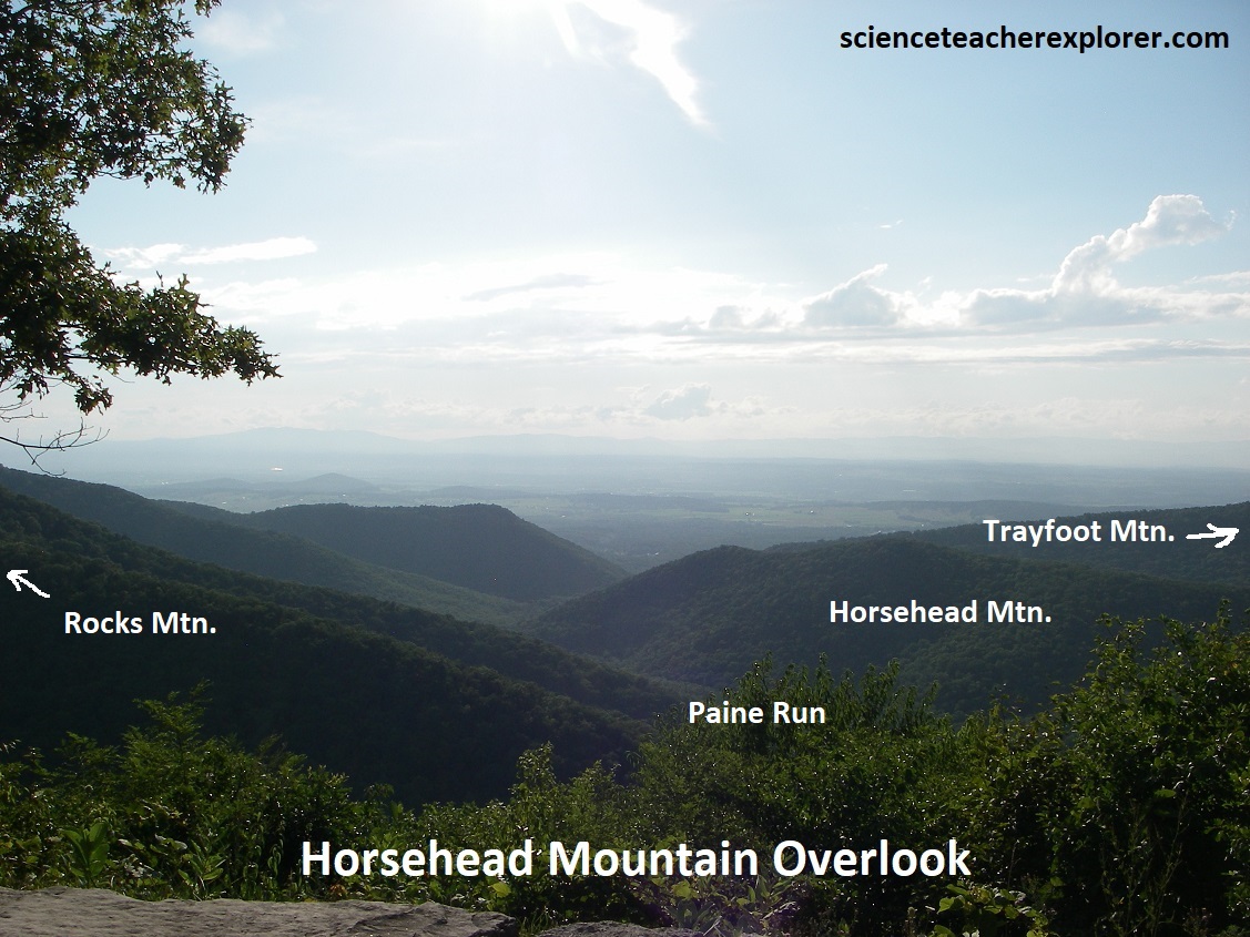
Our next stop was Horsehead Mountain Overlook, (pictured above). This overlook gave us a fantastic view west at the canyon of Paine Run with Trayfoot Mountain to the right and Rocks Mountain to the left. Rocks Montain is capped by the Erwin Formation in the center of a synclinal fold. Trayfoot Mountain, on the other hand, is underlain by the Hampton Formation.
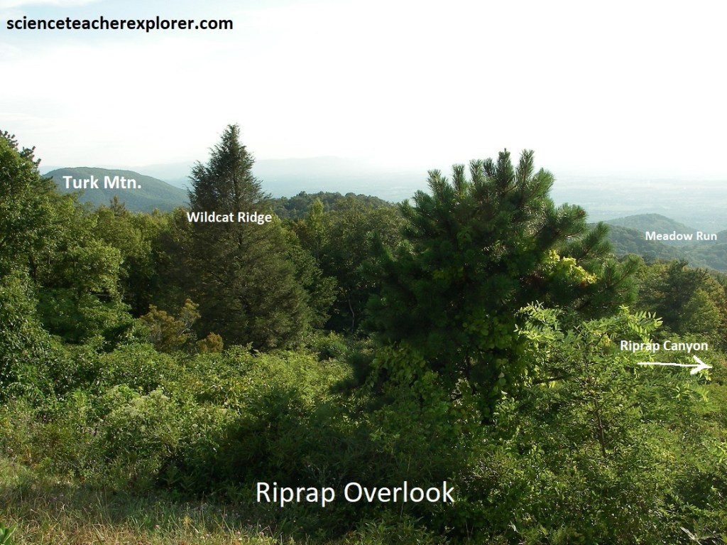
The next stop was Riprap Overlook. This large overlook, with its stand of pine and dogwood, face west toward Riprap Hollow Canyon. These valley are drained by Meadow Run, which sinks into the gravelly alluvial deposits at the foot of Blue Ridge before reaching the South River & then the South Fork of the Shenandoah. Pictured above, the high peak on the left is Turk Mountain which is also capped by Erwin quartzites nestled in the nose of another south-plunging syncline, (like Rocks Mtn.).
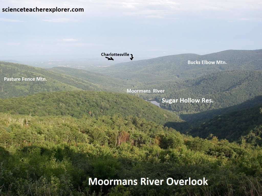
Pictured above, Moormans River Overlook views to the southeast towards Sugar Hollow Reservoir, (Charlottesville Reservoir), located on the Moormans River. The reservoir itself rests on granitic Pedlar rocks. Metamorphosed Catoctin volcanics make-out the surrounding mountains, including the Pasture Fence Mountain on the left and Bucks Elbow Mountain on the right. Charlottesville, receives water from the reservoir 27km to the east. Interestingly, the Moormans River splits and branches in 2 different directions after it leaves the reservoir. This suggests that maybe there is an underlying fault controlling the water flow.
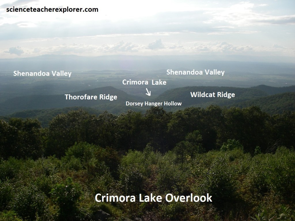
From Crimora Lake Overlook, we could look down the Dorsey Hanger Hollow, with Thorofare Ridge on the left and Wildcat Ridge at right. Crimora Lake is a small reservoir in Dorsey Hanger Hollow. Behind Throrofare Ridge, on the alluvial apron of the Blue Ridge, are parts of an abandoned manganese mining operation that began in 1867 and operated intermittently until 1946. These were open-pit mines that used water from Crimora Lake to separate lumps of manganese ore from the clay and quartz fragments, all of which had been concentrated near the surface by long-term weathering processes. Over half the manganese mined in the United States came from this mine.
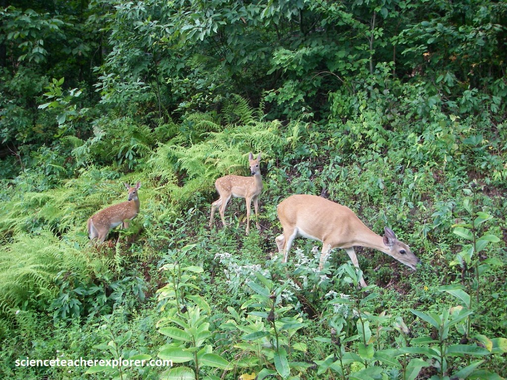
Pictured above, the return of the whitetail deer to Shenandoah began in 1934, when 13 animals were imported and released along Big Run. The regenerating forest provided excellent deer habitat and over 6,000 deer now roam the Park. In addition to the open areas at Big Meadows and Loft Mountain, artificially maintained grazing habitat is provided by the mowed areas along Skyline Drive, (seen above). {Note that there are over 800 Black Bears also in the Park}. However, we didn’t see any.
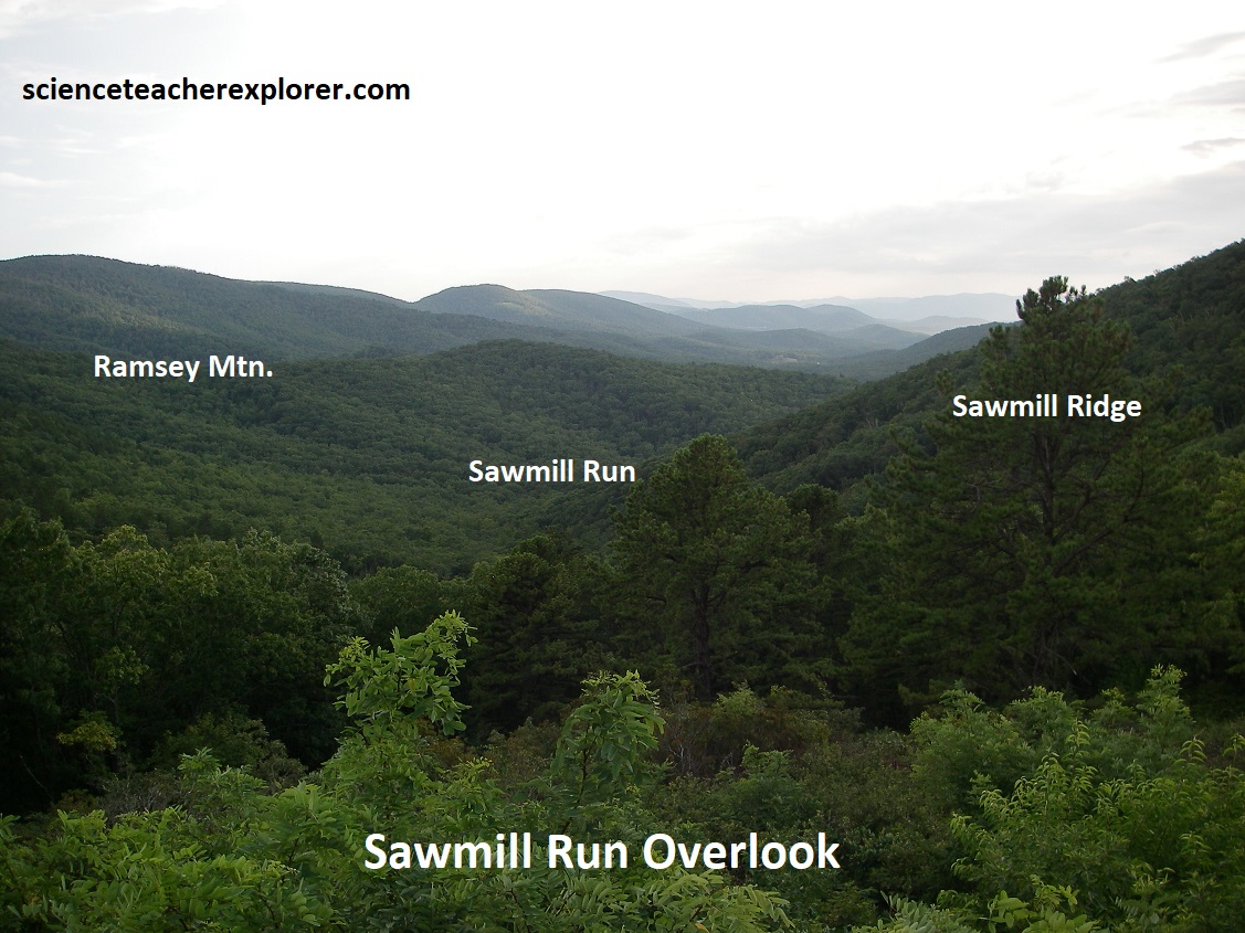
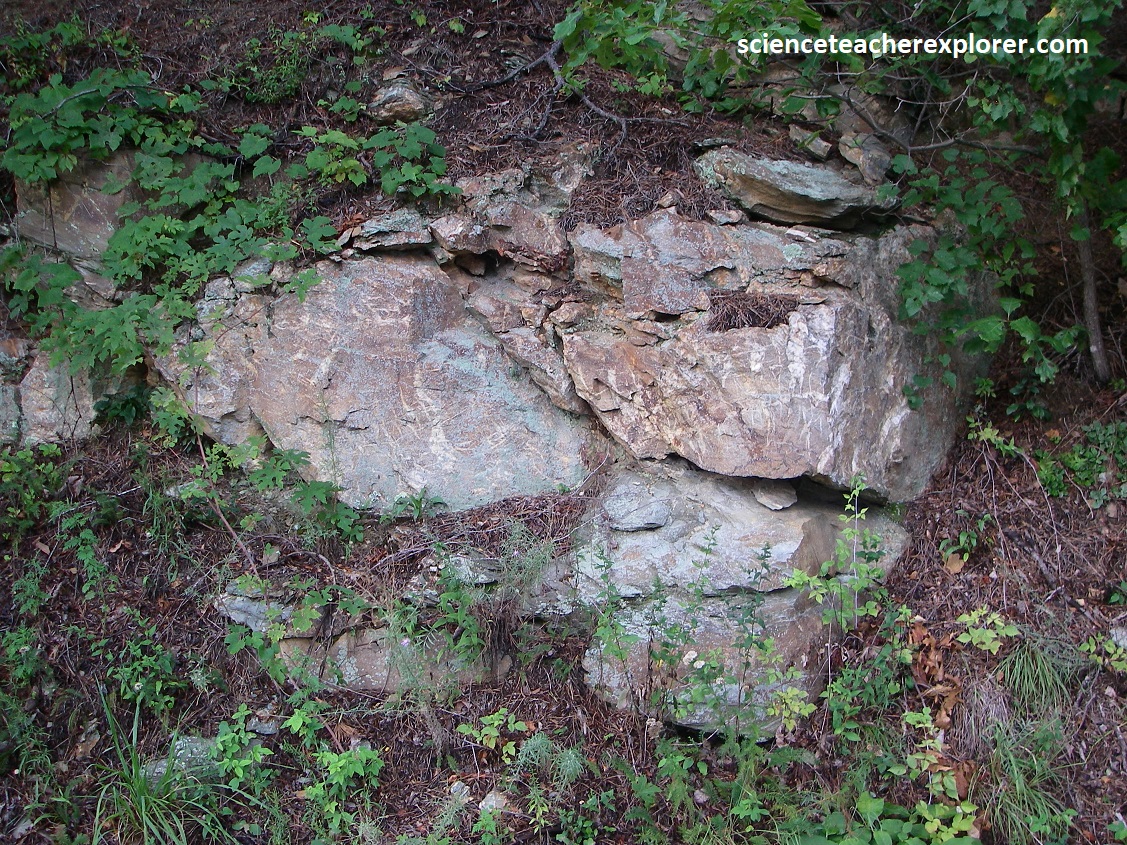
Picture above, at Sawmill Run Overlook, the view southeast down the valley of Sawmill Run showed that it cut a deep water gap through the Erwin quartzites, towards Waynesboro, Virginia. Sawmill Ridge lies north of the gap and Ramsey Mountain lies south. The roadcut across the drive here display irregular beds of pebbly meta-sandstone, quartzite and phyllite of the Weverton Formation, (picture above). However, the Catoctin Formation are plainly visible as a contact zone here.
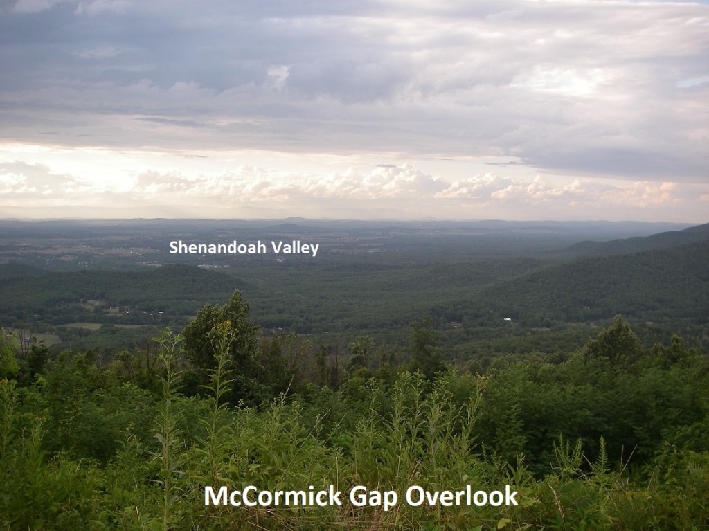
Becky and I, picked up the pace while driving south on Skyline Drive. We bypassed the Calf Mountain & Beagle Gap Overlooks to get to our last pullover at the McCormick Gap Overlook. This gave us a last spectacular view of the Shenandoah Valley with Waynesboro to the west and the Blue Ridge stretching off to the northeast. McCormick Gap owes its origin to a dike of less resistant rock (diabase) which was intruded along a north-south fracture when the region was experiencing tension during the Triassic period. The nearby hollows seemed to be aligned along this dike. The nearby roadcuts showed southeast-dipping, overturned beds of the sandy phyllite and conglomerate in the upper Catoctin Formation.
Shenandoah National Park is located in the state of Virginia, about 113km west of Washington, D.C. The park is known for its breathtaking views along scenic Skyline Drive, which runs down the spine of the park. The Appalachian Trail also goes through the park for a stretch of about 153km. This park has a rich geologic history, with ancient rocks formed over billion of years.
