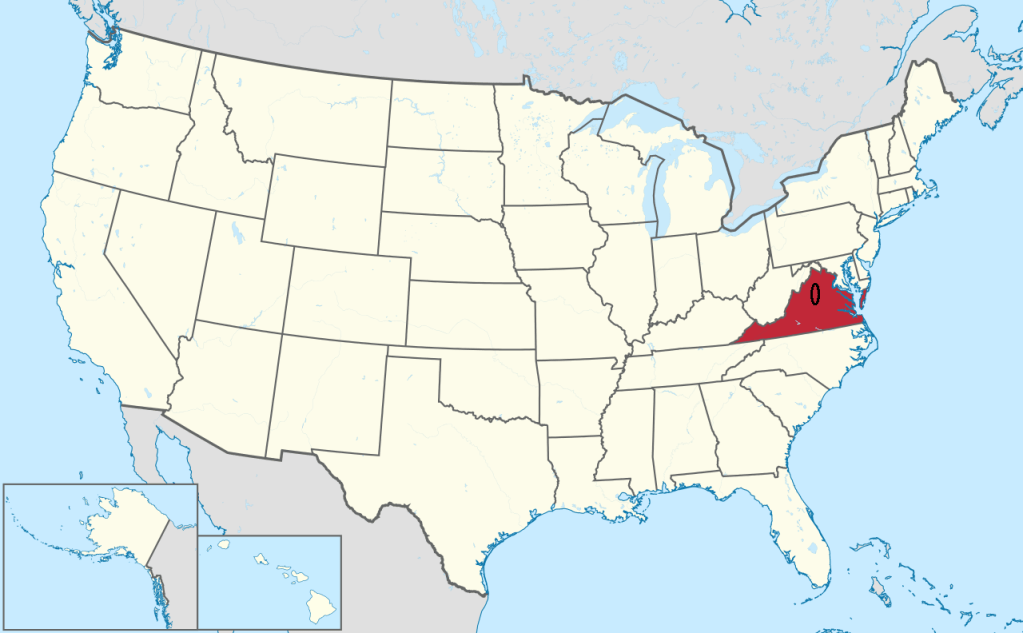
Shenandoah Valley, VA
While trekking and exploring Virginia in 2024, I visited the Shenandoah Valley, (imaged below).
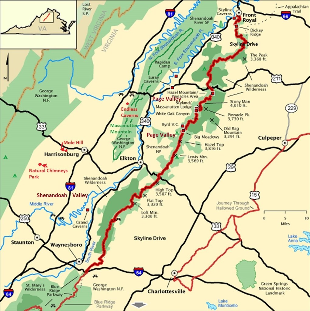
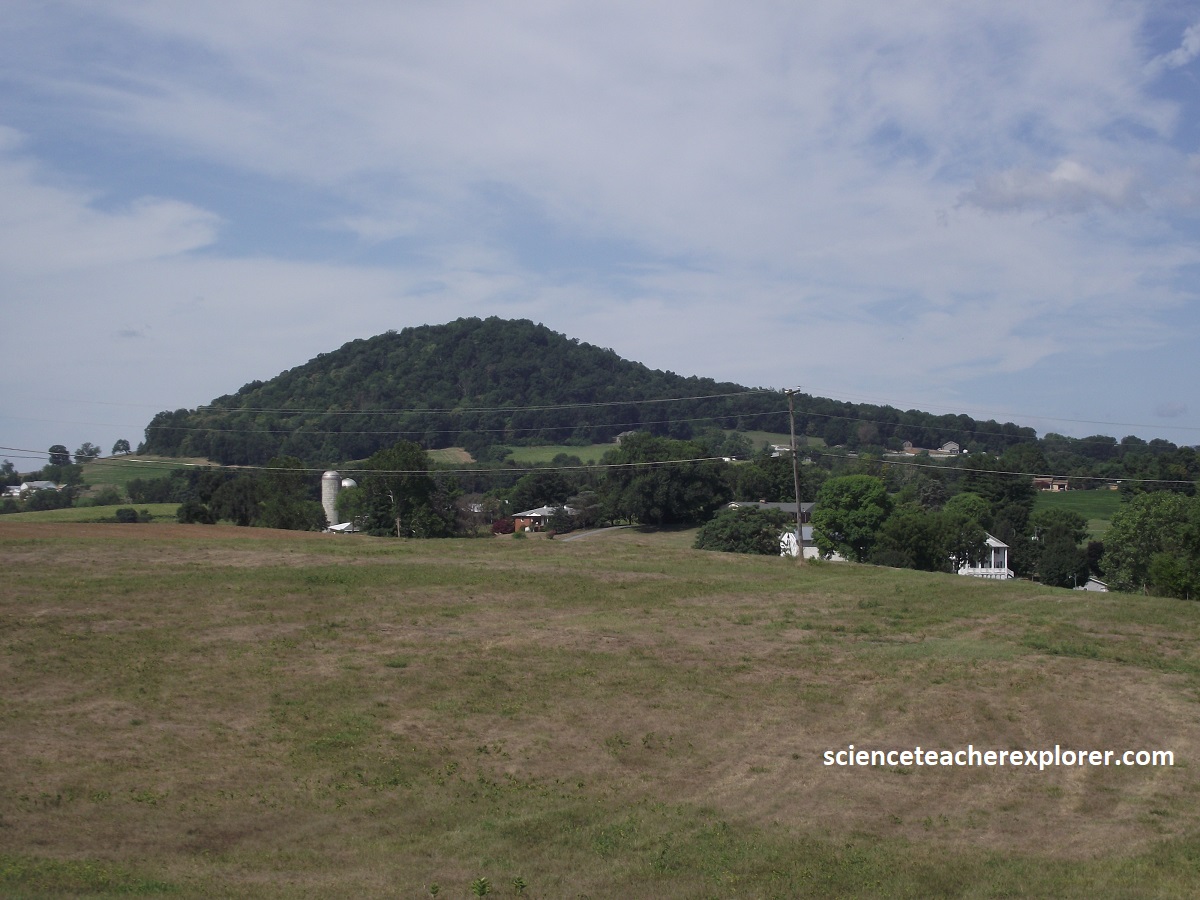
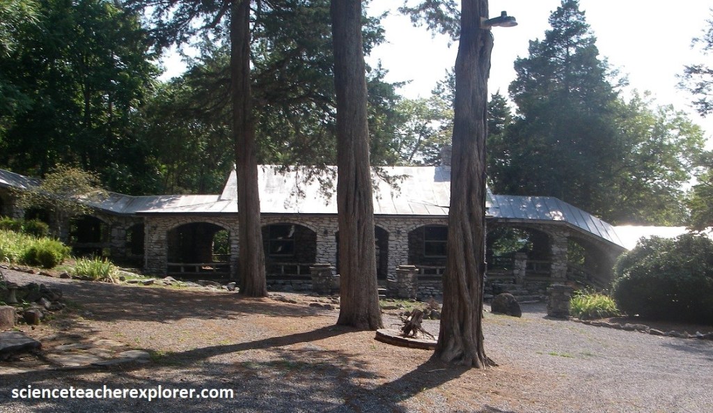
The Shenandoah Valley extends 225 km southwest from the Potomac River and varies from 16-32 km in width. For about 80 km from the Front Royal/Strasburg area to the Harrisonburg/Elkton area, the valley is divided by Massanutten Mountain, (image below).
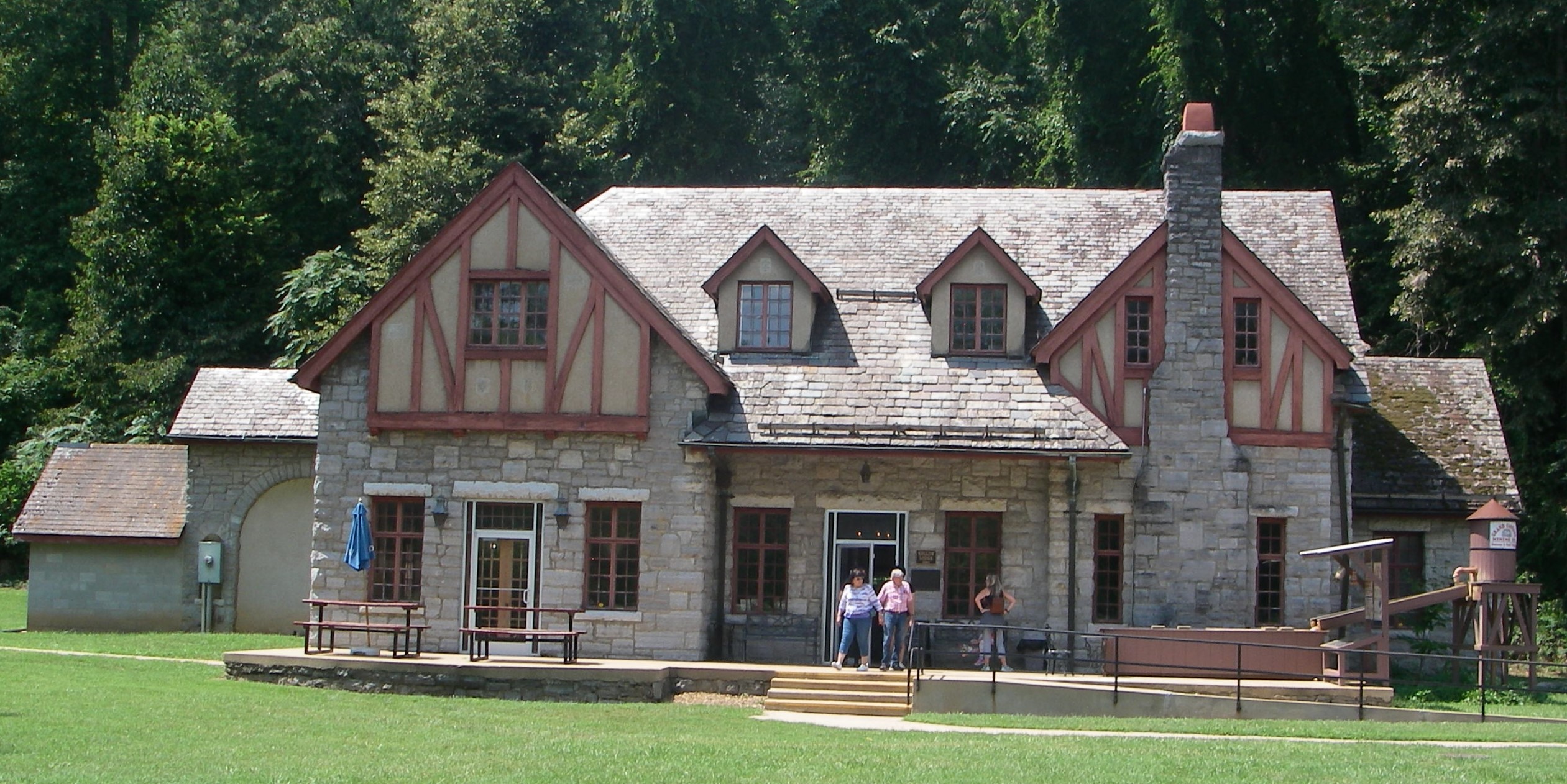
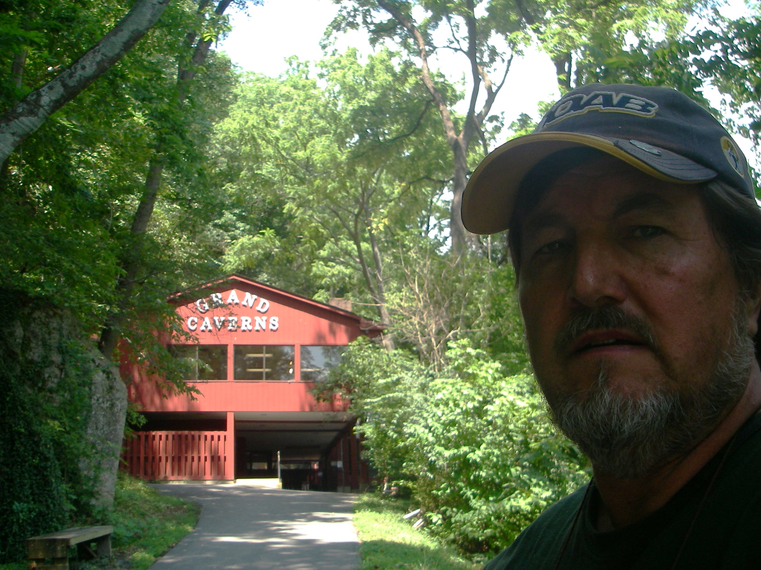
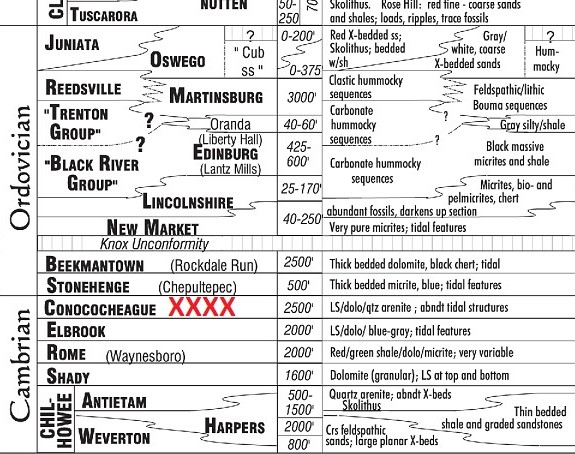
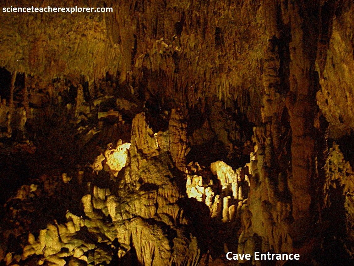
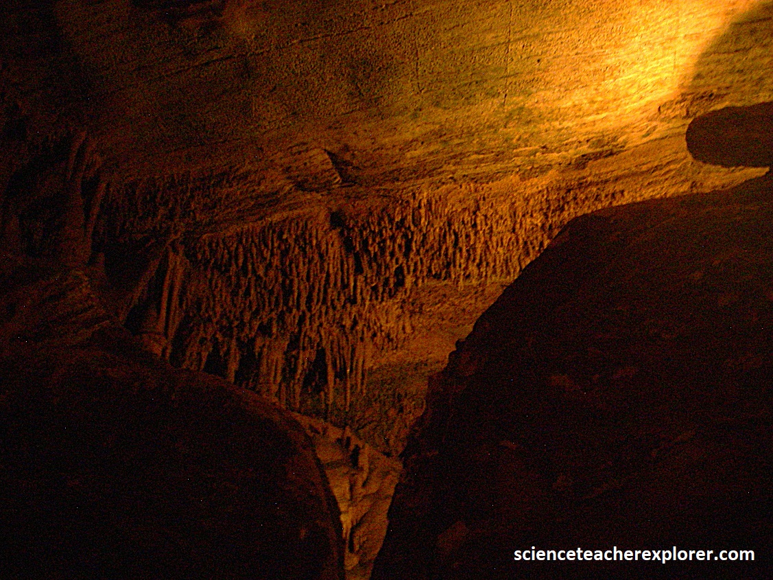
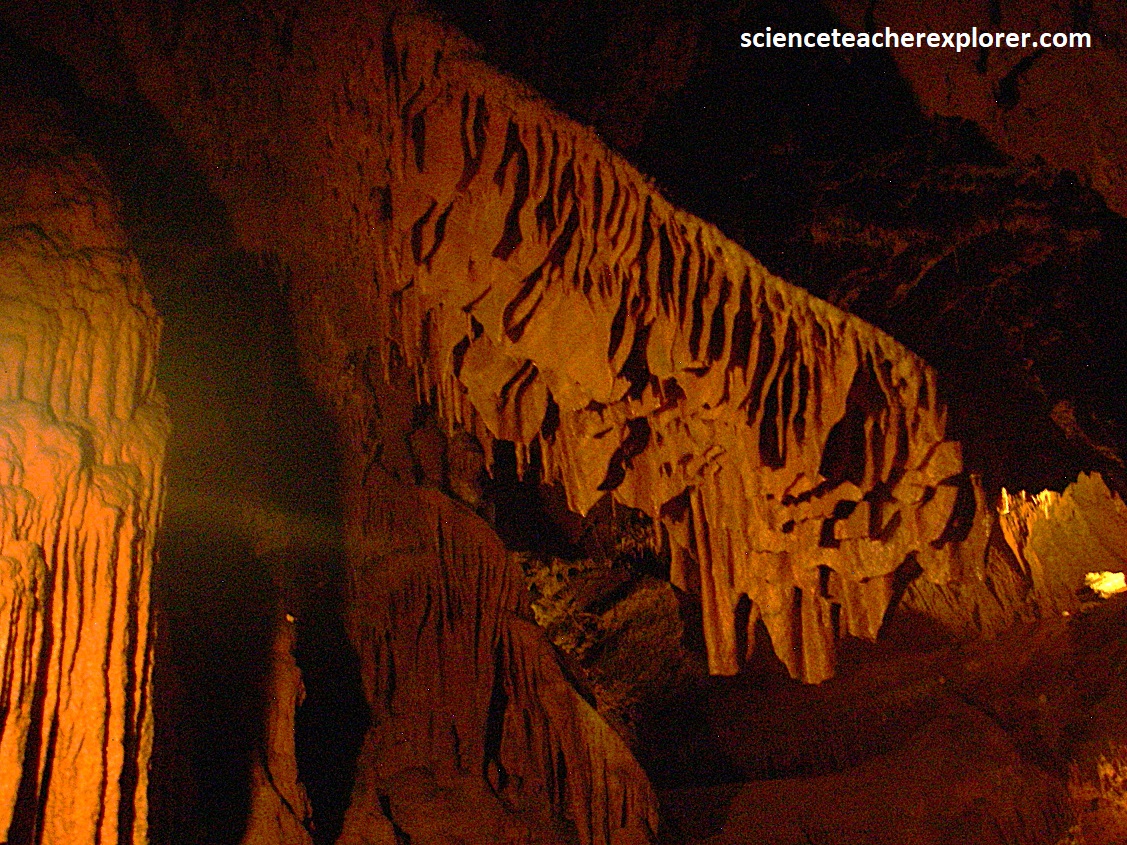
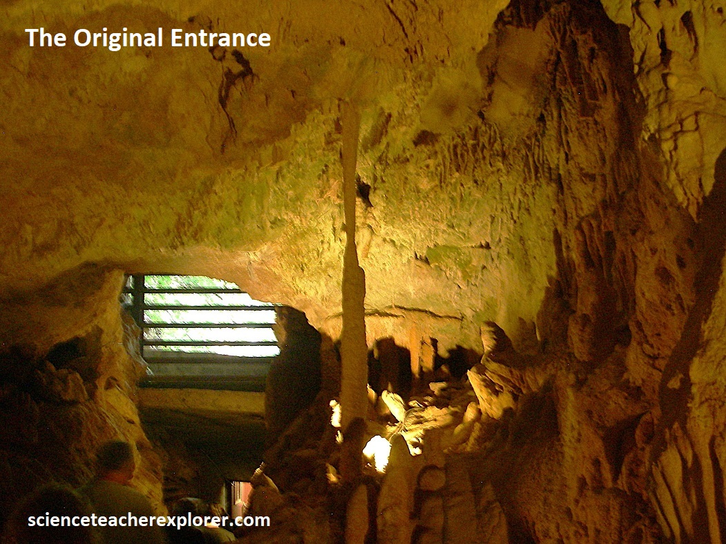
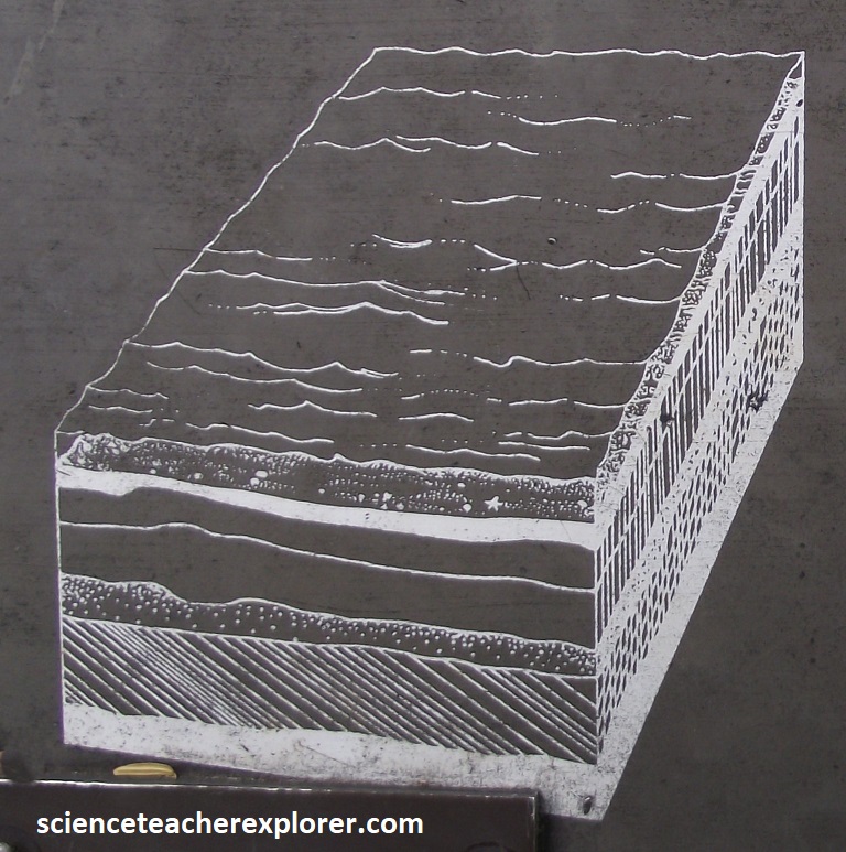
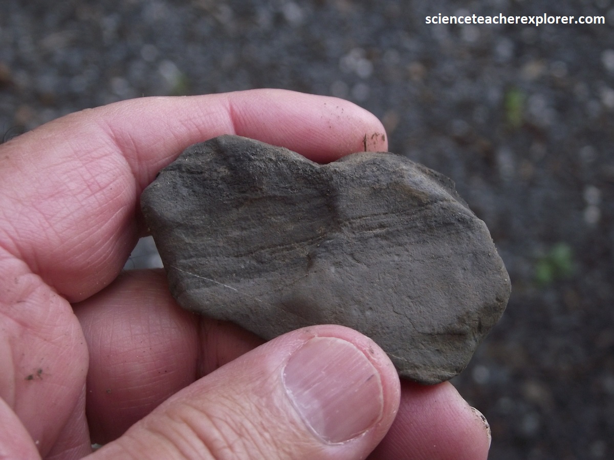
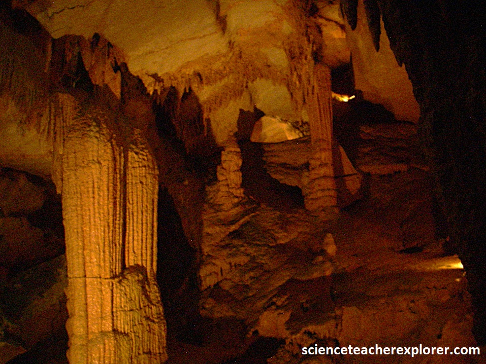
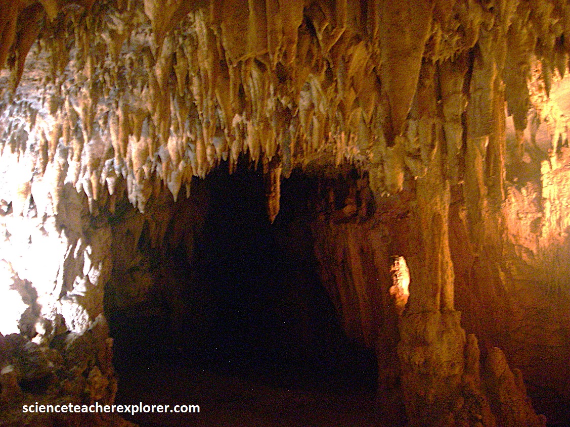
The Shenandoah Valley exists because it is underlain by a thick sequence of nonresistant, folded sedimentary rocks consisting mainly of limestone, dolomites and shales of the Cambrian time period. The more resistant limestones and dolomites form ridges than my rise 100m or more above the adjacent land. These steep ridges are not suitable for farming and, consequently, are used as woodlands or pasture. (The pictures below are the entrance to the Grand Caverns or Weyers Cave).
Some limestone and dolomite formations form a unique topography called karst, which is characterized by many sinkholes and a paucity of streams on the surface. Because these rock types are highly soluble, water tends to flow rapidly into the subsurface along fractures where large solution cavities, or caverns, are formed. Four commercial caves, (Skyline, Luray, Grand Caverns and Endless caverns), lie in the Shenandoah Valley close to Shenandoah National Park. I visited the last two mentioned above.
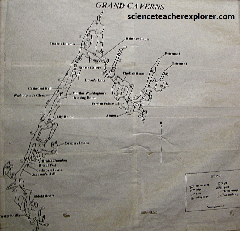
Discovered in 1804 and opened to the public 2 yrs. later, Grand Caverns is America’s oldest continuously operating commercial cavern. It zigzags almost 6.4km through Cambrian-age rock of the Conococheague Formation, in the Shenandoah Valley, the lowland Valley and Ridge region lying adjacent to the Blue Ridge Mountains, (Shenandoah National Park).
Grand Caverns form as acidic groundwater and precipitation dissolved limestone and is called a “solution cave”. This means the main agent of “speleogenesis” or cave-forming, is the process of dissolution from natural waters.
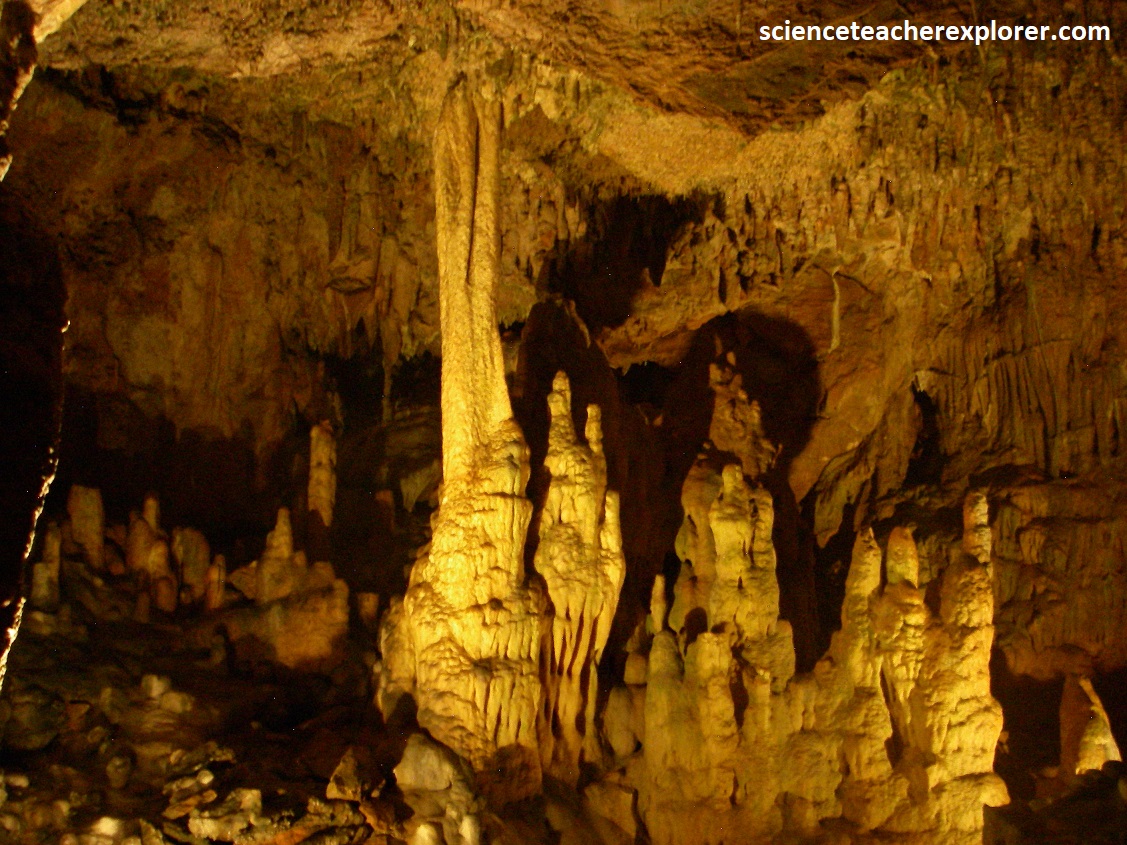
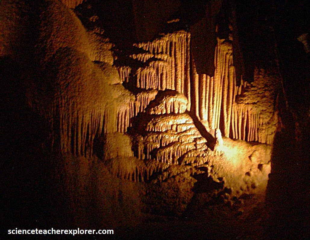
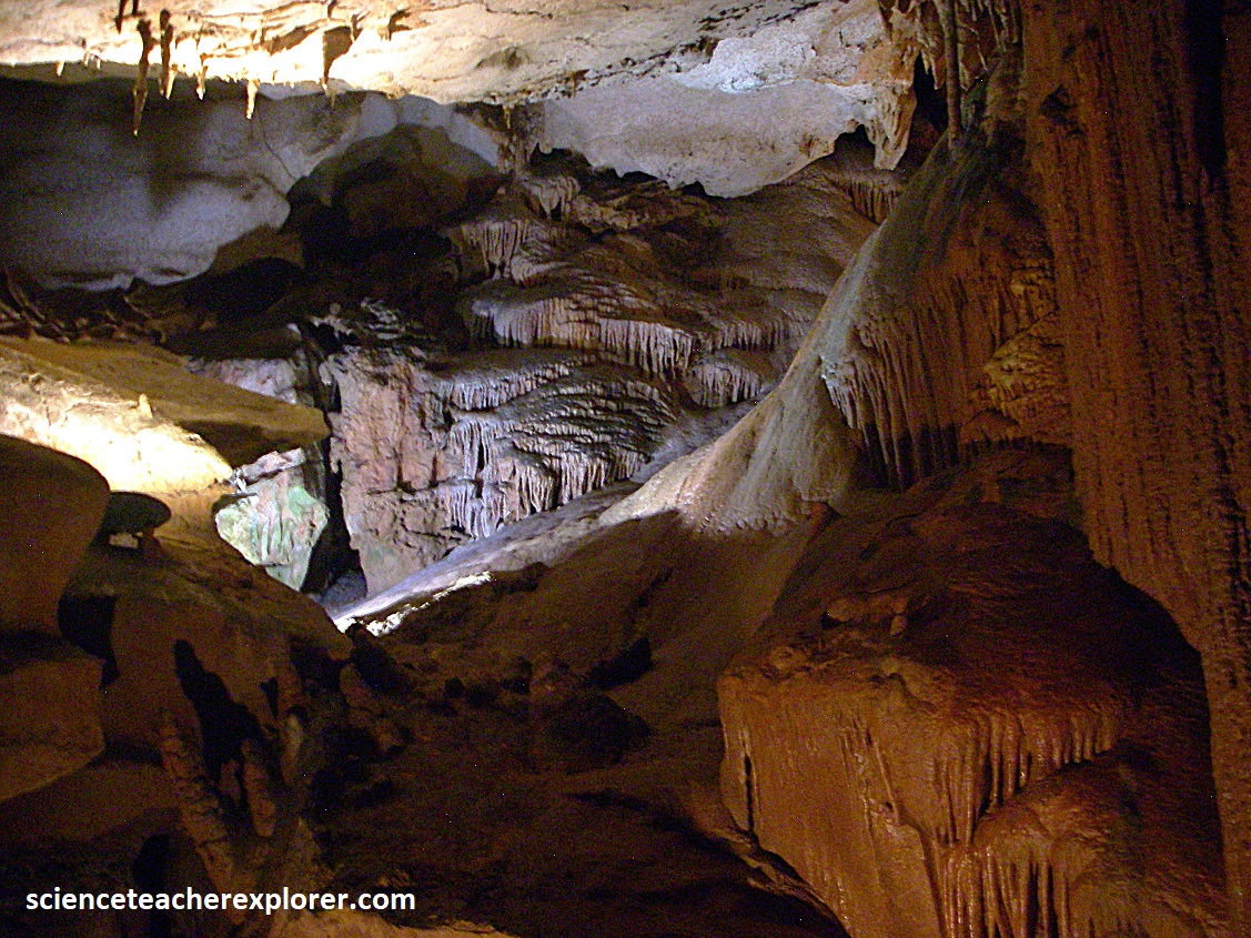
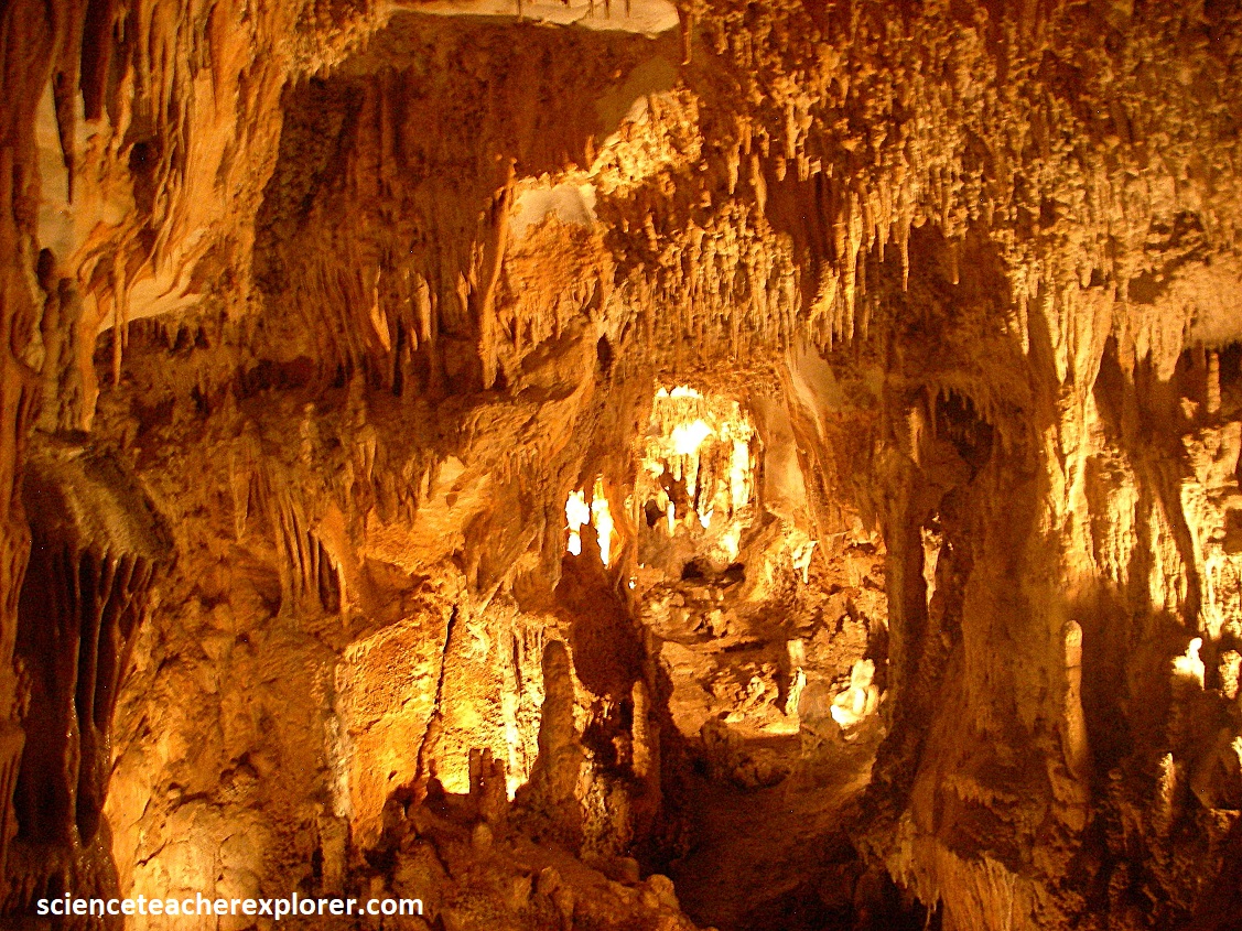
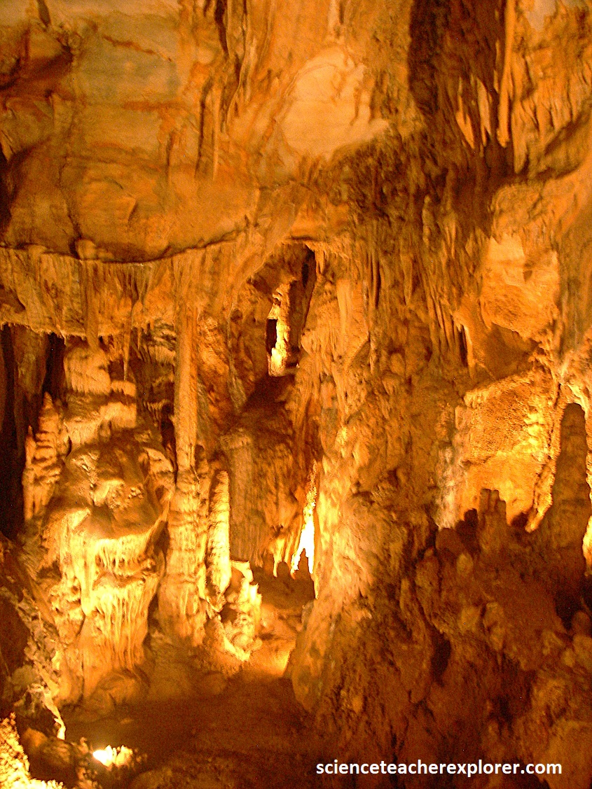
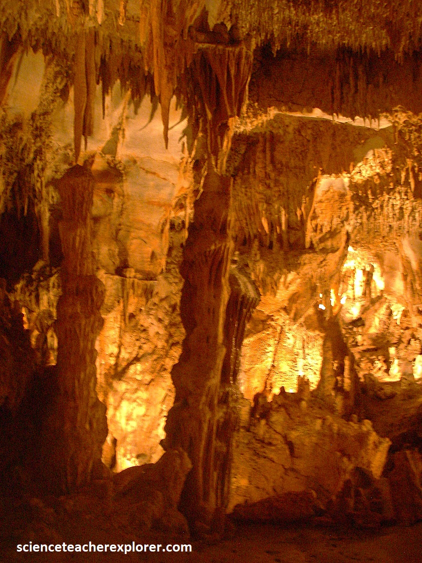
Pictured above and below, some of the rock in the Grand Cavern is made of microcrystalline limestone, (comprised of micro-particles), so tight that water cannot penetrate between the crystals. Compression, compaction, plus heat work together to create microcrystalline structures that cannot easily break. But sandstone, which is porous, is interbedded between layers of limestone, allows water to penetrate the layers and dissolve some of the rock to form the caverns.
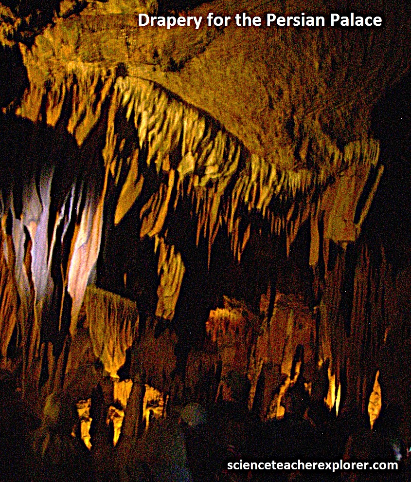
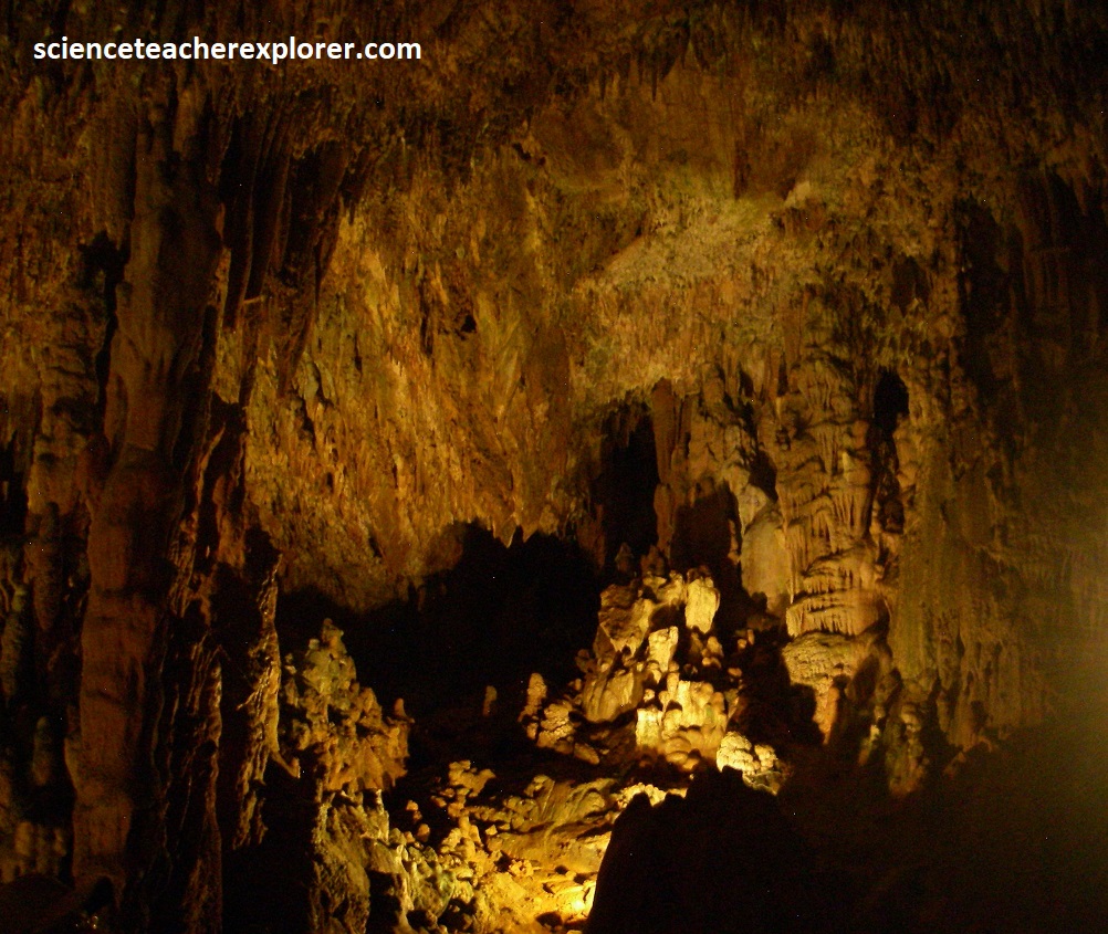
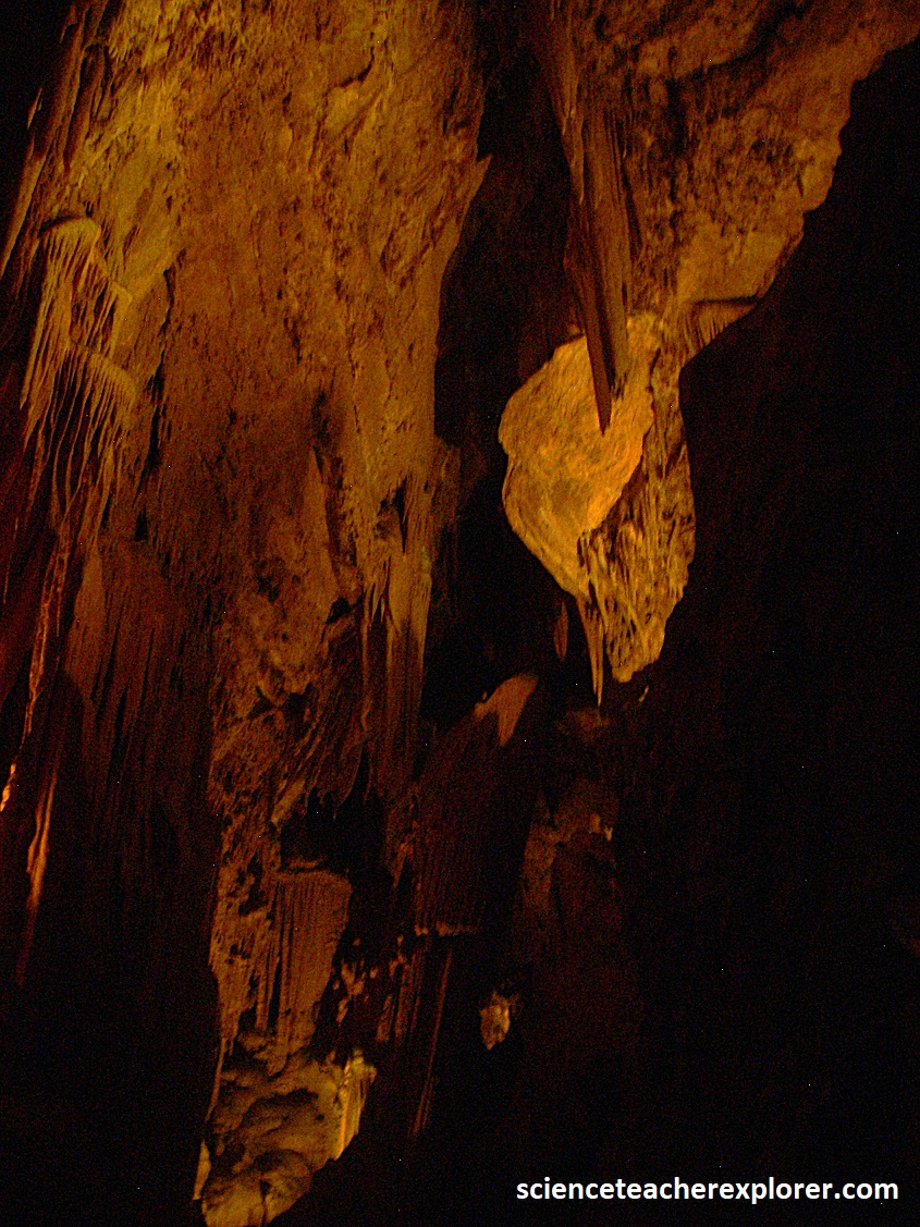
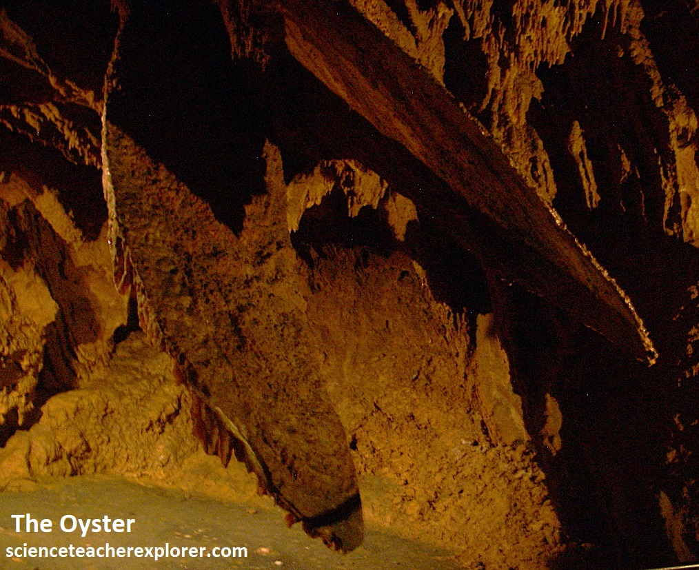
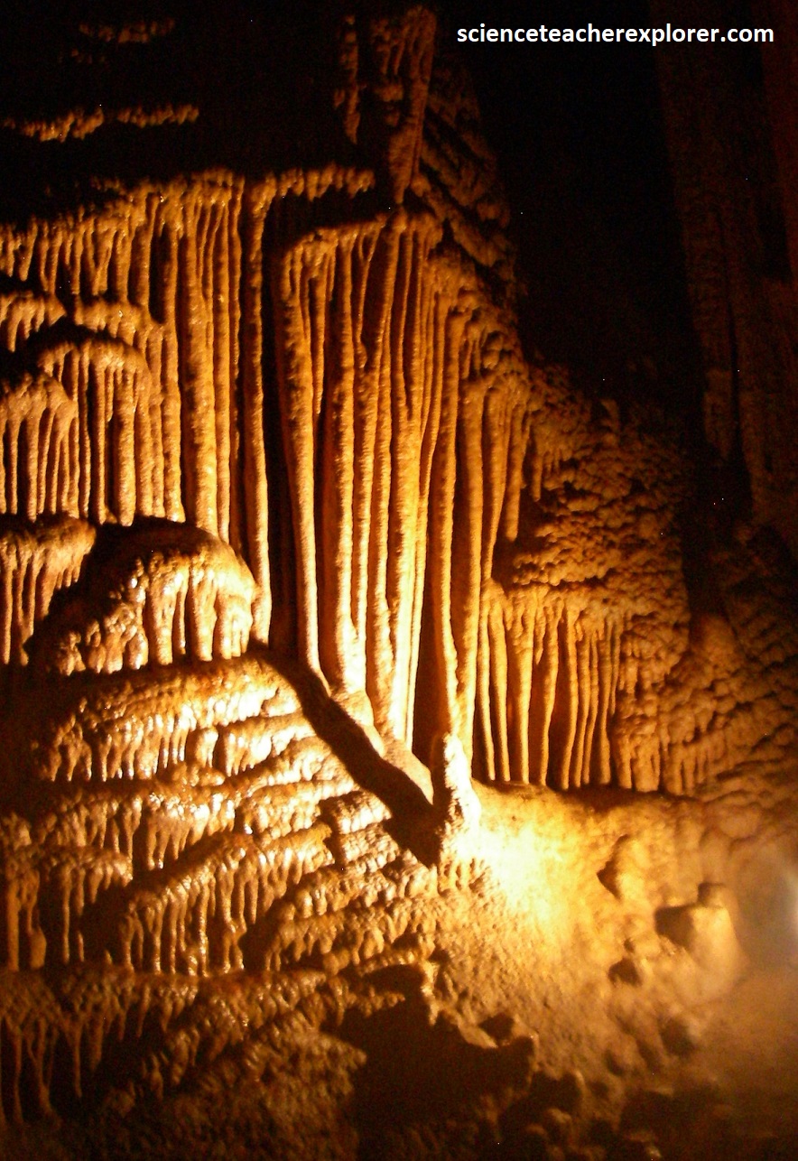
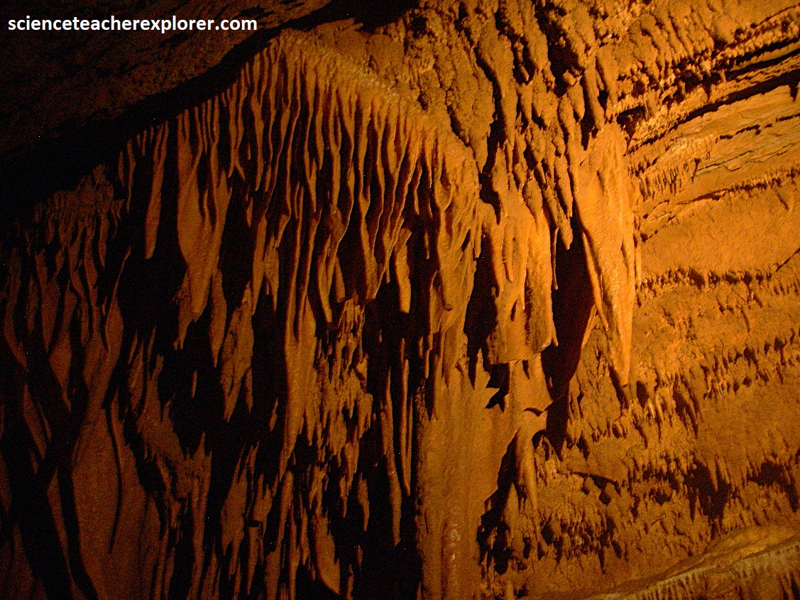
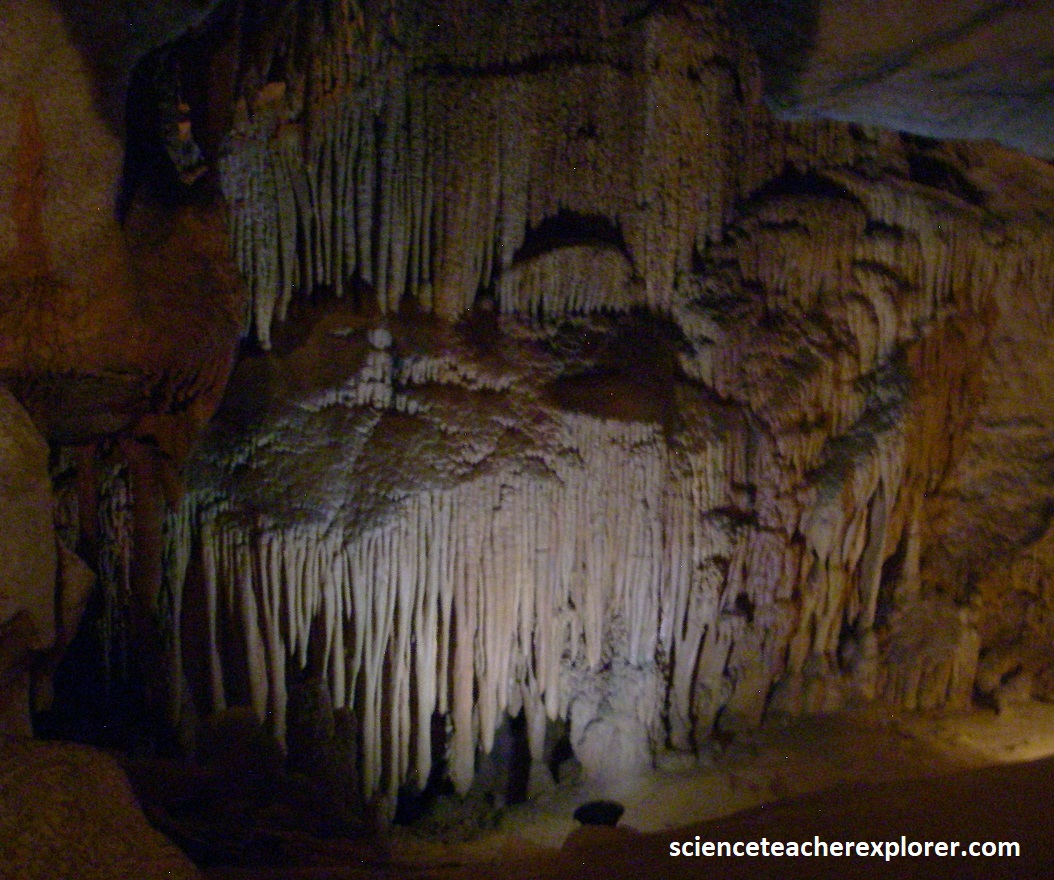
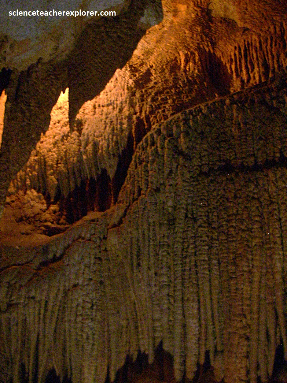
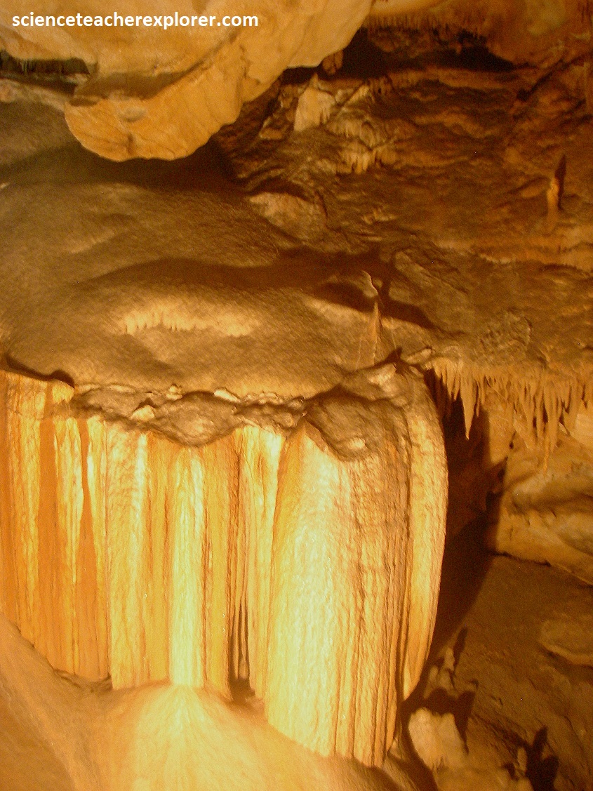
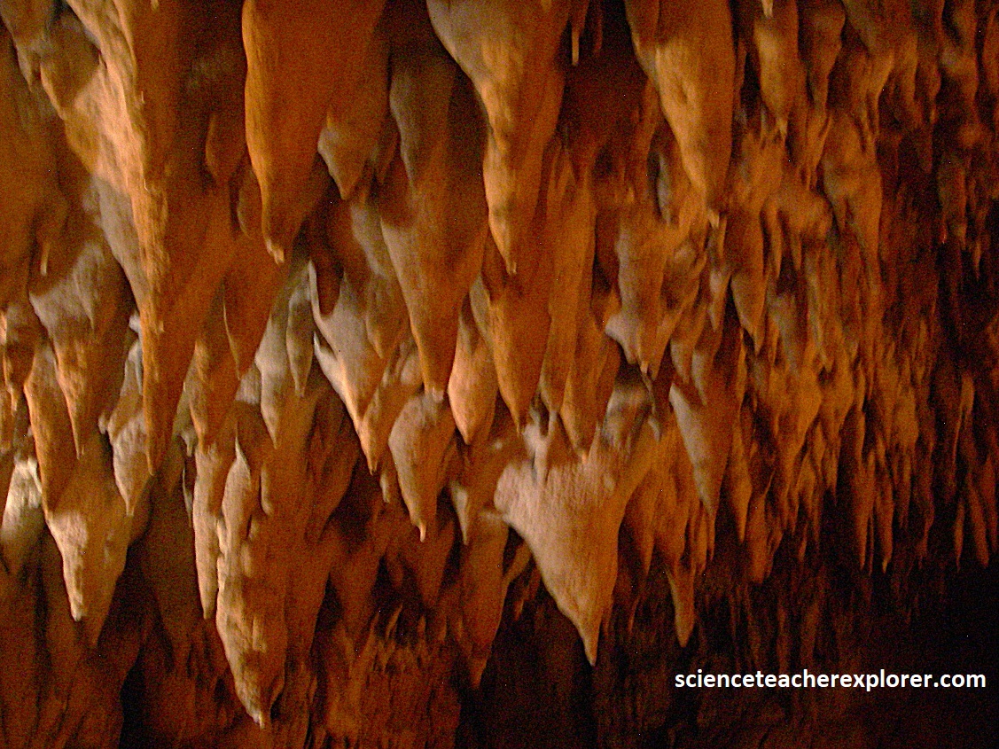
Pictured above and below, another important mineral in these caverns is calcite, (the white-colored deposits), which are the main component of speleothems.
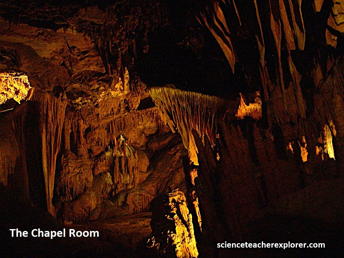
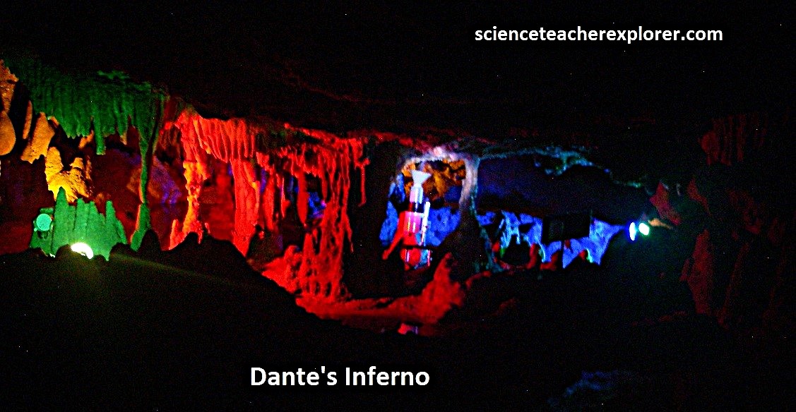
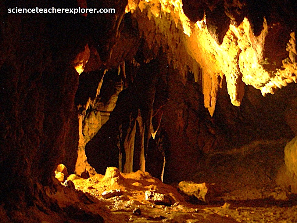
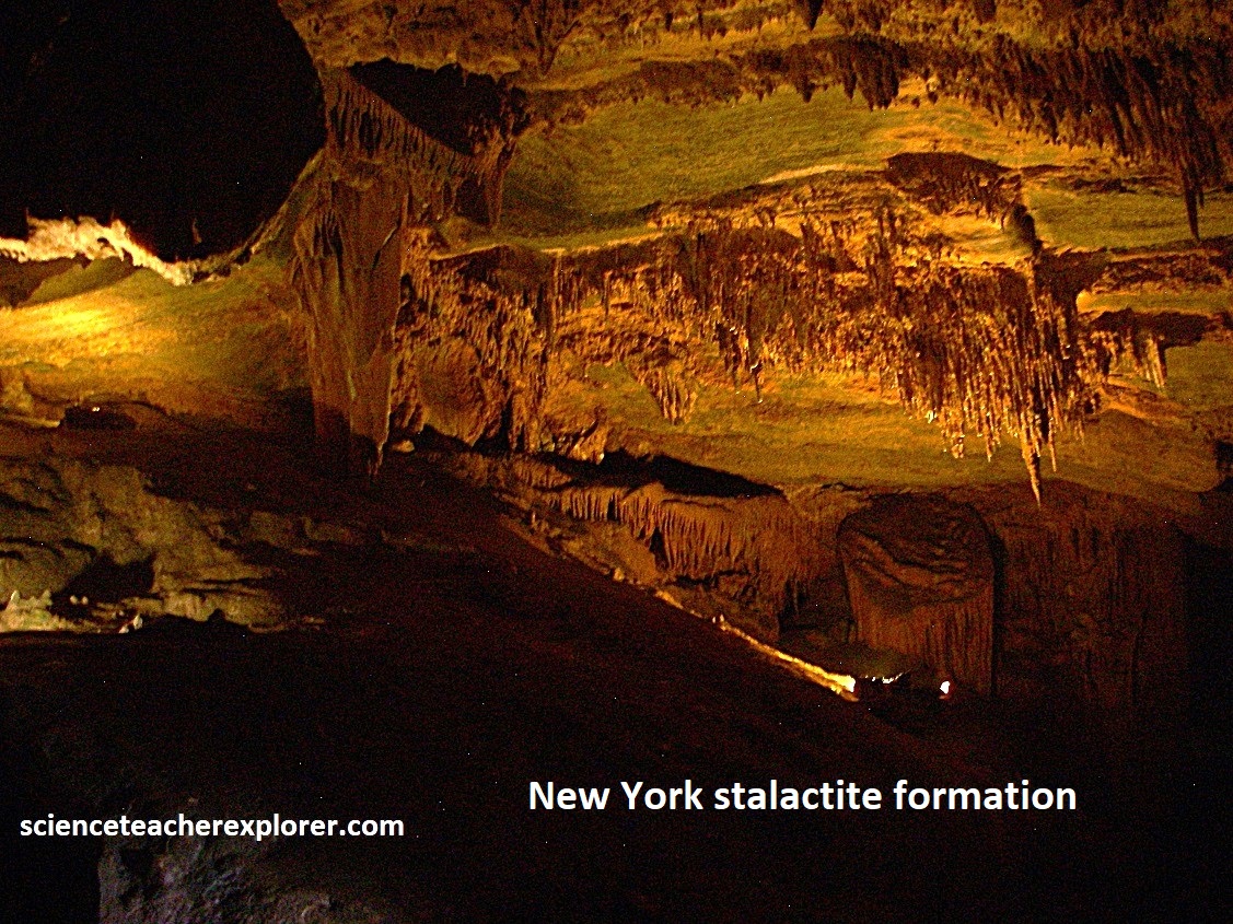
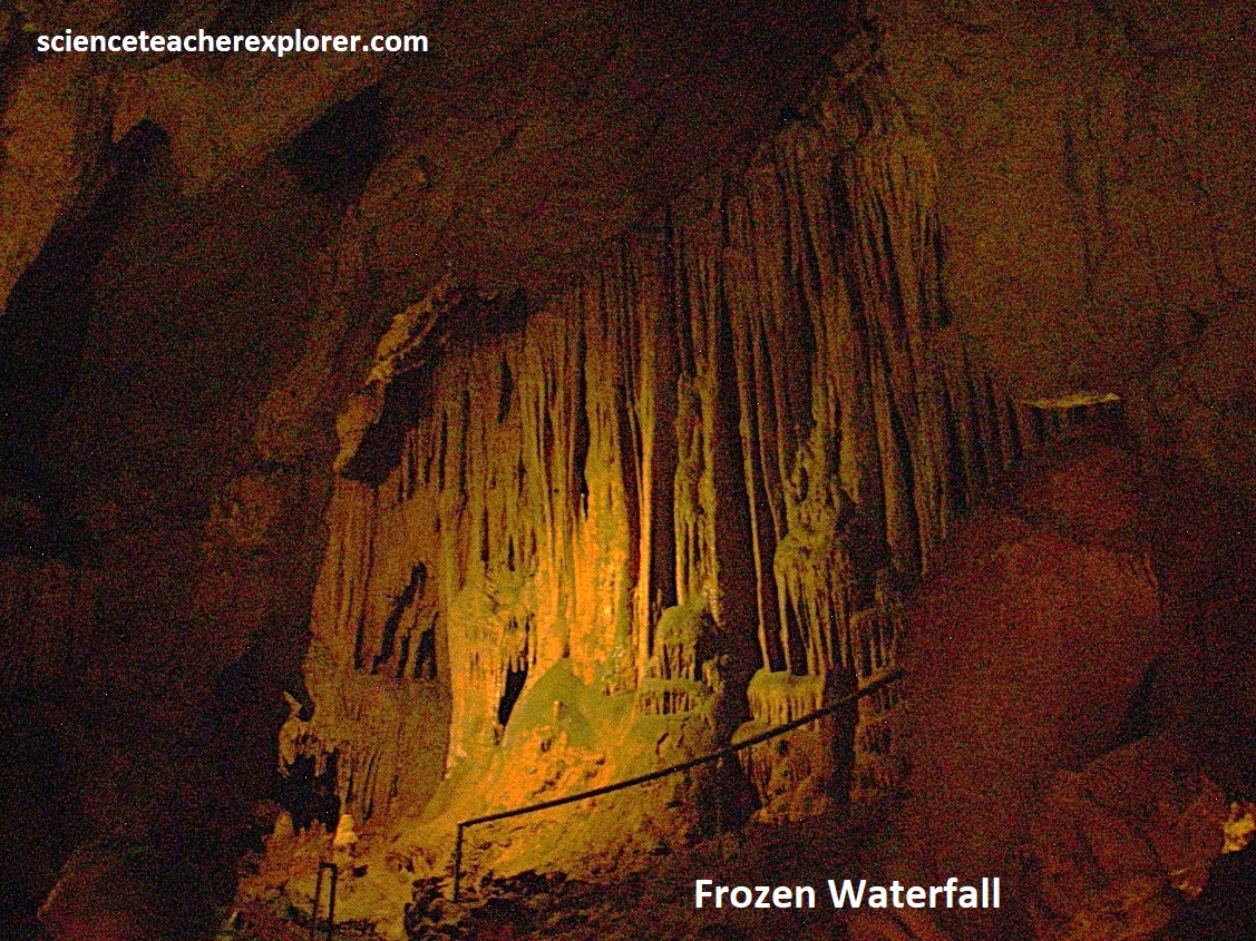
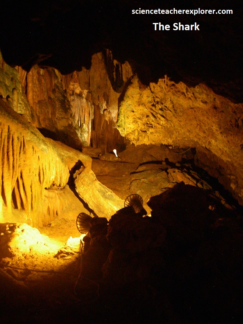
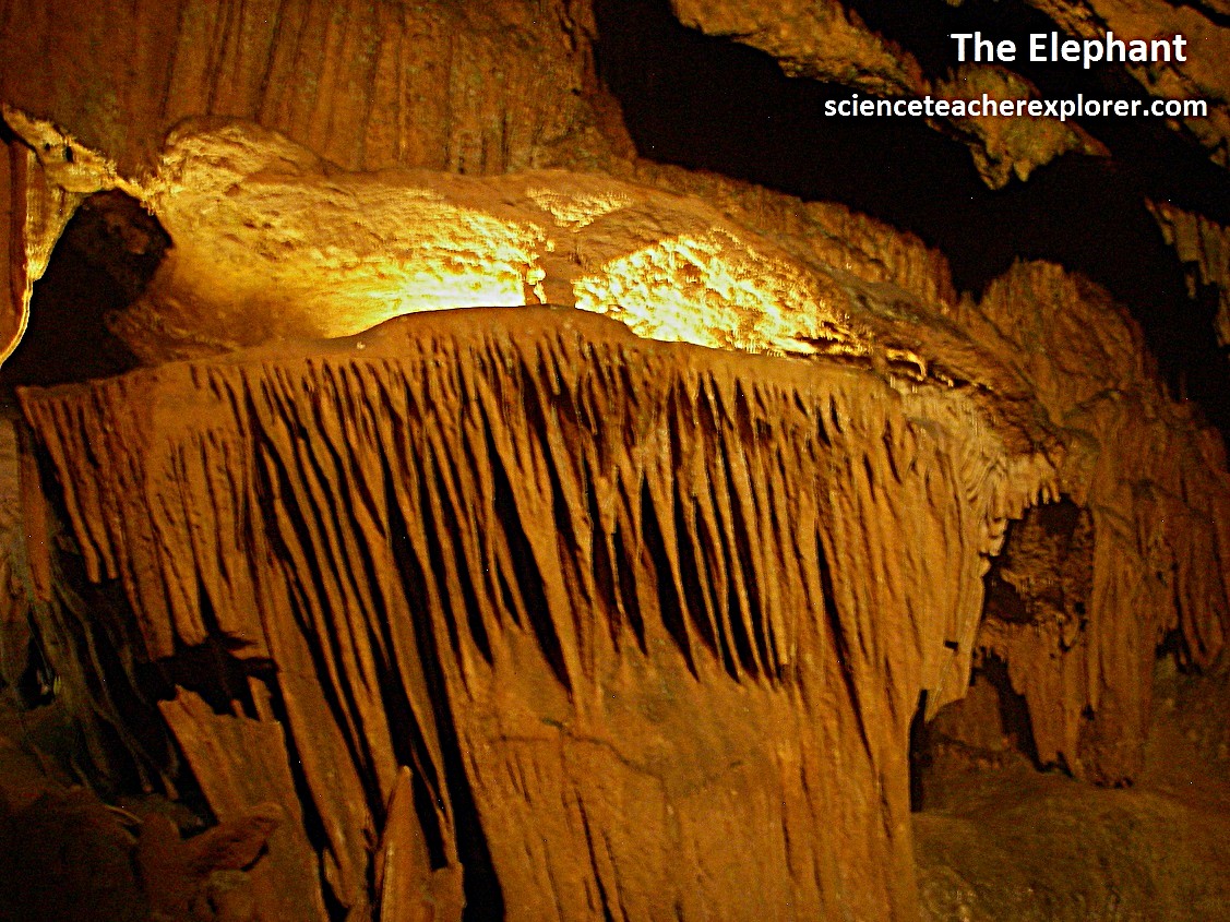
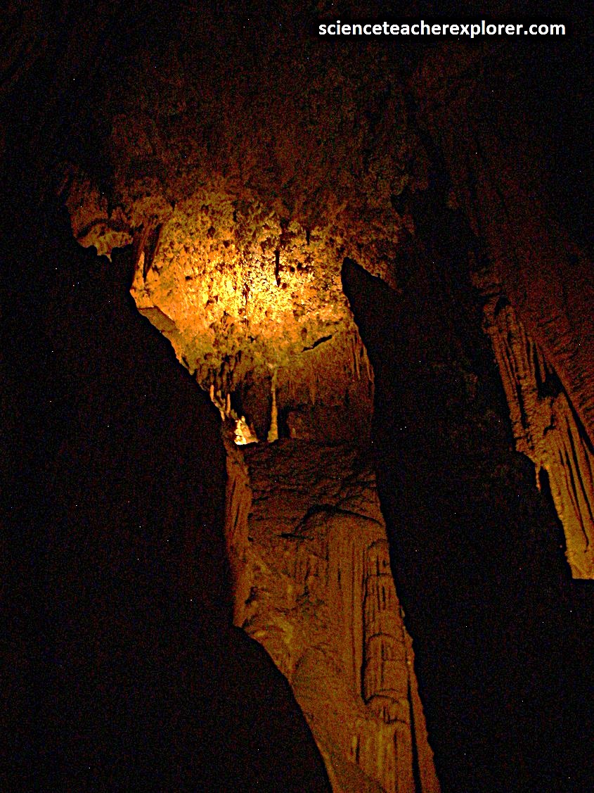
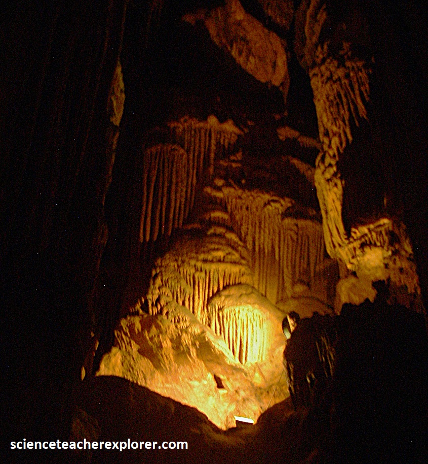
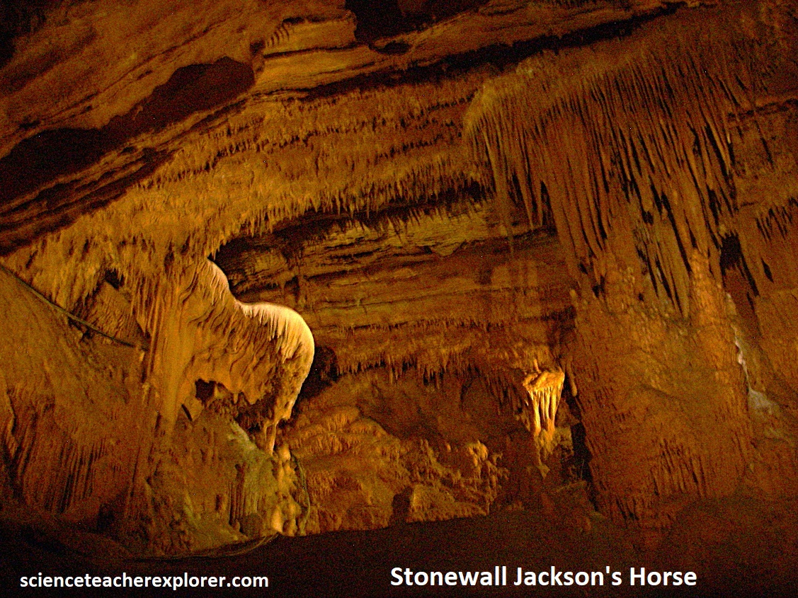
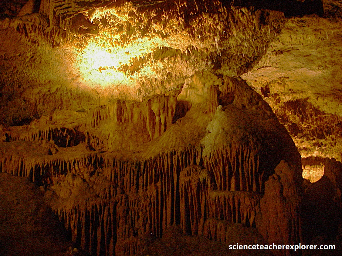
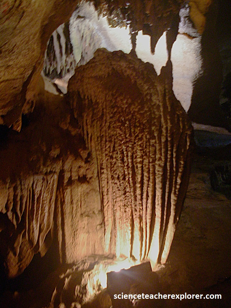
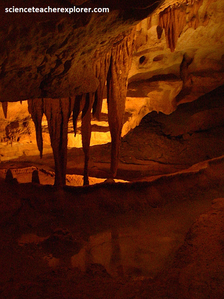
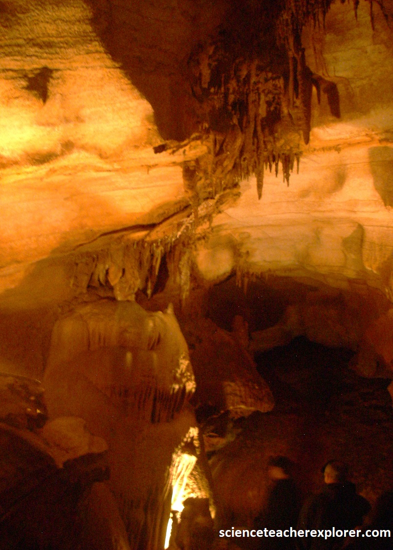
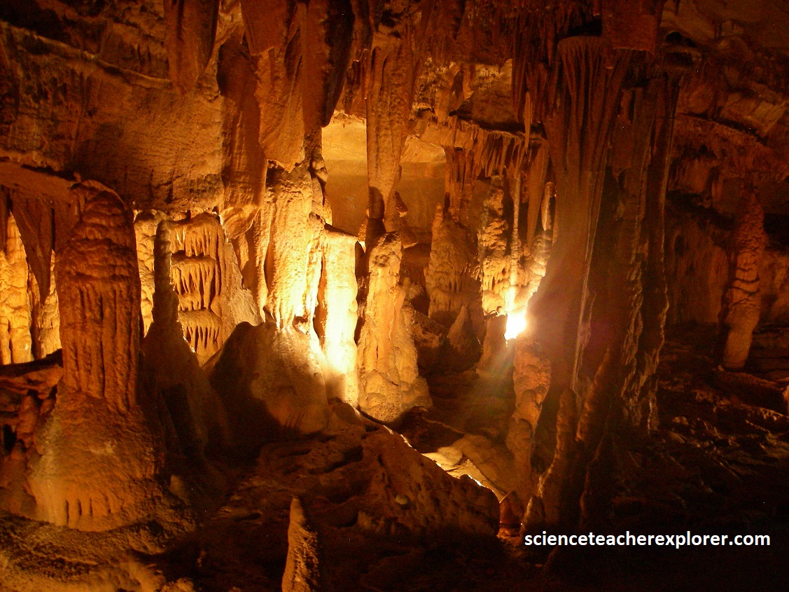
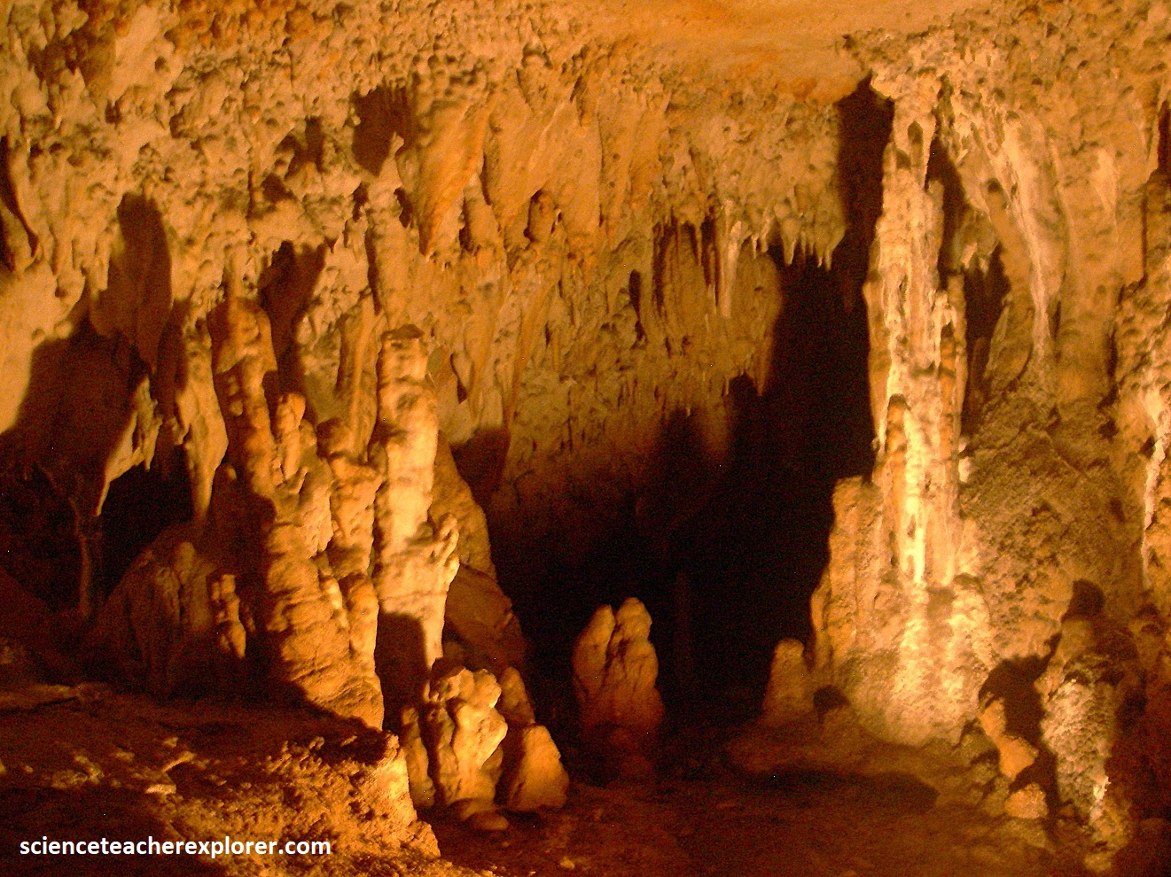
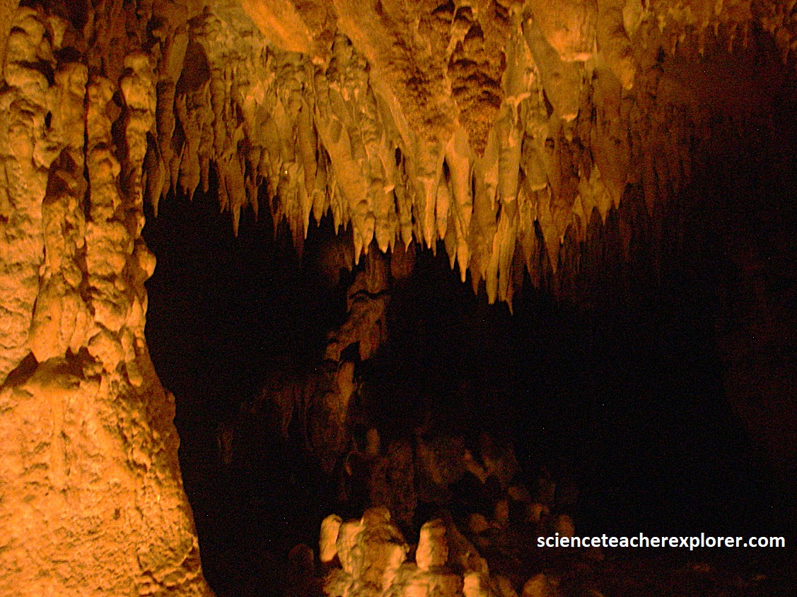
Grand Caverns is known for its abundance of shield formations. Pictured above & below, it is also replete with stalactites, stalagmites, columns (where stalactites and stalagmites meet), draperies and other flowstone formations.
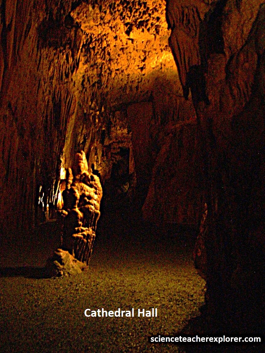
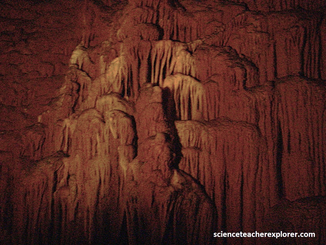
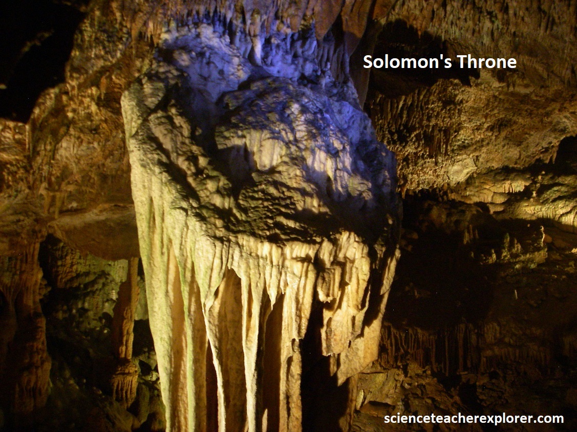
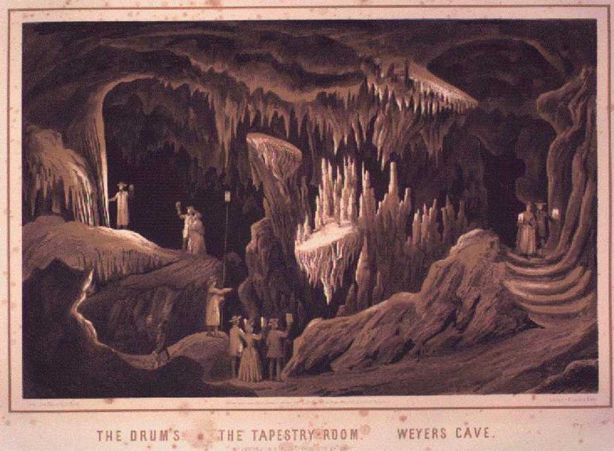
Pictured above on the left, the most stately room, “Cathedral Hall”, is 85m long and over 21m high. It is one of the largest rooms of any cavern in the eastern United States. As seen in my photos, other sights include “Bridal Veil”, “Stonewall Jackson’s Horse”, the “Tapestry Room”, and “Dante’s Inferno”.
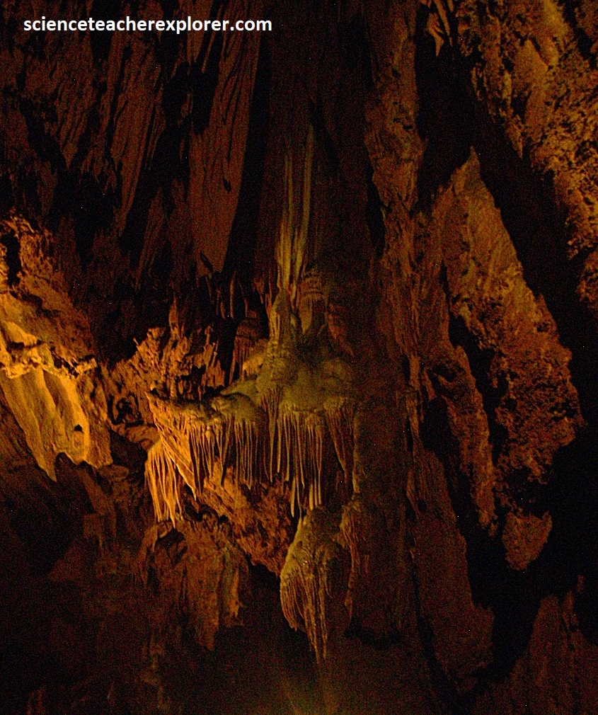
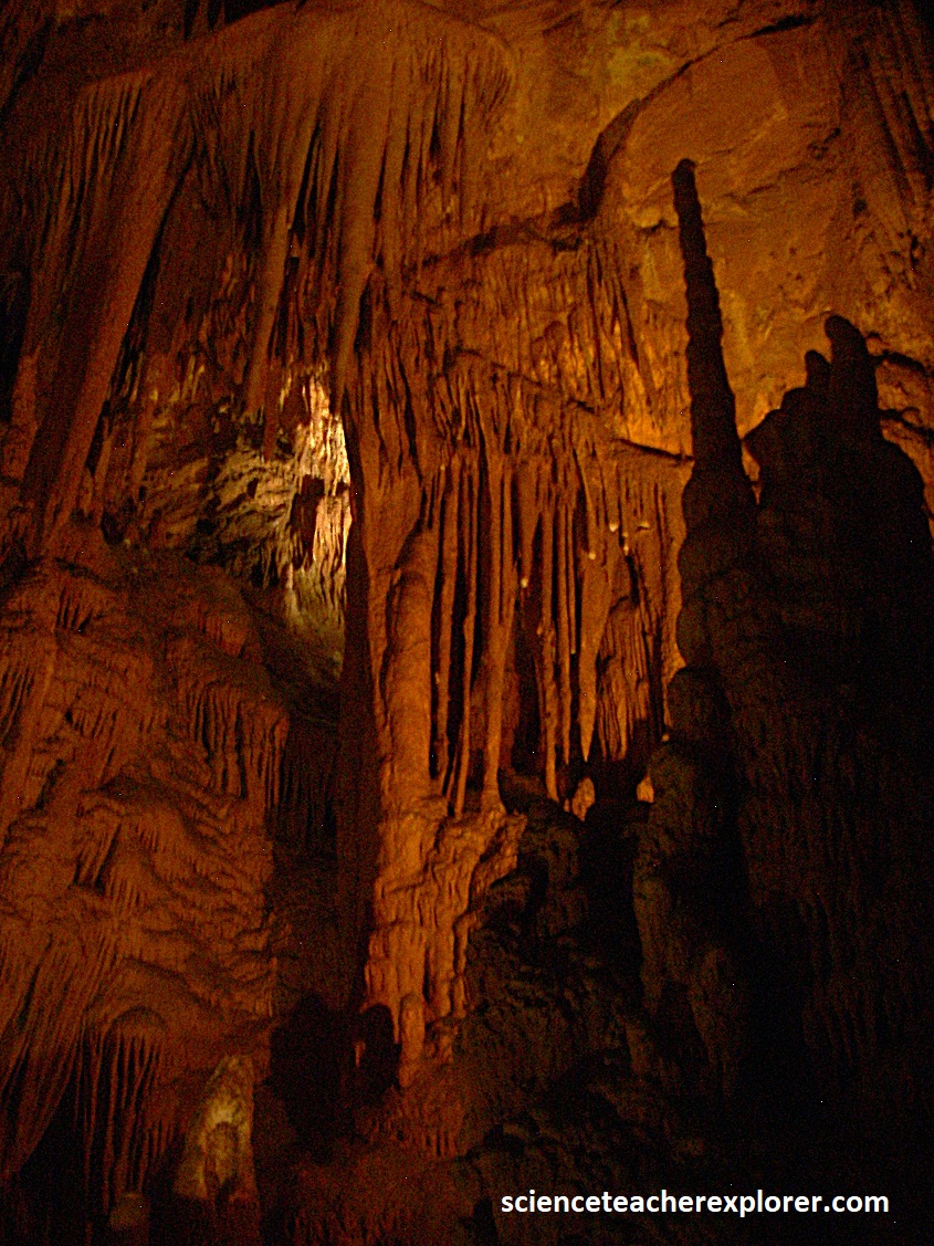
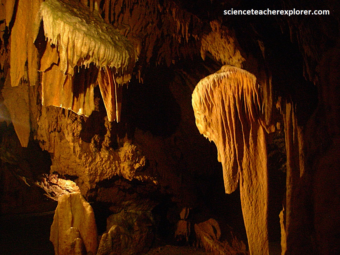
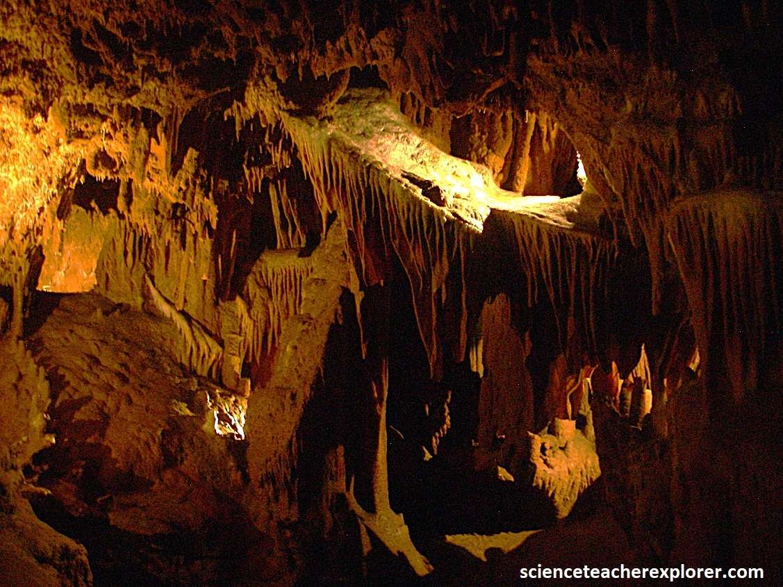
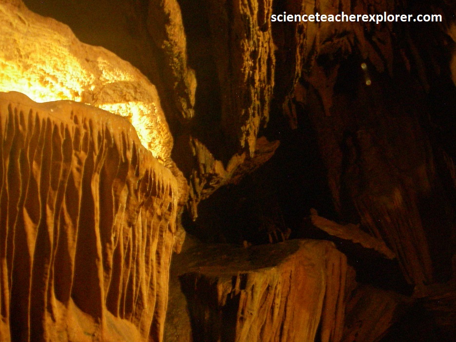
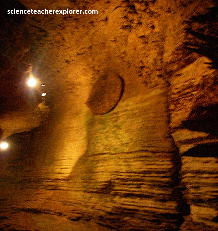
Pictured above, cave shields are composed of two parallel discs separated by a thin, planar space, through which water circulates. Water under pressure moves through thin bedrock fractures, enter the cave passage, and deposits calcium carbonate on either side of the fractures, creating plates of calcite that grow outwardly and radially along their rims and are separated from each other by a thin water-filled space. There are more than 250 of these giant clam-like calcite formations projecting from the walls, ceiling, and floor of Grand Caverns.
Cavern systems usually develop in rock that has remained undisturbed from the horizontal orientation at which it was deposited. However, the Grand Caverns formed with 500 million year old rock that stand on end, and upright position caused by continental compressive forces associated with the birth and development of the Appalachian Mountains. (The historical card seen below on the right is from a postcard found at the entrance).
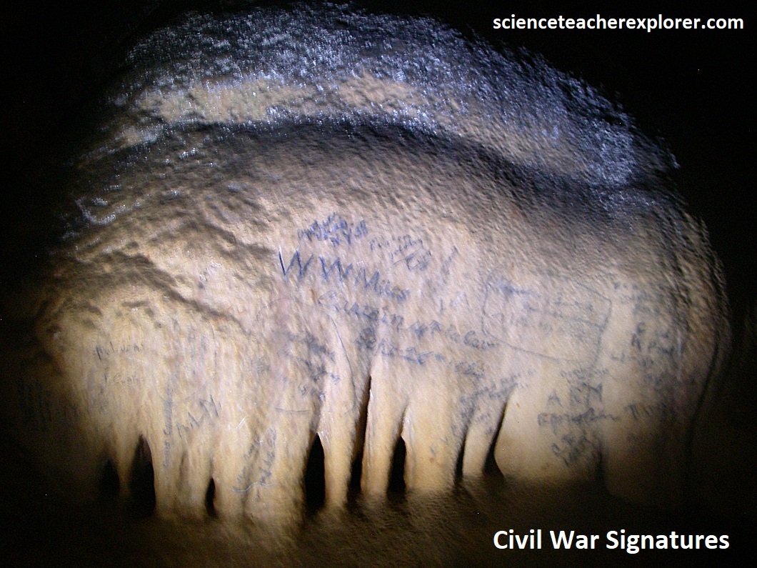
During the Civil War, the cave was visited by both Confederate and Union soldiers. During their visits, over 230 soldiers signed their names on the cave’s walls. One noted signature is that of W.W. Miles, signed on Sept. 26th, 1864. Once, Confederate General Stonewall Jackson was apparently camped near the entrance way and allowed his soldiers to visit the caverns, (pictured above).
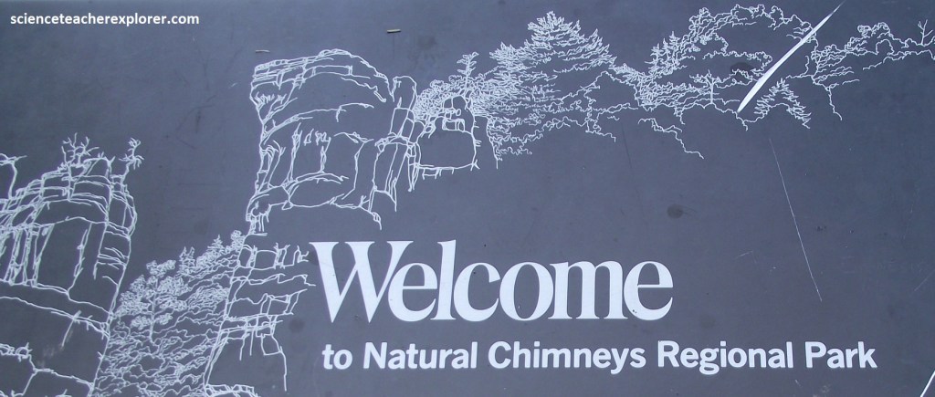
I continued to explore the Late-Cambrian Conococheage Formation by driving north on US340 to Elkton, turning left on US33 and driving to Harrisonburg. From there, I headed south on VA-42 to High Street to VA-747 (Mossy Creek Rd.). From there I turned left onto SR-747/SR-613/Mossy Creek Rd., then right onto SR-731/Natural Chimney Rd. where, at the fork, I went right onto SR-936/Natural Chimney Ln.. This brought me to a parking lot at the Natural Chimneys Park in Virginia, (pictured below).
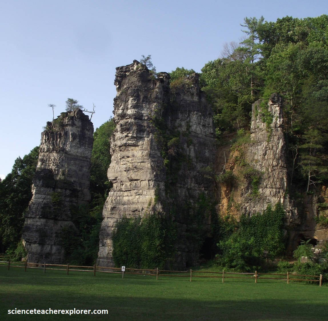
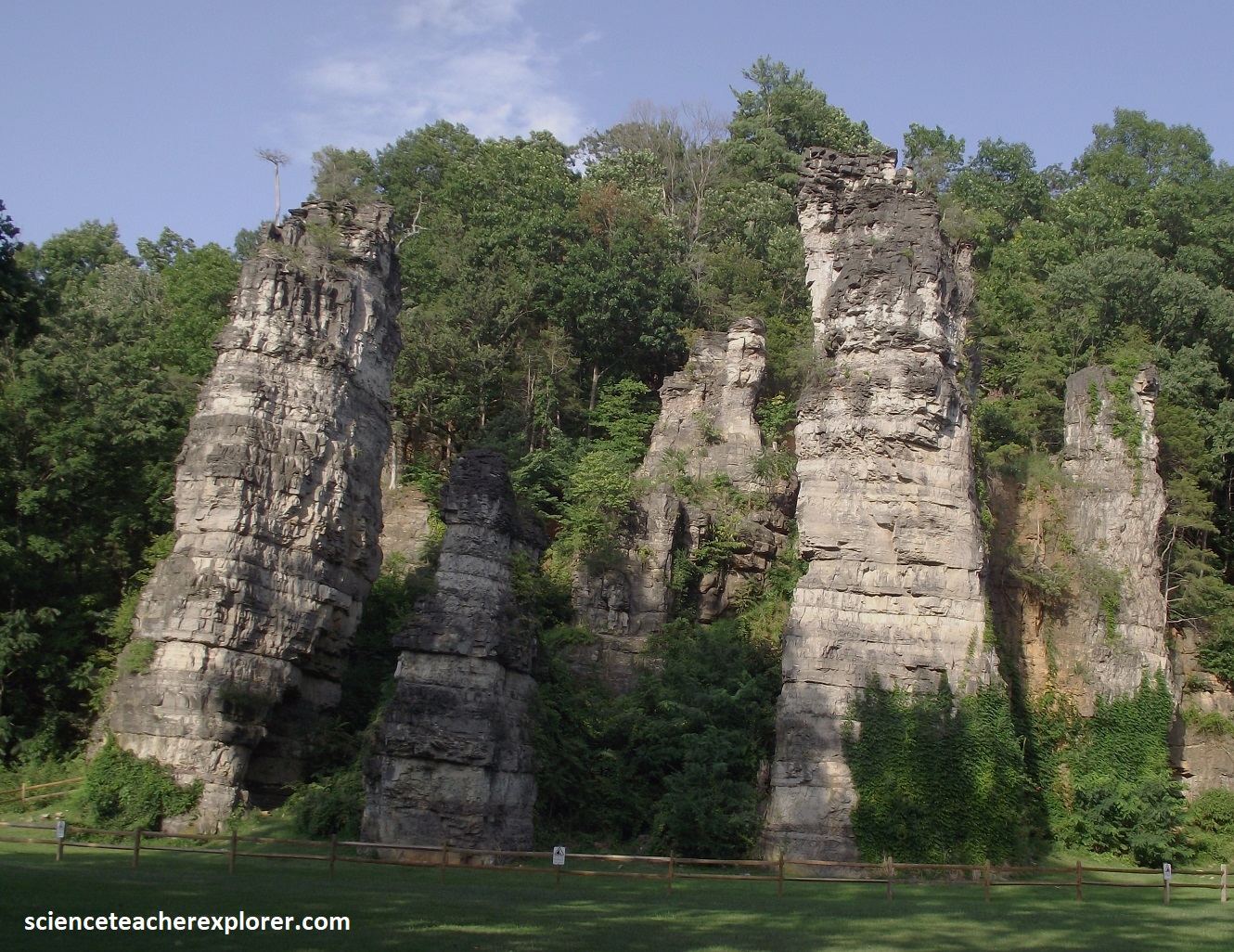
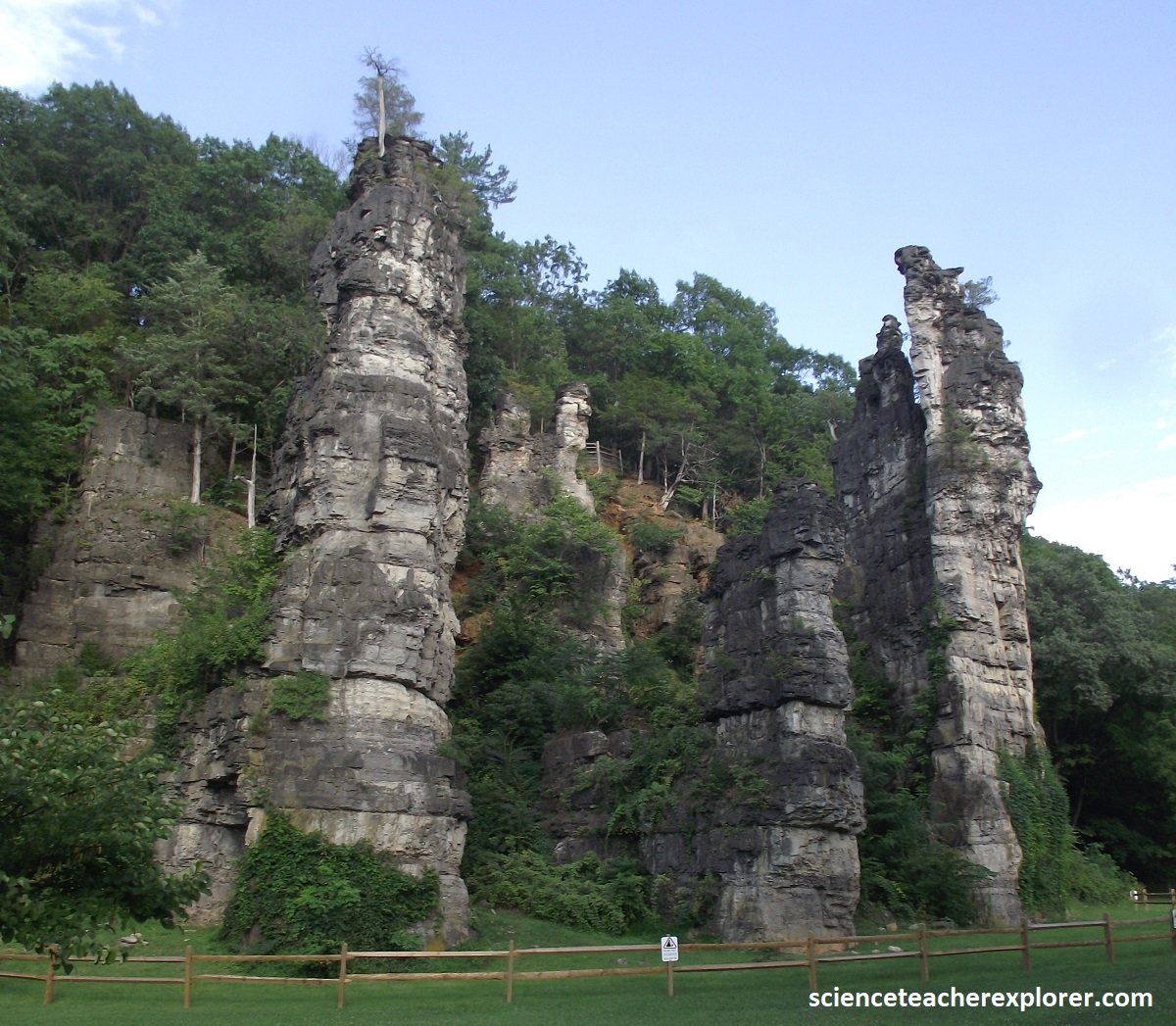
Pictured above, Natural Chimneys is an extraordinary collection of 7 imposing rock structures whose story begins with the deposition of the Conococheage Formation some 500 million years ago, during the Cambrian Period, when the region was inundated by an inland sea.
Imaged above, in the shallow Cambrian sea churning with new life, small shell forming animals with a variety of other marine life began their life and death cycle. Countless millions of years later their shells and remains, now accumulated on the sea floor, had compressed and hardened into what is now known as limestone.
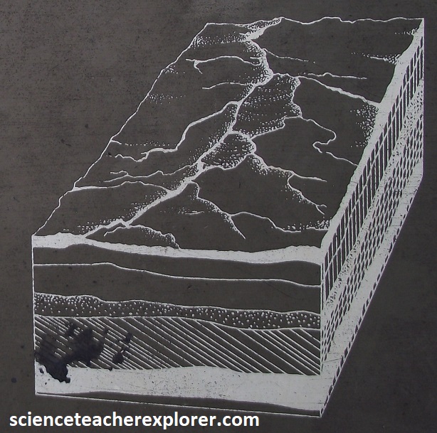
Image above, the earth, tormented within, began a period of restlessness. Upheaval and movement resulted in the formation of the ancestral Appalachian Mountains. Rock layers, formed on the ancient sea floor, were lifted up and folded. The intense pressures from this upheaval left their mark, fracturing and splitting the rock, forming cracks and fissures.
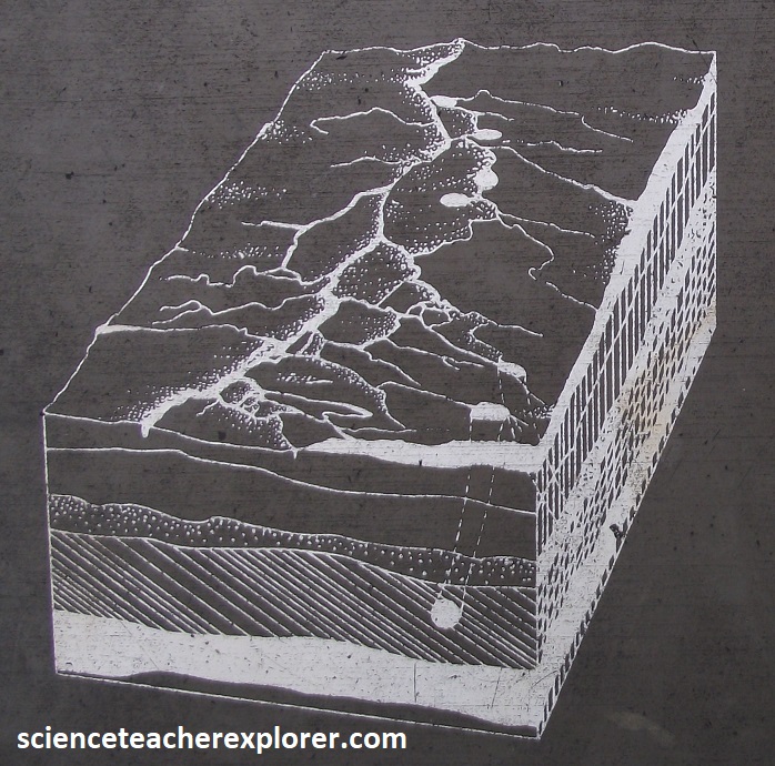
Imaged above, rainwater, churning, swirling, searching for the sea, seeped through cracks and fissures, dissolving the weaker areas and carving underground channels. Sinkholes and a network of interconnecting passages and tunnels tell this story today. The ever moving water, dissolving various and sundry minerals on its journey, including iron and magnesium, redeposited these passengers in limestone layers below. Reinforce by new minerals, some limestone layers become harder and can be identified today by the rusty patches on their sides.
Imaged above, the forerunner of today’s North River began cutting into the layers of limestone, and the ancient sinkholes and the limestone around them were exposed to view. As the erosive process isolated the towers, the hard upper layers of chert protected the limestone beneath from destruction, forming vertical pillars of stone. At times during this erosive process the North River lapped against the pillars, and chimneys, at levels as high as 25m from the ground.
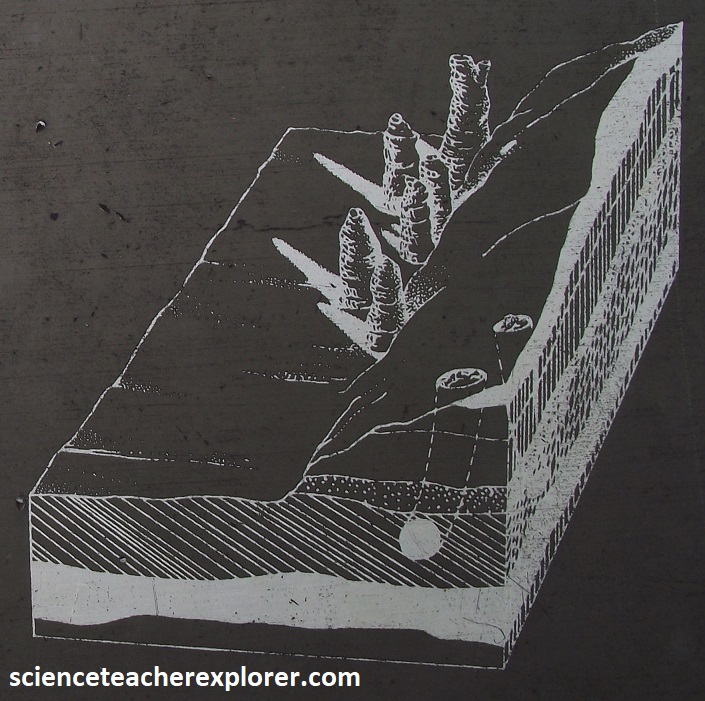
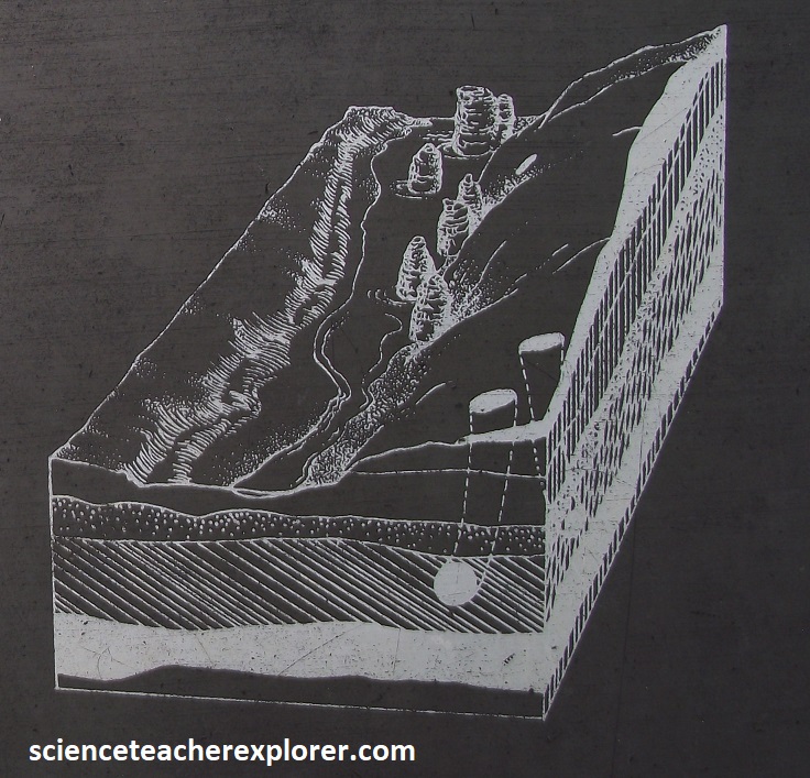
Imaged above, the Natural Chimneys are now erosion remnants of a former fissure cave system, a geologic curiosity unique in the eastern United States. However, processes of erosion continue their relentless work. In some future time, these mighty stone pillars will have been worn completely away.
I then drove north on the backroads, until I reached US33, where I turned east towards Harrisonburg. Just about 20 km west of Harrisonburg, on US33, I viewed a fascinating site. On the southside of road, rose a tree-covered cone called the Mole Hill. The Mole Hill is crowned by exposures of basalt from volcanic activity that has been dated to be 47 million years old. Rising about 134m above the landscape, the basalt consists of a fine-grained texture that has pepper-corn-sized crystals of olivine, (one of the first minerals to form when molten rock cools. It is probable the remains of a plug, a vertical, pipe-like body of cooled magma that represents the conduit of a former volcanic vent. This is very strange for this area, and proves that there are young events of volcanism in Shenandoah Valley.
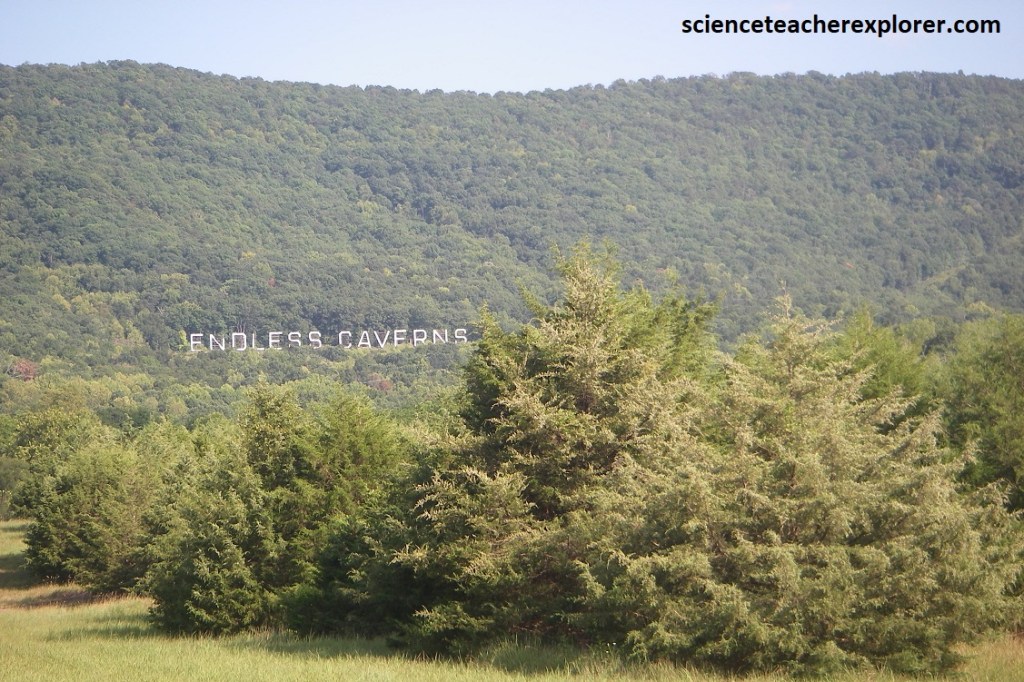
My next trekking experience is to explore the “Endless Caverns”, pictured above. To get there from Harrisonburg, I drove northeast on I-81 for 29km, and exited onto US-11 and drove another 24 northeast where I turned right onto Endless Cavern Rd.
Thick sequences of carbonate strata that constitute the basement of the Shenandoah Valley create an ideal foundation for the development of caves. For millions of years, carbon dioxide, (from dilute concentrations of carbonic acid introduced by charged rains that have fallen to Earth), soaked the ground, seeped into available cracks, and slowly dissolved the limestone bedrock and forming sinuous underground passageways of great length. They have yet to find an end to the complex network of under-gound passageways at Endless Caverns. Overall, this dissolution results in the formation of a karst surface.
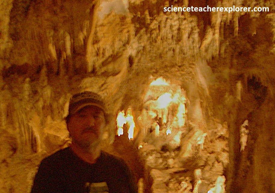
Pictured above, initially swamped with water, cavern systems can become dry when either the land is elevated or the groundwater level is lowered. Once dry, a range of cavern formations, including flowstone, stalagmites, stalactites, and soda straws, begin to ornament ceiling, walls, and floors. These form as the mineral calcium carbonate precipitates from the rainwater percolating into the underground voids. {Photos below were taken at the “Endless Caverns, Virginia in 2024, (I’m standing in the last photo that is a bit blurry).}
Pictured above, “Endless Caverns” is a fairyland of signature limestone features, such as: shields, rimstone, mammary shaped stalactites, ruffle-like terraces that radiate across the cave floor, icicle-like pendants, circular plates separated by thin cracks, semicircular grooves worn into the limestone walls, remnants of subterranean channels, and cavern-developing streams.
