Smoky Hills, KS 2024
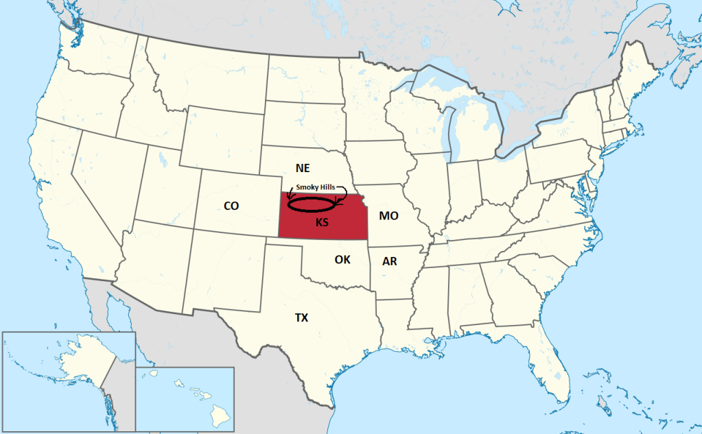
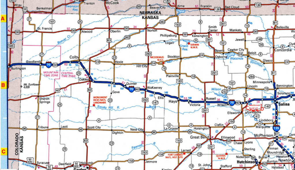
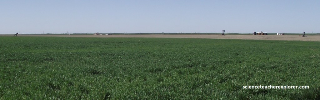
During the Summer of 2024, I found myself exploring/trekking in northwestern Kansas while driving from Topeka to Oakley on I-70, {imaged below}.
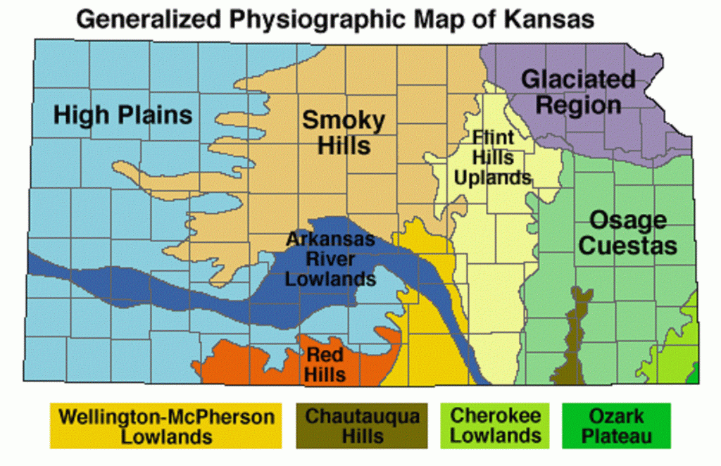
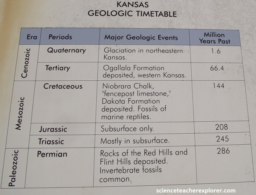
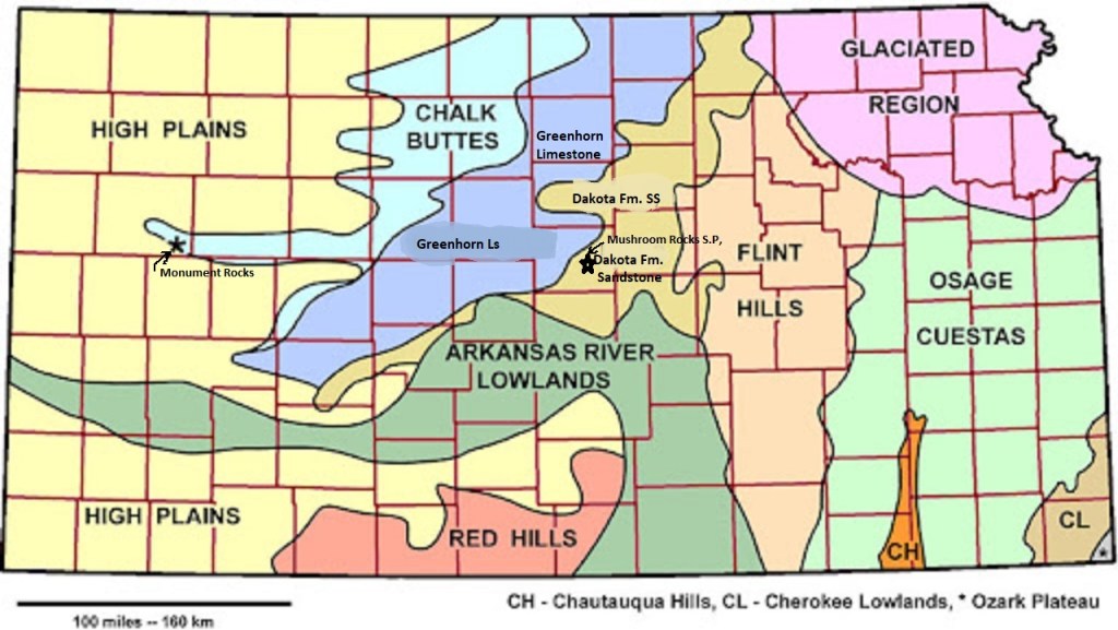
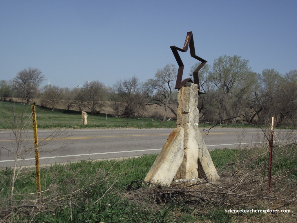
Much of the northcentral region of Kansas is considered the Smoky Hills. Actually, the Smoky Hills are an upland region of hills in the central Great Plains of North America that encompasses north-central Kansas and a small portion of south-central Nebraska. The hills are a dissected plain covered by tallgrass and mixed-grass prairie. However, the region is divided into three regions based on the underlying Cretaceous rock outcroppings of the Dakota Sandstone, the Greenhorn Limestone, and the Niobrara Chalk, (imaged below).
As mentioned above, I started exploring areas around I-70 that were considered geological wonders. These areas were found near Ellsworth, Russell and Oakley Kansas, (imaged below)
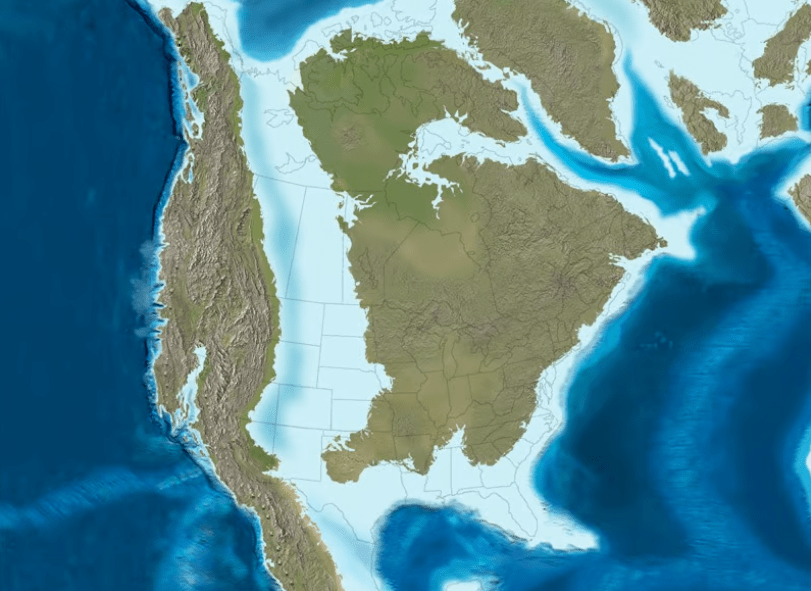
The Cretaceous rocks of Kansas contain abundant remains of late Mesozoic marine life, including some of the best fossils in the world from this time period. Fossils of marine invertebrates indicate that a warm, shallow sea covered the western part of the state, while terrestrial plant fossils and coal seams in central Kansas represent near-shore swamps. These swamps mark the shore of the great Western Interior Seaway, which divided North America into two landmasses as it extended from the Gulf of Mexico to the Arctic Ocean.
Most Cretaceous fossils in western Kansas are found in chalk, a carbonate rock made up primarily of the fossils of microscopic marine algae, called coccolithophores. Today, such sediments accumulate mainly in the deep sea, but during the Cretaceous, when sea levels were much higher than today, chalk accumulated in shallow (100 – 300 meter) inland seas in both North America and Europe. The Cretaceous period is named for the abundance of chalk that accumulated during this time; the Latin word for chalk is “creta“.
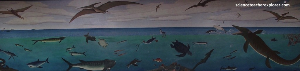
In the Western Interior Seaway, chalk formed in marine environments with relatively little wave or current energy, and on seafloors where dissolved oxygen concentrations were low. This led to conditions that were not particularly favorable for bottom-living organisms, but that were exceptionally good for preserving whatever died there. The Smoky Hill Chalk Member of the Niobrara Chalk Formation is famous for its spectacularly preserved marine vertebrates, (imaged below).
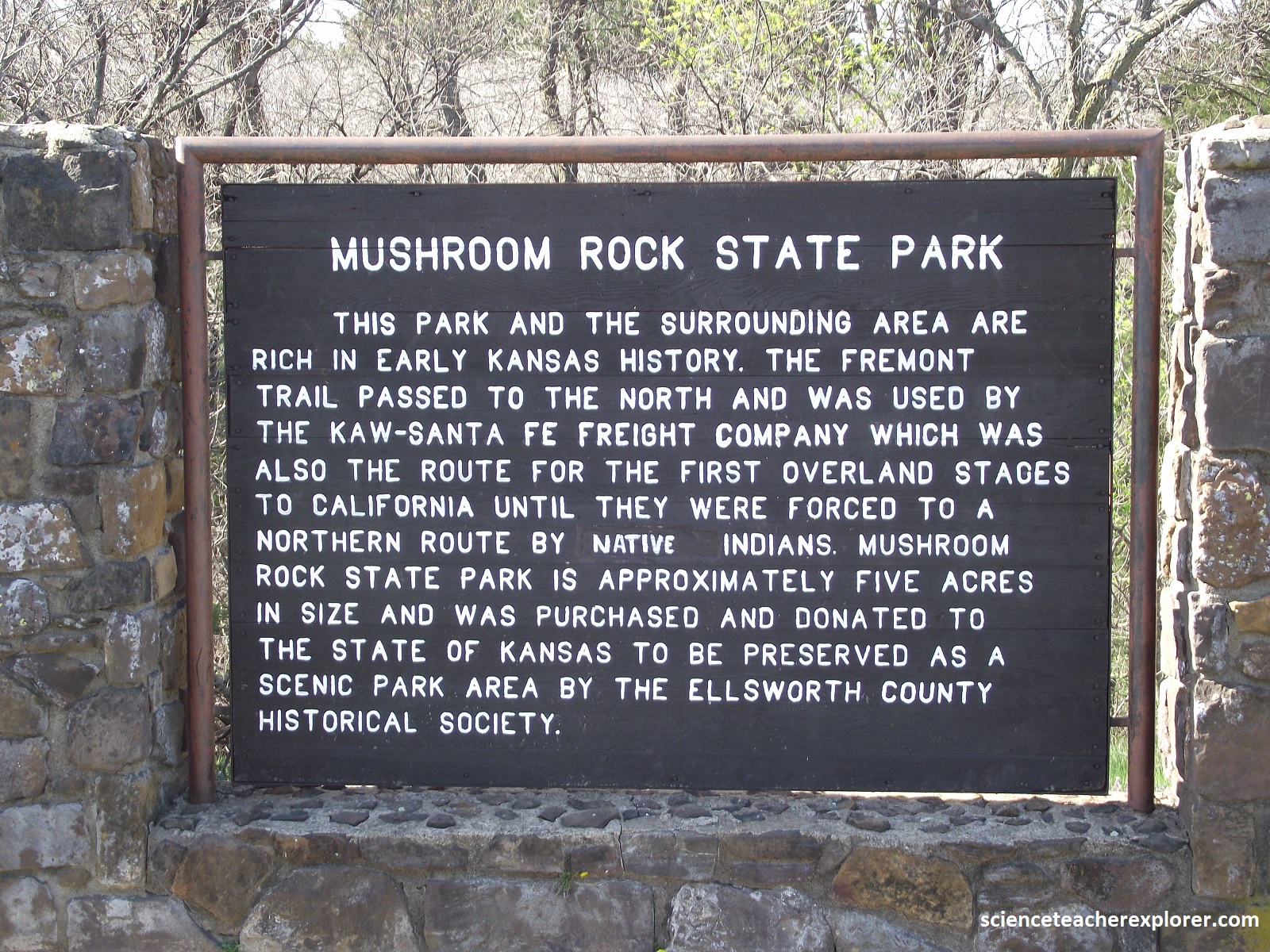
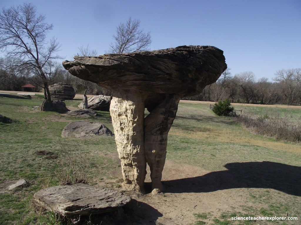
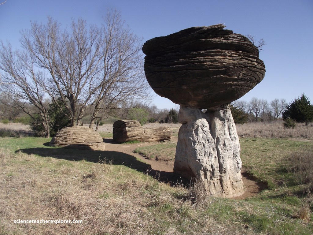
My primary focus of exploration in the Smoky Hills, Kansas was to visit a site that gave me the best look at the Dakota Sandstone near I-70. The Dakota Formation sandstones crop out in a wide belt from Rice and McPherson counties, in the south, to Washington County, in the north (at the border). They are the remains of beach sands and sediments dumped by rivers draining into the early Cretaceous seas. The hills and buttes in this part of the Smoky Hills, such as Coronado Heights in Saline County, are capped by this sandstone and rise sharply above the surrounding plains. It is apparent that the Dakota Formation forms the eastern region and the most notable is the concretions at Mushroom Rock State Par in Ellsworth County, Kansas.
Mushroom Rock State Park showcases the rare Dakota Sandstone concretions that are found to be up to 9 m in diameter and deposited 100 million years ago during the Cretaceous Period, (pictured below).
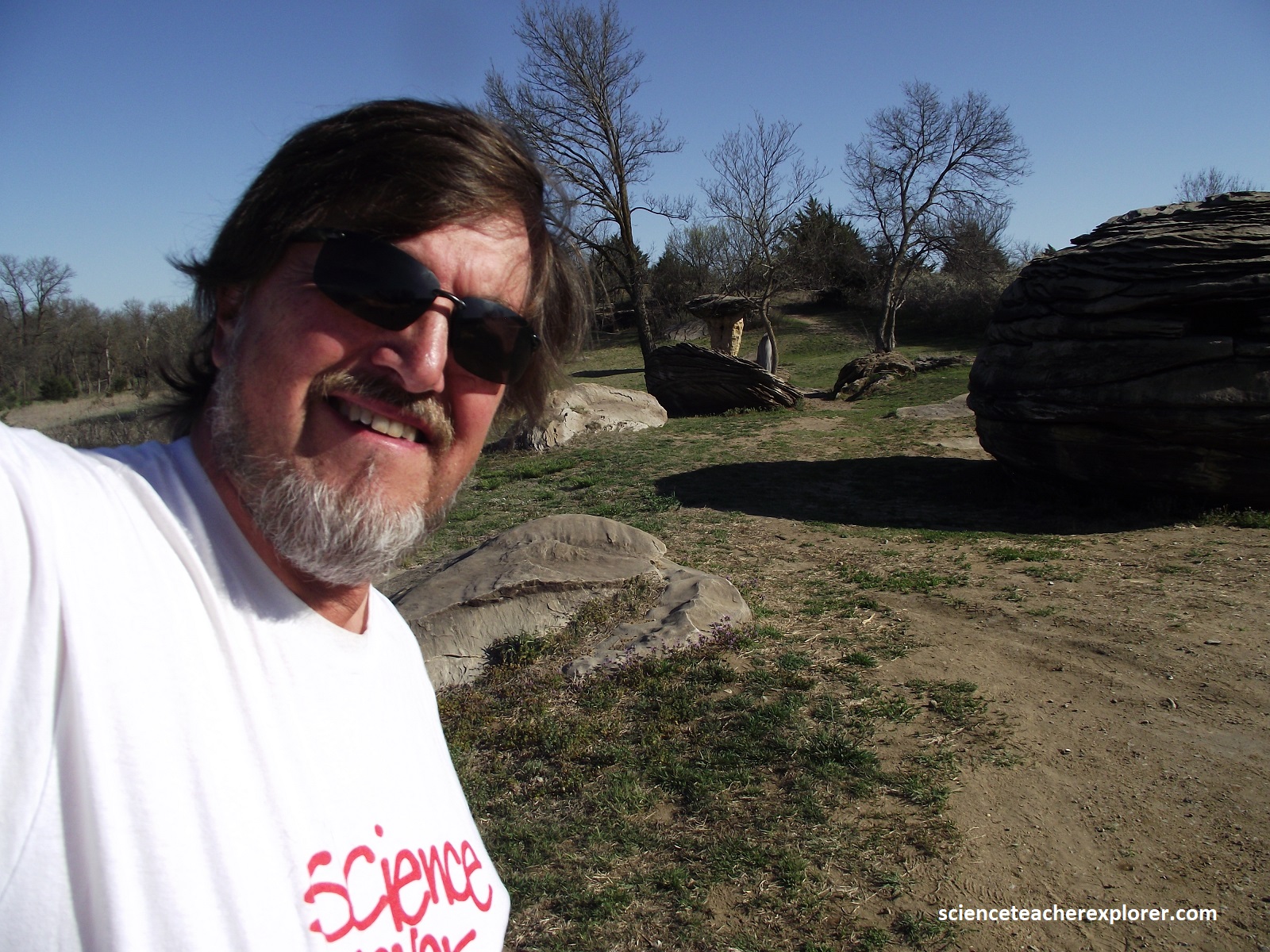
As mentioned above, the Dakota Sandstone sediments were carried by rivers flowing westward from the rising sea level, eventually compacting and cementing into sandstone as the shoreline shifted eastward over time. The rock exposures at the Mushroom Rock State Park shows the angled patterns that scientists call cross-bedding, which is caused by the deposition of sand by moving water.
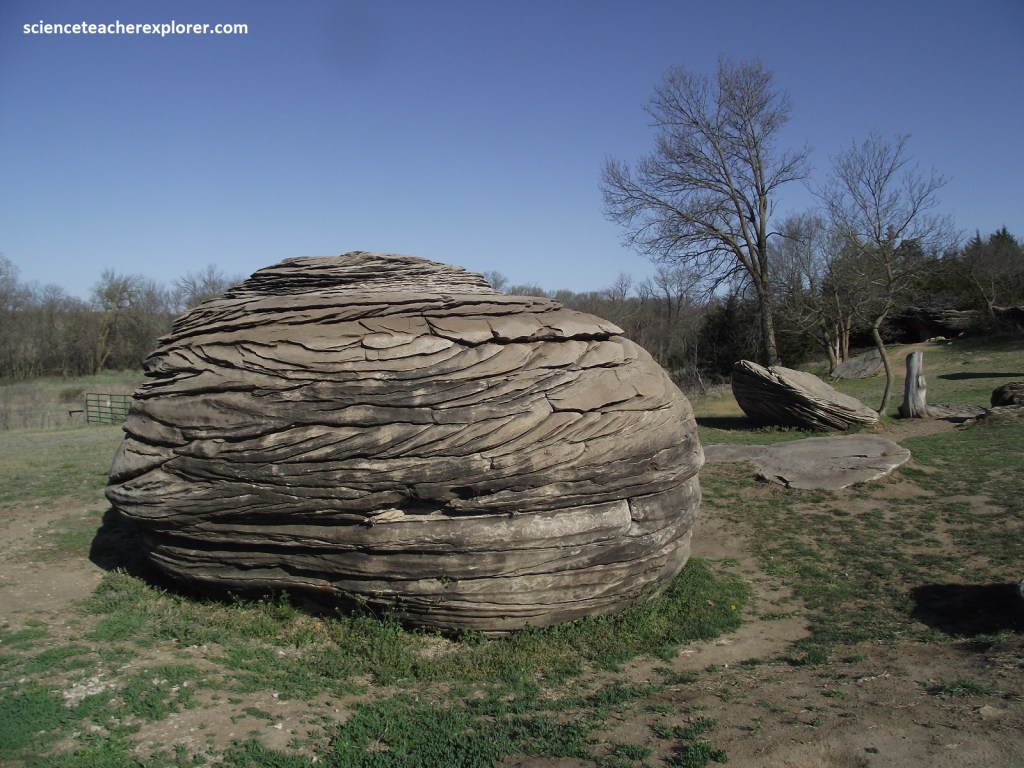
Over time, circulating water deposited a limey cement between the sand grains, creating harder bodies of sandstone called concretions. Concretions are often spherical. The softer sandstone of the stem has eroded more rapidly, creating the mushroom-shaped rock, (pictured below).
The effects of wind erosion are widespread in the Great Plains, but nowhere more apparent than at this five-acre site; “The Mushroom Rock State Park”, Kansas. Heading west on I-70, I turned left, (south), at Trenton, Kansas and drove 2 km on I-135 to KS140. There, I turned right, (west), and drove 34 km on the hold Hwy. 40, (KS140). Then I turn left, (south), onto KS141 and drove 3.7km where I turned right onto Ave. K. In 4km I arrived at “The Mushroom Rock State Park”.
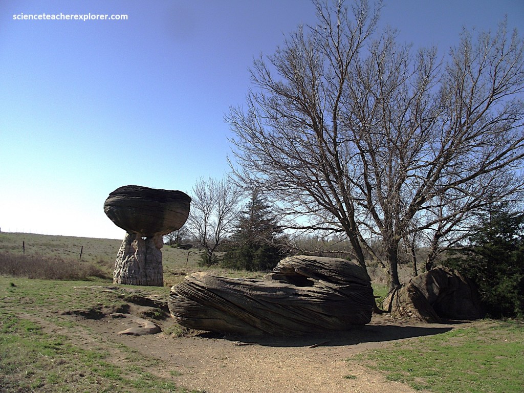
Pictured above, The persistent and sometimes violently swirling winds have gradually shaved away the ground of soft sandstone, leaving small islands of resistant sandstone concretions and gradually sculpting them into huge, dramatic mushroom shape.
The two largest and most obvious are approximately 8 m tall, with caps of about 5 m wide. These rocks once served as meeting places and landmarks for Native Americans and early pioneers, such as Kit Carson and John C. Fremont. Until 1963, the only way to see these spheres was by traveling a rough trail on privately-owned land. Ellsworth County constructed a road that year through the heart of the area, allowing access by automobile. The Ellsworth County Historical Society secured these 5 acres, owned by two different parties, to be deeded to the Kansas Park and Resources Authority, now Kansas Department of Wildlife and Parks. Eventually it became a State Park in 1965. {Note that a gentle book meanders though the area, shaded by tree}.
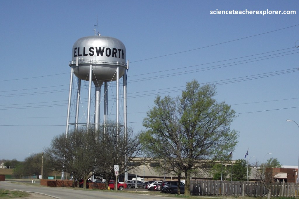
Returning to KS140 & driving west, I approach the the little town of Ellsworth, Kansas. Pictured above, water towers are elevated structures supporting a water tank that are constructed at a height sufficient to pressurize a distribution system for potable water in all the communities of the Great Plains. Otherwise, when you turn on a tap or shower, nothing would come out. Ellsworth is the seat for Ellsworth County and a former cow town. James Butler (“Wild Bill”) Hickok, on the the town’s early residents, later moved to Hays and became town marshal. Wyatt Earp reportedly got his start as a law officer when he made two arrests in Ellsworth, Kansas. From Ellsworth, I drove north on K-14, back to I-70, (11 km).
The next outcrop belt to the west of the Dakota Sandstone is the Greenhorn Limestone, which is made up of thin (usually less than 15 cm) chalky limestones beds alternating with thicker beds of grayish shale. The Greenhorn Limestone was deposited in a relatively shallow part of the Cretaceous sea. Near the top of the Greenhorn is a limestone bed called Fencepost limestone. Because timber was scarce in this part of the state, limestone was used extensively by early settlers for buildings and fenceposts, (pictured above and below). Sometimes this geographical area is called the “Blue Hills or Kearney Hills”.
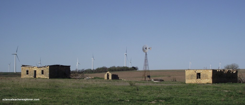
Pictured above, this Windfarm Project includes 56 turbines and currently covers about 12,000 acres (though another phase of construction is under way that will increase its size considerably). At its current size, this wind farm generates about enough electricity for 37,000 Kansas homes. It felt that the old vs. the new wind turbines in the same picture frame was interesting.
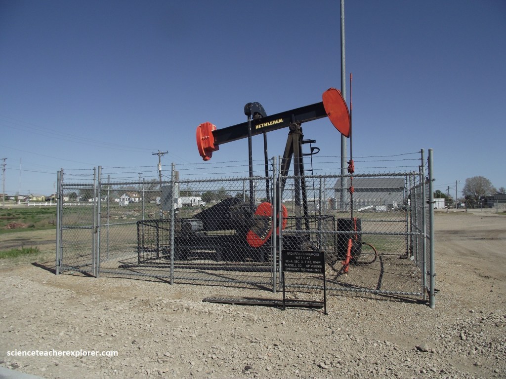
I drove west on I-70, through much of the Greenhorn Limestone or Blue Hills area, (poorly exposed), to Russell, Kansas. Pictured above, oil-wells here are in the “Russel oil field”, discovered in 1934, which produced more than 18 million barrels of oil. During the 1970s, Russell was regularly the second-ranking oil-producing county in Kansas, trailing only neighboring Ellis County. In 2007, Russell County’s production was 1.9 million barrels, making it the third-ranking county, behind Ellis and Rooks, which produced oil 3.1 and 2.0 million barrels, respectively. Because Kansas has produced oil for such a long time, it is known as a “mature” oil and gas province, and production in many counties, such as Russel, has declined over time. However, higher oil prices in the past few years have encouraged exploration, and Russell County production has held about steady since 2000.
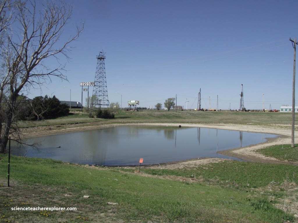
Pictured above, north of I-70 is a display of old oil-field equipment, including a wooden derrick. Derricks were once erected to support the equipment used in drilling oil wells. Most of these old wells were drilled with cable-tool rigs, which over and over again raised and dropped a bit so as to punch a hole in the ground.
Pictured above, the oil wells here are in the Herzog oil field, which, since it was discovered in 1940, has produced over 4.6 million barrels of oil. It would be the largest producer in most Kansas counties, but here in Ellis County, where huge fields are common, the Herzog is just one of many major producing fields. {The nearby Bermis-Shutts field produced more than a million barrels of oil in 2007, making it the largest producing field in the state that year, and has produced more than 260 million barrels of oil since its discovery in 1928}. Note that the Russell and Ellis Counties are located atop the Central Kansas Uplift, a dome of rock that runs from Barber County, in the south-central Kansas, to Norton County in the northwestern part of the state. About 1/3 rd of the wild-cat wells in Kansas are drilled in the Central Kansas Uplift area. In 2006, 6 of the state’s top 10 oil-producing counties were counties that lay atop this geologic feature.
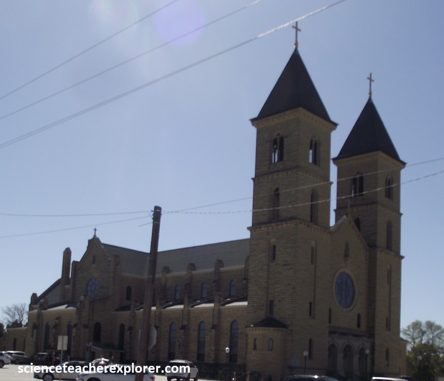
Driving further west on I-70 to exit 255, I found a town called Victoria in the south. Victoria was settled by German-Russians and by Englishmen, who named the town after their queen. Pictured above, the twin towers of the church of St. Fidelis in Victoria are visible to the south from I-70 this church, also known as the Cathedral of the Plains, was built out of 17 million pounds or 7.7 million Kg of native Fencepost Limestone between 1908 & 1911.

Further west in I-70, I drove through Hays, Kansas; Named for the fort that was established here in 1865. Pictured above, on the south side of I-70, is the Sternberg Museum, which includes a fine collection of fossils from the Cretaceous Chalk. Picture below, perhaps the museum’s best-known specimen is a large Cretaceous fish that died with the well-preserved remains of another, smaller fish in it’s stomach.
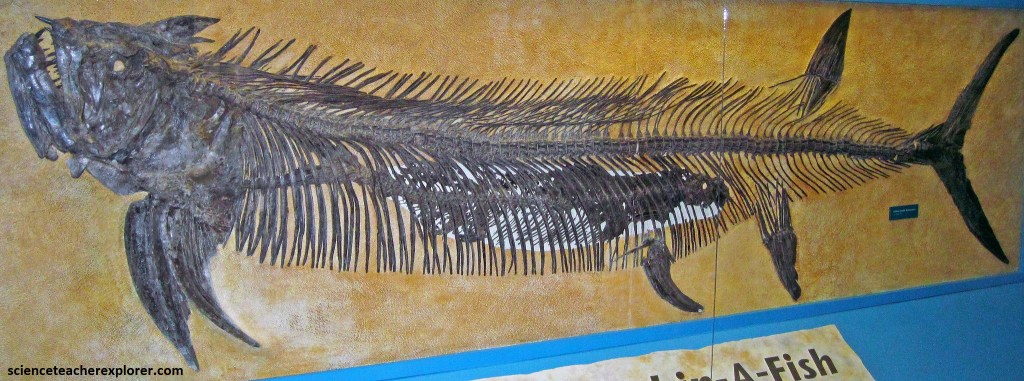
Pictured above, the head of the 4m long Xiphactinus faces left and the entire bone structure and fins are visible. The 2m long Gillicus arcuatus is underneath the bones in the center. The larger fish apparently died soon after eating its prey, most likely owing to the smaller prey’s struggling and rupturing an organ as it was being swallowed. Like modern tarpons, this Xiphactinus likely spent its juvenile stage of life in shallow seaway margins for protection and to utilize rich food resources, possibly rare in open marine water, though this needs confirmation due to the lack of shallow, nearshore deposits from the Cretaceous Western-Interior-Seaway.
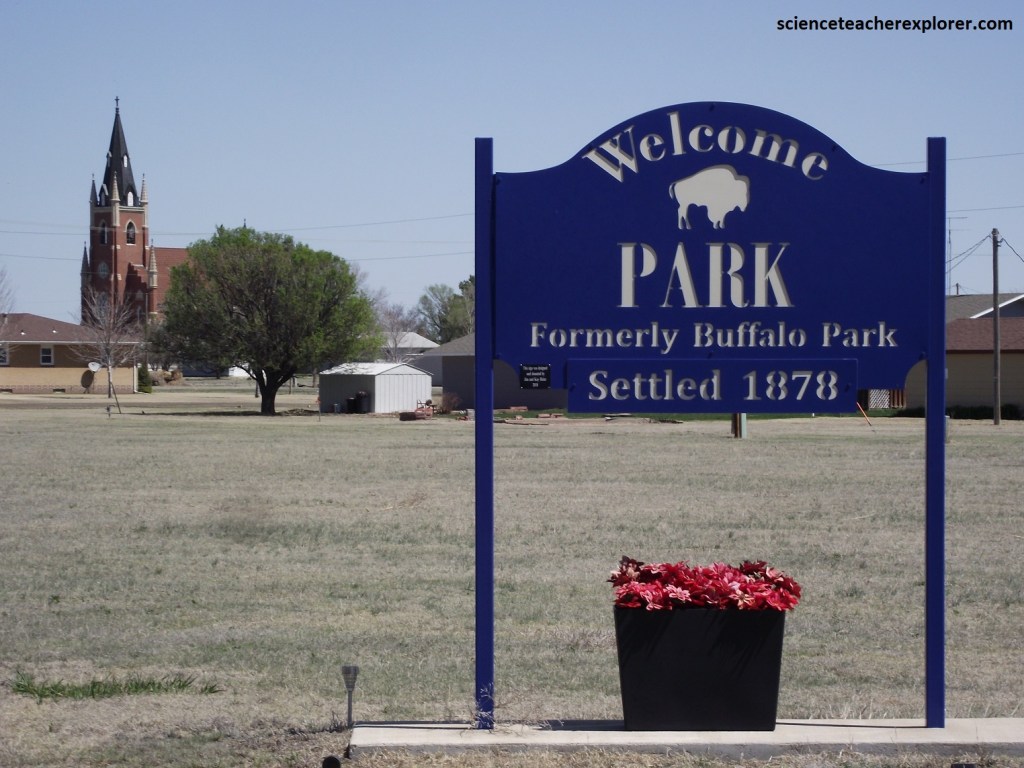
Driving further west in the Cretaceous Chalk of the Smoky Hills, on I-70, for about 90 km, I found a turnoff on KS-211 that led me north to a small community 1.6 km, where I could stretch my legs, named Park. Pictured above, this town was originally named Buffalo, then Buffalo Park, and finally simply Park. During the late 1800x, fossil collectors often used this town as a supply base as they moved into the Cretaceous chalk to look for fossils. At that time, western Kansas was a paleontologist’s paradise, offering numerous samples of previously unknown species. Swimming reptiles called mosasaurs, flying reptiles called pterosaurs, shark’s teeth, toothed birds, and other fantastic fossils that come out of the Cretaceous, all lured paleontologists to western Kansas. This was ground zero for the infamous “Fossil War” of the 1860s.
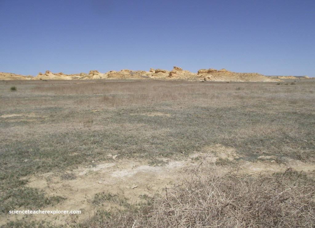
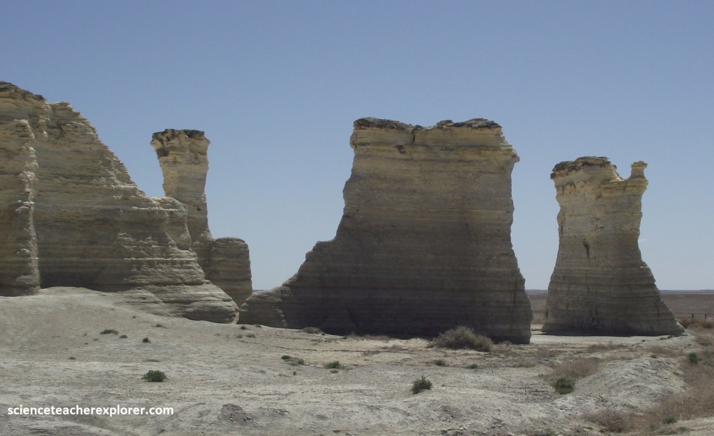
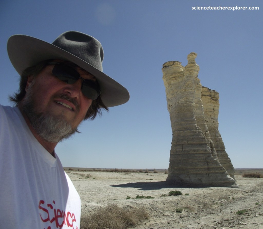
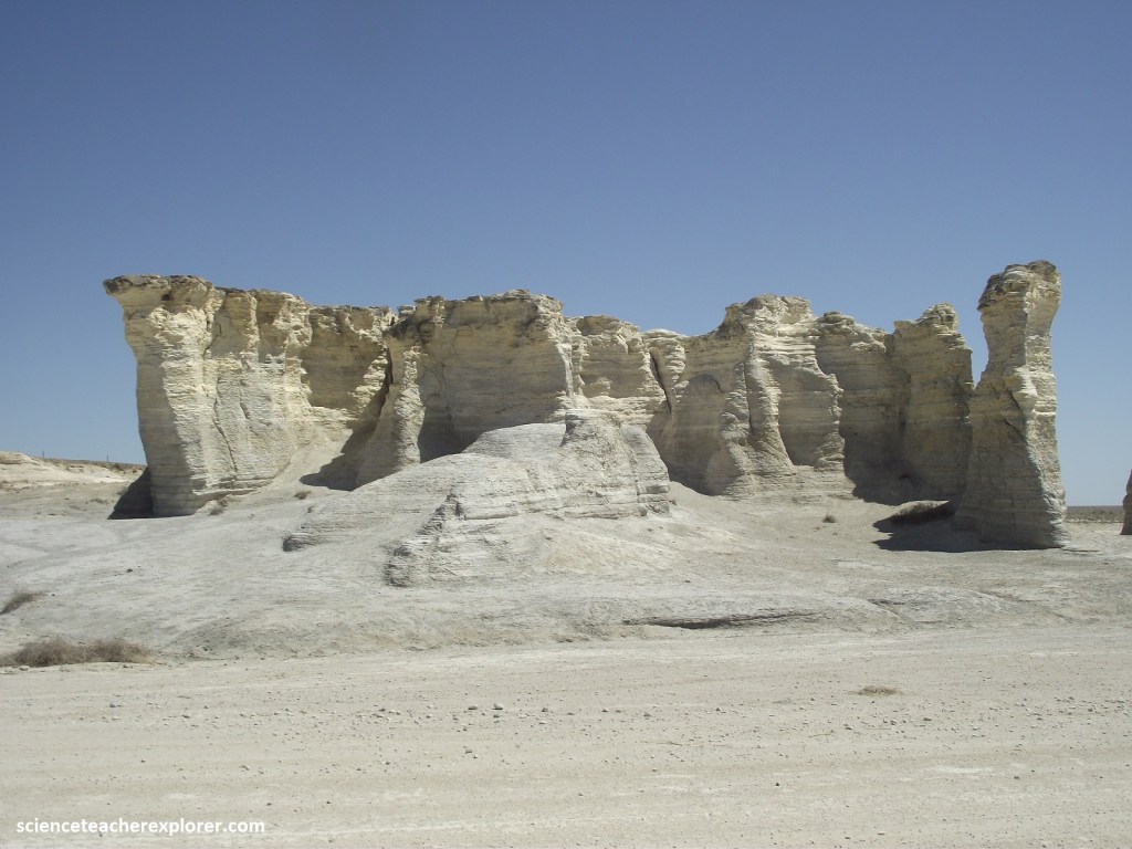
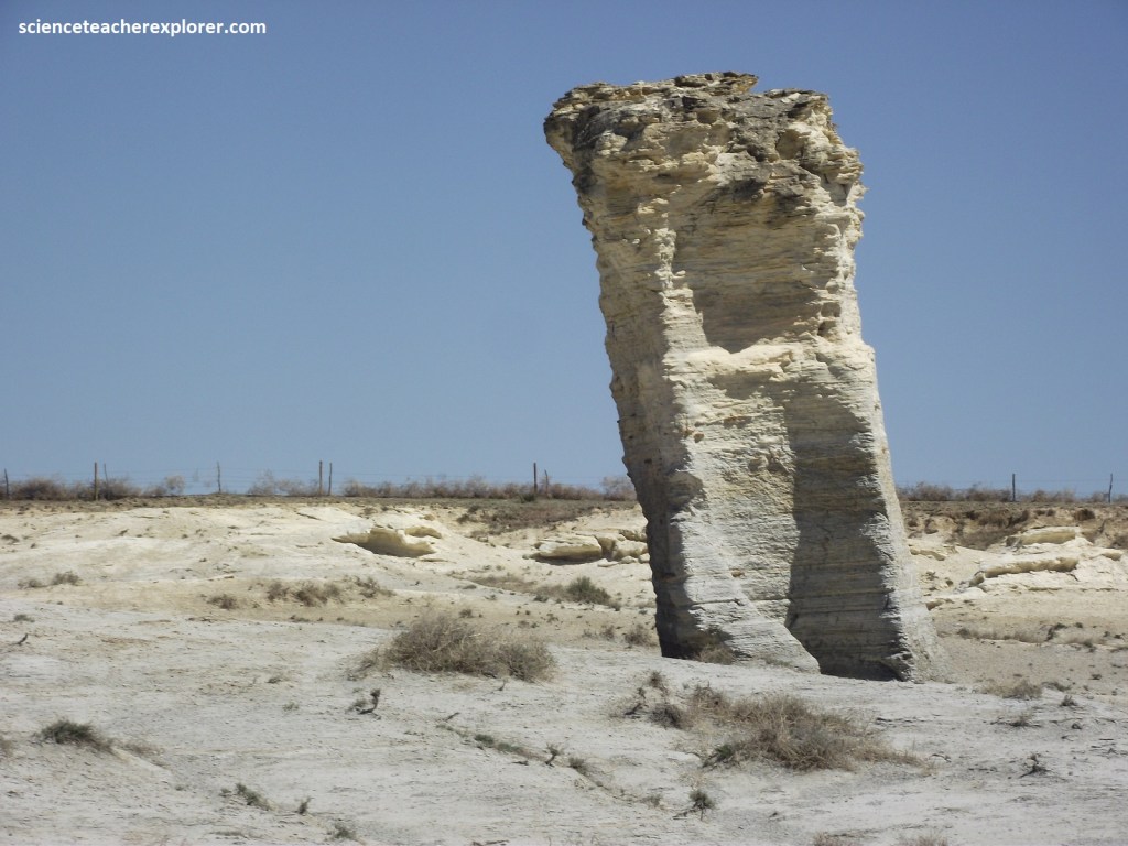
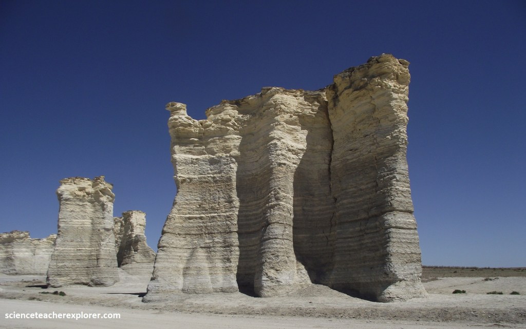
The third and westernmost range of hills in the Smoky Hills developed on the thick chalks of the Niobrara Chalk. The best place to explore this geological formation is to make my way to Monument Rocks, (further west on I-70).
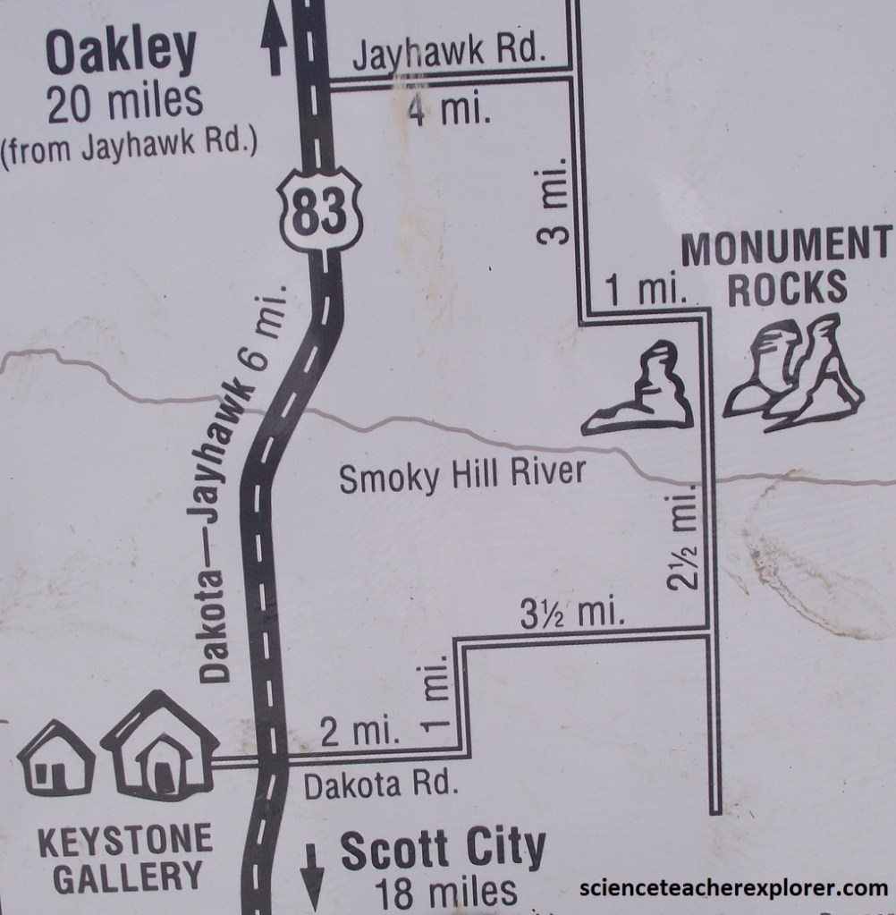
Driving another 57 km to Oakley, Kansas, I turned left, (south) on US-83 and drive another 32 km. From there, I turned left, (east), on Jayhawk/Grove County Rd. for 6.4 km, where it turned to gravel and connected to Grove County Rd. 14 towards the south. I followed this road for another 5.3 km south, east and then south again.
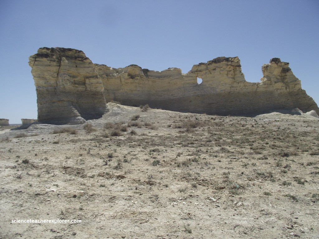
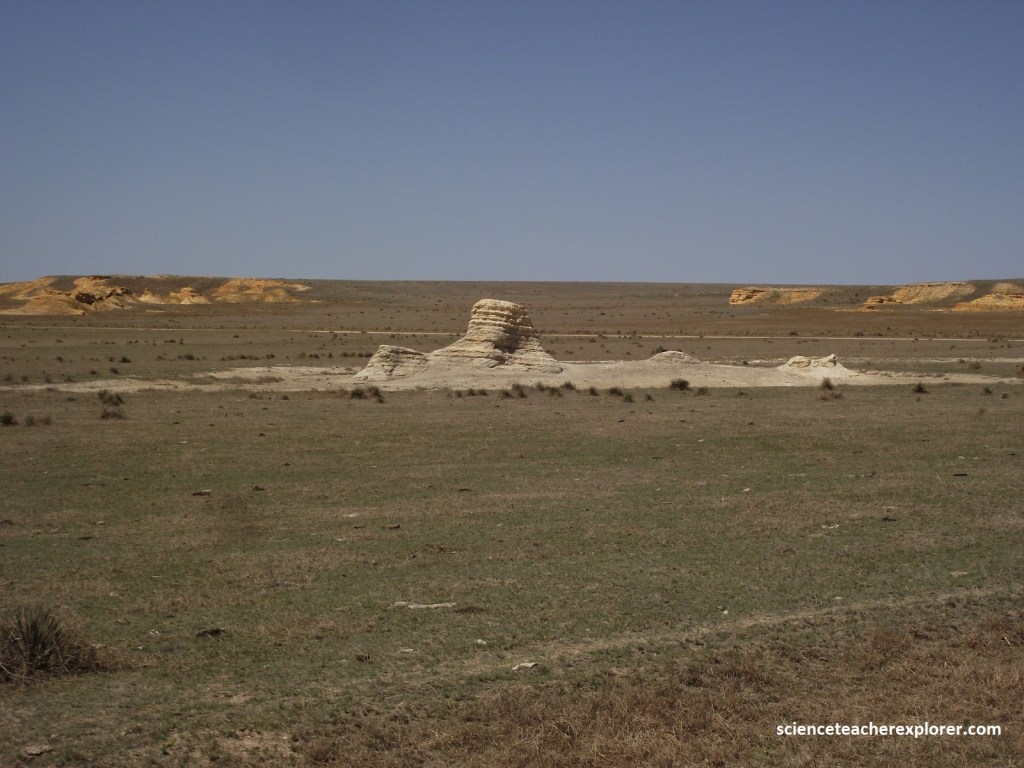
Rising abruptly above the treeless plain of the Smoky Hill River, the 23m high “monuments” look like lonely sentinels. Sculpted by wind and water erosion, many sport crenellated tops, like castle battlements.
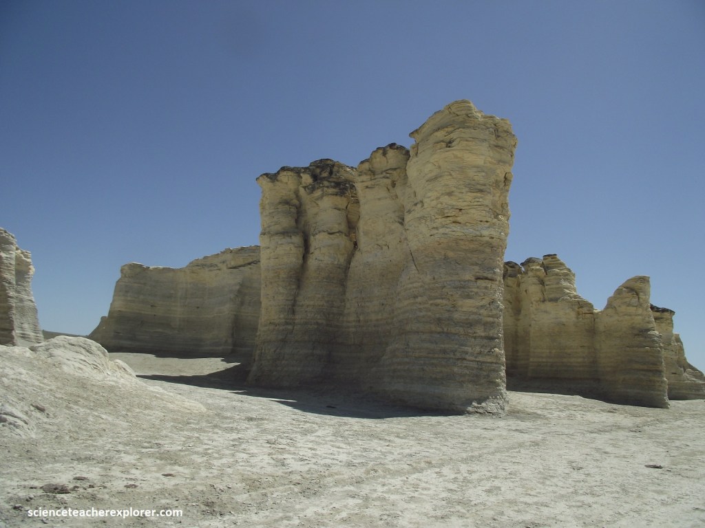
The rocks graduate in color from pale gray at the bottom to gold at their peaks. They are composed of soft Cretaceous chalk from the sediment of an ancient sea, and their layered formations abound with fossils.
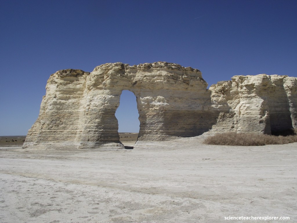
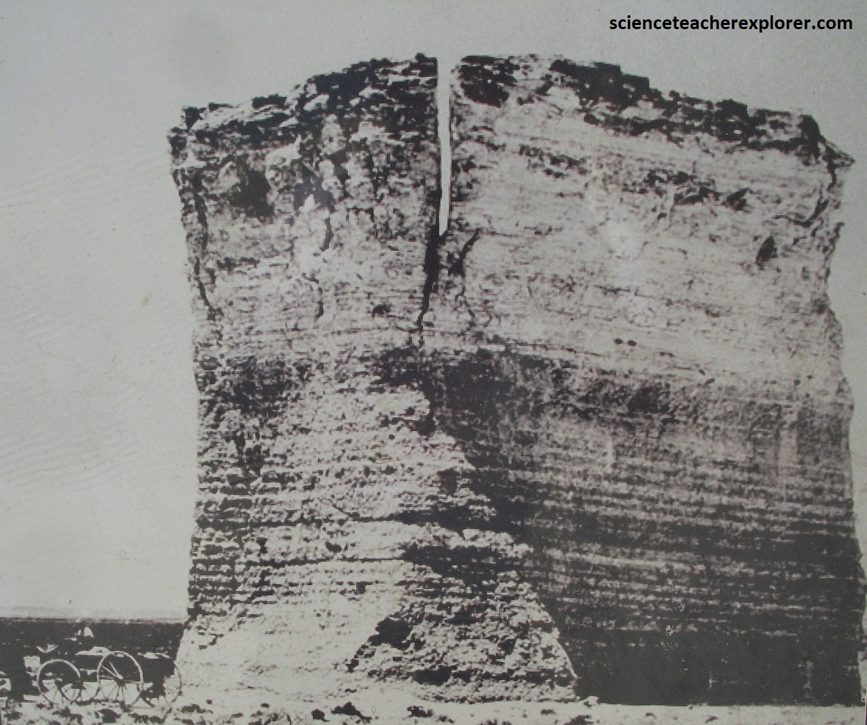
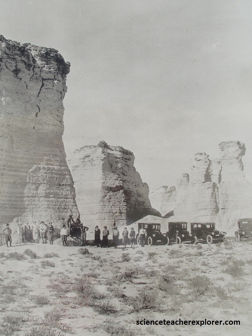
Numbering fewer than a dozen, the towers are found in an area about 0.4 km long and 200m wide. {Historical photos were taken from an interpretive sign on-site and from the Fick Fossil Museum; Photos wee taken in the 1890s and 1920s}
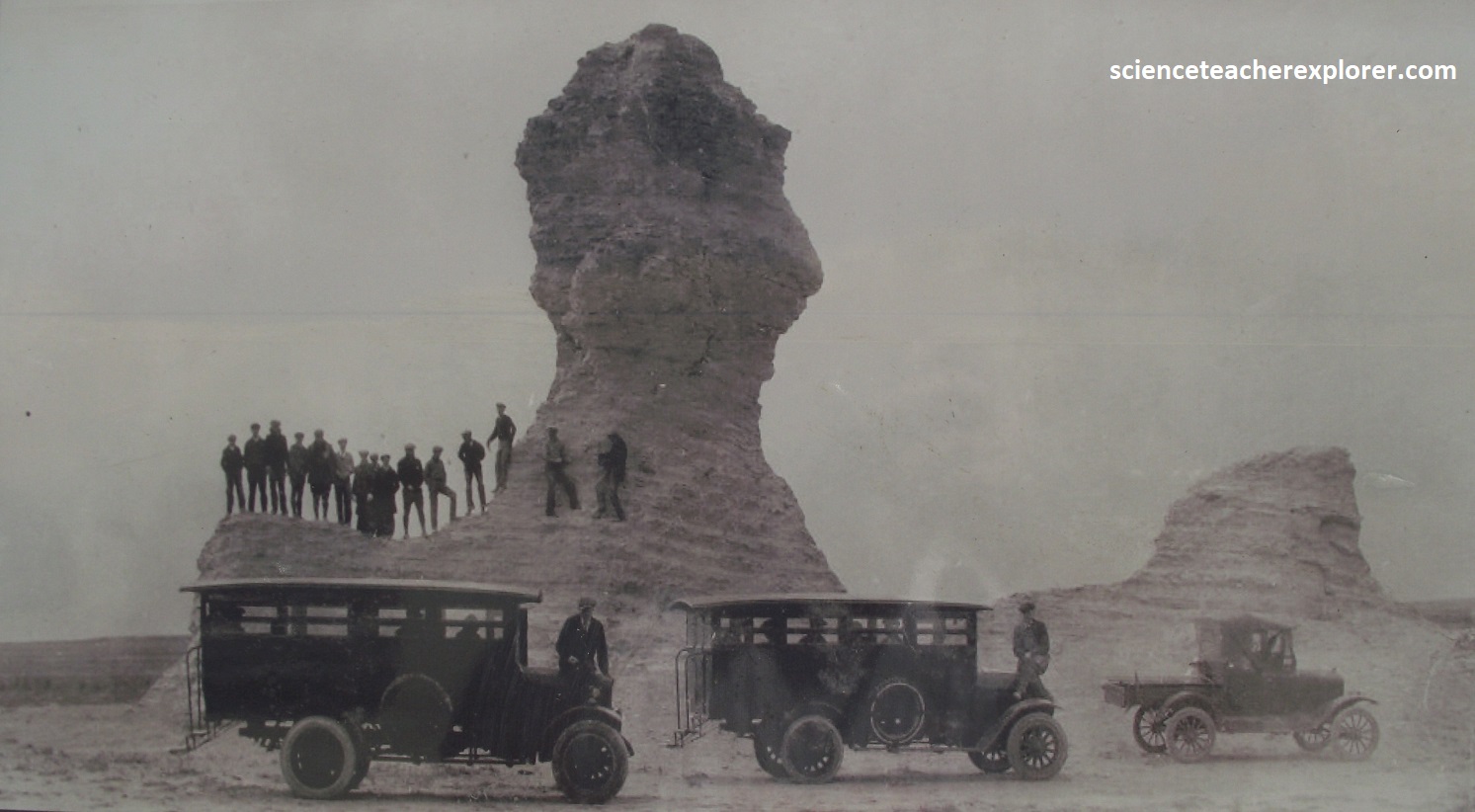
Pictured above, these distinctive formations served as landmarks for early wagon trains and military parties as they trekked the arduous journey westward from Kansas to Colorado along the Smoky Hill Trail. The area has now been designated as a National Natural Monument and has been selected as one of the Eight Wonders of Kansas.
This area also once contained fossils of shark’s teeth, vertebrae, and oyster shells. These unique and eclectic items can be viewed at the nearby Fick Fossil and History Museum.
Chalk is actually a form of limestone that is composed of calcium carbonate, which precipitated out of seawater, and of the remains of tiny one-shelled animals called Foraminifera. These animals lived in the open Cretaceous sea, and their remains rained down on the ocean floor, forming a limy ooze that would later become chalk. At the same time, this soft muck claimed the remains of larger animals that sank to the bottom of the ocean.

Also known as the “Chalk Pyramids, ” the huge stones each have a unique shape and some would say, personality. Some of the formations have even been given names such as “The Eye of the Needle” and ” Charlie the Dog.” The formations are so iconic that they were named the first national natural landmark in America.
Even the erosion here is very, very slow, it does take it’s toll. In 1986, erosion toppled the “head” off a chalk outlier called the Sphynx. In 1998, a slender spire called Cobra Rock, in the chalk south of Castle Rock, collapsed. And of course, human vandalism doesn’t help.