Snowdonia, WAL 2025
Coming back from Africa in 2025, I had decided to take a few days to explore & trek the northwestern part of Wales in the United Kingdom. I was headed back to the United States.
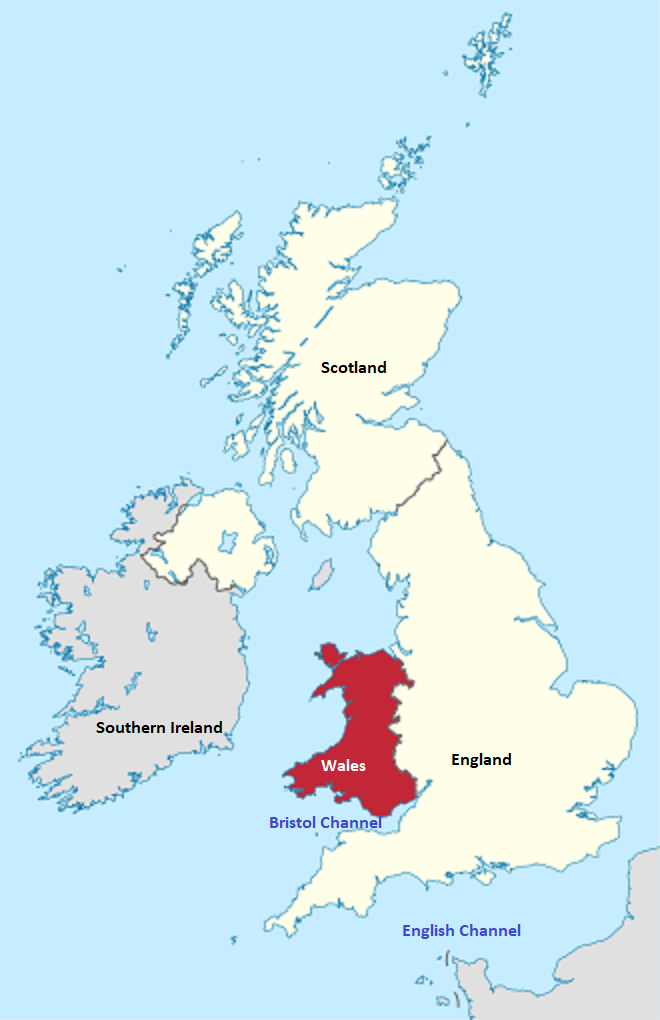
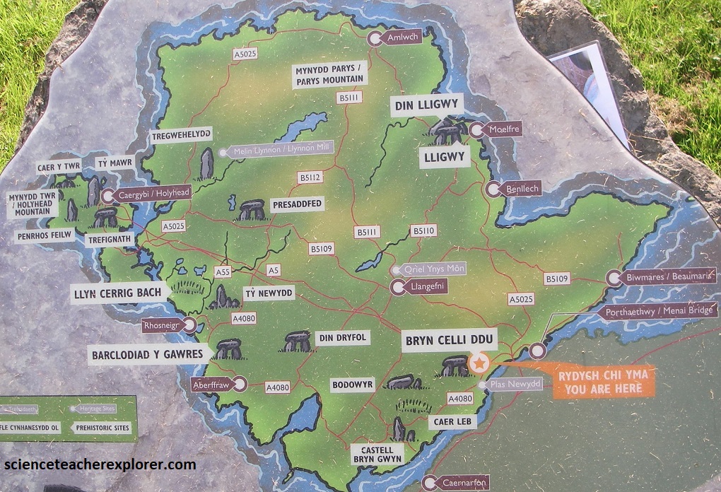
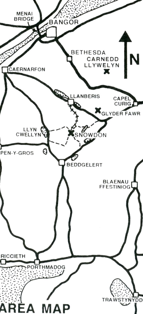
My destination-of-interest was Snowdonia. Snowdonia is the second largest national park in England and Wales, yet only 26,000 people live here, making it a truly wild place.
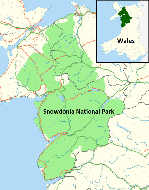
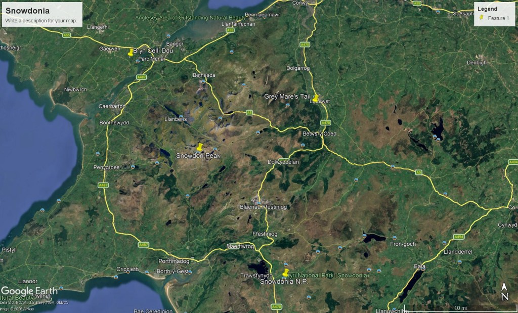
Most visitors come here for the grand scenery, excellent trekking, and the challenge of climbing Snowdon Peak itself. I was particularly interested in trekking/exploring 3 Geo-sites: Snowdon Peak, Grey Mare’s Tail, & the Bryn Celli Ddu.
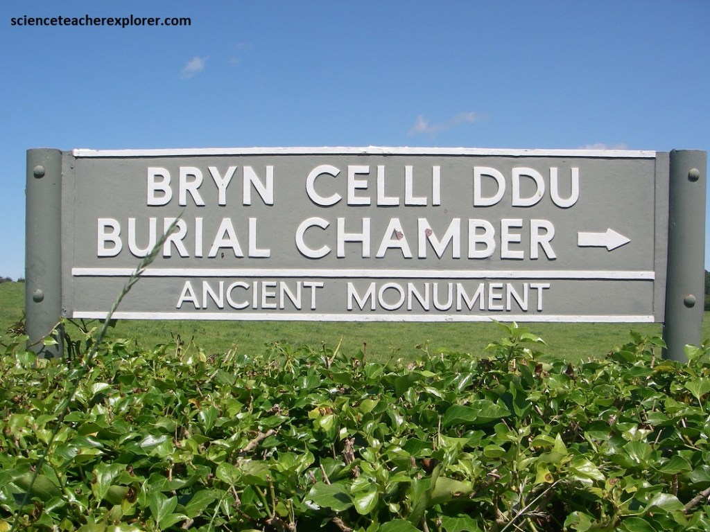
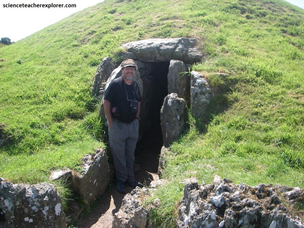
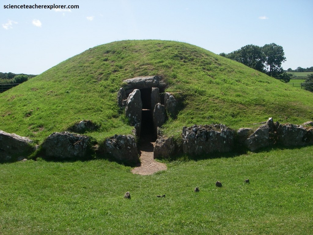
The first Geo-site that we explored was the Bryn Celli Ddu, (the mound in the dark grove). Bryn Celli Ddu is a prehistoric site on the Welsh island of Anglesey located near Llanddaniel Fab.
Bryn Celli Dddo was created during the early Neolithic (New Stone Age) period. It started as a henge (bank and ditch) enclosing a circle of stones, to be replaced later by a chambered tomb beneath a mound measuring up to 26m in diameter. A great video about this history, was created by the Wales government and placed on Youtube. The link: youtu.be/bILAibTR7Wg
Bryn Celli Ddu is a remarkable and mysterious structure on the island of Anglesey. What sets Bryn Celli Ddu apart from the other tombs on Anglesey, is that it is the only one to be accurately aligned to coincide with the rising sun on the longest day of the year.

The people of the Neolithic who built this tomb around 5000 years ago, were farmers. Maybe having an accurate calendar to plan when to sow and harvest crops was important for their success?

Like Stonehenge, or Newgrange in Ireland and Maeshowe on Orkney, Bryn Celli Ddu was deliberately aligned with the movements of the heavens.
Maybe these solar calendars enabled prehistoric people to know the right time of year to come together at these distant sites for important celebrations?
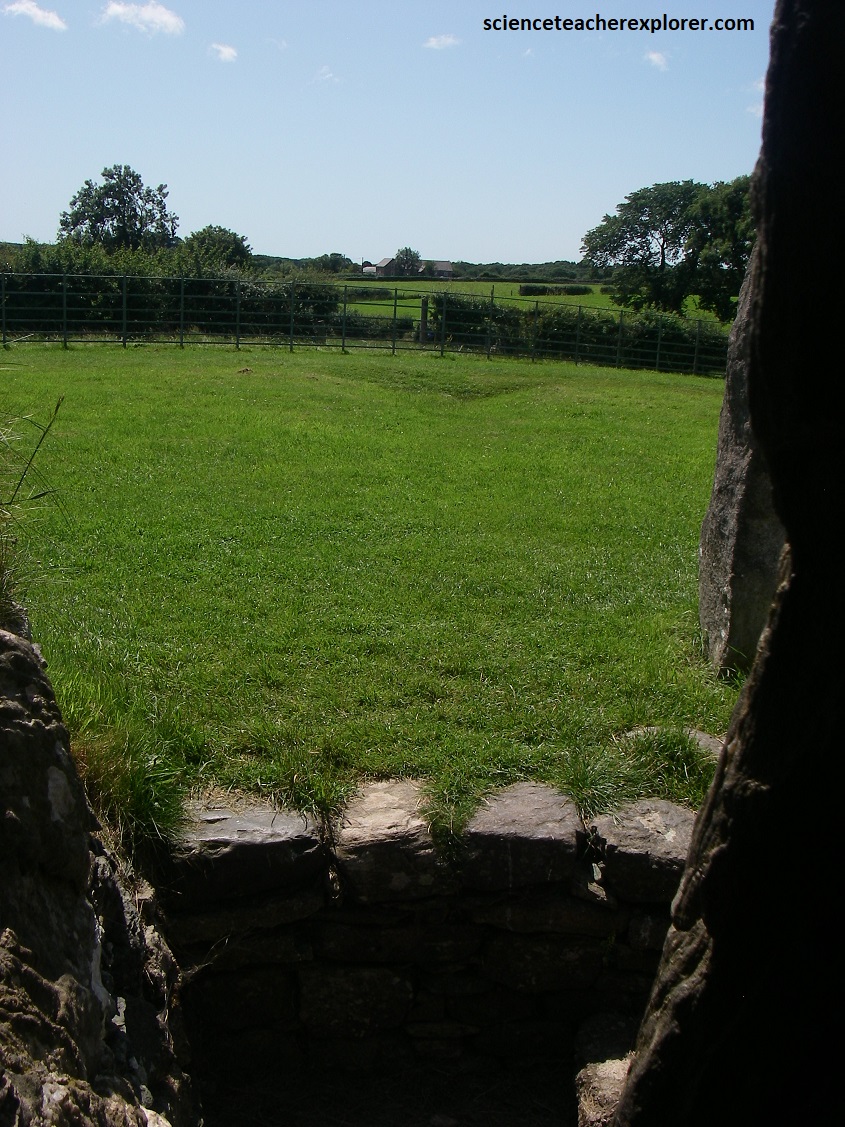
We don’t know how many people were originally buried in the tomb. It remained open for many hundreds of years and suffered from erosion and disturbances. Inside, a long, narrow passage leads to an octagonal chamber 2.4m across, where artefacts such as human bones, arrowheads and carved stones have been found.
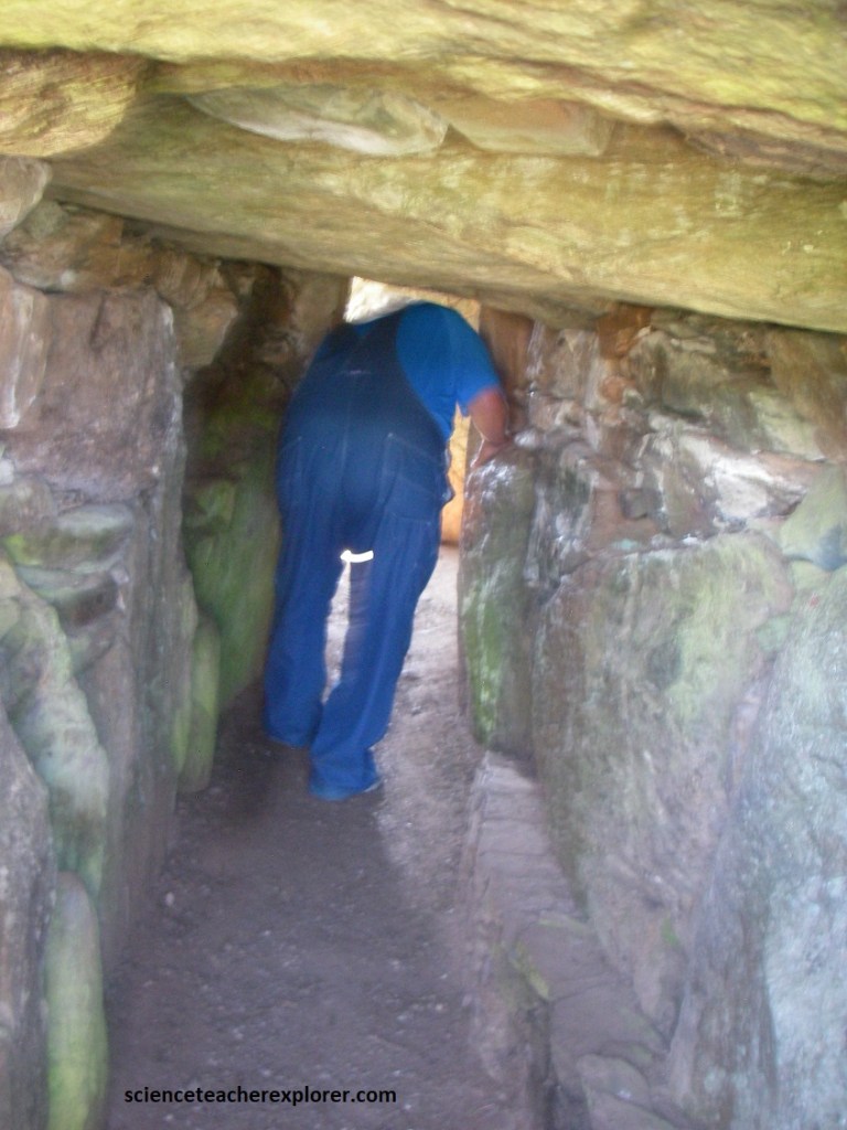
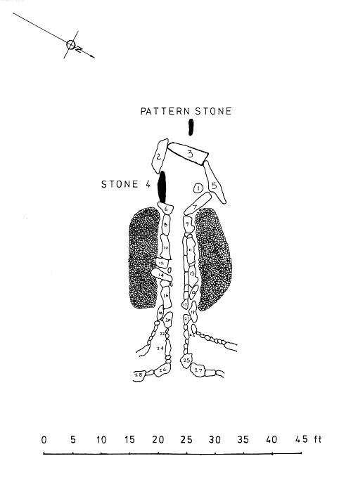
Pictured above, the passage is 8.4 m long, the first 3.4 m being unroofed with a pair of portal stones. The main passage has walls of vertical rock slabs, roofed by a series of stone lintels. The mound, being substantially smaller than as originally made, no longer completely encloses the burial chamber, so the back wall is open to the air, allowing some natural light in.

Free-standing inside the burial chamber is a smooth pillar of blueschist, a metamorphic rock, some 2m high, with a very rounded shape. This single smooth stone-monolith, seems to stand guard in the shadows of the burial chamber as if it was put there as a sentinel to keep watch over the ancestors.

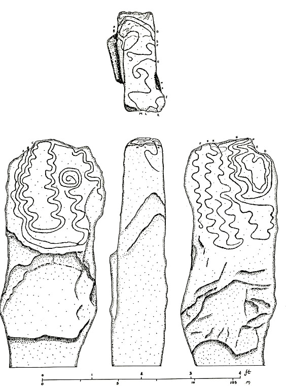
Beyond the back wall of the chamber, in a location that would once have been within the mound, is a replica of the ‘Pattern Stone’. This was found buried under the mound, and has been put standing up in what is thought to have been its original location at a time when the site was a henge rather than a tomb. The patterns take the form of sinuous serpentine shapes that wind around both sides of the stone. Inside the tomb another stone has a small spiral pattern chipped into it.
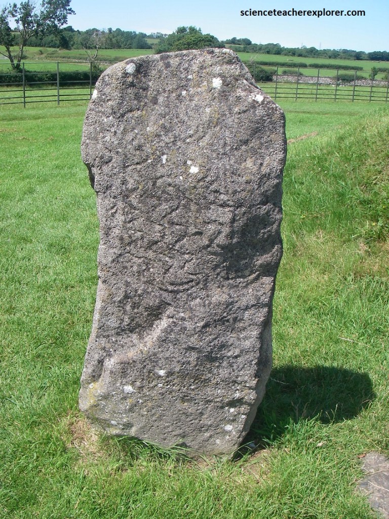
Pictured above and below, the patterns take the form of sinuous serpentine shapes that wind around both sides of the stone. Inside the tomb another stone has a small spiral pattern chipped into it.
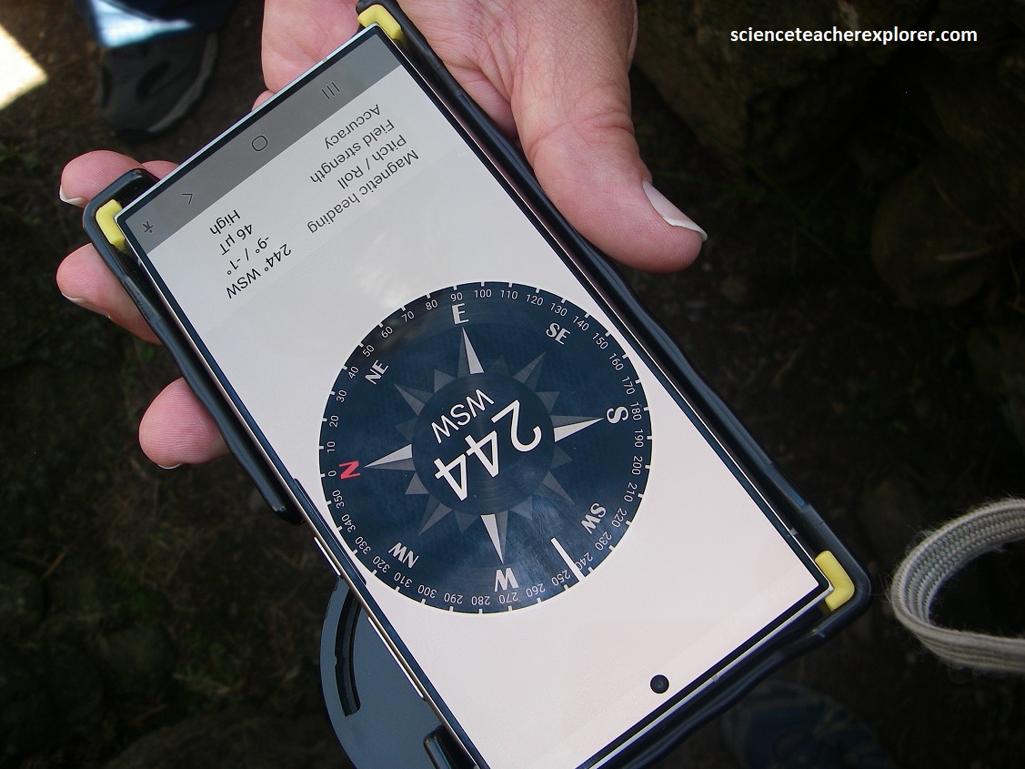
At dawn on midsummer solstice, shafts of light from the rising sun penetrate down the passageway to light the inner burial chamber. Perhaps this sunlight was meant to bring warmth and life to the ancestors? Maybe the community consulted them about important decisions, or simply sought comfort in visiting them at midsummer? {The pictures below, show the compass alignments of the passageway and the far horizon, where the sun would arise on the Summer Solstice}.
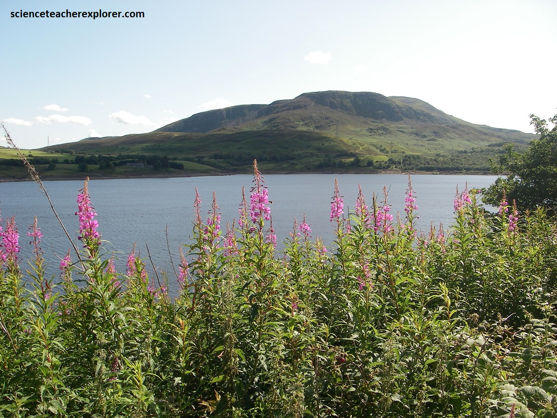
Our next destination was a small waterfall, called Grey Mare’s Tail, on the northeastern side of Snowdonia National Park. Meanwhile we explored the various sites of Snowdonia National Park, (pictured below).
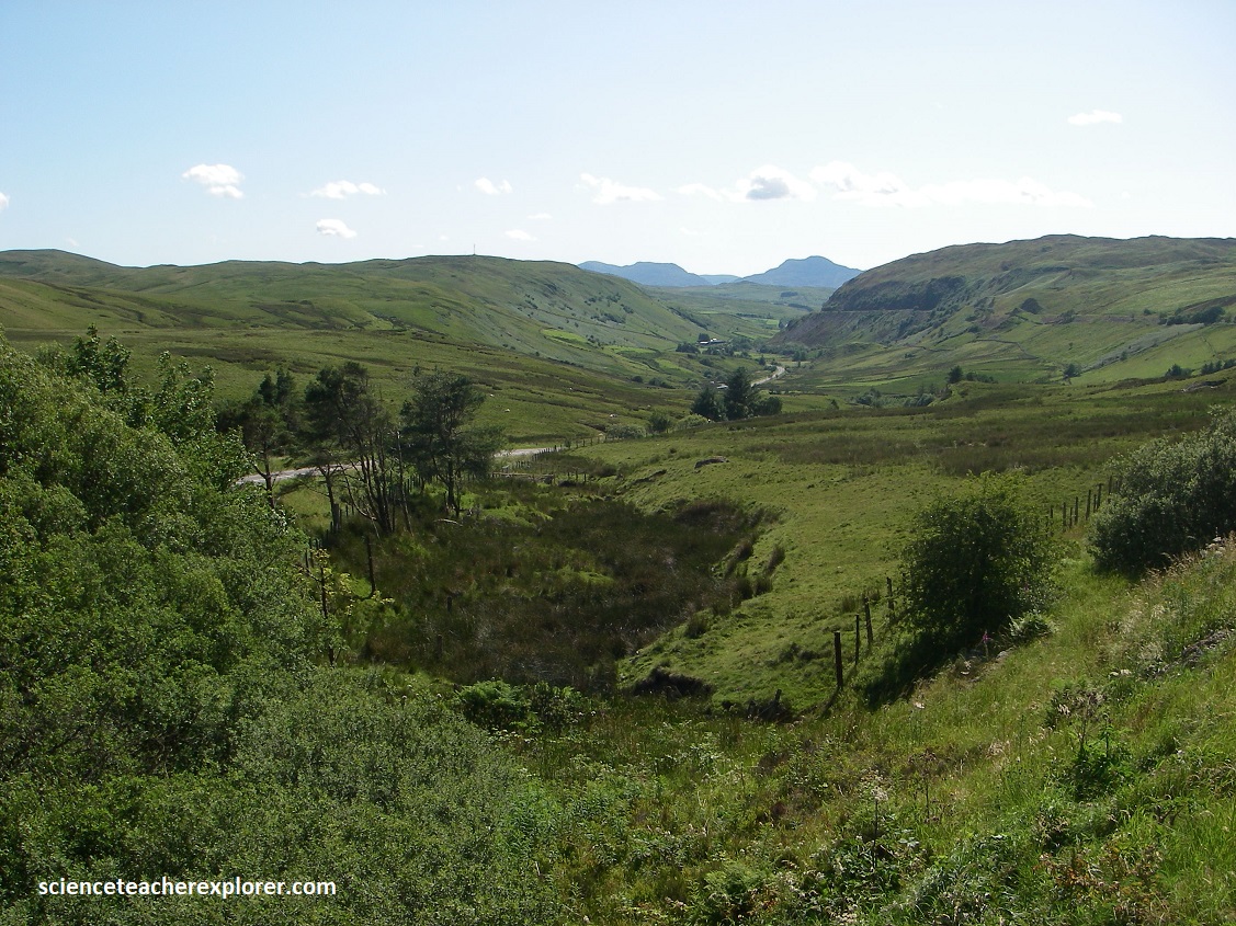
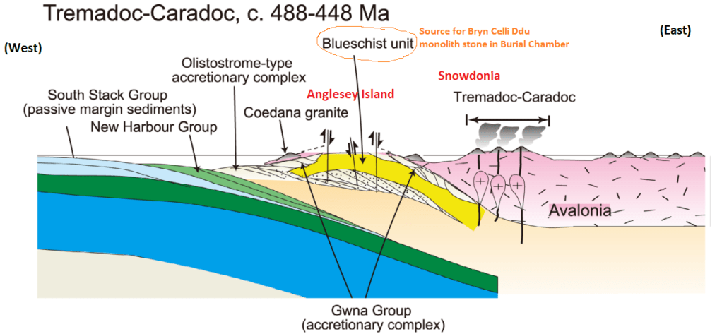
Imaged below, the bedrock geology of Snowdonia is largely formed from a sequence of sedimentary and igneous rocks during the Cambrian, Ordivician and Silurian periods, (539-419 million years ago). The Cambrian and Ordovician rocks accumulated largely on the Avalon terrain, which was involved in the Caledonian Orogeny roughly 490-390 million years ago, (a continental collision which resulted in faulted and folded rocks that were metamorphized).
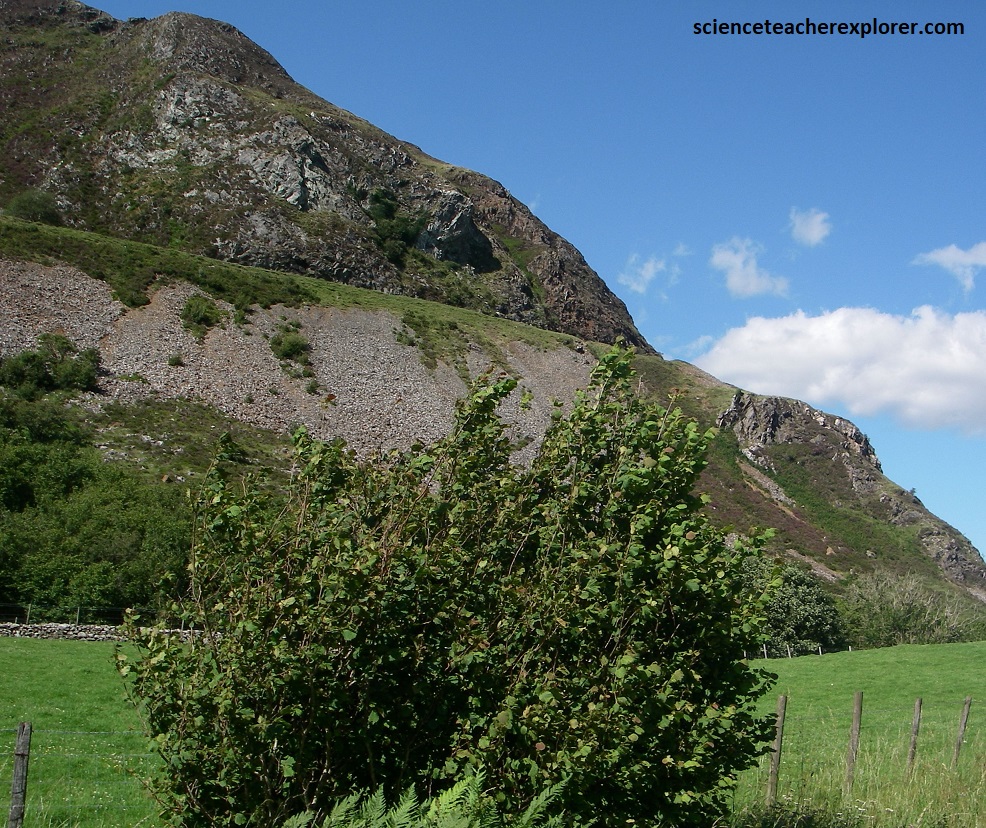
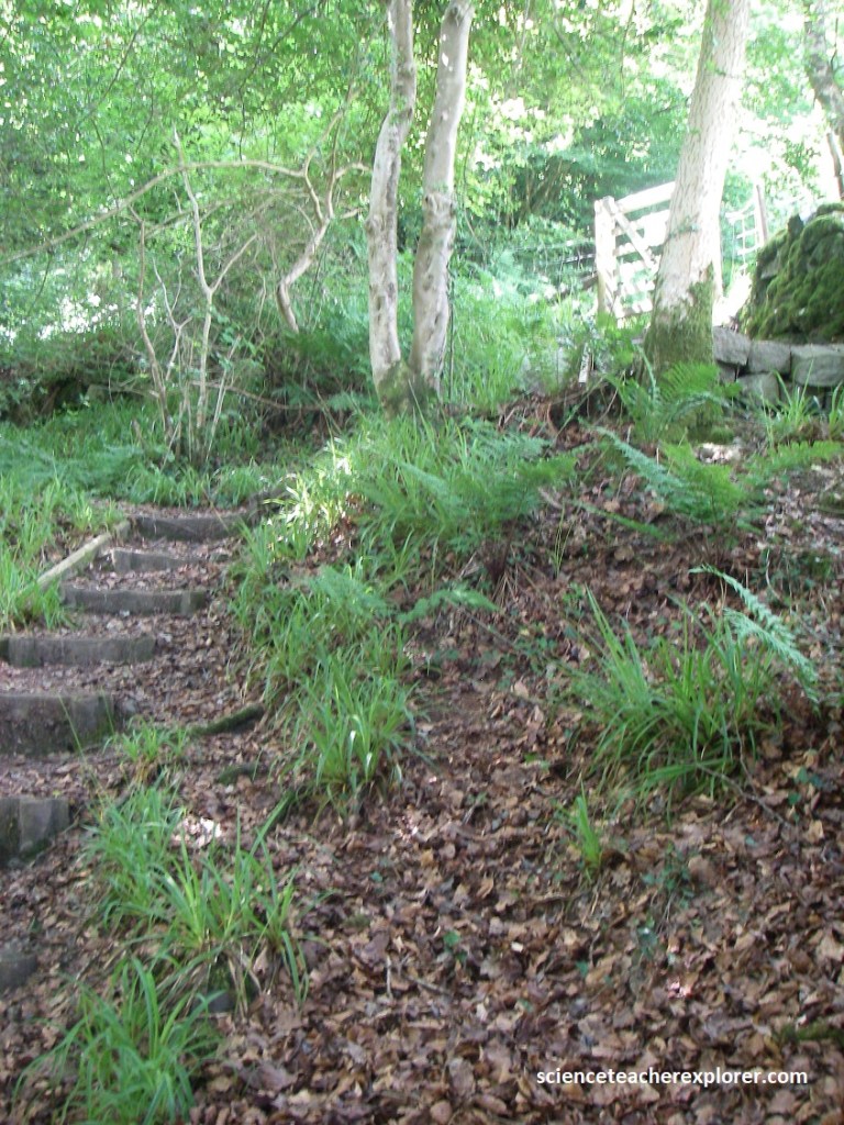
When we finally arrived at the “Grey Mare’s Tail” Geo-site, it was was closed with a locked gate due to storm damage/fallen trees. However, I stepped over the fence and continued down the steep embankment to view the waterfall. There were no signs for restrictions at the time, (pictured below).
The Grey Mare’s Tail is a 12m double-cascade waterfall located on the edge of Snowdonia National Park between Llanrwst and Trefriw (off of the B5106 road in Conwy Valley). It features twin falls dropping into a shallow pool that originated in the nearby Gwydir Forest.

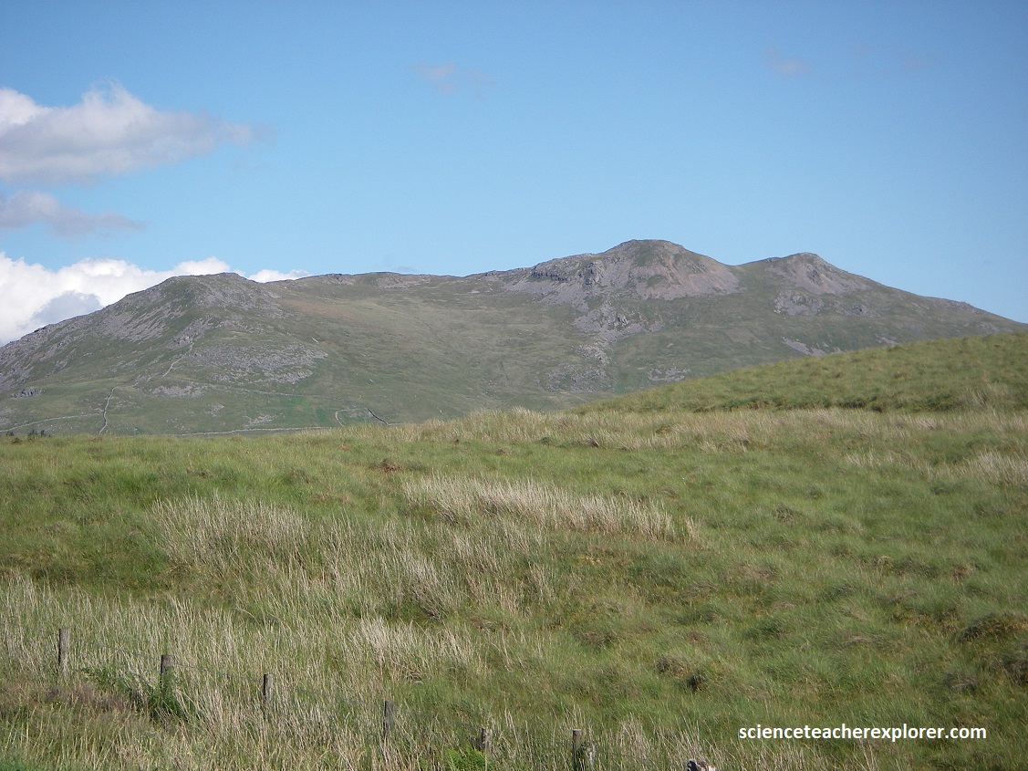
After exploring the Grey Mare’s Tail region, we continued onto our third and last Geo-site, (Snowdon Peak). Snowdon mountain is all that remains of a volcanic crater which was once three times as high, but is still the highest peak in Wales. {Note the two images below were taken from “Climber’s and Hiker’s Guide to the World’s Mountains & Volcanos 4th edition”; Kelsey 2001. }.
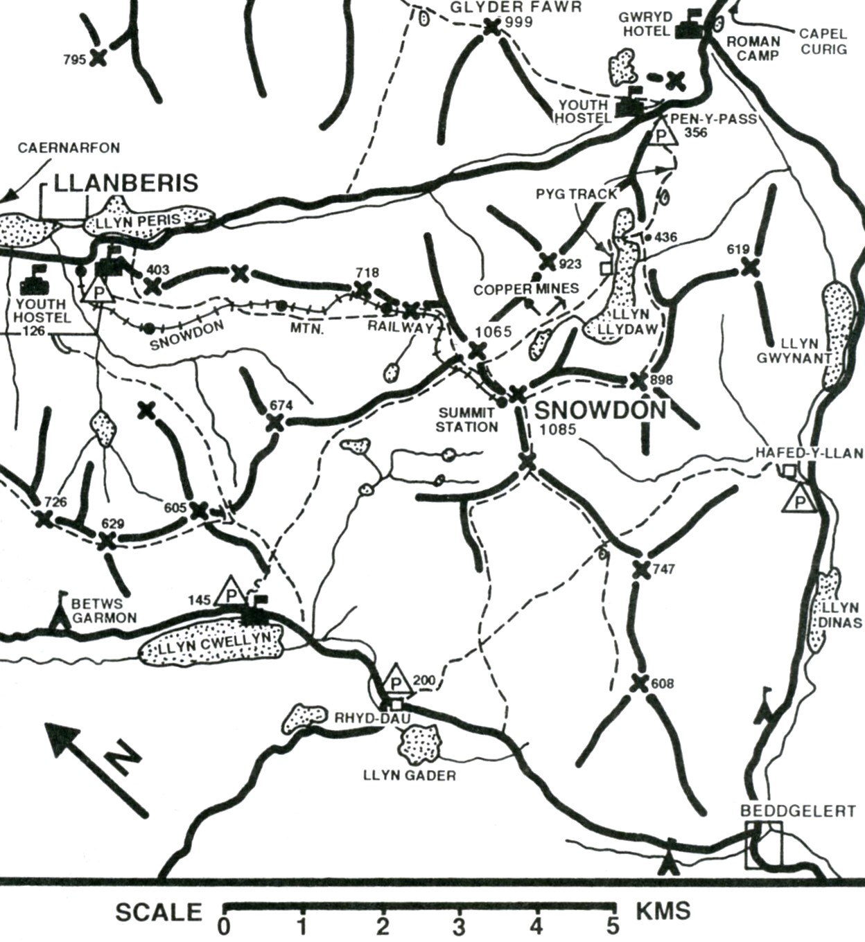
Snowdon Peak and the surrounding peaks are formed from volcanic ashes and lava, specifically from a major caldera-forming eruption in the Ordovician period, with deposits reaching up to 500m thick. The summit consists mostly of tuffs (lithified volcanic ash) and rhyolite. However, the surrounding low elevation areas also include sedimentary rocks like mudstone and sandstones.
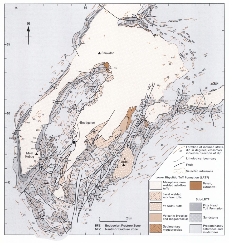
Imaged above, the rocks were heavily faulted and folded around Snowdon Peak into a syncline during the mentioned above Caledonian Orogeny.
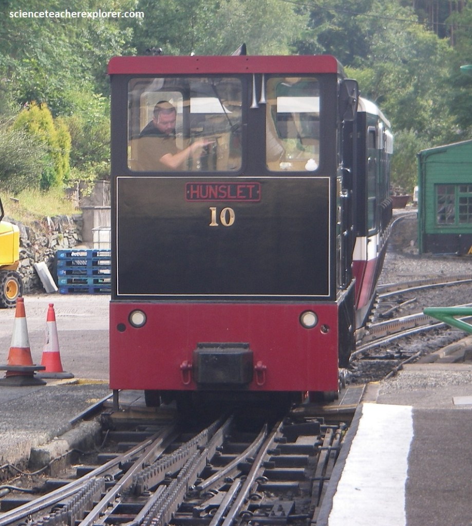
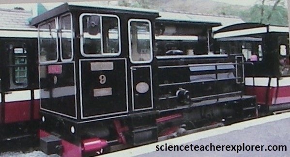
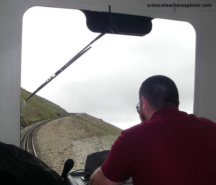
Pictured above, due to time constraints, we decided to ascend Snowdon Peak from Llanberis by Snowdon’s very own train service. Once a railway branch-line from Bangor to Llanberis had been completed Sir Richard Moon, (Chairman of London & North Western Railway), first proposed laying a track to the summit of Mount Snowdon in the late 19th century. It was completed in 1896. The railway continues today.
As demand increased from 75,000-120,000 visitors a year in the 1980s, the first diesel locos were ordered from the Hunslet Engine Company of Leeds. They are powered by 320 horsepower, turbo-charged Rolls Royce engines. We rode the HUNSLET No. 9 &10, (pictured above & below). {The picture above were taken from an interpretive sign on-site}.
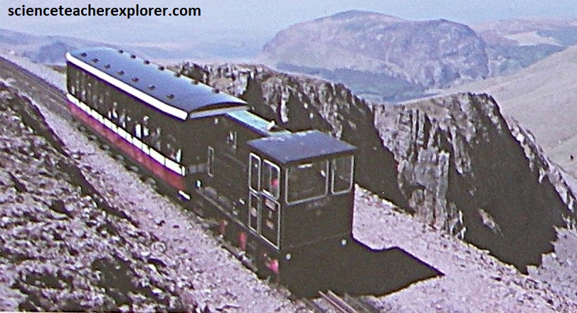
In 2013, new carriages were built by Garmendale Engineering in Derbyshire, for use with the diesel locomotives. They represented an innovation in rail carriage construction as they were made from a very light state-of-the-science cellular material that combines high thermal qualities with structural integrity. Their substantially lighter weight allows the carriages to be wider and long, and reduces the amount of energy needed to push them up the mountain. (The pictures were taken from our viewpoint on the train on our way up or down while riding the Snowdon Train).
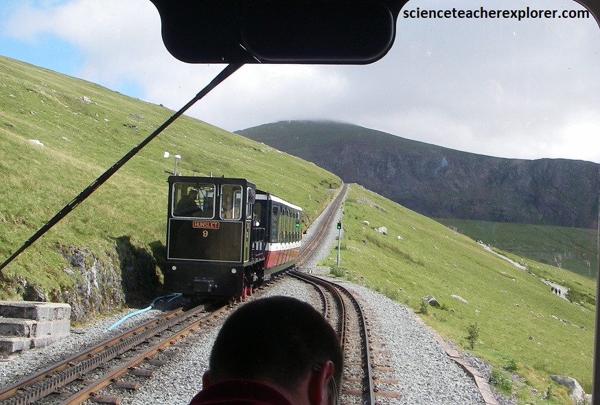
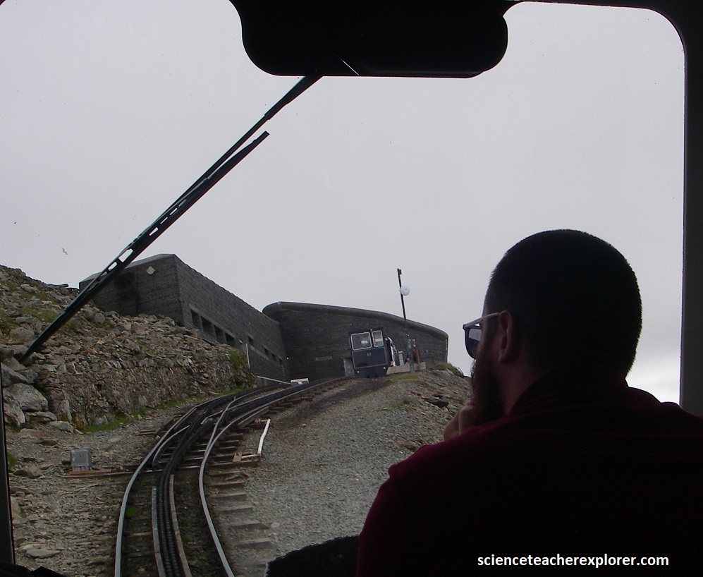
Snowdon’s train service takes us to within 20m of the summit and drops us off at a restaurant where we could enjoy a cup of coffee as we admired the view.
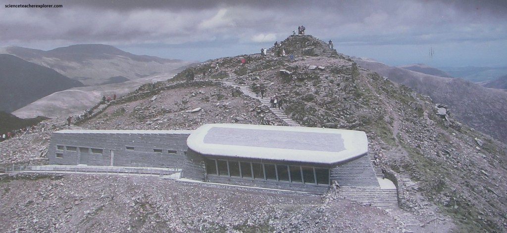
The first building to be erected at the Snowdon summit was in 1838 to sell refreshments and provide the basic accommodations for visitors. During the 1930s, many complaints were received about the state of the facilities at the summit and in 1934/5 a new station building was erected and then again in 2006. The above station was finished in 2009. Of course, we visited it in 2025.
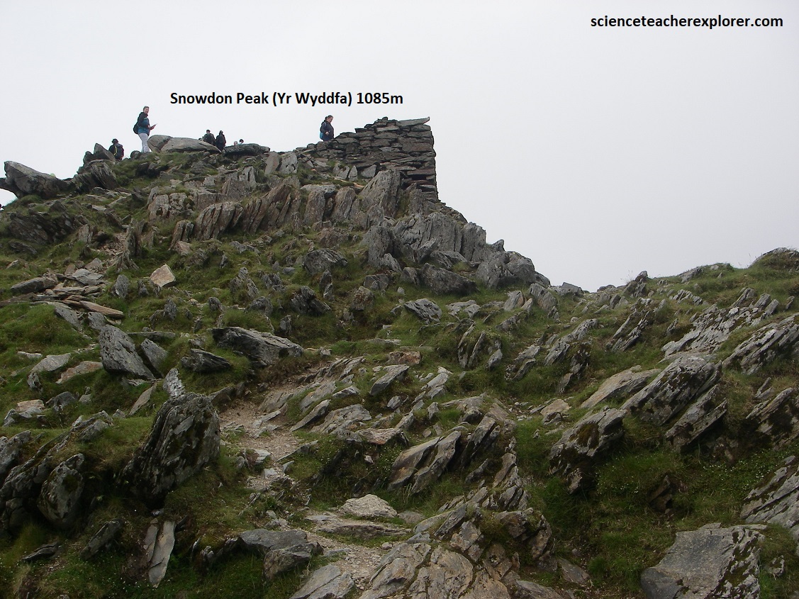
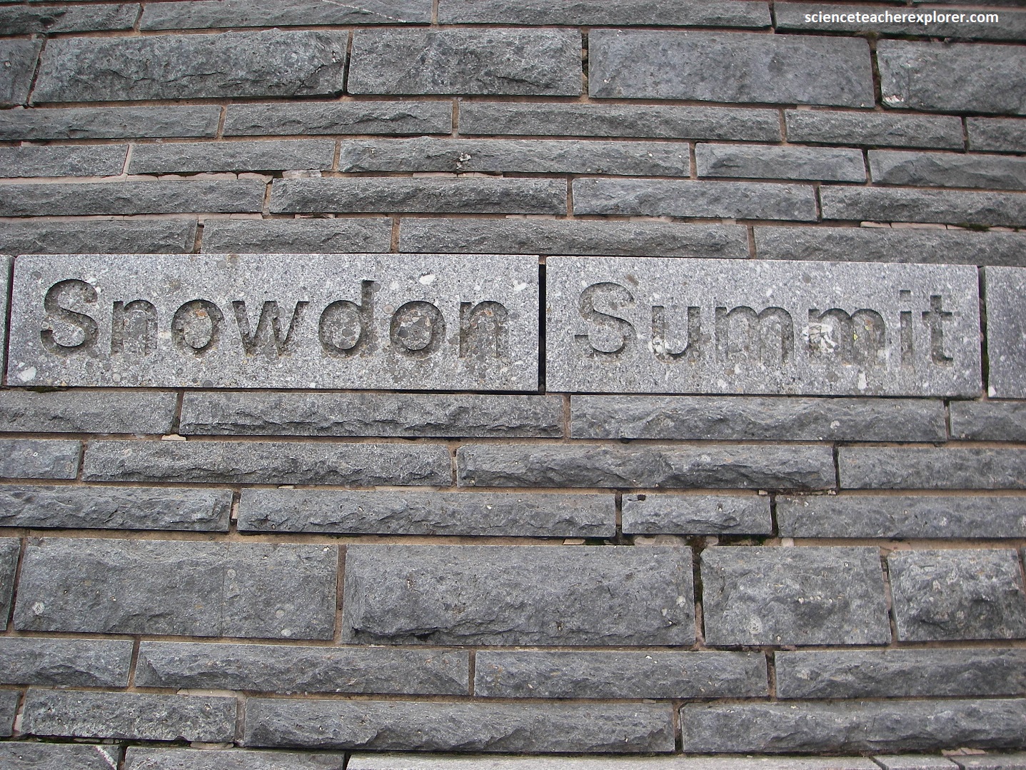
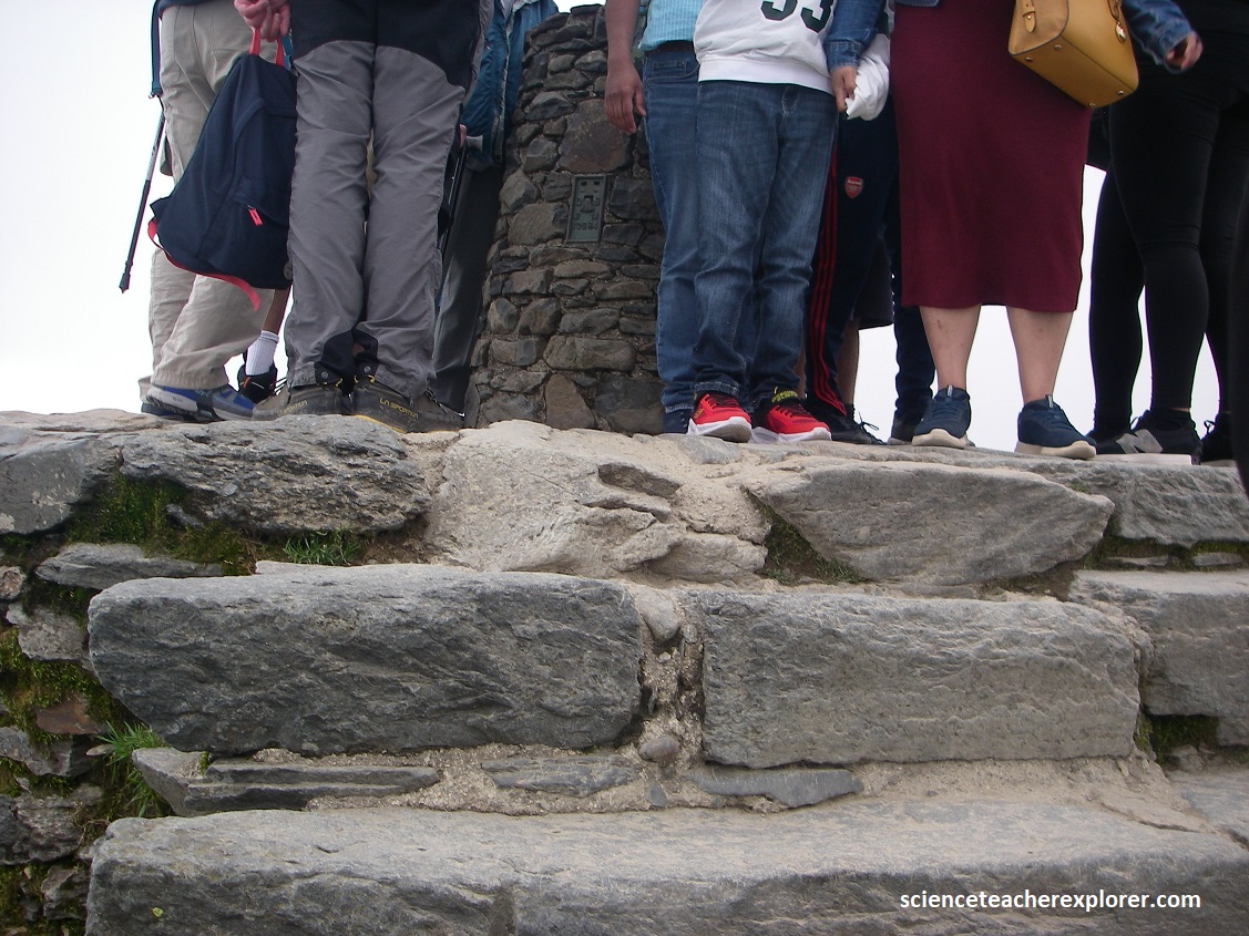
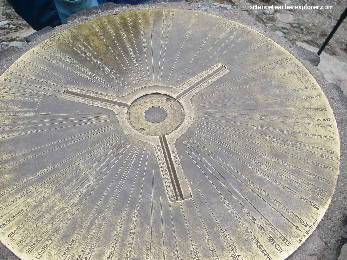
A brief trek/climb to the highest point from the restaurant was very crowded and windy. Pictured above on top, the ‘summit pillar’ was built in 2001 with a brass toposcope carrying the date 2000. This plate detailed exactly 100 locations, mostly other peaks, which could be seen, given ideal visibility. There are six main routes to take for climbing Snowdon from six different directions. I will show them with the pictures below.
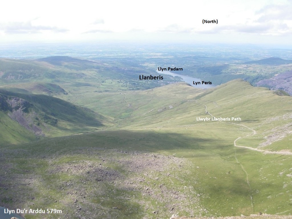
The Llanberis Path is the longest route, (6.8km), to the summit. It follows close to the line of the railway, and being the easiest ascent. However, during the winter it is also the most dangerous. Above, Clogwyn station has long been called the “Killer Convex”; where the convex slope could send unwary trekkers over the cliffs of Clogwyn Du’r Arddu. Four people died there in February 2009.
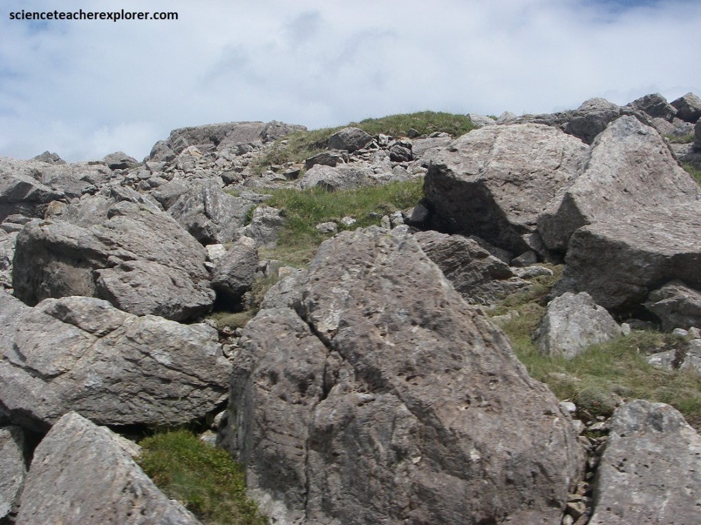
Pictured above and below, the present-day, steep, and rugged topography of Snowdon Peak was sculpted by glaciers during the Quaternary period (about 18,000 years ago), which carved out corries (cwms), deep U-shaped valleys, and sharp arêtes (pointed pyramidal peaks). The rugged and jagged appearance of these mountains is a direct result of freeze-thaw weathering. see boulder fields, screes and lakes when freeze thaw has been in action.
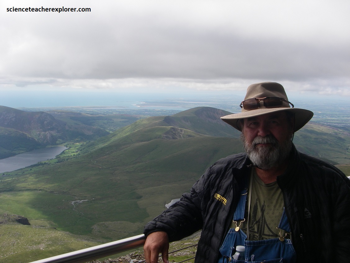
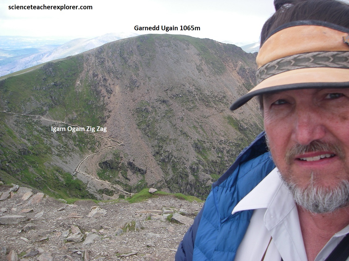
Pictured above, looking west, Tracy Davis is posing in front of the view of the Snowdon Ranger Path/Direction. This 6.3km path starts at Llyn Ffynnon-y-gwas and then climbs to Bwlch Cwm Brwynog, where it snakes along the ridge above Clogwyn Du’r Arddu towards the summit. I would say that it is the safest route.
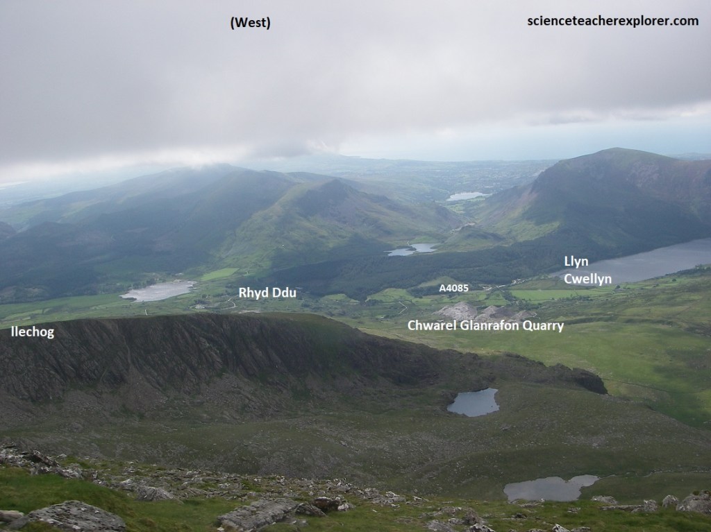
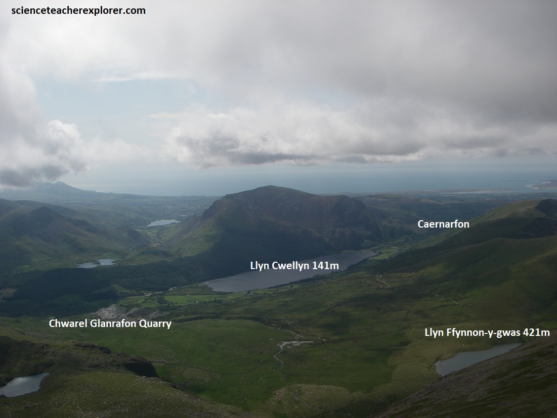
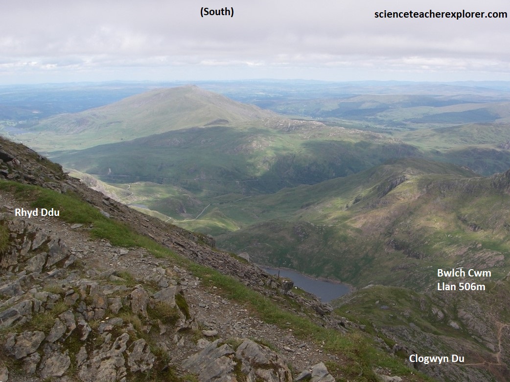
Pictured above, the Rhyd Ddu path, formerly called the Beddgelert Path, leads from the village of Rhyd Ddu, west of Snowdon, gently up on to Llechog, a broad ridge dropping west from the summit.
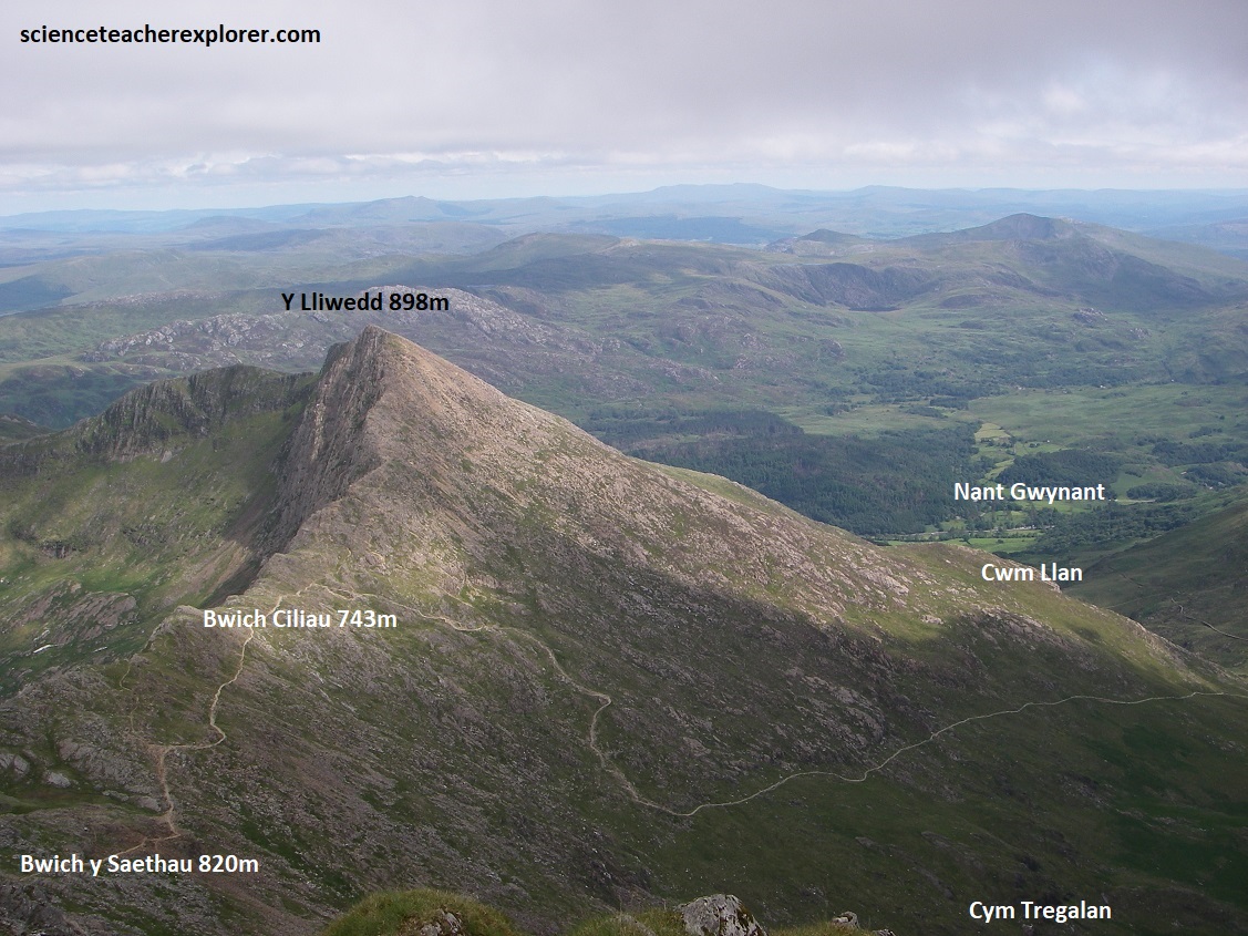
Pictured above, the 6.3km Watkin’s and Y Lliwebb Paths/Directions, is “the most demanding route direct to the summit of Snowdon”. It is also considered to be the prettiest with waterfalls & a famous rock ledge at the lower elevations. Many trekkers enjoy walking down this path to the bottom.
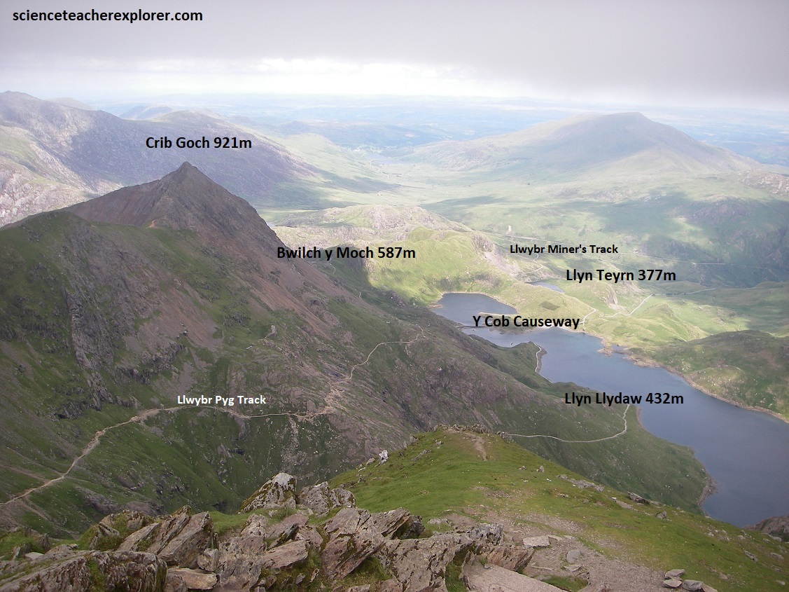
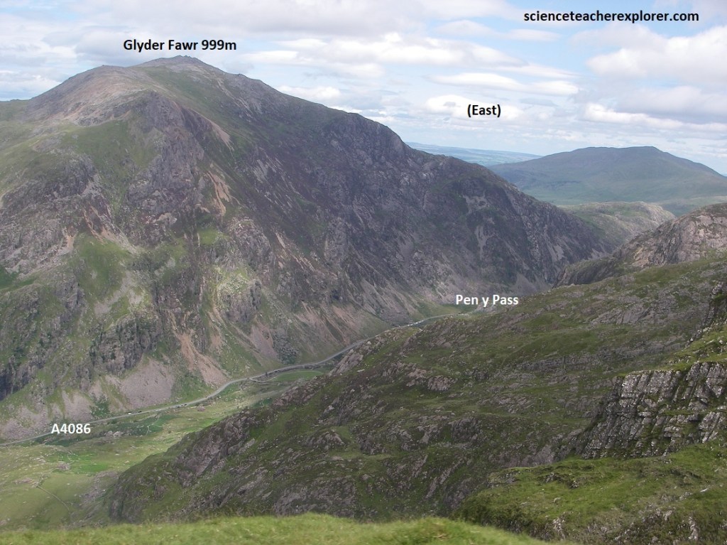
Picture above, I’m standing in front of the Miners’ & Pyg Track/Direction, (east). The Pyg track climb over Bwlch y Moch on the eastern flanks of Crib Goch, before traversing that ridge’s lower slopes. Above Glaslyn, it is joined by the Miners’ Track for the zigzag climb to Bwlch Glas between Snowdon and Garnedd Ugain. From the top it has the most spectacular view.
