Spiro Mounds, OK 2024
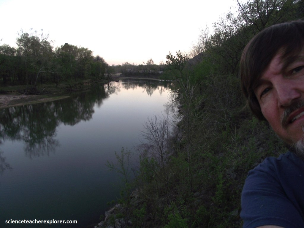
While trekking and exploring the northeastern corner of Oklahoma in 2024, I had the opportunity to visit the Spiro Mounds Archaeological Center, (imaged below).
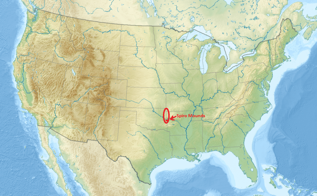
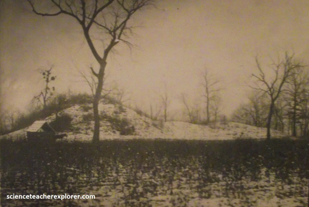
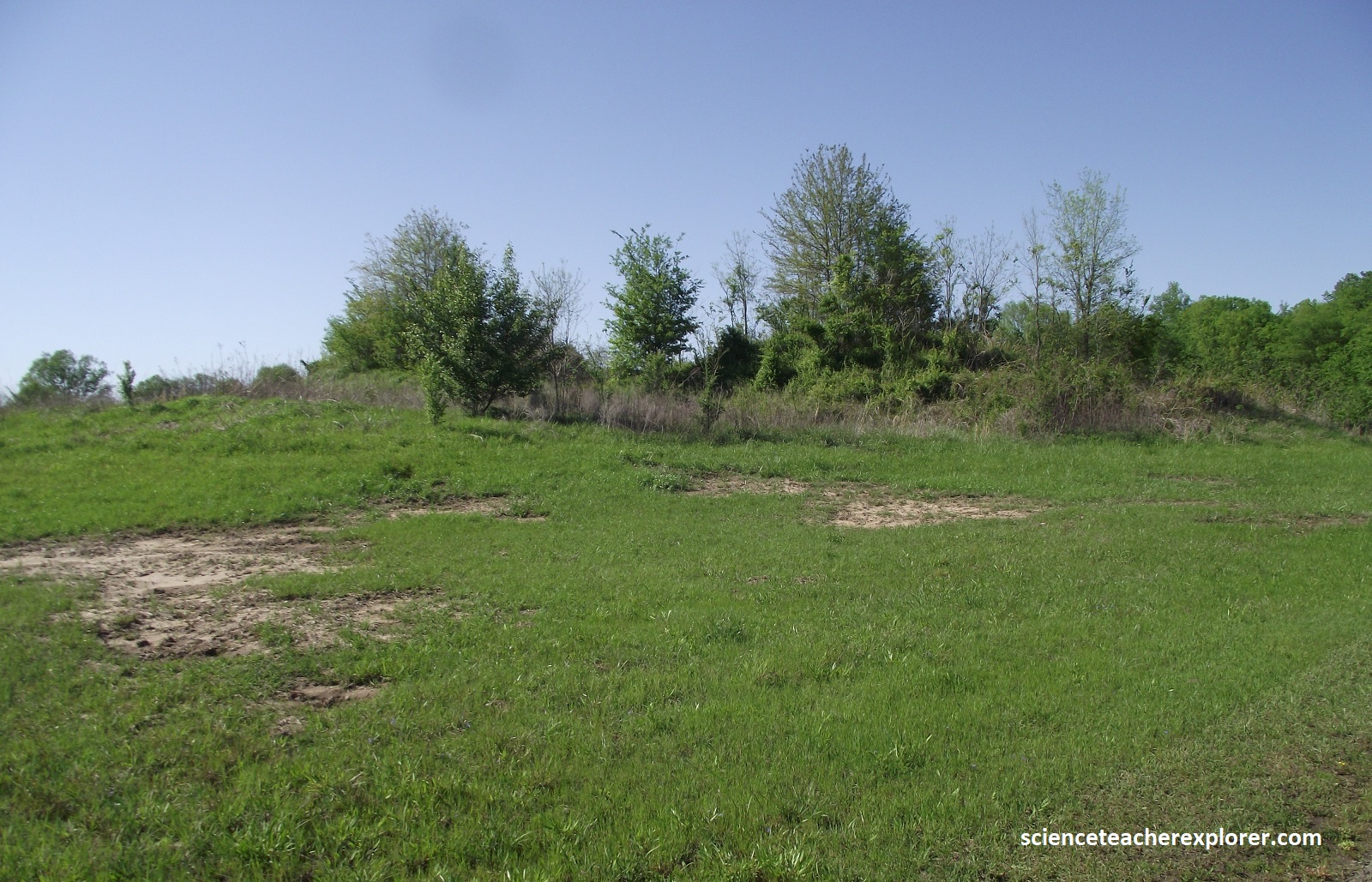
One of the four greatest centers of the Mississippian Native American culture, (and the most mysterious), flourished in the Lower Arkansas River Valley at a wide bend of the Arkansas River from the 9th to the 15th century. The park includes 150 acres and 12 mounds (imaged below).
My approach to the Spiro Mounds Archaeological Center was from the south, on U.S.-271 from Poteau to Spiro. At Spiro, U.S.-271 turns east, where I then drove 10 km to N4750, (Lock & Dam Rd.). Turning left, (north), I then drove 6.7 km, where I again turned left on OK-18. The Spiro Mounds Archaeological Center was about 0.5 km, (on OK-18), on the right. This was not an easy find.
Through the exhibits and walking trails of the Spiro Mounds Archaeological Center, I learned about the mysterious Caddoan-speaking people who live in this region for nearly 33,000 years. Their story was gleaned from early historic records, artifacts and data recovered by archaeologists. The story of Spiro Mounds was also told through traditions of the historic Wichita, Kichai and Caddo tribes.
The Arkansas River was key to the rise of the society at Spiro Mounds. the river provided an agricultural foundation for the city and its people. The predictability of rainfall, flooding and harvest allowed the city to thrive and extend trade and influence throughout much of the area now known as the United States. Spiro trade networks extended in all directions, traveling along major rivers. Goods and communication reached the Gulf of California the Great Lakes, the Gul of Mexico, the tip of Florida and along the Atlantic coastline to Virginia.
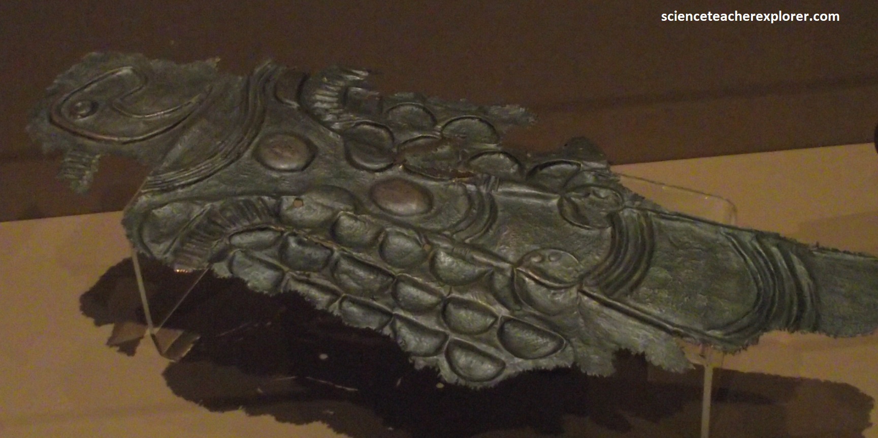
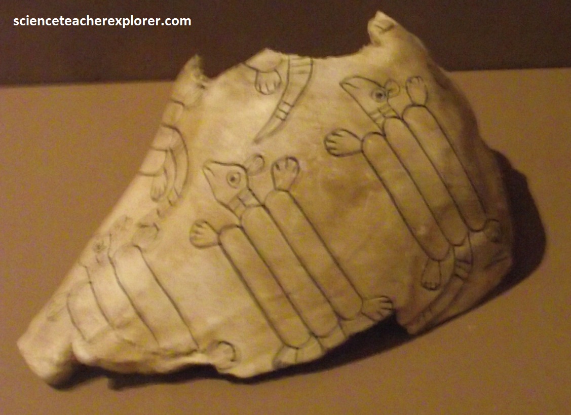
Spiro leaders controlled information with the creation of art and iconography (picture writing). This allowed them to record and standardize the basic religious, political and economic ideas of the Mississippian Culture. More art and iconography was found at Spiro Mounds than at any other prehistoric site in the United States.
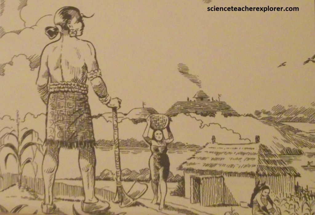
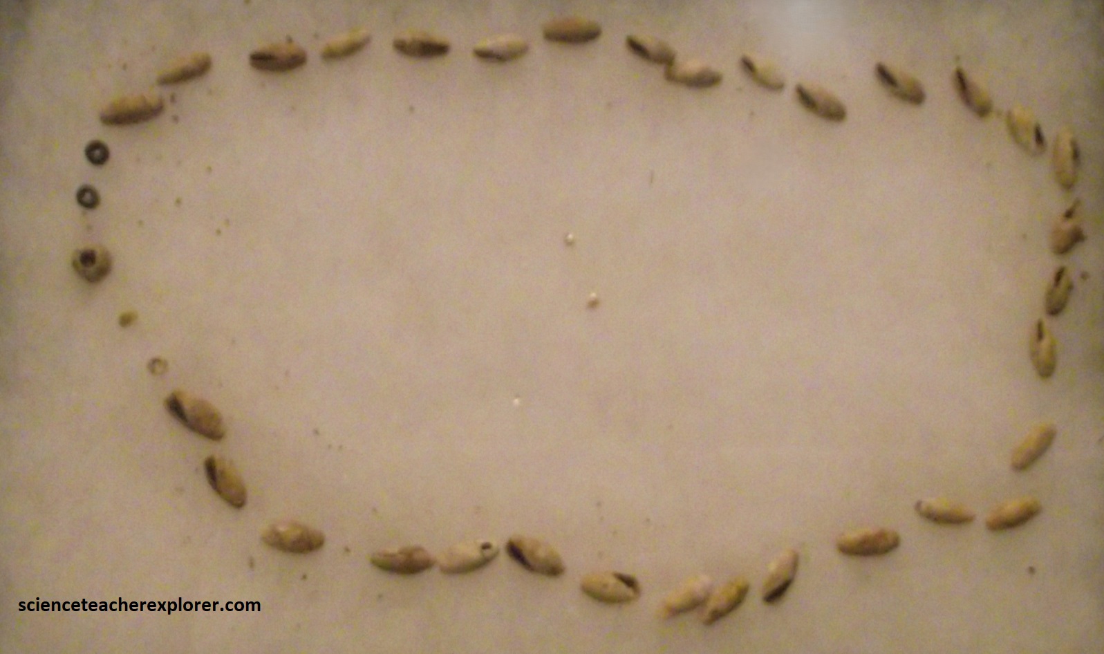
As with most communities of this time period and area, women were responsible for feeding the community at Spiro. the women, with the help of the children, would do the planting, weeding, harvesting, and general care of the crops. They also collected wild or semi-domesticated plants for food and medicines. Farming was a demanding task. Families burned and cut cane breaks and trees with stone axes to created fields near the river, and used hoes of stone and bone to prepare the fields for planting. Woman harvested grain crops with sickles made from the lower jaw of a deer attached to a wooden handle. Crops include corn, beans, squash, sunflower, may-grass, and chenopodia. Wild plants were also a food source.
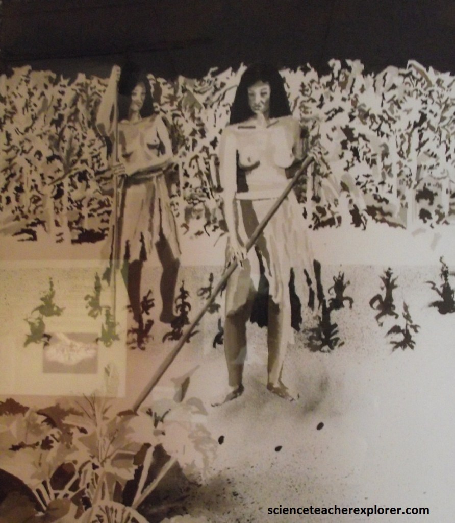
Life revolved around the seasons. In the spring, prior to the Vernal Equinox, the women would prepare the fields and then plant after the leaders performed spring rituals and approved the planting time. In September, the most important celebration took place at harvest with Busk or Green Corn Celebration near the Autumnal Equinox. As crops were harvested and wild foods were collected, they would be eaten or preserved by “drying or smoking”. Root crops would be hung from the ceiling in the house and grains would be stored in large pottery jars for future use.
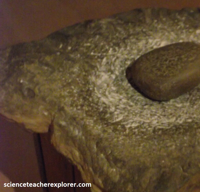
Most meals were stews with various types of meat, vegetables and spices cooked in clay posts for several hours. Grains were ground up on metates using manos to make flour that used for dumplings. Coarsely ground corn was used to make gruel. Fruits were made into desserts.
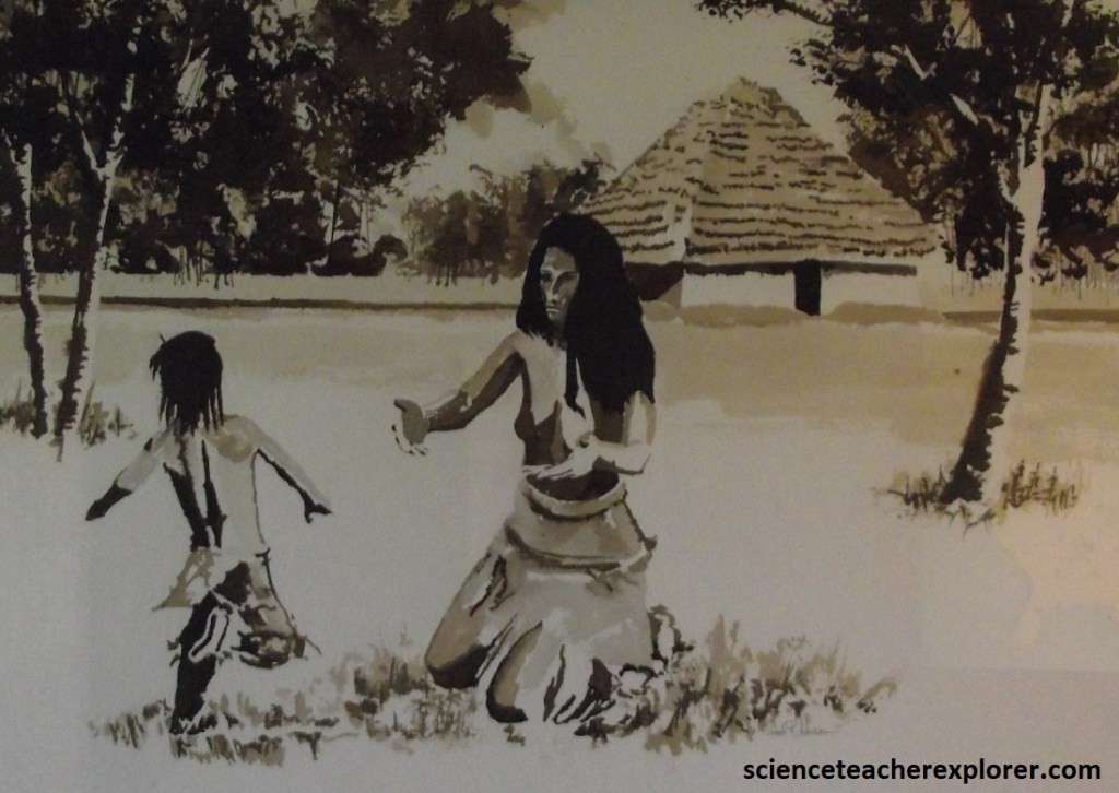
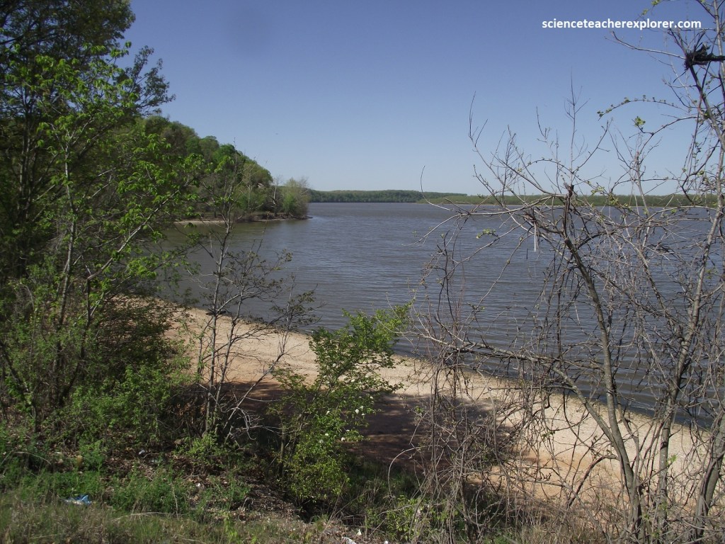
The Spiro area was originally settled around 800 A.D. along the Arkansas River. Over the next 300 years, this community grew to a population between 5,000 and 10,000. Today the site is peaceful and clean, but 1,000 years ago this was a loud, bustling seat of government, agriculture, trade and religion. Thousands of adults, children, and even dogs run around attending to their business amid a constant smoky haze from the home fires as well as the burning of fields. The Arkansas River bustled with activity. On a typical day on the river canoes floated past, filled with people and trade goods, people filled water containers, checked traps and wiers, fished and bathed.
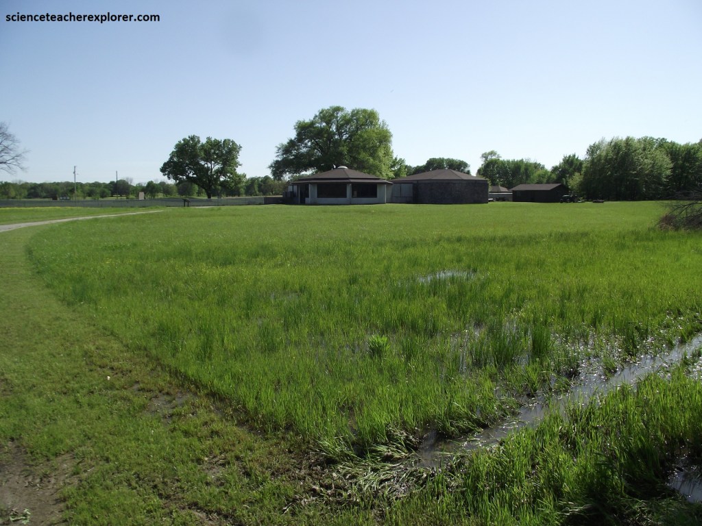
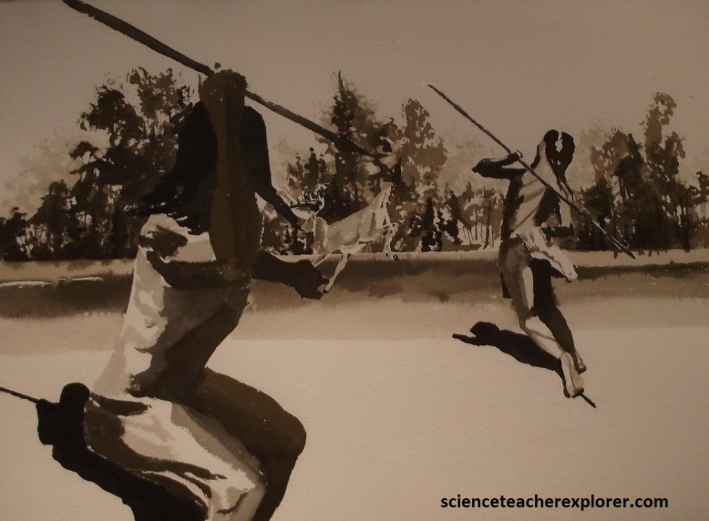
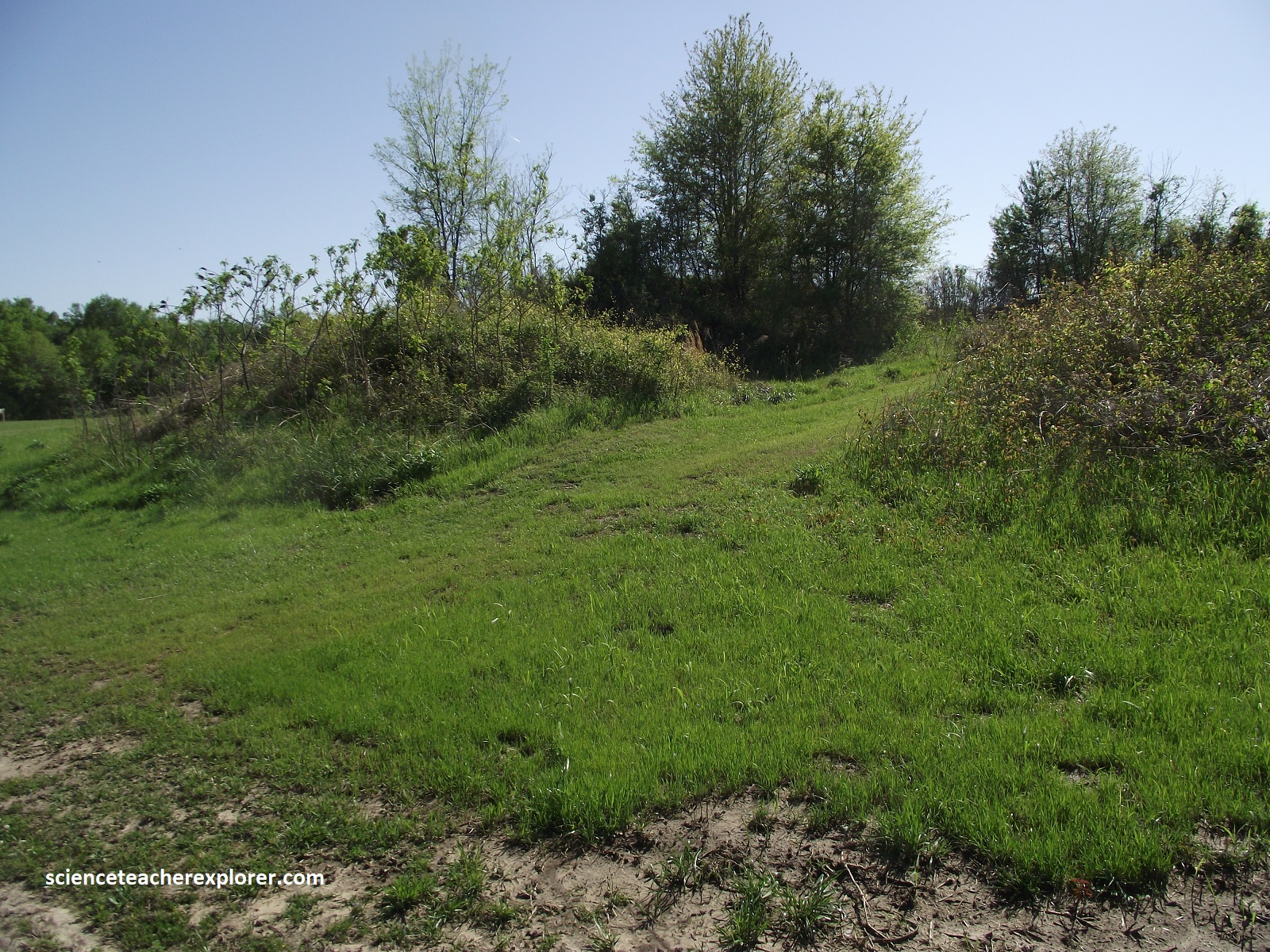
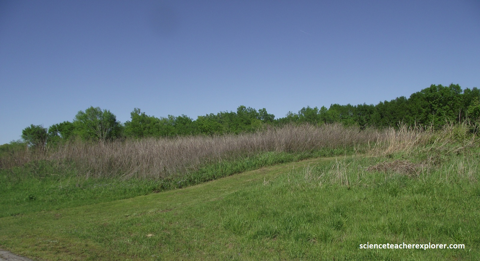
The incredible wealth of art and objects buried with the leaders made the Spiro Mounds Complex famous. Like a town square, the mounds were the site of political, religious, and social activities. Some were foundations for the homes of the elite, or spiritual leaders. Others were for the main political/religious buildings (Temples), and one mound was for the burial of the leaders Sprawling neighborhoods surrounded this city center where farmers, hunters, craftsmen, and their families lived, and most home were built on terraces overlooking the Arkansas River. The upper terrace was a dense Oak-Hickory forest with open grasslands maintained for the men to hunt, (imaged below).
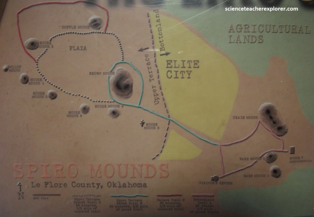
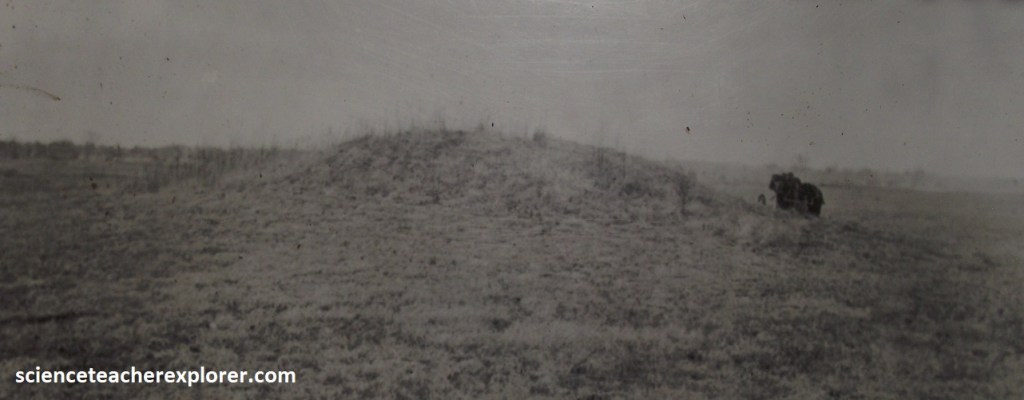
Twelve mounds were built on the 150 acre site: a leaders burial mound known as Craig Mound, two temple mounds, and nine house mounds. These mounds are in two main groups the Bottomland and the Upper Terrace. The Bottomland mounds are Ward Mound 1 and 2 and Craig Mound. They are located on the Arkansas river floodplain just to the east of the Visitor Center. The Upper Terrace mounds are on the terrace overlooking the river bottoms to the northwest of the Visitor Center. Surrounding the ceremonial mounds was a city made up of the swellings of farmers and craftsmen, and beyond these were agricultural lands on the Arkansas River bottoms that sustained all of Spiro.
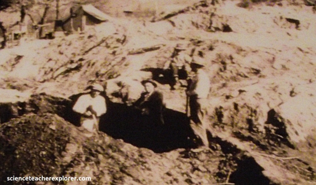
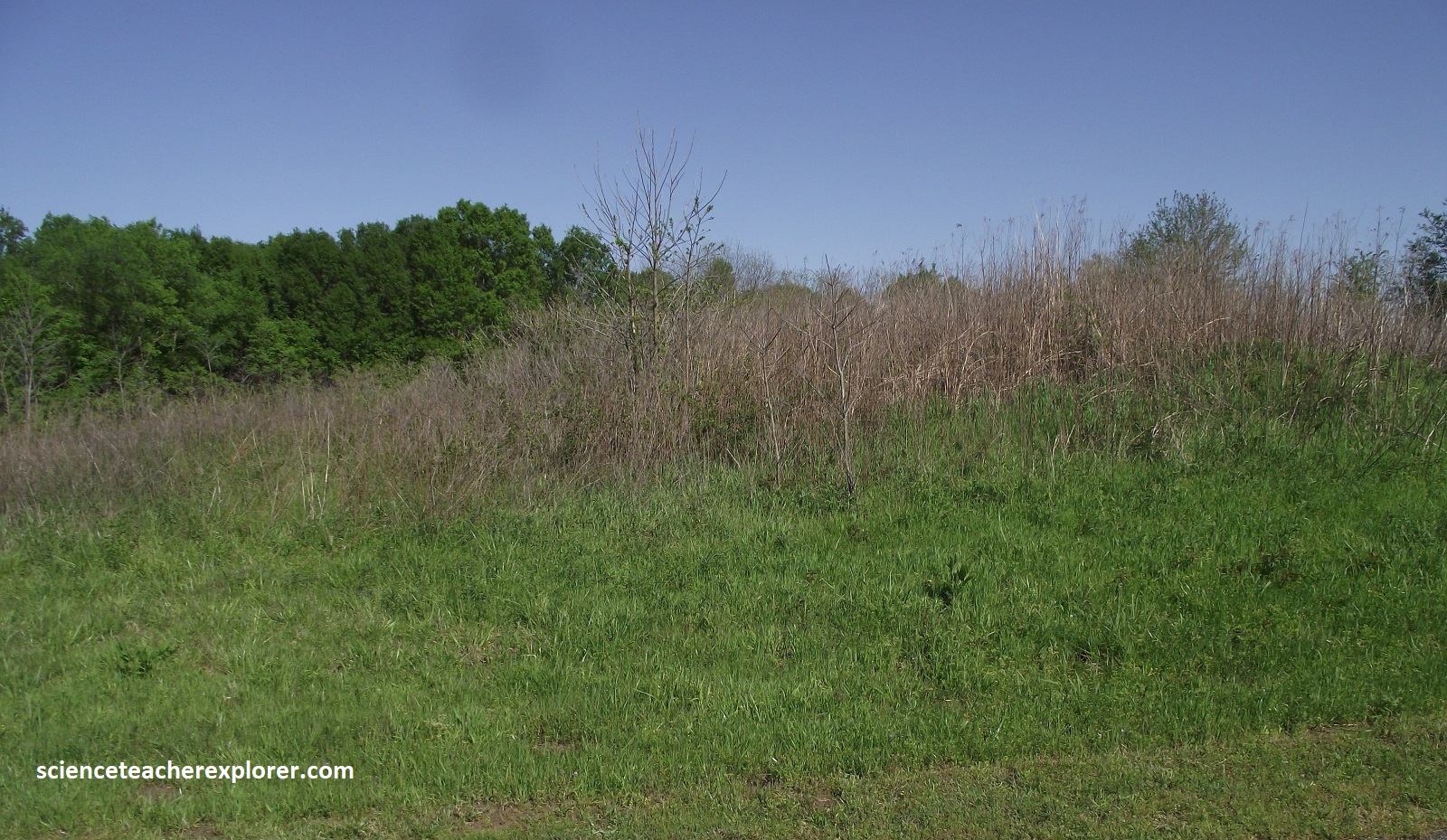
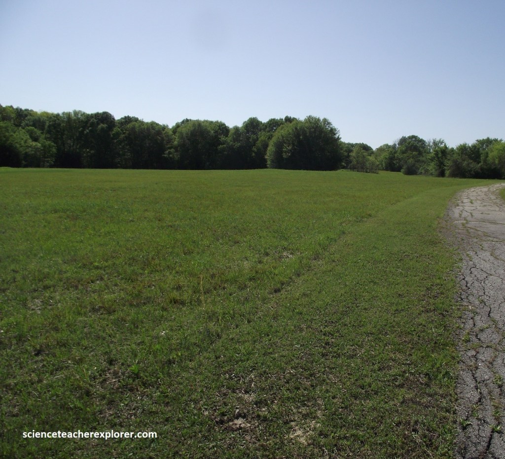
The first mounds to be studied were Ward Mounds 1 and 2. In 1916-17, Joseph Thoburn dug into the mounds and found that both were house mounds. House mounds were created as the base for a leader’s house, elevating it above all others, (imaged below).
Only the immediate and extended family of a principle leader, like our governor or president, would live on a mound. Their homes were constructed of cedar and other woods, grass, cane and clay.
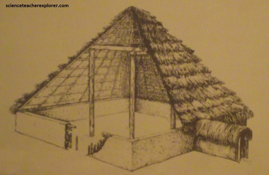
The houses were built, used until the leader’s death, and then destroyed, often by burning. Basket-loads of dirt were carried up from pits along the river and used to cover the old house area with one to two feet of earth. The mounded earth was then flattened on top and sloped on the sides, so it looked like a very small cut-off pyramid. Occasionally the mound was left vacant, but usually the next leader’s home was built on the flattened area. As leaders lived and died, the mound grew larger.
Pictured above, the University of Oklahoma conducted excavations of the Ward mounds from 1936-1941. Ward Mound 1 is located to the south of Ward Mound 2. Ward Mound 1, (pictured by the tree above), was 25m is diameter and 3.1m high. The house covered by the mound belonged to a Spiro leader and was probably used between 900-1050 A.D. After his death, the house was destroyed and covered with dirt. At least 38 human burials were added later. Ward Mound 2 was slightly smaller in diameter but built in a similar way.
Pictured above, Craig Mound is the only mound created for the burial of leaders, although some of the other mounds had burials placed into them. It was used far longer than any other mound at this site and is the largest mound of the complex. By the time of its final use, Craig Mound was around 117m long, 38.3m wide and 11.3m high. The mound was built over 600-800 years as layers of burials were covered by layers of dirt.
Unfortunately, Spiro Mounds is noted as the site of one of the country’s most extensive lootings of artifacts. In 1933, local treasure hunters formed the Pocola Mining Company and bought the rights to dig into Craig Mound, to recover and sell whatever they found, (pictured above). Two years later, public opposition caused Oklahoma to pass one of the first laws protecting antiquities in the country, but the company continued digging.
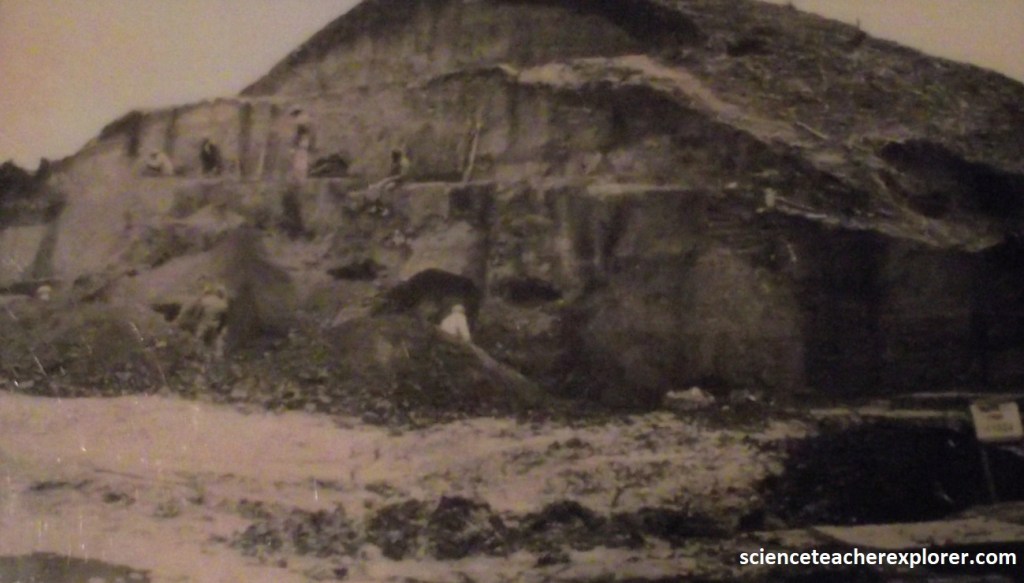
It hired coal miners to tunnel into the mound where and open room, probably a burial chamber, contained and enormous quantity of artifacts, including exceedingly rare, perishable ones. As state authorities moved in to close the operation of the “miners” dynamited the chamber, further destroying forever what historic information could have been acquired. From 1936 to 1941, Spiro was excavated by archaeologists form the University of Oklahoma. Over the years, additional research has been conducted at Spiro, and many of the looted artifacts have been recovered.
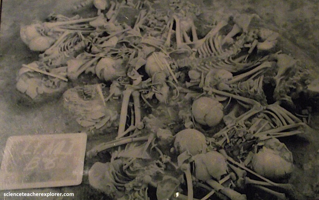
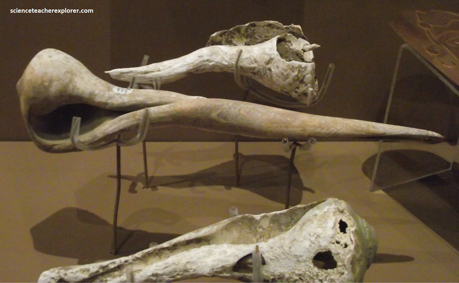
Of the bodies found by the University of Oklahoma, 251 were adults between twenty and fifty years of age. Sixty-nine young adults (between fifteen and twenty years of age) wee found, along with thirty-seven middle-aged individuals. The remains of twenty-six young children were also found. Only sever elderly bodies were found. The majority of the remains were male.
The Mississippian culture created thousands of mound sites in the eastern U.S., beginning in 850 A.D. Craig Mound, the only burial mound at Spiro, was used for the burials of over 1100 leaders. Pipes, conch shells, copper plates, and other items indicative of power and authority were interred with the owner to use in the afterlife. Because more of these items were found at Craig Mound than at any other site in the U.S., newspapers nicknamed this site the “King Tut of the West.”
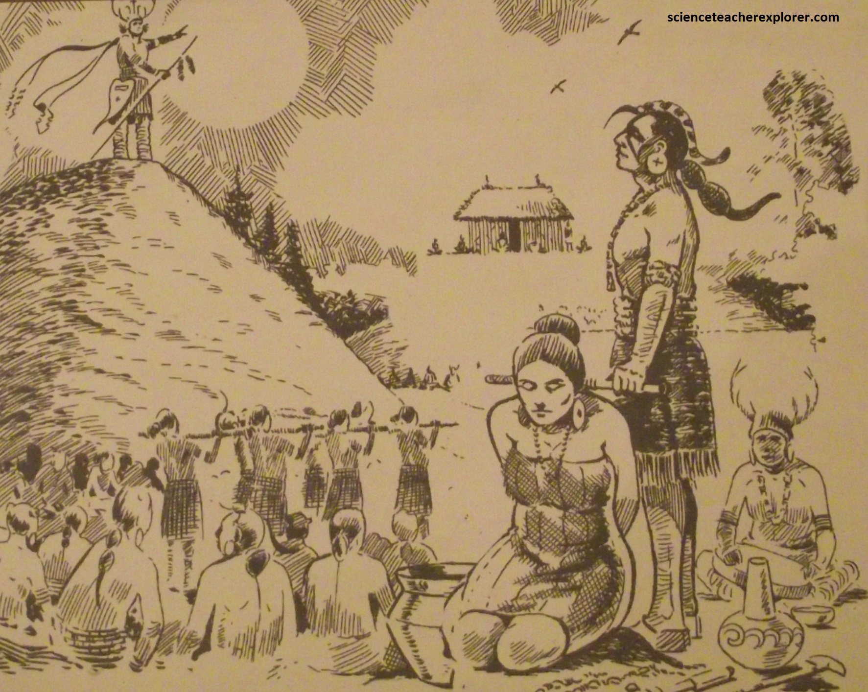
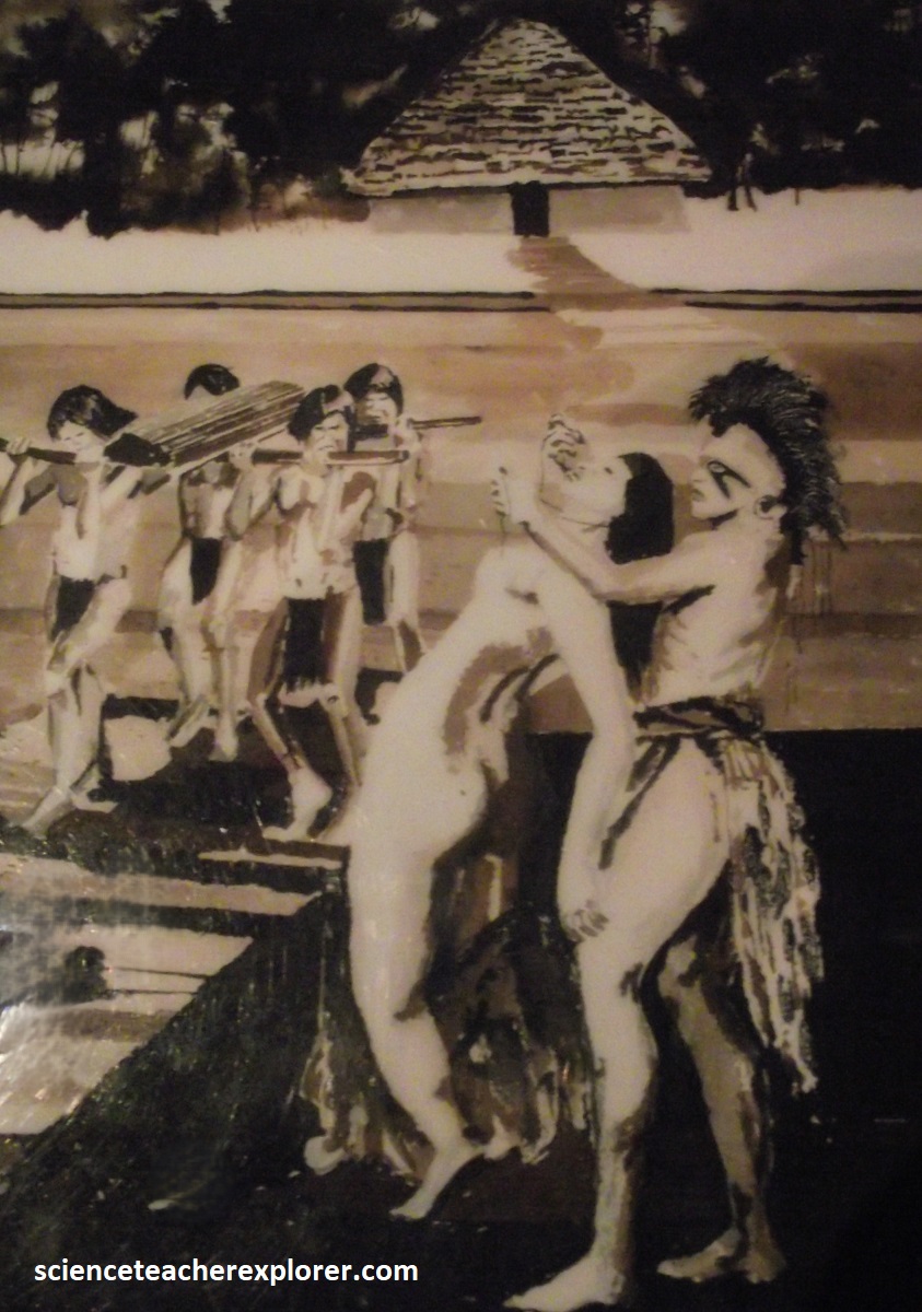
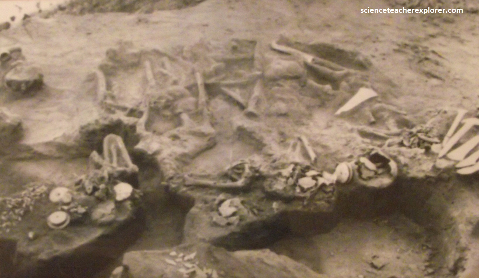
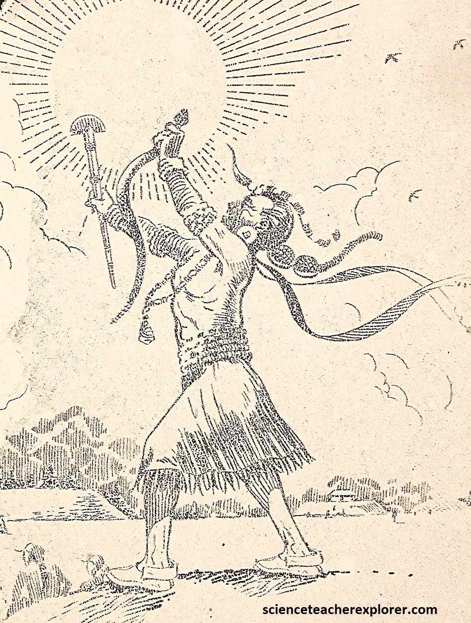
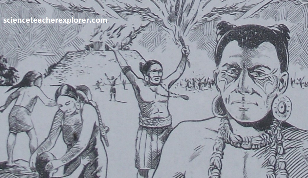
The most elaborate burial was that of “The Great Sun”, the principal leader of the Spiro people. The body was cleaned and dressed in ceremonial garb. Priests then laid the body on a litter of cedar poles surrounded with symbols of power. Imaged below, when the funeral day finally arrived, crowds of people lined the pathway from the Brown-Temple Mound to Craig Mound. Several warriors carried the litter along the route to lay it on the surface of Craig Mound. Close to the burial mound, the spouse and servants of “The Great Sun” knelt and members of the warrior society stood behind. As the body of “The Great Sun” passed by, the spouse and servants were beheaded or garroted (ceremonially strangled) and the bodies placed near the letter on the Craig Mound. The burial was then covered with 1-6m of dirt. (Images below of “The Great Sun” burial were taken from interpretive signs on-site).
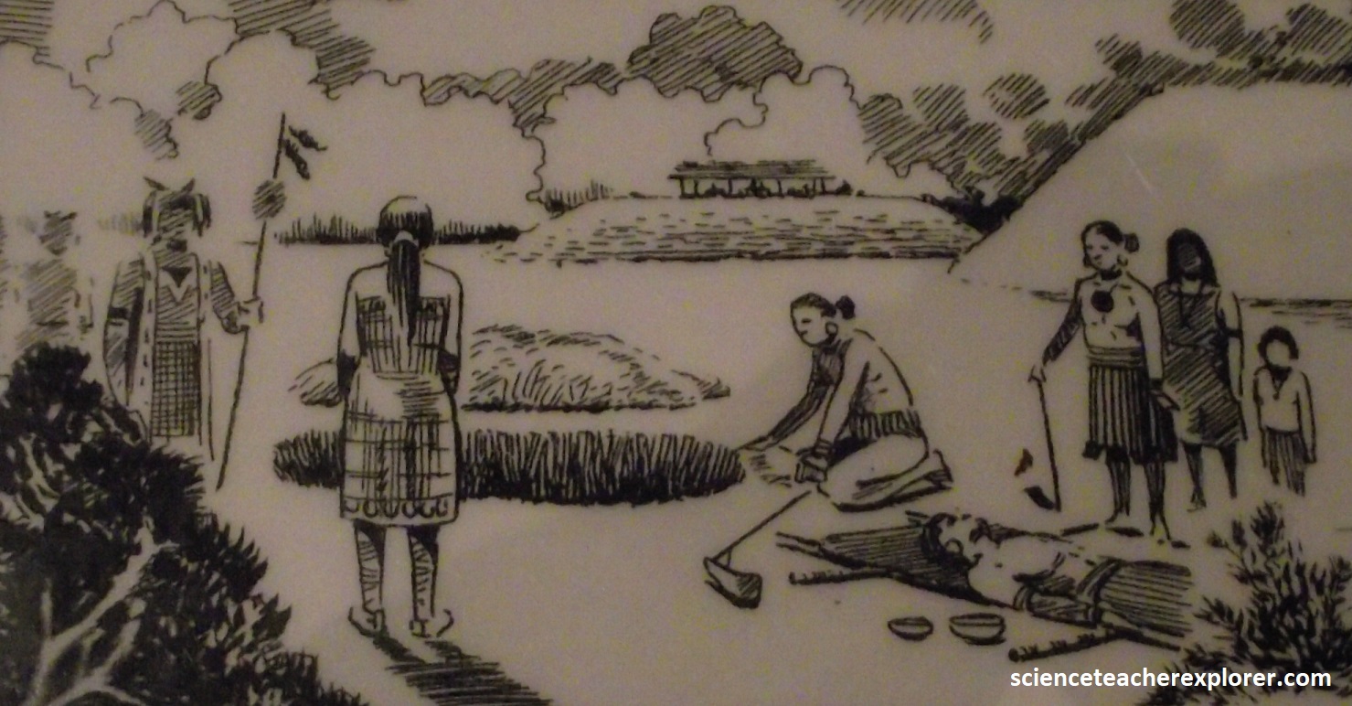
The most common type of burial at Craig Mound was that of mid-level leaders and elders. The bodies were prepared in one of two ways: stripped of flesh and the bones stored in baskets of buried in cemeteries in the home area and dug up when a major group burial at the Craig Mound occurred. Sometimes the remains of as many as 100 people were placed on the mound and covered with a thick layer of packed dirt. (Images below of group burials were taken from interpretive signs on-site)
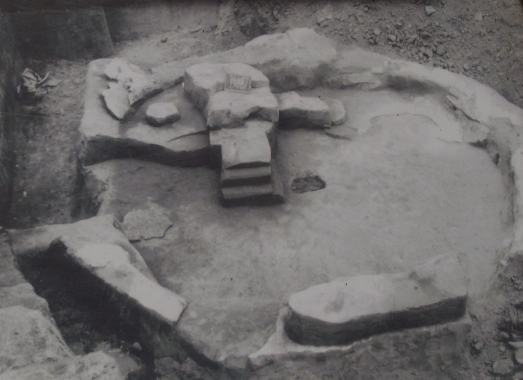
Other types of burials were also used by the Spiro peoples. At one point, for approximately 100 years, a clay crematorium was constructed on the burial mound. It measured 5.3m across and 0.3m deep. Steps descended into the pit and a drain prevented flooding. Archaeologists have found charred bone pieces but the total number of cremations that took place is unknown.
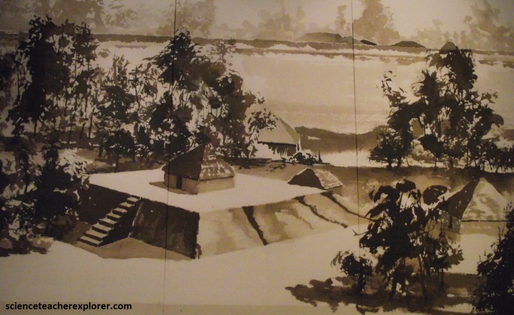
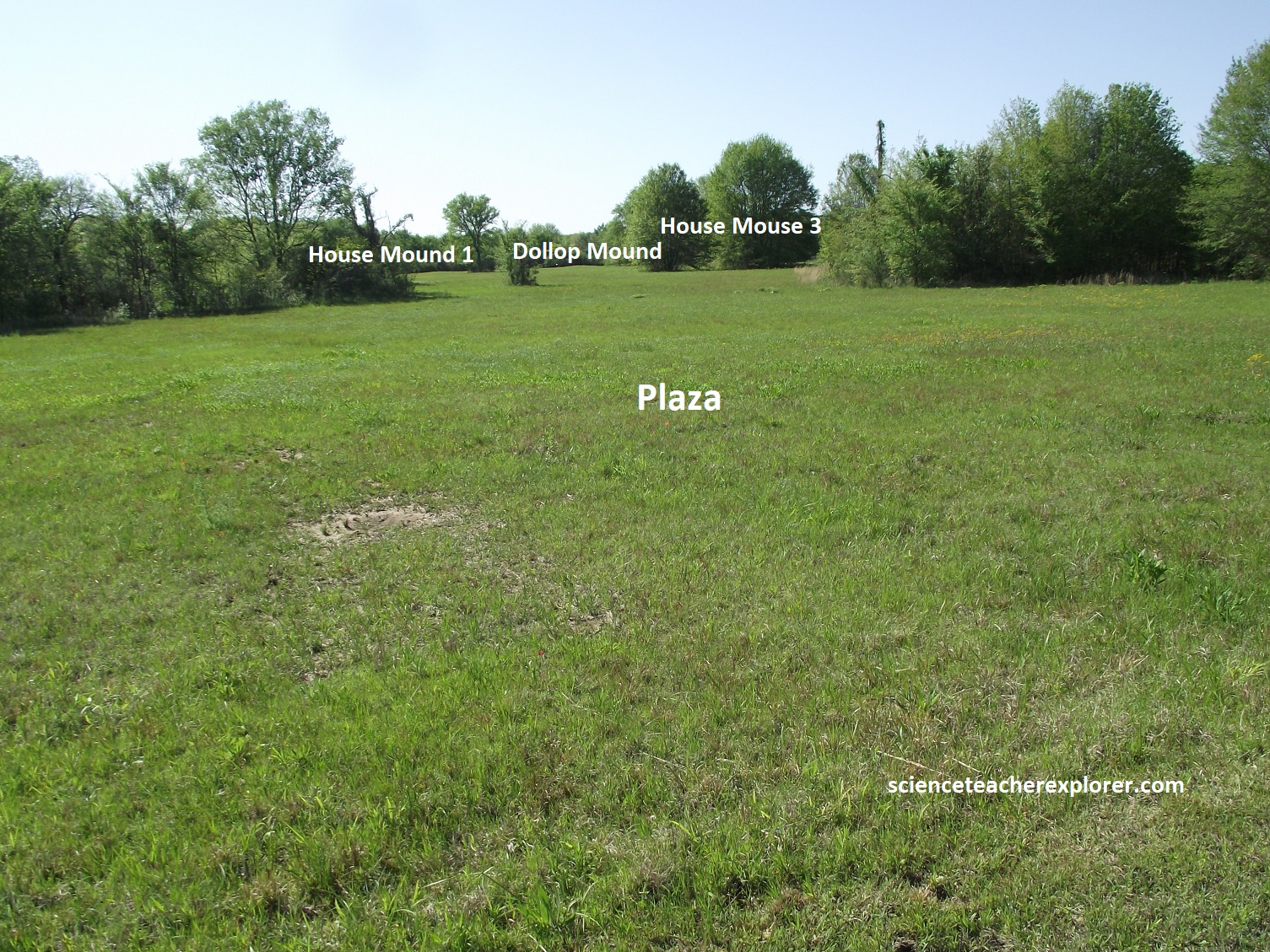
Nine mounds were created on the upper terrace between 850-1450 A.D.. The largest mound is Brown Mound, the site of the principle ceremonial building, (mentioned above). The other mounds are house mounds developed as leaders died and their homes were destroyed and covered with dirt. The mounds grew larger as each leader built his home there. The main temple was located on Brown Mound. Temples were built in the same manner as houses, but were larger, approximately 13m square, the interior of the building was open, with center support posts.
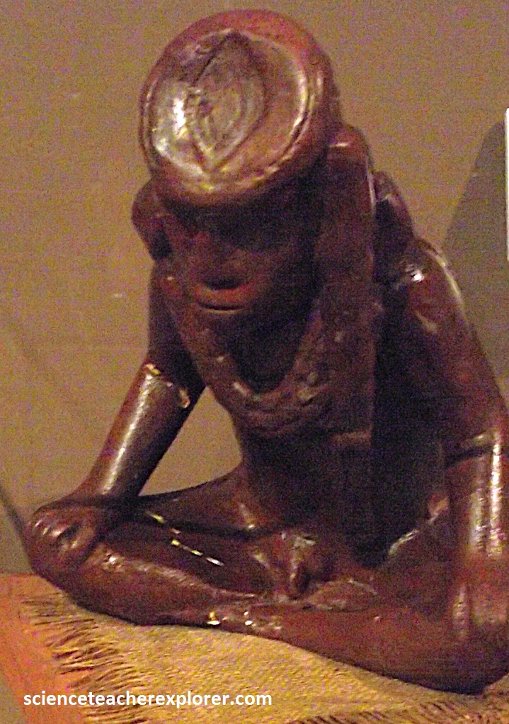
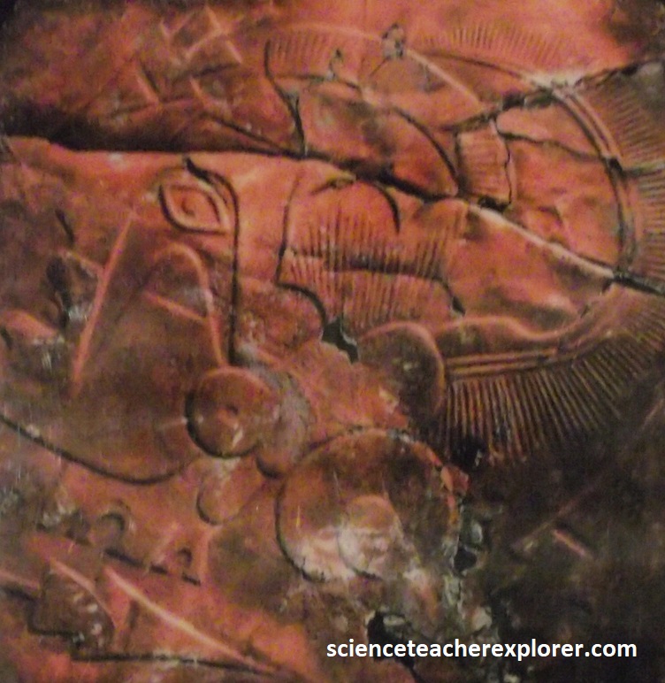
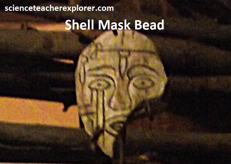
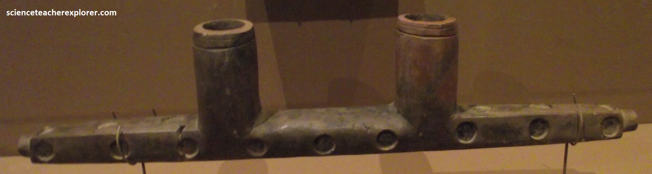
Located within the large room was the First Fire and baskets of ceremonial items, such as copper, conch shell, beads, effigy pipes and personal ceremonial items, (pictured below from the Visitors Center at Spiro Mounds in 2024).

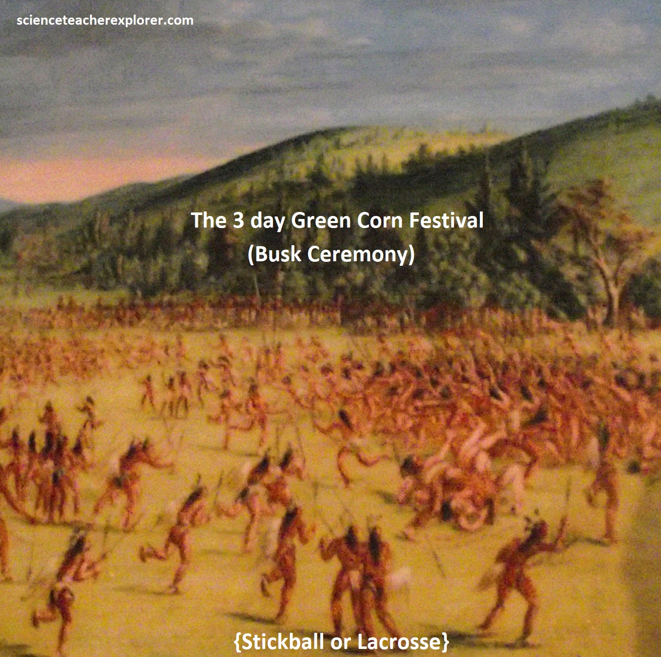
The mounds, on the upper terrace, form a rough oval around an open central area called the Plaza. Many ceremonies took place in the Plaza and Temple area. The most important was the Green Corn Ceremony (Busk) which was held around the autumnal Equinox in September when the late corn was ripe. The purpose of the ceremony was to cleanse the society of past bad behavior.
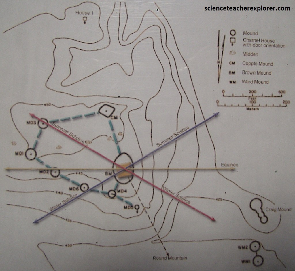
Imaged above, Brown Mound is located at the eastern edge of the Plaza. This mound and three of the house mounds were constructed so that they were in alignment with the sunsets of the various solstices and equinoxes during the year. Summer Solstice (House Mound 3), the Winter solstice (House Mound 6), and the Vernal and Autumnal Equinoxes (house Mound 2). {The lower image below were taken from an interpretive sign on-site}
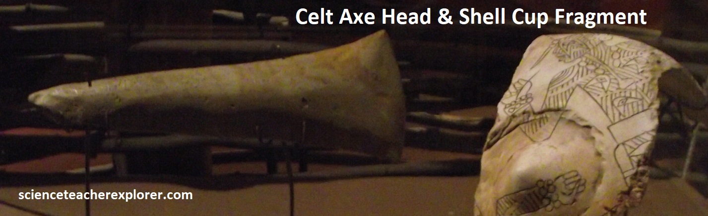
The sun, when viewed from the top of the temple mound on these days, would set over one of the three mounds and the house of the primary leader. For the elite, this visual link of the leader’s spiritual power to the sun was a powerful ceremonial event. The main Temple mound, (Brown Mound), was the center of Spiro’s spiritual, political, and judicial life. The symbol of the sun, the First Fire, burned continuously in the Temple. The Temple was the main focus of the society’s important decisions regarding planting and harvesting times, judicial issues, and spiritual healings. {Photos below were taken in the visitor’s center at the Spiro Mounds Site, Oklahoma 2024.}
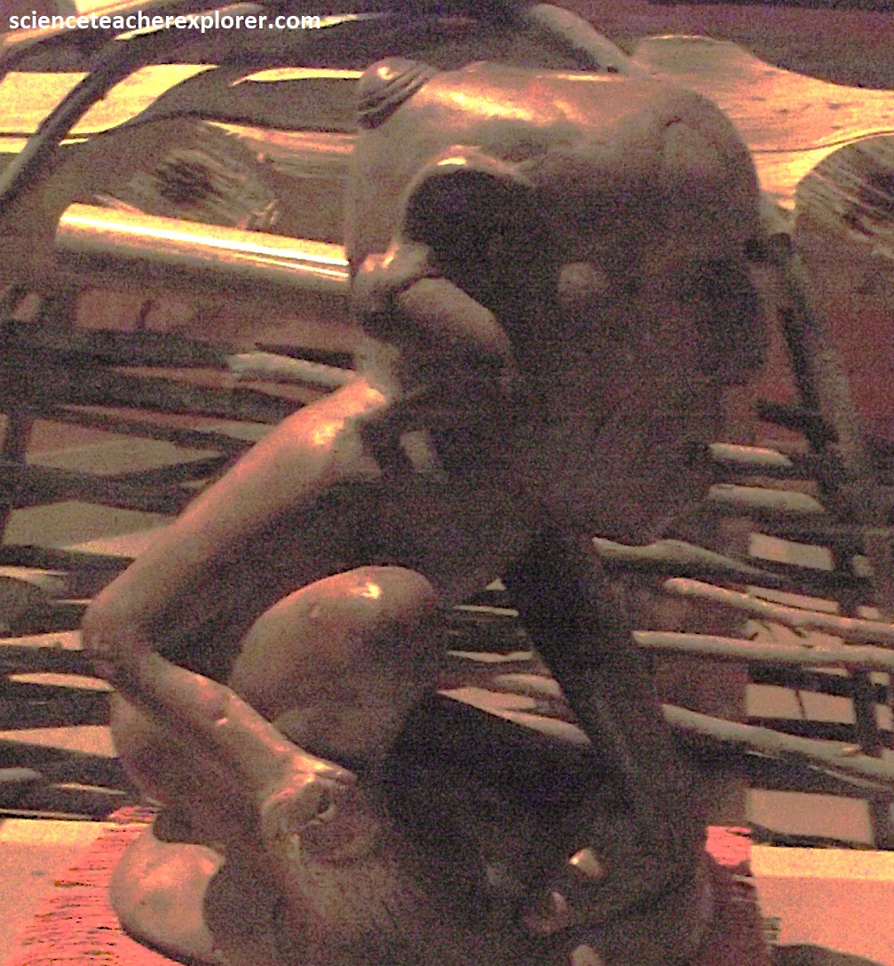
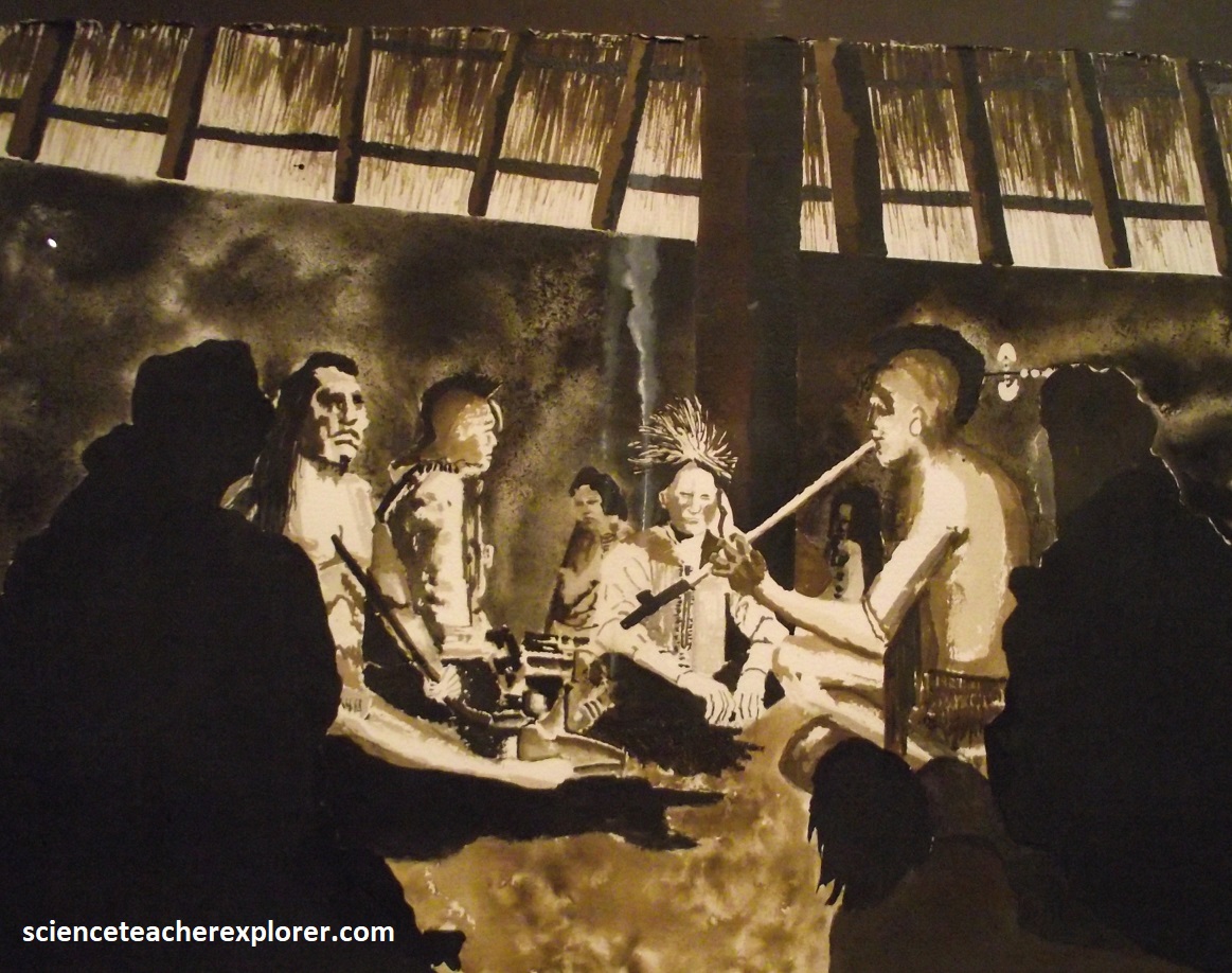
It was also used to store personal ceremonial items such as hunting and fishing tools. Some of these items, including the Lucifer (or Deer Dancer) effigy pipe, were used by generations of men who held the priestly position of the “Deer Dancer”. Non-public religious ceremonies, using ceremonial herbs and ritual items, took place in the Temple. Tobacco was considered a sacred plant and was smoked in effigy pipes before a ceremony as a method of ritual cleansing. The smoke was swallowed, causing the smoker to vomit, ridding himself of outside influences that might otherwise interfere with his spiritual experience. {Photos below were of the Brown Mound, (Sun Temple), of the Spiro Mounds in 2024}
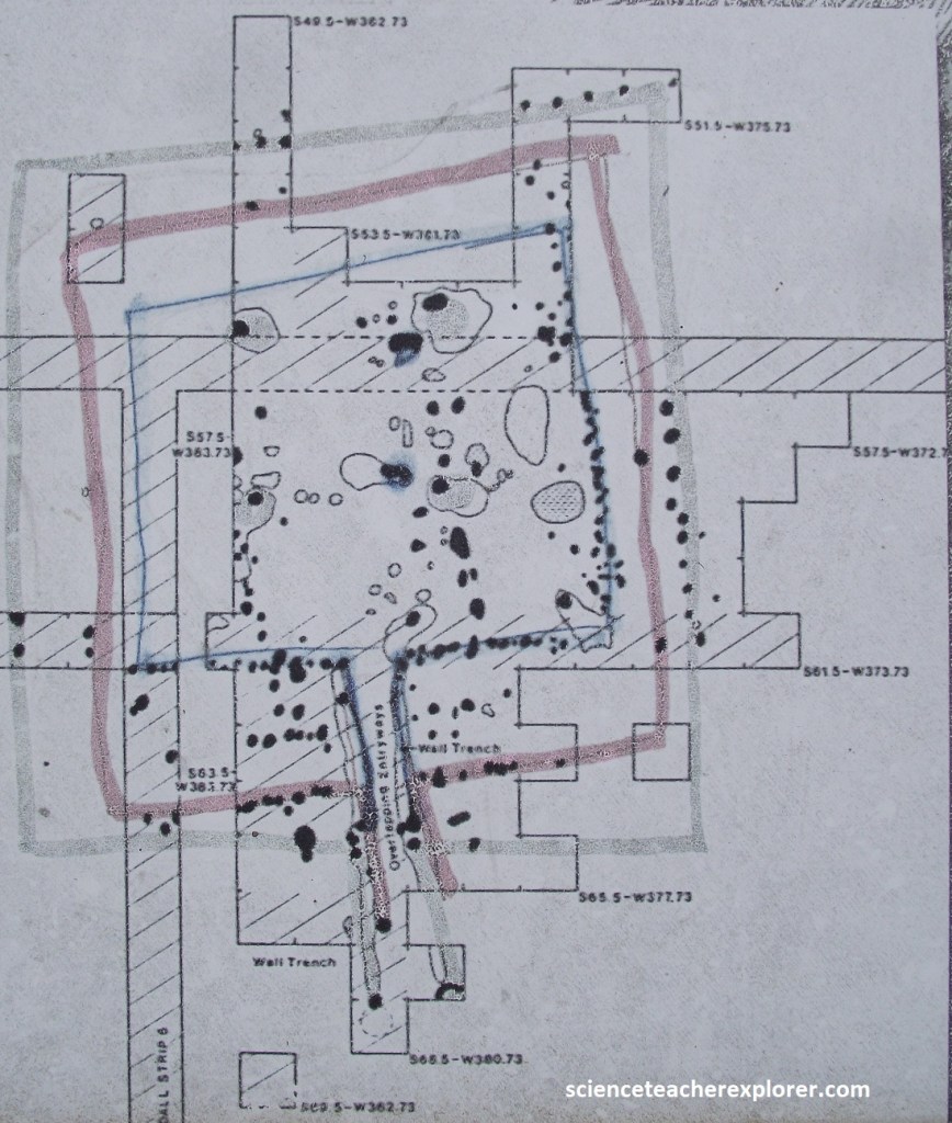
Pictured below; House Mound #5 was discovered in 1979, along with House Mound #6 and Dollop Mound. These last two mounds remain unexcavated. House Mound #5 was partially excavated by the Oklahoma Archeological Survey during 1979 and 1980. Using an easily portable geophysical instrument known as a magnetic gradiometer, archaeologists have surveyed parts of Spiro cheaply and efficiently for the past 40 years without disturbing the surface. The gradiometer measures small changes in the magnetic properties of the soil that may be caused by digging a hole or a fire pit. The survey results located a few houses that appear to be similar to previously excavated square ones, as well as a large number of highly magnetic round areas.
At the House #5 site, a house was built on the ground surface between 900-1000 A.D.. When this house was destroyed by fire it was covered with dirt, and a second house was built on the mound. It was eventually dismantled and replaced with a third house. Each new house, though larger than the previous one, was built in the same way. After the last house was no longer used, it was destroyed and a thick layer of soil was brought in to form the rest of the mound.
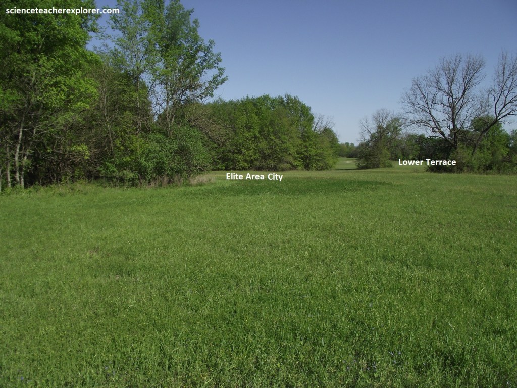
The Spiro Mounds were surrounded by a city of approximately 10,000 people. While burial practices of the Spiro people highlighted the differences between classes, homes showed the similarities of daily life. House of both classes contained similar implements and food. The primary differences between the elite and common classes lay in the size of their homes and the items with which they were buried. As in other Mississippian cities, the elite class lived separately from the general population. From 850 A.D., separation allowed the elite to appear to be physically and psychologically superior. About 50 larger houses were located along the bottomland of the mound site, reinforcing the special position and power of the occupants, (picture below).
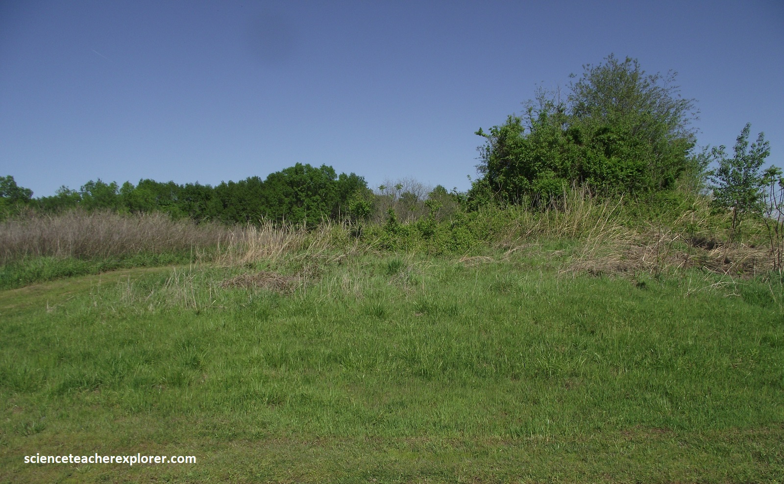
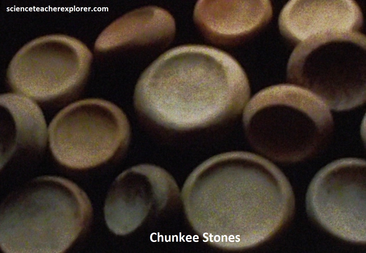
The Plaza at Spiro is a rough oval, surrounded by seven of the nine mounds in this part of the site. The Plaza was a combination of town square, church sanctuary, football stadium and civic center. Ceremonies such as the Green Corn Ceremony took place here, as well as dances and special game like chunkey and stickball, (Lacrosse).
Additionally, the Plaza was important to the inhabitants of Spiro in reinforcing the spiritual link and power of the primary leader, known as “The Great Sun”, (mentioned above). {The temple and House Mound #3 aligned at the Summer Solstice sunset; the temple and House Mound #6 aligned at the Winter Solstice sunset; and the temple aligned with House Mound #2 at the Vernal and Autumnal Equinox sunsets}.
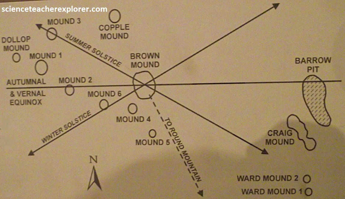
On the sunsets of those days, as seen from the top of the temple mound, the sun would set over one of those three mounds and the house of the leader. This linked “The Great Sun” and the institutions he controlled to the sun, their most powerful spiritual entity.
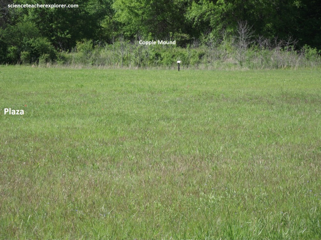
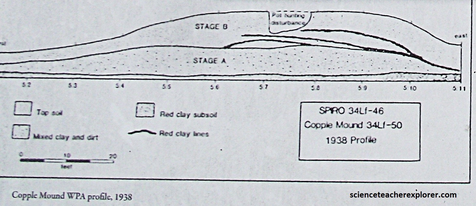
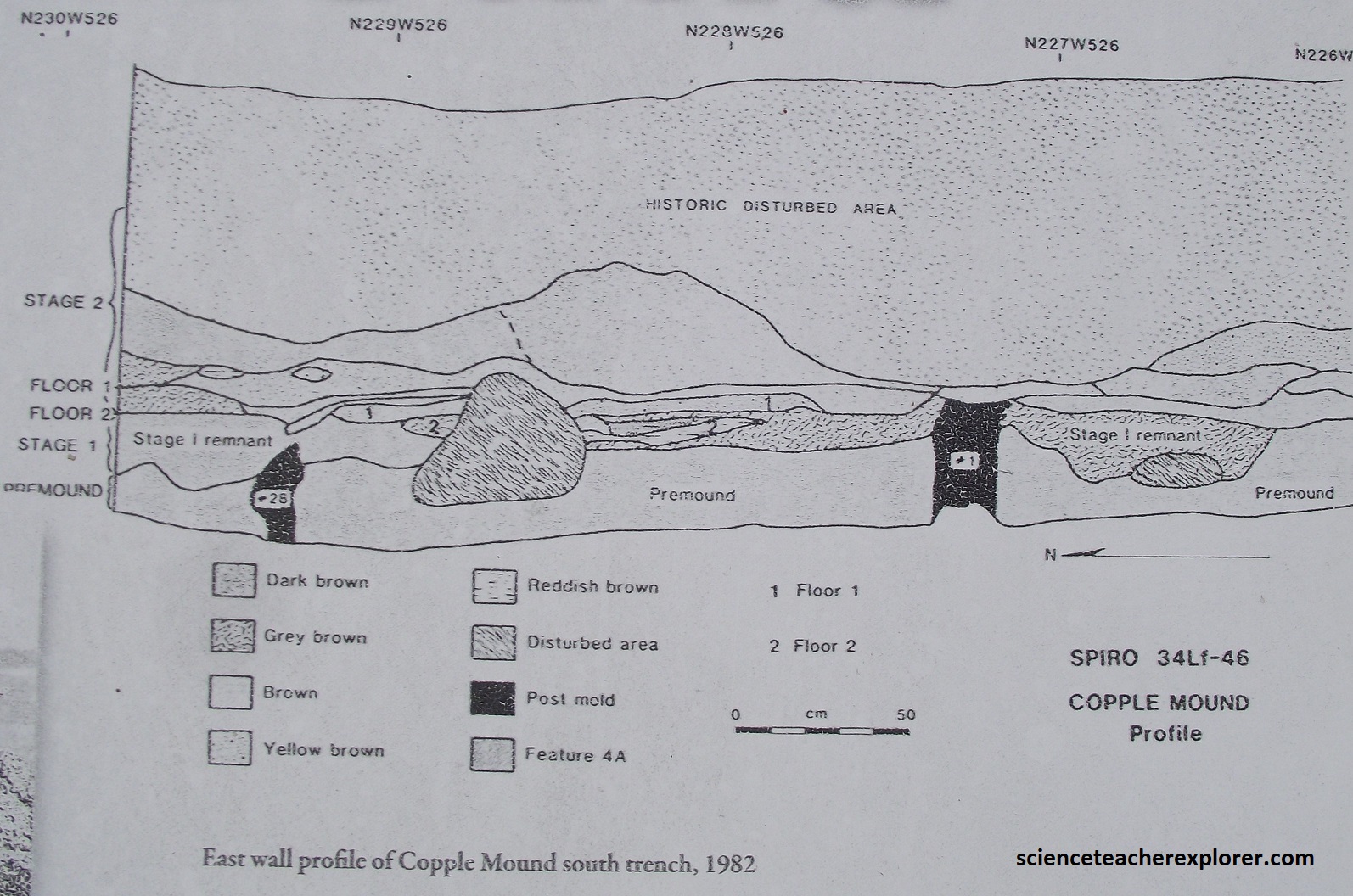
Pictured above, Copple Mound was partially excavated in 1938 and again in 1982, both times by the university of Oklahoma. Pictured below, the excavation in 1982 revealed a very complex series of constructions beginning with two houses and progressing with additional mound building done over time. A date of 1180 A.D. was obtained from a fire hearth in one of the house indicating Copple Mound was one of the last mounds built at the Spiro Mounds site. The later use of the mound was probably as a second temple mound. {Images below were found on an interpretation sign on-site}.
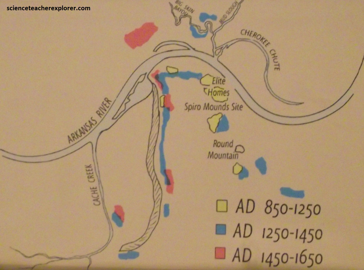
Archaeologists believe that a long drought occurred between 1250-1450 A.D.. The drought cycle lasted so long that people began to lose their faith in the spiritual power of the elite class and abandoned support of them. The mound center stopped being used around 1450 A.D., and the surrounding city was abandoned about 1600 A.D. Descendants of the Spiro people may have joined with the Keechi Tribe, other Wichita tribes, or the Red River Caddo Tribe. (The images below were taken from an interpretive sign at the Spiro Mounds Visitor Center).
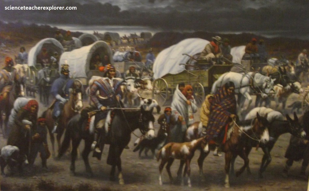
An interest in America’s Native Indian heritage certainly enriches a visit to this corner of Oklahoma. The Cherokees, who had farmed and hunted in the southern Appalachians for centuries, were forced by the government to relocated here n the 1830s. On their way thousands succumbed to sickness and cold along a trek that has com to be called the “Trail of Tears”. Members of the tribes were shackled to wagons while villages were ransacked and burned to discourage resistance. The harsh treatment, grueling pace, and insufficient supplies throughout the forced march killed thousands of indigenous peoples. Yet those who survived gallantly began their new lives, at home once again in a soothing, forested terrain where hope could be reborn with a number of other relocated native-tribes in the Oklahoma Territory, (imaged below). {Imaged below, taken from an interpretive sign on-site}
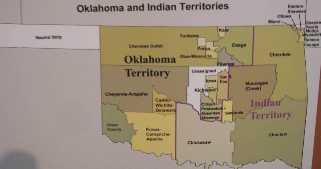
[Many tribes in the Old Northwest, (Ohio, Indiana, Illinois, Minnesota, Michigan and Wisconsin) and the southeast were subjected to removal also. The force relocation of what white leaders called “Civilized Tribes”, due to their increased acculturation into American social norms, (the Choctaw, Creek, Yuchi, Seminole, Chickasaws, and Cherokee).]
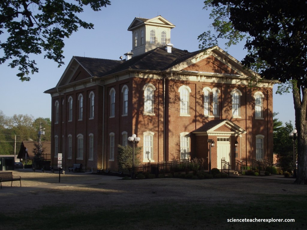
Several years before the march along the “Trail of Tears”, some members of the Cherokee tribe, known as the Western Cherokees, were already living in present-day Oklahoma. Their government, (a democracy that took the U.S. Constitution as it’s model), was centered about 5 km east of Gore, where a re-creation of the 1829 Cherokee Courthouse can be seen, (Pictured below).
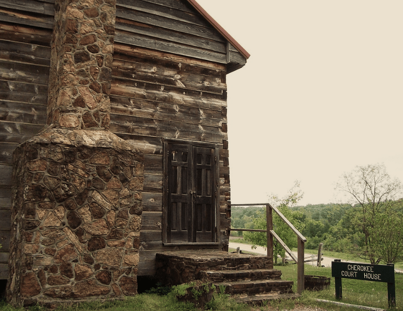
At the end of the day, from Spiro Mounds, I returned to U.S. 271 and drove west to Spiro where I continued driving west on U.S. 59. This took me to Sallisaw, when I turned onto I-40 West and drove to the U.S. 64 junction. There, I drove north to Gore for a visit to the 1829 Cherokee Courthouse, (picture above).
From Gore, I drove northeast on OK-100 to the OK-82 junction and turned left, (northwest) to Tahlequah. More Cherokee history awaited me in nearby Tahlequah, where marchers on the “Trail of Tears” ended their journey.
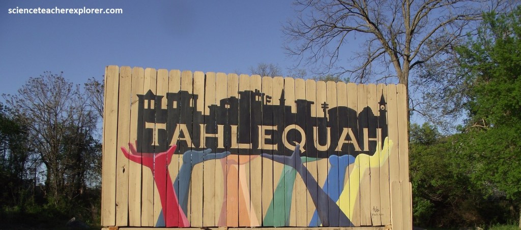
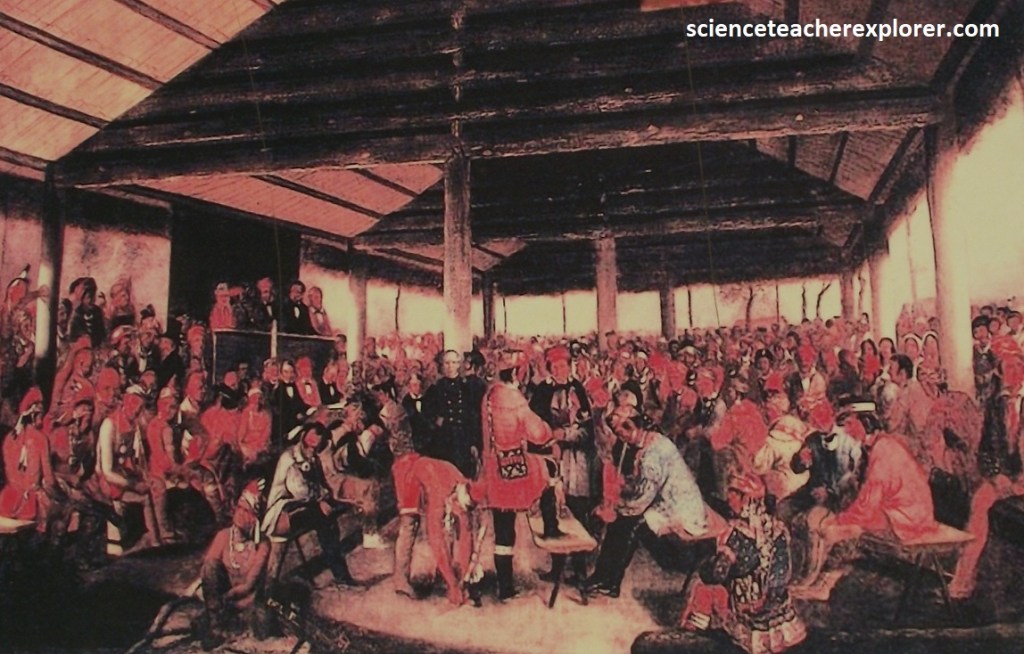
Here in Tahlequah, the tribe’s eastern and western branches joined hands and crafted a constitution for the Cherokee nation.
The area’s first newspaper, “The Cherokee Advocate”, was published in Tahlequah, offering its readers article in both English and the newly created Cherokee written language. Pictured below is the Cherokee National History Museum that was once the “Capitol Building” for the Cherokee Tribe.
From Tahlequah, I drove northeast on the scenic road of OK-10. It accompanies the meandering channel of the Illinois River, (born in the nearby Ozarks of Arkansas). While I was driving trough, the spring redbud and dogwood trees were bursting with blooms, making the stretch particularly pleasing. Pictured below, the fairly tame Illinois River seems to be the perfect avenue for a lazy float trip beneath al lofty canopy of sycamore trees, (pictured below). I stayed the night in Jay, Oklahoma on US-59.
The next morning, I was greeted to the maze of bays, creeks, and wooded hollow of the Grand Lake O’ the Cherokees, (pictured below). The gigantic reservoir was formed in 1940 by the building of the Pensacola Dam, the longest multiple-arch dam in the world, on the Grand River. There are 46,500 surface acres of water and 2,093 km of shoreline here.
Pictured above, Grand Lake O’ the Cherokees is a migratory waterfowl haven, the mudflat areas having been seeded with Japanese millet in an effort to provide a food source for many types of birds. The lake wanders through 106 km of the foothills of the Ozarks called Green Country. It’s tucked into the corner where four states meet: Oklahoma, Kansas, Missouri, and Arkansas.
