Sulphur Cr., UT 1995
Sulphur Creek is a deep gorge-like canyon found in Capitol Reef National Park in Utah of the United States.
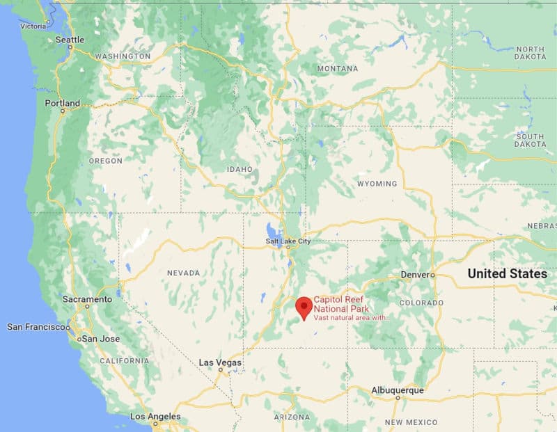
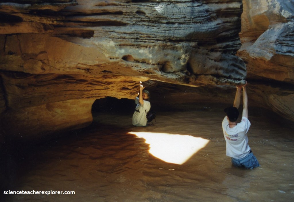
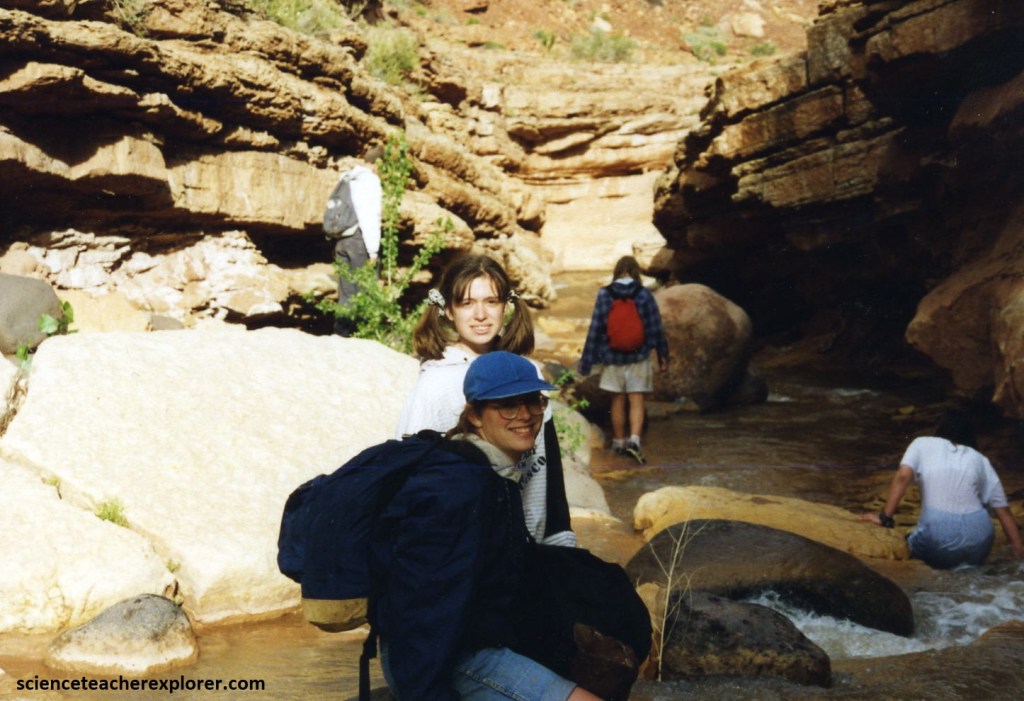
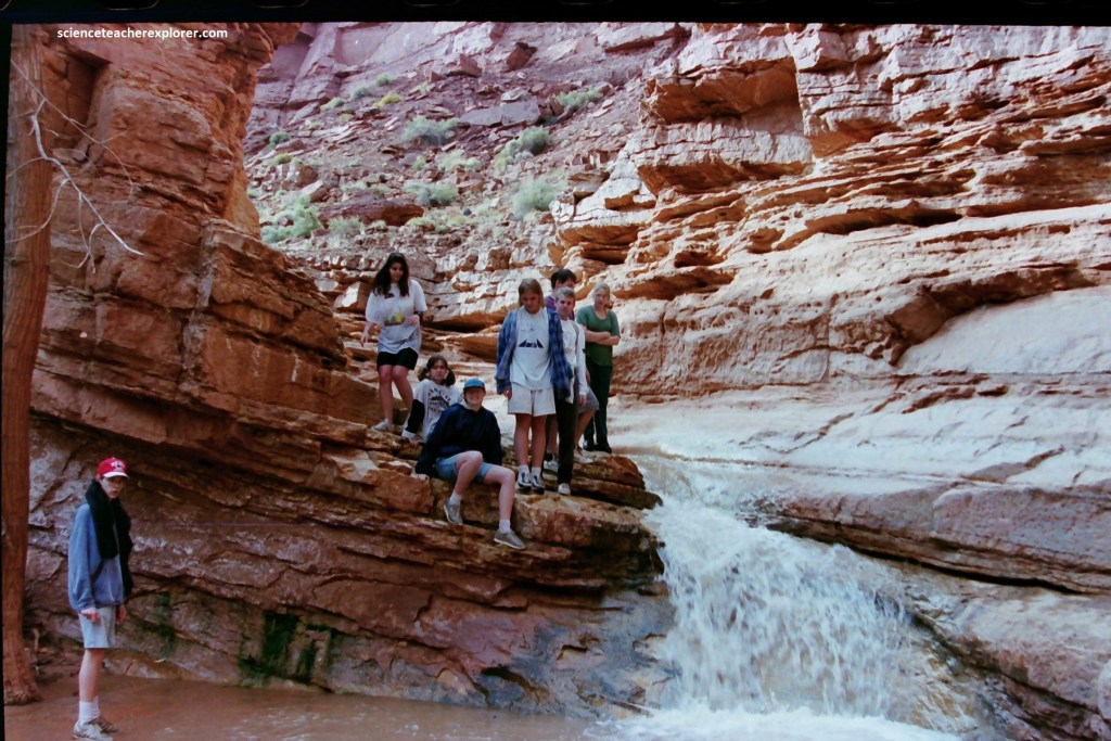
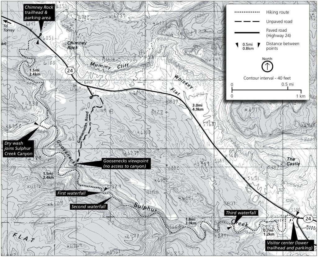
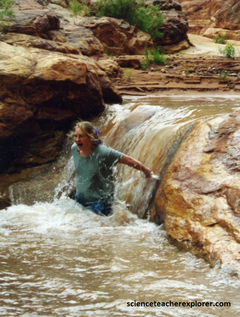
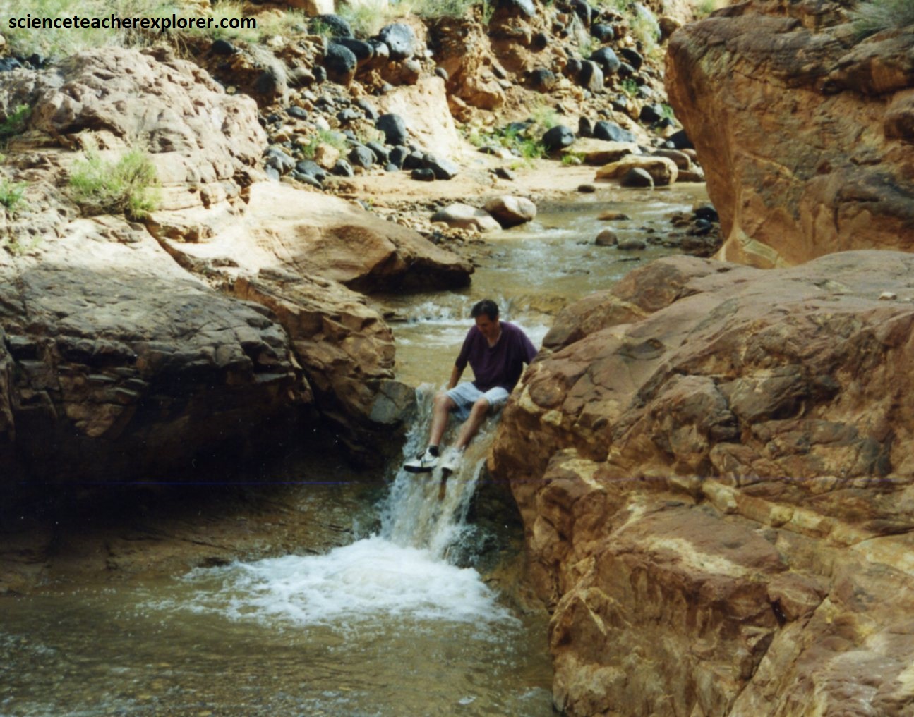
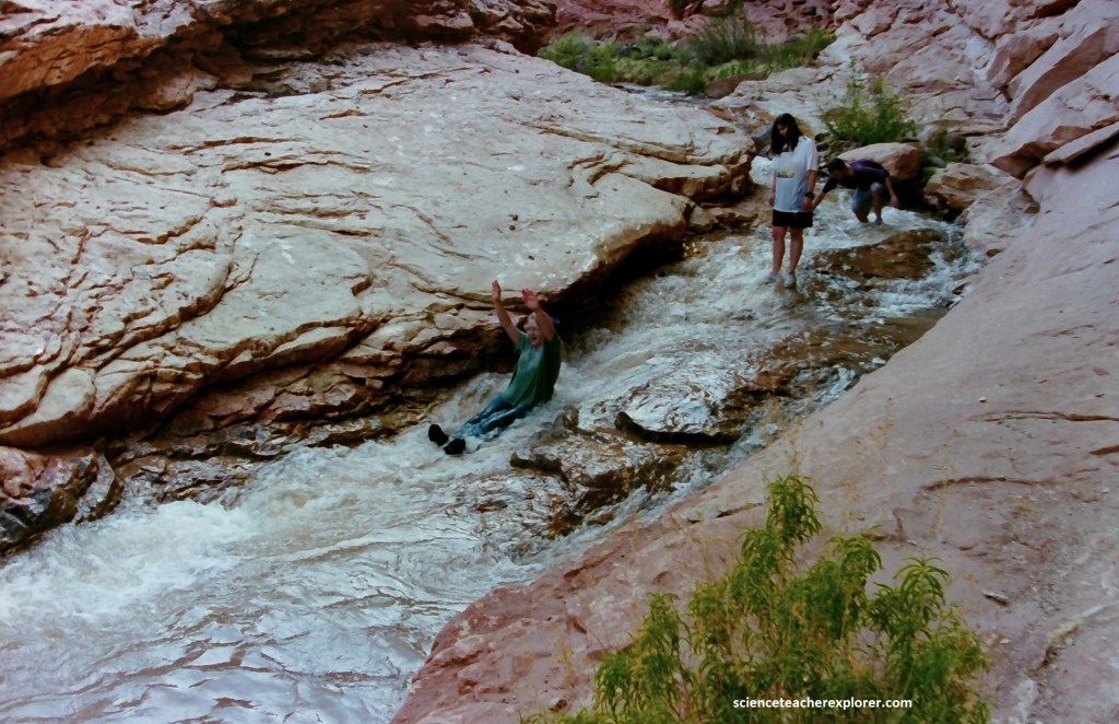
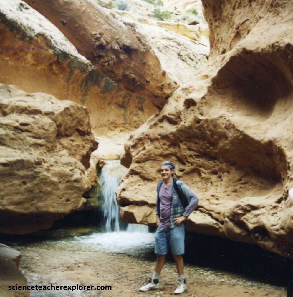
I regularly dropped my students off there, near the Capitol Reef National Park Visitor’s Center, over the years, to trek and explore it’s wonders for 8 km. It was a small wet-canyoneering experience for the students. I’ve included the 1995 student-group experiences here.
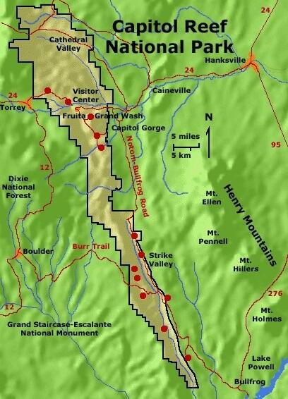
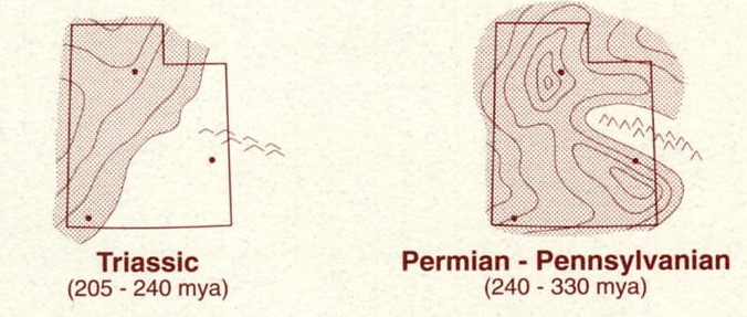
The sedimentary rocks here in the Capitol Reef National Park range from Permian sandstone an marine limestone in the bottom of Sulphur Creek, to Cretaceous shale and sandstone in parallel valleys and ridges east of Capitol Reef. Representing a time span of about 200 million years, these rocks were deposited in a long succession of changing environments.
The rocks along the hike begins 260 million years ago on a Permian desert, with sand dunes that have become the Cedar Mesa Sandstone, visible in the bottom of the deeply entrenched canyon of Sulphur. Above the Cedar Mesa Sandstone are light gray ledges of Kaibab Limestone, the rimrock of the Grand Canyon, here sandy and impure because it was deposited close to the shore of the Permian sea, the last Paleozoic sea to transgress the continent.
In the Triassic time a large marine embayment covered much of southern Utah, opening westward to the sea, successive layers of sand and mud accumulated, to become the dark red sandstone siltstone, and shale of the Moenkopi Formation. Many of these rocks display well-preserved ripple marks, mud cracks, reptile and amphibian trackways, salt crystal impressions, gypsum and alternation of mudstone, siltstone, and sandstone. The formation is nearly 300m thick here near the visitor’s center, (pictured below).
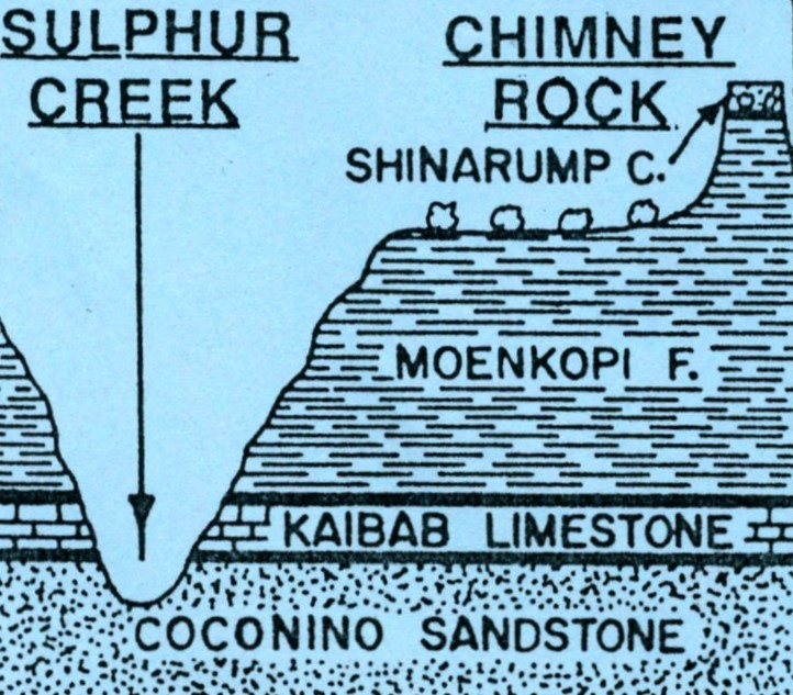
The Sulphur Creek trek begins near the Chimney Rock trailhead and parking area, (which descends down into Sulphur Creek & is imaged below).
Shaped in red mudstone and siltstone of the Moenkopi Formation, the Chimney Rock tower stands with hard, sandy, pebble filled Shinarump Conglomerate. Seen below, the Moenkopi is not normally a cliff-former. But here, where patches of Shinarump Conglomerate protect it and rapid erosion undermines it, it stands in almost vertical walls.
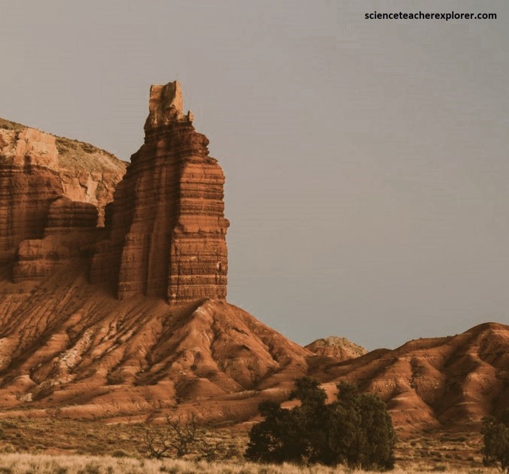
A fault separates these walls from the mesa to the north, where Shinarump Conglomerate is at the base of the mesa cliff. Displacement along the fault is about 50m. Petrified wood is common in the Chinle Formation here. Ripple marks, mud cracks, and raindrop pits mark rock slabs of the Moenkopi Formation. The dark red color of these rocks is due to oxidation of iron minerals after the rock was deposited.
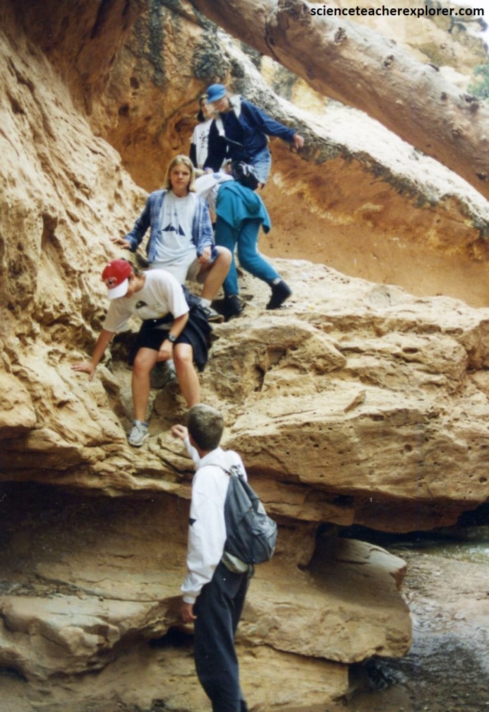
As my student group of 1995 descends into Sulphur Creek, we observed the buff-colored Cedar Mesa Sandstone, a Permian dune deposit, and above it yellowish or tan layers of the Kaibab Formation, marine limestone also of Permian age.
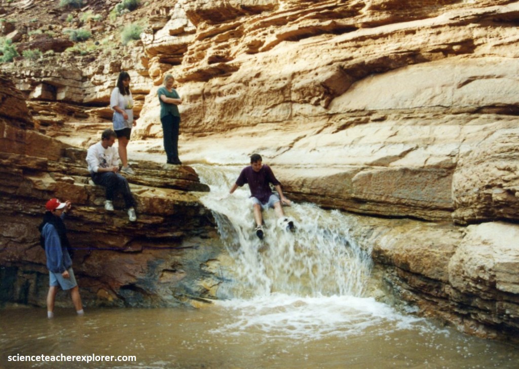
The Goosenecks are entrenched meanders established when Sulphur Creek flowed with a gentle gradient across loose, poorly consolidated gravel deposited here in Pleistocene time. As the river deepened its canyon through Capitol Reef, it retained its old meanders. {Pictured below are two of my students trekking down Sulphur Creek in 1995}.
Red sandstone and siltstone blocks lie scattered on the surface here, tilted in every direction as softer mudstone layers beneath are washed or blown away.
Because two sets of joints, at right angles to each other, cut through these rocks, many of the blocks are almost rectangular. Some are ornamented with 200-million-year-old ripple marks; some show polygonal patterns of mud cracks, small craterlike raindrop pits, or cube-shaped casts of salt crystals. The lower surfaces of some blocks are marked with unusual angular ridges that may be sand-filled fin marks scraped in soft mud by denizens of Triassic seas.