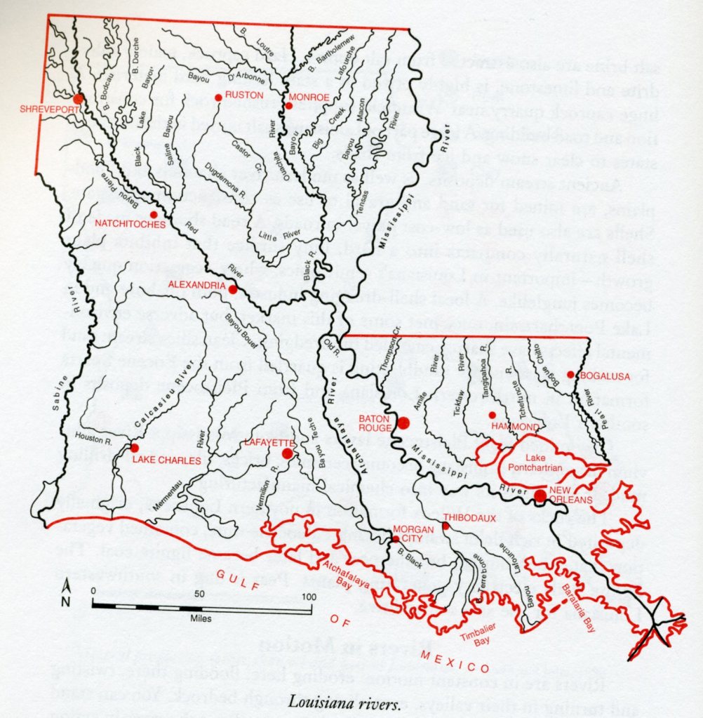
The Bayou, LA 2024
In the Springtime of 2021, Becky (my wife) and I explored the southwestern portion of Louisiana to give us an introduction to the coffee-colored bayous & ancient cypress swamps that make up this portion of the United States. We began at the border of I-10 between Texas and Louisiana and work east towards Lafayette and then south on US-90, towards Morgan City.
Our first stop on I-10 was the “Welcome Center” at the border. It was on the south side if I-10, just inside Louisiana, near Vinton.
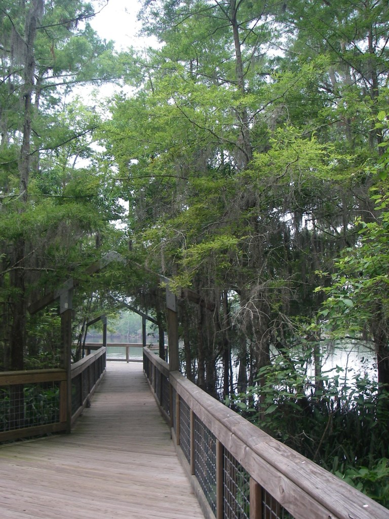
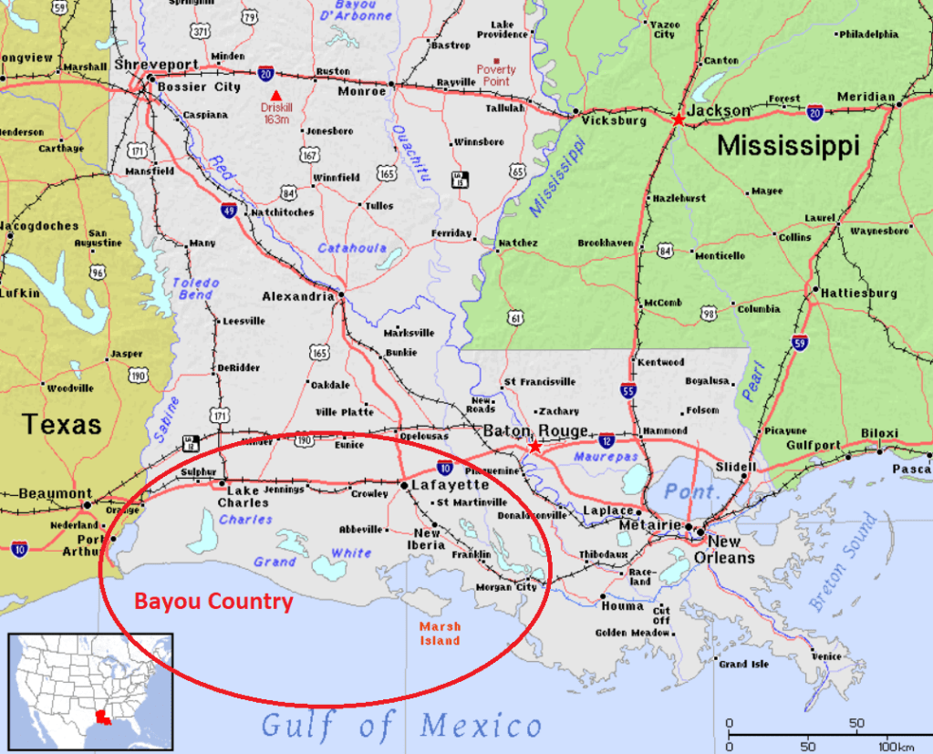
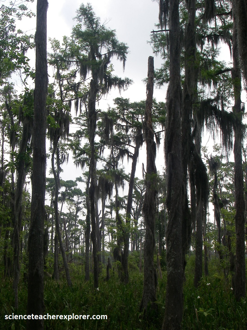
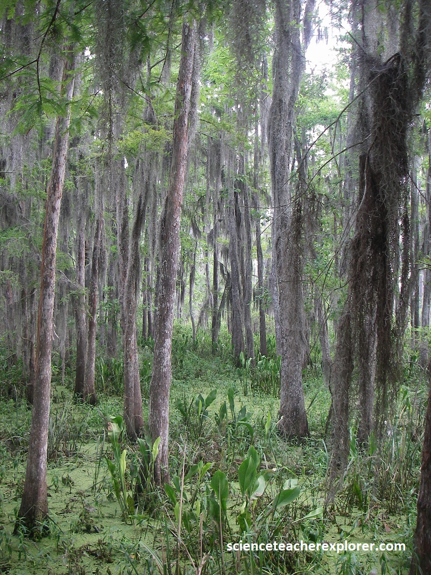
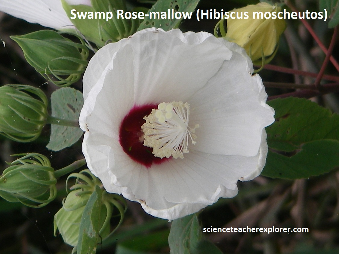
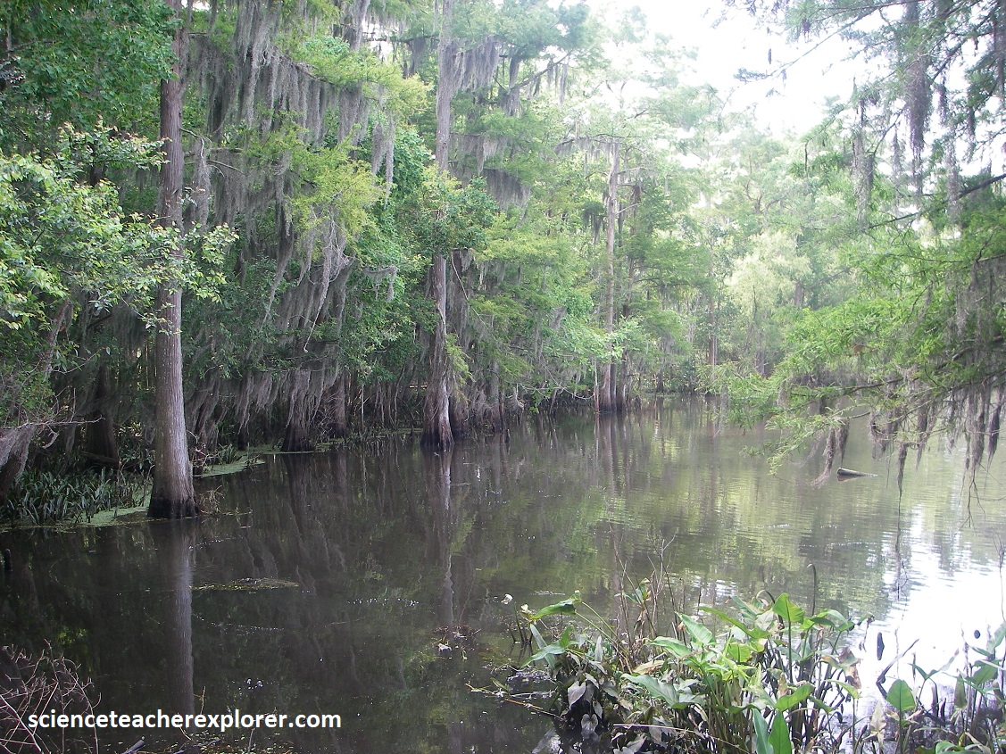
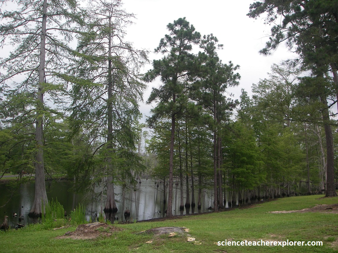
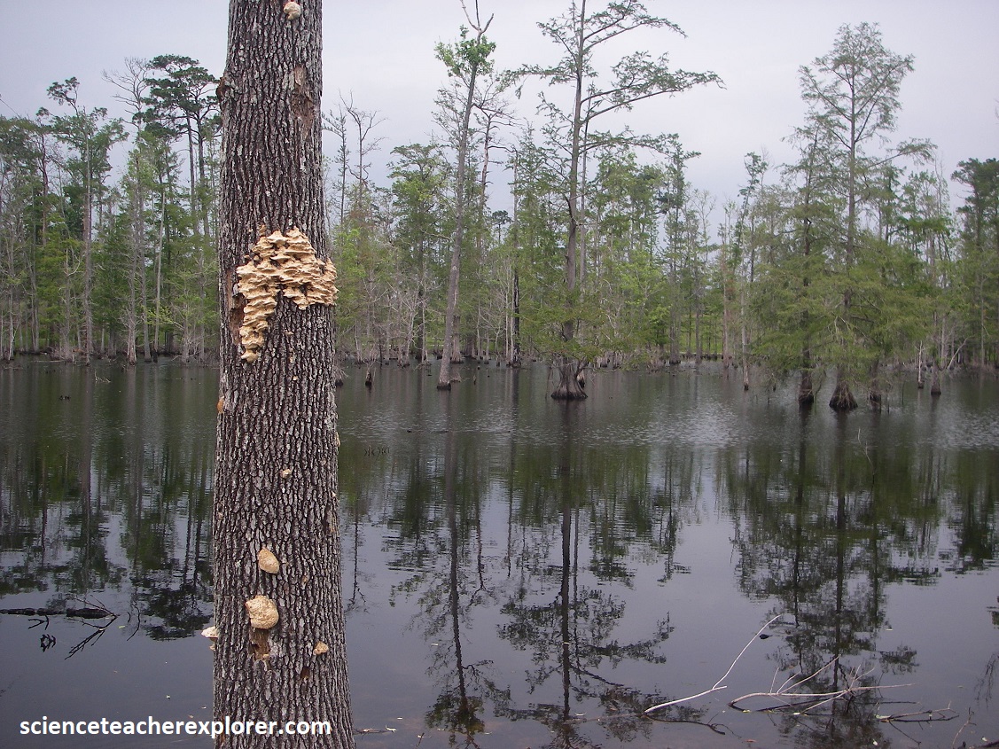
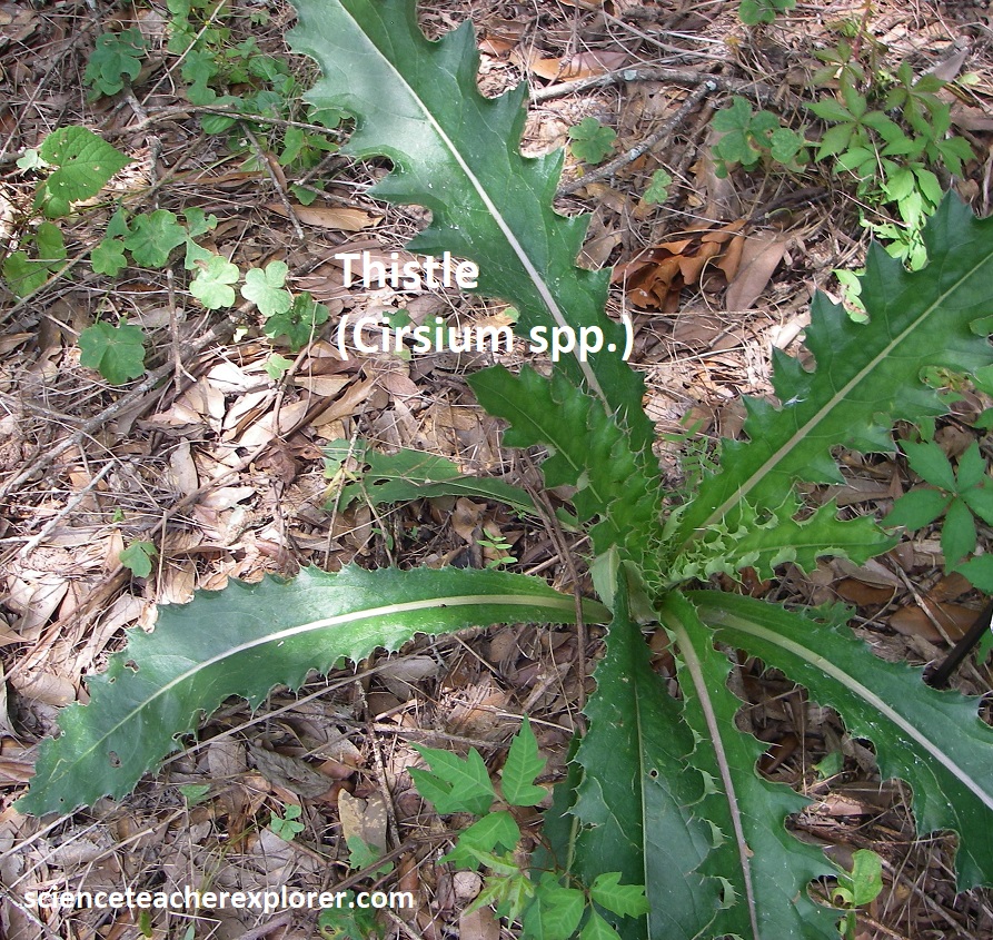
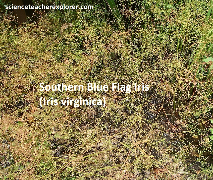
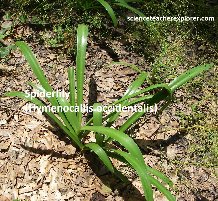
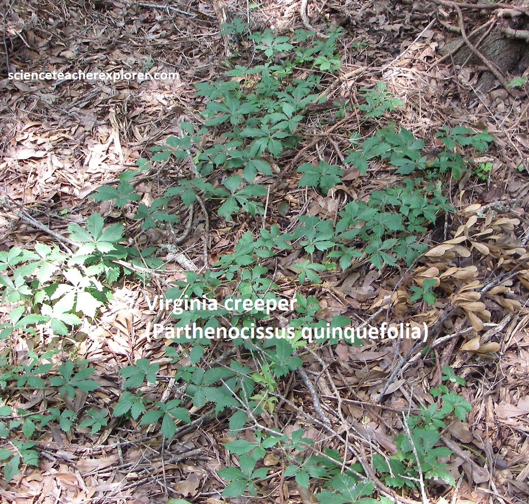
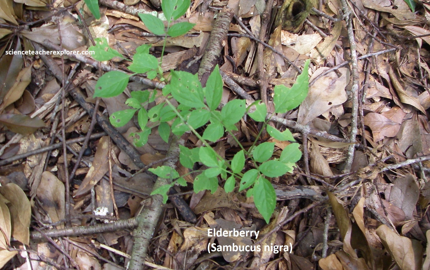
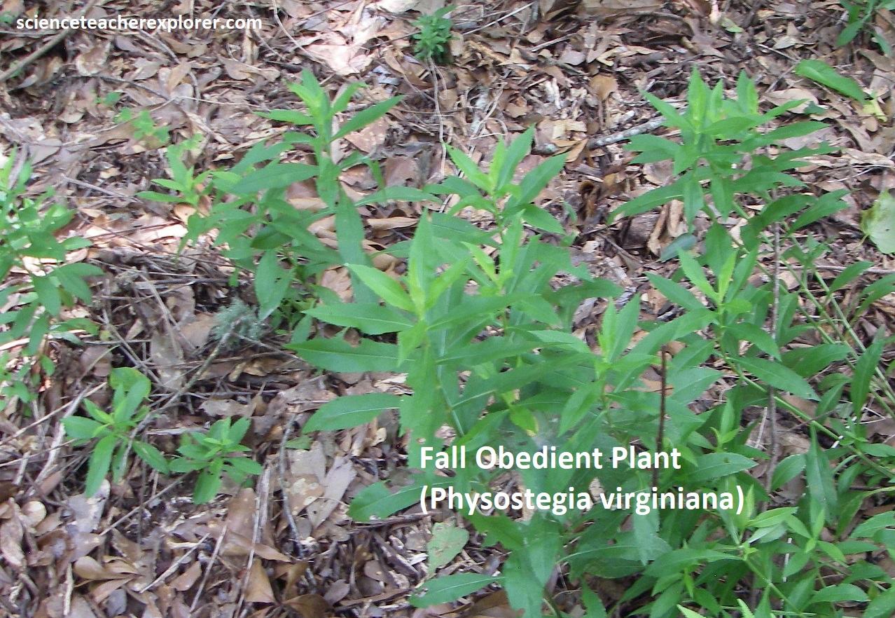
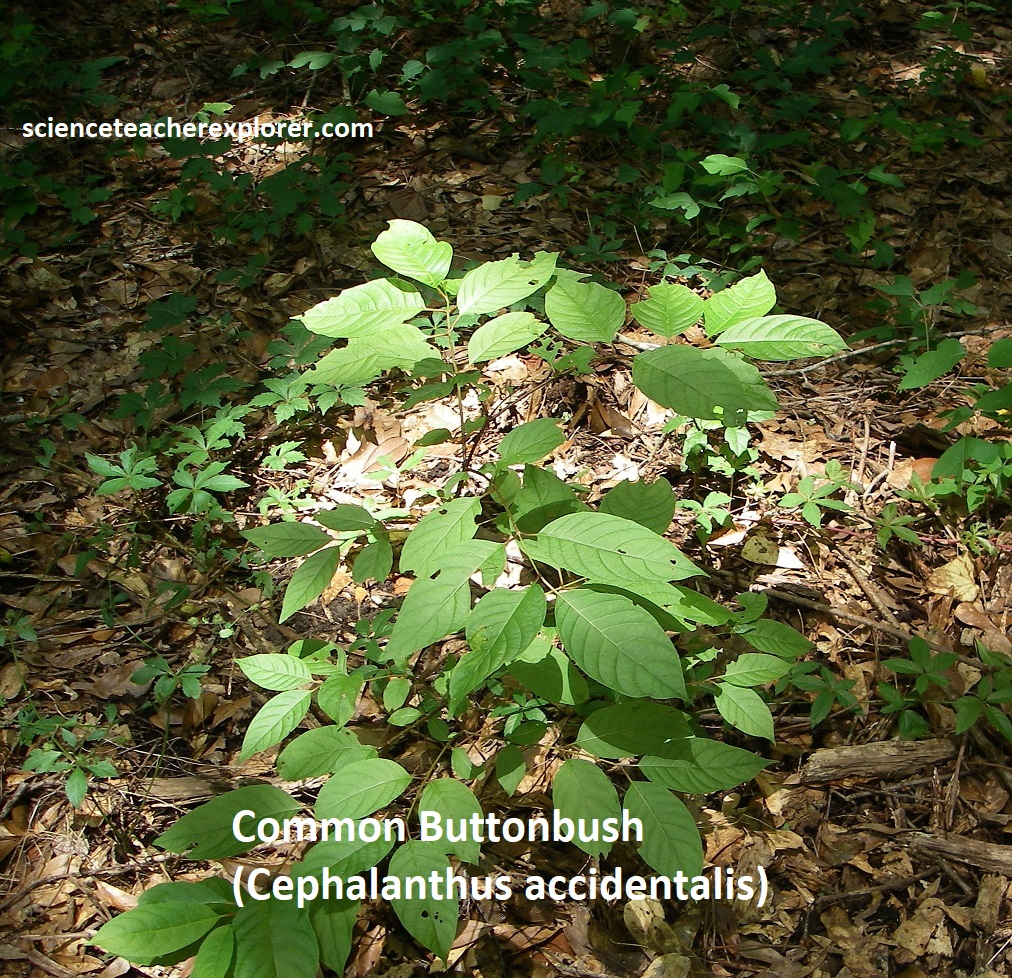
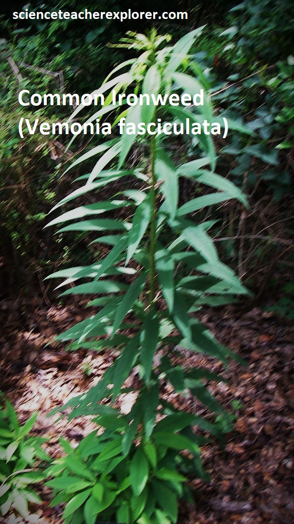
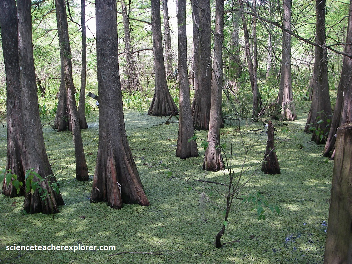
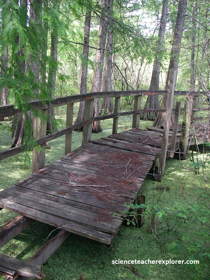
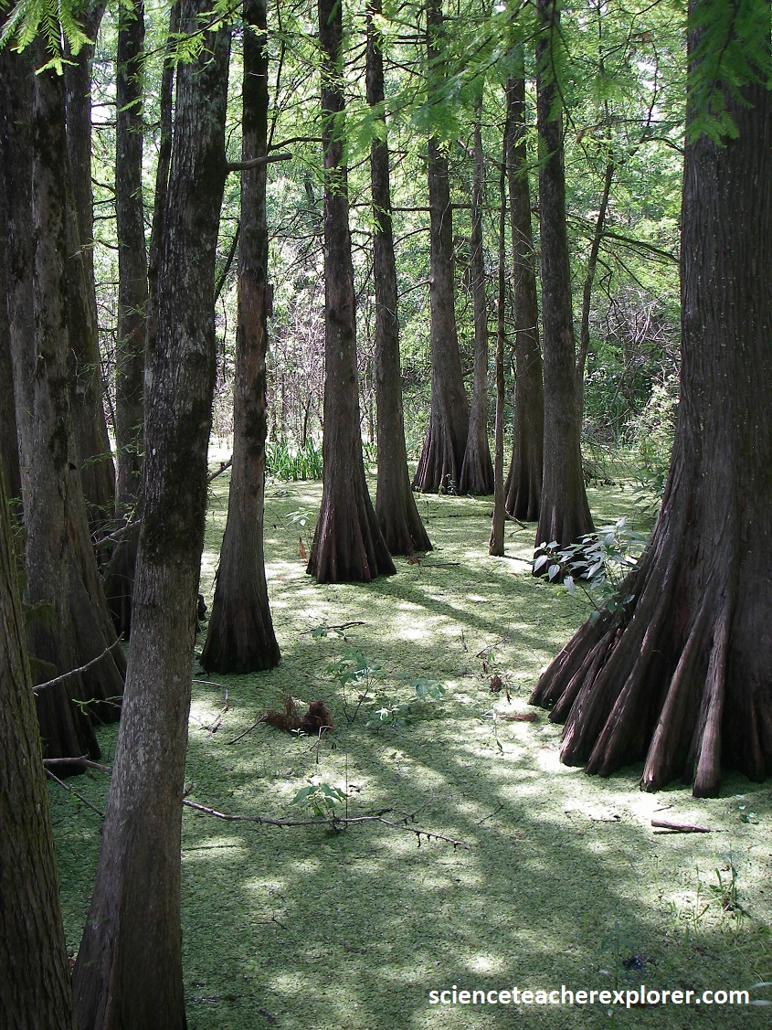
Near the Vinton Welcome Center, there is a boardwalk that explores a cypress swamp on the shores of the Sadine River. It provides a wonderful view of the swamp with it’s cypress trees, cypress knees, maples, ferns, arrowleaf, and animals. Pictured below, the organic productivity of such swamps is very high.
Pictured below, the Sabine River heads in the uplands of East Texas, then turns south to define the border between Texas and Louisiana. Though it now drains a relatively small area, it was once larger and reached much farther inland.
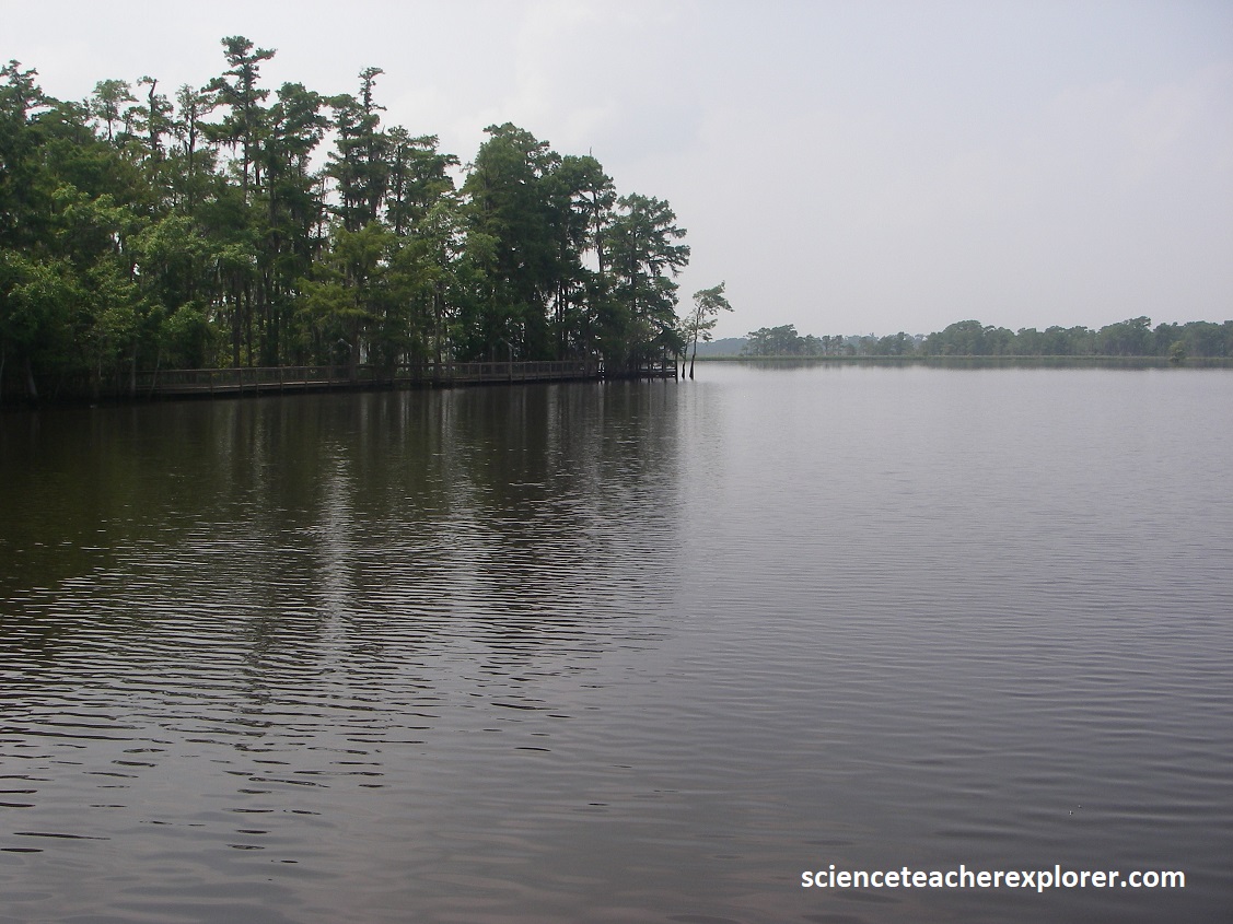
Strangely, the Sabine River receives no water from the Ouachita Mountains north of Texas in southeastern Oklahoma, but the Red River does. During Miocene time, a few million years ago, the upper Red River and its tributary, the Little River, flowed out of the Ouchita Mountains and down the present course of the Sabine River. Then the lower Red River eroded headward and captured the upper Red River, leaving the Sabine River without a large part of it’s watershed, and much diminished. When and why this happened is a mystery. However, a subtile shift in the Sabine uplift, (in east Texas and northwest Louisiana, west of Shreveport), may have tilted drainage of the Red River toward its present course, which joins the Mississippi River.
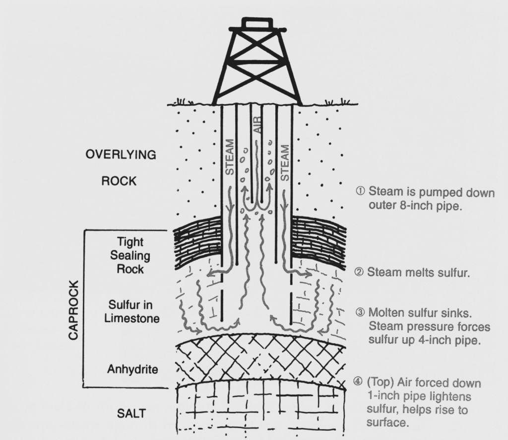
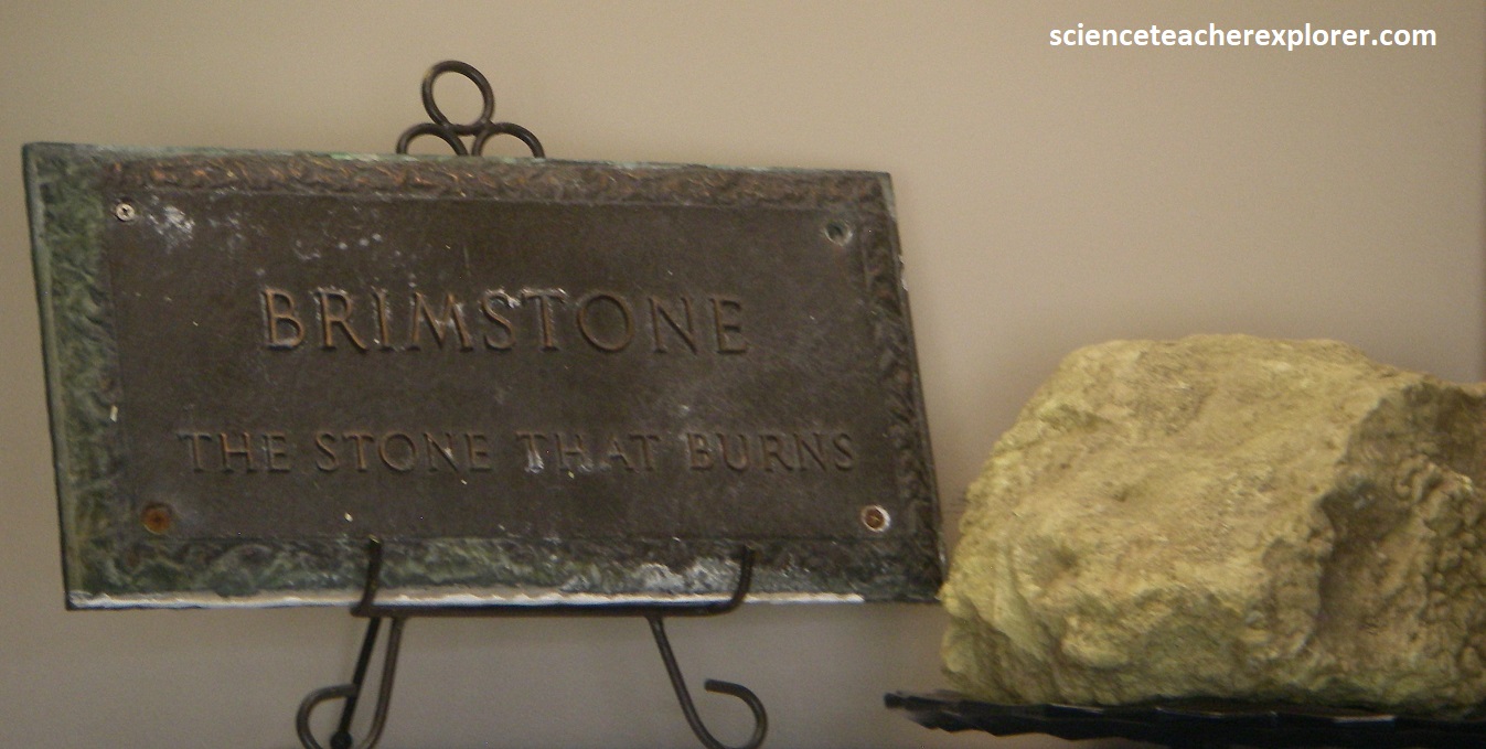
Our next stop on I-10, driving east, was Sulphur, (named for it’s chief product). This is where sulphur was first produced through steam-injection wells. Herman Frasch injected steam into the caprock of the Calcasieu salt dome at Sulphur in 1894, and pumped molten sulphur out. This made it very competitive with the world market at the time. Sulphur was and is necessary in making fertilizers, rubber, paper, sulphuric acid and many other products.
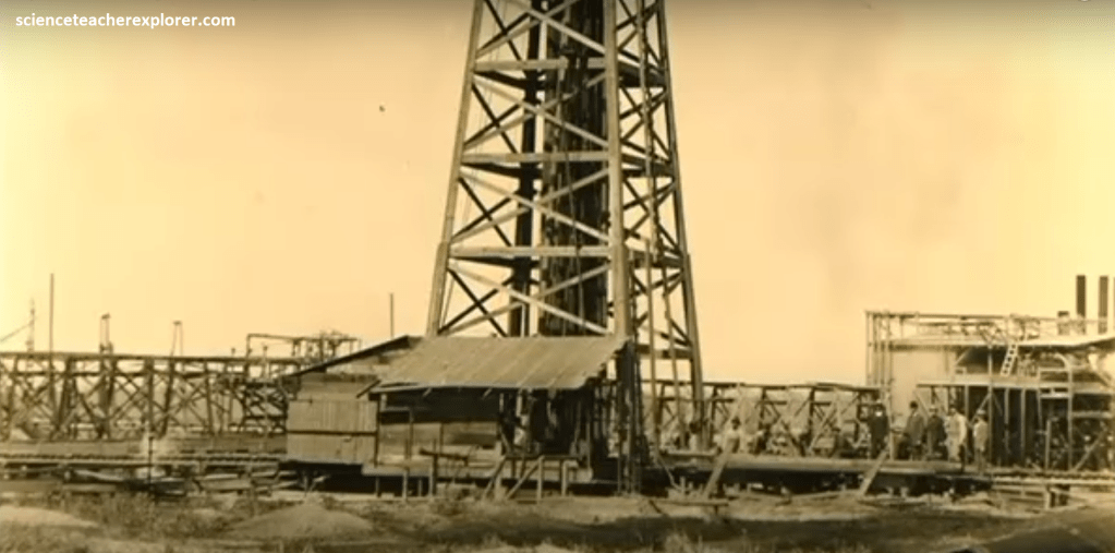
The Frasch process occurs after an oil-drilling rig sinks a hole and sets a 2.5 cm pipe inside a 10 cm pipe. Imaged below, steam at 325 0F is pumped down the outer pipe and into the sulphur, which melts at a temperature of 235 0F. The molten sulphur sinks because it is more dense than water, and the steam pressure drives it up in the inner pipe. Air jetted down the center pipe froths the rising molten sulphur to make it even less dense and help float it to the surface. The molten sulphur is then collected in heated takes and transported in insulated pipes, barges, tank trucks, and ships.
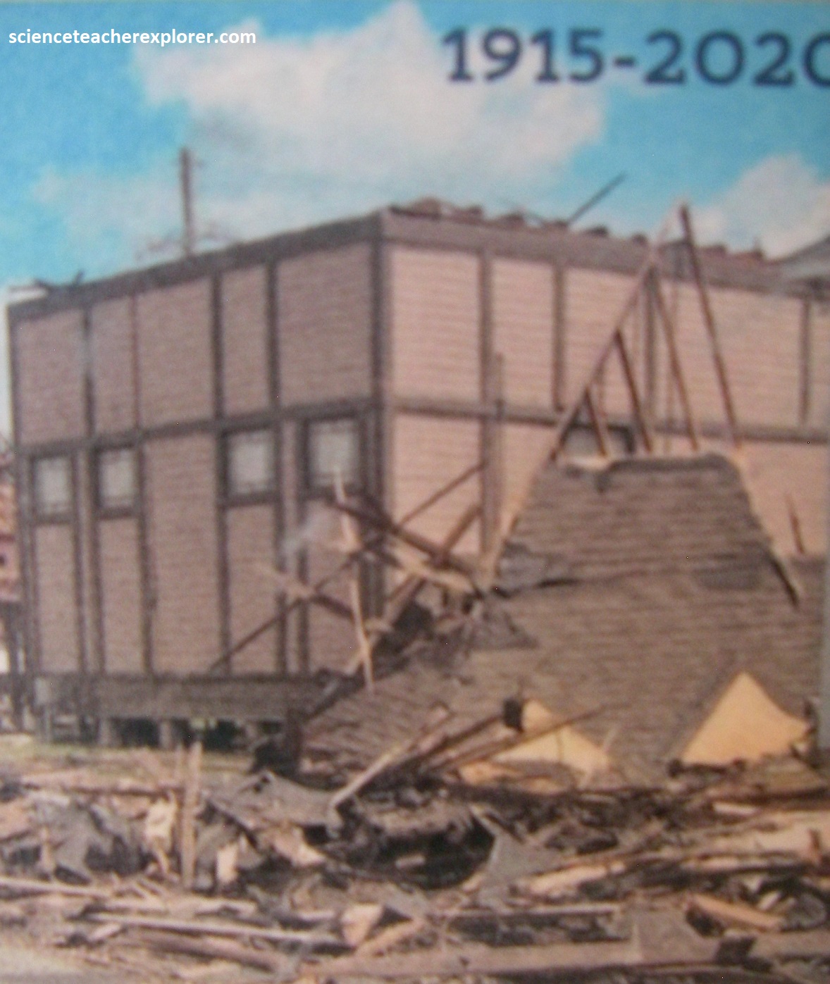
We drove to the Brimstone Museum in Sulphur to find that it had been destroyed by the Hurricanes Laura & Delta in August of 2020, (image below). However, the Brimstone Historical Society was currently raising money to rebuild the museum. {Images below was provided by the Brimstone Historical Society on-site}.
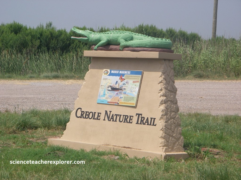
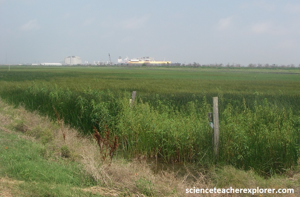
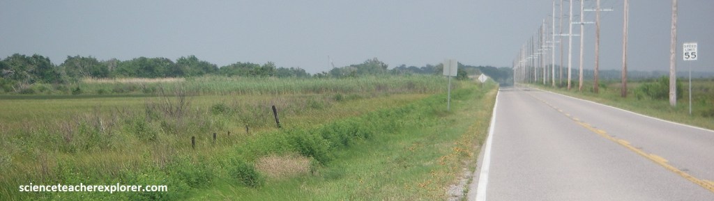
From Sulphur, Becky and I decided to drive/explore the famous “Creole Nature Trail”. Image below, starting at Sulphur, we took LA-27 south through the 125,000 acre Sabine National Wildlife Refuge, (one of several to be found on the trail). At Holly Beach the drive continues east along the Gulf Coast on LA-27/82, where it veers sharply northward on LA-27 north and then follows LA-14 north and west to Lake Charles.
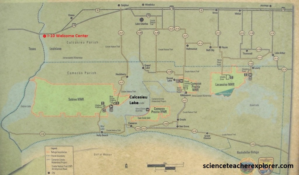
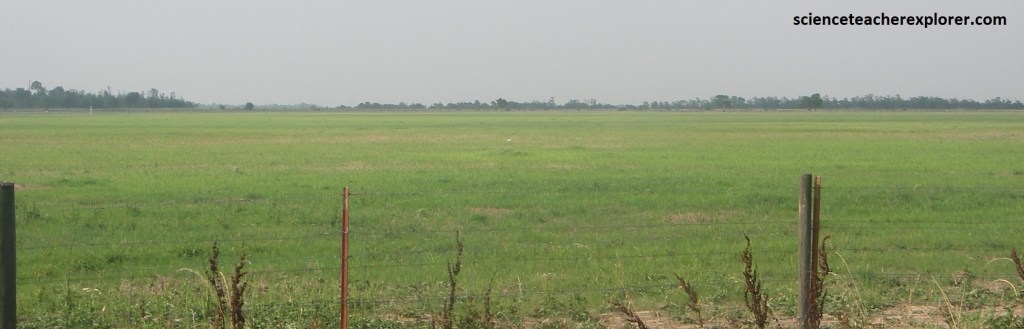
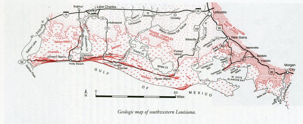
The Creole Nature Trail drive provides an opportunity to compare the landscape of the Prairie Complex with that of the lower marshes of the modern coastal plain. The northern third of the road/trail, (16 km south of Sulphur), is on the gently rolling and forested Prairie Complex, a Pleistocene surface about 18m above sea level. The land is dry, trees are mostly the common deciduous varieties, and the soils are light tan. (Image below is taken from “Roadside Geology of Louisiana” Spearing 1995).
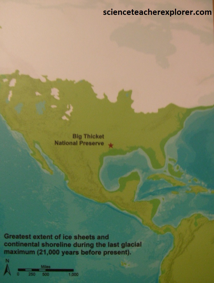
Nearly 2 million years ago North America went into a series of great ice ages of Pleistocene time. Time and again, the climate cooled and immense ice sheets blanketed much of Canada and the northern United States. When glaciers grew, they stored vast amounts of water, and sea level dropped dramatically, sometimes as much as 150m. When the ice ages ended, the climate warmed quickly, and the glaciers melted quickly, sending monumental floods down rivers to the oceans and the sea level rose.
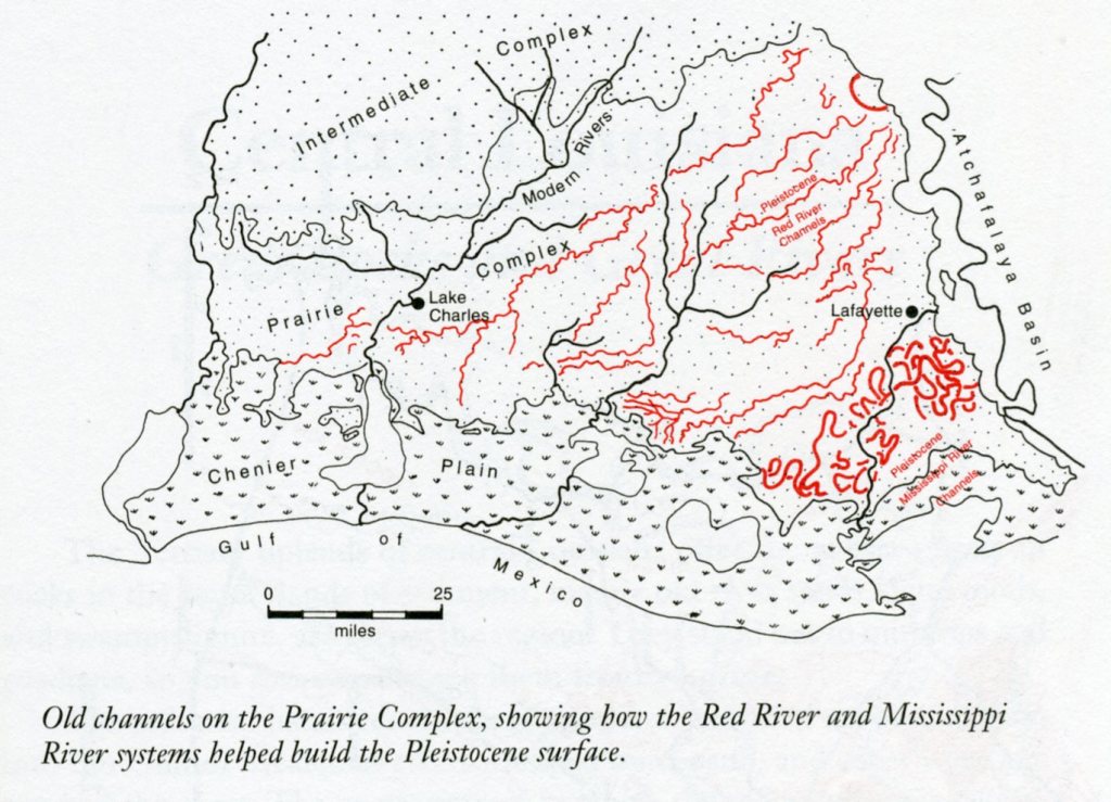
During the Pleistocene, the coast of Louisiana was far south of its current position when the sea level was low during ice ages. Rivers entrenched their valleys as they adjusted to the lower sea level and dumped their sediment loads along that lower coast. In warm interglacial intervals, sea level stood higher and the coast was farther inland than today. Rivers filled their valleys with sand and gravel to adjust to the higher sea level. Pleistocene sediments cover nearly a third of Louisiana. They sweep across the state in a broad arc from Lake Charles to Alexandria and across the Mississippi River to the Florida Parishes in 3 bands that span Pleistocene time period. They consist mostly of gravel and coarse sand brought to the coast by rivers and deposited in great wedges that incline slightly seaward; the trend generally parallel to the modern coast. However, modern rivers have cut through the Pleistocene deposits, leaving remnants of them as terraces along the edges of valleys and are now referred as the “Prairie Complex”, (pictured below).
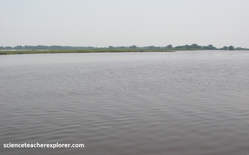
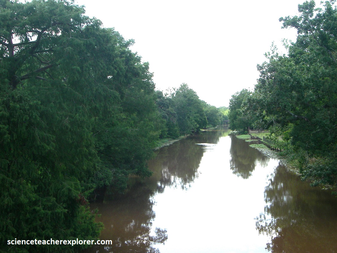
The high bridge over the Intracoastal Waterway, 16km south of I-10, provides a nice vantage point to see the abrupt transition between Prairie Complex and the salt marsh to the south. Pictured below, waterways to the east are part of the Calcasieu River, the Calcasieu ship channel, and the northern end of Calcasieu Lake. Ships using the Intracoastal Waterway can reach Lake Charles or the Gulf of Mexico from this area.
The small town of Hackberry on LA-27 stood on the high ground of another patch of Prairie Complex.

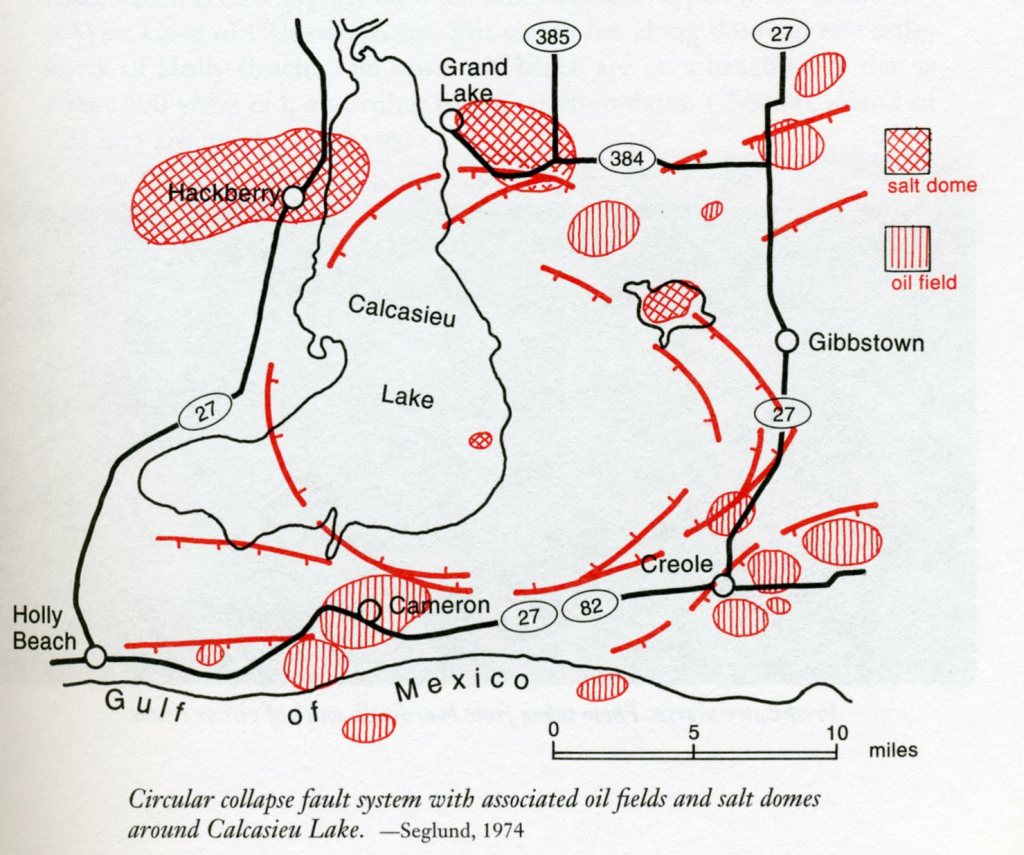
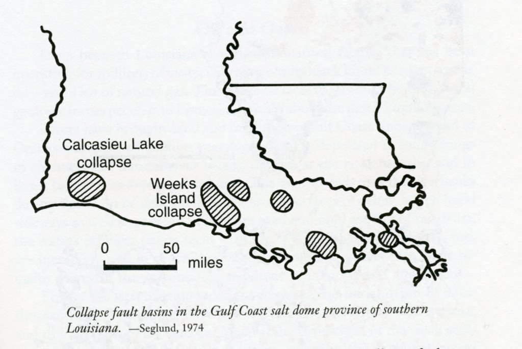
The oil wells along the side of the road in Hackberry indicates the existence of salt-dome structure underlying the town. Its salt-dome rise, probably contributed to the elevation of the “Prairie Complex” finger found there. Imaged below, shows the Calcasieu Lake, the Hackberry salt-dome, and other salt dome structures in the vicinity, clustering around a large collapsed geological structure.
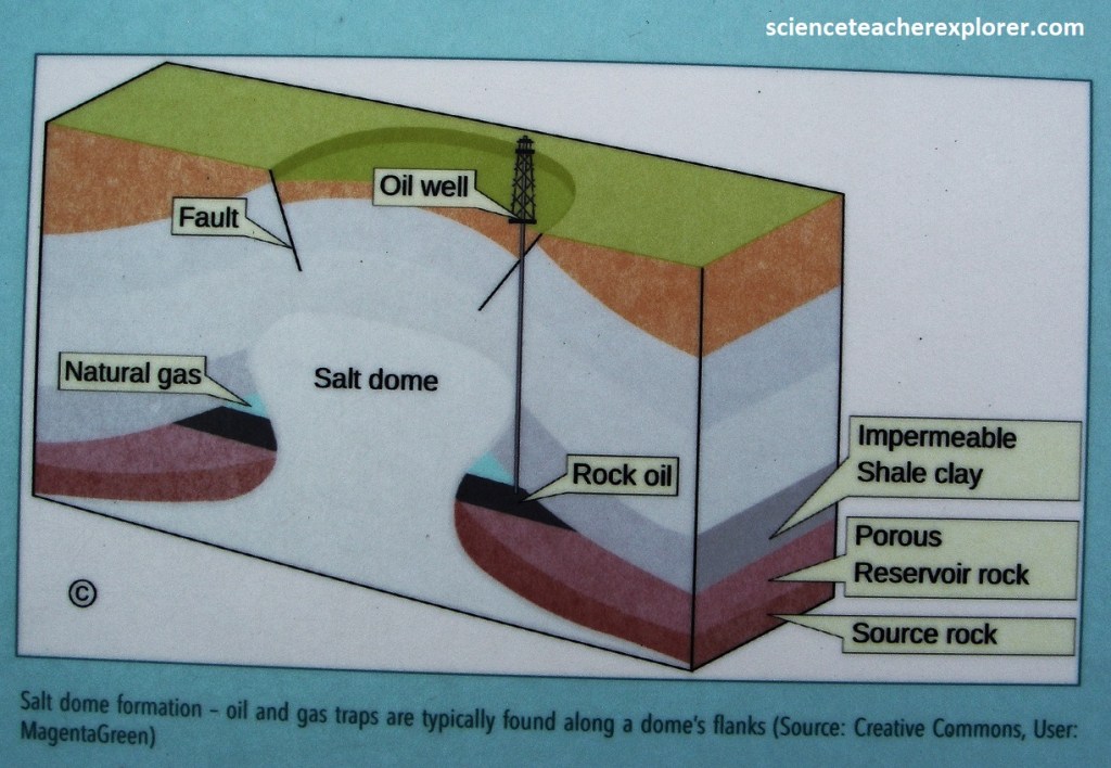
A thick layer of bedded salt, lies deep beneath Louisiana, under some 16km of younger rocks. The salt was deposited in shallow depressions that opened between North and South America as they separated, due to plate tectonics, during the Triassic and Jurassic time. Seawater periodically flooded the depression, then evaporated, leaving behind layers of salt, gypsum and anhydrite. Scientists call this accumulated layer, the Louann salt.
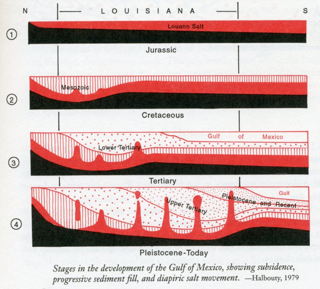
Imaged above, salt being less dense than the sandy and muddy sediments, rose towards the surface. Under the pressure & heat from thousands of meters of rock caused the salt to flow and accumulate with plasticity. This flowing salt rose mostly in vertical pillars, forming salt domes the caused anticlines in the surrounding overlying rock layers. In the image below, notice the accumulation of oil in the sandstone layers on top or sides of the anticlines caused by the salt domes.
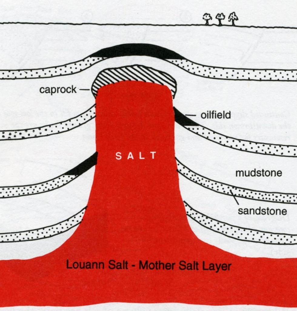
Scientists use the term diapir for the rising plug of salt driven upward by the weight of the overlying rocks. Additionally, the sediments above the salt collapse along curving fault, displacing the salt downward or down-building. Small basins form, and undisturbed salt remains as high ridges and domes between the basins, (pictured below).
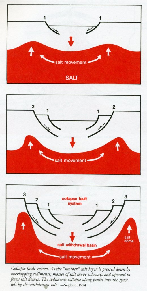
Image below, the Calcasieu Lake collapse basin underlies the marshlands near Hackberry, Gibsland, Cameron, and Creole, in southwestern Louisiana and within our Creole Nature Trail loop.
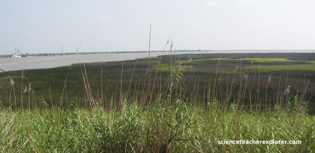
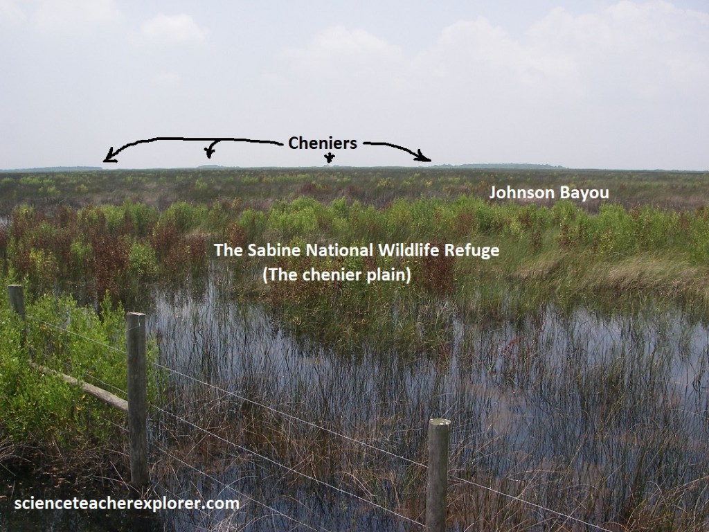
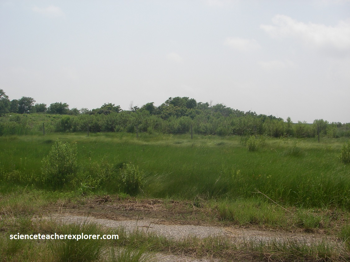
US-27 crosses the Prairie Complex for about 8 km south of Hackberry, then drops into the chenier plain, an elevation of 0.8 m above sea level and a vast expanse of fresh and salt marshes that extend in all directions from the road to the horizon.
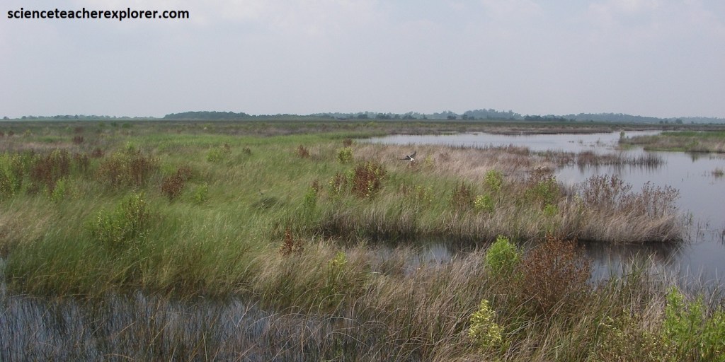
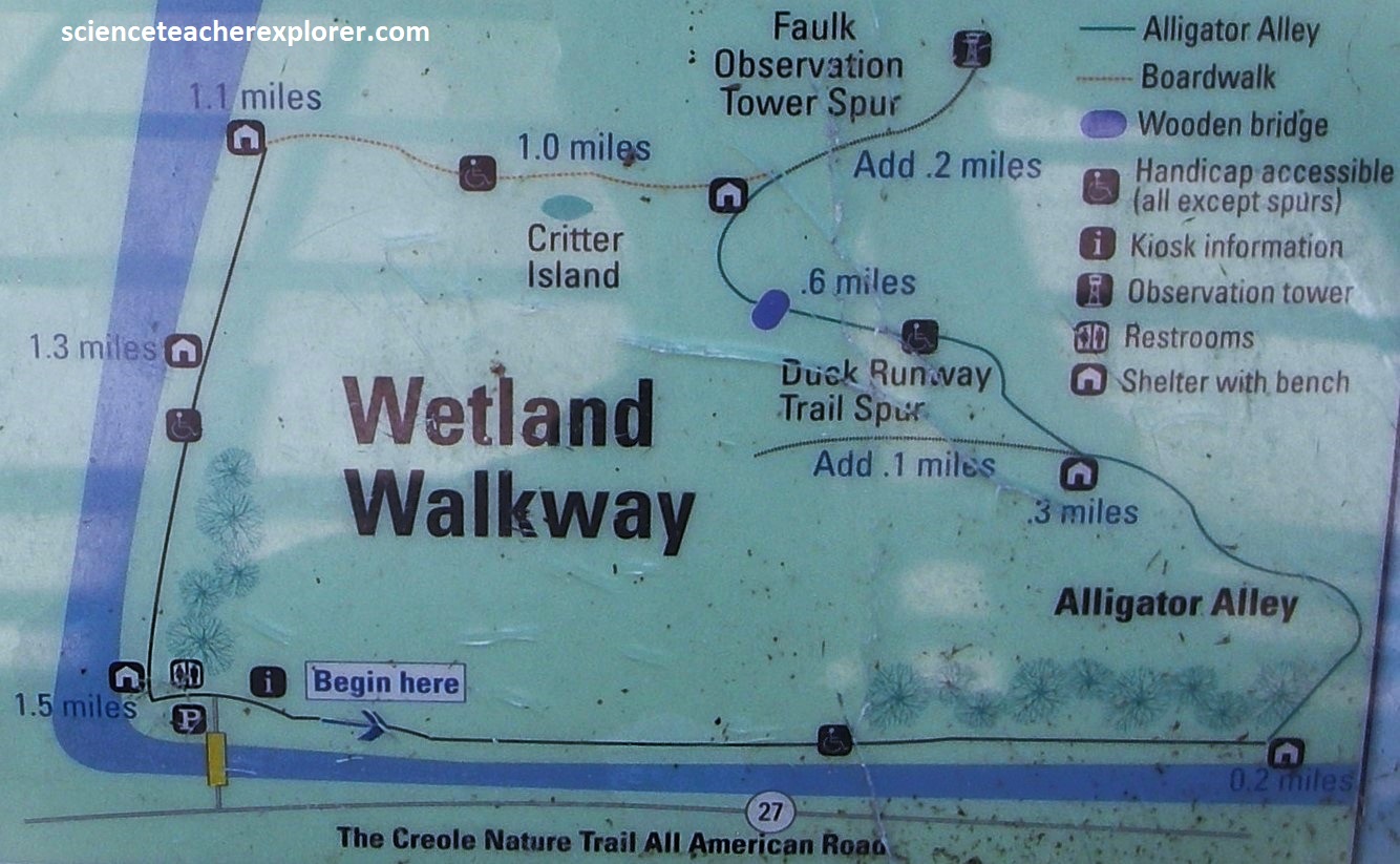
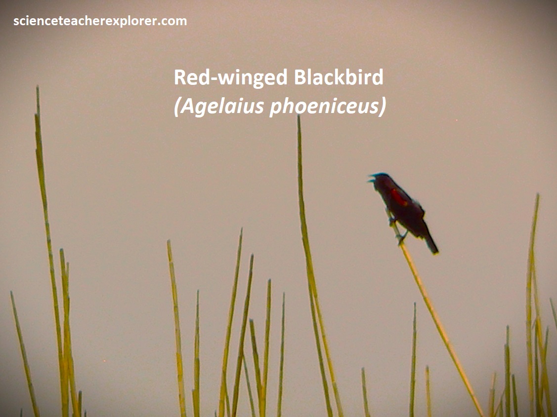
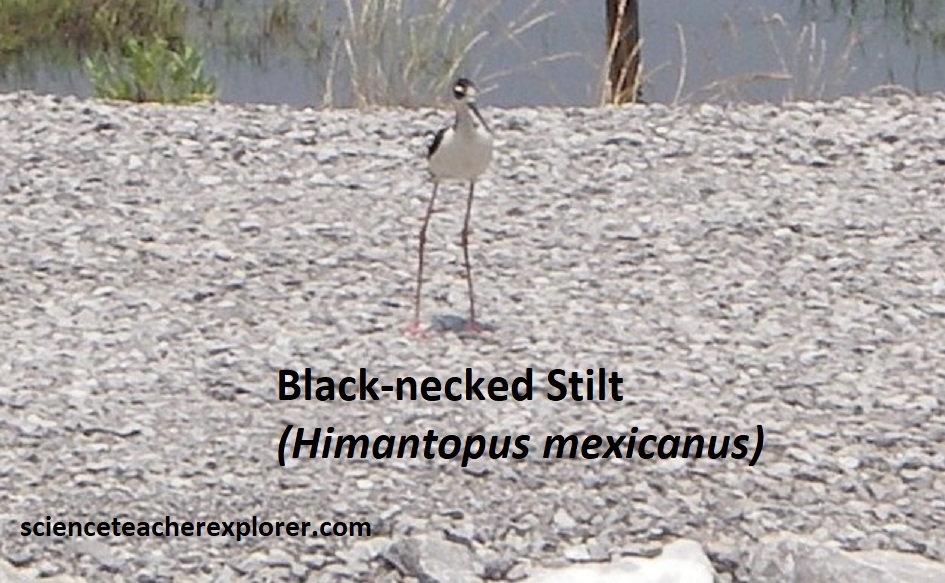
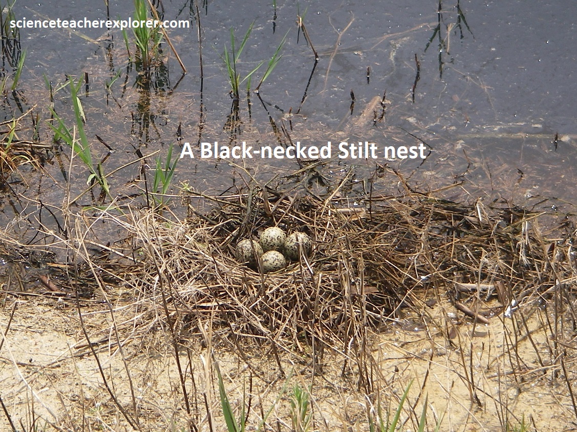
US-27 turns southwest at the Sabine National Wildlife Refuge visitor’s center. The refuge was established in 1937 to protect 143,00 acres of fresh and salt marsh, wintering grounds for waterfowl from the central and Mississippi flyways, and important nursery area for many marine organisms. A boardwalk in the marsh offers a 2 km trek into this wilderness, (pictured below).
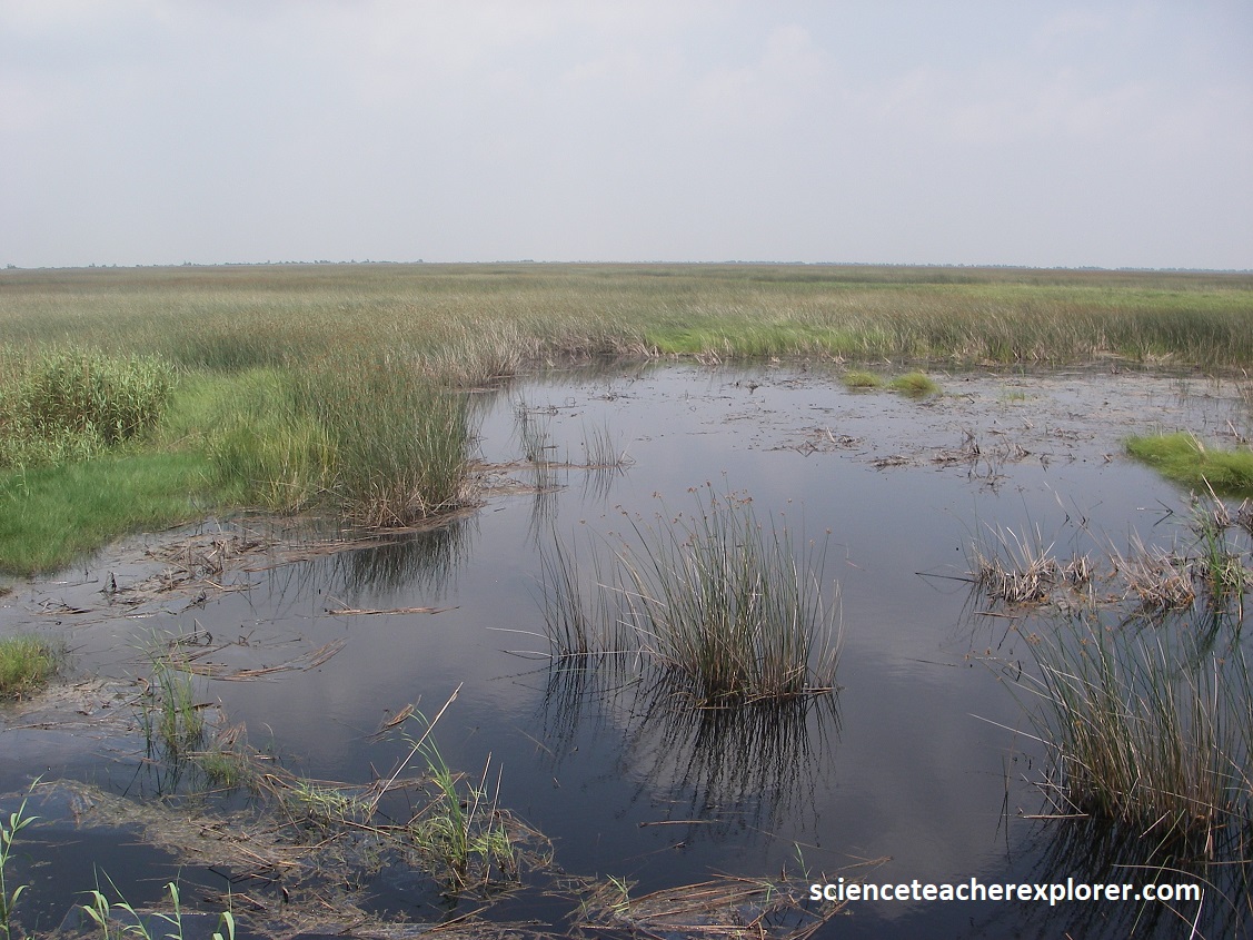
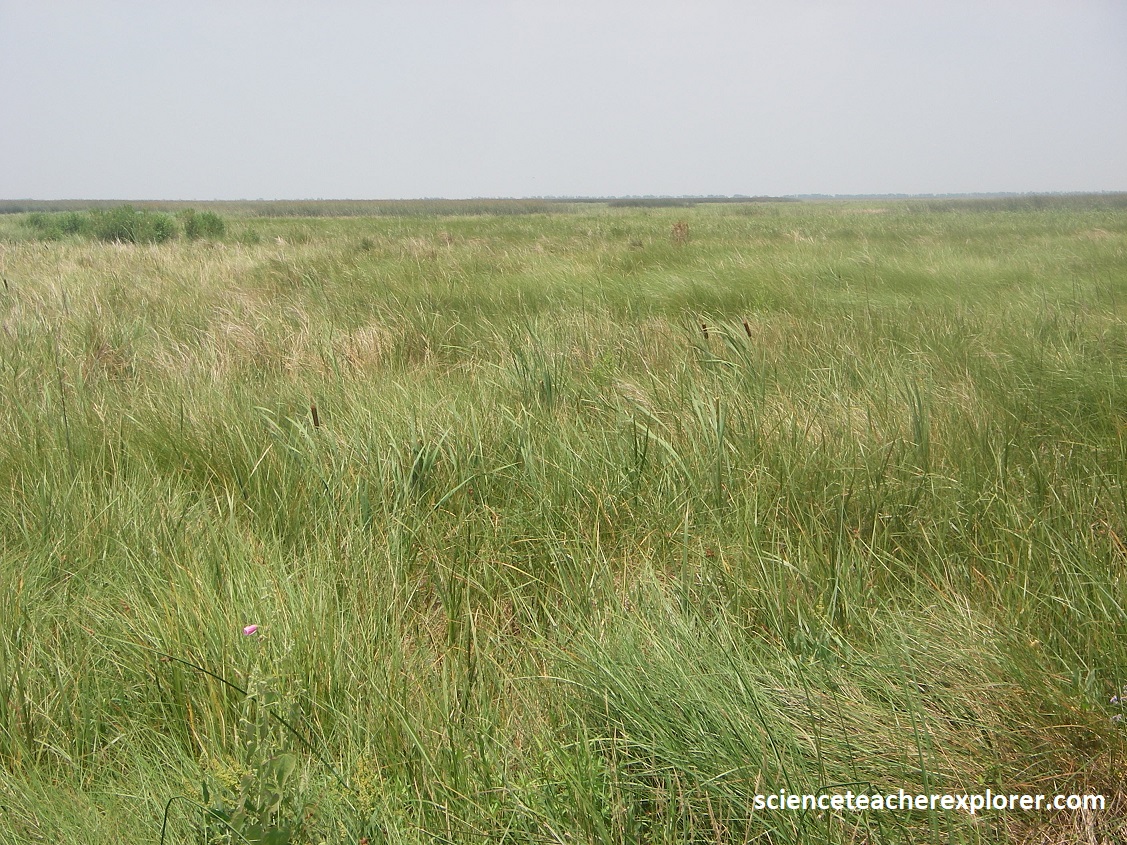
Pictured above, sturdy grasses nod in the breeze, beckoning hordes of waterfowl to roost and feed in the rich organic muck are a common site within the chenier plain and the Sabine National Wildlife Refuge. However, lakes and long ribbons of elevated sand ridges topped by magnificent live oak trees punctuate the marshes. It is these ridges, the cheniers, that give the plain its name, (pictured below). This differs from the delta plain that forms at the mouth of the Mississippi River near New Orleans.
Imaged below, the delta plain forms where the Mississippi River and it’s distributaries pour a great amount of muddy sediment into the Gulf of Mexico. However, no major rivers now feed sediment into the chenier plain, though it stands on a platform of older deltas. But longshore currents that sweep westward from the Mississippi delta import the mud and sand that are building the chenier plain seaward and creating sand dunes and beaches.
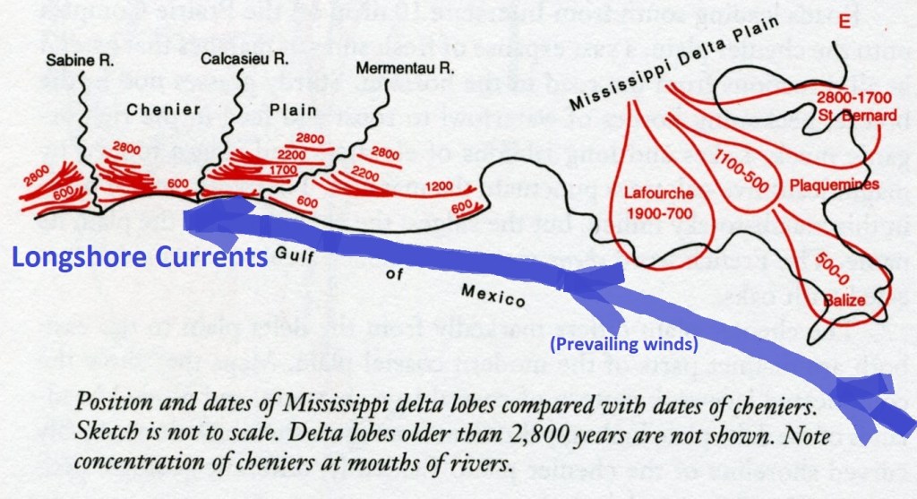
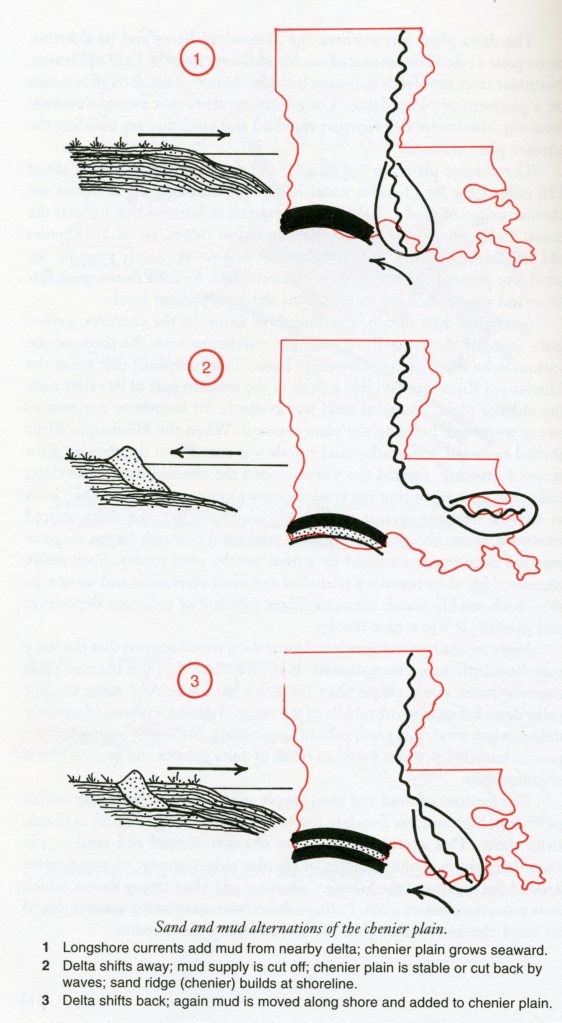
Imaged above, the chenier plain is a flat expanse of low marsh and mudflats, about 190 km long and 19 km wide. Stringing through the mudflats are chenier ridges of sand and shell hash, grouped in bundles that parallel the coast, (where oak trees are planted and human structures are built). Scientists have dated the oldest, (about 2,800 yrs old), are farthest inland, and that they become progressively younger toward the present shoreline.
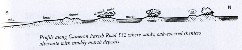
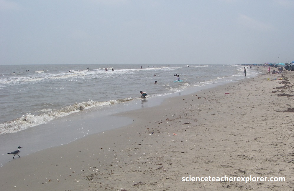
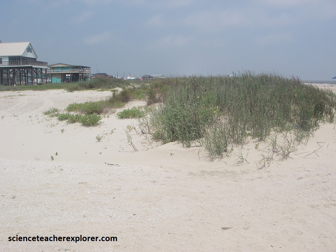
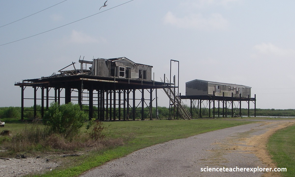
Pictured below are of the town Holly Beach and are on a beach ridge that is about 600 yrs. old. The Holly Beach area and the drive east along LA-82/27 provides one of the best views of a Louisiana chenier. The cheniers stand 0.5-3m above the surrounding grassy marsh, enough to give a firm footing to lines of trees that visually identify them from the highway. Holly Beach is a recreation town built on stilts.
Between Holly Beach and Cameron, LA-82/27 continues to follow the cheniers, which spread out into several, separate ridges, especially noticeable where the road turns north to parallel the Calcasieu ship channel, (pictured below). A ferry took us over the ship channel to Cameron.
Along nearly the entire distance between Cameron and Pecan Island, LA-82/27 follows one chenier or another through the marsh. At the western end of that stretch, between Cameron and Creole, cheniers make a cluster of ridges, and the trees and houses fan out, (imaged below).
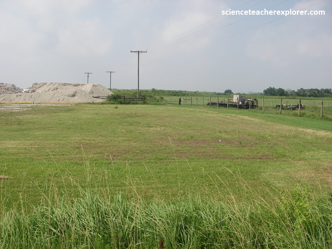
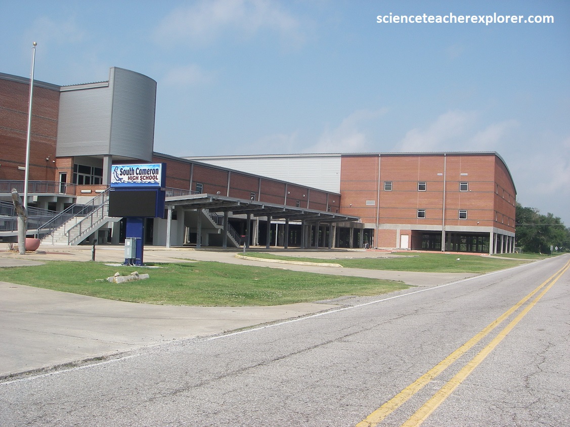
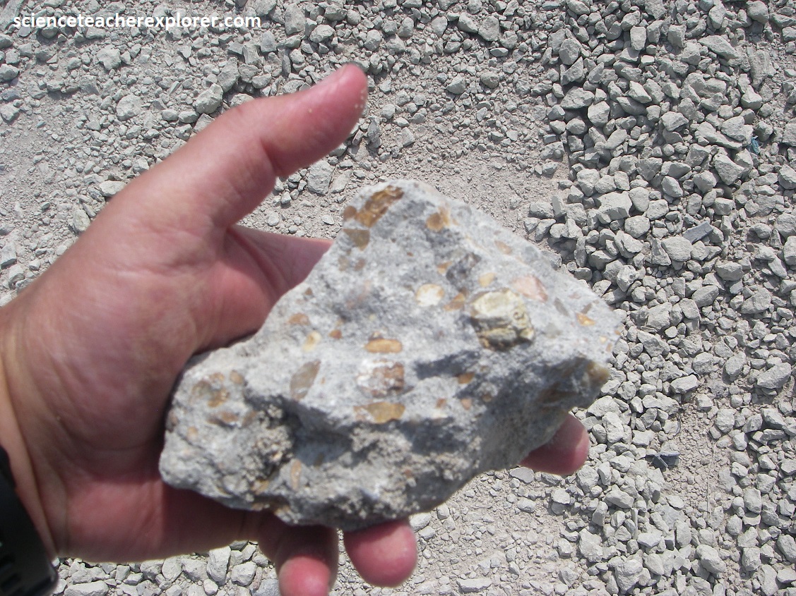
South of Creole, US-82 crosses Creole Ridge, a cluster of cheniers that range in age from 2,200-2,500 years old. A roller coaster of ups and downs are observed with these cheniers. Farther south, US-87 crosses an expanse of marsh, and the prominent Oak Grove chenier, (which is 1.200 years old), at the town of Oak Groves. We could see that the buildings and trees were on the ridge crest. On the eastern end of Oak Grove was a sand pit, north of the road, that gave me an opportunity to look at the rock that the chenier was made of., (pictured below). {Note that the entire South Cameron High School was built on stilts. Some of the stilted-houses didn’t survive the massive hurricanes that hit this area recently}.
Pictured below, LA-82 crosses the Mermentau River, then follow the crest of Grand Chenier, which is 1,200 years old. Multiple cheniers spread northeast of the town of Grand Chenier, just east of the Mermentau River. Rockefeller National Wildlife Refuge lies between the road and the coast between Grand Chenier and Pecan Island. Vast expanse of fresh marshes, large lakes, and long wisps of chenier sands strung across the grassy flats typify this wilderness zone, across the great chenier plain.
Returning to I-10 and Lake Charles on US-27; Becky and I visited the Sam Houston Jones State Park on the Prairie Complex. From Lake Charles we drove north to 107 Sutherland Rd., (8 km north of Lake Charles on LA-378) Named originally for the hero of the Alamo, who according to legend often stayed in this area, the 1,087-acre park now carries the name of the 1940s Louisiana governor who was responsible for preserving these grounds. Here we found some of the loveliest landscape in Louisiana, (towering pines, dense woodlands, lakes, and cypress-bordered lagoons.
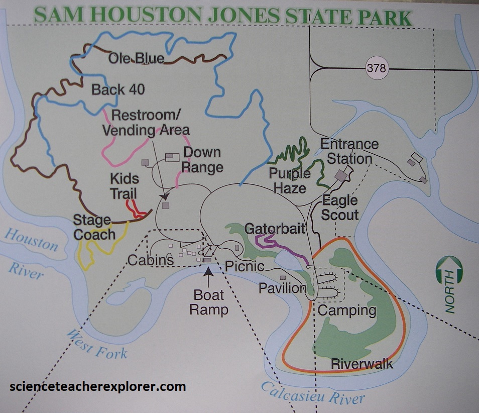
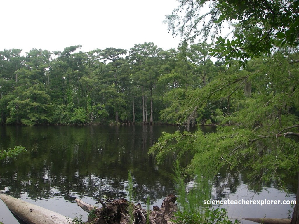
The Sam Houston Jones State Park is found along the banks of the Houston River, a tributary of the Calcasieu River). For part of it’s length, the park road/trail parallels the Houston river, running between the river’s natural levee and a watery back-swamp that harbors a large stand of cypress trees. Becky and I trekked the Riverwalk Trail, (imaged above & pictured below).
Its sandy hills give this park it’s distinctive character amid the surrounding flat land of the Prairie Complex. Pictured below, the sand grains on the trail are almost all glassy quartz, the same size, and nicely rounded. Similar to beach sand or barrier-island sand.
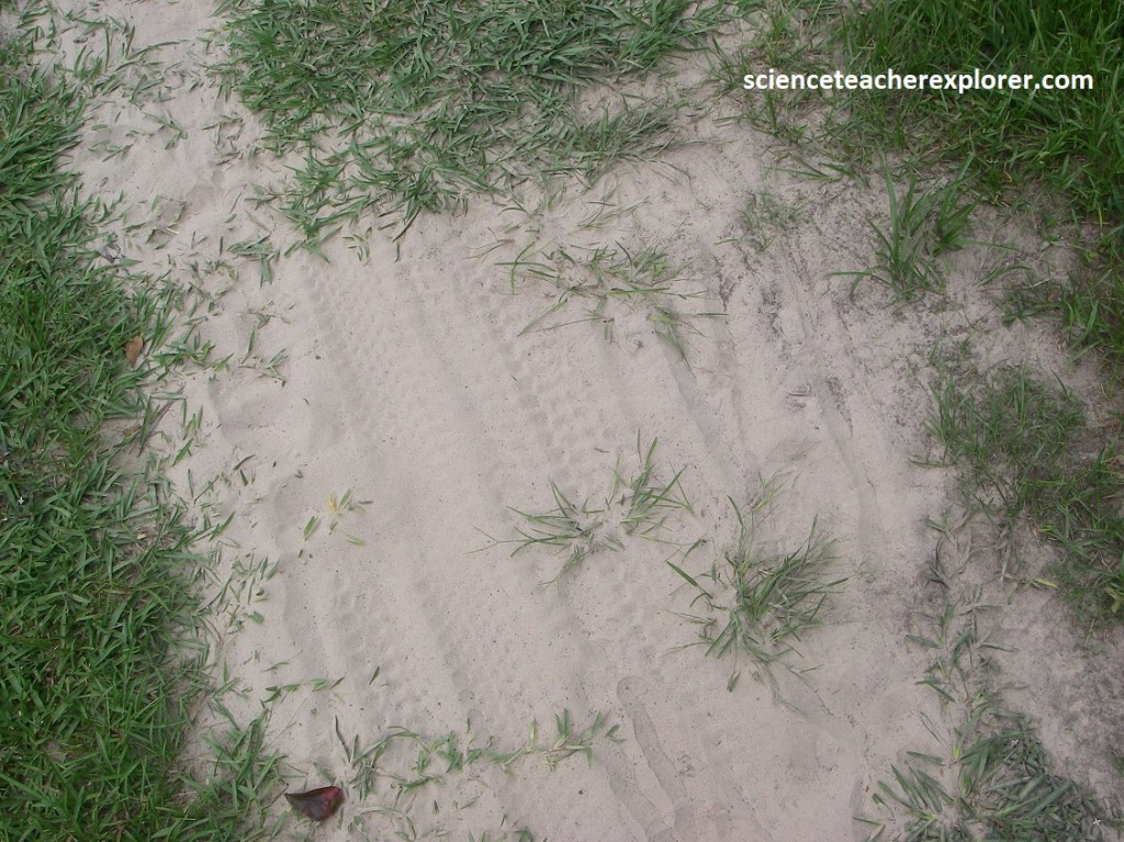
Scientists call this sand ridge at the Sam Houston Jones State Park the Ingleside barrier island trend. It lies on top of the Prairie Complex, so it must be Pleistocene in age. It was deposited when the sea level was high during one of the warm interglacial episodes of the Pleistocene time. This was the coastal barrier island about 135,000 years ago. These sandy hills of the Ingleside barrier island trend within the park are the eastern end of a long sand ridge that reaches to Galveston Bay, Texas.
Hurricane Laura, which made landfall near Lake Charles, Louisiana, on August 27, 2020, ranks among the most powerful storms to hit the state. Laura had sustained winds of 240 km/hr. This took out most of the trees in the Sam Houston State Park. However, after the clean-up, the park has many bald cypress trees that are still prominent. Tree-filled lagoons, mixed pine and hardwood forests combine to create a unique natural environment left behind after the event, (pictured above).
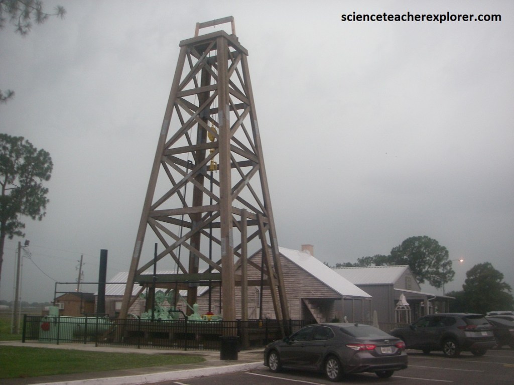
Returning to I-10, Becky and I drove east to Jennings for a brief visit to the Louisiana Oil and Gas Park, (pictured above). A wooden derrick commemorates Louisiana’s first oil well, the Jennings Oil Company #1, which Jules Clement drilled near Evangeline, a few kilometers northeast of the park, in 1901. Between Jennings and Crowley, I-10 crosses Bayou Nezpique, Bayou des Cannes, and Bayou Plaquemine. The three bayous are tributaries of the Mermentau River, which empties southward into Lake Arthur and Grand Lake, both on the modern coastal plain. At Lafayette, we turned southwest on US-90 to visit the Weeks Island Collapse, (imaged below). Becky and I, stayed a week in New Iberia to explore the area.
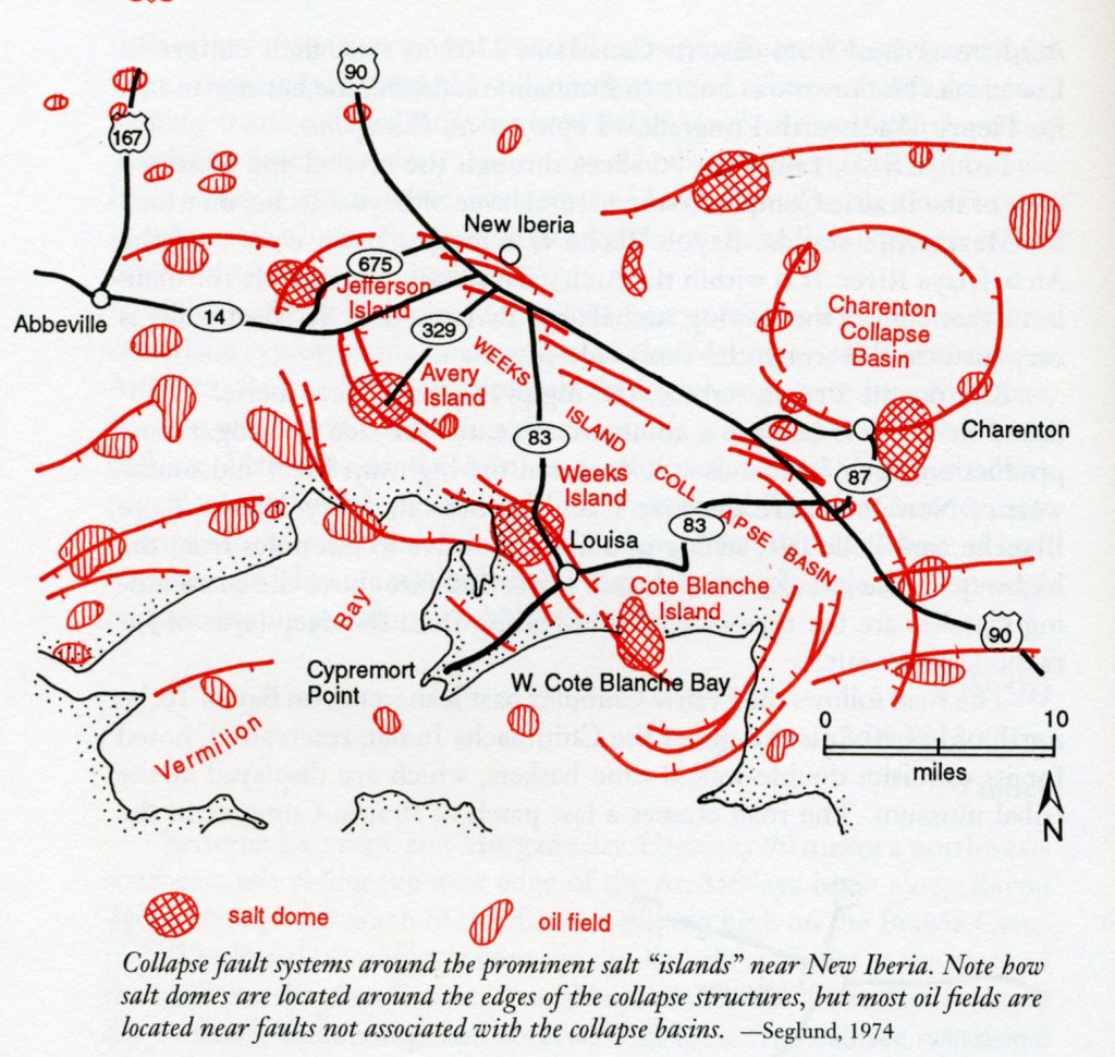
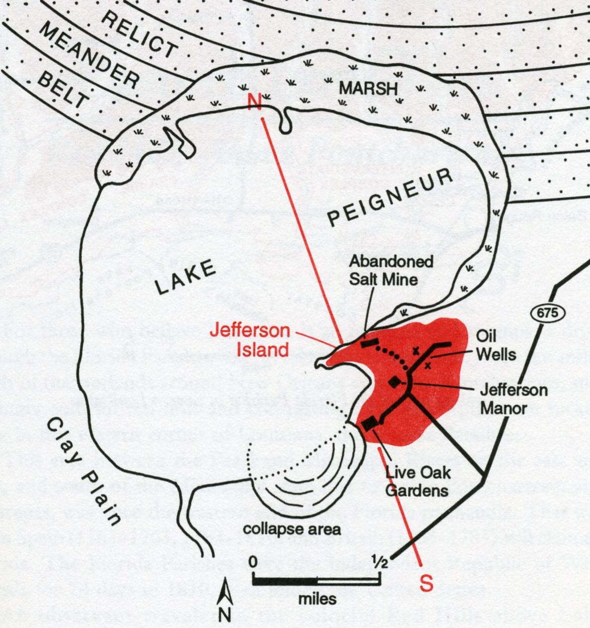
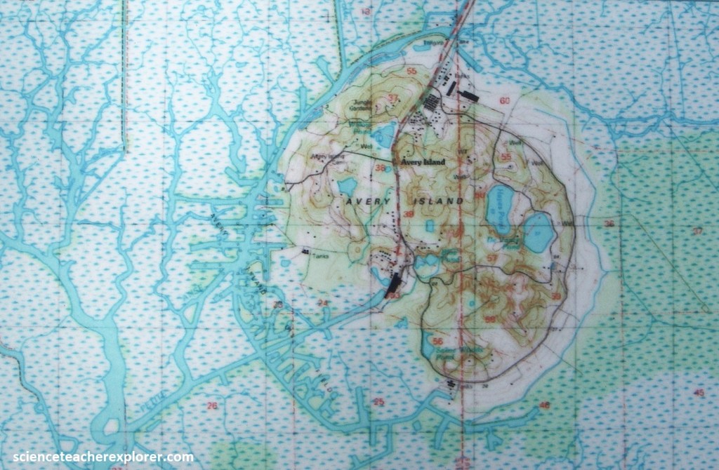
In this part of Louisiana, collapse faults are associated with large salt domes or clusters of salt domes. These circular fault systems develop as sediments collapse above areas where salt has been withdrawn into a large salt dome of a cluster of salt domes. Four of the Five Island string of salt domes near New Iberia are associated with the Weeks Island collapse basin, (imaged below). We explored these four islands: Jefferson, Avery, Weeks & Cote Blanch.
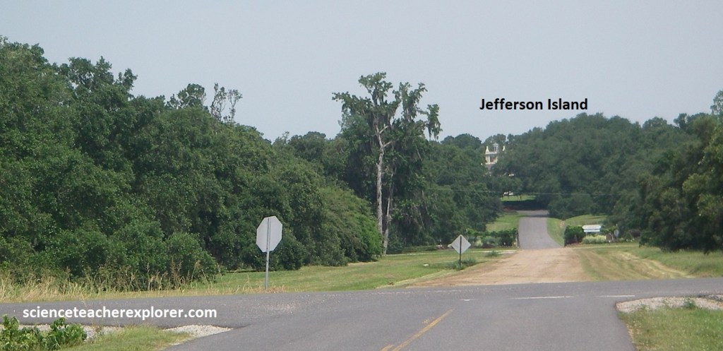
Our first stop was the northern most island, (salt dome), called Jefferson Island. From US-90, we drove southwest on LA-675. Jefferson Island rose some 17m above the surrounding plain of the clay/silt rich Prairie Complex. It was known as Orange Island until Joseph Jefferson (1829-1905), (a famous actor), bought if after the Civil War.
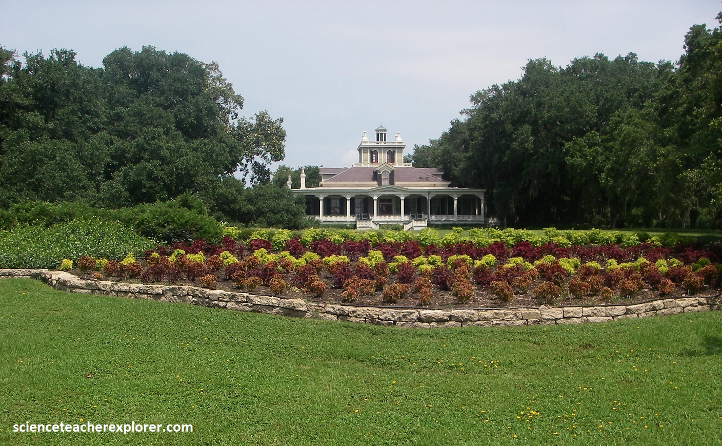
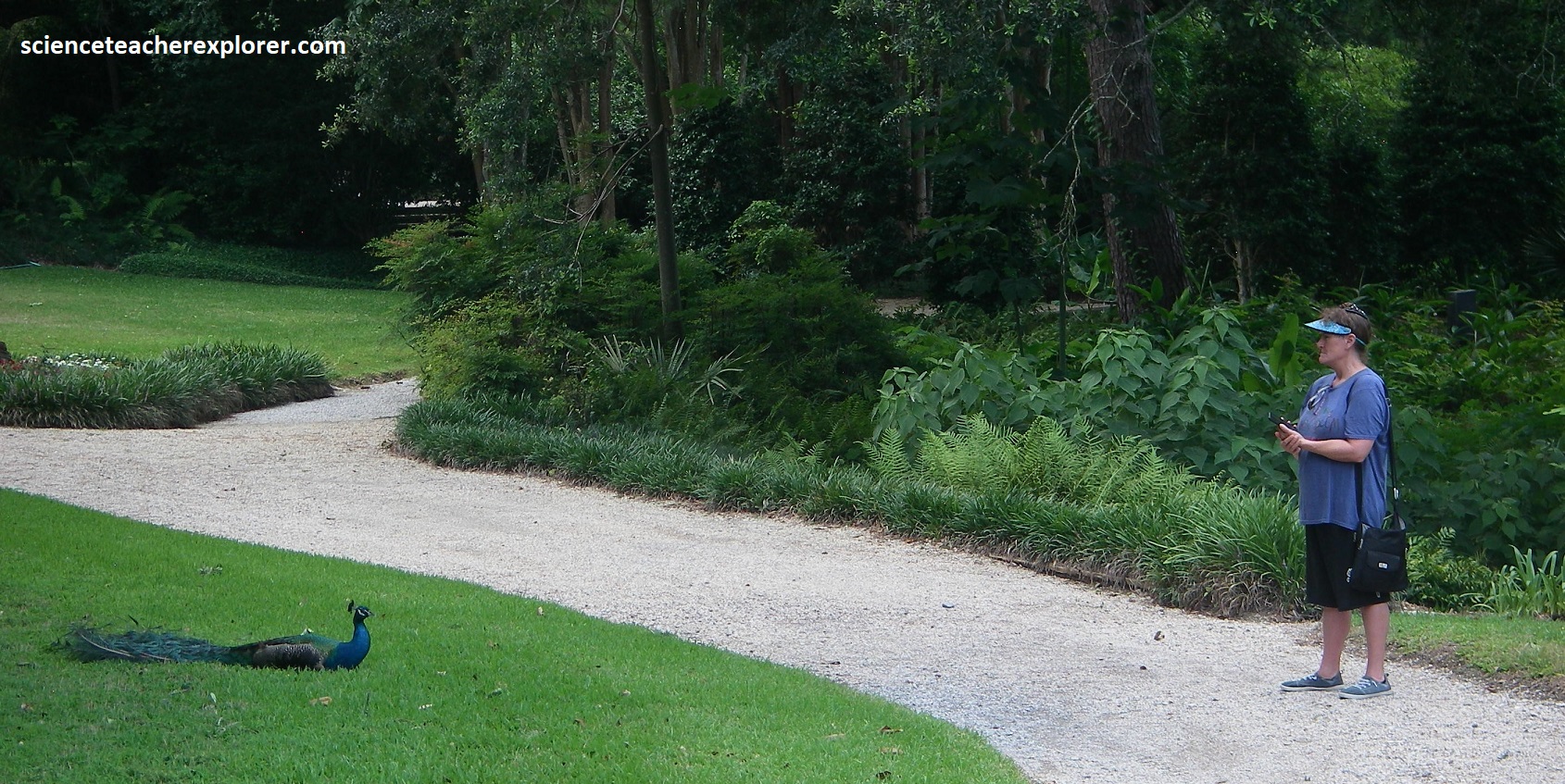
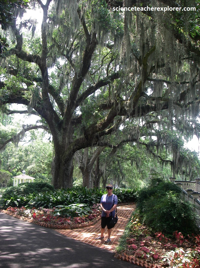
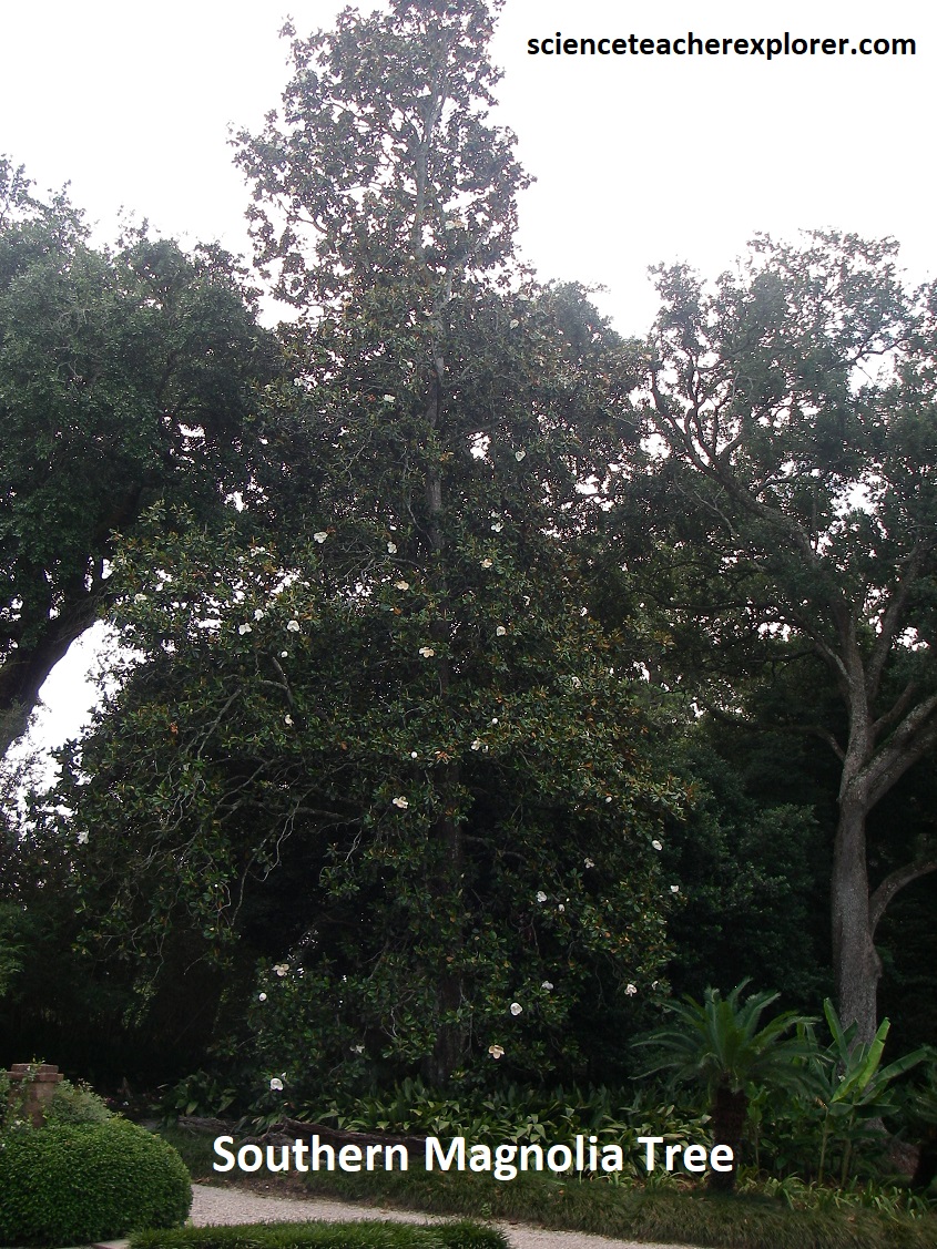
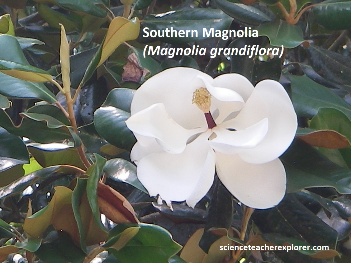
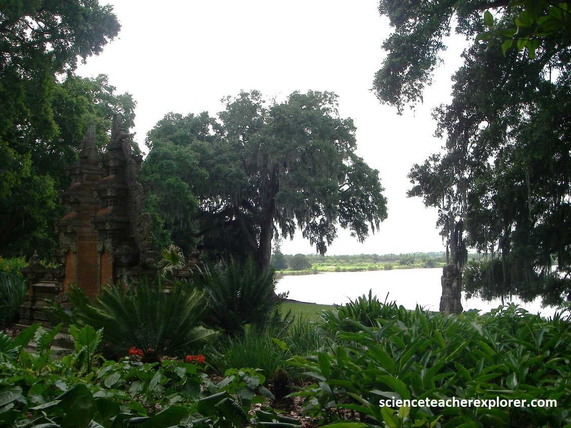
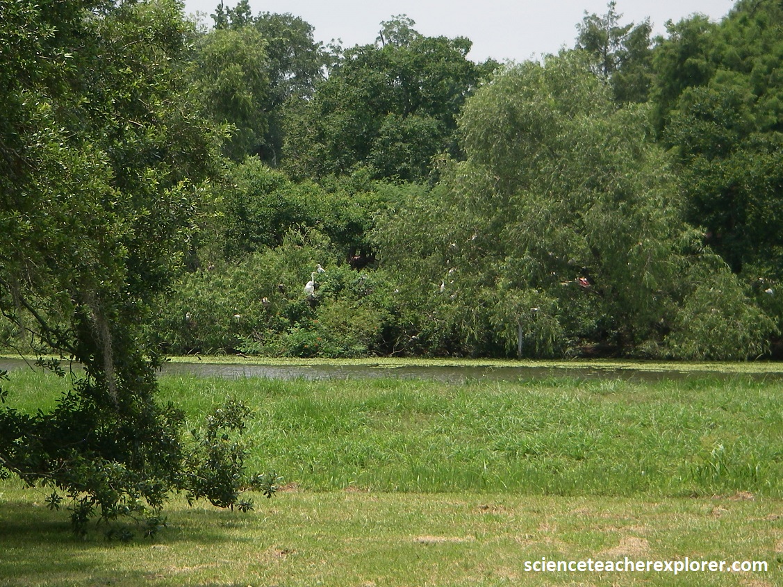
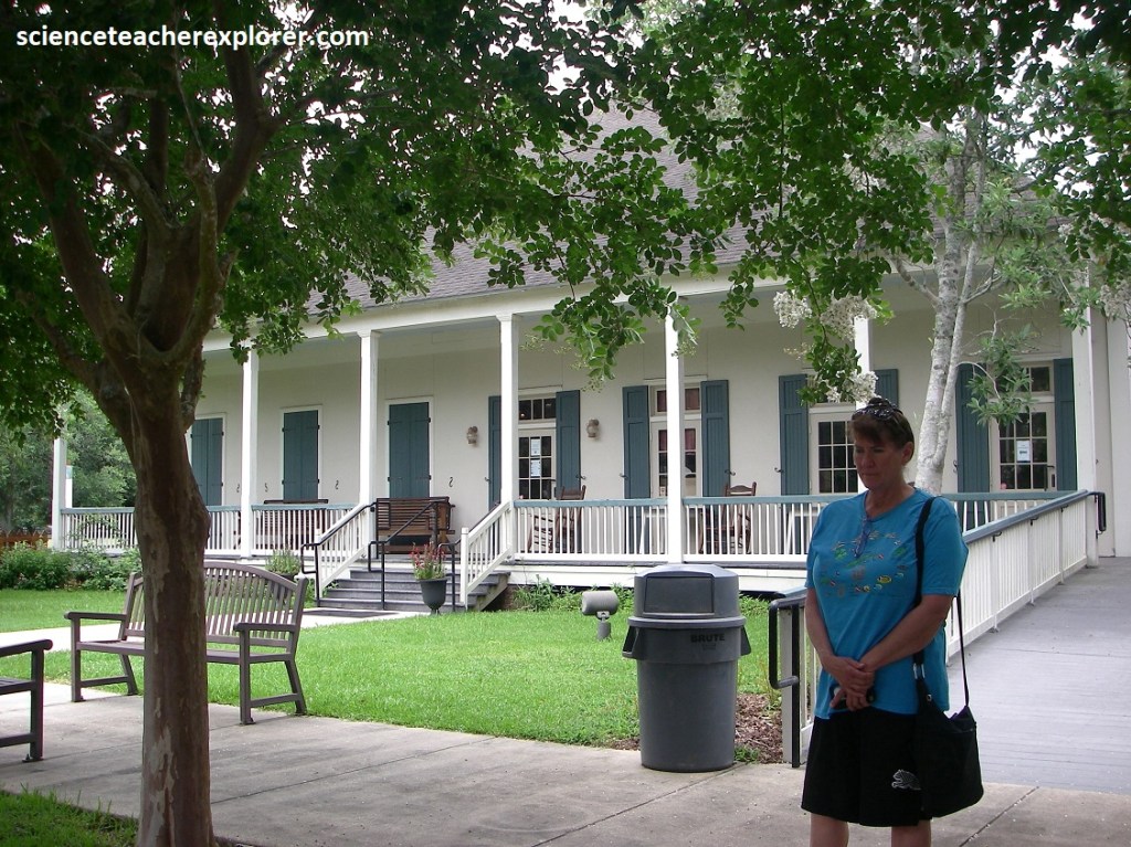
Joseph Jefferson built his Manor in 1870, (pictured below). Becky and I explored the Manor and it’s connected gardens, called the Rip Van Winkle Gardens, (pictured below). Jefferson was credited for playing the “Rip Van Winkle” role from the Washington Irving tale for many years in the theater. The property consisted of 25 acres of semitropical gardens bordering Lake Peigneur. More than 1,000 species of flowering plants can be seen here with peacocks. This is a place of huge Cleveland Oak-Trees, 350 years old or more, draped with Spanish moss (Tillandsia usneoides), {supposedly Grover Cleveland snoozed under}. Pirate Jean Lafitte’s brother-in-law was rumored to have owned this land before Jefferson, a bit of folklore that may have been proven when three pots of very old silver coins were unearthed here. This garden is also the site of a 15-acre cypress-filled artificial impoundment known as Rip’s Rookery, specifically designed to attract nesting water-birds–especially wading birds, (260 species). Pictured below with the last photo, Rip’s Rookery is a complex of ponds lined with marsh vegetation, swampy black willow stands, and bottomland hardwood tree species. Note that American Alligators protect the rookery from predators as they try in vain to cross the surrounding water mote.
A spine of salt under the island comes to within 33m of the surface. A larger salt surface lies about 290m beneath Lake Peigneur. The lake floods a collapsed area over the salt, where the salt dissolved in circulating groundwater.
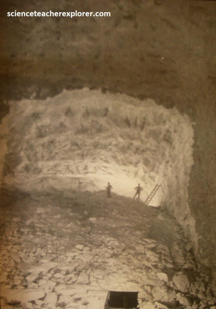
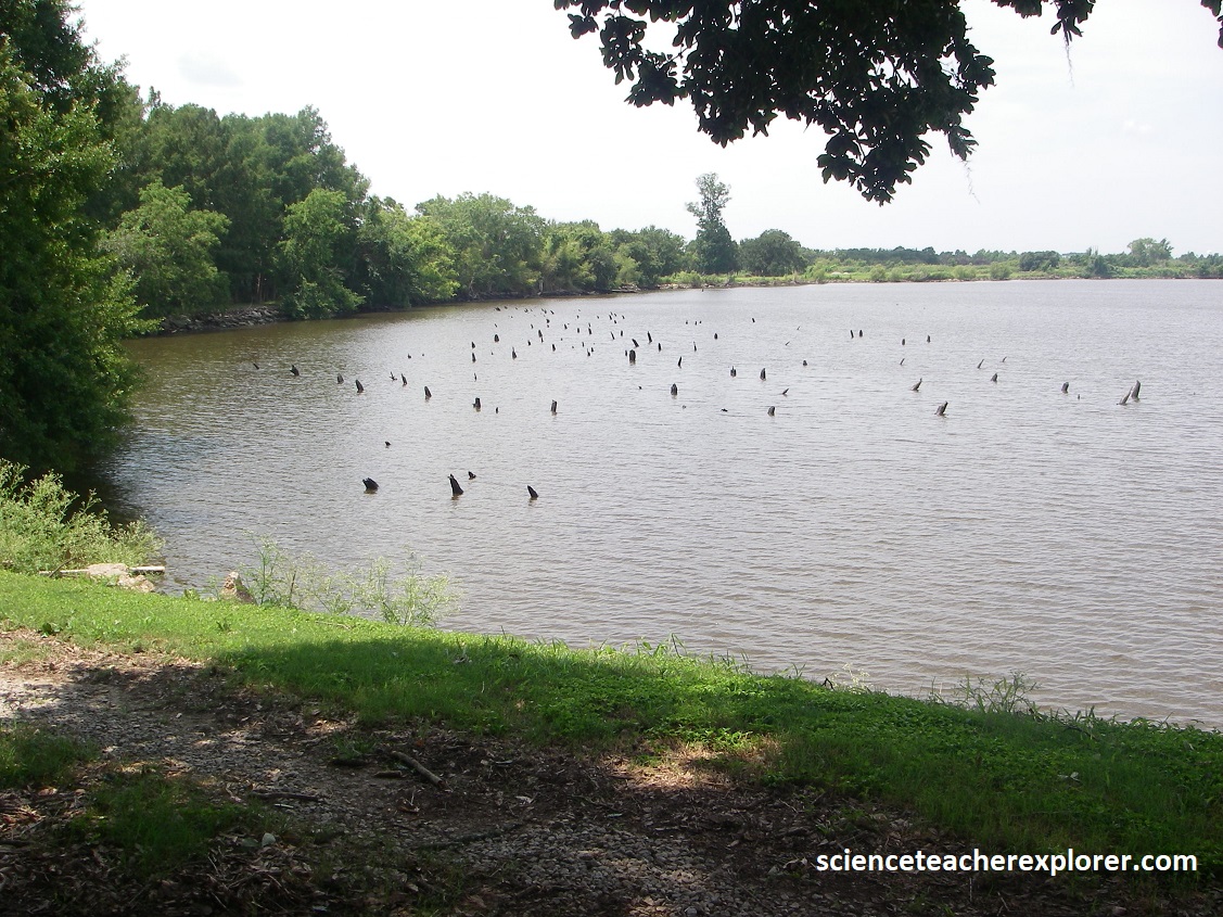
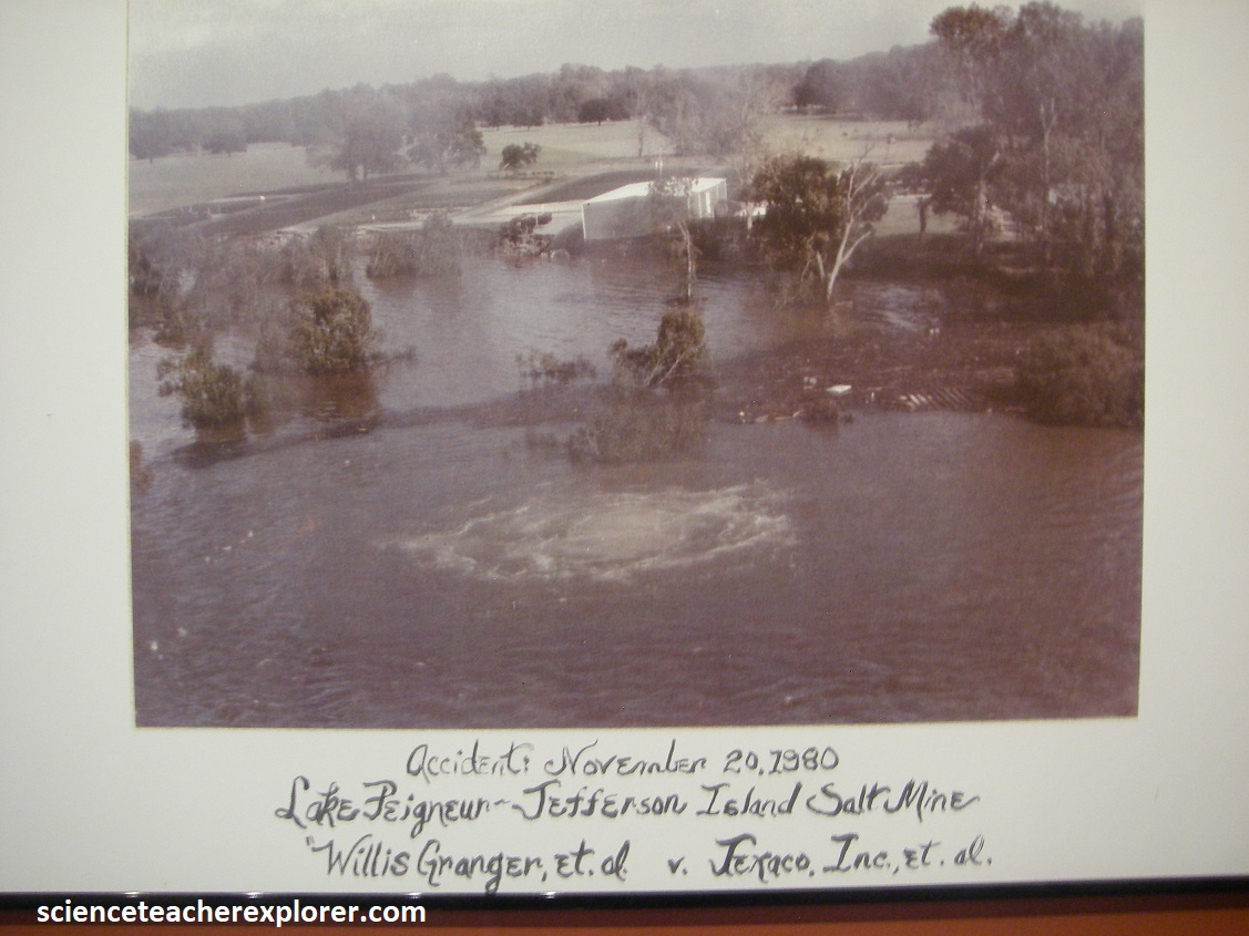
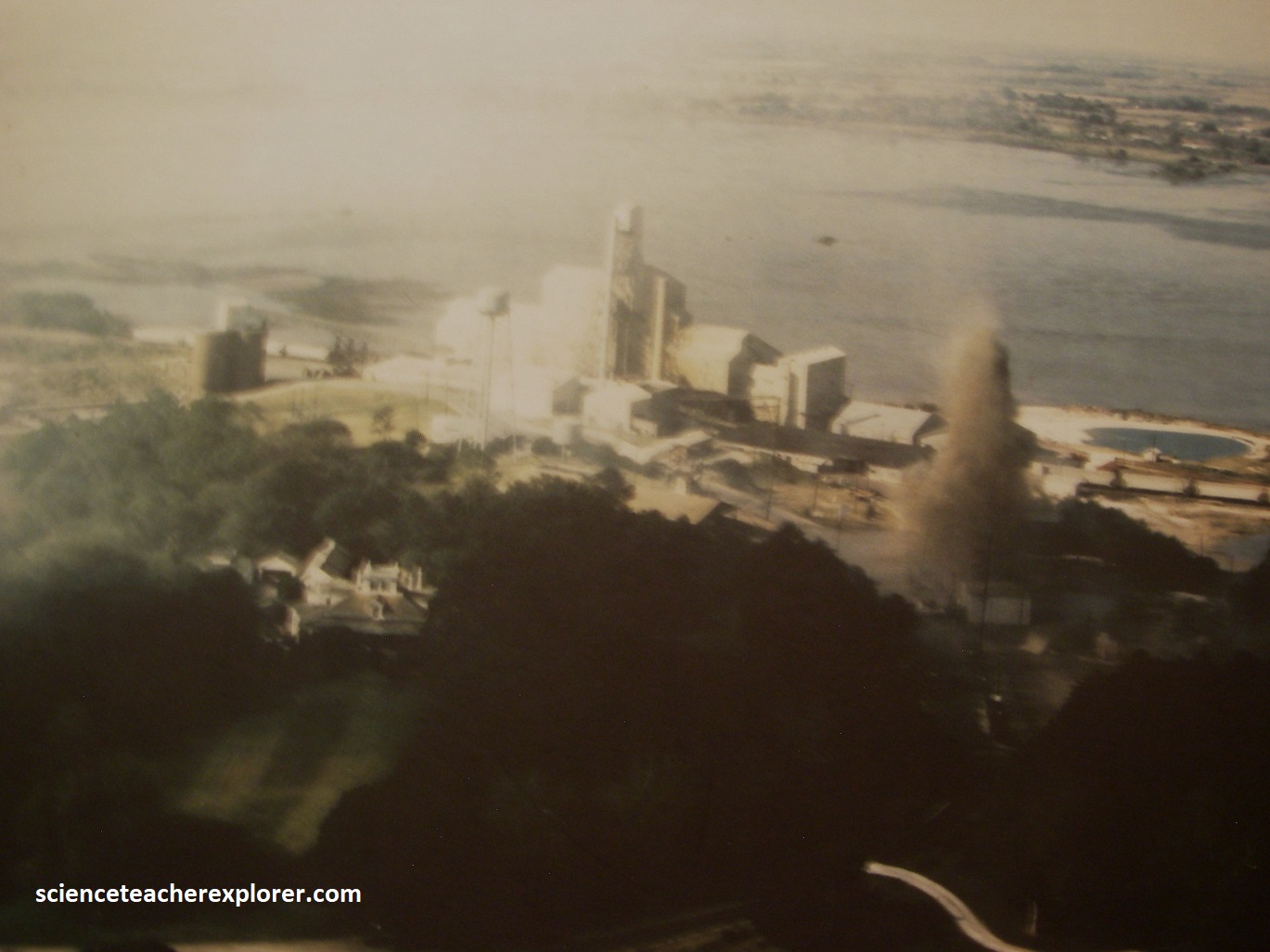
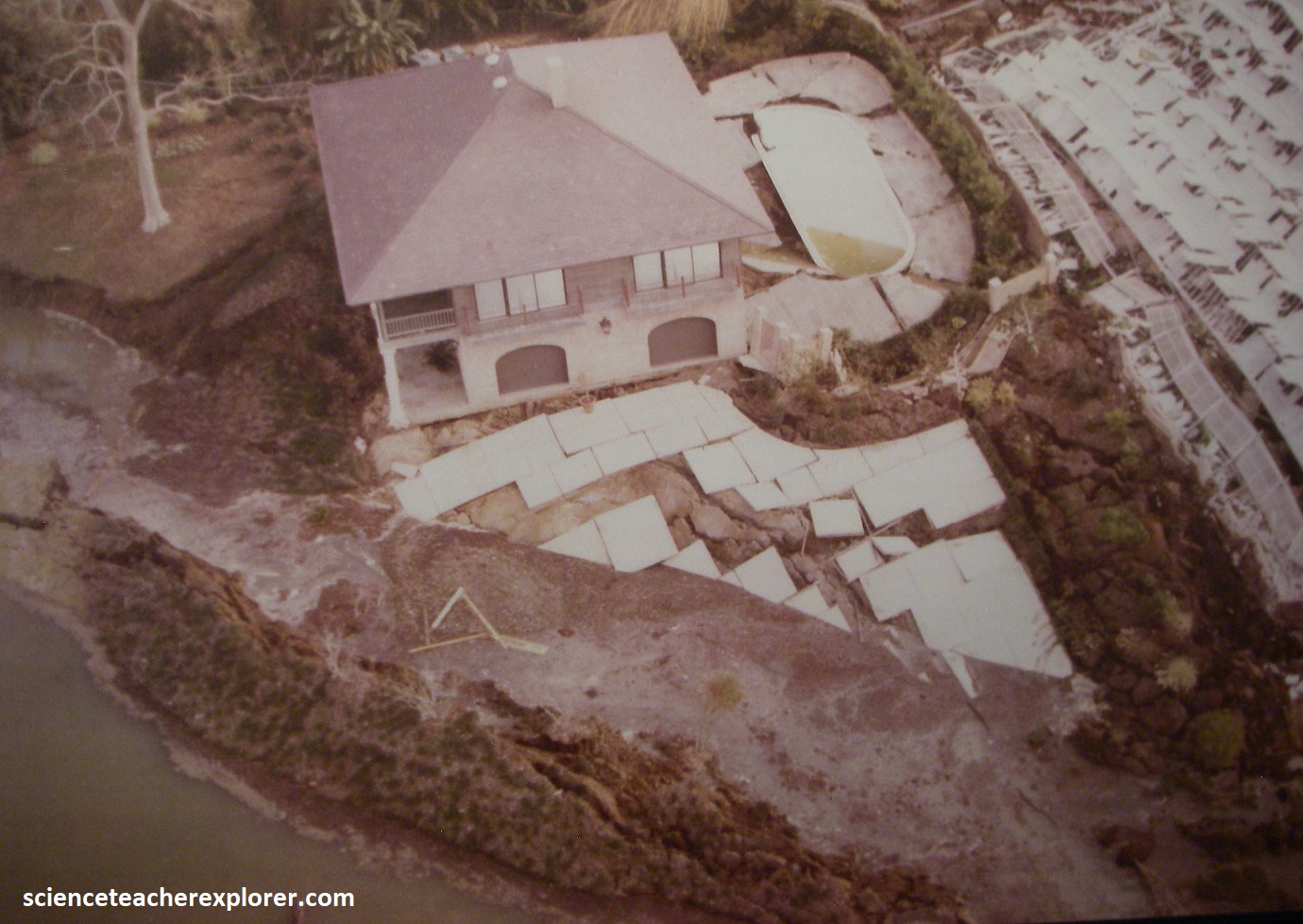
Pictured above, a salt mine operated until November 20, 1980, when it came to a catastrophically abrupt end. An oil rig operating offshore in the shallow waters of Lake Peigneur accidentally drilled into the mine workings, (imaged below). {The left image below was taken from “Roadside Geology of Louisiana” Spearing 1995 and the right image below was taken from an interpretive sign, on-site}.
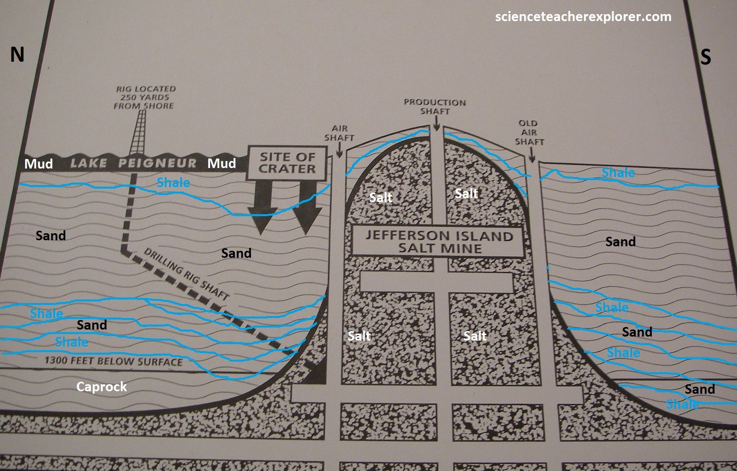
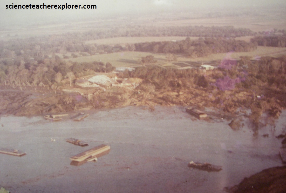
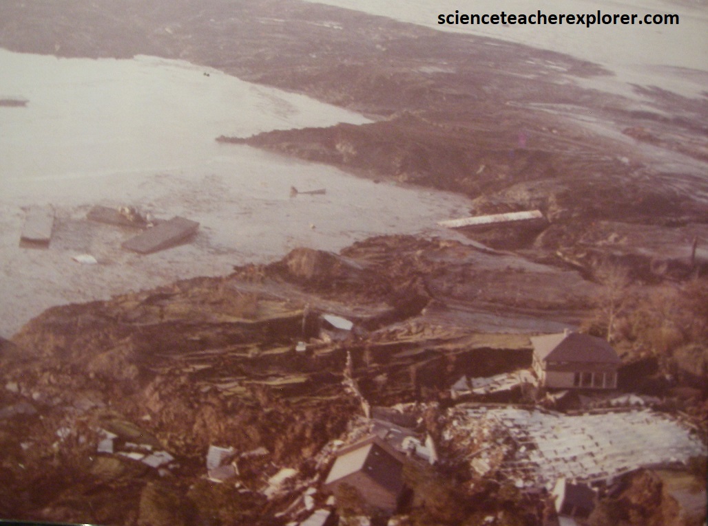
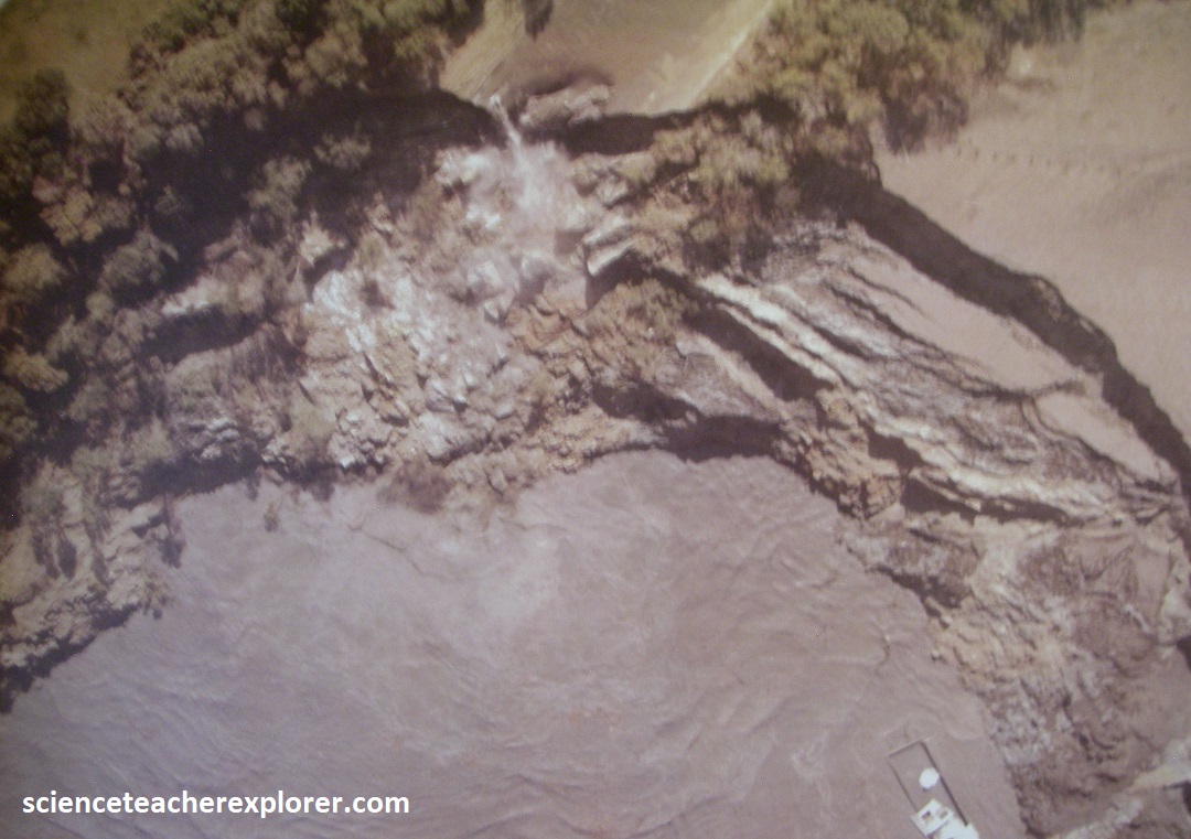
Pictured below, the lake quickly drained into the mine, the overburden collapsed, and the two drill rigs were pulled down with its surrounding equipment, (5 barges loaded with trucks & rock salt). The vortex into the salt cavern swallowed the lake, 65 acres of native woodland, Rip Van Winkle Welcome Center, the glass conservatory and Bayless’ new Home, (The chimney from his home ominously protrudes from the lake, a reminder of that infamous day). Saturated mud flowed across the lake bottom, while firm clay along the southeast side of the lake slipped in a series of curving landslides. Within a few days, the lake returned to its former level, having filled all the empty space in the cavern and mine, (closing it). {The images below were taken from an interpretive sign, on-site}. [Note: This event would of happened naturally in due time, however, the Oil-Well drilling incident sped up the process].
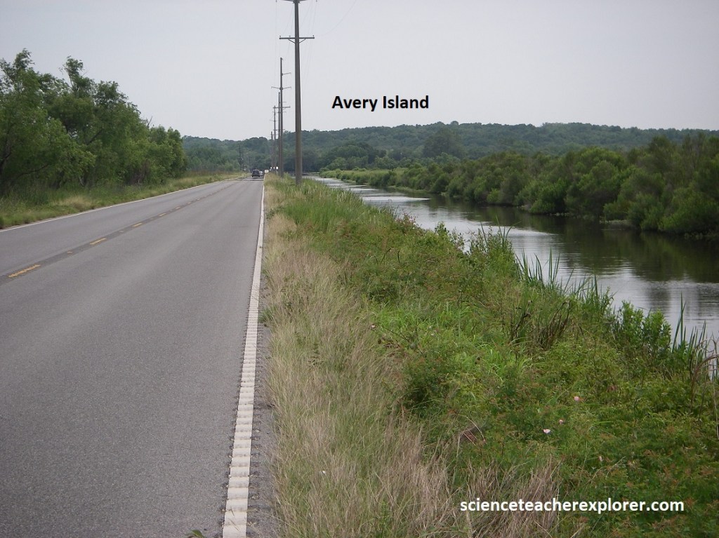
Our next destination of interest was salt dome of Avery Island. Avery Island rose from the surrounding marsh, growing on the horizon as we approached from the northeast along LA-329 from LA-90. It rose 50m above the wetland plain, (pictured below).
Pictured above, Avery Island stands above a salt dome, which rose thousands of meters through layer of sedimentary rocks. The Weeks Island collapse fault system promoted salt movement in this and three of the four other salt islands in this area. Most of the Avery Island salt dome rose between Eocene and Miocene time, but some movement probably continues today with groundwater still dissolving the salt at depth.
Avery Island is nearly circular, and covers about 2,500 acres. It is covered with loess lying on sediments of the Prairie Complex sands. The depth to salt ranges from 5-100m.
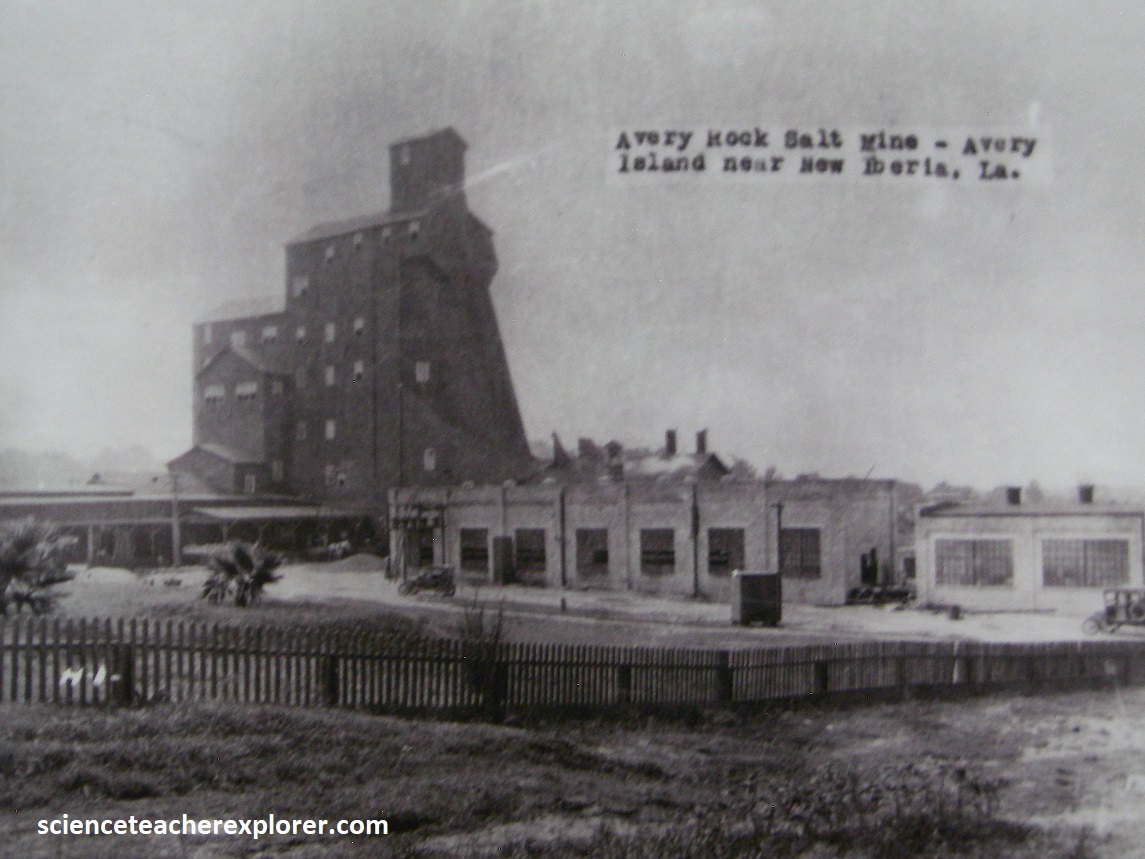
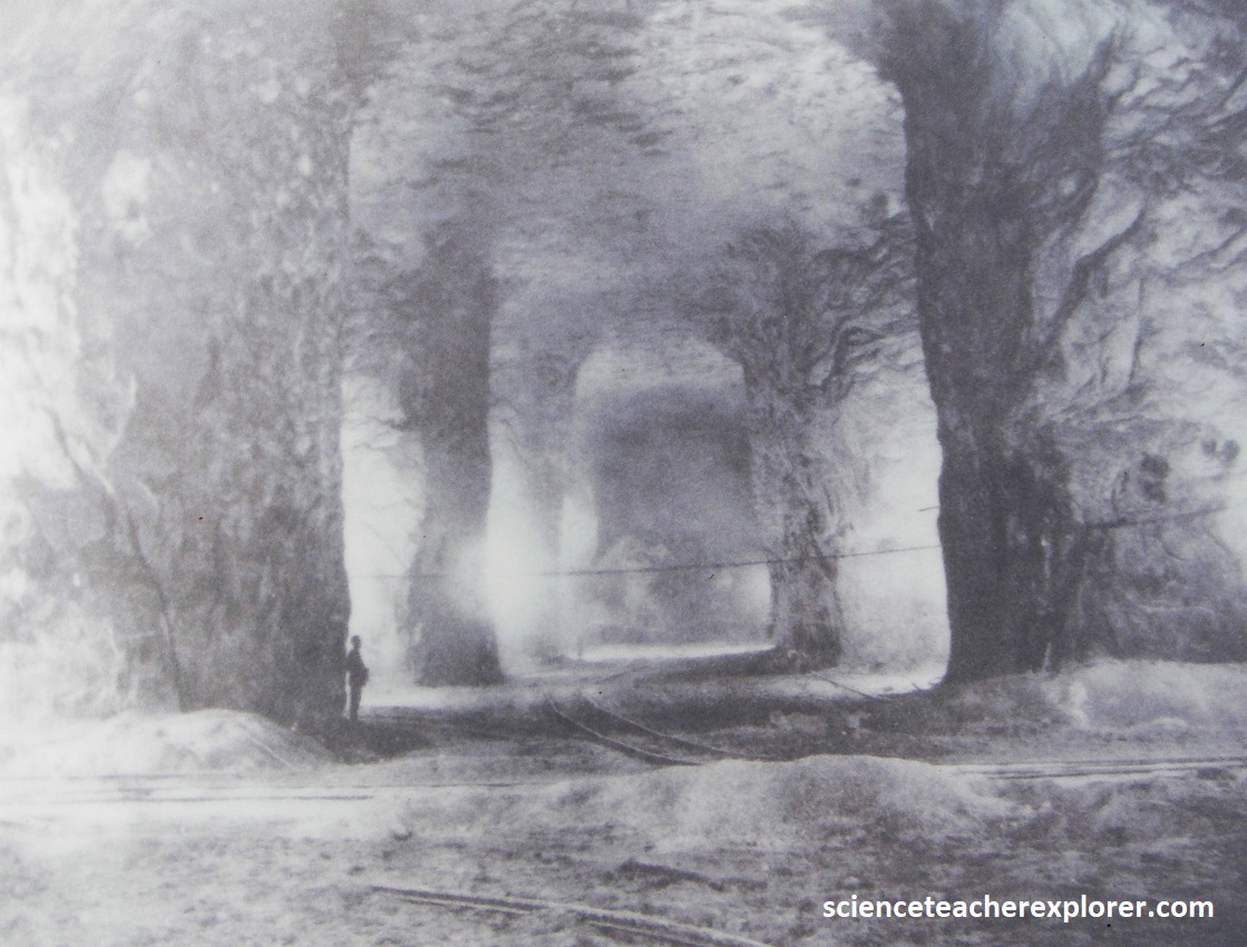
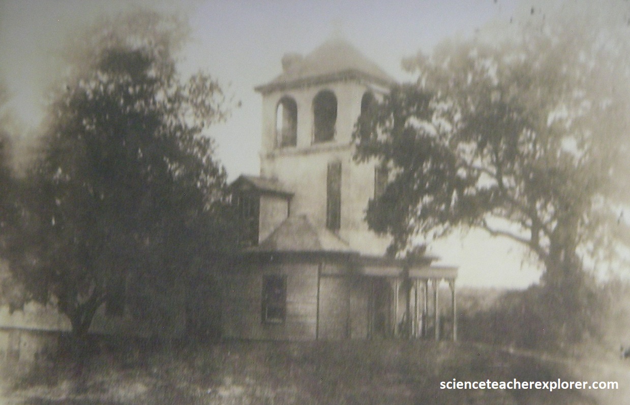
Brine springs were discovered on Avery Island as early as 1791. John Marsh bought the north half of the island in 1818 and produced salt by evaporating brine. In 1837, Judge Daniel Avery married Marsh’s daughter and eventually acquired the entire island. Their son, John, started brine evaporation during the Civil War. In 1867, pure rock salt was discovered 5.3m below the surface and a salt mine was sank to 10m deep before the groundwater seepage became a problem. However, the Avery family later dug a deeper 167m salt mine, (pictured below). {The 2 historical photos below was taken from an interpretive sign, on-site}
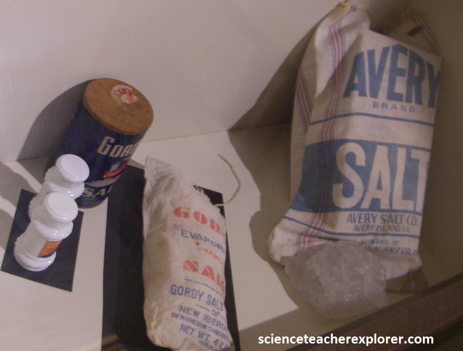
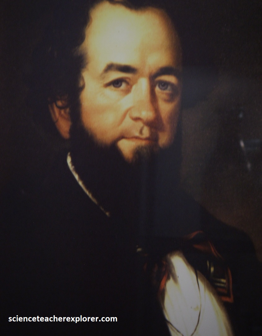
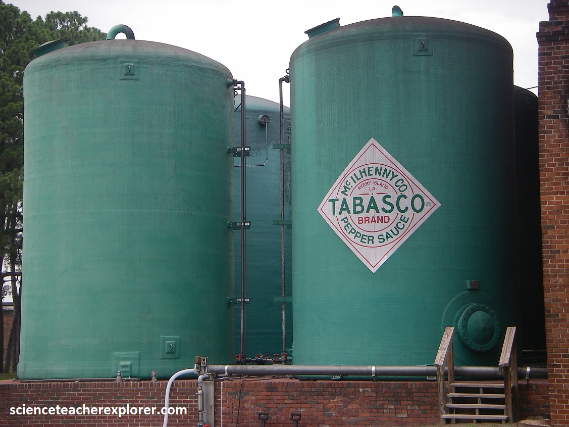
Just before the Civil War, Edmund McIlhenny married Judge Avery’s daughter. Starting with pepper seed he got from Mexico, McIlhenny grew peppers and concocted a sauce from his peppers, Avery Island salt, and vinegar, which he aged in wooden casks. In 1868 his Tabasco sauce was trademarked. Pictured below is a painting of MacIlhenny and his family house. {The two photos below were taken from an interpretive sign, on-site}
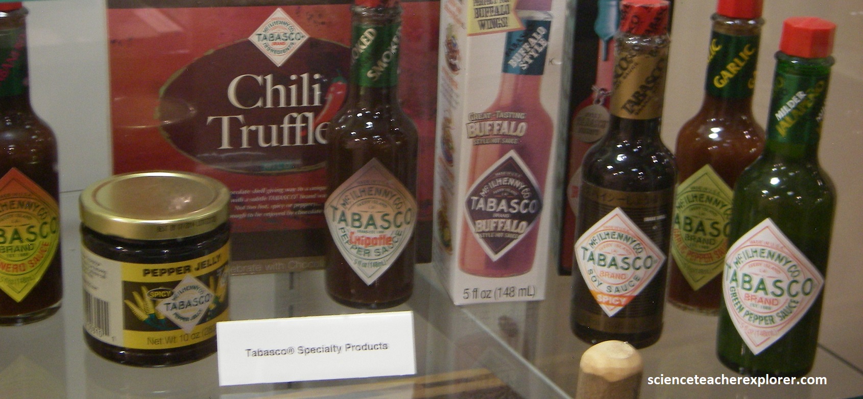
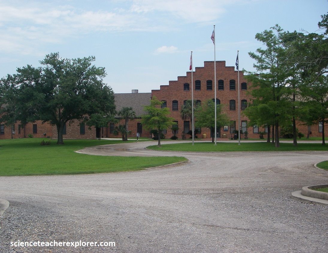
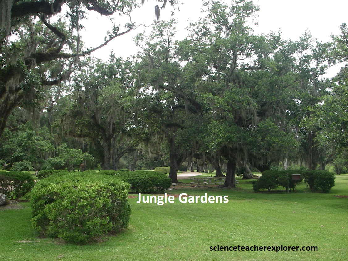
Secluded paths and gravel roads loop among the Tabasco’s compound more-than-200 acre Jungle Gardens and factory, (pictured below), which feature an egret rookery built on bamboo piers. Once prized for their showy feathers, egrets were hunted nearly to extinction. In 1892 the Tabasco company’s founder, E.A. McIlhenny, helped in their recovery by capturing and nurturing 7 young birds, which in less than 25 years increased to 20,000, (the largest egret colony ever established in the U.S.).
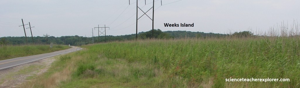
Becky and I returned to LA-90 and drove southeast to the LA-83 turnoff. We turned right and drove south to Weeks Island. For 8km, LA-83 was on the solid ground of the Prairie Complex. It then drops to a freshwater marshland, for another 8km until the sharply delineated slope of Weeks Island the rises abruptly to an elevation of 57m above sea level.
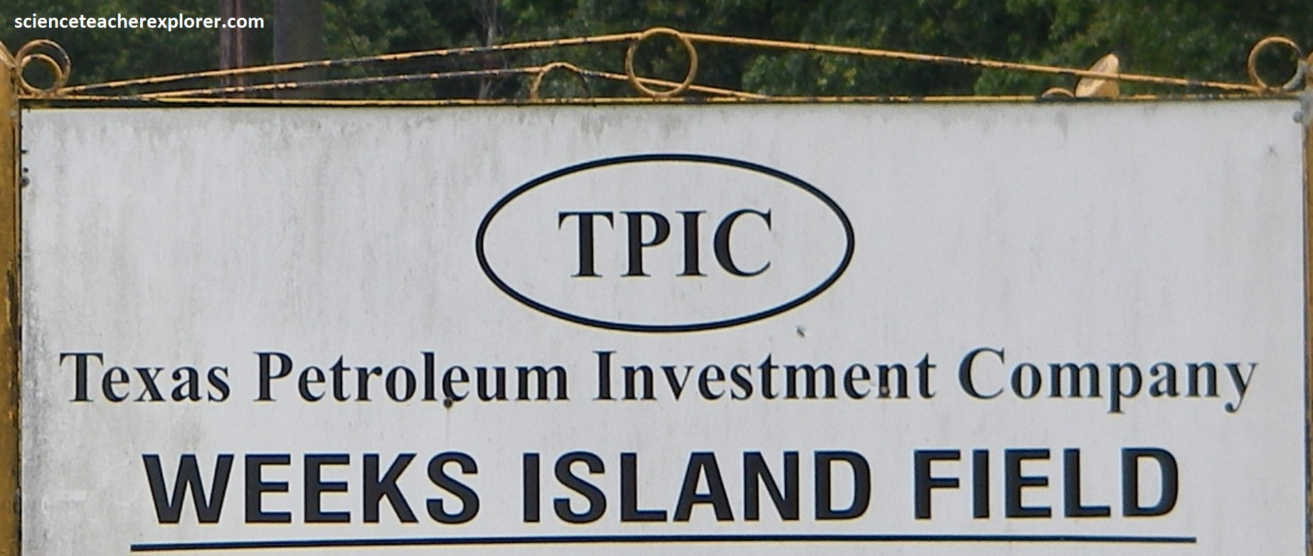
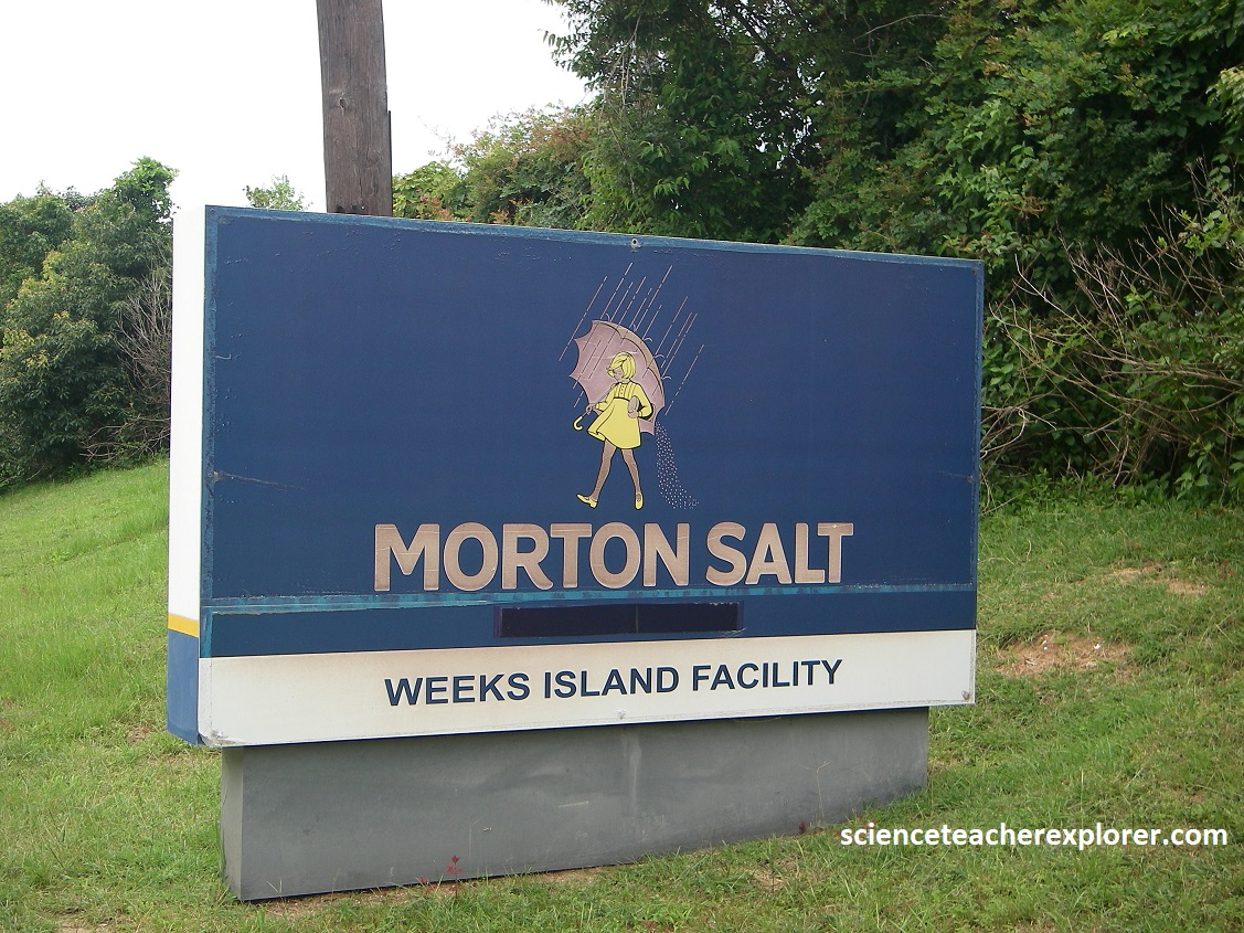
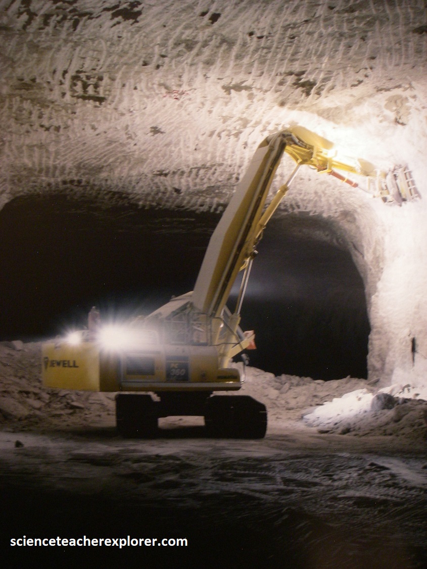
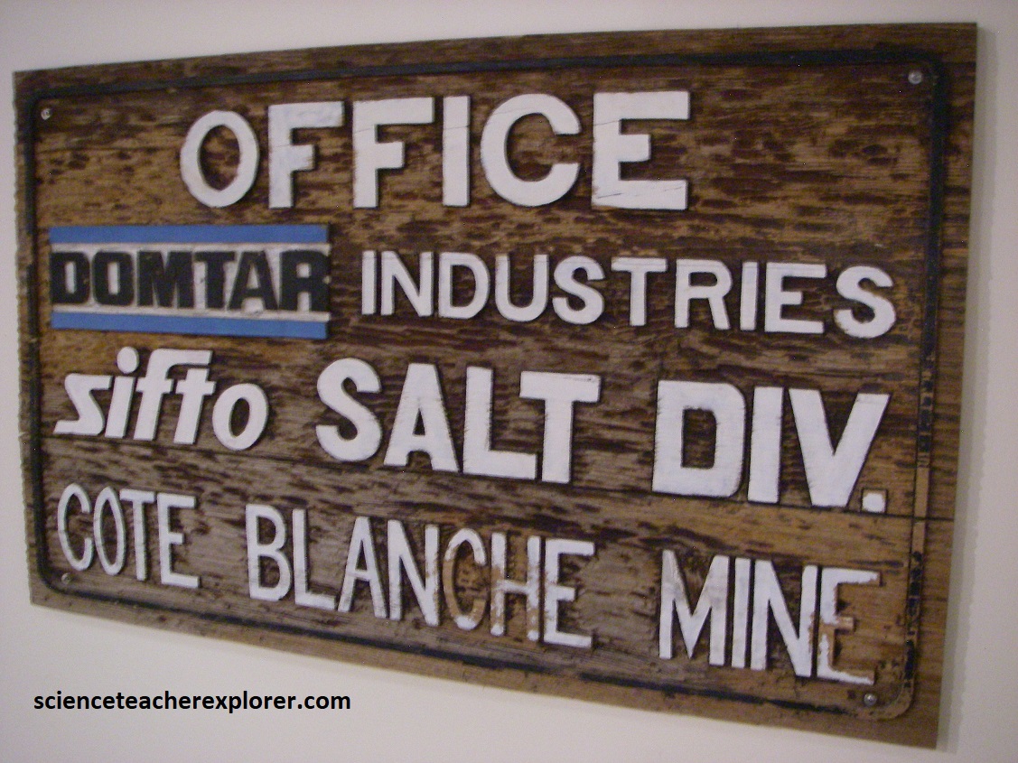
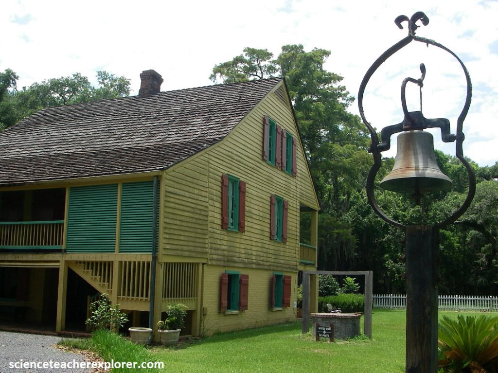
Weeks Island is another of the salt domes on the Five Island chain, and is part of the Weeks Island collapse structure. As in the other islands, salt pushes up beneath Weeks Island from deep beneath the surface, from the Louann Salt. In this case the salt is close enough to the surface to mine during the 1800s. Weeks Island still hosts a salt mine and chemical plant, as well as natural gas field Oil Well and processing Plant, (pictured below).
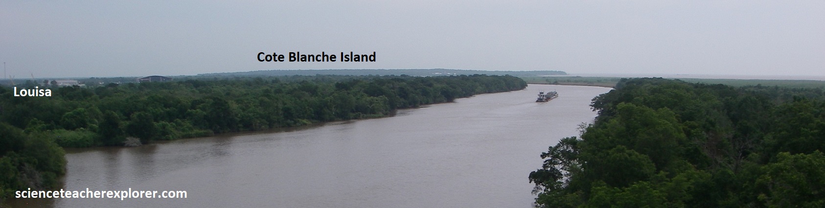
Becky and I drove over the Weeks Island salt-dome to Louisa. River sediments and freshwater surrounds LA- 83 between Weeks Island and Louisa, where we could see Cote Blanche Island to the southeast, (pictured below).
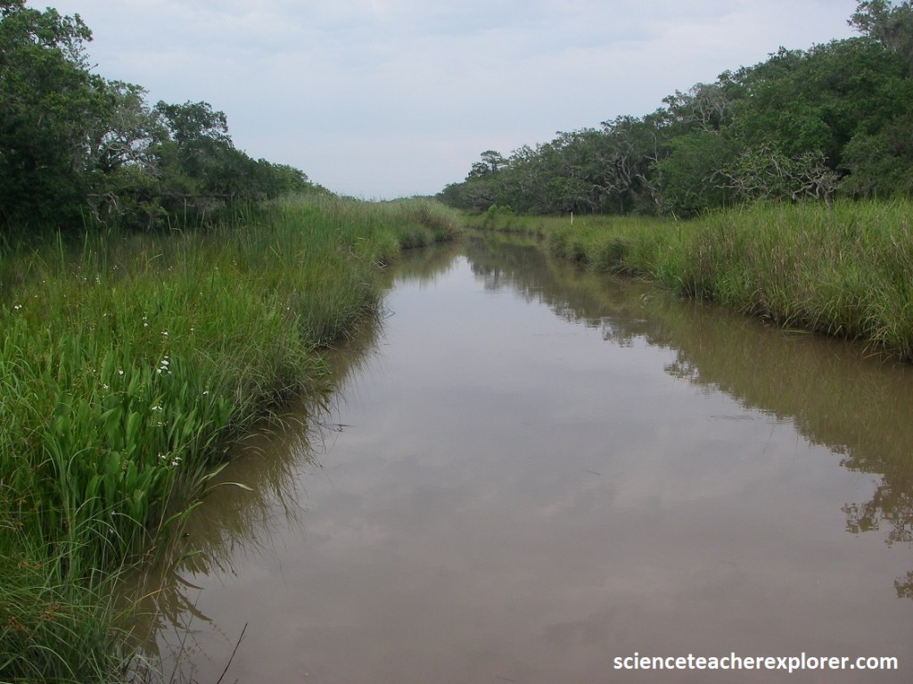
We turned right on LA-319 from Louisa southwest to Cypremort Port. LA-319 seemed to be on a natural levee deposit of the Bayou Cypremort that was 2 to 3m above marsh level. Fresh-water marsh, spreads out on either side of the road until it reaches salt marsh in a few kilometers, near the Cypremort Port State Park turnoff. I noticed that many of the gullies and canals were remarkably straight, which suggested that they probably followed fractures and faults, (pictured below). These may reflect a broken salt surface below. The raised terrace sediments and apron of sediment around the edge of the island suggest that the salt dome has been rising.
Picture below, Bayou is a small remnant channel of a former delta of the Mississippi River. From 7,500-5,000 years ago, the Mississippi River was far west of its present course, running down Bayou Maringouin and Bayou Cypremort, building a delta at Vermilion Bay and West Cote Blanche Bay. About 5,000 years ago, the river shifted east, and the Maringouin-Cypremort delta, starved of its supply of mud, began to sink. The marshes now remain.
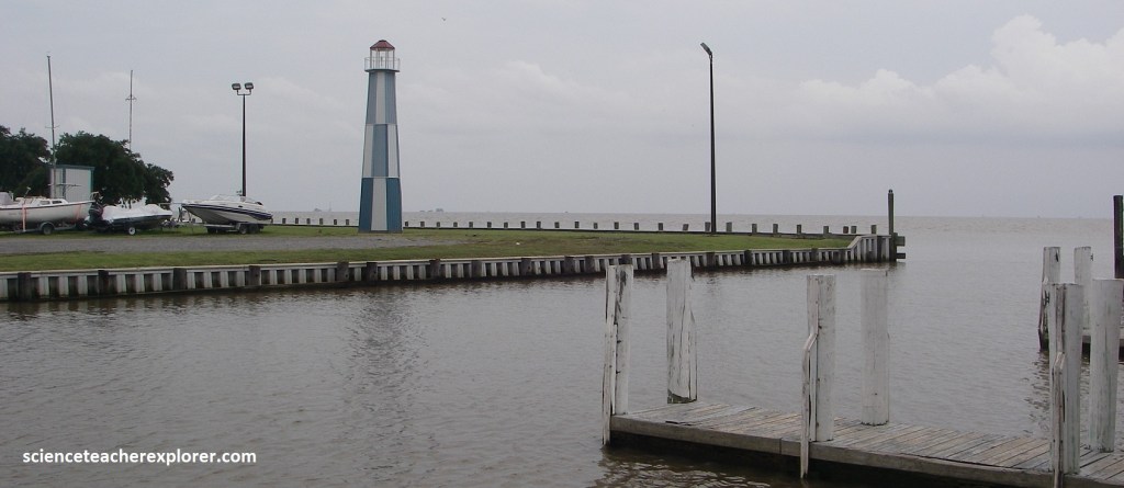
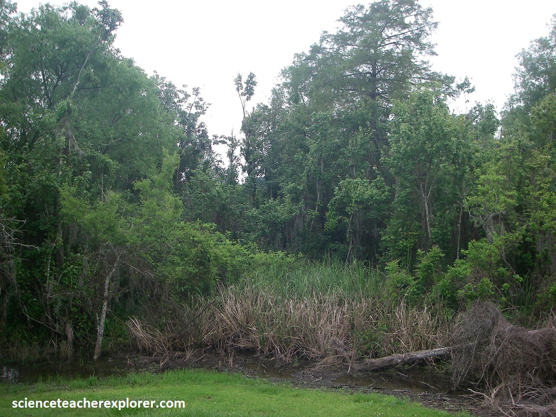
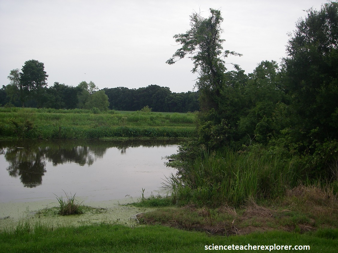
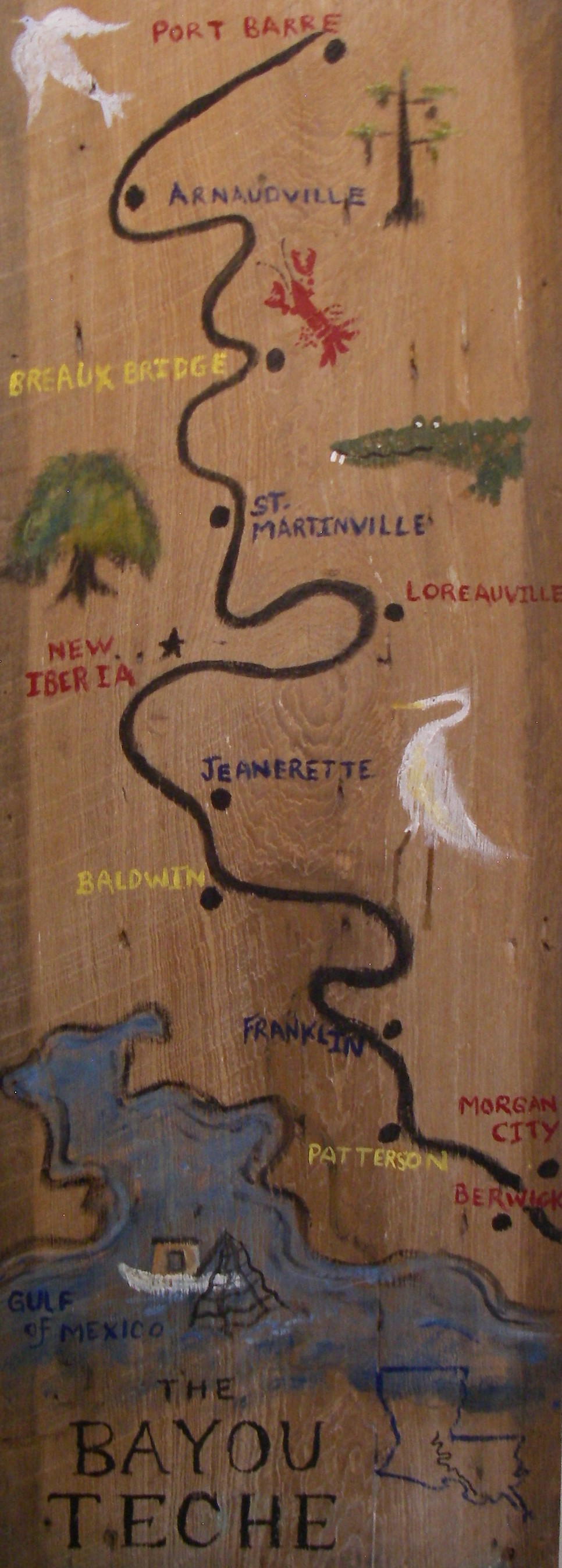
Becky and I returned east on LA-319/83 to US-90. There we visited the Franklin area to begin our exploration of Bayou Teche. There we explored the Bayou Teche National Wildlife Refuge. The Bayou Teche is the most important bayous in south Louisiana. A former channel of the Mississippi River (3,800-5,500 years ago), today the bayou runs 200 km from its headwaters at Bayou Courtableau in Port Barre to its convergence with the Atshafalaya rRiver near Morgan City. The Teche’s multi-layered geological history can be found in the soils of its natural levees, from heavy sand carried by the Mississippi to red clay from the Red River. The diverse land along the bayou provides critical habitats for numerous species, including the elusive Louisiana black bear (Ursus americanus luteolus), on of 16 subspecies of the American black bear and a resident of souther Louisiana and the Atchafalaya River Basin. Pictured below are from our small treks into the Bayou Teche National Wildlife Reserve.
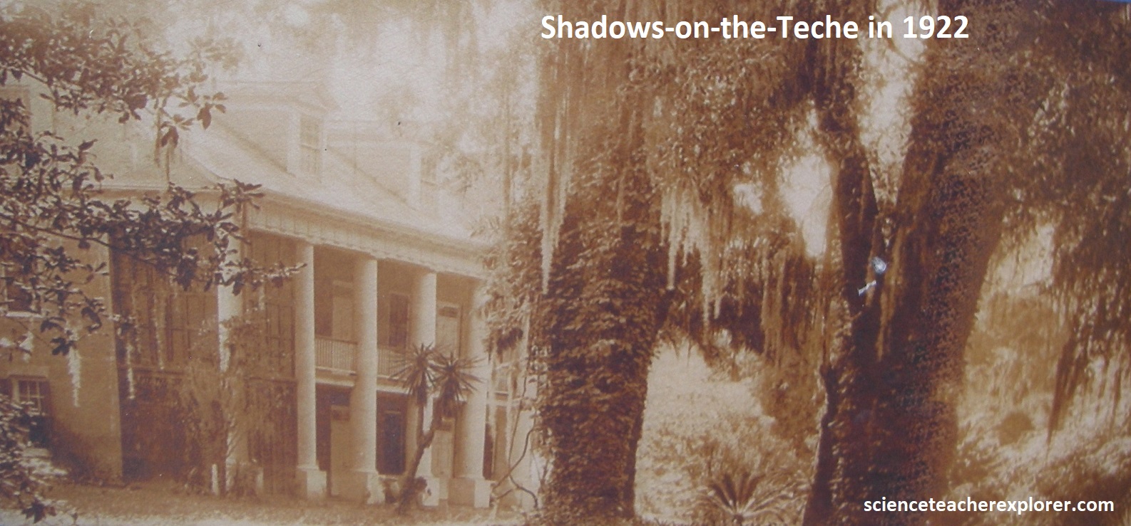
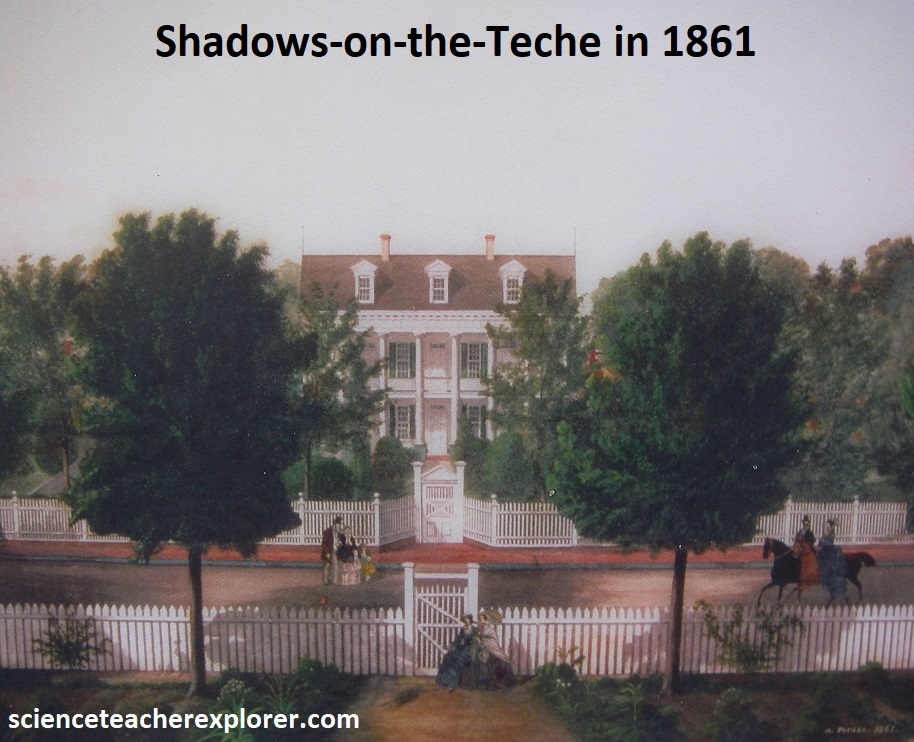
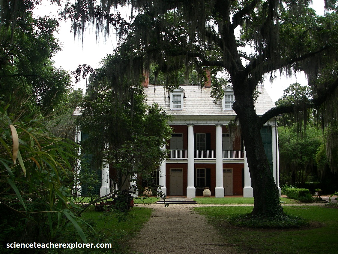
Driving northwest on LA-90, we paralleled with the Bayou Treche. Near Jeanerette several antebellum homes hid like shy southern belles behind fans of magnolias and live oaks on the Parairie Complex Terrace. But the real treat lies farther ahead in New Iberia, site of an exquisite 1834 plantation house called Shadows-on-the-Teche. Breaking with tradition, this coral-brick, white-columned mansion stands with its back to the bayou. Beginning in the 1920s the builder’s great-grandson William Weeks Hall, used the estate to entertain celebrities, including the film director Elia Kazan, who described it as “the most beautiful house I’ve seen in the South”. {The first two historical photos below were taken from a interpretive sign, on-site}
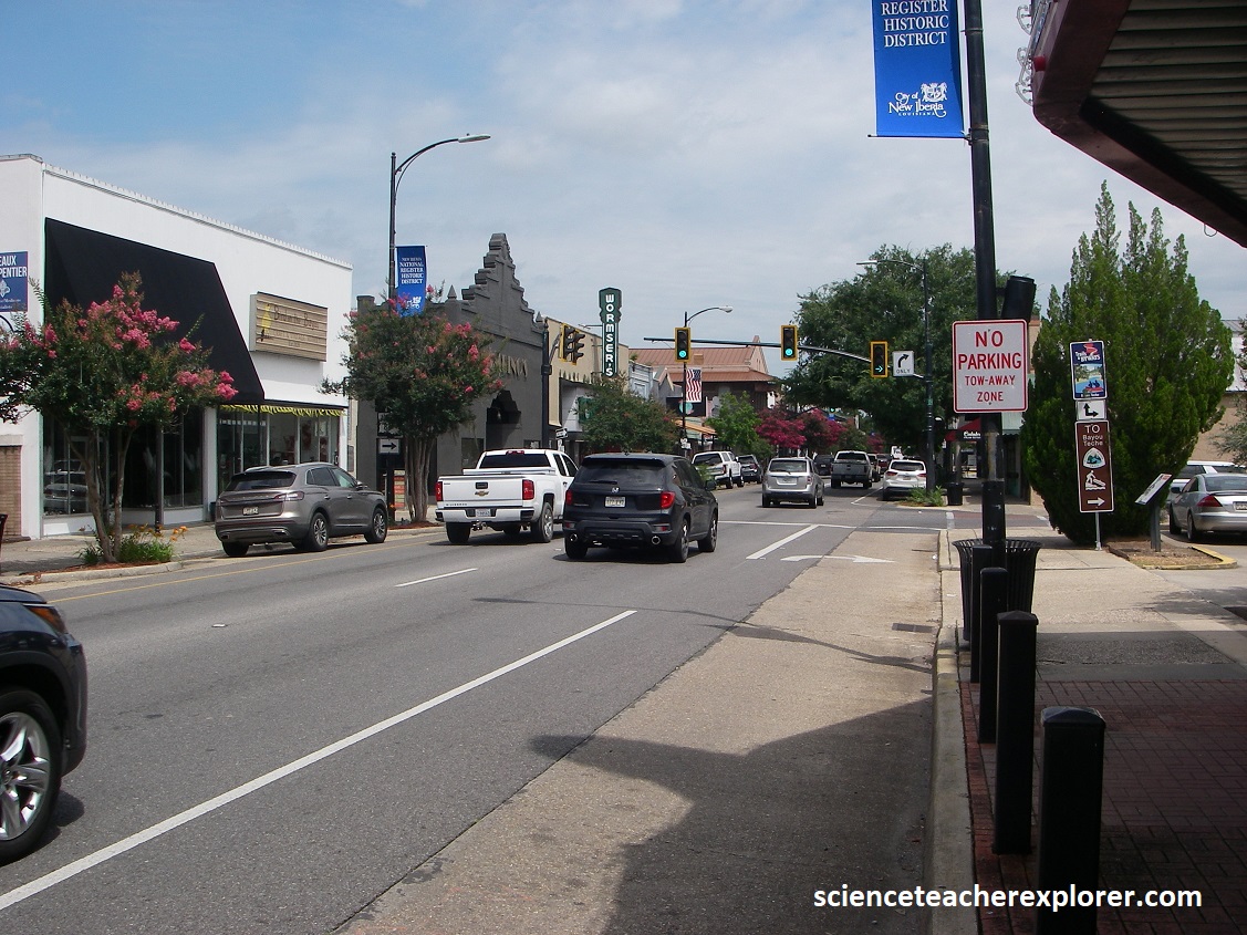
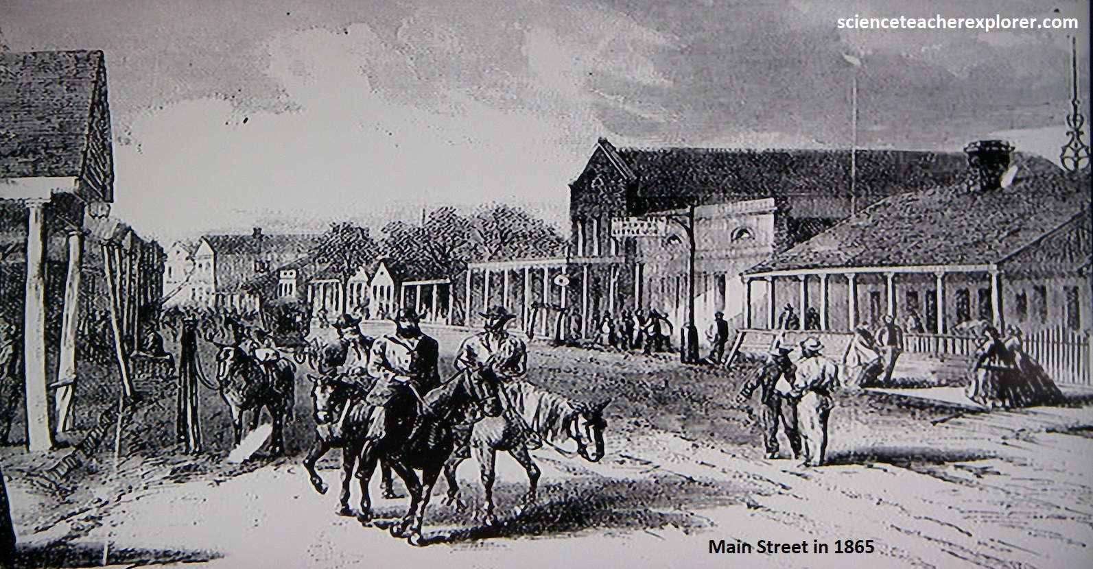
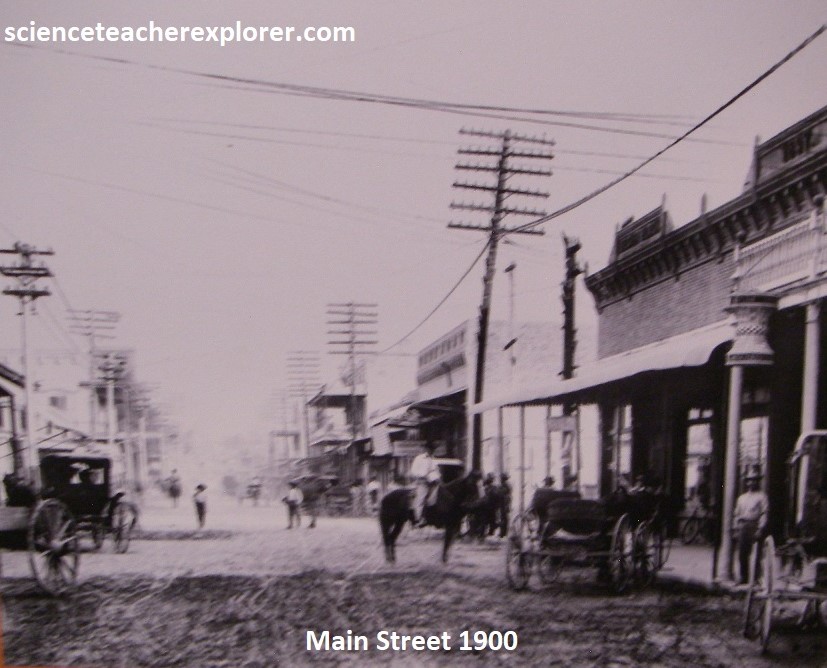
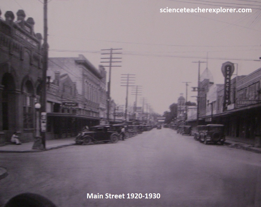
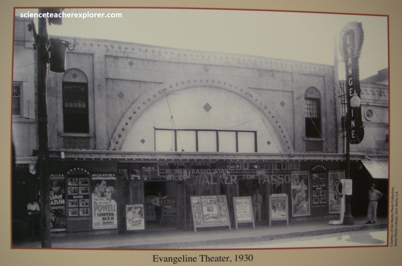
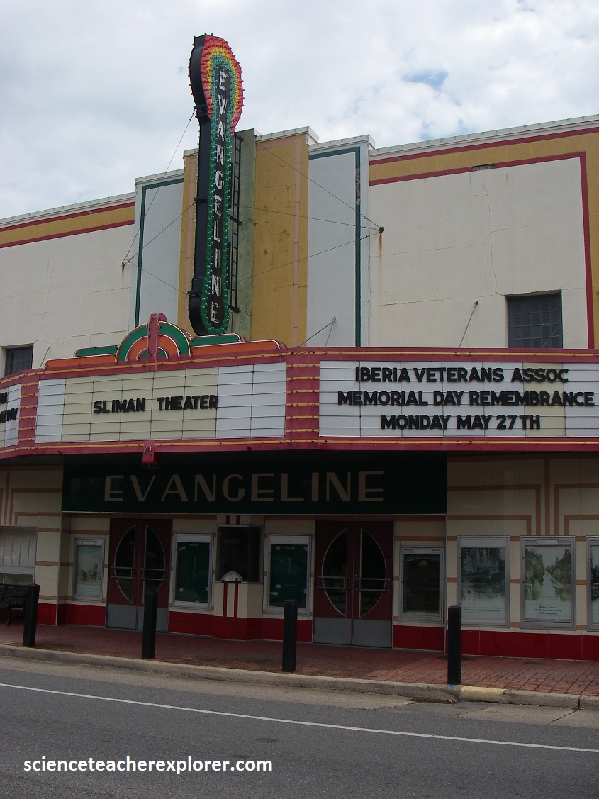
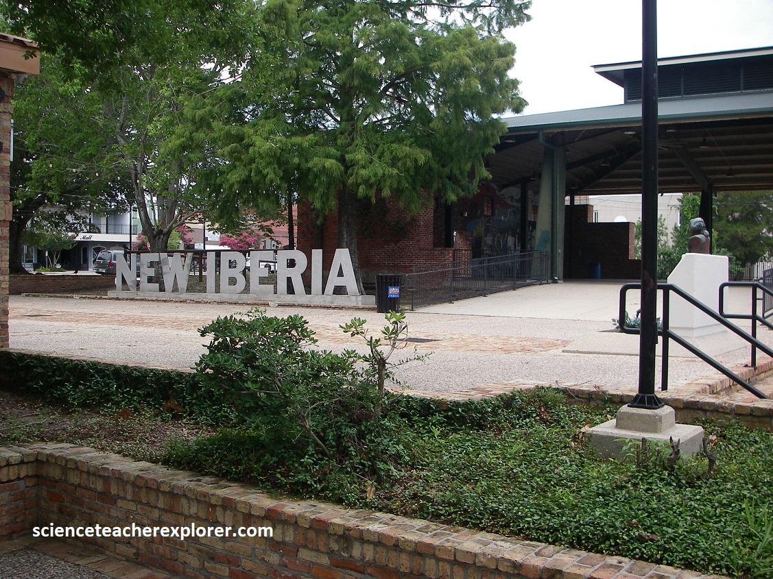
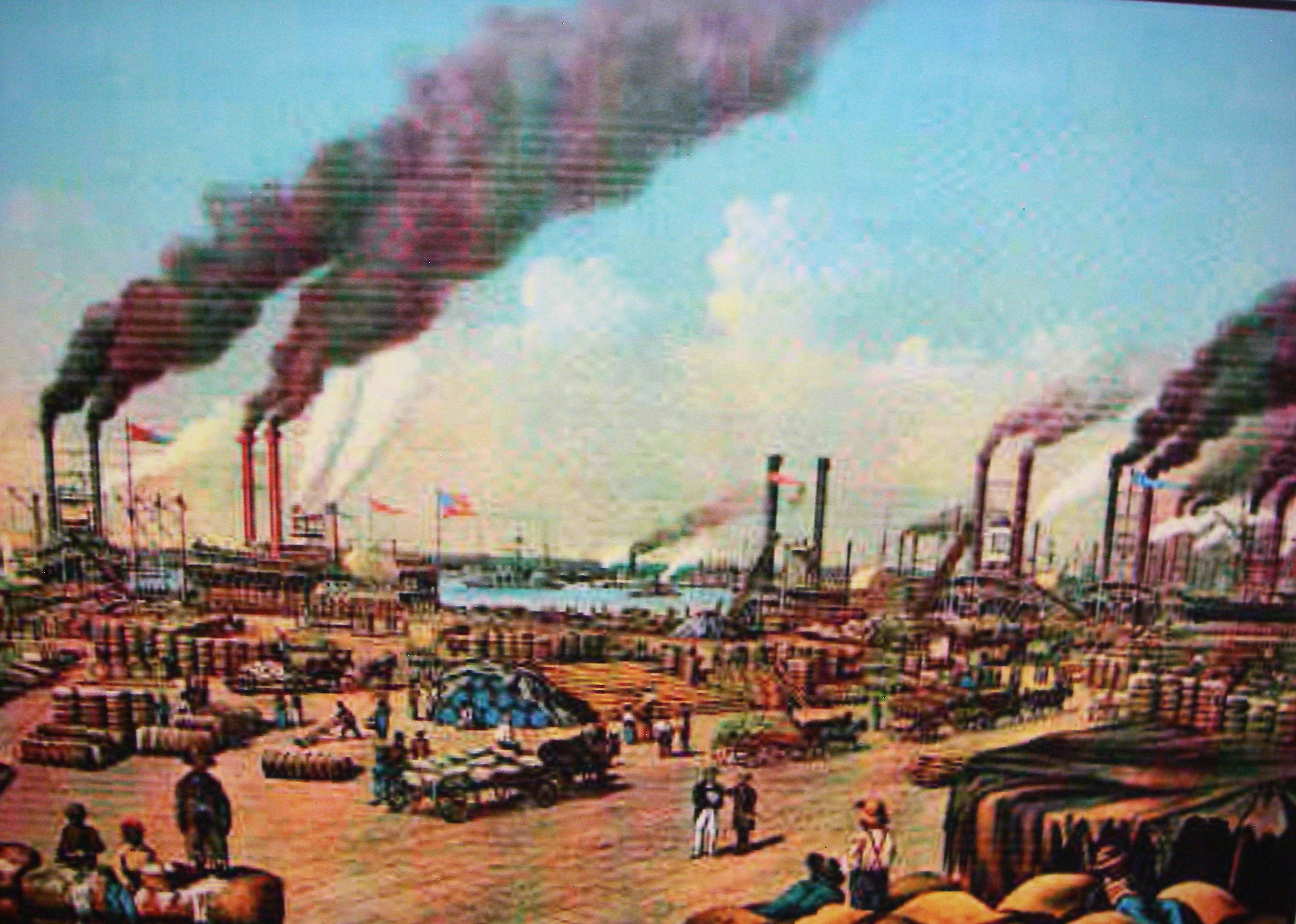
New Iberia was established in 1779, and became a commercial Center for rice and sugar cane production. By the mid to late 1800s, downtown New Iberia flourished as a bustling town and busy port with a large town market, hotels, sugar plantations, and mills. It also boasted the Miller and Marsh Rum Distillery, a bakery, two saloons, the merchant store of Del Valcourt and Taylor, a courthouse, banks, and steamboat warehouses. {The historical photos & sketch below were taken from an interpretive sign, on-site}
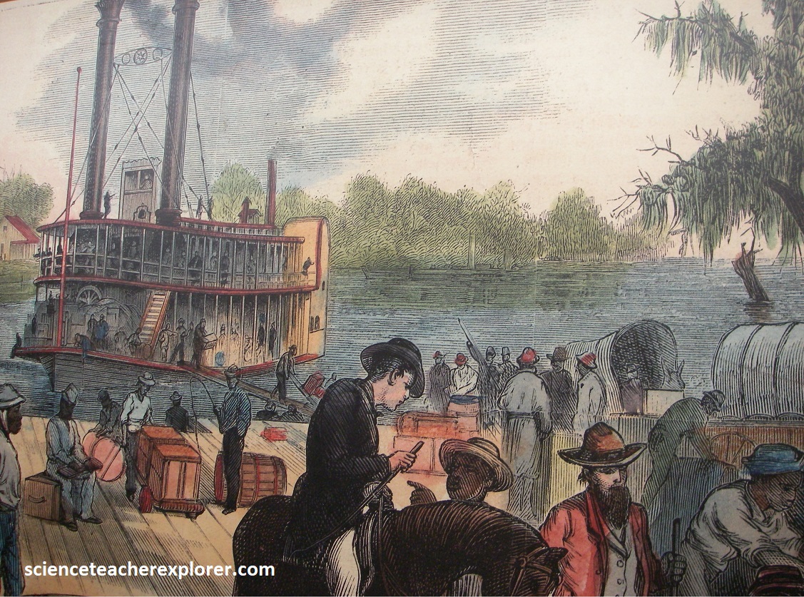
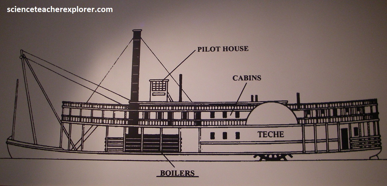
Steamboats were introduced to the Teche Valley area in 1818. In 1820, the Attakapas Steamboat Company owned and operated the first steamboat on Bayou Teche called the Teche. By the mid-1830s, sugarcane surpassed cotton as the most important crop. To meet the increased demands of the quick delivery of perishable products, like sugarcane, steamboat activity expanded rapidly. New Iberia became the leading port for the region. Of the 337 steamboats docked in New Orleans, 116 traveled along the Bayou Teche. Items exported from the Bayou Teche region included sugar, molasses, cotton, lumber, hemp, eggs, chickens, fruits, vegetables and rum. {The historical sketches below were taken from an interpretive sign, on-site}
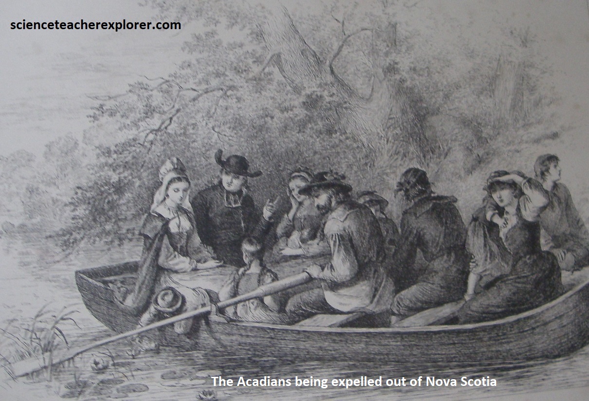
Becky and I followed the Bayou Teche on LA-31 from New Iberia to St. Martinville. This town was established as a military post in 1714 and settled by French expatriates and Spanish soldiers. The Acadians, (or Cajuns, as they came to be called when the word was contracted), eventually settled here after being driven out of Nova Scotia by the British in 1755, and have indelibly branded the area with their customs, (imaged below). During the French Revolution so many Royalist refugees came to St. Martinville that it was dubbed Le Petit Paris. {The two art-images below were taken from the Longfellow-Evangeline Stat Commemorative visitor’s center}
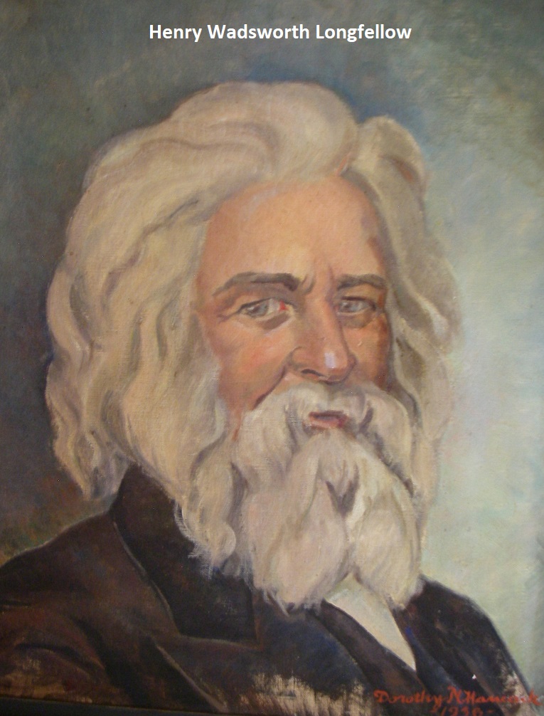
But it is literature, not history, that draws most visitors to St. Martinville, for this charming hamlet is the setting for “Evangeline”, Henry Wadsworth Longfellow’s epic poem about star-crossed lovers separated by the expulsion, (Imaged above). [Tradition holds that the poem, although it ends differently, was inspired by the story of Emmeline Labiche, who died brokenhearted after discovering her long-lost beau had married someone else]. The Longfellow-Evangeline State commemorative Area, (a 157-acre park just north of St. Martinville), has a museum and visitor center that explain the history of the region’s French-speaking peoples, including the colorful Cajuns.
Along with the new visitors center, which focuses on early Louisiana history, including Acadian and Creole, (born in the U.S.), the main attraction in the park is the plantation house of Maison Olivier. Built of bousillage (a mixture of clay and Spanish moss in a cypress frame-work) and brick in 1815, the structure is typical of French plantation architecture. It has been carefully restored and is filled with early Louisiana pieces.
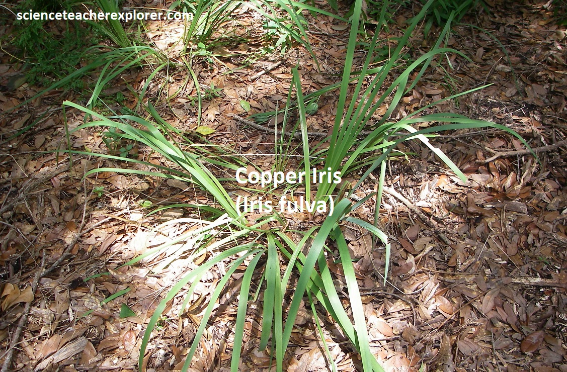
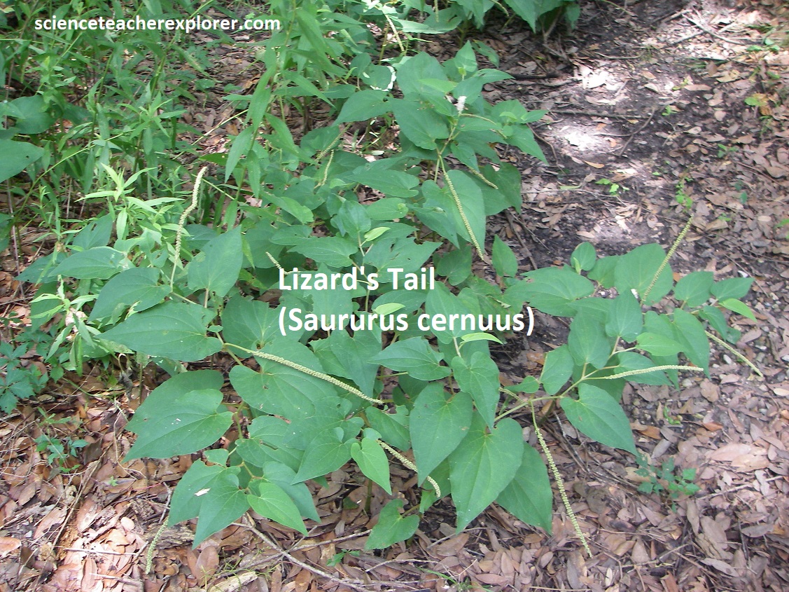
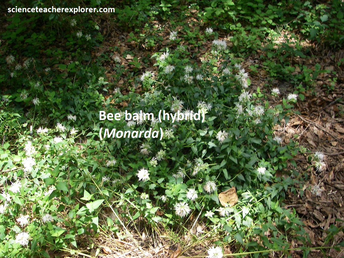
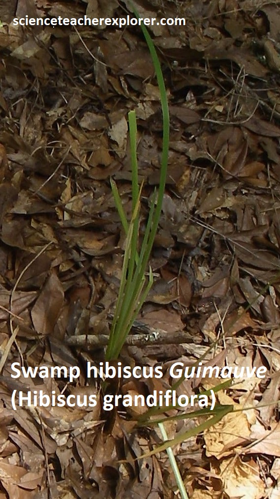
The Longfellow-Evangeline State Historic Park backs onto Bayou Teche, and by a little lagoon we found exceptionally inviting garden with endemic-Louisiana plants surrounded by trees curtained with Spanish moss, (pictured below).
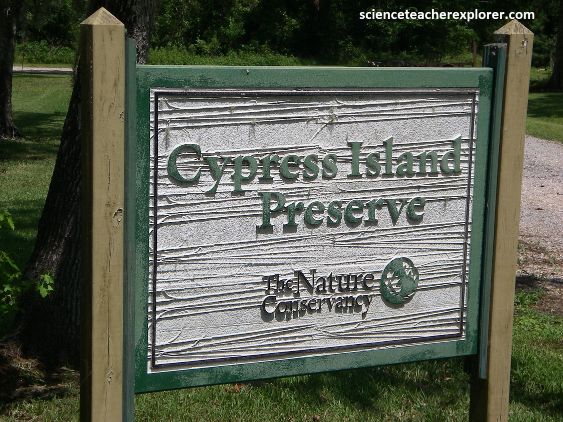
Becky and I continued following Bayou Teche by driving north on LA-31. When we almost got to Breaux Bridge, we made a detour left on southwest LA-314 for a couple of kilometers, then right on LA-353 to the Cypress Island Preserve near Lake Martin, (1 km northwest). Located in the heart of Acadian Louisiana, Cypress Island Preserve and Lake Martin is a naturally occurring open body of water within a cypress-tupelo swamp. Historically, each fall and winter this low area would fill with rain water and backwater from the Vermilion River and Bayou Teche. It would drain gradually through the spring and become essentially dry50am in summer. In the early 1950s, private landowners and local agency agreed to construct a 8 km levee around the lake and forested areas to hold water throughout the year. The impounded area with the levee was designated as a fish and game preserve open for public recreation. Today Lake Martin is approximately 765 acres, with about 200 acres of open water and the rest a permanently-flooded cypress tupelo swamp, (pictured below).
Returning back to LA-31, Becky and I finished our tour of the Bayou Teche by exploring Breaux Bridge, (pictured below). According to Cajun legend, when the Acadians left Nova Scotia the local lobsters grew lonesome and swam after them, becoming so exhausted by the long journey that they shrank to the size of shrimp. But there’s nothing modest about the sized of the crawfish in Breaux Bridge, located south of I-10 and LA-31 junction, (pictured below).
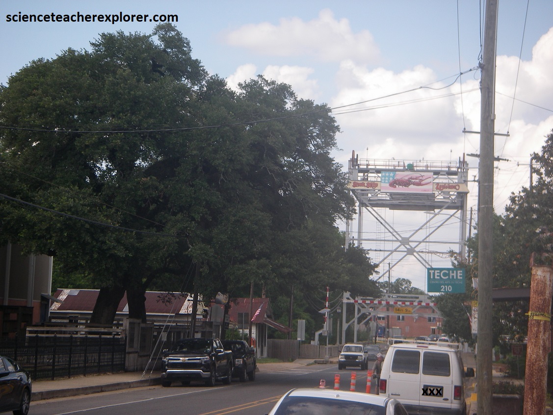
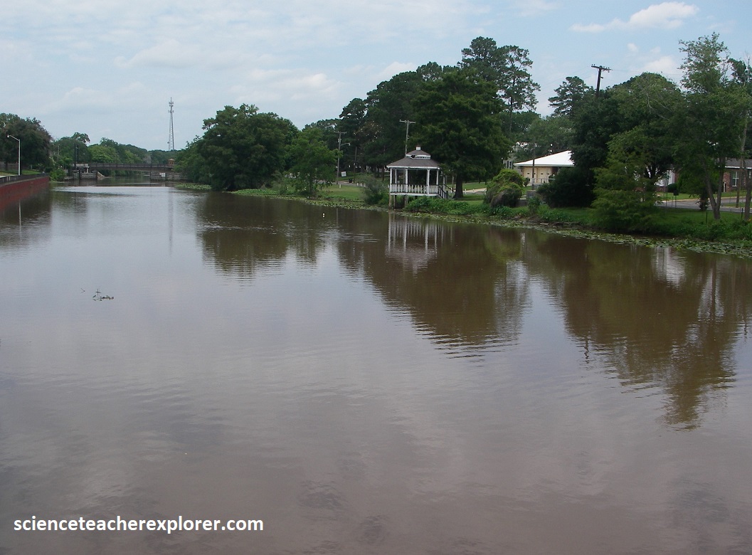
[The photos above are of the Bayou Teche at Breaux Bridge, Louisiana in 2024]
Pictured above, Breaux Bridge is nestled along the banks of the slow-rolling Bayou Teche, the “Crawfish Capital of the World,” and it is a gorgeous historic town with world-class restaurants and a thriving Cajun music and folk art scene. The bridge itself wasn’t much to see (though you can’t miss it) — it was a tall, slightly rusty metal drawbridge that spans the Teche, (pictured above).
