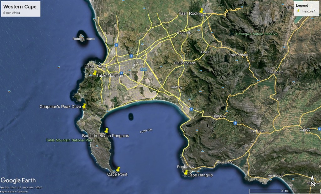
Western Cape, 2024
In February of 2024, Mike Stevens, (a trekking buddy), and I explored and trekked the Western Cape of South Africa.
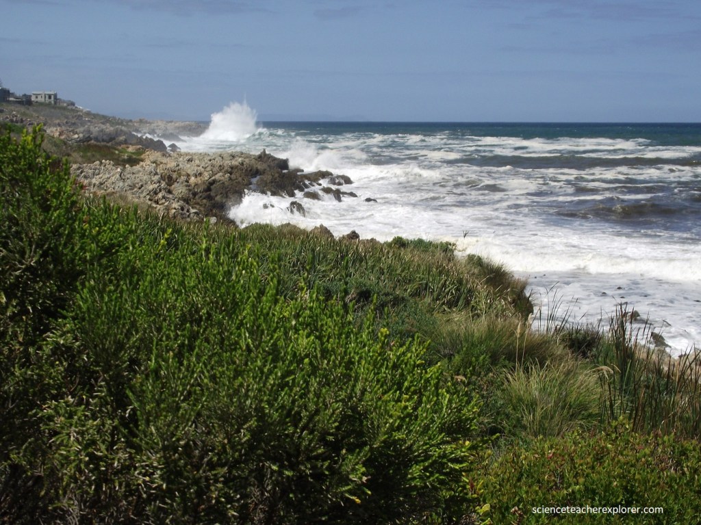
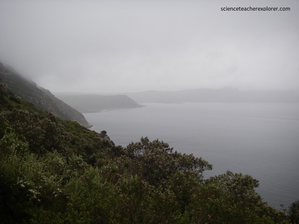
We started exploring this area by driving along the Cape Whale-Coast Route. The first point of interest was Hawston Beach, just east of Betty’s Bay, (imaged below).
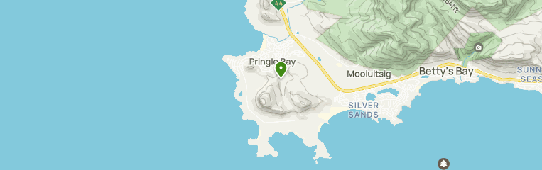
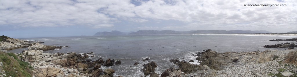
Pictured below, Hawston Beach was an immaculate location west the little town of Hawston, near Hermanus in the Western Cape. The beach offered unsurpassed views of the mountains and dunes that stretch along the length of the coast as far as the eye can see.
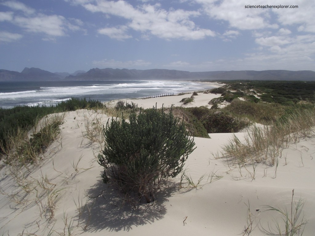
Pictured above and below, Hawston Beach is well known for its whale and dolphin spotting opportunities, and there was plenty of birdlife that call the area home. As the dune systems around the beach was protected, this made it feel like the area was abandoned and left to it’s natural state. Just west of here, the Bot River Lagoon lies between Fisherhaven and Kleinmond. Here in the marshlands next to the Rooisands Nature Reserve, lives a herd of wild horses that are said to be the only horses in the world that live off semi-salt water and plants.
This beautiful stretch of sand spans several kilometers, welcoming visitors with its golden hues contrasted against the azure waters of the Atlantic.
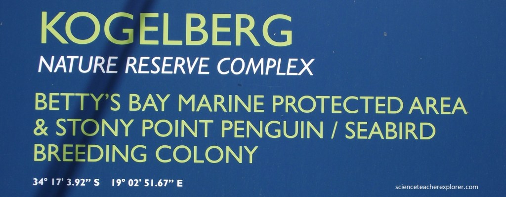
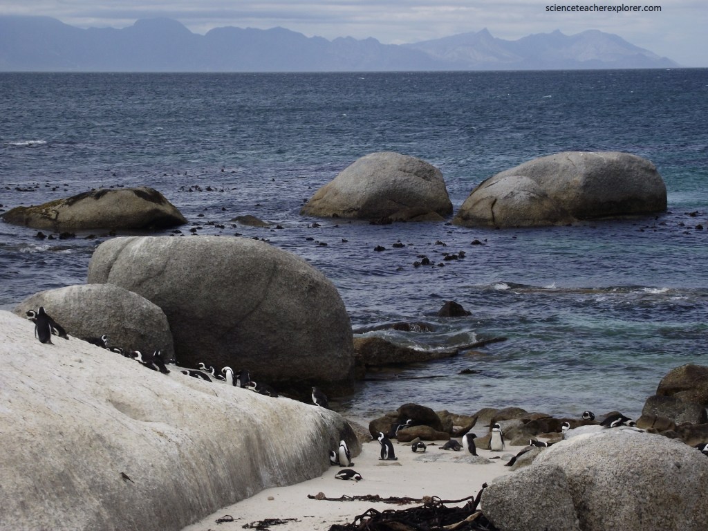
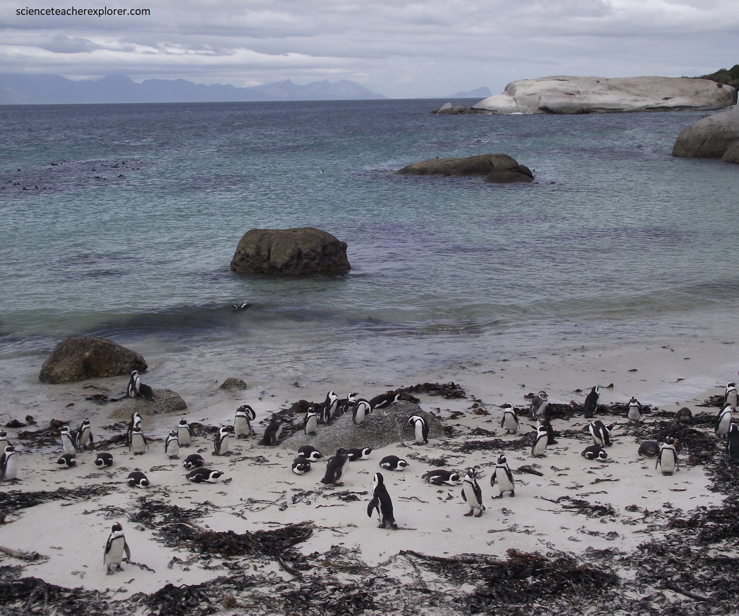
Located in Betty’s Bay, Stony Point is home to a unique colony of African penguins, (pictured below).
Home to roughly 3,600 African Penguins, the thriving African Penguin colony of Stony Point is undoubtedly the most sought-after attraction and top reason to visit this incredible Kogelberg Nature Reserve.
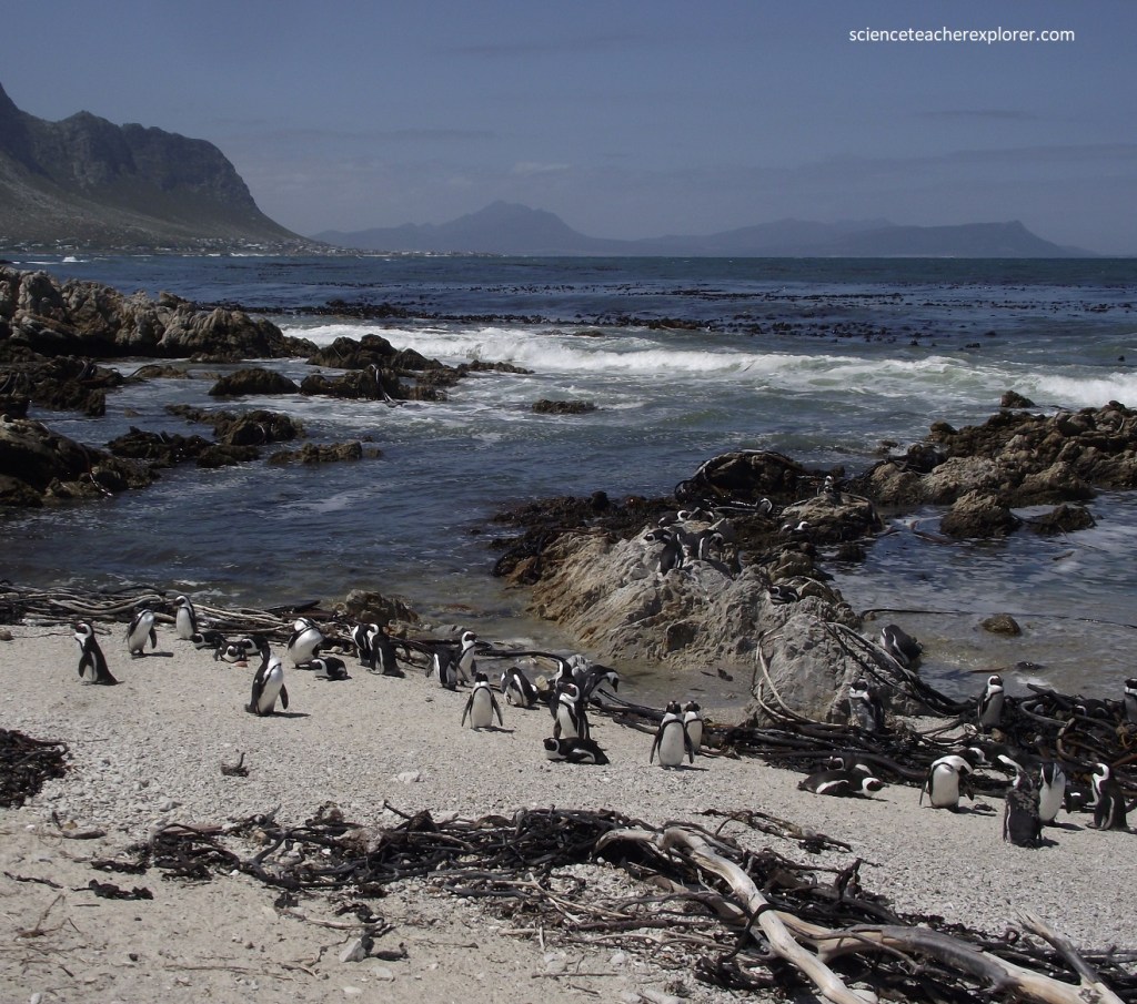
Picture above and below, the Stony Point Nature Reserve supported in 2024, the largest penguin colony in the Western Cape with over 2,000 seasoned breeding pairs predominately residing at the rocky outcrops of Beacon Bay in Stony Point.
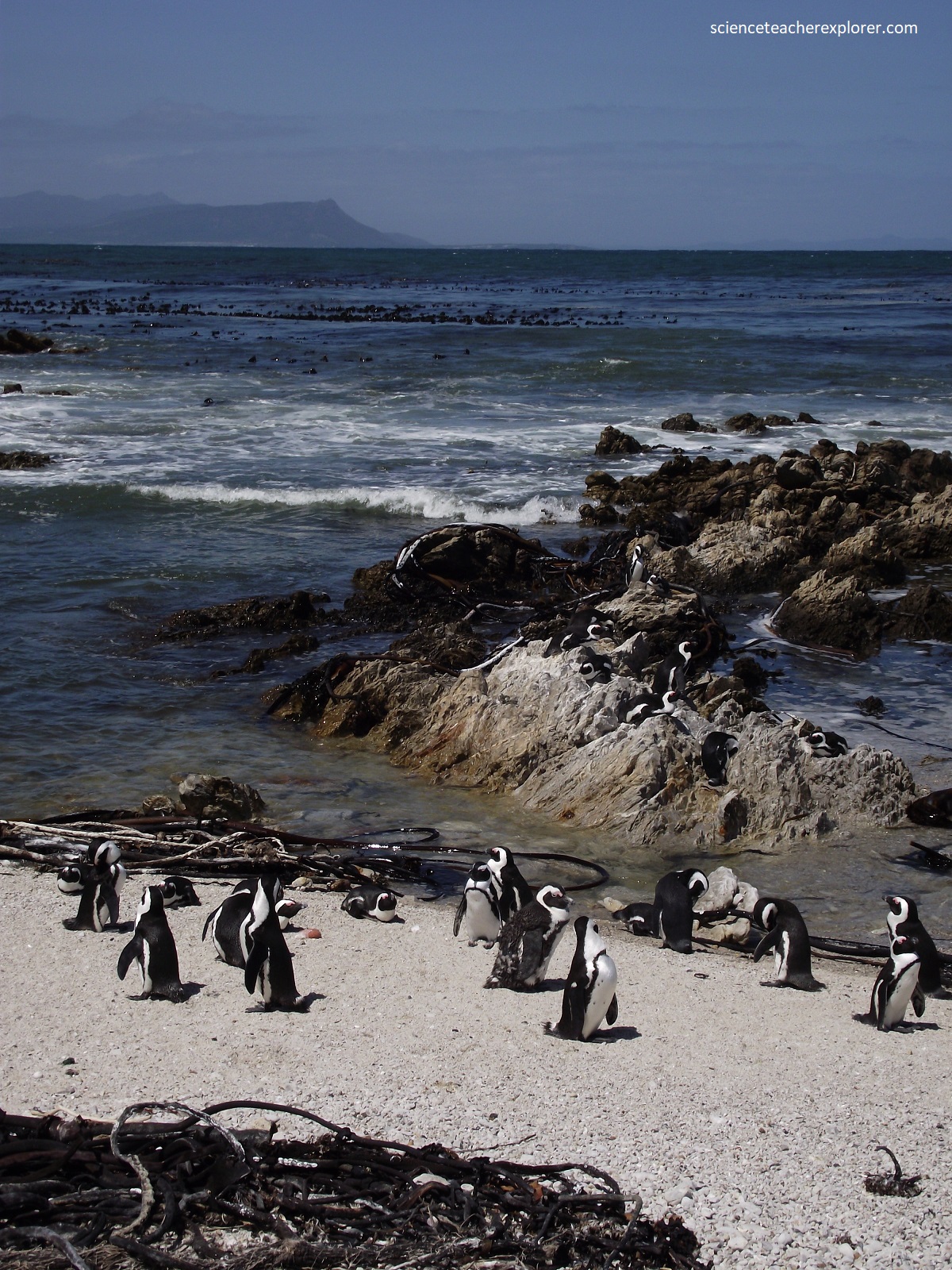
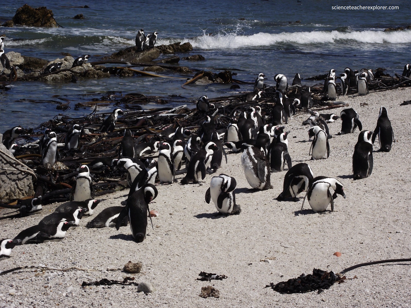
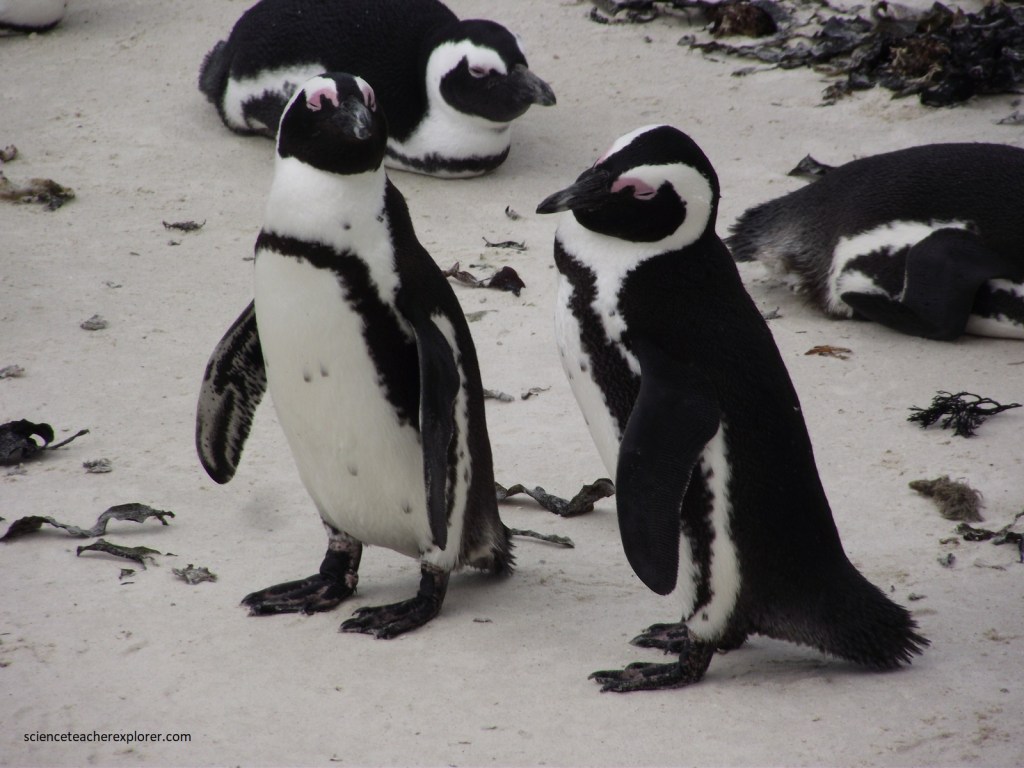
Pictured above, the African Penguin, (Spheniscus demersus), species of penguin (order Sphenisciformes) is characterized by a single band of black feathers cutting across the breast and a circle of featherless skin that completely surrounds each eye.
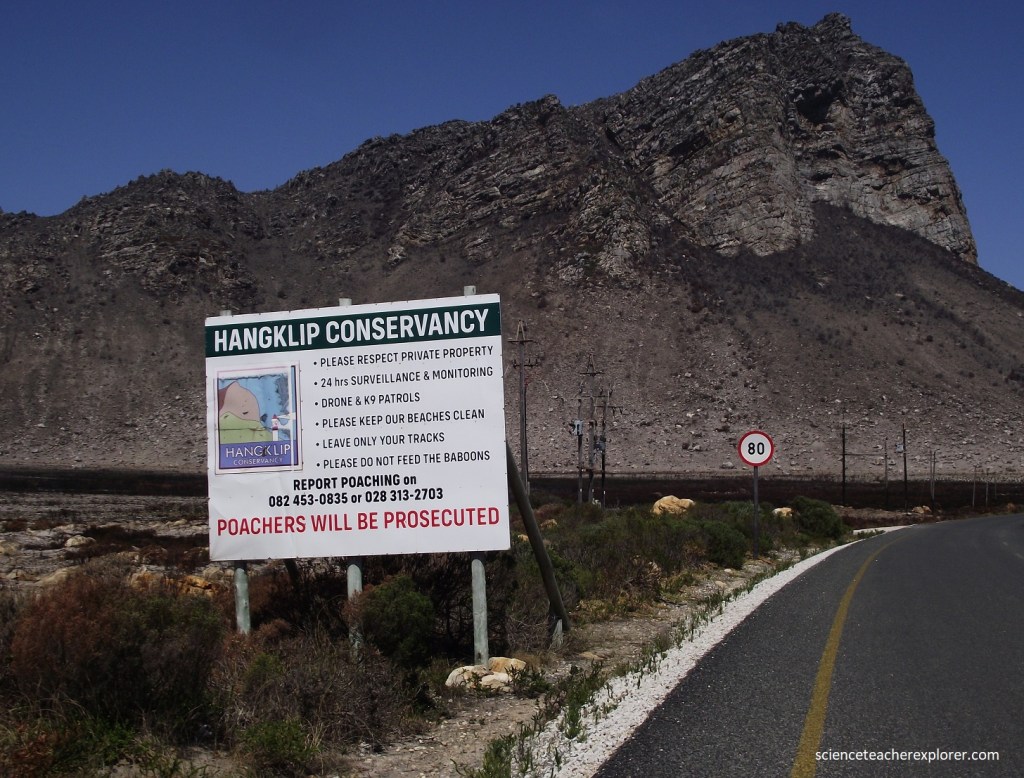
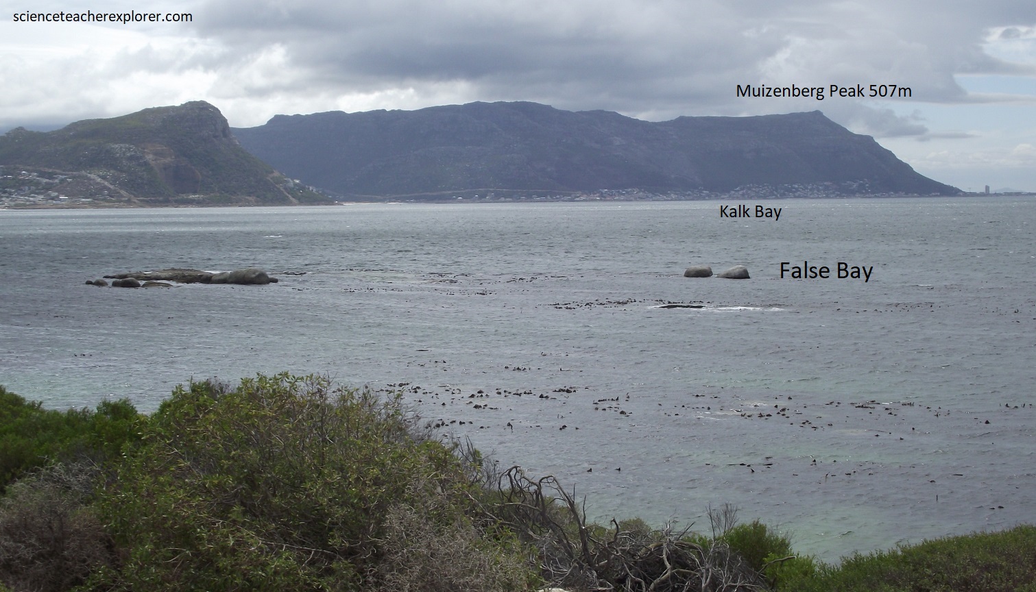
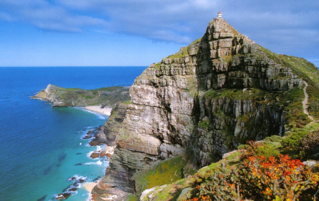
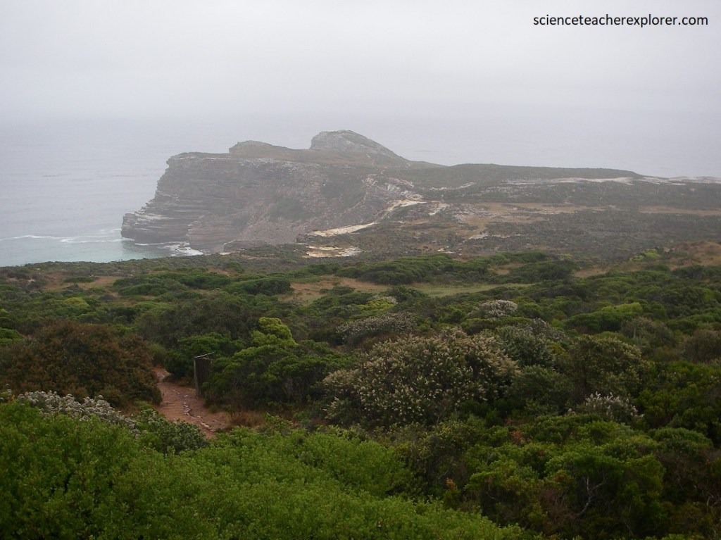
We continued driving west on the Cape Whale-Coast Route to explore the Cape Hangklip. Cape Hangklip forms the eastern end of the mouth of False Bay at Africa’s southwestern tip. The name, “hanging rock” com from the 450m high sandstone peak which towers nearby, (pictured above). From certain angles its cliffs appear to overhang the ocean.
The Portuguese, (who were virtually the only mariners to sail these seas for the century following the discovery of the ocean route to India in 1488), named the peak “Cabo Falso” or False-Cape. When sailing westwards, it was easy to mistake Hangklip of Cape Point and turn northwards into False Bay, rather than up the Atlantic coast, farther to the west.
Pictured above, the area surrounding Hangklip has a number of attractive sandy coves, separated by rocky attractive sandy coves, separated by rocky points. To the south stretches the ocean, (often rough along this coast), while to the north there are magnificent views across False Bay to Table Mountain and the Cape Peninsula.
Until the building of a road during World War II, this region was relatively isolated; escaping slaves used it as a sanctuary during the 18th century. We continued driving around False Bay to the western side called Cape Point.
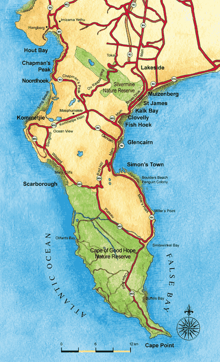
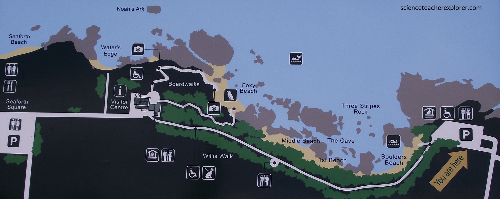
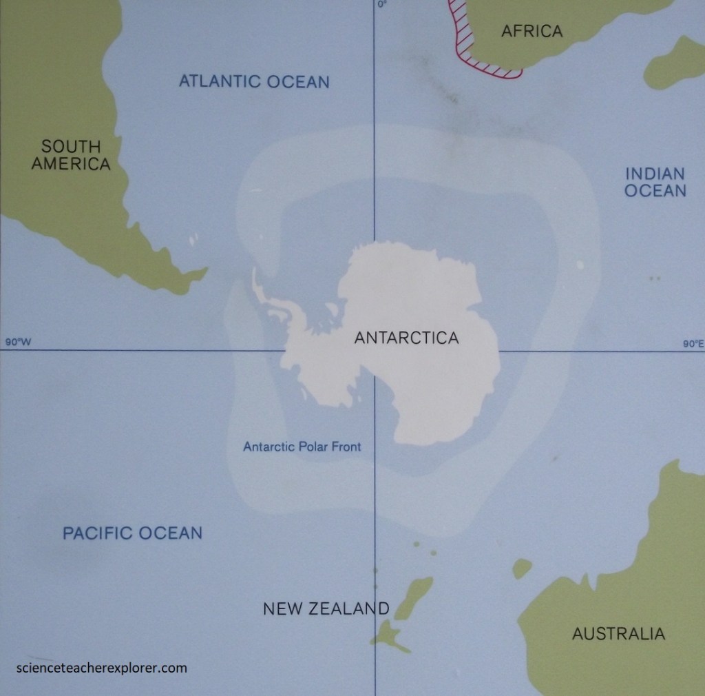
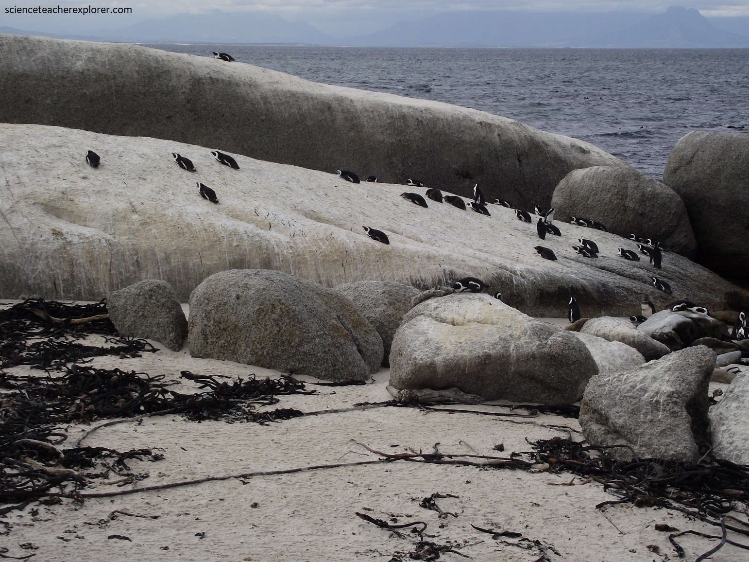
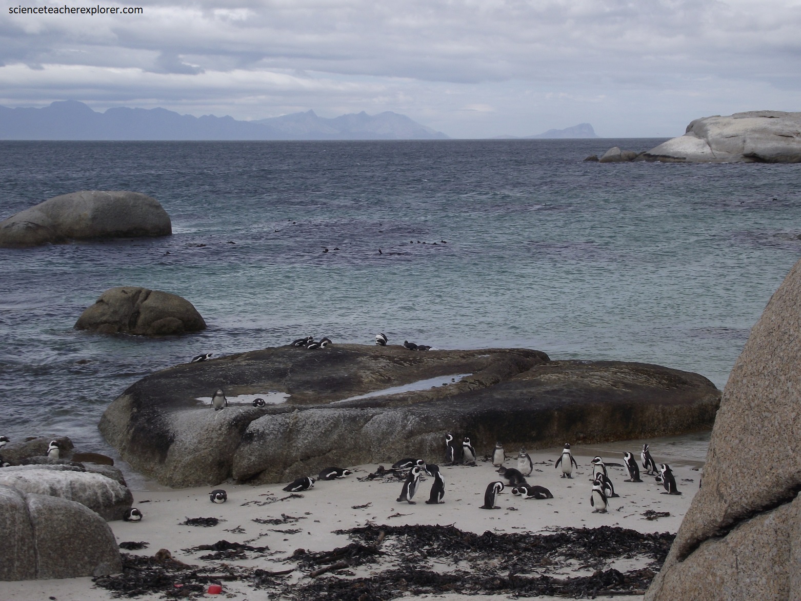
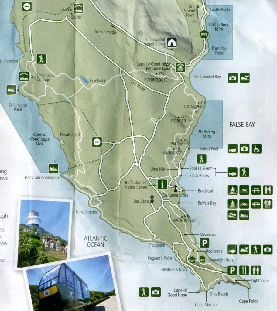
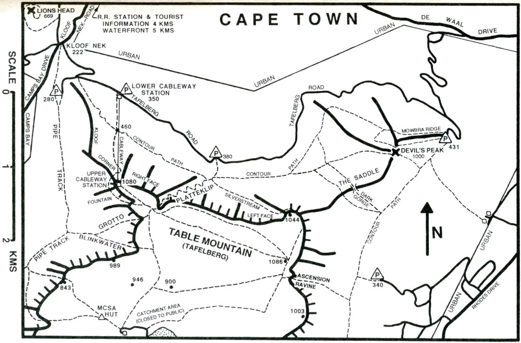
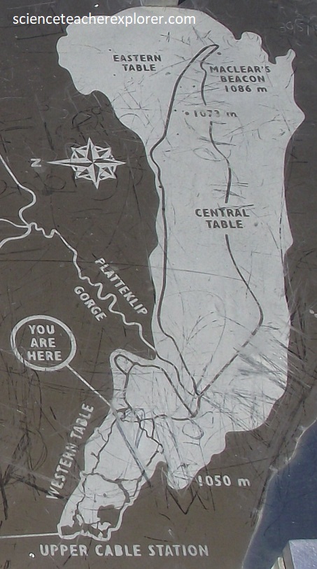
Our primary trekking-destination along the Cape Point side of False Bay was the Boulder’s Beach Penguin Colony, (map imaged below found on an interpretive sign at-site). This location holds another large population of the African Penguin.
Penguins appeared around New Zealand and Antarctica probably at the end of the Cretaceous Period when the dinosaurs vanished. These was bout 65 million years ago. These African penguin, however, is much younger, (about 2-4 million years ago). [Penguins have adapted to water, their wings transforming into flippers. Their bones are not hollow or filled with air for weight reduction as in other birds. They live almost exclusively in the Southern Hemisphere, with only one species, the Galapagos penguin, found north of the equator.]
African penguins are named as such as they are the only ones breeding on the African continent, (imaged above). African penguins feed in the cold waters of the Benguela upwelling current, which is a very rich system but very cold too.
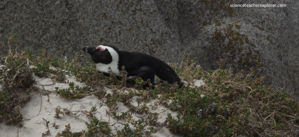
On land, the African Penguin, cope with the warmer climate by burrowing, emerging at dusk and dawn, and using the pink glands above their eyes to cool the blood down.
African Penguins can also increase their heat loss by holding the flippers away from the body, so both surfaces of the flippers are exposed to air, releasing heat. They don’t have feathers on their legs and have bare patches on their faces where excess heat can be lost, (pictured below).
While perfectly designed for a life at sea, penguins must come to shore in order to breed. African Penguins breed within their colonies, they do not travel to give birth. The peak of the breeding season is from February until May.
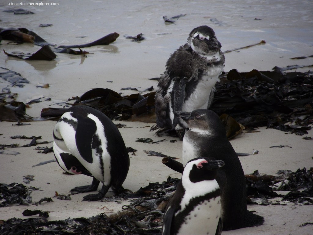
Pictured above, molting occurs annually in all penguins. When this happens they are unable to forage as their new feathers are not waterproof yet; therefore they fatten beforehand and fast through the entire molting period, which in African Penguins take about 20 days. [Note that the middle penguin pictured above is a juvenile. For the first few years of the penguin’s life, they are extremely mobile, traveling great distances. Juveniles keep their plumage for up to a year and a half, after which they need to return to land in order to moult. The feathers on the back and head of juveniles are gray, and those on their underside are white.].
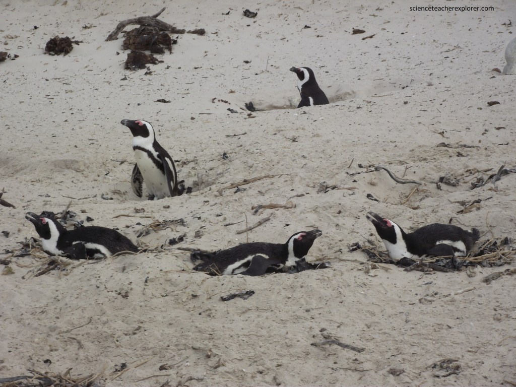
Penguins start breeding at approximately 4 years of age and normally lay 2 eggs. Nests can be open surface nests or burrowed. The eggs are 3-4 times bigger than a hen’s eggs. Incubation, (38-42 days), are shared and whiled one guards the nest, the other will be out feeding for 2.5 days. If nests are approached to closely, the adult turns its head from side to side warning of the imminent attack. Pictured above, burrows protect the eggs and chicks from the weather and predators. Although their fat layer protects them from cold water, during breeding this can become a serious drawback as land temperatures on approach 40 degrees. These make a well-ventilated nesting site extremely important.
Monogamy is common, occurring in about 80–90 percent of breeding pairs between one breeding season and another. To attract a mate, both sexes utter a call similar to the braying of a donkey, which is the reason why they are sometimes referred to as “jackass penguins.”
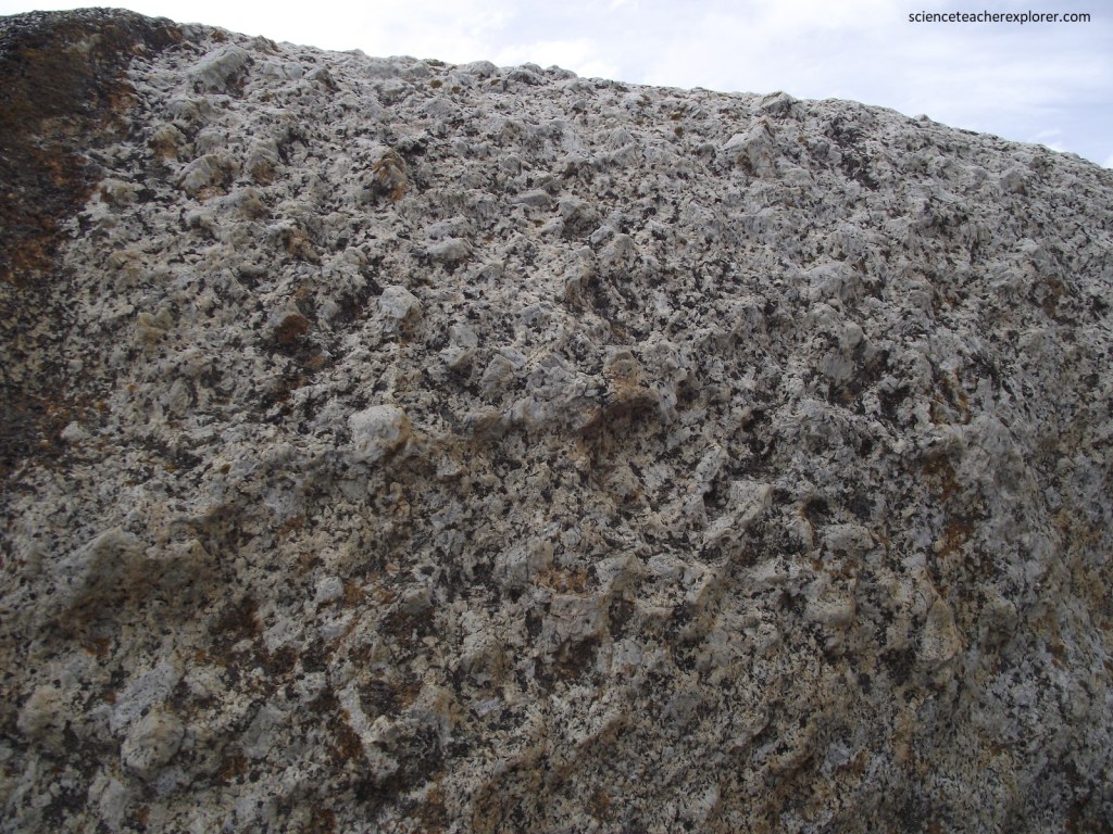
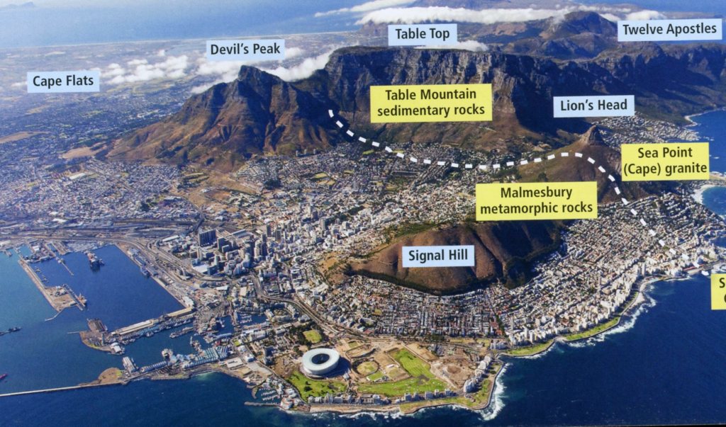
Bordered mainly by indigenous bush above the high-water mark on the one side, and the clear water of False Bay on the other, the area comprises several small sheltered bays, partially enclosed by porphyritic Sea Point (Cape) Granite boulders that are 540 million years old. This granite is strongly weathered and rotten, forming a light-colored, clay-rich cover.
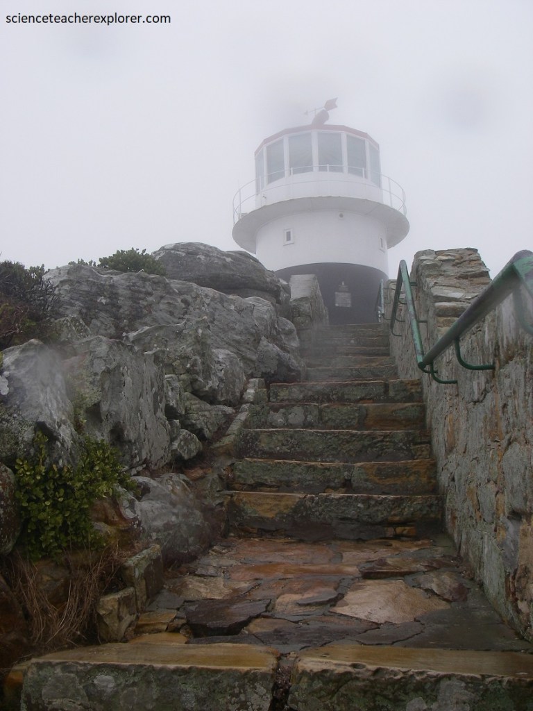
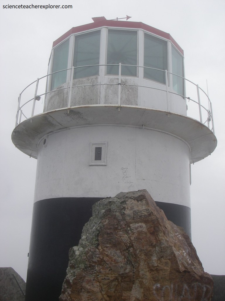
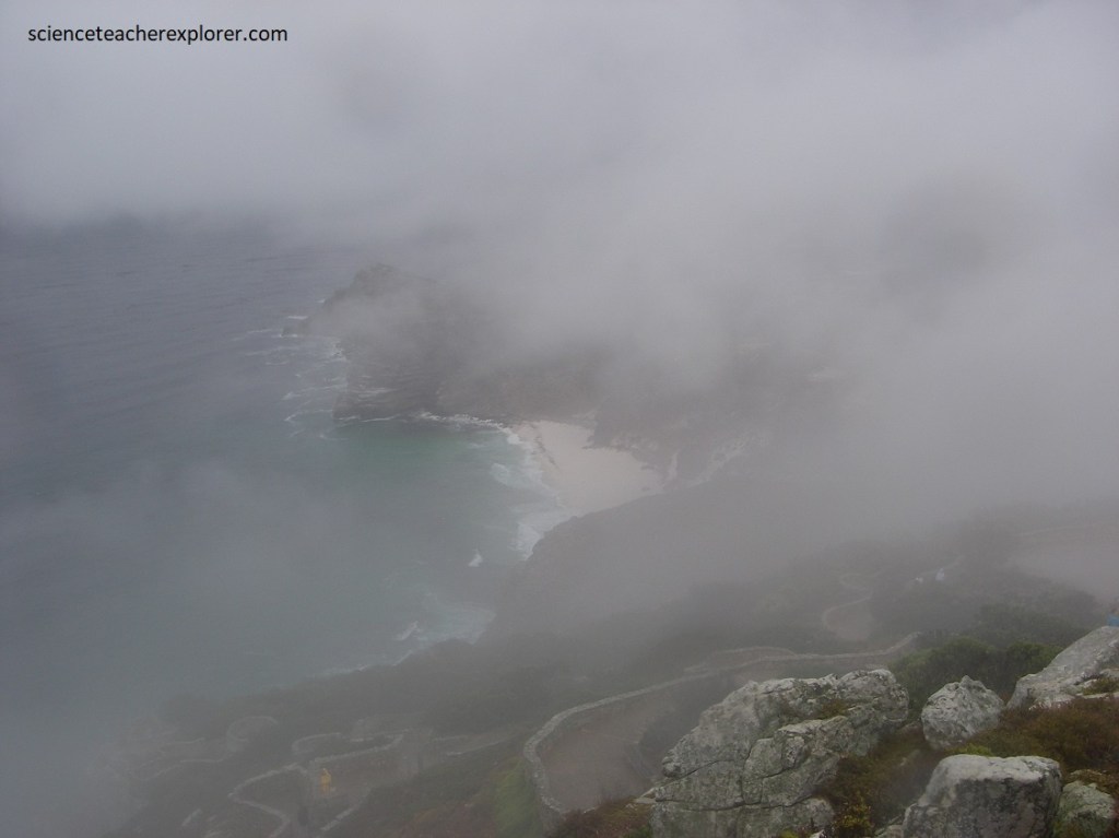
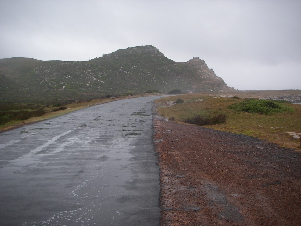
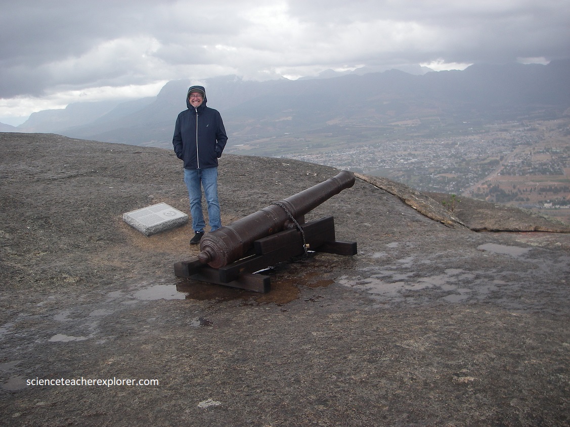
We drove further south down the Western-Cape Peninsula to the Cape Point Lighthouse. However, a local rainstorm made it impossible to see anything. Pictured above, is a post card I purchased at the site on what I was suppose to see. Pictured below, are the photos I took on-site.
The Cape Peninsula runs south from Table Mountain and Boulders Bay, ending in and area of windswept beaches and soaring cliffs.
The first European known to have seen Cape Point from the ocean was Bartholomeu Dias in 1488.
Pictured above, this prefabricated cast iron tower was erected on Cape Point Peak 249m above sea level. The white flashing light of 2,000 candlepower could be seen by ships 67 km out to sea. The lighthouse proved to be ineffective as it was often covered by clouds and mist, (like the day I was there). After the wreck of the Portuguese liner ‘Lusitania’ in 1911, it was decided to erect the present lighthouse on Dias Point below, 87m above sea level, (pictured below).
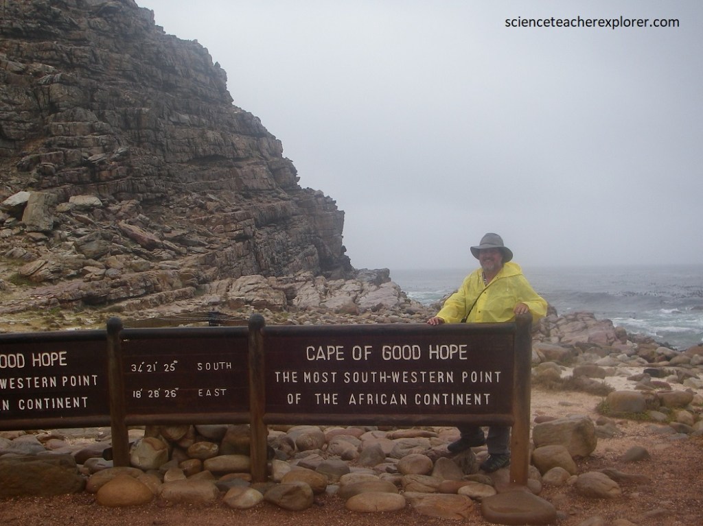
There are several names associated with the southern tip of the peninsula. Both the names Cape of Storms (Cabo Tormentoso) and Cape of Good Hope (Cobo de Boa Esperanca) have been attributed to Dias.
The region is shaped rather like a foot with the toe pointing east, (the Cape of Good Hope now refers to the western end of the “heel”, while the easternmost point of the “toe”), with its great cliffs and magnificent views over False Bay, is known as Cape Point, (pictured above).
When following the western side of the African coastline from the equator, the Cape of Good Hope marks the point where a ship begins to travel more eastward than southward.
Pictured below, once we explored the Cape of Good Hope we drove north on the eastern side of the Cape Peninsula. Both the Cape of Good Hope and Cape Point offered spectacular scenery; the whole of the southernmost portion of the Cape Peninsula was a wild, rugged, scenic and generally an unspoiled part of the Table-Mountain National Park System.
Pictured above, the Cape of Good Hope is an integral part of the Cape Floristic Kingdom, the smallest but richest of the world’s six floral kingdoms. This comprises a treasure trove of 1100 species of indigenous plants, of which a number are endemic, (occur naturally nowhere else on earth). The main type of fynbos (“fine bush”) vegetation at the Cape of Good Hope is Peninsula Sandstone Fynbos, (pictured above), an endangered vegetation type that is endemic to the Cape Peninsula.
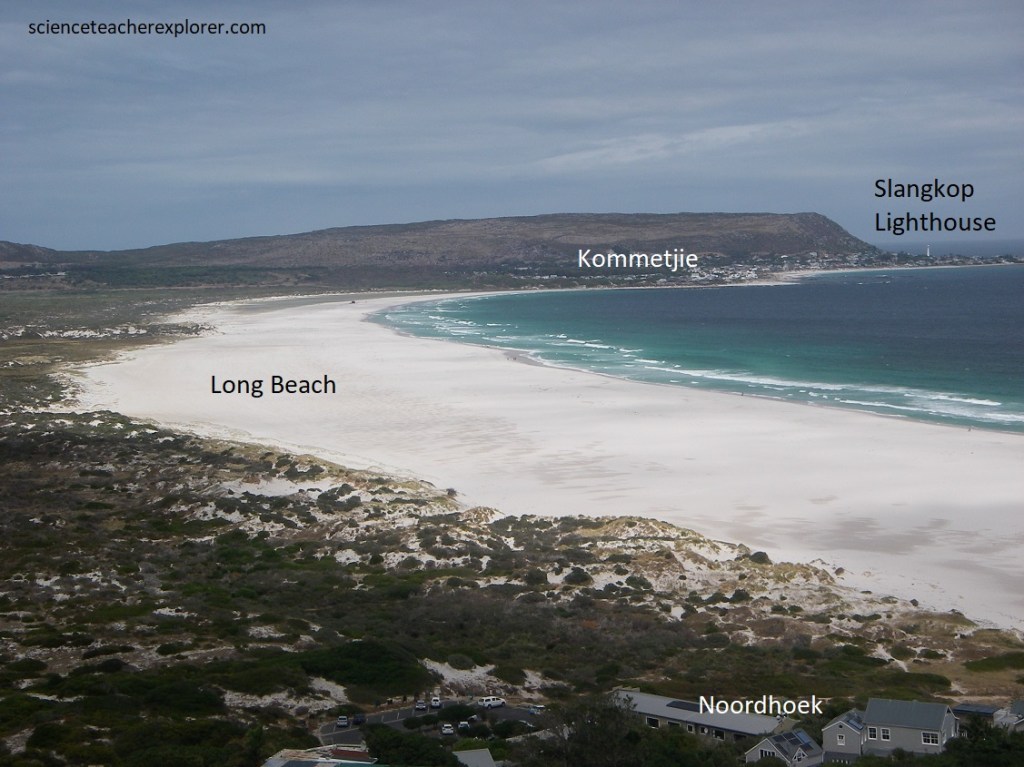
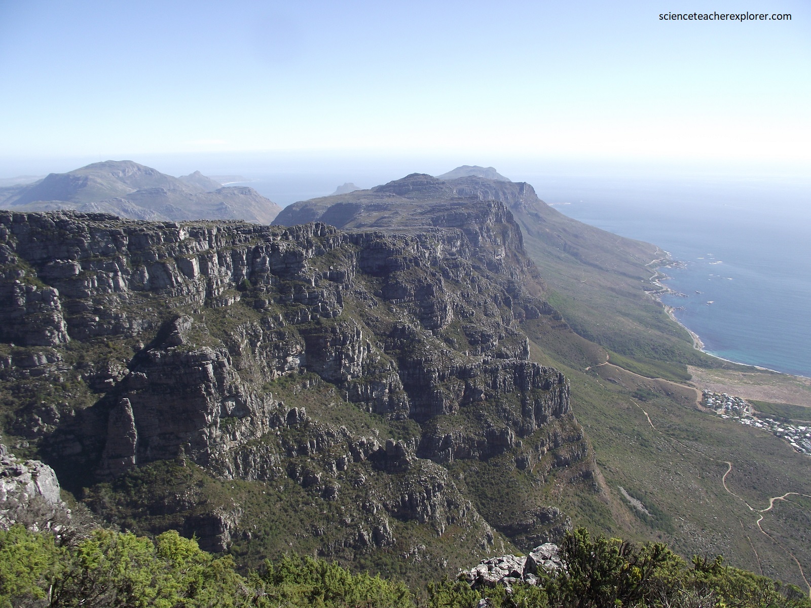
We continued driving north up the eastern side of the Cape Peninsula to explore the Chapman’s Peak Drive, (World Heritage Site). Pictured above is the beautiful white “Long Beach”, just south of Chapman’s Peak Drive.
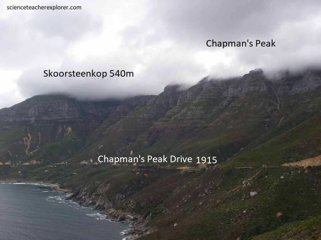
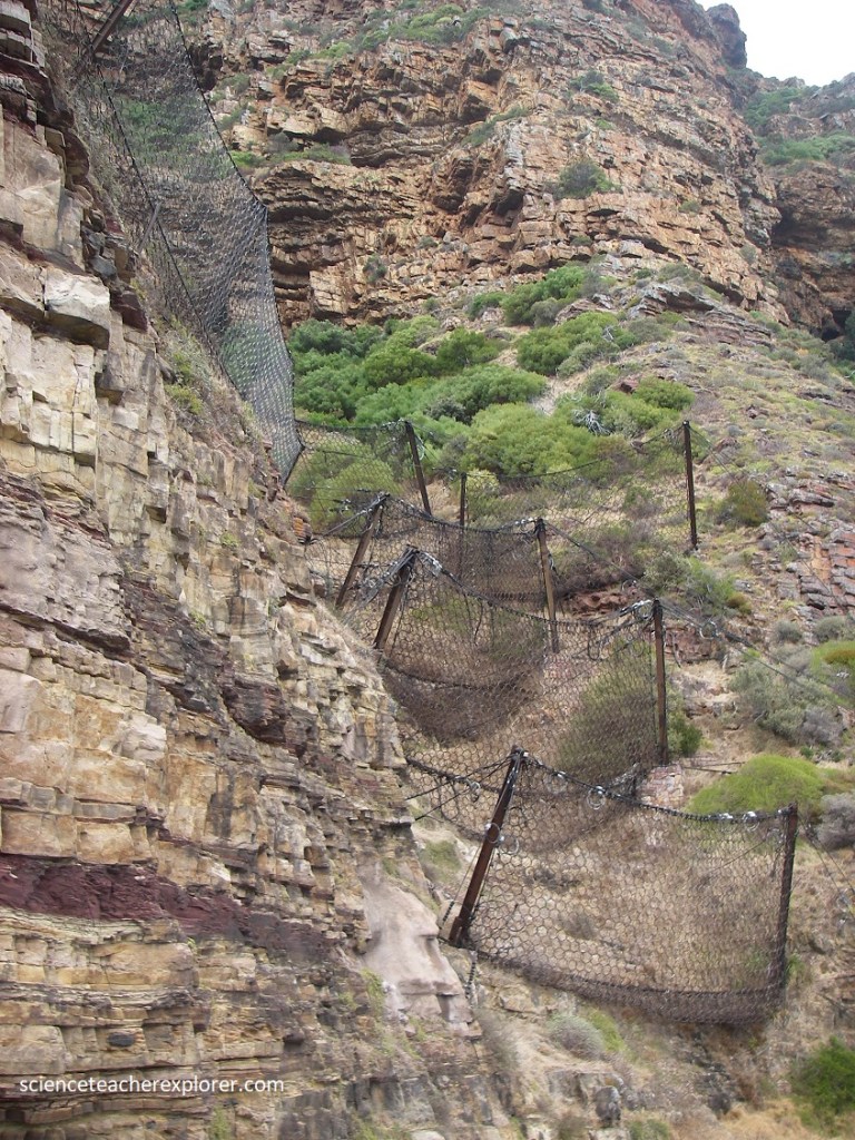
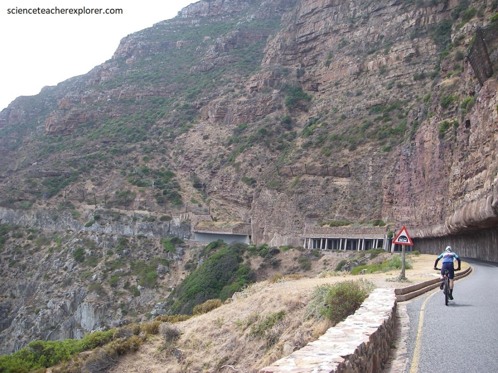
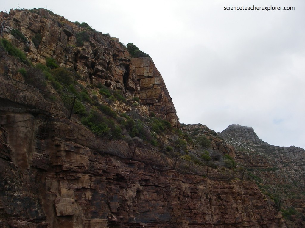
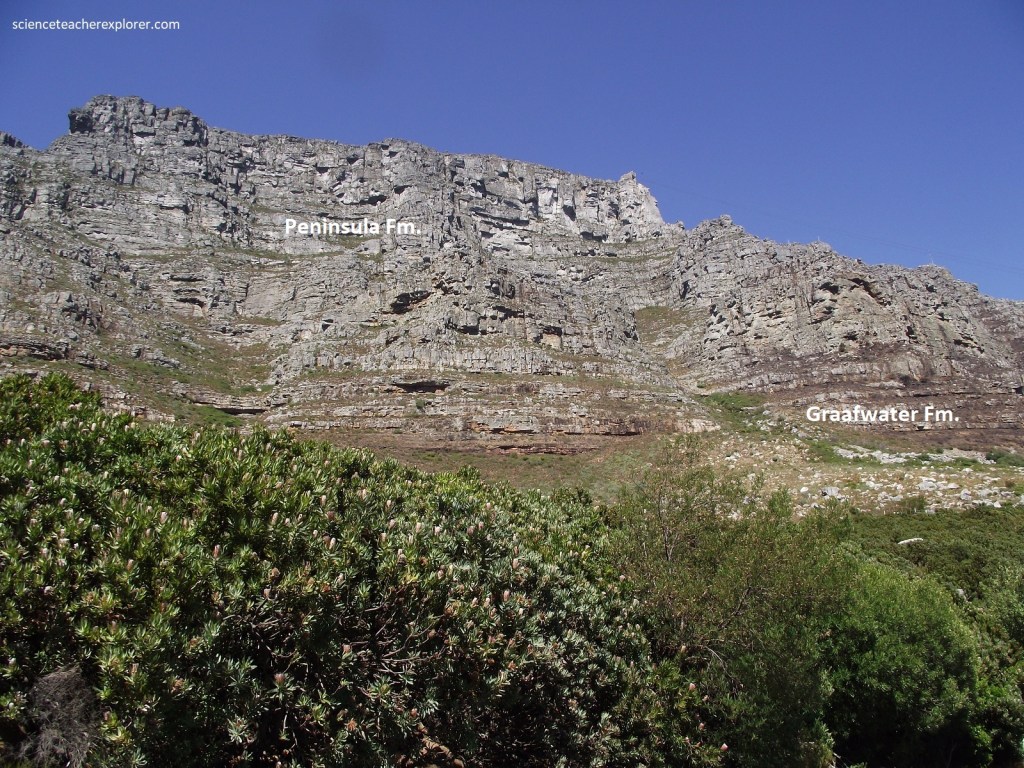
Chapman’s Peak is an imposing 593m high mountain on the Atlantic side of the Cape Peninsula. A spectacular coastal pass, known as Chapman’s Peak Drive, hugs its precipitous western side. The road is regarded as a major feat of design and technology at the time of its construction between 1915 & 1922. It was cleverly engineered to follow precisely the geological contact between hard, planed- down, older Cape granite and the younger, more workable overlying Table Mountain sedimentary formations. Road cuts reveal in great detail the geology at the contact and of the overlying sedimentary rocks. However, the road has recently been re-engineered to protect motorists from dangerous rock falls and has covered some of the spectacular geology, (pictured below).
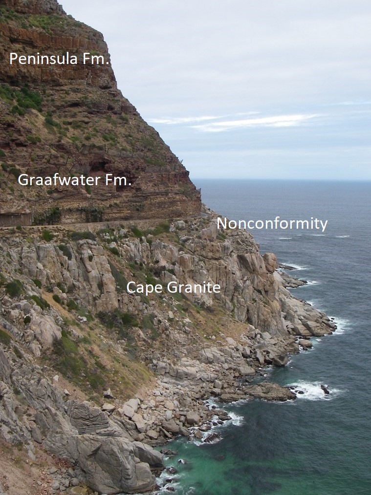
There are 2 very different formations: Sea-Point Granite, part of the 540 million-year-old Cape Peninsula Batholith, (an intrusive of the Cape-Granite Suite); and overlying sedimentary rocks of the Table-Mountain Group, (Graafwater Fm. & Peninsula Fm. of the Ordovician 485-455 mya), that form the base of the Cape Supergroup. They are separated by the famous non-conformity that reflects a time gap of many millions of years. This contact slopes gently to the south and shows minor undulations on the older, planed-down granite land surface.
Elevated and partly dissected peaks of the Table Mountain system make up the landscape, actively being worn down by erosion.
Below road level the granite out crops as bare rounded boulders, fresh because of constant erosion close to the sea; above the road the sedimentary rocks form impressive ramparts and cliffs, and are an ongoing source of rock falls, (an unstoppable natural process). Pictured below, this area was part of an offshore island about 5 million years ago. The steep mountain slope and cliffs have been preserved by the hard layers of erosion-resisting horizontal sandstone.
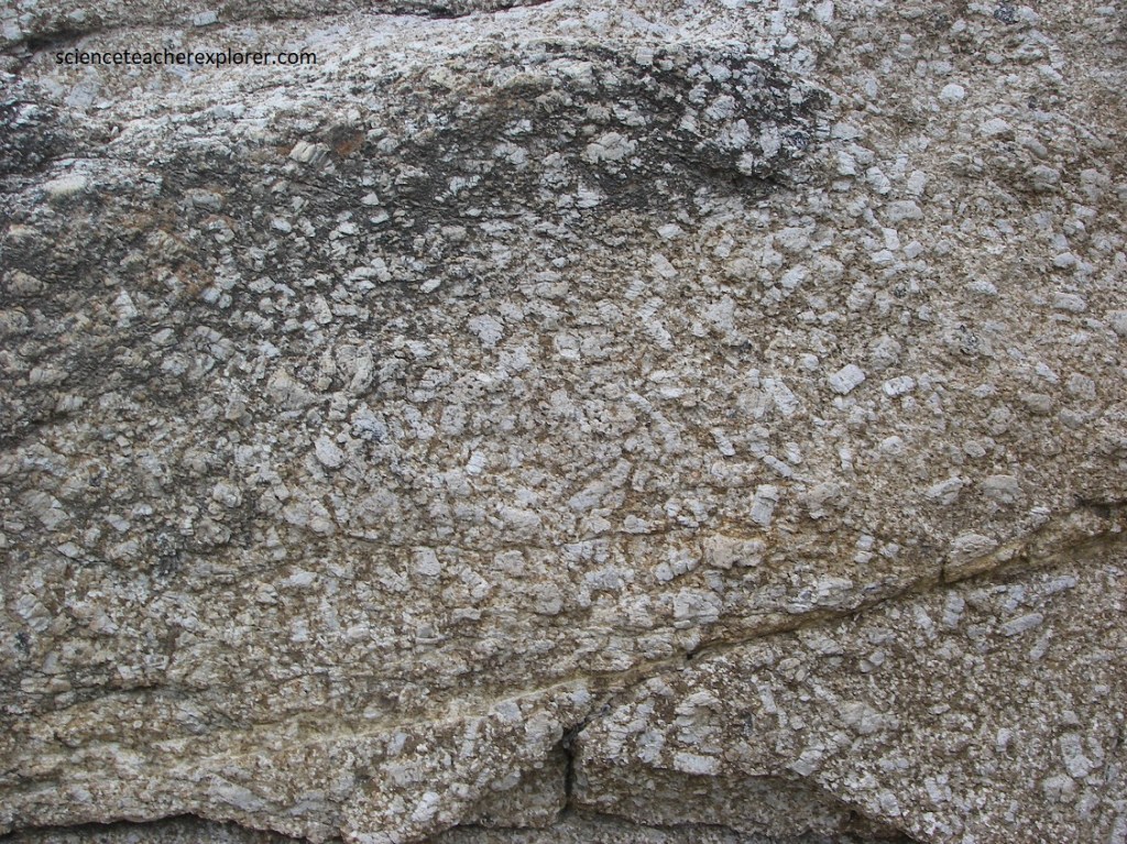
The granite is a plutonic igneous rock, formed by slow cooling and crystallization from a magma emplaced some 540 million yeas ago into a sequence of folded rocks (Malmesbury Group) deep below a Precambrian mountain belt. Pictured below, this Sea-Point Granite is light grey, coarse-grained and strongly porphyritic, (of varying grain size with large rectangular crystals of alkali feldspar, called phenocrysts’), and is well exposed along the coast between Sea-Point and Hout Bay. The buff colored zone of the granite is seen at the top because of the earlier weathered land surface that existed.
The granite intrusion was followed by prolonged uplift and erosion that created the nonconformity surface upon which sediments, (now represented by sedimentary rocks of the Table Mountain Group), were deposited in braided river, floodplain and shallow marine environments. Pictured below, the lower part of the Table Mountain Group succession along Chapmen’s Peak Drive is a sequence of thin-bedded, reddish brown mudstone and sandstone named the Graafwater Formation, (after a village east of Lambert’s Bay). The formation consists of a 70m thick alternating sequence of thinly bedded, reddish-brown sedimentary rock that indicate a changing environment at the time of deposition. These comprise buff-colored sandstones, siltstones and oxidized maroon mudstones or shale, often showing sedimentary depositional structures.
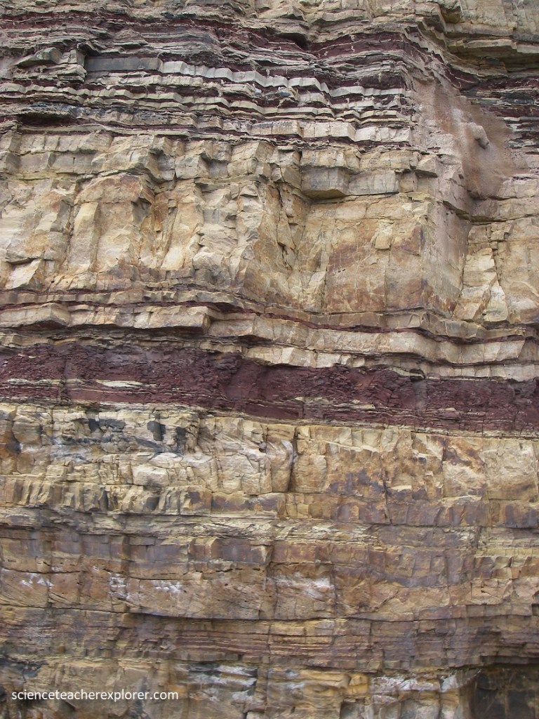
The Graafwater Fm. are overlain by thick-bedded layers of light brown, gritty, quartz-rich sandstone of the Peninsula Formation. The orientation of cross-bedding in the sandstone indicates a consistent southward ancient stream flow direction and the floodplain-mudstones have mud-cracks in them from being exposed to the baking sun after flooding events. [Note: The red color of the rocks is due to the presence of the mineral hematite, and iron oxide. Oxygen in the environments was put there by ancient life at the time of formation].
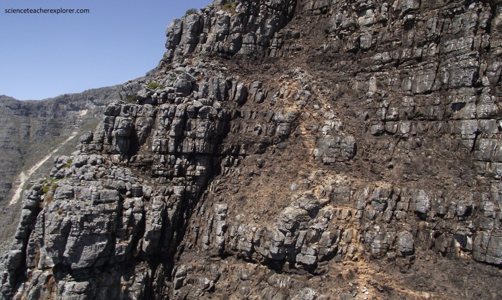
The sedimentary layers have been displaced locally by low-angle thrust faults formed by the convergence of tectonic plate movement that occurred 250-230 million years ago; and move commonly, by steep normal faults formed during the breakup of the supercontinent Gondwana about 100 million years later. Black dolerite dikes, best observed from the sea, cut across the rocks in the cliffs below the road. These sub-vertical features are igneous rocks formed by the intrusion of magma from the earth’s mantle into fractures formed during continental rifting about 130 million years ago. Some 15 million years later, rifting turned into continental drift, forming the Atlantic Ocean. Progressive widening of the ocean resulted in equivalents of the Table Mountain Group now occurring some 7000 km away in the Sierra de la Ventana, south of Buenos Aires in Argentina.
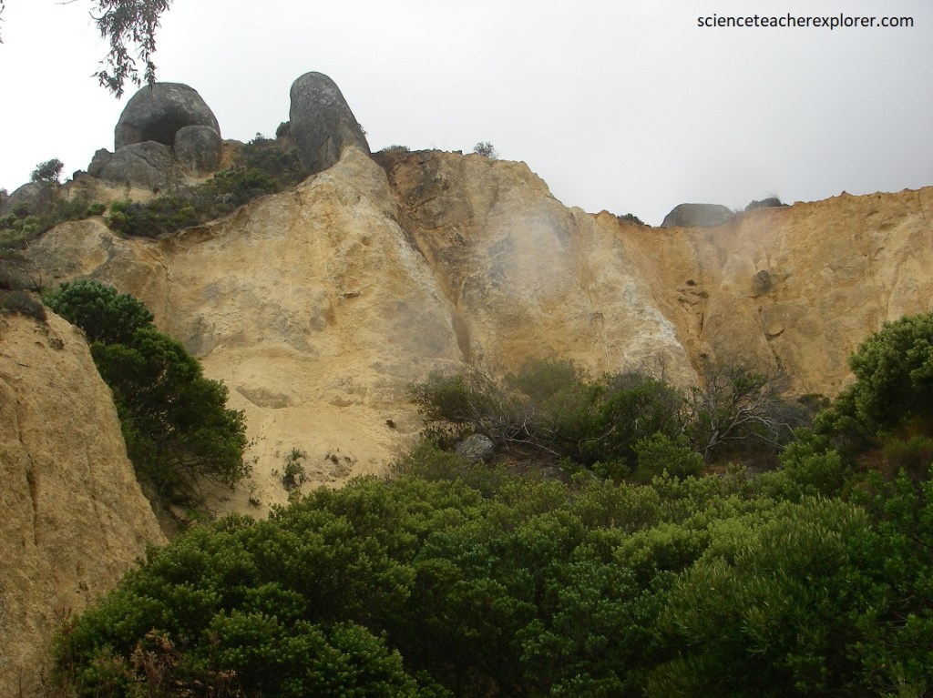
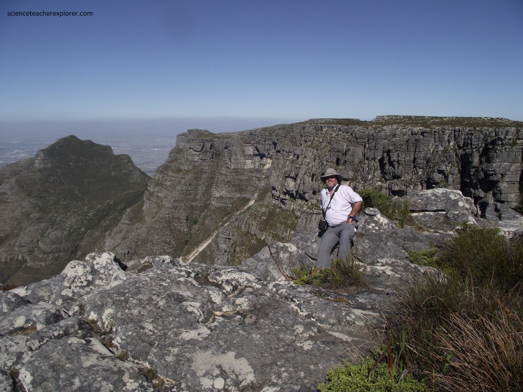
Pictured above, north of the Chapman’s Peak Drive is the deeply weathered and easily eroded granite overlain by Table Mountain sedimentary rocks. We continued driving north to explore and trek the Table Mountain World Heritage Site, (pictured below).
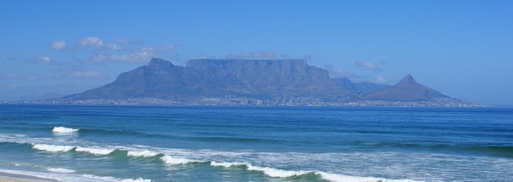
Pictured above, Table Mountain can be seen and recognized from over 200km away, a reassuring beacon for sailors rounding the southern tip of Africa from the north, (usually Europe). [In 1488, Bartholomeu Dias was the first European to see and climb it, and today it is probably South Africa’s most famous landmark.]
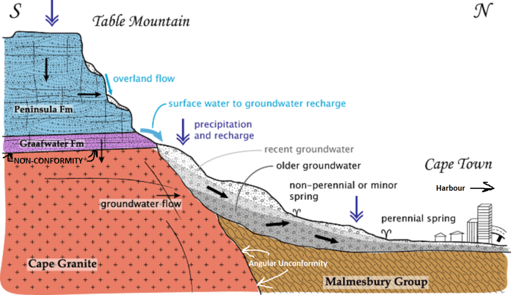
In geological terms, it is a huge block of sandstone that was laid down on the floor of a shallow sea 400-500 million years ago. Major Earth movements lifted the rock to its present height of 1,086m above sea level. It’s history and geological formations are similar to Chapman’s Peak, mentioned above. Table Mountain and the rest of the peninsula, (explored by us earlier), formed 2 offshore islands 5 million years earlier when the sea level was much higher. Imaged below, the cliff-like, layered upper formation is hard sandstone of the Peninsula Formation, which overlies the reddish sandstone and siltstone beds of the Graafwater Formation. The position of Tafelberg Road mostly follows the base of the Graafwater sedimentary rocks, which overlie poorly outcropping Malmesbury Formation rocks or Cape granite.
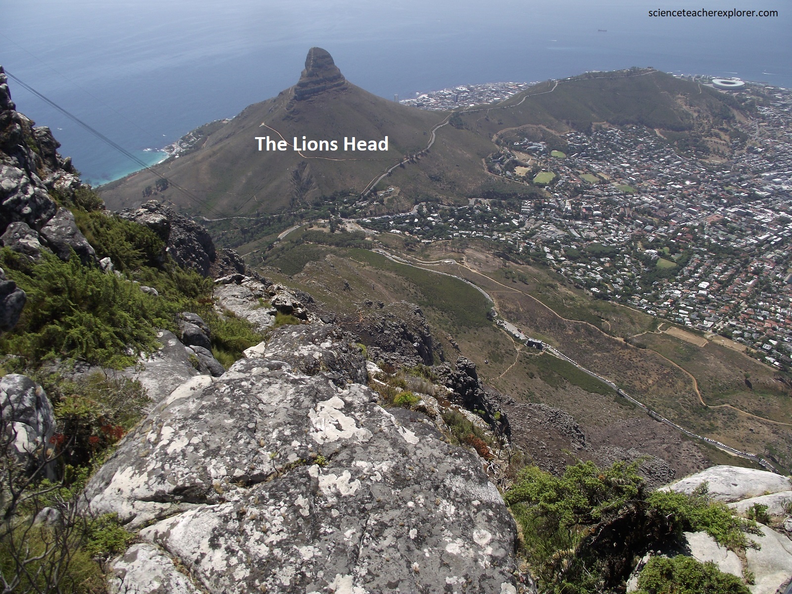
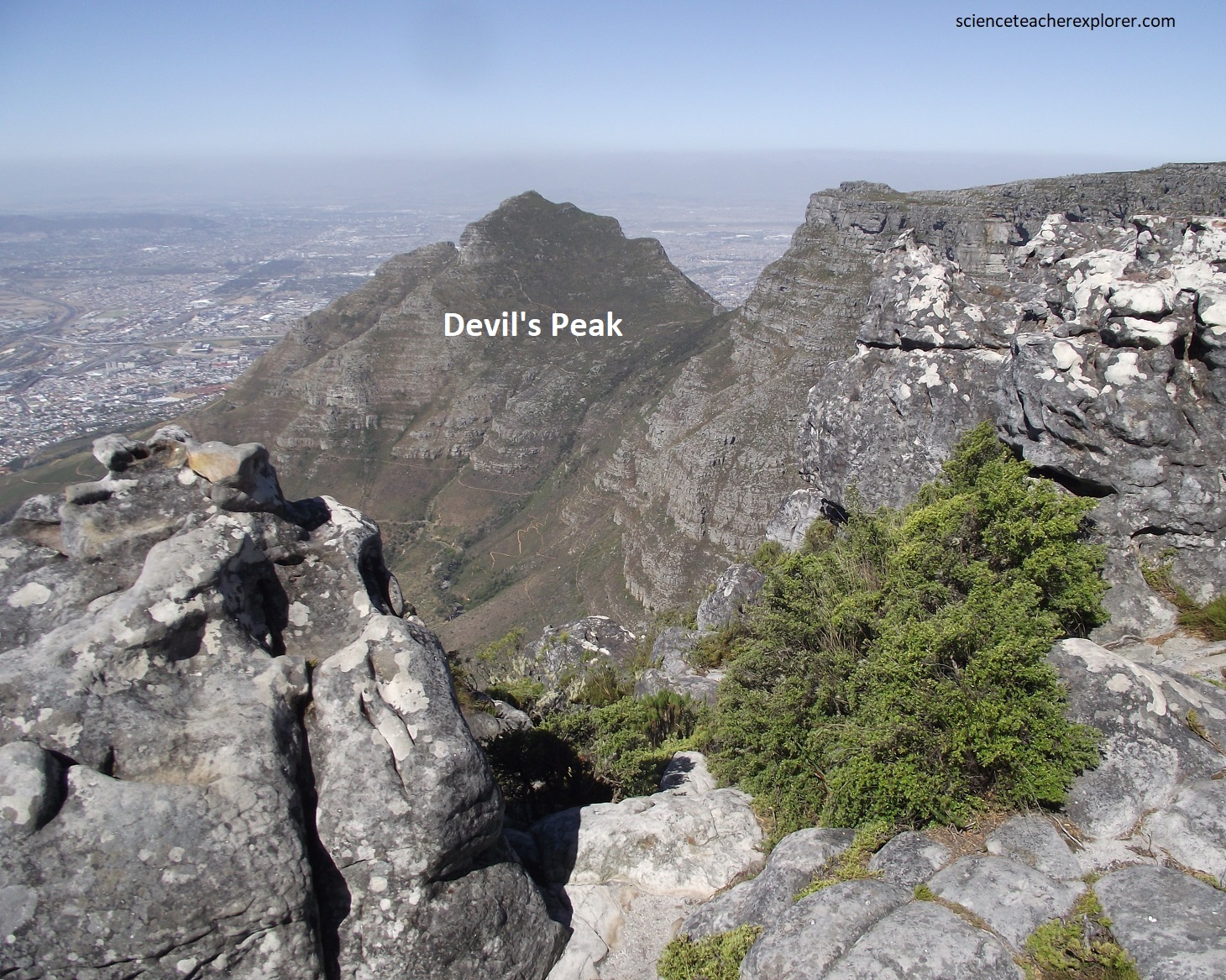
Imaged above, the remarkably flat Table Top is 2.5 km wide and 3.2 km long, with a distinct landform at each end, (a conical hill known as Devil’s Peak at one end and the distinctive Lion’s Head at the other). The top is sometimes veiled in a layer of cloud, giving the appearance of a tablecloth.
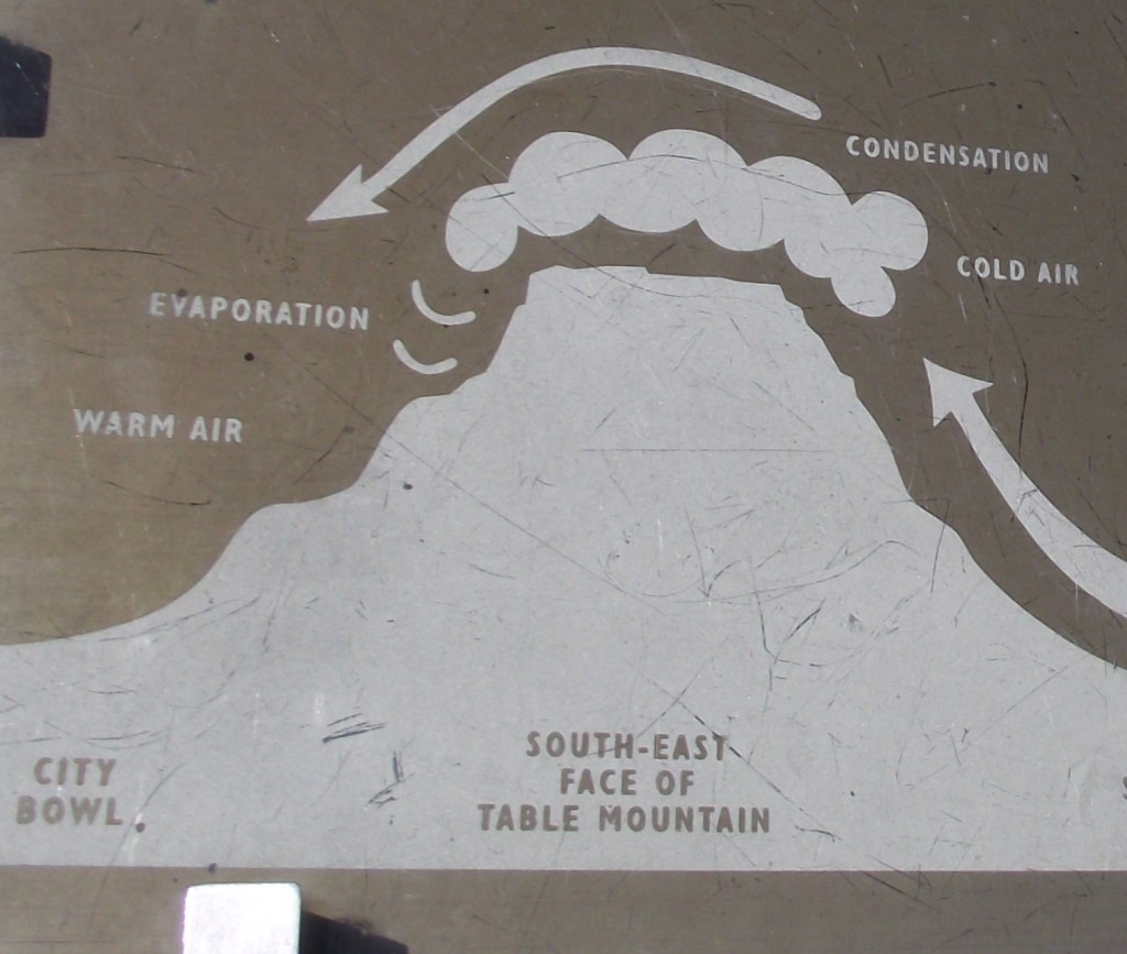
Once aptly named Windberg (Windy Mountain) south-easterly winds are force over the neck between Devil’s Peak and Table Mountain and funneled down into the city. This blast can reach speeds of 130 km/hr and, while annoying to some, it clears Cape Town of its smog and heat, (hence its name, ‘The Cape Doctor’. Additionally, precipitation from this cloud clings to plants and rock surfaces, leaving behind more than twice the amount of water that otherwise falls as rain on the summit and surrounding areas. Much of this moisture is deposited during the months of summer drought at the Cape. Filtering down through cracks and fissures, this input replenishes the water-table, resulting in springs and streams that issue from the Mountain year round. This is vital to the ecology of the Mountain and a primary reason Cape Town took root here.
Below the northern side of Table Mountain, the Tafelberg Road and a network of paths crisscrosses green slopes scattered with wild flowers, (pictured above). However, a cable car took Mike and I directly to the top to save time.
Pictured above, the towering cliffs and buttresses are made of some 500m of well-bedded, light grey, quartz-rich Peninsula Formation sandstone, dipping at about 5 degrees to the south. The sandstone contains scattered quartz pebbles and some thin layers of conglomerated, indicating deposition in shallow water.
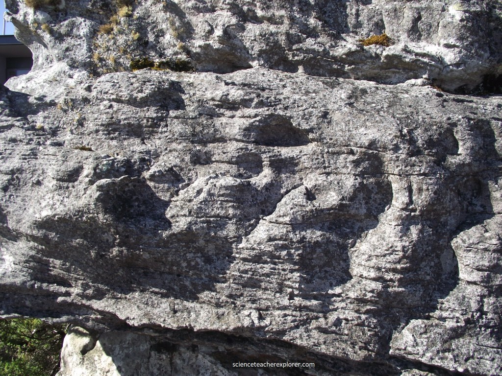
Pictured above, a close-up of Peninsula Formation sandstone outcrop on top of the Table Mountain. On site I could see the gritty layers and the slight dip of the strata to the south. Table Mountain is being actively eroded away. This white sand, now on the mountain top and derived from weathered sandstone will, sooner or later, end up on a local beach.
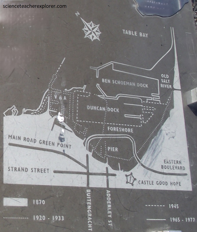
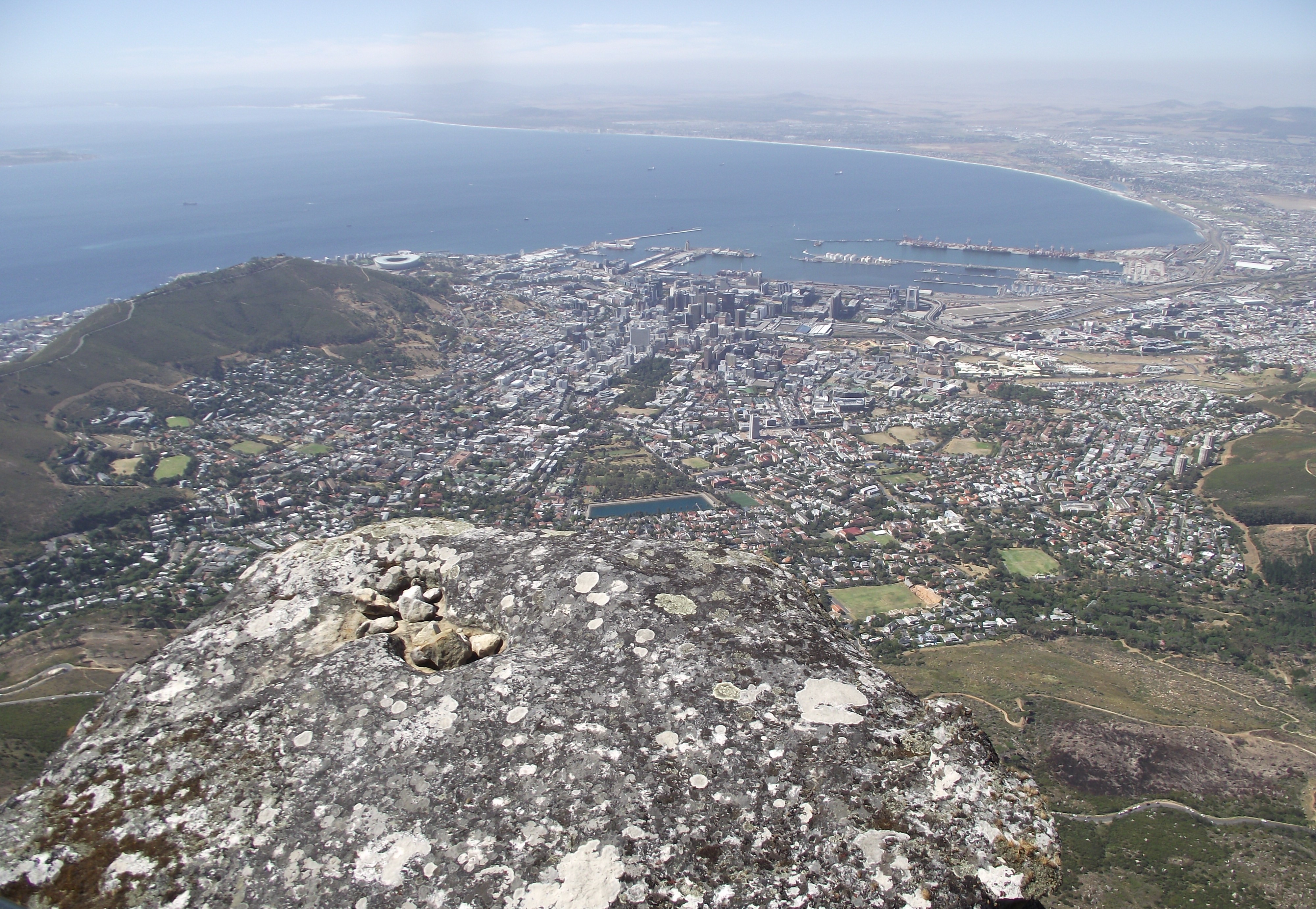
From the top, the city of Cape Town could be seen sprawling directly below, and the Cape of Good Hope was just visible on the south side, (pictured above). While the Bay below, on the northern side of Table Mountain, shelters ships from the heavy southerly swell of the South Atlantic, it has not always been able to protect them from howling north-westerly gales that sweep the Peninsula in the winter months. Over the earlier years, more than 400 ships have been wrecked along this shore during its stormy history. Attempts to tame the Bay proved futile until 1860, when the first load of rock was tipped into the sea for the construction of the Breakwater and Alfred Basin, (where ships could lie at quayside. By 1905, this had been extended to include the Victoria Basin (today’s Waterfront). In 1914 lower Adderley Street boasted a fashionable pier, but by 1940 this too had made way for more docks and the modern city Foreshore, as the sea was pushed back a kilometer further.
As the years passed and trade grew, this unmistakable landmark signaled the halfway point on any journey between East and West. An anchorage where fresh water could be taken on and food obtained be hunting or by bartering with local Khoi herders. In time, this watering place and provisioning station would become home to people from many nations who would shape its future as a city, (here, at the maritime crossroads of the world).
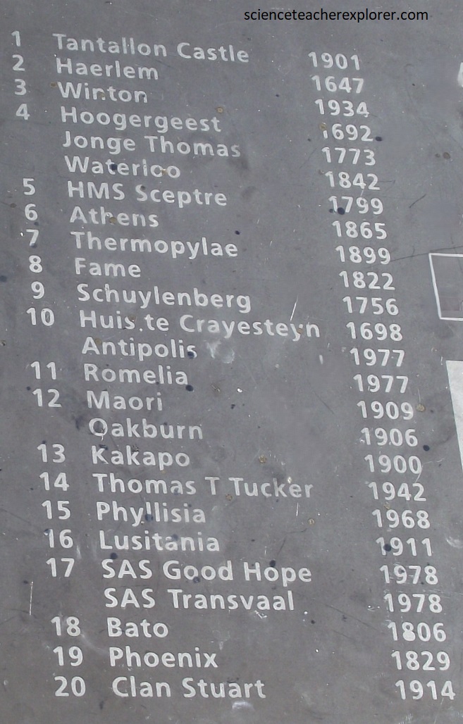
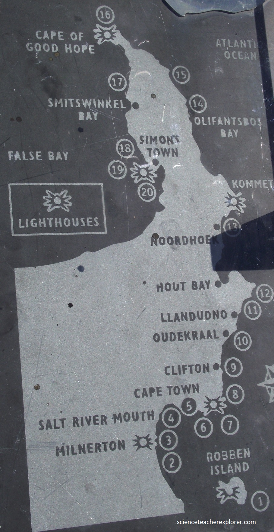
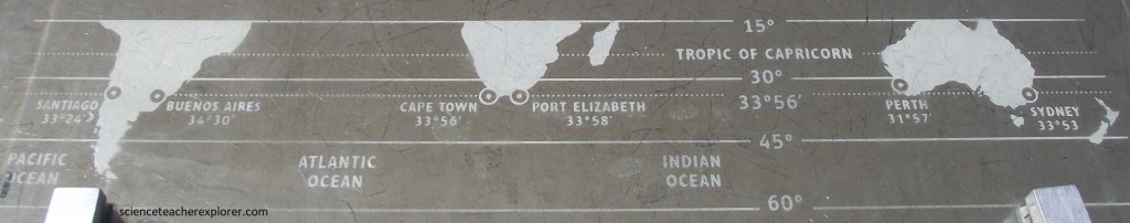
Picture above, the interpretive boards indicate that the legendary ‘Flying Dutchman’ and countless other tales of shipwreck and storm, remind sailors that Cabo da Boa Esperanca can also be Cabo Tormentosa (Cape of Storms!). Ships who hug the Cape, to avoid the infamous Roaring 40’s latitudes (home to a belt of winds that girdle the globe) are often confronted by equally hazardous conditions on this coast, (dense mists, treacherous currents, hidden rocks and shoals). The perils of this ‘chokepoint’ that must be passed to round the Cape have made this one of the world’s great marine graveyards. Pictured above, this map show a few of some 650 wrecks recorded on this coastline over the past 400 years.
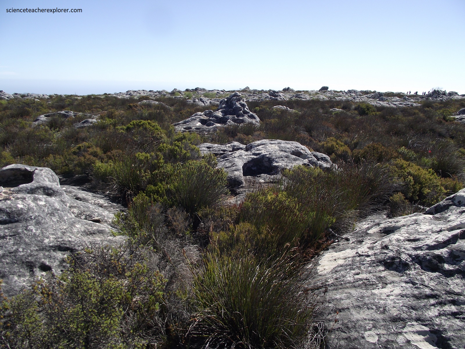
The top of Table Mountain is relatively flat due to the almost horizontal bedding, although there are many eroded sandstone outcrops near the escarpment edge, (pictured above with a trail-top map found on an interpretive sign).
Pictured above, on this summit, I noticed only a few low, stubby plants. These were elements of a vegetation type collectively called Fynbos (fine-leafed bush) and a fraction of some 1500 remarkable plants found across this mountain. Cape fynbos is one of the wonders of the world with 9,000 different species found over 90,000 sq. km. A total of 6,190 of these species are exclusive to the Cape flora. Fynbos grows in a 100 to 200km wide coastal strip on the southeastern coast of South Africa.
Pictured above, Platteklip Gorge cuts through the front face of Table Mountain and provides a popular steep zigzag trail from Tafelberg Road to the top, with excellent geology all the way. The gorge was developed along a zone of strong fracturing along a fault zone.
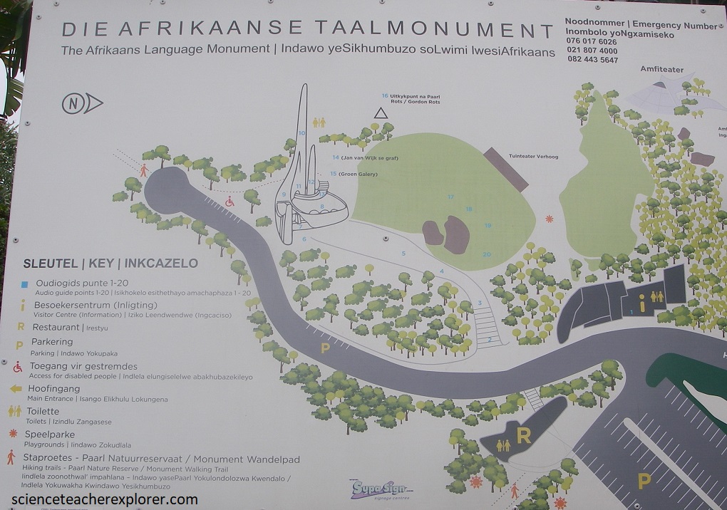
Once we explored and trekked the Table Mountain World Heritage Site, Mike and I drove northeast to Paarl, South Africa. (Imaged above), Paarl was the location of the Afrikaan Language Monument, (Die Afrikaanse Taalmonument).

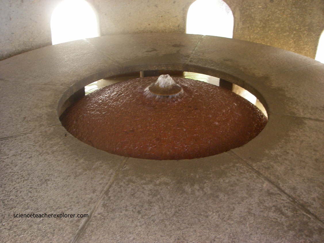
The monument commemorates the semi-centenary of Afrikaans being declared an official language of South Africa separate from Dutch. “Afrikaans” is the Dutch word for “African,” and the language was once called “Cape Dutch.” This very paradox and the language’s complex political history, is depicted in stone by this Afrikaans Language Monument. Pictured above, the monument consisted of various tapering structures of a convex and concave nature, symbolizing the influences of different languages and cultures on Afrikaans itself, as well as political developments in South Africa. The monument’s design reflects this progression: The three columns become progressively shorter, representing the waning influence of the European languages like Dutch and French, and the three convex mounds grow in size to indicate the increasing role played by African tongues.
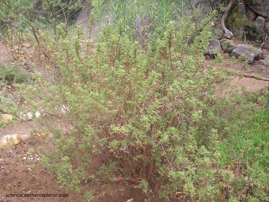
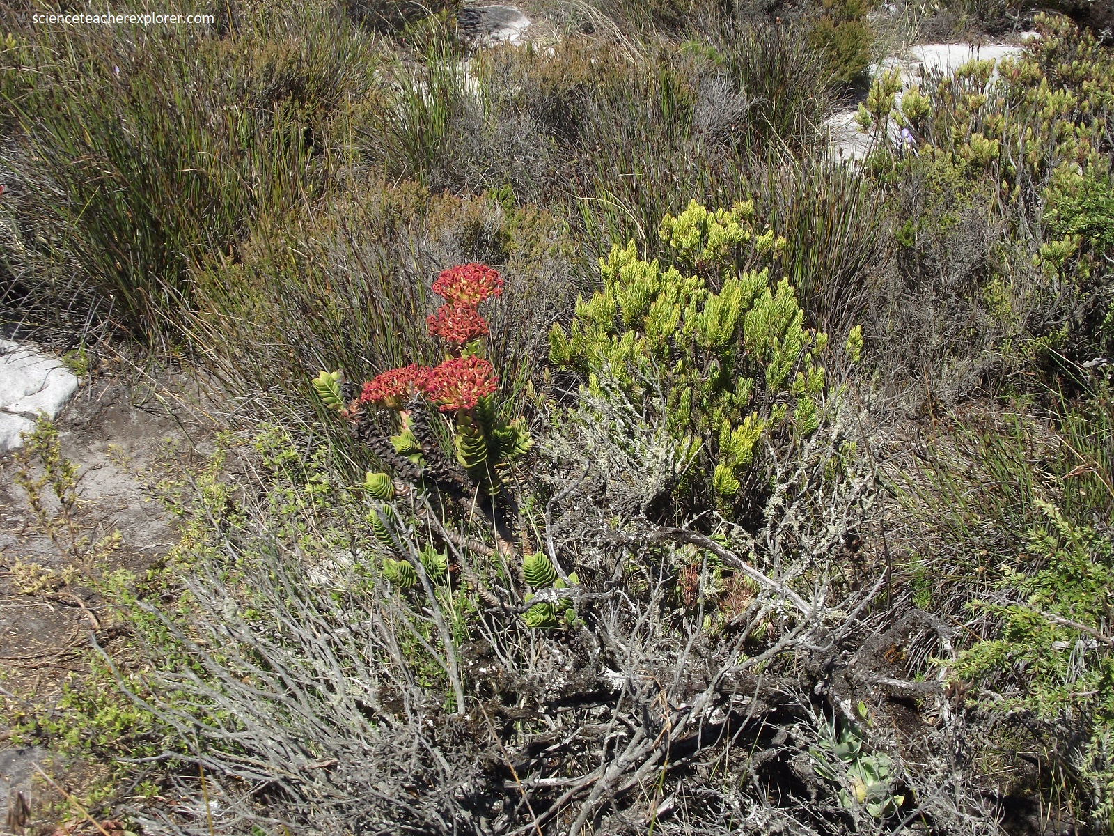
Medicinal plants form an important part of the African culture, and in South Africa knowledge of medicinal plants has been passed down through the generations thanks to oral tradition. Pictured above, there are approximately 245 species of this aromatic perennial herb. It is mainly the leaves and twigs that are used, and sometimes the roots as well. They are used to relieve fever, headache and menstrual cramps. An infusion is prepared or the leaves are boiled in milk, to treat coughs and colds. Leaves were burned and the smoke inhaled to relieve pain. It was used to put on wounds and to prevent inflamation. H. odoratissimum was particularly popularly used for this because of its fragrance and was effective in repelling insects and parasites.
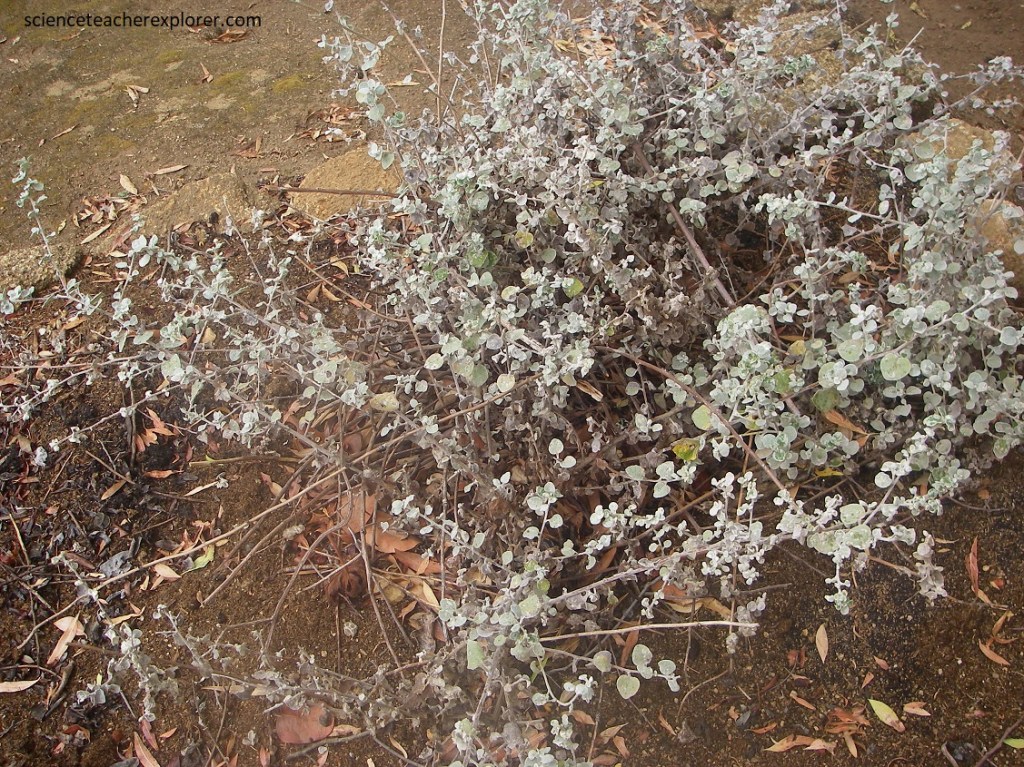
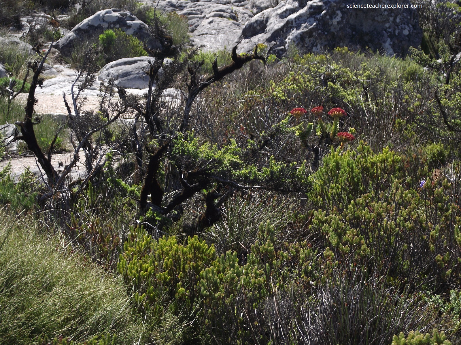
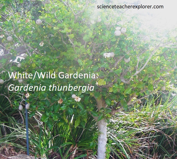
Pictured above, this bushy evergreen shrub is up to 1m high with silvery, grey appearance. Features that help this plant survive with little water include the grey leaf color, which reflects sunlight and thereby reduces leaf temperature. Additionally, the minute, silvery hairs covering the leaves trap moisture and thus reduce transpiration. The small, needle-shaped leaves and aromatic oils are other adaptations that limit water loss. Wild rosemary, (Eriocephalus africanus), has traditionally been used as a medicine for ailments like coughs and colds, colic, and as a diuretic and diaphoretic. A tea is usually made with 1 cup of boiling water and a sprig of wild rosemary. At the Afrikaans Language Monument I found the following endemic species, (pictured below):
Nearby, 3 landmark rock dome, (classic examples of eroded granite and some of the largest such domes in South Africa), bulge out on the southeastern side of Afrikaans Language Monument. Mike and I decided to explore and trek these, (pictured below).
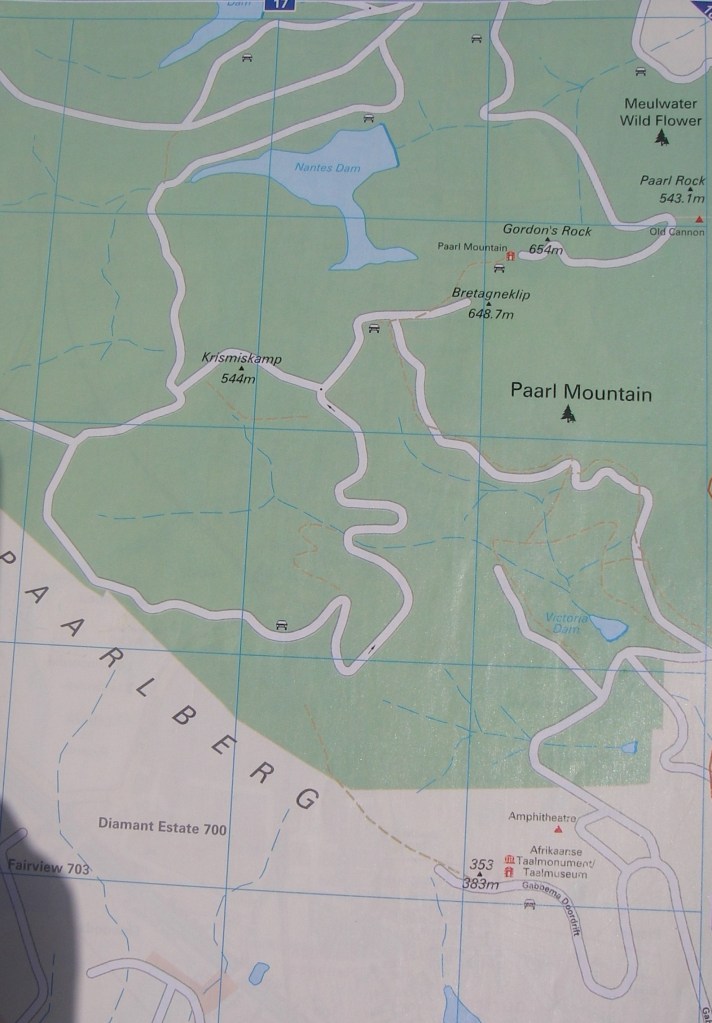
Imaged below, Paarl Mountain is made up mostly of the oval-shaped “Paarl Granite Pluton”, which is more than 5km at its widest and 13km long. It is part of the Cape Granite Suite that intruded into tightly folded and metamorphosed sediments of the Malmesbury Group from 540-520 million years ago, at the start of the Cambrian.
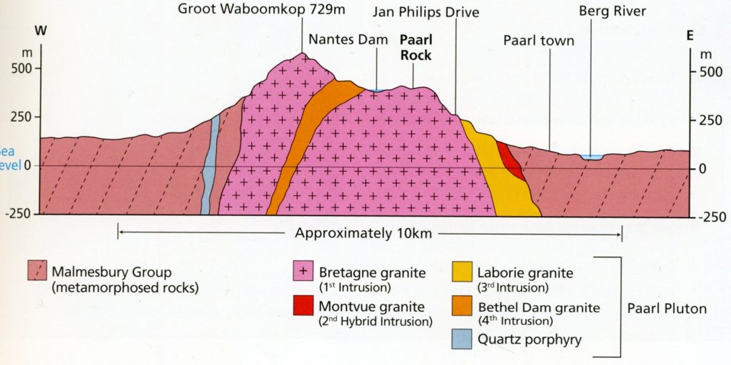
This Paarl pluton is an excellent example of a multiple intrusion. Four phases of granite can be recognized, (imaged above).
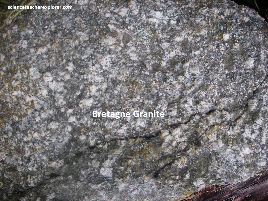
- Bretagne Granite is the most extensive, forms the core of the pluton and was intruded first. It is greyish, coarse-grained, has prismatic feldspar phenocryst.
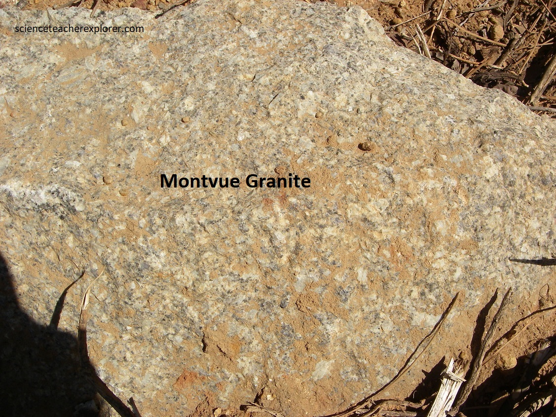
- Montvue Granite forms in smaller bodies of darker, biotite-rich granite along the pluton margin in the east. It is interpreted as a ‘hybrid’ granite.
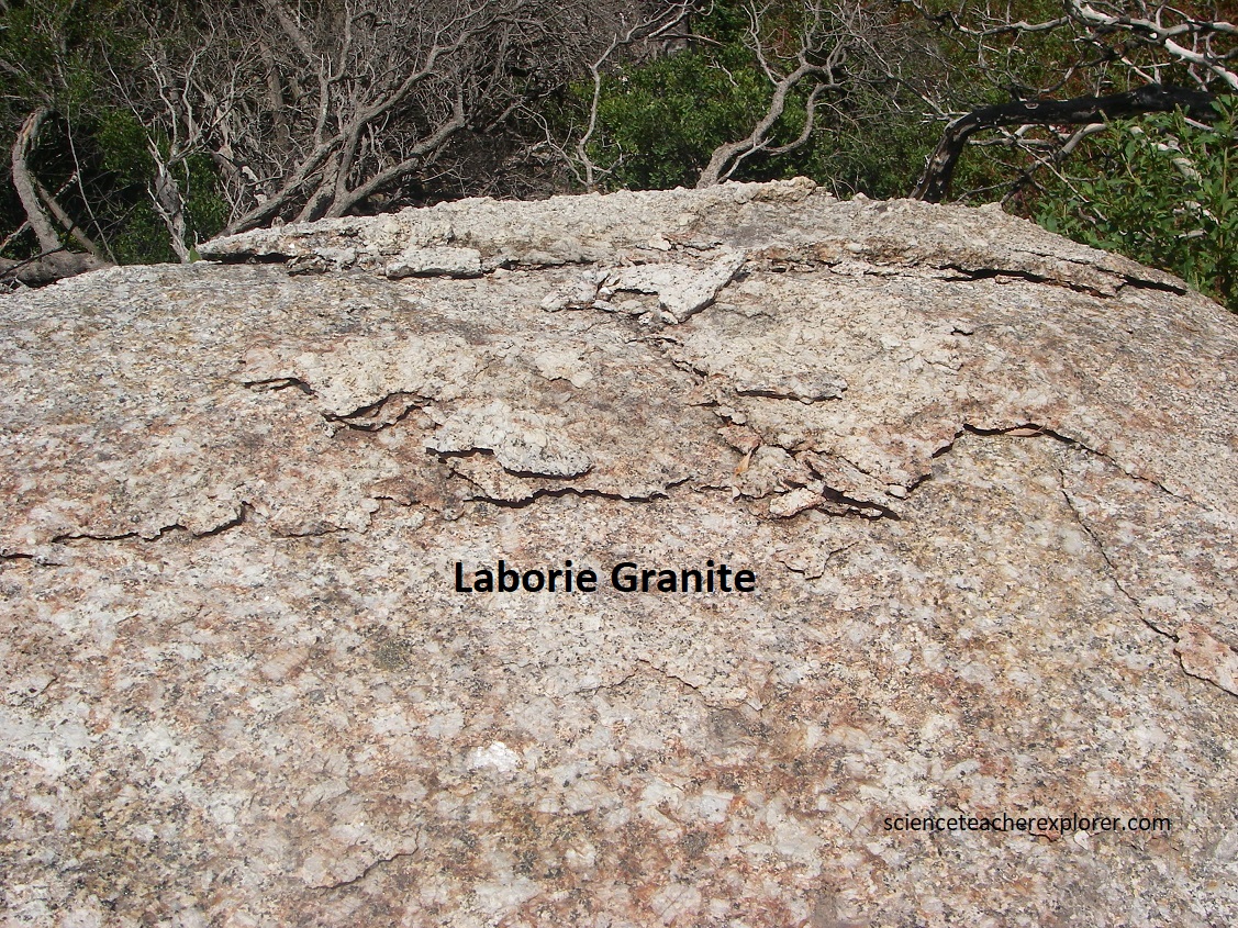
- Laborie Granite occurs as a 1km zone on the eastern & northern sides, where it was intruded between the Bretagne granite & Malmesbury wall-rocks. It is medium grained, consists of pale pink to white feldspar, (potassium to sodium), colorless quartz and flaky dark biotite.
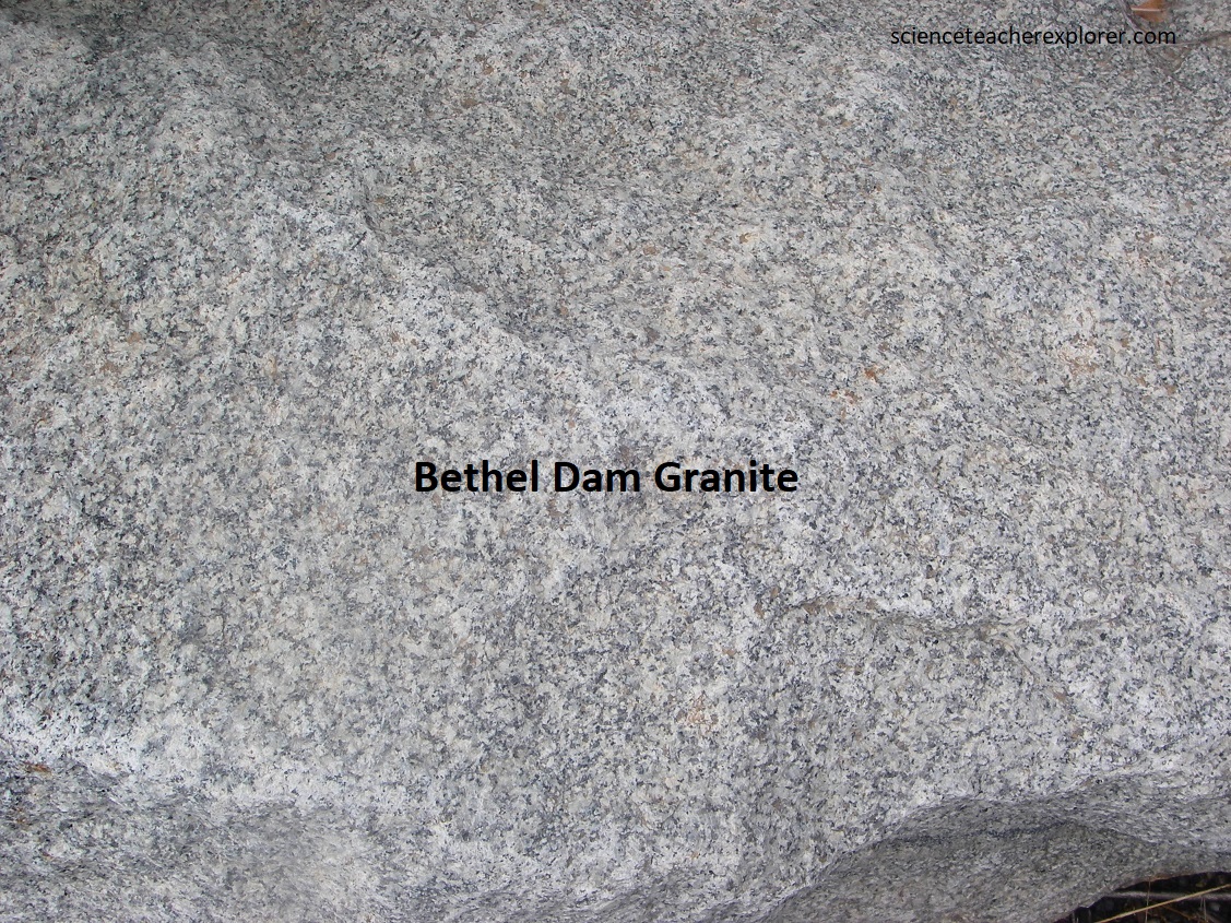
- Bethel Dam Granite occurs as small bodies in the center of the pluton and to the northwest, and is richer in quartz and biotite. It was the last granite phase to intrude, as distinct, fine-grained, granite filled conduits of quartz porphyry.
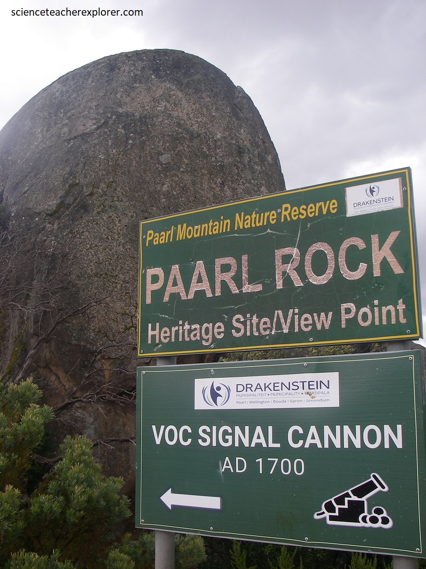
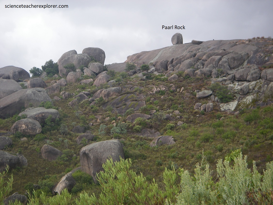
Pictured above, Paarl Mountain is known for the Paarl (meaning ‘pearl’) Rock on the 729m Groot Waboomkop with its scenic view of the Berg River Valley and the town called Paarl.
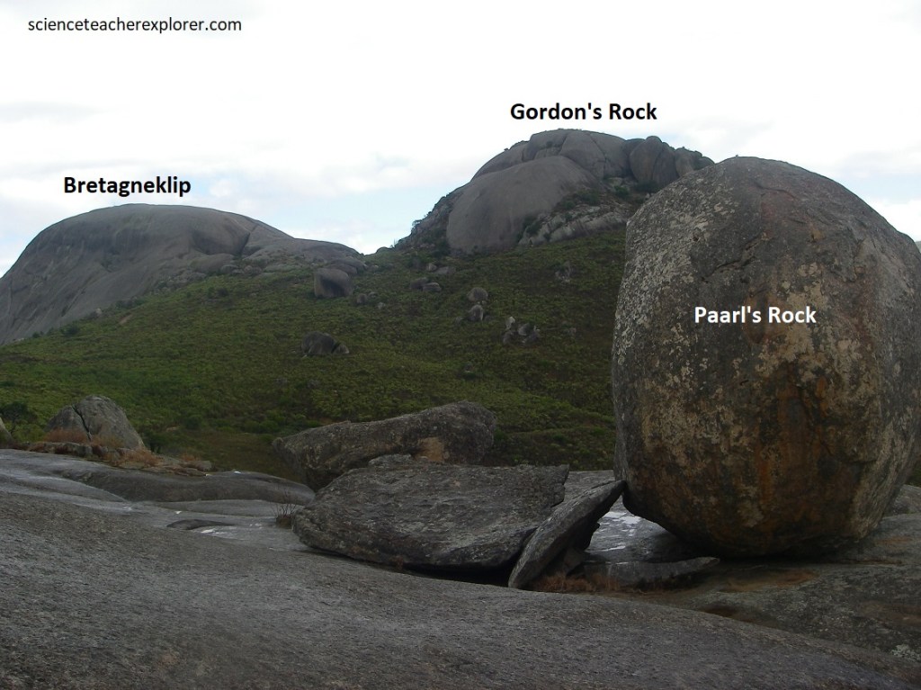
Pictured above, is the outcrop now called Paarl Rock (545m), and about 500m to the west are the more prominent domes named Gordon’s Rock to the north and Bretagne (or Britannia) Rock (650m) to the south. We drove up to the saddle.
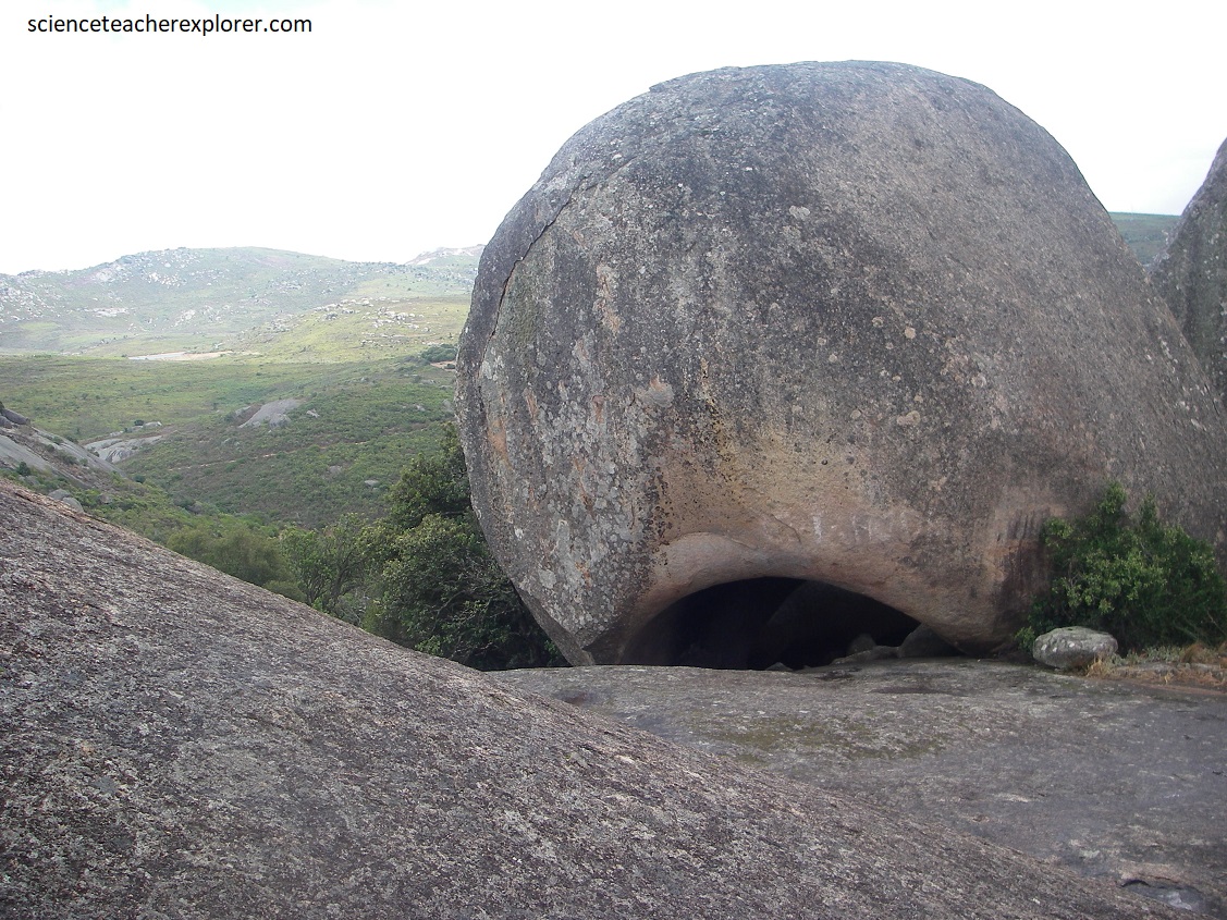
Pictured above, preservation of the granite is due to its greater resistance to erosion compared to the more easily weathered surrounding meta-sedimentary rocks. The spectacular bare dome are superb examples of differential weathering and erosion shown by some massive granite bodies.
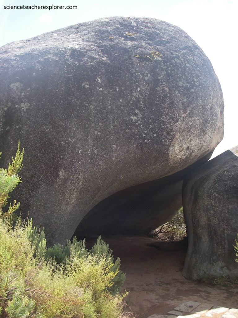
Granite domes such as Bretagne Rock, are the result of when large, curved , convex-upwards slabs and blacks break off along sheet fractures called exfoliation. These fractures are probably caused by relief of stress in the granite when erosion removes the considerable weight of overlying rock.
Pictured above, the large size of the domes is due to the wide spacing of vertical ‘master joints’ within the even-textured and rather structureless granite. There are fine examples of ribbed, gutter-like channels called ‘rillen’ and fracture-controlled clefts on Gordon’s Rock. The story goes that a father and son were wandering around the rocks when the son accidentally fell into one of the many clefts adorning the rocks. After numerous attempts at rescue for several days, and out of hope by this time, the father performs a mercy killing, shooting his son, and so the rock is named after David Gordon.
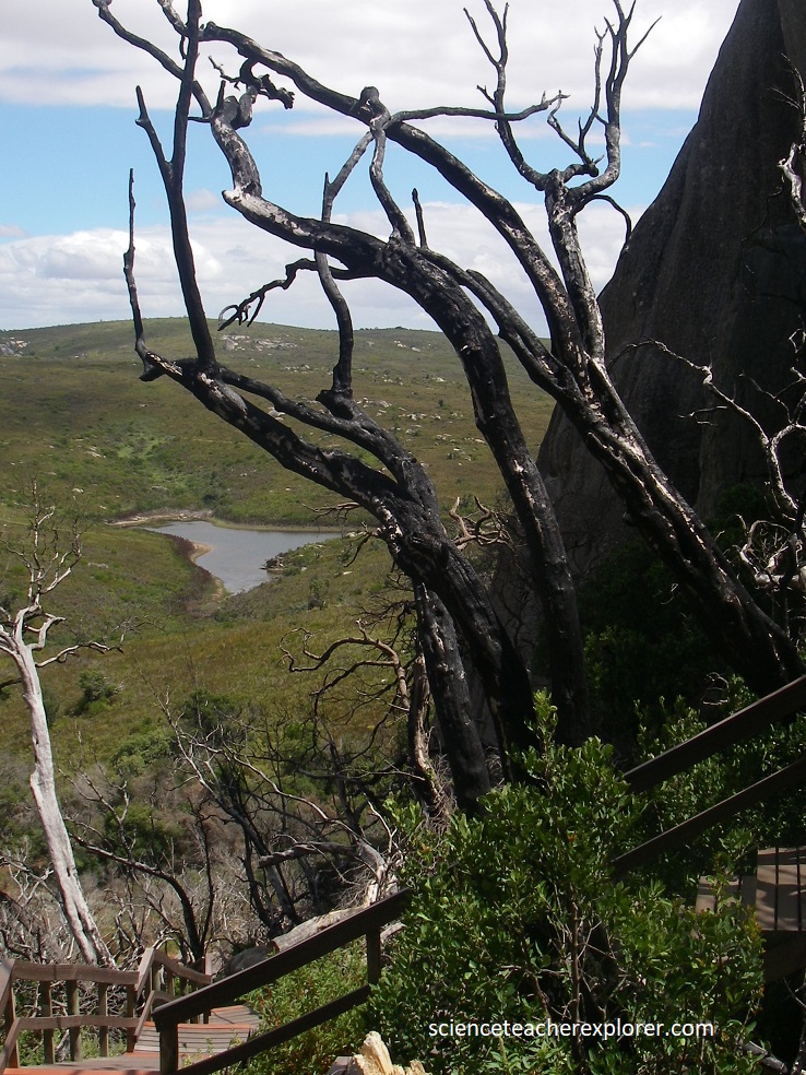
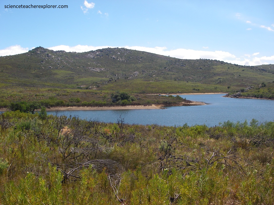
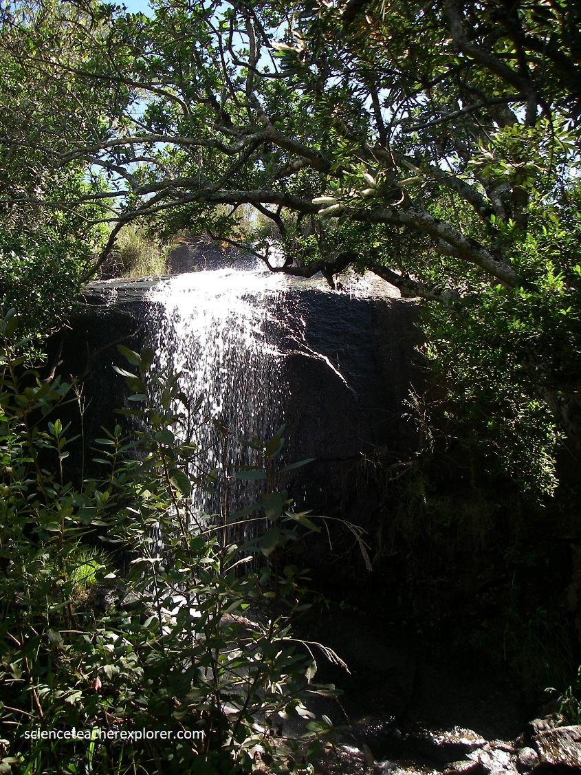
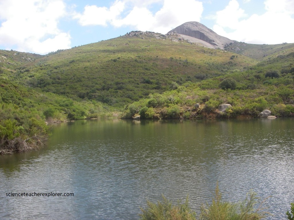
While trekking around Paarl Mountain within the Western Cape, we discovered and explored Nantes Dam, (pictured above on the left), Bethel Dam, (pictured above in the middle), and a beautiful waterfall. It was a spectacular location.
