W. Coast N.P., S. Africa
In March 2024, my trekking buddy, (Mike Stevens) and I explored the West Coast National Park of South Africa.
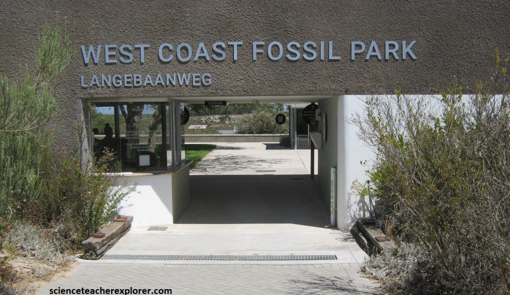
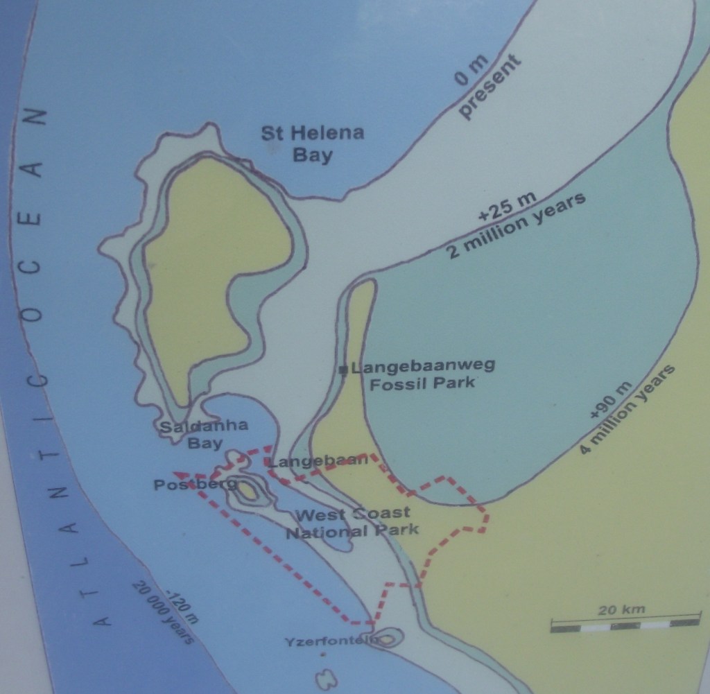
The West Coast National Park was established in 1985 to include Langebaan lagoon; (16km long and 4.5km wide)), and the islands of Jutten, Malgas, Schaapen and Marcus in Saldanha Bay. (Images below are public domain Wikipedia road-maps of the West Coast National Park and surrounding area). Our first destination was the West Coast Fossil Park, just north of the West Coast National Park, (imaged below).
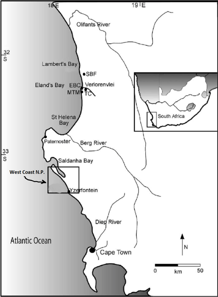
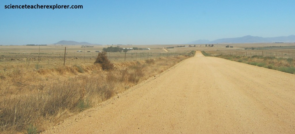
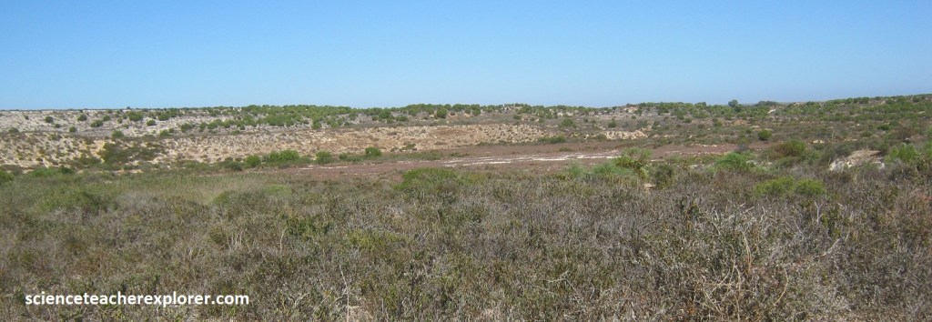
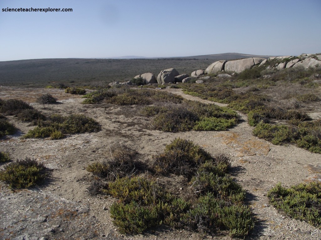
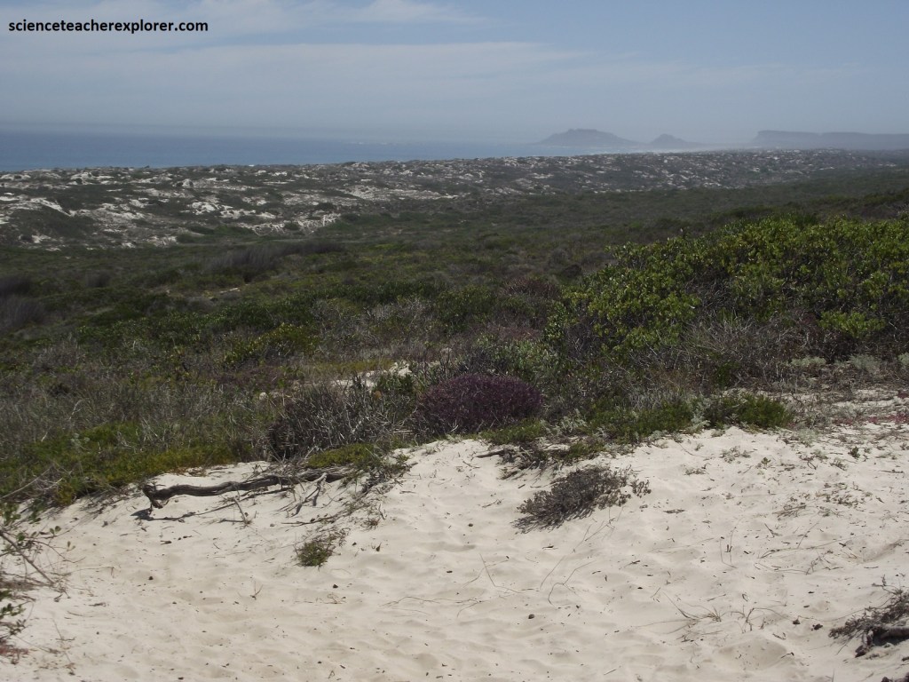
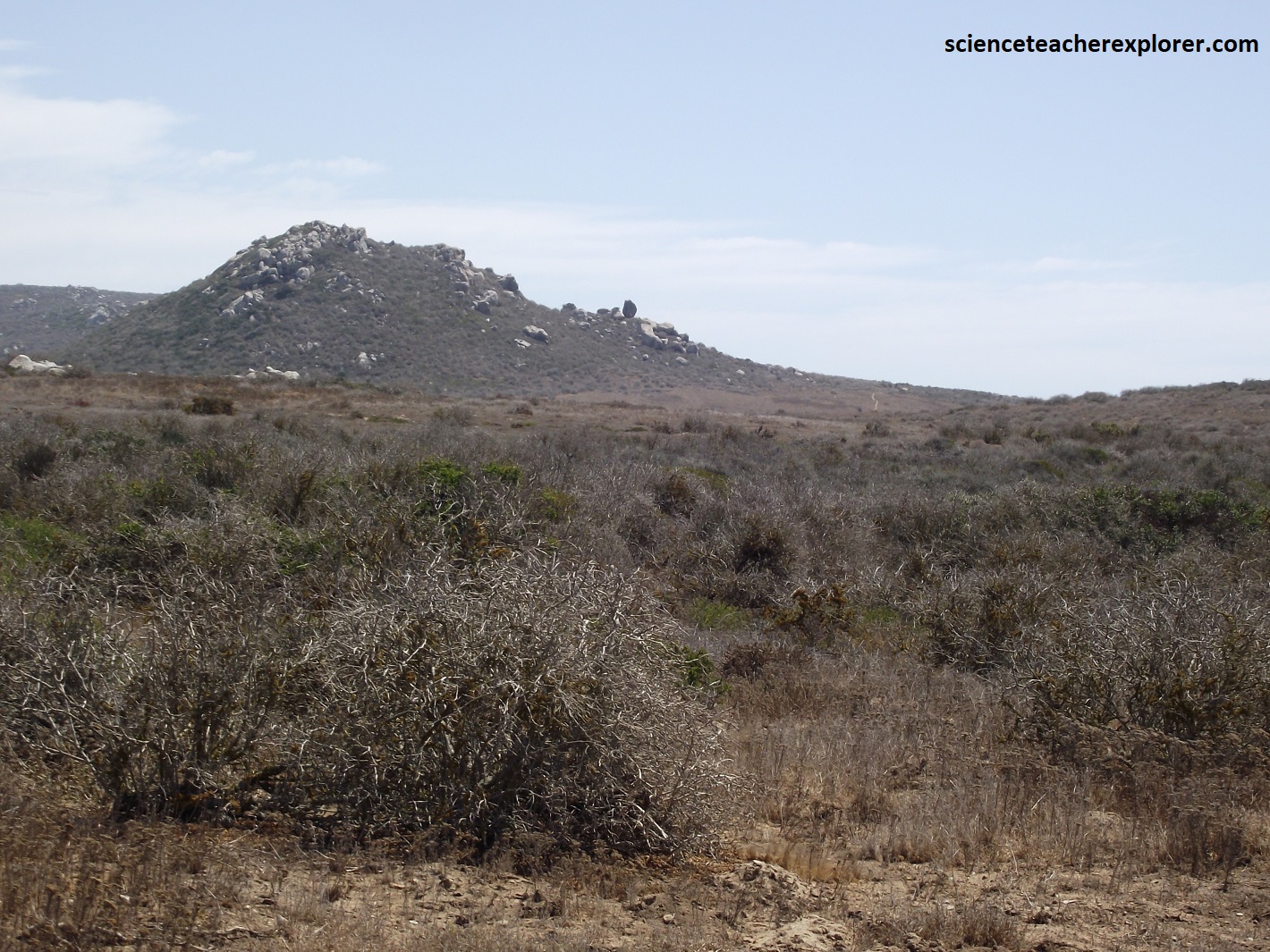
We approached the West Coast Fossil Park from, from Cape Town, by driving north on R307, and then northeast R45, (pictured below). Much of R307 was graveled & crossed the “Sandveld”. The “Sandveld is a narrow, sparsely populated strip between the west coast proper and the Swartland. The climate and vegetation were very similar to the west coast, and the economy seemed to be based on agriculture, especially cattle and sheep ranching and the cultivation of wheat; (pictured below).
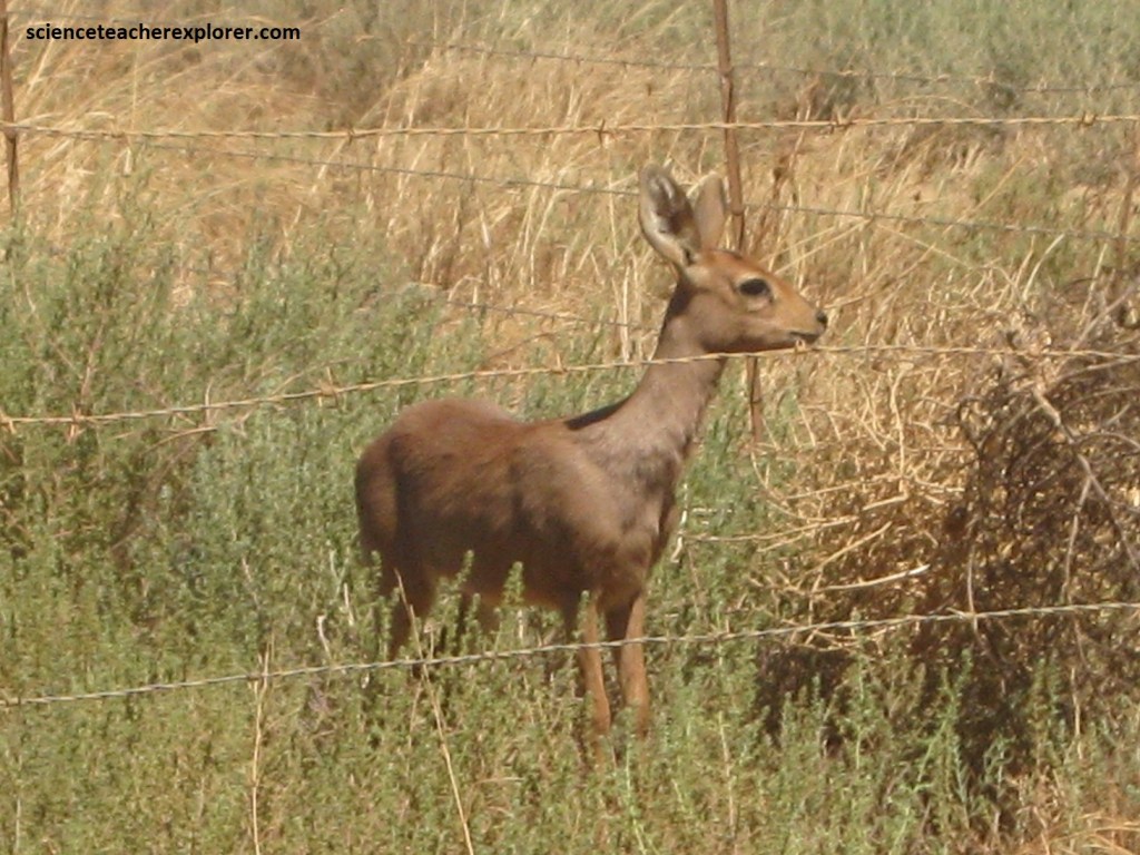
Along the way, we noticed a cute little Steenbok, (Raphicerus campestris), on the side of the graveled road. It was about 60cm high and large ears, (pictured below). These are rarely seen and we felt lucky to see one.
The West Coast Fossil Park is a world-renowned fossil site that has an abundance of exceptionally well-preserved fossils reflecting the incredible assemblage of life that flourished on Saldanha Bay about 5 million years ago. Actually it lies about 50m above sea level on a flat coastal terrace that is some 11km from the coast at Saldanha Bay.
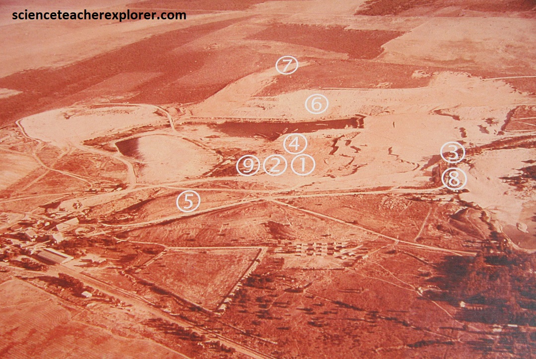
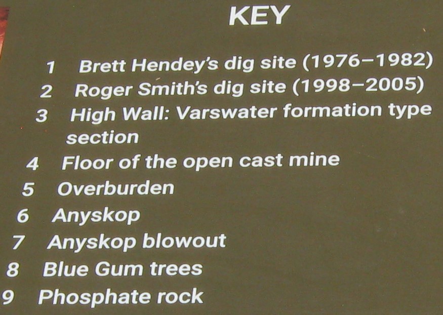
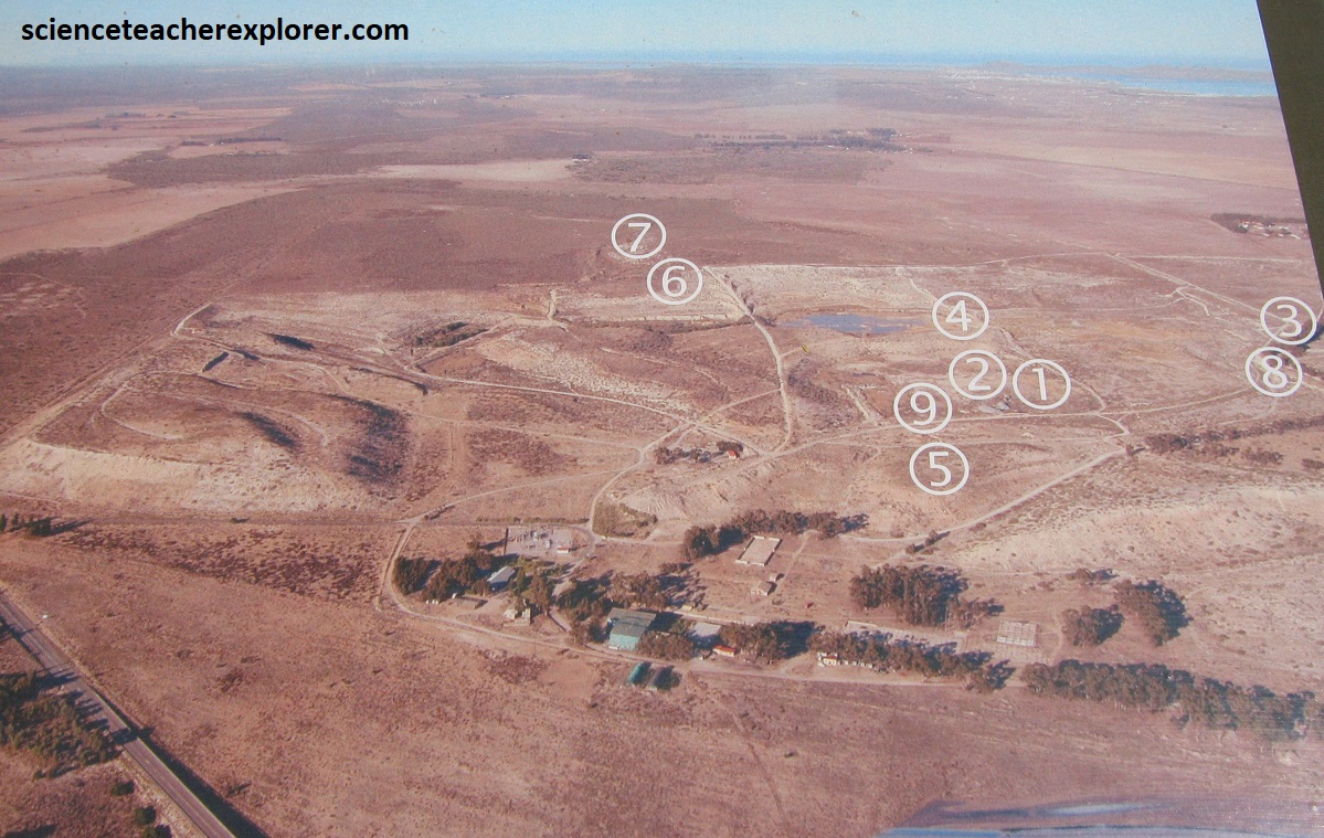
Fossil bones were first discovered here in 1958, but it was in 1976, during the course of phosphate mining operations, that an amazing fossil bone bed was uncovered, (pictured above are aerial photos of the phosphate mining operations in 1976 & 2003 that was taken from a interpretive sign on-site).
After the mine closed down n 1993, the Langebaanweg fossil site was declared a National Monument and is now a National Heritage Site. In 1998, it was incorporated into the West Coast Fossil Park, (pictured above).
Palaeontologist Dr. Brett Hendey of the South African Museum was allowed to rescue the bones of the Langebaanweg fossil site. He collected thousands of specimens and proved this ancient bone bed to be one of the richest and most diverse accumulations of animals of Early Pliocene age ever found to date. Over 200 different species have been discovered from three different quarries and there are still more to come. The mine and the museum have co-operated since fossils were discovered in the first quarry in 1958. Ongoing support for the West Coast Fossil Park from Iziko Museums and BHP Billiton mining company is gratefully acknowledged.
“Today, the south-western coast of South Africa is dry and windswept, the vegetation is stunted, and few wild animals inhabit the region. This is not always the case. The sediments of the West Coast Fossil Park, and the fossils they contain, which were exposed by the mining of phosphate, reveal periods of warmer temperatures, higher rainfall and lush vegetation, when animal life flourished in great abundance. During the last 5 million years, this wildlife paradise has been changed, mainly by cycles of climate change, and more recently, the the detrimental effects of human activity”, (Dr. G.B. Hendey; Palaeontologist quote).
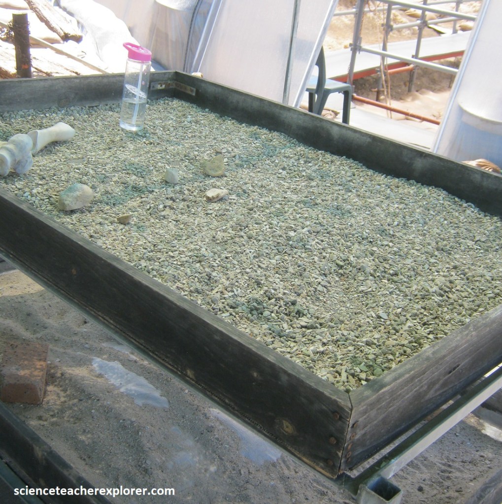
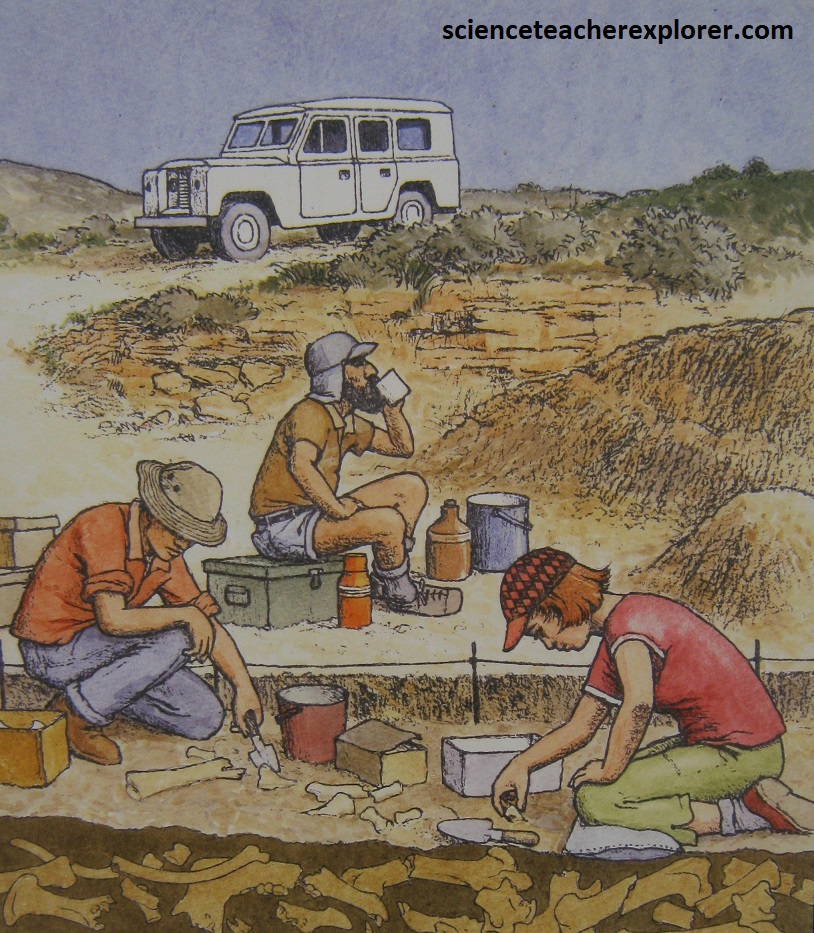
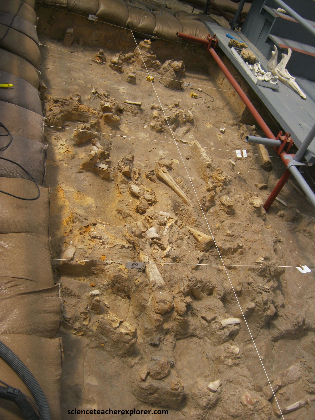
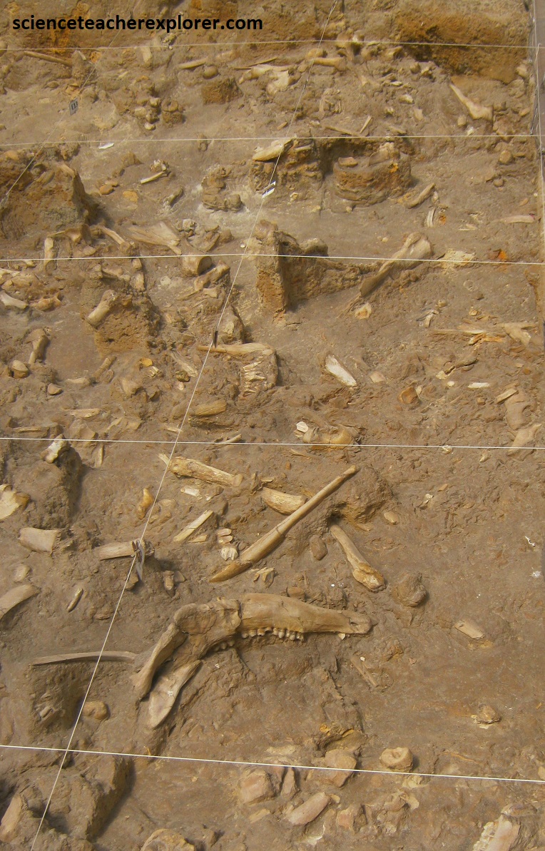
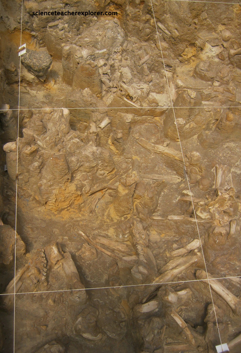
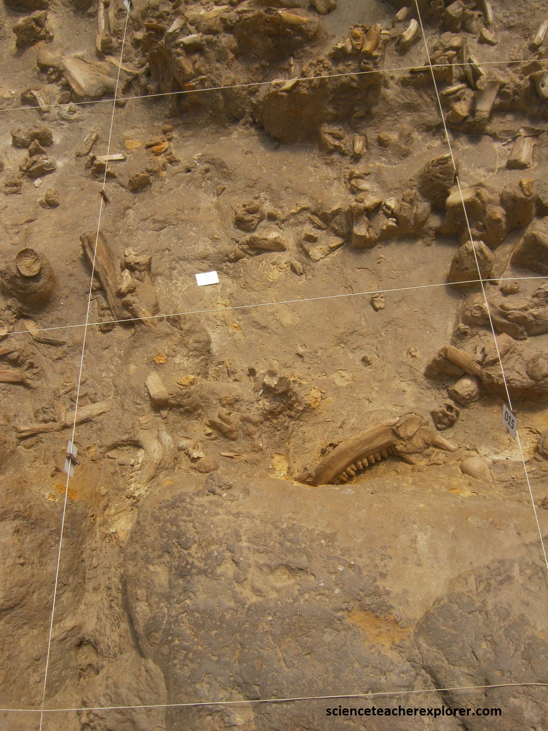
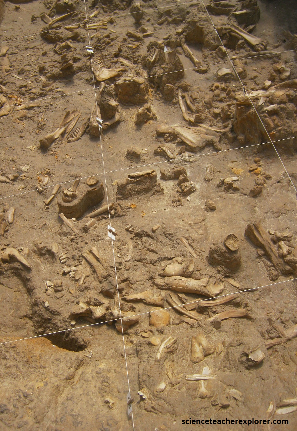
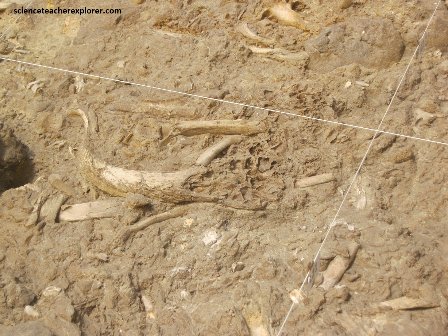
Picture above, employees look through gravel for micro-fossils at the outside sieves, where Mike and I were allowed to try our hand at fossil-seeking. Covered palaeontological dig sites and sorting areas are found on the north side of the old Varswater Quarry. The famous bone bed is under the tunnel cover, (pictured below).
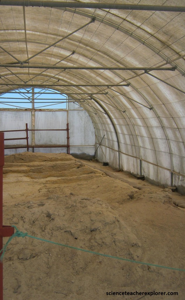
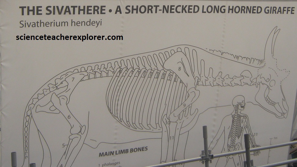
Inside the area covering the archaeological dig, showing part of the prolific fossil bone bed that was once a phosphate mine. Using walkways, we could go on the conducted tour of the site, with interpretive signs scattered around, telling the dramatic story. Pictured below are pictures of the famous fossil beds of hippo teeth, sivathere jaws, ossicone fragments and other misc. mammals of the time period of deposition.
The fossil park is located on the coastal plain along the Atlantic West Coast, a region that has repeatedly been subjected to changing sea levels during the Cenozoic Era.
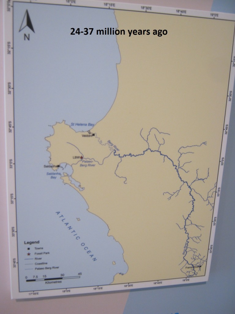
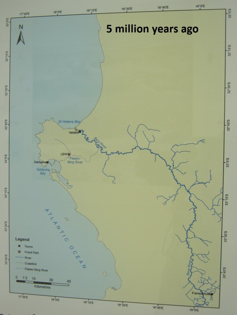
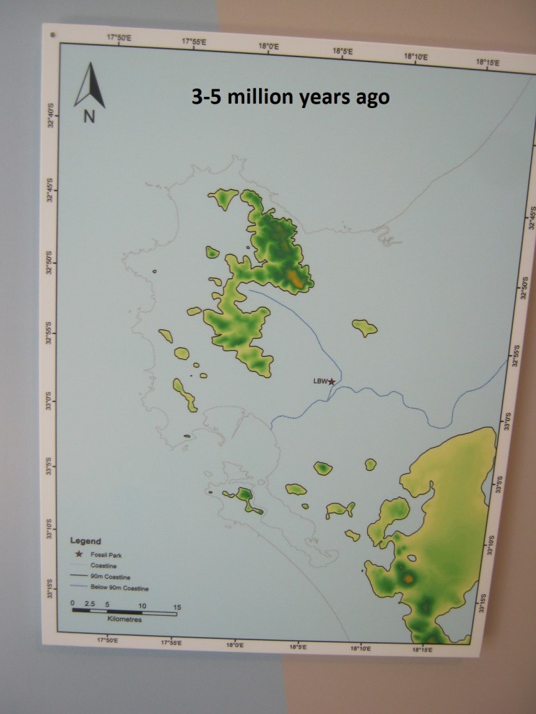
About 37 million years ago the sea that covered Langebaanweg and surrounding areas dramatically dropped several hundred meters below the present level. As water drained off the land it eroded a deep network of channels and valley into the bedrock. One of these channels, flowing southwards from the mountains through Langebaanweg and into the Atlantic Ocean, is know as the Palaeo-Berg River.
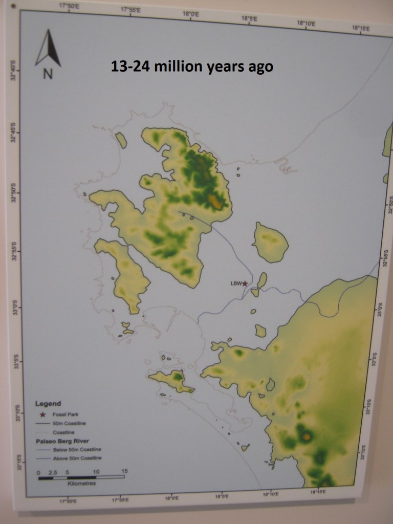
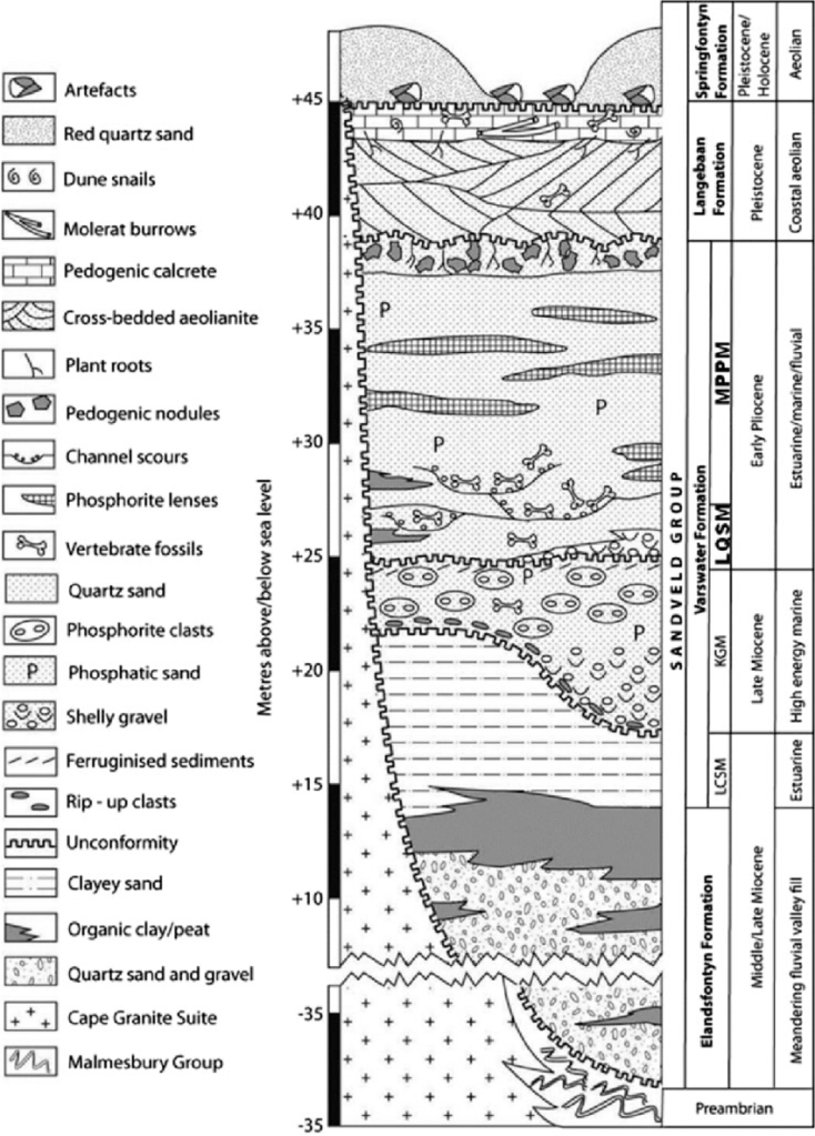
About 24 million years ago the sea began to rise again. By 20 million years ago it had reached its present level where it remained for several million years before rising again. By about 14 million years ago it had reached about 40m above the present level. As the sea rose the shoreline migrated closer to Langebaanweg. The river channels filled and spread, creating a wide shallow estuary with expansive sand flats flanked by well-vegetated marshes. Over time, the remains of the vegetation settled in thick peat and mud layers on the floor of the river channels and in the floodplain. These sediments are known as the Elandsfontyn Formation. Over time a thin layer of fine greyish-green phosphatic sand covered the thick muddy layer in the estuary and at the bottom of the river channel. This sediment is know today as the Varswater Langeenheid Clayey Sand Member.
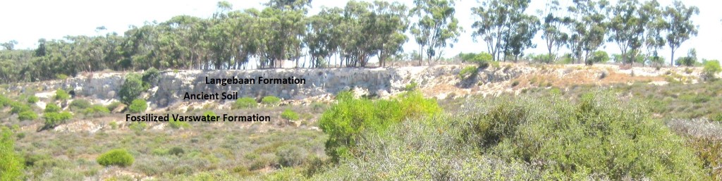
From the Middle Miocene to the Late Miocene, (13-7 million years ago), the sea covers the area around Langebaanweg. Until about 13 million years ago, Langebaanweg was inundated by sea. When the sea level began to drop once more, wave action ground down the phosphatic rock formed in earlier times, mixing it with animal remains to create a layer of shelly gravel. This sediment is known as the Varswater Konings Vlei Gravel Member.
Among the fossils found in this layer, are animals that lived in the sea, like mussels, and sharks, as well as those that lived on the land, like three-toed horses.

About 6.6 million years ago temperatures across the globe fell significantly. The volume of ice at the poles increased, causing sea levels to drop to well below the present level. Almost a million years later temperatures rose again, causing the polar ice sheet to melt and sea levels to rise. As the sea rose, low-lying areas were submerged, bringing the mouth of the Palaeo-Berg River close to Langebaanweg and turning the surrounding hills into islands.
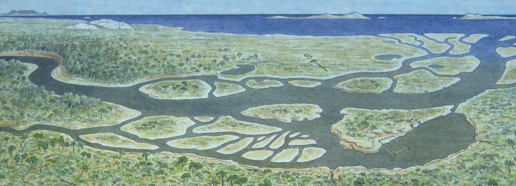
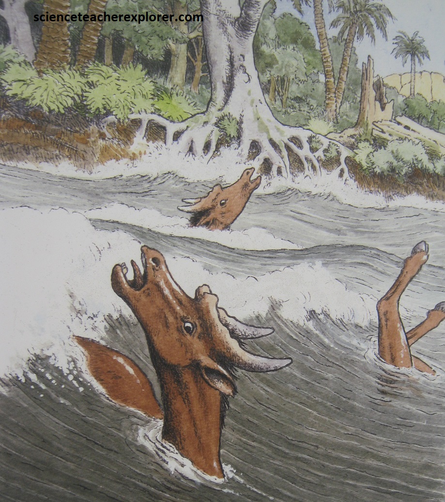
5 million years ago the Palaeo-Berg River once again began entering the sea close to Langebaanweg. Over-time, a sand bar built up at the mouth of the estuary, which sheltered it from the open sea. It is possible that the mouth of the river became completely closed off during periods of periodic drought and that the sand bar was breached during flood events. As a result, the remains of thousands of animals accumulated in the river channels, inter-tidal mudflats, salt marsh and floodplain, where they were preserved in layers of sand. This sediment is know as the Varswater Quartrose Sand Member.
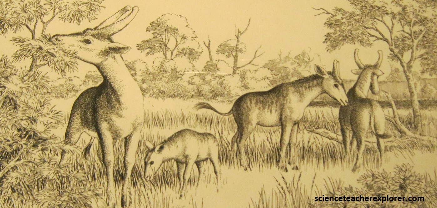
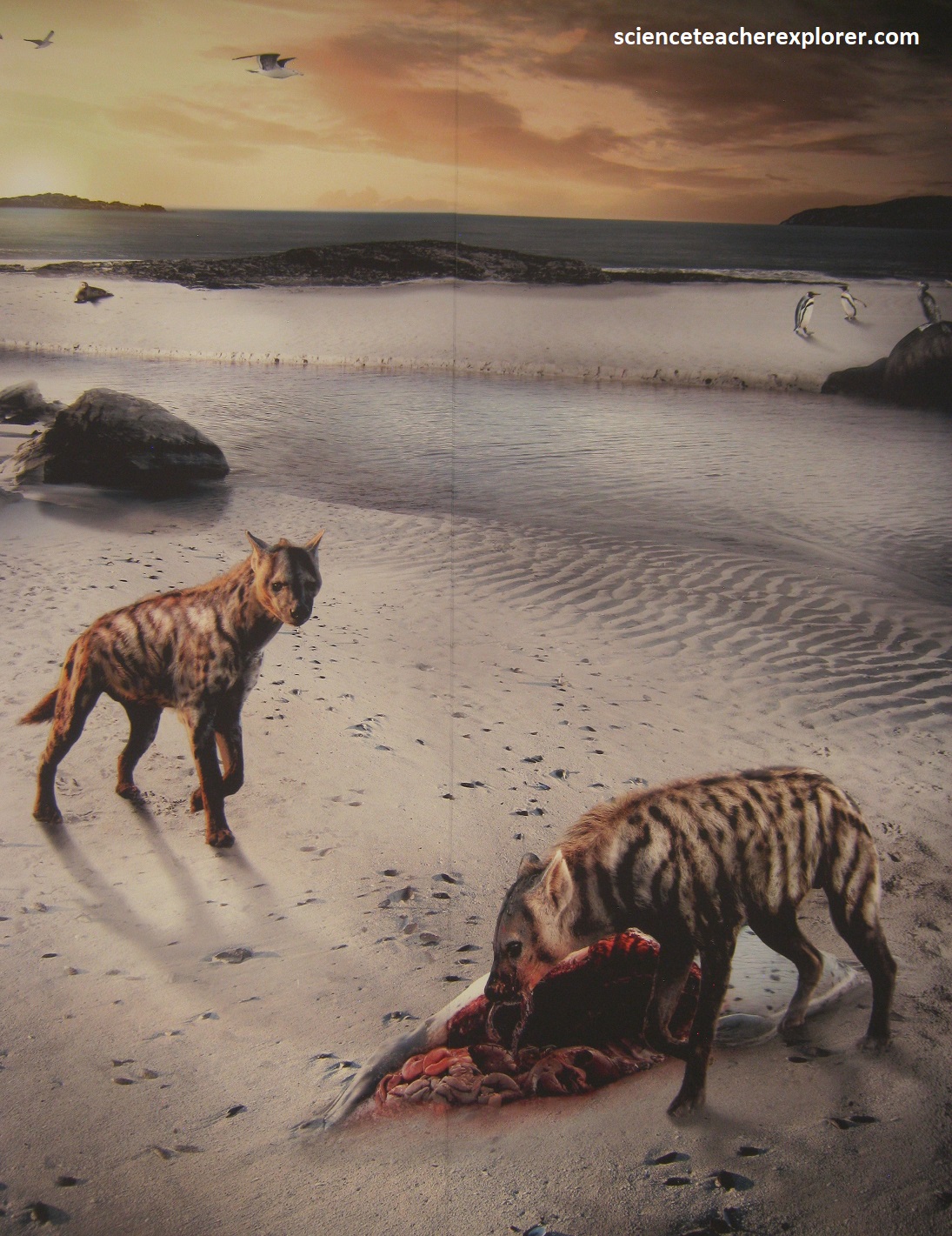
Some of the fossils in Varswater Quartrose Sand Member layer are saber-toothed cats, three toed horse, giant pigs and short-necked giraffe, seal and penguin species, ancient relative of modern animals like elephant pangolin, mongooses, antelopes, reptiles and amphibians; and animals that have remained almost unchanged over the last 5 million years, like the aardvark. The birds include spurfowl, ducks, geese, waders and shorebirds.
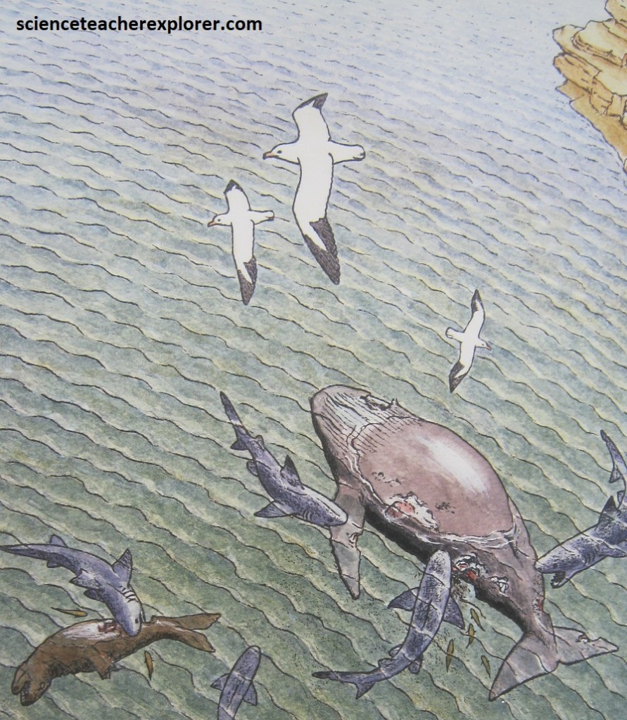
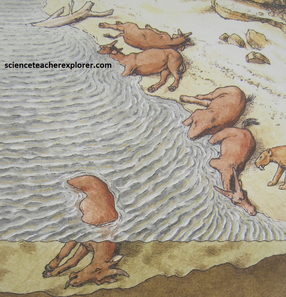
As the sea level continued to rise, a thick layer of phosphate-rich sand covered the animal remains deposited in the estuary. The fossil-rich sediment that built up during this time is known today as the Varswater Muishond Fontein Pelletal Phosphorite Member. The diversity of fossils found in the estuary suggests that some animals died of natural causes, old age, predation or disease, while large groups of others died as a result of catastrophic floods (e.g. the sivathere). It is likely that animals which died upstream or on the floodplain were carried downstream into the estuary during periods of heavy rain, and that some marine animals were washed into the estuary by onshore winds and storm surges.
By about 4.8 million years ago the sea had risen to about 90m above its present level. Although it rose and fell regularly during subsequent years it never again reached this peak.
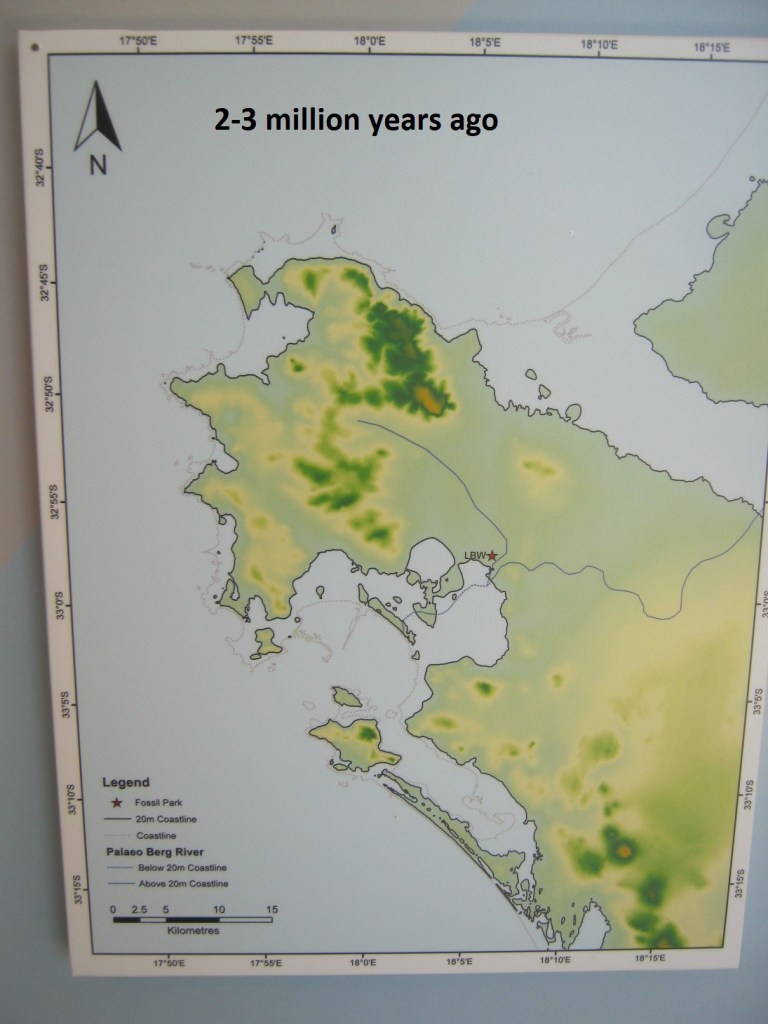
By 2.7 million years ago the sea had dropped to about 18m above it’s present level. As sea levels dropped, wind action along the beaches created a series of dunes that shifted with the coastline and remain as a thick layer of calcified sand known as the Langebaan Formation. Among the fossils found in the Langebaan Formation are dune snails and tortoises.
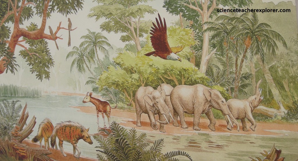
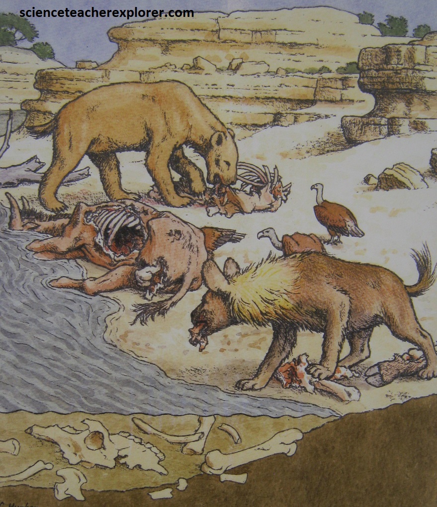
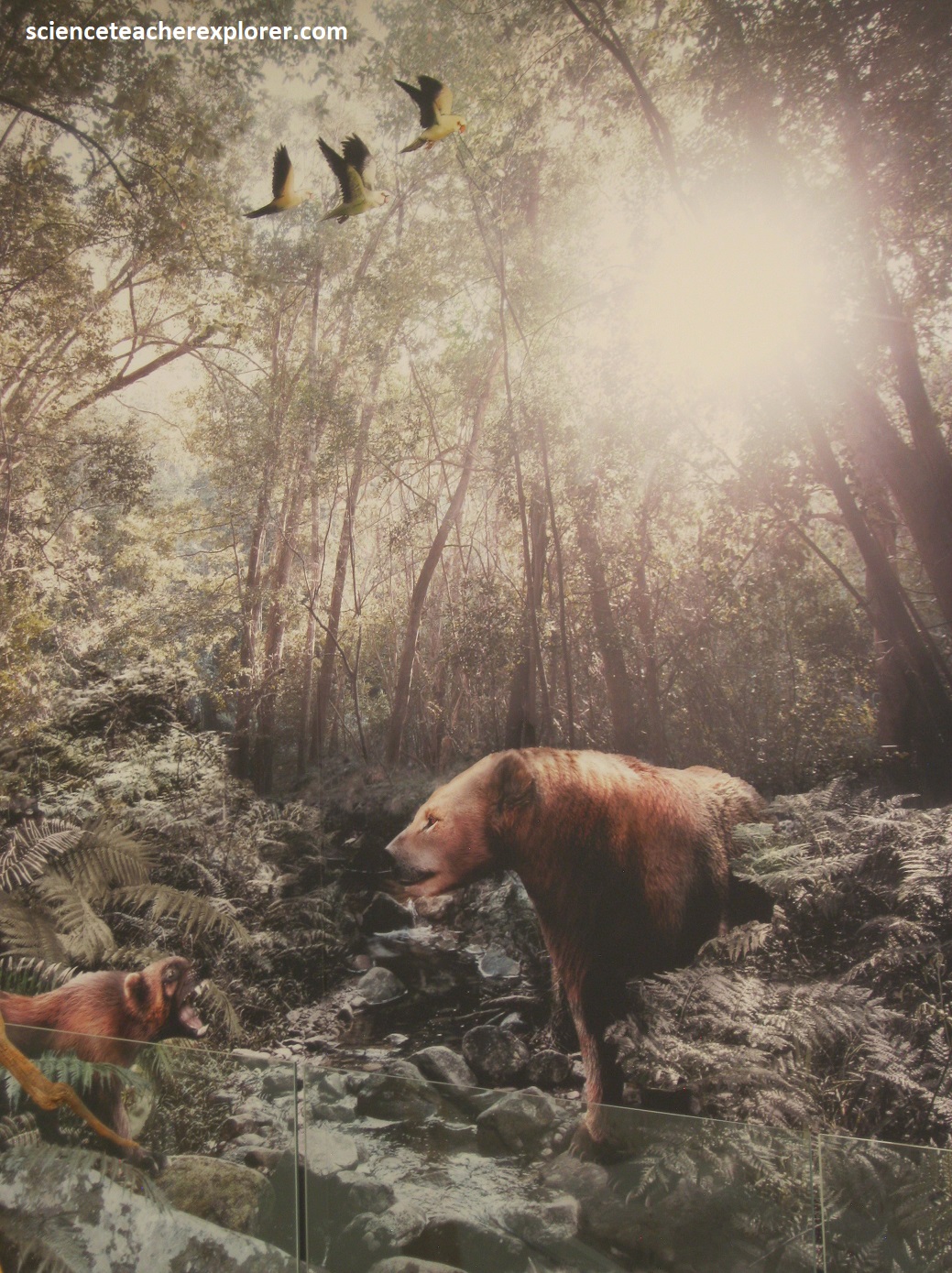
In conclusion, the West Coast Fossil Park National Heritage Site is thinly blanketed by young sedimentary rocks of the Sandveld Group, deposited from Oligocene to Quarternary times, from 37 million to less than 1 million years ago. The fossil deposits are Pliocene in age, around 5.2 million years old. Millions of tons of phosphate-rich rock were mined to produce agricultural fertilizer from the then Varswater Quarry. The countless fossils occur mainly within an exceptionally rich layer of jumbled bones; the lack of any complete animal skeletons suggests the area was subjected to catastrophic floods. During these flash floods many of the larger animals living on the swampy coastal plain, notably hundreds of the extinct-sivathere, were drowned by flood waters. {Note that the sivathere was the ancestor of the present-day giraffe}. Animal bodies were carried downstream to the estuary where they became beached or trapped against rock outcrops. Carcasses were scavenged by flesh-eaters such as hyaena and bears, and bones accumulated in the deeper water and at the river’s edge, where they were broken and trampled in the wet sand, (imaged below from an artist’s rendition on interpretive signs on-site).
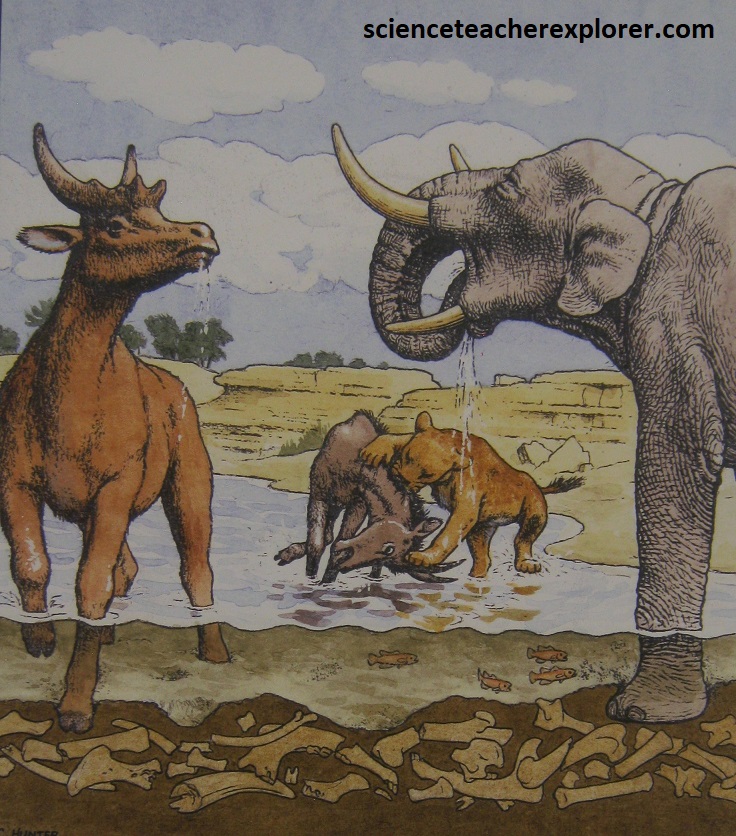
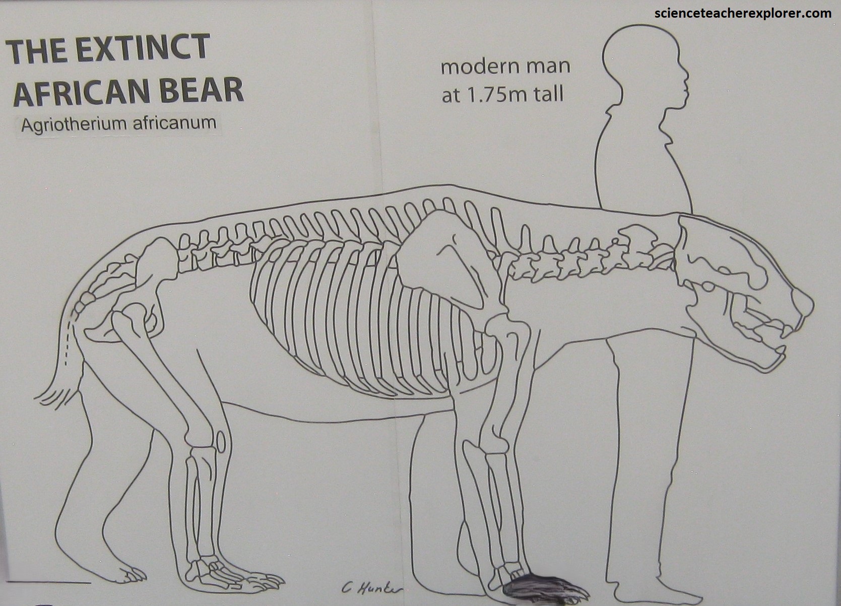
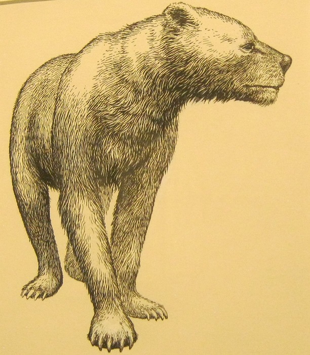
What I found interesting were the abundant neogene-fossils of the northern hemisphere. Apparently, the multitude drops in sea-level coupled with an uplift of land in North Africa separated the Mediterranean Sea from the Atlantic Ocean. The straits of Gibraltar closed during these times and the Mediterranean dried up. This created a land-bridge that made it possible for animals to move freely between Eurasia and Africa. Such events can be linked to the arrival of the extinct bear (Agriotherium africanum), wolverine and saber-toothed cat (Amphimachairodus species) at Langebaanweg, (fossils found there; images below are taken from interpretive signs on-site).
The vast number of fossils recovered at Langebaanweg to date make it one of the most valuable collections of its kind in the world. The remains of mammals, reptiles, birds, amphibian, fish and invertebrates that lived on land or in water have been found. Only a small part of the remaining “E” Quarry deposit has been excavated so far, so the work of finding new sites, excavating, sorting, identifying and analyzing new material is ongoing. Langebaanweg has attracted the attention of leading scientists and researchers. The discovery of new material and the development of more sophisticated methods of investigation are making our knowledge increasingly deep and more accurate.
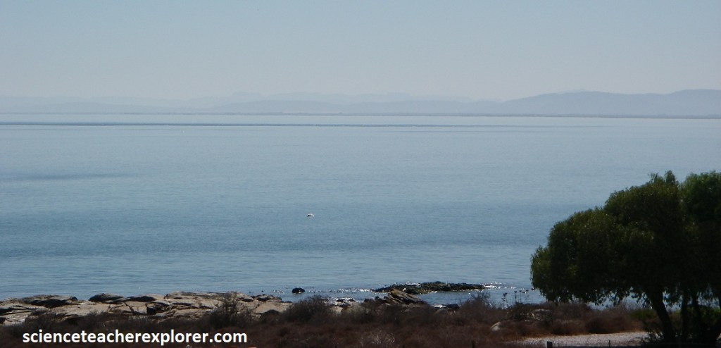
After leaving our exploratory visit to the West Coast Fossil Park, we drove north on R27 to stay the night on St. Helena Bay. This bay, the largest on the west coast and the center of the South African commercial fishing industry, was given its name by Portuguese navigator Vasco da Gama, who anchored his four ships here on Nov. 7th, 1497, the day of St. Helena. {Actually, da Gama was wounded here from a skirmish with a group of indigenous Khoikhoi}. Our next exploration-trek was the West Coast National Park to the south.
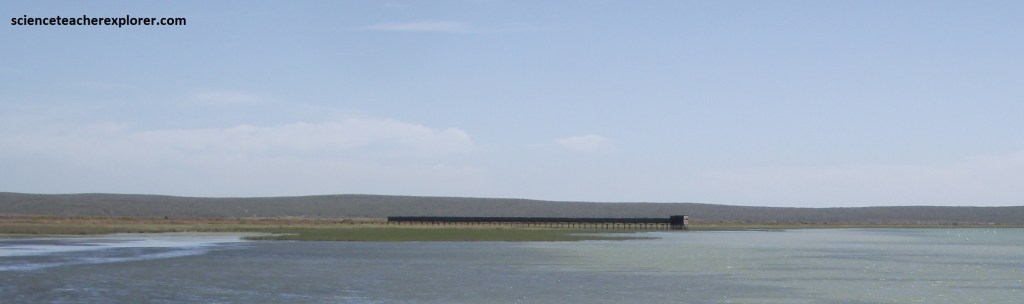
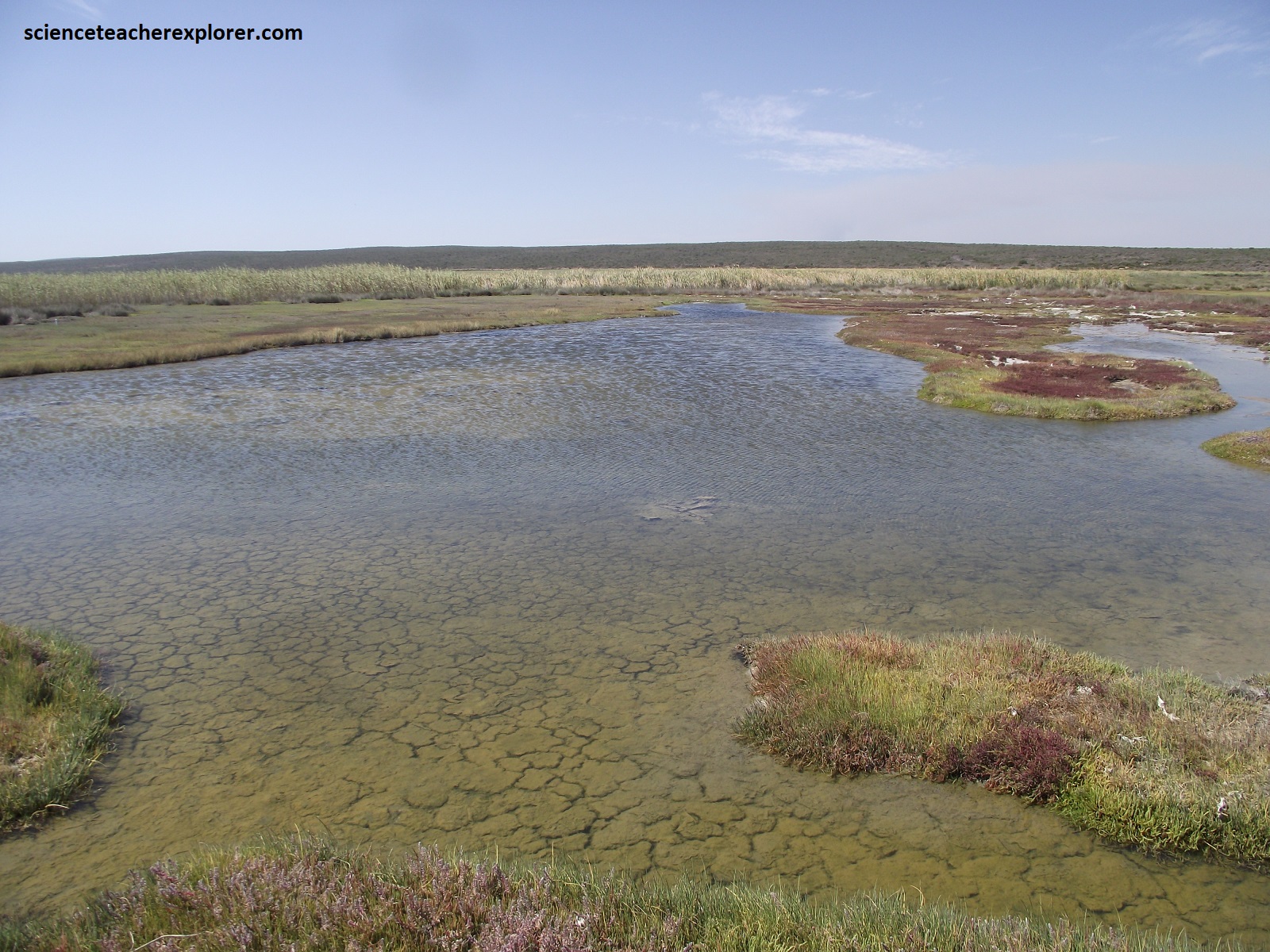
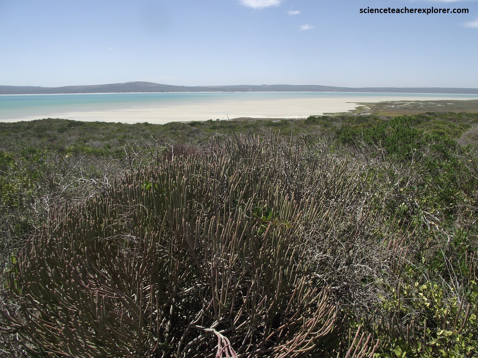
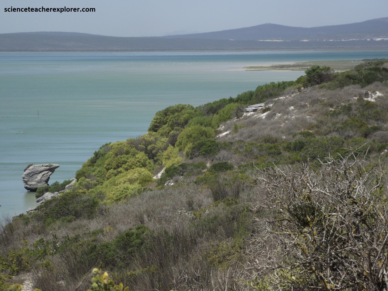
Registered as a wetland under the international Ramsar Convention, Langebaan lagoon of the West Coast National Park is the richest lagoon in South Africa, supporting some 60,000 birds of at least 23 species, of which the most common are cormorants, gulls, sandpipers, plovers, gannets and flamingos. The lagoon, no more than 6m deep and about 10 degree Celsius warmer than the bay, is home to many fish and food-rich mudbanks, which are exposed when the tide is out.
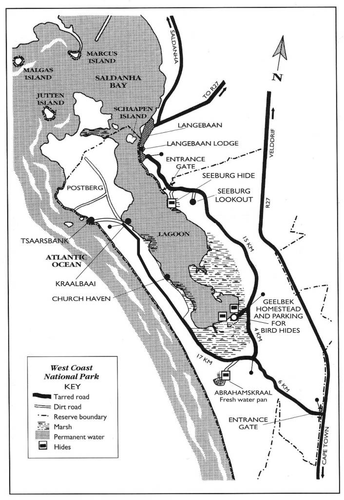
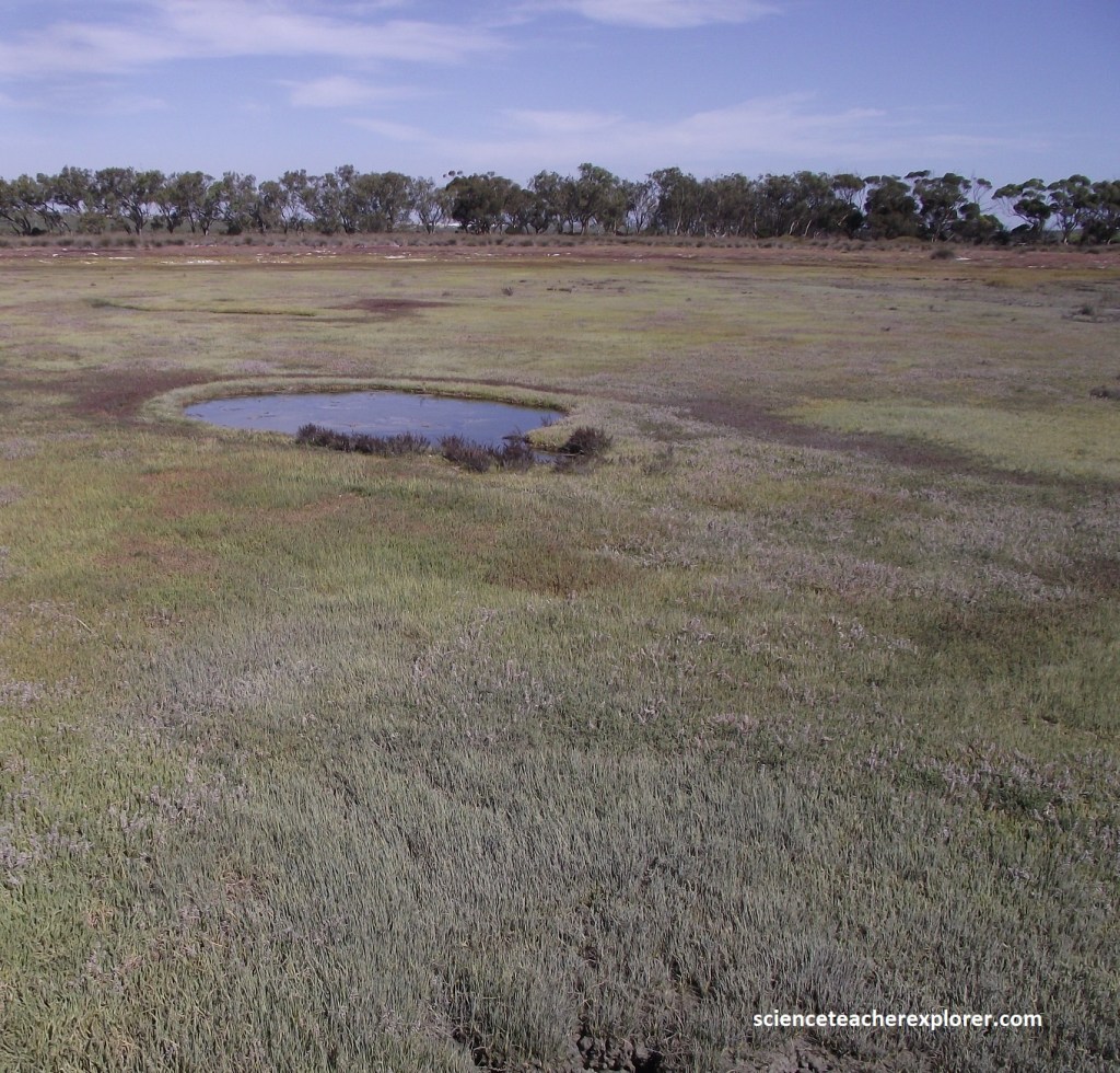
Our first stop, after entering the northeastern entrance of the West Coast National Park, was the Seeburg Hide. We immediately, noticed this Crowned Plover, (Vanellus coronatus), next to the boardwalk in the Glasswort. It had a black cap encircling its head without the banding on it’s chest. The Glasswort, (Sarcocornia perennis), grows low on the salt marsh and is a sprawling, perennial succulent. Its stems are jointed with no apparent leaves and tiny flowers.
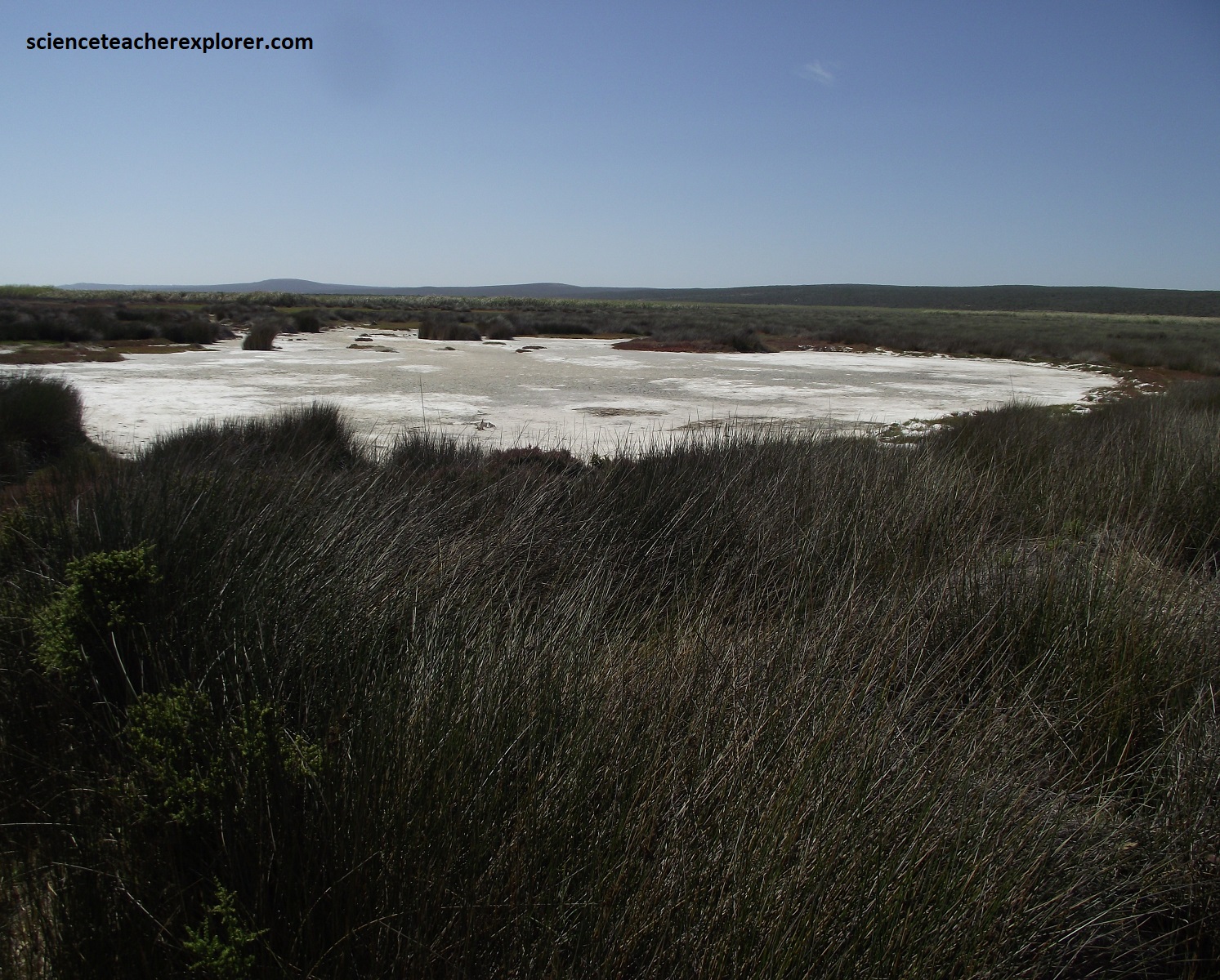
Twice a day, during spring high tide, the salt marshes are flooded with water that has been depleted of plankton by the invertebrates, but is rich in nitrates. The plants that can survive here are adapted to a saline water experience. Most have a sprawling, low-growing habit and succulent or reduced leaves to minimize water loss. Wort and arrow grass are found at the highest level and therefore are adapted to a harsh environment in the sun, (pictured below).
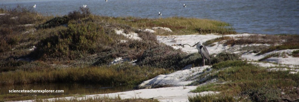
Pictured below is a flock of the African Black Oystercatcher. This bird has a world population of less than 7,000 and here are an entire flock of them.
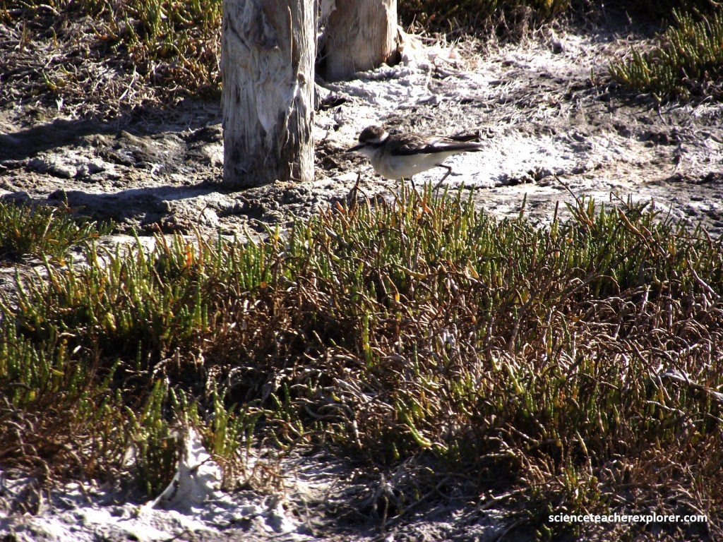
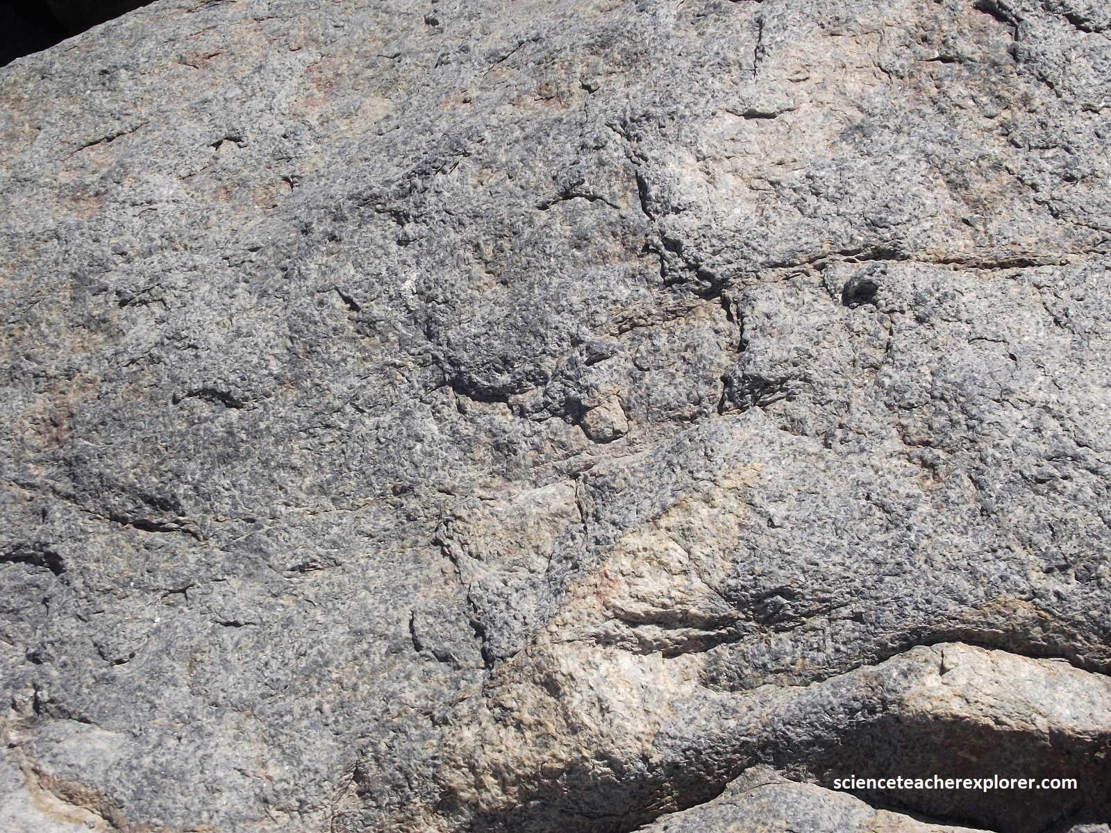
As we drove south in the West Coast National Park, our next stop was the “Seeburg Lookout”. It was immediately apparent that Seeburg Lookout was composed of Cape Granite, (pictured below).
The Seeburg viewpoint is located on exposures of the course-grained, porphyritic Seeburg Granite, (part of the Cape Granite), along the north-eastern shores of Langebaan Lagoon. the granite crystallized deep within the crust at the beginning of the Cambrian Period some 540 million years, (uranium-lead radiometric dating), ago.
560 million years ago the Western Cape was a slowly sinking trough off the coast of the land mass that became the central part of South Africa. For about 20 million years rivers flowing off this land mass washed sand and silt and mud into the trough which built up into a great thickness of sediment, (imaged below).
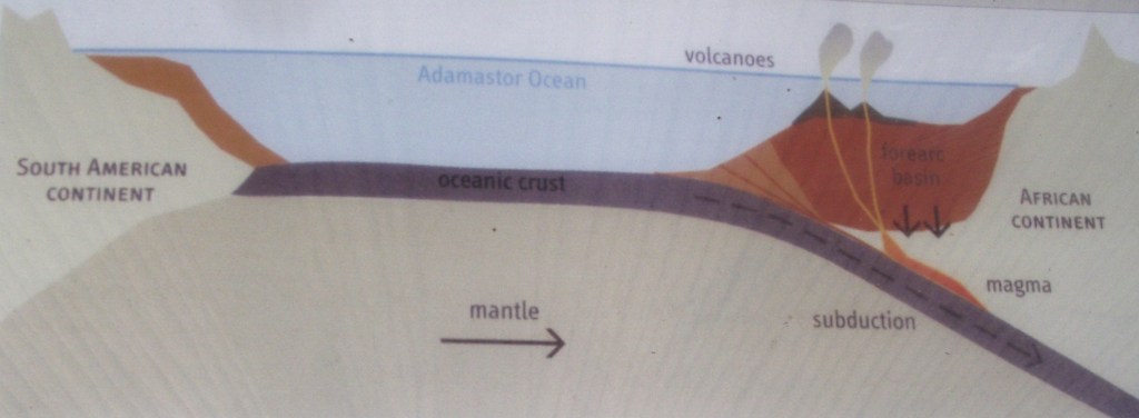
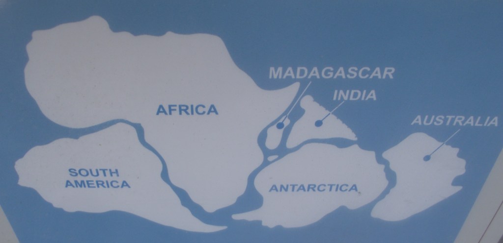
The period of sedimentation ended about 540 million years ago when the African and the South American crustal plates drifted together during the formation of the Gondwana super continent, (pictured below).
Huge forces were produced in this continental collision, folding and fracturing the sedimentary rocks as the trough closed up, and pushing them up into a great mountain chain. Extremes of heat and pressures altered the mineral composition of the sediments changing them into metamorphic rocks, which are now known as the Malmesbury Group, (pictured below).
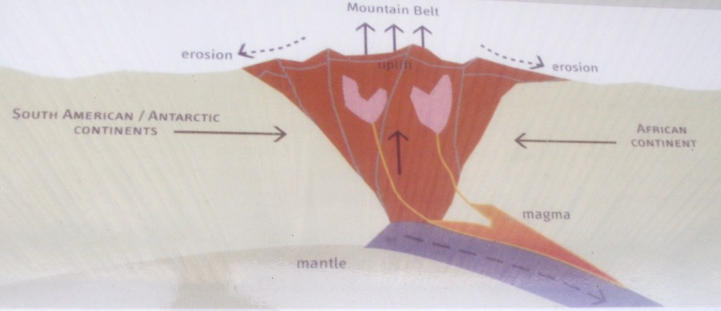
Imaged above, the temperatures at great depth in the collision zone, (more than 10km down), reached the melting point of the rocks in places, (more than 9000C) producing liquid magma which was squeezed (intruded) into weak localities within the deformed sedimentary pile. The magma eventually cooled and crystallized into a suite of igneous rock called the Cape Granite. Where they occur at the modern day land surface, Malmesbury rocks are quite soft and erode relatively easily forming valleys and low ling areas without prominent outcrops, but they are thought to underlie much of the Langebaan Lagoon and the low-lying areas. The Cape Granites, on the other hand, are hard and resistant and form high ground and hills, often with bare, exposed, rounded outcrops.
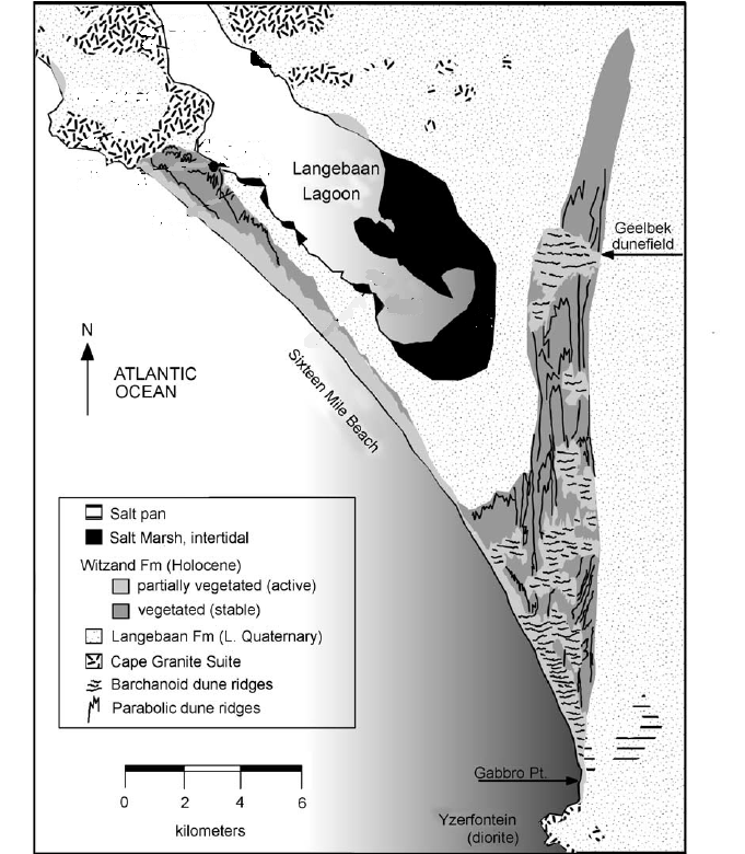
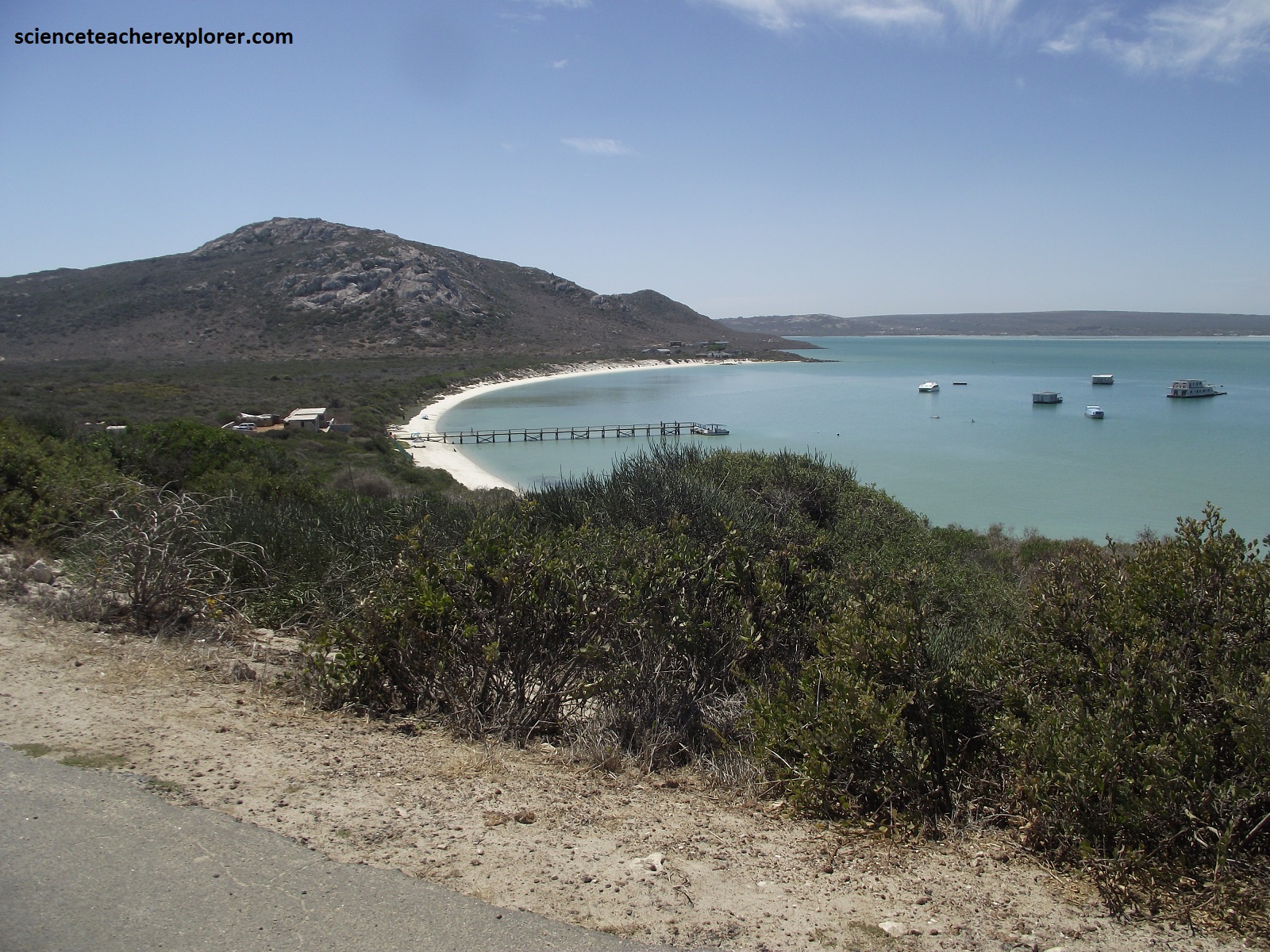
Imaged above, within the West Coast National Park, the Cape Granites form the bold ridges of the Postberg, (pictured later), and Seeburg Overlook. They also crop out along the Atlantic shore from Kraalbaai to the northern tip of the Postberg (Langebaan) Peninsula, (pictured below).
Pictured below, at the Seeburg Overlook, we found the Southern Black Korhaan (Eupodolis afra). This common resident in coastal fynbos is closely related to the bustards. This male had a white cheek on his black face and was seen dangling its legs and parachuting to the ground when displaying his plumage.
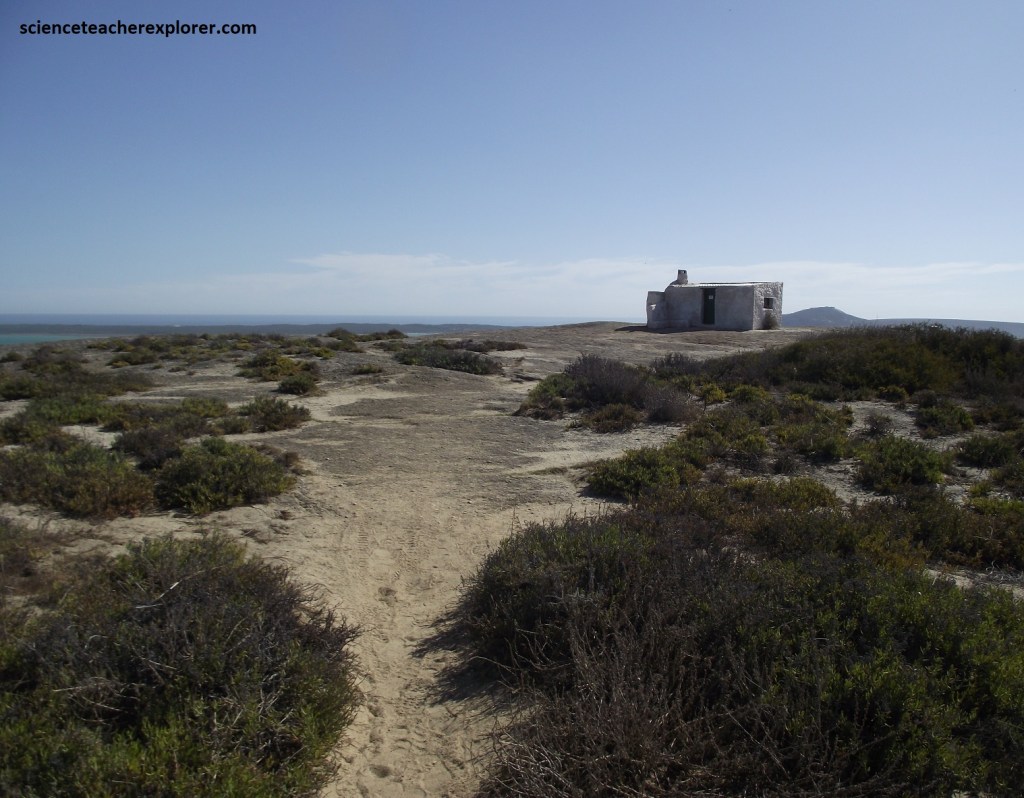
We continued driving south, to the Geelbek Bird Hides & Homestead, (pictured below).
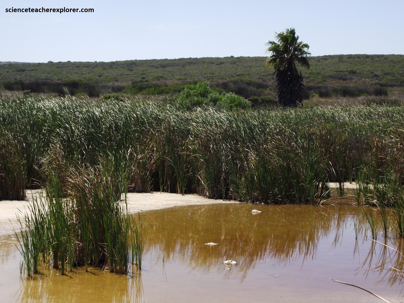
While walking on the boardwalk, out to the Bird Hide, I noticed and outlet to an underground spring, (pictured below). Langebaan Lagoon is the only true saltwater lagoon in South Africa, and yet I find freshwater reeds and rushes, throwing a sharp contrasting border along the salt marsh area at the southern tip of the lagoon at the Geelbek Bird Hide. Apparently, the Langebaanweg and Elandsfontein aquifers run underneath parts of the West Coast National Park; feeding these fresh water plants in a relatively hostile environment. [Note: The Langebaanweg aquifer is said to be around 20,000 years old and is joined to the Elandsfontein aquifer by a paleochannel and the so-called Colenso fault.]
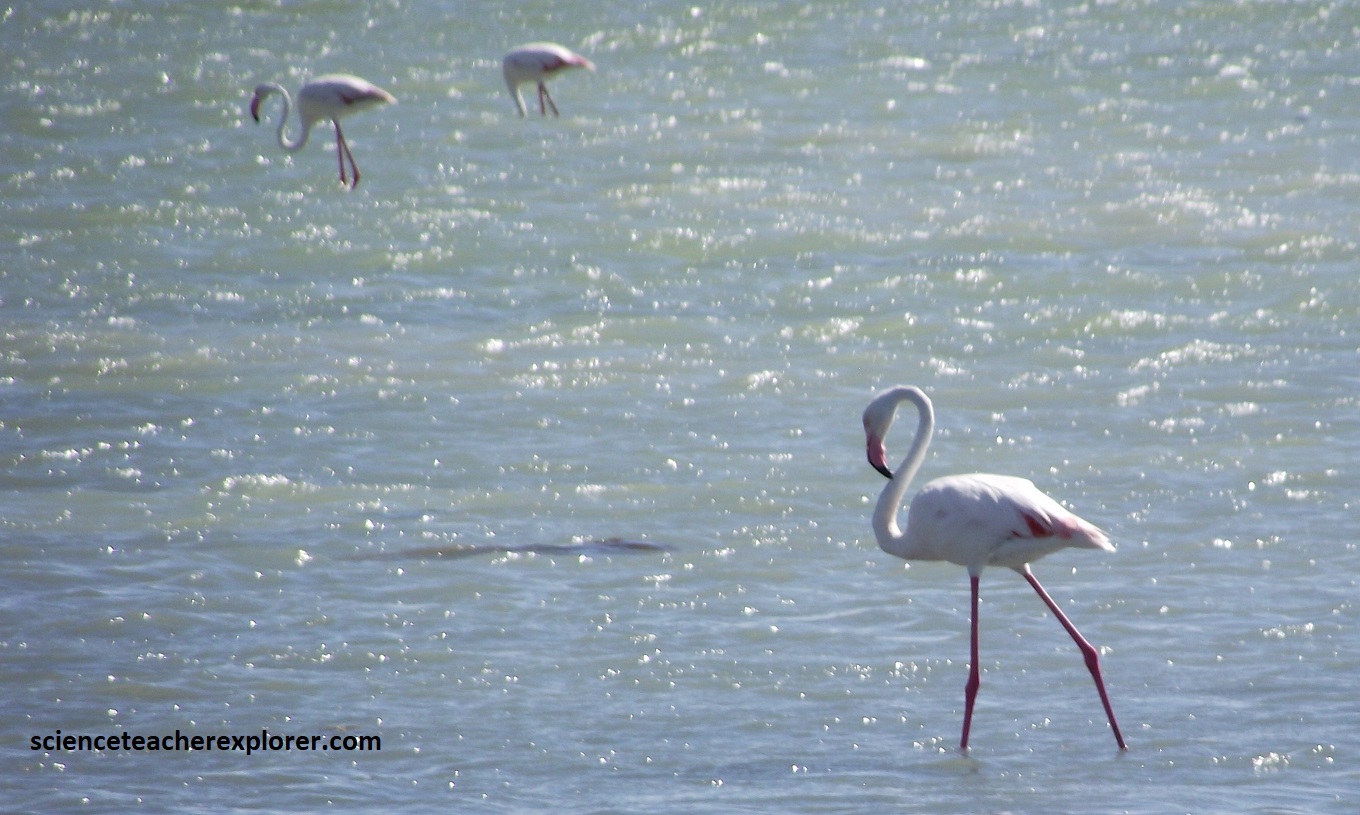
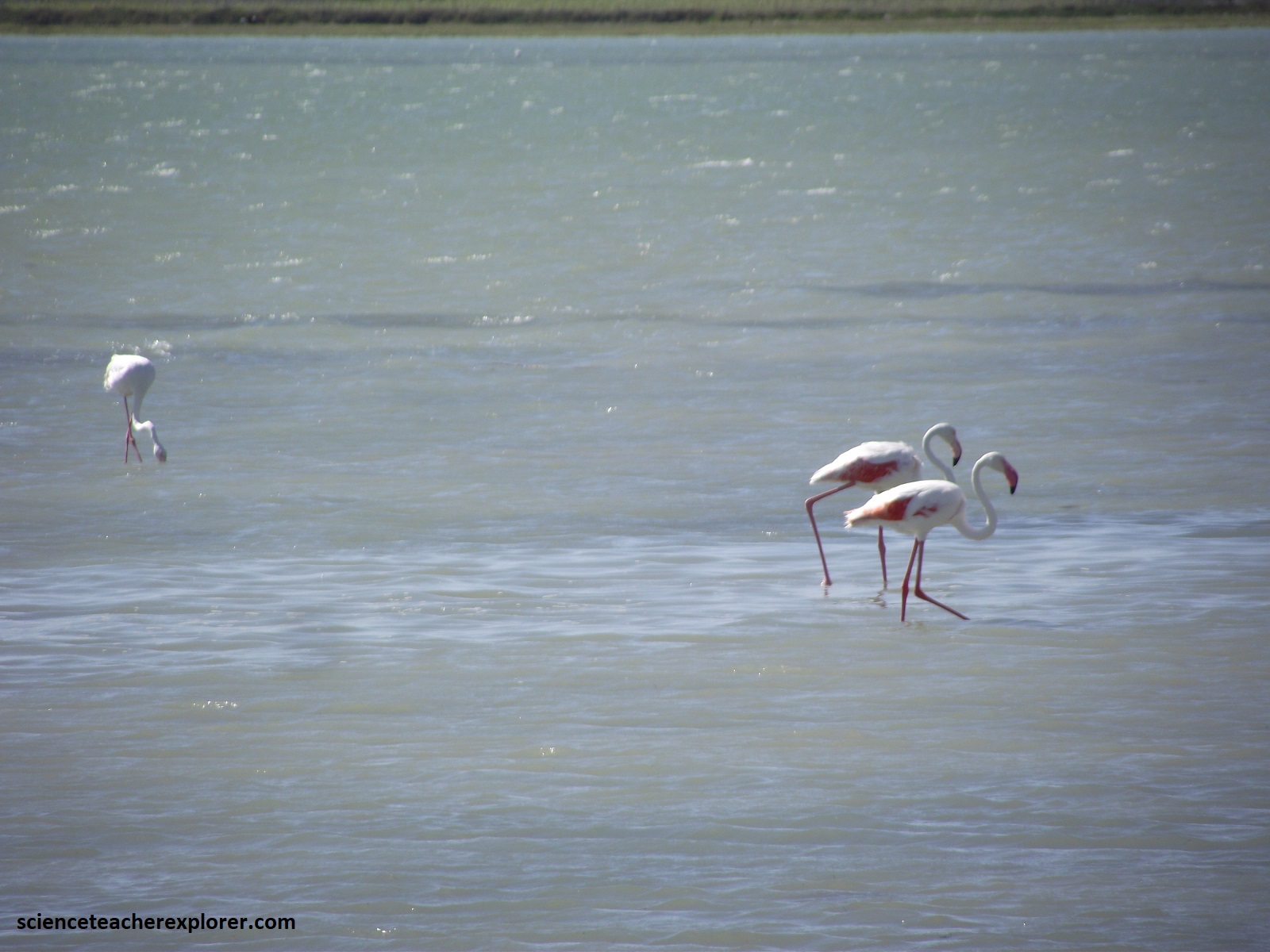
Pictured below, are pictures of the “Greater Flamingo” Phoenicopterus ruber, at the Geelbek Bird-Hide. The “Greater Flamingo” has a light pink bill and is highly gregarious. It will not breed unless large number of flamingos are present. An elaborate group courtship display is sometimes performed that involves synchronized wing raising, preening, marching and head turning.
In the area east of Saldanha Bay several poorly consilidated formations were deposited on the uneven basement of Cape Granite at Langebaan. These young rocks of variable origin formed during a series of major marine transgressions and regressions during the Tertiary, and the area is well known for a variety of fossils of Miocene-Pliocene age, (mentioned above).
The microtidal (tidal variation less than 2m) lagoon has developed since the closing of the Kraalbaai inlet, around 2,000 years ago, when sea level fell to its present level. The subtidal channels shallow from a depth of 17m beside Langebaan towards Geelbek in the south, where they are flanked by wave-rippled intertidal sand-flats that are intensively burrowed by by sand prawns. The elevated supratidal salt marshes are cut by sinuous drainage channels and host a rich carpet of multi-colored, salt-loving succulent vegetation. At high tide, the subtidal channels appear dark blue, whereas the intertidal zone has a turquoise hue, (pictured below).
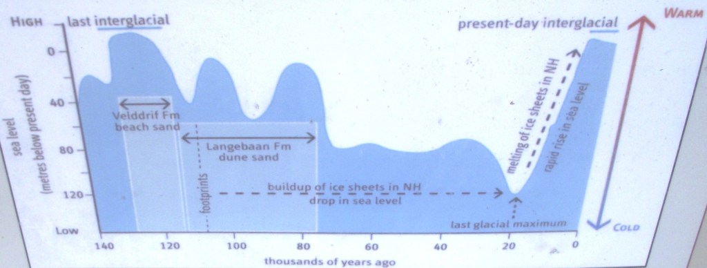
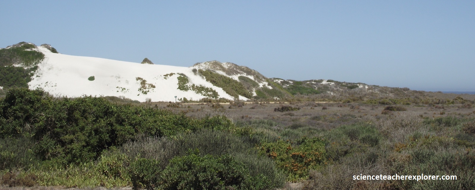
As we were leaving the Geelbek parking-lot at the homestead, we could see the modern mobile sand dunes east of Geelbek in the distance; moving north at an average rate of about 8m/year. This dune system to the east of Geelbek formed over the past 200,000 years. During dry periods corresponding to peaks of the last ice age, the sea level dropped by as much as 120m and the shoreline migrated westwards up to 20km from its present position. these conditions created an abundant sand supply which was driven northwards by the prevailing strong southerly winds in a series of dune phases. {Note that the deflation areas between the dunes the wind ha stripped the sand from the hard calcrete substrate, leaving behind a gravelly concentration on the surface that contains human artefacts}.
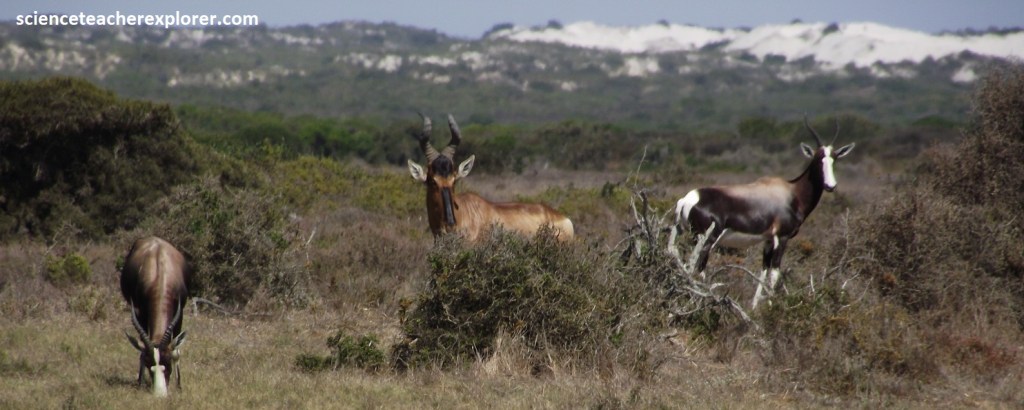
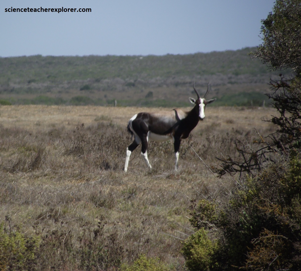
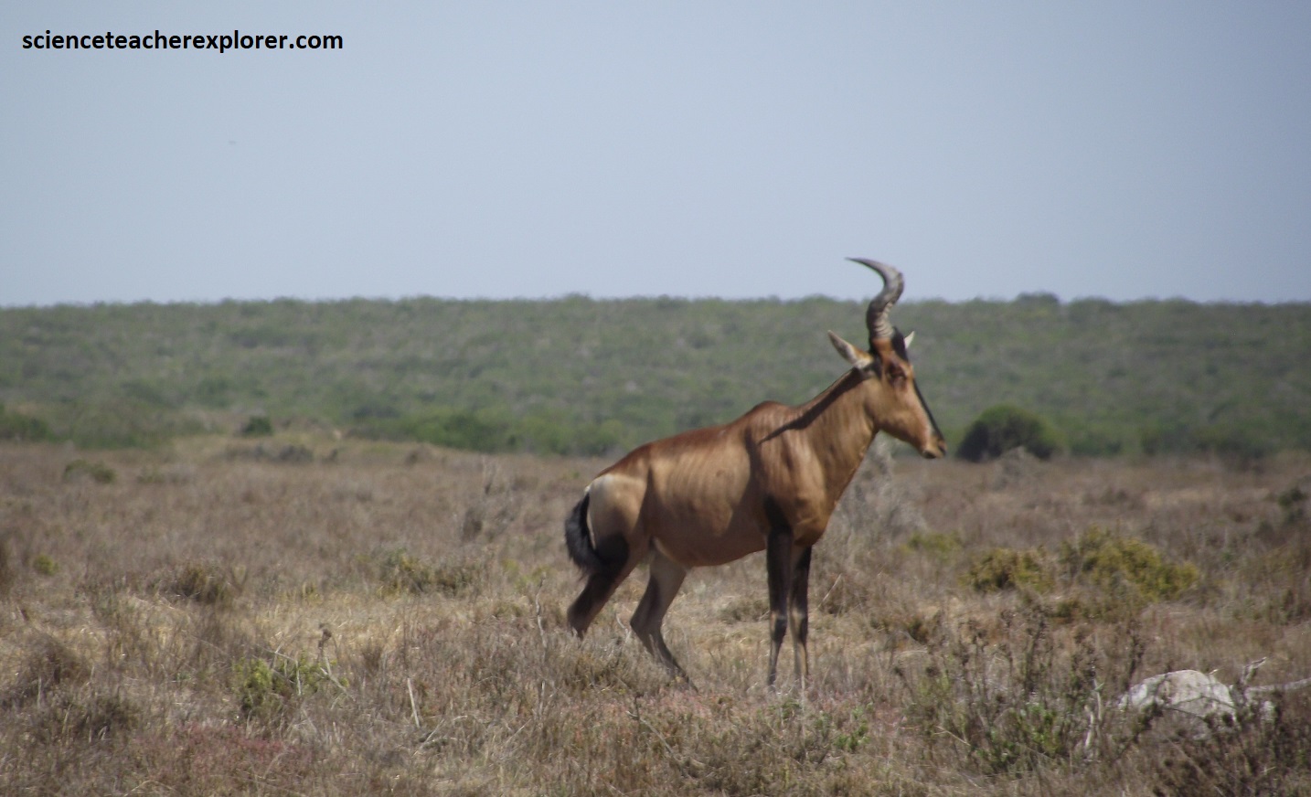
Pictured above and below, the white facial blaze is distinctive for the Bontebok,(Damaliscus pygargus). The Bontebok is similar to the Blesbok. However, the Bontebok has a darker coat and a prominent white rump patch. The Red Hartebeest Alcelaphus buselaphus is red-brown in color with dark marks on the upper legs and snout. This is also similar with the Lichtenstein’s Hartebeest, but with the black markings.
From Geelbek Homestead, we took the fork and drove north on the western side of the lagoon. Our first stop was Abrahamskraal, (pictured below).
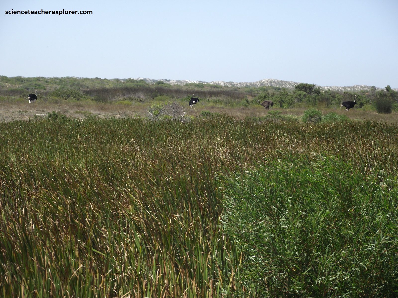
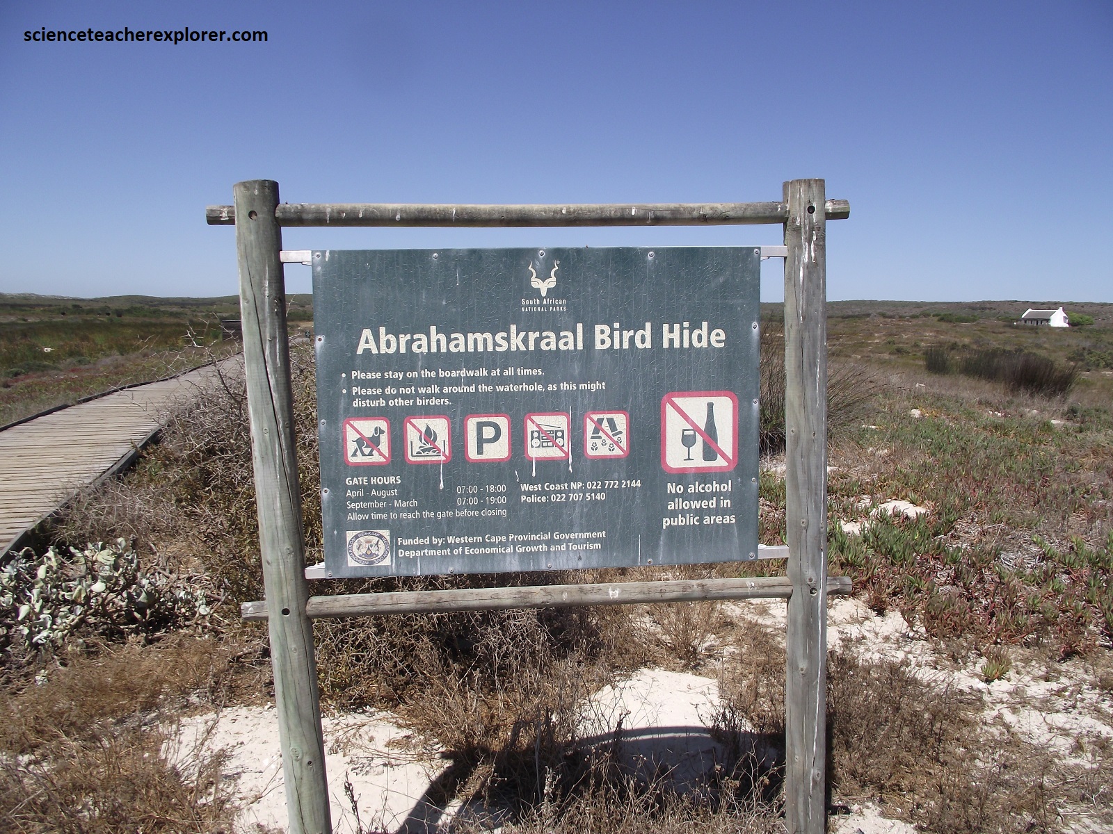
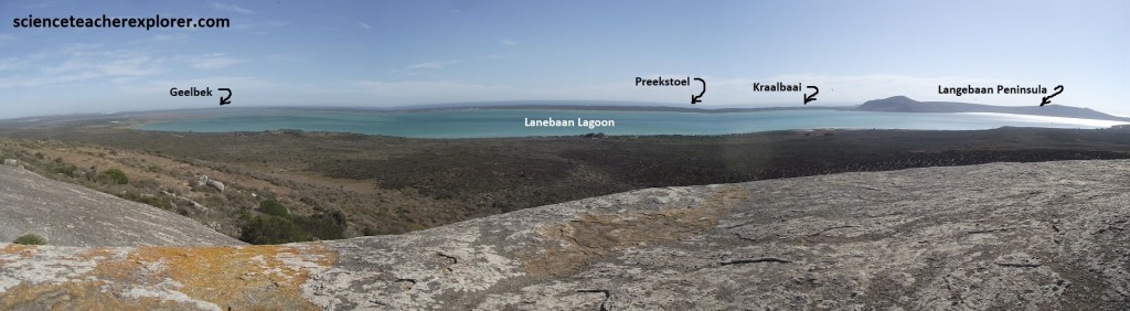
Pictured above, the Abrahamskraal water hole is the only fresh water in the park that the pubic has access to. It was one of the few places to find the 2.7m tall wild-Ostrich, (Struthio carnelus), and other fresh-water waterfowl. The reed beds seem to be where passerines come here to drink, like warblers. There were also indications of a resident water mongoose. Additionally, the reed-beds were riddled with the clicking of stream frogs, (Strongylopus greyii). Further up the north trending road we stopped at the Atlantic viewpoint near Preekstoel, (pictured below).
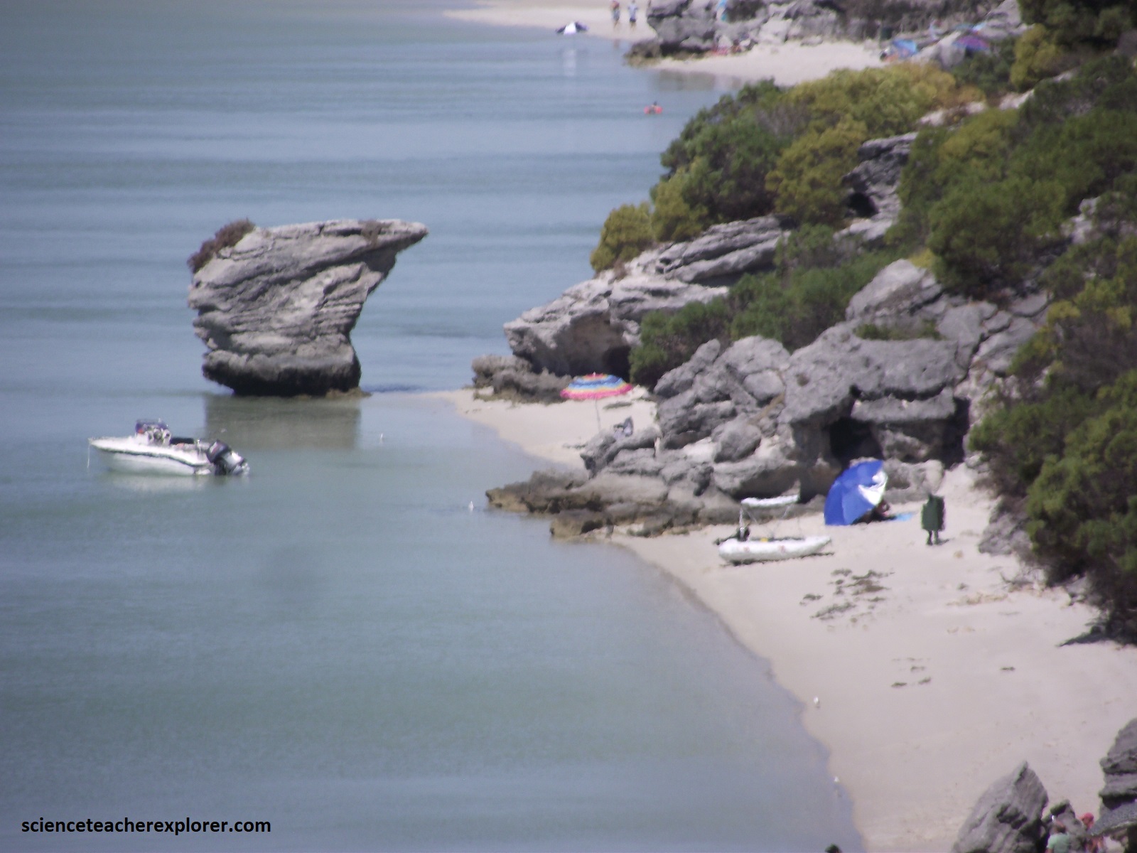
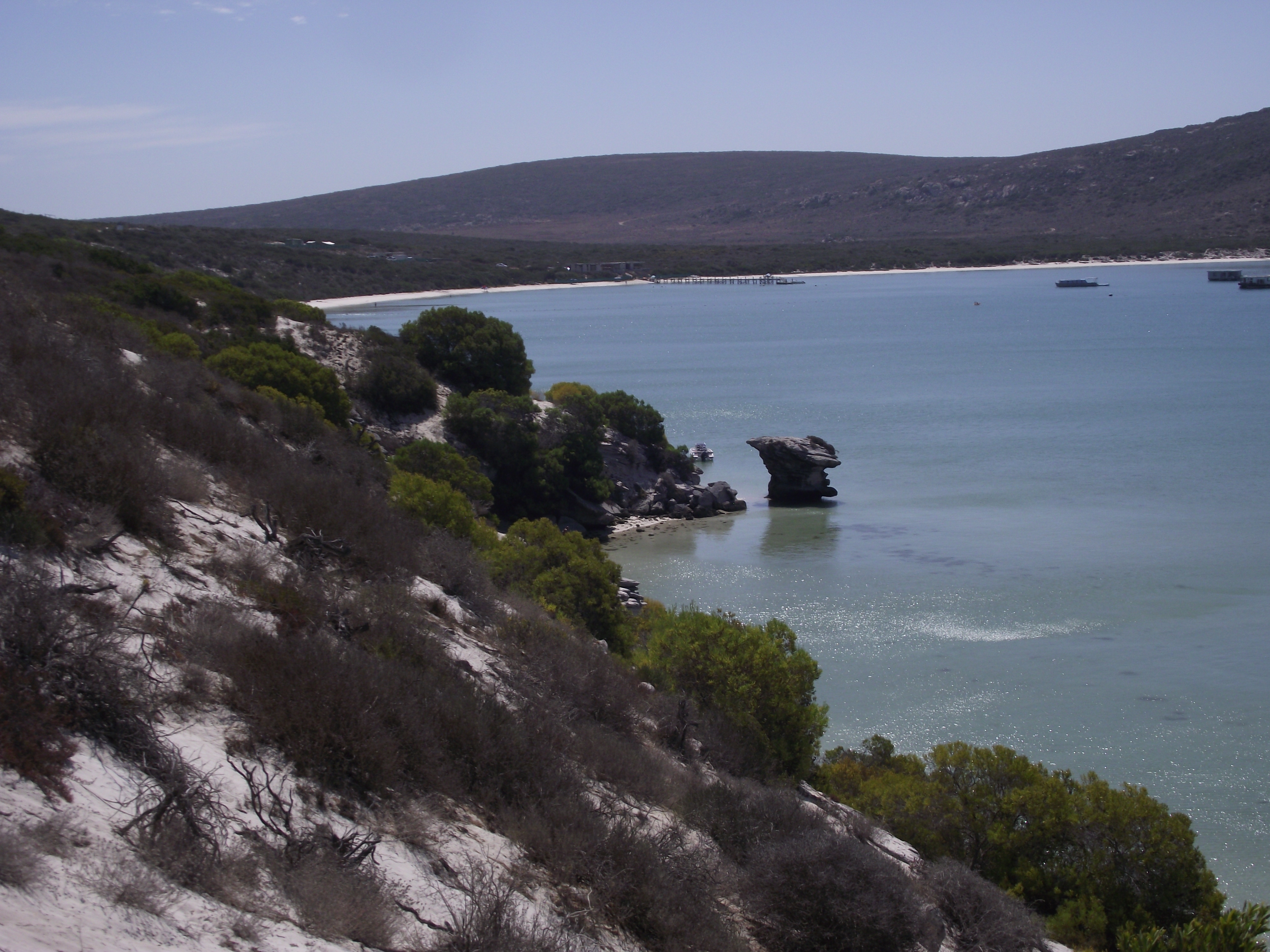
Pictured above, in the cliffs south of Kraalbaai, it comprises burrowed lagoonal sand overlain by horizontally laminated beach sand of the Velddrif Formation, which is about 130,000-120,000 years old (Late Pleistocene). This sequence is overlain by the cross-bedded, cemented dune sands of the Langebaan Formation, which is approximately 117,000 years old and contain footprints of an early modern human, (discussed below at Kraalbaai). Sea levels subsequently feel by as much as 130m during the Last Glacial Maximum, when, some 20,000 years ago, ice sheets extended over much of northern Eurasia and North America. The Langebaan Lagoon would have been left high and dry, tens of kilometers from the sea at this time.
As the ice sheets melted and the sea rose again to a level around 3m higher than today approximately 6-7 thousand years ago, two tidal inlets allowed flooding of the Langebaan Lagoon, on south of Saldanha Bay and a second west of Kraalbaai. The cliffs south of the Preekstoel, on the western side of the lagoon, began eroding away at the time, when sub-tidal channels in the lagoon hosted extensive oyster colonies. Heaps (middens) of discarded mussel and limpet shells on the peninsula, up to 6,000 years old, show that this has long been a popular spot for human visitors. Picture below is look eastward across the Langebaan Lagoon. (Left picture is looking northeast towards the mouth of the lagoon & right picture is looking southeast).
As we continued driving north up the peninsula, our next stop was Kaalbaai, (pictured below). The bottom picture is the site of the ancient human-footprints in the Langebaan Formation.
Pictured above, the earliest evidence of people in the West Coast National Park is a series of footprints, (mentioned earlier), that were left in rain-soaked dune sand by a passer-by in the Kraalbaai area 117,000 years ago. The shape of the footprints indicated that they were made by an anatomically modern human being of small stature (either female or adolescent male) who would today wear a size 5 shoe. (Images below were taken from an on-site visitors center).
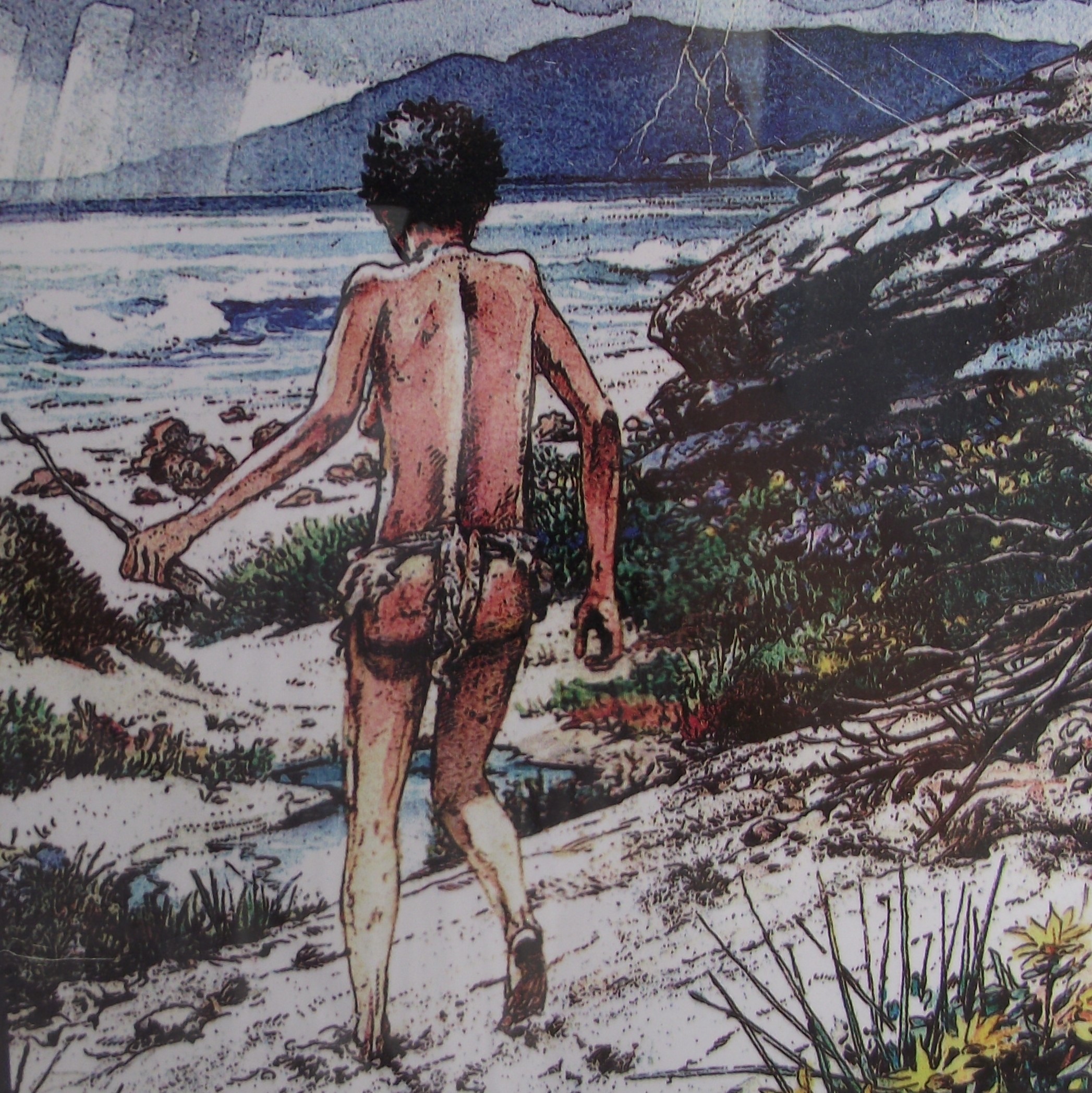
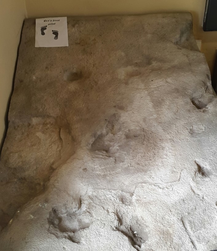
Imaged above, the footprints were covered and preserved shortly afterwards by wind-blown sand and, over time, the whole dune was cemented into a sandy limestone rock. Modern dating techniques have given us the age of the rock in which the footprints lie and hence the time in the past when they were formed.
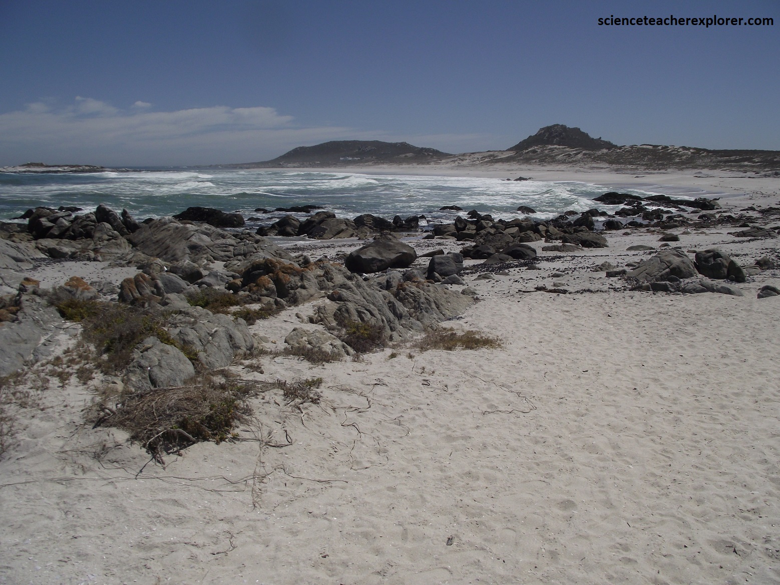
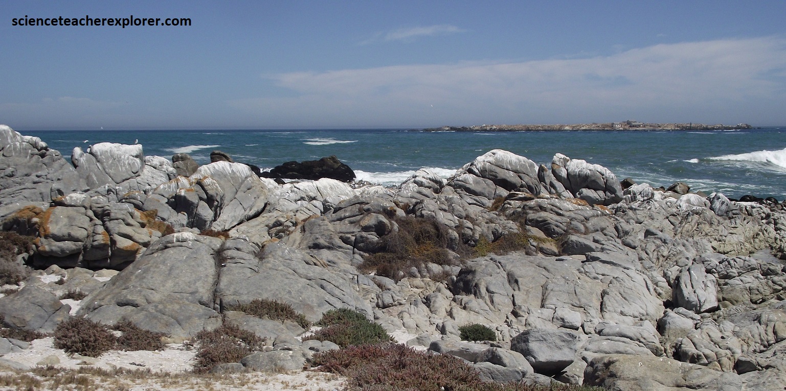
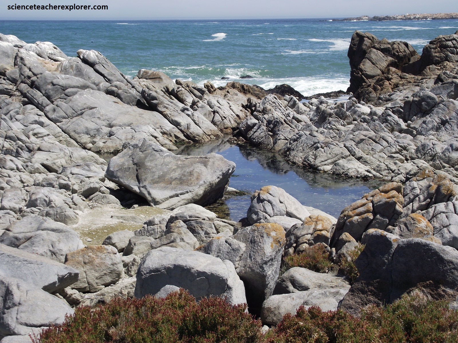

Pictured above, Mike and I continued driving north along the Langebaan Peninsula to the Tsaarsbank tidal-pools and beaches. Much of the rock in this area was of Cape Granite. However, it was evident why they call the West Coast National Park, one of the largest ‘oyster graveyards’ in the world. The enormous colonies of oysters and mussels which once lived in the lagoon were gradually destroyed by changes in the water temperature and today the bed was covered with oyster and mussel shells up to 7m deep.
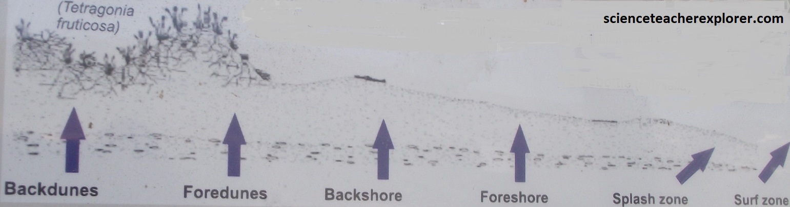
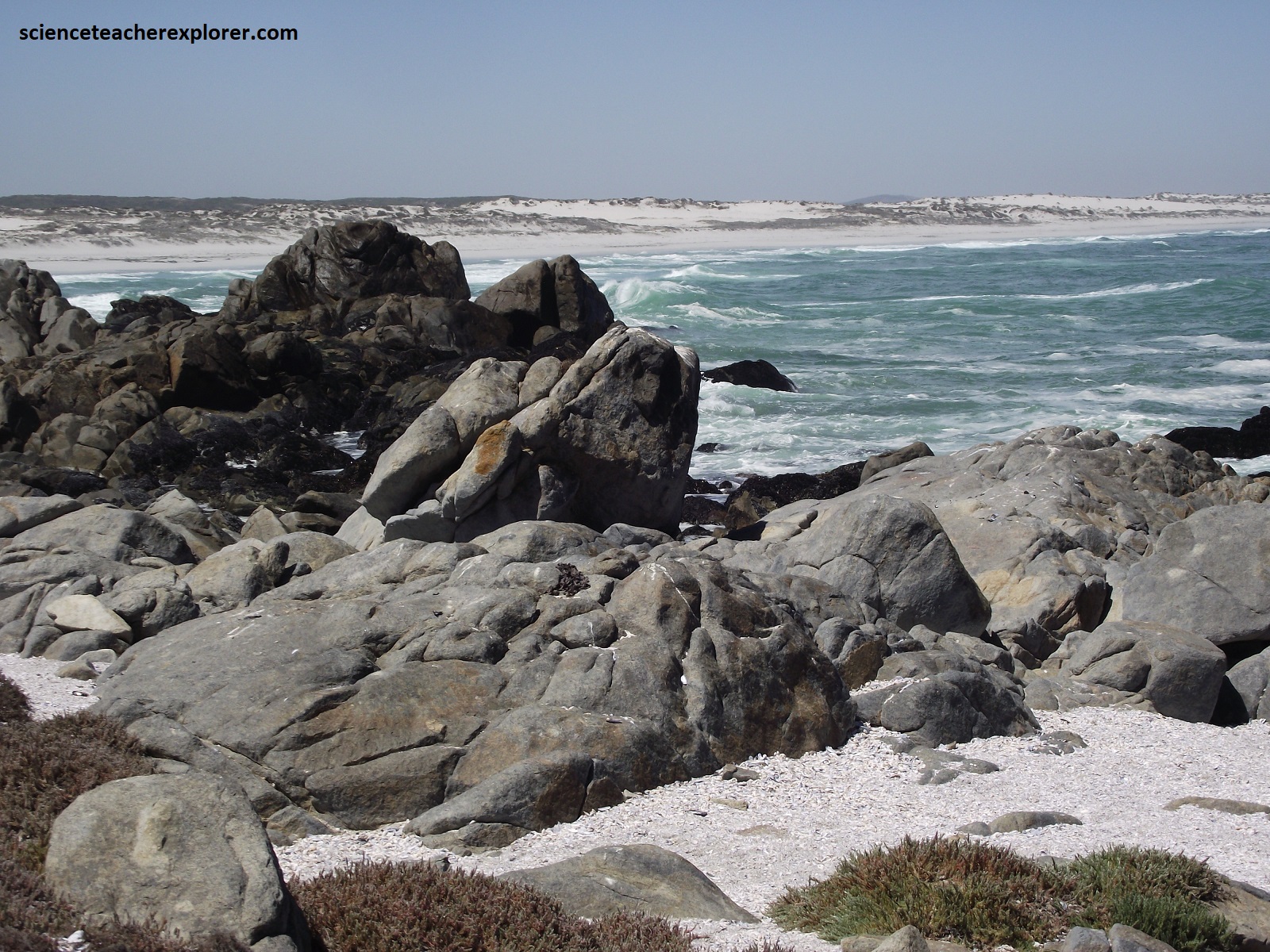
Pictured above, Tsaarsbank of the West Coast National Park gave a ideal/classic example of a beach profile. This idealized cross-sectional profile of an offshore to coastal mainland profile showed the distribution of the nearshore, beach, and dune environments as a function of elevation, water depths, and morphology with its vegetation stabilizing it.
Pictured above are two Hartlaub’s Gulls, (Larus hartlaubii). Although commonly seen in the Western Cape, this is the only part of the world in which this gull can be seen, as it is endemic to the Benguela coast. It is the 10th rarest of around 50 gulls (total population estimated at 30,000), breeding on off-shore islands, wetlands and large buildings. It has dark eyes. In flight it could be told by grey under-wings and black outer primaries. It is an opportunistic scavenger and predator, eating virtually anything.
Postberg was restricted, and we were not allowed to enter, (pictured above). However, the hills forming the northern part of the Langebaan Peninsula, (Postberg), consists of ignimbrite, a rock made of hot volcanic ash ejected from fissures approximately 515 million years ago and deposited at such a high temperature that the edges of the constituent grains fused together. It showed us some interest geological formation from a distance.
