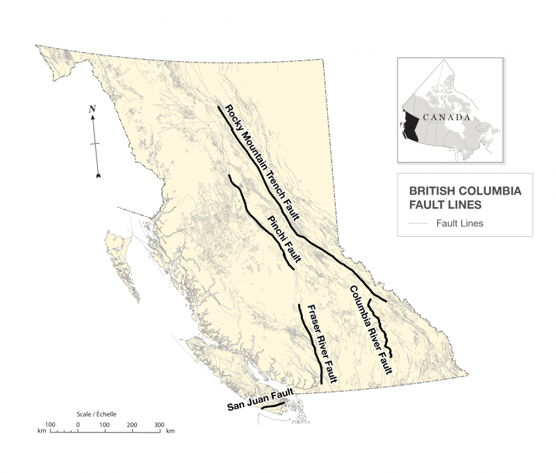
Sea-to-Sky Rte., B.C.
In the late summer of 2025, Becky, (my wife) and I had the opportunity to visit British Columbia, Canada, (imaged below).
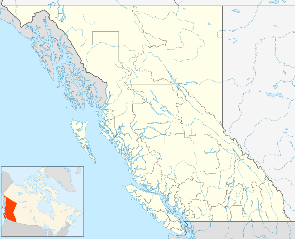
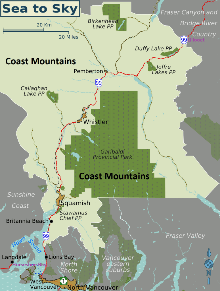
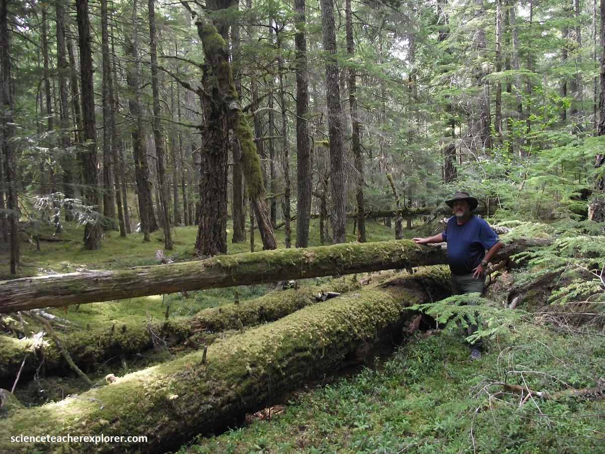
We stayed a week in Whistler, Canada and was able to briefly explore the famous, “Sea-to-Sky Corridor” on Hwy. 99. Much of our trekking consisted of gondolas and car-transportation with a few brief walks along the local trails. As mentioned, “the Sea to Sky Corridor” follows British Columbia’s Highway 99. This stunning 233-km scenic route stretches from Horseshoe Bay, (just north of Vancouver) to Lillooet, guiding us through steep coastal fjords, old-growth rainforests, and the towering peaks of the Coast Mountains,(imaged below).
I’ve decided to briefly discuss the geology along our trek of the “Sea-to-Sky Route” by starting at the Britannia Beach, (pictured below).
Britannia Beach is a small, historic waterfront community, located 55km north of Vancouver along the scenic “Sea-to-Sky Route”. Situated on the eastern shore of Howe Sound, this unincorporated village has a tiny permanent population of around 400 residents. Once a bustling, isolated copper-mining hub, it was transformed into a popular tourist stopover. Britannia Beach was established in 1900 as a residential base for the Britannia Mining and Smelting Company. Copper was first discovered in the mountains here in 1888, and by 1929, the site operated the largest copper mine in the British Empire.
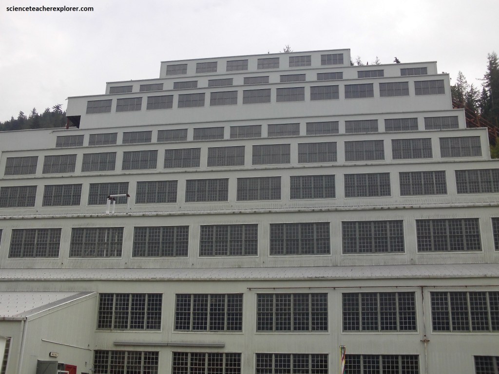
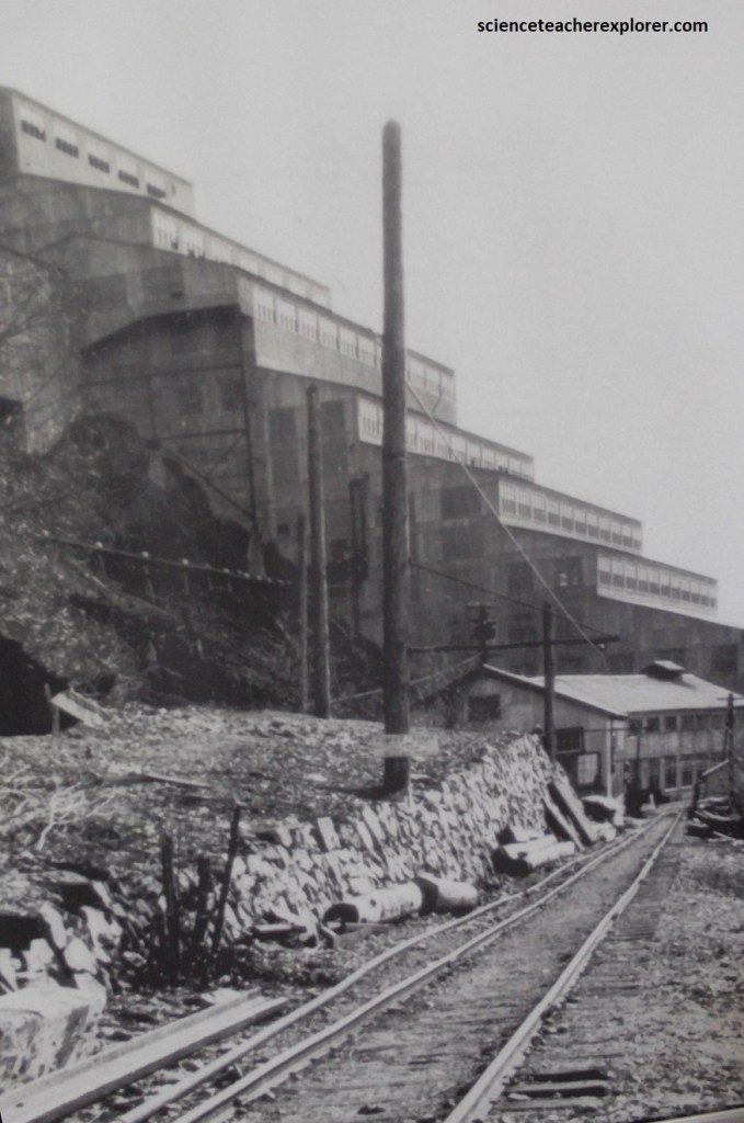
The Britannia Mine Museum is the crown jewel of the town. It features underground train tours into historic transit tunnels, and a multi-sensory special effects show built inside the iconic, 20-story Mill No. 3 building, (pictured above). Becky and I spent a day here, touring the facility. I’ve provided an extensive discussion of this site on another webpage.
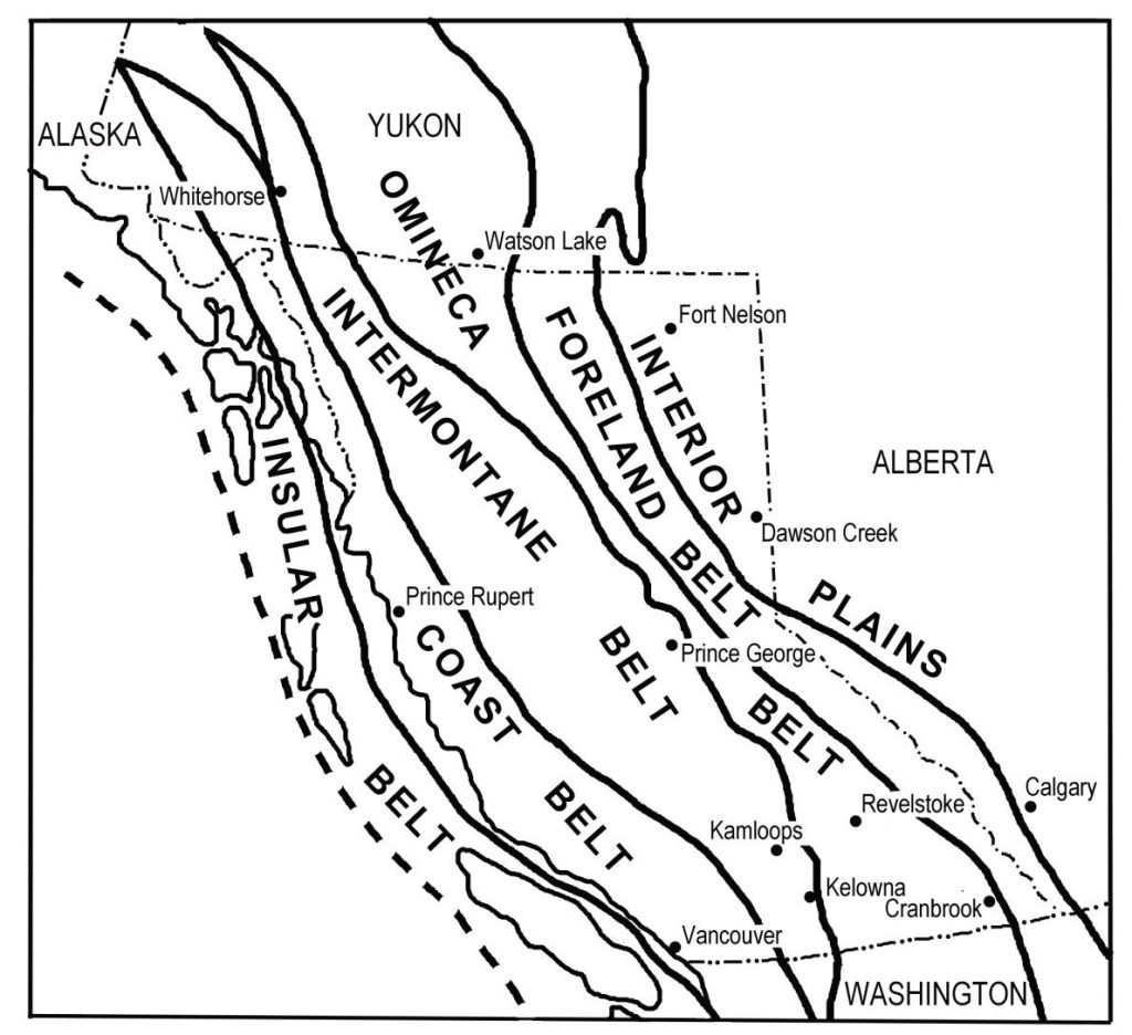
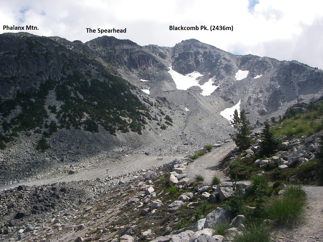
The “Sea-to-Sky Route is found, primarily in the geographical area called the “Coastal Belt”. This “Coastal Belt” was formed by the subduction and collision of ancient tectonic plates against the North American continent, which generated massive plumes of magma. This molten rock cooled deep underground to create massive granite batholiths, which were later carved by glaciers. Note: {imaged below} In the Insular Belt, the magmatic arcs and accretionary complexes welded to the continent about 95 million years ago; 90-million-year-old to present sediments eroded from uplifted Cordilleran mountains. In the Coast Belt, the Terranes accreted to the continent about 95 million years ago, including 170-110-million-year-old granitic rock of an island arc; granitic rock of the Coast Mountains belong to a continental arc that formed 95-45 million years ago; young volcanic rock of the Cascade continental arc.
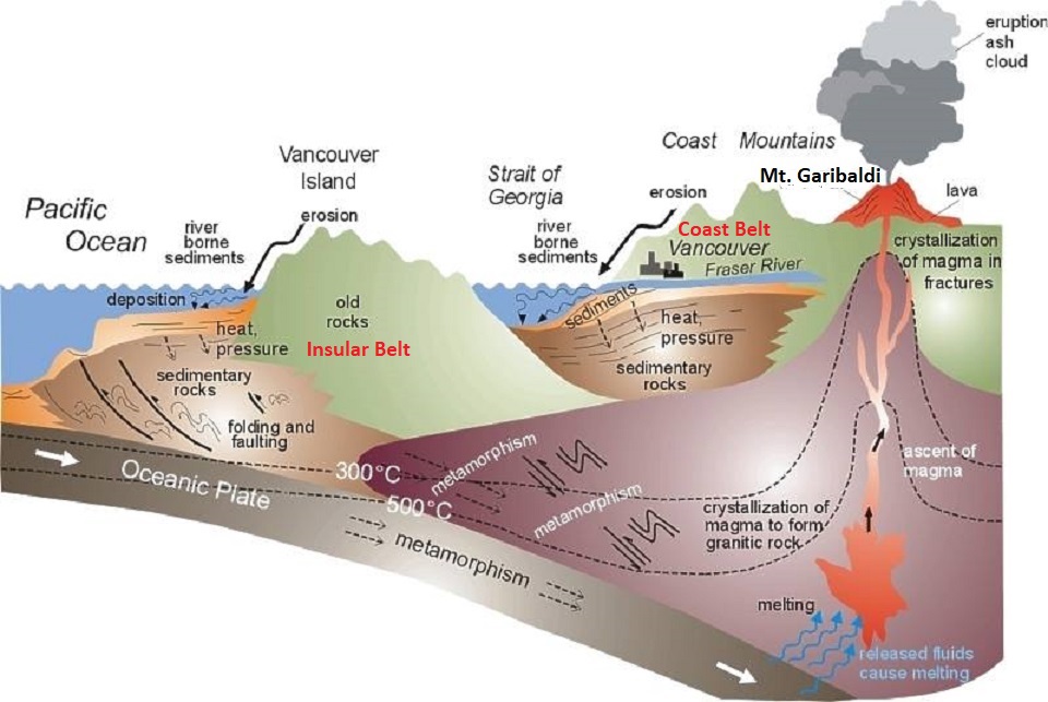
Imaged above, around 115 to 150 million years ago, drifting island arcs and micro-continents (such as the Insular and Intermontane terranes) slammed into the western edge of North America. These violent collisions caused the heavier Pacific and Juan de Fuca plates to subduct (slide beneath) the North American Plate. This massive subduction generated intense heat and melting deep in the earth’s crust, producing one of the largest continuous bodies of granitic rock (a batholith) in the world.
Imaged above, subsequent shifts in tectonic boundaries about 5 to 50 million years ago reheated the crust and violently thrust this massive granitic body thousands of meters upward into a jagged mountain range.
Imaged above, during the last Ice Age (ending roughly 10,000 to 12,000 years ago), immense rivers of glacial ice covered the region. The grinding weight of these glaciers carved out the dramatic, steep-sided U-shaped valleys, knife-edge peaks, Cirques, and deep fjords that define the modern coastline.
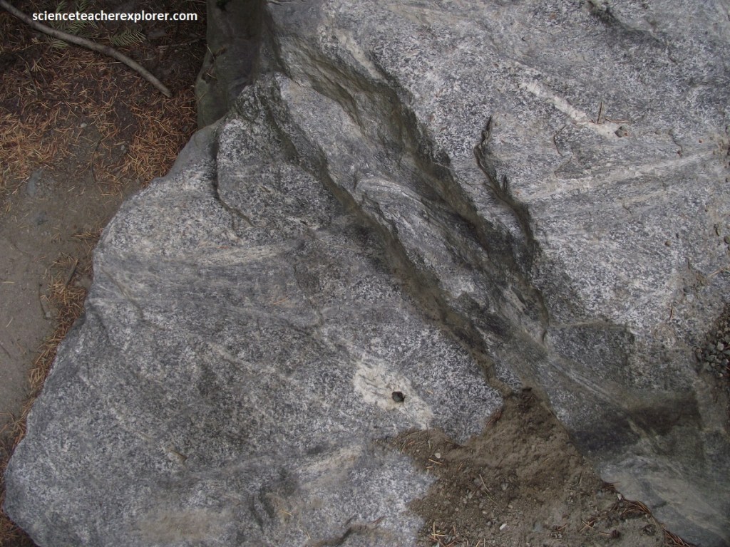
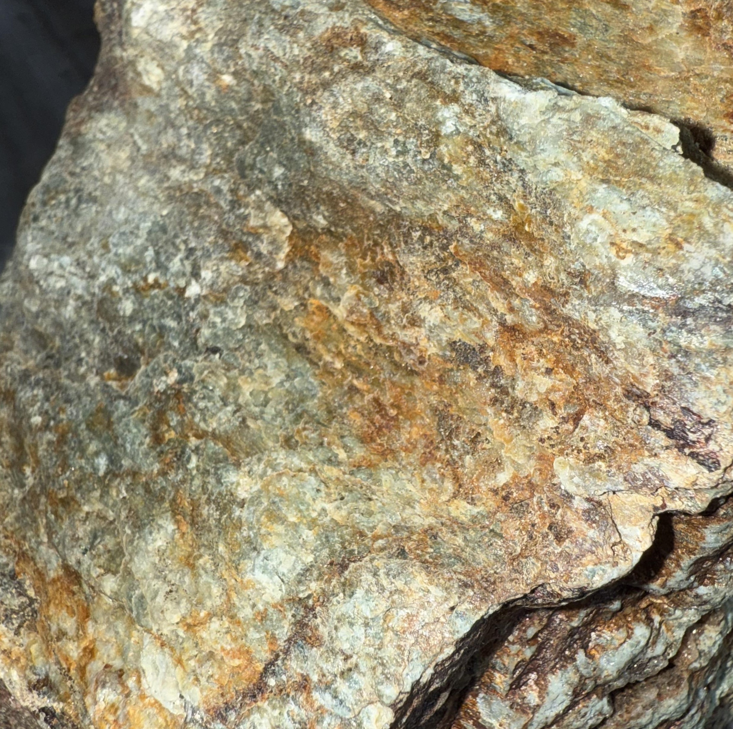
Heading north on Hwy 99 towards the top of the hill, from the Britannia Mine, Becky and I came across an intrusive contact with sparsely jointed and relatively coarse-grained granitic rock, (pictured above). This rock crystallized about 100 million years ago. Unlike most other granitic rocks of the Howe Sound area, it contained a small amount of salmon-colored, potassium-feldspar, which made it a granodiorite. It’s lack of jointing had made it resistant to erosion, and the relatively few fallen fragments were unusually large. This created bold bluffs of pale rock, which included the most spectacular bluff of all, the Squamish Chief.

Just Up ahead, 3km south of Squamish, Shannon Creek drains a hanging valley that heads 6.5km southeast of Hwy 99 and spills over a sheer cliff of granodiorite in a spectacular waterfall about 300m high.
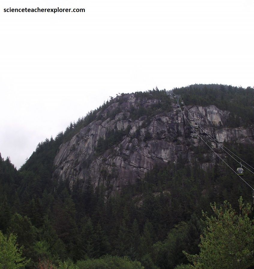
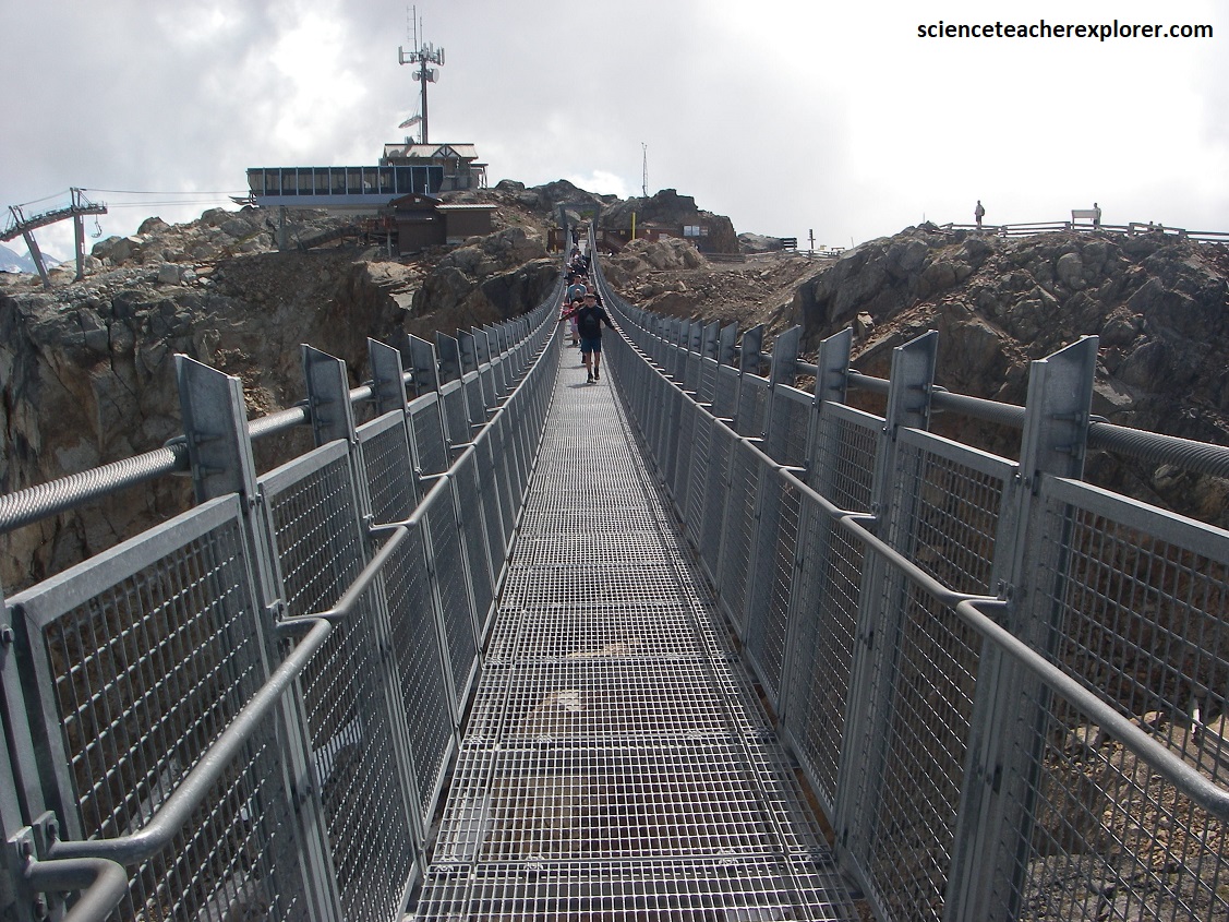
Pictured above, just north of Shannon Falls, is a “Sea-to-Sky” gondola that traverses south and east of the Stawamus Chief. We explored the top by walking the “Sky Pilot” suspended bridge & panorama trail (picture below).

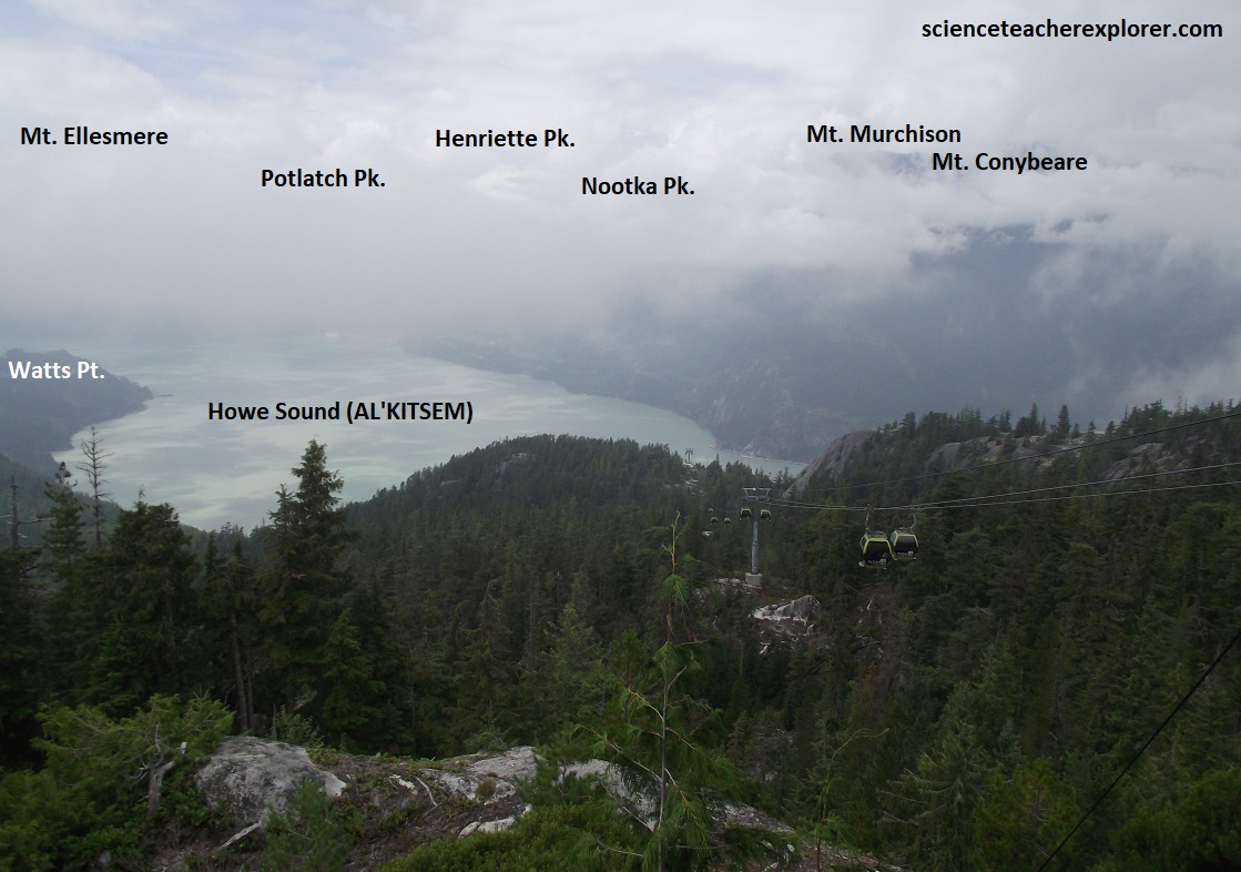
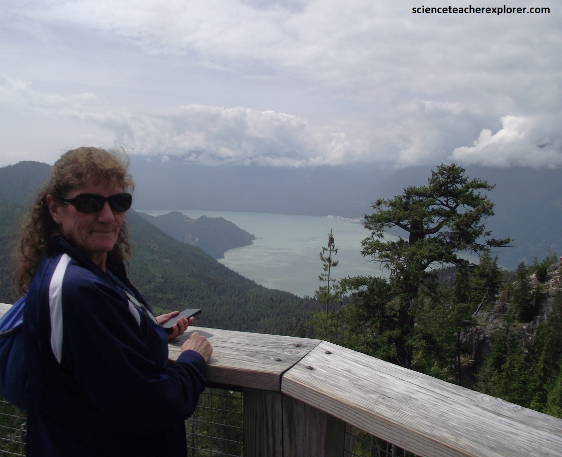
The Sky Pilot Suspension Bridge offers amazing 3600 view of the area, both up to the high alpine of the mountains above and down to the Howe Sound below, (pictured below).
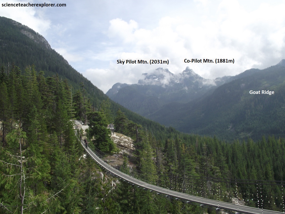
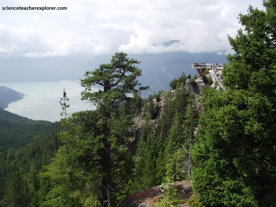
Pictured above, Sky Pilot Mtn. & Co-Pilot Mtn. are defined by the Coast Range Batholith, a massive complex of hard, erosion-resistant igneous rock formed around 100 million years ago during the Cretaceous period due to subduction.
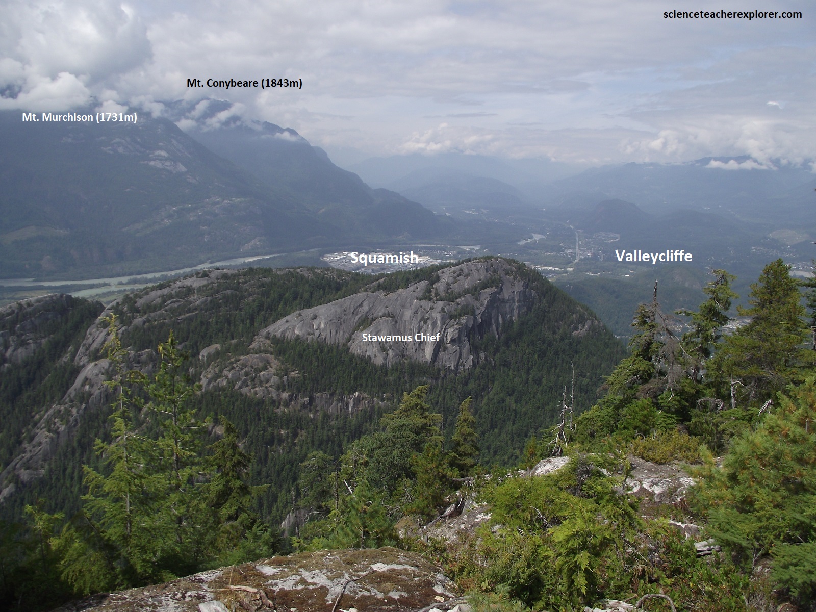
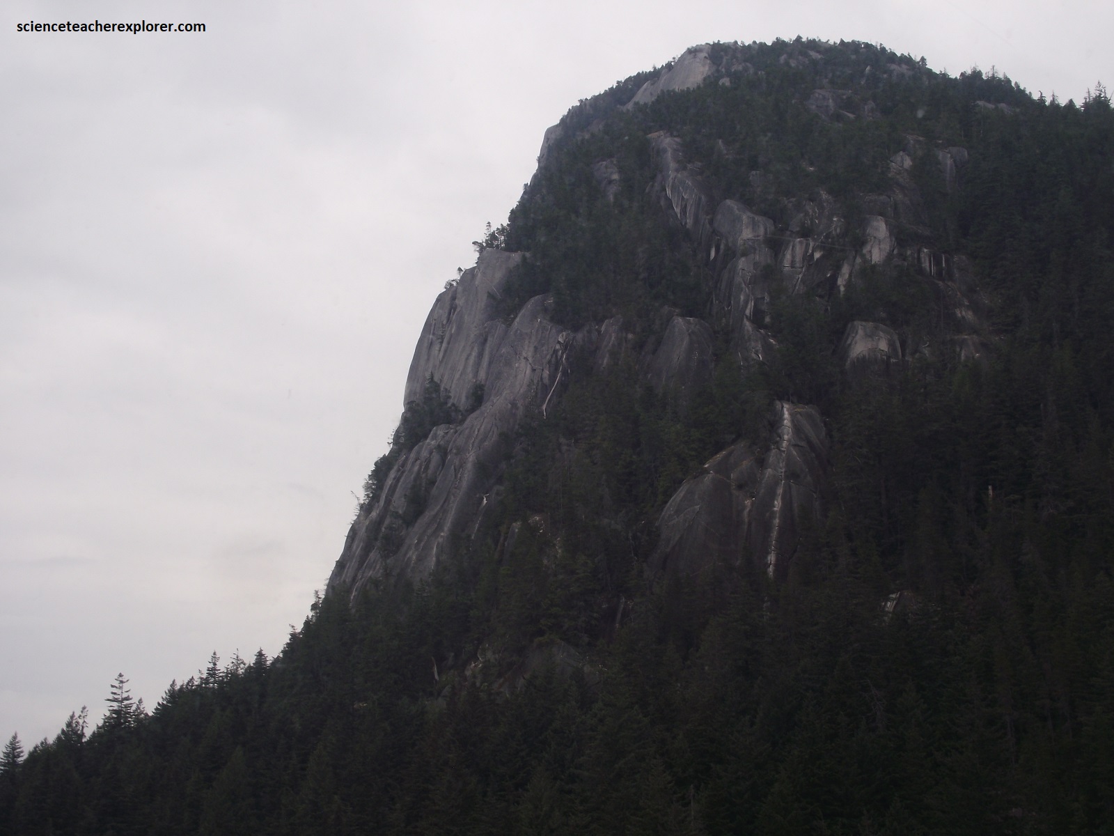
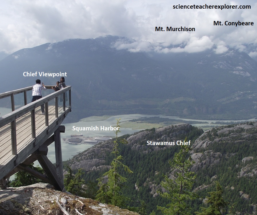
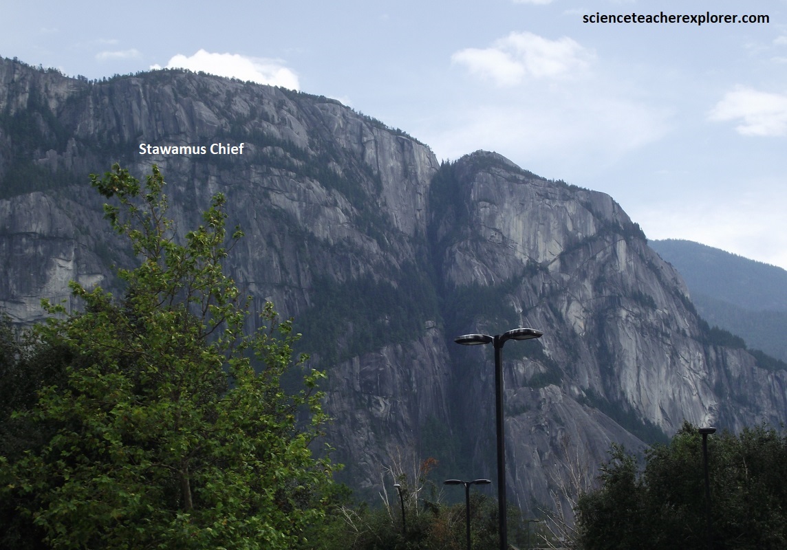
Pictured above, Stawamus Chief is viewed from above and below from Squamish. The Stawamus Chief (known as the Squamish Chief) crystallized slowly from a felsic igneous stock with a granodiorite composition (i.e. mostly consisting of the interlocking minerals of quartz, feldspar and biotite). It was intruded by multiple dark mafic dykes and quartz veins around 40 million years ago. What was once a slowly cooling magma chamber (possible the heart of an extinct volcano), is now exposed and towering over the town due to uplift, erosion and intense glaciation that took place on the West Coast of Canada.
As glaciers advanced and retreated over the land, 2.5mya-10,000yrs ago, they carved and plucked steep slabs off the face of The Chief. This plucking was synchronous with exfoliation weathering due to the expanding and cracking response of minerals and rocks at the surface which initial formed under higher temperatures and pressures.
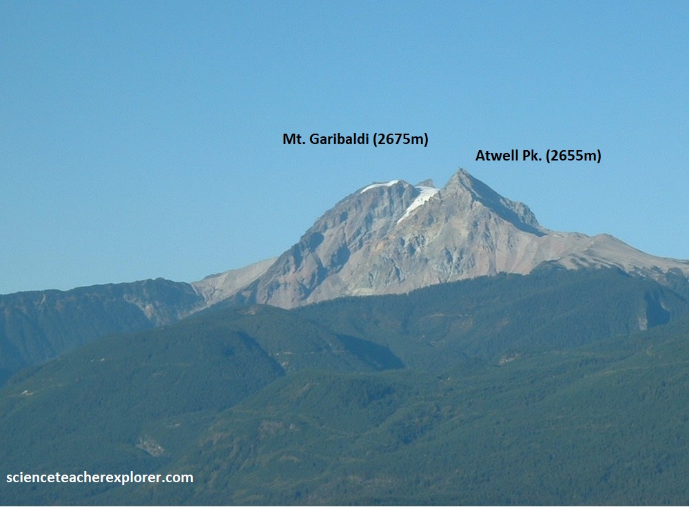
Pictured above, the Mount Garibaldi, (20km northeast of Squamish), is a late Pleistocene volcano rising 2,678m. It grew during and following the last regional glaciation in the area. The ice had withdrawn from it’s upper limit. The Garibaldi eruptions built a broad cone with a summit elevation of about 2,750m, centered at the pyramidal south peak. The eastern part of the cone was built on high, ice-free ground and retains the original 150 slope. However, the western half of the cone was built on the ice sheet. It collapsed as the ice melted, creating debris flows that flowed down the Cheekye River into the valley of the Squamish River.

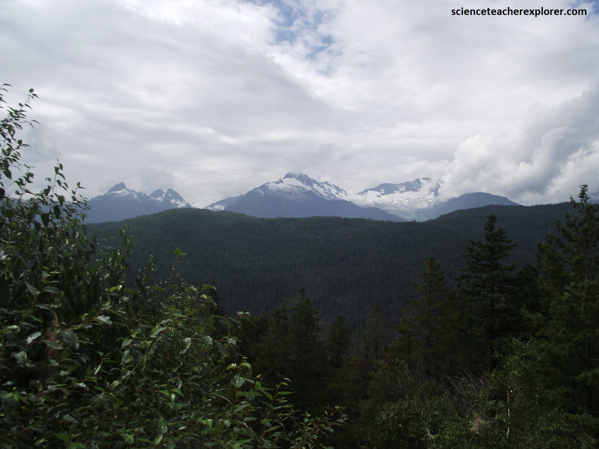
A few kilometers past Squamish, on Hwy 99, we started to climb up an the alluvial fan of the Cheekye River, (a tributary of the Cheakamus River). This 150m alluvial fan was built in postglacial time from debris derived from the above mentioned collapse of the western part of Mount Garibaldi. Roughly 6km north of the Cheekye River Bridge, is the “Tantalus Viewpoint” pullout. Pictured above, the Tantalus Range marks the boundary between Jurassic and Cretaceous granitic rocks. [Note: Cretaceous granitic rocks, which form much of the western side of Howe Sound, intrude the volcanic rocks of the Jurassic granitic rock]. However, the country on the skyline above the sheer granitic cliffs of the Stawamus Chief is early Cretaceous volcanic strata forming Goat Ridge that are gently west-dipping layers. These volcanic rocks also form the upper part of Sky Pilot Mountain east of Goat Ridge (discussed earlier).
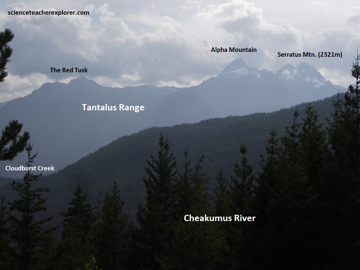
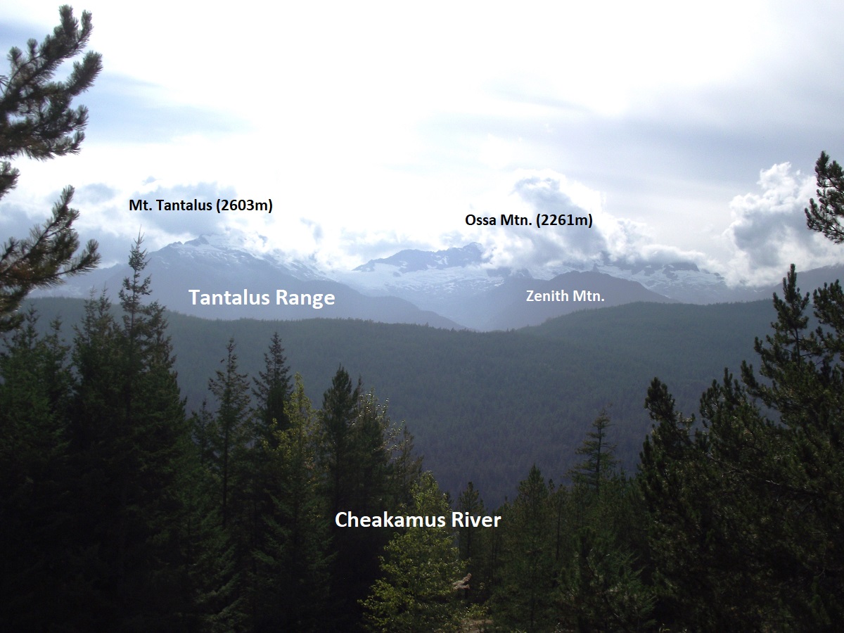
Pictured above and mentioned before, the Tantalus Range features bedrock that dates primarily to the Late Jurassic to Late Cretaceous periods, (roughly 165-85 million years ago). However, during the Pleistocene Epoch (the last 2.6 million years), the area was buried under thousands of meters of the Cordilleran Ice Sheet. The most prominent peaks in the range (such as Mt. Tantalus, Mt. Alpha, and Ossa Mtn.) were exposed as nunataks, (peaks that poked through the top of this massive ice sheet). This left the region with its signature, razor-sharp jagged appearance rather than the rounded features characteristic of lower-elevation hills.
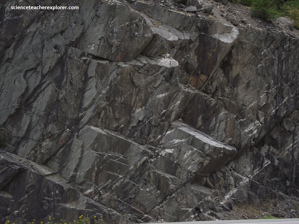
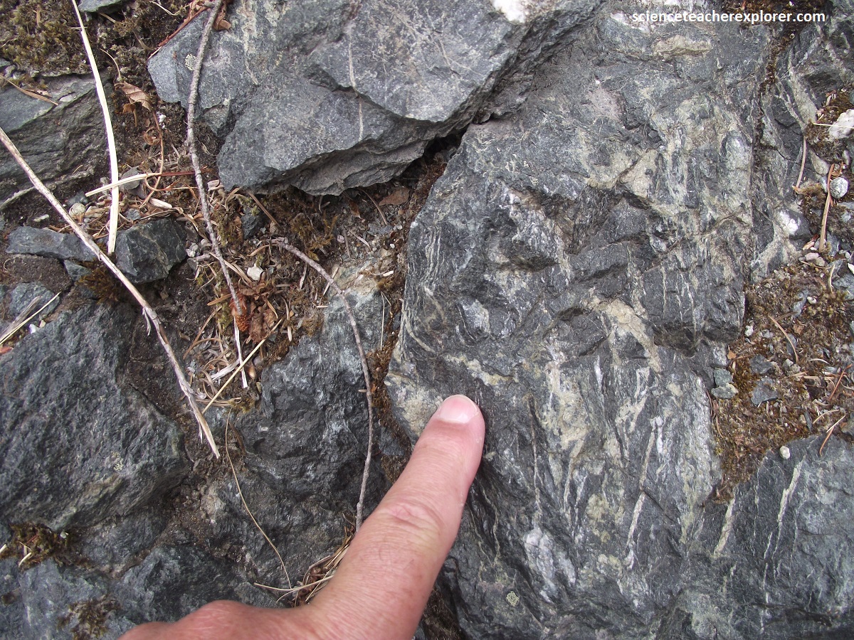
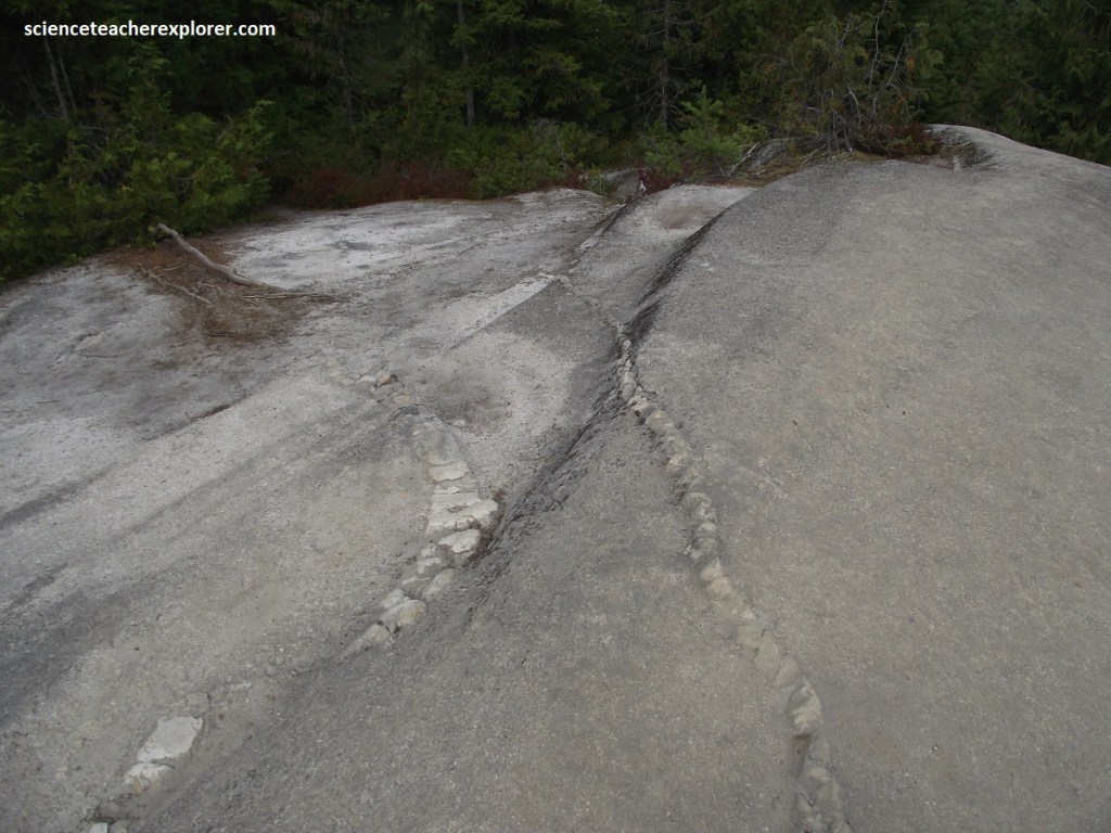
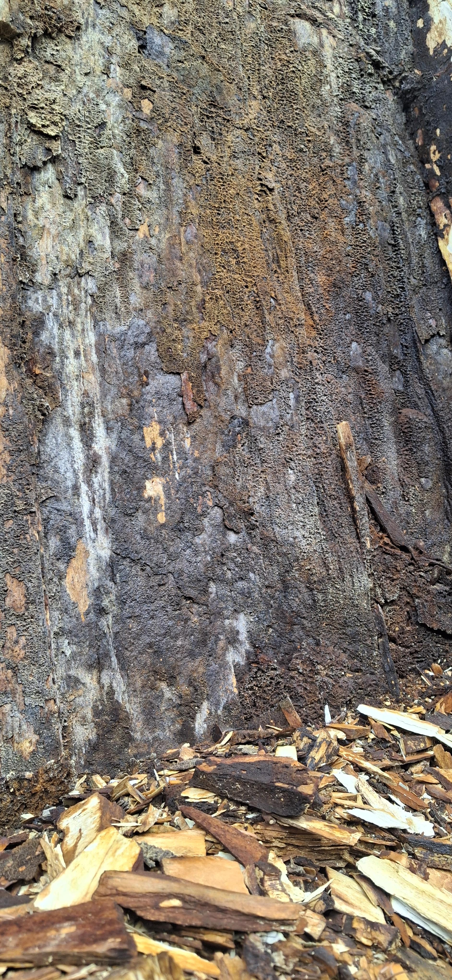
At about 26km past the Cheekye River Bridge, Hwy. 99 descends down to the level of the Cheakamus River. There the Sea-to-Sky Rte. crosses a shear zone of the late Jurassic granitic rocks, (pictured above). The normal granitic texture of randomly oriented crystals changes abruptly to one with a metamorphic-foliation formed by shearing and growth of new crystals called a mylonite. The foliation dips to the northeast and the width of the zone of sheared rock, measured at right angles to the foliation, is about 1.5km.
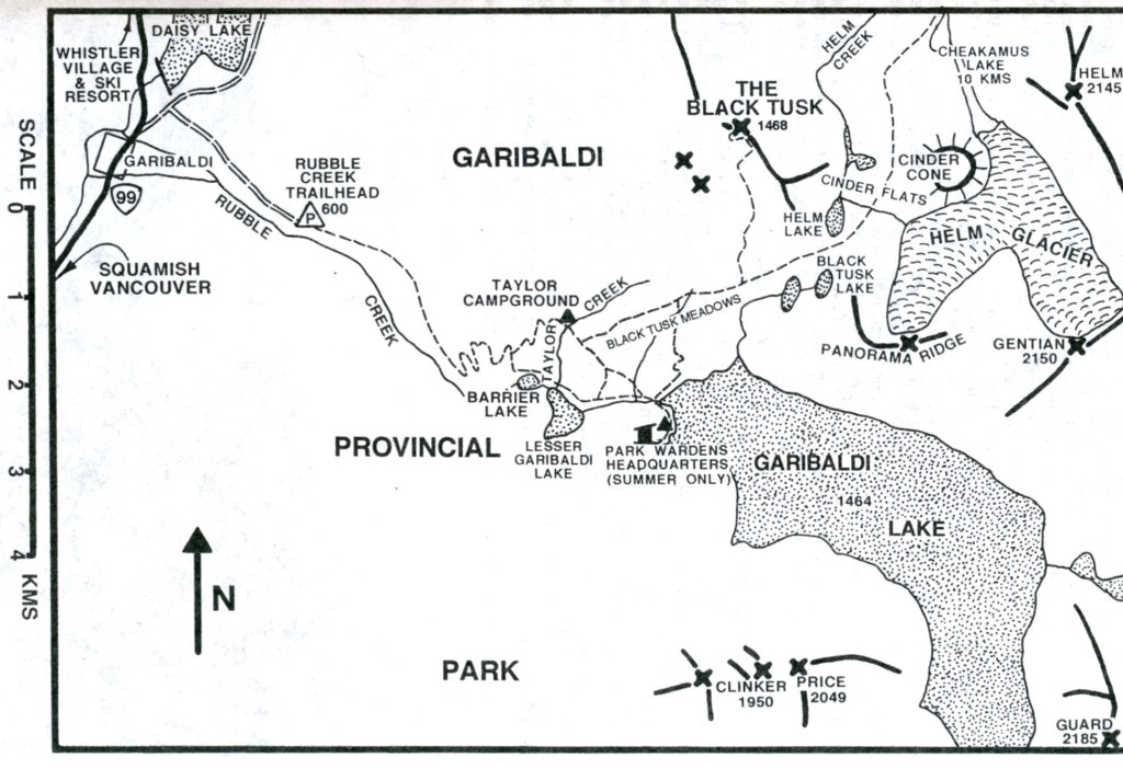
Trail map of the “Black Tusk” in the Garibaldi Provincial Park; (map taken from “Climber’s and Hiker’s Guide to the World’s Mountains & Volcanos 4th edition; Kelsey 2001″).
Continuing north on Hwy. 99; Becky and I turned onto side road, (about 1km south of the hydroelectric dam below Daisy Lake), to drive to the “Rubble Creek Trailhead”. There, I trekked a ways up Rubble Creek to get a view of the infamous rockslide called the “Barrier”, (pictured below). {Note: The trek up Rubble Creek was a bit tricky for me}.
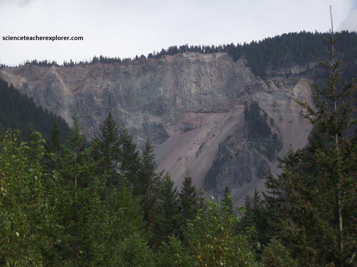
Pictured above, the “Barrier” is a steep, 250 m high volcanic escarpment that was formed by ice-contact volcanism during the Pleistocene epoch, (13,000 years ago). Apparently, lava erupted from Clinker Peak on the western shoulder of Mount Price and flowed down into the Cheakamus River Valley. The molten lava met the retreating Cheakamus Valley Glacier and cooled rapidly against the ice, solidifying into a massive, ice-contact lava dam. The cooling of the lava against glacier ice left a highly fractured structure, (pictured above). The dam currently holds back trillions of cubic meters of water, forming the Garibaldi Lake system. Geological instability and ongoing erosion have resulted in massive rockfalls. Because a catastrophic collapse could trigger a devastating flood downstream, it is heavily monitored.

Driving north on Hwy 99 for about 7km past the Cheakamus dam, Becky and I stopped to view the Brandywine Falls. Brandywine Falls is a classic plunge waterfall formed by ancient basaltic lava flows and subsequent glacial and water erosion, (imaged above). The dramatic 70m falls plunge into a deep, sheer-walled canyon carved by the erosive power of Brandywine Creek, (pictured below).

Pictured above, at least four basaltic lava flows of Late Pleistocene age comprise the vertical walls surrounding the Brandywine Fall. These layers were formed by repeated basaltic lava flows in the last 34000 years. At least four of these basaltic lava flow layers have been identified. They have been speculated to have come from the ancient volcanic eruptions at Mount Cayley, a stratovolcano located located about 12-15km to the northwest.
Between 10,000 and 40,000 years ago, during the Late Pleistocene epoch, Mount Cayley erupted a series of fluid, basaltic lava flows. At the time, the area was covered in thick glacial ice. The lava flowed into meltwater tunnels beneath the glacier, causing the basalt to cool rapidly. This rapid quenching caused the lava to fracture into the symmetrical, vertical formations known as columnar jointing, (pictured above). The four distinct basalt layers are separated by beds of soft glacial till and silt that accumulated during periods when the ice retreated. {Note: Columnar jointing is the name given to this interesting lava flow phenomenon that can be seen in many places around Whistler and are collectively called the Cheakamus Valley Basalts}. When the glacier that filled the Cheakamus Valley receded 12000 years ago, it left the vertical wall of layered rock you see at Brandywine Falls today. Thousands of years later water erosion from Brandywine Creek continues to erode the canyon.
One puzzling aspect about geology of Brandywine Falls is the enormous size of the gorge the relatively small Brandywine Creek has presumably gouged out. Thousands of years of erosion by a creek of its size wouldn’t come close to creating such a chasm. The answer, it is thought, resulted from one or several large floods that gouged out the wide chasm we see today. Periodic, massive floods at the end of the last ice age are suspected to have resulted from ice dams holding back, then releasing enormous floods.
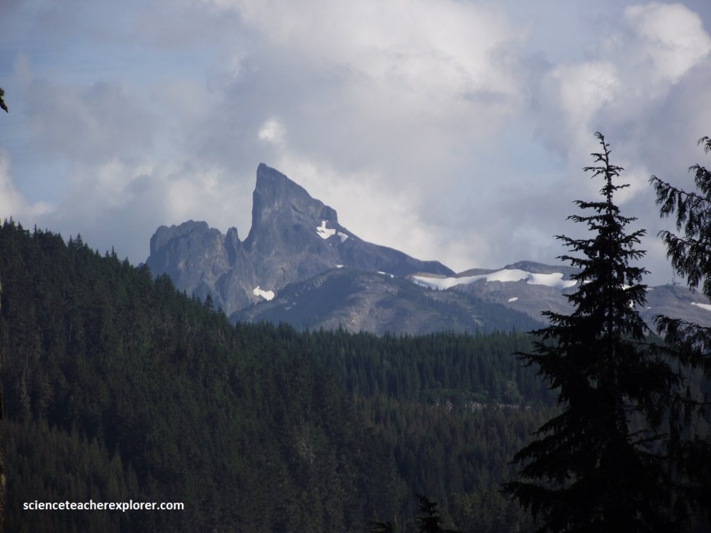
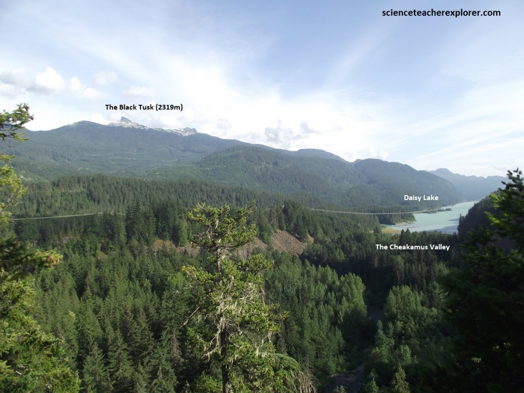
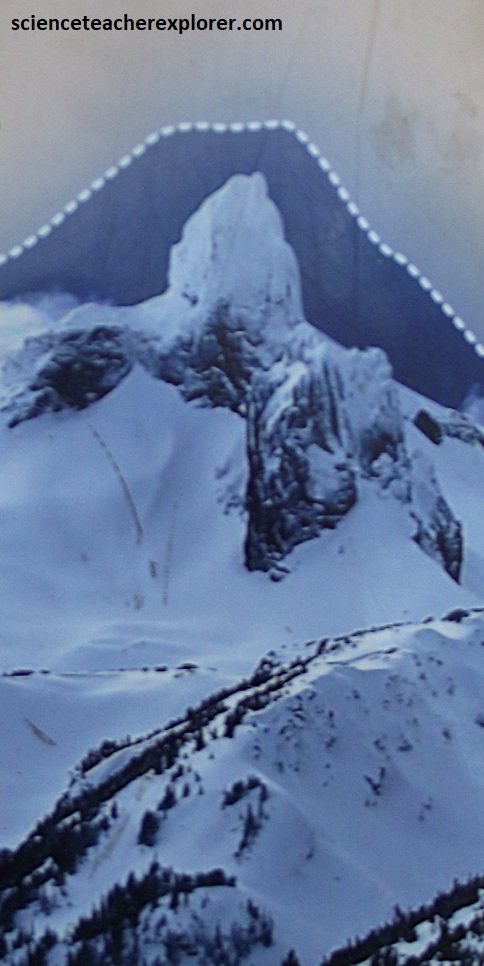
Visible on top of the eastern ridge from Hwy. 99 north of Brandywine Falls is a spectacular, 2,500m high black shaped like a shark’s fin, (which in north-south profile is narrow enough to resemble it’s name), the Black Tusk, (pictured above). The volcanic rocks forming this peak are isotopically dated at between 200,000-90,000 yrs. old. It was once once the core of a volcano. The rising lava hardened in place, surrounded by an outer cone of ash and debris. Over time, the unstable outer layers eroded away, leaving a mountain that is truly hard core, (imaged below).
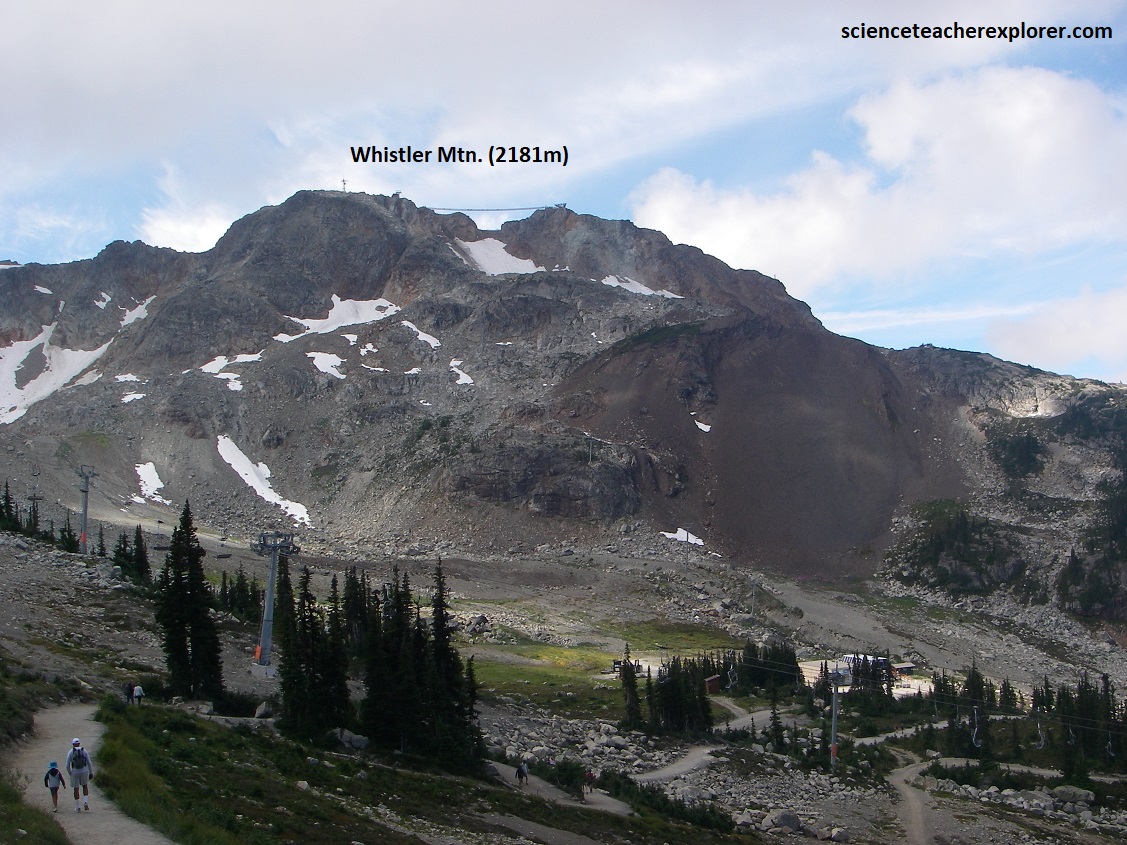
North of Brandywine Falls, Hwy 99 passes through Whistler, venue for the 2010 Winter Olympics. Much of this part of the Sea-to-Sky Route crosses mainly broken and fractured greenish and buff granitic rocks. Becky and I had decided to ride a gondola to the summit of Whistler Peak, (pictured below).
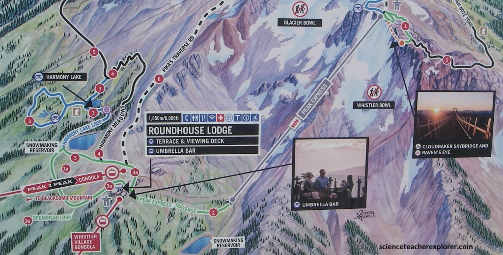
Pictured above, the Whistler Gondola departs directly from Whistler Village. This 25-minute scenic ride took us to the Roundhouse Lodge on Whistler Mountain, where we could access alpine hiking trails, the PEAK 2 PEAK Gondola, and the Umbrella Bar.
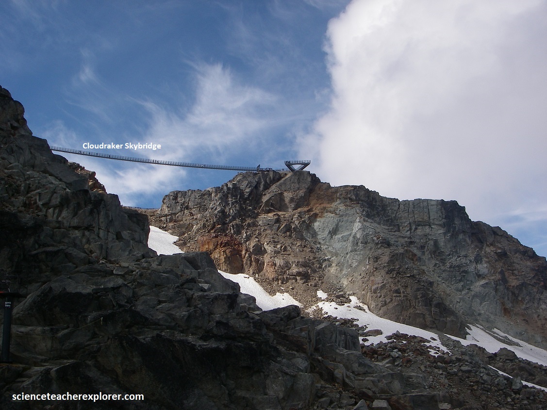
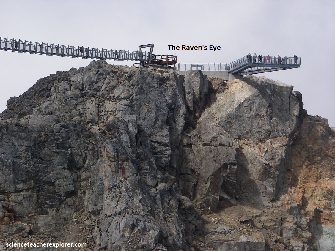
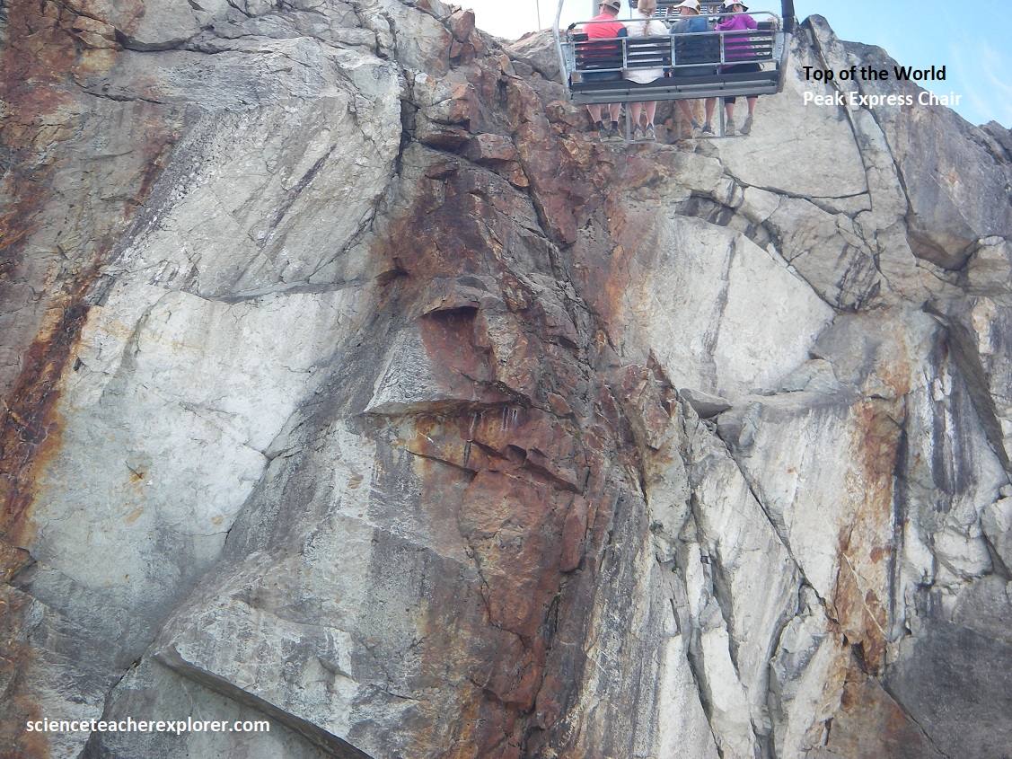
We then trekked over to the Peak Express Chairlift to finish our exploration of Whistler Peak. The Peak Express Chairlift took us up to the 2,182m Whistler Mountain and gave us access to the famous Cloudraker Skybridge and Raven’s Eye Lookout, (pictured below). This chairlift ride was an exhilarating experience that took us over top of an ancient glacier while cresting over a 33m vertical cliff at the top. The Cloudraker Skybridge itself spans 130 meters from Whistler Peak to the West Ridge, (pictured below).
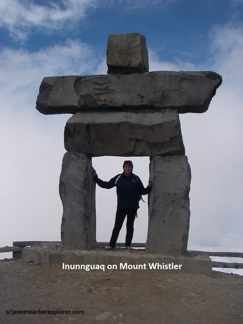
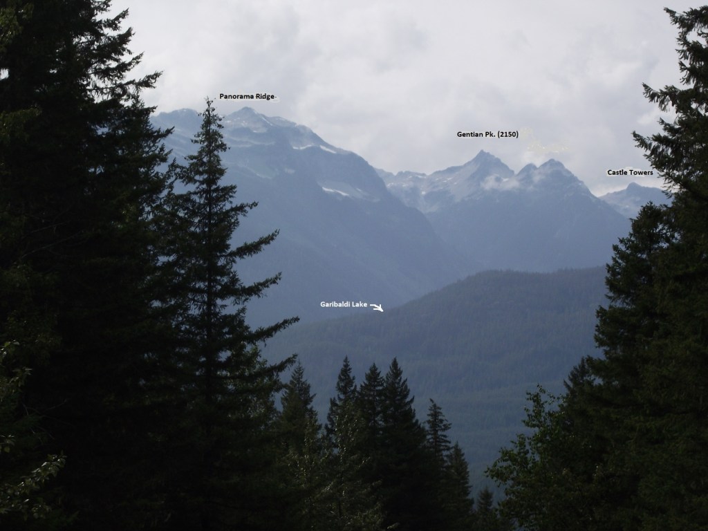
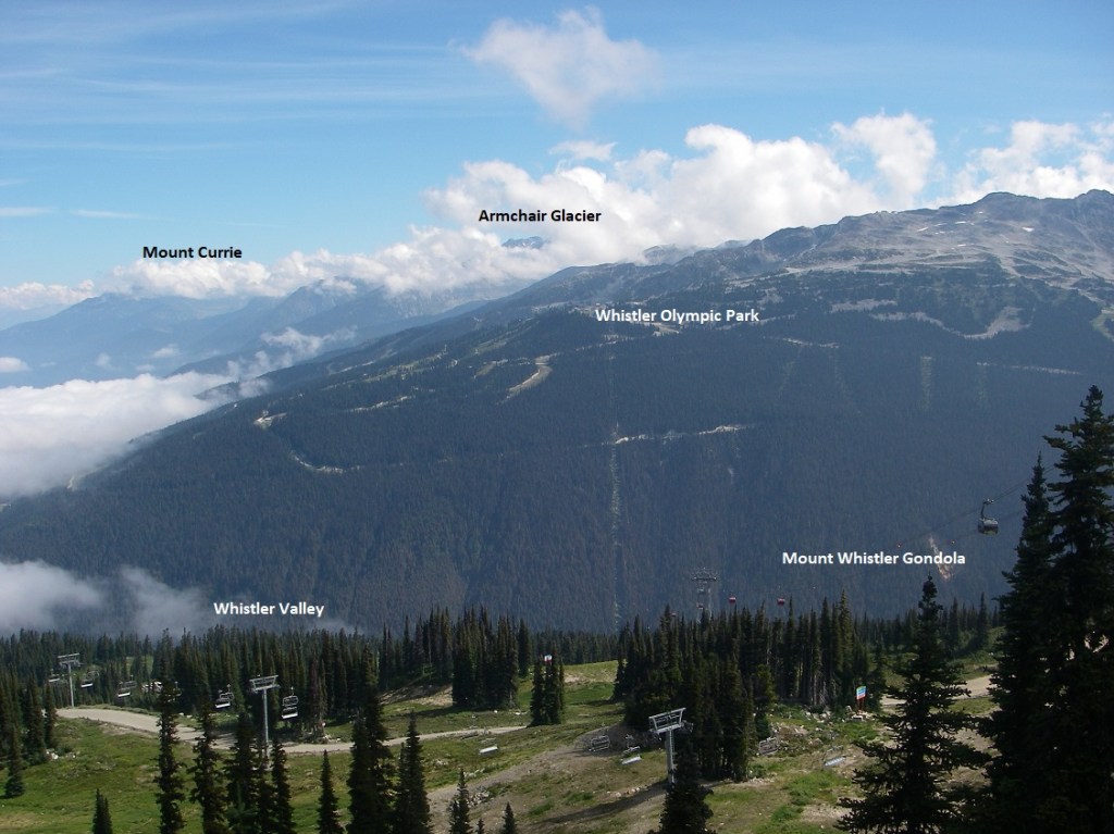
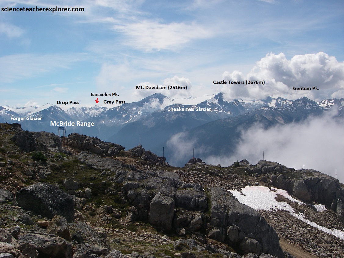
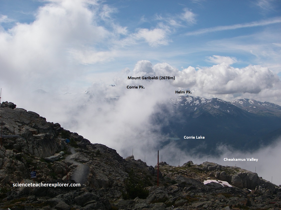
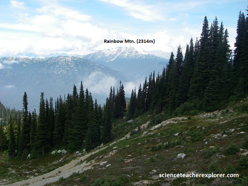
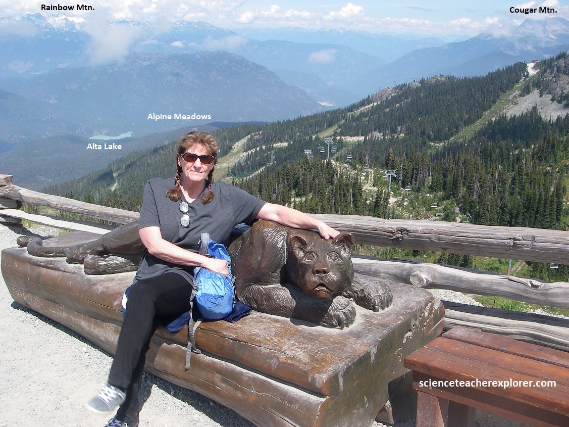
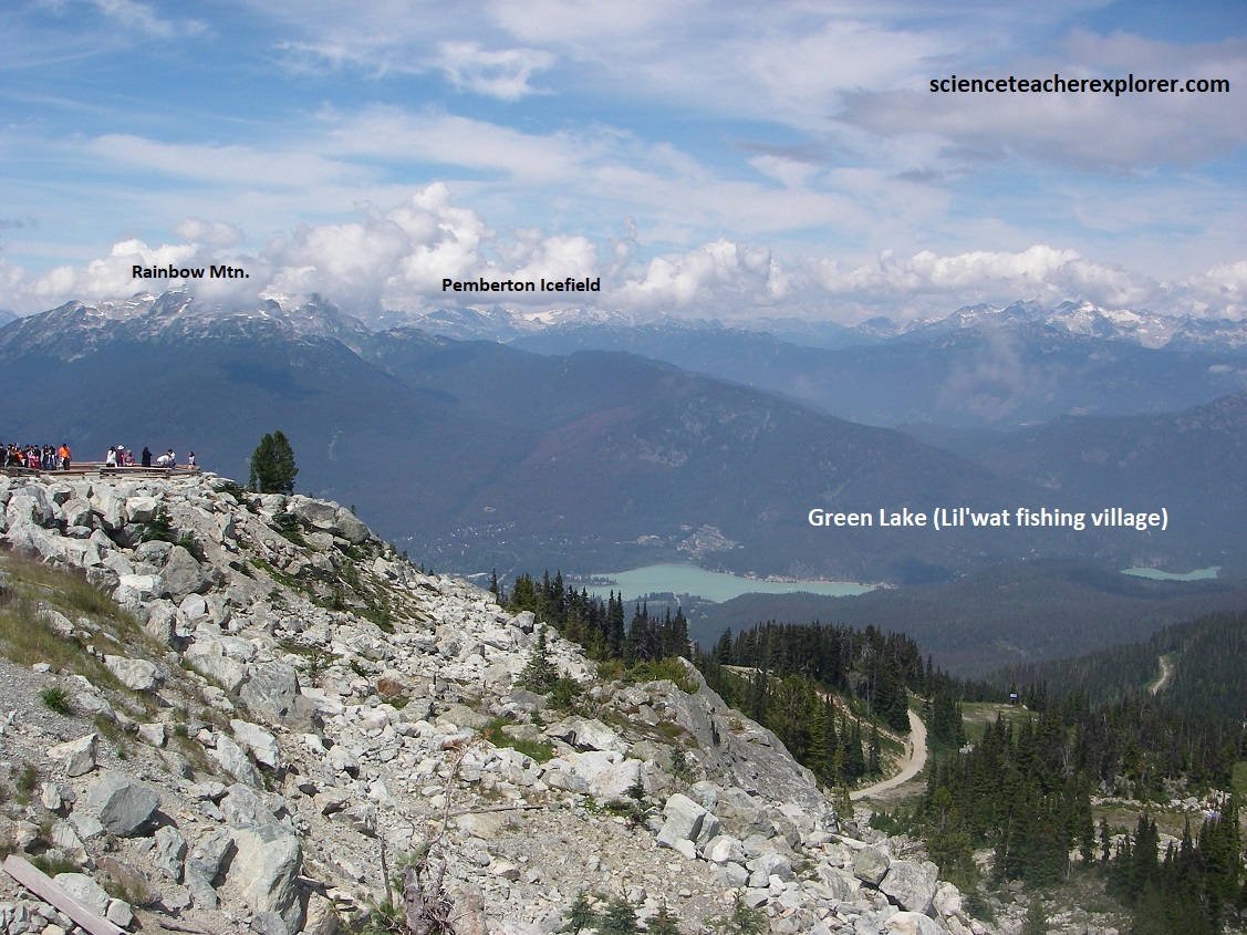
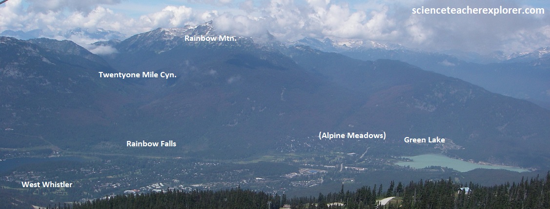
From The Peak Suspension Bridge and Cloudraker Skybridge on Whistler Mountain, we could see a panoramic, 360-degree view of the surrounding “Coast Mountains”. Key peaks and ranges visible include: 1. “The Black Tusk”, (the most iconic volcanic peak in the area). 2. The Castle Towers, (A distinctive, jagged peak to the south). 3. The Garibaldi Provincial Park, (the surrounding wilderness area). 4. The turquoise waters of Cheakamus Lake and Whistler Village far below. 5. Rainbow Mountain, (a peak seen across the Whistler valley to the northwest). {Note: the first photo seen below, (of the Black Tusk), was taken from an interpretive sign on-site}.
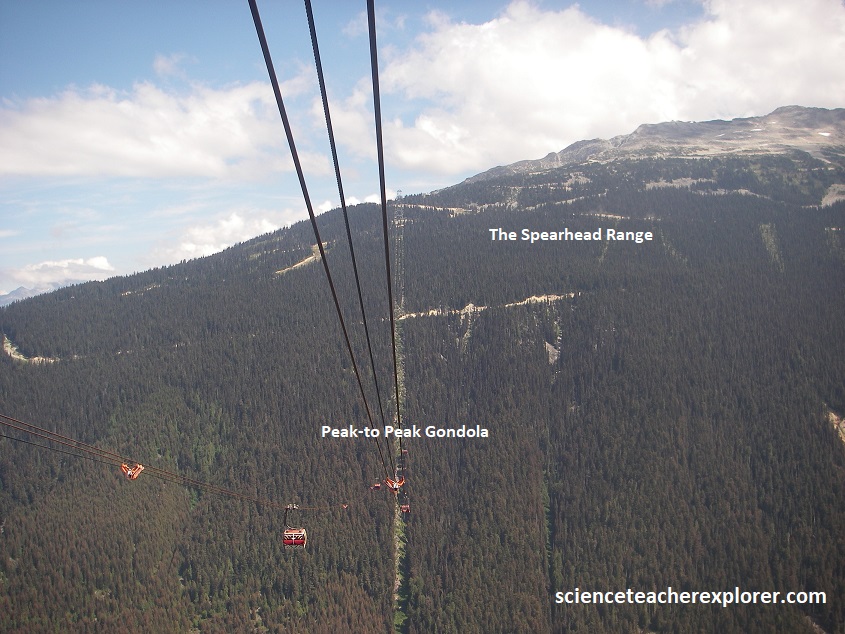
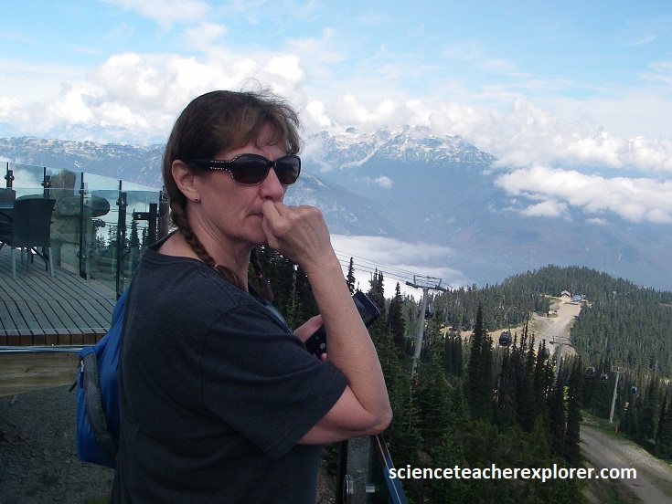
Becky and I returned down to the “Roundhouse Lodge” by way of the “Peak Express Chairlift”. There, we decided to take the Peak-to-Peak Gondola. This was a great way to experience the Coast Mountains “close up” from a vantage point of 436 m above the Fitzsimmons Creek, (imaged below). This gondola took 11 minutes to cover the 4.4 km between the two mountains. It took us from Whistler Mountain to Blackcomb Mountain.
The geology of Whistler Mountain is significantly different from Blackcomb Mountain. Picture below, from the Whistler “Peak Express Chairlift”, the Whistler Mountain rocks were relatively young and formed a mere 80 million years ago during the Cretaceous Period. They were a mixture of sedimentary rocks like shale and silt and volcanic lava rocks like andesite.
In contrast, Blackcomb Mountain is much older, and formed 150 million years ago during the Jurassic Period. During this time, a “pluton” of hot, molten magma slowly moved up through the Earth’s crust before cooling and crystallizing as a solid rock called granodiorite.
However, it should be noted that the rocks in the Fitzsimmons Creek valley below are weak and are susceptible to weathering and erosion. This is the geological processes which formed the distinctive steep valley between Whistler and Blackcomb mountains, (pictured below). These rocks are associated with a large “fault,” the Fitzsimmons Range Fault, which runs along the edge of Whistler Mountain passing through Ego Bowl. Movement along this break in the Earth’s crust produced high pressures and temperatures which metamorphosed (altered) the existing valley rocks to produce the weak and crumbly phyllite and greenish chlorite schist rocks, (which weathers to a tan color), located below the valley today.
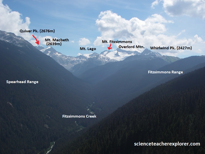
The Rendezvous Lodge was located right at the top of the Blackcomb Gondola and the other-side of the Peak-to-Peak Gondola, offering various food and beverage options, expansive outdoor seating, and quick snacks, (pictured below). It also gave us a 360-degree panoramic views of the spectacular Coast Mountain Range. {The pictures below are looking west and northwest from the Rendezvous Lodge}.
Once we returned back to the Whistler Village below, Becky and I continued driving north on Hwy. 99, along the “Sea-to Sky Route”. Our first stop was the 1.5km trek to Nairn Falls, (pictured below).
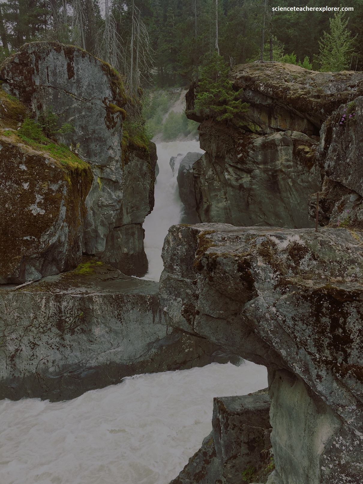
Nairn Falls is a dramatic, glacially-fed waterfall located along the Green River and Hwy. 99. It is carved into an outcrop of metamorphosed bedrock, where relentless, sediment-heavy glacial meltwater over thousands of years has eroded the landscape to create deep, twisting canyons and unique circular potholes. As the river narrows into a gorge, its volume and speed multiply. The immense power of the water carries sand and gravel downstream. When this abrasive material gets trapped in small depressions, the swirling water spins the debris in deepening circles, carving perfectly smooth, circular “potholes” into the bedrock. The waterfall itself is a 40m double-tiered plunge. The upper and lower tiers are separated by a leveled trough and a partially submerged natural rock arch carved by the river’s relentless motion.
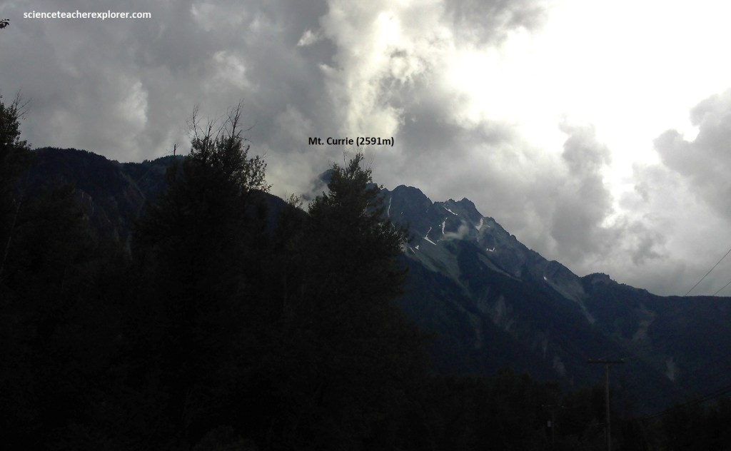
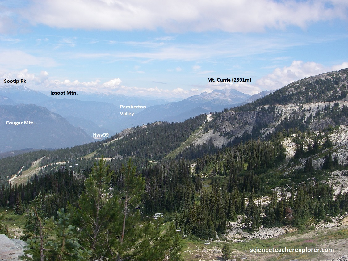
Pictured above Mount Currie, towering over Nairn Falls and Pemberton, is composed primarily of Cretaceous-era igneous rock, specifically diorite and quartz diorite, dating back roughly 70 to 150 million years. The ridge features complex tectonic structures, gravitational faults, and highly fractured bedrock deeply shaped by glacial activity.
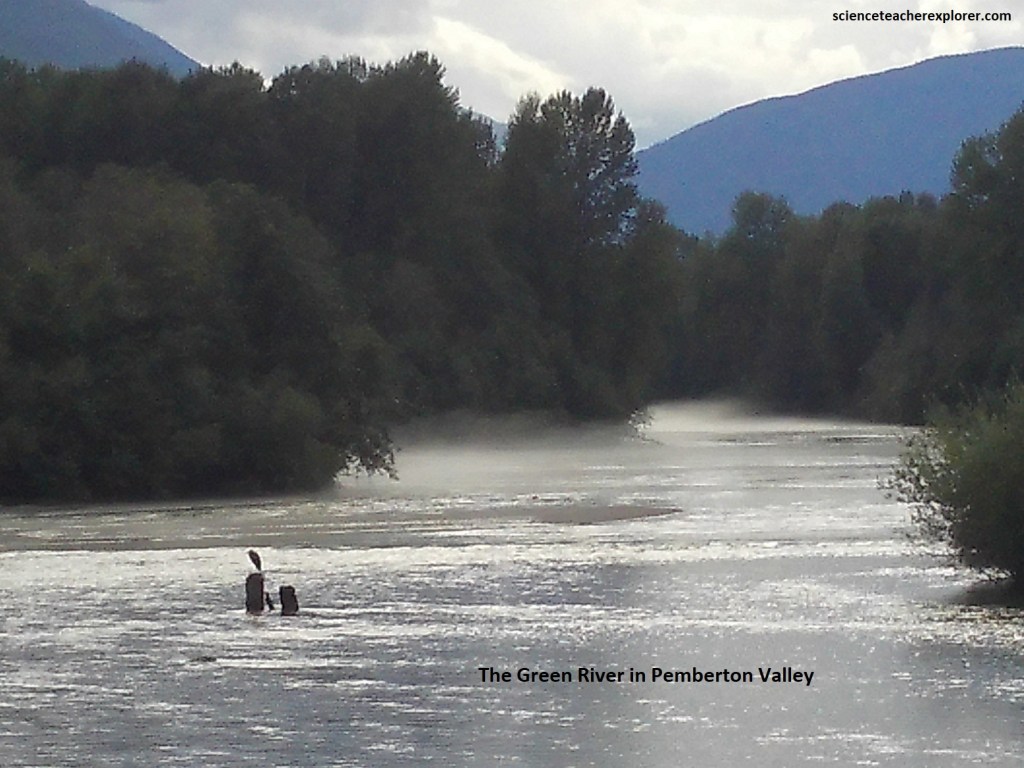
Pictured above, the geology of the Pemberton Valley is largely due to past events from Mount Meager, (63km northeast of Pemberton and is positioned upriver along the Lillooet River). At Just under 3000m, Mount Meager is considered one of the most active volcanoes on the coast. Last erupting 2350 years ago, the outflows dammed the Lillooet River, creating a lake 50m deep.
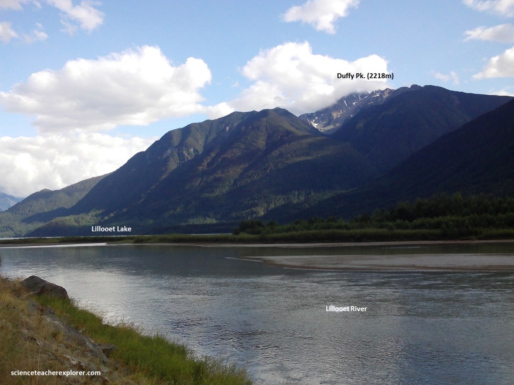
Pictured above, Lillooet Lake is 34km long, 2km wide, and 137m in maximum depth. Hwy 99 crosses the delta of the upper Lillooet River, formed where it discharges into the head of the lake. Geotechnical surveys have shown that the delta front has recently been advancing into the lake at a rate of 20m/yr. It is speculated that erosion by activities related to logging may have been the cause of the rapid advancement of the delta into the lake. Here the bedrock is 102 million years old. It should be noted that as we progress along Hwy 99 towards Lillooet, the granitic rocks become younger west to east.
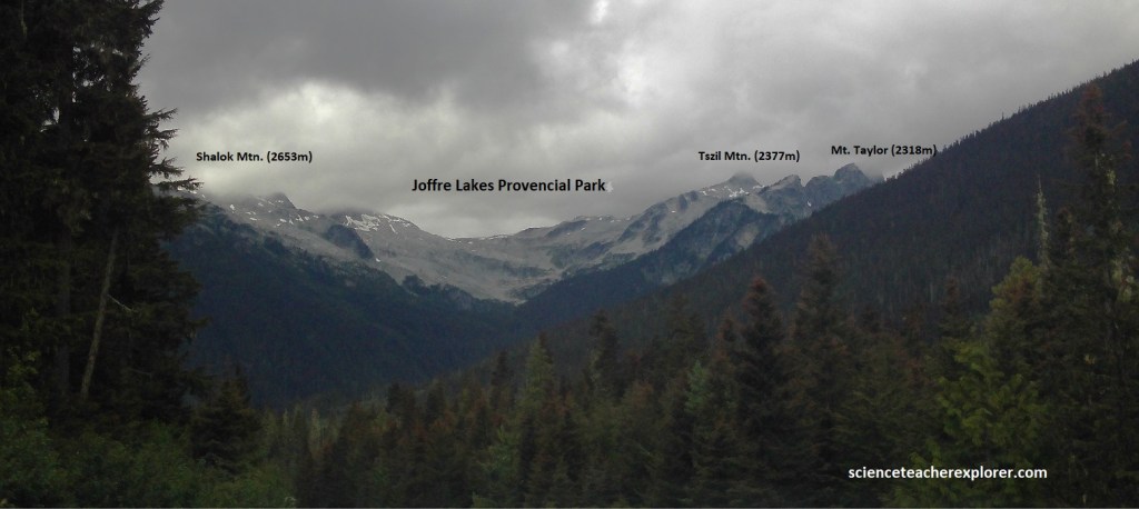
Pictured above, the geology of Joffre Lakes Provincial Park, located 32 km east of Pemberton, is defined by middle Cretaceous igneous intrusions of granodiorite (100 m.y.a), dramatic alpine uplift, and active glacial sculpting that shapes the landscape and creates it’s signature vibrant turquoise lakes.
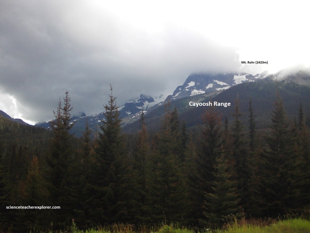
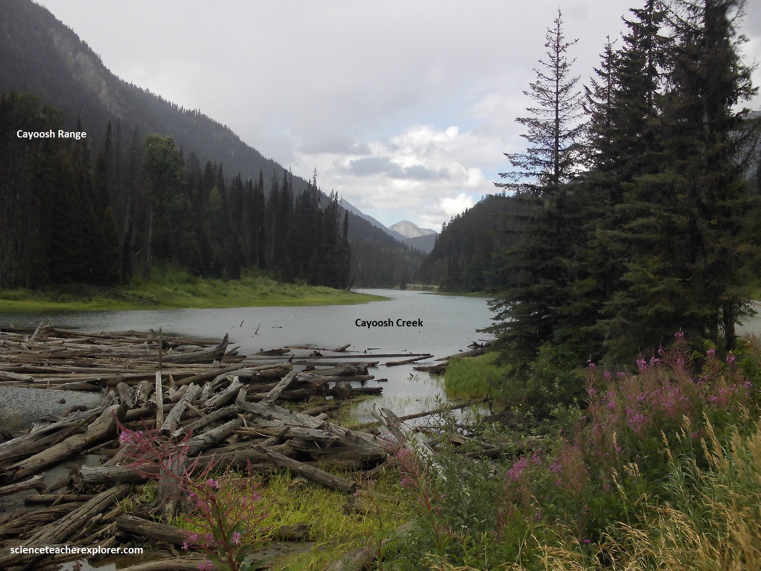
Pictured above, the Cayoosh Range is characterized by a complex, fault-founded oceanic and arc-related terranes. It primarily consists of the Jurassic-Cretaceous Cayoosh RockAssemblage and the Mississippian-to-Jurassic Bridge River Complex, featuring highly metamorphosed phyllitic argillites, siltstones, sandstones, and greenstones. Bedrock in areas like Cayoosh Creek hosts quartz veins and schists containing pyrite, arsenopyrite, and native gold, which led to a historic gold rush and placer mining boom in the late 19th and early 20th centuries. At this location, Hwy 99 follows Cayoosh Creek for remaining way to Lillooet.
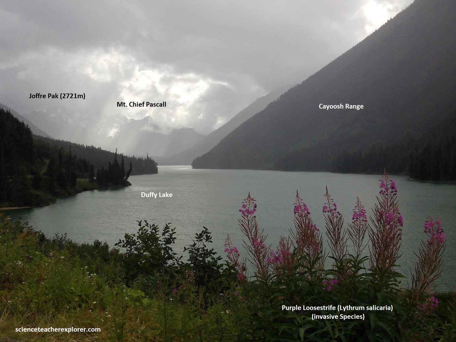
{Pictured above, on the left is looking southwest and the right is looking northeast}. This area is a highly complex geological boundary where the older oceanic rocks of the “Bridge River Complex” were thrust over the younger sedimentary rocks of the “Cayoosh Assemblage”. This interaction occurred along a major geological structure known as the “Cayoosh Creek Thrust Fault”. Duffey Lake is situated in the Cayoosh Creek valley, and the fault contact can be traced along the steep ridges, cliffs, and logging road cuts in the area.
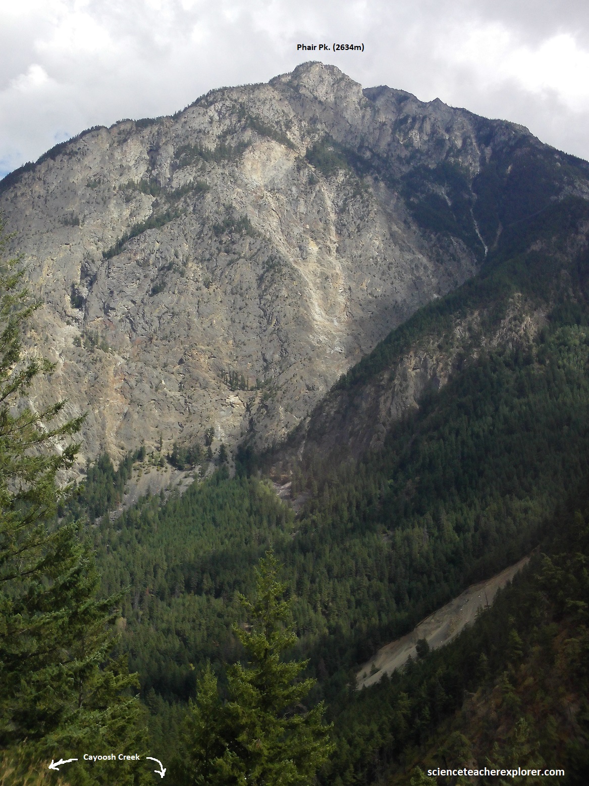
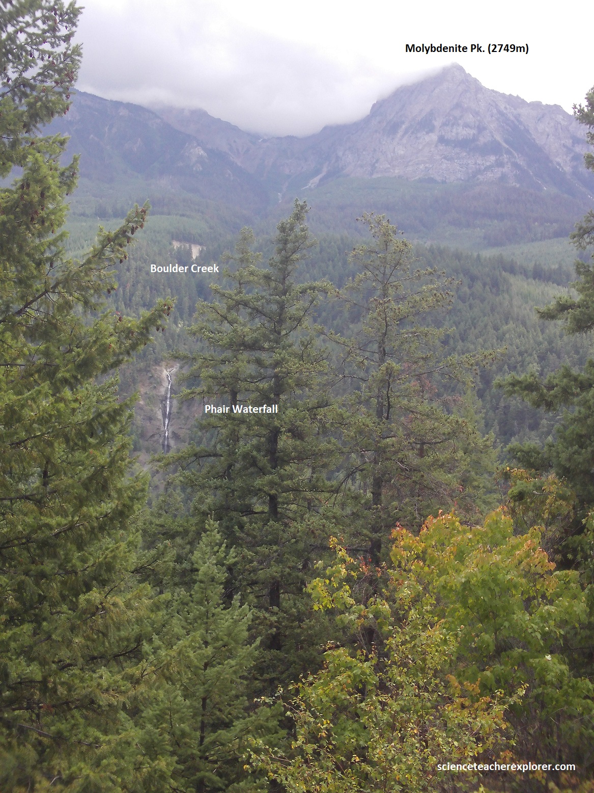
Picture above, on the right, is Phair Falls. A tall but low volume Boulder Creek waterfall spilling off the side of the northern arm of Phair Pk. into Cayoosh Creek canyon. The falls plunge approximately 115m in three major steps before the creek largely sinks into the talus substrate lining the lower canyon wall and flows inconspicuously into Cayoosh Creek at the bottom of the canyon. Hwy 99 passes through 63-million-year-old granodiorite. However, across Cayoosh Creek to the north, the rocks are thinly laminated siltstone and shale. of probable late Jurassic or early Cretaceous age. A fault separates the granite from the sedimentary rock, and Cayoosh Creek probably follows the fault, taking advantage of the more-readily eroded rock along the fault. Phair Peak and the surrounding mountain ridges (including Molybdenite and Onion peaks) are primarily underlain by Mesozoic-era granitic and crystalline rocks. These massive plutonic formations formed deep underground millions of years ago. However, the dramatic, saw-toothed profile of Phair Peak is the result of Quaternary glaciation. Centuries of alpine glacial carving formed the steep cirques, aretes, and couloirs that bisect the peak’s west. The ridge connecting Phair Peak is heavily associated with the Molybdenite Ridge. This area displays localized mineralization where hydrothermal fluids moving through fractured basement rocks deposited molybdenum, a silver-gray transition metal.
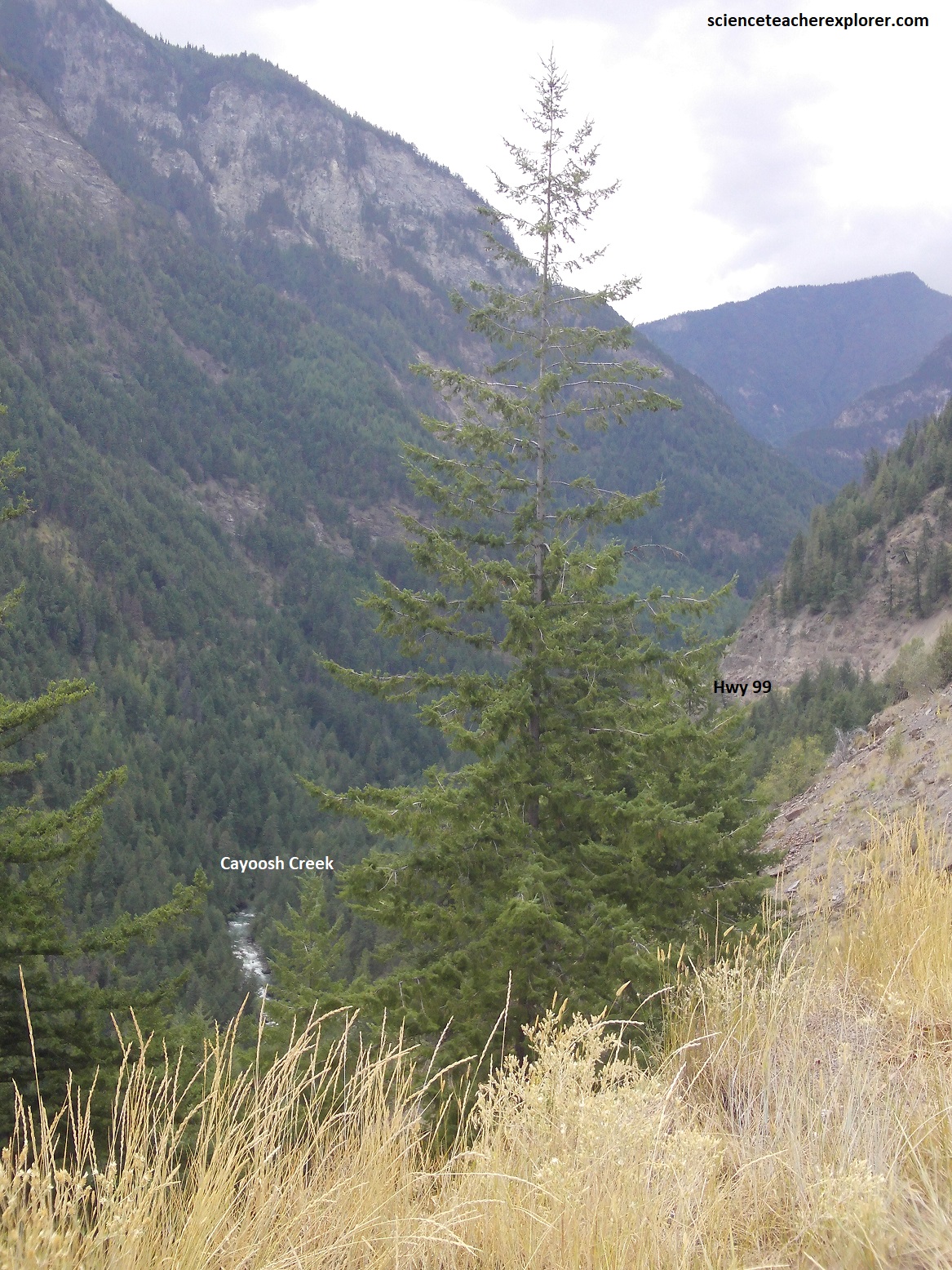
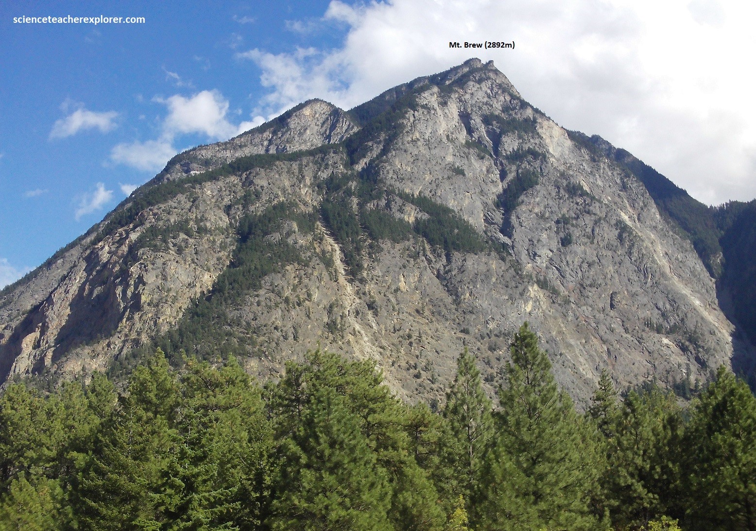
Pictured above, about 14km west of Lilooet, the canyon near the Cayoosh Creek bridge is cut through foliated sandstone, siltstone, and phyllite. Fossil clams were found present about 10km to the southeast, near the top of Mount Brew, at an elevation of nearly 3,000m. These fossils were of earliest Cretaceous age, about 140 million years old, and lived in sand and mud that probable were deposited on top of the Bridge River terrane. The mountains in this area are the highest in the southern Coast Mountains.
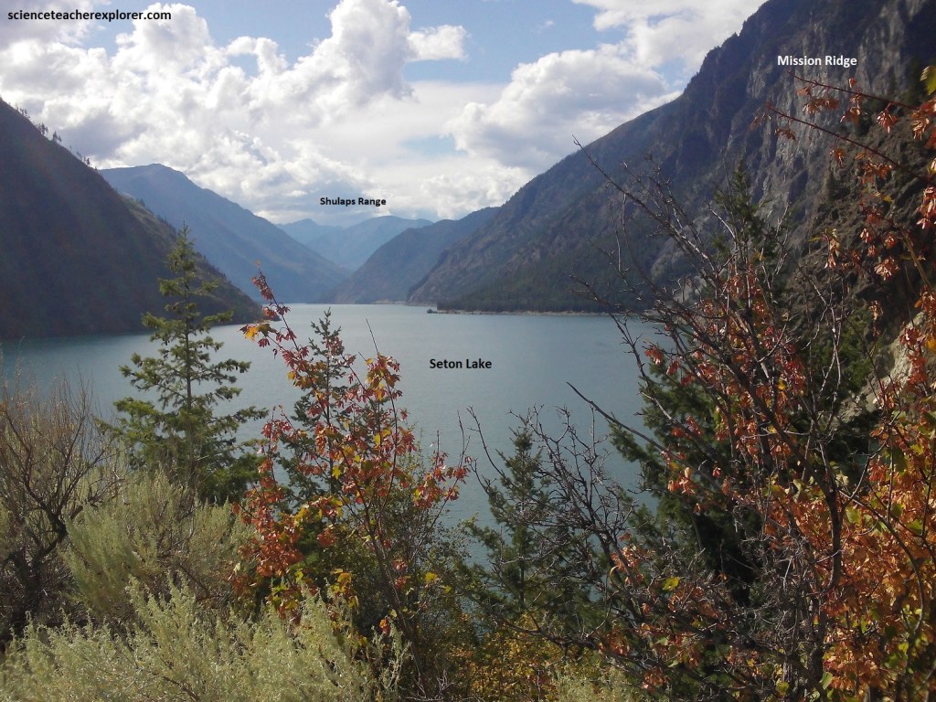
Pictured above, Seton Lake extends westward into the Coast Mountains. In the early 1860s, the lake was part of the route to the Cariboo goldfields at Barkerville, near Quesnel. Seton Creek flows eastward out of Seton Lake along the floor of this spectacular steep-walled valley, to join the Fraser River at Lillooet, 6km away.
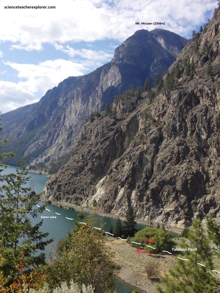
Picture above, at the eastern end of the Seton Creek valley, the large Yalakom fault runs northwestward away from the Fraser River. This fault is a right-lateral strike-slip fault like the Fraser fault, (discussed later), whose west side moved northwestward. The displacement on the fault is estimated to be 155km, and the fault appears to have been active in the latest Cretaceous to early Tertiary time. Northeast of the Yalakom fault are of early Cretaceous sandstone, shale, and conglomerate, which form cliffs of greenish buff color on Fountain Ridge on the west side of the Fraser River. The rocks belong to the Jackass Mountain group.
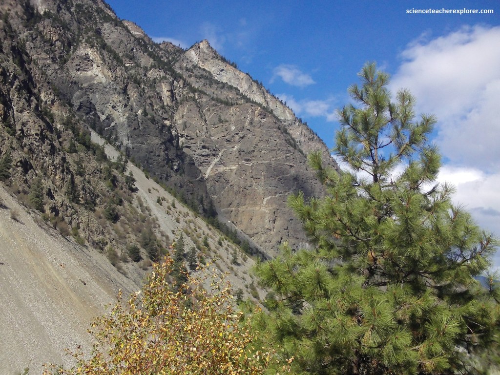
Picture above, the steep walls of the valley are well-foliated rocks, derived from the Bridge River terrane and overlying sediments. Abundant white granitic veins intrude the metamorphic rocks. Some intrusions, called “sills”, lie in the near-horizontal plane of foliation. Others, called “dikes”, crosscut the plane of the foliation but appear to be folded, and still other dikes are un-deformed and rise steeply up the cliff face. Amazingly, all the sills and dikes are about 45 million years old, which means that they were intruded after the latest deformation.
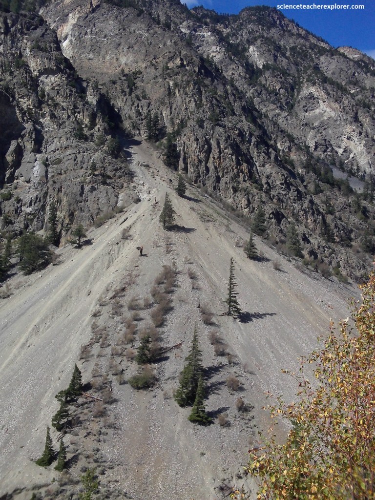
Pictured above, this area is flanked by some of the largest “talus cones” and “talus aprons” in southern British Colombia. These accumulated in post-glacial time from innumerable falls of rock from the cliffs above. Small rock fragments come to rest on the 350 slope of the talus and a few larger locks of rock roll to the bottom and out on the valley floor before stopping. Most rockfalls occur in autumn at the time of early frosts and in spring with early thaws.
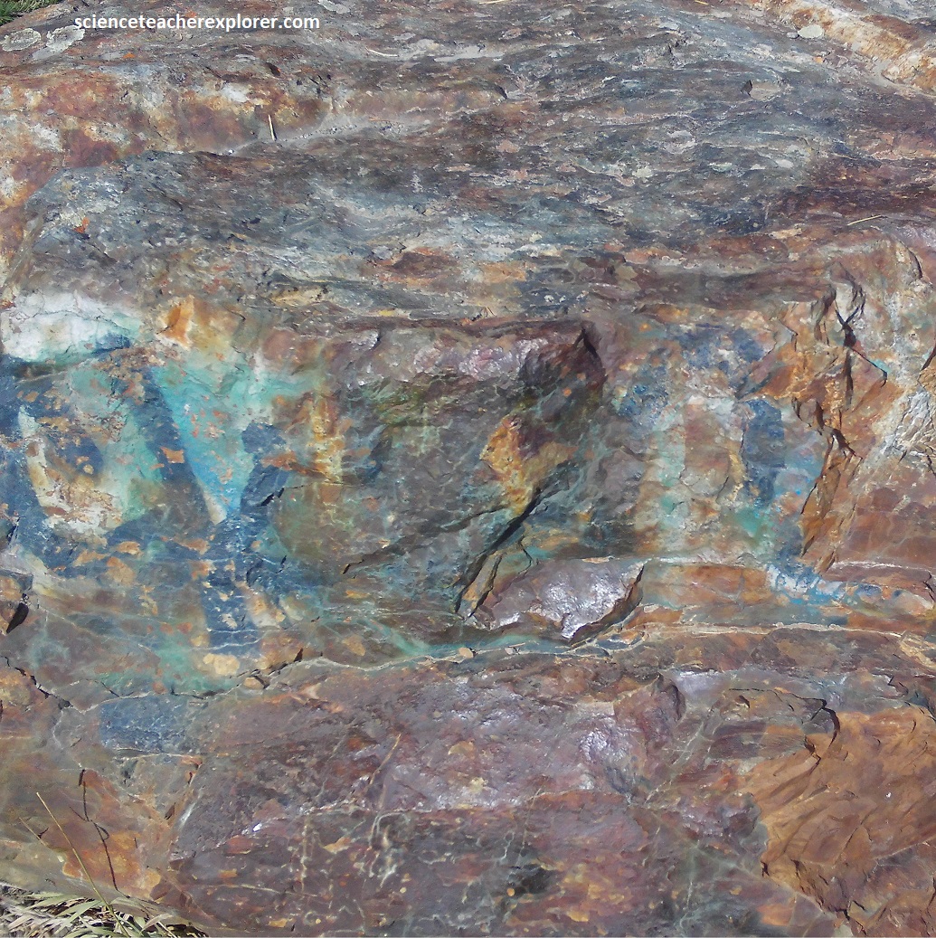
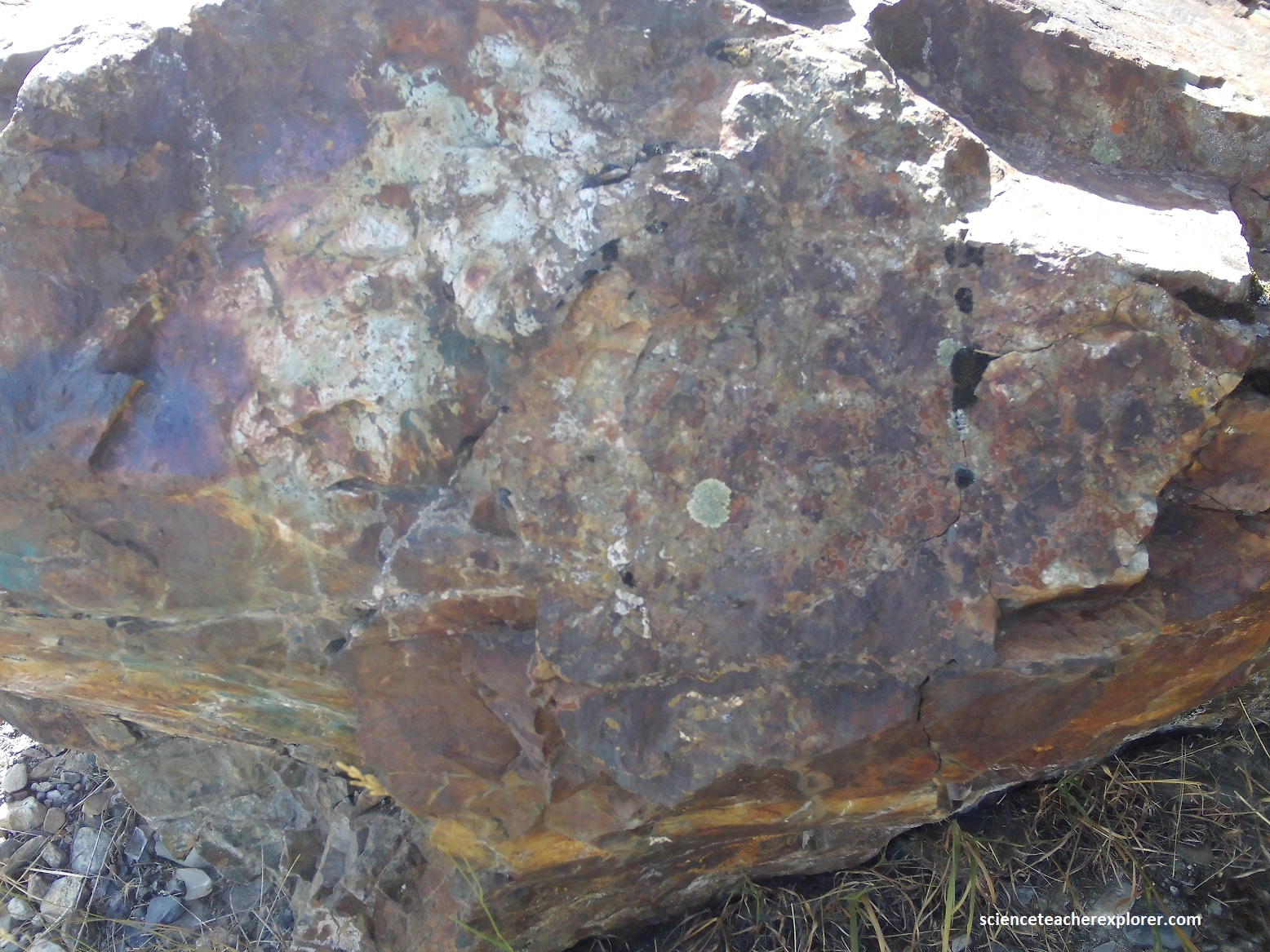
Pictured above, two “erratic”, (rocks deposited from a glacier that do not come from the local area), boulders are found in the parking area at Seton Lake. The rocks contain conspicuous flecks of the azure blue aluminum-, iron-, or magnesium-bearing phosphate mineral Lazulite.
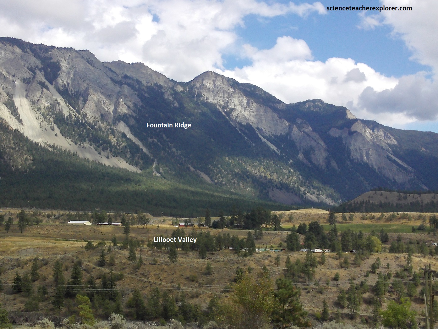
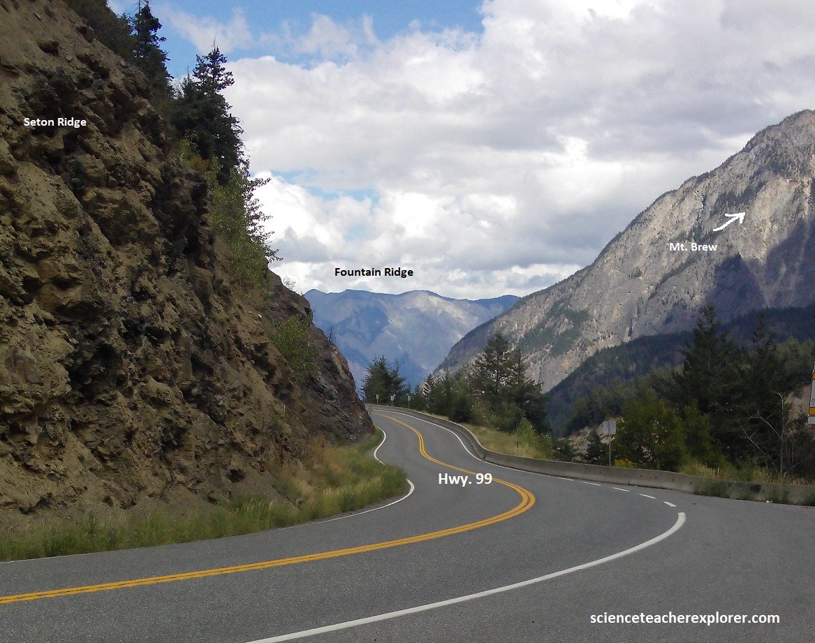
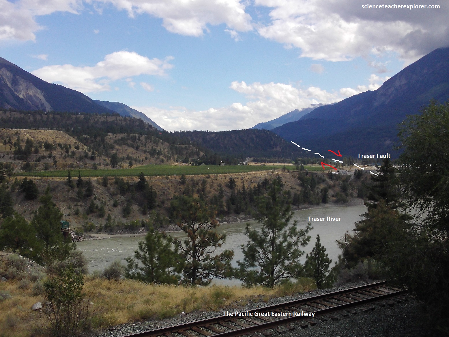
Pictured above, Lillooet & Fountain Ridge sits at the southern apex of a structural “double-horseshoe” bend in the Fraser Canyon. This dramatic ridge was created by the collision and intersection of two massive tectonic cracks: the northerly trending “Fraser River fault system” and the northwesterly striking “Yalakom Fault”. These major faults slice older bedrock into elongate blocks, dictating the sharp, steep-sided structure of the ridge.
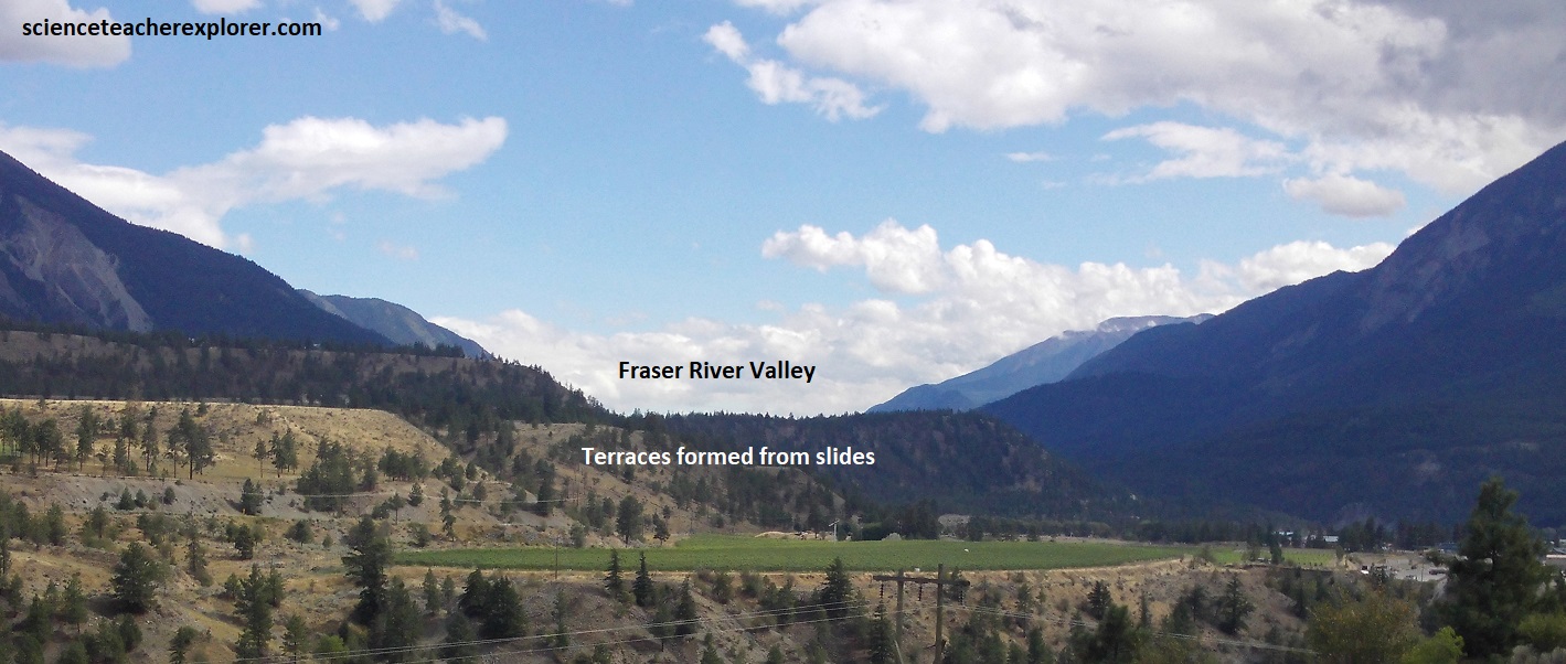
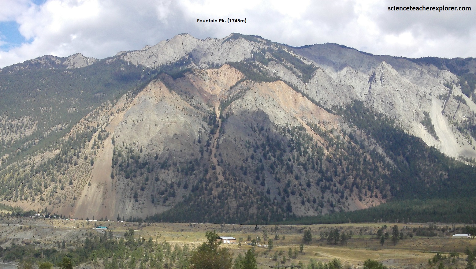
Looking south down Fraser Valley from Lillooet ends our Sea-to-Sky Trek. The landscape around the base of the Fountain Ridge is heavily shaped by Pleistocene and Holocene glacial and river activity. During the retreat of ancient glaciers, the Fraser River was temporarily dammed, leaving behind thick deposits of ancient lake bottoms and glaciofluvial sediment. The Fountain Ridge itself features highly unstable, steep slopes. This has resulted in notable slope failures like the Fountain Landslide, (an ancient earthflow near Highway 99 that moves continuously due to the underlying weak, water-saturated clays and heavily fractured bedrock) and terraces. Much of the bedrock here comprises the Western belt of the Cache Creek Complex, primarily dating from the middle Permian to Middle Jurassic periods. The eastern flanks and portions of the Fountain Ridge are dominated by marine sedimentary rocks—including siltstones, argillites, and conglomerates of volcanic origin—which date back to the Late Jurassic and Early Cretaceous periods.
British Columbia’s Sea to Sky Highway (Highway 99, connecting Vancouver to Squamish, Whistler, Pemberton and Lillooet) provided a journey through the geology of British Columbia’s Coast Mountains, where relief from valley floors to summits was quite the trek. Becky and I saw how glaciation, erosion, the sea, volcanoes, and man have shaped this landscape throughout time.
