Chugach, AK 2025
Becky and I explored Alaska’s Seward-Highway from Anchorage to Seward in the late summer of 2025.
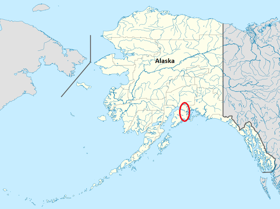
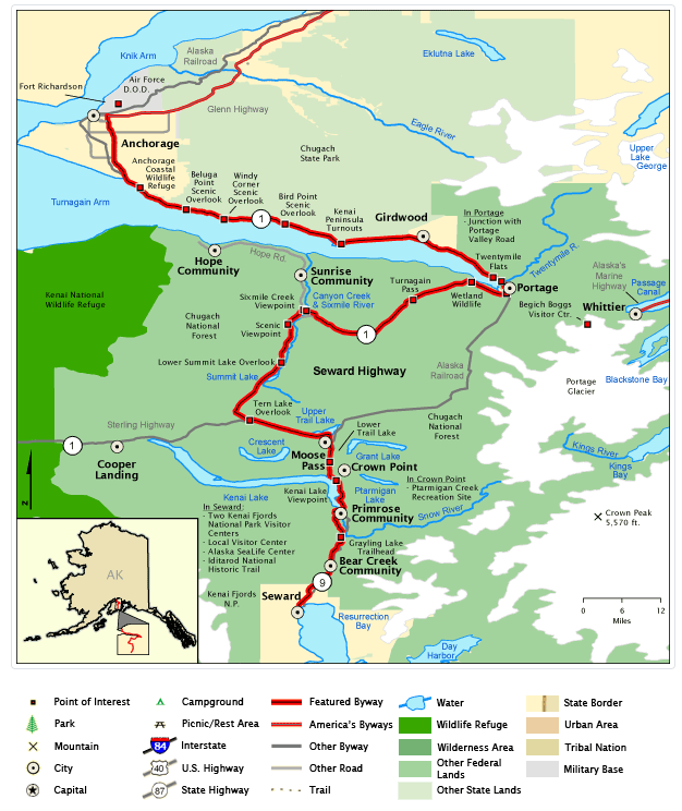
Recognized for its scenic, natural, historical and recreational values, the 205km Seward Highway holds triple designation: USDA Forest Service Scenic Byway, Alaska Scenic Byway, and All-American Road. The first 80km of the Seward Highway skirts the base of the Chugach Mountains and the shore of Turnagain Arm. The remainder of the drive courses through the mountains, offering dramatic views of wild Alaska. With Anchorage as our starting point, we drove along the Seward Highway, a two-lane road winding south for 205km to it’s terminus at Seward on Resurrection Bay.
Home to about half of Alaska’s population, Anchorage is wedged like an arrowhead between the Knik and Turnagain arms of Cook Inlet and sprawls eastward to the steepening foothills of the Chugach Mountains.
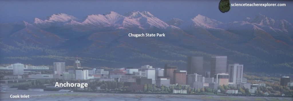
From it’s very first kilometer, the Seward Highway offers gorgeous views: the Chugach Mountains dominate the eastern horizon, (seen above), while the snow-topped summits of the Alaska Range seem to rise from the chilly blue waters of Cook Inlet to the west.
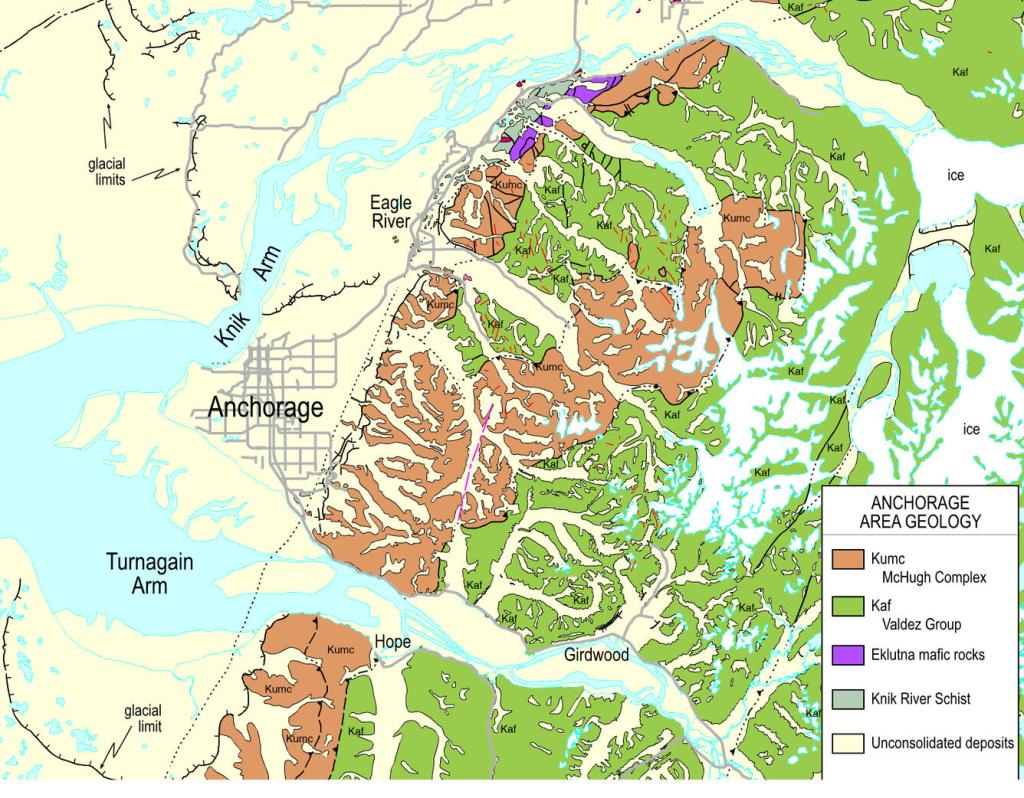
During the last Ice Age, (12-120 thousand years ago), the site of Anchorage was at the intersection of glaciers moving down Turnagain and Knik Arms of Cook Inlet. Glaciers emptied into Cook Inlet and then, scattered glacial outwash and till across the lowlands as they melted back. Fine-grained sediments settling out of the milky water at the glaciers’ edge accumulated to form the notorious Bootlegger Cove formation that underlies much of the Anchorage area, (labeled above as unconsolidated deposits).
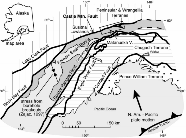
Anchorage sits just west of the Border Ranges Fault, the fault dividing the Peninsular terrane from the Chugach terrane, which forms the Chugach Mountains to the south and east of Anchorage. The Chugach & Peninsular terranes contains the remnants of an accretionary wedge that formed above a subduction zone in plate tectonics. The Peninsular terrane, which accreted to the North American continent at the end of the Jurassic time, forms the Alaska Peninsula and extends east to the Copper River. The Border Ranges Fault slices southward along the Chugach Mountain front along the east side of the Glenn Highway through Anchorage and along the Kenai Mountain front to Homer, where it is buried under thick Tertiary and Quaternary sediments.
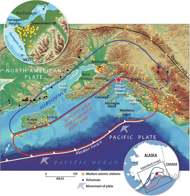
On Good Friday, March 27, 1964 at 5:36pm local time (March 28 at 3:36 UTC), an earthquake of magnitude 9.2 occurred in the Prince William Sound region of Alaska. The earthquake rupture started approximately 25 km beneath the surface, with its epicenter about10 km east of the mouth of College Fiord, 90 km west of Valdez and 120 km east of Anchorage. The earthquake lasted approximately 4.5 minutes and is the most powerful recorded earthquake in U.S. history. It is also the second largest earthquake ever recorded, next to the M9.5 earthquake in Chile in 1960.

Anchorage, the nearest large city to the epicenter, was hit very hard. Parts of the Anchorage along the coast were especially hard hit where the Boot-legger Cove formation slid into the sea. In the Turnagain area, 75 homes were totally destroyed, some sliding as far as 667m. Large cracks appeared in the earth behind the slides, as far back as Northern Lights Boulevard. Government Hill Elementary School was flattened. Portions of 3rd and 4th Avenues dropped as much as 3m as the ground gave way and slid toward the sea, (pictured above). The Violent ground shaking during the earthquake cause the glacial sediments of the Boot-legger Cove formation to collapse and slide into the inlet. After the earthquake, these areas are being developed again and the 1964 quake has been forgotten.
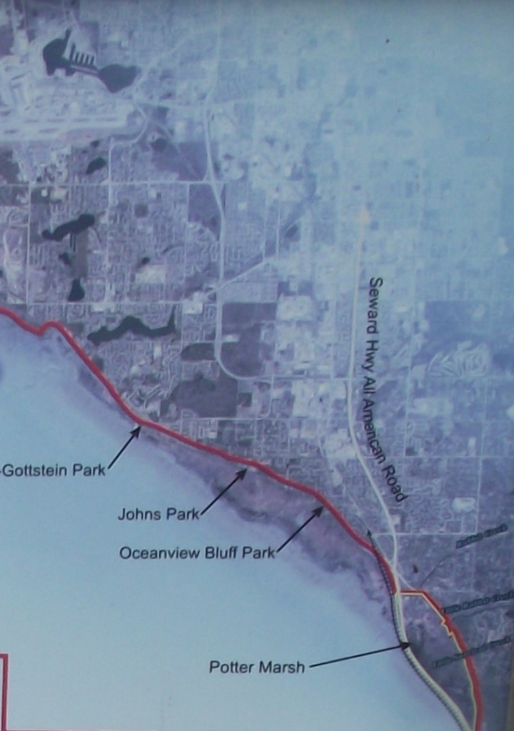
On the outskirts of Anchorage, the Seward Highway passes through a prime locale for bird-watching. Potter Marsh, as it is known, attracts waterfowl from early spring through fall. A boardwalk winds across one section of the marsh, affording close encounters with Canada geese, arctic terns, green-winged teal, and pintails.
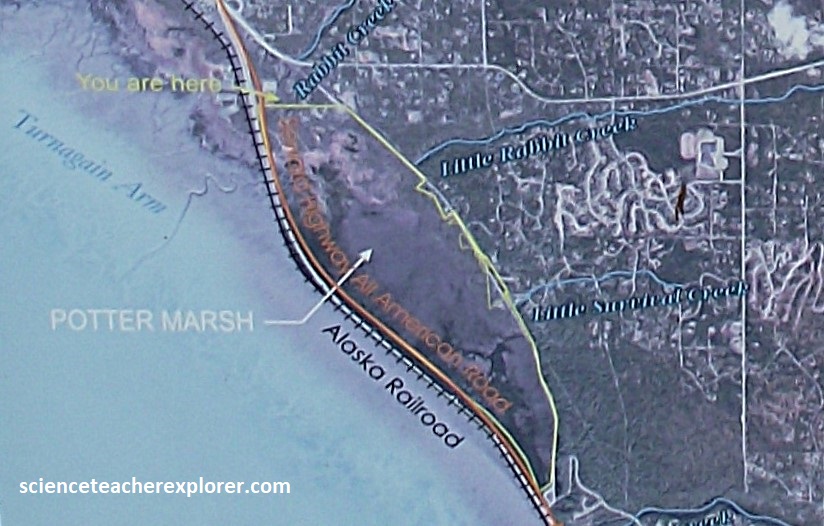
In 1916 and 1917, railroad workers created an embankment between Rabbit and Potter creeks. The embankment impounded several creeks and limited tides and storm surges—Potter Marsh was born. Over time, Potter Marsh became one of Upper Cook Inlet’s largest coastal freshwater marshes. Marsh vegetation grew and low areas filled with water, creating ponds. The ponds and vegetation attract migrating waterfowl and shorebirds, nesting waterfowl, and mammals.
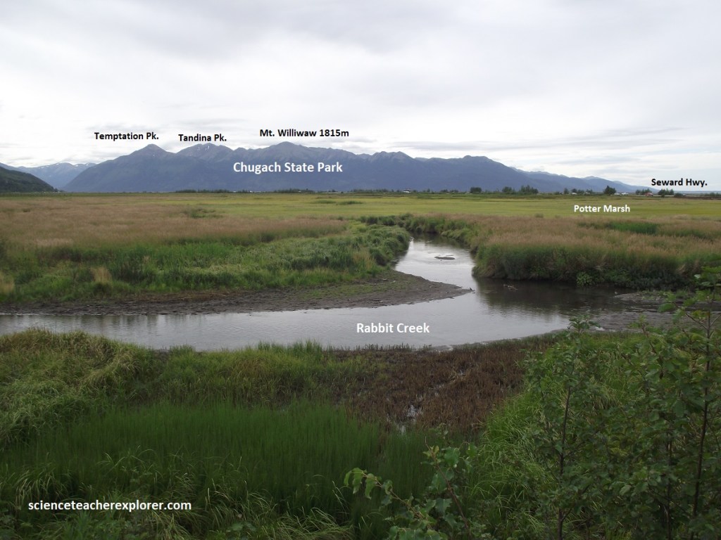
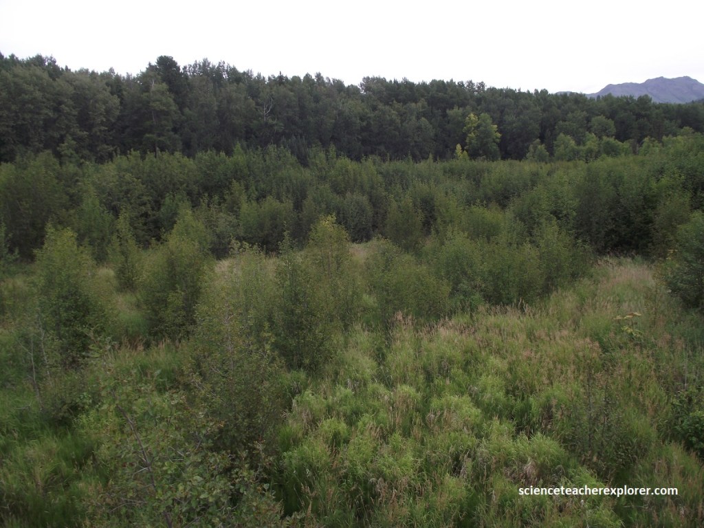
Three main freshwater tributaries, (Rabbit, Little Rabbit, and Little Survival creeks), transport sediment to the marsh. The natural evolution of most marshes is to fill with sediment and dead vegetation, causing the surface water to slowly disappear. A new community of plants would grow and Potter Marsh would begin to resemble a black spruce bog, and eventually the surrounding deciduous forest. Human intervention, such as dredging may be necessary to maintain the marsh.
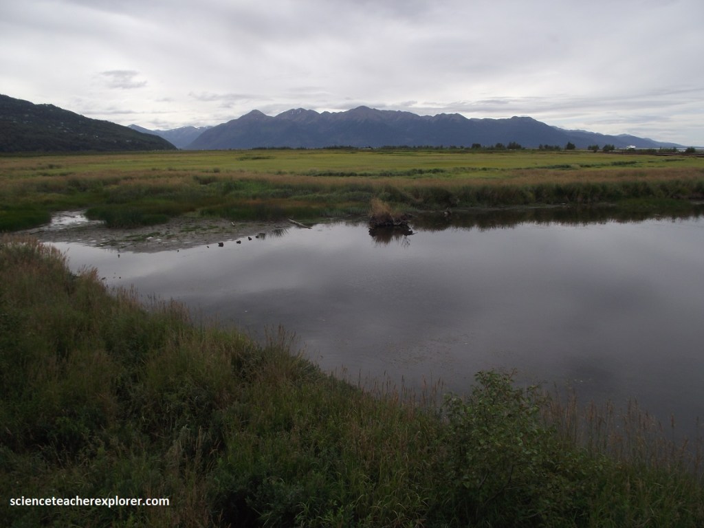
Historically communities have eliminated wetlands in favor of buildings, roads, and parking lots. However, Potter Marsh came about by chance during construction of the Alaska Railroad, before the benefits of wetlands were widely recognized.
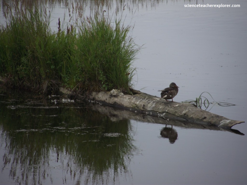
As mentioned above, Potter Marsh receives water from three creeks, as well as surface runoff and groundwater from the surrounding landscape. This water-saturated environment is habitat for migrating and resident birds, spawning and rearing space for five species of salmon, and food and shelter for other wildlife, (pictured above).
Much of the surface water entering the marsh carries sediment and chemicals from streets and lawns. The water slows down when entering the marsh, allowing pollutants to settle into the soil. Plants absorb some of the chemicals. Wetlands do not eliminate pollutants, but they do help fish and wildlife by reducing their effects.
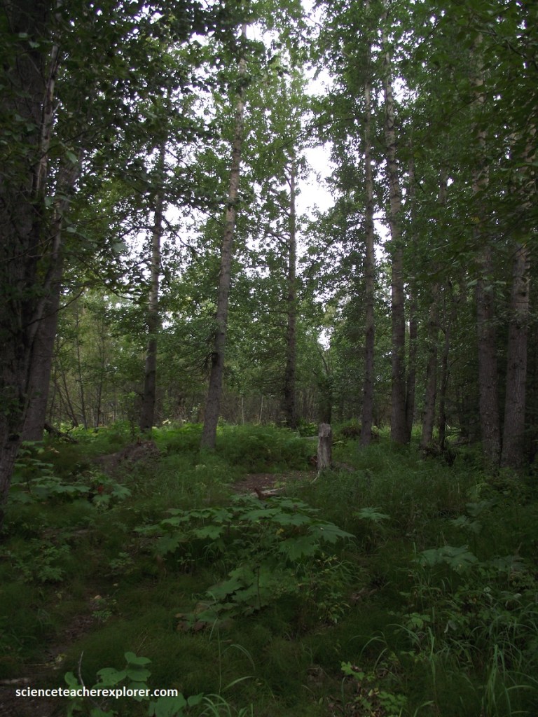
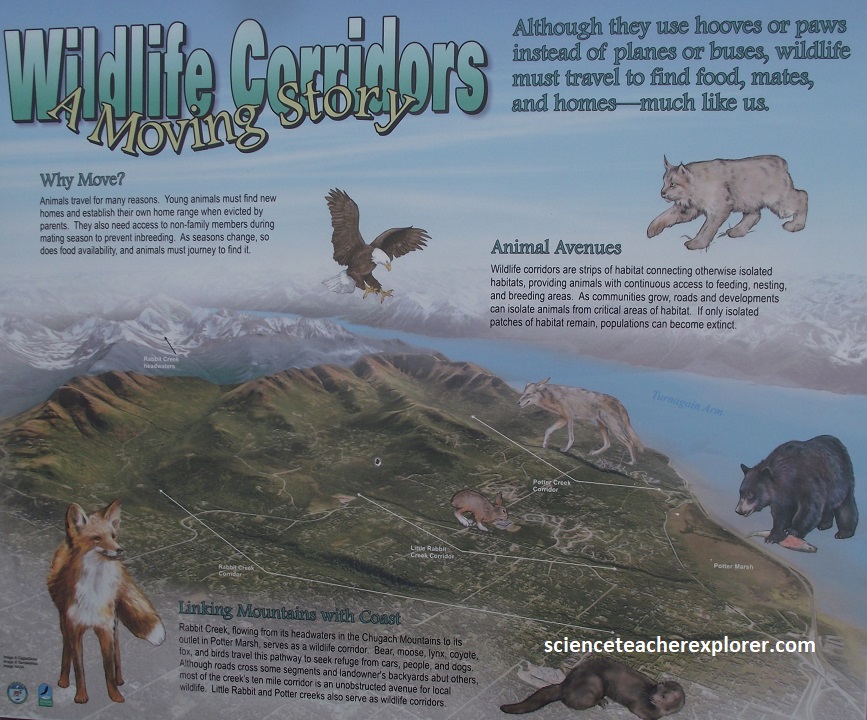
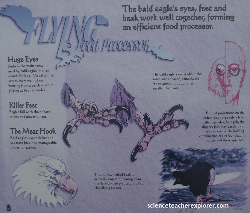
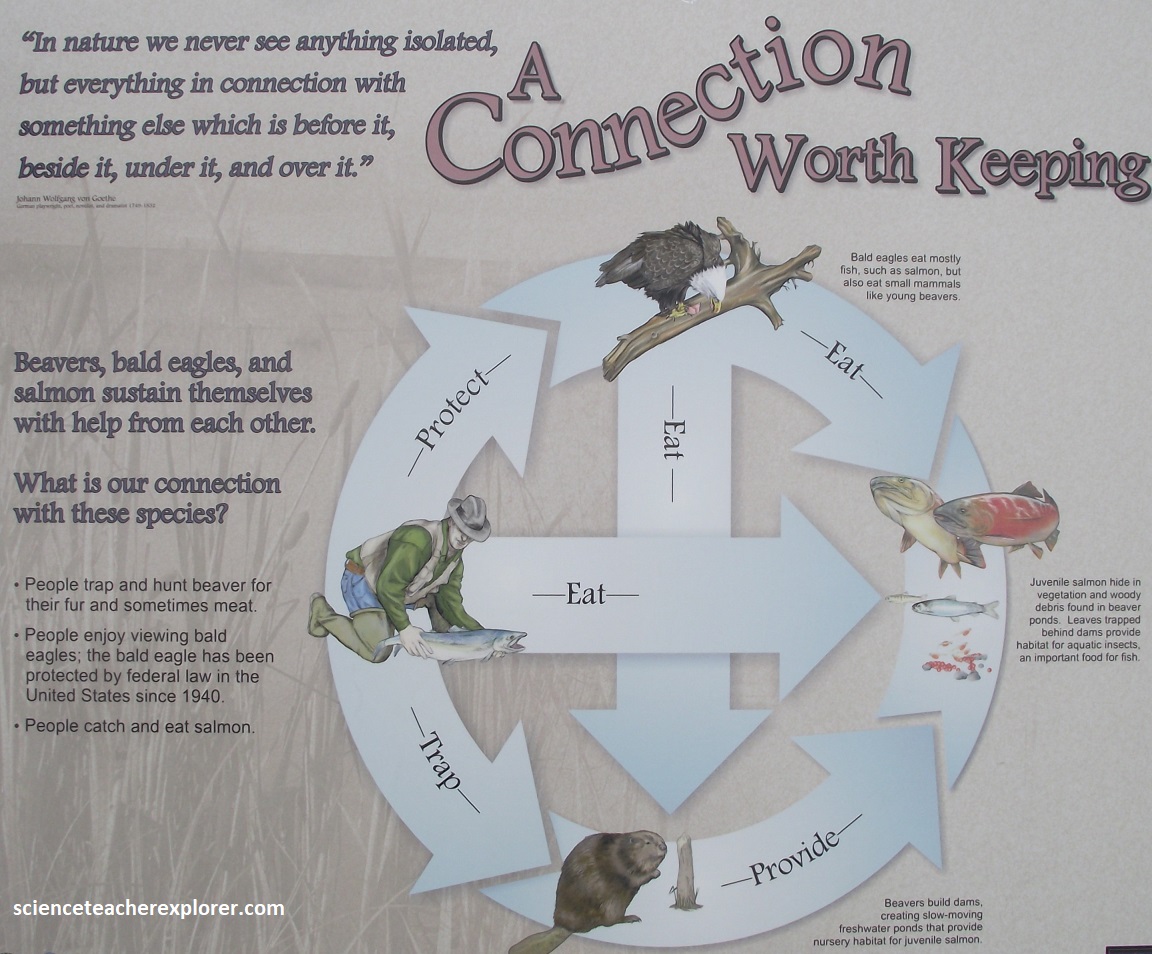
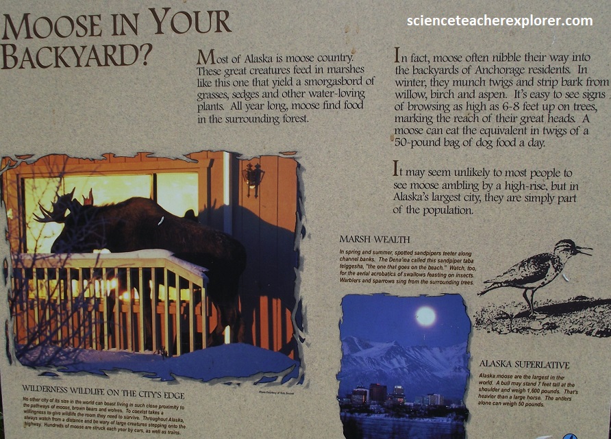
Birds, fish, and mammals need to move from one place to another to fin food and shelter. Cities can fragment natural habitat, making their travel difficult. Wildlife corridors connect urban wildlands such as Potter Marsh with other habitats, allowing wildlife to obtain what they need to survive. Potter Marsh is more than just a wildlife habitat; It serves as an outdoor education area where people can learn about birds, fish, and other wildlife. This marsh offers people easy access to nature, improving the quality of life for local residents and visitors like Becky and I. Below are a collection of interpretive signs I found on the boardwalk at Potter Marsh:
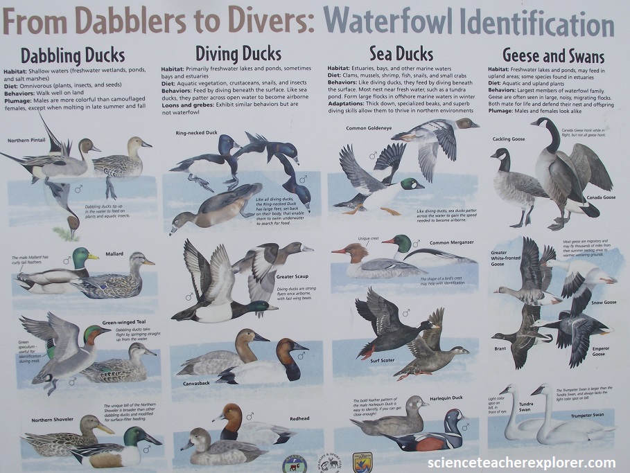
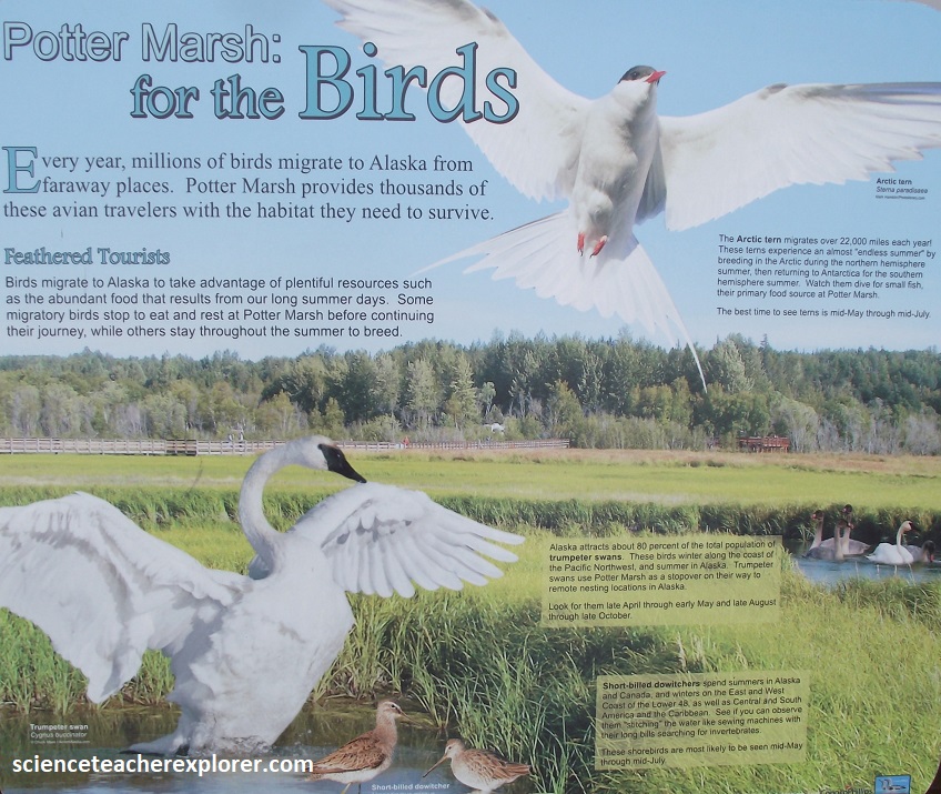
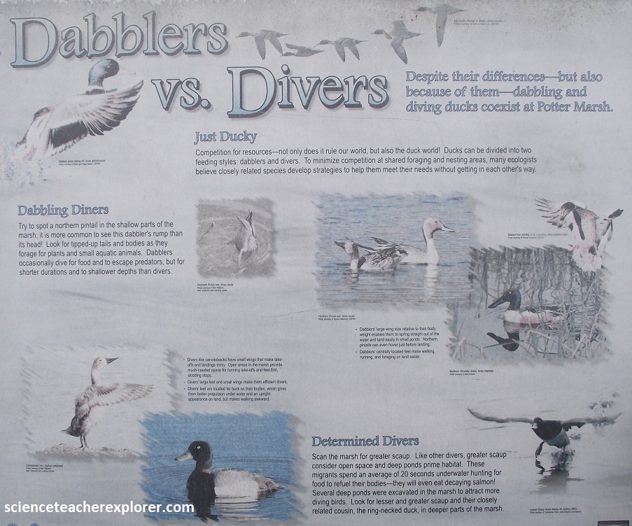
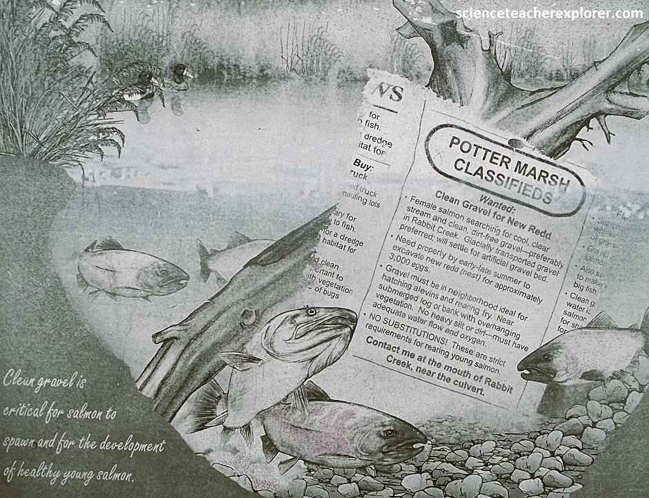
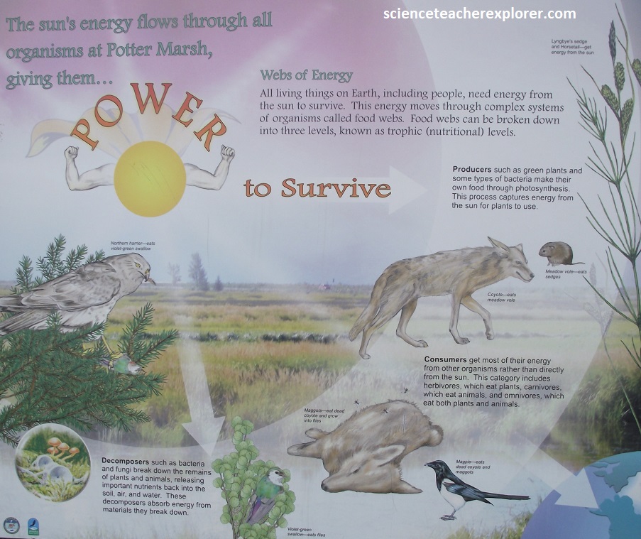
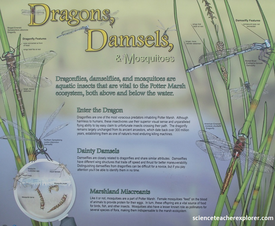
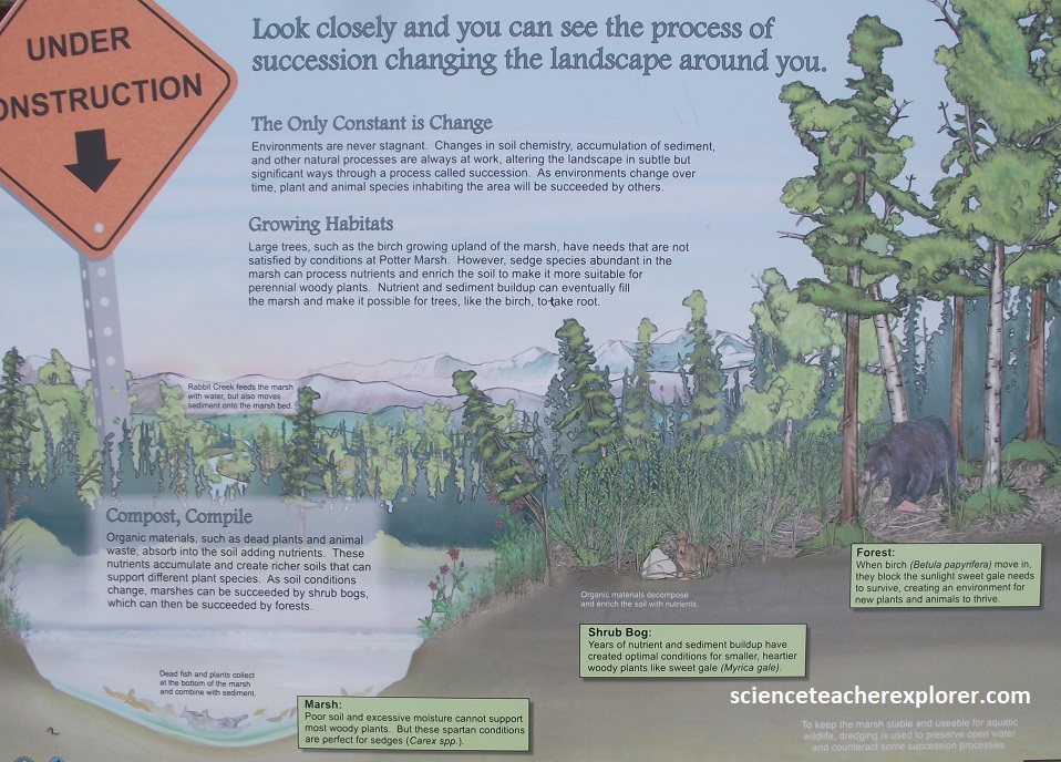
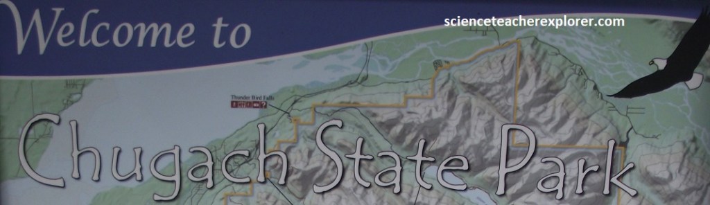
Nearly half the size of Delaware, Chugach State Park encompasses about 500,000 acres of forest, mountains, and glaciers.
Becky and I visited the Potter Section House, a restored building once occupied by railroad workers who maintained tracks here during the days of steam locomotives.
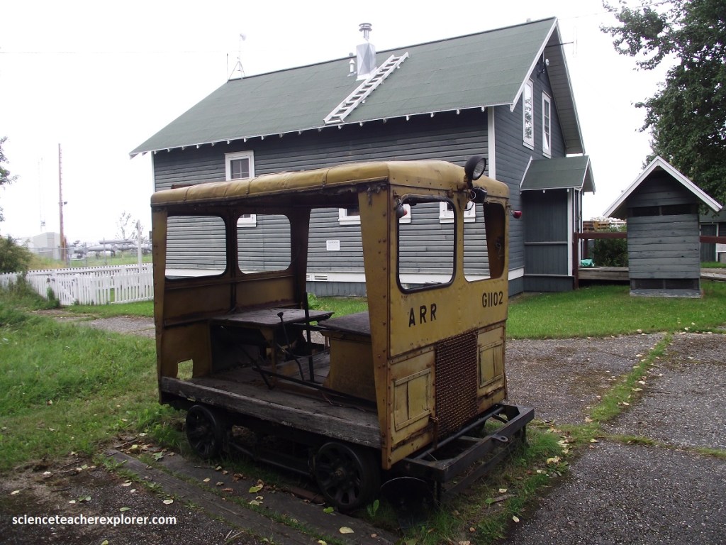
Pictured above, a Section car, in front of the Potter Section House, carried four to five men crews and equipment to their daily jobs of track maintenance, aligning and lifting track, replacing ties and repairing the roadbed. It must of been a chilly winter ride in the canvas-sided gasoline powered car with no heater or insulation. The ride along the Turnagain Arm was usually -230C weather with a 50mph winds in the Winter. Section cars were light enough for the crew to lift off the tracks and out of the way of passing trains. The structure behind contained memorabilia about the Alaska Railroad. Note the small building on the right was the “Meat Cache”, where meat was hung in the fall and froze as winter advanced.
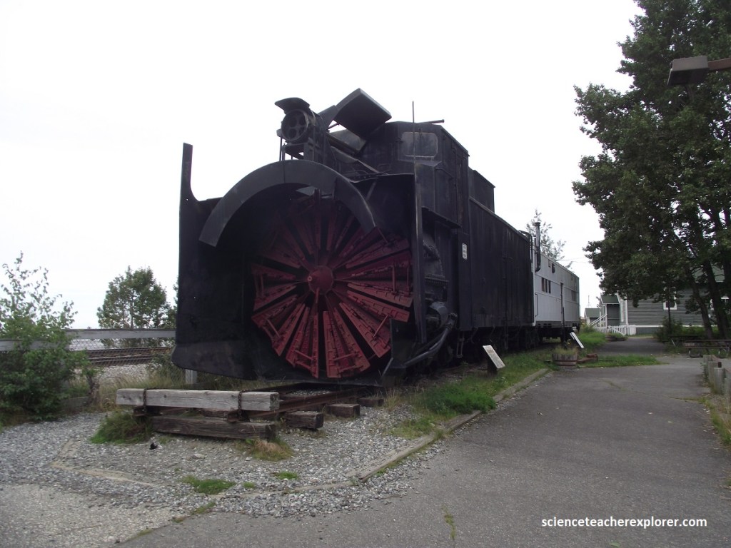
Avalanches made clearing the Turnagain Arm section of the Alaska Railroad (ARR) a nightmare. Snow comes down hard, fast, and heavy and can bend the rails and turn over railcars. When avalanches slow and stop, the snow sets up like cement. J.W. Eliot, a Canadian dentist, patented is design for a rotary snowplow in 1870. Inventor Orange Jull, fine-tuned the design and patented his plow in 1884. His rotary snowplow had/has teeth set in a circle inside an intake manifold. The teeth chop through everything including: frozen snow, frozen moose, and log jams. The plow’s output chute shot snow and ice hundreds of feet to the side, well off the tracks. The challenge was pushing it, which required two steam engines and crew of seven. The rotary plow pictured above was retired in 1985. Today the ARR uses track mounted bulldozers that are more mobile, work faster, and are less destructive to the tracks. However, the ARR still keeps one rotary snowplow in reserve, just in case.
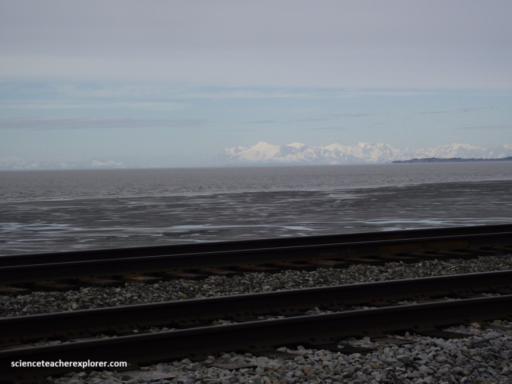
Before track is laid, the right-of-way must be cleared, leveled and the roadbed ballasted. Here, gravel is used as the ballast, or the base of a roadbed. On-top, the ties are laid. All ties are treated with a protective coating. Hardwood ties are used on curves where there is more stress, while cheaper and more available softwood ties are laid on the straight-ways. Rail come in various weights ranging from 55-136 pounds. This weight designation indicates pound per yard. Lightweight rail warps easily because of Alaska’s extreme winters and permafrost hastens wear on the track. So the ARR uses 136 pound rails. Gauge describes the distance between the rails, measured from the inside to inside. The width of narrow gauge is 3 feet. Standard gauge is 4 ft. 8 1/2 inches and wide gauge measures 5 feet from rail to rail. Since most of the equipment came from the Panama RR in the early days, they had to be converted from wide gauge to standard gauge in order to operate here.
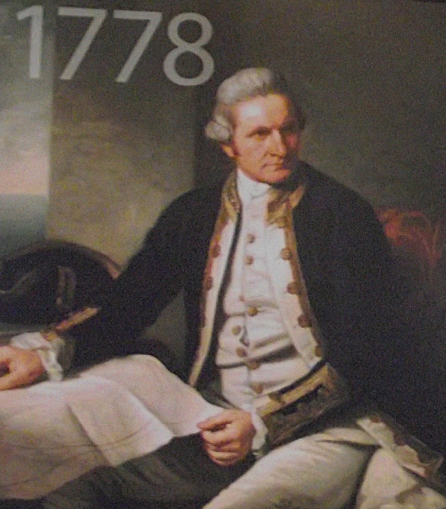
Continuing east, the Seward Highway follows the north coast of Turnagain Arm, so named by Captain James Cook, who sailed up this narrowing extension of Cook Inlet seeking the fabled Northwest passage in 1778. When he hit a dead end. Cook was forced to “turn again”, (pictured above).
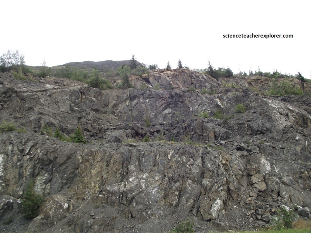
The Chugach terrane is well exposed in roadcuts along most of the Turnagain Arm. Picture above, we see the eroded remnants of rocks that were swept into a trench in late Cretaceous time, (65-100 million years ago). The Chugach terrane contains a belt of melange and a belt of impure sandstone or gray-wacke. The two belts are separated along the Turnagain arm by the Eagle River thrust fault, which crosses the road near Indian Creek and continues across Turnagain Arm and up Resurrection Creek. The McHugh Complex, (pictured above), is a jumble of blocks and pieces of rock floating in a gray, fine-grained matrix. The blocks are of many different types of rock. This melange has been metamorphosed and sheared.
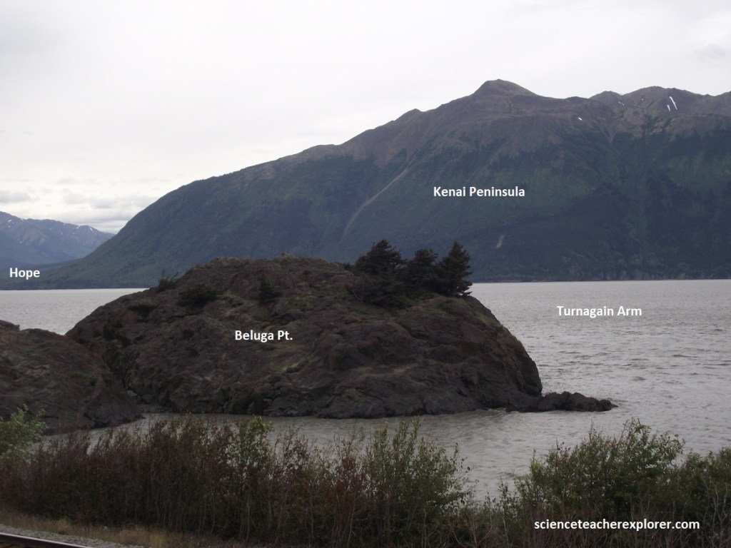
Nearing Beluga Point, Becky and I could see a number of cars slowing down or pulling off the road at the viewing area overlooking Turnagain Arm. The seasonal Tie-up, caused by the sight of white beluga whales, is known locally as a “whale jam”.
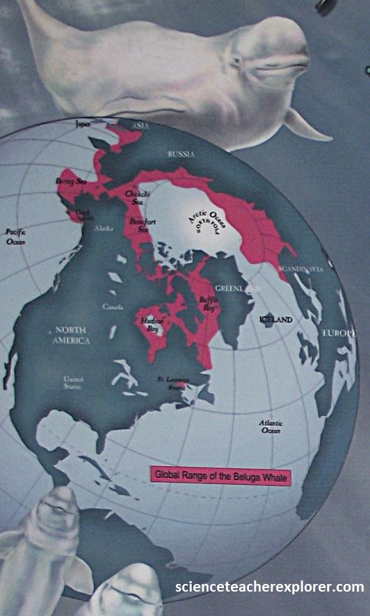
Beluga whales live in the waters of the northern continents encircling the North Pole. In summer, they feed on anadromous fish headed into the rivers along the coasts of Russia, Alaska, Canada, and Greenland. Well-rounded marine mammals that they are, belugas stay warm in their winter hangouts along the edges of the seasonal ice packs, with no blubbering about being unable to visit a warm water vacation spot. However, 5 different populations of beluga whales live in Alaska. While 4 of these population have overlapping ranges in the winter, the belugas living in Cook Inlet remain geographically separate and have grown genetically distinct.
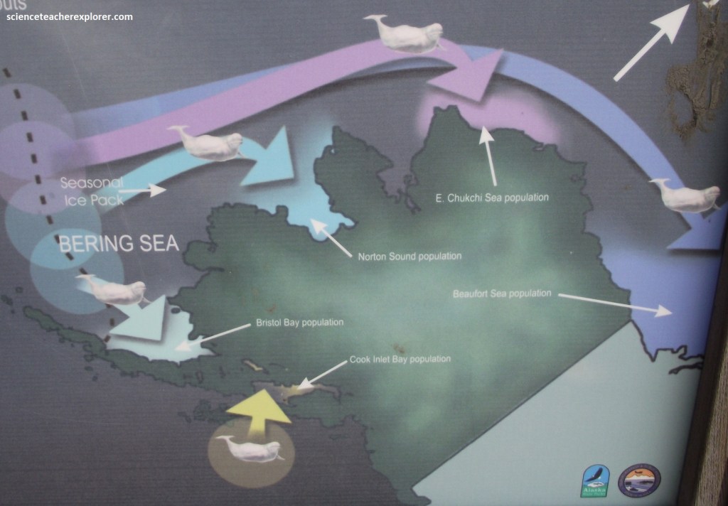
The Bering Sea plays winter host to 4 of Alaska’s populations. The Cook Inlet stock is the only exception, spending it’s winters in the Gulf of Alaska area. The Beaufort Sea whales make the longest journey, some 40,600km each way, to the Bering Sea and back. Warming spring weather puts the ice pack in retreat and triggers the annual run of fish to their natal rivers. The belugas are drawn by their own homing behavior to the same rivers, where they nourish themselves on the abundance of eulachon, salmon and isopods. Note: The Cook Inlet whales show no evidence that any genetic mixing has occurred in at least 6,000 years. To maintain biodiversity, it is important to ensure these distinct Cook Inlet whales remain a viable population.
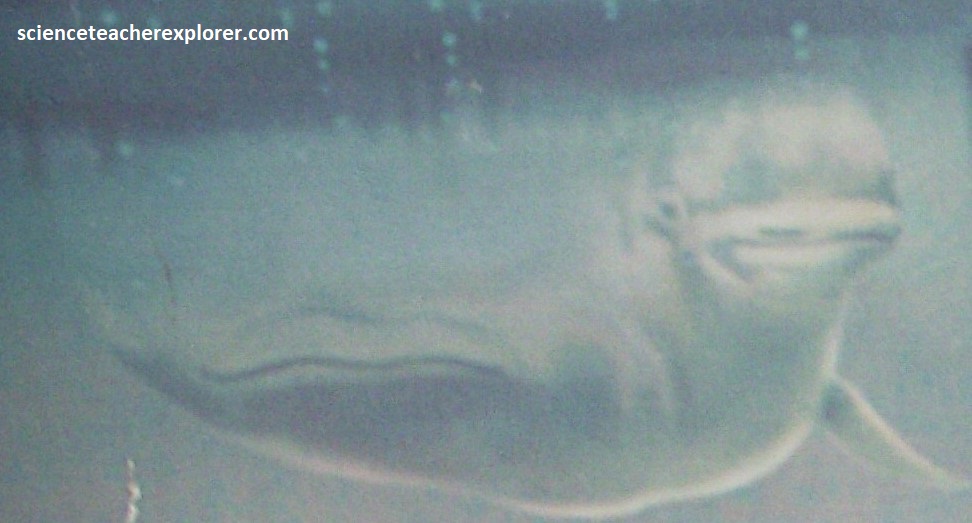
Searching for food and navigating through dark northern waters, belugas beam repetitive sounds called “click trains” into the sea around them. This high frequency sonar system is called echolocation. Echolocation begins with sound that is projected through the oil-filled forehead organ, called the melon. Repetitive clicks originate in air sacs and passages behind the melon and are then passed through it. Surrounding muscles change the shape of the melon to narrow or broaden and amplify the sounds beaming through it. The melon gives the beluga it’s distinctive “melonhead” profile.
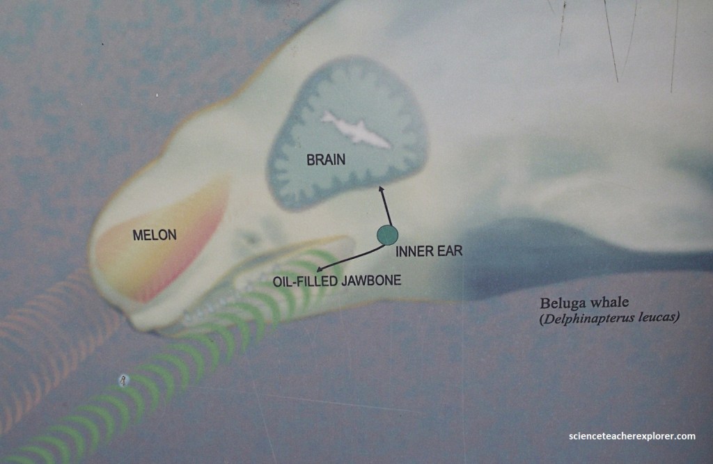
Imaged above, beluga whales receive most sound waves, including returning echoes, through their hollow, oil-filled jawbones. Sounds are conducted through these jawbones to the inner ears, continuing along auditory nerves to hearing receptors in the brain. The brain interprets the sound to give the beluga information it needs about it’s surroundings. Their echolocation faculty allows belugas to survive in cold, dark arctic and subarctic waters. It provides them with the ability to navigate in ice jammed waters, find breakable thin ice in the ice pack for breathing holes and avoid obstacles. They use their sonar beams to find and identify prey and to locate, identify, and avoid predators. These whales have the capability of “seeing” sonically through ambient noise. Belugas are able to use surface reflected echoes to aid them in navigation under an extensive ice pack.
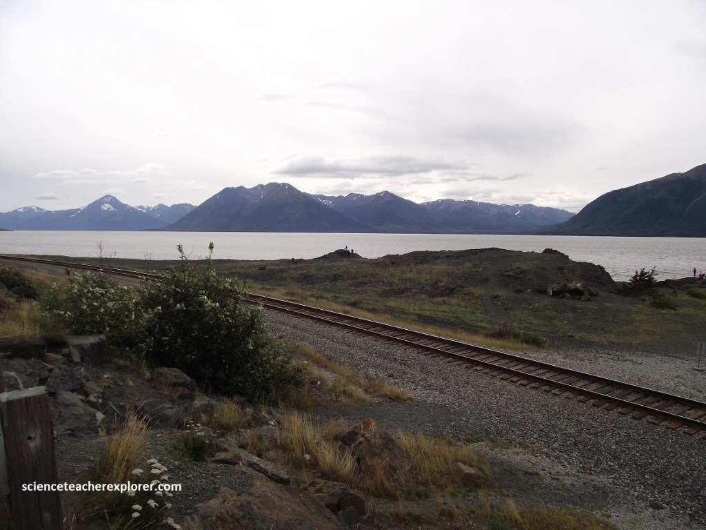
Except for a few species of invertebrates, nearly all the animals found in Turnagain Arm are migratory. Like most tourists, they visit in summer, but don’t stick around for winter. Even during the summers, Turnagain Arm isn’t a rich environment that attracts an abundant variety of marine life. Most of the plants and animals that provide food and shelter for fish can’t thrive in the murky waters and unstable sediments in the Arm. As a result, the fish found here are just passing through on their way to spawning streams. Beluga whales, the ony marine mammals that appear regularly in Turnagain Arm, are here only to feed on the fish. For marine life, the waters of Turnagain Arm may be okay to visit, but few species can live here.
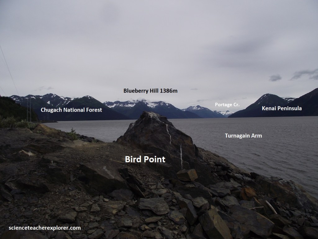
Competing with whales for visitors’ attention near Beluga point and Bird Point are the unusual “bore tides” crated when incoming tides from Cook Inlet are squeezed into Turnagain Arm’s narrow channel. These walls of water can be 3m high and travel about 16km/hr. Announcing its approach with an eerie roar, the bore arrives about 2hrs after low tide. Cook Inlet has one of the greatest tidal fluxes in the world, up to 10m.
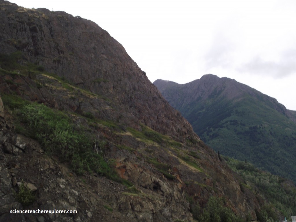
Between Indian Creek and Girdwood there is a fine collection of flysch rocks. (These are sediments that include mudstones, impure sandstones and conglomerates, all deposited in sea water). The latest magnetic studies suggest that these rocks were originally deposited 25 degrees south of their present latitude, then drifted north on plates in the Pacific before being plastered onto the North American plate during the later part of the Cretaceous. They are referred to collectively as the Valdez terrane group.
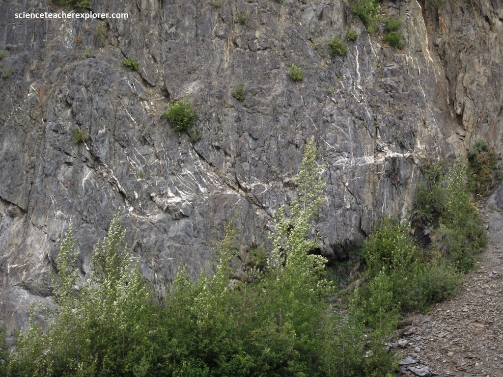
Turbidites can be seen in some of the outcrops near Bird Point Overlook. Turbidites are deposited by turbidity currents, submarine slurries of sediment avalanching down the edge of a continental shelf into deep water. As a cloud of sediment comes to rest on the deep ocean floor, the larger particles come to rest first, creating graded bedding. This makes it possible to determine the original orientation of the sediments.
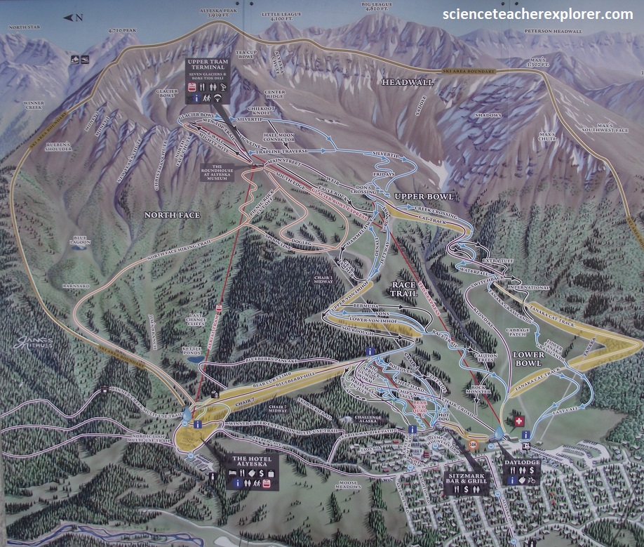
As Becky and I continue along the Seward Highway, we decided to get a bird’s eye view of the area, by turning north at Girdwood, where a 5km spur lead us to the Alyeska Resort, the largest in the state. A 60-passenger aerial tram glides partway up Mt. Alyeska, offering panoramic vistas of Turnagain Arm and the Alyeska Glacier; (pictured below).
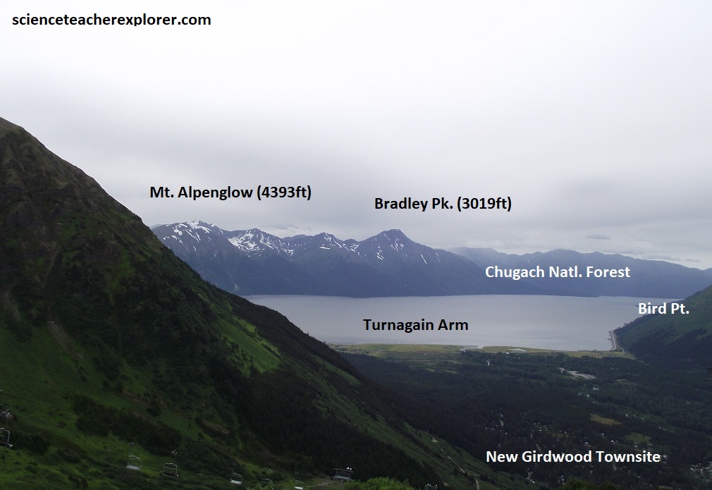
Pictured above, from atop of the Alyeska Resort Tram, Becky and I could see clearly across the Turnagain Arm and Girdwood. Girdwood was originally called Glacier City. However, the little community of Glacier City was renamed Girdwood in 1907, after the gold miner James Girdwood struck it rich in 1900 from his gold find near the present day Crow Pass trailhead.
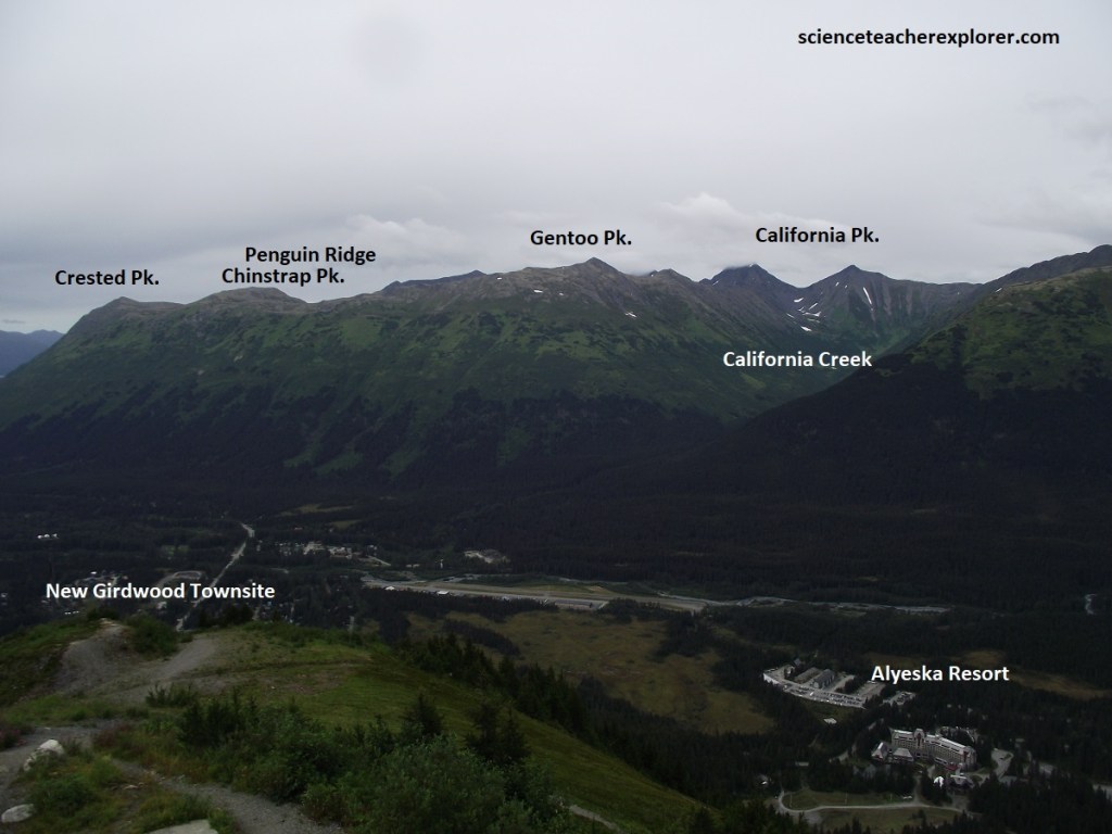
The historic 2,300-mile network of the Iditarod-trail originally started in Seward, wound north along the shores of Turnagain Arm through Girdwood, and headed over Crow Pass toward Knik and the interior goldfields.
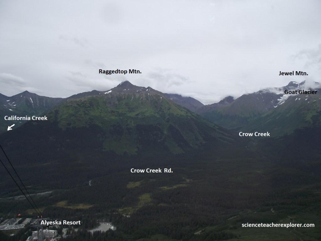
Crow Creek, north of Girdwood, has been the most productive placer gold stream in southcentral Alaska; over 40,000 ounces of gold since mining began in 1896. Every year recreational panners collect several tens of ounces. Much of the gold is coarse and nuggets are occasionally found. Severe bending and fracturing of the “Valdez Group” mentioned above, allowed mineral-rich hydrothermal fluids to migrate through the rock, filling fractures with quartz veins. This mineralization is what historically drove the historic Girdwood gold rush.
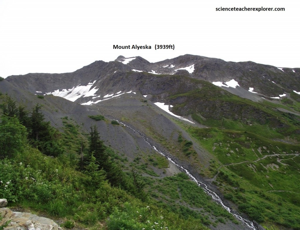
The modern, pyramid-like shape of Mount Alyeska is the direct result of Pleistocene and Holocene glaciation. At least six active alpine glaciers continue to sit in the hanging valleys and ridges surrounding the mountain. These moving ice sheets aggressively carved out the steep bowls, sharp ridges, and deep valley floors that today make up the famous terrain of the Alyeska Ski Resort.
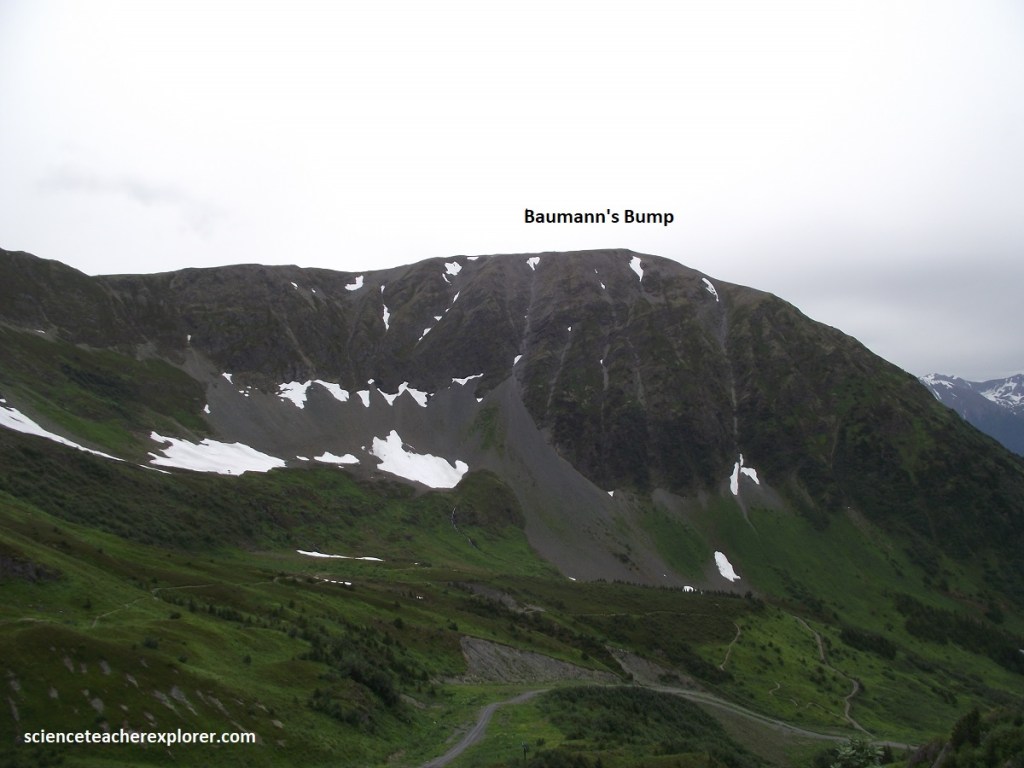
The foundation of Mount Alyeska belongs entirely to the Chugach Terrane, one of the thickest ancient accretionary wedges in the world. Due to intense tectonic pressure and heat from subduction, these sedimentary layers underwent regional metamorphism. The shales squeezed into slate and phyllite, while the sandstones metamorphosed into graywacke.
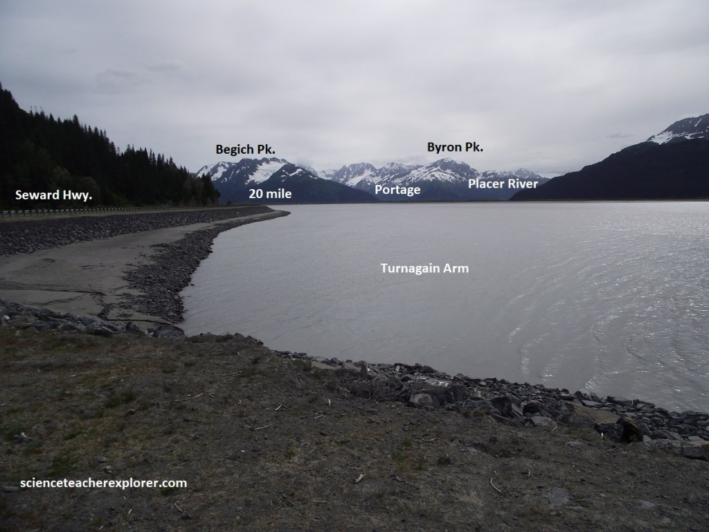
At the Girdwood turnoff, was the home of prehistoric hunters who came to this strategic location to hunt beluga whales and mountain sheep. Pieces of bone and stone blades have been recovered from the windblown sediment, called loess, that covers bedrock at the site. Carbon-14 dates from different artifact-bearing layers in the loess indicate that occupation began about 9,000 years ago and continued until 800 years ago.
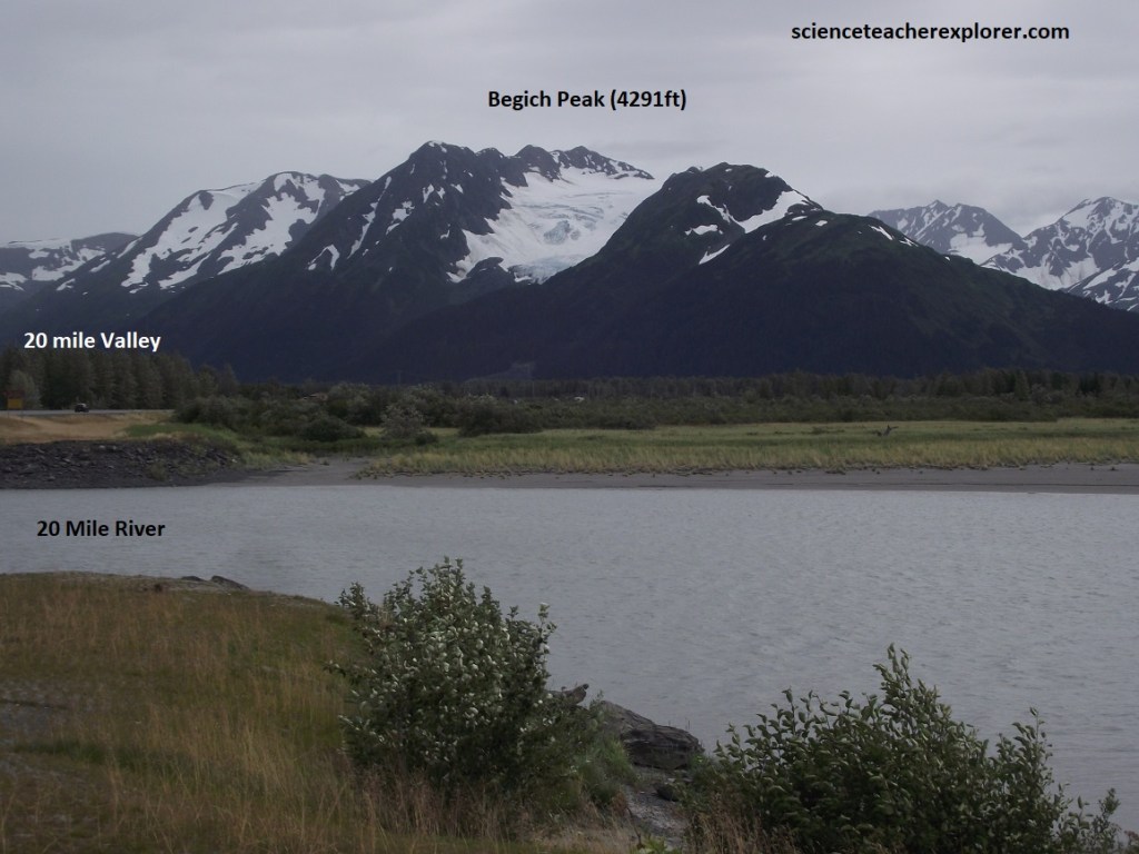
Just north of Portage, the Twenty-Mile River empties into Turnagain Arm. A roadside turnout offers a striking view up the river’s long, verdant valley, where locals use long-handled nets to land smelt in May. Nestled at the valley’s far end is Twenty-Mile Glacier, where the river begins it’s journey.
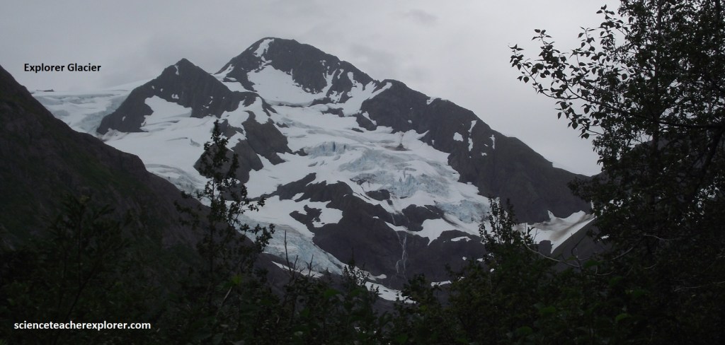
Pictured above, linked to the Seward Highway by an 8km paved road, (Portage Rd.), that begins just south of Portage, this much-visited tourist attraction offers us a vivid introduction to the power of glaciers. Portage was so named because it is here that a short trip will take you across the thin neck of the Kenai Peninsula to Prince William Sound. Today this trip is accomplished by the tunnel connecting Portage with Whittier.
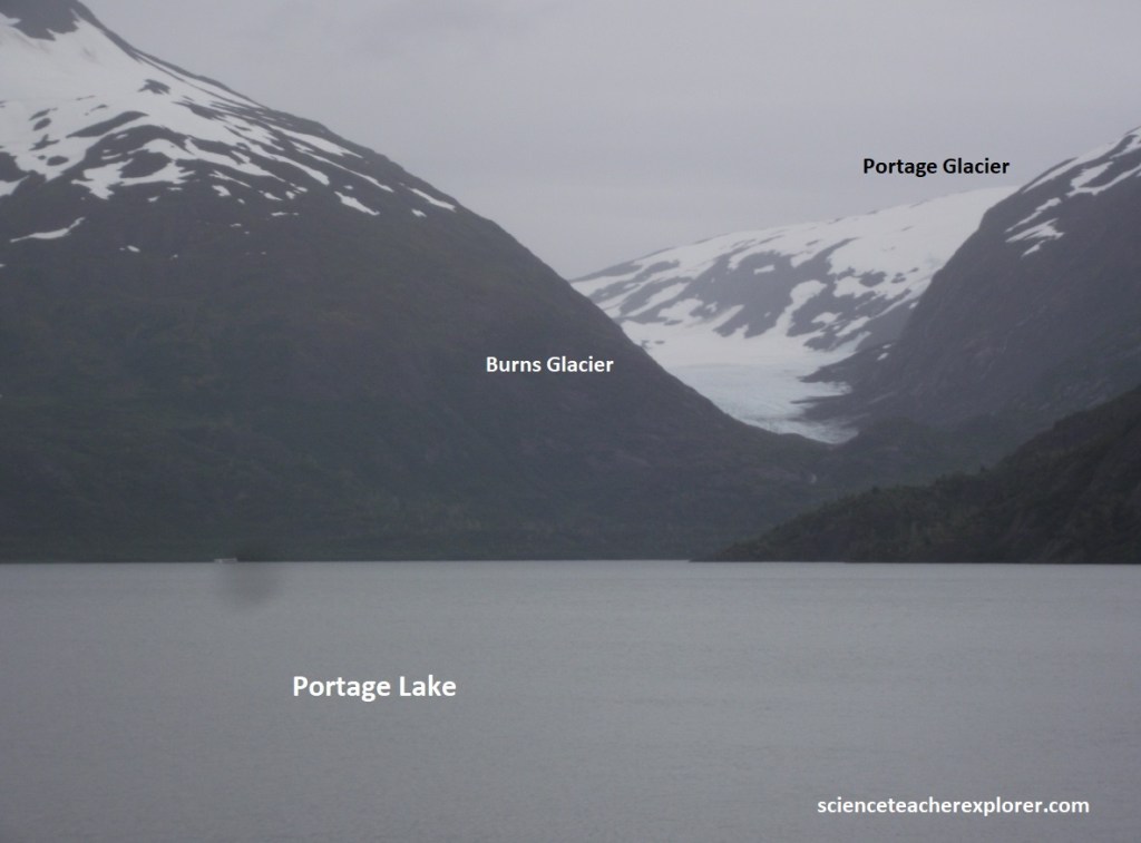
Pictured above, Portage Lake, famous for the icebergs floating in water, used to be a great place to view a glacier calving into a lake. However, the Portage Glacier terminus has retreated over the last 30 years and is no longer visible from the Begich/Boggs Visitor Center at Portage Lake, (pictured above).
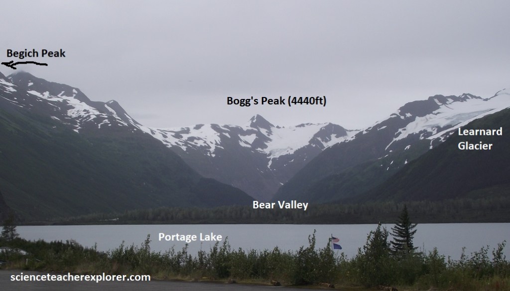
The Begich/Boggs Visitor Center offers a number of displays, including relief maps of the surrounding icefields and vials filled with ice worms, (tiny black creatures that live atop and below glacial ice).
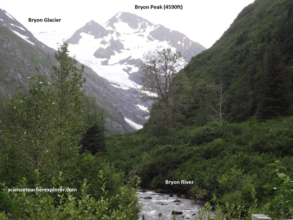
Becky and I were not allowed to hike to Portage Glacier, but we could of booked a tour and viewed it up close from a boat on Portage Lake, (but didn’t). We did trek the nearby trail to Byron Glacier, (pictured above).
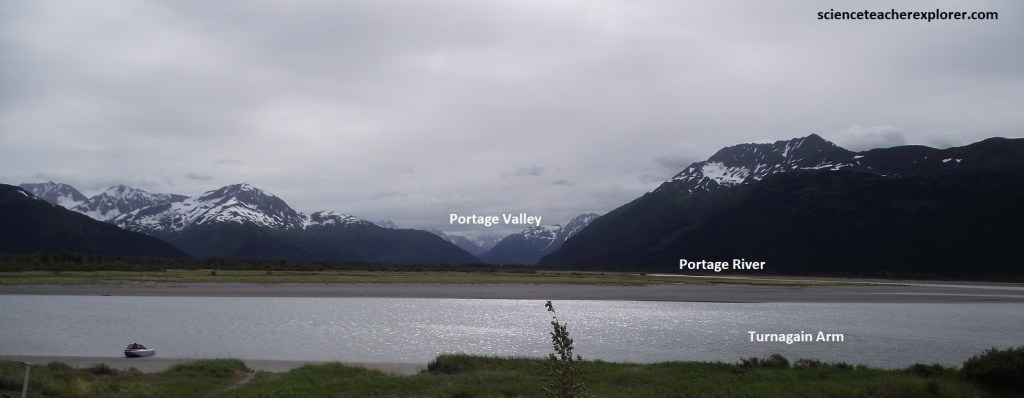
After the Great Alaska Earthquake, the old town of Portage had to be abandoned. Some land was lifted up by the earthquake and some dropped down. At Portage, the land dropped, allowing high tide to inundate the low-lying areas, and the invading saltwater killed the trees at their roots. Some of the old buildings were still there, opposite of the Portage train stop on the inlet side of the highway. Pictured above, sediment deposited since the earthquake has begun to bury the buildings.
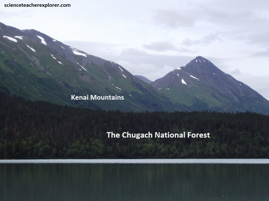
Pictured above, after leaving Turnagain Arm, the Seward Hwy. climbs to Turnagain Pass and goes through the Kenai Mountains. The bedrock here is metamorphosed muddy sandstones of the Chugach terrane. The road passes through many small gold placers in the Hope Mining district. Most of the gold comes from gold-bearing quartz veins that penetrate the metamorphic rocks of the Chugach terrane.
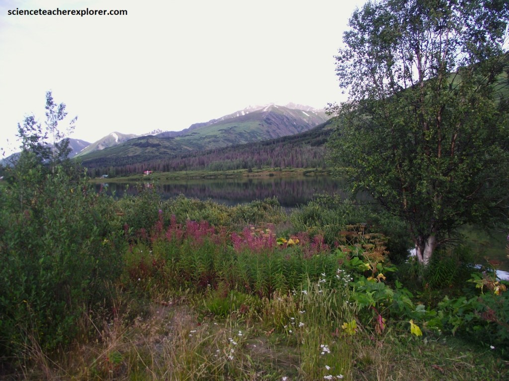
The views of Turnagain Arm fade away through the rear window as the drive cuts south through gigantic Chugach National Forest. Among the many lakes dotting Chugach’s millions of acres is Lower Summit Lake, (pictured above). It lured me to stop because of me seeking exemplary photographic shots of wildflowers.
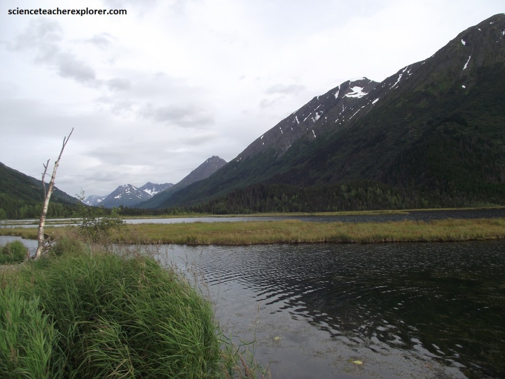
A bit farther to the south is Summit Lake. Uplift of the Kenai Mountains began about 22 million years ago and continues today. Long-term uplift rates are about 0.2mm per year in this section of the Aleutian convergent zone. The Kenai Mountains form a topographic barrier between Prince William Sound and Cook Inlet.
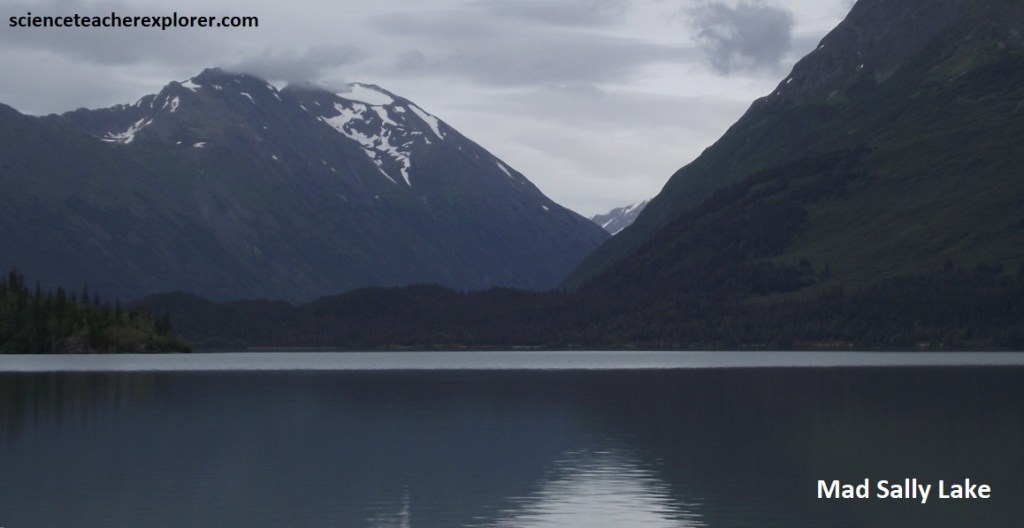
In the early 1930s there was an old miner that frequented this area and was seen often around the lake. Nobody knew his name or even where he lived. He was never know to speak and would only nod when approached. The thinking at the time was that he was a Russian descended from the early Russians living in the area before the U.S. purchased Alaska in 1867. When he did com into Seward to pick up supplies he would always pay for his purchases with gold nuggets. Thee were many attempts to located his gold source. Locals tried to follow him but he seemed to just disappear into the wilderness and the surrounding mountains around the lake. On the occasions when locals did happen to see him, whether near the lake or in Seward for supplies there was always a cat with him. According to legend the cat was beautiful with a long flowing muscular body and almost entirely white with the exception of an auburn tail ringed with small white circles and an auburn patch between her ears. the cat was always with him and followed him in the same manner a dog would follow it’s master. The cat was unique in that when anybody would try to get close to her master she would fiercely try to protect him. According to legend there was only on known attack of someone trying to approach the old miner. A man in Seward tried to make him talk and when he touched the old miner the cat was instantly on him attacking him in the face severely injuring his eyes and face. The old miner said one word and the cat immediately stopped it’s attack and returned to the old miner’s side. That is the only time anyone ever heard him speak. The word everyone thought he said sounded like, “SALLY”, thus the name behind the legend of “MAD SALLY LAKE”. The old miner was never seen again after that, but there were accounts of seeing the white cat around the lake for the next 10 years. There have been no reported sightings of the cat since the early 1940s.
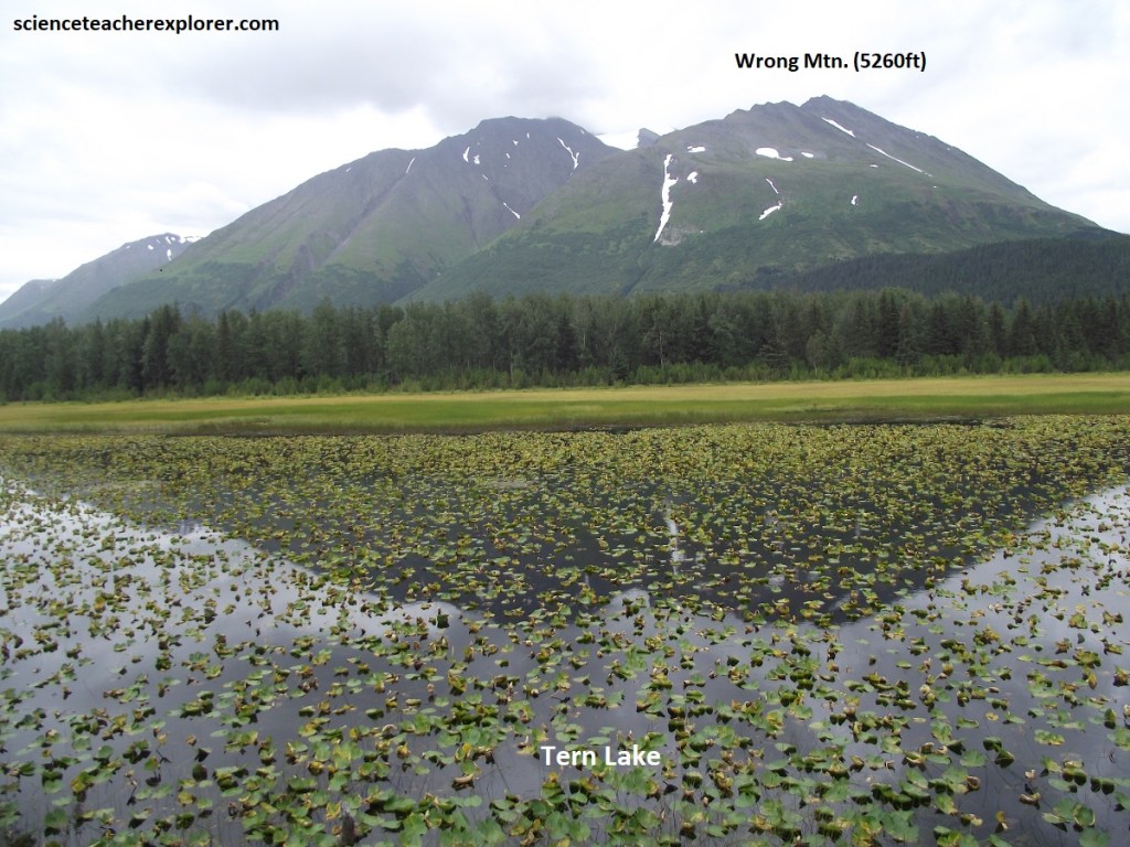
Incoming storms from the southeast rise over the Kenai Mountain barrier and cool, precipitating 508cm over the area. The Kenai Mountains create a rain shadow to the northwest in the Cook Inlet region, reducing annual precipitation in Anchorage to about 41cm per year. Beginning in Miocene time, the 1.6km high mountain range accumulated more snow annually than it melted and glaciers began forming and expanding.
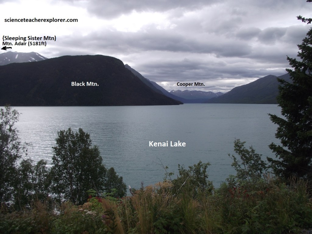
For 8km or so, the Seward Highway cruises along the eastern-most shoreline of blue-green Kenai Lake.
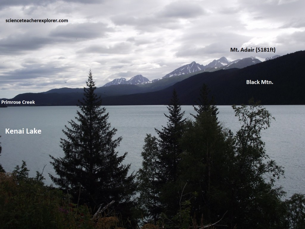
Kenai Lake’s unusual color is produced by rock particles suspended in the glacial meltwater that feeds the lake. Ground by glaciers into a fine powder, the particles reflect blue-green from the spectrum of sun-light, lending a turquoise cast to the snowy peaks mirrored in the water.
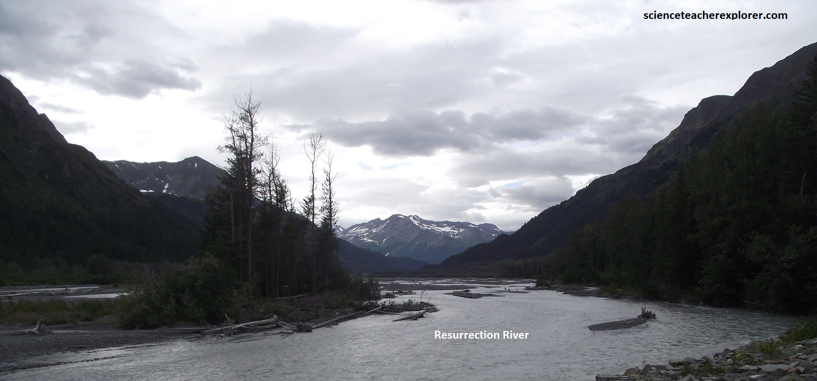
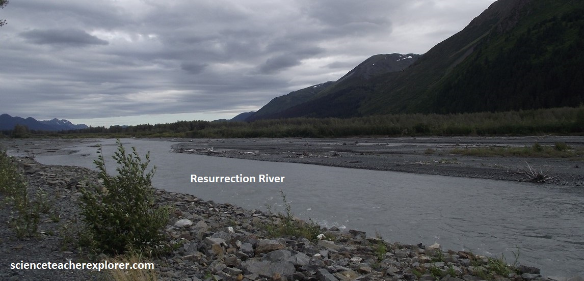
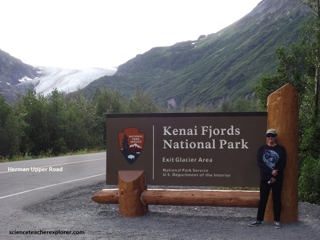
3.5km north of Seward, Becky and I turned west onto a gravel road that parallels the Resurrection River for 14.5km, (pictured above). The road ends at the Exit Glacier Ranger Station in Kenai Fjords National Park.
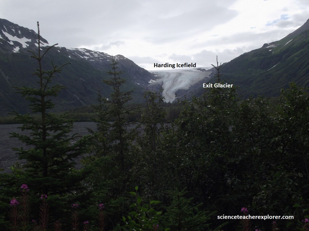
A 4.8km long river of ice flowing from the massive Harding Icefield, Exit Glacier looms like a blue monolith over the surrounding landscape.
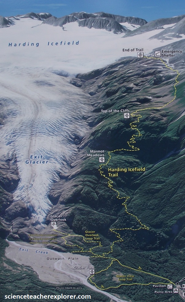
Imaged above, Becky and I approached Exit Glacier’s base by trekking about a 1km on an easy trail from the ranger station. However, we could of trekked a longer, more strenuous trail that lead us up the flank of the glacier to a spot overlooking the Harding Icefield itself.
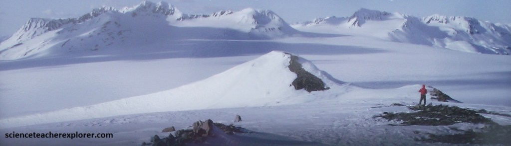
Radiating glaciers in every direction, this mantle of ice measures an imposing 56km by 32km. Buried with its frigid bulk are all but the tallest peaks in the Kenai Mountains. During Pleistocene glaciations the Harding Icefield thickened to over 915m, smoothed mountain peaks, widened formerly V-shaped stream valleys, and scoured the continental shelf, which was exposed by lowered sea levels. The Harding Icefield waxed and waned throughout Pleistocene climate warming and cooling periods. During the las major glaciation between 14,000-10,000 years ago, ice flowed over the divide into the Kenai Lowlands ad filled the Kenai River valley with ice.
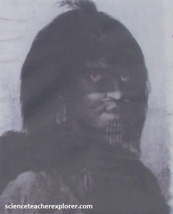
It is estimated that the Chugach Eskimos arrived in the Prince William Sound area three to four thousand years ago. During prehistory, there were eight groups throughout the Sound and all lived a self-sufficient and community oriented lifestyle in the environmentally rich surroundings of the area. Prehistory is defined as the period prior to contact with non-indigenous peoples. This contact came when the Russians first arrived in 1741 with the arrival of Captain Vitus Bering on Kayak Island.
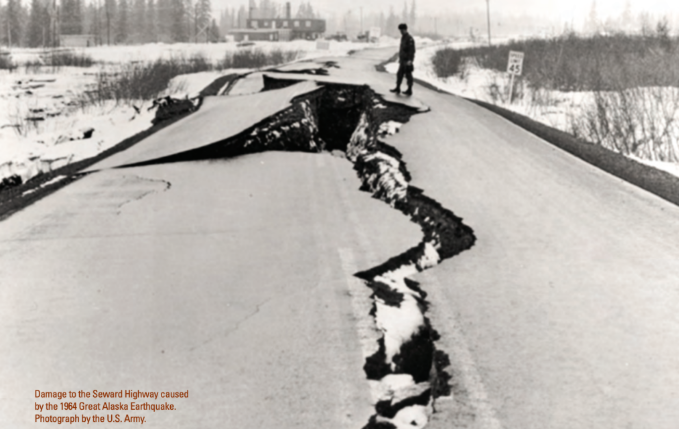
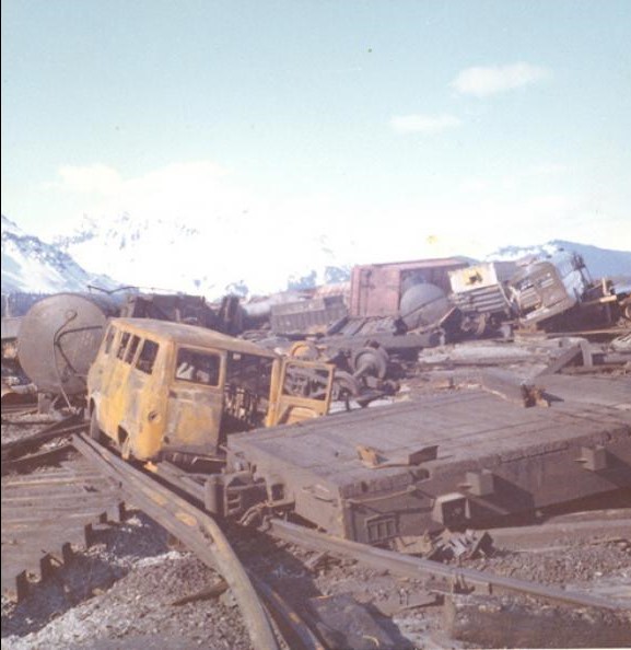
Much of Seward was destroyed by a landslide and tsunami in the 1964 Great Alaska Earthquake. Thirty seconds after the earthquake began, 1,220m of waterfront along Washington Street slid into Resurrection Bay. The waterfront industry had been built on water-saturated alluvium. The earthquake cause the ground to lose its shear strength, and the docks, small boat harbor, and industries slipped away in mammoth underwater slides. The steepness of the submarine slope adjacent to the waterfront was 30-15 degrees. This damage occurred prior to the arrival of the earthquake-generated tsunamis, which finished off what was left of the waterfront, destroying the Alaska Railroad docks and the state’s southernmost railway terminus, an important seaport at that time for Anchorage. This stretch of the Kenai fjords coastline, dropped 3m, drowning adjacent coastal terrestrial environments. Amazingly, only Thirteen people were killed and five were injured as a result of the earthquake. Eighty-six houses were totally destroyed and 260 were heavily damaged.
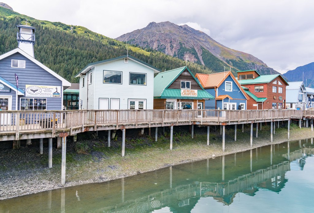
Pictured above, tucked between Resurrection Bay and the foot of Mt. Marathon, the city of Seward serves as the present gateway to Kenai Fjords National Park, a 580,000-acre mosaic of glaciers, fjords, icefields, and mountainous coastline.
Start with a wildly irregular coastline, it’s rocky headlands gouged into fjords by glacial ice. Add jagged, snow-dusted peaks, scaping the sky like saw-teeth in every direction. Mix in massive glaciers and rivers teaming with salmon. Then link this astonishing scenery together with a beautifully maintained highway, and you have the Kenai Peninsula, the Seward Highway and the Chugach National Forest, regarded by Alaskans as a priceless jewel.

