Laurel Hills, PA 2025
Becky (my wife) and I were driving to Virginia in the spring of 2025, when we made our way across Pennsylvania.
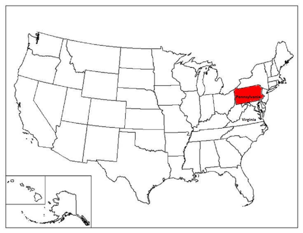
On our way through Pennsylvania, we happened to pass through the beautiful country of the Laurel Highlands. We were driving south on Interstate Hwy. 219 from Bradford, PA.
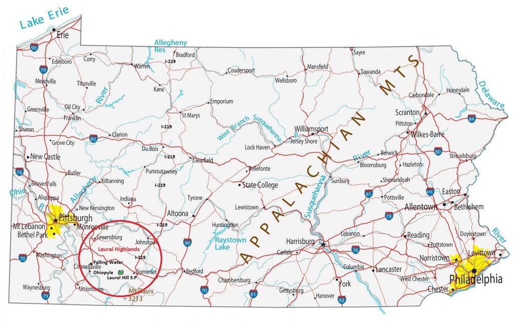
Rolling fields and rounded mountains are cause for rejoicing in this portion of southwestern Pennsylvania.
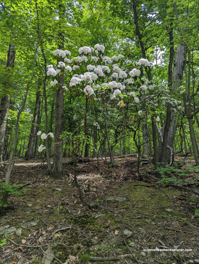
Mountain laurel, the state flower of Pennsylvania, lends it’s name to this rumpled region in the western foothills of the Appalachian Mountains, (pictured below). Covered with clusters of cuplike pink flowers in the spring, the laurels often grow in thickets that brighten whole hillsides.
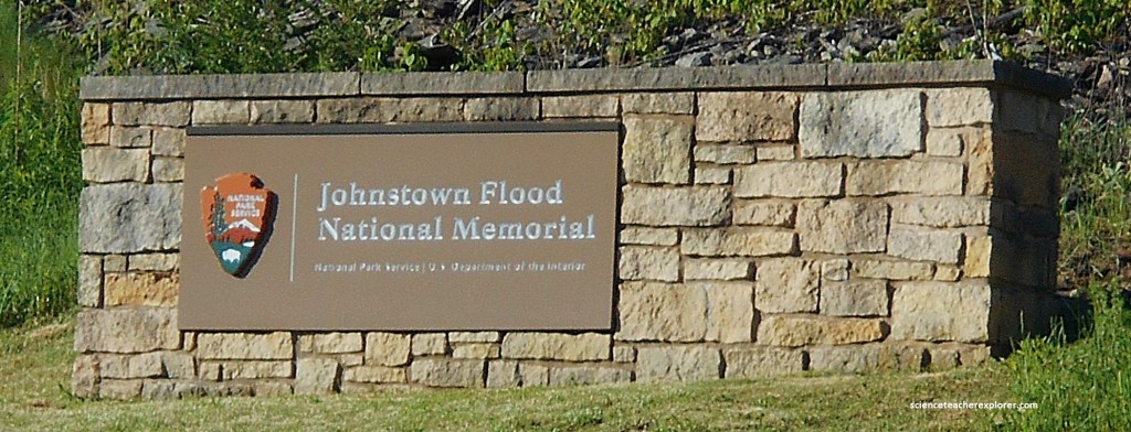
While driving down I-219 (south), we stopped at the Johnstown Memorial to explore.
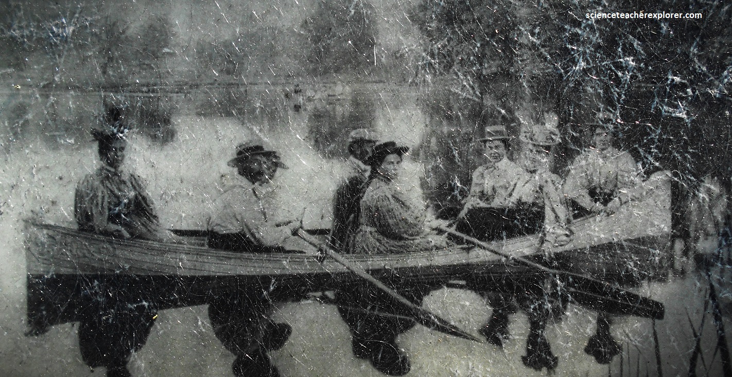
This location was once Lake Conemaugh. For years in the 19th Century, the Gilded Age’s most powerful industrialists gathered at Lake Conemaugh, an idyllic body of water made possible by Pennsylvania’s South Fork Dam. Their secret retreat was a place to fish, hunt and consolidate their power. {The historical photos below were taken from an Interpretive sign on-site}. From 1881-1889 the South Fork Fishing and Hunting Club, an association of Pittsburgh steel and coal magnates, (like Andrew Carnegie, Andrew Mellon, and Henry Clay Frick), owned the dam and lake. On the opposite shore they built a 47-room clubhouse and 16 elegant cottages. Club members took to the water in rowboats and sailing canoes, as well as two fine steam yachts. Stocked bass and trout provided great sport.
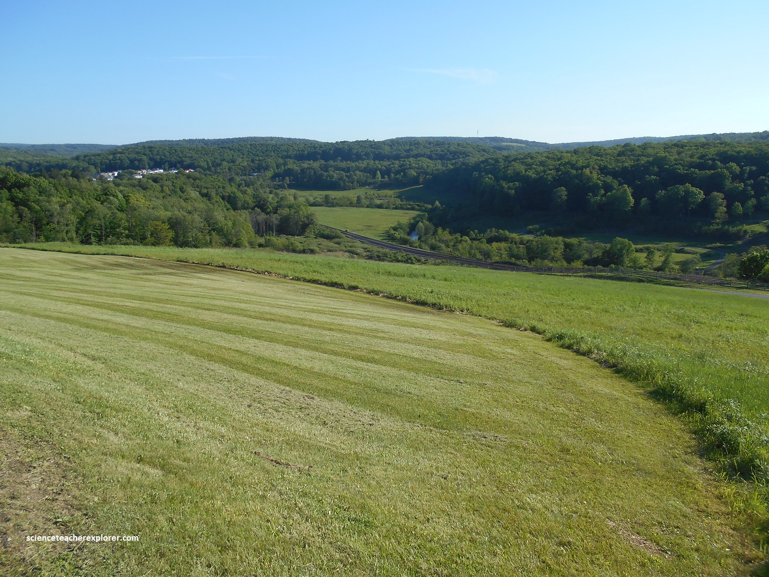
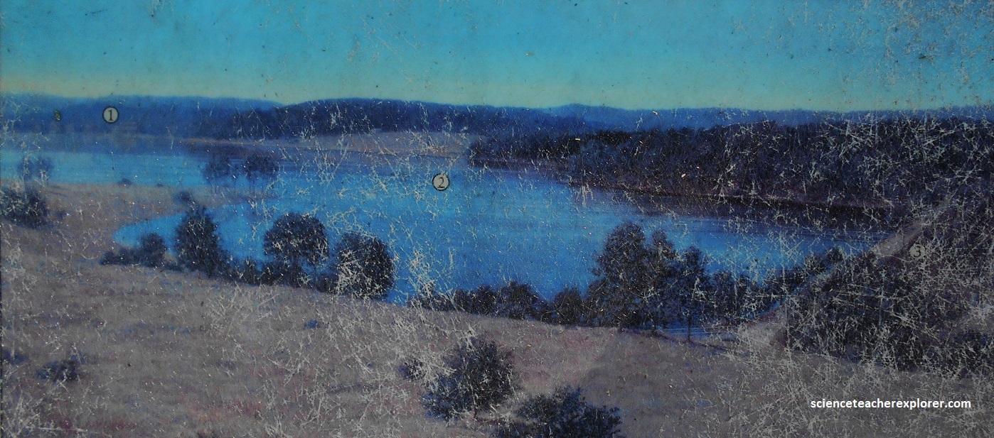
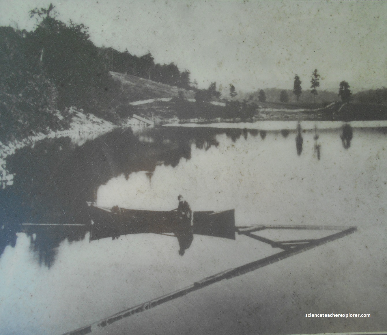
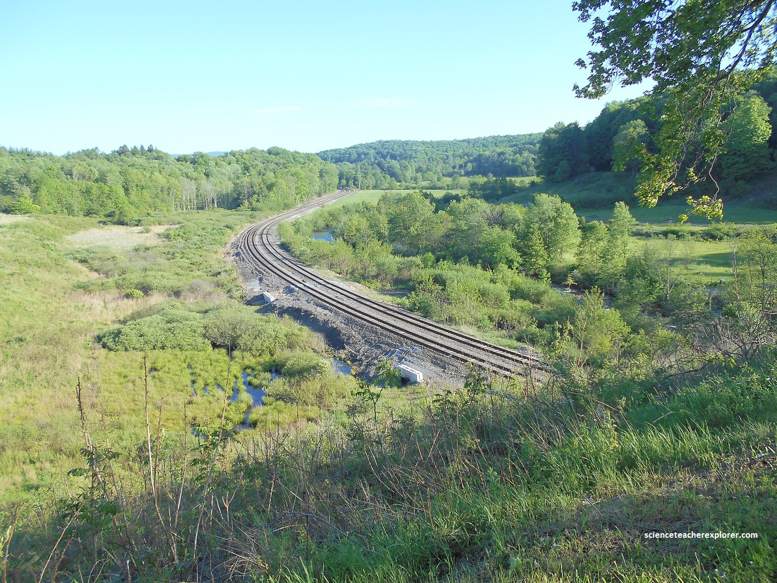
Lake Conemaugh held one of the largest man-made lakes of its time, containing an estimated 480 million cubic feet of water. It extended from the dam just below the Memorial to more than 3.2km to the northeast, with an average with average width of one kilometer.
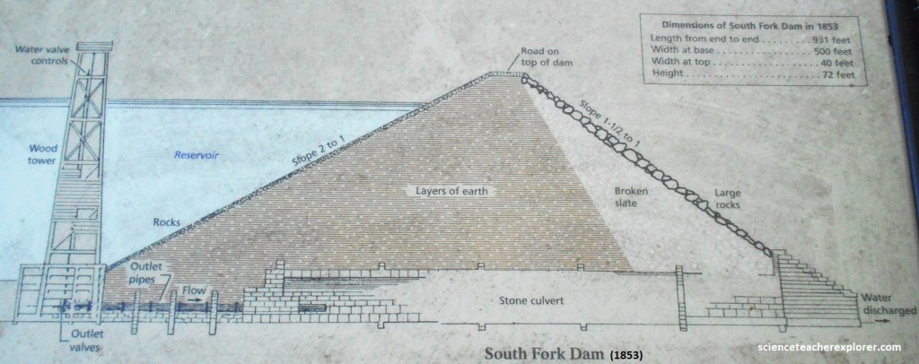
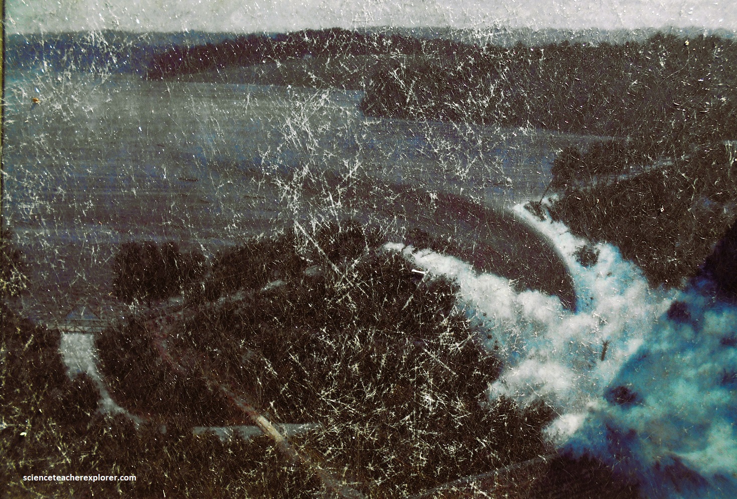
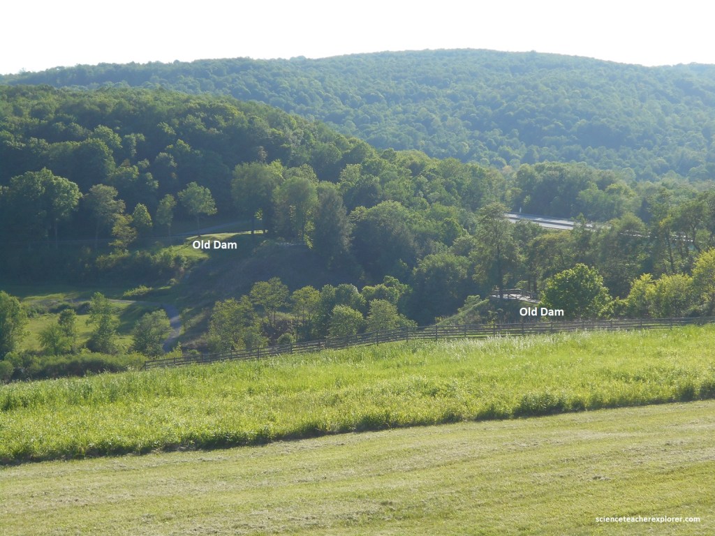
The dam had been completed in 1853 to supply water for the Pennsylvania Main Line canal, but was abandoned a few years later when the railroad rendered the canal obsolete. Pictured above, the South Fork Dam was made chiefly of earth. Layers of clay one-foot thick or less were built upon one by one. Each layer was covered with a skin of water, or “puddled”, to help it settle and harden. Five large outlet pipes were installed under the dam to discharge water safely. Slopes were faced with stone. The dam’s only inadequacy was the spillway, (which was too small and pictured below). {The historical image below was taken from an Interpretive sign on-site}.
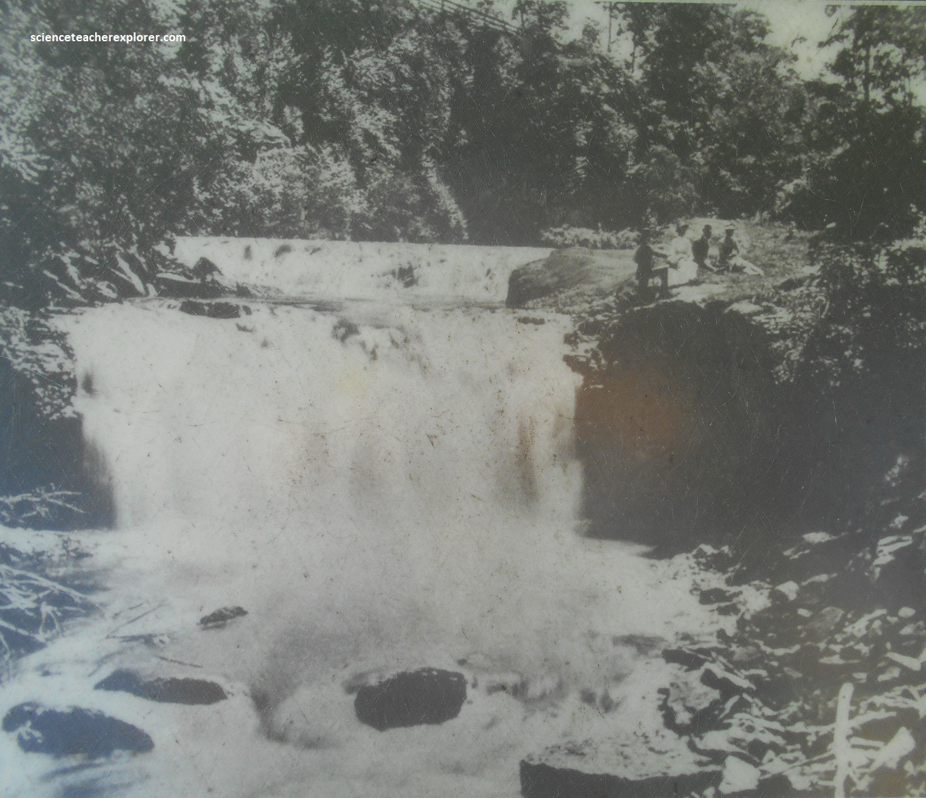
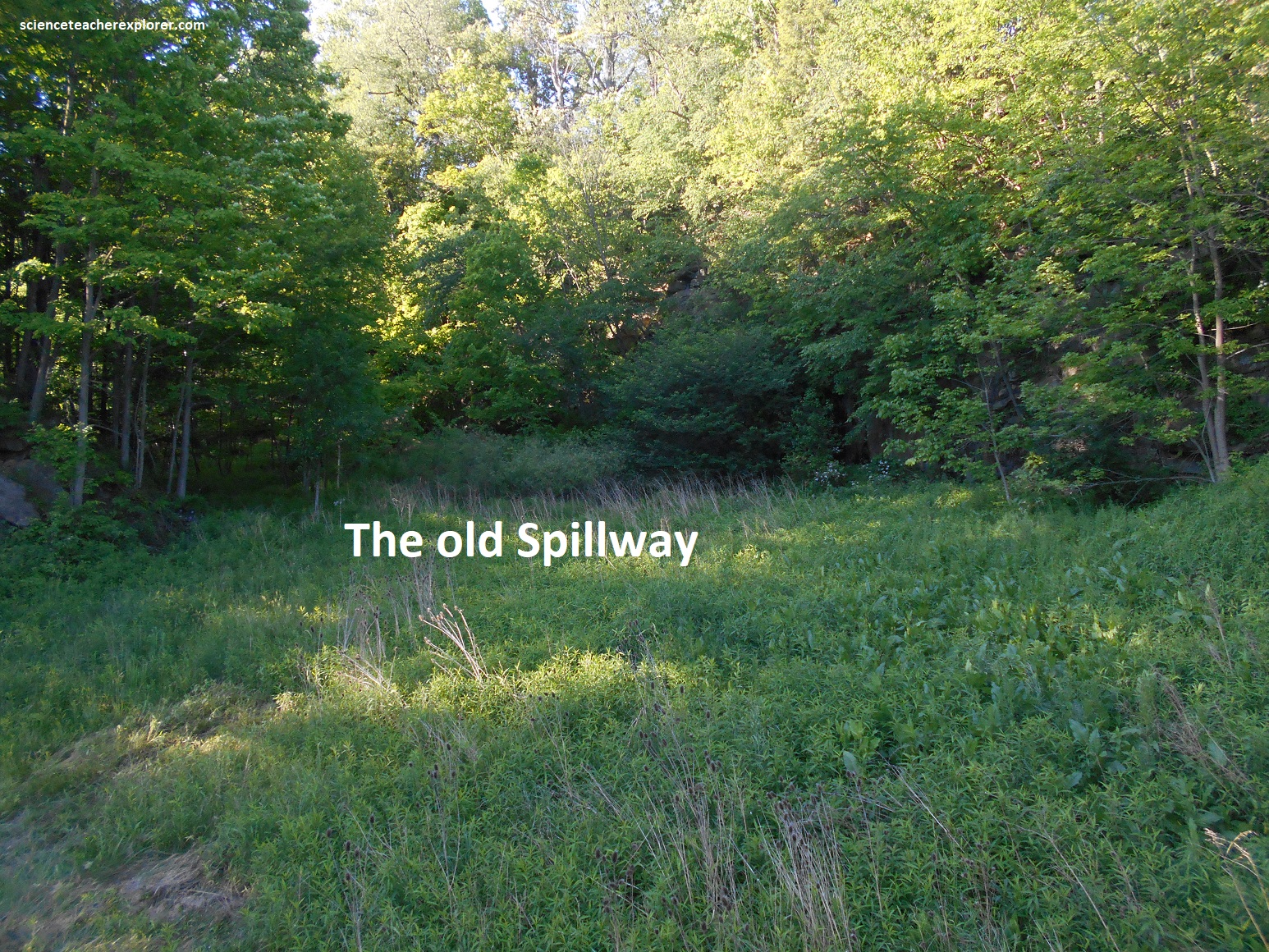
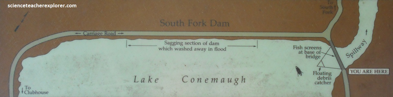
Although well-engineered for its time, years of neglect and unsound alterations had made the South Fork Dam unsafe. By 1899, the water control tower had burned down, and the iron outlet pipes had been removed, making it impossible to control the lake level. Earlier breaches in the dam had been improperly filled with stones, dirt, brush, and even manure. The dam had settled and sagged at the center, inviting a washout. In addition, fish screens had reduced the capacity of the spillway to handle overflow.
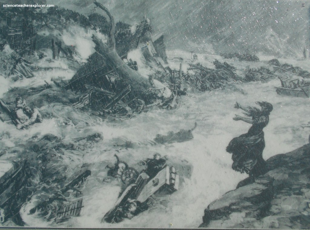
On May 31, 1889, under the force of rising floodwaters, the South Fork Dam gave way, creating a gaping hole. This breaching of the dam launched a deadly flood wave 10-20m high down the valley of the Little Conemough River towards Johnstown. (click on the images below); {Images were taken from an Interpretive-sign on-site}.
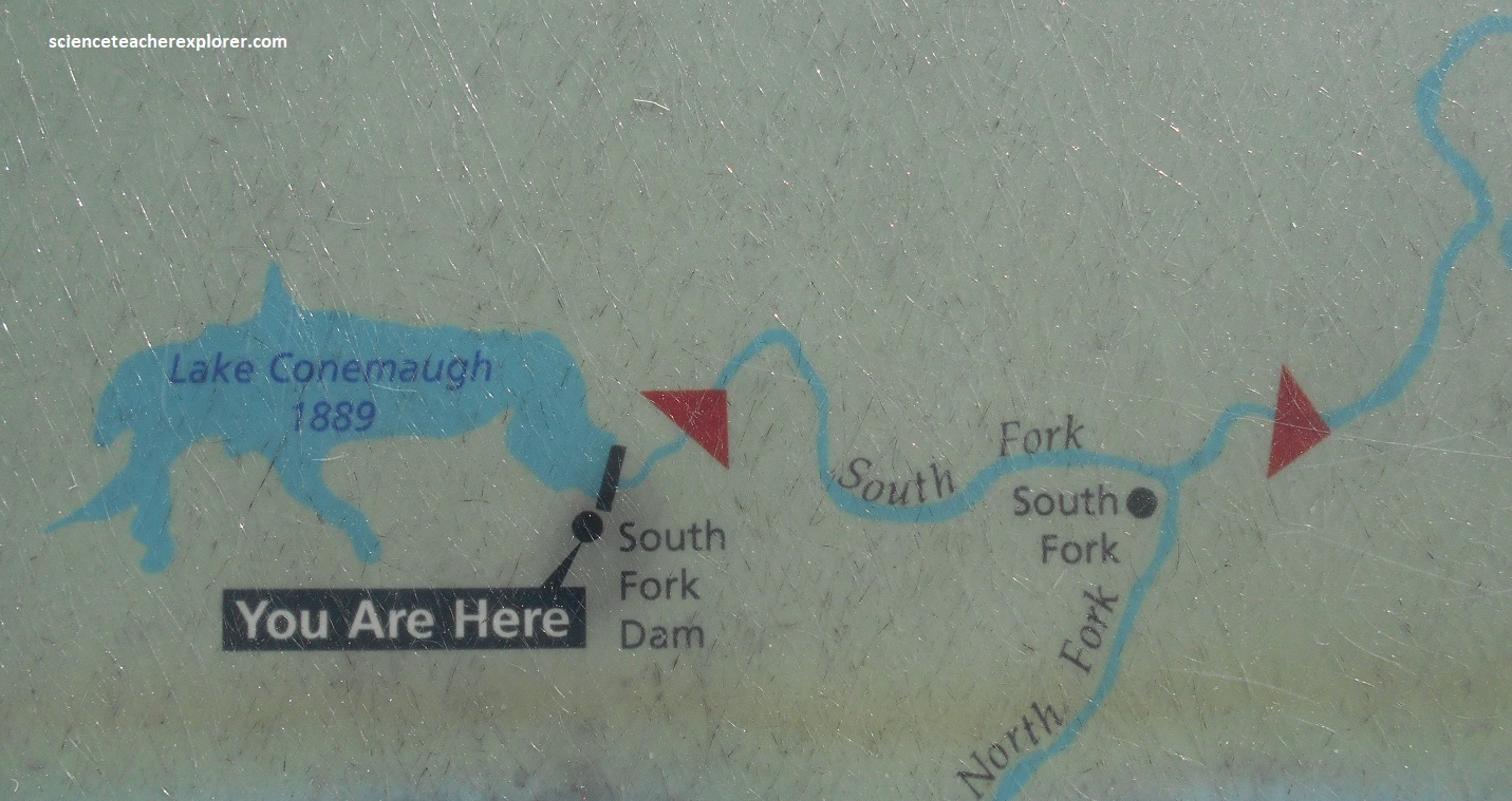
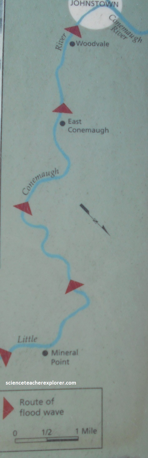
The pleasant little village of Woodvale had no chance at all, surrounded as it was by some of the Little Conemough’s steepest hills. Almost all of its 250 buildings disappeared, while nearly a third of its 1,000 residents were sucked into the torrent as it headed south, (some drowning along the way, others hanging on to anything that bobbed up from the maelstrom churning away beneath them. Johnstown was next! {Note: the image below and historical photos were taken from, “Great Disasters: Dramatic True Stories of Nature’s Awesome Powers”, Reader’s Digest 1989}.
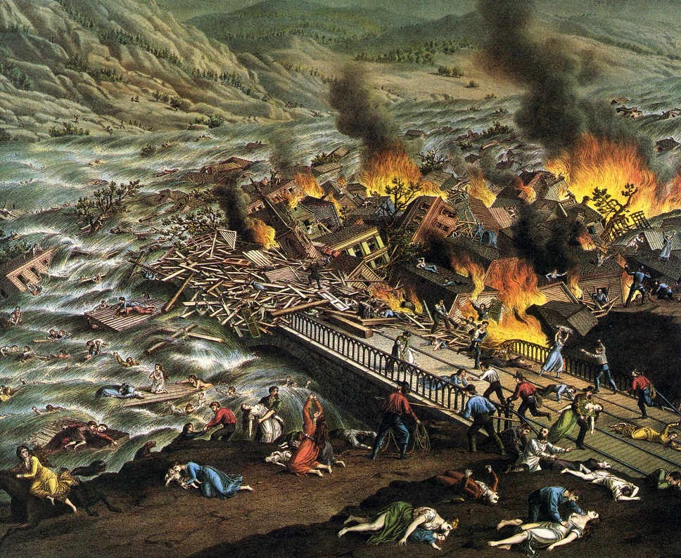
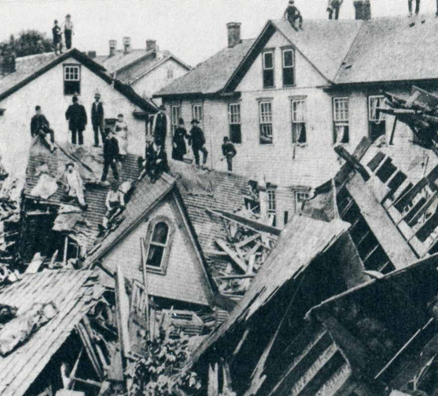
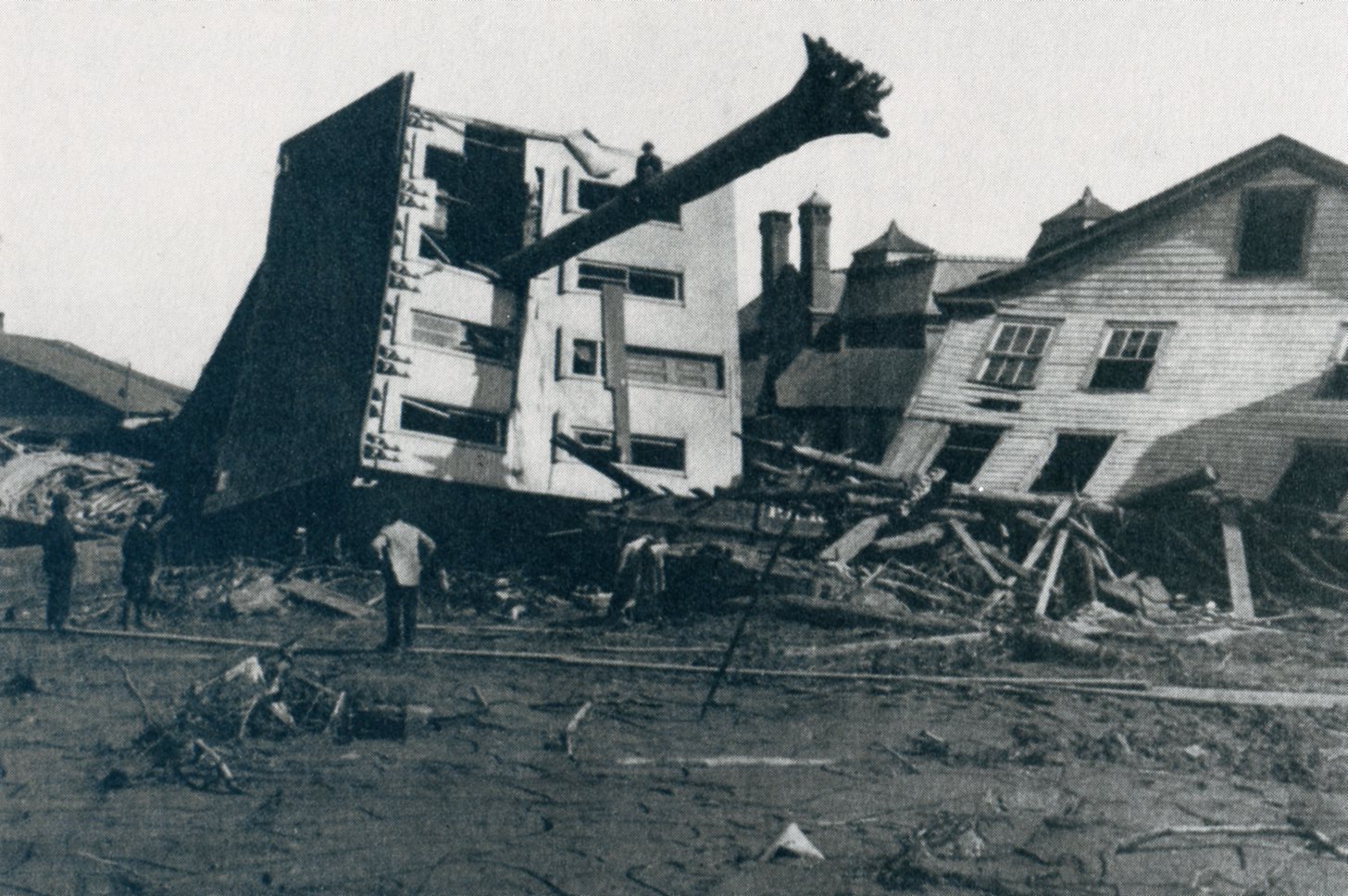
Throughout the city the residents of Johnstown had precious few seconds in which to prepare themselves either to meet death or somehow to avoid it. From her home on Locust Street, Mrs. John Fenn watched her husband swept away while he ran for the front steps. Later, atop her own roof, she endured the agonizing sight of seven of her children being washed loose, one by one, to drown. After a wild 2km ride astride a tar barrel, Mrs. Fenn was pulled to safety, wiling, “My God, what have I to live for?” The wave from the failed dam, travelled the 22.5km in about 45 minutes, killing more than 2,200 people along the way, with almost 1,000 more missing and never found.
More than 18 hours after much of Johnstown had disappeared, workers lifting corpses out of the Allegheny River at Pittsburgh, into which the Conemaugh’s waters eventually drained, pulled ashore the floor of a wrecked home. On it lay a five-month-old baby who had ridden alone, and unharmed, for some 121km on the flood-swollen rivers. Meanwhile, donations and relief workers poured in. Clara Barton, then in her late 60’s, arrived with her newly formed Red Cross.
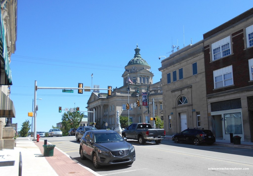
After visiting Johnstown Memorial, Becky and I continued on I-219 to Somerset. Gracious estates and historic government buildings line the streets of Somerset, Pennsylvania. Pictured above, the County Court House was a beautiful two-story Classical Revival building measuring 48.6m by 37.3m, and 45m tall. It was built of Indiana limestone and sat on a sandstone foundation. The building had a terra cotta tile roof, and central tower with a copper dome. It featured a semicircular portico supported by four unfluted Corinthian order columns.
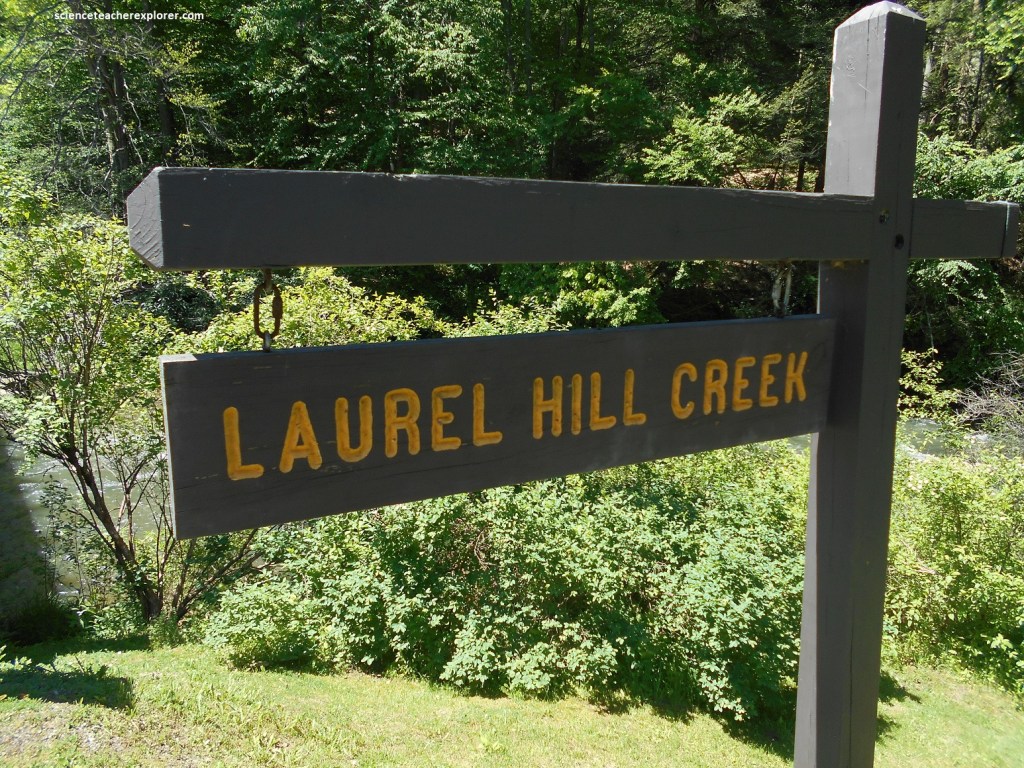
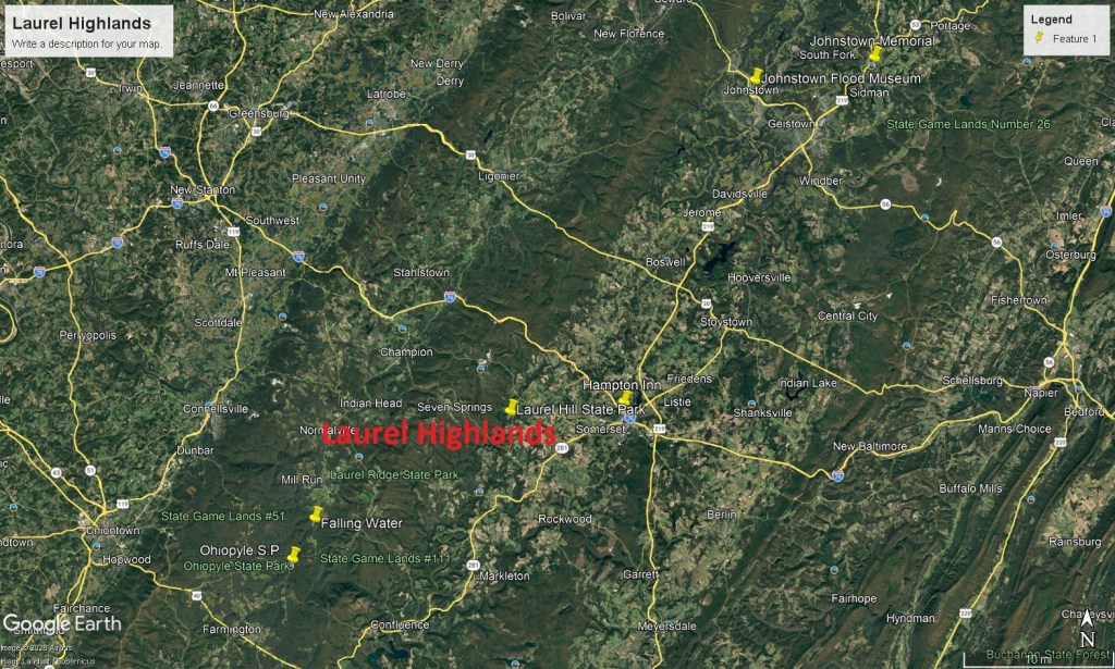
From Somerset, we took PA-31 west, and then turned south on PA-281, where we entered Laurel Hill State Park. Mountain laurel erupts with a profusion of pink blossoms across the slopes of this preserve, and it’s hiking trails, sparkling lake, and quaint visitor center, (an old farm-house).
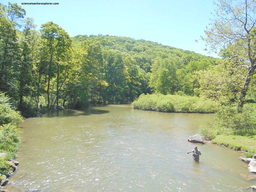
Laurel Hill State Park is a scenic 4,062-acre park nestled within the Laurel Highlands. The park features a large lake, extensive forests, and a variety of recreational opportunities throughout the year. It was apparent that visitors could enjoy swimming, boating, fishing, hiking and camping, that are all set against a backdrop of rolling hills and lush woodlands. The park is known for its natural beauty, diverse wildlife, and well-maintained facilities.
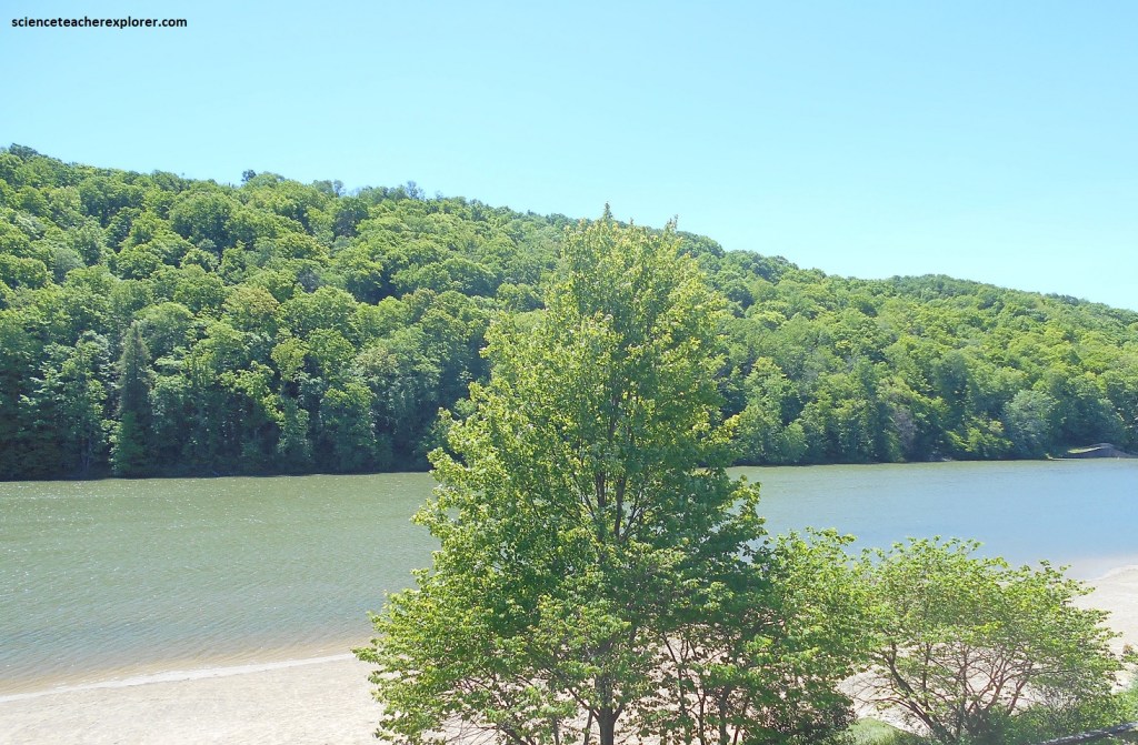
However, America’s early industries devoured timber in colossal quantities. Coal mines, railroads, tanneries, and even urban centers like Pittsburgh all clamored for more wood. In just a few decades the forests here had been completely expended, manipulated by local sawmills, and passed along to nourish a growing nation in the late 19th and early 20th centuries.
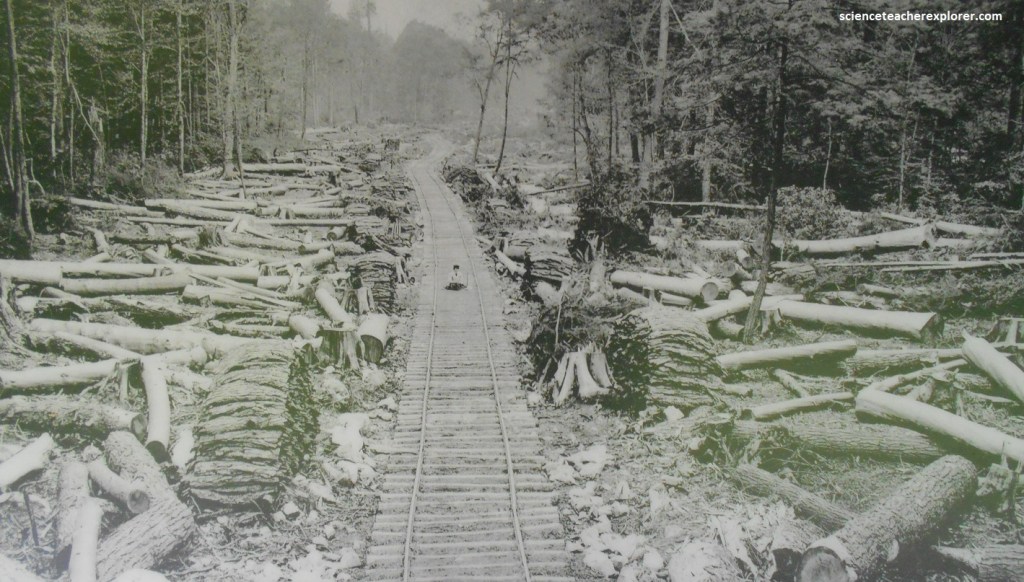
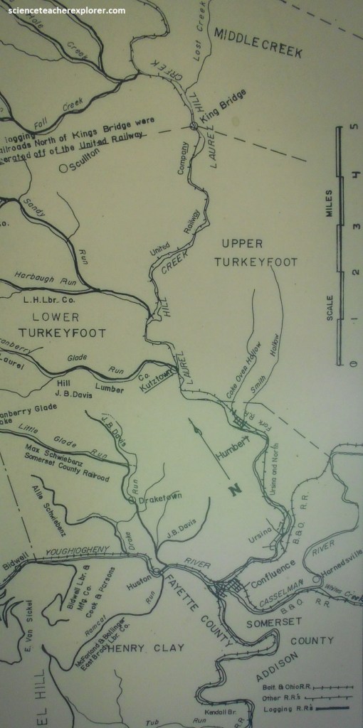
The lumber camps followed the railroads. They were scattered across the landscape of the Laurel Highlands. Camps usually included a central boarding house and several shanties for individual families. After all trees were felled, they loaded their shanties on the train and moved to the next fragment of forest. Mobile saws relocated repeatedly to be close to logging camps. Larger, more permanent mills occupied sites near the juncture of several railways. Lumber mills expanded rapidly. Some grew to include a post office, company store, and schoolhouse. Local families linked their welfare to the screams of the saw, the roar of the machines, and the booming of lumber on the roll. {Historical photos below were taken from an Interpretive sign on-site}.
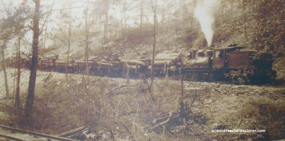
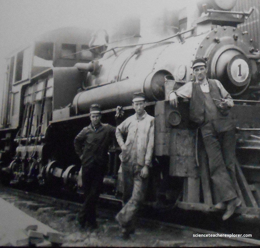
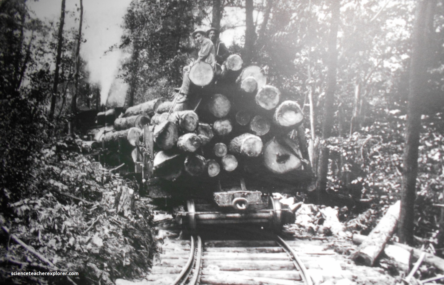
The vast virgin forests of Laurel Hill stood condemned with the advent of specialized logging railroads and geared locomotives. Shay, Heisler, and Climax engines, often called stem-winders, maneuvered along previously inaccessible shallow creeks and up and own steep valleys. The engines were powerful but slow and unusually stable on winding narrow gauge rail lines. Despite traversing irregular, temporary track, they dutifully hauled the region’s harvested trees to local sawmills. {Note: the images below were taken from an Interpretive sign on-site}.
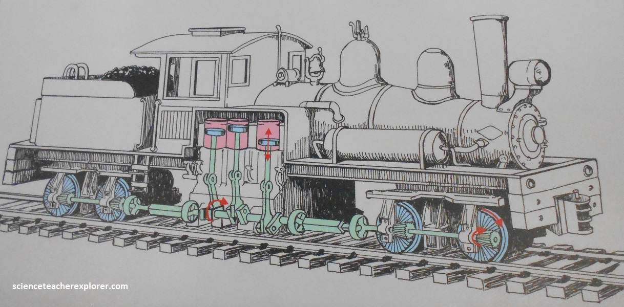
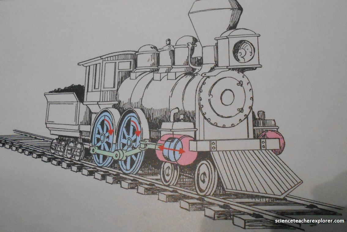
Imaged above, the Shay locomotive, (invented by Ephraim Shay in 1879), ran at lower speeds and could climb steeper grades because it ran using gears rather than rods, as did the typical locomotive. Additionally, the Stay is the four-wheel drive of steam locomotives, with the wheels being driven by gears applying smooth power to the track. The weight of the locomotive as well as the flexible drive shaft of the Shay made it possible to handle bumps and tight curves without derailing and losing its load.
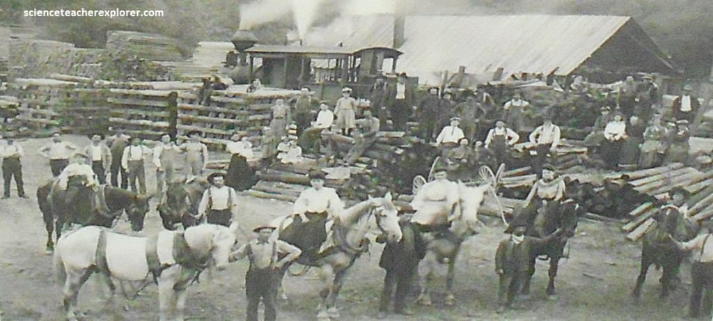
However, camps and crews worked around the clock without regard for the consequences of complete deforestation. Eventually, the forests disappeared. Mills and temporary railways were torn down or fell to ruins. Flooding and soil erosion intensified without trees. The once prosperous mountainsides of Laurel Hill were considered worthless and devoid of life.
Following years of prosperity, the stock market abruptly crashed in October 1929, unemployment mushroomed to around 40%, factories shut down, farms were abandoned and bread lines grew in cities. Franklin D. Roosevelt proposed a flurry of government programs, such as the Works Progress Administration and the Emergency Conservation Works, designed to lift the country out of the depression. A top priority of the programs was to get the people out of bread lines and into sustainable work. On April 10, 1933, just 37 days after Roosevelt’s inauguration, the Civilian Conservation Corps (CCC) was formed. Over a period of 9 years, 3 million CCC enrollees received much needed income. Enrollment was for 6 months and could be extended up to 2 years. Many “CCC Boys” benefited from the program until the outbreak of WWII brought the CCC to an end.
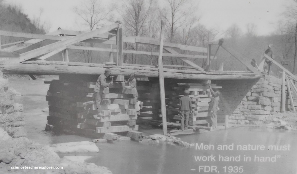
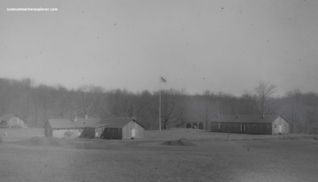
Additionally, the area now known as Laurel Hill State Park was selected as a Recreational Demonstration Area (RDA), one of 5 in Pennsylvania. These projects were large-scale and covered a substantial amount of land. Significant architecture and major water and trail projects were included to create a complete landscape. The Laurel Hill project built group camps, including the camps and barracks that the CCC boys resided in during their enrollment. They also contributed to a nationwide conservation effort to bring our forests back from an era of overharvesting and transform these lands into recreation destinations. The goal was to plant trees, build roads and trails, create camps and campsites, prevent erosion, and construct dams for wildlife habitat and recreation. Ultimately, making these areas accessible for healthful, outdoor recreation for all Americans.
From Laurel Hill State Park, Becky and I drove south, through New Lexington, on PA-281, until we reached I-40. Here, we turned right, (northwest), onto I-40. I-40 is known as the National Road. Cut into the wilderness in the early 1800s, this was the first road to penetrate the 121km wide wall of the Allegheny Mountains. As such it opened a door to the frontier, enabling pioneers to flood westward and begin new lives. The drive rolled past sleepy hamlets, (quiet communities reminiscent of an earlier era), until we turned north onto PA-381.
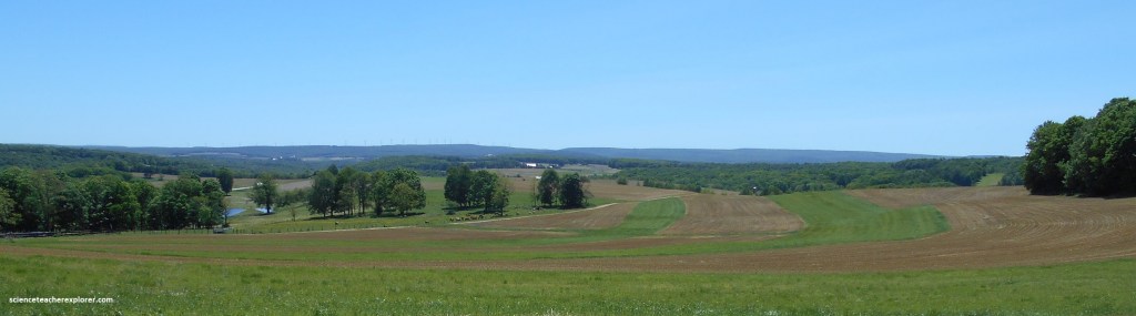
Pictured above, nestled in southwestern Pennsylvania, the Laurel Highlands is a scenic destination known for its rolling mountains, charming small towns, and outdoor adventures. On PA-381 we first came across Ohiopyle State Park.
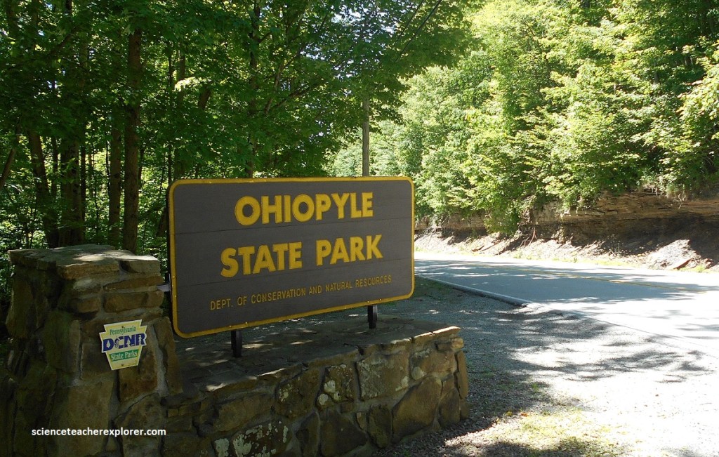
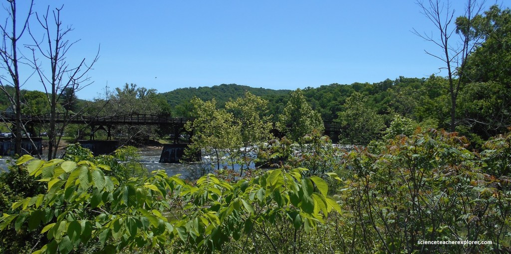
The name of this park is a Native word that translates to “white frothy water”. One look at the Youghiogheny River was enough to show us why. The river wraps around a large horseshoe bend, racing over a waterfall and across churning rapids that are much loved by white-water enthusiasts, (pictured below).
Driving north on PA-381, we came across a famous house called “Falling Water”.
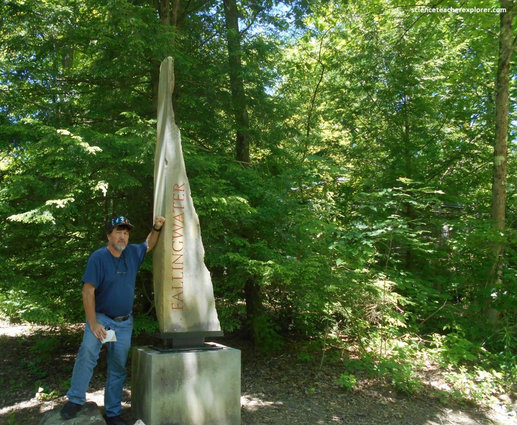
Asked to draw up plans for a house that would look out on a waterfall, architect Frank Lloyd Wright went on step further and designed a building situated directly atop the ledge-leaping stream. Fallingwater is a masterwork of organic architecture designed in 1935 by Frank Lloyd Wright. Built between 1936 and 1939 in Mill Run, Pennsylvania, the house is famously perched directly above a 10m waterfall on Bear Run.
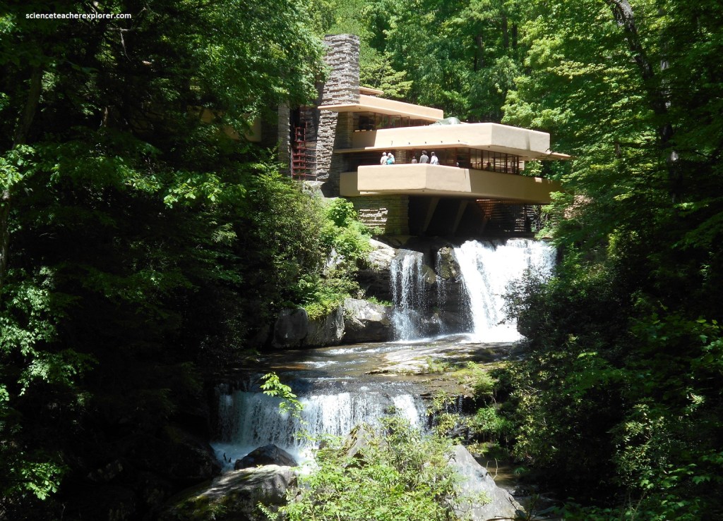
Aptly named “Fallingwater”, the sandstone structure, surrounded by a dark woodland, blends so well with its setting that it seems to spring from the earth itself. Frank Lloyd Wright often said his buildings were like plants that grew from within and came up from the ground into the light. But his work had developed from the outside in and from the top down. But, he wished to bring architecture into harmony with the land.
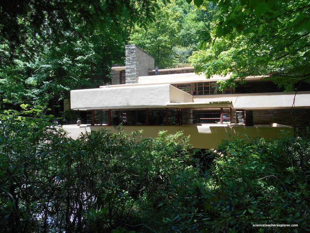
Frank Lloyd Wright designed his buildings with exaggerated eaves that excluded the sun from the upper rooms during the hotter hours of the summer day and provides shade for five or six months of the year. Their soffits, or undersurfaces reflected the indoors of diffused light. And as the roof surfaces quieted the whole, the eaves brought a satisfying sense of shelter from the sun and storm. Wright’s attention to the roof and his affection for the horizontal, (both inspired by his feeling for the prairies from which he was raised as a kid), had happily coincided. To salute the landscape he projected the roof decisively past the walls and thus exalted the necessary into the poetic. He wrote, “The climate, being what it was, a matter of violent extremes of heat and cold, damp and dry, dark and bright, I gave broad protecting roof-shelter to the whole…..At this time, a house to me was obviously primarily an interior space under a fine shelter”. Wright lowered the roof, lengthened it and brought it closer to the ground to introduce is “Prairie-style” architecture.
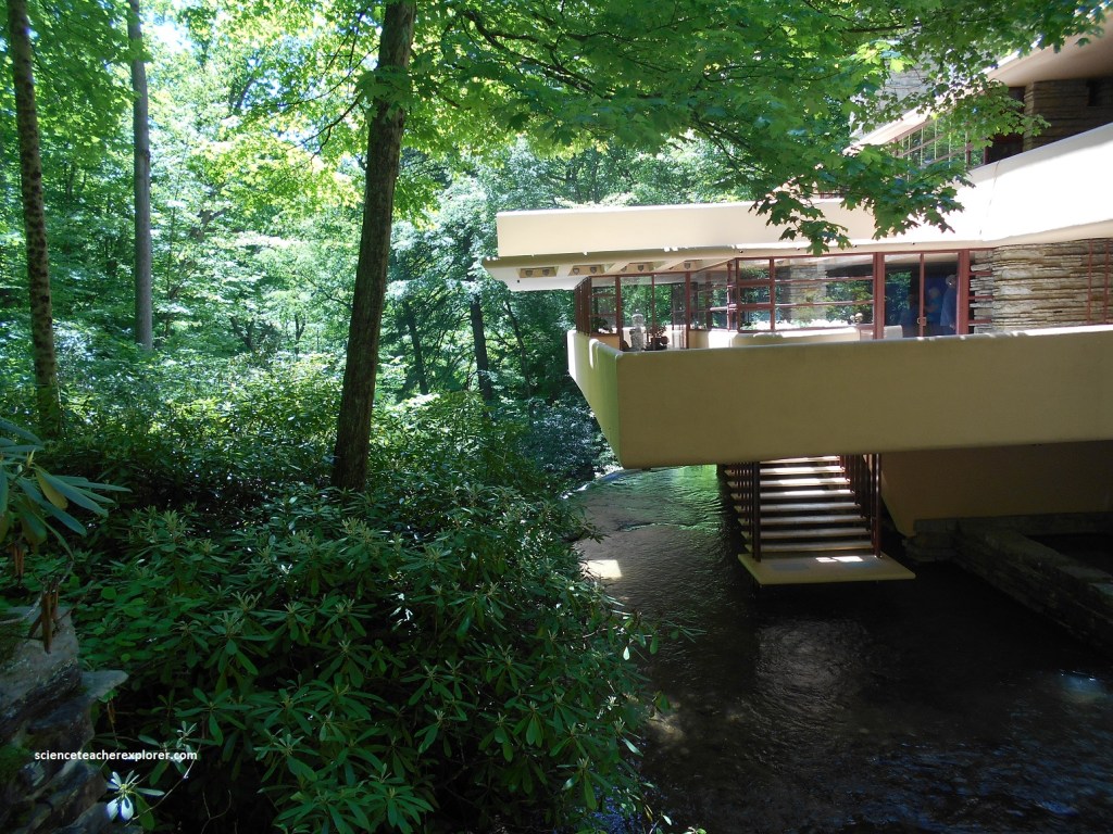
However, here on the “Fallingwater” home, Wright relied on the cantilever, a significant projection of structure beyond any base or point of direct support. As he recognized the latent expressive power of the cantilever, Wright daringly grasped the horizontal that he loved, and grandly culminated a series of planes parallel to the earth. The force of a cantilever might well be compared with that of a running figure, the more a figure leans forward, the swifter it appears, and a moving figure looks faster the farther its center of gravity takes leave from it center of support.
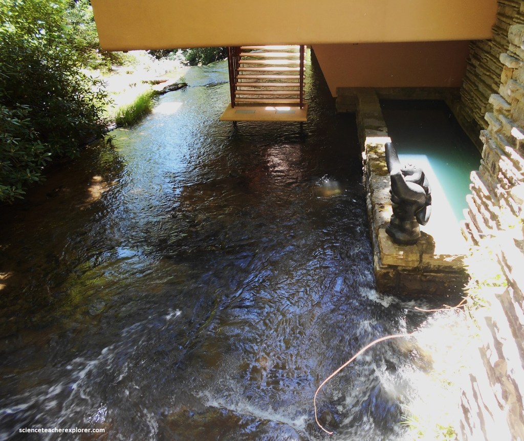
Conceived as a weekend house poised above the waterfalls of an obscure mountain stream, Fallingwater stands as both the consummate manifesto of all his principles and as an apotheosis of the contest between gravity and rigidity. Although he meant to honor the forest site, Wright also chose o compete with the high drama of the falls and with the insistent asymmetric rhythms of the projecting sandstone ledges and long cantilevered leaves. “Cantilever slabs overhanging each other leaping out from the rock ledge behind”, he wrote of the house as it was being completed. Additionally, note the unique trapdoor/hatch in the living room floor that opened up to a set of suspended stairs that led directly down to the stream below, creating a physical and sensory link to the water, (pictured above & below).
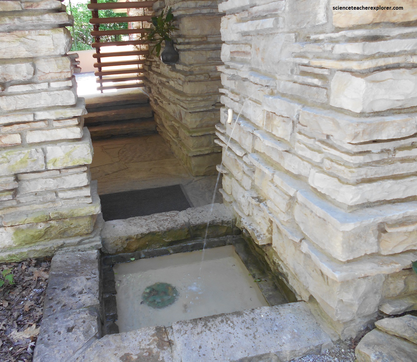
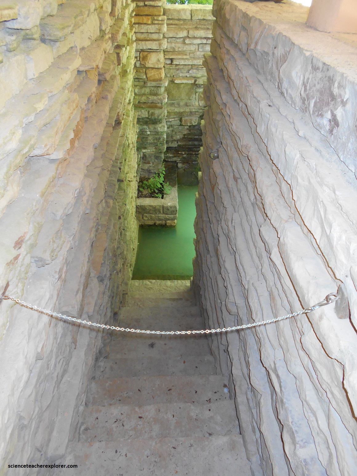
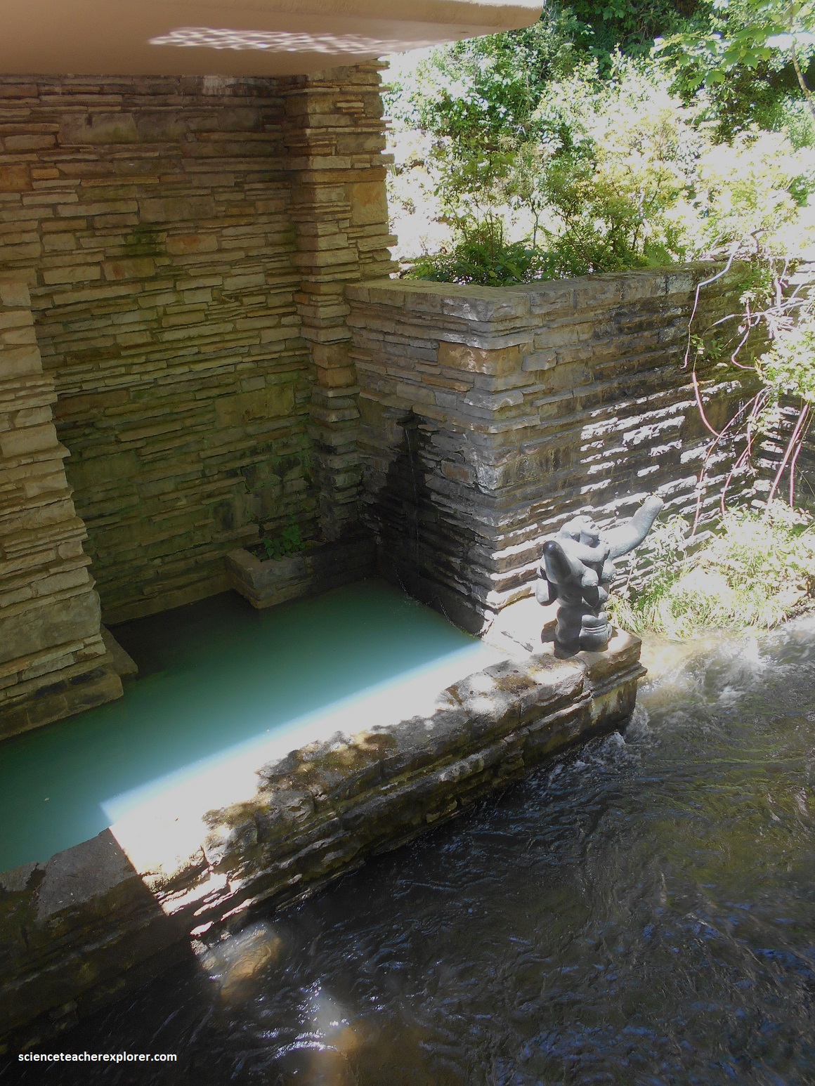
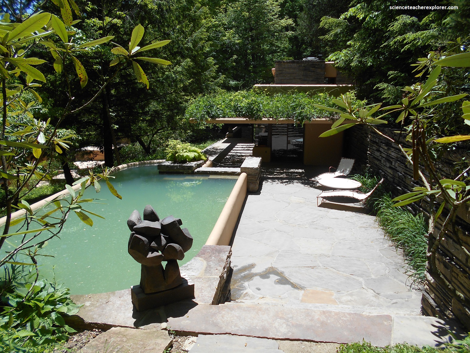
Wright continued to say, “For the first time in my practice, where residence work is concerned in recent years, re-enforced concrete was actually needed to construct the cantilever system of this extension of the cliff beside a mountain stream, making living space over and above the stream upon several terraces upon which a man who loved the place sincerely, on who liked to listen to the waterfall, might well live. In this design for living down in a glen in a deep forest, shelter took on definite masonry form while still preserving protection overhead with extensive glass surface…” The house on Bear Run refused to step lightly down the hill in deference to the waterfalls, and it imposed grand horizontals on a precipitously vertical site. It deliberately obscured many points of view toward the falls, only to defect attention to the monotonous sound of the water.
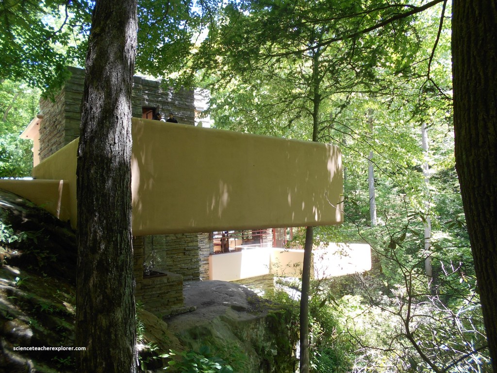
Fallingwater overcame every plane of confinement: the wall, the ceiling, even the floor. Wright put cantilevers to work in five of the six terraces, which altogether offered nearly as much floor space as the entire interior. The terraces and roofs generated the shadowed horizontal rifts that echoed the rift in the rock at the falls. The vertical rifts reached a climax in the light-screen of the kitchen and west bedrooms, a three-story tower of glass between the west wall and the stone chimney mass, which answered the falls as an abstract cascade. Here, Wright diversified the walls into scattered segments. It seems that Fallingwater was a house without four walls. However, it had nine.
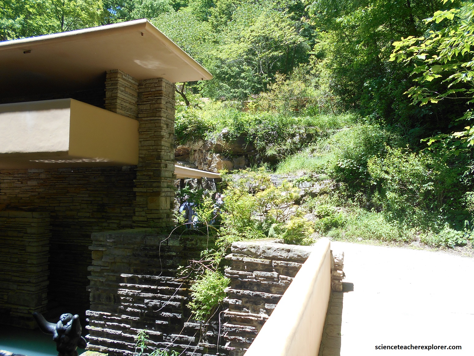
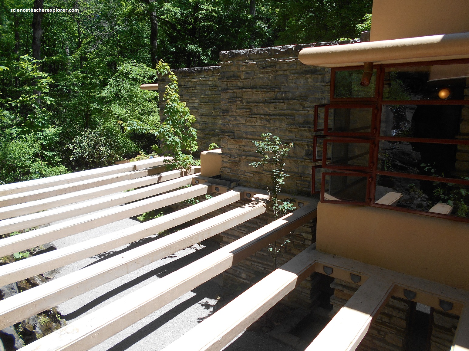
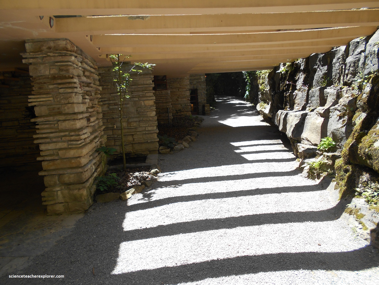
Pictured above, to eliminate the expense of a garage in the depression time-period, Wright devised what he name the “carport”, essentially a porte-cochere streamlined and changed into a cul-de-sac. It too, offered fresh opportunities for the dramatic cantilever. The flat roof gave a bolder expression to the cantilever and especially to the continuity of indoor ceiling with outdoor soffit. Note how the cantilevered roof was broke open with a series of rifts or perforation to form a horizontal treliis.
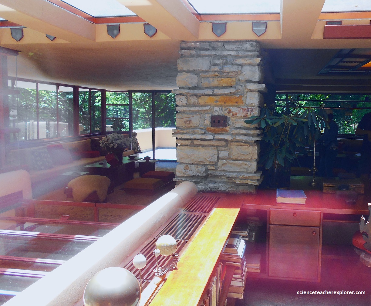
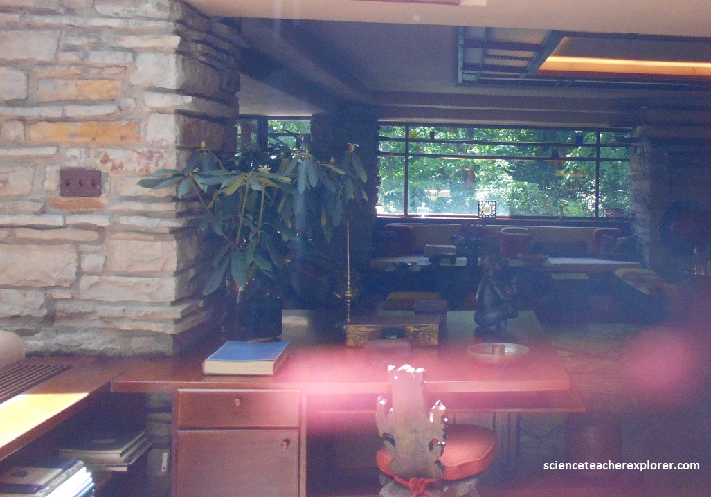
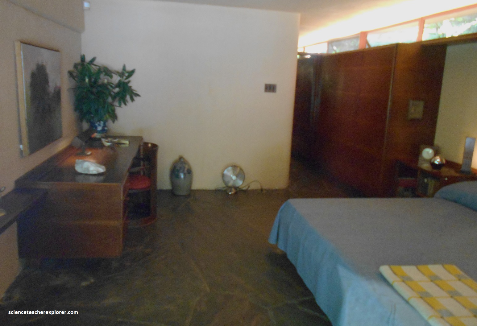
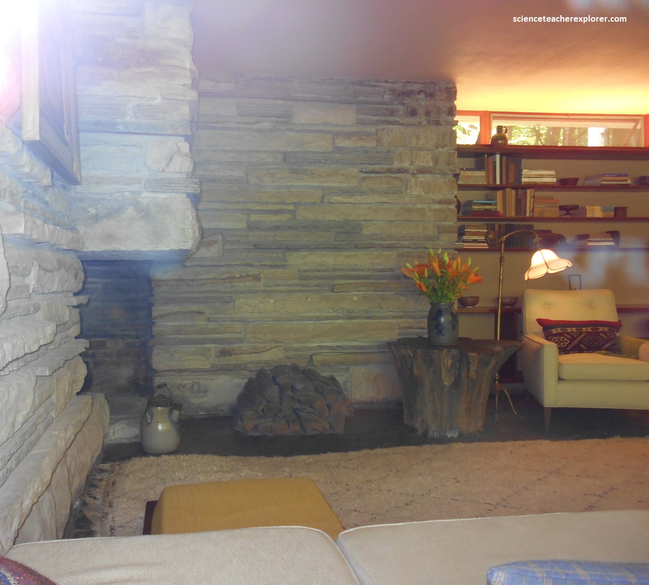
Pictured above, Fallingwater’s indoor architecture applied his philosophy of organic architecture, emerging human living spaces directly with the surrounding forest and waterfall of Bear Run with the use of windows. Entering the main living room from an acute angle rather than straight-on, immediately draws the eye across the space toward the floor-to-ceiling glass windows and the forest outside. A natural boulder of local Pottsville sandstone projects up right through the floor in front of the massive stone fireplace, serving as the symbolic heart of the house and anchoring the cantilevered structure. The interior of the Fallingwater uses an open-plan layout that eliminates rigid partitions between living and dining areas, featuring custom movable glass panels that open the room directly to the sights and sounds of the waterfall. Ceilings throughout much of the interior are kept low and horizontal, a deliberate design choice that makes the open, glass-walled vistas and the outer terraces feel even more expansive by contrast. Lastly, Wright designed almost all of the home’s furnishings—including built-in sofas, dining tables, and wardrobes—treating the entire interior as a cohesive art installation rather than a collection of separate objects.
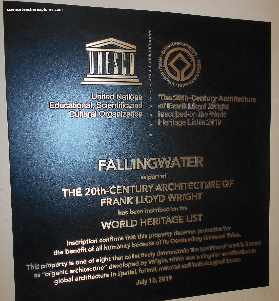
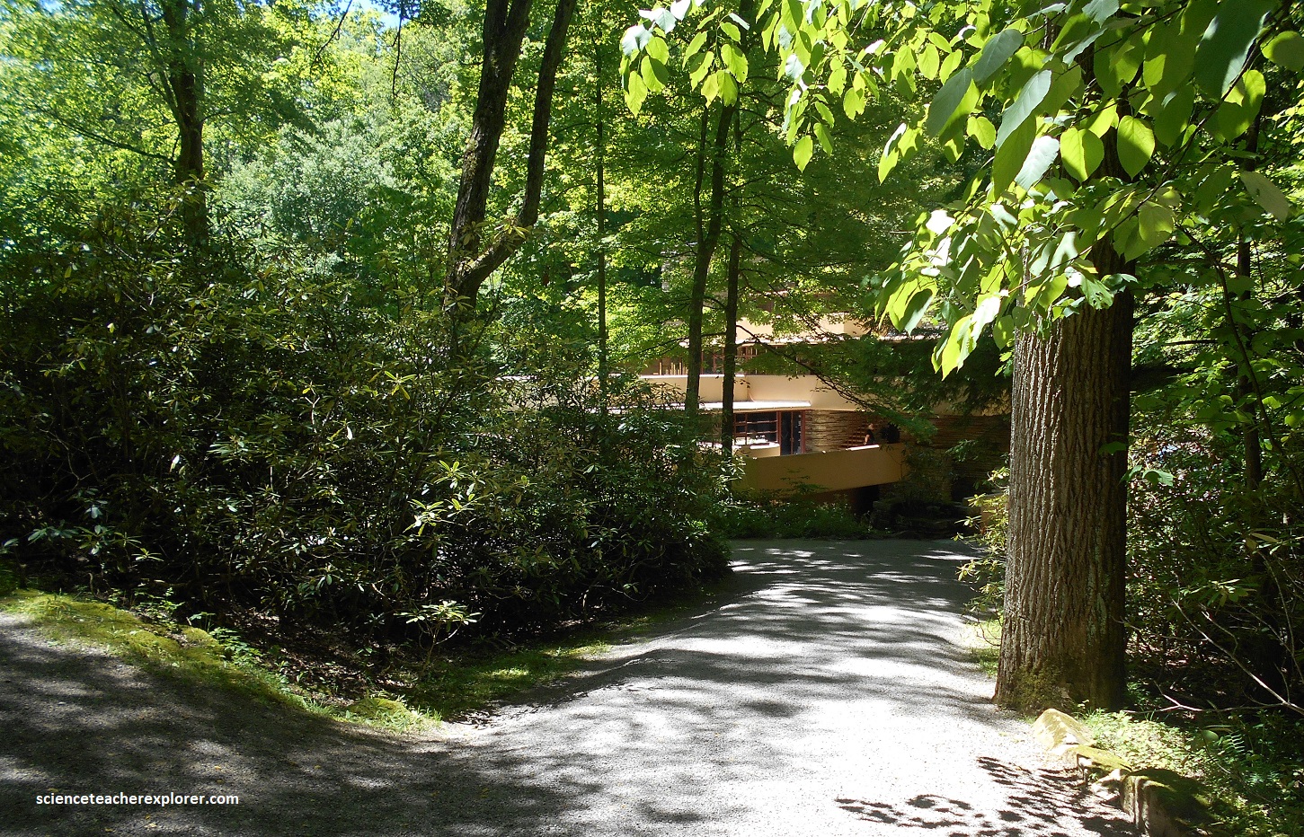
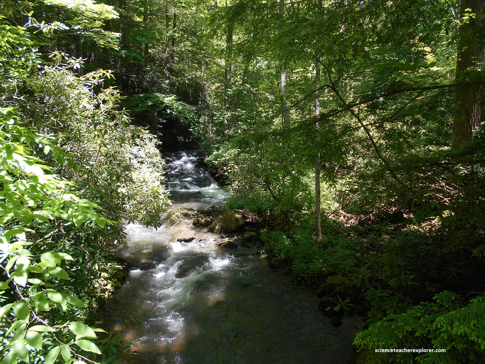
Pictured above, extensive continuous glass windows in red-painted steel frames, broad outdoor terraces (comprising roughly half of the main house’s footprint), and natural stone flooring blur the line between the indoor rooms and the surrounding forest. Furthmore, Fallingwater was one of the world’s most-heavily-discussed modern–style structures by the 1960s, and it has been described as the world’s most famous private residence not belonging to a member of royalty.
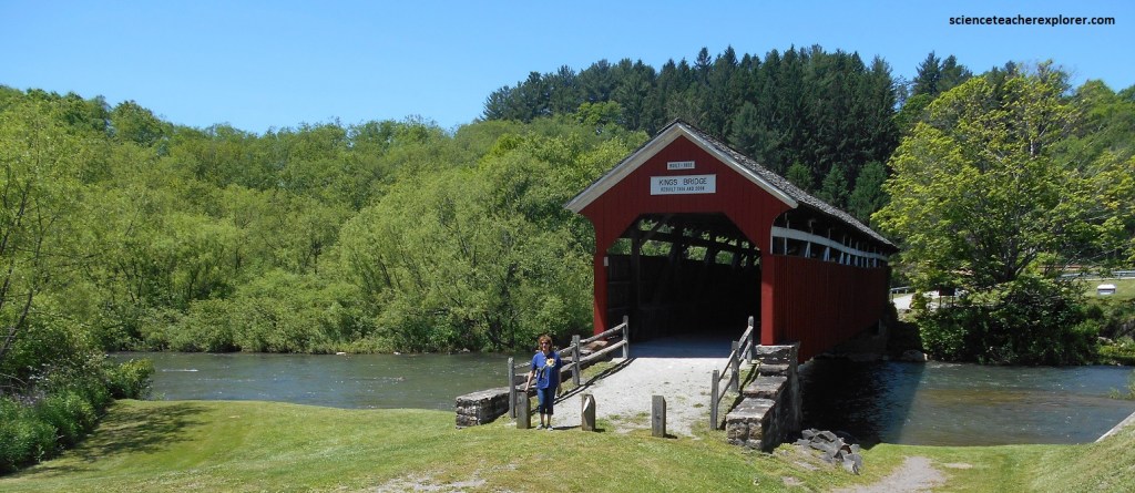
Becky and I continued exploring up PA-381 to finish our exploration of the Laurel Highlands. Pictured above, we came across this beautiful covered bridge, along the way, called the King’s Bridge. It was a single-span Burr arch truss structure (incorporating elements of an earlier multiple kingpost truss layout), measuring roughly 42m long. This area was an amazing location to explore.

